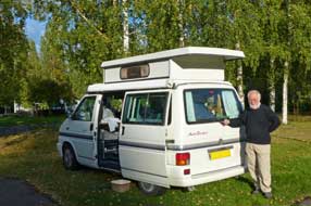
|
 CAMPING
IN FINLAND 2015 - Iisalmi, Pielavesi, Kuopio, Tikkakoski Finnish Air Force
Museum, Petäjävesi Church, Helvetinjärvi National Park, Tampere,
Puurijärvi-Isosuo National Park, Sammallahdenmäki Bronze Age burial ground,
Rauma, port-city of Turku: CAMPING
IN FINLAND 2015 - Iisalmi, Pielavesi, Kuopio, Tikkakoski Finnish Air Force
Museum, Petäjävesi Church, Helvetinjärvi National Park, Tampere,
Puurijärvi-Isosuo National Park, Sammallahdenmäki Bronze Age burial ground,
Rauma, port-city of Turku:
Jyrkkakoski lake-iron smelting works:
after our final and autumnally chill night at Vuokatinranta, we woke to a bright
morning with a warming sun rising above the trees. We called in at reception to
say farewell to Anssi and his staff for all their hospitality and help; they
suggested an interesting back-route to Iisalmi which passed the lake-iron
smelting works at Jyrkka, and as a final act of generosity, presented us with freshly
baked pulla (cinnamon buns), "to eat with our afternoon tea", they insisted. With
parting thanks for their kindness,
 we headed west on Route 76 and turned off
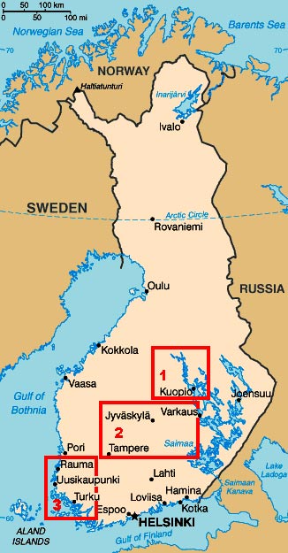
south on Route 870 (click on Map 1 on right of page for details of our journey). This was another delightfully peaceful road, undulating
through pine and spruce forests with the roadside birches glowing golden in the
morning sunlight. At Laakajärvi we turned westwards, meandering through the
forests; this was certainly a wonderful route, almost traffic-free and
well-surfaced, and brought us to Jyrkka and the preserved 19th century
ironworks, Ruukin in Finnish, the equivalent of Bruk in Swedish.
Exactly as at Möhkö near to Ilomantsi in South Karelia (see log of our visit to Möhkö), the remote Jyrkkakoski
ironworks had smelted and forged lake- and bog-iron pellets, but once dynamite made
possible industrial scale extraction of quarried iron ore, such small rural
iron-foundries became uneconomical; Jyrkka closed in 1915. The blast-furnaces,
once powered by water-wheels driven by fast-flowing water on the dammed river
which connected the nearby lakes, had been restored and preserved and were now
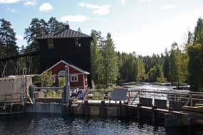
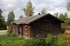
open to public display (Photo 1 - Jyrkkakoski ironworks). Entry to the museum was without charge and we took a
brief look at the blast-furnaces which were lined with English fire-bricks. we headed west on Route 76 and turned off
south on Route 870 (click on Map 1 on right of page for details of our journey). This was another delightfully peaceful road, undulating
through pine and spruce forests with the roadside birches glowing golden in the
morning sunlight. At Laakajärvi we turned westwards, meandering through the
forests; this was certainly a wonderful route, almost traffic-free and
well-surfaced, and brought us to Jyrkka and the preserved 19th century
ironworks, Ruukin in Finnish, the equivalent of Bruk in Swedish.
Exactly as at Möhkö near to Ilomantsi in South Karelia (see log of our visit to Möhkö), the remote Jyrkkakoski
ironworks had smelted and forged lake- and bog-iron pellets, but once dynamite made
possible industrial scale extraction of quarried iron ore, such small rural
iron-foundries became uneconomical; Jyrkka closed in 1915. The blast-furnaces,
once powered by water-wheels driven by fast-flowing water on the dammed river
which connected the nearby lakes, had been restored and preserved and were now
open to public display (Photo 1 - Jyrkkakoski ironworks). Entry to the museum was without charge and we took a
brief look at the blast-furnaces which were lined with English fire-bricks.
|
Click on 3 highlighted areas of
map
for details of Central~Southern Finland |
 |
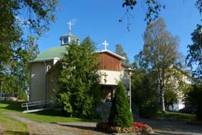 South to Iisalmi: Driving on after
this unexpected bonus visit, we continued on the back-road eventually reaching
Route5/E83 to turn south towards Iisalmi. This main road was festooned with
speed cameras, which along with the frequent elk warning signs, meant ultra care
particularly in the speeding traffic. Reaching the outskirts of Iisalmi we
turned off into the town passing familiar sights from our 2012 visit as we drove
along the main street. But this afternoon, we only had time for a brief visit to
the Orthodox Church and Cultural Centre. South to Iisalmi: Driving on after
this unexpected bonus visit, we continued on the back-road eventually reaching
Route5/E83 to turn south towards Iisalmi. This main road was festooned with
speed cameras, which along with the frequent elk warning signs, meant ultra care
particularly in the speeding traffic. Reaching the outskirts of Iisalmi we
turned off into the town passing familiar sights from our 2012 visit as we drove
along the main street. But this afternoon, we only had time for a brief visit to
the Orthodox Church and Cultural Centre.
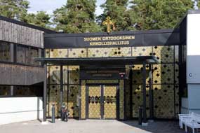
Iisalmi Orthodox Church and Cultural Centre: parking by the bus station and Kauppatori, we walked
over to the quiet residential street on the far side of Pohjolankatu (North
Street) to find the distinctive golden onion-domed Orthodox Cultural Centre
combined with the Artos Hotel. When asked if we could learn more about the
post-WW2 resettlement of Karelian refugees in Iisalmi and their Orthodox faith,
the young receptionist said we should speak to the manager; while waiting, would
we like to see the Orthodox Church? As in 2012, we were given the church key and
left to walk unescorted over and open up the church to see the icon-bedecked
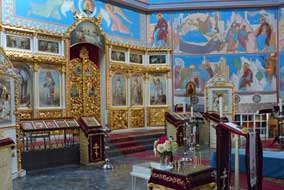
iconostasis and icon-painted walls (Photo 2 - Orthodox Iconostasis). Many Karelian refugees were resettled in the Iisalmi region
 after their expulsion from Karelia with the 1940 Russian
invasion, and the Orthodox Church of the Prophet Elias was built in 1950. The
icons on the iconostasis with its gilded royal doors had been rescued from the
Karelian church at Suistamo at the time of the evacuation in 1940 (see left). We took our
photos, re-locked the church and returned the key to the Hotel/Cultural Centre
where the Manager was now free to talk with us. after their expulsion from Karelia with the 1940 Russian
invasion, and the Orthodox Church of the Prophet Elias was built in 1950. The
icons on the iconostasis with its gilded royal doors had been rescued from the
Karelian church at Suistamo at the time of the evacuation in 1940 (see left). We took our
photos, re-locked the church and returned the key to the Hotel/Cultural Centre
where the Manager was now free to talk with us.
 He
began with a tour of the Cultural Centre where the dining room was decorated
with wall- and ceiling-paintings of saints and the original Valamon Monastery at
Lake Ladoga. He told us more of the history of Iisalmi Church's foundation after
the Karelian evacuation, together with Cultural Centre and Artos Hotel at the
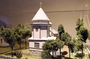
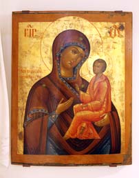
initiative of the priest Father Elias, and showed us the exhibition of icons and
treasures rescued from the Karelian churches (see below left) and scale models
of Karelian Orthodox chapels (see right). As we discussed the importance of
maintaining the cultural heritage of Orthodoxy, his manner became increasingly
less formal, and he suddenly announced that the Artos Hotel was to be closed by
the church authorities in 2 weeks with the loss of jobs. The closure of the
hotel and Cultural Centre seemed to be the culmination of a series of untoward
events starting with the enforced retirement of Father Elias, all of which had
caused major contention among the Orthodox community. He
began with a tour of the Cultural Centre where the dining room was decorated
with wall- and ceiling-paintings of saints and the original Valamon Monastery at
Lake Ladoga. He told us more of the history of Iisalmi Church's foundation after
the Karelian evacuation, together with Cultural Centre and Artos Hotel at the
initiative of the priest Father Elias, and showed us the exhibition of icons and
treasures rescued from the Karelian churches (see below left) and scale models
of Karelian Orthodox chapels (see right). As we discussed the importance of
maintaining the cultural heritage of Orthodoxy, his manner became increasingly
less formal, and he suddenly announced that the Artos Hotel was to be closed by
the church authorities in 2 weeks with the loss of jobs. The closure of the
hotel and Cultural Centre seemed to be the culmination of a series of untoward
events starting with the enforced retirement of Father Elias, all of which had
caused major contention among the Orthodox community.
 The
future of the icons, treasures and church models was unknown, but presumably
they would be removed by the church authorities to Kuopio. We expressed of
sympathies at this startling news, and were invited to stay for coffee and
Karelian savoury pastries made by members of the church congregation. The
future of the icons, treasures and church models was unknown, but presumably
they would be removed by the church authorities to Kuopio. We expressed of
sympathies at this startling news, and were invited to stay for coffee and
Karelian savoury pastries made by members of the church congregation.
Palopaikka Guesthouse/Camping at Kiuruvesi:
we walked back across the town, still bemused by the curiously bizarre events of
the afternoon and news of the Hotel/Orthodox Centre's imminent closure. Resuming
our journey, we re-joined Route 27 and headed westwards towards Kiuruvesi and
tonight's campsite, Palopaikka Guesthouse/Camping. Route 27 was another road
festooned with speed cameras, and judging by the aggressive speeding and
overtaking by local drivers, you could understand why. We doggedly stuck to the
speed limits as other cars zoomed past with apparent indifference to speeding
fines; or perhaps they knew the cameras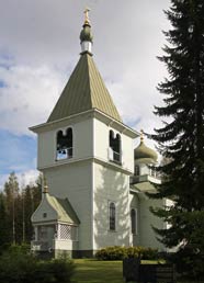 were simply duds! At Kiuruvesi village, we found Palopaikka Guesthouse/Camping.
The name meaning hearth or fire-place, Palopaikka sounded so homely; in fact it
turned out to be a rather grubby, curious building looking just like all the
other industrial units amongst which the so-called guesthouse was located, at an
industrial estate in the village outskirts, the air filled with an ambience of
industrial noise. The café/reception was locked, but eventually a woman
responded to our phone call and opened up; she could speak little English but we
argued down her over-inflated price and booked in. The stark camping area was
nothing more than a concrete patch by the barrack-like apartments which seemed
well-used by itinerant workers. After last night's glorious setting at
Vuokatinranta, with magnificent sunset across the lake and welcoming
hospitality, this was a sorry, dismal place in a gloomy industrial setting with
indifferent welcome, far from the homely atmosphere its name was intended to
conjure up; but it would have to serve for tonight as the sun set over
the chimney stacks of the neighbouring industrial units!
South to Pielavesi and the Birth-place of
Urho Kekkonen: Palopaikka's facilities were limited in the extreme
with no kitchen/wash-up; it was one of the trip's least acceptable, purely
functional stop-overs. Kiuruvesi was clearly a major logging centre with a huge
timber yard opposite the camp-site where heavy lorries were loaded with
 cut timber from the railway sidings, and a huge sawmill and pulp-paper works at
the edge of the village. We departed on a bright morning to turn south onto
Route 561, another delightful traffic-free minor road winding through the
forests (click here for map of our journey). After 60
kms, we reached Pielavesi, a service centre for the surrounding rural
hinterland, and on the far side of the village, found the Orthodox
church built in 1958 to serve the Karelian refugees who had been re-settled
around Pielavesi (see above right). We had learnt this year of another
historical monument in the village outskirts, the birth-place of Urho Kekkonen,
the longest serving and controversial President of Finland from 1956~81. His
father Juho Kekkonen had obtained the tenancy of a leasehold farm at Pielavesi
in the early spring of 1900 and moved with his wife Emilia to the farm in the
summer of that year. Their first son, Urho Kaleva was born at the farm cottage
on 3 September 1900. The Kekkonen family left Pielavesi when the future
President was 6 years old, and the farm cottage was eventually restored to its
original state by the National Board of Antiquities and preserved as a memorial
to UKK; from farm-cottage to Presidential Palace in one lifetime (Photo 3 - Kekkonen's birth-place)
(see left).
We paused at the cottage, little more than a wooden shack, for photographs and
to eat our lunches of muikku- and poron-kukko (fish and reindeer
filled pasties) bought yesterday in Iisalmi market. cut timber from the railway sidings, and a huge sawmill and pulp-paper works at
the edge of the village. We departed on a bright morning to turn south onto
Route 561, another delightful traffic-free minor road winding through the
forests (click here for map of our journey). After 60
kms, we reached Pielavesi, a service centre for the surrounding rural
hinterland, and on the far side of the village, found the Orthodox
church built in 1958 to serve the Karelian refugees who had been re-settled
around Pielavesi (see above right). We had learnt this year of another
historical monument in the village outskirts, the birth-place of Urho Kekkonen,
the longest serving and controversial President of Finland from 1956~81. His
father Juho Kekkonen had obtained the tenancy of a leasehold farm at Pielavesi
in the early spring of 1900 and moved with his wife Emilia to the farm in the
summer of that year. Their first son, Urho Kaleva was born at the farm cottage
on 3 September 1900. The Kekkonen family left Pielavesi when the future
President was 6 years old, and the farm cottage was eventually restored to its
original state by the National Board of Antiquities and preserved as a memorial
to UKK; from farm-cottage to Presidential Palace in one lifetime (Photo 3 - Kekkonen's birth-place)
(see left).
We paused at the cottage, little more than a wooden shack, for photographs and
to eat our lunches of muikku- and poron-kukko (fish and reindeer
filled pasties) bought yesterday in Iisalmi market.
 Rauhalahti Camping at Kuopio:
we continued south, bumping along on the poorly surfaced minor Route 554,
passing whooper swans browsing in a road-side field, and in 40 kms reached the
larger village of Karttula where we turned eastwards in heavier traffic to join
the Route 5 motorway into Kuopio. After re-stocking with provisions at a huge K-Market hypermarket, it was a short
drive to Rauhalahti Lomakeskus-Camping. Recalling the less than satisfactory
experience here in 2012 when, although offering a winter-opening reduced price,
the facilities available were severely restricted and welcome totally
perfunctory, we viewed Rauhalahti as a purely functional stop, there being no
other campsite within bus-ride of Kuopio. In fact today, things had changed
markedly for the better: we received one of the trip's most hospitably helpful
greetings Rauhalahti Camping at Kuopio:
we continued south, bumping along on the poorly surfaced minor Route 554,
passing whooper swans browsing in a road-side field, and in 40 kms reached the
larger village of Karttula where we turned eastwards in heavier traffic to join
the Route 5 motorway into Kuopio. After re-stocking with provisions at a huge K-Market hypermarket, it was a short
drive to Rauhalahti Lomakeskus-Camping. Recalling the less than satisfactory
experience here in 2012 when, although offering a winter-opening reduced price,
the facilities available were severely restricted and welcome totally
perfunctory, we viewed Rauhalahti as a purely functional stop, there being no
other campsite within bus-ride of Kuopio. In fact today, things had changed
markedly for the better: we received one of the trip's most hospitably helpful
greetings
 from the charmingly smiling lady at reception; her welcome simply
could not be faulted: everything was prepared ready - city street plan,
site layout plan, bus details and timetable, but most of all, full facilities
available along with wi-fi, all for the reduced price of €20/night. Rauhalahti
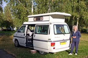
deserved commendation on such a service improvement. We drove around and settled
into a quiet corner close to the facilities buildings, with the autumnally
golden birches of the lovely parkland setting lit by afternoon sunshine
(Photo 4 - Rauhalahti Camping, Kuopio)
(see right). from the charmingly smiling lady at reception; her welcome simply
could not be faulted: everything was prepared ready - city street plan,
site layout plan, bus details and timetable, but most of all, full facilities
available along with wi-fi, all for the reduced price of €20/night. Rauhalahti
deserved commendation on such a service improvement. We drove around and settled
into a quiet corner close to the facilities buildings, with the autumnally
golden birches of the lovely parkland setting lit by afternoon sunshine
(Photo 4 - Rauhalahti Camping, Kuopio)
(see right).
A visit to Kuopio:
the following morning was disappointingly overcast with wet drizzle for today's
visit to the city of Kuopio. Kuopio, founded in 1775, is now a
prosperous city of some 100,000 population, set on a hilly spit of land between 2
arms of Lake Kallavesi, part of the immense waterway system of NW~SE oriented inter-connecting lakes gouged out along the line of retreating
glaciers at the end of the last Ice Age and flooded by melt-waters to form the
lake system. These eventually merge into Lake Saimaa, giving Kuopio distant
access to the sea via the Saimaa Canal. Joensu's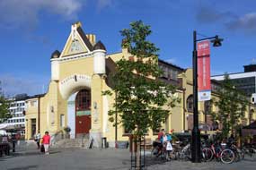 University of Eastern Finland has a
campus at Kuopio specialising in Health Studies (see log of our 2012 visit to Kuopio). Leaving George at the campsite, we
walked up the hill to catch the 11-10am #7 bus from the Rauhalahti Hotel. The
route into the city led through outer residential suburbs and around the western
side of the city past the Itä-Suomen Yliopisto (University of Eastern Finland),
and turned along Tulliportinkatu into the city centre to the terminus at the
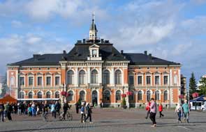
Kauppatori opposite the neo-Gothic City Hall
(see above left) (Photo 5 - Kuopio City-Hall).
The rain had stopped and sky brightening as we walked across the market square
to the fruit and vegetable stalls and coffee stalls . But the immediate impression was
the absence of chaotic building works which had so dominated the Kauppatori in
2012. All the excavations and construction work had been University of Eastern Finland has a
campus at Kuopio specialising in Health Studies (see log of our 2012 visit to Kuopio). Leaving George at the campsite, we
walked up the hill to catch the 11-10am #7 bus from the Rauhalahti Hotel. The
route into the city led through outer residential suburbs and around the western
side of the city past the Itä-Suomen Yliopisto (University of Eastern Finland),
and turned along Tulliportinkatu into the city centre to the terminus at the
Kauppatori opposite the neo-Gothic City Hall
(see above left) (Photo 5 - Kuopio City-Hall).
The rain had stopped and sky brightening as we walked across the market square
to the fruit and vegetable stalls and coffee stalls . But the immediate impression was
the absence of chaotic building works which had so dominated the Kauppatori in
2012. All the excavations and construction work had been
 completed, with a new glazed but unobtrusive superstructure entrance to the new 3-storey underground
car park and shopping mall which was being excavated in 2012 with all the
resultant mess, noise and disruption. With the construction work completed, the Art Nouveau
building of Kuopio's Kauppahalli (market hall) was now revealed in all its elegant
glory (see right) (Photo
6 - Kuopio's Kauppahalli). The fish and meat arrayed on the market-hall
stalls all looked temptingly good, but we confined ourselves to photos (Photo
7 - Kauppahalli fish stalls). Back over to the market square, we browsed
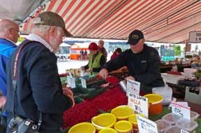
the stalls which had trays of Puolukka (Lingonberries) at €3/litre, still
not fully ripe but at last beginning to be seen on market stalls 2 weeks later
than usual this summer. Paul asked for Yksi litra Puolukat, kiitos (One
litre of Lingonberries, please), and this time received commendation on his
Finnish pronunciation from the stall-holder (Photo
8 - Buying Lingonberries) (see left). As we left the stalls, an elderly gent
stopped us to ask where we were from. He told us proudly in his slow and
deliberate English that, now completed, with a new glazed but unobtrusive superstructure entrance to the new 3-storey underground
car park and shopping mall which was being excavated in 2012 with all the
resultant mess, noise and disruption. With the construction work completed, the Art Nouveau
building of Kuopio's Kauppahalli (market hall) was now revealed in all its elegant
glory (see right) (Photo
6 - Kuopio's Kauppahalli). The fish and meat arrayed on the market-hall
stalls all looked temptingly good, but we confined ourselves to photos (Photo
7 - Kauppahalli fish stalls). Back over to the market square, we browsed
the stalls which had trays of Puolukka (Lingonberries) at €3/litre, still
not fully ripe but at last beginning to be seen on market stalls 2 weeks later
than usual this summer. Paul asked for Yksi litra Puolukat, kiitos (One
litre of Lingonberries, please), and this time received commendation on his
Finnish pronunciation from the stall-holder (Photo
8 - Buying Lingonberries) (see left). As we left the stalls, an elderly gent
stopped us to ask where we were from. He told us proudly in his slow and
deliberate English that, now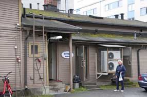 retired, he had formerly taught political and
social history at the University in Kuopio; he seemed taken aback by our travels
in Finland.
It was approaching lunchtime, and when in
Kuopio there was only one place for lunch - Hanna Partanen's bakery for her
Kalakukko, Kuopio meat and fish pies. A couple of blocks from the Kauppatori,
we found the rather insignificant-looking bakery where the renowned Kalakukko
are produced and sold (see right). You usually buy slices of the large pies, but
the man serving suggested we try the mini-Kalakukko; he produced 2 from
the back of the bakery and wrapped them in foil for us, explaining the crusty
pie-filling was a mixture of minced meat and Muikku (lake whitebait). We
took our pies outside to eat for lunch; they were delicious! (Photo
9 - Hanna Partanen's Kalakukko).
 Kuopio Orthodox Church Museum: when we were last in Kuopio, the
Orthodox Church Museum
had been closed for several years for renovation which, along with the chaotic
reconstruction works in the Kauppatori, had then made it a rather futile visit
to Kuopio in 2012. The Museum had now re-opened and after our lunch, we hurried up Puistokato
(Park Street) to find the newly presented museum displays (see left). On arrival, we took
the opportunity to ask the receptionist about the closure of the Iisalmi
Orthodox Cultural Centre/Artos Hotel, the future of the icons and
treasures in Iisalmi, but of more concern the premature retirement of the
long-standing Father Elias from his priestly duties which had caused Kuopio Orthodox Church Museum: when we were last in Kuopio, the
Orthodox Church Museum
had been closed for several years for renovation which, along with the chaotic
reconstruction works in the Kauppatori, had then made it a rather futile visit
to Kuopio in 2012. The Museum had now re-opened and after our lunch, we hurried up Puistokato
(Park Street) to find the newly presented museum displays (see left). On arrival, we took
the opportunity to ask the receptionist about the closure of the Iisalmi
Orthodox Cultural Centre/Artos Hotel, the future of the icons and
treasures in Iisalmi, but of more concern the premature retirement of the
long-standing Father Elias from his priestly duties which had caused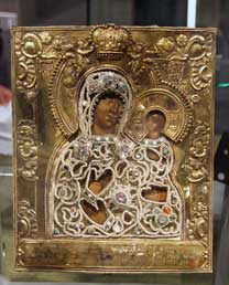 so much
distress among the Iisalmi Orthodox congregation. The lady understood our
concerns and suggested she try to arrange for us to talk with the Orthodox
Archbishop's Secretary. In the meantime we began our visit to the displays. so much
distress among the Iisalmi Orthodox congregation. The lady understood our
concerns and suggested she try to arrange for us to talk with the Orthodox
Archbishop's Secretary. In the meantime we began our visit to the displays.
The Orthodox Church Museum's purpose is to
preserve the cultural heritage of the
Orthodox Church of Finland; its exhibitions display the icons, vestments,
treasures and artefacts rescued in 1940 from the 2 Karelian Monasteries around Lake Ladoga and the Petsamo Monastery on the Barents Sea. The 3
monasteries each had had a turbulent history, suffering under the various wars
and unrest between the Russian and Swedish Empires. Valamon and Konevitsa in
Karelia closer to the Russian imperial capital of St Petersburg had
 periods of
enjoying royal patronage from the Tsar's family; one of the exhibits was the
peaked cap and gloves worn by Tsar Alexander II when he was assassinated by a
bomb in 1881, and presented to Valamon by the late Tsar's wife; what the monks
were supposed to do with them is unclear, but they finished up on display
here at Kuopio! Petsamo had been destroyed and its monks murdered by Finnish
bandits in the 17th century. But the brutal end for Valamon and Konevitsa came
in February 1940 when the monks just had time to escape a similar fate at
the hands of the Red Army when the Soviets invaded Karelia; some of the
monastery's icons and treasures were rescued in carts across the ice of frozen
Lake Ladoga, and these now make up the exhibits here at Kuopio. periods of
enjoying royal patronage from the Tsar's family; one of the exhibits was the
peaked cap and gloves worn by Tsar Alexander II when he was assassinated by a
bomb in 1881, and presented to Valamon by the late Tsar's wife; what the monks
were supposed to do with them is unclear, but they finished up on display
here at Kuopio! Petsamo had been destroyed and its monks murdered by Finnish
bandits in the 17th century. But the brutal end for Valamon and Konevitsa came
in February 1940 when the monks just had time to escape a similar fate at
the hands of the Red Army when the Soviets invaded Karelia; some of the
monastery's icons and treasures were rescued in carts across the ice of frozen
Lake Ladoga, and these now make up the exhibits here at Kuopio.
We began our visit, examining the displays of
icons, and trying to reconcile the English-translated textual commentary with
the exhibits. The museum's main exhibition is named Riisa, from the
Russian word Риза,
meaning the decorative metallic cover placed over an icon; the Riisa,
made of moulded silver or gold and decorated with jewels such as pearls or
rubies, normally revealed just the face, hands and feet of the holy person
depicted on the icon, while protecting the rest of the painting from damage from
the wax of votive candles or from incense smoke (see above right). One of the highly ornate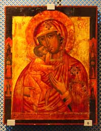 jewel-bedecked Riisas displayed had covered the icon of the Mother of God
of Konevitsa, commissioned in 1893 to celebrate the Monastery's 500th anniversary; it had been rescued at the time of the 1940 evacuation (Photo
10 - Jewel-decorated silver Riisa). Another Riisa similarly
jewelled dated from the 18th century and had also been rescued from Konevitsa (Photo
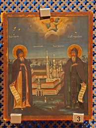
11 - Konevitsa jewelled Riisa). Icons portrayed the founding fathers of the
Monasteries, Saints Sergei and Hermon at Valamon (see above left), St Arseni at
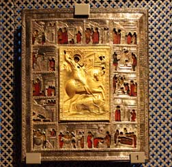
Konevitsa, and St Tryphon at Petsamo. Other icons portrayed the Virgin and
Infant Christ (see right), and St George the Victorious busy at work
skewering his dragon (see below left). Vestments from Petsamo Monastery showed
how the Orthodox community of monks had adopted the designs and colours,
particularly strawberry-red, used by the Skolt Sámi in their traditional festive
clothing. Side displays of artwork set out the history of the Orthodox Church in
Karelia and Finland from its Byzantine origins, and the transference of
allegiance at Finnish independence in 1917 from the Russian Orthodox
 Church
to the Greek Orthodox traditions of Constantinople, becoming an autonomous
archbishopric of the Patriarch of Constantinople in 1923. The exhibits concluded
with further artefacts depicting the festivals of the Orthodox Church year and
an ornate silver sepulchre of St Arseni of Konevitsa. Church
to the Greek Orthodox traditions of Constantinople, becoming an autonomous
archbishopric of the Patriarch of Constantinople in 1923. The exhibits concluded
with further artefacts depicting the festivals of the Orthodox Church year and
an ornate silver sepulchre of St Arseni of Konevitsa.
As we viewed the exhibits, the Archbishop's
Secretary joined us, clearly phased by the fact that 2 complete outsiders (and
English at that!) should take such an interest in recent events at Iisalmi, in
seeking explanation for what had clearly been a controversial issue. Summoning utmost tact, we enquired
what would be the future of the Karelian icons and tsasouna models at Iisalmi if
the Artos Hotel/Cultural Centre closed, and had account been taken of the
feelings of distress caused to the older members of the Iisalmi Orthodox
congregation by the decision to suspend Father Elias from his priestly duties?
The Secretary hesitantly began to defend the enforced retirement, thanking us
for our interest, and undertook to see what could be done, hinting that the
suspension might only be temporary. We urged that everything possible should be
done to achieve reconciliation in what had clearly been a history of bad
feelings between an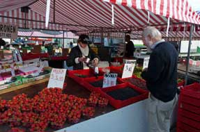 elderly troublesome priest and an authoritarian Archbishop.
It was a curious encounter, and we felt that we had done our bit to see that
natural justice and quality of Christian charity be given due reflection. elderly troublesome priest and an authoritarian Archbishop.
It was a curious encounter, and we felt that we had done our bit to see that
natural justice and quality of Christian charity be given due reflection.
Back down to the Kauppatori, we took another
look around the stalls and bought a half litre of Mustikka (Bilberries)
for our breakfasts (see right), before walking over to the bus stop for our bus back to
the campsite. It had been a much better day in Kuopio than our fruitless visit
in 2012: the city's landscape was certainly much improved with the absence of
building works and completion of the underground car park and shopping mall, and
the Orthodox Church Museum's renovated displays were impressive. And who knows what difference our intervention in the Father Elias episode will make.
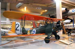 A cross-country drive to Tikkakoski: an early start this morning
for our long drive across country to reach Tikkakoski near to Jyväskylä for
today's visit to the Finnish Air Force Museum (click here for map of our journey). We re-joined Route 5 motorway south with
traffic light on a Saturday morning. But there was no question that driving
standards in Central Finland had declined in the last 3 years, with marked
increase in speeding, inconsiderate overtaking, and concomitant increase in the
numbers of speed cameras which festooned road junctions on main roads. We turned
off across country on Route 69, a quieter road passing through forested
countryside laced with many lakes, the most prominent of which was Konnevesi A cross-country drive to Tikkakoski: an early start this morning
for our long drive across country to reach Tikkakoski near to Jyväskylä for
today's visit to the Finnish Air Force Museum (click here for map of our journey). We re-joined Route 5 motorway south with
traffic light on a Saturday morning. But there was no question that driving
standards in Central Finland had declined in the last 3 years, with marked
increase in speeding, inconsiderate overtaking, and concomitant increase in the
numbers of speed cameras which festooned road junctions on main roads. We turned
off across country on Route 69, a quieter road passing through forested
countryside laced with many lakes, the most prominent of which was Konnevesi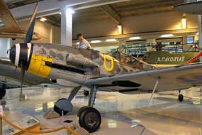 which gave its name to the lakeland national park in this area. Eventually
reaching the main north~south Route 4/E75, we turned south for 15 kms for the
turning to Tikkakoski where the
Finnish Air Force Museum
is based (Keski-Suomen Ilmailumuseo).
Finnish Air Force Museum: seniors' entry tickets
were a very
reasonable €4 for what is an
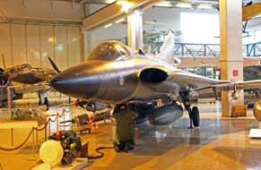
impressive collection of 24 aircraft
set out in a large, well-lit hangar, covering the whole period of the Finnish
Air Force from its foundation in 1918, through the period of WW2, to current
modern-day jet fighters (Photo
12 - Aircraft displays). The number of preserved planes is relatively small
since after WW2, Finland was regarded as a co-belligerent with Germany and
required by the victorious Allies, particularly USSR,
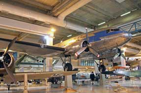 to scrap all its military
aircraft. The aircraft collection, displayed in chronological order, does
however include specimens of almost all the aircraft which Finland managed to
acquire from the early days (see above left), through the Winter and Continuation Wars, and
post-war. These include from the lead-up to the Winter War a Hawker Hurricane and
Bristol Blenheim purchased from Britain and Brewster Buffalo from USA; those
supplied by the Germans during the Continuation War include a Messerschmitt 109
(see above right) and Fokker XXI; and post-war early jet trainers such as the De Haviland Vampire
(see below right) and Folland Gnat purchased from Britain, DC-3/47 military
transport aircraft from USA (see left), MiGs from USSR, and Saab Draken from
Sweden (see below left). to scrap all its military
aircraft. The aircraft collection, displayed in chronological order, does
however include specimens of almost all the aircraft which Finland managed to
acquire from the early days (see above left), through the Winter and Continuation Wars, and
post-war. These include from the lead-up to the Winter War a Hawker Hurricane and
Bristol Blenheim purchased from Britain and Brewster Buffalo from USA; those
supplied by the Germans during the Continuation War include a Messerschmitt 109
(see above right) and Fokker XXI; and post-war early jet trainers such as the De Haviland Vampire
(see below right) and Folland Gnat purchased from Britain, DC-3/47 military
transport aircraft from USA (see left), MiGs from USSR, and Saab Draken from
Sweden (see below left).
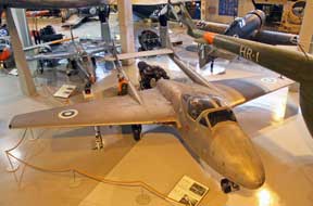 One of the aircraft displayed was an American Brewster Buffalo fighter,
acquired by the Finns during the Continuation War, which in June 1942 was
attacking Soviet aircraft in Eastern Karelia. It was itself shot down by Soviet
fighters and the Finnish pilot, Lieutenant Lauri Pekuri, crash-landed the badly
damaged aircraft in lake Seesjärvi; he survived and managed to return to Finnish
lines. In 1998, the plane was raised from the lake-bed and is now displayed at
the Air Force Museum, on loan from the Naval Aviation Museum in Florida. The
Brewster, a typically chunky US WW2 aircraft is displayed un-restored in the
same state as when lifted from the lake with its propeller damaged from impact
during the crash-landing (Photo
13 - Brewster Buffalo). An information panel explained the reason why early
and WW2 Finnish aircraft carried the blue swastika on white roundel emblem: the
White forces during the Finnish Civil War had acquired a Thulin aircraft,
piloted by a Swedish aristocrat, Count Eric Von Rosen who One of the aircraft displayed was an American Brewster Buffalo fighter,
acquired by the Finns during the Continuation War, which in June 1942 was
attacking Soviet aircraft in Eastern Karelia. It was itself shot down by Soviet
fighters and the Finnish pilot, Lieutenant Lauri Pekuri, crash-landed the badly
damaged aircraft in lake Seesjärvi; he survived and managed to return to Finnish
lines. In 1998, the plane was raised from the lake-bed and is now displayed at
the Air Force Museum, on loan from the Naval Aviation Museum in Florida. The
Brewster, a typically chunky US WW2 aircraft is displayed un-restored in the
same state as when lifted from the lake with its propeller damaged from impact
during the crash-landing (Photo
13 - Brewster Buffalo). An information panel explained the reason why early
and WW2 Finnish aircraft carried the blue swastika on white roundel emblem: the
White forces during the Finnish Civil War had acquired a Thulin aircraft,
piloted by a Swedish aristocrat, Count Eric Von Rosen who
 had painted his personal good luck charm,
the ancient swastika symbol, on the aircraft; the blue swastika was adopted as
the insignia of the Finnish Air Force at its foundation in 1918, and continued
to be used as Finnish aircraft markings during WW2. It also featured on the
Mannerheim Cross and on the Finnish Presidential flag. Because of the political
embarrassment of association with the black swastika used by Nazi Germany, the
Finnish Air Force changed its aircraft-markings after WW2 to the blue-on-white
cockade in use today. had painted his personal good luck charm,
the ancient swastika symbol, on the aircraft; the blue swastika was adopted as
the insignia of the Finnish Air Force at its foundation in 1918, and continued
to be used as Finnish aircraft markings during WW2. It also featured on the
Mannerheim Cross and on the Finnish Presidential flag. Because of the political
embarrassment of association with the black swastika used by Nazi Germany, the
Finnish Air Force changed its aircraft-markings after WW2 to the blue-on-white
cockade in use today.
 Another display described the contribution of a Luftwaffe Stuka squadron which had helped the Finns stem the advance of the summer 1944 major
Soviet offensive. The Luftwaffe aircraft were withdrawn to Estonia as the
Germans retreated into Lapland, and after the war the part played by the
Luftwaffe was glossed over because of Finnish resentment at the German scorched
earth destruction in the north, political embarrassment of having allied with
the Germans and being treated as co-belligerents, and to avoid political denigration
from USSR immediately post-war. Only after the demise of communism in 1991 was a
memorial to the Luftwaffe crews raised. Among the displayed post-war aircraft was the
enormous Ilyushin Il-28 jet bomber, developed by the Soviets in the 1950s and
sold to the Finnish Air Force; this monster aircraft with its evil-looking rear
gun-turret, dominated the view from the balcony (Photo
14 - Soviet Ilyushin Il-28 jet-bomber). Around the sides of the hangar, 3
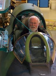
aircraft cockpits were displayed for visitors to squeeze into; it is probably the
only chance you can get to be photographed supposedly taking control of a Saab Draken or Russian MiG fighter, surrounded by a bewilderment of dials and
switches labelled in Cyrillic! (see right). Another display described the contribution of a Luftwaffe Stuka squadron which had helped the Finns stem the advance of the summer 1944 major
Soviet offensive. The Luftwaffe aircraft were withdrawn to Estonia as the
Germans retreated into Lapland, and after the war the part played by the
Luftwaffe was glossed over because of Finnish resentment at the German scorched
earth destruction in the north, political embarrassment of having allied with
the Germans and being treated as co-belligerents, and to avoid political denigration
from USSR immediately post-war. Only after the demise of communism in 1991 was a
memorial to the Luftwaffe crews raised. Among the displayed post-war aircraft was the
enormous Ilyushin Il-28 jet bomber, developed by the Soviets in the 1950s and
sold to the Finnish Air Force; this monster aircraft with its evil-looking rear
gun-turret, dominated the view from the balcony (Photo
14 - Soviet Ilyushin Il-28 jet-bomber). Around the sides of the hangar, 3
aircraft cockpits were displayed for visitors to squeeze into; it is probably the
only chance you can get to be photographed supposedly taking control of a Saab Draken or Russian MiG fighter, surrounded by a bewilderment of dials and
switches labelled in Cyrillic! (see right).
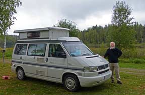 Matsäranta
Camping, another disappointment: the only open campsite close to
Jyväskylä was the small lake-side Matsäranta Camping, and we had good memories
of the hospitable welcome on our 2012 stay at this straightforward, good value
site. In now pouring rain, we set off from Tikkakoski, bypassing Jyväskylä which
we had visited in 2012, to reach Route 23 westwards. Turning off left across 100
kph traffic on this bus main road was a hazardous move, and we approached the
campsite along the narrow dirt road. It seemed tidier than remembered but all seemed well until it came to the price: €30 seemed excessive for a basic
site with minimal facilities, perhaps confusion with the owner's limited
English. But no, that was the price, with take-it-or-leave-it dismissal! The
fact that this was the most expensive paid in the whole of Finland, even more
than at the capital Helsinki, was neither here nor there! Having no other option
we paid up, but made it quite clear we should not be back and should ensure
others did likewise! We Matsäranta
Camping, another disappointment: the only open campsite close to
Jyväskylä was the small lake-side Matsäranta Camping, and we had good memories
of the hospitable welcome on our 2012 stay at this straightforward, good value
site. In now pouring rain, we set off from Tikkakoski, bypassing Jyväskylä which
we had visited in 2012, to reach Route 23 westwards. Turning off left across 100
kph traffic on this bus main road was a hazardous move, and we approached the
campsite along the narrow dirt road. It seemed tidier than remembered but all seemed well until it came to the price: €30 seemed excessive for a basic
site with minimal facilities, perhaps confusion with the owner's limited
English. But no, that was the price, with take-it-or-leave-it dismissal! The
fact that this was the most expensive paid in the whole of Finland, even more
than at the capital Helsinki, was neither here nor there! Having no other option
we paid up, but made it quite clear we should not be back and should ensure
others did likewise! We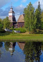 settled in at the lake-side looking out to the forests
across the lake, with the sun just coming through to relieve the gloom (see
left). The following morning it became clear that the owners had newly taken
over; we guessed that they had borrowed heavily to buy the site and make initial
improvements, and to cover interest on the bank loan they needed to charge these
excessive prices. In which case we should do our best to see their investment
was short lived! This is now a campsite to be avoided. settled in at the lake-side looking out to the forests
across the lake, with the sun just coming through to relieve the gloom (see
left). The following morning it became clear that the owners had newly taken
over; we guessed that they had borrowed heavily to buy the site and make initial
improvements, and to cover interest on the bank loan they needed to charge these
excessive prices. In which case we should do our best to see their investment
was short lived! This is now a campsite to be avoided.
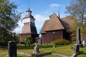
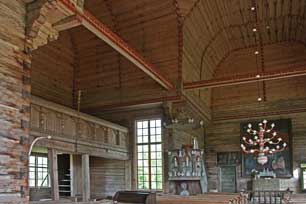 Petäjävesi Old Church: the following morning, we drove the 12 kms
along to Petäjävesi village, and as we walked over the bridge, the sun was just
breaking through lighting the magnificent view of the wooden church among the
distant trees with its foreground reflections in the lake (see right) (Photo
15 - Petäjävesi Old Church reflections). The Old Church at Petäjävesi is set
on a lakeland water course by which most of its parishioners originally
travelled to services by boat. It was built between 1763~65 under the direction
of master-craftsman Jaakko Klemetinpoika Leppänen and the initials of local
carpenters responsible for the corner joints are carved on the central arch of
the roof cupola. 60 years later, Jaakko's grandson Erkki continued the
construction following his grandfather and father, adding the bell-tower and
connecting it to the body of the church with a link-passageway. The Old Church was
abandoned in 1875 when Petäjävesi's new church was built in the village. In
spite of plans at the time to demolish the old wooden church, it was preserved
with the bells retained in the bell-tower and the graveyard continuing in use.
The church is an impressive example of Nordic wooden rustic architecture with
its log-jointing techniques (see left), and as such was added to the World Heritage List in
1994. The main body of the church is cruciform in shape with a polygonal cupola
at its centre and a steep shingled roof. Most of the wooden walls and
barrel-vaulted ceiling Petäjävesi Old Church: the following morning, we drove the 12 kms
along to Petäjävesi village, and as we walked over the bridge, the sun was just
breaking through lighting the magnificent view of the wooden church among the
distant trees with its foreground reflections in the lake (see right) (Photo
15 - Petäjävesi Old Church reflections). The Old Church at Petäjävesi is set
on a lakeland water course by which most of its parishioners originally
travelled to services by boat. It was built between 1763~65 under the direction
of master-craftsman Jaakko Klemetinpoika Leppänen and the initials of local
carpenters responsible for the corner joints are carved on the central arch of
the roof cupola. 60 years later, Jaakko's grandson Erkki continued the
construction following his grandfather and father, adding the bell-tower and
connecting it to the body of the church with a link-passageway. The Old Church was
abandoned in 1875 when Petäjävesi's new church was built in the village. In
spite of plans at the time to demolish the old wooden church, it was preserved
with the bells retained in the bell-tower and the graveyard continuing in use.
The church is an impressive example of Nordic wooden rustic architecture with
its log-jointing techniques (see left), and as such was added to the World Heritage List in
1994. The main body of the church is cruciform in shape with a polygonal cupola
at its centre and a steep shingled roof. Most of the wooden walls and
barrel-vaulted ceiling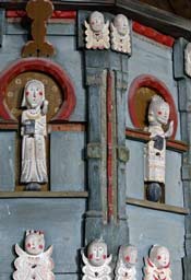 are left unpainted, with just red-painted designs
decorating the vault ribs and tie-beams. In addition to the wonderful structural
carpentry, the church's most impressive piece of decorative fitting is the
polygonal wooden pulpit (Photo
16 - Petäjävesi decorated pulpit), decorated with carved and painted figures of Christ and
the 4 Evangelists and friezes of small angels (see right). The pulpit is supported on the
head of a sturdy carved figure of St Christopher . are left unpainted, with just red-painted designs
decorating the vault ribs and tie-beams. In addition to the wonderful structural
carpentry, the church's most impressive piece of decorative fitting is the
polygonal wooden pulpit (Photo
16 - Petäjävesi decorated pulpit), decorated with carved and painted figures of Christ and
the 4 Evangelists and friezes of small angels (see right). The pulpit is supported on the
head of a sturdy carved figure of St Christopher .
 We had telephoned the previous evening to
confirm the church would be open today, and over at the church the lady we had
spoken to welcomed us. We chatted with her about the church's construction, and
the one service now held each year, a candle-lit Christmas carol-service, with
the local fire brigade in attendance! We told her of our now regular custom of
decorating our Christmas tree with the Petäjävesi pulpit angels bought during
our 2012 visit. She was a truly charming person who spoke fluent English,
even using colloquial expressions such as 'reading between the lines'. Memorable encounters such as this really bring to life our travels. We were
this morning's only visitors and had the privilege of spending uninterrupted
time examining the magnificent beauty and craftsmanship of the church's
interior, in particular the pulpit with its simple, rustic-style carved figures,
one of which formed the subject of our this yea's Christmas card (Photo
17 - Pulpit angel decorations). Outside we photographed the church's
exterior from the graveyard (see left) (Photo
18 - Petäjävesi Old Church), and the distant view from
the bridge with the church's reflections in the lake. We had telephoned the previous evening to
confirm the church would be open today, and over at the church the lady we had
spoken to welcomed us. We chatted with her about the church's construction, and
the one service now held each year, a candle-lit Christmas carol-service, with
the local fire brigade in attendance! We told her of our now regular custom of
decorating our Christmas tree with the Petäjävesi pulpit angels bought during
our 2012 visit. She was a truly charming person who spoke fluent English,
even using colloquial expressions such as 'reading between the lines'. Memorable encounters such as this really bring to life our travels. We were
this morning's only visitors and had the privilege of spending uninterrupted
time examining the magnificent beauty and craftsmanship of the church's
interior, in particular the pulpit with its simple, rustic-style carved figures,
one of which formed the subject of our this yea's Christmas card (Photo
17 - Pulpit angel decorations). Outside we photographed the church's
exterior from the graveyard (see left) (Photo
18 - Petäjävesi Old Church), and the distant view from
the bridge with the church's reflections in the lake.
Haapasaari Lomakylä-Camping at Ruovesi:
we continued westwards on Route 23 (click here for map of our journey),
and just beyond Keuruu turned south onto Route 348. This minor road wound
through forested and farming countryside to reach the larger village of Vilppula;
here we turned westward again onto Route 344, a lovely road passing through
fields of cereal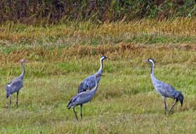 crops, some recently harvested where 4
adult cranes and 2 juveniles
were grazing, preparing for their long migratory flight south (see right) (Photo
19 - Grazing cranes) crops, some recently harvested where 4
adult cranes and 2 juveniles
were grazing, preparing for their long migratory flight south (see right) (Photo
19 - Grazing cranes)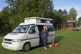 . Any day now the cranes would be
departing; at this time 3 years ago at Helvetinjärvi, a V-formation of migrating
cranes had passed overhead. At Ruhula, little more than a filling station at the
junction, we turned north on Route 66 to Ruovesi and crossed the lake-causeway
to Haapasaari Lomakylä-Camping. The parking area was filled with stacked plastic
crates and weighing machine; the berry pickers were here! We were greeted
hospitably at reception with very reasonable low-season price of €20/night; the
lady warned however that some 100 Thai berry-pickers were occupying the huts. We
picked a spot on the flat hillock of the campsite's lake-island well
away from the Thais, and settled in amid the now peaceful parkland. The
following day with soft autumnal sunshine lighting the now golden birches, we
enjoyed a peaceful and productive day in camp here at Haapasaari; the pleasant
parkland was so well-maintained with fallen leaves constantly raked up by 2
hard-working ladies, lamas grazed the lawns, and a Great Spotted Woodpecker
frustratedly hammered away at the pinnacle of the wooden tower (Photo
20 - Great Spotted Woodpecker). . Any day now the cranes would be
departing; at this time 3 years ago at Helvetinjärvi, a V-formation of migrating
cranes had passed overhead. At Ruhula, little more than a filling station at the
junction, we turned north on Route 66 to Ruovesi and crossed the lake-causeway
to Haapasaari Lomakylä-Camping. The parking area was filled with stacked plastic
crates and weighing machine; the berry pickers were here! We were greeted
hospitably at reception with very reasonable low-season price of €20/night; the
lady warned however that some 100 Thai berry-pickers were occupying the huts. We
picked a spot on the flat hillock of the campsite's lake-island well
away from the Thais, and settled in amid the now peaceful parkland. The
following day with soft autumnal sunshine lighting the now golden birches, we
enjoyed a peaceful and productive day in camp here at Haapasaari; the pleasant
parkland was so well-maintained with fallen leaves constantly raked up by 2
hard-working ladies, lamas grazed the lawns, and a Great Spotted Woodpecker
frustratedly hammered away at the pinnacle of the wooden tower (Photo
20 - Great Spotted Woodpecker).
Helvetinjärvi National Park: 5 kms north of Ruovesi, a single-track
lane turns of Route 66, sign-posted for Helvetinjärvi National Park
and leads to the parking area at Kankimäki, and the start of the 4kms long
Helvetistä Itään Nature
Trail in Helvetinjärvi National Park (Click
here for Helvetistä Itään Nature Trail map). We booted up, taking in our
day sacs equipment for today's berry-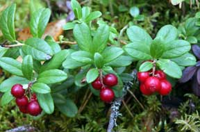 picking
with the Lingonberries now good and ripe. From the start, the well-marked path
passed through ancient pine and spruce forest, with the forest picking
with the Lingonberries now good and ripe. From the start, the well-marked path
passed through ancient pine and spruce forest, with the forest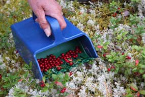 floor covered with a rich layer of Bilberry, the plants now well past and
berries all gone. But back from the path beyond the Bilberry, the Lingonberry
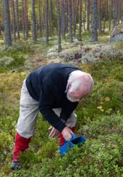
bushes were laden with ripe berries (see left). We began or picking, using our
gathering box which worked so well, its clever design 'combing' through the
leaves and stems drawing clusters of ripe berries into the box with a minimum of
leaf debris. As the device was combed through
the bushes, gathered berries were trapped in the bottom of the box until
transferred to a bag (see right). We just needed to clamber several metres from
the path beyond the Bilberry, and the Lingonberries were plentiful and ripe and
along the first section of path we made several stops, gathering 2 large bagfuls
of fruit (Photo
21 - Lingonberry picking).
The path wound every-which-way, undulating through
the forest and eventually reached the paths-junction just before Helvetinkolu.
The right fork led down steep wooden steps which negotiated the sheer rocky side
of the line of the lake-filled Helvetinkolu Gorge. The steep-sided rocky gorges
which characterise Helvetinjärvi National Park were formed along geological
fracture zones deep in the Earth's crust some 150~200 million years ago; the
most spectacular gorges are in the northern part of the area where the narrow 10
km long chain
 of lakes of Iso- (Great), Pikku- (Small) and
Pitkä-Helvetinjärvi form a narrow steeply
sided gorge in the deepest fault. In places the lakes are up to 50m deep with
sheer-sided rocky cliff walls rising straight out of the water. We descended the
200 wooden steps to the gorge bottom to reach the camp-fire hearth with its
log-store and päivä-tupa (day-hut) at the tip of Lake of lakes of Iso- (Great), Pikku- (Small) and
Pitkä-Helvetinjärvi form a narrow steeply
sided gorge in the deepest fault. In places the lakes are up to 50m deep with
sheer-sided rocky cliff walls rising straight out of the water. We descended the
200 wooden steps to the gorge bottom to reach the camp-fire hearth with its
log-store and päivä-tupa (day-hut) at the tip of Lake
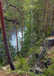 Iso-Helvetinjärvi. Here a
couple of back-packing trekkers were cooking their lunch, with the smoke of
their wood-fire filling the air, a quintessentially Finnish scene (Photo
22 - Lake-side camp-fire). We joined them by the fire to eat our lunch
before re-climbing the steps and taking the transverse path along the top rim of
the Helvetinkolu Gorge. This led along past the top of a sheer-sided, 2m wide
rocky fracture cleft of Helvetinkolu, lying at right angles and dropping steeply
down to the main line of the lake-filled valley. This side-cleft forms the
emblem of Helvetinjärvi National Park (see left). From this point, we could look
down the length of the cleft (Photo
23 - Helvetinkolu Cleft). We continued around directly above the
unsuspecting sheer-drop of Helvetinkolu Gorge (see right), to a look-out point
on a prominent rocky outcrop above the main line of the lake-filled gorge. From
here, despite the overcast lighting conditions, we could photograph the
lake-filled rift-valley, its sides lined with dark pines and the contrasting
golden autumnal colours of birches, Iso-Helvetinjärvi. Here a
couple of back-packing trekkers were cooking their lunch, with the smoke of
their wood-fire filling the air, a quintessentially Finnish scene (Photo
22 - Lake-side camp-fire). We joined them by the fire to eat our lunch
before re-climbing the steps and taking the transverse path along the top rim of
the Helvetinkolu Gorge. This led along past the top of a sheer-sided, 2m wide
rocky fracture cleft of Helvetinkolu, lying at right angles and dropping steeply
down to the main line of the lake-filled valley. This side-cleft forms the
emblem of Helvetinjärvi National Park (see left). From this point, we could look
down the length of the cleft (Photo
23 - Helvetinkolu Cleft). We continued around directly above the
unsuspecting sheer-drop of Helvetinkolu Gorge (see right), to a look-out point
on a prominent rocky outcrop above the main line of the lake-filled gorge. From
here, despite the overcast lighting conditions, we could photograph the
lake-filled rift-valley, its sides lined with dark pines and the contrasting
golden autumnal colours of birches,
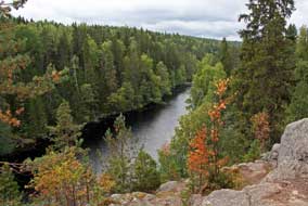 one of the trip's enduring images
(see below left) (Photo
24 - Helvetinkolu Gorge). one of the trip's enduring images
(see below left) (Photo
24 - Helvetinkolu Gorge).
Our return path began from the top rim of the gorge through ancient forest, the
ground under fallen trees covered with the trailing leaves of Twinflowers;
earlier in the year, this would have been a mass of their tiny flowers. The
forest opened up and the path now crossed an open area of marshland, where in
2012 formations of migrating cranes had flown overhead. This morning 4 cranes
had flown over the campsite, as they gathered in readiness for their mass
migratory flight south, any day now. Today we saw our first cranberries (Karpalo
in Finnish) of this year on this marshland's sphagnum, beginning to ripen but
still bitter and needing another couple of months until ripe enough to eat. Over
higher 'islets' of forested ground, more Lingonberries flourished; we continued
our berry-picking, able now to be more selective, and filled a 3rd bag of juicy
ripe berries readily identifiable by their darker red colours and slightly
translucent look. When one area was cleared of its berries with our gathering box, we
moved further inland from the path to find more berries; it was thoroughly
satisfying with endless Lingonberries to be picked.
Back at Haapasaari Camping, we settled up our 3 day's rent and, with our own
picked supply of breakfast Mustikka (Bilberries) almost gone, we bought
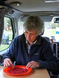 a
half-litre box from the campsite reception. Having re-pitched at our camping
spot, we now had today's picked Lingberries to sort through, picking out any
leaves, debris or unripe berries (see right). It had been a thoroughly rewarding
day: beautiful forest walking on good paths, magnificent gorge terrain, and
fruitful berry-picking using our gathering box, and over 2 litres of ripe
berries to show for it now stowed in the fridge. a
half-litre box from the campsite reception. Having re-pitched at our camping
spot, we now had today's picked Lingberries to sort through, picking out any
leaves, debris or unripe berries (see right). It had been a thoroughly rewarding
day: beautiful forest walking on good paths, magnificent gorge terrain, and
fruitful berry-picking using our gathering box, and over 2 litres of ripe
berries to show for it now stowed in the fridge.
 Siikaneva marshlands and more berry-picking: the following morning,
we headed south on Route 66 for 20 kms beyond Ruovesi, and turned off onto the
dirt road by a former military base to the parking area for the Siikaneva
marshlands. This year we had the coordinates and detailed map; how we originally
found this obscure location in 2012 with neither was a skilful piece of
navigation combined with a lot of luck! It was another morning of warm, soft
autumnal sunshine, and at the parking area we booted up to walk the 4 kms board-walk
circuit of the Siikaneva Marshes (Click
here for Siikaneva Marshes map).
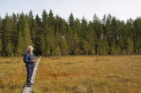
The first 300m section of board-walk across the open mire began immediately on
emerging from the trees just beyond the parking area (Photo
25- Siikaneva Marshland board-walk) (see left). On our 2012 visit, the board-walks
crossing the open sections of mire had been narrow and in poor condition with
some parts rotten and unsafe, and to add to the feeling of insecurity, the
boards' surface was wet and slippery. After constant rain, the marshes had been
water-logged with standing water. In contrast this year after the poor but dry
summer with little rain, the mire was quite dry with sedges growing across its
surface. More significantly, the board-walks had been renewed with double-width
planking; there was no longer a feeling of insecurity and fear of slipping into
the mire. Siikaneva marshlands and more berry-picking: the following morning,
we headed south on Route 66 for 20 kms beyond Ruovesi, and turned off onto the
dirt road by a former military base to the parking area for the Siikaneva
marshlands. This year we had the coordinates and detailed map; how we originally
found this obscure location in 2012 with neither was a skilful piece of
navigation combined with a lot of luck! It was another morning of warm, soft
autumnal sunshine, and at the parking area we booted up to walk the 4 kms board-walk
circuit of the Siikaneva Marshes (Click
here for Siikaneva Marshes map).
The first 300m section of board-walk across the open mire began immediately on
emerging from the trees just beyond the parking area (Photo
25- Siikaneva Marshland board-walk) (see left). On our 2012 visit, the board-walks
crossing the open sections of mire had been narrow and in poor condition with
some parts rotten and unsafe, and to add to the feeling of insecurity, the
boards' surface was wet and slippery. After constant rain, the marshes had been
water-logged with standing water. In contrast this year after the poor but dry
summer with little rain, the mire was quite dry with sedges growing across its
surface. More significantly, the board-walks had been renewed with double-width
planking; there was no longer a feeling of insecurity and fear of slipping into
the mire.
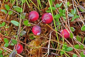
Right from the start of the passageway across this section of marsh we found
flourishing patches of red ripening Cranberry (Karpalo), their berries
sitting on a cushion of sphagnum
 (Photo
26- Ripening Cranberry) (see right). With the marsh quite dry this year,
it was firm enough to step off the board to photograph these large fruits with
their trailing stems of tiny leaves. We crossed (Photo
26- Ripening Cranberry) (see right). With the marsh quite dry this year,
it was firm enough to step off the board to photograph these large fruits with
their trailing stems of tiny leaves. We crossed
 the
first 300m length of board-walk to step 'ashore' onto the large marshland
'island' where flourishing Lingonberry bushes laden with ripe berries grew on
the 'island's' rocky terraces. In anticipation of this opportunity for further
berry-picking, we had come armed with bags and gathering box again. With the aid
of our useful picking tool, we systematically set to work 'hoovering' up bunches
of the ripest berries seen so far, and within 15 minutes we had totally stripped
an entire bank of plants and filled our bag with a good 1½ litres of berries
(see left). The gathering box's clever internal design enabled you to continue
brushing up more berries with the front comb without spilling those already
collected into the device's box. Having bagged up and stowed our pickings in the
day sac, we sat at the foot of the rocky terrace to eat our sandwiches, looking
back across the mire we had just crossed along the length of the board-walk,
revelling in the peaceful stillness of the marshlands (see below right). the
first 300m length of board-walk to step 'ashore' onto the large marshland
'island' where flourishing Lingonberry bushes laden with ripe berries grew on
the 'island's' rocky terraces. In anticipation of this opportunity for further
berry-picking, we had come armed with bags and gathering box again. With the aid
of our useful picking tool, we systematically set to work 'hoovering' up bunches
of the ripest berries seen so far, and within 15 minutes we had totally stripped
an entire bank of plants and filled our bag with a good 1½ litres of berries
(see left). The gathering box's clever internal design enabled you to continue
brushing up more berries with the front comb without spilling those already
collected into the device's box. Having bagged up and stowed our pickings in the
day sac, we sat at the foot of the rocky terrace to eat our sandwiches, looking
back across the mire we had just crossed along the length of the board-walk,
revelling in the peaceful stillness of the marshlands (see below right).
The large 'island' rose steeply from the surrounding marshlands, densely wooded
with ancient pine, spruce and birch, with bushy groundcover of Bilberry,
Lingonberry and Ling. A short side-path terraced across the island's forested
slope to a Tuli-päikka camp-fire place set on a headland overlooking the
marsh and a smaller neighbouring 'island', a magnificent spot (Photo
27- Siikaneva camp-fire spot). The main path continued up and over the
steep slope of the island's densely wooded crown, dropping down to a 100m
section of board-walk over open mire linking to the next
and smaller island of Pikkulatosaari. This was covered with even older pines,
many fallen and dead. On the far side, a reassuring sign-board marked a paths
junction where our 4km circuit turned off to the island's northern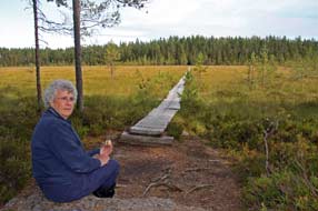 edge and the
start of the next 500m stretch of board-walk, initially crossing 2 tiny 'islets'
projecting from the surrounding mire. Thankfully this longer board-walk had also
been totally renewed edge and the
start of the next 500m stretch of board-walk, initially crossing 2 tiny 'islets'
projecting from the surrounding mire. Thankfully this longer board-walk had also
been totally renewed
 since 2012 and was now firm and safe. The marsh also was
much drier and covered with lush growth of sedge, hiding any
Cranberries growing on the sphagnum. Across the length of the board-walk, the
path turned back eastward on the northern shore through birch woodland alongside
the drainage ditch to reach a short stretch of board-walk out to an experimental
station on a wooden platform in the centre of the open mire. Here we spoke with
the leader of a group of young students on a field trip from Helsinki
University. The research station's purpose was to monitor variations in
atmospheric CO2 levels and emissions of methane gas from the peatland
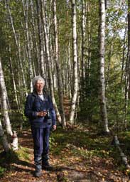
marshes. Our path continued along the marshland edge drainage ditch, passing
through delightful stands of tall birches, their white trunks and golden leaves
glowing in the afternoon sunlight (see left). This led to the final stretch of
board-walk which in 2012 had been the narrowest and most decayed boards we had
crossed, unreliable and treacherously wet after rain; today in contrast, the
renewed boards were firm and generally 2 widths, and the marsh no longer
water-logged. The path led back to the parking area through the forest with
sunlight filtering down through the trees and ground covered with ripe
Lingonberries. since 2012 and was now firm and safe. The marsh also was
much drier and covered with lush growth of sedge, hiding any
Cranberries growing on the sphagnum. Across the length of the board-walk, the
path turned back eastward on the northern shore through birch woodland alongside
the drainage ditch to reach a short stretch of board-walk out to an experimental
station on a wooden platform in the centre of the open mire. Here we spoke with
the leader of a group of young students on a field trip from Helsinki
University. The research station's purpose was to monitor variations in
atmospheric CO2 levels and emissions of methane gas from the peatland
marshes. Our path continued along the marshland edge drainage ditch, passing
through delightful stands of tall birches, their white trunks and golden leaves
glowing in the afternoon sunlight (see left). This led to the final stretch of
board-walk which in 2012 had been the narrowest and most decayed boards we had
crossed, unreliable and treacherously wet after rain; today in contrast, the
renewed boards were firm and generally 2 widths, and the marsh no longer
water-logged. The path led back to the parking area through the forest with
sunlight filtering down through the trees and ground covered with ripe
Lingonberries.
Härmälä Camping at Tampere, the trip's worst campsite: we re-joined Route 66 and headed south
towards the small town of Orivesi (click here for
map of our journey),
with forest now giving way to more pastoral land with harvesting of cereal crops
taking place. After a provisions stop at Orivesi, we turned westwards on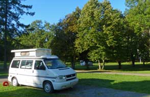 Route 9
towards Tampere, a busy road well-protected with elk-fencing on both sides.
Approaching Tampere, Route 9 assumed motorway standard around the city with
traffic now the busiest we had driven in all trip, and driving standards
noticeably more aggressive. We turned off the ring-road towards Pirkkala,
heading for Härmälä Camping. But after our 2012 experience, we had no great
hopes for the place, the only campsite within public transport distance of
Tampere. Sure enough on our arrival, a half-hearted take-it-or-leave-it
greeting, excessive prices at €29/night, grotty surroundings with steeply
sloping and water-logged land unfit for camping on, and worst of all the
filthiest WC/showers seen all trip. The girl at reception succumbed to the full
brunt of pressure about excessive prices and low standards, and offered free
electricity and €23.50/night; only this begrudging gesture saved Härmälä Camping
being given our lowest rating, but without doubt it gets the wooden spoon award
as the trip's worst campsite. Reluctantly we settled in at one of the few
gravelled pitches (see right), albeit sloping severely down towards Tampere's northern lake Näsijärvi. First job was to sort and sift today's crop of Lingonberries, all
consistently ripe and dark red; now with a further 2 litres of ripe fruit in the
fridge, tonight's supper tonight had to be a cheering beef and Lingonberry stew. Route 9
towards Tampere, a busy road well-protected with elk-fencing on both sides.
Approaching Tampere, Route 9 assumed motorway standard around the city with
traffic now the busiest we had driven in all trip, and driving standards
noticeably more aggressive. We turned off the ring-road towards Pirkkala,
heading for Härmälä Camping. But after our 2012 experience, we had no great
hopes for the place, the only campsite within public transport distance of
Tampere. Sure enough on our arrival, a half-hearted take-it-or-leave-it
greeting, excessive prices at €29/night, grotty surroundings with steeply
sloping and water-logged land unfit for camping on, and worst of all the
filthiest WC/showers seen all trip. The girl at reception succumbed to the full
brunt of pressure about excessive prices and low standards, and offered free
electricity and €23.50/night; only this begrudging gesture saved Härmälä Camping
being given our lowest rating, but without doubt it gets the wooden spoon award
as the trip's worst campsite. Reluctantly we settled in at one of the few
gravelled pitches (see right), albeit sloping severely down towards Tampere's northern lake Näsijärvi. First job was to sort and sift today's crop of Lingonberries, all
consistently ripe and dark red; now with a further 2 litres of ripe fruit in the
fridge, tonight's supper tonight had to be a cheering beef and Lingonberry stew.
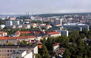 A day in Tampere: morning brought a misty but clearing sky with
promise of a fine day for our re-visit to Tampere, and we walked up to the main
road to catch the 11-05 #11 bus into the city (see log of our 2012 visit to Tampere).
Finland's second city Tampere was founded in 1779 in the final years of Swedish
rule, along the isthmus between Lakes Pyhäjärvi and Näsijärvi. During the 19th
century, A day in Tampere: morning brought a misty but clearing sky with
promise of a fine day for our re-visit to Tampere, and we walked up to the main
road to catch the 11-05 #11 bus into the city (see log of our 2012 visit to Tampere).
Finland's second city Tampere was founded in 1779 in the final years of Swedish
rule, along the isthmus between Lakes Pyhäjärvi and Näsijärvi. During the 19th
century,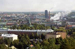 the fast-flowing Tammerkoski rapids which connected the 2 lakes through
the city powered textile mills which lined the river-banks. Tsar Alexander I
abolished taxes on local industries to encourage the growth of trade
leading to the rapid expansion of Tampere as a manufacturing city. One of the
entrepreneurial industrialists attracted here was a Quaker Scotsman, James
Finlayson, who opened a textile factory here in 1820, drawing on labour from
surrounding rural areas where traditional crafts were in decline. This rapid
industrial growth attracted both Finnish and foreign investors, and the city
developed as a centre of both engineering and textile manufacture.
Paternalistic factory owners provided for their employees' leisure, creating a
cultural heritage still seen in the modern city. The mobile phone giant Nokia
was founded here in 1865 as a wood-pulp and paper mill on the banks of the Tammerkoski rapids. They later moved to the nearby town of Nokia which gave the
company its name, producing everything from wellington boots to cycle tyres and
TVs to steel cables, before specialising in electronics in the 1970s. Following
Finland's independence in 1917, the industrial workers of the fast-flowing Tammerkoski rapids which connected the 2 lakes through
the city powered textile mills which lined the river-banks. Tsar Alexander I
abolished taxes on local industries to encourage the growth of trade
leading to the rapid expansion of Tampere as a manufacturing city. One of the
entrepreneurial industrialists attracted here was a Quaker Scotsman, James
Finlayson, who opened a textile factory here in 1820, drawing on labour from
surrounding rural areas where traditional crafts were in decline. This rapid
industrial growth attracted both Finnish and foreign investors, and the city
developed as a centre of both engineering and textile manufacture.
Paternalistic factory owners provided for their employees' leisure, creating a
cultural heritage still seen in the modern city. The mobile phone giant Nokia
was founded here in 1865 as a wood-pulp and paper mill on the banks of the Tammerkoski rapids. They later moved to the nearby town of Nokia which gave the
company its name, producing everything from wellington boots to cycle tyres and
TVs to steel cables, before specialising in electronics in the 1970s. Following
Finland's independence in 1917, the industrial workers of
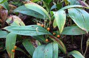 Tampere formed the
backbone of the left-wing Red Guards during the Finnish Civil War when the city
was ravaged by savage urban battles. Once called the Manchester of Finland,
Tampere's industrial heritage can still be
seen today with the former factories
and their tall brick chimneys along the Tammerkoski rapids conserved or
converted to modern usage. The rapids which once powered Tampere's industrial
growth still generate HEP in the heart of the city. Tampere formed the
backbone of the left-wing Red Guards during the Finnish Civil War when the city
was ravaged by savage urban battles. Once called the Manchester of Finland,
Tampere's industrial heritage can still be
seen today with the former factories
and their tall brick chimneys along the Tammerkoski rapids conserved or
converted to modern usage. The rapids which once powered Tampere's industrial
growth still generate HEP in the heart of the city.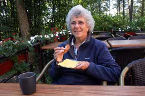
Our plan was to begin our day in Tampere on the Pyynkki
esker-ridge which stands
85m high separating the 2 lakes on which Tampere stands, Pyhäjärvi
on the south
and Näsijärvi the north. Our bus reached the city centre and trundled across the
cobbled Hämeenkatu bridge past the Keskustori (Central square) and along the
main shopping street. The bus turned past the offensively triumphalist Victory
Memorial erected by the victorious Whites after the Civil War, the tilting
flying saucer-shaped public library, and the Aleksanterin Church, and a couple
of stops along Pirkankatu we got off a Pyynikintori. Here a side street led us
up towards the pathway leading onto Pyynkki ridge with its network of tracks.
Our first appointment this morning was to find the Lilies of the Valley (Kielo
Finland's national flower) which flourish along the slopes of the wooded
esker-ridge. With their leaves now dying in autumn and their flowers long past
or picked, we wanted to photograph their orange berries; how a plant that can
produce such
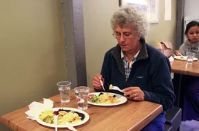 attractively delicate and sweet-smelling flowers in spring but
fatally poisonous berries in autumn is one of nature's bizarre quirks. We found
the banks of Kielo with their orange berries, and local passers-by gazed
with curiosity as 2 obvious visitors squatted among the dying leaves pointing
cameras; but we got our photos of the wild Lily of the Valley berries recalled
from 2012 (see
above left). Up onto the summit of the ridge, our next stop was
the 1929 Pyynikin Näkötorni (observation tower)
for its views attractively delicate and sweet-smelling flowers in spring but
fatally poisonous berries in autumn is one of nature's bizarre quirks. We found
the banks of Kielo with their orange berries, and local passers-by gazed
with curiosity as 2 obvious visitors squatted among the dying leaves pointing
cameras; but we got our photos of the wild Lily of the Valley berries recalled
from 2012 (see
above left). Up onto the summit of the ridge, our next stop was
the 1929 Pyynikin Näkötorni (observation tower)
for its views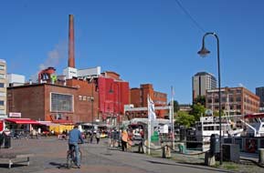 over the city.
With the sun finally breaking trough, we paid our €2s to climb to the tower's
viewing platform to photograph the distant city skyline, trying to identify
features we could recognise such as the Finlayson Factory and Cathedral (Photo
28 - Tampere skyline) (see above left and right). In the westerly
direction, the 2 lakes shone blue in the morning light above the dark green
pines covering the ridge below us. Down at the tower's café, famous for its
home-make munkki (doughnuts), we ordered our Kahvi ja
munkki. Our
pronunciation must be improving since the young lady responded fully in Finnish;
we had to confess that our limited language was not up to full conversation! We
sat out on the terrace with our coffee and the doughnuts were indeed delicious
(see above right). over the city.
With the sun finally breaking trough, we paid our €2s to climb to the tower's
viewing platform to photograph the distant city skyline, trying to identify
features we could recognise such as the Finlayson Factory and Cathedral (Photo
28 - Tampere skyline) (see above left and right). In the westerly
direction, the 2 lakes shone blue in the morning light above the dark green
pines covering the ridge below us. Down at the tower's café, famous for its
home-make munkki (doughnuts), we ordered our Kahvi ja
munkki. Our
pronunciation must be improving since the young lady responded fully in Finnish;
we had to confess that our limited language was not up to full conversation! We
sat out on the terrace with our coffee and the doughnuts were indeed delicious
(see above right).
The lane from the Pyynikin tower led along the length of the wooded ridge
towards the city, dropping down into Tiiliruukinkatu where former industrial
buildings are now tastefully converted to apartment blocks. We reached the wide
harbour area at the southern
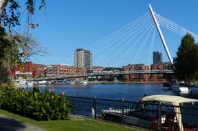 end of the Tammerkoski channel where it joined Pyhäjärvi
lake, and walked around to the harbour-side market. There was no time to stop
now since our 3rd appointment this morning awaited - lunch of Tampere
Musta-makkara (black-pudding sausage) with Puolukka in the Kauppahalli (Market
Hall), which we had enjoyed on our 2012 visit. Up through the back streets, we
found the rear entrance to the Kauppahalli with its attractive elongated façade
and along the rows of stalls found stall #52, the Pyörykkä-baari, a market
cafeteria serving an array of hot dishes, still as popular a lunch spot end of the Tammerkoski channel where it joined Pyhäjärvi
lake, and walked around to the harbour-side market. There was no time to stop
now since our 3rd appointment this morning awaited - lunch of Tampere
Musta-makkara (black-pudding sausage) with Puolukka in the Kauppahalli (Market
Hall), which we had enjoyed on our 2012 visit. Up through the back streets, we
found the rear entrance to the Kauppahalli with its attractive elongated façade
and along the rows of stalls found stall #52, the Pyörykkä-baari, a market
cafeteria serving an array of hot dishes, still as popular a lunch spot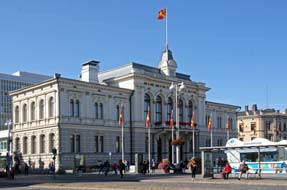 as ever
with local people and the same couple serving. We ordered our Musta-makkara with
salads and potatoes-anna sold by weight, and sat in the café area to eat
our lunch (Photo
29 - Lunch at market baari) (see above left). It was truly delicious with the market
ambience adding to the occasion. After lunch we ambled around the stalls taking
our photos of this magnificent market hall (Photo
30 - Tampere Kauppahalli). Returning down to the harbour-side market
where local people sat enjoying the sunshine, we browsed the stalls which were
now piled high with berries. From the high point of the elegant footbridge over
the harbour, we took our photos against the backdrop of the wood-pulp and paper
mill; in any other city centre this would be considered an intrusive eye-sore,
but somehow in Tampere, with its industrial heritage, this large industrial
complex and smoking chimney seemed entirely at home (Photo
31- Market-place industrial backdrop). Walking along the harbour
frontage past moored boats, today's lovely sunshine lit the glorious setting
from under the trees looking along to the suspension footbridge (see left). as ever
with local people and the same couple serving. We ordered our Musta-makkara with
salads and potatoes-anna sold by weight, and sat in the café area to eat
our lunch (Photo
29 - Lunch at market baari) (see above left). It was truly delicious with the market
ambience adding to the occasion. After lunch we ambled around the stalls taking
our photos of this magnificent market hall (Photo
30 - Tampere Kauppahalli). Returning down to the harbour-side market
where local people sat enjoying the sunshine, we browsed the stalls which were
now piled high with berries. From the high point of the elegant footbridge over
the harbour, we took our photos against the backdrop of the wood-pulp and paper
mill; in any other city centre this would be considered an intrusive eye-sore,
but somehow in Tampere, with its industrial heritage, this large industrial
complex and smoking chimney seemed entirely at home (Photo
31- Market-place industrial backdrop). Walking along the harbour
frontage past moored boats, today's lovely sunshine lit the glorious setting
from under the trees looking along to the suspension footbridge (see left).
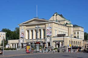 A walk back up Aleks Kivi katu brought us to the main street of Hämeenkatu and
across to the Keskustori (Central Square) lined by Tampere City Hall on one
side (see above right), and the Theatre on the other (see left). The terrace of the
Engel designed Vanha Kirkko (Old Church) on the far side of the square gave
further views of both the City Hall (Photo 32 - Keskustori and City Hall)
and Tampere Theatre A walk back up Aleks Kivi katu brought us to the main street of Hämeenkatu and
across to the Keskustori (Central Square) lined by Tampere City Hall on one
side (see above right), and the Theatre on the other (see left). The terrace of the
Engel designed Vanha Kirkko (Old Church) on the far side of the square gave
further views of both the City Hall (Photo 32 - Keskustori and City Hall)
and Tampere Theatre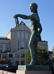 (Photo
33 - Tampere Theatre). Along to Hämeenkatu Bridge with its 4
well-endowed male statues
(see below right), we again admired the classic view
along the length of the Tammerkoski Rapids which had provided the power-source
to drive Tampere's early industrial development. On such a gloriously sunny
afternoon, we ambled through the trim river-side parklands photographing the
conserved former industrial factories and chimney stacks and the cascade of the HEP
generating plant (see below left) (Photo
34 - Tammerkoski Rapids). Tampere city authorities had had the awareness to realise the
aesthetic qualities and tourist potential of its industrial heritage, before
developers could rip it all down along with the city's historic soul in the
spurious name of progress (and profit!), and replace the attractive brick
structures with formless glass and concrete eyesores. Beyond the generating
station at the far end of the parkland, we walked trough to the Satakunnankatu
bridge for the view across the upper Tammerkoski Rapids towards the former Tampella
textile-mill and heavy engineering factory now housing the Vapriikki Museum
which we visited in 2012 (Photo
35 - Former Tampella factory) (see below right).
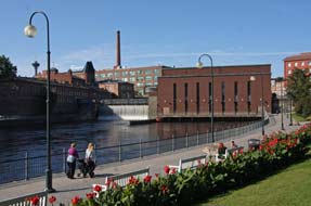 On
the opposite side of the rapids, the former Finlayson factory is now so
tastefully converted to a complex of shops, museums and restaurants, with the
conserved factory gate still bearing the name Finlayson and Co after its
originating Scots founder (Photo
36 - Finlayson factory gate), and the former huge cotton mill's imposing façade
dominating the length of Satakunnankatu (see below left). Back across the bridge, we crossed the
footbridge over the Tammerkoski cascades by the HEP generating plant. Dodging
the cyclists crossing the bridge, we photographed the northward view along the
upper rapids towards the Satakunnankatu bridge with the backdrop of the
Finlayson and Tampella factories. Down the steps alongside the Tammerkoski
cascade which glistened in the afternoon sunshine (Photo
37 - Tammerkoski Rapids), we crossed the lower parkland
by the On
the opposite side of the rapids, the former Finlayson factory is now so
tastefully converted to a complex of shops, museums and restaurants, with the
conserved factory gate still bearing the name Finlayson and Co after its
originating Scots founder (Photo
36 - Finlayson factory gate), and the former huge cotton mill's imposing façade
dominating the length of Satakunnankatu (see below left). Back across the bridge, we crossed the
footbridge over the Tammerkoski cascades by the HEP generating plant. Dodging
the cyclists crossing the bridge, we photographed the northward view along the
upper rapids towards the Satakunnankatu bridge with the backdrop of the
Finlayson and Tampella factories. Down the steps alongside the Tammerkoski
cascade which glistened in the afternoon sunshine (Photo
37 - Tammerkoski Rapids), we crossed the lower parkland
by the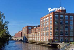 magnificently tall, slender and elegantly octagonal factory chimney of
the former paper-mill which once occupied this site. It had been a brave if
expensive decision to conserve such a tall industrial chimney, but the resulting
impact of its presence here is now startling. magnificently tall, slender and elegantly octagonal factory chimney of
the former paper-mill which once occupied this site. It had been a brave if
expensive decision to conserve such a tall industrial chimney, but the resulting
impact of its presence here is now startling.
Back past another of the conserved industrial buildings, now converted to a
theatre, we re-crossed Satakunnankatu into the yard of the Finlayson factory to
find the Werstas Finnish Labour Movement Museum
which is
devoted to Tampere's social and industrial history and proudly promotes itself as Finland's largest free-entry museum. We wanted particularly to
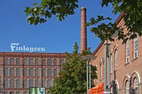 see the Textile Museum which sets out the
history of cotton, wool and linen spinning in Tampere and the various mills that
were established during the 19th century along the Tammerkoski Rapids, most
noticeably the Finlayson factory, and that in their day had employed 1000s. James
Finlayson (1771~1852) (see below right) had set up his original textile factory in
1820 with financial encouragement from the Tsarist authorities and sold the mill
in 1836 when ill health forced his return to Scotland. The company retained the
Finlayson name and went on to develop as one of Tampere's most progressive
industries and major employer; it was one of the last of Tampere's textile mills
to close in 1991 as Far Eastern cheap labour and foreign imports made Finland's
domestic textile industry uneconomic. see the Textile Museum which sets out the
history of cotton, wool and linen spinning in Tampere and the various mills that
were established during the 19th century along the Tammerkoski Rapids, most
noticeably the Finlayson factory, and that in their day had employed 1000s. James
Finlayson (1771~1852) (see below right) had set up his original textile factory in
1820 with financial encouragement from the Tsarist authorities and sold the mill
in 1836 when ill health forced his return to Scotland. The company retained the
Finlayson name and went on to develop as one of Tampere's most progressive
industries and major employer; it was one of the last of Tampere's textile mills
to close in 1991 as Far Eastern cheap labour and foreign imports made Finland's
domestic textile industry uneconomic..jpg)
The highlight of our day was a re-visit to the Plevna Panimo-ravintola (brewery-pub) for their excellent range of home-brewed beers, set in the
former spinning hall of the Finlayson factory. The brewery takes its name from
the battle of Plevna in modern-day Bulgaria fought in the Russo-Turkish War
(1877-78). Men from the Finlayson cotton mills fought alongside Russian troops,
and since the custom of the day was to name each new Finlayson building after
some major current event, the weaving hall was named after the battle fought in
the Balkan town of Plevna during this conflict. Sitting to enjoy the Plevna Pils
and Dark Lager was a suitable climax to our memorable day in Tampere with its conserved
factory buildings, themselves a worthy tribute to the city's industrial heritage.
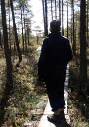 South
on Route 12: the sun was up early after a
chill and dewy night, and we returned to Tampere's busy motorway ring-road to
turn off onto Route 12 towards Rauma (click here for
map of our journey).
The forested terrain was attractive but there was little chance to take notice.
Maximum attention had to be given to 3 distracting hazards: the least concerning
were the frequent elk-warning signs alerting to the potential for elks lumbering
across the road; the second were the speed cameras with the general limit at
100kph but around junctions dropping with little warning to 80 kph and
cameras lurking to trap the unwary; but the most hazardous of all were the
utterly ruthless driving standards, excessive speeding and dangerous tail-gating
and overtaking by Finnish motorists. The combination of these 3 hazards made
Route 12 a wearyingly unpleasant road for the 60 kms drive to our South
on Route 12: the sun was up early after a
chill and dewy night, and we returned to Tampere's busy motorway ring-road to
turn off onto Route 12 towards Rauma (click here for
map of our journey).
The forested terrain was attractive but there was little chance to take notice.
Maximum attention had to be given to 3 distracting hazards: the least concerning
were the frequent elk-warning signs alerting to the potential for elks lumbering
across the road; the second were the speed cameras with the general limit at
100kph but around junctions dropping with little warning to 80 kph and
cameras lurking to trap the unwary; but the most hazardous of all were the
utterly ruthless driving standards, excessive speeding and dangerous tail-gating
and overtaking by Finnish motorists. The combination of these 3 hazards made
Route 12 a wearyingly unpleasant road for the 60 kms drive to our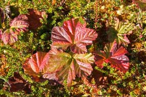 turning for
the Puurijärvi and Iso-suo National Park. turning for
the Puurijärvi and Iso-suo National Park.
Puurijärvi and Iso-suo National Park:
grateful to leave Route 12, we crossed the sluggish, wide Kohemäenjoki river and
turned off onto the peaceful Route 2481 which passed through farming hamlets and
fields of ripe cereal crops some already harvested. 6 kms further we turned off
again onto the narrow Karhiniementie and a dirt road leading to the parking area
by a dark pine wood for first of today's stops, the Mutilahti nature trail and
bird-watching tower. The 2 kms board-walk circular trail around the Iso-suo (Big
Bog) marshes began just beyond the parking area, passing through luxuriant
pinewoods growing around the rim of the marshland (see left). The mires,
particularly around the edges had been drained during the 19~20th centuries for
farmland, leaving the raised marshland dry and now growing stunted pine trees;
but with the recent creation of the national park, Metsähallitus have
systematically blocked off the drainage ditches to restore land to its natural
marshland state, with the peat at the marsh's centre still up to 6m deep. The
forest floor was covered with patches of Labrador-tea, and Bilberry, Bog
Bilberry and Lingonberry all still laden with berries. The nature trail
board-walk advanced out into the broader, open marshland, the pines now fewer
and more
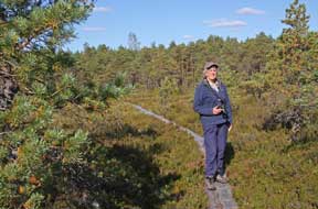 stunted, and rounded onto the main body
of Iso-suo (Photo
38 - Iso-suo nature trail). After a dry summer,
even with the marshland restoration works, the sphagnum alongside the board-walk
was quite dry and firm. The nutrient-rich mire supported much vegetation
including Cloudberry, its stunted, and rounded onto the main body
of Iso-suo (Photo
38 - Iso-suo nature trail). After a dry summer,
even with the marshland restoration works, the sphagnum alongside the board-walk
was quite dry and firm. The nutrient-rich mire supported much vegetation
including Cloudberry, its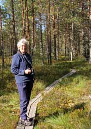 leaves now with their red-rust autumn colours (see
above right), matted patches of Cranberry leaves, and short new shoots of Bog
Rosemary poking up through the sphagnum. The
board-walk continued around through the stunted pines leading to the Iso-suo
bird-watching tower whose platform gave panoramic views across the central and
largely treeless and wetter areas of marshland. But in bright sunshine in
early September there was not a trace of bird-life to be seen. The board-walk
circled back through the stunted pines towards denser woodland as it approached
the marsh's fringe. As we entered the forest (see right), Sheila unexpectedly
disturbed a long, black grass snake sunning itself on the board-walk. leaves now with their red-rust autumn colours (see
above right), matted patches of Cranberry leaves, and short new shoots of Bog
Rosemary poking up through the sphagnum. The
board-walk continued around through the stunted pines leading to the Iso-suo
bird-watching tower whose platform gave panoramic views across the central and
largely treeless and wetter areas of marshland. But in bright sunshine in
early September there was not a trace of bird-life to be seen. The board-walk
circled back through the stunted pines towards denser woodland as it approached
the marsh's fringe. As we entered the forest (see right), Sheila unexpectedly
disturbed a long, black grass snake sunning itself on the board-walk.
Back at the path's start we crossed to the second
observation tower which overlooked distant Puurijärvi and the river weaving
through the surrounding wetlands. Here we were rewarded with the afternoon's
highlight: an Osprey was soaring over the marshlands and swooping down into the
water for fish (Photo
39 - Osprey over Puurijärvi) (see below left). It continued its impressive display
for several minutes not seeming to catch anything, before flying off in search of
richer pickings elsewhere.
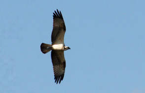 We
returned around the dirt road and continued north through farming hamlets and
their fields of ripe oats to the parking area for the third bird-watching tower
at Kärjenkallio overlooking the main body of the shallow, marshy Puurijärvi. The
800m long approach path led initially through woodland then alongside lake-side
pastures out to the tower. This was an enormous structure 20m high and
accommodating up to 50 visitors on its lofty observation platform. We climbed
gingerly to the top which looked out across Puurijärvi's broad wetlands, but
apart from a few distant ducks and swans, there was little else to be seen. We
continued We
returned around the dirt road and continued north through farming hamlets and
their fields of ripe oats to the parking area for the third bird-watching tower
at Kärjenkallio overlooking the main body of the shallow, marshy Puurijärvi. The
800m long approach path led initially through woodland then alongside lake-side
pastures out to the tower. This was an enormous structure 20m high and
accommodating up to 50 visitors on its lofty observation platform. We climbed
gingerly to the top which looked out across Puurijärvi's broad wetlands, but
apart from a few distant ducks and swans, there was little else to be seen. We
continued
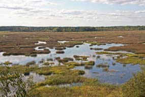 north,
turning off on a dirt road to reach the Ahvenus tower which was set alongside
the Kauvatsanjoki river where this flowed into the Puurijärvi marshes. The
river-side approach path was overgrown and when we eventually reached the tower,
there was not a trace of bird-life to reward our efforts. Apart from the
Osprey's thrilling display, it had been a frustratingly unrewarding afternoon; Puurijärvi and Iso-suo,
along with other newly designated national parks, seemed less impressive than
the longer standing areas of natural beauty further north and perhaps more to do
with Metsähallitus' concern to maintain its political standing. north,
turning off on a dirt road to reach the Ahvenus tower which was set alongside
the Kauvatsanjoki river where this flowed into the Puurijärvi marshes. The
river-side approach path was overgrown and when we eventually reached the tower,
there was not a trace of bird-life to reward our efforts. Apart from the
Osprey's thrilling display, it had been a frustratingly unrewarding afternoon; Puurijärvi and Iso-suo,
along with other newly designated national parks, seemed less impressive than
the longer standing areas of natural beauty further north and perhaps more to do
with Metsähallitus' concern to maintain its political standing.
A long drive and campsite problems:
we now had a 50 kms drive to reach tonight's campsite at Säkylä (click here for
map of our journey).
An earlier telephone call had reassured us it was open, and we anticipated a
peaceful, lake-side location at Pyhäjärvi with few if any other visitors at this
late
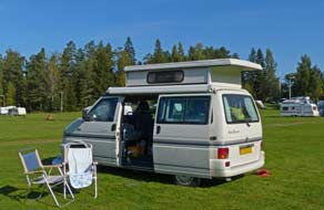 end
of the summer. After pulling off for provisions at the small town of Huittinen,
and shortly beyond we pulled off onto the minor Route 212. Having been
accustomed to minor roads in Northern and Central Finland being well-maintained,
it came as a shock now to face a badly surfaced, pot-hole riven road with
sections of road works stripped of asphalt. Route 212 was a total disgrace and
without doubt the worst stretch of road we had travelled in the whole of the
country, worse than many unsurfaced roads in the north. Route 204 brought us to Säkylä Camping, not the peaceful place we had expected: there were parked cars
everywhere, folks galore spilling out of a marquee, staff far too busy to bother
with us, and camping area packed. This place was an evident no-no! But where
now? Having tried without success to phone another site at the northern end of Pyhäjärvi, there was nothing for it but to drive on for another 70 kms to our
next planned campsite at the coast. We were already exhausted after a long day
and taxing drive, but as so end
of the summer. After pulling off for provisions at the small town of Huittinen,
and shortly beyond we pulled off onto the minor Route 212. Having been
accustomed to minor roads in Northern and Central Finland being well-maintained,
it came as a shock now to face a badly surfaced, pot-hole riven road with
sections of road works stripped of asphalt. Route 212 was a total disgrace and
without doubt the worst stretch of road we had travelled in the whole of the
country, worse than many unsurfaced roads in the north. Route 204 brought us to Säkylä Camping, not the peaceful place we had expected: there were parked cars
everywhere, folks galore spilling out of a marquee, staff far too busy to bother
with us, and camping area packed. This place was an evident no-no! But where
now? Having tried without success to phone another site at the northern end of Pyhäjärvi, there was nothing for it but to drive on for another 70 kms to our
next planned campsite at the coast. We were already exhausted after a long day
and taxing drive, but as so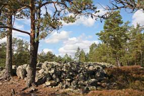 often in such cases, our patron St Serendipity came
to our aid. We set off and near to the junction with Route 210, spotted a
campsite sign for Kallionokka Camping; if it existed, we expected it to be
closed or derelict, but a gravelled driveway led down to the shore of Pyhäjärvi
and to our surprise there was a large and trimly turfed campsite, clearly
open. Reception was locked and no one responded to a phone call, but the
facilities were open, albeit basic and antiquated, and we settled in (see left). often in such cases, our patron St Serendipity came
to our aid. We set off and near to the junction with Route 210, spotted a
campsite sign for Kallionokka Camping; if it existed, we expected it to be
closed or derelict, but a gravelled driveway led down to the shore of Pyhäjärvi
and to our surprise there was a large and trimly turfed campsite, clearly
open. Reception was locked and no one responded to a phone call, but the
facilities were open, albeit basic and antiquated, and we settled in (see left).
Sammallahdenmäki Bronze Age burial ground:
the following morning, the sun burned through early mist to give another lovely
Indian Summer day. Having by good fortune happened on this perfectly placed
campsite at the southern end of Pyhäjärvi, we could now resume our planned route
today.
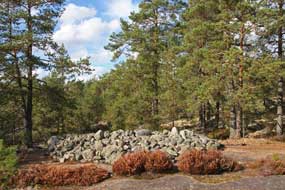 Along the eastern shore of the lake to Säkylä village, we turned
westwards at Eura to re-join Route 12 to the village of Lappi to find the Bronze
Age burial ground of Sammallahdenmäki. Declared a UNESCO World Heritage Site in
1999, the Sammallahdenmäki site consists of clusters of some 33 stone burial
cairns of varying size spread along a low, wooded ridge 1 km in length near to
Saanijärvi (see left). The lake would have been an inlet of the Bothnian Gulf during the
Bronze Age period of the burial site's construction (1,500~500 BC), but due to
land uplift, the site is now 15kms inland. The Sammallahdenmäki burial ground is
one of the most important Bronze Age sites of Scandinavia, showing evidence of
the long history of settlement, culture and funerary practices of the peoples living along the Scandinavian
coast and archipelago at that time. The large stone Along the eastern shore of the lake to Säkylä village, we turned
westwards at Eura to re-join Route 12 to the village of Lappi to find the Bronze
Age burial ground of Sammallahdenmäki. Declared a UNESCO World Heritage Site in
1999, the Sammallahdenmäki site consists of clusters of some 33 stone burial
cairns of varying size spread along a low, wooded ridge 1 km in length near to
Saanijärvi (see left). The lake would have been an inlet of the Bothnian Gulf during the
Bronze Age period of the burial site's construction (1,500~500 BC), but due to
land uplift, the site is now 15kms inland. The Sammallahdenmäki burial ground is
one of the most important Bronze Age sites of Scandinavia, showing evidence of
the long history of settlement, culture and funerary practices of the peoples living along the Scandinavian
coast and archipelago at that time. The large stone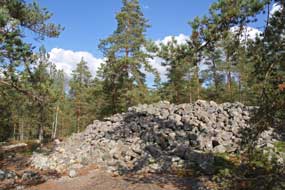 burial cairns were
constructed of granite boulders set over stone cysts which contained the
interred or cremated body and grave-goods. It is the largest and best preserved
cairn burial site in Finland, and was in use for 1,000 years until the early
Iron Age. The site included 2 very large and unusual cairn structures: one
elongated, oval walled cairn structure known as Huilun pitkä raunio (Long
ruin of Huilu), the other a low, flat quadrangular structure 16 x 19m known as
Kirkonlaattia (The Church Floor). Four of the large cairns were excavated
in 1891, but other than cremated human bone remains and fragment of a bronze
bracelet, no other artefacts were uncovered. Radiocarbon analysis dated the
remains to the early Bronze Age around 1,500 BC. burial cairns were
constructed of granite boulders set over stone cysts which contained the
interred or cremated body and grave-goods. It is the largest and best preserved
cairn burial site in Finland, and was in use for 1,000 years until the early
Iron Age. The site included 2 very large and unusual cairn structures: one
elongated, oval walled cairn structure known as Huilun pitkä raunio (Long
ruin of Huilu), the other a low, flat quadrangular structure 16 x 19m known as
Kirkonlaattia (The Church Floor). Four of the large cairns were excavated
in 1891, but other than cremated human bone remains and fragment of a bronze
bracelet, no other artefacts were uncovered. Radiocarbon analysis dated the
remains to the early Bronze Age around 1,500 BC.
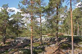 We had the plotted coordinates for the site and
followed the approach lane from Lappi village which led to a small industrial
unit at the suitably named Kivikylä (Stone village); further signs led from here
along a dirt road to a small parking area with information panels, and UNESCO
leaflets/site plan. This seemed to be at the southern end of the ridge where the
cairns were located, and we walked from here to find the burial site. The
ground's exposed slabbed granite bed rock, scoured by glacial action, was
reminiscent of the Ålands and Archipelago topography. Still unsure of
directions, and with the aid of the site plan, we followed the faint track up
onto the low ridge. For a World Heritage site, the natural pine forested We had the plotted coordinates for the site and
followed the approach lane from Lappi village which led to a small industrial
unit at the suitably named Kivikylä (Stone village); further signs led from here
along a dirt road to a small parking area with information panels, and UNESCO
leaflets/site plan. This seemed to be at the southern end of the ridge where the
cairns were located, and we walked from here to find the burial site. The
ground's exposed slabbed granite bed rock, scoured by glacial action, was
reminiscent of the Ålands and Archipelago topography. Still unsure of
directions, and with the aid of the site plan, we followed the faint track up
onto the low ridge. For a World Heritage site, the natural pine forested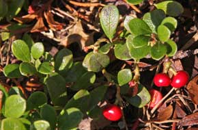 landscape was remarkably uncontaminated by intrusive signs or markers, and
almost by chance it seemed, we came on the first of the large burial cairns at
the southern extremity of the wooded ridge, the oval Long Ruin of Huilu (Photo
40 - Long Ruin of Huilu burial cairn) (see above right). We followed the faint
pathway over the granite slabs along the ridge, finding other cairns both large
and small (see above right), and at the northern end located the low,
flat-topped structure of the Church Floor cairn (see left) (Photo
41 - Church Floor burial cairn). The upper surfaces of the cairns
were covered with Bearberry (Arctostaphylos
uva-ursi) whose distinctive leaves and red ripe berries spread across
the flat granite slabs; this was the first time we had seen the fruits of
Bearberry (Sianpuolukka in Finnish)
(see right)
(Photo
42 - Bearberry fruits).
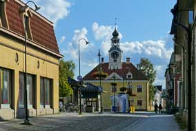 We had this remarkable site virtually to
ourselves, enjoying the peaceful ambiance and magnificent setting with the pine
woods lit by bright afternoon sunshine. It was truly amazing that for a World
Heritage Site, Sammallahdenmäki was completely untarnished by signs, hot dog
stalls and such intrusions. In its remote setting, it was difficult to find but
all the more rewarding for that; it was so rewarding to enjoy this noteworthy
historical monument in its unblemished natural state. We had this remarkable site virtually to
ourselves, enjoying the peaceful ambiance and magnificent setting with the pine
woods lit by bright afternoon sunshine. It was truly amazing that for a World
Heritage Site, Sammallahdenmäki was completely untarnished by signs, hot dog
stalls and such intrusions. In its remote setting, it was difficult to find but
all the more rewarding for that; it was so rewarding to enjoy this noteworthy
historical monument in its unblemished natural state.
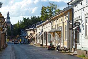 The wooden Old Town of Rauma: rejoining Route 12 we headed
westwards to turn into Vanha (Old) Rauma. Rauma was founded in 1442 as a Swedish trading
centre and was one of the few towns to repudiate King Gustav Vasa's 1550 command
to up sticks and move to the newly founded Helsinki to create a trading
port-city there to rival Hanseatic Tallinn. A wise decision since the embryonic
Helsinki foundered with plague and trade continued to flourish at Rauma. By
18/19th centuries Rauma had developed into a major trading port with Finland's
largest fleet of sailing ships, exporting Rauma's high quality lace all around
Europe. It remains today an important shipping and industrial centre, exporting
Finnish timber and paper world wide. There are still lace-making workshops on
Rauma's Old Town and a lace-making festival is held each year in July. But the
Old Town's striking wooden architecture is Rauma's key attraction today, The wooden Old Town of Rauma: rejoining Route 12 we headed
westwards to turn into Vanha (Old) Rauma. Rauma was founded in 1442 as a Swedish trading
centre and was one of the few towns to repudiate King Gustav Vasa's 1550 command
to up sticks and move to the newly founded Helsinki to create a trading
port-city there to rival Hanseatic Tallinn. A wise decision since the embryonic
Helsinki foundered with plague and trade continued to flourish at Rauma. By
18/19th centuries Rauma had developed into a major trading port with Finland's
largest fleet of sailing ships, exporting Rauma's high quality lace all around
Europe. It remains today an important shipping and industrial centre, exporting
Finnish timber and paper world wide. There are still lace-making workshops on
Rauma's Old Town and a lace-making festival is held each year in July. But the
Old Town's striking wooden architecture is Rauma's key attraction today,
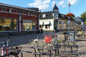 recognised with UNESCO World Heritage Site status in 1991. We had first been to Rauma in 2012 and today only had time for a fleeting visit, walking the circuit
of Old Rauma's main streets of Kauppakatu (Market Street) and Kuninkaankatu
(Royal Street). We ambled through the cobbled streets photographing the
conserved wooden buildings (Photo
43 - Rauma Old Town) (see right), and reached the Kauppatori where
locals sat at café terraces in the afternoon sunshine (see left) (Photo
44 - Rauma Kauppatori). Clearly there had been a
market earlier since the cobbles of the square were littered with Lingonberry
debris. We wandered down Isokirkkokatu to Pyhän Ristin Kirkko (Church of the
Holy Cross), hoping to recognised with UNESCO World Heritage Site status in 1991. We had first been to Rauma in 2012 and today only had time for a fleeting visit, walking the circuit
of Old Rauma's main streets of Kauppakatu (Market Street) and Kuninkaankatu
(Royal Street). We ambled through the cobbled streets photographing the
conserved wooden buildings (Photo
43 - Rauma Old Town) (see right), and reached the Kauppatori where
locals sat at café terraces in the afternoon sunshine (see left) (Photo
44 - Rauma Kauppatori). Clearly there had been a
market earlier since the cobbles of the square were littered with Lingonberry
debris. We wandered down Isokirkkokatu to Pyhän Ristin Kirkko (Church of the
Holy Cross), hoping to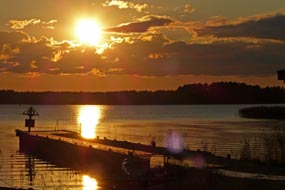 see the magnificent ecclesiastical artwork again, dating
from the church's period as a Franciscan priory before the Lutherans kicked the
monks out at the 1538 Reformation after their own church had burnt down. But
today the church had closed at 4-00pm and it was now 4-30. We returned along Kuninkaankatu admiring more of Old Rauma's decorated wooden buildings, before
turning our attention to more mundane provisions shopping at the Prisma
hypermarket. see the magnificent ecclesiastical artwork again, dating
from the church's period as a Franciscan priory before the Lutherans kicked the
monks out at the 1538 Reformation after their own church had burnt down. But
today the church had closed at 4-00pm and it was now 4-30. We returned along Kuninkaankatu admiring more of Old Rauma's decorated wooden buildings, before
turning our attention to more mundane provisions shopping at the Prisma
hypermarket.
Pyhäranta Camping on the Bothnian coast: joining Route 8, we headed
south for 20 kms along another speed camera infested main road, and turned off
to the Bothnian coast to find Pyhäranta Camping which we had used in 2012. The
narrow lane wound through lovely forest littered with
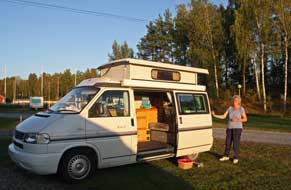 glacial erratic boulders
and farmland where harvesting was in progress. Finnish farmers must have blessed
this period of late summer fine weather for their harvesting. Reaching Pyhäranta,
the little shore-side campsite static caravans were full of locals making merry
on a sunny afternoon around the camp-fire. We settled in hoping the carousing
would not go on late into the night! (see left) The smoking chimney of smoke-sauna down by
the shore showed that it was time for the locals to break of from their drinking
to do whatever Finns do in a sauna. We cooked our supper as the sun set over the
Bothnian coast to give a magnificently flaring sunset (Photo
45 - Sunset over Bothnian coast) (see above right). glacial erratic boulders
and farmland where harvesting was in progress. Finnish farmers must have blessed
this period of late summer fine weather for their harvesting. Reaching Pyhäranta,
the little shore-side campsite static caravans were full of locals making merry
on a sunny afternoon around the camp-fire. We settled in hoping the carousing
would not go on late into the night! (see left) The smoking chimney of smoke-sauna down by
the shore showed that it was time for the locals to break of from their drinking
to do whatever Finns do in a sauna. We cooked our supper as the sun set over the
Bothnian coast to give a magnificently flaring sunset (Photo
45 - Sunset over Bothnian coast) (see above right).
Return to Saariston Lomskeskus on Mossala Island in Turku Archipelago: our
original plan had been to spend our final nights in Finland at Solliden Camping,
the only campsite close to Turku, for a re-visit to the port-city before catching
the overnight return ferry to Sweden. But our experience in the first week of
the trip had shown that the greedy new owners had increased prices to a
ludicrously indefensible level for a basic campsite, thus black-listing Solliden.
We now therefore had a problem: did we stick to our principles and boycott
Solliden, and seek an alternative? Of course there was only one answer, and we
therefore took the brave decision to drive there and back along the length of the
Turku Archipelago with all its ferries, for a final night at Saariston Lomskeskus
on remote Mossala Island (see log of our spring-time stay at Saariston) which we had so enjoyed at the start of the trip (click here for
map of our journey).
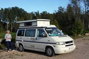 We left Pyhäranta early the next morning, and back up the winding lane to Route
8, turned south passing through the little town of Laitila with its brewery
visited in 2012 and whose fine beers we had enjoyed all this trip. Approaching
Turku, road works for the outward extension of Route 8's motorway delayed us,
but we reached the city outskirts without undue loss of time. Passing through
the centre and across the river, another unexpected issue for tomorrow's return
to the city: the car park along the embankment we planned to use was totally
closed off with building works. Turning off onto Route 110, we headed out through
the southern suburbs to Kaarina for the drive down to Pargas, again
wary of speed limits and speed cameras. After a brief pause at K-Market Pargas for
provisions, we continued SW-wards passing 3 speed cameras in the
space of 1 km. We We left Pyhäranta early the next morning, and back up the winding lane to Route
8, turned south passing through the little town of Laitila with its brewery
visited in 2012 and whose fine beers we had enjoyed all this trip. Approaching
Turku, road works for the outward extension of Route 8's motorway delayed us,
but we reached the city outskirts without undue loss of time. Passing through
the centre and across the river, another unexpected issue for tomorrow's return
to the city: the car park along the embankment we planned to use was totally
closed off with building works. Turning off onto Route 110, we headed out through
the southern suburbs to Kaarina for the drive down to Pargas, again
wary of speed limits and speed cameras. After a brief pause at K-Market Pargas for
provisions, we continued SW-wards passing 3 speed cameras in the
space of 1 km. We
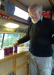 reached Pargas ferry-dock just as the ferry was approaching
and crossed to the first island of Nagu-Nauvo. We only had the spring-time
timetables but assumed they would be similar in autumn, and rapidly drove the 27 kms
across Nagu hoping to catch the 14-37 ferry across to Korpo in time to make the
15-10 ferry from Galtby to Houtskär; otherwise we had a long wait until 16-50.
We drove on determinedly on Route 180 across the island for the ferry over to
Korpo, reaching Galtby in good time to queue for the 35 minute crossing to
Kittius on Houtskär. Returning weekend traffic from the Archipelago had caused
long queues back at the previous ferry-docks, but by the time we docked at
Kittius, there were few other vehicles. We drove the winding, narrow lanes across
Houtskär, a surprisingly large island, to reach the Kivimo~Björkö chain-ferry,
then around the coast of Björkö for the final 5 kms to Saariston Lomskeskus at
the isolated northern tip of Mossala. We had made it. reached Pargas ferry-dock just as the ferry was approaching
and crossed to the first island of Nagu-Nauvo. We only had the spring-time
timetables but assumed they would be similar in autumn, and rapidly drove the 27 kms
across Nagu hoping to catch the 14-37 ferry across to Korpo in time to make the
15-10 ferry from Galtby to Houtskär; otherwise we had a long wait until 16-50.
We drove on determinedly on Route 180 across the island for the ferry over to
Korpo, reaching Galtby in good time to queue for the 35 minute crossing to
Kittius on Houtskär. Returning weekend traffic from the Archipelago had caused
long queues back at the previous ferry-docks, but by the time we docked at
Kittius, there were few other vehicles. We drove the winding, narrow lanes across
Houtskär, a surprisingly large island, to reach the Kivimo~Björkö chain-ferry,
then around the coast of Björkö for the final 5 kms to Saariston Lomskeskus at
the isolated northern tip of Mossala. We had made it.
Reaching the Saariston camping-marina complex, there was not a soul about, and at
reception we
phoned the campsite owner and received their usual courteous and helpful
response; we booked in and left our €22 overnight rent in the post box. The
ferry barrier was up, as when we were here in May, the northern line ferry
service now ended for the winter, and the marina deserted. Along at the
camping area, also thankfully deserted, we settled in close to the facilities
hut (see above right). The sun was warm, the scent of wild roses filled the air, and the whole
ambiance of the now peaceful parkland was wonderful; it was so good to be back,
albeit briefly. But with 3 litres of freshly picked ripe Lingonberries in the
fridge awaiting attention, there was no time yet for relaxing. A large billy was
filled with Lingonberries to boil up to make this year's Lingonberry sauce; with
the berries fully ripe they took little time to soften, and Paul filled 3 empty
jam jars kept for this purpose with the luscious Lingonberry sauce (Photo
46 - Lingonberry sauce) (see above left); this year's Christmas turkey would
taste all the better with this as accompaniment. Dusk seemed to settle even
earlier tonight and it was fully dark by soon after 8-00pm, as we settled in
for our peaceful night out here on the remote northern tip of Mossala where we
had begun this year's trip seemingly so long ago.
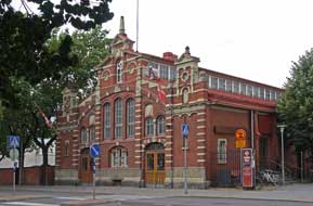 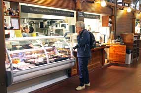 Return
drive along the Archipelago: dawn was just breaking when we were up
this morning, and over morning tea Paul killed what he hoped was the final
mossie of this year's midge-infested trip. Saariston Lomakeskus was a thoroughly
well-conceived and equipped site, the results of much hard work on the owner's
part to create the campsite's beautiful environment out of naturally undrained,
swampy forest; but with the strict proviso of only staying in May/early June or
September when all the usual holidaymaking hoards have left the place in peace.
We were away by 9-30am in good time for the return drive and ferries across Mossala, Björkö and Kivimo, to reach Kittius by 10-15 with plenty of time for
the 10-45 return ferry to Korpo. As we waited, the Viking Line ferry from Turku~Stockholm passed
through channel between the Archipelago's islands, the
same route we should take tomorrow evening by the Silja Line boat. Quite a
few other vehicles had joined the queue by the time the ferry drew in; George
drove aboard and we passed the half hour crossing in the little cafeteria.
Ashore at Galtby, we had 15 minutes to drive the 7km length of Korpo for the
11-30 ferry across the channel to Nagu. We then had the greater challenge of
driving the 27km length of Nagu in time for the 12-02 ferry to
the mainland, without breaking the 80 kph limit and tripping a speed camera. All
the other vehicles from the ferry had the same objective, resulting in a long Return
drive along the Archipelago: dawn was just breaking when we were up
this morning, and over morning tea Paul killed what he hoped was the final
mossie of this year's midge-infested trip. Saariston Lomakeskus was a thoroughly
well-conceived and equipped site, the results of much hard work on the owner's
part to create the campsite's beautiful environment out of naturally undrained,
swampy forest; but with the strict proviso of only staying in May/early June or
September when all the usual holidaymaking hoards have left the place in peace.
We were away by 9-30am in good time for the return drive and ferries across Mossala, Björkö and Kivimo, to reach Kittius by 10-15 with plenty of time for
the 10-45 return ferry to Korpo. As we waited, the Viking Line ferry from Turku~Stockholm passed
through channel between the Archipelago's islands, the
same route we should take tomorrow evening by the Silja Line boat. Quite a
few other vehicles had joined the queue by the time the ferry drew in; George
drove aboard and we passed the half hour crossing in the little cafeteria.
Ashore at Galtby, we had 15 minutes to drive the 7km length of Korpo for the
11-30 ferry across the channel to Nagu. We then had the greater challenge of
driving the 27km length of Nagu in time for the 12-02 ferry to
the mainland, without breaking the 80 kph limit and tripping a speed camera. All
the other vehicles from the ferry had the same objective, resulting in a long
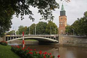 convoy of generally local cars travelling across the island at 79 kph, to avoid a
long wait for the next ferry! We all reached Prostvik at the eastern end of
Korpo just as the 12-02 ferry was loading; it was filled to capacity. Across the
channel, we drove up to Pargas where George had his final convoy of generally local cars travelling across the island at 79 kph, to avoid a
long wait for the next ferry! We all reached Prostvik at the eastern end of
Korpo just as the 12-02 ferry was loading; it was filled to capacity. Across the
channel, we drove up to Pargas where George had his final
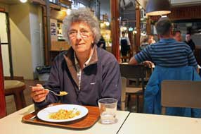 fill of Finnish
diesel. We now had the second challenge of finding parking in Turku with our usual car park now closed for building work. We drove the now familiar route
through Kaarina into the city centre, and turned off through side streets down
to the back of the theatre where we managed to find space in a paying car park
overlooking Itäinen Rantakatu (Eastern Promenade) and the river, and for €4.50
secured parking for the day (see log of our 2012 visit to Turku). fill of Finnish
diesel. We now had the second challenge of finding parking in Turku with our usual car park now closed for building work. We drove the now familiar route
through Kaarina into the city centre, and turned off through side streets down
to the back of the theatre where we managed to find space in a paying car park
overlooking Itäinen Rantakatu (Eastern Promenade) and the river, and for €4.50
secured parking for the day (see log of our 2012 visit to Turku).
An afternoon in Turku:
our third challenge for today was to reach the Kauppahalli in time for lunch at
the baari-cafeteria, and we hot-footed it along the river embankment, over
the bridge towards the Kauppatori, and just along Eerikinkatu we found the
attractive building of Turku's Kauppahalli (see above right). Towards the rear of the market hall we
found the food stalls (see above left), and as in 2012 the cheery ladies at the
traditional lunch stall filled our plates and we sat at the communal seating
area to enjoy our lunch along with Turku locals (see above right). We could now enjoy a relaxing
afternoon's ambling around the centre of Turku, and after
browsing the market hall's other stalls (Photo
47 - Turku Kauppahalli), we walked along the western side of the river
embankment (Läntinen Rantakatu) for the views along the length of the Aurajoki river towards the
Cathedral (see above left) (Photo
48 - Aurajoki river embankment).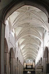
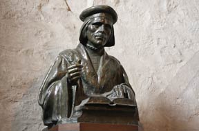 Over the bridge, dodging the speeding student cyclists, we went into the
Cathedral (Tuomiokirkko) to admire again the glorious lofty Gothic splendour of
its medieval nave (see left), and the array of side chapels filled with memorials and
sarcophagi of assorted Swedish/Finnish royals and nobility. The
trompe-l'oeil curved murals by the chancel, and the bust of Mikael Agricola the
16th century bishop who first translated the New Testament into vernacular
Finnish at the time of the Reformation (see right), attracted more of our
attention than Engel's rather nondescript but more renowned pulpit. Outside in the gardens, the
statue of cavalier-like Per Brahe looked across towards the Swedish university
of Åbo Akademi with the Cathedral towering overhead (Photo
49 - Turku Cathedral). We continued our ambling around the ultra-modern
campus of Turku Finnish University which spread across the
hill-side above Hämeenkatu, and back along the embankment where the sun sparkled
along the river (Photo
50 - Turku river embankments), we ended the afternoon
with a beer at the Koulu Brewery-pub set in an old school building in Eerikinkatu. Here we sat in
the dimly lit former classroom to enjoy their home-brewed beer surrounded by
school maps and portraits of past Finnish presidents. Over the bridge, dodging the speeding student cyclists, we went into the
Cathedral (Tuomiokirkko) to admire again the glorious lofty Gothic splendour of
its medieval nave (see left), and the array of side chapels filled with memorials and
sarcophagi of assorted Swedish/Finnish royals and nobility. The
trompe-l'oeil curved murals by the chancel, and the bust of Mikael Agricola the
16th century bishop who first translated the New Testament into vernacular
Finnish at the time of the Reformation (see right), attracted more of our
attention than Engel's rather nondescript but more renowned pulpit. Outside in the gardens, the
statue of cavalier-like Per Brahe looked across towards the Swedish university
of Åbo Akademi with the Cathedral towering overhead (Photo
49 - Turku Cathedral). We continued our ambling around the ultra-modern
campus of Turku Finnish University which spread across the
hill-side above Hämeenkatu, and back along the embankment where the sun sparkled
along the river (Photo
50 - Turku river embankments), we ended the afternoon
with a beer at the Koulu Brewery-pub set in an old school building in Eerikinkatu. Here we sat in
the dimly lit former classroom to enjoy their home-brewed beer surrounded by
school maps and portraits of past Finnish presidents.
Unless we were to return all the way out along the Archipelago to Mossala,
our only solution for a camp in Turku was to wild-camp in a parking area we had
identified near the Forum Maritinum maritime museum out by the docks. Early
evening we therefore drove out along Linnankatu/ Slottsgatan towards Turku Castle
to investigate the riverside parking area. There was plenty of space and we
selected a spot over by the river's edge, losing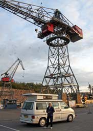 our presence among other vans
also evidently parked overnight. George has camped in some unusual spots, but
never before overshadowed by dock-yard cranes, museum our presence among other vans
also evidently parked overnight. George has camped in some unusual spots, but
never before overshadowed by dock-yard cranes, museum
 ships and the elegant
3-masted clipper ship Suomen Joutsen (Finnish Swan) (Photo
51 - Turku wild-camp). Looking around to assess the surroundings, all
seemed well, and we set up camp. As darkness fell, the cranes and sailing ship
were illuminated further masking our presence. ships and the elegant
3-masted clipper ship Suomen Joutsen (Finnish Swan) (Photo
51 - Turku wild-camp). Looking around to assess the surroundings, all
seemed well, and we set up camp. As darkness fell, the cranes and sailing ship
were illuminated further masking our presence.
Our
final day in Finland at Turku: after an undisturbed night, we were woken by
the sound of lorries disembarking from a ferry at the nearby port. It had been a
successful wild-camp among the dock-yard cranes (see right). The morning sun was
bright but a brisk wind blew along the river and across the museum ships and
parking area. After a leisurely morning, we headed back into the city and turned
up Herinkinkatu to find street parking behind the Finnish
University for our planned lunch in the Assarin Ulakko student cafeteria. This
is open to the public, as we had discovered in 2012 and offers the best value
lunch in the city, as well as having a lively atmosphere. In the crowded
cafeteria, we queued along with young undergraduates and sat to eat our lunch on
the sunny terrace (see left). After lunch we returned uphill through the modern
university's campus (see below right), back to George before his one hour
parking expired. Around at the Eastern Embankment, we found parking space in the
paying car park there, and with the sky now heavily overcast and threatening
rain, we walked uphill to re-visit the Turku Biological Museum. We had been
impressed with this museum when newly arrived in Finland in 2012; the series of
displays presented examples of all the wild-life we should see in the varied
landscapes around Finland and Lapland. But 3 years and many travels later,
nothing at all had changed here, other than perhaps a further 3 years' layer of
dust on the already dusty, antique dioramas. How a museum of a museum like this survives
in today's world was anyone's guess, but we persevered! During the hour we were
there, the anticipated rain had begun, making it too dull and wet to consider
trying to see anything else today.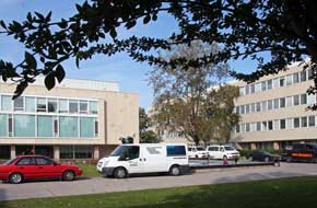
 In gloomy, wet weather now, we collected George and drove out to the
ferry-port to find the Silja Line check-in and joined the queue of other
vehicles for the long wait, the evening becoming dusky and air now filled with
soaking drizzle. We whiled away the time, waiting for our ferry, the Silja Line
Baltic Princess, eventually to draw into the quay to begin unloading for the
quick turn-around before the 8-15pm sailing. By 7-45pm when loading began, it
was fully dark but at least the soaking rain had eased. There had not seemed
many cars and vans waiting in the assembly area, but by the time we were aboard,
the entire hold space was filled with the many lorries that use this crossing
between Finland and Sweden. Up aloft we found our cabin, donned cagoules and
hurried up to the 'sun deck' (sic!) on deck 10 for departing photos (see left) (Photo
52 - Farewell Finland!). We found a place by the rail looking out over the
port with Turku Castle dimly visible in the city in the misty distance.
Fortunately the rain had now stopped enabling us to take our photos overlooking
the illuminated harbour as the
Baltic Princess eventually drew away from her moorings to begin the
overnight crossing to Stockholm. After our 5 month and very eventful stay in this country we admire so much, where we had again learnt so much, it was
Farewell Finland! In gloomy, wet weather now, we collected George and drove out to the
ferry-port to find the Silja Line check-in and joined the queue of other
vehicles for the long wait, the evening becoming dusky and air now filled with
soaking drizzle. We whiled away the time, waiting for our ferry, the Silja Line
Baltic Princess, eventually to draw into the quay to begin unloading for the
quick turn-around before the 8-15pm sailing. By 7-45pm when loading began, it
was fully dark but at least the soaking rain had eased. There had not seemed
many cars and vans waiting in the assembly area, but by the time we were aboard,
the entire hold space was filled with the many lorries that use this crossing
between Finland and Sweden. Up aloft we found our cabin, donned cagoules and
hurried up to the 'sun deck' (sic!) on deck 10 for departing photos (see left) (Photo
52 - Farewell Finland!). We found a place by the rail looking out over the
port with Turku Castle dimly visible in the city in the misty distance.
Fortunately the rain had now stopped enabling us to take our photos overlooking
the illuminated harbour as the
Baltic Princess eventually drew away from her moorings to begin the
overnight crossing to Stockholm. After our 5 month and very eventful stay in this country we admire so much, where we had again learnt so much, it was
Farewell Finland!
In due course we shall publish our updated Review of
Campsites reflecting our experiences during our 5 months stay in Finland during
2015. It has taken us a long time to complete this series of travelogues
covering these long travels, but 2016 is already 2 months old; it is time for us
to turn attention to plans for this year's travel venture. We can now
reveal that in 2016 we shall be exploring Iceland which we first visited on a
self-organised back-packing expedition in 1972, long before the mass tourism
industry had hooked its exploitational claws into this then unknown island. We
shall be publishing our customary Prologue to Iceland 2016 shortly.
Prologue to Iceland 2016
to be published quite soon
|
Sheila and Paul |
Published: 29 February 2016 |
|
 CAMPING
IN FINLAND 2015 - Iisalmi, Pielavesi, Kuopio, Tikkakoski Finnish Air Force
Museum, Petäjävesi Church, Helvetinjärvi National Park, Tampere,
Puurijärvi-Isosuo National Park, Sammallahdenmäki Bronze Age burial ground,
Rauma, port-city of Turku:
 we headed west on Route 76 and turned off
south on Route 870 (click on Map 1 on right of page for details of our journey). This was another delightfully peaceful road, undulating
through pine and spruce forests with the roadside birches glowing golden in the
morning sunlight. At Laakajärvi we turned westwards, meandering through the
forests; this was certainly a wonderful route, almost traffic-free and
well-surfaced, and brought us to Jyrkka and the preserved 19th century
ironworks, Ruukin in Finnish, the equivalent of Bruk in Swedish.
Exactly as at Möhkö near to Ilomantsi in South Karelia (
 South to Iisalmi: Driving on after
this unexpected bonus visit, we continued on the back-road eventually reaching
Route5/E83 to turn south towards Iisalmi. This main road was festooned with
speed cameras, which along with the frequent elk warning signs, meant ultra care
particularly in the speeding traffic. Reaching the outskirts of Iisalmi we
turned off into the town passing familiar sights from our 2012 visit as we drove
along the main street. But this afternoon, we only had time for a brief visit to
the Orthodox Church and Cultural Centre.
  after their expulsion from Karelia with the 1940 Russian
invasion, and the Orthodox Church of the Prophet Elias was built in 1950. The
icons on the iconostasis with its gilded royal doors had been rescued from the
Karelian church at Suistamo at the time of the evacuation in 1940 (see left). We took our
photos, re-locked the church and returned the key to the Hotel/Cultural Centre
where the Manager was now free to talk with us.
 He
began with a tour of the Cultural Centre where the dining room was decorated
with wall- and ceiling-paintings of saints and the original Valamon Monastery at
Lake Ladoga. He told us more of the history of Iisalmi Church's foundation after
the Karelian evacuation, together with Cultural Centre and Artos Hotel at the
initiative of the priest Father Elias, and showed us the exhibition of icons and
treasures rescued from the Karelian churches (see below left) and scale models
of Karelian Orthodox chapels (see right). As we discussed the importance of
maintaining the cultural heritage of Orthodoxy, his manner became increasingly
less formal, and he suddenly announced that the Artos Hotel was to be closed by
the church authorities in 2 weeks with the loss of jobs. The closure of the
hotel and Cultural Centre seemed to be the culmination of a series of untoward
events starting with the enforced retirement of Father Elias, all of which had
caused major contention among the Orthodox community.
 The
future of the icons, treasures and church models was unknown, but presumably
they would be removed by the church authorities to Kuopio. We expressed of
sympathies at this startling news, and were invited to stay for coffee and
Karelian savoury pastries made by members of the church congregation.
  were simply duds! At Kiuruvesi village, we found Palopaikka Guesthouse/Camping.
The name meaning hearth or fire-place, Palopaikka sounded so homely; in fact it
turned out to be a rather grubby, curious building looking just like all the
other industrial units amongst which the so-called guesthouse was located, at an
industrial estate in the village outskirts, the air filled with an ambience of
industrial noise. The café/reception was locked, but eventually a woman
responded to our phone call and opened up; she could speak little English but we
argued down her over-inflated price and booked in. The stark camping area was
nothing more than a concrete patch by the barrack-like apartments which seemed
well-used by itinerant workers. After last night's glorious setting at
Vuokatinranta, with magnificent sunset across the lake and welcoming
hospitality, this was a sorry, dismal place in a gloomy industrial setting with
indifferent welcome, far from the homely atmosphere its name was intended to
conjure up; but it would have to serve for tonight as the sun set over
the chimney stacks of the neighbouring industrial units!
 cut timber from the railway sidings, and a huge sawmill and pulp-paper works at
the edge of the village. We departed on a bright morning to turn south onto
Route 561, another delightful traffic-free minor road winding through the
forests (
 Rauhalahti Camping at Kuopio:
we continued south, bumping along on the poorly surfaced minor Route 554,
passing whooper swans browsing in a road-side field, and in 40 kms reached the
larger village of Karttula where we turned eastwards in heavier traffic to join
the Route 5 motorway into Kuopio. After re-stocking with provisions at a huge K-Market hypermarket, it was a short
drive to Rauhalahti Lomakeskus-Camping. Recalling the less than satisfactory
experience here in 2012 when, although offering a winter-opening reduced price,
the facilities available were severely restricted and welcome totally
perfunctory, we viewed Rauhalahti as a purely functional stop, there being no
other campsite within bus-ride of Kuopio. In fact today, things had changed
markedly for the better: we received one of the trip's most hospitably helpful
greetings
 from the charmingly smiling lady at reception; her welcome simply
could not be faulted: everything was prepared ready - city street plan,
site layout plan, bus details and timetable, but most of all, full facilities
available along with wi-fi, all for the reduced price of €20/night. Rauhalahti
deserved commendation on such a service improvement. We drove around and settled
into a quiet corner close to the facilities buildings, with the autumnally
golden birches of the lovely parkland setting lit by afternoon sunshine
(
 University of Eastern Finland has a
campus at Kuopio specialising in Health Studies (
 completed, with a new glazed but unobtrusive superstructure entrance to the new 3-storey underground
car park and shopping mall which was being excavated in 2012 with all the
resultant mess, noise and disruption. With the construction work completed, the Art Nouveau
building of Kuopio's Kauppahalli (market hall) was now revealed in all its elegant
glory (see right) (
 retired, he had formerly taught political and
social history at the University in Kuopio; he seemed taken aback by our travels
in Finland.
 Kuopio Orthodox Church Museum: when we were last in Kuopio, the
 so much
distress among the Iisalmi Orthodox congregation. The lady understood our
concerns and suggested she try to arrange for us to talk with the Orthodox
Archbishop's Secretary. In the meantime we began our visit to the displays.
 periods of
enjoying royal patronage from the Tsar's family; one of the exhibits was the
peaked cap and gloves worn by Tsar Alexander II when he was assassinated by a
bomb in 1881, and presented to Valamon by the late Tsar's wife; what the monks
were supposed to do with them is unclear, but they finished up on display
here at Kuopio! Petsamo had been destroyed and its monks murdered by Finnish
bandits in the 17th century. But the brutal end for Valamon and Konevitsa came
in February 1940 when the monks just had time to escape a similar fate at
the hands of the Red Army when the Soviets invaded Karelia; some of the
monastery's icons and treasures were rescued in carts across the ice of frozen
Lake Ladoga, and these now make up the exhibits here at Kuopio.
  jewel-bedecked Riisas displayed had covered the icon of the Mother of God
of Konevitsa, commissioned in 1893 to celebrate the Monastery's 500th anniversary; it had been rescued at the time of the 1940 evacuation (
 Church
to the Greek Orthodox traditions of Constantinople, becoming an autonomous
archbishopric of the Patriarch of Constantinople in 1923. The exhibits concluded
with further artefacts depicting the festivals of the Orthodox Church year and
an ornate silver sepulchre of St Arseni of Konevitsa.
  elderly troublesome priest and an authoritarian Archbishop.
It was a curious encounter, and we felt that we had done our bit to see that
natural justice and quality of Christian charity be given due reflection.
 A cross-country drive to Tikkakoski: an early start this morning
for our long drive across country to reach Tikkakoski near to Jyväskylä for
today's visit to the Finnish Air Force Museum (
 which gave its name to the lakeland national park in this area. Eventually
reaching the main north~south Route 4/E75, we turned south for 15 kms for the
turning to Tikkakoski where the
 to scrap all its military
aircraft. The aircraft collection, displayed in chronological order, does
however include specimens of almost all the aircraft which Finland managed to
acquire from the early days (see above left), through the Winter and Continuation Wars, and
post-war. These include from the lead-up to the Winter War a Hawker Hurricane and
Bristol Blenheim purchased from Britain and Brewster Buffalo from USA; those
supplied by the Germans during the Continuation War include a Messerschmitt 109
(see above right) and Fokker XXI; and post-war early jet trainers such as the De Haviland Vampire
(see below right) and Folland Gnat purchased from Britain, DC-3/47 military
transport aircraft from USA (see left), MiGs from USSR, and Saab Draken from
Sweden (see below left).
 One of the aircraft displayed was an American Brewster Buffalo fighter,
acquired by the Finns during the Continuation War, which in June 1942 was
attacking Soviet aircraft in Eastern Karelia. It was itself shot down by Soviet
fighters and the Finnish pilot, Lieutenant Lauri Pekuri, crash-landed the badly
damaged aircraft in lake Seesjärvi; he survived and managed to return to Finnish
lines. In 1998, the plane was raised from the lake-bed and is now displayed at
the Air Force Museum, on loan from the Naval Aviation Museum in Florida. The
Brewster, a typically chunky US WW2 aircraft is displayed un-restored in the
same state as when lifted from the lake with its propeller damaged from impact
during the crash-landing (
 had painted his personal good luck charm,
the ancient swastika symbol, on the aircraft; the blue swastika was adopted as
the insignia of the Finnish Air Force at its foundation in 1918, and continued
to be used as Finnish aircraft markings during WW2. It also featured on the
Mannerheim Cross and on the Finnish Presidential flag. Because of the political
embarrassment of association with the black swastika used by Nazi Germany, the
Finnish Air Force changed its aircraft-markings after WW2 to the blue-on-white
cockade in use today.
 Another display described the contribution of a Luftwaffe Stuka squadron which had helped the Finns stem the advance of the summer 1944 major
Soviet offensive. The Luftwaffe aircraft were withdrawn to Estonia as the
Germans retreated into Lapland, and after the war the part played by the
Luftwaffe was glossed over because of Finnish resentment at the German scorched
earth destruction in the north, political embarrassment of having allied with
the Germans and being treated as co-belligerents, and to avoid political denigration
from USSR immediately post-war. Only after the demise of communism in 1991 was a
memorial to the Luftwaffe crews raised. Among the displayed post-war aircraft was the
enormous Ilyushin Il-28 jet bomber, developed by the Soviets in the 1950s and
sold to the Finnish Air Force; this monster aircraft with its evil-looking rear
gun-turret, dominated the view from the balcony (
 Matsäranta
Camping, another disappointment: the only open campsite close to
Jyväskylä was the small lake-side Matsäranta Camping, and we had good memories
of the hospitable welcome on our 2012 stay at this straightforward, good value
site. In now pouring rain, we set off from Tikkakoski, bypassing Jyväskylä which
we had visited in 2012, to reach Route 23 westwards. Turning off left across 100
kph traffic on this bus main road was a hazardous move, and we approached the
campsite along the narrow dirt road. It seemed tidier than remembered but all seemed well until it came to the price: €30 seemed excessive for a basic
site with minimal facilities, perhaps confusion with the owner's limited
English. But no, that was the price, with take-it-or-leave-it dismissal! The
fact that this was the most expensive paid in the whole of Finland, even more
than at the capital Helsinki, was neither here nor there! Having no other option
we paid up, but made it quite clear we should not be back and should ensure
others did likewise! We
 settled in at the lake-side looking out to the forests
across the lake, with the sun just coming through to relieve the gloom (see
left). The following morning it became clear that the owners had newly taken
over; we guessed that they had borrowed heavily to buy the site and make initial
improvements, and to cover interest on the bank loan they needed to charge these
excessive prices. In which case we should do our best to see their investment
was short lived! This is now a campsite to be avoided.
 Petäjävesi Old Church: the following morning, we drove the 12 kms
along to Petäjävesi village, and as we walked over the bridge, the sun was just
breaking through lighting the magnificent view of the wooden church among the
distant trees with its foreground reflections in the lake (see right) (
 are left unpainted, with just red-painted designs
decorating the vault ribs and tie-beams. In addition to the wonderful structural
carpentry, the church's most impressive piece of decorative fitting is the
polygonal wooden pulpit (
 We had telephoned the previous evening to
confirm the church would be open today, and over at the church the lady we had
spoken to welcomed us. We chatted with her about the church's construction, and
the one service now held each year, a candle-lit Christmas carol-service, with
the local fire brigade in attendance! We told her of our now regular custom of
decorating our Christmas tree with the Petäjävesi pulpit angels bought during
our 2012 visit. She was a truly charming person who spoke fluent English,
even using colloquial expressions such as 'reading between the lines'. Memorable encounters such as this really bring to life our travels. We were
this morning's only visitors and had the privilege of spending uninterrupted
time examining the magnificent beauty and craftsmanship of the church's
interior, in particular the pulpit with its simple, rustic-style carved figures,
one of which formed the subject of our this yea's Christmas card (
 crops, some recently harvested where 4
adult cranes and 2 juveniles
were grazing, preparing for their long migratory flight south (see right) (
 . Any day now the cranes would be
departing; at this time 3 years ago at Helvetinjärvi, a V-formation of migrating
cranes had passed overhead. At Ruhula, little more than a filling station at the
junction, we turned north on Route 66 to Ruovesi and crossed the lake-causeway
to Haapasaari Lomakylä-Camping. The parking area was filled with stacked plastic
crates and weighing machine; the berry pickers were here! We were greeted
hospitably at reception with very reasonable low-season price of €20/night; the
lady warned however that some 100 Thai berry-pickers were occupying the huts. We
picked a spot on the flat hillock of the campsite's lake-island well
away from the Thais, and settled in amid the now peaceful parkland. The
following day with soft autumnal sunshine lighting the now golden birches, we
enjoyed a peaceful and productive day in camp here at Haapasaari; the pleasant
parkland was so well-maintained with fallen leaves constantly raked up by 2
hard-working ladies, lamas grazed the lawns, and a Great Spotted Woodpecker
frustratedly hammered away at the pinnacle of the wooden tower (
 picking
with the Lingonberries now good and ripe. From the start, the well-marked path
passed through ancient pine and spruce forest, with the forest
 floor covered with a rich layer of Bilberry, the plants now well past and
berries all gone. But back from the path beyond the Bilberry, the Lingonberry
bushes were laden with ripe berries (see left). We began or picking, using our
gathering box which worked so well, its clever design 'combing' through the
leaves and stems drawing clusters of ripe berries into the box with a minimum of
leaf debris. As the device was combed through
the bushes, gathered berries were trapped in the bottom of the box until
transferred to a bag (see right). We just needed to clamber several metres from
the path beyond the Bilberry, and the Lingonberries were plentiful and ripe and
along the first section of path we made several stops, gathering 2 large bagfuls
of fruit (
 of lakes of Iso- (Great), Pikku- (Small) and
Pitkä-Helvetinjärvi form a narrow steeply
sided gorge in the deepest fault. In places the lakes are up to 50m deep with
sheer-sided rocky cliff walls rising straight out of the water. We descended the
200 wooden steps to the gorge bottom to reach the camp-fire hearth with its
log-store and päivä-tupa (day-hut) at the tip of Lake
 Iso-Helvetinjärvi. Here a
couple of back-packing trekkers were cooking their lunch, with the smoke of
their wood-fire filling the air, a quintessentially Finnish scene (
 one of the trip's enduring images
(see below left) (
 a
half-litre box from the campsite reception. Having re-pitched at our camping
spot, we now had today's picked Lingberries to sort through, picking out any
leaves, debris or unripe berries (see right). It had been a thoroughly rewarding
day: beautiful forest walking on good paths, magnificent gorge terrain, and
fruitful berry-picking using our gathering box, and over 2 litres of ripe
berries to show for it now stowed in the fridge.
 Siikaneva marshlands and more berry-picking: the following morning,
we headed south on Route 66 for 20 kms beyond Ruovesi, and turned off onto the
dirt road by a former military base to the parking area for the Siikaneva
marshlands. This year we had the coordinates and detailed map; how we originally
found this obscure location in 2012 with neither was a skilful piece of
navigation combined with a lot of luck! It was another morning of warm, soft
autumnal sunshine, and at the parking area we booted up to walk the 4 kms board-walk
circuit of the Siikaneva Marshes (
 (
( the
first 300m length of board-walk to step 'ashore' onto the large marshland
'island' where flourishing Lingonberry bushes laden with ripe berries grew on
the 'island's' rocky terraces. In anticipation of this opportunity for further
berry-picking, we had come armed with bags and gathering box again. With the aid
of our useful picking tool, we systematically set to work 'hoovering' up bunches
of the ripest berries seen so far, and within 15 minutes we had totally stripped
an entire bank of plants and filled our bag with a good 1½ litres of berries
(see left). The gathering box's clever internal design enabled you to continue
brushing up more berries with the front comb without spilling those already
collected into the device's box. Having bagged up and stowed our pickings in the
day sac, we sat at the foot of the rocky terrace to eat our sandwiches, looking
back across the mire we had just crossed along the length of the board-walk,
revelling in the peaceful stillness of the marshlands (see below right).
the
first 300m length of board-walk to step 'ashore' onto the large marshland
'island' where flourishing Lingonberry bushes laden with ripe berries grew on
the 'island's' rocky terraces. In anticipation of this opportunity for further
berry-picking, we had come armed with bags and gathering box again. With the aid
of our useful picking tool, we systematically set to work 'hoovering' up bunches
of the ripest berries seen so far, and within 15 minutes we had totally stripped
an entire bank of plants and filled our bag with a good 1½ litres of berries
(see left). The gathering box's clever internal design enabled you to continue
brushing up more berries with the front comb without spilling those already
collected into the device's box. Having bagged up and stowed our pickings in the
day sac, we sat at the foot of the rocky terrace to eat our sandwiches, looking
back across the mire we had just crossed along the length of the board-walk,
revelling in the peaceful stillness of the marshlands (see below right). edge and the
start of the next 500m stretch of board-walk, initially crossing 2 tiny 'islets'
projecting from the surrounding mire. Thankfully this longer board-walk had also
been totally renewed
 since 2012 and was now firm and safe. The marsh also was
much drier and covered with lush growth of sedge, hiding any
Cranberries growing on the sphagnum. Across the length of the board-walk, the
path turned back eastward on the northern shore through birch woodland alongside
the drainage ditch to reach a short stretch of board-walk out to an experimental
station on a wooden platform in the centre of the open mire. Here we spoke with
the leader of a group of young students on a field trip from Helsinki
University. The research station's purpose was to monitor variations in
atmospheric CO2 levels and emissions of methane gas from the peatland
marshes. Our path continued along the marshland edge drainage ditch, passing
through delightful stands of tall birches, their white trunks and golden leaves
glowing in the afternoon sunlight (see left). This led to the final stretch of
board-walk which in 2012 had been the narrowest and most decayed boards we had
crossed, unreliable and treacherously wet after rain; today in contrast, the
renewed boards were firm and generally 2 widths, and the marsh no longer
water-logged. The path led back to the parking area through the forest with
sunlight filtering down through the trees and ground covered with ripe
Lingonberries.
 Route 9
towards Tampere, a busy road well-protected with elk-fencing on both sides.
Approaching Tampere, Route 9 assumed motorway standard around the city with
traffic now the busiest we had driven in all trip, and driving standards
noticeably more aggressive. We turned off the ring-road towards Pirkkala,
heading for Härmälä Camping. But after our 2012 experience, we had no great
hopes for the place, the only campsite within public transport distance of
Tampere. Sure enough on our arrival, a half-hearted take-it-or-leave-it
greeting, excessive prices at €29/night, grotty surroundings with steeply
sloping and water-logged land unfit for camping on, and worst of all the
filthiest WC/showers seen all trip. The girl at reception succumbed to the full
brunt of pressure about excessive prices and low standards, and offered free
electricity and €23.50/night; only this begrudging gesture saved Härmälä Camping
being given our lowest rating, but without doubt it gets the wooden spoon award
as the trip's worst campsite. Reluctantly we settled in at one of the few
gravelled pitches (see right), albeit sloping severely down towards Tampere's northern lake Näsijärvi. First job was to sort and sift today's crop of Lingonberries, all
consistently ripe and dark red; now with a further 2 litres of ripe fruit in the
fridge, tonight's supper tonight had to be a cheering beef and Lingonberry stew.
 A day in Tampere: morning brought a misty but clearing sky with
promise of a fine day for our re-visit to Tampere, and we walked up to the main
road to catch the 11-05 #11 bus into the city (
 the fast-flowing Tammerkoski rapids which connected the 2 lakes through
the city powered textile mills which lined the river-banks. Tsar Alexander I
abolished taxes on local industries to encourage the growth of trade
leading to the rapid expansion of Tampere as a manufacturing city. One of the
entrepreneurial industrialists attracted here was a Quaker Scotsman, James
Finlayson, who opened a textile factory here in 1820, drawing on labour from
surrounding rural areas where traditional crafts were in decline. This rapid
industrial growth attracted both Finnish and foreign investors, and the city
developed as a centre of both engineering and textile manufacture.
Paternalistic factory owners provided for their employees' leisure, creating a
cultural heritage still seen in the modern city. The mobile phone giant Nokia
was founded here in 1865 as a wood-pulp and paper mill on the banks of the Tammerkoski rapids. They later moved to the nearby town of Nokia which gave the
company its name, producing everything from wellington boots to cycle tyres and
TVs to steel cables, before specialising in electronics in the 1970s. Following
Finland's independence in 1917, the industrial workers of
 Tampere formed the
backbone of the left-wing Red Guards during the Finnish Civil War when the city
was ravaged by savage urban battles. Once called the Manchester of Finland,
Tampere's industrial heritage can still be
seen today with the former factories
and their tall brick chimneys along the Tammerkoski rapids conserved or
converted to modern usage. The rapids which once powered Tampere's industrial
growth still generate HEP in the heart of the city.
 attractively delicate and sweet-smelling flowers in spring but
fatally poisonous berries in autumn is one of nature's bizarre quirks. We found
the banks of Kielo with their orange berries, and local passers-by gazed
with curiosity as 2 obvious visitors squatted among the dying leaves pointing
cameras; but we got our photos of the wild Lily of the Valley berries recalled
from 2012 (see
above left). Up onto the summit of the ridge, our next stop was
the 1929
  over the city.
With the sun finally breaking trough, we paid our €2s to climb to the tower's
viewing platform to photograph the distant city skyline, trying to identify
features we could recognise such as the Finlayson Factory and Cathedral (
 end of the Tammerkoski channel where it joined Pyhäjärvi
lake, and walked around to the harbour-side market. There was no time to stop
now since our 3rd appointment this morning awaited - lunch of Tampere
Musta-makkara (black-pudding sausage) with Puolukka in the Kauppahalli (Market
Hall), which we had enjoyed on our 2012 visit. Up through the back streets, we
found the rear entrance to the Kauppahalli with its attractive elongated façade
and along the rows of stalls found stall #52, the Pyörykkä-baari, a market
cafeteria serving an array of hot dishes, still as popular a lunch spot
 as ever
with local people and the same couple serving. We ordered our Musta-makkara with
salads and potatoes-anna sold by weight, and sat in the café area to eat
our lunch (
 A walk back up Aleks Kivi katu brought us to the main street of Hämeenkatu and
across to the Keskustori (Central Square) lined by Tampere City Hall on one
side (see above right), and the Theatre on the other (see left). The terrace of the
Engel designed Vanha Kirkko (Old Church) on the far side of the square gave
further views of both the City Hall (
 (
( On
the opposite side of the rapids, the former Finlayson factory is now so
tastefully converted to a complex of shops, museums and restaurants, with the
conserved factory gate still bearing the name Finlayson and Co after its
originating Scots founder (
 magnificently tall, slender and elegantly octagonal factory chimney of
the former paper-mill which once occupied this site. It had been a brave if
expensive decision to conserve such a tall industrial chimney, but the resulting
impact of its presence here is now startling.
 see the Textile Museum which sets out the
history of cotton, wool and linen spinning in Tampere and the various mills that
were established during the 19th century along the Tammerkoski Rapids, most
noticeably the Finlayson factory, and that in their day had employed 1000s. James
Finlayson (1771~1852) (see below right) had set up his original textile factory in
1820 with financial encouragement from the Tsarist authorities and sold the mill
in 1836 when ill health forced his return to Scotland. The company retained the
Finlayson name and went on to develop as one of Tampere's most progressive
industries and major employer; it was one of the last of Tampere's textile mills
to close in 1991 as Far Eastern cheap labour and foreign imports made Finland's
domestic textile industry uneconomic.
see the Textile Museum which sets out the
history of cotton, wool and linen spinning in Tampere and the various mills that
were established during the 19th century along the Tammerkoski Rapids, most
noticeably the Finlayson factory, and that in their day had employed 1000s. James
Finlayson (1771~1852) (see below right) had set up his original textile factory in
1820 with financial encouragement from the Tsarist authorities and sold the mill
in 1836 when ill health forced his return to Scotland. The company retained the
Finlayson name and went on to develop as one of Tampere's most progressive
industries and major employer; it was one of the last of Tampere's textile mills
to close in 1991 as Far Eastern cheap labour and foreign imports made Finland's
domestic textile industry uneconomic..jpg)
 South
on Route 12: the sun was up early after a
chill and dewy night, and we returned to Tampere's busy motorway ring-road to
turn off onto Route 12 towards Rauma (
 turning for
the Puurijärvi and Iso-suo National Park.
 stunted, and rounded onto the main body
of Iso-suo (
 leaves now with their red-rust autumn colours (see
above right), matted patches of Cranberry leaves, and short new shoots of Bog
Rosemary poking up through the sphagnum. The
board-walk continued around through the stunted pines leading to the Iso-suo
bird-watching tower whose platform gave panoramic views across the central and
largely treeless and wetter areas of marshland. But in bright sunshine in
early September there was not a trace of bird-life to be seen. The board-walk
circled back through the stunted pines towards denser woodland as it approached
the marsh's fringe. As we entered the forest (see right), Sheila unexpectedly
disturbed a long, black grass snake sunning itself on the board-walk.
  We
returned around the dirt road and continued north through farming hamlets and
their fields of ripe oats to the parking area for the third bird-watching tower
at Kärjenkallio overlooking the main body of the shallow, marshy Puurijärvi. The
800m long approach path led initially through woodland then alongside lake-side
pastures out to the tower. This was an enormous structure 20m high and
accommodating up to 50 visitors on its lofty observation platform. We climbed
gingerly to the top which looked out across Puurijärvi's broad wetlands, but
apart from a few distant ducks and swans, there was little else to be seen. We
continued
 north,
turning off on a dirt road to reach the Ahvenus tower which was set alongside
the Kauvatsanjoki river where this flowed into the Puurijärvi marshes. The
river-side approach path was overgrown and when we eventually reached the tower,
there was not a trace of bird-life to reward our efforts. Apart from the
Osprey's thrilling display, it had been a frustratingly unrewarding afternoon; Puurijärvi and Iso-suo,
along with other newly designated national parks, seemed less impressive than
the longer standing areas of natural beauty further north and perhaps more to do
with Metsähallitus' concern to maintain its political standing.
 end
of the summer. After pulling off for provisions at the small town of Huittinen,
and shortly beyond we pulled off onto the minor Route 212. Having been
accustomed to minor roads in Northern and Central Finland being well-maintained,
it came as a shock now to face a badly surfaced, pot-hole riven road with
sections of road works stripped of asphalt. Route 212 was a total disgrace and
without doubt the worst stretch of road we had travelled in the whole of the
country, worse than many unsurfaced roads in the north. Route 204 brought us to Säkylä Camping, not the peaceful place we had expected: there were parked cars
everywhere, folks galore spilling out of a marquee, staff far too busy to bother
with us, and camping area packed. This place was an evident no-no! But where
now? Having tried without success to phone another site at the northern end of Pyhäjärvi, there was nothing for it but to drive on for another 70 kms to our
next planned campsite at the coast. We were already exhausted after a long day
and taxing drive, but as so
 often in such cases, our patron St Serendipity came
to our aid. We set off and near to the junction with Route 210, spotted a
campsite sign for Kallionokka Camping; if it existed, we expected it to be
closed or derelict, but a gravelled driveway led down to the shore of Pyhäjärvi
and to our surprise there was a large and trimly turfed campsite, clearly
open. Reception was locked and no one responded to a phone call, but the
facilities were open, albeit basic and antiquated, and we settled in (see left).
 Along the eastern shore of the lake to Säkylä village, we turned
westwards at Eura to re-join Route 12 to the village of Lappi to find the Bronze
Age burial ground of Sammallahdenmäki. Declared a UNESCO World Heritage Site in
1999, the Sammallahdenmäki site consists of clusters of some 33 stone burial
cairns of varying size spread along a low, wooded ridge 1 km in length near to
Saanijärvi (see left). The lake would have been an inlet of the Bothnian Gulf during the
Bronze Age period of the burial site's construction (1,500~500 BC), but due to
land uplift, the site is now 15kms inland. The Sammallahdenmäki burial ground is
one of the most important Bronze Age sites of Scandinavia, showing evidence of
the long history of settlement, culture and funerary practices of the peoples living along the Scandinavian
coast and archipelago at that time. The large stone
 burial cairns were
constructed of granite boulders set over stone cysts which contained the
interred or cremated body and grave-goods. It is the largest and best preserved
cairn burial site in Finland, and was in use for 1,000 years until the early
Iron Age. The site included 2 very large and unusual cairn structures: one
elongated, oval walled cairn structure known as Huilun pitkä raunio (Long
ruin of Huilu), the other a low, flat quadrangular structure 16 x 19m known as
Kirkonlaattia (The Church Floor). Four of the large cairns were excavated
in 1891, but other than cremated human bone remains and fragment of a bronze
bracelet, no other artefacts were uncovered. Radiocarbon analysis dated the
remains to the early Bronze Age around 1,500 BC.
 We had the plotted coordinates for the site and
followed the approach lane from Lappi village which led to a small industrial
unit at the suitably named Kivikylä (Stone village); further signs led from here
along a dirt road to a small parking area with information panels, and UNESCO
leaflets/site plan. This seemed to be at the southern end of the ridge where the
cairns were located, and we walked from here to find the burial site. The
ground's exposed slabbed granite bed rock, scoured by glacial action, was
reminiscent of the Ålands and Archipelago topography. Still unsure of
directions, and with the aid of the site plan, we followed the faint track up
onto the low ridge. For a World Heritage site, the natural pine forested
 landscape was remarkably uncontaminated by intrusive signs or markers, and
almost by chance it seemed, we came on the first of the large burial cairns at
the southern extremity of the wooded ridge, the oval Long Ruin of Huilu (
 We had this remarkable site virtually to
ourselves, enjoying the peaceful ambiance and magnificent setting with the pine
woods lit by bright afternoon sunshine. It was truly amazing that for a World
Heritage Site, Sammallahdenmäki was completely untarnished by signs, hot dog
stalls and such intrusions. In its remote setting, it was difficult to find but
all the more rewarding for that; it was so rewarding to enjoy this noteworthy
historical monument in its unblemished natural state.
 The wooden Old Town of Rauma: rejoining Route 12 we headed
westwards to turn into Vanha (Old) Rauma. Rauma was founded in 1442 as a Swedish trading
centre and was one of the few towns to repudiate King Gustav Vasa's 1550 command
to up sticks and move to the newly founded Helsinki to create a trading
port-city there to rival Hanseatic Tallinn. A wise decision since the embryonic
Helsinki foundered with plague and trade continued to flourish at Rauma. By
18/19th centuries Rauma had developed into a major trading port with Finland's
largest fleet of sailing ships, exporting Rauma's high quality lace all around
Europe. It remains today an important shipping and industrial centre, exporting
Finnish timber and paper world wide. There are still lace-making workshops on
Rauma's Old Town and a lace-making festival is held each year in July. But the
Old Town's striking wooden architecture is Rauma's key attraction today,
 recognised with UNESCO World Heritage Site status in 1991. We had first been to Rauma in 2012 and today only had time for a fleeting visit, walking the circuit
of Old Rauma's main streets of Kauppakatu (Market Street) and Kuninkaankatu
(Royal Street). We ambled through the cobbled streets photographing the
conserved wooden buildings (
 see the magnificent ecclesiastical artwork again, dating
from the church's period as a Franciscan priory before the Lutherans kicked the
monks out at the 1538 Reformation after their own church had burnt down. But
today the church had closed at 4-00pm and it was now 4-30. We returned along Kuninkaankatu admiring more of Old Rauma's decorated wooden buildings, before
turning our attention to more mundane provisions shopping at the Prisma
hypermarket.
 glacial erratic boulders
and farmland where harvesting was in progress. Finnish farmers must have blessed
this period of late summer fine weather for their harvesting. Reaching Pyhäranta,
the little shore-side campsite static caravans were full of locals making merry
on a sunny afternoon around the camp-fire. We settled in hoping the carousing
would not go on late into the night! (see left) The smoking chimney of smoke-sauna down by
the shore showed that it was time for the locals to break of from their drinking
to do whatever Finns do in a sauna. We cooked our supper as the sun set over the
Bothnian coast to give a magnificently flaring sunset (
 We left Pyhäranta early the next morning, and back up the winding lane to Route
8, turned south passing through the little town of Laitila with its brewery
visited in 2012 and whose fine beers we had enjoyed all this trip. Approaching
Turku, road works for the outward extension of Route 8's motorway delayed us,
but we reached the city outskirts without undue loss of time. Passing through
the centre and across the river, another unexpected issue for tomorrow's return
to the city: the car park along the embankment we planned to use was totally
closed off with building works. Turning off onto Route 110, we headed out through
the southern suburbs to Kaarina for the drive down to Pargas, again
wary of speed limits and speed cameras. After a brief pause at K-Market Pargas for
provisions, we continued SW-wards passing 3 speed cameras in the
space of 1 km. We
 reached Pargas ferry-dock just as the ferry was approaching
and crossed to the first island of Nagu-Nauvo. We only had the spring-time
timetables but assumed they would be similar in autumn, and rapidly drove the 27 kms
across Nagu hoping to catch the 14-37 ferry across to Korpo in time to make the
15-10 ferry from Galtby to Houtskär; otherwise we had a long wait until 16-50.
We drove on determinedly on Route 180 across the island for the ferry over to
Korpo, reaching Galtby in good time to queue for the 35 minute crossing to
Kittius on Houtskär. Returning weekend traffic from the Archipelago had caused
long queues back at the previous ferry-docks, but by the time we docked at
Kittius, there were few other vehicles. We drove the winding, narrow lanes across
Houtskär, a surprisingly large island, to reach the Kivimo~Björkö chain-ferry,
then around the coast of Björkö for the final 5 kms to Saariston Lomskeskus at
the isolated northern tip of Mossala. We had made it.
 Return
drive along the Archipelago: dawn was just breaking when we were up
this morning, and over morning tea Paul killed what he hoped was the final
mossie of this year's midge-infested trip. Saariston Lomakeskus was a thoroughly
well-conceived and equipped site, the results of much hard work on the owner's
part to create the campsite's beautiful environment out of naturally undrained,
swampy forest; but with the strict proviso of only staying in May/early June or
September when all the usual holidaymaking hoards have left the place in peace.
We were away by 9-30am in good time for the return drive and ferries across Mossala, Björkö and Kivimo, to reach Kittius by 10-15 with plenty of time for
the 10-45 return ferry to Korpo. As we waited, the Viking Line ferry from Turku~Stockholm passed
through channel between the Archipelago's islands, the
same route we should take tomorrow evening by the Silja Line boat. Quite a
few other vehicles had joined the queue by the time the ferry drew in; George
drove aboard and we passed the half hour crossing in the little cafeteria.
Ashore at Galtby, we had 15 minutes to drive the 7km length of Korpo for the
11-30 ferry across the channel to Nagu. We then had the greater challenge of
driving the 27km length of Nagu in time for the 12-02 ferry to
the mainland, without breaking the 80 kph limit and tripping a speed camera. All
the other vehicles from the ferry had the same objective, resulting in a long
 convoy of generally local cars travelling across the island at 79 kph, to avoid a
long wait for the next ferry! We all reached Prostvik at the eastern end of
Korpo just as the 12-02 ferry was loading; it was filled to capacity. Across the
channel, we drove up to Pargas where George had his final
 fill of Finnish
diesel. We now had the second challenge of finding parking in Turku with our usual car park now closed for building work. We drove the now familiar route
through Kaarina into the city centre, and turned off through side streets down
to the back of the theatre where we managed to find space in a paying car park
overlooking Itäinen Rantakatu (Eastern Promenade) and the river, and for €4.50
secured parking for the day (
 Over the bridge, dodging the speeding student cyclists, we went into the
Cathedral (Tuomiokirkko) to admire again the glorious lofty Gothic splendour of
its medieval nave (see left), and the array of side chapels filled with memorials and
sarcophagi of assorted Swedish/Finnish royals and nobility. The
trompe-l'oeil curved murals by the chancel, and the bust of Mikael Agricola the
16th century bishop who first translated the New Testament into vernacular
Finnish at the time of the Reformation (see right), attracted more of our
attention than Engel's rather nondescript but more renowned pulpit. Outside in the gardens, the
statue of cavalier-like Per Brahe looked across towards the Swedish university
of Åbo Akademi with the Cathedral towering overhead (
 our presence among other vans
also evidently parked overnight. George has camped in some unusual spots, but
never before overshadowed by dock-yard cranes, museum
 ships and the elegant
3-masted clipper ship Suomen Joutsen (Finnish Swan) (
 In gloomy, wet weather now, we collected George and drove out to the
ferry-port to find the Silja Line check-in and joined the queue of other
vehicles for the long wait, the evening becoming dusky and air now filled with
soaking drizzle. We whiled away the time, waiting for our ferry, the Silja Line
Baltic Princess, eventually to draw into the quay to begin unloading for the
quick turn-around before the 8-15pm sailing. By 7-45pm when loading began, it
was fully dark but at least the soaking rain had eased. There had not seemed
many cars and vans waiting in the assembly area, but by the time we were aboard,
the entire hold space was filled with the many lorries that use this crossing
between Finland and Sweden. Up aloft we found our cabin, donned cagoules and
hurried up to the 'sun deck' (sic!) on deck 10 for departing photos (see left) (