|
 CAMPING
IN ICELAND 2017 - Seyðisfjörður, Egilsstaðir,
Fljótsdalur valley and Hengifoss, Borgarfjörður Eystri, Möðrudalur
in the highlands, and Vopnafjörður on NE coast: CAMPING
IN ICELAND 2017 - Seyðisfjörður, Egilsstaðir,
Fljótsdalur valley and Hengifoss, Borgarfjörður Eystri, Möðrudalur
in the highlands, and Vopnafjörður on NE coast:
Arrival in Iceland at eastern port of Seyðisfjörður:
our forward facing cabin window gave a perfect view as M/S Norröna edged
slowly
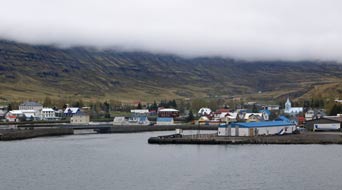 up the narrow fjord
towards the eastern port of Seyðisfjörður. The ferry docked at 10-00am Icelandic
time/GMT, with the low cloud just lifting to give a magnificent panorama of the
wooden houses and blue-painted church of the tiny port nestled around the head
of the fjord and watercourses tumbling down the layered basalt strata of the
enclosing mountains (see left). up the narrow fjord
towards the eastern port of Seyðisfjörður. The ferry docked at 10-00am Icelandic
time/GMT, with the low cloud just lifting to give a magnificent panorama of the
wooden houses and blue-painted church of the tiny port nestled around the head
of the fjord and watercourses tumbling down the layered basalt strata of the
enclosing mountains (see left).
|
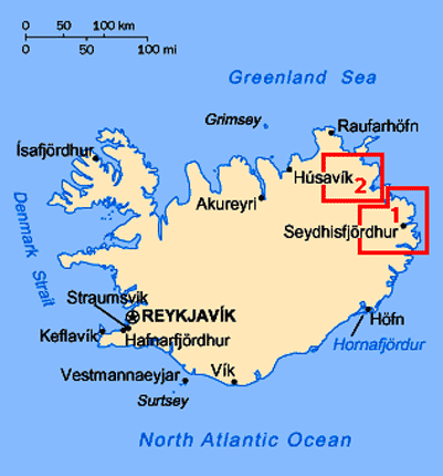
Click on 2 highlighted
areas of map
for
details of
NE
Iceland |
 |
Seyðisfjörður Camping: we were
some of the first to disembark to queue briefly at Icelandic Customs. Despite
all our earlier concerns over necessity for visas for stays of 90 days or more,
the Icelandic Customs officials were smilingly welcoming; once assured that we
had our return ferry tickets booked for mid-September, they waved us through with a
windscreen sticker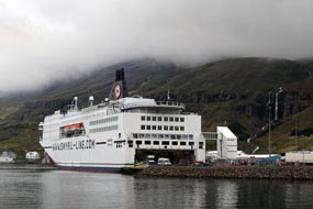 indicating our arrival date. We were here a last, and after a pause to
get our bearings and photos of Norröna over-towering the dock (see left) (Photo
1 - Norröna moored at Seyðisfjörður),
we drove around through the village to find Seyðisfjörður Camping. We were
welcomed with a hospitably helpful greeting and selected a pitch looking
down over the village towards the fjord (Photo 2 - Seyðisfjörður Camping).
We had bought in advance the Icelandic Camping Card; this gives reduced price
for 28 night-stays at selected campsites, although whether this would prove a
worthwhile investment when most sites give seniors' discounts, only time would
tell. indicating our arrival date. We were here a last, and after a pause to
get our bearings and photos of Norröna over-towering the dock (see left) (Photo
1 - Norröna moored at Seyðisfjörður),
we drove around through the village to find Seyðisfjörður Camping. We were
welcomed with a hospitably helpful greeting and selected a pitch looking
down over the village towards the fjord (Photo 2 - Seyðisfjörður Camping).
We had bought in advance the Icelandic Camping Card; this gives reduced price
for 28 night-stays at selected campsites, although whether this would prove a
worthwhile investment when most sites give seniors' discounts, only time would
tell.
Exploring Seyðisfjörður village: having
brewed coffee and restored some order to George after the ferry crossing, we set
off for a couple of hours' exploration around the port, with the huge Norröna
ferry still moored at the quay dominating the little port (Photo
3 - Seyðisfjörður village). Seyðisfjörður, an
unassuming village of 800 inhabitants augmented by the 1000s of visitors who pass
through each summer from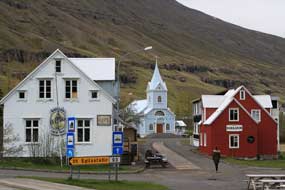 the weekly ferry, is spread around the head of the
narrow fjord. It was founded by a Norwegian fishing company in 1895 and
flourished as a major herring port until the herring disappeared 50 years
later. The wooden buildings were transported in prefabricated form from Norway
and reassembled here before the winter snows the weekly ferry, is spread around the head of the
narrow fjord. It was founded by a Norwegian fishing company in 1895 and
flourished as a major herring port until the herring disappeared 50 years
later. The wooden buildings were transported in prefabricated form from Norway
and reassembled here before the winter snows
 cut off the town. As a result, all
the houses, warehouses and church look spick and span, set against the surrounding background of high mountains on both sides of the fjord, all still
snow-covered at this early stage of the year (see right). But this morning the air was
beginning to gain a Spring warmth, and the new leaves of birches around the
campsite were just bursting, filling the air with a fresh herbal smell; it was a
beautifully peaceful morning. cut off the town. As a result, all
the houses, warehouses and church look spick and span, set against the surrounding background of high mountains on both sides of the fjord, all still
snow-covered at this early stage of the year (see right). But this morning the air was
beginning to gain a Spring warmth, and the new leaves of birches around the
campsite were just bursting, filling the air with a fresh herbal smell; it was a
beautifully peaceful morning.
Down by the bridge where Vesturvegur turned
inland, leading up over the mountain pass to Egilsstaðir, and where the river
Fjarðará flowed down into the fjord, we found the supermarket and, in buying
provisions, got our first impressions of Iceland's expensive food prices; with
the bewildering rate of exchange, it
needed a calculator to convert Icelandic Kroner with 1 ISK worth £0.0075! We ambled along Austurvegur, taking everything in and enjoying the peace of the
setting after such a busy initial 2 weeks. We passed the Vinbuðin state monopoly
alcohol shop with highly restricted opening hours; with beer of more than 2.25%
ABV not sold in Icelandic supermarkets, buying beer stocks was going to need
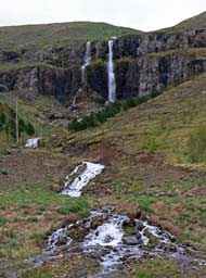
some planning! Beyond the filling station, the waterfalls which we had seen from
the ferry spilled over 2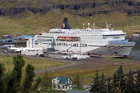 basalt escarpments from a high corrie, dropping to the
fjord by Seyðisfjörður's little fishing harbour. We followed a footpath up the
fell-side alongside the stream to the foot of the lower falls (see left); from here there
was a glorious view looking over the village
and ferry moored by the fishing harbour (see right); as the cloud lifted further, more
of the enclosing mountains came into view. Back along through the village to the
campsite, we moved George closer to the facilities hut to get a better wi-fi
signal. The weather improved further and cloud cleared the tops revealing fully
the scale of the mountains enclosing the valley (Photo
4 - Snow-covered mountains above Seyðisfjörður). Snow still lined the upper
reaches, streaking well down the upper slopes, filling the high corries
with
cornices edging the ridges. Against the blue sky, it was a truly inspiring
Alpine setting, lit by the bright afternoon sun. basalt escarpments from a high corrie, dropping to the
fjord by Seyðisfjörður's little fishing harbour. We followed a footpath up the
fell-side alongside the stream to the foot of the lower falls (see left); from here there
was a glorious view looking over the village
and ferry moored by the fishing harbour (see right); as the cloud lifted further, more
of the enclosing mountains came into view. Back along through the village to the
campsite, we moved George closer to the facilities hut to get a better wi-fi
signal. The weather improved further and cloud cleared the tops revealing fully
the scale of the mountains enclosing the valley (Photo
4 - Snow-covered mountains above Seyðisfjörður). Snow still lined the upper
reaches, streaking well down the upper slopes, filling the high corries
with
cornices edging the ridges. Against the blue sky, it was a truly inspiring
Alpine setting, lit by the bright afternoon sun.
 With the scent of new leaf on
the birches and warm Spring air, it was a magnificent afternoon. Daylight lasted
late into the evening, and many more vans arrived filling the campsite, most of them poorly-equipped hired
campers. We turned in for our first night in Iceland, but
this arrival late into the evening of tourists 'doing the Ring Road in a week',
with much noise and inconsiderate slamming of van doors, was to become an all
too familiar and irritating feature of our travels around Iceland. With the scent of new leaf on
the birches and warm Spring air, it was a magnificent afternoon. Daylight lasted
late into the evening, and many more vans arrived filling the campsite, most of them poorly-equipped hired
campers. We turned in for our first night in Iceland, but
this arrival late into the evening of tourists 'doing the Ring Road in a week',
with much noise and inconsiderate slamming of van doors, was to become an all
too familiar and irritating feature of our travels around Iceland.
A sunny Spring morning at Seyðisfjörður Camping:
the following morning, the sun shone brightly in a clear, blue sky, warm enough
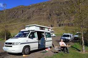
for us to sit out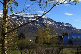 for breakfast (Photo
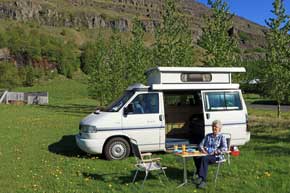
5 - Breakfast on a Spring morning) (see left); how many days this would be possible with
unpredictable Icelandic weather remained to be seen. But this morning, glancing
up from our breakfast table to this mountainous backdrop, we could admire
the snow glistening on the shapely pyramidical peak of Strandatindur with its
snow-filled corries and cornices extending along its ridges, and on the opposite
side of the fjord, the sun picked out all the detail of the south-facing
basalt-stratified cliffs (see right). It was a heavenly morning, the air filled with the
herbal scent of new birch leaf. Before leaving home, we had watched the
Icelandic TV crime drama Trapped in which, after a brutal murder, local
residents and ferry
passengers are trapped by heavy snow-fall supposedly in Seyðisfjörður. This for breakfast (Photo
5 - Breakfast on a Spring morning) (see left); how many days this would be possible with
unpredictable Icelandic weather remained to be seen. But this morning, glancing
up from our breakfast table to this mountainous backdrop, we could admire
the snow glistening on the shapely pyramidical peak of Strandatindur with its
snow-filled corries and cornices extending along its ridges, and on the opposite
side of the fjord, the sun picked out all the detail of the south-facing
basalt-stratified cliffs (see right). It was a heavenly morning, the air filled with the
herbal scent of new birch leaf. Before leaving home, we had watched the
Icelandic TV crime drama Trapped in which, after a brutal murder, local
residents and ferry
passengers are trapped by heavy snow-fall supposedly in Seyðisfjörður. This
 morning we learned from the campsite warden (a local Icelander from Seyðisfjörður who had married an English girl and spoke his English with a Notts
accent) why we had failed to recognise any of the village's buildings: other
than the ferry sequences, Trapped had been filmed not in Seyðisfjörður
(there had been insufficient snow that winter) but in the northern Icelandic
port of Siglufjörður. On such a beautiful Spring morning, the sun shining through
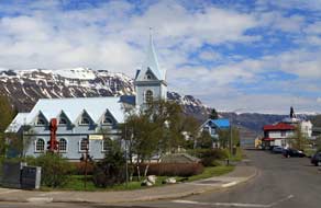
the birches lit Seyðisfjörður church (Photo
6 - Seyðisfjörður church) (see left), and the morning just drifted by; with the benign
weather and hospitable welcome to Iceland, it was almost noon by the time we
finally left Seyðisfjörður, and turned onto Route 93, the mountain road up over
the pass to Egilsstaðir. morning we learned from the campsite warden (a local Icelander from Seyðisfjörður who had married an English girl and spoke his English with a Notts
accent) why we had failed to recognise any of the village's buildings: other
than the ferry sequences, Trapped had been filmed not in Seyðisfjörður
(there had been insufficient snow that winter) but in the northern Icelandic
port of Siglufjörður. On such a beautiful Spring morning, the sun shining through
the birches lit Seyðisfjörður church (Photo
6 - Seyðisfjörður church) (see left), and the morning just drifted by; with the benign
weather and hospitable welcome to Iceland, it was almost noon by the time we
finally left Seyðisfjörður, and turned onto Route 93, the mountain road up over
the pass to Egilsstaðir.
 Over the mountains to Egilsstaðir: the moment we left Seyðisfjörður
(click here for detailed map of route),
Route 93 climbed steadily up the steepening valley with the snow-covered
mountains closing in around us. We also
left behind the clear, sunny weather down in the valley bottom, and the higher
the road climbed, the more grey and overcast the sky became. Two sharp hair-pins
gained us further height to a lay-by where we pulled over for sandwiches; what a
lunch spot, gazing down from such cloudy heights into the sunny valley bottom,
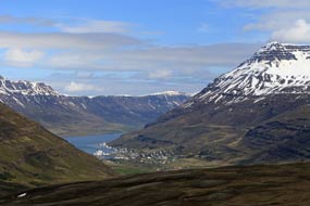
with the little port of Seyðisfjörður nestled into the head of the fjord,
enclosed on both sides by snow-covered mountains (see right) (Photo
7 - Seyðisfjörður nestled into head of fjord). We continued upwards reaching the lower snow-line now in very overcast conditions. Although tarmaced,
the road was more narrow now and raised on an embankment from the surrounding
snow-fields and snow-covered, Over the mountains to Egilsstaðir: the moment we left Seyðisfjörður
(click here for detailed map of route),
Route 93 climbed steadily up the steepening valley with the snow-covered
mountains closing in around us. We also
left behind the clear, sunny weather down in the valley bottom, and the higher
the road climbed, the more grey and overcast the sky became. Two sharp hair-pins
gained us further height to a lay-by where we pulled over for sandwiches; what a
lunch spot, gazing down from such cloudy heights into the sunny valley bottom,
with the little port of Seyðisfjörður nestled into the head of the fjord,
enclosed on both sides by snow-covered mountains (see right) (Photo
7 - Seyðisfjörður nestled into head of fjord). We continued upwards reaching the lower snow-line now in very overcast conditions. Although tarmaced,
the road was more narrow now and raised on an embankment from the surrounding
snow-fields and snow-covered,
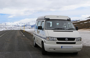 frozen tarns with minimal side verges making it
difficult to pull over. From the cosily warm and sunny atmosphere down at the
fjord-side at Seyðisfjörður, suddenly we were in a alien and inhospitable snowy
wilderness, crossing the broad watershed plateau at an altitude of 587m (1,925
feet) (see left). Beginning the inland descent, the road lost height rapidly via a hair-pin
and sweeping bends, leaving behind the snow as the terrain became greener.
Spread out below was the verdant panorama of the Fljótsdalur valley and
Largarfljót river which swelled out into the elongated lake alongside the
township of Egilsstaðir. As we descended towards the town, we passed the first
of the stunted birches, but this landscape had none of the comfortable
familiarity of Seyðisfjörður's fjordland mountains; despite the green
surroundings, this felt to be a dreary and relatively featureless environment,
especially as we suddenly reached Egilsstaðir's outskirts of ticky-tacky
box-like houses. frozen tarns with minimal side verges making it
difficult to pull over. From the cosily warm and sunny atmosphere down at the
fjord-side at Seyðisfjörður, suddenly we were in a alien and inhospitable snowy
wilderness, crossing the broad watershed plateau at an altitude of 587m (1,925
feet) (see left). Beginning the inland descent, the road lost height rapidly via a hair-pin
and sweeping bends, leaving behind the snow as the terrain became greener.
Spread out below was the verdant panorama of the Fljótsdalur valley and
Largarfljót river which swelled out into the elongated lake alongside the
township of Egilsstaðir. As we descended towards the town, we passed the first
of the stunted birches, but this landscape had none of the comfortable
familiarity of Seyðisfjörður's fjordland mountains; despite the green
surroundings, this felt to be a dreary and relatively featureless environment,
especially as we suddenly reached Egilsstaðir's outskirts of ticky-tacky
box-like houses.
 The township of Egilsstaðir:
the township of Egilsstaðir has no history to speak of: it was conceived in the
post newly independent Iceland days of 1944, as a new town to encourage
development of the remote and empty eastern region of the country around the
expanding Ring Road. The town was founded in 1947 near to where Route 1 bridged
the Largarfljót river, and named Egilsstaðir to give it apparent Saga Age
credentials. Nowadays it is nothing more than a service centre half-way around
the Ring Road where ferry-borne passengers arrive from continental Europe. Egilsstaðir serves as a place to stock up with provisions and fuel before
setting off to explore Iceland. And this was our only reason for stopping off
here. We found the Bonus supermarket which we assumed would be better stocked
than the Netto. Between the 2 supermarkets, and struggling to translate names of Icelandic
foodstuffs, we eventually garnered enough for 4 suppers, but at what
seemed astronomical prices. By now it was 3-30pm and it seemed best to camp here
at Egilsstaðir tonight before moving inland to the Fljótsdalur valley tomorrow. The township of Egilsstaðir:
the township of Egilsstaðir has no history to speak of: it was conceived in the
post newly independent Iceland days of 1944, as a new town to encourage
development of the remote and empty eastern region of the country around the
expanding Ring Road. The town was founded in 1947 near to where Route 1 bridged
the Largarfljót river, and named Egilsstaðir to give it apparent Saga Age
credentials. Nowadays it is nothing more than a service centre half-way around
the Ring Road where ferry-borne passengers arrive from continental Europe. Egilsstaðir serves as a place to stock up with provisions and fuel before
setting off to explore Iceland. And this was our only reason for stopping off
here. We found the Bonus supermarket which we assumed would be better stocked
than the Netto. Between the 2 supermarkets, and struggling to translate names of Icelandic
foodstuffs, we eventually garnered enough for 4 suppers, but at what
seemed astronomical prices. By now it was 3-30pm and it seemed best to camp here
at Egilsstaðir tonight before moving inland to the Fljótsdalur valley tomorrow.
Egilsstaðir Camping: along at
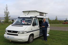
Kaupvangur we found Egilsstaðir tjaldsvæði (campsite) and contrary to our expectation, this was a large, grassy and almost
empty camping area lined with stunted birch trees (see right). Egilsstaðir TIC served as the
campsite reception and this closed at 3-00pm, but
 the facilities were open and
looked reasonable. We settled into a pitch along at the far end in a quiet
corner looking out to a low, craggy and birch-covered escarpment lining the
valley. The campsite gradually filled, mainly with small hire-campers or
back-packers and cyclists in tents. After the warm sun of this morning, tonight
was heavily overcast with a chill wind blowing from the north. the facilities were open and
looked reasonable. We settled into a pitch along at the far end in a quiet
corner looking out to a low, craggy and birch-covered escarpment lining the
valley. The campsite gradually filled, mainly with small hire-campers or
back-packers and cyclists in tents. After the warm sun of this morning, tonight
was heavily overcast with a chill wind blowing from the north.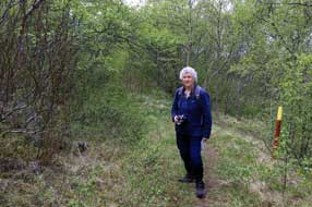
Hallormsstaður Forest in Fljótsdalur valley:
after overnight rain, the following morning was still heavily overcast and
chill. The tents and small campers gradually moved on leaving us in peace, and we
departed later in the morning to head south on the Hringvegur (Ring Road
- Route 1) to turn off in 10kms onto Route 931 along Fljótsdalur and the Largarfljót
Lake extending along the full length of the valley (click here for detailed map of route). The valley road was less wide
but still well-surfaced, and shortly crossed the wide Grimsá river, a tributary
of the Largarfljót, on our first single-lane bridge (Einbreið Brú - see left).
Single-lane bridges were to become a regular feature of driving in Iceland even
on the Ring Road,
 and a major source of hazard especially with speeding
tourists. The valley had been lightly wooded with birch up to this point, and part-way along we reached the protected area of the Hallormsstaður Forest, the remnants of the natural birch woods which
pre-Settlement once covered Iceland. This surviving area of natural woodland was
protected in 1905 as Iceland's first National Forest
and further planted with conifers. The mainly birch natural woodland covering an
area of 740 hectares, now includes larch, spruce and pines, and has a number
of way-marked forest trails. Our plan for this afternoon was to walk one of
these Hallormsstaður Forest paths above the Hafursá stream, detailed as Route 16-1 in the
Rother Guide to Iceland,
a walking guide book which served us well during the trip. and a major source of hazard especially with speeding
tourists. The valley had been lightly wooded with birch up to this point, and part-way along we reached the protected area of the Hallormsstaður Forest, the remnants of the natural birch woods which
pre-Settlement once covered Iceland. This surviving area of natural woodland was
protected in 1905 as Iceland's first National Forest
and further planted with conifers. The mainly birch natural woodland covering an
area of 740 hectares, now includes larch, spruce and pines, and has a number
of way-marked forest trails. Our plan for this afternoon was to walk one of
these Hallormsstaður Forest paths above the Hafursá stream, detailed as Route 16-1 in the
Rother Guide to Iceland,
a walking guide book which served us well during the trip.
 Forest walks
in
Hallormsstaður:
following the yellow way-mark posts, we began the gradual ascent through the
forest (see above right) and after a short distance diverted towards the Hafursá lower gorge. To
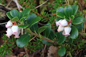
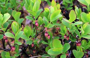
our surprised delight, the grassy banks here were covered with Bearberry,
exactly as we had seen in Spring time in SE Finland. This unexpected discovery
soon had us down on hands and knees photographing these elegantly white,
pink-fringed lantern-shaped flowers (Photo
8 - Bearberry flowers) (see above left). We resumed our upward path,
pausing frequently to photograph the Bearberry flowers growing along a raised
embankment amid beds of Crowberry and bushes of Bog Bilberry, Forest walks
in
Hallormsstaður:
following the yellow way-mark posts, we began the gradual ascent through the
forest (see above right) and after a short distance diverted towards the Hafursá lower gorge. To
our surprised delight, the grassy banks here were covered with Bearberry,
exactly as we had seen in Spring time in SE Finland. This unexpected discovery
soon had us down on hands and knees photographing these elegantly white,
pink-fringed lantern-shaped flowers (Photo
8 - Bearberry flowers) (see above left). We resumed our upward path,
pausing frequently to photograph the Bearberry flowers growing along a raised
embankment amid beds of Crowberry and bushes of Bog Bilberry,
 their Spring
leaves fresh green and tiny pink flowers newly formed (see right). A
further 800m and we reached a sign Útsýnisstaður pointing up a side path
to viewpoints on a rocky spur overlooking the Hafursá's upper gorge with the Largarfljót
Lake spreading along the broad Fljótsdalur valley floor below us (Photo
9 - Hallormsstaður forest walk). The ongoing path wove a zigzag course
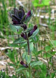
through plantations of spruce and pine where we came across another old Nordic
floral friend, a lone specimen of Alpine Bartsia (see left). While in the dense
forest, we could hear a low-pitched, whirring sound, variously described as
buzzing or burbling. To begin with we could not decide whether this was a bird
or insect since the sound seemed to come from deep within the woodland. As we
rose higher into more open areas of the forest, it became clear that the sound
originated from a long-beaked wader type bird, soaring around and diving
vertically, making this characteristic whirring sound. We later discovered that
these were Snipes, typical of Iceland's their Spring
leaves fresh green and tiny pink flowers newly formed (see right). A
further 800m and we reached a sign Útsýnisstaður pointing up a side path
to viewpoints on a rocky spur overlooking the Hafursá's upper gorge with the Largarfljót
Lake spreading along the broad Fljótsdalur valley floor below us (Photo
9 - Hallormsstaður forest walk). The ongoing path wove a zigzag course
through plantations of spruce and pine where we came across another old Nordic
floral friend, a lone specimen of Alpine Bartsia (see left). While in the dense
forest, we could hear a low-pitched, whirring sound, variously described as
buzzing or burbling. To begin with we could not decide whether this was a bird
or insect since the sound seemed to come from deep within the woodland. As we
rose higher into more open areas of the forest, it became clear that the sound
originated from a long-beaked wader type bird, soaring around and diving
vertically, making this characteristic whirring sound. We later discovered that
these were Snipes, typical of Iceland's heath-land, and seen regularly by us during the early~mid summer all around the
country. The low-pitched buzzing, warbling sound was made by their spread of
tail feathers as they soared and dived above us in their display flights (see
right). Reaching the walk's half-way point, the path turned downwards among
Larch plantations onto a broader forestry track, steeply down through the forest
towards the road and finally over a knoll back down to the start point. The walk
had only been 3 kms but the woodland had more mature trees and floral gems than
we should probably see in the rest of Iceland.
Just beyond the turning for
Hallormsstaður village, another of the way-marked routes led up through
the forest to Ljósárfoss waterfalls. The path gained height steeply for 850m,
bringing us out suddenly at a point where one of a number of water courses along
the wooded fell-side dropped over a 20m high basalt escarpment into a enclosed
basin. Surrounded by birch trees, this was a magnificent sight (Photo
10 - Ljósárfoss waterfalls).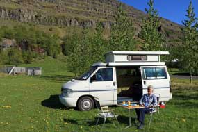
A day in camp at Fljótsdalsgrund Farm Camping: continuing beyond the
woodland to where Fljótsdalur broadened out into the upper valley, Route 931
crossed Largarfljót Lake on a modern bridge and turned past the parking area for
Hengifoss waterfalls which we could see tumbling over a basalt cliff into a dark
cauldron high on the fell-side. We continued ahead into the upper reaches of the
valley, past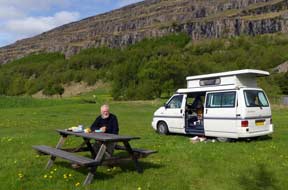 the turning up to the controversial Kárahnjúkar
Dam which was constructed in 2009 flooding an immense area of wilderness
highlands below the Vatnajökull ice-field. This brought us
to tonight's campsite at Fljótsdalsgrund Farm. The flat glacial valley, 1km wide
at this point, was clearly fertile pastoral terrain with broad, grassy meadows
spread across the valley floor grazed by horses and cattle. We had yesterday
phoned the owner Helga Vigfúsdóttir, who with her husband farms Fljótsdalsgrund,
to confirm the campsite was open; the welcoming response was to settle in when
we arrived and Helga would be round later. We had this magnificent campsite to
ourselves and selected a pitch on the lush grassy camping area as Helga arrived
in her pick-up. The facilities hut not only had homely WC/shower and fully
equipped kitchen/wash-up, but also site-wide wi-fi with full strength signal and
washing/drying machines to do our laundry on tomorrow's day in camp. the turning up to the controversial Kárahnjúkar
Dam which was constructed in 2009 flooding an immense area of wilderness
highlands below the Vatnajökull ice-field. This brought us
to tonight's campsite at Fljótsdalsgrund Farm. The flat glacial valley, 1km wide
at this point, was clearly fertile pastoral terrain with broad, grassy meadows
spread across the valley floor grazed by horses and cattle. We had yesterday
phoned the owner Helga Vigfúsdóttir, who with her husband farms Fljótsdalsgrund,
to confirm the campsite was open; the welcoming response was to settle in when
we arrived and Helga would be round later. We had this magnificent campsite to
ourselves and selected a pitch on the lush grassy camping area as Helga arrived
in her pick-up. The facilities hut not only had homely WC/shower and fully
equipped kitchen/wash-up, but also site-wide wi-fi with full strength signal and
washing/drying machines to do our laundry on tomorrow's day in camp.
 We woke to a gloriously sunny morning and
breakfasted outside in this magnificent setting (see above left and right); the
multi-layered basalt strata rose
in tiers on the cliffs of the valley-side behind us, with the lower hills extending
along the far side of the broad, flat valley floor still streaked with residual
snow. Snipes soared and dived above us with the low-pitched whirring of their
tail feathers in display flight, and Redwings pecked in the grass around us. The
sun was warm and the air sensuously scented with the We woke to a gloriously sunny morning and
breakfasted outside in this magnificent setting (see above left and right); the
multi-layered basalt strata rose
in tiers on the cliffs of the valley-side behind us, with the lower hills extending
along the far side of the broad, flat valley floor still streaked with residual
snow. Snipes soared and dived above us with the low-pitched whirring of their
tail feathers in display flight, and Redwings pecked in the grass around us. The
sun was warm and the air sensuously scented with the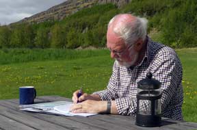 fresh smell of grass and the birch trees' new leaf, and filled with bird song (Photo
11 - Fljótsdalsgrund Farm Camping). It was as fine a Spring morning as
you could wish for, with not a soul in sight to disturb the peacefulness of
nature; this was a
perfect campsite and perfect weather for our first
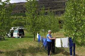
substantive day in camp in almost 3 weeks of exhausting travelling. Sheila set our laundry going in the campsite
washing/drying machines and rigged a line between the birches to finish the
drying in the warm sunshine (see left), while Paul brought the log up to date at
the picnic table (see right). Even basic jobs like washing up were a
pleasure on such a morning (Photo
12 - Morning chores). As the day progressed however, the sky gradually
clouded over and by 5-00pm light rain began; this was a typically Icelandic
change in the weather. With heavy cloud covering the hills on both sides of the
valley, it became almost dark later in the evening, but in all our years of
camping, our day in camp at Fljótsdalsgrund had been one of the most memorable
ever.
 A spectacular climb to Hengifoss waterfall: after a night of rain,
we woke to breaking cloud and clearing sky with warm sunshine again. It was
going to be another fine day for our climb up to Hengifoss waterfall. Along the
valley past the farms, we pulled into the parking area at the foot of the
Hengifoss path; the number of tourist hire cars already here showed we should
not have the fells to ourselves today. The sun was warm as we set off up the
initially steep slope. The path levelled out onto A spectacular climb to Hengifoss waterfall: after a night of rain,
we woke to breaking cloud and clearing sky with warm sunshine again. It was
going to be another fine day for our climb up to Hengifoss waterfall. Along the
valley past the farms, we pulled into the parking area at the foot of the
Hengifoss path; the number of tourist hire cars already here showed we should
not have the fells to ourselves today. The sun was warm as we set off up the
initially steep slope. The path levelled out onto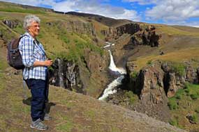 meadowland and here to our
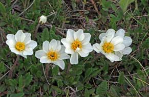
surprise we found a wealth of wild flora: large clumps of Mountain Avens in full
bloom on the south-facing slope (see left), cushions of pink Moss Campion, tiny Butterwort,
scattered plants of Alpine Mouse Ear with their veined white flowers and
grey-green hairy leaves, and more of the purple flowered Alpine Bartsia. We
inevitably spent longer than planned photographing them, as the tourists hurried
past totally indifferent to these floral delights spread out before them on this
sunny slope. meadowland and here to our
surprise we found a wealth of wild flora: large clumps of Mountain Avens in full
bloom on the south-facing slope (see left), cushions of pink Moss Campion, tiny Butterwort,
scattered plants of Alpine Mouse Ear with their veined white flowers and
grey-green hairy leaves, and more of the purple flowered Alpine Bartsia. We
inevitably spent longer than planned photographing them, as the tourists hurried
past totally indifferent to these floral delights spread out before them on this
sunny slope.
The path narrowed as we rose higher, closer to
the deep, rocky gorge carved out on the lower reaches of the slope by the
Hengifoss watercourse. We diverted over towards the canyon edge to view the
spectacular falls dropping in a series of steps down through a winding ravine (Photo
13 - Lower ravines and waterfalls) (see left).
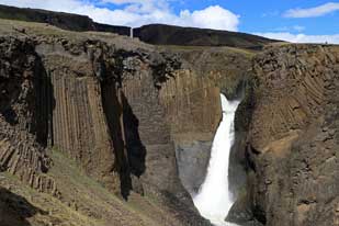
The slope steepened further leading to a
gorge-edge view-point looking over the
even more spectacular Litlanesfoss falls which spilled out from a higher winding
canyon into its gigantic drop. But what held our gaze more than the cascading
water were the rust-brown basalt columns lining the gorge's high walls and
framing the falls (Photo
14 - Basalt columns at Litlanesfoss waterfalls) (see above right).
Click here to watch our
video of Litlanesfoss and its basalt columns
  The columns were both vertical and horizontal on the nearer
side, but on the far side were inclined at a curving angle, reflecting the
pattern of the lava intrusion that had solidified to form the basalt, so that their
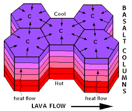
massed hexagonal upper surfaces were revealed on the exposed upper face. Here before our eyes was a text book geology lesson showing basalt column formation
in cooling lava (see right): polygonal basalt columns, exposed here by the
erosive power of water carving out the deep gorge, were created by the
contraction and fracturing of rapidly cooling basaltic lava. Columns are formed
perpendicular to the lava's cooling surface, and are therefore vertical when formed by
a cooling horizontal lava flow (see diagram left); where the lava intrusion flowed into a vertical
crack in the bed rock, cooling surfaces produced horizontal columns. Here at Litlanesfoss, the advancing lava had filled a stream bed, cooling initially to
form vertical columns; but the forward moving lava flow distorted the developing
column formation, producing the curvature seen today on the exposed cliff face
of columns. The columns were both vertical and horizontal on the nearer
side, but on the far side were inclined at a curving angle, reflecting the
pattern of the lava intrusion that had solidified to form the basalt, so that their
massed hexagonal upper surfaces were revealed on the exposed upper face. Here before our eyes was a text book geology lesson showing basalt column formation
in cooling lava (see right): polygonal basalt columns, exposed here by the
erosive power of water carving out the deep gorge, were created by the
contraction and fracturing of rapidly cooling basaltic lava. Columns are formed
perpendicular to the lava's cooling surface, and are therefore vertical when formed by
a cooling horizontal lava flow (see diagram left); where the lava intrusion flowed into a vertical
crack in the bed rock, cooling surfaces produced horizontal columns. Here at Litlanesfoss, the advancing lava had filled a stream bed, cooling initially to
form vertical columns; but the forward moving lava flow distorted the developing
column formation, producing the curvature seen today on the exposed cliff face
of columns.
We continued up the slope eventually crossing a
side watercourse. The path now steepened around a hillock, leading to a point
where the distant Hengifoss falls came into view, dropping into its huge corrie.
This skyline panorama revealed the distinctive red stripes across the basalt
strata of the cliff-face backing the falls, formed by iron-rich layers of ash
and scoria deposited on the upper surface of lower layers of basaltic lava which
were then covered by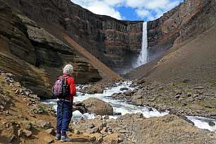
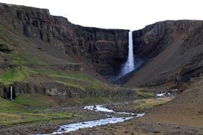 further layers of lava flow. The distant
view from this point was spectacular, looking along the upper
valley with the main watercourse surging powerfully across the valley floor,
against a backdrop of Hengifoss dropping into the upper corrie and its enclosing basalt cliffs
with their distinctive red stripes clearly visible (Photo
15 - Upper valley and Hengifoss waterfalls) (see left). Unsure of how difficult the
ongoing route might became, we advanced across the broad valley, passing under
an unstable steep slope of crumbling layers of fractured mudstone and lignite.
These sedimentary strata some 100m deep were subsequently overlaid by lava flows
forming higher basal strata, later exposed by glacial erosion and revealed as
basalt cliffs. As so often on this trip, every step was a geology lesson
prompting questions about the formation of this dramatic topography. further layers of lava flow. The distant
view from this point was spectacular, looking along the upper
valley with the main watercourse surging powerfully across the valley floor,
against a backdrop of Hengifoss dropping into the upper corrie and its enclosing basalt cliffs
with their distinctive red stripes clearly visible (Photo
15 - Upper valley and Hengifoss waterfalls) (see left). Unsure of how difficult the
ongoing route might became, we advanced across the broad valley, passing under
an unstable steep slope of crumbling layers of fractured mudstone and lignite.
These sedimentary strata some 100m deep were subsequently overlaid by lava flows
forming higher basal strata, later exposed by glacial erosion and revealed as
basalt cliffs. As so often on this trip, every step was a geology lesson
prompting questions about the formation of this dramatic topography.
It was now necessary to ford a further
watercourse and rounding a corner, the path passed under lower basalt cliffs
just above the fast-flowing
main valley river. We advanced uncertainly to a
point which was evidently path's end, where further progress into
the corrie's
inner sanctum closer to Hengifoss waterfalls would have necessitated an
impracticable fording
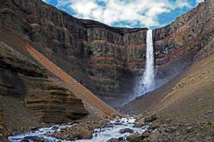 of the deep, surging river flowing from the foot of the
falls. But even though further forward progress was barred by the impassable
torrent, the views from this end point of the path into the corrie across the
roaring torrent were truly awe-inspiring (see left and right) (Photo
16 - Path's end at Hengifoss): the 128m falls of Hengifoss dropped
vertically immediately ahead amid foaming spray over the brim of the basalt
plateau high of the deep, surging river flowing from the foot of the
falls. But even though further forward progress was barred by the impassable
torrent, the views from this end point of the path into the corrie across the
roaring torrent were truly awe-inspiring (see left and right) (Photo
16 - Path's end at Hengifoss): the 128m falls of Hengifoss dropped
vertically immediately ahead amid foaming spray over the brim of the basalt
plateau high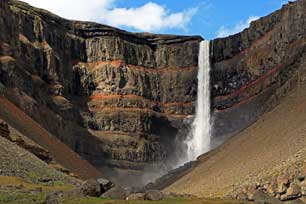 above, and at this close range, the inter-basaltic iron-rich ash
and scoria striped layers were even more obvious (see right) (Photo
17 - Hengifoss' inter-basaltic stripes). The scale of the cliffs
enclosing the dark corrie was truly monumental, and the sun broke through just
at the right moment to illuminate the spectacular falls and red striped
cliff-face. With the roar of the fast-flowing torrent which blocked further
forward progress, it felt a precarious position stood beneath the unstable
cliffs towering above and evidently prone to rock-falls judging by the amount of
debris. Having taken our photos, we withdrew to a more secure spot, and with one
last glance at the mesmerising falls, we set off back along the upper gorge
valley for the descent. above, and at this close range, the inter-basaltic iron-rich ash
and scoria striped layers were even more obvious (see right) (Photo
17 - Hengifoss' inter-basaltic stripes). The scale of the cliffs
enclosing the dark corrie was truly monumental, and the sun broke through just
at the right moment to illuminate the spectacular falls and red striped
cliff-face. With the roar of the fast-flowing torrent which blocked further
forward progress, it felt a precarious position stood beneath the unstable
cliffs towering above and evidently prone to rock-falls judging by the amount of
debris. Having taken our photos, we withdrew to a more secure spot, and with one
last glance at the mesmerising falls, we set off back along the upper gorge
valley for the descent.
Again we made frequent stops for the sweeping
views that opened up looking along the length of Fljótsdalur, from its wide,
pastoral upper valley down the full length of Largarfljót lake (see below left) (Photo
18 - Fljótsdalur valley). The valley,
scoured out by glacial action during the last Ice Age, is now fed by the waters
of the Jökulsá í fljótsdal river 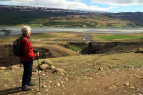 flowing down from the Vatnajökull ice-field, and
filling the 30km long, 112m deep Largarfljót lake. Although we were enjoying
bright afternoon sun as we made our descent, it was evident that a squally
shower was advancing up the valley, and we hurried back down to the parking
area before it reached us. Before returning for a final night at Fljótsdalsgrund,
we called in at the Snæfellsstofa Vatnajökull National Park Visitor Centre. Here
we learned more about the environmental impact caused by construction of the Kárahnjúkar
Dam. Not only had the reservoir flooded extensive tracts of wildness below the
Vatnajökull Glacier, formerly reindeer grazing lands, but also water which once
had drained naturally down the neighbouring Jökulsá á Bru valley was diverted down
underground pipelines to the generating station here in the Fljótsdal valley, now
out-flowing into the Jökulsá í fljótsdal river contaminating the Largarfljót
lake with increased silt from the greater rate of flow and flowing down from the Vatnajökull ice-field, and
filling the 30km long, 112m deep Largarfljót lake. Although we were enjoying
bright afternoon sun as we made our descent, it was evident that a squally
shower was advancing up the valley, and we hurried back down to the parking
area before it reached us. Before returning for a final night at Fljótsdalsgrund,
we called in at the Snæfellsstofa Vatnajökull National Park Visitor Centre. Here
we learned more about the environmental impact caused by construction of the Kárahnjúkar
Dam. Not only had the reservoir flooded extensive tracts of wildness below the
Vatnajökull Glacier, formerly reindeer grazing lands, but also water which once
had drained naturally down the neighbouring Jökulsá á Bru valley was diverted down
underground pipelines to the generating station here in the Fljótsdal valley, now
out-flowing into the Jökulsá í fljótsdal river contaminating the Largarfljót
lake with increased silt from the greater rate of flow and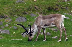 adversely affecting
the lake's natural vegetation and fish.
Although generating huge quantities of
hydro-electricity, the dam's construction
made no contribution to Iceland's
domestic power supplies since it was all consumed by the
massive aluminium
smelter at Reyðarfjörður. The aluminium plant brought little additional
employment opportunities for native Icelanders since the majority of jobs
were taken by Polish and East European migrant labour. We learned much at Snæfellsstofa about the controversial dam construction project which we should
see on our return to Fljótsdalur in the final days of the trip; see more on
Kárahnjúkar Dam controversy.
 Return to Egilsstaðir and
drive out to Borgarfjörður Eystri on the NE coast: as we drove back along the valley the
following morning, near to one of the farms we saw a few of the wild reindeer
that still live in East Iceland (see right). They were introduced from Norway in
the late 18th century originally for farming, but reindeer husbandry never
became established. A few still survive in the wilds of East Iceland mostly at higher altitudes in summer but migrate
to lower pastures closer to the coast in winter (Photo
19 - Wild reindeer) (see above right). Passing Largarfljót, the impact of increased silt
now flowing into the lake from Fljótsdalur hydro-electric generating station
seemed particularly noticeable; the water looked a muddy, brown colour when once
it had been clear. Returning to Egilsstaðir, we shopped for further provisions
before turning onto Route 94 to begin the 70km drive out to Borgarfjörður Return to Egilsstaðir and
drive out to Borgarfjörður Eystri on the NE coast: as we drove back along the valley the
following morning, near to one of the farms we saw a few of the wild reindeer
that still live in East Iceland (see right). They were introduced from Norway in
the late 18th century originally for farming, but reindeer husbandry never
became established. A few still survive in the wilds of East Iceland mostly at higher altitudes in summer but migrate
to lower pastures closer to the coast in winter (Photo
19 - Wild reindeer) (see above right). Passing Largarfljót, the impact of increased silt
now flowing into the lake from Fljótsdalur hydro-electric generating station
seemed particularly noticeable; the water looked a muddy, brown colour when once
it had been clear. Returning to Egilsstaðir, we shopped for further provisions
before turning onto Route 94 to begin the 70km drive out to Borgarfjörður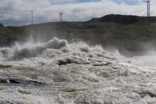 Eystri
on the remote NE coast (click here for detailed map of route). The road, tarmaced at this stage, followed the course of
the lower Largarfljót river through the moorland of the broad
Hérað valley,
passing scattered farms whose hayfields were interspersed with marshland, with
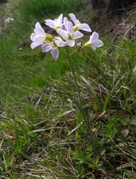
the horizon to the east lined with snow-covered mountains. The road ran alongside meandering tributaries of the Selfljót river
and we paused here to photograph the wild flora growing along the
stream's embankments: Lady's Smock (see left), Water Avens, Alpine Cinquefoil,
Mountain Avens, and Bearberry flowers. The air was filled with the calls of
Whimbrels and the whirring sound of Snipe soaring and diving above us. Eystri
on the remote NE coast (click here for detailed map of route). The road, tarmaced at this stage, followed the course of
the lower Largarfljót river through the moorland of the broad
Hérað valley,
passing scattered farms whose hayfields were interspersed with marshland, with
the horizon to the east lined with snow-covered mountains. The road ran alongside meandering tributaries of the Selfljót river
and we paused here to photograph the wild flora growing along the
stream's embankments: Lady's Smock (see left), Water Avens, Alpine Cinquefoil,
Mountain Avens, and Bearberry flowers. The air was filled with the calls of
Whimbrels and the whirring sound of Snipe soaring and diving above us.
Beyond the farming hamlet of Eiðar the road became gravelled for the next 30kms, raising
clouds of dust as we advanced more slowly. Where the tarmac began again, we
turned off along a gravelled side-road down into the lower Largarfljót valley,
to investigate a possible wild camp spot by the river. Snipe flew up in a
flutter from the tussocky moorland as we passed. Beyond large farmsteads, where
ewes and lambs grazed by the road-side, we reached the Largarfossvirkjun
hydro-electric generating plant which harnessed the
 power of the lower Largarfljót
river rapids. Below the power plant, we ventured across rocky ground to
photograph these extraordinarily powerful rapids; their turbulence sent flailing
clouds of spray high above the surging river, filling the air with its roar
(Photo
20 - Largarfljót river rapids) (see above right). power of the lower Largarfljót
river rapids. Below the power plant, we ventured across rocky ground to
photograph these extraordinarily powerful rapids; their turbulence sent flailing
clouds of spray high above the surging river, filling the air with its roar
(Photo
20 - Largarfljót river rapids) (see above right).
Back to the comparative comfort of tarmac
again, Route 94 curved around the enormous glacial sand and gravel outwash plain
of Héraðssandur,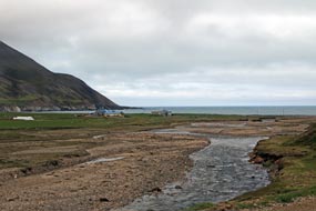 formed by the combined outflows of the Jökulsá
á Bru and Largarfljót
river mouths into Héraðsflói bay. The road turned across the grassy flatlands of
the broad coastal plains which were dotted with many lakes. Ahead the
snow-covered mountains, which earlier had lined the distant eastern horizon, now
loomed closer seeming to form an impenetrable barrier to further progress. How
on earth was the road to get over this obstacle? Across the bridge over the Selfljót
river which drained the mountains' western slopes, the tarmac ended again, just
at the worst possible point where the road began its slanting ascent of the
mountain slope. The bare, rough unsurfaced road climbed steeply, veering around 2
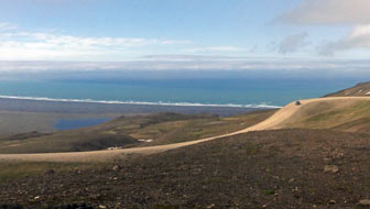
hair-pins and finally reaching a pull-off just before the watershed. We pulled
over despite the misty cloud to look down the hair-pins we had just climbed over
the panoramic vista across Héraðssandur, with the distant outflow of the 2
mighty rivers into Héraðsflói bay, the broad coastal plain, and white line of
surf along the dark strip of glacial sand and gravel (see above left). formed by the combined outflows of the Jökulsá
á Bru and Largarfljót
river mouths into Héraðsflói bay. The road turned across the grassy flatlands of
the broad coastal plains which were dotted with many lakes. Ahead the
snow-covered mountains, which earlier had lined the distant eastern horizon, now
loomed closer seeming to form an impenetrable barrier to further progress. How
on earth was the road to get over this obstacle? Across the bridge over the Selfljót
river which drained the mountains' western slopes, the tarmac ended again, just
at the worst possible point where the road began its slanting ascent of the
mountain slope. The bare, rough unsurfaced road climbed steeply, veering around 2
hair-pins and finally reaching a pull-off just before the watershed. We pulled
over despite the misty cloud to look down the hair-pins we had just climbed over
the panoramic vista across Héraðssandur, with the distant outflow of the 2
mighty rivers into Héraðsflói bay, the broad coastal plain, and white line of
surf along the dark strip of glacial sand and gravel (see above left).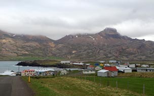
Beyond this point as the road mounted the pass,
we entered cloud totally obscuring any views, and began the descent via a
further hair-pin, curving around into a long narrow sandur-valley leading out to
coastal flats where the isolated hamlet of Borg nestled by the shore. Tarmac
began for a short stretch before the road became gravelled again across the
unstable stonefields of this wild,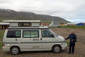 glacial sandur (see above right). We now
faced the final challenge of this hair-raising route, with the road clinging
precariously to the fractured, unstable cliffs and winding around the murky
headlands. The dangerously loose cliffs, covered with rock debris, were said to
have been the domain of a malevolent demon called Naddi who was pushed into the
sea by a 14th century settler; the damaged state of the road and rock-fall
debris supports the legend that this evil presence still stalks the cliff-face.
A protective road-side cross with the inscription Effigiem Christi qui
transis pronus honora - anno MCCCVI (Honour the image of Christ, you who
hurry past - 1306) gave little comfort; putting more faith
in the cliff-top safety fencing, we did indeed hurry past, eyeing nervously the
broken road and fractured rock slopes above. Thankfully around this last hurdle,
we re-joined tarmac for the final stretch along the wild shore-line, with mighty
breakers crashing onto the rocks. Our goal, the fishing settlement of Borgarfjörður Eystri
was now visible in the murky, misty distance against the backdrop of mountainous
coastline (see left). glacial sandur (see above right). We now
faced the final challenge of this hair-raising route, with the road clinging
precariously to the fractured, unstable cliffs and winding around the murky
headlands. The dangerously loose cliffs, covered with rock debris, were said to
have been the domain of a malevolent demon called Naddi who was pushed into the
sea by a 14th century settler; the damaged state of the road and rock-fall
debris supports the legend that this evil presence still stalks the cliff-face.
A protective road-side cross with the inscription Effigiem Christi qui
transis pronus honora - anno MCCCVI (Honour the image of Christ, you who
hurry past - 1306) gave little comfort; putting more faith
in the cliff-top safety fencing, we did indeed hurry past, eyeing nervously the
broken road and fractured rock slopes above. Thankfully around this last hurdle,
we re-joined tarmac for the final stretch along the wild shore-line, with mighty
breakers crashing onto the rocks. Our goal, the fishing settlement of Borgarfjörður Eystri
was now visible in the murky, misty distance against the backdrop of mountainous
coastline (see left).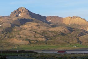
Borgarfjörður Eystri Camping: the houses of the village were scattered
across a broad, flat valley bottom, and around the bay just beyond the centre we
found Borgarfjörður Eystri's trim little campsite set under the hillock of
Álfaborg. There was just one other camper and a few tents here, with plenty of
space in both gravelled and grassy camping areas. Facilities were limited and
price quite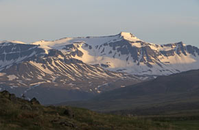 expensive, but the setting was magnificently peaceful overlooking the village
and bay (see above right) (Photo
21 - Borgarfjörður Eystri Camping). We selected an end pitch and settled in as the cloud
began to lift, clearing more of the surrounding shapely, snow-covered peaks in
this magnificent setting (see right). Later in the evening the western sun lit
the rhyolite mountain peaks revealing fully their gloriously sculpted shapes
(see left).
Borgarfjörður Eystri village: our plan for the following day was to
spend a leisurely morning exploring the village of Borgarfjörður Eystri, and
later to go round to Hafnarhólmi to find the Puffin colony by the little
harbour. But the peace of the morning did not last. Before long, the village was
swarming with an invasion of tourists, ferried in from a Hurtigrute cruise-ship
anchored out in the fjord. They were milling everywhere, behaving with the sort
of outrageously ill-mannered and intrusive lack of any
 consideration for this
small community typical of modern mass tourism; such was their insensitive
arrogance that we actually saw them wandering indifferently through people's
gardens. Is it surprising that we regard such behaviour so grossly offensive,
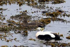
and mass tourism the ultimate pollutant. From the campsite, we walked along the
sea-shore to the village's old harbour, watching Eider Ducks 'oo-ooing' in the
shallows (see left) and Ring-Plovers scampering along the black sand (Photo
22 - Ringed Plover). Borgarfjörður Eystri's
small fishing fleet used to be moored at the village's old harbour, but with no
natural consideration for this
small community typical of modern mass tourism; such was their insensitive
arrogance that we actually saw them wandering indifferently through people's
gardens. Is it surprising that we regard such behaviour so grossly offensive,
and mass tourism the ultimate pollutant. From the campsite, we walked along the
sea-shore to the village's old harbour, watching Eider Ducks 'oo-ooing' in the
shallows (see left) and Ring-Plovers scampering along the black sand (Photo
22 - Ringed Plover). Borgarfjörður Eystri's
small fishing fleet used to be moored at the village's old harbour, but with no
natural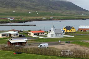 shelter here, the boats had to be drawn up onto the beach for protection
against winter storms. Then in the 1940s, a new harbour was created 5kms around
the bay at Höfn as a sheltered mooring for the fishing boas operating in the
local waters of Borgarfjörður. After shopping in the village stores, we treated
ourselves to a fish soup lunch at the Álfa Café, delicious but unaffordably
expensive! shelter here, the boats had to be drawn up onto the beach for protection
against winter storms. Then in the 1940s, a new harbour was created 5kms around
the bay at Höfn as a sheltered mooring for the fishing boas operating in the
local waters of Borgarfjörður. After shopping in the village stores, we treated
ourselves to a fish soup lunch at the Álfa Café, delicious but unaffordably
expensive!
Before setting off for our afternoon of Puffin
watching, we climbed the Álfaborg hillock behind the campsite. The views from
this high-point out over the village scattered across the valley bottom with the
old harbour and fjord beyond (see right), and the surrounding spread of rhyolite peaks now beginning to
emerge from the cloud, all showed what a memorably stunning
 location Borgarfjörður
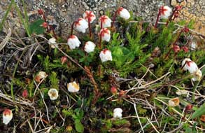
Eystri occupied. On the way back down to the campsite, we stumbled upon another
floral gem: a low cushion of tiny white globular flowers capped with a
distinctive red sepal cross, which Sheila identified as Cassiope (see left)
(Photo
23 - Cassiope); we had twice seen this Ericaceae
plant late in the season in North Sweden, but never before in flower. location Borgarfjörður
Eystri occupied. On the way back down to the campsite, we stumbled upon another
floral gem: a low cushion of tiny white globular flowers capped with a
distinctive red sepal cross, which Sheila identified as Cassiope (see left)
(Photo
23 - Cassiope); we had twice seen this Ericaceae
plant late in the season in North Sweden, but never before in flower.
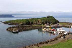 The Puffin colony at
Hafnarhólmi: leaving the
village, we drove around the flat lands of the inner fjord bay where Eiders swam
in the shallows and a colony of Arctic Terns nested on the sand banks. Over a
headland, the lane dropped down to its end at Borgarfjörður Höfn, the village's
harbour artificially created by blocking off one side of the channel between the
off-shore islet of Hafnarhólmi with a huge sea-wall (see right). Across the
sea-wall wooden steps led up onto a viewing platform on the islet. The tiny
islet with its low cliffs and tufted turf top is a breeding ground for colonies
of Kittiwakes, Fulmars and Puffins. Although still only 3-30pm and the Puffins
would not be expected to return to their nest burrows until late afternoon after
fishing all day out at sea, we walked over for an exploratory foray. The Puffin colony at
Hafnarhólmi: leaving the
village, we drove around the flat lands of the inner fjord bay where Eiders swam
in the shallows and a colony of Arctic Terns nested on the sand banks. Over a
headland, the lane dropped down to its end at Borgarfjörður Höfn, the village's
harbour artificially created by blocking off one side of the channel between the
off-shore islet of Hafnarhólmi with a huge sea-wall (see right). Across the
sea-wall wooden steps led up onto a viewing platform on the islet. The tiny
islet with its low cliffs and tufted turf top is a breeding ground for colonies
of Kittiwakes, Fulmars and Puffins. Although still only 3-30pm and the Puffins
would not be expected to return to their nest burrows until late afternoon after
fishing all day out at sea, we walked over for an exploratory foray.
Fulmars and Kittiwakes nest along cliff edges,
the Fulmars remaining in the vicinity after the breeding season all year round,
whereas the migratory
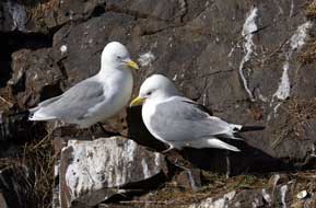 Kittiwakes arrive in March~April
to breed and depart in
September to over-winter east of Newfoundland. Puffins arrive in early April,
and after a winter-long separation, the breeding pairs re-unite at their nesting
burrows in the turf on Hafnarhólmi islet's upper slopes. Single eggs are laid in
the burrow mid-May, and one of the adult Puffins remains incubating the egg in
the burrow-nest while the other adult flies out to sea fishing. The Puffin chicks hatch at the turn of June~July.
The adult birds bring Kittiwakes arrive in March~April
to breed and depart in
September to over-winter east of Newfoundland. Puffins arrive in early April,
and after a winter-long separation, the breeding pairs re-unite at their nesting
burrows in the turf on Hafnarhólmi islet's upper slopes. Single eggs are laid in
the burrow mid-May, and one of the adult Puffins remains incubating the egg in
the burrow-nest while the other adult flies out to sea fishing. The Puffin chicks hatch at the turn of June~July.
The adult birds bring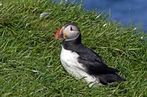 back beakfuls
of sand eels garnered on their fishing trips, and can be seen standing by their
burrows early evening. The Puffins depart from the islet early August to over-winter at sea. back beakfuls
of sand eels garnered on their fishing trips, and can be seen standing by their
burrows early evening. The Puffins depart from the islet early August to over-winter at sea.
On our first visit up the wooden steps to the
viewing platform, it was too early in the afternoon, and only one or two Puffins
could be seen by the burrows which covered the turf tops and upper slopes of Hafnarhólmi.
While waiting for the Puffins to return, we watched the Kittiwakes nesting on
the low cliff-sides: the females sat on their untidy nests on cliff-ledges while
the male birds stood alongside preening or flew around with their raucous
'Kittiwake' cries
(Photo
24 - Nesting Kittiwakes). Later in the afternoon we returned to the Puffin nesting
burrows sites which covered the islet's top and upper slopes alongside the
wooden steps. The adult Puffins began returning from sea in ones and twos,
flying in with their almost clockwork-like wing-flapping to land on the turf.
Others popped out of the nests, standing alongside their burrows, stretching
their wings and waddling around the turf, their webbed feet looking ungainly on
land.
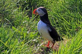 When their striped, colourful beaks gaped, the orange rosette at the base
of the bill enabling the beak to open wider for gripping fish could clearly be
seen. As the late afternoon progressed, increasing numbers of Puffins appeared
back on the islet's top and slopes, and the sunlight became brighter giving good
illumination for our photos When their striped, colourful beaks gaped, the orange rosette at the base
of the bill enabling the beak to open wider for gripping fish could clearly be
seen. As the late afternoon progressed, increasing numbers of Puffins appeared
back on the islet's top and slopes, and the sunlight became brighter giving good
illumination for our photos
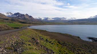 (Photo
25 - Atlantic Puffin) (see above right and left). From the viewing steps, the Puffins stood just a
few metres from us, undisturbed by our presence and with their
inquisitive look seeming to peer curiously at our camera lens. We stayed until
the dark shadows of early evening cast the islet top into gloom, and a selection
of our photos is given in our
Puffin photo gallery. (Photo
25 - Atlantic Puffin) (see above right and left). From the viewing steps, the Puffins stood just a
few metres from us, undisturbed by our presence and with their
inquisitive look seeming to peer curiously at our camera lens. We stayed until
the dark shadows of early evening cast the islet top into gloom, and a selection
of our photos is given in our
Puffin photo gallery.
Driving back around the bay to Borgarfjörður Eystri
in the evening sunlight, the view from the headland gave a magnificent 270º
panoramic vista of snow-covered mountains lining the eastern, southern and
western skyline (see right), but by the time we were back a camp in the village,
cloud began to gather and a chill wind to blow, foreshadowing tomorrow's forecast rain.
A muddy drive back to Egilsstaðir: a night of rain was followed by a morning of low, heavy
cloud and drizzle, poor visibility for today's return over the mountains to Egilsstaðir.
Leaving Borgarfjörður Eystri after such a memorable stay, we began the drive
around the coast in gloomy conditions, rising
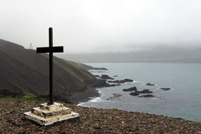 warily up and around the
crumbling, unstable cliffs to the high point passing the way-side cross (see
left). The gravel road descended to the sandur by Borg where the Selfljót river
flowed out into the sea, and began the long haul up the valley. Re-joining
tarmac, we gained height up towards the pass; the road became gravel again,
reaching the cloud layer as we ascended the hair-pins in minimal warily up and around the
crumbling, unstable cliffs to the high point passing the way-side cross (see
left). The gravel road descended to the sandur by Borg where the Selfljót river
flowed out into the sea, and began the long haul up the valley. Re-joining
tarmac, we gained height up towards the pass; the road became gravel again,
reaching the cloud layer as we ascended the hair-pins in minimal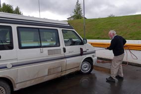 visibility. Fortunately meeting no descending traffic, we reached the high point
of the pass safely, unable to see far ahead in the misty cloud, and began the
winding descent down to Héraðssandur. Across the broad, flat valley bottom, we
re-joined tarmac for the drive along the lower Largarfljót valley. Shortly
after, the tarmac gave way to unsurfaced gravel again. This slowed our progress,
but all was well to begin with. Then however we reached a section of scraped
road, where the gravel was heaped in the middle of the road and the edges rutted
and rougher than ever. Shortly further and we caught up with the scraping machine, where not only was the
surface rough but water-sprayed and salted, leaving just a slurried mess to
drive through. A pause at Eiðar confirmed our fears: despite taking it slowly,
George was totally filthy from the splashed-up slurry. Reaching Egilsstaðir, we
pulled into a filling station which fortunately was equipped with hose-brushes;
clearly this was a regular feature at Icelandic garages, much needed for vehicle
cleaning with all the filth of gravelled roads after rain. A session with the
hose-brush and George was gleaming white again (see above right). Down in the
town, we re-stocked with provisions for the coming days up in the remote
highlands; Egilsstaðir was useful as a service-centre if nothing more.
 The Ring-Road westwards along the Jökuldalur
valley and up into highlands: we finally crossed
the wide Largarfljót river and in gloomy weather The Ring-Road westwards along the Jökuldalur
valley and up into highlands: we finally crossed
the wide Largarfljót river and in gloomy weather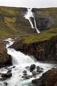 headed northwards on the Ring-Road over high,
featureless tundra moorland (click here for detailed map of route). Swinging westwards, the road reached the
fast-flowing Jökulsá á Brú river whose gorge was spanned by a high-arching
modern bridge (Photo
26 - Jökulsá á Brú river). Here we paused for photographs of this mighty
glacial river which flows down from the Brúarjökul Galcier, part of the Vatnajökul ice-cap, following a parallel course with the Largarfljót. The
Hringvegur (Ring Road) took a south-westerly course along the broad Jökuldalur,
with the Jökulsá á Brú meandering along the far side of the valley carving out a
wide gorge bordered with gravel banks from the river's spreading during Spring
melts. The northern side of the valley was hemmed in by a high rising string of
hills, down which surging watercourses cascaded to join the main valley river. A series of hill-farms was strung out along the Jökuldalur valley,
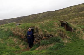
and one of these farmsteads, Hjarðarhagi, still retained a couple of traditional
turf-roofed and walled sheep byres, in use until the 1970s and now preserved by
the farm driveway. The farmer passed in his pick-up, shouting a welcome to us to
take a look inside the old buildings. A short distance further, we reached
Skjöldólfsstaðir, a former schoolhouse which had once served the farms along the
valley and now was converted to guesthouse and campsite. Close to here, despite
the gloomy light we paused to photograph one of the torrents plunging in
waterfalls down over the valley side-wall carving out a craggy gorge
(Photo
27 - Jökuldalur waterfalls). headed northwards on the Ring-Road over high,
featureless tundra moorland (click here for detailed map of route). Swinging westwards, the road reached the
fast-flowing Jökulsá á Brú river whose gorge was spanned by a high-arching
modern bridge (Photo
26 - Jökulsá á Brú river). Here we paused for photographs of this mighty
glacial river which flows down from the Brúarjökul Galcier, part of the Vatnajökul ice-cap, following a parallel course with the Largarfljót. The
Hringvegur (Ring Road) took a south-westerly course along the broad Jökuldalur,
with the Jökulsá á Brú meandering along the far side of the valley carving out a
wide gorge bordered with gravel banks from the river's spreading during Spring
melts. The northern side of the valley was hemmed in by a high rising string of
hills, down which surging watercourses cascaded to join the main valley river. A series of hill-farms was strung out along the Jökuldalur valley,
and one of these farmsteads, Hjarðarhagi, still retained a couple of traditional
turf-roofed and walled sheep byres, in use until the 1970s and now preserved by
the farm driveway. The farmer passed in his pick-up, shouting a welcome to us to
take a look inside the old buildings. A short distance further, we reached
Skjöldólfsstaðir, a former schoolhouse which had once served the farms along the
valley and now was converted to guesthouse and campsite. Close to here, despite
the gloomy light we paused to photograph one of the torrents plunging in
waterfalls down over the valley side-wall carving out a craggy gorge
(Photo
27 - Jökuldalur waterfalls).
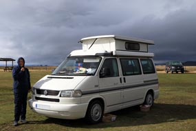 The Ring Road now began a long and sustained
steep, grinding ascent from the upper valley floor, gaining much
height up onto the barren and desolate tundra wastelands of Jökuldalsheiði.
Partway across these bleak and lonely highland moors, the altimeter showed a
height of 546m. The road dropped to the junction where Route 85 turned off
northwards down to Vopnafjörður on the NE coast. Continuing ahead, further
height gain brought the Ring Road back up to 575m to cross the even more
desolate ash and scoria wasteland desert of Möðrudalsfjallgarður. This was
archetypal Icelandic desert lands recalled from our 1972 trip, the skyline dotted with
volcanic peaks, an utterly barren, desolate wasteland of featureless grey-brown
ash and volcanic debris. The road took us across this wilderness to another road
junction, where Route 901 branched off south across the equally barren and
dismal wasteland of Ódáðahraun which The Ring Road now began a long and sustained
steep, grinding ascent from the upper valley floor, gaining much
height up onto the barren and desolate tundra wastelands of Jökuldalsheiði.
Partway across these bleak and lonely highland moors, the altimeter showed a
height of 546m. The road dropped to the junction where Route 85 turned off
northwards down to Vopnafjörður on the NE coast. Continuing ahead, further
height gain brought the Ring Road back up to 575m to cross the even more
desolate ash and scoria wasteland desert of Möðrudalsfjallgarður. This was
archetypal Icelandic desert lands recalled from our 1972 trip, the skyline dotted with
volcanic peaks, an utterly barren, desolate wasteland of featureless grey-brown
ash and volcanic debris. The road took us across this wilderness to another road
junction, where Route 901 branched off south across the equally barren and
dismal wasteland of Ódáðahraun which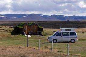 extended southwards into the highlands and
the 8km wide volcanic depression of the Askja crater. The road became black
lava-gravelled and brought us in 7kms to tonight's campsite at Fjalladýrð in
Möðrudalur highlands, a former farmstead now converted to tourist accommodation,
café and campsite. The farm is one of the highest in Iceland at 470m (1,572
feet), said to have been inhabited since the time of Icelandic settlement.
Today's drive
had been a far longer than anticipated and it was 5-30pm by the time we
reached Möðrudalur. extended southwards into the highlands and
the 8km wide volcanic depression of the Askja crater. The road became black
lava-gravelled and brought us in 7kms to tonight's campsite at Fjalladýrð in
Möðrudalur highlands, a former farmstead now converted to tourist accommodation,
café and campsite. The farm is one of the highest in Iceland at 470m (1,572
feet), said to have been inhabited since the time of Icelandic settlement.
Today's drive
had been a far longer than anticipated and it was 5-30pm by the time we
reached Möðrudalur.
Fjalladýrð in Möðrudalur highlands:
the café-reception was in a turf-walled and roofed building, and it was
clear at once that Fjalladýrð's stunning location on the high, exposed volcanic
plateau was being milked to the full: prices were ratcheted up to mercenarily
high levels, the young staff were
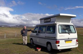 too busy serving flocks of American tourists
to give other than perfunctory welcome, and the facilities were primitive and limited to one WC and a cold water sink. In driving rain and
enervating northerly wind blasting across the plateau, we struggled to pitch the
camper to get into
warmth and cover and pile on extra layers of clothing against the most numbing
cold recalled in a long time. The wind simply got stronger, buffeting the camper
with no shelter to protect us. In such challenging conditions, on such a wild
evening, in such an exposed location, we were thankful for the heater and a
warming supper. too busy serving flocks of American tourists
to give other than perfunctory welcome, and the facilities were primitive and limited to one WC and a cold water sink. In driving rain and
enervating northerly wind blasting across the plateau, we struggled to pitch the
camper to get into
warmth and cover and pile on extra layers of clothing against the most numbing
cold recalled in a long time. The wind simply got stronger, buffeting the camper
with no shelter to protect us. In such challenging conditions, on such a wild
evening, in such an exposed location, we were thankful for the heater and a
warming supper.
A day in camp at Möðrudalur:
overnight the rain stopped and wind eased, shifting around to the east; with the
sky still inky black, first job was
to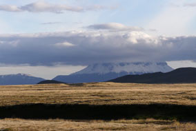 turn the camper into the wind (see above left) (Photo
28 - Fjalladýrð Camping in Möðrudalur). In the more settled weather this
morning, we were able to consider the magnificent highland plateau landscape of Möðrudalur
(see above right). After breakfast however, exploration of the
campsite confirmed its woeful lack of facilities despite the prices being
charged; showers were an additional cost and involved a 500m walk. Limited range wi-fi in the café-reception enabled us to consult the ever-reliable
yr.no weather forecast,
which disappointingly showed strong winds and rain continuing for the next week.
As we were preparing lunch, the camper's sliding door mechanism jammed,
preventing it from closing; we had a major problem. In desperation, we found the
number for the VW agent in the northern city of Akureyri and phoned for advice. As always, the
response was reassuringly
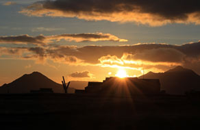 helpful: lubrication with ever-faithful WD40 released the locking
mechanism, and to our relief the door closed normally. We could resume our day's
work, and consider a modified schedule in the light of the adverse weather
forecast. Mid-afternoon today's improvement in weather continued, and the sun
began to break through a clearing sky, revealing a dramatic landscape and skyline
of distant volcanic peaks
(Photo
29 - Highland landscape at Möðrudalur) (see above left). As the cloud cleared to the south-west, we could now
make out a large, snow-covered distant crater; we initially took this to be Askja,
but a map and compass bearing showed clearly this was the closer 1,682m
volcanic peak of Herðubreið (Photo
30 - Snow-covered volcanic peak of Herðubreið) (see above right). The campsite was less crowded this evening, mainly
with tents making for far more congenial company; our immediate neighbours were
a French couple of cyclists from Lyons who, with impressive and speedy
efficiency, erected their tent in the face of the brisk and chilling wind. They
had cycled today from Egilsstaðir, an impressive performance having to make that enormous ascent up from Jökuldalur
onto the highland plateau. Later that evening, with the sky now clear and patchy
cloud gracing the NW horizon, the golden light of a
magnificent setting sun silhouetted the volcanic peaks (see left) (Photo
31 - Sunset silhouetting volcanic peaks). helpful: lubrication with ever-faithful WD40 released the locking
mechanism, and to our relief the door closed normally. We could resume our day's
work, and consider a modified schedule in the light of the adverse weather
forecast. Mid-afternoon today's improvement in weather continued, and the sun
began to break through a clearing sky, revealing a dramatic landscape and skyline
of distant volcanic peaks
(Photo
29 - Highland landscape at Möðrudalur) (see above left). As the cloud cleared to the south-west, we could now
make out a large, snow-covered distant crater; we initially took this to be Askja,
but a map and compass bearing showed clearly this was the closer 1,682m
volcanic peak of Herðubreið (Photo
30 - Snow-covered volcanic peak of Herðubreið) (see above right). The campsite was less crowded this evening, mainly
with tents making for far more congenial company; our immediate neighbours were
a French couple of cyclists from Lyons who, with impressive and speedy
efficiency, erected their tent in the face of the brisk and chilling wind. They
had cycled today from Egilsstaðir, an impressive performance having to make that enormous ascent up from Jökuldalur
onto the highland plateau. Later that evening, with the sky now clear and patchy
cloud gracing the NW horizon, the golden light of a
magnificent setting sun silhouetted the volcanic peaks (see left) (Photo
31 - Sunset silhouetting volcanic peaks).
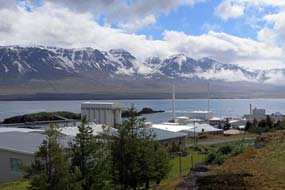 The north-east coast down to the fishing
port of Vopnafjörður:
low cloud and the return of the numbingly chill gale gusting across the highland
plateau meant an exhausting struggle packing to depart the following day. It
also confirmed our decision to postpone westward travel towards Dettifoss and
Mývatn, and instead head around to the more sheltered north-east coast and
the fishing port of Vopnafjörður in the hope of finding more settled weather.
It was a soullessly grey morning with the lava desert looking more dismal than
ever as we rejoined the Ring Road and turned back eastwards across Möðrudalsheiði
(click here for detailed map of route). At the junction with Route 85, we headed north-easterly across
the desolately empty Hauksstaðheiði moorland; there was no sign of any human
life, not even sheep to be seen. But Route 85 was tarmaced and well-surfaced with even The north-east coast down to the fishing
port of Vopnafjörður:
low cloud and the return of the numbingly chill gale gusting across the highland
plateau meant an exhausting struggle packing to depart the following day. It
also confirmed our decision to postpone westward travel towards Dettifoss and
Mývatn, and instead head around to the more sheltered north-east coast and
the fishing port of Vopnafjörður in the hope of finding more settled weather.
It was a soullessly grey morning with the lava desert looking more dismal than
ever as we rejoined the Ring Road and turned back eastwards across Möðrudalsheiði
(click here for detailed map of route). At the junction with Route 85, we headed north-easterly across
the desolately empty Hauksstaðheiði moorland; there was no sign of any human
life, not even sheep to be seen. But Route 85 was tarmaced and well-surfaced with even
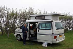 safety fencing along the edge of the exposed rocky Hofsá watercourse
that the road followed. As the road began to loose height, we paused to
telephone Vopnafjörður TIC and received a reassuring response that Vopnafjörður
Camping was open. As we lost further height, the lower valley showed more signs
of being farmed, with farmsteads spread along the valley side stocked with
winter hay bales and sheep grazing the home pastures. Route 85 had clearly been
re-engineered taking a direct route into the lower Vesturá valley towards an
inlet of Vopnafjörður, with the fishing port visible in the distance. Reaching
the road junction just above the town overlooking the main fjord, we turned into Vopnafjörður.
The 2 parallel streets of the township nestled along the narrow peninsula of Kolbeinstangi, in this sheltered but isolated setting at the head of the fjord,
backed on the eastern side by the snow-covered whaleback heights of Smjörfjöll.
The 3 rivers flowing down the lonely valley inland from the town that we had just driven down offer some of Iceland's best salmon fishing, the exclusive
preserve of the wealthy safety fencing along the edge of the exposed rocky Hofsá watercourse
that the road followed. As the road began to loose height, we paused to
telephone Vopnafjörður TIC and received a reassuring response that Vopnafjörður
Camping was open. As we lost further height, the lower valley showed more signs
of being farmed, with farmsteads spread along the valley side stocked with
winter hay bales and sheep grazing the home pastures. Route 85 had clearly been
re-engineered taking a direct route into the lower Vesturá valley towards an
inlet of Vopnafjörður, with the fishing port visible in the distance. Reaching
the road junction just above the town overlooking the main fjord, we turned into Vopnafjörður.
The 2 parallel streets of the township nestled along the narrow peninsula of Kolbeinstangi, in this sheltered but isolated setting at the head of the fjord,
backed on the eastern side by the snow-covered whaleback heights of Smjörfjöll.
The 3 rivers flowing down the lonely valley inland from the town that we had just driven down offer some of Iceland's best salmon fishing, the exclusive
preserve of the wealthy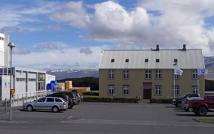 establishment and nouveaux riches. Farming along this
hinterland valley dates back to Settlement times, whose inter-clan bloody
feuding features in the Vopnfirðinga Saga. 'Weapon Fjord', the literal meaning of Vopnafjörður,
was originally settled in the 9th century by Eyvindur the Well-Armed who laid
claim to the fjord and valley. The modern fishing port of Vopnafjörður is a town
of some 500 inhabitants, the main industries being fishing, fish processing and
farming. establishment and nouveaux riches. Farming along this
hinterland valley dates back to Settlement times, whose inter-clan bloody
feuding features in the Vopnfirðinga Saga. 'Weapon Fjord', the literal meaning of Vopnafjörður,
was originally settled in the 9th century by Eyvindur the Well-Armed who laid
claim to the fjord and valley. The modern fishing port of Vopnafjörður is a town
of some 500 inhabitants, the main industries being fishing, fish processing and
farming.
Vopnafjörður Camping:
we made our way down into the heart of the town at the quay-side Kaupangur, an
ochre-painted wooden former customs-house that now serves as a café-cum-Tourist
Information
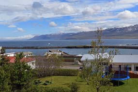 (see right). We were welcomed by
the lady at the café, whom we
had phoned earlier. She gave us further details of the campsite up the hill at Miðbraut; we should make ourselves at home and her husband would call round
later for payment. Having bought cod fillets for supper (frozen in the local
fish processing factory, we were assured) from the well-stocked supermarket next
door, we made our way to the upper part of the town to find the campsite. (see right). We were welcomed by
the lady at the café, whom we
had phoned earlier. She gave us further details of the campsite up the hill at Miðbraut; we should make ourselves at home and her husband would call round
later for payment. Having bought cod fillets for supper (frozen in the local
fish processing factory, we were assured) from the well-stocked supermarket next
door, we made our way to the upper part of the town to find the campsite.
Vopnafjörður's bijou little campsite, run by
the community association, was in a delightful setting, tucked away on flat,
grassy terraces overlooking the harbour and fjord, with the snow-covered
mountain ridge of Smjörfjöll dominating the eastern skyline on the far side of
the fjord (Photo
32 - Vopnafjörður fishing port) (see above right and left). Although in a lofty position above the town, rocky terraces and
hedges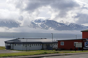 provided much-needed shelter at the campsite from the bitterly chill
north-easterly wind blowing from across the fjord. In stark contrast with the
over-hyped, over-priced and pretentious Möðrudalur Camping with its shamefully
minimal facilities, Vopnafjörður Camping was reasonably priced and well-provided
with heated WC/showers and wash-up sinks with hot water; this modestly
unassuming and welcoming little community's campsite immediately commended
itself. We settled in on the lower terrace, sheltering behind the screen of
hedges (see above left). Thankfully the wind was not blowing as punishingly as up in the
highlands, but the weather remained dispiritingly overcast and miserably wet; we
hoped for an improvement tomorrow to explore this isolated little town and find
out more about life in Vopnafjörður. And that evening the locally caught cod
which we cooked for supper was the tastiest fish we had ever eaten. provided much-needed shelter at the campsite from the bitterly chill
north-easterly wind blowing from across the fjord. In stark contrast with the
over-hyped, over-priced and pretentious Möðrudalur Camping with its shamefully
minimal facilities, Vopnafjörður Camping was reasonably priced and well-provided
with heated WC/showers and wash-up sinks with hot water; this modestly
unassuming and welcoming little community's campsite immediately commended
itself. We settled in on the lower terrace, sheltering behind the screen of
hedges (see above left). Thankfully the wind was not blowing as punishingly as up in the
highlands, but the weather remained dispiritingly overcast and miserably wet; we
hoped for an improvement tomorrow to explore this isolated little town and find
out more about life in Vopnafjörður. And that evening the locally caught cod
which we cooked for supper was the tastiest fish we had ever eaten.
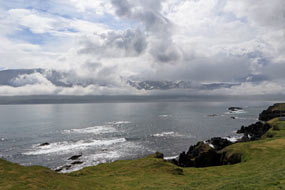 The Icelandic Museum of Emigration at Vopnafjörður:
after a wet and blustery night, the weather was little improved this
morning, and after an early lunch we kitted up fully against the misty rain to
walk down into the town, past the school, kindergarten, sports hall and Lögreglan (police station) to the
Kaupangur café. This also houses the Museum of Emigration
which documents the huge numbers of émigrés who sailed from Vopnafjörður, forced
to seek a new life in Canada and USA by poverty and starvation caused by the 1875
volcanic eruption of Viti
on Askja which had sterilised vast tracts of farmland in NE Iceland. Kaupangur
had been the customs house through which many of the emigrants passed, and we were
introduced to the museum's Canadian-Icelandic curator who researches the family
origins of descendents of the original émigrés. A chart in the museum showed lists of
the farms all across The Icelandic Museum of Emigration at Vopnafjörður:
after a wet and blustery night, the weather was little improved this
morning, and after an early lunch we kitted up fully against the misty rain to
walk down into the town, past the school, kindergarten, sports hall and Lögreglan (police station) to the
Kaupangur café. This also houses the Museum of Emigration
which documents the huge numbers of émigrés who sailed from Vopnafjörður, forced
to seek a new life in Canada and USA by poverty and starvation caused by the 1875
volcanic eruption of Viti
on Askja which had sterilised vast tracts of farmland in NE Iceland. Kaupangur
had been the customs house through which many of the emigrants passed, and we were
introduced to the museum's Canadian-Icelandic curator who researches the family
origins of descendents of the original émigrés. A chart in the museum showed lists of
the farms all across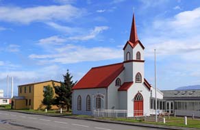 eastern Iceland which the emigrants were compelled to
leave, and the numbers departing each year with 1893 having the highest levels;
some 25% of the the entire Icelandic population emigrated between 1875 and 1914.
We were given movingly graphic details of the social, economic and climactic
hardships faced by families during the years following the 1875 Viti eruption,
and learned of the impoverishment, infantile/childhood mortality rates, and the
socio-economic restrictions on marriage causing much fostering of children. Financial incentives
were given by the Danish government (which then ruled Iceland)
to encourage migration of dependent families, and plots of land proffered by the Canadian government, promoting immigration schemes to
attract labour and new settlers from those facing hardships in Iceland, to
populate new regions of the Dominion. Land agents painted a falsely encouraging
picture of life in the new country. In fact however the eastern Iceland which the emigrants were compelled to
leave, and the numbers departing each year with 1893 having the highest levels;
some 25% of the the entire Icelandic population emigrated between 1875 and 1914.
We were given movingly graphic details of the social, economic and climactic
hardships faced by families during the years following the 1875 Viti eruption,
and learned of the impoverishment, infantile/childhood mortality rates, and the
socio-economic restrictions on marriage causing much fostering of children. Financial incentives
were given by the Danish government (which then ruled Iceland)
to encourage migration of dependent families, and plots of land proffered by the Canadian government, promoting immigration schemes to
attract labour and new settlers from those facing hardships in Iceland, to
populate new regions of the Dominion. Land agents painted a falsely encouraging
picture of life in the new country. In fact however the
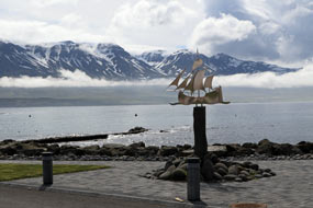 emigrants faced undue hardships attempting to escape the
hopelessness of life in Iceland: a sea voyage initially to Scotland to await
onward passage, followed by further hardships in establishing a new
life in Canada, and founding Icelandic communities mainly in Nova Scotia and Manitoba.
The plots of forested land assigned needed clearing and were unsuitable for
sheep farming with which the émigrés were skilled, with the result that many sold up their land plots to
move on to seek better conditions across the US border in North Dakota and
Minnesota. It was a grievously moving story of impoverishment, famine and
hopelessness in Iceland, and false hopes of a new and better life after the
hardships and desperation of emigration and attempts at resettlement. Again we
had learned much about a period of history of which we had known nothing. emigrants faced undue hardships attempting to escape the
hopelessness of life in Iceland: a sea voyage initially to Scotland to await
onward passage, followed by further hardships in establishing a new
life in Canada, and founding Icelandic communities mainly in Nova Scotia and Manitoba.
The plots of forested land assigned needed clearing and were unsuitable for
sheep farming with which the émigrés were skilled, with the result that many sold up their land plots to
move on to seek better conditions across the US border in North Dakota and
Minnesota. It was a grievously moving story of impoverishment, famine and
hopelessness in Iceland, and false hopes of a new and better life after the
hardships and desperation of emigration and attempts at resettlement. Again we
had learned much about a period of history of which we had known nothing.
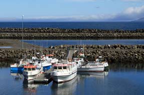 A wet day in Vopnafjörður: the Kaupangur
café also served as something of a social centre for the town, and here we learned more about Vopnafjörður as a community. In
addition to the farms up the valley behind the town, the main employer was HB
Grandi who operates the modern fish processing factory which produces fish meal
and frozen fish. The town's fleet of a dozen deep water ocean-going fishing
boats which supplied the fish factory was away at sea for week-long stretches;
this explained why the large harbour stood empty at present.
Along with service industries like the school and Commune, the other large
employer was the sláturhús (slaughterhouse) operated by a farming
cooperative for butchering sheep and cattle, the only remaining slaughterhouse
in East Iceland. At the café, we discussed fish quotas which controlled the length of time
fishing A wet day in Vopnafjörður: the Kaupangur
café also served as something of a social centre for the town, and here we learned more about Vopnafjörður as a community. In
addition to the farms up the valley behind the town, the main employer was HB
Grandi who operates the modern fish processing factory which produces fish meal
and frozen fish. The town's fleet of a dozen deep water ocean-going fishing
boats which supplied the fish factory was away at sea for week-long stretches;
this explained why the large harbour stood empty at present.
Along with service industries like the school and Commune, the other large
employer was the sláturhús (slaughterhouse) operated by a farming
cooperative for butchering sheep and cattle, the only remaining slaughterhouse
in East Iceland. At the café, we discussed fish quotas which controlled the length of time
fishing
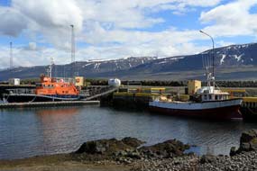 boats could be at sea, and the controversial issue of large combines
buying up quotas from smaller operators. boats could be at sea, and the controversial issue of large combines
buying up quotas from smaller operators.
In miserably wet weather, we continued along
Kolbeinsgata, its name taken from Kolbeinstangi the rocky spit of land on which
the town stands, past the trim little white church and modern health centre
(see above right) along to the filling station cum fish and chip café. But the misty weather was
so wretched that we turned back and used the wi-fi at Kaupangur to check the
forecast; thankfully the weekend weather looked more promising. Before doing our
shopping at the Kauptún supermarket, we walked along Hlíðarvegur to investigate
the fish factory hoping to buy some more fish directly at source. But of course
this was industrial scale working with no retail sales, and having stocked up at
the supermarket, we returned up to the campsite to get out of the rain and brew
tea.
The rain had cleared and cloud beginning to
lift the following morning, revealing the full scale of Smjörfjöll across the
fjord in all its snow-covered glory (see above left). Before leaving Vopnafjörður, we drove down
into the town to take photos in the brighter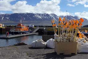 weather. By the little central square outside the supermarket and Kaupangur
café, a monument stood by the water's edge commemorating local sailors lost at
sea (see above left) (Photo
33 - Lost sailors' Memorial). Along at the fishing harbour the town's deep-water fishing fleet was
still out at sea, but a few smaller boats were moored in the harbour (see above
right)
(Photo
34 - Vopnafjörður fishing harbour) along with the local rescue boat (see
above left)
(Photo
35 - Rescue boat). On such a bright morning, the fishing
harbour was such a peaceful setting against the mountainous backdrop (see right) (Photo
36 - Mountainous backdrop).
We had been impressed by all we had learned today about this
self-sufficient and close-knit, isolated little fishing and farming community of Vopnafjörður
(see
Vopnafjörður's official web site).
Despite the tough life here in the fishing port of Vopnafjörður, there was a noticeable sense of community
atmosphere, embodied in the cooperative movement and community enterprises like the kindergarten and
campsite. We had been made to feel welcome by those we had met in this
unassuming but enterprising township which had worked hard successfully to
attract employment opportunities to the town and retained its senior school,
both of which helped to prevent its youngsters from leaving. Despite the miserable weather, we had felt fully at
home here in this isolated community; Vopnafjörður had truly endeared
itself to us.
We now move on around the north-east coast to the even more remote fishing villages of Þórshöfn,
Raufarhöfn, and Kópasker, enjoy a couple of days walking at
Ásbyrgi in the thrilling Jökulsárgljúfur National Park, go whale-watching at the
northern port of Húsavik, and visit the
sensational Dettifoss waterfalls in the northern volcanic wildlands. More of
that in our next edition.
Next edition
from Iceland to be published shortly
|
Sheila and Paul |
Published: 28 October
2017 |
|

 CAMPING
IN ICELAND 2017 - Seyðisfjörður, Egilsstaðir,
Fljótsdalur valley and Hengifoss, Borgarfjörður Eystri, Möðrudalur
in the highlands, and Vopnafjörður on NE coast:
 up the narrow fjord
towards the eastern port of Seyðisfjörður. The ferry docked at 10-00am Icelandic
time/GMT, with the low cloud just lifting to give a magnificent panorama of the
wooden houses and blue-painted church of the tiny port nestled around the head
of the fjord and watercourses tumbling down the layered basalt strata of the
enclosing mountains (see left).
 indicating our arrival date. We were here a last, and after a pause to
get our bearings and photos of Norröna over-towering the dock (see left) (
 the weekly ferry, is spread around the head of the
narrow fjord. It was founded by a Norwegian fishing company in 1895 and
flourished as a major herring port until the herring disappeared 50 years
later. The wooden buildings were transported in prefabricated form from Norway
and reassembled here before the winter snows
 cut off the town. As a result, all
the houses, warehouses and church look spick and span, set against the surrounding background of high mountains on both sides of the fjord, all still
snow-covered at this early stage of the year (see right). But this morning the air was
beginning to gain a Spring warmth, and the new leaves of birches around the
campsite were just bursting, filling the air with a fresh herbal smell; it was a
beautifully peaceful morning.
  basalt escarpments from a high corrie, dropping to the
fjord by Seyðisfjörður's little fishing harbour. We followed a footpath up the
fell-side alongside the stream to the foot of the lower falls (see left); from here there
was a glorious view looking over the village
and ferry moored by the fishing harbour (see right); as the cloud lifted further, more
of the enclosing mountains came into view. Back along through the village to the
campsite, we moved George closer to the facilities hut to get a better wi-fi
signal. The weather improved further and cloud cleared the tops revealing fully
the scale of the mountains enclosing the valley (
 With the scent of new leaf on
the birches and warm Spring air, it was a magnificent afternoon. Daylight lasted
late into the evening, and many more vans arrived filling the campsite, most of them poorly-equipped hired
campers. We turned in for our first night in Iceland, but
this arrival late into the evening of tourists 'doing the Ring Road in a week',
with much noise and inconsiderate slamming of van doors, was to become an all
too familiar and irritating feature of our travels around Iceland.
 for breakfast (
 morning we learned from the campsite warden (a local Icelander from Seyðisfjörður who had married an English girl and spoke his English with a Notts
accent) why we had failed to recognise any of the village's buildings: other
than the ferry sequences, Trapped had been filmed not in Seyðisfjörður
(there had been insufficient snow that winter) but in the northern Icelandic
port of Siglufjörður. On such a beautiful Spring morning, the sun shining through
the birches lit Seyðisfjörður church (
 Over the mountains to Egilsstaðir: the moment we left Seyðisfjörður
(
 frozen tarns with minimal side verges making it
difficult to pull over. From the cosily warm and sunny atmosphere down at the
fjord-side at Seyðisfjörður, suddenly we were in a alien and inhospitable snowy
wilderness, crossing the broad watershed plateau at an altitude of 587m (1,925
feet) (see left). Beginning the inland descent, the road lost height rapidly via a hair-pin
and sweeping bends, leaving behind the snow as the terrain became greener.
Spread out below was the verdant panorama of the Fljótsdalur valley and
Largarfljót river which swelled out into the elongated lake alongside the
township of Egilsstaðir. As we descended towards the town, we passed the first
of the stunted birches, but this landscape had none of the comfortable
familiarity of Seyðisfjörður's fjordland mountains; despite the green
surroundings, this felt to be a dreary and relatively featureless environment,
especially as we suddenly reached Egilsstaðir's outskirts of ticky-tacky
box-like houses.
 The township of Egilsstaðir:
the township of Egilsstaðir has no history to speak of: it was conceived in the
post newly independent Iceland days of 1944, as a new town to encourage
development of the remote and empty eastern region of the country around the
expanding Ring Road. The town was founded in 1947 near to where Route 1 bridged
the Largarfljót river, and named Egilsstaðir to give it apparent Saga Age
credentials. Nowadays it is nothing more than a service centre half-way around
the Ring Road where ferry-borne passengers arrive from continental Europe. Egilsstaðir serves as a place to stock up with provisions and fuel before
setting off to explore Iceland. And this was our only reason for stopping off
here. We found the Bonus supermarket which we assumed would be better stocked
than the Netto. Between the 2 supermarkets, and struggling to translate names of Icelandic
foodstuffs, we eventually garnered enough for 4 suppers, but at what
seemed astronomical prices. By now it was 3-30pm and it seemed best to camp here
at Egilsstaðir tonight before moving inland to the Fljótsdalur valley tomorrow.
  the facilities were open and
looked reasonable. We settled into a pitch along at the far end in a quiet
corner looking out to a low, craggy and birch-covered escarpment lining the
valley. The campsite gradually filled, mainly with small hire-campers or
back-packers and cyclists in tents. After the warm sun of this morning, tonight
was heavily overcast with a chill wind blowing from the north.
 and a major source of hazard especially with speeding
tourists. The valley had been lightly wooded with birch up to this point, and part-way along we reached the protected area of the Hallormsstaður Forest, the remnants of the natural birch woods which
pre-Settlement once covered Iceland. This surviving area of natural woodland was
protected in 1905 as Iceland's first National Forest
and further planted with conifers. The mainly birch natural woodland covering an
area of 740 hectares, now includes larch, spruce and pines, and has a number
of way-marked forest trails. Our plan for this afternoon was to walk one of
these Hallormsstaður Forest paths above the Hafursá stream, detailed as Route 16-1 in the
 Forest walks
in
Hallormsstaður:
following the yellow way-mark posts, we began the gradual ascent through the
forest (see above right) and after a short distance diverted towards the Hafursá lower gorge. To
our surprised delight, the grassy banks here were covered with Bearberry,
exactly as we had seen in Spring time in SE Finland. This unexpected discovery
soon had us down on hands and knees photographing these elegantly white,
pink-fringed lantern-shaped flowers (
 their Spring
leaves fresh green and tiny pink flowers newly formed (see right). A
further 800m and we reached a sign Útsýnisstaður pointing up a side path
to viewpoints on a rocky spur overlooking the Hafursá's upper gorge with the Largarfljót
Lake spreading along the broad Fljótsdalur valley floor below us (
 heath-land, and seen regularly by us during the early~mid summer all around the
country. The low-pitched buzzing, warbling sound was made by their spread of
tail feathers as they soared and dived above us in their display flights (see
right). Reaching the walk's half-way point, the path turned downwards among
Larch plantations onto a broader forestry track, steeply down through the forest
towards the road and finally over a knoll back down to the start point. The walk
had only been 3 kms but the woodland had more mature trees and floral gems than
we should probably see in the rest of Iceland.
 the turning up to the controversial Kárahnjúkar
Dam which was constructed in 2009 flooding an immense area of wilderness
highlands below the Vatnajökull ice-field. This brought us
to tonight's campsite at Fljótsdalsgrund Farm. The flat glacial valley, 1km wide
at this point, was clearly fertile pastoral terrain with broad, grassy meadows
spread across the valley floor grazed by horses and cattle. We had yesterday
phoned the owner Helga Vigfúsdóttir, who with her husband farms Fljótsdalsgrund,
to confirm the campsite was open; the welcoming response was to settle in when
we arrived and Helga would be round later. We had this magnificent campsite to
ourselves and selected a pitch on the lush grassy camping area as Helga arrived
in her pick-up. The facilities hut not only had homely WC/shower and fully
equipped kitchen/wash-up, but also site-wide wi-fi with full strength signal and
washing/drying machines to do our laundry on tomorrow's day in camp.
 We woke to a gloriously sunny morning and
breakfasted outside in this magnificent setting (see above left and right); the
multi-layered basalt strata rose
in tiers on the cliffs of the valley-side behind us, with the lower hills extending
along the far side of the broad, flat valley floor still streaked with residual
snow. Snipes soared and dived above us with the low-pitched whirring of their
tail feathers in display flight, and Redwings pecked in the grass around us. The
sun was warm and the air sensuously scented with the
 fresh smell of grass and the birch trees' new leaf, and filled with bird song (
 A spectacular climb to Hengifoss waterfall: after a night of rain,
we woke to breaking cloud and clearing sky with warm sunshine again. It was
going to be another fine day for our climb up to Hengifoss waterfall. Along the
valley past the farms, we pulled into the parking area at the foot of the
Hengifoss path; the number of tourist hire cars already here showed we should
not have the fells to ourselves today. The sun was warm as we set off up the
initially steep slope. The path levelled out onto
 meadowland and here to our
surprise we found a wealth of wild flora: large clumps of Mountain Avens in full
bloom on the south-facing slope (see left), cushions of pink Moss Campion, tiny Butterwort,
scattered plants of Alpine Mouse Ear with their veined white flowers and
grey-green hairy leaves, and more of the purple flowered Alpine Bartsia. We
inevitably spent longer than planned photographing them, as the tourists hurried
past totally indifferent to these floral delights spread out before them on this
sunny slope.
 The columns were both vertical and horizontal on the nearer
side, but on the far side were inclined at a curving angle, reflecting the
pattern of the lava intrusion that had solidified to form the basalt, so that their
massed hexagonal upper surfaces were revealed on the exposed upper face. Here before our eyes was a text book geology lesson showing basalt column formation
in cooling lava (see right): polygonal basalt columns, exposed here by the
erosive power of water carving out the deep gorge, were created by the
contraction and fracturing of rapidly cooling basaltic lava. Columns are formed
perpendicular to the lava's cooling surface, and are therefore vertical when formed by
a cooling horizontal lava flow (see diagram left); where the lava intrusion flowed into a vertical
crack in the bed rock, cooling surfaces produced horizontal columns. Here at Litlanesfoss, the advancing lava had filled a stream bed, cooling initially to
form vertical columns; but the forward moving lava flow distorted the developing
column formation, producing the curvature seen today on the exposed cliff face
of columns.
 further layers of lava flow. The distant
view from this point was spectacular, looking along the upper
valley with the main watercourse surging powerfully across the valley floor,
against a backdrop of Hengifoss dropping into the upper corrie and its enclosing basalt cliffs
with their distinctive red stripes clearly visible (
 of the deep, surging river flowing from the foot of the
falls. But even though further forward progress was barred by the impassable
torrent, the views from this end point of the path into the corrie across the
roaring torrent were truly awe-inspiring (see left and right) (
 above, and at this close range, the inter-basaltic iron-rich ash
and scoria striped layers were even more obvious (see right) (
 flowing down from the Vatnajökull ice-field, and
filling the 30km long, 112m deep Largarfljót lake. Although we were enjoying
bright afternoon sun as we made our descent, it was evident that a squally
shower was advancing up the valley, and we hurried back down to the parking
area before it reached us. Before returning for a final night at Fljótsdalsgrund,
we called in at the Snæfellsstofa Vatnajökull National Park Visitor Centre. Here
we learned more about the environmental impact caused by construction of the Kárahnjúkar
Dam. Not only had the reservoir flooded extensive tracts of wildness below the
Vatnajökull Glacier, formerly reindeer grazing lands, but also water which once
had drained naturally down the neighbouring Jökulsá á Bru valley was diverted down
underground pipelines to the generating station here in the Fljótsdal valley, now
out-flowing into the Jökulsá í fljótsdal river contaminating the Largarfljót
lake with increased silt from the greater rate of flow and
 adversely affecting
the lake's natural vegetation and fish.
Although generating huge quantities of
hydro-electricity, the dam's construction
made no contribution to Iceland's
domestic power supplies since it was all consumed by the
massive aluminium
smelter at Reyðarfjörður. The aluminium plant brought little additional
employment opportunities for native Icelanders since the majority of jobs
were taken by Polish and East European migrant labour. We learned much at Snæfellsstofa about the controversial dam construction project which we should
see on our return to Fljótsdalur in the final days of the trip; see more on
 Return to Egilsstaðir and
drive out to Borgarfjörður Eystri on the NE coast: as we drove back along the valley the
following morning, near to one of the farms we saw a few of the wild reindeer
that still live in East Iceland (see right). They were introduced from Norway in
the late 18th century originally for farming, but reindeer husbandry never
became established. A few still survive in the wilds of East Iceland mostly at higher altitudes in summer but migrate
to lower pastures closer to the coast in winter (
 Eystri
on the remote NE coast (
 power of the lower Largarfljót
river rapids. Below the power plant, we ventured across rocky ground to
photograph these extraordinarily powerful rapids; their turbulence sent flailing
clouds of spray high above the surging river, filling the air with its roar
(
 formed by the combined outflows of the Jökulsá
á Bru and Largarfljót
river mouths into Héraðsflói bay. The road turned across the grassy flatlands of
the broad coastal plains which were dotted with many lakes. Ahead the
snow-covered mountains, which earlier had lined the distant eastern horizon, now
loomed closer seeming to form an impenetrable barrier to further progress. How
on earth was the road to get over this obstacle? Across the bridge over the Selfljót
river which drained the mountains' western slopes, the tarmac ended again, just
at the worst possible point where the road began its slanting ascent of the
mountain slope. The bare, rough unsurfaced road climbed steeply, veering around 2
hair-pins and finally reaching a pull-off just before the watershed. We pulled
over despite the misty cloud to look down the hair-pins we had just climbed over
the panoramic vista across Héraðssandur, with the distant outflow of the 2
mighty rivers into Héraðsflói bay, the broad coastal plain, and white line of
surf along the dark strip of glacial sand and gravel (see above left).
 glacial sandur (see above right). We now
faced the final challenge of this hair-raising route, with the road clinging
precariously to the fractured, unstable cliffs and winding around the murky
headlands. The dangerously loose cliffs, covered with rock debris, were said to
have been the domain of a malevolent demon called Naddi who was pushed into the
sea by a 14th century settler; the damaged state of the road and rock-fall
debris supports the legend that this evil presence still stalks the cliff-face.
A protective road-side cross with the inscription Effigiem Christi qui
transis pronus honora - anno MCCCVI (Honour the image of Christ, you who
hurry past - 1306) gave little comfort; putting more faith
in the cliff-top safety fencing, we did indeed hurry past, eyeing nervously the
broken road and fractured rock slopes above. Thankfully around this last hurdle,
we re-joined tarmac for the final stretch along the wild shore-line, with mighty
breakers crashing onto the rocks. Our goal, the fishing settlement of Borgarfjörður Eystri
was now visible in the murky, misty distance against the backdrop of mountainous
coastline (see left).
 expensive, but the setting was magnificently peaceful overlooking the village
and bay (see above right) (
 consideration for this
small community typical of modern mass tourism; such was their insensitive
arrogance that we actually saw them wandering indifferently through people's
gardens. Is it surprising that we regard such behaviour so grossly offensive,
and mass tourism the ultimate pollutant. From the campsite, we walked along the
sea-shore to the village's old harbour, watching Eider Ducks 'oo-ooing' in the
shallows (see left) and Ring-Plovers scampering along the black sand (
 shelter here, the boats had to be drawn up onto the beach for protection
against winter storms. Then in the 1940s, a new harbour was created 5kms around
the bay at Höfn as a sheltered mooring for the fishing boas operating in the
local waters of Borgarfjörður. After shopping in the village stores, we treated
ourselves to a fish soup lunch at the Álfa Café, delicious but unaffordably
expensive!
  location Borgarfjörður
Eystri occupied. On the way back down to the campsite, we stumbled upon another
floral gem: a low cushion of tiny white globular flowers capped with a
distinctive red sepal cross, which Sheila identified as Cassiope (see left)
(
 The Puffin colony at
Hafnarhólmi: leaving the
village, we drove around the flat lands of the inner fjord bay where Eiders swam
in the shallows and a colony of Arctic Terns nested on the sand banks. Over a
headland, the lane dropped down to its end at Borgarfjörður Höfn, the village's
harbour artificially created by blocking off one side of the channel between the
off-shore islet of Hafnarhólmi with a huge sea-wall (see right). Across the
sea-wall wooden steps led up onto a viewing platform on the islet. The tiny
islet with its low cliffs and tufted turf top is a breeding ground for colonies
of Kittiwakes, Fulmars and Puffins. Although still only 3-30pm and the Puffins
would not be expected to return to their nest burrows until late afternoon after
fishing all day out at sea, we walked over for an exploratory foray.
 Kittiwakes arrive in March~April
to breed and depart in
September to over-winter east of Newfoundland. Puffins arrive in early April,
and after a winter-long separation, the breeding pairs re-unite at their nesting
burrows in the turf on Hafnarhólmi islet's upper slopes. Single eggs are laid in
the burrow mid-May, and one of the adult Puffins remains incubating the egg in
the burrow-nest while the other adult flies out to sea fishing. The Puffin chicks hatch at the turn of June~July.
The adult birds bring
 back beakfuls
of sand eels garnered on their fishing trips, and can be seen standing by their
burrows early evening. The Puffins depart from the islet early August to over-winter at sea.
 When their striped, colourful beaks gaped, the orange rosette at the base
of the bill enabling the beak to open wider for gripping fish could clearly be
seen. As the late afternoon progressed, increasing numbers of Puffins appeared
back on the islet's top and slopes, and the sunlight became brighter giving good
illumination for our photos
 (
( warily up and around the
crumbling, unstable cliffs to the high point passing the way-side cross (see
left). The gravel road descended to the sandur by Borg where the Selfljót river
flowed out into the sea, and began the long haul up the valley. Re-joining
tarmac, we gained height up towards the pass; the road became gravel again,
reaching the cloud layer as we ascended the hair-pins in minimal
 visibility. Fortunately meeting no descending traffic, we reached the high point
of the pass safely, unable to see far ahead in the misty cloud, and began the
winding descent down to Héraðssandur. Across the broad, flat valley bottom, we
re-joined tarmac for the drive along the lower Largarfljót valley. Shortly
after, the tarmac gave way to unsurfaced gravel again. This slowed our progress,
but all was well to begin with. Then however we reached a section of scraped
road, where the gravel was heaped in the middle of the road and the edges rutted
and rougher than ever. Shortly further and we caught up with the scraping machine, where not only was the
surface rough but water-sprayed and salted, leaving just a slurried mess to
drive through. A pause at Eiðar confirmed our fears: despite taking it slowly,
George was totally filthy from the splashed-up slurry. Reaching Egilsstaðir, we
pulled into a filling station which fortunately was equipped with hose-brushes;
clearly this was a regular feature at Icelandic garages, much needed for vehicle
cleaning with all the filth of gravelled roads after rain. A session with the
hose-brush and George was gleaming white again (see above right). Down in the
town, we re-stocked with provisions for the coming days up in the remote
highlands; Egilsstaðir was useful as a service-centre if nothing more.
 The Ring-Road westwards along the Jökuldalur
valley and up into highlands: we finally crossed
the wide Largarfljót river and in gloomy weather
 headed northwards on the Ring-Road over high,
featureless tundra moorland (
 The Ring Road now began a long and sustained
steep, grinding ascent from the upper valley floor, gaining much
height up onto the barren and desolate tundra wastelands of Jökuldalsheiði.
Partway across these bleak and lonely highland moors, the altimeter showed a
height of 546m. The road dropped to the junction where Route 85 turned off
northwards down to Vopnafjörður on the NE coast. Continuing ahead, further
height gain brought the Ring Road back up to 575m to cross the even more
desolate ash and scoria wasteland desert of Möðrudalsfjallgarður. This was
archetypal Icelandic desert lands recalled from our 1972 trip, the skyline dotted with
volcanic peaks, an utterly barren, desolate wasteland of featureless grey-brown
ash and volcanic debris. The road took us across this wilderness to another road
junction, where Route 901 branched off south across the equally barren and
dismal wasteland of Ódáðahraun which
 extended southwards into the highlands and
the 8km wide volcanic depression of the Askja crater. The road became black
lava-gravelled and brought us in 7kms to tonight's campsite at Fjalladýrð in
Möðrudalur highlands, a former farmstead now converted to tourist accommodation,
café and campsite. The farm is one of the highest in Iceland at 470m (1,572
feet), said to have been inhabited since the time of Icelandic settlement.
Today's drive
had been a far longer than anticipated and it was 5-30pm by the time we
reached Möðrudalur.
 too busy serving flocks of American tourists
to give other than perfunctory welcome, and the facilities were primitive and limited to one WC and a cold water sink. In driving rain and
enervating northerly wind blasting across the plateau, we struggled to pitch the
camper to get into
warmth and cover and pile on extra layers of clothing against the most numbing
cold recalled in a long time. The wind simply got stronger, buffeting the camper
with no shelter to protect us. In such challenging conditions, on such a wild
evening, in such an exposed location, we were thankful for the heater and a
warming supper.
 turn the camper into the wind (see above left) (
 helpful: lubrication with ever-faithful WD40 released the locking
mechanism, and to our relief the door closed normally. We could resume our day's
work, and consider a modified schedule in the light of the adverse weather
forecast. Mid-afternoon today's improvement in weather continued, and the sun
began to break through a clearing sky, revealing a dramatic landscape and skyline
of distant volcanic peaks
(
 The north-east coast down to the fishing
port of Vopnafjörður:
low cloud and the return of the numbingly chill gale gusting across the highland
plateau meant an exhausting struggle packing to depart the following day. It
also confirmed our decision to postpone westward travel towards Dettifoss and
Mývatn, and instead head around to the more sheltered north-east coast and
the fishing port of Vopnafjörður in the hope of finding more settled weather.
It was a soullessly grey morning with the lava desert looking more dismal than
ever as we rejoined the Ring Road and turned back eastwards across Möðrudalsheiði
(
 safety fencing along the edge of the exposed rocky Hofsá watercourse
that the road followed. As the road began to loose height, we paused to
telephone Vopnafjörður TIC and received a reassuring response that Vopnafjörður
Camping was open. As we lost further height, the lower valley showed more signs
of being farmed, with farmsteads spread along the valley side stocked with
winter hay bales and sheep grazing the home pastures. Route 85 had clearly been
re-engineered taking a direct route into the lower Vesturá valley towards an
inlet of Vopnafjörður, with the fishing port visible in the distance. Reaching
the road junction just above the town overlooking the main fjord, we turned into Vopnafjörður.
The 2 parallel streets of the township nestled along the narrow peninsula of Kolbeinstangi, in this sheltered but isolated setting at the head of the fjord,
backed on the eastern side by the snow-covered whaleback heights of Smjörfjöll.
The 3 rivers flowing down the lonely valley inland from the town that we had just driven down offer some of Iceland's best salmon fishing, the exclusive
preserve of the wealthy
 establishment and nouveaux riches. Farming along this
hinterland valley dates back to Settlement times, whose inter-clan bloody
feuding features in the Vopnfirðinga Saga. 'Weapon Fjord', the literal meaning of Vopnafjörður,
was originally settled in the 9th century by Eyvindur the Well-Armed who laid
claim to the fjord and valley. The modern fishing port of Vopnafjörður is a town
of some 500 inhabitants, the main industries being fishing, fish processing and
farming.
 (see right). We were welcomed by
the lady at the café, whom we
had phoned earlier. She gave us further details of the campsite up the hill at Miðbraut; we should make ourselves at home and her husband would call round
later for payment. Having bought cod fillets for supper (frozen in the local
fish processing factory, we were assured) from the well-stocked supermarket next
door, we made our way to the upper part of the town to find the campsite.
  provided much-needed shelter at the campsite from the bitterly chill
north-easterly wind blowing from across the fjord. In stark contrast with the
over-hyped, over-priced and pretentious Möðrudalur Camping with its shamefully
minimal facilities, Vopnafjörður Camping was reasonably priced and well-provided
with heated WC/showers and wash-up sinks with hot water; this modestly
unassuming and welcoming little community's campsite immediately commended
itself. We settled in on the lower terrace, sheltering behind the screen of
hedges (see above left). Thankfully the wind was not blowing as punishingly as up in the
highlands, but the weather remained dispiritingly overcast and miserably wet; we
hoped for an improvement tomorrow to explore this isolated little town and find
out more about life in Vopnafjörður. And that evening the locally caught cod
which we cooked for supper was the tastiest fish we had ever eaten.
 The Icelandic Museum of Emigration at Vopnafjörður:
after a wet and blustery night, the weather was little improved this
morning, and after an early lunch we kitted up fully against the misty rain to
walk down into the town, past the school, kindergarten, sports hall and Lögreglan (police station) to the
Kaupangur café. This also houses the Museum of Emigration
which documents the huge numbers of émigrés who sailed from Vopnafjörður, forced
to seek a new life in Canada and USA by poverty and starvation caused by the 1875
volcanic eruption of Viti
on Askja which had sterilised vast tracts of farmland in NE Iceland. Kaupangur
had been the customs house through which many of the emigrants passed, and we were
introduced to the museum's Canadian-Icelandic curator who researches the family
origins of descendents of the original émigrés. A chart in the museum showed lists of
the farms all across
 eastern Iceland which the emigrants were compelled to
leave, and the numbers departing each year with 1893 having the highest levels;
some 25% of the the entire Icelandic population emigrated between 1875 and 1914.
We were given movingly graphic details of the social, economic and climactic
hardships faced by families during the years following the 1875 Viti eruption,
and learned of the impoverishment, infantile/childhood mortality rates, and the
socio-economic restrictions on marriage causing much fostering of children. Financial incentives
were given by the Danish government (which then ruled Iceland)
to encourage migration of dependent families, and plots of land proffered by the Canadian government, promoting immigration schemes to
attract labour and new settlers from those facing hardships in Iceland, to
populate new regions of the Dominion. Land agents painted a falsely encouraging
picture of life in the new country. In fact however the
 emigrants faced undue hardships attempting to escape the
hopelessness of life in Iceland: a sea voyage initially to Scotland to await
onward passage, followed by further hardships in establishing a new
life in Canada, and founding Icelandic communities mainly in Nova Scotia and Manitoba.
The plots of forested land assigned needed clearing and were unsuitable for
sheep farming with which the émigrés were skilled, with the result that many sold up their land plots to
move on to seek better conditions across the US border in North Dakota and
Minnesota. It was a grievously moving story of impoverishment, famine and
hopelessness in Iceland, and false hopes of a new and better life after the
hardships and desperation of emigration and attempts at resettlement. Again we
had learned much about a period of history of which we had known nothing.
 A wet day in Vopnafjörður: the Kaupangur
café also served as something of a social centre for the town, and here we learned more about Vopnafjörður as a community. In
addition to the farms up the valley behind the town, the main employer was HB
Grandi who operates the modern fish processing factory which produces fish meal
and frozen fish. The town's fleet of a dozen deep water ocean-going fishing
boats which supplied the fish factory was away at sea for week-long stretches;
this explained why the large harbour stood empty at present.
Along with service industries like the school and Commune, the other large
employer was the sláturhús (slaughterhouse) operated by a farming
cooperative for butchering sheep and cattle, the only remaining slaughterhouse
in East Iceland. At the café, we discussed fish quotas which controlled the length of time
fishing
 boats could be at sea, and the controversial issue of large combines
buying up quotas from smaller operators.
  weather. By the little central square outside the supermarket and Kaupangur
café, a monument stood by the water's edge commemorating local sailors lost at
sea (see above left) (