|
 CAMPING
IN ICELAND 2017 - North-West Iceland: Western Eyjafj÷rur, ┴rskˇgssandur, HrÝsey Island, DalvÝk, Ëlafsfj÷rur, Siglufj÷rur,
Hofsˇs, Hˇlar, Sauarkrˇkur, GlaumbŠr, Varmahli,
Skagastr÷nd, Bl÷nduˇs, Ůingeyrar, Hvammstangi,
and HˇlmavÝk: CAMPING
IN ICELAND 2017 - North-West Iceland: Western Eyjafj÷rur, ┴rskˇgssandur, HrÝsey Island, DalvÝk, Ëlafsfj÷rur, Siglufj÷rur,
Hofsˇs, Hˇlar, Sauarkrˇkur, GlaumbŠr, Varmahli,
Skagastr÷nd, Bl÷nduˇs, Ůingeyrar, Hvammstangi,
and HˇlmavÝk:
 Western Eyjafj÷rur coast to DalvÝk:
leaving Lonsß Camping on a bright, sunny morning, we drove down into the city
outskirts to re-stock with provisions at Netto and finally left Akureyri. After
3 days in such a likeable place where people had been so friendly and helpful,
we headed north on Route 1 along the
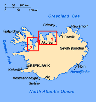
Western Eyjafj÷rur coast (click on Map 1 opposite for details
of route). Ahead across the coastal moors and farmland, the hefty wall of sculpted
Tr÷llskagi mountains seemed to bar further progress northward along the fjord. Western Eyjafj÷rur coast to DalvÝk:
leaving Lonsß Camping on a bright, sunny morning, we drove down into the city
outskirts to re-stock with provisions at Netto and finally left Akureyri. After
3 days in such a likeable place where people had been so friendly and helpful,
we headed north on Route 1 along the
Western Eyjafj÷rur coast (click on Map 1 opposite for details
of route). Ahead across the coastal moors and farmland, the hefty wall of sculpted
Tr÷llskagi mountains seemed to bar further progress northward along the fjord.
|
Click on the 2 highlighted areas of map
for
details of
North-West Iceland |
 |
Route 1 branched off SW-wards to disappear into
the depths of H÷rgßrdalur, the only breach in this solid N~S mountainous
barrier; we thankfully left the Ring Road tourist traffic behind, and turned off
northwards following the
 shore of Eyjafj÷rur on Route 82. The broad meadows,
sandwiched between fjord and elongated N~S mountain wall of Flßr, was some of
the richest dairy farming land we had seen so far, and farmers were busily at
work taking advantage of a few days of fine weather for hay-making. Bales of
silage were lined up in the mown fields ready for the long winter ahead. Route
82 hugged the fjord-shore where the northern end of the enclosing mountainous
spur tailed off at the opening of Ůorsvaldsdalur, the next breach in this
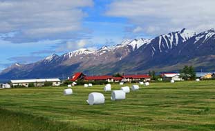
mountainous mass. On the coastal side, the broad farming meadows of
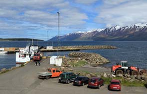
┴rskˇgsstr÷nd opened up (see above left); we turned off onto Route 808 into the tiny fishing
settlement of ┴rskˇgssandur and drove down to the little port where the HrÝsey
ferry was being loaded (see left). Here we sat to eat our sandwich lunch, looking out on
this beautifully peaceful morning across the northern end of Eyjafj÷rur where
the flat island of HrÝsey seemed to fill the centre of the fjord. On the far
side, a solid wall of snow-capped mountains forming the bleak and uninhabited
northern extremity of the Lßtrastr÷nd peninsula were lit by bright sunshine. shore of Eyjafj÷rur on Route 82. The broad meadows,
sandwiched between fjord and elongated N~S mountain wall of Flßr, was some of
the richest dairy farming land we had seen so far, and farmers were busily at
work taking advantage of a few days of fine weather for hay-making. Bales of
silage were lined up in the mown fields ready for the long winter ahead. Route
82 hugged the fjord-shore where the northern end of the enclosing mountainous
spur tailed off at the opening of Ůorsvaldsdalur, the next breach in this
mountainous mass. On the coastal side, the broad farming meadows of
┴rskˇgsstr÷nd opened up (see above left); we turned off onto Route 808 into the tiny fishing
settlement of ┴rskˇgssandur and drove down to the little port where the HrÝsey
ferry was being loaded (see left). Here we sat to eat our sandwich lunch, looking out on
this beautifully peaceful morning across the northern end of Eyjafj÷rur where
the flat island of HrÝsey seemed to fill the centre of the fjord. On the far
side, a solid wall of snow-capped mountains forming the bleak and uninhabited
northern extremity of the Lßtrastr÷nd peninsula were lit by bright sunshine.
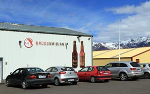  Bruggsmijan Micro-brewery
at ┴rskˇgssandur: ┴rskˇgssandur is home to the
Bruggsmijan Micro-brewery, makers of Kaldi beers (see right), and we had phoned earlier to arrange a
visit this afternoon. Iceland's still archaic licensing laws restrict the sale
of wines, spirits and beers above 2.25% ABV to Vinbuin, the state alcohol
monopoly shops (prohibition in Iceland was imposed in 1915 and only lifted in
1989). The 2.25% ABV so-called 'beers' available from supermarkets have the taste of low grade washing up water and are
produced by 2 major commercial brewers, Vifilfell/Viking from Akureyri owned
by Coca-Cola (sic!), and Egill-SkallagrÝmsson in ReykjavÝk; after having to
endure this for the past 6 weeks, we were looking forward to visiting the brewers of Kaldi quality beers at
Bruggsmijan
Micro-brewery. Bruggsmijan Micro-brewery
at ┴rskˇgssandur: ┴rskˇgssandur is home to the
Bruggsmijan Micro-brewery, makers of Kaldi beers (see right), and we had phoned earlier to arrange a
visit this afternoon. Iceland's still archaic licensing laws restrict the sale
of wines, spirits and beers above 2.25% ABV to Vinbuin, the state alcohol
monopoly shops (prohibition in Iceland was imposed in 1915 and only lifted in
1989). The 2.25% ABV so-called 'beers' available from supermarkets have the taste of low grade washing up water and are
produced by 2 major commercial brewers, Vifilfell/Viking from Akureyri owned
by Coca-Cola (sic!), and Egill-SkallagrÝmsson in ReykjavÝk; after having to
endure this for the past 6 weeks, we were looking forward to visiting the brewers of Kaldi quality beers at
Bruggsmijan
Micro-brewery.
We were welcomed at the small brewery in the
village outskirts (see left) by a young friend of Ëlafur Trostur and his wife Agnes Anna,
the family who had founded Iceland's first micro-brewery in 2006~7; ┴rskˇgssandur
has 100 residents, and along with fishing, Bruggsmijan brewery is one of the village's major employers. Ëlafur had been a fisherman but an injury at sea had prevented him from working, and
the family faced hard times. A chance viewing of a TV interview with a Danish
micro-brewer prompted him and Anna to consider establishing a brewery, and
despite scepticism from the banks, they went ahead. They chose to emulate the Czech
 brewing tradition, seeking malt and hops, brewing equipment and expertise from
Czech sources combined with local mountain water from ┴rskˇgssandur, and with quality of product as their hallmark, they produced
their first Pilsner-style Kaldi brew in 2006. By 2007 their small premises at ┴rskˇgssandur
was producing 160,000 litres per year. Demand for quality beers in beer-deprived
Iceland outstripped their capacity, and both their premises and production have
expanded so that by 2015 annual production had increased to 650,000 litres, with
a range of 5 regular beers plus seasonal specials. brewing tradition, seeking malt and hops, brewing equipment and expertise from
Czech sources combined with local mountain water from ┴rskˇgssandur, and with quality of product as their hallmark, they produced
their first Pilsner-style Kaldi brew in 2006. By 2007 their small premises at ┴rskˇgssandur
was producing 160,000 litres per year. Demand for quality beers in beer-deprived
Iceland outstripped their capacity, and both their premises and production have
expanded so that by 2015 annual production had increased to 650,000 litres, with
a range of 5 regular beers plus seasonal specials.
And excellent the Kaldi beers are; the name
Kaldi comes from Ëlafur's fishing days, meaning bitterly chill wind and weather.
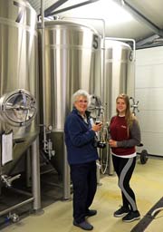
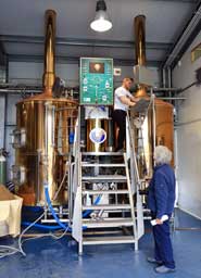
We viewed their production plant (Photo 1 - Bruggsmijan Micro-brewery)
and fermentation/maturing vessels (see above
right), and met Ëlafur and his eldest son Sigur who is now head brewer (see left). The cost of the visit was not
cheap at 2,000kr each (ú15), but it was a joy to see such entrepreneurial
enthusiasm and to taste such quality of resultant beers. Restrictive Icelandic
law prevented them from selling us Kaldi beers after our tasting, but they
presented us with a couple of bottles in addition to Kaldi glasses as souvenirs
of our visit. Long may the Kaldi Brewery flourish!
DalvÝk fishing port: we continued
north on Route 82 around the spur-end of the next snow-capped mountain range,
across the mouth of Svarfaardalur and River Svarfaardalsß, into the fishing
port of DalvÝk to find the Vinbuin shop in DalvÝk for further supplies of Kaldi
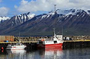
beers. Down at the port, we walked along past the fishing boats and the large
fisheries freezing vessels moored at the quays (Photo
2 - DalvÝk fishing port), against a backdrop of the
magnificent range of snow-capped, sculpted peaks on the far side of northern Eyjafj÷rur
(see below left), all lit by the bright afternoon sun
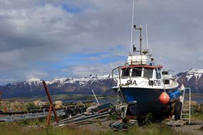
(Photo
3 - DalvÝk fishing boats). Up in the town, we found the Vinbuin in
the main street but searched in vain for a supermarket for provisions. In the
end we enquired at the TIC in the Culture House/library, and there got into
conversation with the delightful elderly gent manning the desk who told us more
about DalvÝk: although the town's fishing fleet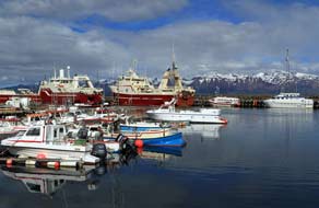
 was reduced in size from former
days as larger firms bought up fishing quotas and reduced crew levels, fishing
and associated support industries, including manufacture of plastic fish
boxes seen universally at the ports, were still DalvÝk's major employers. was reduced in size from former
days as larger firms bought up fishing quotas and reduced crew levels, fishing
and associated support industries, including manufacture of plastic fish
boxes seen universally at the ports, were still DalvÝk's major employers.
A rest day at hospitable H˙sabakki Camping:
leaving DalvÝk for now, we drove out on Route 805 along
the broad, green valley of Svarfaardalur, past sizeable horse farms, to find
tonight's campsite, H˙sabakki Camping (click
here for detailed map of route). The large guest-house/hostel with its adjoining campsite occupied former
boarding school premises, and was set alongside the Svarfaardalsß river and
nature reserve. We had earlier telephoned and
received a helpfully welcoming response from the warden who now received us
hospitably, assuring us of site-wide wi-fi and washing/drying machine for our
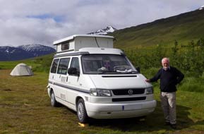
planned day in camp here tomorrow. We selected a pitch on the flat, grassy
camping area with clear views along the length of the broad valley lined with
green hills, with the valley head hemmed in by craggy mountains (see below left) and the shapely,
snow-capped peaks on the far side of Eyjafj÷rur visible at the valley's lower
end; it was a truly magnificent location. The strong wi-fi
 signal connected
immediately, and the WC/showers in the hostel basement, although rather
institutional from their school origins, were modern and spotlessly clean; a
small, signal connected
immediately, and the WC/showers in the hostel basement, although rather
institutional from their school origins, were modern and spotlessly clean; a
small,
 limited kitchen/wash-up was set in a hut by the camping area. This was
the perfect setting for our much needed rest day tomorrow. limited kitchen/wash-up was set in a hut by the camping area. This was
the perfect setting for our much needed rest day tomorrow.
It had been 5 weeks since we had last had
access to a campsite washing/drying machine and the following morning Sheila put H˙sabakki's
to full usage to catch up with our laundry. Access to campsite wi-fi had also
been disappointingly limited, and Paul made good use of H˙sabakki's to catch up
with emails. The setting was truly inspirational in this open, green valley
enclosed by snow-flecked mountains and distant views of the sculpted peaks
lining Eyjafj÷rur, and the bird-life from the neighbouring nature reserve,
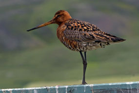
including a handsomely coloured Black-tailed Godwit perched on the fence-posts (Photo
4 - Black-tailed Godwit) (see right), kept us entertained
all day. All our laundry was dried, aired and folded; we had clean clothes
again. It had also been a while since we had enjoyed the luxury of a campsite
kitchen, and H˙sabakki's, although limited, helped to conserve our gas supply.
With its welcoming hospitality, lovely setting, excellent facilities and good
value price, H˙sabakki Camping merited a +5 rating, only the second Icelandic
campsite so far worthy of this recognition. And tonight we concluded our
productive day in camp with Kaldi beers.
 Crossing by ferry from ┴rskˇgssandur to HrÝsey Island:
the alarm was set early in readiness for today's crossing on the 11-30am ferry
from ┴rskˇgssandur for a day on HrÝsey Island. It was a beautiful morning
when we returned to ┴rskˇgssandur's little port, and the view looking across the
fjord with the sun lighting the snow-capped mountains on the far side of Eyjafj÷rur
was truly magnificent (Photo
5 - ┴rskˇgssandur ferry port) (see left and right). At 11-00am we watched the little ferry SŠvar leave
HrÝsey town to begin its crossing of the fjord, and 15 minutes later, it swung
into ┴rskˇgssandur and moored at the dock (see below left) (Photo
6 - HrÝsey ferry). Crossing by ferry from ┴rskˇgssandur to HrÝsey Island:
the alarm was set early in readiness for today's crossing on the 11-30am ferry
from ┴rskˇgssandur for a day on HrÝsey Island. It was a beautiful morning
when we returned to ┴rskˇgssandur's little port, and the view looking across the
fjord with the sun lighting the snow-capped mountains on the far side of Eyjafj÷rur
was truly magnificent (Photo
5 - ┴rskˇgssandur ferry port) (see left and right). At 11-00am we watched the little ferry SŠvar leave
HrÝsey town to begin its crossing of the fjord, and 15 minutes later, it swung
into ┴rskˇgssandur and moored at the dock (see below left) (Photo
6 - HrÝsey ferry).
HrÝsey, known as the Pearl of Eyjafj÷rur from its mid-fjord setting, Iceland's second largest island after Heimaey in the Westman Islands off the south coast, is 7.5kms long and 2.5kms at
its widest point and has 200 residents (click here for map of
HrÝsey Island). Sheep-grazing on HrÝsey was ended in 1974, allowing the
natural vegetation and flora to regenerate; the name HrÝsey comes from the plant
hris (dwarf birch) which once covered the island. Some 40 species
of
 birds nest on HrÝsey; the reason for this large concentration is that all
hunting of birds or gathering of eggs is banned, and there are no predators such
as foxes, mink or rats. With its lush moorland, low-growing willow and
plentiful food, conditions are particularly favourable for ground-nesting birds.
The birds nest on HrÝsey; the reason for this large concentration is that all
hunting of birds or gathering of eggs is banned, and there are no predators such
as foxes, mink or rats. With its lush moorland, low-growing willow and
plentiful food, conditions are particularly favourable for ground-nesting birds.
The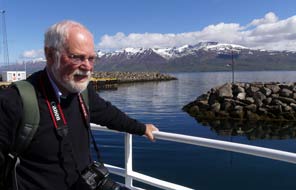 island has one of the largest population of nesting Arctic Terns in Europe,
as well as a sizeable population of Ptarmigan. There are 3 marked walking trails
around the southern part of the island, all starting from HrÝsey village, and we
planned to walk the largest circuit at 5kms. island has one of the largest population of nesting Arctic Terns in Europe,
as well as a sizeable population of Ptarmigan. There are 3 marked walking trails
around the southern part of the island, all starting from HrÝsey village, and we
planned to walk the largest circuit at 5kms.
A day's walking on HrÝsey Island:
the return ferry costs 1,500kr (ú11) each; there were few others crossing and on
such a beautifully sunny morning, with the fjord calm, we stood out on deck in
the bows looking out for whales or porpoises as SŠvar crossed the fjord (Photo
7 - Ferry crossing) (see right). As the ferry approached the island, HrÝsey village looked a picture-postcard place lit by the morning sun against
the backdrop of snowy peaks on the far side of the fjord (see below left). The ferry deftly
moored at the quay, and once ashore we headed up through the village to locate
the path's starting point. The view westward across the harbour with the
ubiquitous blue lupins growing in the foreground presented a magnificent
panorama of the solid wall of mountains north of DalvÝk across on the mainland (Photo
8 - HrÝsey's lupin-lined quayside).
Beyond the village, the track was lined with the bulky flowering heads of
Angelica. Our path turned off inland past long-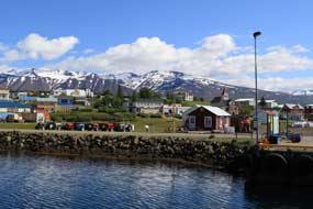 disused fish-drying frames. HrÝsey's
fishing heyday was during the period 1930~50, when the herring boom made the
island second only in size to Siglufj÷rur with its herring salting industry and
deep-sea fishing, and seasonal workers flocked to HrÝsey for employment in the
herring disused fish-drying frames. HrÝsey's
fishing heyday was during the period 1930~50, when the herring boom made the
island second only in size to Siglufj÷rur with its herring salting industry and
deep-sea fishing, and seasonal workers flocked to HrÝsey for employment in the
herring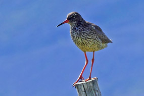 processing factories. In the 1960s however, whether through over-fishing,
the herring suddenly disappeared, and HrÝsey settled back into quiet obscurity. processing factories. In the 1960s however, whether through over-fishing,
the herring suddenly disappeared, and HrÝsey settled back into quiet obscurity.
Redshanks and a Redwing perched on the
fish-racks (see right), and the path continued ahead onto the island's moorland which was
lushly covered with willow scrub, dwarf birch, heather, crowberry and bog
bilberry. There were also residual traces of past unsuccessful attempts to
re-afforest the island with coppices of spruce now largely dying off. The path
gained height onto more open moorland dotted with flora: Mountain Avens their
flowers now almost past and plants covered with seed heads, Alpine Bartsia,
Northern Green Orchids and tiny white flowers of Slender Bedstraw. Arctic Terns
soared and dived threateningly above (if you have ever been subject to an Arctic
Tern screaming aerial Stuka attack, you will appreciate why in Icelandic they are
called KrÝa), and Whimbrels paraded before us, both
trying to deter us from their nests on the moorland. The path led across towards
the island's eastern shore where we hoped to see Hump-backed Whales in the
fjord, and
 at BorgarbrÝk down at the coast we reached the remains of an
ancient volcanic dyke formed by magma flowing into a weakness in the bedrock. An
inlet from the sea with cliffs towering above was all that remained of this
eroded volcanic intrusion (Photo
9 - BorgarbrÝk eroded dyke). Fulmars nested on the inlet's cliffs with at BorgarbrÝk down at the coast we reached the remains of an
ancient volcanic dyke formed by magma flowing into a weakness in the bedrock. An
inlet from the sea with cliffs towering above was all that remained of this
eroded volcanic intrusion (Photo
9 - BorgarbrÝk eroded dyke). Fulmars nested on the inlet's cliffs with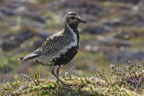 the male
birds soaring around. We sat among the Sea Pinks on the cliff-tops to eat our
sandwiches, with one eye scouring the fjord for any sign of whales. The brisk
wind whipped up 'white horses' in the blue waters of the fjord, but
none of this spray was the blow of a surfacing whale. On the far side of the
fjord, the snow-capped line of peaks of the remote and uninhabited Lßtrastr÷nd
peninsula was totally absorbing, compelling our attention. the male
birds soaring around. We sat among the Sea Pinks on the cliff-tops to eat our
sandwiches, with one eye scouring the fjord for any sign of whales. The brisk
wind whipped up 'white horses' in the blue waters of the fjord, but
none of this spray was the blow of a surfacing whale. On the far side of the
fjord, the snow-capped line of peaks of the remote and uninhabited Lßtrastr÷nd
peninsula was totally absorbing, compelling our attention.
The ongoing path edged perilously close to the
cliff's edge, and down at sea level low, eroded basal dyke intrusions extended
out into the fjord showing evident horizontal column layers with exposed
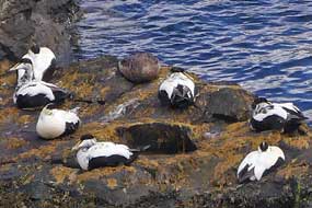
polygonal faces of vertical column ends. Eiders were sitting on the rocks and swimming in the sea nearby (see left). Male Velvet Scoters swam in the
shallows, with the distinguishing triangular white patches on their black backs.
We continued along the cliff-top path, still scanning the fjord for any sign of
whales, until the path turned inland gaining height across the lush moorland.
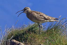
Whimbrels (see left) and Golden Plovers (see above right) constantly drew attention from their nesting mates
and chicks in the moorland vegetation, and being so close, they made
ready subjects for our photographs as they paraded before us (Photo
10 - Whimbrel) or
 flew overhead. There
were so many, it was difficult to decide which way to point cameras, surrounded
as we were by their constant calling. A little flew overhead. There
were so many, it was difficult to decide which way to point cameras, surrounded
as we were by their constant calling. A little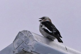 further more Frog Orchids were
seen by the path, and a Ptarmigan in full summer plumage; in spite of the number
of Ptarmigan reported on HrÝsey, this was the only one seen today. The path eventually
rejoined the gravel track of the island's shorter walking routes, and brought us
back down to the outskirts of HrÝsey village through more thickets of planted
spruce. A local lady we had talked to earlier about the island's bird-life had
told us of Snow Buntings to be seen around the village's cafÚ, and sure enough
as we passed, a Snow Bunting was perched on the roof crest (see right). Workmen were
strimming the verges, cutting back the Angelica plants; Angelica from HrÝsey is used to flavour one of the Kaldi beers, Stinnings,
giving the beer a subtle liquorice taste. further more Frog Orchids were
seen by the path, and a Ptarmigan in full summer plumage; in spite of the number
of Ptarmigan reported on HrÝsey, this was the only one seen today. The path eventually
rejoined the gravel track of the island's shorter walking routes, and brought us
back down to the outskirts of HrÝsey village through more thickets of planted
spruce. A local lady we had talked to earlier about the island's bird-life had
told us of Snow Buntings to be seen around the village's cafÚ, and sure enough
as we passed, a Snow Bunting was perched on the roof crest (see right). Workmen were
strimming the verges, cutting back the Angelica plants; Angelica from HrÝsey is used to flavour one of the Kaldi beers, Stinnings,
giving the beer a subtle liquorice taste.
Down through the village to the harbour, where
M/V SŠvar was waiting at the quay, the warm sun of earlier was now long
gone. Huddled in cags against the chill wind blowing across the fjord, we sat
waiting for the 5-00pm ferry departure. A small fishing boat returned to harbour
and we walked over to watch the catch being unloaded from the hold into
insulated plastic crates (made in DalvÝk). Each crate was brim full of cod,
haddock and sad-eyed, thick lipped monk fish, all still with the long-line hooks
in their mouth and packed with ice; the crates
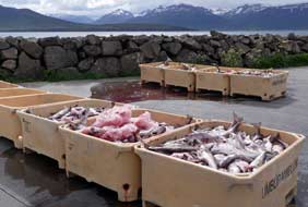 dripped with fish blood mixed
with melted ice-water. For such a small boat, it seemed a remarkably large
catch; dried fish hung from rails on the boat's decking. A fork-lift truck
driver deftly hoisted up the crates, tipping their fishy contents into larger
crates (Photo
11 - Unloading today's fish catch), stacking these for transportation into the nearby processing sheds,
and hosing down the empty crates. It was a fascinating scene of activity. As
5-00pm approached, we boarded the ferry along with a number of other local
passengers, and M/V SŠvar departed for the return crossing to dripped with fish blood mixed
with melted ice-water. For such a small boat, it seemed a remarkably large
catch; dried fish hung from rails on the boat's decking. A fork-lift truck
driver deftly hoisted up the crates, tipping their fishy contents into larger
crates (Photo
11 - Unloading today's fish catch), stacking these for transportation into the nearby processing sheds,
and hosing down the empty crates. It was a fascinating scene of activity. As
5-00pm approached, we boarded the ferry along with a number of other local
passengers, and M/V SŠvar departed for the return crossing to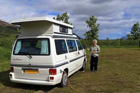 ┴rskˇgssandur. ┴rskˇgssandur.
A final night's camp at H˙sabakki:
we returned along Route 82 across the ┴rskˇgsstr÷nd farming lands to DalvÝk with
the intention of camping at the municipal campsite by the town's sports ground.
This however was stark, rather like camping in a town playing field amid local
houses (which it in fact was!); it was also noisy with basic, minimal facilities and
unduly high price. We took one look, and the solution was clear: why pay all
that for poor standards, when we could return just 6kms along Svarfaardalur
to the peaceful setting, hospitable welcome, quality facilities and good value price at H˙sabakki
Camping for our
final night; and of course, we did just that. It only took us 15 minutes, and we
were pitching in that lovely valley setting at H˙sabakki, welcomed back by the
charming warden, after our rewarding day's walking and bird photography on HrÝsey.
Even as we turned in at 11-00pm, it seemed extra light tonight. But again we
 were to get little sleep, being woken at 1-00am by young American tourists
arriving late, slamming car doors with undue noise and no awareness of or
consideration for sleeping neighbours. The following morning, we made it
forcibly clear that arriving late at a campsite entailed a responsibility to
show neighbourly consideration for others. Blank looks in response: such was the
uncouth, impenetrable ignorance and engrained egocentricity of these sad folk that we might as well
have been speaking in Mongolian
for all the impact it made! were to get little sleep, being woken at 1-00am by young American tourists
arriving late, slamming car doors with undue noise and no awareness of or
consideration for sleeping neighbours. The following morning, we made it
forcibly clear that arriving late at a campsite entailed a responsibility to
show neighbourly consideration for others. Blank looks in response: such was the
uncouth, impenetrable ignorance and engrained egocentricity of these sad folk that we might as well
have been speaking in Mongolian
for all the impact it made!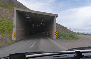
North through
the M˙lag÷ng Tunnel to Ëlafsfj÷rur: with little distance to
travel today through the M˙lag÷ng Tunnel to Ëlafsfj÷rur, we took a
leisurely morning enjoying the continuing fine weather. Departing around noon,
we drove back into DalvÝk, and as we sat eating our lunch sandwiches by the
port, one of the fish freezing vessels left the quay, turned in the harbour, and
moved quickly out into the fjord. Having shopped for provisions, we headed north
from DalvÝk along the Upsastr÷nd coast towards the M˙lag÷ng Tunnel which now
links DalvÝk through to Ëlafsfj÷rur (click here for detailed map of route).
The road rose steadily across the coastal land of now abandoned farms, with the
bulky mass of Sauaneshn˙kar towering overhead. The coastal strip now narrowed
further with the road running along the cliff-tops. To seaward across the fjord,
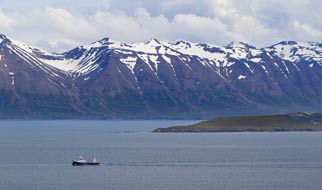
the northern tip of HrÝsey stood out, backed by the line of snowy peaks of the Lßtrastr÷nd peninsula on the far side
(see above left).
The fishing boat
 which had left port at DalvÝk just before us was now
steaming northwards towards the mouth of Eyjafj÷rur and the lighthouse on the
islet of Hrˇlfssker in mid-fjord. Ahead the waterfall of MÝgindisfoss, fed by
melt-waters streaming over a headland from the mountains high above, plummeted
headlong over a high cliff directly down into the sea. The road now turned abruptly into
the mouth of M˙lag÷ng Tunnel, its south portal looking like a huge square
concrete shed (see above right). The tunnel, which had left port at DalvÝk just before us was now
steaming northwards towards the mouth of Eyjafj÷rur and the lighthouse on the
islet of Hrˇlfssker in mid-fjord. Ahead the waterfall of MÝgindisfoss, fed by
melt-waters streaming over a headland from the mountains high above, plummeted
headlong over a high cliff directly down into the sea. The road now turned abruptly into
the mouth of M˙lag÷ng Tunnel, its south portal looking like a huge square
concrete shed (see above right). The tunnel, single-lane only with passing places every 200m on
the northern side and priority to south-bound traffic, cuts diagonally for 3.4kms through the otherwise impassable
mountainous headland of Ëlafsfjararm˙li which tops the whole peninsula;
only a trackway passes around the tip. The tunnel was opened in 1991, and before
that there had been no direct connection between DalvÝk and Ëlafsfj÷rur. single-lane only with passing places every 200m on
the northern side and priority to south-bound traffic, cuts diagonally for 3.4kms through the otherwise impassable
mountainous headland of Ëlafsfjararm˙li which tops the whole peninsula;
only a trackway passes around the tip. The tunnel was opened in 1991, and before
that there had been no direct connection between DalvÝk and Ëlafsfj÷rur.
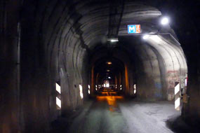
With
some trepidation we edged forward into the narrow tunnel which fortunately was
well lit. Not far in, the lights of an approaching vehicle could be see ahead,
and we pulled into the next passing place (indicated by the M-sign for MŠtast
- Meeting place) (see right). In this way we progressed slowly through the
tunnel, pulling into M-places to allow oncoming traffic to pass. We were later
told that locals, who know the tunnel, pass through at speed; visitors are
instantly recognisable by their more hesitant, slower speed. All went well until
the final corner where daylight was visible ahead just around the bend beyond
the final M-place; Paul missed the red illuminated sign
warning that a car was entering the tunnel, and drove past the M-place, meaning
a
 tight tight
 squeeze for the car to pass, doubtless provoking curses from the local
driver! squeeze for the car to pass, doubtless provoking curses from the local
driver!
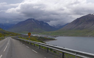
Out of the tunnel's north mouth into gloomy
rain, there was the
little port of Ëlafsfj÷rur spread out around the head of the fjord in the
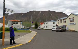
valley enclosed on all sides by high mountains (see above left). Down into the town and along the
main street past the ornamental lake, we found the municipal campsite by the town swimming pool and
pulled in; the high mountainside rose steeply over the upper tiers of houses
above the camping area. The campsite was well laid-out with sheltering hedges and
we selected a pitch with George's nose into the fresh wind blowing from the
fjord up the valley which stretched high into the mountains behind us.
Facilities were straightforward and limited to WCs/hand-basins and wash-up sinks;
showers were available in the swimming pool but when we enquired, full payment
of 800kr was required for entry, so no showers! We set up camp, and kitted up
with waterproofs to walk along past the ornamental lake to explore the little
town and port; rain was forecast and heavy cloud was mustering above the
mountains up the valley.
 The port of Ëlafsfj÷rur: first stop was the town library/TIC in
Ëlafsvegur, where the garrulous young lass in fluently colloquial Americanese
(learnt from TV soap operas, she admitted) entertained us at length about life
in Ëlafsfj÷rur, and its rivalry relationship with Siglufj÷rur. Since the 2 The port of Ëlafsfj÷rur: first stop was the town library/TIC in
Ëlafsvegur, where the garrulous young lass in fluently colloquial Americanese
(learnt from TV soap operas, she admitted) entertained us at length about life
in Ëlafsfj÷rur, and its rivalry relationship with Siglufj÷rur. Since the 2
 connecting HÚinsfjararg÷ng tunnels were opened in 2010, the 2 townships
were now united under the one municipal authority of Fjallabygg; those living
in Ëlafsfj÷rur felt resentment at being the poor neighbour. The
residents of Ëlafsfj÷rur did not give the impression of being book-lovers and
regular users of their impressively stocked little library, and clearly she
clearly had not had a single customer all day to chat with, until we arrived! We
did however eventually escape to continue along Aalgata and found the local
supermarket at the corner of Strandgata (see above right). Judging by its scale, Ëlafsfj÷rur's
large port during the town's herring heyday would once have been home to a
sizeable fishing fleet; today however it stood largely empty with an air of sad
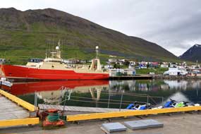
dereliction (see above left). The only ship moored at the quay was one token rusting fishing
support vessel which looked as if it had not put to sea for many a month (see
below right). The
fish-processing factory was evidently closed, and others now seemed occupied by
smaller scale industries. We walked around the dock, taking photos looking back
across the port towards the little town with its mountainous backdrop (Photo
12 - Ëlafsfj÷rur) (see above right). Blue lupins grew like weeds among piles
of scrap, and although most of the buildings and the town church were connecting HÚinsfjararg÷ng tunnels were opened in 2010, the 2 townships
were now united under the one municipal authority of Fjallabygg; those living
in Ëlafsfj÷rur felt resentment at being the poor neighbour. The
residents of Ëlafsfj÷rur did not give the impression of being book-lovers and
regular users of their impressively stocked little library, and clearly she
clearly had not had a single customer all day to chat with, until we arrived! We
did however eventually escape to continue along Aalgata and found the local
supermarket at the corner of Strandgata (see above right). Judging by its scale, Ëlafsfj÷rur's
large port during the town's herring heyday would once have been home to a
sizeable fishing fleet; today however it stood largely empty with an air of sad
dereliction (see above left). The only ship moored at the quay was one token rusting fishing
support vessel which looked as if it had not put to sea for many a month (see
below right). The
fish-processing factory was evidently closed, and others now seemed occupied by
smaller scale industries. We walked around the dock, taking photos looking back
across the port towards the little town with its mountainous backdrop (Photo
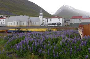
12 - Ëlafsfj÷rur) (see above right). Blue lupins grew like weeds among piles
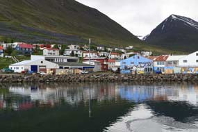
of scrap, and although most of the buildings and the town church were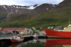 modern,
the looming rain clouds gave the town a sad air (see above left). We walked
around past the decaying port buildings to the smaller
harbour where modern,
the looming rain clouds gave the town a sad air (see above left). We walked
around past the decaying port buildings to the smaller
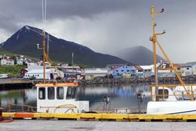
harbour where
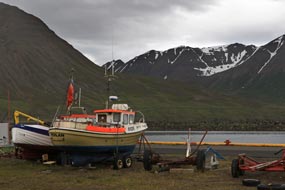 a few small fishing boats were moored
(see below left) (Photo
13 - Ëlafsfj÷rur fishing harbour). We had managed to avoid the
rain until now, but dark rain cloud was closing in over the mountains
immediately above the town (see above right), and the inevitable rain started in earnest
(see below right). We
hurried back along Strandgata past the church, calling in
again at the library for shelter and to use their wi-fi to consult the weather
forecast. a few small fishing boats were moored
(see below left) (Photo
13 - Ëlafsfj÷rur fishing harbour). We had managed to avoid the
rain until now, but dark rain cloud was closing in over the mountains
immediately above the town (see above right), and the inevitable rain started in earnest
(see below right). We
hurried back along Strandgata past the church, calling in
again at the library for shelter and to use their wi-fi to consult the weather
forecast.
A wet night's camp at Ëlafsfj÷rur municipal campsite: back across to the campsite, we
settled in, glad for warmth and shelter from the now pouring rain, and brewed
tea (Photo
14 - Ëlafsfj÷rur Camping). At 6-00pm someone from the swimming pool came round to collect rent, and we
paid using our Icelandic Camping Card. Again this set H˙sabakki's excellent
value in context: Ëlafsfj÷rur charged 2,800kr with no showers, no kitchen, and
no wi-fi; H˙sabakki's 2,000kr included all of these and excellent facilities. DalvÝk
had been even poorer value at 3,500kr with minimal facilities. As the rent man
sheltered under the awning from the rain, we learnt more from him about Ëlafsfj÷rur:
for a town of 1,000 residents, fishing was clearly in major decline, but the
town was taking initiatives to attract alternative employment. The new combined
local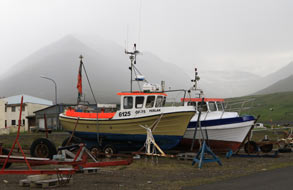 authority focussed on attracting tourism income, organising a number of
summer festivals, but such transient features do nothing for jobs. Ëlafsfj÷rur
was managing to halt the population decline and had retained local schools from
kindergarten through to senior schooling. But there was strong local resentment
about health care being centralised at rival Siglufj÷rur on cost-saving authority focussed on attracting tourism income, organising a number of
summer festivals, but such transient features do nothing for jobs. Ëlafsfj÷rur
was managing to halt the population decline and had retained local schools from
kindergarten through to senior schooling. But there was strong local resentment
about health care being centralised at rival Siglufj÷rur on cost-saving
 grounds;
the latest loss was the local ambulance station. Having said that, despite the
apparent air of dereliction as we walked around the harbour, the houses were all
modern, there were plenty of large 4WD cars, and although a work-a-day town, Ëlafsfj÷rur
had a lively air. grounds;
the latest loss was the local ambulance station. Having said that, despite the
apparent air of dereliction as we walked around the harbour, the houses were all
modern, there were plenty of large 4WD cars, and although a work-a-day town, Ëlafsfj÷rur
had a lively air.
The heavy rain eased at 7-30pm enabling us to
light the barbecue for supper. Dense streaks of low cloud hovered along the
sides of the surrounding mountains, gradually consolidating again into a solid,
misty cloud mass almost down to fjord level; it was a thoroughly miserable
evening. We turned in early, but were again woken at midnight by a late arriving
caravan, this time an Icelandic family who had driven up from ReykjavÝk, arriving
late with much inconsiderate noise and slamming of car doors. Such loutish
behaviour and lack of neighbourly consideration deserved the robust outburst it
received from us.
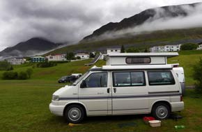 A wet drive north through HÚinsfjararg÷ng Tunnels
to Siglufj÷rur:
after a night of much rain, we woke to a miserably wet morning with low cloud
obscuring the surrounding mountains. The fjord level mist gradually lifted, hovering in linear patches along the mountain faces
(see right). In such weather we had certainly not seen Ëlafsfj÷rur at its best, A wet drive north through HÚinsfjararg÷ng Tunnels
to Siglufj÷rur:
after a night of much rain, we woke to a miserably wet morning with low cloud
obscuring the surrounding mountains. The fjord level mist gradually lifted, hovering in linear patches along the mountain faces
(see right). In such weather we had certainly not seen Ëlafsfj÷rur at its best,
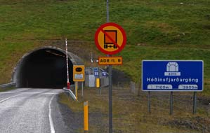 but
before leaving we drove across to the far side of the fjord to see the town's
award-winning avalanche barrier whose turf-covered bund so blended into the
mountain side as to be almost impossible to detect. And so we approached the
entrance to the HÚinsfjararg÷ng Tunnels (see
left) (Photo
15 - HÚinsfjararg÷ngáTunnels) which cut through the
2 northerly mountainous peninsulas separated by the intervening HÚinsfj÷rur,
and which since the tunnels' construction from 2006~2010 now connect the 2
towns of Ëlafsfj÷rur and Siglufj÷rur (click here for detailed map of route).
The southern tunnel is 7.1 kms and the northern tunnel 3.9kms, and both are dual
lane and well lit; the only concern was keeping below the 70 kph speed
limit in the tunnels with their frequent speed cameras. but
before leaving we drove across to the far side of the fjord to see the town's
award-winning avalanche barrier whose turf-covered bund so blended into the
mountain side as to be almost impossible to detect. And so we approached the
entrance to the HÚinsfjararg÷ng Tunnels (see
left) (Photo
15 - HÚinsfjararg÷ngáTunnels) which cut through the
2 northerly mountainous peninsulas separated by the intervening HÚinsfj÷rur,
and which since the tunnels' construction from 2006~2010 now connect the 2
towns of Ëlafsfj÷rur and Siglufj÷rur (click here for detailed map of route).
The southern tunnel is 7.1 kms and the northern tunnel 3.9kms, and both are dual
lane and well lit; the only concern was keeping below the 70 kph speed
limit in the tunnels with their frequent speed cameras.
We emerged at the intervening gap at HÚinsfj÷rur, and in pouring rain
sat in the camper at the lay-by to eat our sandwiches. Low misty cloud obscured
the magnificent view looking up-valley into the mammoth cwm carved out in the
mountainous heartland, and down-valley along the fjord
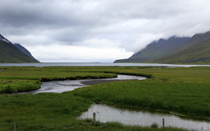 towards
the sea (see right). Looking along the road, the 2 tunnel mouths seemed so tiny
against the backdrop of these huge mountain faces, their overwhelming scale
emphasising the enormity of the project to bore these 2 tunnels. A 7 year
research project had been conducted by the University of Akureyri to evaluate
the social, cultural and economic impact of the tunnels' construction on the 2 towards
the sea (see right). Looking along the road, the 2 tunnel mouths seemed so tiny
against the backdrop of these huge mountain faces, their overwhelming scale
emphasising the enormity of the project to bore these 2 tunnels. A 7 year
research project had been conducted by the University of Akureyri to evaluate
the social, cultural and economic impact of the tunnels' construction on the 2
 towns
they now connect. Results showed tunnel traffic above expectations, with
considerable commuting between Ëlafsfj÷rur and Siglufj÷rur, and residents
travelling between them for shopping, healthcare, schooling and social events.
Increased tourism resulting from the improved access by tunnels had
strengthened the regional economy. But state and municipal services have been
reduced as a result of the 2008 economic crisis, particularly health care:
access to educations services has improved, but Ëlafsfj÷rur residents feel
a resentment at not receiving due share of public services. Siglufj÷rur has
seen an increase in population, and the population decline in Ëlafsfj÷rur has
been halted with young people tending to remain in their home community. All of
this reflected what we had heard from conversations with people at Ëlafsfj÷rur. towns
they now connect. Results showed tunnel traffic above expectations, with
considerable commuting between Ëlafsfj÷rur and Siglufj÷rur, and residents
travelling between them for shopping, healthcare, schooling and social events.
Increased tourism resulting from the improved access by tunnels had
strengthened the regional economy. But state and municipal services have been
reduced as a result of the 2008 economic crisis, particularly health care:
access to educations services has improved, but Ëlafsfj÷rur residents feel
a resentment at not receiving due share of public services. Siglufj÷rur has
seen an increase in population, and the population decline in Ëlafsfj÷rur has
been halted with young people tending to remain in their home community. All of
this reflected what we had heard from conversations with people at Ëlafsfj÷rur.
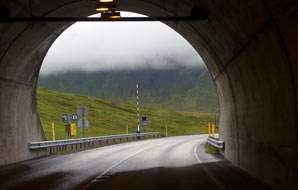
The former herring port of Siglufj÷rur:
emerging from the second tunnel into misty,
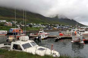
gloomy daylight (see above left), there below was the little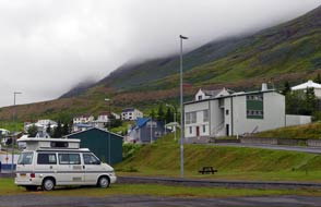 town and port of Siglufj÷rur, nestled almost precariously on a narrow spit of fjord-side land (eyri
in Icelandic)
towered over on both sides of this isolated, narrow fjord by mountains of unseen
height, their tops totally buried in rain cloud (see below left). Siglufj÷rur claims to be
Iceland's northernmost town, now with a population of less than 1,500 residents,
and isolated from the rest of the town and port of Siglufj÷rur, nestled almost precariously on a narrow spit of fjord-side land (eyri
in Icelandic)
towered over on both sides of this isolated, narrow fjord by mountains of unseen
height, their tops totally buried in rain cloud (see below left). Siglufj÷rur claims to be
Iceland's northernmost town, now with a population of less than 1,500 residents,
and isolated from the rest of the
 country though not as much as
in pre-tunnels days.
There had long been a Danish fishing and trading station on the fjord at Siglunes point at the northern tip of the peninsula, with shark fishing for
shark oil as the main catch. As demand increased prompting larger ships, the
port moved to a more sheltered position inside the fjord where the town of Siglufj÷rur
developed. But it was herring (sÝld in Icelandic) that gave rise to Siglufj÷rur's
boom years from 1920~60s. The Depression of the 1930s and the 1940s war years produced a global demand for conserved food, and Iceland's herring fisheries
prospered. By the 1950s, Siglufj÷rur was the largest port in Iceland with over
500 boats based here and sailing out to follow the summer migration of the
herring shoals. It was the herring catches that brought the revenue to modernise
the country, bringing the latest technology; it was herring and herring products
that made up 25% of Iceland's exports, and the revenue from this underwrote
Iceland's independence in 1944. We later saw photographs from the 1930s showing Siglufj÷rur's
docks piled high with barrels of smoked and pickled herring. Seasonal workers in
their 1000s flocked to Siglufj÷rur from all over the country and beyond for the
high wages and good life associated with the summer herring run. The quays were
lined with herring girl workers gutting and salting country though not as much as
in pre-tunnels days.
There had long been a Danish fishing and trading station on the fjord at Siglunes point at the northern tip of the peninsula, with shark fishing for
shark oil as the main catch. As demand increased prompting larger ships, the
port moved to a more sheltered position inside the fjord where the town of Siglufj÷rur
developed. But it was herring (sÝld in Icelandic) that gave rise to Siglufj÷rur's
boom years from 1920~60s. The Depression of the 1930s and the 1940s war years produced a global demand for conserved food, and Iceland's herring fisheries
prospered. By the 1950s, Siglufj÷rur was the largest port in Iceland with over
500 boats based here and sailing out to follow the summer migration of the
herring shoals. It was the herring catches that brought the revenue to modernise
the country, bringing the latest technology; it was herring and herring products
that made up 25% of Iceland's exports, and the revenue from this underwrote
Iceland's independence in 1944. We later saw photographs from the 1930s showing Siglufj÷rur's
docks piled high with barrels of smoked and pickled herring. Seasonal workers in
their 1000s flocked to Siglufj÷rur from all over the country and beyond for the
high wages and good life associated with the summer herring run. The quays were
lined with herring girl workers gutting and salting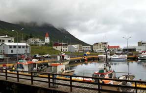 the herring from the
returning boats for loading in barrels. This heyday however came to an abrupt end in the mid-1960s when the herring simply disappeared, either through overfishing
or their migration pattern changed from Icelandic waters. In just a few years, Siglufj÷rur
and other herring the herring from the
returning boats for loading in barrels. This heyday however came to an abrupt end in the mid-1960s when the herring simply disappeared, either through overfishing
or their migration pattern changed from Icelandic waters. In just a few years, Siglufj÷rur
and other herring
 ports declined or closed down, leaving just proud memories of
what Siglufj÷rur had meant for Iceland. All that is left now to recall the
herring boom years is the much-promoted, but over-rated and over-priced Herring
Museum that fuels the town's now economic dependence on a growing tourist
industry. ports declined or closed down, leaving just proud memories of
what Siglufj÷rur had meant for Iceland. All that is left now to recall the
herring boom years is the much-promoted, but over-rated and over-priced Herring
Museum that fuels the town's now economic dependence on a growing tourist
industry.
Those who watch BBC4 will recall the 2016 Icelandic crime drama
Trapped; Seyisfj÷rur (where we had arrived in Iceland) was supposedly the
setting for this Nordic Noir thriller in which winter snows on the enclosing
mountains cutting off the small port, and the police investigation following discovery of a dismembered body in the
fjord, all conspire to trap both the townsfolk and the Smyril Line ferry M/S Norr÷na.
We had learned however that Trapped had largely been filmed at Siglufj÷rur because Seyisfj÷rur on the
east coast had insufficient snow that winter! As we drove down into the town
from the tunnel mouth, a side road winding up into the mountains could well have
figured in the snow-engulfed town of the film.
Click here to watch the trailer of the TV thriller
Trapped filmed in Siglufj÷rur
 The
town and what remained of the port was strung out along the fjord-side, and
right by the central square next to the fishing dock (see above right) we found the municipal
campsite (Photo
16 - Siglufj÷rur Camping), all very public,
overlooked by houses and passing traffic of the main street. After all the The
town and what remained of the port was strung out along the fjord-side, and
right by the central square next to the fishing dock (see above right) we found the municipal
campsite (Photo
16 - Siglufj÷rur Camping), all very public,
overlooked by houses and passing traffic of the main street. After all the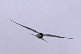 recent wet weather, the ground was soft and
churned up in places, but we found a spot well away from the noise potential of
a group of camping-cars, and settled in before kitting up in waterproofs for an
afternoon of exploring the town (Photo
17 - Siglufj÷rur fishing dock) (see above left). recent wet weather, the ground was soft and
churned up in places, but we found a spot well away from the noise potential of
a group of camping-cars, and settled in before kitting up in waterproofs for an
afternoon of exploring the town (Photo
17 - Siglufj÷rur fishing dock) (see above left).
An afternoon's exploration in Siglufj÷rur: across the central square
by the Rahus (town hall), we found the TIC in the town library for a
street plan, then ambled along past the fishing port and the expensive-looking
Siglˇ Hotel built out into a pier to resemble a fishing station. Along at the
Innrih÷fn harbour
(Photo
18 - Siglufj÷rur over-towered by cloud-covered mountains), we stood dodging the Arctic Terns which swooped down above
our heads (see right), aggressively protecting their nests in the tussocky grass
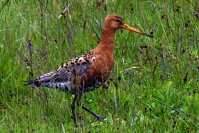
by the water's edge. A Black-tailed Godwit paraded along the muddy road-way and
over the grassy banks; being able to examine the Godwit closely showed what a
truly elegant bird this was with its characteristic rusty-brown neck, speckled
body and black-tipped tail (see above left).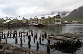
Back along the waterfront, we glanced in at the herring Museum which was based
in former fishing sheds, not prepared to pay the unduly expensive 2,000kr (ú14)
admission charge. Their publicity promised demonstrations of herring smoking on
Saturdays in July, but it turned out this was only when a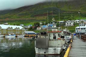 cruise ship was in
port; that said it all, and unimpressed by this sterile, over-rated museum, we
left with just a passing glance into the conserved herring factory where herring
oil had once been extracted and purified leaving the remaining fish-meal as
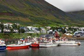
fertiliser. By the fjord-side opposite, the decaying wooden piers of the former
herring dock still stood in the water
(Photo
19 - Siglufj÷rur's former herring dock piers) (see left). Back along at the Bßtadokk, we walked around examining the boats
with their long-line fishing gear
(see right) (Photo
20 - Long-line fishing boats). A poster promoted the free-entry
Photographic History Museum in Vetrabraut, so we wandered past the dock and fish
market along through Siglufj÷rur's open-spaced grid of streets, looking out for
sights familiar from Trapped. At the far end of Vetrabrautopposite a factory and oil-storage
tanks, we found the house with the Photographic History Museum, and were
welcomed by a charming elderly gent Steingrimur Kristinsson, now age 83 and a
life-long photographer. He showed us the impressive exhibition of historic
photographic equipment and display of photographs taken by Vigf˙s Sigurgeirsson
between 1929~52; this photographer and filmmaker from Akureyri had travelled
each cruise ship was in
port; that said it all, and unimpressed by this sterile, over-rated museum, we
left with just a passing glance into the conserved herring factory where herring
oil had once been extracted and purified leaving the remaining fish-meal as
fertiliser. By the fjord-side opposite, the decaying wooden piers of the former
herring dock still stood in the water
(Photo
19 - Siglufj÷rur's former herring dock piers) (see left). Back along at the Bßtadokk, we walked around examining the boats
with their long-line fishing gear
(see right) (Photo
20 - Long-line fishing boats). A poster promoted the free-entry
Photographic History Museum in Vetrabraut, so we wandered past the dock and fish
market along through Siglufj÷rur's open-spaced grid of streets, looking out for
sights familiar from Trapped. At the far end of Vetrabrautopposite a factory and oil-storage
tanks, we found the house with the Photographic History Museum, and were
welcomed by a charming elderly gent Steingrimur Kristinsson, now age 83 and a
life-long photographer. He showed us the impressive exhibition of historic
photographic equipment and display of photographs taken by Vigf˙s Sigurgeirsson
between 1929~52; this photographer and filmmaker from Akureyri had travelled
each
 summer to Siglufj÷rur
(no mean journey in those pre-tunnel days) to document the herring industry in a
wonderful series of photographs. These showed the port filled with 100s of
boats, herring girls working by the dockside piers where the catch had just been
unloaded, and even an official visit to Siglufj÷rur by the Icelandic president
in 1952. Sigurgeirsson had lugged his heavy camera summer to Siglufj÷rur
(no mean journey in those pre-tunnel days) to document the herring industry in a
wonderful series of photographs. These showed the port filled with 100s of
boats, herring girls working by the dockside piers where the catch had just been
unloaded, and even an official visit to Siglufj÷rur by the Icelandic president
in 1952. Sigurgeirsson had lugged his heavy camera and tripod up onto the
mountainside opposite for aerial photos showing the port spread along the narrow spit of
fjord-side land and piers stretching out into the fjord. This had been a
thoroughly worthwhile chance-find visit, and we had learned more about Siglufj÷rur's
herring history here than ever we should have at the over-priced Herring Museum.
Back through the town streets to the campsite by the fishing dock, we were glad
to settle into the warmth and shelter of George out of the chill, misty rain. and tripod up onto the
mountainside opposite for aerial photos showing the port spread along the narrow spit of
fjord-side land and piers stretching out into the fjord. This had been a
thoroughly worthwhile chance-find visit, and we had learned more about Siglufj÷rur's
herring history here than ever we should have at the over-priced Herring Museum.
Back through the town streets to the campsite by the fishing dock, we were glad
to settle into the warmth and shelter of George out of the chill, misty rain.
The
Siglufj÷rur avalanche protection:
it was indeed a cold night, and we woke to a chill, wet mist down to
fjord-level; the campsite's hot showers were very welcome this morning. As we
were preparing to leave, the owners of the Photographic History Museum, Balvin
and Ingar, professional photographers from ReykjavÝk whom we had met yesterday,
called by on their way to the harbour to see the cruise-ship that had docked
this morning. Last evening, the campsite warden admitted that such visiting
cruise-ships brought no economic benefit to the town; passengers came ashore
briefly, visited the Herring Museum, and
 immediately re-boarded. After calling
in at the supermarket to re-stock with provisions, we departed northwards. immediately re-boarded. After calling
in at the supermarket to re-stock with provisions, we departed northwards.
 With low, wet cloud still clinging to the
mountains, we paused at the northern outskirts of Siglufj÷rur to admire the
impressive scale of the avalanche protection, huge turfed bunds extending across
the face of the mountain slopes above the town, topped by steel fencing tiers,
to trap and deflect falling snow and rocks (see above right). The avalanche defences were built at
government expense in the 1990s to protect communities vulnerable to avalanches
after the disaster which hit SuavÝk in the West Fjords where we should stay later. With low, wet cloud still clinging to the
mountains, we paused at the northern outskirts of Siglufj÷rur to admire the
impressive scale of the avalanche protection, huge turfed bunds extending across
the face of the mountain slopes above the town, topped by steel fencing tiers,
to trap and deflect falling snow and rocks (see above right). The avalanche defences were built at
government expense in the 1990s to protect communities vulnerable to avalanches
after the disaster which hit SuavÝk in the West Fjords where we should stay later.
Through the Strßkag÷ng Tunnel
and around Sauanes point: the onward road (click here for detailed map of route)
shelved high above the sea around the face of the
mountainside, which towered unseen in the cloud above, towards the mouth of Siglufj÷rur
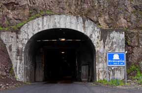
fjord. Ahead loomed the entrance to Strßkag÷ng Tunnel, looking like a
gloomy, square concrete box. This single-lane tunnel, 830m long
through the mountainous headland, was the earliest of the tunnel-links to Siglufj÷rur
completed in 1967 (see above left)
(Photo
21 - Strßkag÷ngáTunnel); before its opening, Siglufj÷rur had only been
accessible by sea. With even more trepidation than usual at entering tunnels, we
edged forward into the ultra-narrow tunnel. Lighting was better
 than feared, but
the M-places were something of a squeeze (see above right); fortunately we were
through before needing to pull over to allow any than feared, but
the M-places were something of a squeeze (see above right); fortunately we were
through before needing to pull over to allow any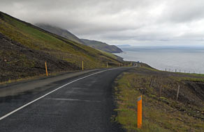 oncoming traffic to pass. We
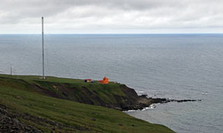
emerged into gloomy daylight at the northern end box-like portal, with the land
falling away steeply towards the squat lighthouse at Sauanes point on the
peninsula tip (see left). oncoming traffic to pass. We
emerged into gloomy daylight at the northern end box-like portal, with the land
falling away steeply towards the squat lighthouse at Sauanes point on the
peninsula tip (see left).
Lonely road around Sauanes coastline past Miklavatn to H÷favatn: the next stretch of road, shelving around the
cliff-tops of the northern tip of Sauanes, felt to be the most isolated,
remote and lonely place we had travelled in Iceland, particularly in the gloomy
light (click here for detailed map of route)
(see right). The road looped inland to cross a water course above an abandoned farm,
then continued high above the sea around the cliff-tops. Sections of this lonely
road had been stripped of tarmac leaving just a gravel surface. From the lagoon
of Miklavatn, trapped behind a sandbar stretching from shore to shore across the mouth of the bay, the road swung
inland around the bay. At the innermost corner, the old gravelled Route 82
turned off inland along a murky valley; pre-tunnels, this had been the only land
route connecting Ëlafsfj÷rur with Siglufj÷rur once the Strßkag÷ng link had
been constructed through the peninsula tip in the late 1960s. Route 76 turned off
right, cutting across a broad, flat and fertile area of
 farmland, the fields now
cut for baled hay. Passing the mouth of Flˇkadalur which cut up into the hills,
there were signs of this being an area of farmland, the fields now
cut for baled hay. Passing the mouth of Flˇkadalur which cut up into the hills,
there were signs of this being an area of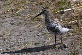 geothermal hot water, with a small
natural swimming pool by a farm. As the road swung inland across moorland, the
noticeable increase in tourist hire-car traffic driving at reckless speed
indicated we were getting back closer to the Ring Road; it suddenly felt
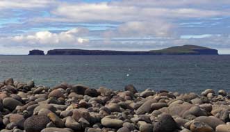
hazardous again. Off the coast, the low flat island of Mßlmey rose from
Skagafj÷rur, with the 180m high sheer-sided, flat-topped volcanic plug of
Drangey further out (see left). geothermal hot water, with a small
natural swimming pool by a farm. As the road swung inland across moorland, the
noticeable increase in tourist hire-car traffic driving at reckless speed
indicated we were getting back closer to the Ring Road; it suddenly felt
hazardous again. Off the coast, the low flat island of Mßlmey rose from
Skagafj÷rur, with the 180m high sheer-sided, flat-topped volcanic plug of
Drangey further out (see left).
Bird-life at H÷favatn: beyond the mouth of Hrolleifsdalur, we pulled in
by the shingle-bar which extends out to the island of ١rarh÷fi, trapping the
lagoon of H÷favatn. We kitted up fully against the chill wind to walk out along
the shingle-bar trackway out to the island alongside the shallow lagoon, hoping to
see waders on the mudflats. A pair of Whooper Swans grazed the lakeside meadow,
and Ringed Plovers pecked in the mudflats (see below left). As
we continued along the track, a Dunlin insistently followed, probably
decoying us from its nest. This beautifully marked small wader with its dark underside, boldly mottled back
and down-turned
bill paraded
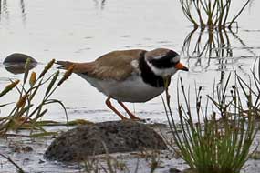 in
front of us before eventually
flying off (Photo
22 - Dunlin (Calidris alpina)) (see above right).
As we clambered up over the boulders
to peer across the embankment towards the
sea, Arctic Terns swooped aggressively overhead, and across on the rocks a male Snow Bunting
(Photo
23 - Snow Bunting) (see below right) hopped around with its mate and buff-coloured juvenile birds. As we returned
along the in
front of us before eventually
flying off (Photo
22 - Dunlin (Calidris alpina)) (see above right).
As we clambered up over the boulders
to peer across the embankment towards the
sea, Arctic Terns swooped aggressively overhead, and across on the rocks a male Snow Bunting
(Photo
23 - Snow Bunting) (see below right) hopped around with its mate and buff-coloured juvenile birds. As we returned
along the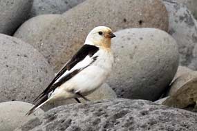 trackway, several more of the Dunlins flew around, settling in front
of us with their sharp, repetitive, staccato 'tew, tew, tew' alarm call, and
Red-necked Phalaropes darted busily among the reeds of a watercourse. We had been entertained by
an unexpected variety of waders and other bird-life
along the trackway by the H÷favatn mudflats. trackway, several more of the Dunlins flew around, settling in front
of us with their sharp, repetitive, staccato 'tew, tew, tew' alarm call, and
Red-necked Phalaropes darted busily among the reeds of a watercourse. We had been entertained by
an unexpected variety of waders and other bird-life
along the trackway by the H÷favatn mudflats.
The Icelandic Emigration Centre at Hofsˇs: we continued
southwards along the shore of Skagafj÷rur,
with young tourists in hire-cars speeding past, to approach the village of Hofsˇs set just off Route 76 on the seaward side.
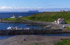
The main street led down from the modern village to a tiny harbour, site of the
original settlement which had developed around the warehouses of a Danish
trading station (Photo
24 - Hofsˇs harbour) (see below left and right). These conserved black-tarred wooden warehouses now house the
much-publicised Icelandic Emigration Centre. Having rejected the equally
much-vaunted, but over-priced, poor-value (in terms of learning potential)
Herring Museum, we also now had grave reservations about the cost~value of this
glitzy part-museum, part-genealogical centre which allegedly documents the
 history of the 1000s of Icelanders who were driven by failed farming, poverty
and hardship to seek a new life in Canada and USA in the late 19th/early 20th
centuries. We had earlier learned much about the causative factors underlying the
emigration from the unpretentious but knowledge-packed Emigration Museum at Vopnafj÷rur
(See log of our visit); our doubts about the over-publicised and pretentious Hofsˇs
museum of history of the 1000s of Icelanders who were driven by failed farming, poverty
and hardship to seek a new life in Canada and USA in the late 19th/early 20th
centuries. We had earlier learned much about the causative factors underlying the
emigration from the unpretentious but knowledge-packed Emigration Museum at Vopnafj÷rur
(See log of our visit); our doubts about the over-publicised and pretentious Hofsˇs
museum of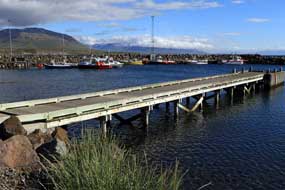 Emigration were compounded by the evident superficial understanding of
the causes of mass emigration shown by the American woman at reception. It soon
became clear that, despite her claims of Icelandic descent from the Westman
Islands, she knew absolutely nothing about Iceland, spoke no Icelandic, and her
little knowledge about Icelandic emigration was book-derived. A glance at the
display panels supposedly recounting ÚmigrÚs' experiences showed they were
over-romanticised and failed to explain the social, economic and climactic
hardships that led to emigration. There was no reference to the conspiracy
between Canadian government promoting immigration schemes to attract settlers to
populate new regions of the Dominion and Icelandic authorities trying to
minimise poor-law support for the destitute, leading to land agents painting a
falsely encouraging picture of life in the new country compared with the
hardships faced on arrival in the new lands. Compared with all we had learned
from the knowledgeable Kathy at Vopnafj÷rur, we should learn nothing here at Hofsˇs,
and were certainly not prepared to pay even the seniors' reduced admission of
1,400kr (ú10) each. Our conclusion was that the Icelandic Emigration Centre at Hofsˇs,
like the Siglufj÷rur Herring Museum, was over-priced and over-rated; you would come away
with little depth of understanding Emigration were compounded by the evident superficial understanding of
the causes of mass emigration shown by the American woman at reception. It soon
became clear that, despite her claims of Icelandic descent from the Westman
Islands, she knew absolutely nothing about Iceland, spoke no Icelandic, and her
little knowledge about Icelandic emigration was book-derived. A glance at the
display panels supposedly recounting ÚmigrÚs' experiences showed they were
over-romanticised and failed to explain the social, economic and climactic
hardships that led to emigration. There was no reference to the conspiracy
between Canadian government promoting immigration schemes to attract settlers to
populate new regions of the Dominion and Icelandic authorities trying to
minimise poor-law support for the destitute, leading to land agents painting a
falsely encouraging picture of life in the new country compared with the
hardships faced on arrival in the new lands. Compared with all we had learned
from the knowledgeable Kathy at Vopnafj÷rur, we should learn nothing here at Hofsˇs,
and were certainly not prepared to pay even the seniors' reduced admission of
1,400kr (ú10) each. Our conclusion was that the Icelandic Emigration Centre at Hofsˇs,
like the Siglufj÷rur Herring Museum, was over-priced and over-rated; you would come away
with little depth of understanding
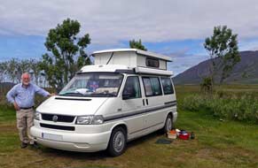 about the causes of Icelandic mass
emigration, and the real hardships faced by emigrants on arrival in the New
World. For this, you would do better to talk with Kathy at Vopnafj÷rur
which would cost you nothing, rather than spend vast sums to view pretentiously glitzy but
non-informative display panels at Hofsˇs. about the causes of Icelandic mass
emigration, and the real hardships faced by emigrants on arrival in the New
World. For this, you would do better to talk with Kathy at Vopnafj÷rur
which would cost you nothing, rather than spend vast sums to view pretentiously glitzy but
non-informative display panels at Hofsˇs.
Hofsˇs Camping:
arriving early at Hofsˇs Camping close to the community centre in the modern
village, we were able to select a corner pitch and protect our space from
disturbance by late-arrivers with picnic tables (see left) (Photo
25 - Hofsˇs Camping).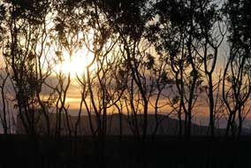 During the evening, the campsite began to fill with tourists in hired cars and
camping cars now that we were closer to the Ring Road. Many of these tourist tent-campers were clearly ill-equipped, ill-clothed and ill-prepared for tent camping
in Icelandic conditions, displaying comical incompetence at putting up a
tent and cooking supper even in fine weather. The lad from the campsite-owning
family called round at 9-00pm to collect payment of 1000kr each for seniors plus
800kr for electricity. Facilities were limited to WCs, showers and wash-up sinks
with hot water, but all were modern and totally clean; there was no kitchen,
wi-fi, common room or bad weather shelter for tent campers. Behind us, the bulky mountains of Tr÷llskagi
peninsula lying between Eyjafj÷rur and Skagafj÷rur were indented by craggy
ridges dividing off long valleys cutting deep into the uninhabited interior,
with distant snowfields and glaciers covering the peaks and cwms at the valley
heads. The Skagafj÷rur western side is lined by a wide coastal strip with
fertile, moraine-rich farmland providing sheep, cattle and horse grazing. The
wind dropped, and clear evening sky brought sunlight, picking out all the
details of the shapely peaks lining the valleys of the mountainous hinterland
beyond the farming lands of the broad, flat coastal strip, and later the sun set
over this mountainous backdrop (see right).
Hofsˇs village:
Hofsˇs village clearly still functions as a service centre for this farming
hinterland, just as in times past farmers had brought their surplus produce here
to trade with Danish merchants. But the modern village was something of a
puzzle, far larger and livelier than the run-down backwater
 implied by our guide
books. It was a surprisingly large settlement with rows of modern and
affluent-looking single-storey houses extending along the side streets, and a
school, community centre, shop and filling station at the village centre. The
large number of houses seemed to indicate that the original community had now implied by our guide
books. It was a surprisingly large settlement with rows of modern and
affluent-looking single-storey houses extending along the side streets, and a
school, community centre, shop and filling station at the village centre. The
large number of houses seemed to indicate that the original community had now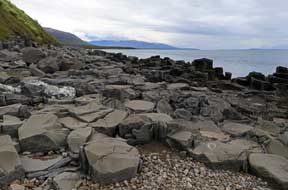 increased with holiday- and weekend-homes, particularly as with the improved
state of the Ring Road and Hvalfj÷rur tunnel, Hofsˇs was now within weekend
range from ReykjavÝk. This impression was reinforced by the modern village of Hofsˇs
having what was referred to as a 'designer swimming pool' which had put the
place 'on the map'. We should stay here a second day and investigate the
swimming pool tomorrow.
Hofsˇs swimming pool:
the following day, after a morning in camp, we walked along to Hofsˇs'
geothermally heated swimming pool. The small outdoor pool was designed by the same
architect responsible for the Blue Lagoon bathing complex in SW Iceland which
was fed by effluent from a
geothermal power station (not something any self-respecting professional would
admit to on his CV!). It is landscaped into the hillside above the fjord in such an
integrated fashion as to give an impression of infinite view from the pool
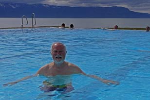
extending over the sea to the mountains beyond (see above left). The pool was reported to have
been donated to the village just before the 2008 financial crisis by 2 bankers'
wives who presumably had holiday homes in Hofsˇs. Admission to the pool was
900kr each, and while Sheila swam in the 32║C warm water, Paul took photos of the
setting against the fjord and mountainous backdrop
(Photo
26 - Hofsˇs swimming pool), before joining her in the pool. Even the
sun
 managed to shine as we enjoyed the comfortably warm pool, and wallowed in
the 36║C geothermally heated hot-pot. managed to shine as we enjoyed the comfortably warm pool, and wallowed in
the 36║C geothermally heated hot-pot.
A final night at Hofsˇs Camping:
from the pool, we walked back down to the little harbour, with the restored
log-built warehouses (pakkhusi in Icelandic) from the Danish trading
station. The far side of the grey shingle beach was edged at the fjord-side with
grey basalt polygonal column bases (Photo
27 - Basalt column bases) (see above right),
replicas of which formed features at the swimming pool. Across the bridge, the Hofsß river tumbled down from the Tr÷llskagi mountains into the sea by the
harbour wall (Photo
28 - Hofsß river) (see left). Walking back to camp, we were still
intrigued by the size of Hofsˇs and the number of modern houses extending along
the newer part of the village away from the original settlement which had developed
down by the harbour. Dark cloud, which earlier had been gathering over the
mountains on the far side of Skagafj÷rur, gradually crept nearer bringing a
miserably wet evening. We sat in George to cook and eat supper, looking out into
the rain and heavy cloud which tonight covered the Tr÷llskagi mountains,
obscuring the deep valleys cutting into the hills behind us. When the campsite
lad called round later for payment, we asked more about Hofsˇs: there are now
less than 200 permanent residents, and as we suspected, many of the modern
houses are holiday-, weekend- or summer-houses owned by distant city-folk. This
would explain why fat-cat bankers' wives lived in Hofsˇs, with enough money to
endow the 'designer swimming pool'. pool. Across the bridge, the Hofsß river tumbled down from the Tr÷llskagi mountains into the sea by the
harbour wall (Photo
28 - Hofsß river) (see left). Walking back to camp, we were still
intrigued by the size of Hofsˇs and the number of modern houses extending along
the newer part of the village away from the original settlement which had developed
down by the harbour. Dark cloud, which earlier had been gathering over the
mountains on the far side of Skagafj÷rur, gradually crept nearer bringing a
miserably wet evening. We sat in George to cook and eat supper, looking out into
the rain and heavy cloud which tonight covered the Tr÷llskagi mountains,
obscuring the deep valleys cutting into the hills behind us. When the campsite
lad called round later for payment, we asked more about Hofsˇs: there are now
less than 200 permanent residents, and as we suspected, many of the modern
houses are holiday-, weekend- or summer-houses owned by distant city-folk. This
would explain why fat-cat bankers' wives lived in Hofsˇs, with enough money to
endow the 'designer swimming pool'.
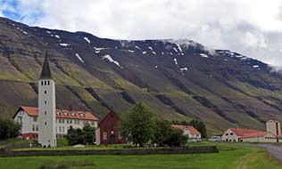 Cathedral church at
Hˇlar:
the overnight rain had just about stopped, and heavy overcast beginning to clear
from the 3 valleys of Unadalur, Seljadalur and Vesterdalur which penetrate deep
into the Tr÷llskagi mountainous interior. We returned to Route 76 and turned
south across the broad coastal farming strip where hay had been cut and baled (click here for detailed map of route).
The road swung inland across the open mouth of Kolbeinsdalur to reach
the Route 767 turning into Hjaltadalur and Hˇlar 12kms along the broad valley. Cathedral church at
Hˇlar:
the overnight rain had just about stopped, and heavy overcast beginning to clear
from the 3 valleys of Unadalur, Seljadalur and Vesterdalur which penetrate deep
into the Tr÷llskagi mountainous interior. We returned to Route 76 and turned
south across the broad coastal farming strip where hay had been cut and baled (click here for detailed map of route).
The road swung inland across the open mouth of Kolbeinsdalur to reach
the Route 767 turning into Hjaltadalur and Hˇlar 12kms along the broad valley.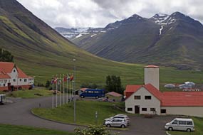 Herds
of Icelandic horses grazed the farmland pastures, and in the distance the small
cathedral church with its bell-tower at Hˇlar could be seen, set among woodland under the bulky, looming shadow of
snow-fringed Hˇlabyra mountain (see above right). Herds
of Icelandic horses grazed the farmland pastures, and in the distance the small
cathedral church with its bell-tower at Hˇlar could be seen, set among woodland under the bulky, looming shadow of
snow-fringed Hˇlabyra mountain (see above right).
There had been a church here a Hˇlar in Hjaltadalur since
Iceland's 11th century conversion to Christianity
(Photo
29 - Hˇlar cathedral church) (see left). Set at a cross-roads of N~S,
W~E communication routes, the site at Hˇlar in Hjaltadalur was for centuries
Northern Iceland's episcopal seat, ranking in importance with Skßlholt in the
south (see right). The Bishopric at Hˇlar was founded in 1106, with the church and seminary
developing as the ecclesiastical, educational and cultural capital of the north.
Until the Reformation, Catholicism flourished with the Church acquiring vast
land holdings, along with the wealth and power from tithes income. The last of
the Catholic Bishops of Hˇlar
 was Jˇn Arason 1484~1550). Denmark adopted Lutheranism in
1536, and the Kingdom outlawed the Catholic Church, taking over its lands and
wealth including those in Iceland. The Icelanders' vehement resistance to the
enforced Protestant Reformation was politically motivated, with the Catholic Church becoming
a powerful and independent counter to Danish imperial control. The Bishop of Skßlholt was unable to resist Danish demands and was arrested in 1541, dying in
a Copenhagen prison; the was Jˇn Arason 1484~1550). Denmark adopted Lutheranism in
1536, and the Kingdom outlawed the Catholic Church, taking over its lands and
wealth including those in Iceland. The Icelanders' vehement resistance to the
enforced Protestant Reformation was politically motivated, with the Catholic Church becoming
a powerful and independent counter to Danish imperial control. The Bishop of Skßlholt was unable to resist Danish demands and was arrested in 1541, dying in
a Copenhagen prison; the south soon fell to Lutheranism. In the north however,
the Catholics rallied around Bishop Arason who amassed an army to resist the
Danes and marched on the Althing. After defeat in battle, he was arrested and beheaded
in 1550 along with his 2 sons. Arason had been a man ahead of his times: while mainland Europe
was in the throes of the Reformation, Bishop Arason had shipped a printing press
to Iceland and installed it at Hˇlar to print religious texts. The second
Lutheran Bishop of Hˇlar, Gubrandur Ůorlßksson (1541~1627) had himself
translated the Old Testament from Hebrew to Icelandic. A group of monks at Hˇlar
had, before the Reformation, begun illicitly translating the New Testament from
Greek, but none of this work had been distributed. Then in 1584, Gubrandur Ůorlßksson used Arason's printing press to produce 500 copes of the Bible translated into
vernacular Icelandic (see right); the work took 7 years and was paid for by every church
being required to purchase a copy. Gubrandur produced his own woodcuts to
illuminate the Bible headings. The south soon fell to Lutheranism. In the north however,
the Catholics rallied around Bishop Arason who amassed an army to resist the
Danes and marched on the Althing. After defeat in battle, he was arrested and beheaded
in 1550 along with his 2 sons. Arason had been a man ahead of his times: while mainland Europe
was in the throes of the Reformation, Bishop Arason had shipped a printing press
to Iceland and installed it at Hˇlar to print religious texts. The second
Lutheran Bishop of Hˇlar, Gubrandur Ůorlßksson (1541~1627) had himself
translated the Old Testament from Hebrew to Icelandic. A group of monks at Hˇlar
had, before the Reformation, begun illicitly translating the New Testament from
Greek, but none of this work had been distributed. Then in 1584, Gubrandur Ůorlßksson used Arason's printing press to produce 500 copes of the Bible translated into
vernacular Icelandic (see right); the work took 7 years and was paid for by every church
being required to purchase a copy. Gubrandur produced his own woodcuts to
illuminate the Bible headings. The
 current church at Hˇlar was built from local
red sandstone in 1763. Although the bishopric was abolished in 1801 and school
closed, the cathedral church remained, and the school was revived in 1882. This
has developed as a college teaching equine science and agriculture, and has now
acquired university status. Hˇlar became an episcopal seat again in 1997. current church at Hˇlar was built from local
red sandstone in 1763. Although the bishopric was abolished in 1801 and school
closed, the cathedral church remained, and the school was revived in 1882. This
has developed as a college teaching equine science and agriculture, and has now
acquired university status. Hˇlar became an episcopal seat again in 1997.
 Our visit to Hˇlar cathedral church: reaching the cathedral church and
college with the mountain looming overhead, we walked back down the road for
photographs. To one side of the site below woods, a timber log house had been
reconstructed to commemorate 1000 years of Christianity in Iceland, based on the
original Auunarstofa structure built by the Norwegian Bishop of Hˇlar, Auun
the Red in the early 14th century (see above left). The wooden building displayed early religious
printed texts from Hˇlar. The bell-tower had been erected alongside the small
cathedral church in 1950 to commemorate the 500th anniversary of Jˇn Arason's
execution; his remains had been re-interred in a small chapel at the foot of the
bell-tower. Our visit to Hˇlar cathedral church: reaching the cathedral church and
college with the mountain looming overhead, we walked back down the road for
photographs. To one side of the site below woods, a timber log house had been
reconstructed to commemorate 1000 years of Christianity in Iceland, based on the
original Auunarstofa structure built by the Norwegian Bishop of Hˇlar, Auun
the Red in the early 14th century (see above left). The wooden building displayed early religious
printed texts from Hˇlar. The bell-tower had been erected alongside the small
cathedral church in 1950 to commemorate the 500th anniversary of Jˇn Arason's
execution; his remains had been re-interred in a small chapel at the foot of the
bell-tower.
Over at the cathedral, we learned from the pastor
more about the history of Hˇlar and its 2 renowned bishops Arason and Gubrandur.
The church's treasures included a late Baroque 1674 baptismal font carved from a
piece of soapstone said to have floated to Iceland from Greenland on an
ice floe (see below left). Of particular interest was an original of the Gubrandur Bible printed at Hˇlar in 1584
which stood on
a lectern
(Photo
30 - Gubrandur Bible), overlooked by a portrait of Bishop Ůorlßksson
(see left)
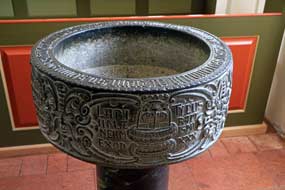 whose tomb stone
was set in the chancel floor. 2 works of art that remarkably had survived the
Reformation's Lutheran bigotry were a beautiful carved and gold-leaf inlaid
altarpiece from the Netherlands displaying the crucifixion and figures of saints
and presented to the cathedral in 1520 by Jˇn Arason (see above right), and an whose tomb stone
was set in the chancel floor. 2 works of art that remarkably had survived the
Reformation's Lutheran bigotry were a beautiful carved and gold-leaf inlaid
altarpiece from the Netherlands displaying the crucifixion and figures of saints
and presented to the cathedral in 1520 by Jˇn Arason (see above right), and an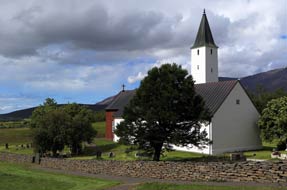 ornate alabaster
altarpiece made in Nottingham around 1470. ornate alabaster
altarpiece made in Nottingham around 1470.
Up the hillside behind the cathedral stood the
NřibŠr, a restored mid-19th century turf-built, multi-roomed farm-house and
rectory with walls 3m thick. Like the farmstead at GlaumbŠr which we should see
later, these represented superb examples of Icelandic rural turf-built
dwellings. A path continued over the hillock down through conifer woods to the
modern college building. The peaceful environs of Hˇlar and its wonderful
setting in Hjaltadalur
(Photo
31 - Hˇlar in Hjaltadalur) looking up the length of the valley to the
snow-covered Tr÷llskagi peaks had been a restful interlude, with a chance to
understand more of Iceland's turbulent history and see the cathedral's precious
works of art.
The port-town of Saußrkrˇkur with its dismal campsite: back down the valley, we turned off
onto Route 75 across the broadly spreading delta of the J÷kulsa glacial river's
estuary, to approach the port-town of Saußrkrˇkur (click here for detailed map of route).
With 3,000 residents, this is Skagafj÷rur's largest town. We made first for the town's campsite, a bleakly
barren, open field by the swimming pool alongside the main street. There
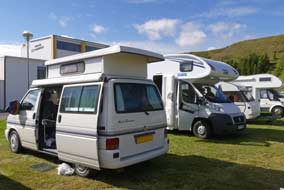 was little
to commend the place other than the newish facilities block, with WC/showers and wash-up
sinks, but ill-designed, poorly equipped and not particularly clean, and no
kitchen or wi-fi. A number of caravans and camping-cars were already taking up
the best spots; it all looked very dismal. We was little
to commend the place other than the newish facilities block, with WC/showers and wash-up
sinks, but ill-designed, poorly equipped and not particularly clean, and no
kitchen or wi-fi. A number of caravans and camping-cars were already taking up
the best spots; it all looked very dismal. We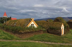 found Saußrkrˇkur's Vinbuin
which stocked Kaldi beers but not the local microbrewery's products, stocked up
with provisions at the large supermarket, and filled George with diesel. Given
the campsite's unattractive urban setting, we considered our camping options:
should we stay here in these dismal and noisy surroundings, or drive on 25kms
down to Varmahli? We decided to brave it out here (a decision later regretted),
and selected the least bad spot away from the noise potential of the
camping-cars but close to the main road's traffic noise. By later that evening,
we were totally hemmed in by hired camping-cars and their inconsiderately noisy
occupants. It was a drizzly, cold evening, wretchedly noisy on this dismally
bleak urban site. found Saußrkrˇkur's Vinbuin
which stocked Kaldi beers but not the local microbrewery's products, stocked up
with provisions at the large supermarket, and filled George with diesel. Given
the campsite's unattractive urban setting, we considered our camping options:
should we stay here in these dismal and noisy surroundings, or drive on 25kms
down to Varmahli? We decided to brave it out here (a decision later regretted),
and selected the least bad spot away from the noise potential of the
camping-cars but close to the main road's traffic noise. By later that evening,
we were totally hemmed in by hired camping-cars and their inconsiderately noisy
occupants. It was a drizzly, cold evening, wretchedly noisy on this dismally
bleak urban site.
The GlaumbŠr turf-walled farmstead museum: a warm and sunny morning at
last, but Saußrkrˇkur Camping had been a thoroughly unpleasant experience: this bleakly
barren, open field next to the town swimming pool and alongside a busy main town
road, amid all the noise of traffic and dismal urban setting, combined with the
intrusive presence of tourist camping-cars and their inconsiderate
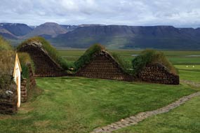 occupants crowding in on us, made this one of the trip's worst campsites (see above left). How we regretted
not having moved on last evening down to Varmahli. With much relief this
morning we departed, glad to leave this dismal town, and turned off onto Route 75
down the broad farming valley of the J÷kulsa river (click here for detailed map of route).
12kms south, we reached the
GlaumbŠr turf-walled farmstead museum, set alongside GlaumbŠr church (see above right). occupants crowding in on us, made this one of the trip's worst campsites (see above left). How we regretted
not having moved on last evening down to Varmahli. With much relief this
morning we departed, glad to leave this dismal town, and turned off onto Route 75
down the broad farming valley of the J÷kulsa river (click here for detailed map of route).
12kms south, we reached the
GlaumbŠr turf-walled farmstead museum, set alongside GlaumbŠr church (see above right).
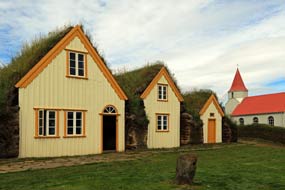 The GlaumbŠr site has been farmed since the 9th century time of Settlement, but the
conserved turf-walled and roofed farmstead complex dates from the 18~19th
centuries, and had been inhabited until 1947
(Photo
32 - GlaumbŠr turf-walled farmstead) (see above right). This style of turf construction
was typical of farm dwellings in rural Iceland until around 1900, when it was
gradually replaced by reinforced concrete
seen in most contemporary Icelandic buildings. Extensive turf-construction
evolved in rural Iceland owning to the acute shortage of large trees for timber
construction. The traditional turf-built farm-complex of small separate rooms
connected by central passageway, and fronted by a row of 5 gabled fašades as at GlaumbŠr
(see right)
(Photo
33 - GlaumbŠr gabled-frontage), shows the impoverished lifestyle in rural Iceland before the 20th
century. Externally, the cut turf 'bricks' were laid in courses or bonded together in a herringbone
pattern (see above left) (Photo
34 - GlaumbŠr external turf walls). Inside The GlaumbŠr site has been farmed since the 9th century time of Settlement, but the
conserved turf-walled and roofed farmstead complex dates from the 18~19th
centuries, and had been inhabited until 1947
(Photo
32 - GlaumbŠr turf-walled farmstead) (see above right). This style of turf construction
was typical of farm dwellings in rural Iceland until around 1900, when it was
gradually replaced by reinforced concrete
seen in most contemporary Icelandic buildings. Extensive turf-construction
evolved in rural Iceland owning to the acute shortage of large trees for timber
construction. The traditional turf-built farm-complex of small separate rooms
connected by central passageway, and fronted by a row of 5 gabled fašades as at GlaumbŠr
(see right)
(Photo
33 - GlaumbŠr gabled-frontage), shows the impoverished lifestyle in rural Iceland before the 20th
century. Externally, the cut turf 'bricks' were laid in courses or bonded together in a herringbone
pattern (see above left) (Photo
34 - GlaumbŠr external turf walls). Inside
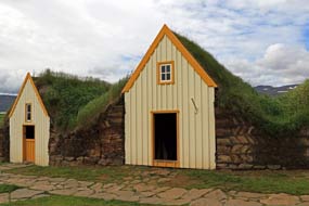 the gabled compound of storage rooms and living space, the 2~3m
thick turf walls built around a wooden frame gave effective insulation against the freezing temperatures of
winter. The inner walls were lined with thin panels of drift-wood separated and
insulated by thick layers of turf, and roofed with the same materials. Icelandic
grass grows thickly, and this combination of turf, roots and compacted soil gave
a strong, binding and enduringly insulating layer (see left and below right)
(Photo
35 - Turf block construction) . Turf walls in areas of
moderate rainfall can, with continuing maintenance, last for up to a century.
The pitch of the roof must be sloped the gabled compound of storage rooms and living space, the 2~3m
thick turf walls built around a wooden frame gave effective insulation against the freezing temperatures of
winter. The inner walls were lined with thin panels of drift-wood separated and
insulated by thick layers of turf, and roofed with the same materials. Icelandic
grass grows thickly, and this combination of turf, roots and compacted soil gave
a strong, binding and enduringly insulating layer (see left and below right)
(Photo
35 - Turf block construction) . Turf walls in areas of
moderate rainfall can, with continuing maintenance, last for up to a century.
The pitch of the roof must be sloped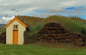 at just the right angle: too flat and water
pools, causing the turf roof to leak; too steep and the water drains over-quickly so that the grass does not grow, or dries and cracks in dry weather,
both again causing leaks. The turf-walled and roofed farming complex at GlaumbŠr
is superbly conserved and administered by the National Museum of Iceland. The
original preservation was begun by an English aristocrat, Sir Mark Watson, who
travelled around Iceland in the 1930s and was so impressed by GlaumbŠr that he
donated ú200 for its refurbishment as a museum. at just the right angle: too flat and water
pools, causing the turf roof to leak; too steep and the water drains over-quickly so that the grass does not grow, or dries and cracks in dry weather,
both again causing leaks. The turf-walled and roofed farming complex at GlaumbŠr
is superbly conserved and administered by the National Museum of Iceland. The
original preservation was begun by an English aristocrat, Sir Mark Watson, who
travelled around Iceland in the 1930s and was so impressed by GlaumbŠr that he
donated ú200 for its refurbishment as a museum.
Having examined the exterior details of the turf
constructed farmstead, we paid the 1,200kr entry to explore the interior of the
hobbit-like warren. Each of the 16 carefully conserved rooms was filled with a
collection of period furniture and equipment to demonstrate rural living and
working conditions
(see below left and right) (Photo
36 - Storage pantry). GlaumbŠr was in fact quite a wealthy farm, providing a living 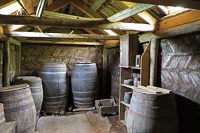 for the
pastor who not only ran the farm but also provided rudimentary education to
local youngsters. An extended family with its workers occupied the complex, with
accommodation for up to 22 people. Tiny wood-framed windows set into the grassy
turf of the roof admitted light, and although it was a cold day, it felt totally
snug within the insulated depths of the building's thick turf walls, with not a
trace of earthy, musty smell. Various store rooms, pantries for storing
preserved food for for the
pastor who not only ran the farm but also provided rudimentary education to
local youngsters. An extended family with its workers occupied the complex, with
accommodation for up to 22 people. Tiny wood-framed windows set into the grassy
turf of the roof admitted light, and although it was a cold day, it felt totally
snug within the insulated depths of the building's thick turf walls, with not a
trace of earthy, musty smell. Various store rooms, pantries for storing
preserved food for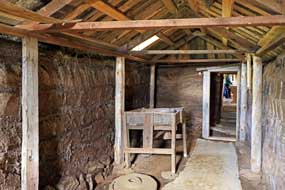 winter, and a kitchen led off the central passageway, and at
the far end the bastofa provided living and sleeping space with 11 beds
sleeping 2 to a bed (Photo
37 - Bastofa living and sleeping space) (see below right). They eat or worked at domestic tasks sitting on the
beds, and at night slept under woollen blankets or eider-down duvets, tucked in
on the outer side by a removable bed-board (r˙mfj÷l) made from a length
of drift-wood and often elaborately engraved with owner's initials, date and a
night-time prayer. Along with 19th furnishings,
the room displayed personal belongings such as food bowls (askur), and
working equipment for spinning, weaving and sewing. The displays were a superbly
presented illustration of cramped living conditions within the farmstead
complex. winter, and a kitchen led off the central passageway, and at
the far end the bastofa provided living and sleeping space with 11 beds
sleeping 2 to a bed (Photo
37 - Bastofa living and sleeping space) (see below right). They eat or worked at domestic tasks sitting on the
beds, and at night slept under woollen blankets or eider-down duvets, tucked in
on the outer side by a removable bed-board (r˙mfj÷l) made from a length
of drift-wood and often elaborately engraved with owner's initials, date and a
night-time prayer. Along with 19th furnishings,
the room displayed personal belongings such as food bowls (askur), and
working equipment for spinning, weaving and sewing. The displays were a superbly
presented illustration of cramped living conditions within the farmstead
complex.
On the southern side, an exit door from a store
room led out to what was now a grass-covered mound. It seemed clear that this
may once have been the farmstead's midden, a waste tip for dumping rubbish and
ashes; human waste along with animal dung would have been re-cycled to manure
the
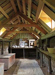 fields. Over at one of the nearby wooden buildings, we found the site
director and archaeologist, SigrÝur Sigurar and from her learned more about
GlaumbŠr's history. It was known that the site had been farmed since Settlement
times: the Saga of the Greenlanders describes how 2 of those who had
sailed with Leifur EirÝksson on the abortive voyage to found a settlement in
Vinland on the shores of North America, Ůorfinnur Karlsefni and GurÝur fields. Over at one of the nearby wooden buildings, we found the site
director and archaeologist, SigrÝur Sigurar and from her learned more about
GlaumbŠr's history. It was known that the site had been farmed since Settlement
times: the Saga of the Greenlanders describes how 2 of those who had
sailed with Leifur EirÝksson on the abortive voyage to found a settlement in
Vinland on the shores of North America, Ůorfinnur Karlsefni and GurÝur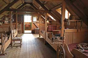 Ůorbjarnardˇttir, returned to Iceland in
the early years of the 11th century after the expedition's failure, along with
their infant son Snorri Ůorfinnson, the first American born of European parents in 1003 AD. The Saga
records that they purchased land in the J÷kulsa valley at GlaumbŠr, and
that Snorri built the first church here in memory of his mother. Although the
authenticity of the Saga's account linking GlaumbŠr to Snorri
Ůorfinnson has been questioned by scholars, the existence of a Settlement era
farm at GlaumbŠr is known. It was believed that this was located on the valley
side above the river on the site of the 18~19th century farmstead. But analysis
of materials and artefacts from a test trench dug into the midden mound at the
rear showed an earliest date of around 1104 AD, implying that the farm here was
built or moved from elsewhere sometime later after 1100 AD. Remote sensing
however on a
levelled area 150m eastward of the present farm complex lower towards the river
indicated building remains under the surface turf. Excavation of the site
unearthed a 30m longhouse (skßli) and its associated midden dated to the
11th century. Its shape and layout was exactly like the 11th century Viking
farmsteads we had seen in the Faroes. The original settlers would have sailed
up-river
from their landfall at the coast, to build their skßli a safe
distance up the valley. Perhaps the farm dwelling had later been moved further uphill
around 1100 AD to a more secure site away from river flooding. The intriguing
question remains unconfirmed: was the skßli the farmstead of Snorri
Ůorfinnson? We spent time with SigrÝur
discussing the archaeology of the GlaumbŠr site and the possible but umprovable links with Snorri
Ůorfinnson. The skßli longhouse and the later turf farmstead represent 2
different forms of rural dwelling, but together they show that this land
at GlaumbŠr had been farmed for more than 1000 years. What a rewarding visit
this had been.
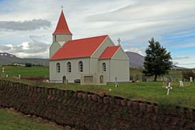
GlaumbŠr church, J÷kulsa valley and VÝimřri turf-walled chapel:
as another party of tourists arrived at GlaumbŠr
simply to take their 'selfies', with little more than fleetingly superficial
glances at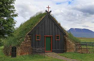 the magnificent turf-walled farmstead, we walked over to visit the
church. The present church dates from 1926, and replaced earlier turf-covered
wooden churches on the site facing the farmstead which had provided a living for
the pastor (see left). The most interesting of the church's decorations was a series of
wooden panels from an earlier pulpit, painted with figures of Christ, Mary and
apostles, dating from 1685. the magnificent turf-walled farmstead, we walked over to visit the
church. The present church dates from 1926, and replaced earlier turf-covered
wooden churches on the site facing the farmstead which had provided a living for
the pastor (see left). The most interesting of the church's decorations was a series of
wooden panels from an earlier pulpit, painted with figures of Christ, Mary and
apostles, dating from 1685.
Before leaving the J÷kulsa valley to return to Saußrkrˇkur,
we drove on down to VarmahlÝ
(click here for detailed map of route),
both to investigate the campsite there and to visit the turf-built
chapel at VÝimřri. The broad, green valley was fertile farming country, with many horses
grazing by each of the farms, and the fields spread with silage bales. VarmahlÝ was little more than a service station
at the Ring Road's junction with Route 75, but on the far side of the village a
side turning led to the tiny rural chapel of
VÝimřrarkirkja. This turf-walled and roofed chapel, built in 1834 to replace an
earlier medieval structure around a
frame of driftwood with wooden fašade ends, is still in use as a parish
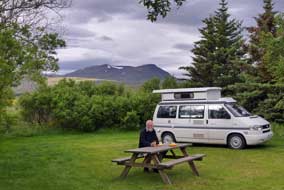 church (see above right) (Photo
38 - VÝimřri turf-walled chapel). church (see above right) (Photo
38 - VÝimřri turf-walled chapel).
VarmahlÝ Camping:
back in VarmahlÝ we found the campsite tucked away uphill behind the village.
The site was divided into a number of secluded grassy areas, each with power
supplies and sheltered by mature trees, most un-Icelandic and more like a French
campsite. How we wished we had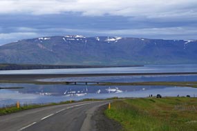 come here last evening. Rather than continue with
our journey over to Skagastr÷nd tonight, this was too tempting a campsite to
miss, and we found a well-hidden corner protected by picnic tables from
disturbance by late-arrivers and screened by clumps of spruces. We later leaned
from the warden when he came round for payment that until 2008, this had been a
government operated forestry preserve and tree nursery which had been sold off
and converted to a campsite. It was perfect, with modern, clean facilities and
the same good-value pricing structure as the other sites in the Skagafj÷rur group. The following morning was bright and sunny, enabling us to
sit outside for breakfast at the picnic table (see above left) (Photo
39 - VarmahlÝ Camping). The campsite with its secluded bays was able to
absorb the numbers of holiday-making caravans without feeling crowded; despite
being close to the Ring Road, it was relatively tourist-free, making for a
delightfully peaceful stay for once. With its arboreal environment, VarmahlÝ
was the best of the Skagafj÷rur group of campsites. come here last evening. Rather than continue with
our journey over to Skagastr÷nd tonight, this was too tempting a campsite to
miss, and we found a well-hidden corner protected by picnic tables from
disturbance by late-arrivers and screened by clumps of spruces. We later leaned
from the warden when he came round for payment that until 2008, this had been a
government operated forestry preserve and tree nursery which had been sold off
and converted to a campsite. It was perfect, with modern, clean facilities and
the same good-value pricing structure as the other sites in the Skagafj÷rur group. The following morning was bright and sunny, enabling us to
sit outside for breakfast at the picnic table (see above left) (Photo
39 - VarmahlÝ Camping). The campsite with its secluded bays was able to
absorb the numbers of holiday-making caravans without feeling crowded; despite
being close to the Ring Road, it was relatively tourist-free, making for a
delightfully peaceful stay for once. With its arboreal environment, VarmahlÝ
was the best of the Skagafj÷rur group of campsites.
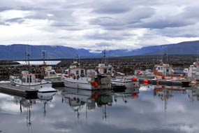 Fish-drying history at Saußrkrˇkur, and farewell to
Skagafj÷rur:
we returned northwards to Saußrkrˇkur via Route 76 on the far side of the J÷kulsa
valley
(click here for detailed map of route).
This was very much horse rearing country on a large scale, with every farm
having large herds grazing its home pastures. At the north end of the valley, we
turned across the delta-estuary into Fish-drying history at Saußrkrˇkur, and farewell to
Skagafj÷rur:
we returned northwards to Saußrkrˇkur via Route 76 on the far side of the J÷kulsa
valley
(click here for detailed map of route).
This was very much horse rearing country on a large scale, with every farm
having large herds grazing its home pastures. At the north end of the valley, we
turned across the delta-estuary into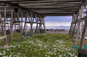 Saußrkrˇkur (see above right), and along Strandvegur at the
far end of town found the small boats harbour (Photo
40 - Saußrkrˇkur fishing harbour) (see left). Beyond the shrimp factory with
its giant painted crustacean mural (Ceci n'est pas une crevette announced
the graffiti!), we reached the industrial container port, and beyond this, the
modern fish-drying factory, which had replaced the rows of fish-drying wooden
frames now standing empty and abandoned (Photo
41 - Saußrkrˇkur fish-drying frames) (see right). Until recently, these would have been
loaded with 1000s of cod, gutted bodies and heads as we had seen in the Lofotens,
hanging for drying in the cold Icelandic air, for export as Bacalao to Nigeria (Skrei
= dried fish in Icelandic). We recalled seeing the wooden frames in 1972 loaded
with drying fish rattling in the wind, with luxuriant growth of chickweed
beneath. Here at Saußrkrˇkur the wooden racks now stood empty and abandoned,
some demolished and poles lying in heaps, their former role for drying fish now
usurped by a modern freeze-drying factory. Back into town, we shopped for
provisions and used the Arion Bank's ATM to withdraw cash; it was finally time
to leave Saußrkrˇkur and wave farewell to Saußrkrˇkur (see above right), and along Strandvegur at the
far end of town found the small boats harbour (Photo
40 - Saußrkrˇkur fishing harbour) (see left). Beyond the shrimp factory with
its giant painted crustacean mural (Ceci n'est pas une crevette announced
the graffiti!), we reached the industrial container port, and beyond this, the
modern fish-drying factory, which had replaced the rows of fish-drying wooden
frames now standing empty and abandoned (Photo
41 - Saußrkrˇkur fish-drying frames) (see right). Until recently, these would have been
loaded with 1000s of cod, gutted bodies and heads as we had seen in the Lofotens,
hanging for drying in the cold Icelandic air, for export as Bacalao to Nigeria (Skrei
= dried fish in Icelandic). We recalled seeing the wooden frames in 1972 loaded
with drying fish rattling in the wind, with luxuriant growth of chickweed
beneath. Here at Saußrkrˇkur the wooden racks now stood empty and abandoned,
some demolished and poles lying in heaps, their former role for drying fish now
usurped by a modern freeze-drying factory. Back into town, we shopped for
provisions and used the Arion Bank's ATM to withdraw cash; it was finally time
to leave Saußrkrˇkur and wave farewell to
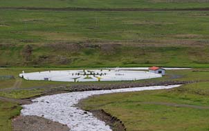 Skagafj÷rur around whose shores we had travelled and camped over the past week. Skagafj÷rur around whose shores we had travelled and camped over the past week.
Over the fells to the eastern shore
of H˙naflˇi: Route 744 rose steadily up the long, bleak valley NW of Saußrkrˇkur, gaining
height on a newly engineered road below the Tindast÷ll fells, wild and empty
country with just a handful of abandoned farms (click here for detailed map of route).
Over the watershed, the road dropped steeply to the junction with the gravelled
Route 745 which turned off northwards hugging the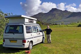 coast around the tip of the Skagi peninsula. Route 744 climbed to another bleak fell-land watershed to
descend the long and lonely Norurßrdalur through the mountainous terrain of
Ůverßrfjall. The road dropped down to the broad valley bottom, passing isolated
farms one of which had a huge, circular horse and sheep gathering coral (hammarsrÚtt)
(see left), used during the autumn round-up when the animals are brought down from high
fell-land pastures for sorting by owner. At the junction with Route 74, we
turned north along the eastern shore of H˙naflˇi, with the jagged peaks on the
far side of the fjord silhouetted against the bright afternoon light. Some 12kms
north, past more horse rearing farms, we turned off to the small fishing port
and trading post of Skagastr÷nd.
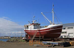 Skagastr÷nd Camping:
at the edge of the village we found tonight's campsite, Skagastr÷nd Camping;
this was a Camping Card site, fortunate since the cumulative pricing was
expensive totalling 3,200kr with showers. Facilities however included both a
common room and kitchen with electric cooker, the first seen in quite a while,
plus washing/drying machine but no wi-fi. Despite the presence of tourist
camping-cars and caravans with their inconsiderately noisy occupants (all
thoroughly unsavoury company), we found a quiet corner on the far side sheltered
by hedges and under a craggy outcrop (see above right). Skagastr÷nd Camping:
at the edge of the village we found tonight's campsite, Skagastr÷nd Camping;
this was a Camping Card site, fortunate since the cumulative pricing was
expensive totalling 3,200kr with showers. Facilities however included both a
common room and kitchen with electric cooker, the first seen in quite a while,
plus washing/drying machine but no wi-fi. Despite the presence of tourist
camping-cars and caravans with their inconsiderately noisy occupants (all
thoroughly unsavoury company), we found a quiet corner on the far side sheltered
by hedges and under a craggy outcrop (see above right).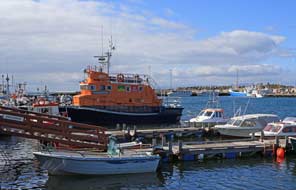 Mid-evening, an officiously
rude Jobsworth character called round for payment, his petty rule-book manner
giving immediate offence and provoking suitably curt response; he had clearly
overlooked the fact that it was those staying at the campsite who paid his wages. The
following morning was bright and sunny at last, but with a chill wind blowing
along the exposed H˙naflˇi shore-line. As some counter justice for the
campsite's unduly expensive showers, this morning we discovered that the coin
machine was not working meaning free hot showers. The unsavoury Jobsworth posted
a note on the shower door saying 'Out of action'; we ignored this and went ahead
with our free showers, prepared if need be to defend this with the response
'Well if the shower's not working, how could we use it?' Although intrinsically
a reasonable municipal site, Skagastr÷nd was spoiled by its offensively
ill-mannered warden. Mid-evening, an officiously
rude Jobsworth character called round for payment, his petty rule-book manner
giving immediate offence and provoking suitably curt response; he had clearly
overlooked the fact that it was those staying at the campsite who paid his wages. The
following morning was bright and sunny at last, but with a chill wind blowing
along the exposed H˙naflˇi shore-line. As some counter justice for the
campsite's unduly expensive showers, this morning we discovered that the coin
machine was not working meaning free hot showers. The unsavoury Jobsworth posted
a note on the shower door saying 'Out of action'; we ignored this and went ahead
with our free showers, prepared if need be to defend this with the response
'Well if the shower's not working, how could we use it?' Although intrinsically
a reasonable municipal site, Skagastr÷nd was spoiled by its offensively
ill-mannered warden.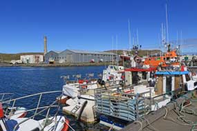
Skagastr÷nd fishing harbour: Skagastr÷nd
(meaning Skagi shore) was aptly named given its location along the western coast of the wild Skagi
peninsula, but most of the village's houses were tastelessly modern dating from
the 1940~50s herring boom years. Before leaving however we drove down to the
fishing harbour for photos in the bright sunshine (see above left and right) (Photo
42 - Skagastr÷nd fishing harbour), against its backdrop of
derelict and unsightly concrete former fish factory.
Blanda river-rapids at Bl÷nduˇs:
returning along the Skagi coast (click here for detailed map of route)
into the underwhelming service centre town of Bl÷nduˇs, we pulled into Glaheimer camping in the outskirts where the campsite
reception served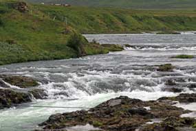 also as the town's tourist information centre. Here, in total
contrast to the offensive Jobsworth character at Skagastr÷nd, we were greeted by
a charming and helpful elderly gent who readily gave us advice on bird-watching
sites along the glacial river Blanda where it flowed through
Bl÷nduˇs. A short way back uphill, we parked to cross a footbridge above the
Blanda river-rapids over to the river-island of
Hr˙tey, now a nature reserve
with walking trail. The surging rapids were impressive and we hoped to find
Harlequin ducks here in spite of the lateness of the season. At this late stage of
the year however, bird-life was there none. Down in the town, Greylag Geese with
goslings also as the town's tourist information centre. Here, in total
contrast to the offensive Jobsworth character at Skagastr÷nd, we were greeted by
a charming and helpful elderly gent who readily gave us advice on bird-watching
sites along the glacial river Blanda where it flowed through
Bl÷nduˇs. A short way back uphill, we parked to cross a footbridge above the
Blanda river-rapids over to the river-island of
Hr˙tey, now a nature reserve
with walking trail. The surging rapids were impressive and we hoped to find
Harlequin ducks here in spite of the lateness of the season. At this late stage of
the year however, bird-life was there none. Down in the town, Greylag Geese with
goslings
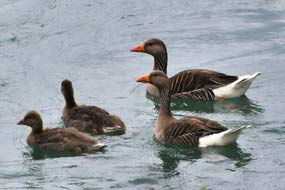 were swimming by the main bridge (Photo
43 - Greylag Geese) (see below left), and along a side road we found a bird
hide overlooking the Blanda river-mouth where the now wide and shallow river
flowed towards its exit into H˙nafj÷rur. There were again large numbers of Greylag
Geese here, both swimming on the river and standing on the river banks. But that
was about it for Bl÷nduˇs; despite the reports of flocks of Harlequin Ducks both here and on the Laxß
river at Mřvatn, for us these elegant ducks remained elusive. were swimming by the main bridge (Photo
43 - Greylag Geese) (see below left), and along a side road we found a bird
hide overlooking the Blanda river-mouth where the now wide and shallow river
flowed towards its exit into H˙nafj÷rur. There were again large numbers of Greylag
Geese here, both swimming on the river and standing on the river banks. But that
was about it for Bl÷nduˇs; despite the reports of flocks of Harlequin Ducks both here and on the Laxß
river at Mřvatn, for us these elegant ducks remained elusive.
Around H˙nafj÷rur: we now faced a long stretch of Ring Road around the
flat, fertile horse farming lands of the shores of H˙nafj÷rur (click here for detailed map of route); the recklessly speeding tourist traffic was worse than ever, making this the
most stressful driving in Iceland so far. Shapely peaks lined the southern
horizon as we passed around the shore of Hˇp lagoon which was
trapped by a huge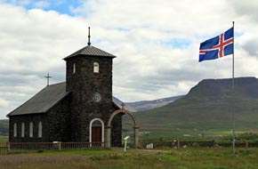 glacial moraine sand-bar separating it from H˙nafj÷rur.
Thankful for some relief from Ring Road tourist traffic, we turned off onto the
unsurfaced Route 721. Just by the junction, a curious cluster of conical-shaped
hillocks covers an area of some 4 km2;
some reports ascribe the Vatnsdalshˇlar mounds to the debris remains of a massive
landslide from the Vatnsdalsfjall mountains east
of Hˇp Lagoon, but in such an obvious glacial terminal location at the estuary
delta of the Vatnsdalsß river, they seemed far more likely to be drumlin heaps
of glacial moraine. This glacial moraine sand-bar separating it from H˙nafj÷rur.
Thankful for some relief from Ring Road tourist traffic, we turned off onto the
unsurfaced Route 721. Just by the junction, a curious cluster of conical-shaped
hillocks covers an area of some 4 km2;
some reports ascribe the Vatnsdalshˇlar mounds to the debris remains of a massive
landslide from the Vatnsdalsfjall mountains east
of Hˇp Lagoon, but in such an obvious glacial terminal location at the estuary
delta of the Vatnsdalsß river, they seemed far more likely to be drumlin heaps
of glacial moraine. This
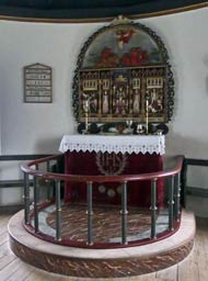 moraine-rich, fertile farming land bordering H˙nafj÷rur
bay and Hˇp lagoon at Ůingeyrar had originally been the long-established
meeting site of the regional assembly, the H˙na-Thing during the
time of
the Icelandic Commonwealth (930~1262 AD). The first Bishop of Hˇlar, Jˇn
Ígmundsson, pledged to endow a church with its associated farm as a living for
the priest here at Ůingeyrar in return for relief from a local famine. When
the land began to regain its productivity, Bishop Ígmundsson kept his word and
founded not only a church but Iceland's first monastery, Ůingeyra-Klaustur, here
in 1133 AD. The monastery prospered and became a centre of culture, with
Iceland's most outstanding texts of medieval Saga literature transcribed here,
so preserving them for posterity. The monastery was closed at the 1550 Lutheran
Reformation and nothing now survives of it except the church and farm. The
present stone church was endowed in 1877 by a wealthy local farmer and member of
the Althing, built from cut basalt blocks transported on sledges across the
winter frozen Hˇp Lagoon from the hills to the west. It now
stands in splendid isolation out here moraine-rich, fertile farming land bordering H˙nafj÷rur
bay and Hˇp lagoon at Ůingeyrar had originally been the long-established
meeting site of the regional assembly, the H˙na-Thing during the
time of
the Icelandic Commonwealth (930~1262 AD). The first Bishop of Hˇlar, Jˇn
Ígmundsson, pledged to endow a church with its associated farm as a living for
the priest here at Ůingeyrar in return for relief from a local famine. When
the land began to regain its productivity, Bishop Ígmundsson kept his word and
founded not only a church but Iceland's first monastery, Ůingeyra-Klaustur, here
in 1133 AD. The monastery prospered and became a centre of culture, with
Iceland's most outstanding texts of medieval Saga literature transcribed here,
so preserving them for posterity. The monastery was closed at the 1550 Lutheran
Reformation and nothing now survives of it except the church and farm. The
present stone church was endowed in 1877 by a wealthy local farmer and member of
the Althing, built from cut basalt blocks transported on sledges across the
winter frozen Hˇp Lagoon from the hills to the west. It now
stands in splendid isolation out here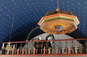 in these remote and lonely farmlands by
the flat lagoon shore next to Ůingeyrar Farm (Photo
44 - Ůingeyrar church) (see right), clearly still prosperous
horse-rearing lands. in these remote and lonely farmlands by
the flat lagoon shore next to Ůingeyrar Farm (Photo
44 - Ůingeyrar church) (see right), clearly still prosperous
horse-rearing lands.
The church at Ůingeyrar: we drove out along the 6kms of dirt road through the empty H˙nafj÷rur farmlands to reach the
isolated church at Ůingeyrar, to be greeted by a young attendant from the nearby glitzy
visitor centre with demand for payment of 800kr each 'service charge' to visit
the church. Hmmm .. first mistake! His second mistake was showing us the church
before collecting his pieces of silver! In our view, turning a church into a
tourist attraction was no pretext for charging admission however euphemistically
disguised. The oldest and most attractive piece of
artwork in the stark 19th century dark stone Ůingeyrar
church was a 15th century alabaster relief altarpiece, made in Nottingham
and originally in the form of a triptych (see above left). This was the only treasure remarkably
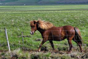 to have survived from the monastery after its dissolution. The ornate but rather
less attractive 17th century Baroque hexagonal pulpit and octagonal baptismal
font were both over-decorative with gilded canopies and painted panels. The
organ loft rail was lined with carved figures of Christ and apostles (see above
right); those here
are copies of the originals which once had decorated the rood-screen of an
earlier Ůingeyrar church and are now in the ReykjavÝk National Museum. The church's
blue-panted ceiling was covered with 1000 stars, representing 1000 years of
Christianity in Iceland. We spent time photographing the church's artwork, then
walked over intending to see the replica Saga manuscripts in the visitor centre.
But instead we were to have survived from the monastery after its dissolution. The ornate but rather
less attractive 17th century Baroque hexagonal pulpit and octagonal baptismal
font were both over-decorative with gilded canopies and painted panels. The
organ loft rail was lined with carved figures of Christ and apostles (see above
right); those here
are copies of the originals which once had decorated the rood-screen of an
earlier Ůingeyrar church and are now in the ReykjavÝk National Museum. The church's
blue-panted ceiling was covered with 1000 stars, representing 1000 years of
Christianity in Iceland. We spent time photographing the church's artwork, then
walked over intending to see the replica Saga manuscripts in the visitor centre.
But instead we were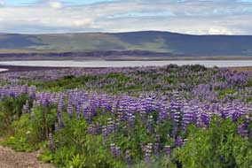 distracted by the sight of attractive Icelandic horses
grazing
the nearby pastures (see left) (Photo
45 - Icelandic horses), and somehow the 'service charge' got overlooked!
Returning along the dirt track to the Ring Road, we paused to photograph more of
the horses farmed in these lonely H˙nafj÷rur lands, and a typically Icelandic setting
of lupins growing along the VÝidalsß estuary (see
right) (Photo
46 - Lupins at Ůingeyrar).
Koluglj˙fur Canyon and Kolufossar waterfalls:
continuing westwards past VÝidalsfjall ridge in oppressively speeding Ring Road
tourist traffic, we turned off onto the gravelled Route 715 along the farming
valley of VÝidalur
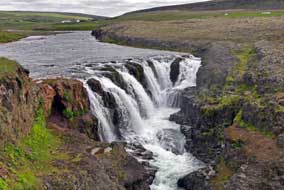 (click here for detailed map of route).
Some 6kms along, we crossed the VÝidalsß just where the river emerged from the
2kms long Koluglj˙fur Canyon carved out along the valley. At Kolugil Farm, we turned into a parking area for
the Kolufossar waterfalls, expecting to be able to
enjoy this little known and unpublicised natural wonder in peace. But we should
have realised: never underestimate the all-pervasive reach of the mass tourism
industry; Kolufossar had been discovered. A number of tourist cars were parked
here along with even a tour-bus whose rowdy occupants spilled everywhere along
the canyon top. We waited until the tourists' brief span of attention wearied and
they were hastened on for another set of 'selfies' at the next 'attraction'.
Then in relative peace, we were able to study the falls from the narrow bridge (click here for detailed map of route).
Some 6kms along, we crossed the VÝidalsß just where the river emerged from the
2kms long Koluglj˙fur Canyon carved out along the valley. At Kolugil Farm, we turned into a parking area for
the Kolufossar waterfalls, expecting to be able to
enjoy this little known and unpublicised natural wonder in peace. But we should
have realised: never underestimate the all-pervasive reach of the mass tourism
industry; Kolufossar had been discovered. A number of tourist cars were parked
here along with even a tour-bus whose rowdy occupants spilled everywhere along
the canyon top. We waited until the tourists' brief span of attention wearied and
they were hastened on for another set of 'selfies' at the next 'attraction'.
Then in relative peace, we were able to study the falls from the narrow bridge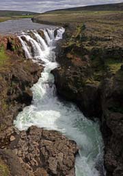 (see right),
as the shallow and rather insignificant VÝidalsß
river spilled over the brink, its ice-blue cascades tumbling in multi-layered
falls into the depths of the canyon carved out over aeons into crumbling rock
(see left and right) (Photo
47 - Kolufossar waterfalls).
The far side of the bridge looked downstream along the winding length of the 40m
deep gorge, with rock pinnacles standing stark along the canyon's length (Photo
48 - Koluglj˙fur Canyon).
This localised area of softer, friable rock must have been eroded away by the
river before it emerged at a lower level to flow along the surface of harder
rock. Having photographed the falls and canyon from the vantage point of the
bridge, we clambered down the rocks below the bridge to the head of the falls
for photographs at closer quarters (see below left) (Photo
49 - Kolufossar waterfalls), and stood at the brink
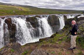 of the canyon
precipice peering down into the depth of the gorge (Photo
50 - Koluglj˙fur Canyon) (see below right). This was truly as magnificent a sight of
natural beauty in such a wild and lonely setting along this valley as we should
see in the whole of Iceland, and still remarkably free from the pollutant
intrusion of mass tourism. of the canyon
precipice peering down into the depth of the gorge (Photo
50 - Koluglj˙fur Canyon) (see below right). This was truly as magnificent a sight of
natural beauty in such a wild and lonely setting along this valley as we should
see in the whole of Iceland, and still remarkably free from the pollutant
intrusion of mass tourism.
Hvammstangi
Camping: returning to Route 1, we continued westwards for the final stretch of speeding
tourist traffic to the turning onto Route 72 along the shore of Mifj÷rur
up to Hvammstangi (click here for detailed map of route). This was a sizeable fishing port, lit by the now bright
afternoon sun, and high on the fell-side above the village we found Kirkjuhvammur
Camping, aptly named alongside the municipal graveyard and chapel. But alas, so
had half the caravanning holiday-makers of Iceland together with vast numbers of
tourists, and it was only with difficulty that we managed to secure a reasonably
free space towards the top, preferring the peaceful company of the graveyard
incumbents to that of rowdy holiday-makers with all their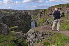 materialistic
paraphernalia. On such a sunny evening, we relaxed a while with well-earned
beers before setting up our barbecue for supper (see below left) (Photo
51 - Hvammstangi Camping). materialistic
paraphernalia. On such a sunny evening, we relaxed a while with well-earned
beers before setting up our barbecue for supper (see below left) (Photo
51 - Hvammstangi Camping).
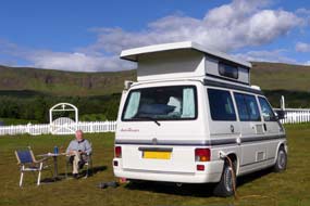 Hvammstangi
fishing port: it rained heavily during the night and this morning the
air was still moist with rain cloud on the hills above the village. Last evening
the fells had glowed in the late sun which picked out all the detail of the
rocky outcrops; this morning they were totally hidden in low, misty cloud. We
had expected someone to call round for payment but no one appeared; Hvammstangi
was a Camping Card site, but how can you pay when there was no reception or no
warden calling. The facilities were reasonable with a large common room, a small
kitchen/wash-up and outside a covered grill-house with seating, and wi-fi around
the facilities building. The WCs were modern and clean but with minimal
hand-basins,
and extraordinarily no showers whatsoever; clearly you were not expected either
to wash or shower at Hvammstangi! Before leaving the village, we drove down to
the fishing harbour for photos (see below right) (Photo
52 - Hvammstangi fishing harbour), shopped at the Vinbuin and
well-stocked supermarket and admired the even better stocked hardware stores
where Hvammstangi
fishing port: it rained heavily during the night and this morning the
air was still moist with rain cloud on the hills above the village. Last evening
the fells had glowed in the late sun which picked out all the detail of the
rocky outcrops; this morning they were totally hidden in low, misty cloud. We
had expected someone to call round for payment but no one appeared; Hvammstangi
was a Camping Card site, but how can you pay when there was no reception or no
warden calling. The facilities were reasonable with a large common room, a small
kitchen/wash-up and outside a covered grill-house with seating, and wi-fi around
the facilities building. The WCs were modern and clean but with minimal
hand-basins,
and extraordinarily no showers whatsoever; clearly you were not expected either
to wash or shower at Hvammstangi! Before leaving the village, we drove down to
the fishing harbour for photos (see below right) (Photo
52 - Hvammstangi fishing harbour), shopped at the Vinbuin and
well-stocked supermarket and admired the even better stocked hardware stores
where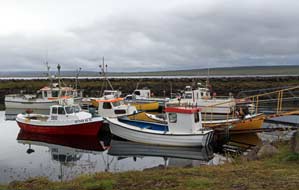 seemingly anything you could possibly imagine was on sale. Nearly a decorative
fish-drying rack was hung with a few token fish (see below left). Having
re-filled George's diesel, we finally left Hvammstangi to return to the Ring
Road.
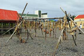 A
long and lonely drive north through wild terrain to HˇlmavÝk: the
first stage of today's long drive north was 28kms down Route 1 across the
fertile farmlands of the Mifj÷rur estuary past Laugarbakki and down the long
eastern shore of Hr˙tafj÷rur to round the head of the inner fjord close to the
large Ring Road service station of Bru (click
here for detailed map of route). Before reaching Bru, we turned off
northwards onto Route 68, all the way back along the western fjord coast passing
the shore-side farming settlement of Boreyri. This was still farming
countryside, but 15kms further at the farm and isolated church of Prestbakki,
the tarmac ended for 18kns of gravelled road through wild fell terrain dotted
with abandoned farms. At the farmstead of Kolbeinsß, looking out over the mouth
of Hr˙tafj÷rur to the wild, open expanse of the Arctic Ocean, the tarmac began
again. The narrow road ran along the shore-side, and the surf from the open sea
beyond the sheltered fjord was wilder, littering the shore-line with driftwood washed across the Ocean from who-knows-where in the Siberian forests
(see below A
long and lonely drive north through wild terrain to HˇlmavÝk: the
first stage of today's long drive north was 28kms down Route 1 across the
fertile farmlands of the Mifj÷rur estuary past Laugarbakki and down the long
eastern shore of Hr˙tafj÷rur to round the head of the inner fjord close to the
large Ring Road service station of Bru (click
here for detailed map of route). Before reaching Bru, we turned off
northwards onto Route 68, all the way back along the western fjord coast passing
the shore-side farming settlement of Boreyri. This was still farming
countryside, but 15kms further at the farm and isolated church of Prestbakki,
the tarmac ended for 18kns of gravelled road through wild fell terrain dotted
with abandoned farms. At the farmstead of Kolbeinsß, looking out over the mouth
of Hr˙tafj÷rur to the wild, open expanse of the Arctic Ocean, the tarmac began
again. The narrow road ran along the shore-side, and the surf from the open sea
beyond the sheltered fjord was wilder, littering the shore-line with driftwood washed across the Ocean from who-knows-where in the Siberian forests
(see below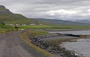 right). At one
time, driftwood was prized picking for the settlers in treeless Iceland, used
for making timber frames for dwellings and for furniture. Ahead the cliffs of Skarfatangi loomed ominously above the ocean appearing impassable, but the road
turned inland climbing steeply over a high shoulder to descend on the northern
side down to the shore of Bitrufj÷rur. The way forward had to make a long sweep
inland around to the isolated farmstead of Sandhˇlar at the head of the narrow
fjord inlet,
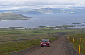 followed by the long return leg along the far side, passing another
isolated shore-side farm church at Ëspakseyri. The weather had now become
oppressively gloomy, making the fjord seem even more narrow. followed by the long return leg along the far side, passing another
isolated shore-side farm church at Ëspakseyri. The weather had now become
oppressively gloomy, making the fjord seem even more narrow.
As the road reached the open sea again beyond the
mouth of Bitrufj÷rur, the gravelled surface began again, this time wet after
recent rain, coating the road with muddy slurry. Ahead beyond a turning to a
lonely farm, the sheer cliffs of the formidable Ennish÷fi headland towered
above the sea. The road again turned inland to climb even more steeply, gaining
height via hairpins to surmount the headland's shoulder. With uncertain grip on
the narrow road's muddy slurry, George bravely tackled the gradient to reach the
highpoint, and began the long and equally steep downward slope to Broddanes on
the shore of Kollafj÷rur (see left). Along the fjord's southern shore to its head, we
paused to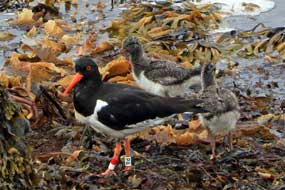 photograph more Icelandic horses at Lj˙fustair farm. Just around the
northern side, the tarmac began again as the road passed another isolated farm
church at Kollafjararnes. Route 68 now continued around the shore-line of
SteingrÝmsfj÷rur, and here the heaps of driftwood were piled high along the
wild beach of Gßlmastr÷nd. Just beyond the farmstead of H˙savÝk, we passed
shallow lagoons on both sides of the road. This was clearly a birding area: Red
Throated Divers could be seen in the distance, and photograph more Icelandic horses at Lj˙fustair farm. Just around the
northern side, the tarmac began again as the road passed another isolated farm
church at Kollafjararnes. Route 68 now continued around the shore-line of
SteingrÝmsfj÷rur, and here the heaps of driftwood were piled high along the
wild beach of Gßlmastr÷nd. Just beyond the farmstead of H˙savÝk, we passed
shallow lagoons on both sides of the road. This was clearly a birding area: Red
Throated Divers could be seen in the distance, and
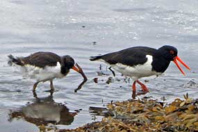 along the shore-side mother
and chick Oystercatcher pairings waded and pecked in the shallows. Some of the chicks were
still young and covered with fluffy down (Photo
53 - Oystercatcher with chick) (see right); others were juveniles, almost
fledged and recognisable as young Oystercatchers (Photo
54 - Oystercatcher with juvenile young) (see left). along the shore-side mother
and chick Oystercatcher pairings waded and pecked in the shallows. Some of the chicks were
still young and covered with fluffy down (Photo
53 - Oystercatcher with chick) (see right); others were juveniles, almost
fledged and recognisable as young Oystercatchers (Photo
54 - Oystercatcher with juvenile young) (see left).
HˇlmavÝk Camping: just beyond the junction with Route 61 coming in
from the SW, we reached the outskirts of HˇlmavÝk. We had 2 campsites identified
for tonight, one here and the other 20kms further around on the far side of
SteingrÝmsfj÷rur at Drangsnes. HˇlmavÝk Camping at the entrance to the fishing
village, near the community centre and swimming pool, was already quite full of
holiday-making Icelanders in caravans, but we found a secluded bay enclosed by a
bund which we hoped would restrict the inevitable noise. There was every reason
to believe that in July, Drangsnes would similarly be 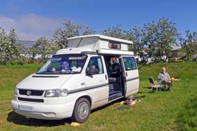 full of holiday-makers,
and was set on a more exposed hill-side overlooking the fjord. At least it was
more sheltered here and we decided to stay at HˇlmavÝk. Facilities were some
distance from the camping areas in the community centre, but both kitchen and
WCs were out of bounds today reserved for a private function. The only showers
were at the swimming pool at full admission prices. The camping area had
minimalist facility huts with one functioning WC and a wash-up sink. Despite
there being in effect no showers, no wi-fi, and limited access today to WCs and
kitchen, the campsite charges were unprecedentedly expensive: 1,240kr/person
plus 1,240kr for power full of holiday-makers,
and was set on a more exposed hill-side overlooking the fjord. At least it was
more sheltered here and we decided to stay at HˇlmavÝk. Facilities were some
distance from the camping areas in the community centre, but both kitchen and
WCs were out of bounds today reserved for a private function. The only showers
were at the swimming pool at full admission prices. The camping area had
minimalist facility huts with one functioning WC and a wash-up sink. Despite
there being in effect no showers, no wi-fi, and limited access today to WCs and
kitchen, the campsite charges were unprecedentedly expensive: 1,240kr/person
plus 1,240kr for power
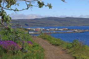 making a total of 3,720kr. This was just silly for what
was a very basic municipal site! But with George's undersides caked in mud sprayed
up from the wet gravel roads, we settled in. It was a bleakly chill evening,
gloomily overcast with cold wind blowing from the north. Despite being mid-July,
we were glad of the fan heater tonight for warmth. More caravans and tourist
hire-cars arrived later, but weary after today's long drive, we turned in early,
looking forward to a day in camp tomorrow. making a total of 3,720kr. This was just silly for what
was a very basic municipal site! But with George's undersides caked in mud sprayed
up from the wet gravel roads, we settled in. It was a bleakly chill evening,
gloomily overcast with cold wind blowing from the north. Despite being mid-July,
we were glad of the fan heater tonight for warmth. More caravans and tourist
hire-cars arrived later, but weary after today's long drive, we turned in early,
looking forward to a day in camp tomorrow.
A day at HˇlmavÝk Camping and HˇlmavÝk fishing harbour: amazingly the wind had shifted overnight,
and we woke to warm sun enabling us to sit out for breakfast (Photo
55 - HˇlmavÝk Camping) (see above right). What an amazing
difference in weather and temperature wind direction makes. After a restful
morning in camp, we walked along a pathway from the campsite into HˇlmavÝk where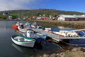 Lupins grew on the fell-side above SteingrÝmsfj÷rur (see left and below left), past
the modern church set high on a rocky bluff above the village, to wander around
the fishing port (Photo
56 - HˇlmavÝk fishing harbour) (see right). HˇlmavÝk's small fishing fleet catches shrimps out in the
fjord and in deeper waters off the coast. Back at camp, more holiday-making
caravans were arriving, their occupants making enough noise for the entire
ReykjavÝk conurbation where they all clearly came from. And to cap all of
this hullaballoo, long distance refrigerated lorries began parking immediately
by the campsite with their engines constantly running, making incessant
intrusive noise. Yet more caravans arrived later in the evening, and with the
campsite full, a pair of them with
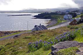 arrogant indifference tried parking across
our front. They reluctantly moved, seeming surprised at our objection! HˇlmavÝk Camping was
without doubt the trip's (and Iceland's) worst campsite, particularly in peak
holiday season of July; it was rated at a sordid -5, for its ridiculously
over-priced charges, combined with worse than minimalist facilities, no showers,
overcrowding, and constant intrusive noise of trucks parked nearby overnight
with engines running. Today had been a far from restful rest day, and we had no
intention of parting with money for this disgraceful campsite. It is a place to
be avoided. arrogant indifference tried parking across
our front. They reluctantly moved, seeming surprised at our objection! HˇlmavÝk Camping was
without doubt the trip's (and Iceland's) worst campsite, particularly in peak
holiday season of July; it was rated at a sordid -5, for its ridiculously
over-priced charges, combined with worse than minimalist facilities, no showers,
overcrowding, and constant intrusive noise of trucks parked nearby overnight
with engines running. Today had been a far from restful rest day, and we had no
intention of parting with money for this disgraceful campsite. It is a place to
be avoided.
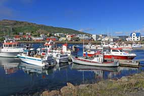 Tomorrow we should move on for the next phase of our
Icelandic travels, exploring the remote
West Fjords region of NW Iceland. Normally of course we should continue to
complete our series of last summer's travelogues over the winter months. This
year however, such were our experiences in Iceland, with so much opportunity for
learning, spectacular volcanic terrain and unprecedented wealth of wild flora
and birdlife, all deserving duly detailed attention, that time constraints are
catching up with us. We simply cannot complete our writing up at present. But do
not worry: we shall take a pause with our Icelandic travelogues, and resume this
series in the autumn. The editions published so far will be included in the
normal country index page, with the remaining missing editions to be added on
our return. We must now turn our attention to preparing for our summer 2018
travels when we plan to circumnavigate the Baltic, focussing on a re-visit to
the three Baltic Republics of Lithuania, Latvia and Estonia, with a crossing to
Helsinki to return along the Baltic's northern seaboard through Finland, the
┼land Islands and southern Sweden to our start point back at LŘbeck. So join us
again shortly. Tomorrow we should move on for the next phase of our
Icelandic travels, exploring the remote
West Fjords region of NW Iceland. Normally of course we should continue to
complete our series of last summer's travelogues over the winter months. This
year however, such were our experiences in Iceland, with so much opportunity for
learning, spectacular volcanic terrain and unprecedented wealth of wild flora
and birdlife, all deserving duly detailed attention, that time constraints are
catching up with us. We simply cannot complete our writing up at present. But do
not worry: we shall take a pause with our Icelandic travelogues, and resume this
series in the autumn. The editions published so far will be included in the
normal country index page, with the remaining missing editions to be added on
our return. We must now turn our attention to preparing for our summer 2018
travels when we plan to circumnavigate the Baltic, focussing on a re-visit to
the three Baltic Republics of Lithuania, Latvia and Estonia, with a crossing to
Helsinki to return along the Baltic's northern seaboard through Finland, the
┼land Islands and southern Sweden to our start point back at LŘbeck. So join us
again shortly.
The Prologue to our summer 2018
travels around the Baltic
will be published quite soon
|
Sheila and Paul |
Published: 8 February 2018 |
|

 CAMPING
IN ICELAND 2017 - North-West Iceland: Western Eyjafj÷rur, ┴rskˇgssandur, HrÝsey Island, DalvÝk, Ëlafsfj÷rur, Siglufj÷rur,
Hofsˇs, Hˇlar, Sauarkrˇkur, GlaumbŠr, Varmahli,
Skagastr÷nd, Bl÷nduˇs, Ůingeyrar, Hvammstangi,
and HˇlmavÝk:
 Western Eyjafj÷rur coast to DalvÝk:
leaving Lonsß Camping on a bright, sunny morning, we drove down into the city
outskirts to re-stock with provisions at Netto and finally left Akureyri. After
3 days in such a likeable place where people had been so friendly and helpful,
we headed north on Route 1 along the
Western Eyjafj÷rur coast (click on Map 1 opposite for details
of route). Ahead across the coastal moors and farmland, the hefty wall of sculpted
Tr÷llskagi mountains seemed to bar further progress northward along the fjord.
 shore of Eyjafj÷rur on Route 82. The broad meadows,
sandwiched between fjord and elongated N~S mountain wall of Flßr, was some of
the richest dairy farming land we had seen so far, and farmers were busily at
work taking advantage of a few days of fine weather for hay-making. Bales of
silage were lined up in the mown fields ready for the long winter ahead. Route
82 hugged the fjord-shore where the northern end of the enclosing mountainous
spur tailed off at the opening of Ůorsvaldsdalur, the next breach in this
mountainous mass. On the coastal side, the broad farming meadows of
┴rskˇgsstr÷nd opened up (see above left); we turned off onto Route 808 into the tiny fishing
settlement of ┴rskˇgssandur and drove down to the little port where the HrÝsey
ferry was being loaded (see left). Here we sat to eat our sandwich lunch, looking out on
this beautifully peaceful morning across the northern end of Eyjafj÷rur where
the flat island of HrÝsey seemed to fill the centre of the fjord. On the far
side, a solid wall of snow-capped mountains forming the bleak and uninhabited
northern extremity of the Lßtrastr÷nd peninsula were lit by bright sunshine.
 Bruggsmijan Micro-brewery
at ┴rskˇgssandur: ┴rskˇgssandur is home to the
 brewing tradition, seeking malt and hops, brewing equipment and expertise from
Czech sources combined with local mountain water from ┴rskˇgssandur, and with quality of product as their hallmark, they produced
their first Pilsner-style Kaldi brew in 2006. By 2007 their small premises at ┴rskˇgssandur
was producing 160,000 litres per year. Demand for quality beers in beer-deprived
Iceland outstripped their capacity, and both their premises and production have
expanded so that by 2015 annual production had increased to 650,000 litres, with
a range of 5 regular beers plus seasonal specials.

 was reduced in size from former
days as larger firms bought up fishing quotas and reduced crew levels, fishing
and associated support industries, including manufacture of plastic fish
boxes seen universally at the ports, were still DalvÝk's major employers.
 signal connected
immediately, and the WC/showers in the hostel basement, although rather
institutional from their school origins, were modern and spotlessly clean; a
small,
 limited kitchen/wash-up was set in a hut by the camping area. This was
the perfect setting for our much needed rest day tomorrow.
 Crossing by ferry from ┴rskˇgssandur to HrÝsey Island:
the alarm was set early in readiness for today's crossing on the 11-30am ferry
from ┴rskˇgssandur for a day on HrÝsey Island. It was a beautiful morning
when we returned to ┴rskˇgssandur's little port, and the view looking across the
fjord with the sun lighting the snow-capped mountains on the far side of Eyjafj÷rur
was truly magnificent (
 birds nest on HrÝsey; the reason for this large concentration is that all
hunting of birds or gathering of eggs is banned, and there are no predators such
as foxes, mink or rats. With its lush moorland, low-growing willow and
plentiful food, conditions are particularly favourable for ground-nesting birds.
The
 island has one of the largest population of nesting Arctic Terns in Europe,
as well as a sizeable population of Ptarmigan. There are 3 marked walking trails
around the southern part of the island, all starting from HrÝsey village, and we
planned to walk the largest circuit at 5kms.
 disused fish-drying frames. HrÝsey's
fishing heyday was during the period 1930~50, when the herring boom made the
island second only in size to Siglufj÷rur with its herring salting industry and
deep-sea fishing, and seasonal workers flocked to HrÝsey for employment in the
herring
 processing factories. In the 1960s however, whether through over-fishing,
the herring suddenly disappeared, and HrÝsey settled back into quiet obscurity.
 at BorgarbrÝk down at the coast we reached the remains of an
ancient volcanic dyke formed by magma flowing into a weakness in the bedrock. An
inlet from the sea with cliffs towering above was all that remained of this
eroded volcanic intrusion (
 the male
birds soaring around. We sat among the Sea Pinks on the cliff-tops to eat our
sandwiches, with one eye scouring the fjord for any sign of whales. The brisk
wind whipped up 'white horses' in the blue waters of the fjord, but
none of this spray was the blow of a surfacing whale. On the far side of the
fjord, the snow-capped line of peaks of the remote and uninhabited Lßtrastr÷nd
peninsula was totally absorbing, compelling our attention.
 flew overhead. There
were so many, it was difficult to decide which way to point cameras, surrounded
as we were by their constant calling. A little
 further more Frog Orchids were
seen by the path, and a Ptarmigan in full summer plumage; in spite of the number
of Ptarmigan reported on HrÝsey, this was the only one seen today. The path eventually
rejoined the gravel track of the island's shorter walking routes, and brought us
back down to the outskirts of HrÝsey village through more thickets of planted
spruce. A local lady we had talked to earlier about the island's bird-life had
told us of Snow Buntings to be seen around the village's cafÚ, and sure enough
as we passed, a Snow Bunting was perched on the roof crest (see right). Workmen were
strimming the verges, cutting back the Angelica plants; Angelica from HrÝsey is used to flavour one of the Kaldi beers, Stinnings,
giving the beer a subtle liquorice taste.
 dripped with fish blood mixed
with melted ice-water. For such a small boat, it seemed a remarkably large
catch; dried fish hung from rails on the boat's decking. A fork-lift truck
driver deftly hoisted up the crates, tipping their fishy contents into larger
crates (
 ┴rskˇgssandur.
  were to get little sleep, being woken at 1-00am by young American tourists
arriving late, slamming car doors with undue noise and no awareness of or
consideration for sleeping neighbours. The following morning, we made it
forcibly clear that arriving late at a campsite entailed a responsibility to
show neighbourly consideration for others. Blank looks in response: such was the
uncouth, impenetrable ignorance and engrained egocentricity of these sad folk that we might as well
have been speaking in Mongolian
for all the impact it made!
 which had left port at DalvÝk just before us was now
steaming northwards towards the mouth of Eyjafj÷rur and the lighthouse on the
islet of Hrˇlfssker in mid-fjord. Ahead the waterfall of MÝgindisfoss, fed by
melt-waters streaming over a headland from the mountains high above, plummeted
headlong over a high cliff directly down into the sea. The road now turned abruptly into
the mouth of M˙lag÷ng Tunnel, its south portal looking like a huge square
concrete shed (see above right). The tunnel,
 single-lane only with passing places every 200m on
the northern side and priority to south-bound traffic, cuts diagonally for 3.4kms through the otherwise impassable
mountainous headland of Ëlafsfjararm˙li which tops the whole peninsula;
only a trackway passes around the tip. The tunnel was opened in 1991, and before
that there had been no direct connection between DalvÝk and Ëlafsfj÷rur.
 tight
tight
 squeeze for the car to pass, doubtless provoking curses from the local
driver!
 The port of Ëlafsfj÷rur: first stop was the town library/TIC in
Ëlafsvegur, where the garrulous young lass in fluently colloquial Americanese
(learnt from TV soap operas, she admitted) entertained us at length about life
in Ëlafsfj÷rur, and its rivalry relationship with Siglufj÷rur. Since the 2
 connecting HÚinsfjararg÷ng tunnels were opened in 2010, the 2 townships
were now united under the one municipal authority of Fjallabygg; those living
in Ëlafsfj÷rur felt resentment at being the poor neighbour. The
residents of Ëlafsfj÷rur did not give the impression of being book-lovers and
regular users of their impressively stocked little library, and clearly she
clearly had not had a single customer all day to chat with, until we arrived! We
did however eventually escape to continue along Aalgata and found the local
supermarket at the corner of Strandgata (see above right). Judging by its scale, Ëlafsfj÷rur's
large port during the town's herring heyday would once have been home to a
sizeable fishing fleet; today however it stood largely empty with an air of sad
dereliction (see above left). The only ship moored at the quay was one token rusting fishing
support vessel which looked as if it had not put to sea for many a month (see
below right). The
fish-processing factory was evidently closed, and others now seemed occupied by
smaller scale industries. We walked around the dock, taking photos looking back
across the port towards the little town with its mountainous backdrop (
 modern,
the looming rain clouds gave the town a sad air (see above left). We walked
around past the decaying port buildings to the smaller
harbour where
 a few small fishing boats were moored
(see below left) (
 authority focussed on attracting tourism income, organising a number of
summer festivals, but such transient features do nothing for jobs. Ëlafsfj÷rur
was managing to halt the population decline and had retained local schools from
kindergarten through to senior schooling. But there was strong local resentment
about health care being centralised at rival Siglufj÷rur on cost-saving
 grounds;
the latest loss was the local ambulance station. Having said that, despite the
apparent air of dereliction as we walked around the harbour, the houses were all
modern, there were plenty of large 4WD cars, and although a work-a-day town, Ëlafsfj÷rur
had a lively air.
 A wet drive north through HÚinsfjararg÷ng Tunnels
to Siglufj÷rur:
after a night of much rain, we woke to a miserably wet morning with low cloud
obscuring the surrounding mountains. The fjord level mist gradually lifted, hovering in linear patches along the mountain faces
(see right). In such weather we had certainly not seen Ëlafsfj÷rur at its best,
 but
before leaving we drove across to the far side of the fjord to see the town's
award-winning avalanche barrier whose turf-covered bund so blended into the
mountain side as to be almost impossible to detect. And so we approached the
entrance to the HÚinsfjararg÷ng Tunnels (see
left) (
 towards
the sea (see right). Looking along the road, the 2 tunnel mouths seemed so tiny
against the backdrop of these huge mountain faces, their overwhelming scale
emphasising the enormity of the project to bore these 2 tunnels. A 7 year
research project had been conducted by the University of Akureyri to evaluate
the social, cultural and economic impact of the tunnels' construction on the 2
 towns
they now connect. Results showed tunnel traffic above expectations, with
considerable commuting between Ëlafsfj÷rur and Siglufj÷rur, and residents
travelling between them for shopping, healthcare, schooling and social events.
Increased tourism resulting from the improved access by tunnels had
strengthened the regional economy. But state and municipal services have been
reduced as a result of the 2008 economic crisis, particularly health care:
access to educations services has improved, but Ëlafsfj÷rur residents feel
a resentment at not receiving due share of public services. Siglufj÷rur has
seen an increase in population, and the population decline in Ëlafsfj÷rur has
been halted with young people tending to remain in their home community. All of
this reflected what we had heard from conversations with people at Ëlafsfj÷rur.
 town and port of Siglufj÷rur, nestled almost precariously on a narrow spit of fjord-side land (eyri
in Icelandic)
towered over on both sides of this isolated, narrow fjord by mountains of unseen
height, their tops totally buried in rain cloud (see below left). Siglufj÷rur claims to be
Iceland's northernmost town, now with a population of less than 1,500 residents,
and isolated from the rest of the
 country though not as much as
in pre-tunnels days.
There had long been a Danish fishing and trading station on the fjord at Siglunes point at the northern tip of the peninsula, with shark fishing for
shark oil as the main catch. As demand increased prompting larger ships, the
port moved to a more sheltered position inside the fjord where the town of Siglufj÷rur
developed. But it was herring (sÝld in Icelandic) that gave rise to Siglufj÷rur's
boom years from 1920~60s. The Depression of the 1930s and the 1940s war years produced a global demand for conserved food, and Iceland's herring fisheries
prospered. By the 1950s, Siglufj÷rur was the largest port in Iceland with over
500 boats based here and sailing out to follow the summer migration of the
herring shoals. It was the herring catches that brought the revenue to modernise
the country, bringing the latest technology; it was herring and herring products
that made up 25% of Iceland's exports, and the revenue from this underwrote
Iceland's independence in 1944. We later saw photographs from the 1930s showing Siglufj÷rur's
docks piled high with barrels of smoked and pickled herring. Seasonal workers in
their 1000s flocked to Siglufj÷rur from all over the country and beyond for the
high wages and good life associated with the summer herring run. The quays were
lined with herring girl workers gutting and salting
 the herring from the
returning boats for loading in barrels. This heyday however came to an abrupt end in the mid-1960s when the herring simply disappeared, either through overfishing
or their migration pattern changed from Icelandic waters. In just a few years, Siglufj÷rur
and other herring
 ports declined or closed down, leaving just proud memories of
what Siglufj÷rur had meant for Iceland. All that is left now to recall the
herring boom years is the much-promoted, but over-rated and over-priced Herring
Museum that fuels the town's now economic dependence on a growing tourist
industry.
 The
town and what remained of the port was strung out along the fjord-side, and
right by the central square next to the fishing dock (see above right) we found the municipal
campsite (
 recent wet weather, the ground was soft and
churned up in places, but we found a spot well away from the noise potential of
a group of camping-cars, and settled in before kitting up in waterproofs for an
afternoon of exploring the town (
 cruise ship was in
port; that said it all, and unimpressed by this sterile, over-rated museum, we
left with just a passing glance into the conserved herring factory where herring
oil had once been extracted and purified leaving the remaining fish-meal as
fertiliser. By the fjord-side opposite, the decaying wooden piers of the former
herring dock still stood in the water
(
 summer to Siglufj÷rur
(no mean journey in those pre-tunnel days) to document the herring industry in a
wonderful series of photographs. These showed the port filled with 100s of
boats, herring girls working by the dockside piers where the catch had just been
unloaded, and even an official visit to Siglufj÷rur by the Icelandic president
in 1952. Sigurgeirsson had lugged his heavy camera
 and tripod up onto the
mountainside opposite for aerial photos showing the port spread along the narrow spit of
fjord-side land and piers stretching out into the fjord. This had been a
thoroughly worthwhile chance-find visit, and we had learned more about Siglufj÷rur's
herring history here than ever we should have at the over-priced Herring Museum.
Back through the town streets to the campsite by the fishing dock, we were glad
to settle into the warmth and shelter of George out of the chill, misty rain.
 immediately re-boarded. After calling
in at the supermarket to re-stock with provisions, we departed northwards.
 With low, wet cloud still clinging to the
mountains, we paused at the northern outskirts of Siglufj÷rur to admire the
impressive scale of the avalanche protection, huge turfed bunds extending across
the face of the mountain slopes above the town, topped by steel fencing tiers,
to trap and deflect falling snow and rocks (see above right). The avalanche defences were built at
government expense in the 1990s to protect communities vulnerable to avalanches
after the disaster which hit SuavÝk in the West Fjords where we should stay later.
 than feared, but
the M-places were something of a squeeze (see above right); fortunately we were
through before needing to pull over to allow any
 oncoming traffic to pass. We
emerged into gloomy daylight at the northern end box-like portal, with the land
falling away steeply towards the squat lighthouse at Sauanes point on the
peninsula tip (see left).
 farmland, the fields now
cut for baled hay. Passing the mouth of Flˇkadalur which cut up into the hills,
there were signs of this being an area of
 geothermal hot water, with a small
natural swimming pool by a farm. As the road swung inland across moorland, the
noticeable increase in tourist hire-car traffic driving at reckless speed
indicated we were getting back closer to the Ring Road; it suddenly felt
hazardous again. Off the coast, the low flat island of Mßlmey rose from
Skagafj÷rur, with the 180m high sheer-sided, flat-topped volcanic plug of
Drangey further out (see left).
 in
front of us before eventually
flying off (
 trackway, several more of the Dunlins flew around, settling in front
of us with their sharp, repetitive, staccato 'tew, tew, tew' alarm call, and
Red-necked Phalaropes darted busily among the reeds of a watercourse. We had been entertained by
an unexpected variety of waders and other bird-life
along the trackway by the H÷favatn mudflats.
 history of the 1000s of Icelanders who were driven by failed farming, poverty
and hardship to seek a new life in Canada and USA in the late 19th/early 20th
centuries. We had earlier learned much about the causative factors underlying the
emigration from the unpretentious but knowledge-packed Emigration Museum at Vopnafj÷rur
 Emigration were compounded by the evident superficial understanding of
the causes of mass emigration shown by the American woman at reception. It soon
became clear that, despite her claims of Icelandic descent from the Westman
Islands, she knew absolutely nothing about Iceland, spoke no Icelandic, and her
little knowledge about Icelandic emigration was book-derived. A glance at the
display panels supposedly recounting ÚmigrÚs' experiences showed they were
over-romanticised and failed to explain the social, economic and climactic
hardships that led to emigration. There was no reference to the conspiracy
between Canadian government promoting immigration schemes to attract settlers to
populate new regions of the Dominion and Icelandic authorities trying to
minimise poor-law support for the destitute, leading to land agents painting a
falsely encouraging picture of life in the new country compared with the
hardships faced on arrival in the new lands. Compared with all we had learned
from the knowledgeable Kathy at Vopnafj÷rur, we should learn nothing here at Hofsˇs,
and were certainly not prepared to pay even the seniors' reduced admission of
1,400kr (ú10) each. Our conclusion was that the Icelandic Emigration Centre at Hofsˇs,
like the Siglufj÷rur Herring Museum, was over-priced and over-rated; you would come away
with little depth of understanding
 about the causes of Icelandic mass
emigration, and the real hardships faced by emigrants on arrival in the New
World. For this, you would do better to talk with Kathy at Vopnafj÷rur
which would cost you nothing, rather than spend vast sums to view pretentiously glitzy but
non-informative display panels at Hofsˇs.
 During the evening, the campsite began to fill with tourists in hired cars and
camping cars now that we were closer to the Ring Road. Many of these tourist tent-campers were clearly ill-equipped, ill-clothed and ill-prepared for tent camping
in Icelandic conditions, displaying comical incompetence at putting up a
tent and cooking supper even in fine weather. The lad from the campsite-owning
family called round at 9-00pm to collect payment of 1000kr each for seniors plus
800kr for electricity. Facilities were limited to WCs, showers and wash-up sinks
with hot water, but all were modern and totally clean; there was no kitchen,
wi-fi, common room or bad weather shelter for tent campers. Behind us, the bulky mountains of Tr÷llskagi
peninsula lying between Eyjafj÷rur and Skagafj÷rur were indented by craggy
ridges dividing off long valleys cutting deep into the uninhabited interior,
with distant snowfields and glaciers covering the peaks and cwms at the valley
heads. The Skagafj÷rur western side is lined by a wide coastal strip with
fertile, moraine-rich farmland providing sheep, cattle and horse grazing. The
wind dropped, and clear evening sky brought sunlight, picking out all the
details of the shapely peaks lining the valleys of the mountainous hinterland
beyond the farming lands of the broad, flat coastal strip, and later the sun set
over this mountainous backdrop (see right).
 implied by our guide
books. It was a surprisingly large settlement with rows of modern and
affluent-looking single-storey houses extending along the side streets, and a
school, community centre, shop and filling station at the village centre. The
large number of houses seemed to indicate that the original community had now
 increased with holiday- and weekend-homes, particularly as with the improved
state of the Ring Road and Hvalfj÷rur tunnel, Hofsˇs was now within weekend
range from ReykjavÝk. This impression was reinforced by the modern village of Hofsˇs
having what was referred to as a 'designer swimming pool' which had put the
place 'on the map'. We should stay here a second day and investigate the
swimming pool tomorrow.
 managed to shine as we enjoyed the comfortably warm pool, and wallowed in
the 36║C geothermally heated hot-pot.
 pool. Across the bridge, the Hofsß river tumbled down from the Tr÷llskagi mountains into the sea by the
harbour wall (
 Cathedral church at
Hˇlar:
the overnight rain had just about stopped, and heavy overcast beginning to clear
from the 3 valleys of Unadalur, Seljadalur and Vesterdalur which penetrate deep
into the Tr÷llskagi mountainous interior. We returned to Route 76 and turned
south across the broad coastal farming strip where hay had been cut and baled (
 Herds
of Icelandic horses grazed the farmland pastures, and in the distance the small
cathedral church with its bell-tower at Hˇlar could be seen, set among woodland under the bulky, looming shadow of
snow-fringed Hˇlabyra mountain (see above right).
 was Jˇn Arason 1484~1550). Denmark adopted Lutheranism in
1536, and the Kingdom outlawed the Catholic Church, taking over its lands and
wealth including those in Iceland. The Icelanders' vehement resistance to the
enforced Protestant Reformation was politically motivated, with the Catholic Church becoming
a powerful and independent counter to Danish imperial control. The Bishop of Skßlholt was unable to resist Danish demands and was arrested in 1541, dying in
a Copenhagen prison; the
 south soon fell to Lutheranism. In the north however,
the Catholics rallied around Bishop Arason who amassed an army to resist the
Danes and marched on the Althing. After defeat in battle, he was arrested and beheaded
in 1550 along with his 2 sons. Arason had been a man ahead of his times: while mainland Europe
was in the throes of the Reformation, Bishop Arason had shipped a printing press
to Iceland and installed it at Hˇlar to print religious texts. The second
Lutheran Bishop of Hˇlar, Gubrandur Ůorlßksson (1541~1627) had himself
translated the Old Testament from Hebrew to Icelandic. A group of monks at Hˇlar
had, before the Reformation, begun illicitly translating the New Testament from
Greek, but none of this work had been distributed. Then in 1584, Gubrandur Ůorlßksson used Arason's printing press to produce 500 copes of the Bible translated into
vernacular Icelandic (see right); the work took 7 years and was paid for by every church
being required to purchase a copy. Gubrandur produced his own woodcuts to
illuminate the Bible headings. The
 current church at Hˇlar was built from local
red sandstone in 1763. Although the bishopric was abolished in 1801 and school
closed, the cathedral church remained, and the school was revived in 1882. This
has developed as a college teaching equine science and agriculture, and has now
acquired university status. Hˇlar became an episcopal seat again in 1997.
 Our visit to Hˇlar cathedral church: reaching the cathedral church and
college with the mountain looming overhead, we walked back down the road for
photographs. To one side of the site below woods, a timber log house had been
reconstructed to commemorate 1000 years of Christianity in Iceland, based on the
original Auunarstofa structure built by the Norwegian Bishop of Hˇlar, Auun
the Red in the early 14th century (see above left). The wooden building displayed early religious
printed texts from Hˇlar. The bell-tower had been erected alongside the small
cathedral church in 1950 to commemorate the 500th anniversary of Jˇn Arason's
execution; his remains had been re-interred in a small chapel at the foot of the
bell-tower.
 whose tomb stone
was set in the chancel floor. 2 works of art that remarkably had survived the
Reformation's Lutheran bigotry were a beautiful carved and gold-leaf inlaid
altarpiece from the Netherlands displaying the crucifixion and figures of saints
and presented to the cathedral in 1520 by Jˇn Arason (see above right), and an
 ornate alabaster
altarpiece made in Nottingham around 1470.
 was little
to commend the place other than the newish facilities block, with WC/showers and wash-up
sinks, but ill-designed, poorly equipped and not particularly clean, and no
kitchen or wi-fi. A number of caravans and camping-cars were already taking up
the best spots; it all looked very dismal. We
 found Saußrkrˇkur's Vinbuin
which stocked Kaldi beers but not the local microbrewery's products, stocked up
with provisions at the large supermarket, and filled George with diesel. Given
the campsite's unattractive urban setting, we considered our camping options:
should we stay here in these dismal and noisy surroundings, or drive on 25kms
down to Varmahli? We decided to brave it out here (a decision later regretted),
and selected the least bad spot away from the noise potential of the
camping-cars but close to the main road's traffic noise. By later that evening,
we were totally hemmed in by hired camping-cars and their inconsiderately noisy
occupants. It was a drizzly, cold evening, wretchedly noisy on this dismally
bleak urban site.
 occupants crowding in on us, made this one of the trip's worst campsites (see above left). How we regretted
not having moved on last evening down to Varmahli. With much relief this
morning we departed, glad to leave this dismal town, and turned off onto Route 75
down the broad farming valley of the J÷kulsa river (
 The GlaumbŠr site has been farmed since the 9th century time of Settlement, but the
conserved turf-walled and roofed farmstead complex dates from the 18~19th
centuries, and had been inhabited until 1947
(
 the gabled compound of storage rooms and living space, the 2~3m
thick turf walls built around a wooden frame gave effective insulation against the freezing temperatures of
winter. The inner walls were lined with thin panels of drift-wood separated and
insulated by thick layers of turf, and roofed with the same materials. Icelandic
grass grows thickly, and this combination of turf, roots and compacted soil gave
a strong, binding and enduringly insulating layer (see left and below right)
(
 at just the right angle: too flat and water
pools, causing the turf roof to leak; too steep and the water drains over-quickly so that the grass does not grow, or dries and cracks in dry weather,
both again causing leaks. The turf-walled and roofed farming complex at GlaumbŠr
is superbly conserved and administered by the National Museum of Iceland. The
original preservation was begun by an English aristocrat, Sir Mark Watson, who
travelled around Iceland in the 1930s and was so impressed by GlaumbŠr that he
donated ú200 for its refurbishment as a museum.
 for the
pastor who not only ran the farm but also provided rudimentary education to
local youngsters. An extended family with its workers occupied the complex, with
accommodation for up to 22 people. Tiny wood-framed windows set into the grassy
turf of the roof admitted light, and although it was a cold day, it felt totally
snug within the insulated depths of the building's thick turf walls, with not a
trace of earthy, musty smell. Various store rooms, pantries for storing
preserved food for
 winter, and a kitchen led off the central passageway, and at
the far end the bastofa provided living and sleeping space with 11 beds
sleeping 2 to a bed (
 fields. Over at one of the nearby wooden buildings, we found the site
director and archaeologist, SigrÝur Sigurar and from her learned more about
GlaumbŠr's history. It was known that the site had been farmed since Settlement
times: the Saga of the Greenlanders describes how 2 of those who had
sailed with Leifur EirÝksson on the abortive voyage to found a settlement in
Vinland on the shores of North America, Ůorfinnur Karlsefni and GurÝur
 Ůorbjarnardˇttir, returned to Iceland in
the early years of the 11th century after the expedition's failure, along with
their infant son Snorri Ůorfinnson, the first American born of European parents in 1003 AD. The Saga
records that they purchased land in the J÷kulsa valley at GlaumbŠr, and
that Snorri built the first church here in memory of his mother. Although the
authenticity of the Saga's account linking GlaumbŠr to Snorri
Ůorfinnson has been questioned by scholars, the existence of a Settlement era
farm at GlaumbŠr is known. It was believed that this was located on the valley
side above the river on the site of the 18~19th century farmstead. But analysis
of materials and artefacts from a test trench dug into the midden mound at the
rear showed an earliest date of around 1104 AD, implying that the farm here was
built or moved from elsewhere sometime later after 1100 AD. Remote sensing
however on a
levelled area 150m eastward of the present farm complex lower towards the river
indicated building remains under the surface turf. Excavation of the site
unearthed a 30m longhouse (skßli) and its associated midden dated to the
11th century. Its shape and layout was exactly like the 11th century Viking
farmsteads we had seen in the Faroes. The original settlers would have sailed
up-river
from their landfall at the coast, to build their skßli a safe
distance up the valley. Perhaps the farm dwelling had later been moved further uphill
around 1100 AD to a more secure site away from river flooding. The intriguing
question remains unconfirmed: was the skßli the farmstead of Snorri
Ůorfinnson? We spent time with SigrÝur
discussing the archaeology of the GlaumbŠr site and the possible but umprovable links with Snorri
Ůorfinnson. The skßli longhouse and the later turf farmstead represent 2
different forms of rural dwelling, but together they show that this land
at GlaumbŠr had been farmed for more than 1000 years. What a rewarding visit
this had been.
 the magnificent turf-walled farmstead, we walked over to visit the
church. The present church dates from 1926, and replaced earlier turf-covered
wooden churches on the site facing the farmstead which had provided a living for
the pastor (see left). The most interesting of the church's decorations was a series of
wooden panels from an earlier pulpit, painted with figures of Christ, Mary and
apostles, dating from 1685.
 church (see above right) (
 come here last evening. Rather than continue with
our journey over to Skagastr÷nd tonight, this was too tempting a campsite to
miss, and we found a well-hidden corner protected by picnic tables from
disturbance by late-arrivers and screened by clumps of spruces. We later leaned
from the warden when he came round for payment that until 2008, this had been a
government operated forestry preserve and tree nursery which had been sold off
and converted to a campsite. It was perfect, with modern, clean facilities and
the same good-value pricing structure as the other sites in the Skagafj÷rur group. The following morning was bright and sunny, enabling us to
sit outside for breakfast at the picnic table (see above left) (
 Fish-drying history at Saußrkrˇkur, and farewell to
Skagafj÷rur:
we returned northwards to Saußrkrˇkur via Route 76 on the far side of the J÷kulsa
valley
(
 Saußrkrˇkur (see above right), and along Strandvegur at the
far end of town found the small boats harbour (
 Skagafj÷rur around whose shores we had travelled and camped over the past week.
 coast around the tip of the Skagi peninsula. Route 744 climbed to another bleak fell-land watershed to
descend the long and lonely Norurßrdalur through the mountainous terrain of
Ůverßrfjall. The road dropped down to the broad valley bottom, passing isolated
farms one of which had a huge, circular horse and sheep gathering coral (hammarsrÚtt)
(see left), used during the autumn round-up when the animals are brought down from high
fell-land pastures for sorting by owner. At the junction with Route 74, we
turned north along the eastern shore of H˙naflˇi, with the jagged peaks on the
far side of the fjord silhouetted against the bright afternoon light. Some 12kms
north, past more horse rearing farms, we turned off to the small fishing port
and trading post of Skagastr÷nd.
 Skagastr÷nd Camping:
at the edge of the village we found tonight's campsite, Skagastr÷nd Camping;
this was a Camping Card site, fortunate since the cumulative pricing was
expensive totalling 3,200kr with showers. Facilities however included both a
common room and kitchen with electric cooker, the first seen in quite a while,
plus washing/drying machine but no wi-fi. Despite the presence of tourist
camping-cars and caravans with their inconsiderately noisy occupants (all
thoroughly unsavoury company), we found a quiet corner on the far side sheltered
by hedges and under a craggy outcrop (see above right).
 Mid-evening, an officiously
rude Jobsworth character called round for payment, his petty rule-book manner
giving immediate offence and provoking suitably curt response; he had clearly
overlooked the fact that it was those staying at the campsite who paid his wages. The
following morning was bright and sunny at last, but with a chill wind blowing
along the exposed H˙naflˇi shore-line. As some counter justice for the
campsite's unduly expensive showers, this morning we discovered that the coin
machine was not working meaning free hot showers. The unsavoury Jobsworth posted
a note on the shower door saying 'Out of action'; we ignored this and went ahead
with our free showers, prepared if need be to defend this with the response
'Well if the shower's not working, how could we use it?' Although intrinsically
a reasonable municipal site, Skagastr÷nd was spoiled by its offensively
ill-mannered warden.
 also as the town's tourist information centre. Here, in total
contrast to the offensive Jobsworth character at Skagastr÷nd, we were greeted by
a charming and helpful elderly gent who readily gave us advice on bird-watching
sites along the glacial river Blanda where it flowed through
Bl÷nduˇs. A short way back uphill, we parked to cross a footbridge above the
Blanda river-rapids over to the river-island of
 were swimming by the main bridge (
 glacial moraine sand-bar separating it from H˙nafj÷rur.
Thankful for some relief from Ring Road tourist traffic, we turned off onto the
unsurfaced Route 721. Just by the junction, a curious cluster of conical-shaped
hillocks covers an area of some 4 km2;
some reports ascribe the Vatnsdalshˇlar mounds to the debris remains of a massive
landslide from the Vatnsdalsfjall mountains east
of Hˇp Lagoon, but in such an obvious glacial terminal location at the estuary
delta of the Vatnsdalsß river, they seemed far more likely to be drumlin heaps
of glacial moraine. This
 moraine-rich, fertile farming land bordering H˙nafj÷rur
bay and Hˇp lagoon at Ůingeyrar had originally been the long-established
meeting site of the regional assembly, the H˙na-Thing during the
time of
the Icelandic Commonwealth (930~1262 AD). The first Bishop of Hˇlar, Jˇn
Ígmundsson, pledged to endow a church with its associated farm as a living for
the priest here at Ůingeyrar in return for relief from a local famine. When
the land began to regain its productivity, Bishop Ígmundsson kept his word and
founded not only a church but Iceland's first monastery, Ůingeyra-Klaustur, here
in 1133 AD. The monastery prospered and became a centre of culture, with
Iceland's most outstanding texts of medieval Saga literature transcribed here,
so preserving them for posterity. The monastery was closed at the 1550 Lutheran
Reformation and nothing now survives of it except the church and farm. The
present stone church was endowed in 1877 by a wealthy local farmer and member of
the Althing, built from cut basalt blocks transported on sledges across the
winter frozen Hˇp Lagoon from the hills to the west. It now
stands in splendid isolation out here
 in these remote and lonely farmlands by
the flat lagoon shore next to Ůingeyrar Farm (
 to have survived from the monastery after its dissolution. The ornate but rather
less attractive 17th century Baroque hexagonal pulpit and octagonal baptismal
font were both over-decorative with gilded canopies and painted panels. The
organ loft rail was lined with carved figures of Christ and apostles (see above
right); those here
are copies of the originals which once had decorated the rood-screen of an
earlier Ůingeyrar church and are now in the ReykjavÝk National Museum. The church's
blue-panted ceiling was covered with 1000 stars, representing 1000 years of
Christianity in Iceland. We spent time photographing the church's artwork, then
walked over intending to see the replica Saga manuscripts in the visitor centre.
But instead we were
 distracted by the sight of attractive Icelandic horses
grazing
the nearby pastures (see left) (
 (
( (see right),
as the shallow and rather insignificant VÝidalsß
river spilled over the brink, its ice-blue cascades tumbling in multi-layered
falls into the depths of the canyon carved out over aeons into crumbling rock
(see left and right) (
 of the canyon
precipice peering down into the depth of the gorge (
 materialistic
paraphernalia. On such a sunny evening, we relaxed a while with well-earned
beers before setting up our barbecue for supper (see below left) (
 Hvammstangi
fishing port: it rained heavily during the night and this morning the
air was still moist with rain cloud on the hills above the village. Last evening
the fells had glowed in the late sun which picked out all the detail of the
rocky outcrops; this morning they were totally hidden in low, misty cloud. We
had expected someone to call round for payment but no one appeared; Hvammstangi
was a Camping Card site, but how can you pay when there was no reception or no
warden calling. The facilities were reasonable with a large common room, a small
kitchen/wash-up and outside a covered grill-house with seating, and wi-fi around
the facilities building. The WCs were modern and clean but with minimal
hand-basins,
and extraordinarily no showers whatsoever; clearly you were not expected either
to wash or shower at Hvammstangi! Before leaving the village, we drove down to
the fishing harbour for photos (see below right) (
 seemingly anything you could possibly imagine was on sale. Nearly a decorative
fish-drying rack was hung with a few token fish (see below left). Having
re-filled George's diesel, we finally left Hvammstangi to return to the Ring
Road.
 A
long and lonely drive north through wild terrain to HˇlmavÝk: the
first stage of today's long drive north was 28kms down Route 1 across the
fertile farmlands of the Mifj÷rur estuary past Laugarbakki and down the long
eastern shore of Hr˙tafj÷rur to round the head of the inner fjord close to the
large Ring Road service station of Bru (
 right). At one
time, driftwood was prized picking for the settlers in treeless Iceland, used
for making timber frames for dwellings and for furniture. Ahead the cliffs of Skarfatangi loomed ominously above the ocean appearing impassable, but the road
turned inland climbing steeply over a high shoulder to descend on the northern
side down to the shore of Bitrufj÷rur. The way forward had to make a long sweep
inland around to the isolated farmstead of Sandhˇlar at the head of the narrow
fjord inlet,
 followed by the long return leg along the far side, passing another
isolated shore-side farm church at Ëspakseyri. The weather had now become
oppressively gloomy, making the fjord seem even more narrow.
 photograph more Icelandic horses at Lj˙fustair farm. Just around the
northern side, the tarmac began again as the road passed another isolated farm
church at Kollafjararnes. Route 68 now continued around the shore-line of
SteingrÝmsfj÷rur, and here the heaps of driftwood were piled high along the
wild beach of Gßlmastr÷nd. Just beyond the farmstead of H˙savÝk, we passed
shallow lagoons on both sides of the road. This was clearly a birding area: Red
Throated Divers could be seen in the distance, and
 along the shore-side mother
and chick Oystercatcher pairings waded and pecked in the shallows. Some of the chicks were
still young and covered with fluffy down (
 full of holiday-makers,
and was set on a more exposed hill-side overlooking the fjord. At least it was
more sheltered here and we decided to stay at HˇlmavÝk. Facilities were some
distance from the camping areas in the community centre, but both kitchen and
WCs were out of bounds today reserved for a private function. The only showers
were at the swimming pool at full admission prices. The camping area had
minimalist facility huts with one functioning WC and a wash-up sink. Despite
there being in effect no showers, no wi-fi, and limited access today to WCs and
kitchen, the campsite charges were unprecedentedly expensive: 1,240kr/person
plus 1,240kr for power
 making a total of 3,720kr. This was just silly for what
was a very basic municipal site! But with George's undersides caked in mud sprayed
up from the wet gravel roads, we settled in. It was a bleakly chill evening,
gloomily overcast with cold wind blowing from the north. Despite being mid-July,
we were glad of the fan heater tonight for warmth. More caravans and tourist
hire-cars arrived later, but weary after today's long drive, we turned in early,
looking forward to a day in camp tomorrow.
 Lupins grew on the fell-side above SteingrÝmsfj÷rur (see left and below left), past
the modern church set high on a rocky bluff above the village, to wander around
the fishing port (
 arrogant indifference tried parking across
our front. They reluctantly moved, seeming surprised at our objection! HˇlmavÝk Camping was
without doubt the trip's (and Iceland's) worst campsite, particularly in peak
holiday season of July; it was rated at a sordid -5, for its ridiculously
over-priced charges, combined with worse than minimalist facilities, no showers,
overcrowding, and constant intrusive noise of trucks parked nearby overnight
with engines running. Today had been a far from restful rest day, and we had no
intention of parting with money for this disgraceful campsite. It is a place to
be avoided.
