CAMPING
IN POLAND 2010
- Tatra Mountains, Pieniny, Beskid Niski, Bieszczady Hills and Ukraine border:
Leaving
Kraków on the busy Route 7, forested hills graced the southern skyline, a
foretaste of the alpine Tatra Mountains which form the Polish border with
Slovakia. In the foothills, we paused at Chabówka, a village which grew up in
the late 19th century Habsburg days around an important railway junction; the
former depot is now site of the Chabówka Steam Railway Skansen (Taboru
Kolejowega) which houses a large collection of Polish steam engines. Some of the
express locomotives have been beautifully restored to working order with their
peculiar East European smoke-deflectors, but most now stand in lines of
forlornly rusting hulks. The depot supplied the engine and cattle trucks for the
scenes in Spielberg's Schindler's List film showing the transportation of
Jews to Auschwitz-Birkenau.
Click
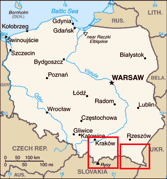
on 2 regions of map for details of South-eastern
Poland
A
minor road led through the sparsely populated Podhale foothills region of lush
rolling meadows and winding valleys edged by dark pines; our reason for taking
this back route was to re-visit the border village of Chochołow (pronounced
Ho-ho-wov) which we had last seen 2 years ago when crossing from Slovakia. This
alpine farming village's traditional log-built houses standing end-on to the
road were having their wood shingle roofs re-creosoted and their walls repaired,
and elderly gents led cows in ones and twos back from the meadows for afternoon
milking. Such traditional wooden houses lined the road leading through alpine
meadows to the mountain resort of Zakopane which was to be the base for our 4
day stay in the Western Tatra Mountains. We eventually found Ustup Camping in
the northern outskirts of Zakopane, next to a well-stocked supermarket, and were
welcomed in truly friendly manner at this small and delightful family-run
campsite; hospitality does not come better than this. The views of the distant
craggy Tatras skyline from Zakopane, lit by the setting sun on the evening of
our arrival were magnificent (Photo 1 - Tatra Mountains skyline from Zakpane); little did we know at this stage that with 4 days of continuous
rain, this would be our only such view.
The following morning,
a heavy cloud layer totally obscured the Tatras peaks, but packing full mountain
rain gear, we caught the minibus into Zakopane with plans to explore one of the
alpine dolinas. The so-called bus station was utter chaos and all the buses
seemed destined for Chochołowska Dolina; the decision on our day's walking
was made for us by where the buses were going. The bus gained height rapidly through
a succession of attractive alpine wooden settlements, eventually turning into
the Chochołowska valley to drop us at the peaceful alpine meadows of Siwa Polana
where our walk began and where alpine cattle were being hand-milked. A long and
tedious walk through pine woods with occasional tantalising glimpses of the high
Tatras ridges above the dark trees, brought us out eventually into the open
alpine meadows of Chochołowska Polana where tethered cattle grazed by the wooden
cabins. It was a delightful scene with the high craggy Tatras peaks skyline
appearing above the gloomy pines (Photo 2 - Alpine meadow
of Chochołowska Polana). The path led eventually to the
steeply-roofed wooden alpine hut where Pope John-Paul II held a clandestine
meeting in 1983 with the then Solidarity leader Lech Walęsa. We had just about
escaped the rain for our first day in the hills, but by the time we were back at
camp at Ustup that evening, the air temperature was down to 15°C, less than half
that of a week ago.
Then the rain did arrive, wretchedly miserable
rain, totally obscuring even the pine-covered hillside above Ustup Camping and
frustratingly keeping us in camp next day, but giving opportunity to perfect our
recipe for bigos, the warming traditional Polish smoked sausage and shredded
cabbage stew. Next day despite the still low rain cloud, we had to brave another venture
into the hills, the exact destination being determined by whatever bus we could
catch from Zakopane. This time, Kuźnice seemed the easiest of venues, starting
point for the walking route up to the peak of Giemont, and although this was out
of the question in such poor conditions, it did at least get us out of the
valley. In full rain gear, we felt distinctly over-dressed compared with most of
the
Poles who were protected against the driving mountain rain by little more than
plastic capes. The path led up past a mountain hut onto the open alpine meadows
of Polana Kalatówki; what should have been a magnificent mountain panorama was
totally obscured by dismal misty cloud swirling among the pines (Photo 3 -
Alpine meadows of Polana Kalatówki in pouring rain). Despite the
driving, soaking mist, we took our photos and pressed on upwards on a
well-defined path through the pine woods, leading to the upper hut of Kondratowej Hali, a classic wooden alpine chata (Photo
4 - Alpine refuge of
Kondratowej Hali in rain cloud) where we were glad to
seek shelter before descending through the eerily dark pines (Photo 5 - Forested
mountain path above Polana Kalatówki in rain).
Back at camp, we had the long job of shedding and stowing wet kit to await
drying whenever fine weather would eventually return. We seemed fated never to
enjoy fine weather in the Tatra Mountains, our days on the Slovak side 2 years
ago frustrated by continuous rain.
We moved on through the Spicz region,
traditional home of the Górale people and annexed by the newly independent
Poland from the similarly new state of Czechoslovakia in 1920. This was clearly
still an economically backward region, heavily dependent on tourist income as
was clear from the numbers of people squatting on stools by the roadside
under umbrellas in pouring rain with their placards promoting Wolne Pokojy
(Rooms free). Beyond the dreary town of Nowy Targ, our first stop was to visit
the beautiful 15th century wooden Gothic church in the village of Dębno. The
church's interior murals dating from 1500 are made up of 77 different folk-art
geometric motifs in 33 colours covering walls and ceiling. The paintings
have survived for 500 years keeping their original soft tones without need for
restoration (Photo 6 - 15th century
Catholic wooden church at Dębno).
The kindly priest was impressed that we had come all the way from Wielka
Brytania to visit his church. Outside in the village, a stork stood forlornly on
its nest in the pouring rain, urging its youngster to hurry and learn to fly so
that they could get away to Africa to escape this foul weather.
Our campsite that night, Polana Sosny, was set
just below the Czorsztyn dam which as a controversial hydroelectric scheme had
created the Czorsztyn reservoir flooding several Dunajec villages. Set in a
flat, well-drained meadow alongside the Dunajec River opposite the traditional
Pieniny Hills farming settlement of Sromowce Wyżne, this was a commendably
welcoming and good value campsite, well-appointed in such wretched weather.
Their free wi-fi link, the first in Poland, enabled us to collect emails and
upload our new web edition. After more than a week of constant rain, the air was
filled with the savage roaring sound of the River Dunajec in surging spate; this
did not augur well for our anticipated river rafting trip along the Dunajec
Gorge which formed the border with Slovakia where we had camped 2 years ago at
Ĉervaný Kláŝtor. The following morning remarkably dawned fine, but inevitably
all rafting was cancelled; with the river in spate, it was simply too dangerous
and all the rafts were piled on the embankment.
A walk up to the dam showed
just how fearsomely the river was running in spate
with the overflow from the sluices creating a turbulent maelstrom (Photo 7 - River Dunajec in spate
at Czorszyn Dam after heavy rain). In stead we crossed
the nearby border to the Slovak side for a walk along the limestone Dunajec
Gorge. Even from the riverside path, the surging Dunajec felt threateningly
fast-running, but our eyes were drawn upwards to the magnificent limestone
pinnacles of the Three Crowns (Trzy Korony) towering overhead on the Polish side, part of the Pieniny National Park (Photo 8 - Trzy Korony (Three Crowns) limestone peaks).
The path wound alongside the swirling muddy river which surged into vicious
rapids at the narrowing turns; a few hardy canoeists braved these rapids,
crashing through the snarling waters. The high, craggy tree-covered cliffs of
the gorge were lit by bright sunshine making for a spectacular walk (Photo
9 - Dunajec River Gorge
from Slovak shore). Since we were there 2 years ago,
Slovakia has adopted the Euro, but just across the border, our Polish złotys were readily accepted for us to enjoy nostalgic glasses of Žlaty
Bažant Slovak beers on our return to Ĉervaný Kláŝtor.
Leaving
Polana Sosny, we crossed the Pieniny Hills where strip-farming and hay-cutting
by hand are still the tradition and horse-drawn carts very much the norm. The
views of the distant outline of the Tatra peaks and dark pine forests across the
rolling hillsides were truly magnificent. Our onward road ran along the Dunajec
valley, at times uncomfortably close to the brink of the embankment with the
river still running in high spate. After a pause at the unassuming but
delightful town of Stary Sącz, we crossed the Poprad River to the modern
industrial town of Nowy Sącz. The large skansen set in the town's suburbs was
said to house one of Poland's finest collection of Carpathian wooden rural
architecture, but on a dull, rainy day, superlatives were in short supply.
Braving the efforts of pipe-laying contractors to deny us access and a crucial
bridge washed away by recent rains, we appreciated the help of a local man to
guide us by an alternative route to reach the skansen. Similarly braving more
rain, we toured the collection of early 20th century farmstead wooden buildings
and village school, and photographed the wooden Catholic and Orthodox churches (Photo 10 -
Catholic and Orthodox wooden churches at Nowy Sącz Skansen),
before the rain finally forced us to seek shelter under the dripping thatch
eaves of one of the farmsteads; 2 forlorn figures squatting on a wooden
threshold in the pouring rain. Nowy Sącz campsite that evening provided modest
shelter and even more welcome beer as the storms continued on a dark and gloomy
evening.
Continuing eastward over the rolling Beskid
Niski Hills, we paused briefly at Grybow, a small market town so typical of this
region which must have suffered such devastation in both WW1 and
WW2, as its modern church showed (Photo 11 - Post-WW1 church at
Grybow in Beskid Niski). The next town, Gorlice, was
scene of crucial WW1 Eastern Front battles in 1915 when the Tsarist Russian
advance was halted and pushed back on a 150 mile front by combined
Austro-Hungarian and German forces. During 3 days of fighting in May 1915,
20,000 men were killed and 90% of Gorlice left in ruins. The war dead, including
Russians, Germans and all the nationalities of the Habsburg Empire, were buried
in a number of war cemeteries around the town. Modern Gorlice is an unassuming
little town with no great sights to attract visitors, but its central Rynek is
full of charm with a Carillion which plays Auld Lang Syne at 1-00pm. Our
experience suggests an inverse correlation between a place's popularity with
tourists and the attitude of its TIC staff; the ladies at Gorlice TIC were a
credit to their town, showing commendable attention to duty in helping us to
find the largest of Gorlice's WW1 war cemeteries. At this hilltop site above the
town, 913 soldiers killed in the 1915 fighting from all 3 armies are buried (Photo 12
- WW1 war cemetery at
Gorlice from 1915 battles).
Unlike CWGC cemeteries, this was a dark and gloomy place, and the plaque on the
central memorial cross, erected in 1928 after Poland had regained her
independence, recorded the tragedy of WW1 for Poland with Poles being
conscripted into the armies of the 3 Partitioning Powers (Prussia and Austria in
conflict with Tsarist Russia) and forced in foreign uniforms to kill
fellow Poles.
Just beyond the small town of Biecz, which had
grown wealthy from its medieval trade monopoly on Hungarian wines as its huge
parish church and recently renovated sgraffito-decorated Renaissance town hall
tower showed, we turned off to find the Catholic wooden church at Binarova
village. Built in 1500 in late Gothic style, the church's interior was decorated
with floral folk-art designs similar in style to Dębno (Photo 13 -
15th century
Catholic wooden church at Binarowa).
Further
east, we passed Krosno which, since the earliest distillation of crude oil in
the mid-19th century, had become the petroleum capital of Poland, the heart of
the country's richest oil reserves, and today is a large industrial city. Our
experience also suggests a positive correlation between a town's modern day
prosperity and the standards of its driving; judging by the unpleasantly
aggressive driving standards around Krosno, it must be a prosperous city, and we
were glad to get past safely. Turning south on Route 9 towards the Dukla Pass
which leads over the Carpathians into Slovakia, we took a narrow lane to Bóbrka past an area
of modern commercially worked oil wells to find the Muzeum Przemysłu Naftowega
(Museum of the Oil and Gas Industry) named in honour of Ignacy Łukasiewicz, the
19th century father of the Polish oil industry. Born of wealthy Galician
parents, Łukasiewicz trained as a pharmacist and developed an interest in the
potential of naturally occurring 'seep oil' which gathered in surface hollows in
the sub-Carpathian valley near to Bóbrka and was used by farmers to grease cart
axles and treat sick animals. In 1853, using his pharmaceutical
skills, Łukasiewicz distilled kerosene from seep oil as an alternative fuel for oil
lamps
than more expensive whale oil, and invented the kerosene lamp. This was the
world's first successful refining of crude oil. In 1854 he began commercial
gathering of seep oil at Bóbrka, firstly in trenches then by drilling deeper
wells, and in 1856 he opened an 'oil distillery', the world's first oil
refinery. Drilling technologies improved and although demand for kerosene was
limited to oil lamp lighting, the later invention of the internal combustion
engine prompted a whole new industry of oil production which blossomed into what
it is today, all thanks to an obscure Galician-Polish pharmacist whom no one had
heard of - until now.
The Oil Skansen at Bóbrka was established in
the 1960s to commemorate Łukasiewicz's pioneering work at the place where crude
oil naturally seeped to the surface and was first 'mined'. The displays included
modern oil rigs and drilling technology, but the more interesting were the
earliest hand-dug wells from which crude oil was lifted in barrels. Peering down into the trough, crude oil could still be seen bubbling up and the air was
heavy with the smell of oil (Photo 14 - 1854 hand-dug oil well
at Bóbrka Oil Skansen). An exhibition showed displays of
Łukasiewicz's kerosene lamps, his first crude oil distilling apparatus, and
geological maps showing the extent of Bóbrka's oilfield and increasing depth of
its wells. This was a skansen with a difference, devoted to the life and work of
a
remarkable
man of vision and enterprise, who saw the potential of oil exploitation in the
Carpathian foothills long before the demands for oil created by the internal
combustion engine.
The small town of Dukla leading up to the Pass
must have been totally destroyed in August 1944 as the Red Army drove back the
German occupiers in the costly campaign to recapture the route into
Czechoslovakia. We had passed this way 2 years ago crossing from Slovakia to
stay at the delightfully straightforward farm campsite at Tylawa; we were again
welcomed hospitably. Further storms threatened but the thunder-head clouds
trailed by westwards, leaving us to enjoy a nostalgic nights camp at Tylawa in
peace with candles twinkling on our supper table as dusk seemed to settle
earlier.
Over breakfast the following morning, as the
cloud at last broke for a fine day, buzzards circled and mewed overhead. We
travelled eastwards through the isolated Beskid Niski foothills with not a sign
of human habitation in sight. The road eventually led down to the large village
of Komańcza, where the religious diversity of the
Carpathian foothills region is illustrated by the village's 3 wooden churches,
Eastern Orthodox, Uniate (Greek-Catholic) and Roman Catholic, all in active use.
The oldest church, the Orthodox, built in 1802 was burnt to the ground in 2006
leaving just the separate bell-tower. The community had pledged to rebuild their
church,
the
Forestry Department had donated timber, and on a hillock at the village edge
building work was already well advanced. Here was a building site with a
difference with wood stacks and cuttings (Photo
15 - Orthodox wooden
church at Komańcza). The structure was complete,
leaving the internal fitting-out and refurnishing of the re-emerging church.
At the far end of Komańcza, a side turning
led to the Covent of the Nazarene Sisters where in the 1950s Cardinal Wynszyński,
Catholic Primate of Poland, was detained under house arrest for his opposition to
the communist regime. Nearby the in the village of Turzańsk, the Greek-Catholic
wooden church of St Michael the Archangel stood on a hillock, topped with 5
graceful onion-shaped domes (Photo 16 - Greek-Catholic wooden
church at Turzańsk). A service was taking place and
we stood in the church porch to admire the elaborate iconostasis and listen to
the sweetly sounding harmonies of the Orthodox chanting. A little further, a
side valley led to the wooden Uniate church at Rzepedz, nestled into a hillside
and surrounded by trees, seeming to blend into the landscape (Photo 17 - Greek-Catholic wooden
church at Rzepedź). The Uniate churches we did
manage to see inside showed the twin heritage of that faith with Catholic
trappings such as Madonnas combined with Eastern Orthodox icons.
The onward road wound steeply over hilly country
to reach the town of Lesko. As with so many other Eastern Polish towns, Lesko's
pre-WW2 Jewish community made up a large part of the population. The sturdy
Renaissance former synagogue, with its beautifully sculpted façade decorated
with a quotation from the Torah, was badly damaged in WW2 but is now restored as
a gallery. In the entrance hall, lists detailed all the Jewish communities of SE
Poland destroyed by German barbarism in death camps like Bełżec and Sobibór. Set
on a shady hillside nearby, we found the now sadly neglected Jewish cemetery;
there are simply no survivors to look after it. The cemetery contains over 2,000
graves dating back to the 16th century, and many of those murdered at Bełżec
were re-interred here. Many of the randomly scattered graves were worn and eroded
with time, but the peaceful setting was a powerful and moving testimony to the
1000s of human beings systematically murdered by German genocide (Photo 18 -
Jewish Cemetery at Lesko).
We needed provisions, and winding over
forested hills, we descended to the scattered village of Średnia Wieś. Here we
found a real treasure trove of a village general store where not only could we
re-stock our food supplies (albeit more expensively than at Tesco), we could
also have bought, had we needed them, Kilner preserving jars and their tops.
Just beyond we joined the road to Cisna in the Bieszczady Hills. This was a
truly delightful valley lined with pine-covered hills, and in each village we
passed through, storks' nests topped the power poles. In the village of
Zahoczewie, we counted 3 occupied nests (Photo
19 - Storks' nest at
Zahoczewie near to Baligród)
The
valley had not always been so peaceful. The next town of Baligród had been HQ of
the Polish communist army during the 1945~7 fighting with the anti-communist
Ukrainian Resistance Army (UPA) guerrillas who had been forced out of western
Ukraine by the Red Army. The UPA had taken refuge in the forested Bieszczady
Hills of SE Poland, and like so many anti-communists groups of that period,
assumed that worsening relations between the Soviet Bloc and the West in the
early days of the Cold War would ultimately lead to US-British intervention on
their behalf. Sustained by this forlorn hope, the Ukrainian guerrillas fought on
for some 2 years against the Soviet-armed Polish forces. The UPA were based at
Cisna and the valley had been scene of some of the bloodiest fighting of this
vicious war. A short distance further south, we passed the Soviet-style
monolithic memorial to General Karol Świerczewski, regional commander of the
Polish Army, whose assassination by the UPA in 1947 gave the newly established
Polish communist government the pretext to launch Operation Vistula, one of the
most pointlessly vindictive pieces of genocide which ranks with German
destruction of the Jews.
The Carpathian valleys of SE Poland had long been
the traditional heartland of the Boyks and Lemkos, both cultural groups
descended from nomadic shepherds and cattle-herders who had settled in the
Bieszczady and Beskid Niski Hills from the 15th century. Speaking dialects
similar to modern Ukrainian, they led a separate life from that of lowland
Poles, both groups belonging to the Orthodox or Uniate faiths. For centuries,
these farming communities lived peacefully and despite their linguistic and
cultural affinities with Ukrainians, they showed no interest in Ukrainian
nationalistic aspirations. Their troubles began however with the UPA's
assassination of General Świerczewski. Alleging that the UPA was being given
support
by Boyk and Lemko communities in the Bieszczady Hills, the Polish communist
authorities launched an all-out attack on both the UPA and the local civilian
population, and under Operation Vistula, the entire population of the region was
deported, either eastwards to Soviet gulags or to former German territories in
the west. Entire villages were cleared of their inhabitants and although some
were repopulated by the communists with Polish settlers, many villages forcibly
evacuated in 1947 have disappeared leaving the region seriously depopulated. Many
former Orthodox and Uniate churches were either abandoned or handed over to the
incoming Catholic Polish settlers. The results of this little known example of
communist genocide can still be seen today in the depopulated region of the
Bieszczady Hills where we now headed. If the image of General Świerczewski on
his memorial is true to life, the war against the UPA would have been conducted
with ruthless brutality. At Baligród, a war cemetery holds the remains of Polish
soldiers killed in the fighting and an unsavoury inscription there reads
Passer by, look at this cross - Polish soldiers raised it up, chasing fascists
through forests, over mountains and rocks, for you Poland and for your glory.
This was one war cemetery we could shed no tears over.
Beyond
Cisna which clearly was now a busy tourist centre, the road led over a low pass
into the upper Osława valley, and here at the remote village of Nowy Łupków we
found the site of another notorious piece of history from the later days of the
communist era: here an internment labour camp was sited in which many prominent
Solidarity activists were imprisoned during the period of martial law in the
early 1980s, General Jarulzelski's only answer to the Polish people's demands for social justice. We
knew there was no memorial to this further example of communist repression, but
turning off into the hamlet, we could see a suspicious overgrown area bristling
with concrete posts topped with derelict lights; this was clearly the abandoned
remains of the internment camp. Returning to Cisna, we found Camping Tramp just
round from the centre, and were welcomed affably by the elderly couple who kept
the campsite. She had been born in London of Polish refugee parents and her
father had fought with the RAF during WW2. That evening we were invited to join
others for a sing-song of traditional Polish songs around the camp-fire with
roast kiełbasas (smokey sausages) (Photo 20 - Evening
camp-fire at Camping Tramp, Cisna). The
straightforward Camping Tramp was simply delightful.
Majdan 3kms from Cisna is home to the restored
narrow gauge Bieszczadaka Kolejka Lesna (Forest Railway), built originally in
1898 to transport timber from the Bieszczady forests to the sawmills at Majdan
and onward to the main line to Sanok. The railway suffered much damage in both
World Wars, and re-opened in 1950 to provide timber and local passenger
transport given that the remote valleys were so badly served by roads. The
timber trade declined but the line is now a major tourist attraction, running
east along the valley to Przystup. Such was the demand that the following day,
the only seats available were for the branch running west up to the isolated
halt at Balnica on the Slovak border. The line wound along the valley and began
the steady climb up through the forests whose timber had formed the railway's
origins. There was plenty of opportunity for photographs from the open-sided
carriages as the rounded sharp bends (Photo 21 -Bieszczady Forest
Railway in Osława valley).
But the following day the rain returned with heavy
cloud totally obscuring the surrounding hills. In driving rain, we moved over
the Wyznia Pass and down to the tiny settlement of Ustrzyki Górne, isolated in
the ultimate salient of SE Poland which projects into Ukraine with an
end-of-world feeling surrounded by the highest of the Bieszczady Hills. The only
campsite there, operated by Polish state-run tourist organisation the PTTK, was
not only water-logged after bad weather but staffed by the surliest and rudest
folk ever encountered. We sat out the afternoon, and as the rain at last stopped
we settled in for the gloomiest night of the trip hoping the weather would
ease tomorrow. When we woke, the cloud was beginning to break; this was perhaps
our one chance for a fine day on the Bieszczady Hills. Packing full rain gear,
we set off from Ustrzyki Górne to climb the ridge of Połonina Caryska, one of
the Bieszczady's classic high alpine pastures, forest-covered on its lower
slopes but once above the tree line, opening out onto grass-covered meadows
along the ridges. The route rose steeply through the trees on a well-marked and
well-used path. After some 2 hours of unremitting height gain, we emerged onto
the open połonina ridge with panoramic views stretching away eastwards over the
totally unpopulated puszcza towards the Ukraine (Photo 22 -Połonina Caryńska
alpine meadows in Bieszczady Hills). A further half hour
brought us up to the ridge's high point to join other walkers gathered around the
marker board (see right). From here we were able to drop down the southern side,
pausing to pick bilberries, to the road at the top of the Wynzianska Pass and
catch a minibus saving us a 5 km road walk back to Ustrzyki Górne. Back at camp,
we shared experiences with a young Polish couple from Gdansk, Kate and Sławek,
who were camped nearby; we send them our greetings and thank them for their
company and help with weather forecasts at Camping Ustrzyki Górne. Dusk seemed
to fall earlier now even though it was only August, and by 9-00pm it was fully
dark.
Wet and fine days now seemed to
alternate and the following day we were caught in a mountain storm, getting a
total soaking despite gortex and over-trousers, which meant a day in camp to dry
all our sodden kit (Photo 23 -Drying wet kit at Ustrzyki Górne after mountain rain).
Fortunately our final day in the Bieszczady dawned fine to give us another day
in the hills, walking from Wołosate, the ultimate isolated village and very last
in SE Poland. No vehicles were allowed beyond the village but we hoped to take a
path shown on the map leading up to a col on the Ukraine border. We set off but
signs forbade both vehicular and pedestrian access on this route, a prohibition
enforced by the presence of mounted border police with very business-like side
arms. Another lane continued ahead which seemed open with no such restrictions,
leading ultimately to the Prsel Bukowsa pass also on the Ukraine border. We took
this and after 3 hours of steady and tedious height gain up through woods, the
path petered out at the sign 'Granica Państwa - Przekraczanie Zabronione'
(National Border - do not cross). 2 coloured posts marked the border,
blue-yellow on the Ukrainian side and red-white at the Polish line, and with no
border guards to deter us, we stood with one foot in each country to take our
photographs, a suitable climax for this phase of the trip (Photo 24 -Polish~Ukraine border
in Bieszczady Hills).
This
had been a richly rewarding 2 weeks despite less good weather; we had achieved
much and learned even more about this remote corner of Poland and its sad
history, its people suffering both from German barbarism in WW2 and even more
tragically from vicious persecution during the early communist era. Over the
next two weeks, we move north along Poland's eastern border with Ukraine to see
the direct evidence of this tragic recent history in the form of the surviving
wooden churches left behind by the forcibly evacuated Boyk and Lemko people and visit
the extermination camps of Bełżec and Sobibór, operated by the Germans from
1941~43 in their fanatical attempt to eliminate the entire Jewish population of
eastern Poland; we shall conclude at Lublin, the principal city of eastern
Poland. Join us again shortly.

 CAMPING
IN POLAND 2010
- Tatra Mountains, Pieniny, Beskid Niski, Bieszczady Hills and Ukraine border:
CAMPING
IN POLAND 2010
- Tatra Mountains, Pieniny, Beskid Niski, Bieszczady Hills and Ukraine border: Leaving
Kraków on the busy Route 7, forested hills graced the southern skyline, a
foretaste of the alpine Tatra Mountains which form the Polish border with
Slovakia. In the foothills, we paused at Chabówka, a village which grew up in
the late 19th century Habsburg days around an important railway junction; the
former depot is now site of the Chabówka Steam Railway Skansen (Taboru
Kolejowega) which houses a large collection of Polish steam engines. Some of the
express locomotives have been beautifully restored to working order with their
peculiar East European smoke-deflectors, but most now stand in lines of
forlornly rusting hulks. The depot supplied the engine and cattle trucks for the
scenes in Spielberg's Schindler's List film showing the transportation of
Jews to Auschwitz-Birkenau.
Leaving
Kraków on the busy Route 7, forested hills graced the southern skyline, a
foretaste of the alpine Tatra Mountains which form the Polish border with
Slovakia. In the foothills, we paused at Chabówka, a village which grew up in
the late 19th century Habsburg days around an important railway junction; the
former depot is now site of the Chabówka Steam Railway Skansen (Taboru
Kolejowega) which houses a large collection of Polish steam engines. Some of the
express locomotives have been beautifully restored to working order with their
peculiar East European smoke-deflectors, but most now stand in lines of
forlornly rusting hulks. The depot supplied the engine and cattle trucks for the
scenes in Spielberg's Schindler's List film showing the transportation of
Jews to Auschwitz-Birkenau. A
minor road led through the sparsely populated Podhale foothills region of lush
rolling meadows and winding valleys edged by dark pines; our reason for taking
this back route was to re-visit the border village of Chochołow (pronounced
Ho-ho-wov) which we had last seen 2 years ago when crossing from Slovakia. This
alpine farming village's traditional log-built houses standing end-on to the
road were having their wood shingle roofs re-creosoted and their walls repaired,
and elderly gents led cows in ones and twos back from the meadows for afternoon
milking. Such traditional wooden houses lined the road leading through alpine
meadows to the mountain resort of Zakopane which was to be the base for our 4
day stay in the Western Tatra Mountains. We eventually found Ustup Camping in
the northern outskirts of Zakopane, next to a well-stocked supermarket, and were
welcomed in truly friendly manner at this small and delightful family-run
campsite; hospitality does not come better than this. The views of the distant
craggy Tatras skyline from Zakopane, lit by the setting sun on the evening of
our arrival were magnificent (Photo 1 - Tatra Mountains skyline from Zakpane); little did we know at this stage that with 4 days of continuous
rain, this would be our only such view.
A
minor road led through the sparsely populated Podhale foothills region of lush
rolling meadows and winding valleys edged by dark pines; our reason for taking
this back route was to re-visit the border village of Chochołow (pronounced
Ho-ho-wov) which we had last seen 2 years ago when crossing from Slovakia. This
alpine farming village's traditional log-built houses standing end-on to the
road were having their wood shingle roofs re-creosoted and their walls repaired,
and elderly gents led cows in ones and twos back from the meadows for afternoon
milking. Such traditional wooden houses lined the road leading through alpine
meadows to the mountain resort of Zakopane which was to be the base for our 4
day stay in the Western Tatra Mountains. We eventually found Ustup Camping in
the northern outskirts of Zakopane, next to a well-stocked supermarket, and were
welcomed in truly friendly manner at this small and delightful family-run
campsite; hospitality does not come better than this. The views of the distant
craggy Tatras skyline from Zakopane, lit by the setting sun on the evening of
our arrival were magnificent (Photo 1 - Tatra Mountains skyline from Zakpane); little did we know at this stage that with 4 days of continuous
rain, this would be our only such view.  The following morning,
a heavy cloud layer totally obscured the Tatras peaks, but packing full mountain
rain gear, we caught the minibus into Zakopane with plans to explore one of the
alpine dolinas. The so-called bus station was utter chaos and all the buses
seemed destined for Chochołowska Dolina; the decision on our day's walking
was made for us by where the buses were going. The bus gained height rapidly through
a succession of attractive alpine wooden settlements, eventually turning into
the Chochołowska valley to drop us at the peaceful alpine meadows of Siwa Polana
where our walk began and where alpine cattle were being hand-milked. A long and
tedious walk through pine woods with occasional tantalising glimpses of the high
Tatras ridges above the dark trees, brought us out eventually into the open
alpine meadows of Chochołowska Polana where tethered cattle grazed by the wooden
cabins. It was a delightful scene with the high craggy Tatras peaks skyline
appearing above the gloomy pines (Photo 2 - Alpine meadow
of Chochołowska Polana). The path led eventually to the
steeply-roofed wooden alpine hut where Pope John-Paul II held a clandestine
meeting in 1983 with the then Solidarity leader Lech Walęsa. We had just about
escaped the rain for our first day in the hills, but by the time we were back at
camp at Ustup that evening, the air temperature was down to 15°C, less than half
that of a week ago.
The following morning,
a heavy cloud layer totally obscured the Tatras peaks, but packing full mountain
rain gear, we caught the minibus into Zakopane with plans to explore one of the
alpine dolinas. The so-called bus station was utter chaos and all the buses
seemed destined for Chochołowska Dolina; the decision on our day's walking
was made for us by where the buses were going. The bus gained height rapidly through
a succession of attractive alpine wooden settlements, eventually turning into
the Chochołowska valley to drop us at the peaceful alpine meadows of Siwa Polana
where our walk began and where alpine cattle were being hand-milked. A long and
tedious walk through pine woods with occasional tantalising glimpses of the high
Tatras ridges above the dark trees, brought us out eventually into the open
alpine meadows of Chochołowska Polana where tethered cattle grazed by the wooden
cabins. It was a delightful scene with the high craggy Tatras peaks skyline
appearing above the gloomy pines (Photo 2 - Alpine meadow
of Chochołowska Polana). The path led eventually to the
steeply-roofed wooden alpine hut where Pope John-Paul II held a clandestine
meeting in 1983 with the then Solidarity leader Lech Walęsa. We had just about
escaped the rain for our first day in the hills, but by the time we were back at
camp at Ustup that evening, the air temperature was down to 15°C, less than half
that of a week ago. Then the rain did arrive, wretchedly miserable
rain, totally obscuring even the pine-covered hillside above Ustup Camping and
frustratingly keeping us in camp next day, but giving opportunity to perfect our
recipe for bigos, the warming traditional Polish smoked sausage and shredded
cabbage stew. Next day despite the still low rain cloud, we had to brave another venture
into the hills, the exact destination being determined by whatever bus we could
catch from Zakopane. This time, Kuźnice seemed the easiest of venues, starting
point for the walking route up to the peak of Giemont, and although this was out
of the question in such poor conditions, it did at least get us out of the
valley. In full rain gear, we felt distinctly over-dressed compared with most of
the
Then the rain did arrive, wretchedly miserable
rain, totally obscuring even the pine-covered hillside above Ustup Camping and
frustratingly keeping us in camp next day, but giving opportunity to perfect our
recipe for bigos, the warming traditional Polish smoked sausage and shredded
cabbage stew. Next day despite the still low rain cloud, we had to brave another venture
into the hills, the exact destination being determined by whatever bus we could
catch from Zakopane. This time, Kuźnice seemed the easiest of venues, starting
point for the walking route up to the peak of Giemont, and although this was out
of the question in such poor conditions, it did at least get us out of the
valley. In full rain gear, we felt distinctly over-dressed compared with most of
the Poles who were protected against the driving mountain rain by little more than
plastic capes. The path led up past a mountain hut onto the open alpine meadows
of Polana Kalatówki; what should have been a magnificent mountain panorama was
totally obscured by dismal misty cloud swirling among the pines (Photo 3 -
Alpine meadows of Polana Kalatówki in pouring rain). Despite the
driving, soaking mist, we took our photos and pressed on upwards on a
well-defined path through the pine woods, leading to the upper hut of Kondratowej Hali, a classic wooden alpine chata (Photo
4 - Alpine refuge of
Kondratowej Hali in rain cloud) where we were glad to
seek shelter before descending through the eerily dark pines (Photo 5 - Forested
mountain path above Polana Kalatówki in rain).
Back at camp, we had the long job of shedding and stowing wet kit to await
drying whenever fine weather would eventually return. We seemed fated never to
enjoy fine weather in the Tatra Mountains, our days on the Slovak side 2 years
ago frustrated by continuous rain.
Poles who were protected against the driving mountain rain by little more than
plastic capes. The path led up past a mountain hut onto the open alpine meadows
of Polana Kalatówki; what should have been a magnificent mountain panorama was
totally obscured by dismal misty cloud swirling among the pines (Photo 3 -
Alpine meadows of Polana Kalatówki in pouring rain). Despite the
driving, soaking mist, we took our photos and pressed on upwards on a
well-defined path through the pine woods, leading to the upper hut of Kondratowej Hali, a classic wooden alpine chata (Photo
4 - Alpine refuge of
Kondratowej Hali in rain cloud) where we were glad to
seek shelter before descending through the eerily dark pines (Photo 5 - Forested
mountain path above Polana Kalatówki in rain).
Back at camp, we had the long job of shedding and stowing wet kit to await
drying whenever fine weather would eventually return. We seemed fated never to
enjoy fine weather in the Tatra Mountains, our days on the Slovak side 2 years
ago frustrated by continuous rain. We moved on through the Spicz region,
traditional home of the Górale people and annexed by the newly independent
Poland from the similarly new state of Czechoslovakia in 1920. This was clearly
still an economically backward region, heavily dependent on tourist income as
was clear from the numbers of people squatting on stools by the roadside
under umbrellas in pouring rain with their placards promoting Wolne Pokojy
(Rooms free). Beyond the dreary town of Nowy Targ, our first stop was to visit
the beautiful 15th century wooden Gothic church in the village of Dębno. The
church's interior murals dating from 1500 are made up of 77 different folk-art
geometric motifs in 33 colours covering walls and ceiling. The paintings
have survived for 500 years keeping their original soft tones without need for
restoration (Photo 6 - 15th century
Catholic wooden church at Dębno).
The kindly priest was impressed that we had come all the way from Wielka
Brytania to visit his church. Outside in the village, a stork stood forlornly on
its nest in the pouring rain, urging its youngster to hurry and learn to fly so
that they could get away to Africa to escape this foul weather.
We moved on through the Spicz region,
traditional home of the Górale people and annexed by the newly independent
Poland from the similarly new state of Czechoslovakia in 1920. This was clearly
still an economically backward region, heavily dependent on tourist income as
was clear from the numbers of people squatting on stools by the roadside
under umbrellas in pouring rain with their placards promoting Wolne Pokojy
(Rooms free). Beyond the dreary town of Nowy Targ, our first stop was to visit
the beautiful 15th century wooden Gothic church in the village of Dębno. The
church's interior murals dating from 1500 are made up of 77 different folk-art
geometric motifs in 33 colours covering walls and ceiling. The paintings
have survived for 500 years keeping their original soft tones without need for
restoration (Photo 6 - 15th century
Catholic wooden church at Dębno).
The kindly priest was impressed that we had come all the way from Wielka
Brytania to visit his church. Outside in the village, a stork stood forlornly on
its nest in the pouring rain, urging its youngster to hurry and learn to fly so
that they could get away to Africa to escape this foul weather. Our campsite that night, Polana Sosny, was set
just below the Czorsztyn dam which as a controversial hydroelectric scheme had
created the Czorsztyn reservoir flooding several Dunajec villages. Set in a
flat, well-drained meadow alongside the Dunajec River opposite the traditional
Pieniny Hills farming settlement of Sromowce Wyżne, this was a commendably
welcoming and good value campsite, well-appointed in such wretched weather.
Their free wi-fi link, the first in Poland, enabled us to collect emails and
upload our new web edition. After more than a week of constant rain, the air was
filled with the savage roaring sound of the River Dunajec in surging spate; this
did not augur well for our anticipated river rafting trip along the Dunajec
Gorge which formed the border with Slovakia where we had camped 2 years ago at
Ĉervaný Kláŝtor. The following morning remarkably dawned fine, but inevitably
all rafting was cancelled; with the river in spate, it was simply too dangerous
and all the rafts were piled on the embankment.
A walk up to the dam showed
Our campsite that night, Polana Sosny, was set
just below the Czorsztyn dam which as a controversial hydroelectric scheme had
created the Czorsztyn reservoir flooding several Dunajec villages. Set in a
flat, well-drained meadow alongside the Dunajec River opposite the traditional
Pieniny Hills farming settlement of Sromowce Wyżne, this was a commendably
welcoming and good value campsite, well-appointed in such wretched weather.
Their free wi-fi link, the first in Poland, enabled us to collect emails and
upload our new web edition. After more than a week of constant rain, the air was
filled with the savage roaring sound of the River Dunajec in surging spate; this
did not augur well for our anticipated river rafting trip along the Dunajec
Gorge which formed the border with Slovakia where we had camped 2 years ago at
Ĉervaný Kláŝtor. The following morning remarkably dawned fine, but inevitably
all rafting was cancelled; with the river in spate, it was simply too dangerous
and all the rafts were piled on the embankment.
A walk up to the dam showed
 just how fearsomely the river was running in spate
with the overflow from the sluices creating a turbulent maelstrom (Photo 7 - River Dunajec in spate
at Czorszyn Dam after heavy rain). In stead we crossed
the nearby border to the Slovak side for a walk along the limestone Dunajec
Gorge. Even from the riverside path, the surging Dunajec felt threateningly
fast-running, but our eyes were drawn upwards to the magnificent limestone
pinnacles of the Three Crowns (Trzy Korony) towering overhead on the Polish side, part of the Pieniny National Park (Photo 8 - Trzy Korony (Three Crowns) limestone peaks).
The path wound alongside the swirling muddy river which surged into vicious
rapids at the narrowing turns; a few hardy canoeists braved these rapids,
crashing through the snarling waters. The high, craggy tree-covered cliffs of
the gorge were lit by bright sunshine making for a spectacular walk (Photo
9 - Dunajec River Gorge
from Slovak shore). Since we were there 2 years ago,
Slovakia has adopted the Euro, but just across the border, our Polish złotys were readily accepted for us to enjoy nostalgic glasses of Žlaty
Bažant Slovak beers on our return to Ĉervaný Kláŝtor.
just how fearsomely the river was running in spate
with the overflow from the sluices creating a turbulent maelstrom (Photo 7 - River Dunajec in spate
at Czorszyn Dam after heavy rain). In stead we crossed
the nearby border to the Slovak side for a walk along the limestone Dunajec
Gorge. Even from the riverside path, the surging Dunajec felt threateningly
fast-running, but our eyes were drawn upwards to the magnificent limestone
pinnacles of the Three Crowns (Trzy Korony) towering overhead on the Polish side, part of the Pieniny National Park (Photo 8 - Trzy Korony (Three Crowns) limestone peaks).
The path wound alongside the swirling muddy river which surged into vicious
rapids at the narrowing turns; a few hardy canoeists braved these rapids,
crashing through the snarling waters. The high, craggy tree-covered cliffs of
the gorge were lit by bright sunshine making for a spectacular walk (Photo
9 - Dunajec River Gorge
from Slovak shore). Since we were there 2 years ago,
Slovakia has adopted the Euro, but just across the border, our Polish złotys were readily accepted for us to enjoy nostalgic glasses of Žlaty
Bažant Slovak beers on our return to Ĉervaný Kláŝtor. Leaving
Polana Sosny, we crossed the Pieniny Hills where strip-farming and hay-cutting
by hand are still the tradition and horse-drawn carts very much the norm. The
views of the distant outline of the Tatra peaks and dark pine forests across the
rolling hillsides were truly magnificent. Our onward road ran along the Dunajec
valley, at times uncomfortably close to the brink of the embankment with the
river still running in high spate. After a pause at the unassuming but
delightful town of Stary Sącz, we crossed the Poprad River to the modern
industrial town of Nowy Sącz. The large skansen set in the town's suburbs was
said to house one of Poland's finest collection of Carpathian wooden rural
architecture, but on a dull, rainy day, superlatives were in short supply.
Braving the efforts of pipe-laying contractors to deny us access and a crucial
bridge washed away by recent rains, we appreciated the help of a local man to
guide us by an alternative route to reach the skansen. Similarly braving more
rain, we toured the collection of early 20th century farmstead wooden buildings
and village school, and photographed the wooden Catholic and Orthodox churches (Photo 10 -
Catholic and Orthodox wooden churches at Nowy Sącz Skansen),
before the rain finally forced us to seek shelter under the dripping thatch
eaves of one of the farmsteads; 2 forlorn figures squatting on a wooden
threshold in the pouring rain. Nowy Sącz campsite that evening provided modest
shelter and even more welcome beer as the storms continued on a dark and gloomy
evening.
Leaving
Polana Sosny, we crossed the Pieniny Hills where strip-farming and hay-cutting
by hand are still the tradition and horse-drawn carts very much the norm. The
views of the distant outline of the Tatra peaks and dark pine forests across the
rolling hillsides were truly magnificent. Our onward road ran along the Dunajec
valley, at times uncomfortably close to the brink of the embankment with the
river still running in high spate. After a pause at the unassuming but
delightful town of Stary Sącz, we crossed the Poprad River to the modern
industrial town of Nowy Sącz. The large skansen set in the town's suburbs was
said to house one of Poland's finest collection of Carpathian wooden rural
architecture, but on a dull, rainy day, superlatives were in short supply.
Braving the efforts of pipe-laying contractors to deny us access and a crucial
bridge washed away by recent rains, we appreciated the help of a local man to
guide us by an alternative route to reach the skansen. Similarly braving more
rain, we toured the collection of early 20th century farmstead wooden buildings
and village school, and photographed the wooden Catholic and Orthodox churches (Photo 10 -
Catholic and Orthodox wooden churches at Nowy Sącz Skansen),
before the rain finally forced us to seek shelter under the dripping thatch
eaves of one of the farmsteads; 2 forlorn figures squatting on a wooden
threshold in the pouring rain. Nowy Sącz campsite that evening provided modest
shelter and even more welcome beer as the storms continued on a dark and gloomy
evening. Continuing eastward over the rolling Beskid
Niski Hills, we paused briefly at Grybow, a small market town so typical of this
region which must have suffered such devastation in both WW1 and
WW2, as its modern church showed (Photo 11 - Post-WW1 church at
Grybow in Beskid Niski). The next town, Gorlice, was
scene of crucial WW1 Eastern Front battles in 1915 when the Tsarist Russian
advance was halted and pushed back on a 150 mile front by combined
Austro-Hungarian and German forces. During 3 days of fighting in May 1915,
20,000 men were killed and 90% of Gorlice left in ruins. The war dead, including
Russians, Germans and all the nationalities of the Habsburg Empire, were buried
in a number of war cemeteries around the town. Modern Gorlice is an unassuming
little town with no great sights to attract visitors, but its central Rynek is
full of charm with a Carillion which plays Auld Lang Syne at 1-00pm. Our
experience suggests an inverse correlation between a place's popularity with
tourists and the attitude of its TIC staff; the ladies at Gorlice TIC were a
credit to their town, showing commendable attention to duty in helping us to
find the largest of Gorlice's WW1 war cemeteries. At this hilltop site above the
town, 913 soldiers killed in the 1915 fighting from all 3 armies are buried (Photo 12
- WW1 war cemetery at
Gorlice from 1915 battles).
Unlike CWGC cemeteries, this was a dark and gloomy place, and the plaque on the
central memorial cross, erected in 1928 after Poland had regained her
independence,
Continuing eastward over the rolling Beskid
Niski Hills, we paused briefly at Grybow, a small market town so typical of this
region which must have suffered such devastation in both WW1 and
WW2, as its modern church showed (Photo 11 - Post-WW1 church at
Grybow in Beskid Niski). The next town, Gorlice, was
scene of crucial WW1 Eastern Front battles in 1915 when the Tsarist Russian
advance was halted and pushed back on a 150 mile front by combined
Austro-Hungarian and German forces. During 3 days of fighting in May 1915,
20,000 men were killed and 90% of Gorlice left in ruins. The war dead, including
Russians, Germans and all the nationalities of the Habsburg Empire, were buried
in a number of war cemeteries around the town. Modern Gorlice is an unassuming
little town with no great sights to attract visitors, but its central Rynek is
full of charm with a Carillion which plays Auld Lang Syne at 1-00pm. Our
experience suggests an inverse correlation between a place's popularity with
tourists and the attitude of its TIC staff; the ladies at Gorlice TIC were a
credit to their town, showing commendable attention to duty in helping us to
find the largest of Gorlice's WW1 war cemeteries. At this hilltop site above the
town, 913 soldiers killed in the 1915 fighting from all 3 armies are buried (Photo 12
- WW1 war cemetery at
Gorlice from 1915 battles).
Unlike CWGC cemeteries, this was a dark and gloomy place, and the plaque on the
central memorial cross, erected in 1928 after Poland had regained her
independence, recorded the tragedy of WW1 for Poland with Poles being
conscripted into the armies of the 3 Partitioning Powers (Prussia and Austria in
conflict with Tsarist Russia) and forced in foreign uniforms to kill
fellow Poles.
recorded the tragedy of WW1 for Poland with Poles being
conscripted into the armies of the 3 Partitioning Powers (Prussia and Austria in
conflict with Tsarist Russia) and forced in foreign uniforms to kill
fellow Poles. Further
east, we passed Krosno which, since the earliest distillation of crude oil in
the mid-19th century, had become the petroleum capital of Poland, the heart of
the country's richest oil reserves, and today is a large industrial city. Our
experience also suggests a positive correlation between a town's modern day
prosperity and the standards of its driving; judging by the unpleasantly
aggressive driving standards around Krosno, it must be a prosperous city, and we
were glad to get past safely. Turning south on Route 9 towards the Dukla Pass
which leads over the Carpathians into Slovakia, we took a narrow lane to Bóbrka past an area
of modern commercially worked oil wells to find the Muzeum Przemysłu Naftowega
(Museum of the Oil and Gas Industry) named in honour of Ignacy Łukasiewicz, the
19th century father of the Polish oil industry. Born of wealthy Galician
parents, Łukasiewicz trained as a pharmacist and developed an interest in the
potential of naturally occurring 'seep oil' which gathered in surface hollows in
the sub-Carpathian valley near to Bóbrka and was used by farmers to grease cart
axles and treat sick animals. In 1853, using his pharmaceutical
Further
east, we passed Krosno which, since the earliest distillation of crude oil in
the mid-19th century, had become the petroleum capital of Poland, the heart of
the country's richest oil reserves, and today is a large industrial city. Our
experience also suggests a positive correlation between a town's modern day
prosperity and the standards of its driving; judging by the unpleasantly
aggressive driving standards around Krosno, it must be a prosperous city, and we
were glad to get past safely. Turning south on Route 9 towards the Dukla Pass
which leads over the Carpathians into Slovakia, we took a narrow lane to Bóbrka past an area
of modern commercially worked oil wells to find the Muzeum Przemysłu Naftowega
(Museum of the Oil and Gas Industry) named in honour of Ignacy Łukasiewicz, the
19th century father of the Polish oil industry. Born of wealthy Galician
parents, Łukasiewicz trained as a pharmacist and developed an interest in the
potential of naturally occurring 'seep oil' which gathered in surface hollows in
the sub-Carpathian valley near to Bóbrka and was used by farmers to grease cart
axles and treat sick animals. In 1853, using his pharmaceutical skills, Łukasiewicz distilled kerosene from seep oil as an alternative fuel for oil
lamps
than more expensive whale oil, and invented the kerosene lamp. This was the
world's first successful refining of crude oil. In 1854 he began commercial
gathering of seep oil at Bóbrka, firstly in trenches then by drilling deeper
wells, and in 1856 he opened an 'oil distillery', the world's first oil
refinery. Drilling technologies improved and although demand for kerosene was
limited to oil lamp lighting, the later invention of the internal combustion
engine prompted a whole new industry of oil production which blossomed into what
it is today, all thanks to an obscure Galician-Polish pharmacist whom no one had
heard of - until now.
skills, Łukasiewicz distilled kerosene from seep oil as an alternative fuel for oil
lamps
than more expensive whale oil, and invented the kerosene lamp. This was the
world's first successful refining of crude oil. In 1854 he began commercial
gathering of seep oil at Bóbrka, firstly in trenches then by drilling deeper
wells, and in 1856 he opened an 'oil distillery', the world's first oil
refinery. Drilling technologies improved and although demand for kerosene was
limited to oil lamp lighting, the later invention of the internal combustion
engine prompted a whole new industry of oil production which blossomed into what
it is today, all thanks to an obscure Galician-Polish pharmacist whom no one had
heard of - until now. remarkable
man of vision and enterprise, who saw the potential of oil exploitation in the
Carpathian foothills long before the demands for oil created by the internal
combustion engine.
remarkable
man of vision and enterprise, who saw the potential of oil exploitation in the
Carpathian foothills long before the demands for oil created by the internal
combustion engine. westwards, leaving us to enjoy a nostalgic nights camp at Tylawa in
peace with candles twinkling on our supper table as dusk seemed to settle
earlier.
westwards, leaving us to enjoy a nostalgic nights camp at Tylawa in
peace with candles twinkling on our supper table as dusk seemed to settle
earlier. the
Forestry Department had donated timber, and on a hillock at the village edge
building work was already well advanced. Here was a building site with a
difference with wood stacks and cuttings (Photo
15 - Orthodox wooden
church at Komańcza). The structure was complete,
leaving the internal fitting-out and refurnishing of the re-emerging church.
the
Forestry Department had donated timber, and on a hillock at the village edge
building work was already well advanced. Here was a building site with a
difference with wood stacks and cuttings (Photo
15 - Orthodox wooden
church at Komańcza). The structure was complete,
leaving the internal fitting-out and refurnishing of the re-emerging church.  The onward road wound steeply over hilly country
to reach the town of Lesko. As with so many other Eastern Polish towns, Lesko's
pre-WW2 Jewish community made up a large part of the population. The sturdy
Renaissance former synagogue, with its beautifully sculpted façade decorated
with a quotation from the Torah, was badly damaged in WW2 but is now restored as
a gallery. In the entrance hall, lists detailed all the Jewish communities of SE
Poland destroyed by German barbarism in death camps like Bełżec and Sobibór. Set
on a shady hillside nearby, we found the now sadly neglected Jewish cemetery;
there are simply no survivors to look after it. The cemetery contains over 2,000
graves dating back to the 16th century, and many of those murdered at Bełżec
were re-interred here. Many of the randomly scattered graves were worn and eroded
with time, but the peaceful setting was a powerful and moving testimony to the
1000s of human beings systematically murdered by German genocide (Photo 18 -
Jewish Cemetery at Lesko).
The onward road wound steeply over hilly country
to reach the town of Lesko. As with so many other Eastern Polish towns, Lesko's
pre-WW2 Jewish community made up a large part of the population. The sturdy
Renaissance former synagogue, with its beautifully sculpted façade decorated
with a quotation from the Torah, was badly damaged in WW2 but is now restored as
a gallery. In the entrance hall, lists detailed all the Jewish communities of SE
Poland destroyed by German barbarism in death camps like Bełżec and Sobibór. Set
on a shady hillside nearby, we found the now sadly neglected Jewish cemetery;
there are simply no survivors to look after it. The cemetery contains over 2,000
graves dating back to the 16th century, and many of those murdered at Bełżec
were re-interred here. Many of the randomly scattered graves were worn and eroded
with time, but the peaceful setting was a powerful and moving testimony to the
1000s of human beings systematically murdered by German genocide (Photo 18 -
Jewish Cemetery at Lesko).
 The
valley had not always been so peaceful. The next town of Baligród had been HQ of
the Polish communist army during the 1945~7 fighting with the anti-communist
Ukrainian Resistance Army (UPA) guerrillas who had been forced out of western
Ukraine by the Red Army. The UPA had taken refuge in the forested Bieszczady
Hills of SE Poland, and like so many anti-communists groups of that period,
assumed that worsening relations between the Soviet Bloc and the West in the
early days of the Cold War would ultimately lead to US-British intervention on
their behalf. Sustained by this forlorn hope, the Ukrainian guerrillas fought on
for some 2 years against the Soviet-armed Polish forces. The UPA were based at
Cisna and the valley had been scene of some of the bloodiest fighting of this
vicious war. A short distance further south, we passed the Soviet-style
monolithic memorial to General Karol Świerczewski, regional commander of the
Polish Army, whose assassination by the UPA in 1947 gave the newly established
Polish communist government the pretext to launch Operation Vistula, one of the
most pointlessly vindictive pieces of genocide which ranks with German
destruction of the Jews.
The
valley had not always been so peaceful. The next town of Baligród had been HQ of
the Polish communist army during the 1945~7 fighting with the anti-communist
Ukrainian Resistance Army (UPA) guerrillas who had been forced out of western
Ukraine by the Red Army. The UPA had taken refuge in the forested Bieszczady
Hills of SE Poland, and like so many anti-communists groups of that period,
assumed that worsening relations between the Soviet Bloc and the West in the
early days of the Cold War would ultimately lead to US-British intervention on
their behalf. Sustained by this forlorn hope, the Ukrainian guerrillas fought on
for some 2 years against the Soviet-armed Polish forces. The UPA were based at
Cisna and the valley had been scene of some of the bloodiest fighting of this
vicious war. A short distance further south, we passed the Soviet-style
monolithic memorial to General Karol Świerczewski, regional commander of the
Polish Army, whose assassination by the UPA in 1947 gave the newly established
Polish communist government the pretext to launch Operation Vistula, one of the
most pointlessly vindictive pieces of genocide which ranks with German
destruction of the Jews. support
by Boyk and Lemko communities in the Bieszczady Hills, the Polish communist
authorities launched an all-out attack on both the UPA and the local civilian
population, and under Operation Vistula, the entire population of the region was
deported, either eastwards to Soviet gulags or to former German territories in
the west. Entire villages were cleared of their inhabitants and although some
were repopulated by the communists with Polish settlers, many villages forcibly
evacuated in 1947 have disappeared leaving the region seriously depopulated. Many
former Orthodox and Uniate churches were either abandoned or handed over to the
incoming Catholic Polish settlers. The results of this little known example of
communist genocide can still be seen today in the depopulated region of the
Bieszczady Hills where we now headed. If the image of General Świerczewski on
his memorial is true to life, the war against the UPA would have been conducted
with ruthless brutality. At Baligród, a war cemetery holds the remains of Polish
soldiers killed in the fighting and an unsavoury inscription there reads
Passer by, look at this cross - Polish soldiers raised it up, chasing fascists
through forests, over mountains and rocks, for you Poland and for your glory.
This was one war cemetery we could shed no tears over.
support
by Boyk and Lemko communities in the Bieszczady Hills, the Polish communist
authorities launched an all-out attack on both the UPA and the local civilian
population, and under Operation Vistula, the entire population of the region was
deported, either eastwards to Soviet gulags or to former German territories in
the west. Entire villages were cleared of their inhabitants and although some
were repopulated by the communists with Polish settlers, many villages forcibly
evacuated in 1947 have disappeared leaving the region seriously depopulated. Many
former Orthodox and Uniate churches were either abandoned or handed over to the
incoming Catholic Polish settlers. The results of this little known example of
communist genocide can still be seen today in the depopulated region of the
Bieszczady Hills where we now headed. If the image of General Świerczewski on
his memorial is true to life, the war against the UPA would have been conducted
with ruthless brutality. At Baligród, a war cemetery holds the remains of Polish
soldiers killed in the fighting and an unsavoury inscription there reads
Passer by, look at this cross - Polish soldiers raised it up, chasing fascists
through forests, over mountains and rocks, for you Poland and for your glory.
This was one war cemetery we could shed no tears over. Beyond
Cisna which clearly was now a busy tourist centre, the road led over a low pass
into the upper Osława valley, and here at the remote village of Nowy Łupków we
found the site of another notorious piece of history from the later days of the
communist era: here an internment labour camp was sited in which many prominent
Solidarity activists were imprisoned during the period of martial law in the
early 1980s, General Jarulzelski's only answer to the Polish people's demands for social justice. We
knew there was no memorial to this further example of communist repression, but
turning off into the hamlet, we could see a suspicious overgrown area bristling
with concrete posts topped with derelict lights; this was clearly the abandoned
remains of the internment camp. Returning to Cisna, we found Camping Tramp just
round from the centre, and were welcomed affably by the elderly couple who kept
the campsite. She had been born in London of Polish refugee parents and her
father had fought with the RAF during WW2. That evening we were invited to join
others for a sing-song of traditional Polish songs around the camp-fire with
roast kiełbasas (smokey sausages) (Photo 20 - Evening
camp-fire at Camping Tramp, Cisna). The
straightforward Camping Tramp was simply delightful.
Beyond
Cisna which clearly was now a busy tourist centre, the road led over a low pass
into the upper Osława valley, and here at the remote village of Nowy Łupków we
found the site of another notorious piece of history from the later days of the
communist era: here an internment labour camp was sited in which many prominent
Solidarity activists were imprisoned during the period of martial law in the
early 1980s, General Jarulzelski's only answer to the Polish people's demands for social justice. We
knew there was no memorial to this further example of communist repression, but
turning off into the hamlet, we could see a suspicious overgrown area bristling
with concrete posts topped with derelict lights; this was clearly the abandoned
remains of the internment camp. Returning to Cisna, we found Camping Tramp just
round from the centre, and were welcomed affably by the elderly couple who kept
the campsite. She had been born in London of Polish refugee parents and her
father had fought with the RAF during WW2. That evening we were invited to join
others for a sing-song of traditional Polish songs around the camp-fire with
roast kiełbasas (smokey sausages) (Photo 20 - Evening
camp-fire at Camping Tramp, Cisna). The
straightforward Camping Tramp was simply delightful. near Cisna") Majdan 3kms from Cisna is home to the restored
narrow gauge Bieszczadaka Kolejka Lesna (Forest Railway), built originally in
1898 to transport timber from the Bieszczady forests to the sawmills at Majdan
and onward to the main line to Sanok. The railway suffered much damage in both
World Wars, and re-opened in 1950 to provide timber and local passenger
transport given that the remote valleys were so badly served by roads. The
timber trade declined but the line is now a major tourist attraction, running
east along the valley to Przystup. Such was the demand that the following day,
the only seats available were for the branch running west up to the isolated
halt at Balnica on the Slovak border. The line wound along the valley and began
the steady climb up through the forests whose timber had formed the railway's
origins. There was plenty of opportunity for photographs from the open-sided
carriages as the rounded sharp bends (Photo 21 - Bieszczady Forest
Railway in Osława valley).
Majdan 3kms from Cisna is home to the restored
narrow gauge Bieszczadaka Kolejka Lesna (Forest Railway), built originally in
1898 to transport timber from the Bieszczady forests to the sawmills at Majdan
and onward to the main line to Sanok. The railway suffered much damage in both
World Wars, and re-opened in 1950 to provide timber and local passenger
transport given that the remote valleys were so badly served by roads. The
timber trade declined but the line is now a major tourist attraction, running
east along the valley to Przystup. Such was the demand that the following day,
the only seats available were for the branch running west up to the isolated
halt at Balnica on the Slovak border. The line wound along the valley and began
the steady climb up through the forests whose timber had formed the railway's
origins. There was plenty of opportunity for photographs from the open-sided
carriages as the rounded sharp bends (Photo 21 - Bieszczady Forest
Railway in Osława valley). But the following day the rain returned with heavy
cloud totally obscuring the surrounding hills. In driving rain, we moved over
the Wyznia Pass and down to the tiny settlement of Ustrzyki Górne, isolated in
the ultimate salient of SE Poland which projects into Ukraine with an
end-of-world feeling surrounded by the highest of the Bieszczady Hills. The only
campsite there, operated by Polish state-run tourist organisation the PTTK, was
not only water-logged after bad weather but staffed by the surliest and rudest
folk ever encountered. We sat out the afternoon, and as the rain at last stopped
we settled in for the gloomiest night of the trip hoping the weather would
ease tomorrow. When we woke, the cloud was beginning to break; this was perhaps
our one chance for a fine day on the Bieszczady Hills. Packing full rain gear,
we set off from Ustrzyki Górne to climb the ridge of Połonina Caryska, one of
the Bieszczady's classic high alpine pastures, forest-covered on its lower
slopes but once above the tree line, opening out onto grass-covered meadows
along the ridges. The route rose steeply through the trees on a well-marked and
well-used path. After some 2 hours of unremitting height gain, we emerged onto
the open połonina ridge with panoramic views stretching away eastwards over the
totally unpopulated puszcza towards the Ukraine (Photo 22 - Połonina Caryńska
alpine meadows in Bieszczady Hills). A further half hour
brought us up to the ridge's high point to join other walkers gathered around the
marker board (see right). From here we were able to drop down the southern side,
pausing to pick bilberries, to the road at the top of the Wynzianska Pass and
catch a minibus saving us a 5 km road walk back to Ustrzyki Górne. Back at camp,
we shared experiences with a young Polish couple from Gdansk, Kate and Sławek,
who were camped nearby; we send them our greetings and thank them for their
company and help with weather forecasts at Camping Ustrzyki Górne. Dusk seemed
to fall earlier now even though it was only August, and by 9-00pm it was fully
dark.
But the following day the rain returned with heavy
cloud totally obscuring the surrounding hills. In driving rain, we moved over
the Wyznia Pass and down to the tiny settlement of Ustrzyki Górne, isolated in
the ultimate salient of SE Poland which projects into Ukraine with an
end-of-world feeling surrounded by the highest of the Bieszczady Hills. The only
campsite there, operated by Polish state-run tourist organisation the PTTK, was
not only water-logged after bad weather but staffed by the surliest and rudest
folk ever encountered. We sat out the afternoon, and as the rain at last stopped
we settled in for the gloomiest night of the trip hoping the weather would
ease tomorrow. When we woke, the cloud was beginning to break; this was perhaps
our one chance for a fine day on the Bieszczady Hills. Packing full rain gear,
we set off from Ustrzyki Górne to climb the ridge of Połonina Caryska, one of
the Bieszczady's classic high alpine pastures, forest-covered on its lower
slopes but once above the tree line, opening out onto grass-covered meadows
along the ridges. The route rose steeply through the trees on a well-marked and
well-used path. After some 2 hours of unremitting height gain, we emerged onto
the open połonina ridge with panoramic views stretching away eastwards over the
totally unpopulated puszcza towards the Ukraine (Photo 22 - Połonina Caryńska
alpine meadows in Bieszczady Hills). A further half hour
brought us up to the ridge's high point to join other walkers gathered around the
marker board (see right). From here we were able to drop down the southern side,
pausing to pick bilberries, to the road at the top of the Wynzianska Pass and
catch a minibus saving us a 5 km road walk back to Ustrzyki Górne. Back at camp,
we shared experiences with a young Polish couple from Gdansk, Kate and Sławek,
who were camped nearby; we send them our greetings and thank them for their
company and help with weather forecasts at Camping Ustrzyki Górne. Dusk seemed
to fall earlier now even though it was only August, and by 9-00pm it was fully
dark. Wet and fine days now seemed to
alternate and the following day we were caught in a mountain storm, getting a
total soaking despite gortex and over-trousers, which meant a day in camp to dry
all our sodden kit (Photo 23 - Drying wet kit at Ustrzyki Górne after mountain rain).
Fortunately our final day in the Bieszczady dawned fine to give us another day
in the hills, walking from Wołosate, the ultimate isolated village and very last
in SE Poland. No vehicles were allowed beyond the village but we hoped to take a
path shown on the map leading up to a col on the Ukraine border. We set off but
signs forbade both vehicular and pedestrian access on this route, a prohibition
enforced by the presence of mounted border police with very business-like side
arms. Another lane continued ahead which seemed open with no such restrictions,
leading ultimately to the Prsel Bukowsa pass also on the Ukraine border. We took
this and after 3 hours of steady and tedious height gain up through woods, the
path petered out at the sign 'Granica Państwa - Przekraczanie Zabronione'
(National Border - do not cross). 2 coloured posts marked the border,
blue-yellow on the Ukrainian side and red-white at the Polish line, and with no
border guards to deter us, we stood with one foot in each country to take our
photographs, a suitable climax for this phase of the trip (Photo 24 - Polish~Ukraine border
in Bieszczady Hills).
Wet and fine days now seemed to
alternate and the following day we were caught in a mountain storm, getting a
total soaking despite gortex and over-trousers, which meant a day in camp to dry
all our sodden kit (Photo 23 - Drying wet kit at Ustrzyki Górne after mountain rain).
Fortunately our final day in the Bieszczady dawned fine to give us another day
in the hills, walking from Wołosate, the ultimate isolated village and very last
in SE Poland. No vehicles were allowed beyond the village but we hoped to take a
path shown on the map leading up to a col on the Ukraine border. We set off but
signs forbade both vehicular and pedestrian access on this route, a prohibition
enforced by the presence of mounted border police with very business-like side
arms. Another lane continued ahead which seemed open with no such restrictions,
leading ultimately to the Prsel Bukowsa pass also on the Ukraine border. We took
this and after 3 hours of steady and tedious height gain up through woods, the
path petered out at the sign 'Granica Państwa - Przekraczanie Zabronione'
(National Border - do not cross). 2 coloured posts marked the border,
blue-yellow on the Ukrainian side and red-white at the Polish line, and with no
border guards to deter us, we stood with one foot in each country to take our
photographs, a suitable climax for this phase of the trip (Photo 24 - Polish~Ukraine border
in Bieszczady Hills).
