|
 CAMPING
IN SWEDEN 2016 - Karlstad, Nora and
Pershyttan, Bergslagen, Lake Siljan,
Fulufjället National Park, Idredalen, Funnäsdalen,
Ristafallet in Åredalen, and Hammerdal: CAMPING
IN SWEDEN 2016 - Karlstad, Nora and
Pershyttan, Bergslagen, Lake Siljan,
Fulufjället National Park, Idredalen, Funnäsdalen,
Ristafallet in Åredalen, and Hammerdal:
 Around Lake Vänern to Karlstad:
rejoining E45, we made steady progress northwards along the western shore of
Lake Vänern with a pause for provisions re-stocking at a new out-of-town ICA
hypermarket on the outskirts of Säffle. E45 merged with E18 coming in from Oslo,
becoming motorway standard, before the E45 branched off northwards as the Inlandsvägan; we continued eastwards towards Karlstad and turned off into the
city. Our last visit in 2013 had been on a Sunday afternoon when street parking
was plentiful; today however on a busy weekday with the city crowded with traffic,
it was well nigh impossible to park. We eventually found space in a paying car
park and bought a couple of hours parking for our brief re-visit to the
provincial capital of Värmland (see
Log of our 2013 visit to Karlstad). Around Lake Vänern to Karlstad:
rejoining E45, we made steady progress northwards along the western shore of
Lake Vänern with a pause for provisions re-stocking at a new out-of-town ICA
hypermarket on the outskirts of Säffle. E45 merged with E18 coming in from Oslo,
becoming motorway standard, before the E45 branched off northwards as the Inlandsvägan; we continued eastwards towards Karlstad and turned off into the
city. Our last visit in 2013 had been on a Sunday afternoon when street parking
was plentiful; today however on a busy weekday with the city crowded with traffic,
it was well nigh impossible to park. We eventually found space in a paying car
park and bought a couple of hours parking for our brief re-visit to the
provincial capital of Värmland (see
Log of our 2013 visit to Karlstad).
We crossed the main city bridge and walked
through riverside parkland on the northern bank of Östra Älvgrenen, the eastern
branch of the Klarälven river, to
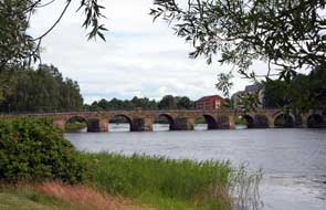
re-cross the sturdy Östra bron, a 12-arched stone bridge which spans 168m
across the river and was built in 1797 by Anders Jacobsson, who is said to have
thrown himself from his bridge in despair that his life's achievement in
spanning the river would collapse (see above left). He need not have worried since over 200 years
later, his magnificent
 bridge still bears the weight of city buses crossing.
Back through the city streets on the southern side, we crossed the canal which
links the Klarälven into Lake Vänern, and called in at Karlstad's neo-Classical
Domkyrka, built in the mid-18th century and seriously damaged in the disastrous
1865 fire which destroyed most of the town. bridge still bears the weight of city buses crossing.
Back through the city streets on the southern side, we crossed the canal which
links the Klarälven into Lake Vänern, and called in at Karlstad's neo-Classical
Domkyrka, built in the mid-18th century and seriously damaged in the disastrous
1865 fire which destroyed most of the town.
|
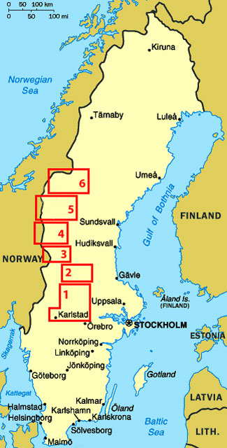
Click on 6 highlighted areas of map
for
details Western Sweden |
 |
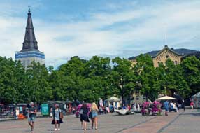
Along to the main square of Storatorget (see
left), where
we stood among the bus stops and loppis (bric-a-brac) stalls to photograph
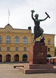
Karlstad's neo-Classical Rådhuset (town hall) and the memorial statue
commemorating the 1905 peaceful dissolution of Norway's union with Sweden which
was negotiated in Karlstad (see below left). The naively pious inscription on the statue's plinth
translates as Feuds feed folk hatred, peace promotes
people's understanding.
Along by the river, the Residenset (provincial governor's official residence)
stands opposite the statue of King Karl IX who granted Karlstad its charter in
1584 and immodestly named the town in his own honour (Photo 1 -
Provincial Governor's residence). This elegant building now
houses the Sverige-Amerika Centret, which documents 19th century emigration to
USA when over 1/3 of Värmland's population left for a new life in the New World
fleeing poverty and no prospects
 at home. Having failed to gain entry on our
last visit, we tried again. 20kr gained us access to an unimpressive one room
museum with no English translations; the fact that 95% of its American visitors would
speak no Swedish was lost on the lady at reception who spoke no English, and
with no one available who could tell us more of the emigration database, we
might as well have saved our kroner. And that was Karlstad, but at least it had
been a pleasant stroll in the afternoon sunshine. at home. Having failed to gain entry on our
last visit, we tried again. 20kr gained us access to an unimpressive one room
museum with no English translations; the fact that 95% of its American visitors would
speak no Swedish was lost on the lady at reception who spoke no English, and
with no one available who could tell us more of the emigration database, we
might as well have saved our kroner. And that was Karlstad, but at least it had
been a pleasant stroll in the afternoon sunshine.
Disappointing changes at Nora campsite:
we extricated ourselves from Karlstad's traffic, and re-joined the E18 eastwards
to continue our journey around the northern head of Lake Vänern (see Map 1 top
right for details of route). Beyond
Kristinehamn we made good progress to reach Karlskroga, where Alfred Nobel
 (of
Nobel Prizes fame) made his fortune manufacturing arms and explosives. Turning
off here for the final 50kms of today's drive, Route 243 meandered its winding
way through the southern Bergslagen forests and former mining and iron working
villages like Gyttorp towards our destination, the small town of Nora. Reaching
Nora's outskirts, we threaded a way around the town's narrow streets past the
archetypal wooden houses, out to the campsite. We had happy memories from our
2013 stay at Trängbo Camping, a municipal-owned site with good value prices and
run by a welcoming and helpful lady. This year a shock awaited us: in the last
year, the campsite had been taken over by a large commercial concern, Sweden
Resorts, with prices to match, now increased to 270kr/night. The glossy
information brochure told us nothing except the list of do's and don'ts, all
common sense but doubtless necessary for the holiday-making folks who were now
prepared to pay such unheard of prices to frequent the place with their monster
caravans. Protestations about unjustifiable price increases were casually
brushed aside by the inanely grinning girl at reception with a
take-it-or-leave-it attitude; she further compounded the place's lost image by
being unable/unwilling to provide us each with a key to the facilities hut. The
place did at least now have wi-fi, but at that price you should be able to take
that for granted these days. (of
Nobel Prizes fame) made his fortune manufacturing arms and explosives. Turning
off here for the final 50kms of today's drive, Route 243 meandered its winding
way through the southern Bergslagen forests and former mining and iron working
villages like Gyttorp towards our destination, the small town of Nora. Reaching
Nora's outskirts, we threaded a way around the town's narrow streets past the
archetypal wooden houses, out to the campsite. We had happy memories from our
2013 stay at Trängbo Camping, a municipal-owned site with good value prices and
run by a welcoming and helpful lady. This year a shock awaited us: in the last
year, the campsite had been taken over by a large commercial concern, Sweden
Resorts, with prices to match, now increased to 270kr/night. The glossy
information brochure told us nothing except the list of do's and don'ts, all
common sense but doubtless necessary for the holiday-making folks who were now
prepared to pay such unheard of prices to frequent the place with their monster
caravans. Protestations about unjustifiable price increases were casually
brushed aside by the inanely grinning girl at reception with a
take-it-or-leave-it attitude; she further compounded the place's lost image by
being unable/unwilling to provide us each with a key to the facilities hut. The
place did at least now have wi-fi, but at that price you should be able to take
that for granted these days.
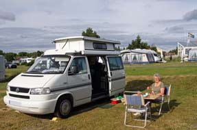
 We had no choice but to acquiesce tonight (see
above right), but
rather than stay for a second night as planned, we spent the first hour
researching an alternative site nearby for tomorrow after our visit to Nora and Pershyttan. We had no choice but to acquiesce tonight (see
above right), but
rather than stay for a second night as planned, we spent the first hour
researching an alternative site nearby for tomorrow after our visit to Nora and Pershyttan.
A happy reunion at Nora Tourist Information Centre: the following
morning, we drove down to Nora's former railway station cum Tourist Information Centre
(TIC) to renew an old acquaintance: when we were last here in 2013 (see
Log of our 2013 visit to Nora), we had been so impressed with the
helpful manner, fluent English and detailed local knowledge shown by one of the
assistants, Heléne Sommar, and wondered if she still worked here. After all this
time, she recognised us and was taken aback that we had looked her up again.
When told of the sorry state to which Nora's local campsite had been reduced by
commercial greed, she called her boss who, concerned for the town's image,
readily agreed to pass this on to the Commune authorities. We chatted at
length with him and Heléne, and they recommended other nearby campsites; it was
a lovely reunion.
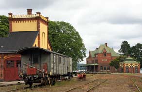
 Re-visit to the iron mining valley of Pershyttan: as well as serving as the town's TIC, the magnificent
1909 station building
(Photo 2 - Nora's 1909 railway station)
now forms the headquarters of the preservation society
which operates summer services on what was one of Sweden's earliest railways
along to Pershyttan. After photographs of the station building from the
railway tracks (see left), we drove out along the wooded valley of Pershyttan, where
iron had been smelted since medieval times, past former miners' cottages and
spoil heaps of long closed mines. Re-visit to the iron mining valley of Pershyttan: as well as serving as the town's TIC, the magnificent
1909 station building
(Photo 2 - Nora's 1909 railway station)
now forms the headquarters of the preservation society
which operates summer services on what was one of Sweden's earliest railways
along to Pershyttan. After photographs of the station building from the
railway tracks (see left), we drove out along the wooded valley of Pershyttan, where
iron had been smelted since medieval times, past former miners' cottages and
spoil heaps of long closed mines.
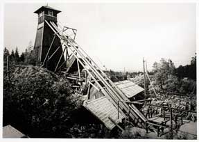 Pershyttan, with its iron mines and communal
charcoal-fired blast furnace smelter, was typical of the small scale iron
producing villages across the Bergslagen region (see
Log of our 2013 visit to Pershyttan). By the 18th century, Sweden produced a
quarter of Europe's iron. As water-driven pumping technology improved the mines
were driven deeper, and during the later 19th~20th centuries industrial scale
smelting increased; the last mines at Pershyttan closed in the 1970s. Pershyttan, with its iron mines and communal
charcoal-fired blast furnace smelter, was typical of the small scale iron
producing villages across the Bergslagen region (see
Log of our 2013 visit to Pershyttan). By the 18th century, Sweden produced a
quarter of Europe's iron. As water-driven pumping technology improved the mines
were driven deeper, and during the later 19th~20th centuries industrial scale
smelting increased; the last mines at Pershyttan closed in the 1970s.
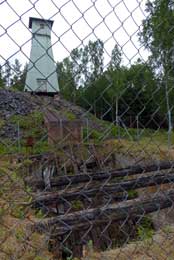
We parked at the preservation society's railway sidings
at Pershyttan and followed the track up into the forests to where the shaft's
headstocks and winding gear of the former Åkers Mine rose above the trees amid
spoil heaps (see right). At its foot behind safety fencing, rusty rails sloped downwards at
a 45º angle into the fearful black mine hole where, during the mine's working
days, the winding gear had lowered miners and raised tubs of extracted iron ore
(see left).
Nearby the winding house stood open showing the huge electrically driven winding
gear. We continued ahead further into the forest passing fenced-off holes
of earlier deep workings among the spoil heap remains. The sky was gloomily
overcast with rain beginning, and with too poor light for photography making pointless
further exploration of the old workings, we returned along the path to where
a restored flume fed water to drive the mines' main water wheel. Motive power
from the water-wheel had once been transferred over a distance to drive pumps up
at the mines by means of an ingenious system of interconnected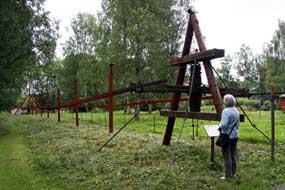 wooden rods
called a beam-drive (see below right); on our 2013 visit, both the water-wheel and beam drive had
been operating, but today this rickety-looking structure stood silent under the
birch trees, the only noise being from a lad strimming the grass under the drive
linkages.
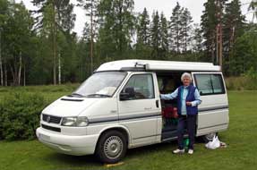 Nearby the tower of Pershyttan's smelting house and blast furnace rose
above the trees
(Photo 3 - Pershyttan's 1856 blast furnace). The word hyttan, meaning foundry, gives its name to so
many of the former iron mining and smelting villages across Berslagen. The
hyttan had been the heart of the communal mining and smelting industry along the Pershyttan
valley, and the preserved charcoal-fired smelter dating from 1856 had last been
fired in 1953. Before leaving the valley, we diverted up to investigate what
remained of Pershyttan's largest mine, the Lock Gruva. Although underground
tours are now organised during the summer, today everything was locked and
deserted, and dismally grey amid the spoil heaps on a gloomy day. Nearby the tower of Pershyttan's smelting house and blast furnace rose
above the trees
(Photo 3 - Pershyttan's 1856 blast furnace). The word hyttan, meaning foundry, gives its name to so
many of the former iron mining and smelting villages across Berslagen. The
hyttan had been the heart of the communal mining and smelting industry along the Pershyttan
valley, and the preserved charcoal-fired smelter dating from 1856 had last been
fired in 1953. Before leaving the valley, we diverted up to investigate what
remained of Pershyttan's largest mine, the Lock Gruva. Although underground
tours are now organised during the summer, today everything was locked and
deserted, and dismally grey amid the spoil heaps on a gloomy day.
Another over-expensive and unwelcoming campsite: back into Nora, we parked in
the town's cobbled square of Stortorget and walked along for a taste of the
town's other main claim to fame, Nora Glass (Ice Cream), made daily in Nora
since 1923, and we sat in sunshine with local families to eat our ice cream. It
was now approaching 4-00pm and time to leave Nora to find an acceptable campsite
for tonight. We headed westwards across country on bumpy minor roads towards Hällefors,
passing through several hamlets whose name ending in -hyttan showed their
Bergslagen iron-smelting origins. We had found Sörälgen Camping in the Swedish
Camping Association listing as an alternative to the now unacceptably
over-expensive Nora Camping. The campsite was set on a forested lakeside,
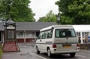 and
the owner greeted us in Germanically officious manner, listing all her
regulations about how and where we should camp. Too travel-weary to take any
notice of this, we pitched how and where we wanted. Apparently she had kept
the campsite since 2001, and the care-worn facilities suggested they had not
received a lick of paint since long and
the owner greeted us in Germanically officious manner, listing all her
regulations about how and where we should camp. Too travel-weary to take any
notice of this, we pitched how and where we wanted. Apparently she had kept
the campsite since 2001, and the care-worn facilities suggested they had not
received a lick of paint since long
 before then. The published price of 230kr
made no mention of an additional 2 x 10kr coins for showers; a total of 250kr
was far too much for such a unexceptional site, and we responded to her unwelcoming manner
by telling her so! With rain now pouring making the attractive forested surroundings
gloomily dark, we settled in to make the best of it and enjoy our evening after
today's happy re-visit to Nora and Pershyttan (see above left). before then. The published price of 230kr
made no mention of an additional 2 x 10kr coins for showers; a total of 250kr
was far too much for such a unexceptional site, and we responded to her unwelcoming manner
by telling her so! With rain now pouring making the attractive forested surroundings
gloomily dark, we settled in to make the best of it and enjoy our evening after
today's happy re-visit to Nora and Pershyttan (see above left).
A wet drive across Berslagen:
with rain still pouring the following morning, it was going to be a long, wet
drive today across the width of Bergslagen (see Map 1 top right for details of
route). Returning to Route 63, we initially
turned westwards to revisit Grythyttan, and on a gloomily wet morning, we parked
outside Neerings ice-cream kiosk (see above right) opposite the village's 1632 wood-shingled church with its beautiful interior
(see below right). The
population of Grythyttan is still part Finnish speaking, reflecting the numbers
of Finnish immigrant timber workers who settled in the village during the
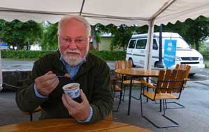
18~19th centuries. Besides the lovely church, the other reason for re-visiting Grythyttan was to call in at Neerings kiosk for their Lakrits (liquorice) ice
cream; even at 11-30 in the morning it was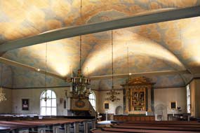 delicious!
(see above left) delicious!
(see above left)
Re-joining Route 63, we now began today's
long north-easterly drive across Bergslagen, heading initially for the town of
Kopparberg. It was now raining harder than ever with misty, murky cloud
obscuring the distant forests. In fine weather this would have been a glorious
landscape of rolling, pine-covered hills; today however in pouring rain it was
simply dismal. As its name suggests, Kopparberg was once one of Bergslagen's
major copper-mining centres, but the industry is long gone leaving the town and
its residents with a dreary, down-at-heel air. Even the poorly stocked
ICA supermarket reflected this sorry state, and perhaps the winos slouched in
the doorway survived on a diet of the Koppaberg
cider brewery's produce. The only feature of note in Kopparberg was the shingle-faced
wooden church, but with rain still pouring, we passed through without stopping.
Route 50 took us northwards into the province
of Dalarna, and on entering the industrial town of Grängesberg we saw this
year's first Dala Horse painted on a railway bridge. The town's industrial and
mining heritage was celebrated with an industrial archaeology museum, but there
was also still
 much evidence of heavy engineering industry. The same was true of
the next town on our route, Ludvika, where we passed several heavy electrical engineering plants. Bergslagen's industrial heritage was still alive and thriving
in towns like Grängesberg and Ludvika. Continuing northwards on Route 50 with
pouring rain still obscuring the forested terrain, frequent speed cameras
further compounded trying driving conditions. Reaching the outskirts of the
steel-making town of Borlänge, our route on E16 took a western bypass so we saw
nothing of the huge SSAB steel producing plant which is the town's largest
employer. Just beyond Borlänge, E16 branched off signposted for Oslo; we
continued north on Route 70 towards Leksand, crossing the wide Österdalälven
river which flows south-easterly from the highlands of Idre, through Lake Siljan
and eventually exits into the Bothnian Gulf south of Gävle. Reaching Leksand, we
turned off through the village to take a minor lane through charmingly rustic
Dalarna villages to Tällberg. From Tällberg hill we got our first glimpse of
Lake Siljan, and turned off in the village down to the lake-side and Tällberg
Camping which was to be our base for the couple of days at Siljan. much evidence of heavy engineering industry. The same was true of
the next town on our route, Ludvika, where we passed several heavy electrical engineering plants. Bergslagen's industrial heritage was still alive and thriving
in towns like Grängesberg and Ludvika. Continuing northwards on Route 50 with
pouring rain still obscuring the forested terrain, frequent speed cameras
further compounded trying driving conditions. Reaching the outskirts of the
steel-making town of Borlänge, our route on E16 took a western bypass so we saw
nothing of the huge SSAB steel producing plant which is the town's largest
employer. Just beyond Borlänge, E16 branched off signposted for Oslo; we
continued north on Route 70 towards Leksand, crossing the wide Österdalälven
river which flows south-easterly from the highlands of Idre, through Lake Siljan
and eventually exits into the Bothnian Gulf south of Gävle. Reaching Leksand, we
turned off through the village to take a minor lane through charmingly rustic
Dalarna villages to Tällberg. From Tällberg hill we got our first glimpse of
Lake Siljan, and turned off in the village down to the lake-side and Tällberg
Camping which was to be our base for the couple of days at Siljan.
Tällberg Camping and magnificent sunset
across Lake Siljan: we
knew from our 2013 visit that the small Tällberg Camping, tucked away on the
lakeside below the village, was almost the only acceptable campsite around the
hugely popular summer holiday-making shores of Lake Siljan. Our telephone call
this morning had received a welcoming response and assurance of a reserved space
down by the lake. On arrival however, a heart-sink moment: the place looked
jam-packed full of caravans and camping-cars. But the young couple at reception
welcomed us hospitably and, true to their word, had indeed reserved us a space.
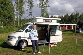
The pitches were large, but rather than be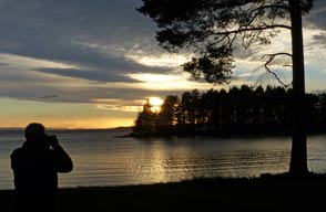 hemmed in between monster
camping-cars, we selected a spot higher up in what seemed a quiet corner (see
above left). Little
did we know that the nearby static caravans with awnings the size of a circus
big top were filled with holiday-makers whose noise and behaviour showed a total
indifference towards hemmed in between monster
camping-cars, we selected a spot higher up in what seemed a quiet corner (see
above left). Little
did we know that the nearby static caravans with awnings the size of a circus
big top were filled with holiday-makers whose noise and behaviour showed a total
indifference towards
 neighbouring campers. By now
rain had started again; we quickly pitched and pulled out the awning as rain
obscured the lake. When the rain eased, we used the wi-fi at reception to check
the forecast which showed Sunday as the better day for our Siljan tour, with a
likely wet day in camp tomorrow. The evening remained dull and gloomy with
little chance of Tällberg's renowned sunset across the lake tonight. neighbouring campers. By now
rain had started again; we quickly pitched and pulled out the awning as rain
obscured the lake. When the rain eased, we used the wi-fi at reception to check
the forecast which showed Sunday as the better day for our Siljan tour, with a
likely wet day in camp tomorrow. The evening remained dull and gloomy with
little chance of Tällberg's renowned sunset across the lake tonight.
The following day remained wet and gloomy, only
fit for a day in camp to make some headway with web writing which was already
slipping well behind schedule. Later in the afternoon, the sky brightened so
that by early evening there was room for hope of a Tällberg sunset across the
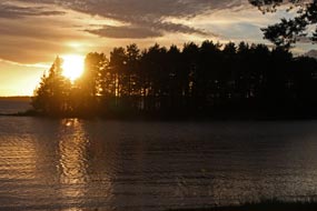
lake. By 10-00pm the sky had cleared sufficiently for the sun to have declined
into a patch of low cloud above the lake, giving naturally sepia-coloured
photographs against the silhouetted lake-side pine trees (see left and right). After the sun had set,
the western sky was lit by a deep salmon-pink after-glow reflected from the
clouds. The majority of the caravan occupants were too preoccupied with their TV
soap-operas even to be aware of such natural beauty.
A day around Lake Siljan: the sky
remained clear overnight to give bright morning sun but with a cool breeze
blowing from across the lake for our day around Siljan (see Map 2 top right for
details of route). With our pitch reserved
by a large red traffic cone borrowed from the campsite, we drove back through Tällberg
village along to Leksand to park by the large 18th century
 parish church
(Photo 4 - Leksand parish church). The
days when villagers around Siljan had rowed to church in large 'church boats' (Kyrkbåtar)
are still recalled with the annual church-boat races festival which takes place
during the week following Midsummer Day at several locations around Siljan.
Leksand's Kyrkbåtar races had taken place yesterday and late in the evening we
had seen Tällberg's church-boat being rowed back across the lake. Today we followed
the path from the church down to the lake to Leksand's church-boat house. The
path led back up to the large grassy hollow where crowds gather on 24 June for
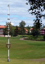
the Leksand Midsummer celebrations with dancing around the Midsummer Pole (see
left). The
pole with residue of its floral decorations still stood at the centre of the
park, now quiet on Sunday morning. parish church
(Photo 4 - Leksand parish church). The
days when villagers around Siljan had rowed to church in large 'church boats' (Kyrkbåtar)
are still recalled with the annual church-boat races festival which takes place
during the week following Midsummer Day at several locations around Siljan.
Leksand's Kyrkbåtar races had taken place yesterday and late in the evening we
had seen Tällberg's church-boat being rowed back across the lake. Today we followed
the path from the church down to the lake to Leksand's church-boat house. The
path led back up to the large grassy hollow where crowds gather on 24 June for
the Leksand Midsummer celebrations with dancing around the Midsummer Pole (see
left). The
pole with residue of its floral decorations still stood at the centre of the
park, now quiet on Sunday morning.
The meteorite impact-crater which produced
Lake Siljan: the road from Leksand crossed the Österdalälven
river where it flows from a southern bay of Lake Siljan, and we drove along the
western shore of the lake to the hilltop village of Siljansnäs where a look-out
tower at the Dalarna Naturum nature centre gives views across the flooded
meteorite-impact crater that had created Lake Siljan. Some 377 millions years ago, a
3km wide meteorite had struck the earth causing Europe's largest impact
crater 40km wide. This area of the earth's surface crust at that time consisted
of deep layers of sedimentary rock overlaying more substantial granite bed-rock.
The cataclysmic explosion resulting from the impact vaporised the meteorite's
material and pulverised the sedimentary layer at the point of impact, throwing up
disruptive clouds of debris, and forcing outwards the buckled strata to form a
ring around the impact site. Over aeons the underlying granite at the point of
impact has been lifted by pressure from within the earth's crust to form a low
dome of hills. The ring of disturbed sedimentary strata was subsequently eroded
by ice ages to form trenches which were flooded by glacial melt waters creating
the currently evident ring of lakes, Siljan, Orsa and other smaller lakes,
clearly visible from satellite photos around the uplifted dome of hills. We had
hoped to see the views looking out over the Siljan Ring from the look-out tower,
but to our disappointment, the tower was closed for repairs.
Sollerön Island Viking Graves nature trail:
continuing northwards, the road along Siljan's
western shore passed through peaceful pine forests to reach
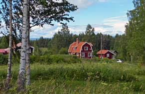 the hamlet of Gesunda with its attractive Falun-Red painted wooden cottages. Here we turned
off over to Sollerön island for a glance at the campsite there. The sight of
massed ranks of caravans and camping-cars, packed in like sardines in a tin and
looking like a council estate on wheels, was more than enough to convince us
that this was not a place we should choose to camp; we readily drove on into Sollerön village. The apple trees in cottage gardens which lined the lane had
all been in blossom on our last visit in May 2013; today in early July, the
fruits were beginning to form. the hamlet of Gesunda with its attractive Falun-Red painted wooden cottages. Here we turned
off over to Sollerön island for a glance at the campsite there. The sight of
massed ranks of caravans and camping-cars, packed in like sardines in a tin and
looking like a council estate on wheels, was more than enough to convince us
that this was not a place we should choose to camp; we readily drove on into Sollerön village. The apple trees in cottage gardens which lined the lane had
all been in blossom on our last visit in May 2013; today in early July, the
fruits were beginning to form.
Through Sollerön village we parked at the
Homestead Museum skansen, tucked away near the peaceful farming hamlet of
Bengtsarvet. Dark clouds and a squally shower blew over, bringing a clearer
spell and even some blue sky and sun. Sollerön island in Lake Siljan had
provided secure dwelling to Iron Age settlers who had cleared the stony fields,
farmed the land, smelted lake-iron and traded their produce further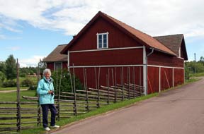 afield.
These late Viking period farming folk cremated their dead and buried the ashes
under burial mounds close to their homesteads, and modern archaeology has
revealed the remains of grave-goods from 950~1050 AD scattered across the
pastures of present day farms around Bengtsarvet. A jewel of a nature trail
threads a peaceful 3km circular walk from the Homestead Museum across the
fields, passing the Viking graves and back around lanes past modern-day farms
and cottages. Far away from the hoards of tourists that flock in droves to
the Siljan area like overflowing pollutant, this remote corner of Sollerön is a
haven of peace, still a farming area as it had been during the mid~late Iron
Age. Wearing waterproofs as a precaution against further rain, we set off to walk
the circuit of Viking graves (see above right), taking the sketch map and commentary sheet from 2013. In May 2013, the nature trail was a treasure trove of spring wild
flowers, but today the summertime grasses were high. We passed the Viking grave
mounds which were almost indistinguishable from piles of boulders cleared from
the fields, and walked over to the site of St Laurentius' ancient chapel built
by an earlier pagan sacred well. With the sky now bright, we branched off onto a
longer path circuit, sloping down towards the pools of Agnmyr. From across the
distant pastureland an unseen lapwing repeatedly sang his happy pee-wit call.
The path passed the remains of a 18~19th century silver mine cut into a rocky
escarpment; what had been hoped as a profitable source of silver turned out to
be poor quality afield.
These late Viking period farming folk cremated their dead and buried the ashes
under burial mounds close to their homesteads, and modern archaeology has
revealed the remains of grave-goods from 950~1050 AD scattered across the
pastures of present day farms around Bengtsarvet. A jewel of a nature trail
threads a peaceful 3km circular walk from the Homestead Museum across the
fields, passing the Viking graves and back around lanes past modern-day farms
and cottages. Far away from the hoards of tourists that flock in droves to
the Siljan area like overflowing pollutant, this remote corner of Sollerön is a
haven of peace, still a farming area as it had been during the mid~late Iron
Age. Wearing waterproofs as a precaution against further rain, we set off to walk
the circuit of Viking graves (see above right), taking the sketch map and commentary sheet from 2013. In May 2013, the nature trail was a treasure trove of spring wild
flowers, but today the summertime grasses were high. We passed the Viking grave
mounds which were almost indistinguishable from piles of boulders cleared from
the fields, and walked over to the site of St Laurentius' ancient chapel built
by an earlier pagan sacred well. With the sky now bright, we branched off onto a
longer path circuit, sloping down towards the pools of Agnmyr. From across the
distant pastureland an unseen lapwing repeatedly sang his happy pee-wit call.
The path passed the remains of a 18~19th century silver mine cut into a rocky
escarpment; what had been hoped as a profitable source of silver turned out to
be poor quality
 galena ore. We emerged at a gravel lane and beyond a group of
cottages (see above left) turned back along a trackway past more grave-fields to the hamlet of Bengtsarvet.
From here it was a short walk back to the Homestead Museum, passing modern-day
wooden farmsteads which now stand on the site of Iron Age farms whose occupants had been buried in the neighbouring
fields (see above right). galena ore. We emerged at a gravel lane and beyond a group of
cottages (see above left) turned back along a trackway past more grave-fields to the hamlet of Bengtsarvet.
From here it was a short walk back to the Homestead Museum, passing modern-day
wooden farmsteads which now stand on the site of Iron Age farms whose occupants had been buried in the neighbouring
fields (see above right).
Nusnäs, home of Dala Horses: in the town of Mora at the head of Lake Siljan, we
paused for unashamed photos by the world's largest Dala Horse (Photo 5 - World's largest Dala Horse). The original
wooden Dala Horses had been carved in 1928 by 2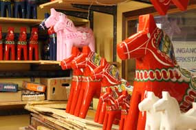 young Dalarna brothers, Nils and
Jannes Olssson, to make a few kroner for their family. The stumpy little brightly painted wooden horses caught on and now have become a symbol of Sweden.
The Swedes are potty about them and every home has a couple of Dala Horses on
its mantelpiece. Before beginning the drive down the eastern shore of the lake,
we turned off the main Route 70 into Nusnäs village to visit the workshops
where the cute little Dala Horses are produced by the current and more
commercially-minded generations of the Olsson family (Photo 6 - Dala Horse workshops at Nusnäs). Cute they may be, but the
prices are nothing of the kind: at 135kr for a tiny one, increasing to
mega-prices for the large ones, Dala Horses are highly promoted by a voracious
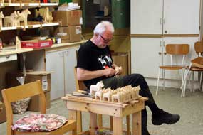
tourist industry. Today, the workshops were open to tourists, and we stopped to
take a look, watching an elderly gent adding hand-carved authentication touches
to machine-cut wooden horses (see above left). The end result was dunked in red paint and young Dalarna brothers, Nils and
Jannes Olssson, to make a few kroner for their family. The stumpy little brightly painted wooden horses caught on and now have become a symbol of Sweden.
The Swedes are potty about them and every home has a couple of Dala Horses on
its mantelpiece. Before beginning the drive down the eastern shore of the lake,
we turned off the main Route 70 into Nusnäs village to visit the workshops
where the cute little Dala Horses are produced by the current and more
commercially-minded generations of the Olsson family (Photo 6 - Dala Horse workshops at Nusnäs). Cute they may be, but the
prices are nothing of the kind: at 135kr for a tiny one, increasing to
mega-prices for the large ones, Dala Horses are highly promoted by a voracious
tourist industry. Today, the workshops were open to tourists, and we stopped to
take a look, watching an elderly gent adding hand-carved authentication touches
to machine-cut wooden horses (see above left). The end result was dunked in red paint and
 varnish, again by machine. You could have them in a range of colours - red, white,
pink
or kitschy lilac-blue, all with their floral patterning, hand-carved and
hand-painted by machine and at astronomical prices (see above right). varnish, again by machine. You could have them in a range of colours - red, white,
pink
or kitschy lilac-blue, all with their floral patterning, hand-carved and
hand-painted by machine and at astronomical prices (see above right).
Rättvik church-town: we re-joined
Route 70, today busy with holiday traffic returning south at silly speeds
despite the frequent speed cameras. 30kms south through the pine forested hilly
countryside, we turned off into Rättvik. Most of the town is drab and
unattractive, but at the northern end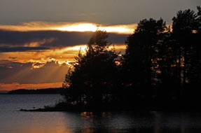 clustered around the large 18th century
church, a 'church town' of preserved 18~19th century wooden shacks once served
as stables for the horses of those attending church from outlying farms and
villages. In the bright afternoon sunshine, a brisk wind whipped up breakers on
the lake as we stood taking our photos of the 'church town' against the church
backdrop by the landing-stage where those attending church by church-boat had
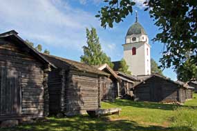
moored (see left) (Photo 7 - Rättvik 'church town'). Inside, the church retained its 18th century artwork and paintings of
saints and apostles and a carved wooden statue of an enthroned St Olaf, the
church's patron saint. As we left Rättvik and rounded the SE corner of Lake
Siljan, it was 5-30pm and time to return to our campsite at Tällberg. Most of
the rowdy holiday-makers had gone, leaving the place in peace, and we settled
back in after our satisfying day around Siljan. And after supper, we walked down
to the lake-shore for a further set of memorable Siljan sunset photos from the
lake-side at Tällberg (see right) (Photo 8 - Siljan sunset). clustered around the large 18th century
church, a 'church town' of preserved 18~19th century wooden shacks once served
as stables for the horses of those attending church from outlying farms and
villages. In the bright afternoon sunshine, a brisk wind whipped up breakers on
the lake as we stood taking our photos of the 'church town' against the church
backdrop by the landing-stage where those attending church by church-boat had
moored (see left) (Photo 7 - Rättvik 'church town'). Inside, the church retained its 18th century artwork and paintings of
saints and apostles and a carved wooden statue of an enthroned St Olaf, the
church's patron saint. As we left Rättvik and rounded the SE corner of Lake
Siljan, it was 5-30pm and time to return to our campsite at Tällberg. Most of
the rowdy holiday-makers had gone, leaving the place in peace, and we settled
back in after our satisfying day around Siljan. And after supper, we walked down
to the lake-shore for a further set of memorable Siljan sunset photos from the
lake-side at Tällberg (see right) (Photo 8 - Siljan sunset).
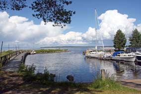 Northwards into the forested hills of NW Dalarna : a lovely sunny morning
for the start of 4th week, and we were able to sit outside for breakfast (Photo
9 - Breakfast at Tällberg Camping); before
leaving the campsite, we walked down to the lake-shore by the Tällberg marina
(see left). Returning northwards around the eastern side of Siljan, in the
outskirts of Rättvik by the river-crossing Northwards into the forested hills of NW Dalarna : a lovely sunny morning
for the start of 4th week, and we were able to sit outside for breakfast (Photo
9 - Breakfast at Tällberg Camping); before
leaving the campsite, we walked down to the lake-shore by the Tällberg marina
(see left). Returning northwards around the eastern side of Siljan, in the
outskirts of Rättvik by the river-crossing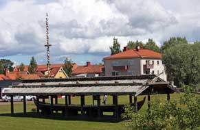 we passed the village's Midsummer
Pole and the church-boat in its boat-house (see below right). By the time we reached Mora for a
provisions stock-up, the morning sun had disappeared behind heavy cloud; the forecast for
a dull afternoon looked to be right. Leaving Mora, we
headed north on Route 70 into the forests of NW Dalarna (see Map 3 top right for
details of route). Settlements were few
and far between and this NW corner of Dalarna had a feel of remote wilderness,
shrouded with vast swathes of uninhabited coniferous forest, so different from
the province's southern areas. There was a real feeling now of leaving behind
Southern and Central Sweden and making progress northwards; we hoped this would
also mean we were leaving behind crowded and expensive campsites and rowdy
holiday-makers. This was a region dominated by forestry and Route 70, the only
communications route through this remote part of the country, was rutted from
the frequent passage of logging trucks, many of which passed carrying cut timber
to the large gathering areas. we passed the village's Midsummer
Pole and the church-boat in its boat-house (see below right). By the time we reached Mora for a
provisions stock-up, the morning sun had disappeared behind heavy cloud; the forecast for
a dull afternoon looked to be right. Leaving Mora, we
headed north on Route 70 into the forests of NW Dalarna (see Map 3 top right for
details of route). Settlements were few
and far between and this NW corner of Dalarna had a feel of remote wilderness,
shrouded with vast swathes of uninhabited coniferous forest, so different from
the province's southern areas. There was a real feeling now of leaving behind
Southern and Central Sweden and making progress northwards; we hoped this would
also mean we were leaving behind crowded and expensive campsites and rowdy
holiday-makers. This was a region dominated by forestry and Route 70, the only
communications route through this remote part of the country, was rutted from
the frequent passage of logging trucks, many of which passed carrying cut timber
to the large gathering areas.
We now began the long, steady climb into forested hill-country, and by now not
only was the sky gloomily dull but rain had begun. This was the
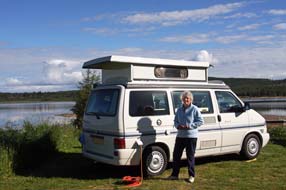 second time we
had driven this route in poor weather, gaining height through the upper valley
of the great Österdalälven river which flows down from the northern mountains
through a series of elongated lakes dammed for HEP generation into Lake Siljan.
The empty terrain covered with dark pine and second time we
had driven this route in poor weather, gaining height through the upper valley
of the great Österdalälven river which flows down from the northern mountains
through a series of elongated lakes dammed for HEP generation into Lake Siljan.
The empty terrain covered with dark pine and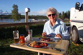 spruce forests stretching away to
murky horizons gave a real feeling of being back in comfortably familiar
northern Scandinavia. At one point we got a first glimpse of residual snow on
distant hilly slopes. The road was good with little traffic, and we steadily
gained height up onto the broad, empty plateau with the map showing spot heights
of over 500m. The rain eased and sky brightened as Route 70 crossed the
plateau-top to begin the long northern descent to the village of Särna where we
planned to camp tonight. spruce forests stretching away to
murky horizons gave a real feeling of being back in comfortably familiar
northern Scandinavia. At one point we got a first glimpse of residual snow on
distant hilly slopes. The road was good with little traffic, and we steadily
gained height up onto the broad, empty plateau with the map showing spot heights
of over 500m. The rain eased and sky brightened as Route 70 crossed the
plateau-top to begin the long northern descent to the village of Särna where we
planned to camp tonight.
Welcoming and magnificently sited Särna Camping: Särna Campsite's
camping areas were terraced into the gently sloping hillside overlooking the
broad Österdalälven river which flowed gently past (see left) (Photo
10 - Särna Camping). We identified a quiet corner pitch at the lower
level just above the river and returned to reception to book
in. Here we were greeted with warm hospitality and a smiling welcome by the girl
at reception. The price an all-inclusive 235kr (no messing about with coins for
showers, she insisted), facilities were modern and clean with a homely,
well-equipped kitchen cum common room, and the wi-fi at reception enabled us to
check tomorrow's forecast; along with its fair price, smilingly
helpful welcome
and lovely position,
 Särna Camping ticked all the right boxes for a high rating.
With the sun now shining brightly, we pitched to give a lovely sheltered
position, enabling us to sit in the lee of George to enjoy the afternoon
sunshine looking out across the wide, placidly flowing river against a backdrop
of distant forested fells. Revelling in this glorious setting, we lit the first
barbecue of the trip and enjoyed a memorable supper Särna Camping ticked all the right boxes for a high rating.
With the sun now shining brightly, we pitched to give a lovely sheltered
position, enabling us to sit in the lee of George to enjoy the afternoon
sunshine looking out across the wide, placidly flowing river against a backdrop
of distant forested fells. Revelling in this glorious setting, we lit the first
barbecue of the trip and enjoyed a memorable supper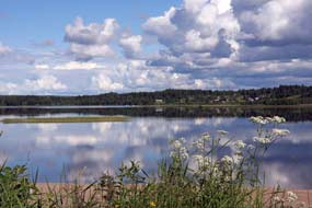 enhanced by the peace of the
evening and this magnificent view from above the river (see above right). Late evening, the sun
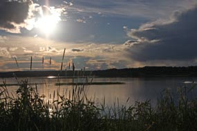
declined against a dramatic cloud-scape above the open vista of river and fell (Photo 11 - Declining sun and dramatic cloud-scape)
(see left),
viewed through a fringe of attractively silhouetted grasses at the edge of our
pitch (Photo 12 - Silhouetted grasses). The price of coming north however was that we were catching up with the
midges, albeit belatedly this year, and as the evening grew cooler and we moved
inside, we killed the first mossies of the season. This had been a wonderfully
refreshing evening, and the forecast looked good for tomorrow's walk up to the
Njupeskär waterfalls. enhanced by the peace of the
evening and this magnificent view from above the river (see above right). Late evening, the sun
declined against a dramatic cloud-scape above the open vista of river and fell (Photo 11 - Declining sun and dramatic cloud-scape)
(see left),
viewed through a fringe of attractively silhouetted grasses at the edge of our
pitch (Photo 12 - Silhouetted grasses). The price of coming north however was that we were catching up with the
midges, albeit belatedly this year, and as the evening grew cooler and we moved
inside, we killed the first mossies of the season. This had been a wonderfully
refreshing evening, and the forecast looked good for tomorrow's walk up to the
Njupeskär waterfalls.
Fulufjället National Park and Njupeskär waterfalls:
after a cool night, we woke to clear sky and warming sun, looking out from our
breakfast table to this glorious vista to a horizon of pine-forested fells (Photo 13 - Breakfast at Särna Camping) (see right). Särna Camping had indeed been a memorable stay. Just north of Särna village, we
turned off onto a bumpy side lane for 19 kms to the fell-land hamlet of Mörkret
(see Map 3 top right for details of route),
and steeply uphill to the road's end parking area at
Fulufjället National Park Visitor Centre for the circular fell-walk up to
the Njupeskär waterfalls. Even mid-week in July, with scarcely a space in
the parking area there was bound to be a lot of walkers about on the trail.
 Over at the Naturum, we confirmed details of the circular walk, and set out across the board-walk which spanned the lower mires of the Njupån valley. The
marshland surface was covered with Cloudberry leaves and some developing fruits (Photo 14 - Cloudberry fruit).
At the far end of the Over at the Naturum, we confirmed details of the circular walk, and set out across the board-walk which spanned the lower mires of the Njupån valley. The
marshland surface was covered with Cloudberry leaves and some developing fruits (Photo 14 - Cloudberry fruit).
At the far end of the
 board-walk, we began the gradual fell-land ascent through
ancient spruce forest (Photo 15 - Njupån spruce forests), the forest floor covered with a dense carpet of both
Bilberry and Bog Bilberry, the blue-green leaves of the latter contrasting with
the brighter green of the former. All the tiny pink flowers were of course past
but the Bilberry bushes now had masses of unripe green berries. board-walk, we began the gradual fell-land ascent through
ancient spruce forest (Photo 15 - Njupån spruce forests), the forest floor covered with a dense carpet of both
Bilberry and Bog Bilberry, the blue-green leaves of the latter contrasting with
the brighter green of the former. All the tiny pink flowers were of course past
but the Bilberry bushes now had masses of unripe green berries.
The forecast had assured the bright sunny weather of earlier would last through
the day, but disappointingly cloud was now gathering. We recalled from 2013 the
route gaining height up through the Njupån spruce forests on a well-made path
with wooden step-ways on the steeper sections. In the intervening 3 years,
the 1000s of visitors daily waking this popular route up to the Njupeskär
waterfalls had badly eroded the path into a worn trackway, and the wooden steps
were in need of attention. As we gained height and crossed the Njupån torrent,
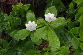
we began seeing all the familiar northern fell flora: Chickweed Wintergreen (see
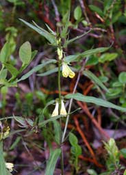
left) with its dainty white flowers, Cow Wheat a constant companion on forested fells (see
right), the trefoil leaves of Wood Sorrel but flowers long past, ground-hugging leaves of
Twin Flowers but again no flowers. Alongside the path, ungainly plants of Alpine
Sow-Thistle were still in tight bud. With the now heavily overcast weather
giving spots of rain, we continued upwards with frequent stops to photograph the
flora despite the poor light. On higher ground, we began seeing small patches of
Lingonberry, their tiny pink-fringed bell-shaped flowers looking like hanging
Christmas bells (Photo 16 - Lingonberry flowers); here was the subject for our 2016 Christmas card photograph.
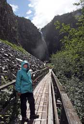 By the time we reached the wooden shelter at the
head of the path, heavier rain was falling causing us to kit up with full
waterproofs. The first distant views of Njupeskär falls in its dark cleft
were grey and obscured by mist and poor light, and from this
high vantage point the air was filled with the sound of rushing water from the Njupån
torrent way down below in the trees. With rain dripping off overhanging tree
branches, we began the descent of the steep wooden step-way down the precipitous
forested fell-side to the level of the wooden bridge spanning the torrent
descending from Njupeskär. These waters have their source in the lakes high on
the 980m Fulufjälletplateau, and over aeons have eroded a tiered canyon-cleft
in the red sandstone By the time we reached the wooden shelter at the
head of the path, heavier rain was falling causing us to kit up with full
waterproofs. The first distant views of Njupeskär falls in its dark cleft
were grey and obscured by mist and poor light, and from this
high vantage point the air was filled with the sound of rushing water from the Njupån
torrent way down below in the trees. With rain dripping off overhanging tree
branches, we began the descent of the steep wooden step-way down the precipitous
forested fell-side to the level of the wooden bridge spanning the torrent
descending from Njupeskär. These waters have their source in the lakes high on
the 980m Fulufjälletplateau, and over aeons have eroded a tiered canyon-cleft
in the red sandstone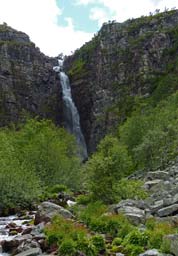 escarpment of the plateau's precipitous western edge, down
which the waters drop 93m forming the Njupeskär cascades, Sweden's highest
waterfall (see right). But being north facing, Njupeskär's cliff-enclosed cleft remains
totally shaded throughout the year, other than a few days around Midsummer when
dawn sunlight relieves the canyon's dark gloom. In today's rain, the
canyon-cleft was totally obscured and the dizzying cascades of falling water and
spray scarcely visible in the misty gloom. escarpment of the plateau's precipitous western edge, down
which the waters drop 93m forming the Njupeskär cascades, Sweden's highest
waterfall (see right). But being north facing, Njupeskär's cliff-enclosed cleft remains
totally shaded throughout the year, other than a few days around Midsummer when
dawn sunlight relieves the canyon's dark gloom. In today's rain, the
canyon-cleft was totally obscured and the dizzying cascades of falling water and
spray scarcely visible in the misty gloom.
From the board-walk which crossed the rock-fall
below the escarpment cliffs, with the rain still falling we tried to get
something of a photograph of the falls dropping within the cliff-enclosed gloom
of the canyon-cleft (Photo 17 - Njupeskär waterfalls)
(see left). After the promising forecast, this weather was a supreme
disappointment; visibility was worse than when we were last here in 2013. But
then suddenly, the wind caused a gap in the cloud cover above the escarpment,
with a patch of blue sky bringing the chance of a let-up in the rain and perhaps
even a hint of sunlight to enliven the falls. We waited hopefully as other
walkers passed along the board-walk and the rain continued in a gradually
brightening sky. Eventually the sun did manage to break through at the edge of
the rain cloud, but shining in the escarpment gap immediately above the falls
and directly into our camera lens, making the canyon even darker and the
monumental falls almost invisible within the dark, inner recesses of the cleft
and spray wafting over our cameras. We moved forward along the now wet
board-walk to the viewing platform immediately below the full 93m
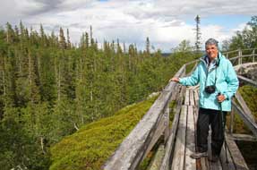 drop of the
falls. High above, the sun flared out at the uppermost gap of the cleft, but
ahead the cliff-enclosed canyon was misty blackness and the lower falls scarcely visible (Photo 18 - Sun flare over Njupeskär waterfalls). These were almost impossible conditions for meaningful photography with
harsh contrast of light and shade and spray soaking our cameras, but we took our
shots of the falls crashing into the canyon's gloom, unsure of correct exposure
and unable to see what results we were getting. drop of the
falls. High above, the sun flared out at the uppermost gap of the cleft, but
ahead the cliff-enclosed canyon was misty blackness and the lower falls scarcely visible (Photo 18 - Sun flare over Njupeskär waterfalls). These were almost impossible conditions for meaningful photography with
harsh contrast of light and shade and spray soaking our cameras, but we took our
shots of the falls crashing into the canyon's gloom, unsure of correct exposure
and unable to see what results we were getting.
The return path began from the board-walk and
traversed the lower rock-fall below the line of the escarpment to descend into
the valley and return through the forests to the Visitor Centre. Once out onto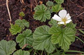 the rock-fall board-walk, bright sun lit the magnificent view over pines and
spruces towards distant northward fells (Photo 19 -
Njupeskär rock-fall board-walk). From a look-out point, the distant
horizon above the forests was graced with the distinctive profile of Städjan
high on Idrefjäll. Nearer at hand, the rocky fell-land was covered with
Bilberry, Lingonberry and Crowberry; today, from lower woodland mires up to the
high fells, we had seen the full range of northern berry plants. The path
descended into more enclosed forest, passing venerable 500 year old pines,
and crossing wetter marshland on board-walks, we found the elegantly pink
globular flowers of Bog Rosemary. This return path was less frequented and
therefore less eroded, a magnificently peaceful route down from the higher open
fells through the lower forests with their familiar range of northern flora.
Across the lower mires, we paused to photograph
 flourishing patches of
Cloudberry with their white male flowers, returning to the parking area to begin
the 40km drive back to the main Route 70 and north to Idre. flourishing patches of
Cloudberry with their white male flowers, returning to the parking area to begin
the 40km drive back to the main Route 70 and north to Idre.
Näsets Camping at Idre: northwards
through the magnificent pine-forested terrain of the upper Österdalälven valley,
we turned off into Näsets Camping in the southern outskirts of Idre village as
our base for this year's walking on Idrefjäll (see Map 4 top right for details
of route). The owner gave us a cheery welcome, suggesting
a pitch down at the lower camping area looking out towards Idresjön lake among
scattered pine trees with Lingonberries growing beneath them. It was a delightful
and peaceful setting, but this evening the air was chill with a brisk northerly
breeze (see left). Today up in the fells, the midges had been bothersome for the first time
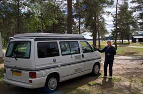
this summer and this evening we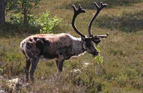 needed the Bagon diffuser to clear them from the
camper. needed the Bagon diffuser to clear them from the
camper.
A day's walk on Städjan high on Idrefjäll:
we were late away the following morning for our day out on Städjan in the Idre
fells. A lane from the village led steeply up the pine forested fellside of
Idrefjäll past the Idrefjäll ski resort to the alpine hamlet of Gränjesåsvallen.
As we turned off to the tiny alpine settlement, we passed this year's first
reindeer wandering along the lane and grazing the forest sides in the morning
sunshine (Photo 20 -
First reindeer of the trip) (see right). The Gränjesåsvallen parking area by the start of the Städjan climb was
quite full meaning there would be a number of walkers out on the
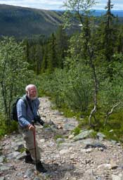 mountain.
Although the sun was bright, the chill northern breeze would blow keenly on the
high open shoulder of Städjan, and today we had kitted up fully with our
northern clime clothing layers. Crossing the board-walk over the boggy ground at
the foot of the path, we began the lower slope up through the spruce forest.
From the start, the path was rough with tree roots and boulders and soon became
stonier and steeper. We had enjoyed a superb day's climb to Städjan's 1131m
summit in 2013 (see
Log of our 2013 Städjan climb), but today with our late start, there was no
way we should complete the climb up to the summit ridge. We wanted however to tackle the lower forested stages at least to the open fell-land
shoulder. mountain.
Although the sun was bright, the chill northern breeze would blow keenly on the
high open shoulder of Städjan, and today we had kitted up fully with our
northern clime clothing layers. Crossing the board-walk over the boggy ground at
the foot of the path, we began the lower slope up through the spruce forest.
From the start, the path was rough with tree roots and boulders and soon became
stonier and steeper. We had enjoyed a superb day's climb to Städjan's 1131m
summit in 2013 (see
Log of our 2013 Städjan climb), but today with our late start, there was no
way we should complete the climb up to the summit ridge. We wanted however to tackle the lower forested stages at least to the open fell-land
shoulder.
Although the steep lower path was rough and stony,
the spruce forest surroundings were glorious, the forest floor covered with a
dense carpet of Bilberry dotted with Lingonberry flowers. We climbed steadily
upwards on the grindingly steep, stony upper path, and with the height gain, the
spruces thinned giving way to stunted birches (see left) (Photo 21 - Approach path to Städjan). Beyond these towards the tree
line, we found today's floral gems: firstly the green unripe berries of
ground-hugging Bearberry with its distinctively shaped elongated, textured
leaves (Photo 22 - Bearberry), and then a tiny clump of Twin Flowers nestled demurely in the shelter of
low Juniper bushes. As the path led out onto the open fell-land shoulder, Städjan's
summit ridge now came into view. As we emerged from the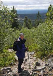 relative shelter of the
forested approach path out onto the broad, open fell-land of the mountain's
shoulder, the full force of the chill northern wind blew into our faces. At
least today, with all this brisk air movement even down on the lower path, there
would be no midges to bother us, and we donned cagoules, neck-muffs and hats
against the wind-chill. Out here on the open shoulder, the predominant ground
cover was spikey-leaved Crowberry, dotted with dwarf birch and low willow scrub,
with the occasional patch of Bearberry full of green, unripe fruits. We recalled
from 2013 the shoulder having masses of purple-flowered Mountain Heath, but that
had been 5 weeks earlier in the season. All that remained this year was the
ruddy-brown seed-cases of the Mountain Heath plants. relative shelter of the
forested approach path out onto the broad, open fell-land of the mountain's
shoulder, the full force of the chill northern wind blew into our faces. At
least today, with all this brisk air movement even down on the lower path, there
would be no midges to bother us, and we donned cagoules, neck-muffs and hats
against the wind-chill. Out here on the open shoulder, the predominant ground
cover was spikey-leaved Crowberry, dotted with dwarf birch and low willow scrub,
with the occasional patch of Bearberry full of green, unripe fruits. We recalled
from 2013 the shoulder having masses of purple-flowered Mountain Heath, but that
had been 5 weeks earlier in the season. All that remained this year was the
ruddy-brown seed-cases of the Mountain Heath plants.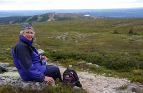
Ahead across the gently rising shoulder, the bulky
mass of Städjan's ridge-line and summit rose, with the slanting approach path
scarred deeply across its flank (Photo 23 - Städjan's summit ridge-line).
But tempting as it looked, the time was now
3-15pm and it would need at least another hour to reach the summit; we had
achieved the gruelling lower climb, but our late start would deny us the summit
this year. We advanced a little further to the foot of the summit ridge path's
steepest section, and called a halt there (see left); frustrating as it was, we had reached
around 1000m of the summit's 1131m height. The sun of earlier was now gone, and
grey cloud filled the sky, driven by the brisk northerly wind. With wistful
glances back towards the summit we began our descent, re-tracing our
steps down across the broad shoulder and soon approached the tree-line, having
noted carefully on our ascent the point at which the summer path branched off
steeply down into the forest (see above right). A steady pace down into the rough, stony terrain
of the upper zone of stunted birches brought us down through the spruce forests,
and within an hour we were back at the parking area to drive back to Idre
village for a second chill night at Näsets Camping. Tomorrow we should move
north to Funäsdalen.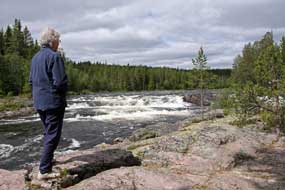
The drive north over the fells into Härjedalen: Näsets Camping had
certainly been a worthwhile stay, and the following morning, we set off on our long
drive northwards to Funäsdalen, turning north on the minor road to Foskros from
Idre village (see Map 4 top right for details of route). Our route initially ran alongside the Grovlan Storån river,
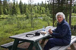 which
merges with the Sörälven at Idre as the 2 source rivers of the Österdalälven. A
short distance north, what had lower been a placidly flowing river narrowed into
white-water rapids, cascading into a rocky channel. From the pine and birch-lined
rocky river bank, the river made a spectacular picture sparkling in the morning
sunshine
(Photo 24 - Grovlan Storån white-water rapids)
(see right). This was a beautiful road passing through birch-fringed spruce
woodland, and we paused for an early lunch in bright sunshine at a riverside
picnic area (see left). Just beyond the tiny hamlet of Foskros however, the tarmac ended
giving way to a lonely gravel-surfaced road for 30kms which passed over high
and thinly forested plateau-land, totally deserted apart from the occasional
farmstead
(Photo 25 - Lonely road over into Härjedalen). As the road steadily lost height down to the reindeer-herding
settlement of Sörvattnet, we finally left Dalarna and crossed into the region of Härjedalen.
Here the road-sign warned of Renstängsel (reindeer enclosure), and a short
distance further we passed a large herd of does with this year's young calves
(see below right)
(Photo 26 - Reindeer herd at Sörvattnet).
The owner at Näsets Camping had which
merges with the Sörälven at Idre as the 2 source rivers of the Österdalälven. A
short distance north, what had lower been a placidly flowing river narrowed into
white-water rapids, cascading into a rocky channel. From the pine and birch-lined
rocky river bank, the river made a spectacular picture sparkling in the morning
sunshine
(Photo 24 - Grovlan Storån white-water rapids)
(see right). This was a beautiful road passing through birch-fringed spruce
woodland, and we paused for an early lunch in bright sunshine at a riverside
picnic area (see left). Just beyond the tiny hamlet of Foskros however, the tarmac ended
giving way to a lonely gravel-surfaced road for 30kms which passed over high
and thinly forested plateau-land, totally deserted apart from the occasional
farmstead
(Photo 25 - Lonely road over into Härjedalen). As the road steadily lost height down to the reindeer-herding
settlement of Sörvattnet, we finally left Dalarna and crossed into the region of Härjedalen.
Here the road-sign warned of Renstängsel (reindeer enclosure), and a short
distance further we passed a large herd of does with this year's young calves
(see below right)
(Photo 26 - Reindeer herd at Sörvattnet).
The owner at Näsets Camping had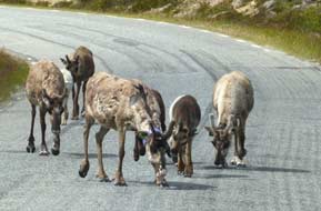 warned that the ongoing Route 311 was narrow,
winding and in poor condition, and he was right: the next 40kms as far as Tännäs
was the roughest piece of road travelled on throughout Sweden. We bumped and
jolted along, dodging the pot-holes, and gained height up to Högvålen signed as
Sveriges högst belågna by (Sweden's highest village). The bumpy road
continued across the high, forested plateau warned that the ongoing Route 311 was narrow,
winding and in poor condition, and he was right: the next 40kms as far as Tännäs
was the roughest piece of road travelled on throughout Sweden. We bumped and
jolted along, dodging the pot-holes, and gained height up to Högvålen signed as
Sveriges högst belågna by (Sweden's highest village). The bumpy road
continued across the high, forested plateau
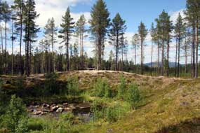 with a sweeping vista of distant
fells some streaked with residual snow gracing the northern horizon. This lonely
road continued over high fells, passing occasional remote settlements, and
eventually dropping down to the ski-resort village of Tännäs; here we joined
Route 84, the main cross-country road running through Funäsdalen and Tänndalen
and on into Norway. with a sweeping vista of distant
fells some streaked with residual snow gracing the northern horizon. This lonely
road continued over high fells, passing occasional remote settlements, and
eventually dropping down to the ski-resort village of Tännäs; here we joined
Route 84, the main cross-country road running through Funäsdalen and Tänndalen
and on into Norway.
The Torbygget meteorite impact crater: shortly before the village
of Torbygget, a sign pointed into the forest to a meteorite crater, and a 400m
long board-walk, badly in need of repair, led through the forest to a significant
sized, water-logged crater among the trees
(Photo
27 - Meteorite impact crater) (see left). The crater 44m in diameter at its
widest point and some 5m deep was created around 2,000 years ago by the impact
of space debris. We walked the circuit rim for photos of the crater and the
forest floor of Bilberry and Lingonberry before continuing along to the village
of Funäsdalen with its scattered houses spread along the open valley against a
backdrop of distant fells.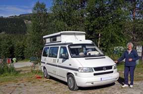
Funäsdalens Fjäll-Camping:
having shopped for provisions at the ICA supermarket, we headed up to
Funäsdalens Fjäll-Camping 2kms uphill from the village past the craggy hill of
Funäsdalsberget, centre of the local skiing industry. We had happy memories of
this straightforward campsite with camping areas terraced up the hillside among
birch trees in a glorious fell-land setting directly below the Funäsdalsberget
 ski runs. But on arrival today another heart-sink-moment awaited: seemingly
endless caravans and camping-cars lined up in conformist row upon row like not-so-little white
boxes (all made out of ticky-tacky and all looking just the same, as Pete
Seeger sang in 1963), filling the lower terraces of what had been a peacefully
empty campsite when we last stayed here in early June 2013. Fortunately we
found empty space on a higher terrace and settled in (see right), with a chill northerly wind
blowing. As evening drew on, the holiday-making hoards all hoisted their
satellite dishes and retired into their white boxes to watch their soap operas,
while we prepared our barbecue supper
(Photo 28 - Funäsdalens barbecue) and revelled in the magnificent fell-land
surroundings, as the sun sank below the flank of Funäsdalsberget. ski runs. But on arrival today another heart-sink-moment awaited: seemingly
endless caravans and camping-cars lined up in conformist row upon row like not-so-little white
boxes (all made out of ticky-tacky and all looking just the same, as Pete
Seeger sang in 1963), filling the lower terraces of what had been a peacefully
empty campsite when we last stayed here in early June 2013. Fortunately we
found empty space on a higher terrace and settled in (see right), with a chill northerly wind
blowing. As evening drew on, the holiday-making hoards all hoisted their
satellite dishes and retired into their white boxes to watch their soap operas,
while we prepared our barbecue supper
(Photo 28 - Funäsdalens barbecue) and revelled in the magnificent fell-land
surroundings, as the sun sank below the flank of Funäsdalsberget.
Fell-land walk up to Livsäterån: after the chillest night
so far with temperature down to 6ºC, we woke to a clear sky and warming sun.
Reserving George's spot, we were away early for our day's walking up to Livsäterån in the Funäsdalen
fells. We drove west from Funäsdalen village steeply up to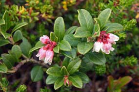 the highest point of
Route 84 at Högsta Hållan, the start point for Funäsdalen Guld Tur 11 to the Livsäterån
ravine high in the fells. It was here at the start of the walk that in 2013 we
had seen Siberian Jays in the birch woods (see our Siberian Jay photos).
Exclusively found in the Eurasian northern taiga coniferous forests (hence its
name), the bird's normal habitat rarely brings them into contact with humans;
they therefore show no fear and have even been known to beg food. We had been
fortunate enough to see a pair of them, flitting about among birch branches,
hopping around on the ground, perching on a the highest point of
Route 84 at Högsta Hållan, the start point for Funäsdalen Guld Tur 11 to the Livsäterån
ravine high in the fells. It was here at the start of the walk that in 2013 we
had seen Siberian Jays in the birch woods (see our Siberian Jay photos).
Exclusively found in the Eurasian northern taiga coniferous forests (hence its
name), the bird's normal habitat rarely brings them into contact with humans;
they therefore show no fear and have even been known to beg food. We had been
fortunate enough to see a pair of them, flitting about among birch branches,
hopping around on the ground, perching on a
 post
before our eyes and making no
attempt to avoid us as we moved closer;
we hoped for a repeat sighting today. The lowest section of the walk's start was
intrinsically wet and boggy from springtime snow-melts; although drier today later in the season, we picked a way carefully up the lower slopes, and
immediately began seeing interesting flora: an area of Heath Spotted Orchids soon had us down on hands and knees photographing these lovely specimens
(Photo 29 - Heath Spotted Orchids). We
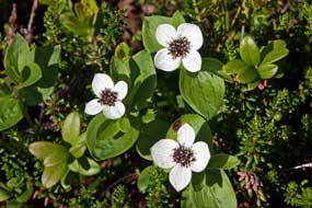
also saw all our old favourite northern flora, including Lingonberry flowers
(see right), Dwarf Cornel (see above
left),
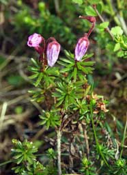
Cloudberry, Bog Rosemary, Tormentil (see below right), Mountain Heath its
flowers past but now with prominent seed cases, Juniper bushes with unripe
berries, Lapland Lousewort (Photo
30 - Lapland Lousewort) with its distinctive pale yellow snap-dragon
flowers, and Bog Bilberry still in flower (Photo
31 - Bog Bilberry). But
alas, there was no sign of the Siberian Jays today. At the top of the slope we
sat by a huge erratic boulder to eat our sandwich lunch, looking out to the
magnificent view across the intervening valley. post
before our eyes and making no
attempt to avoid us as we moved closer;
we hoped for a repeat sighting today. The lowest section of the walk's start was
intrinsically wet and boggy from springtime snow-melts; although drier today later in the season, we picked a way carefully up the lower slopes, and
immediately began seeing interesting flora: an area of Heath Spotted Orchids soon had us down on hands and knees photographing these lovely specimens
(Photo 29 - Heath Spotted Orchids). We
also saw all our old favourite northern flora, including Lingonberry flowers
(see right), Dwarf Cornel (see above
left),
Cloudberry, Bog Rosemary, Tormentil (see below right), Mountain Heath its
flowers past but now with prominent seed cases, Juniper bushes with unripe
berries, Lapland Lousewort (Photo
30 - Lapland Lousewort) with its distinctive pale yellow snap-dragon
flowers, and Bog Bilberry still in flower (Photo
31 - Bog Bilberry). But
alas, there was no sign of the Siberian Jays today. At the top of the slope we
sat by a huge erratic boulder to eat our sandwich lunch, looking out to the
magnificent view across the intervening valley.
The path with its orange-topped way-marker
posts led out above the tree line onto the flat, open fell-plateau through low
ground-cover of Crowberry and Dwarf Birch, and dipped to a low-lying marshy area
which, earlier in the season in 2013, had only been passable thanks to
board-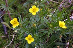 walks. During the afternoon, we passed several other walkers who greeted
us with a cheery Hej, hej. We followed the path through an avenue of
birch trees and at the far end crossed a stream on steeping stones, which in
2013 had been covered by a large area of residual snow. Here in this more
sheltered spot we found more floral gems: a few Mountain Heath plants still in
flower (see above left), Bilberry bushes also still with their deep pink flowers and a patch of
cheery Yellow Wood Violets. Leaving the birch grove, the path led out onto a
wide expanse of open fell-land with distant views in today's clear light to the
2 rounded peaks of Skarven to the north-west, and eastwards towards the
settlement of Funäsdalen nestling alongside its lake under craggy Funäsdalsberget.
The far horizon away to the north-east was graced with the crinkly ridge-line of Anåfjället. We were grateful for the reassuring guidance of way-marker posts
indicating the now indistinct line of the path across the open, treeless
moorland where in places the peat was moist and soft. We continued for some
distance across the fell-land plateau, finally dropping down into the low ravine
of the Livsäterån stream which sloped eastwards towards Funäsdalsjön. walks. During the afternoon, we passed several other walkers who greeted
us with a cheery Hej, hej. We followed the path through an avenue of
birch trees and at the far end crossed a stream on steeping stones, which in
2013 had been covered by a large area of residual snow. Here in this more
sheltered spot we found more floral gems: a few Mountain Heath plants still in
flower (see above left), Bilberry bushes also still with their deep pink flowers and a patch of
cheery Yellow Wood Violets. Leaving the birch grove, the path led out onto a
wide expanse of open fell-land with distant views in today's clear light to the
2 rounded peaks of Skarven to the north-west, and eastwards towards the
settlement of Funäsdalen nestling alongside its lake under craggy Funäsdalsberget.
The far horizon away to the north-east was graced with the crinkly ridge-line of Anåfjället. We were grateful for the reassuring guidance of way-marker posts
indicating the now indistinct line of the path across the open, treeless
moorland where in places the peat was moist and soft. We continued for some
distance across the fell-land plateau, finally dropping down into the low ravine
of the Livsäterån stream which sloped eastwards towards Funäsdalsjön.
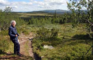 This was the outer limit of today's walk, but
the floral treasures were not over yet. On the very wet slopes of the ravine
bank, we found beautiful specimens of Bog Rosemary still adorned with its
elegant pink globular flowers
(Photo
32 - Bog Rosemary), Alpine Bartsia with its distinctive, dark purple
upper clusters of leaves, pink Moss Campion flowers and tiny insectivorous
Butterwort. We spent a happy, wet knee-ed 10 minutes on this marshy slope
photographing these magnificent wild flora. After final photos by the Livsäterån
sign board against the fell-land backdrop
(Photo 33 - Livsäterån ravine), we began the return walk across the
broad shoulder of open moorland, through the birch grove, and finally down the
slope to the road with its glorious views across the wooded valley now lit by the
afternoon sunshine
(Photo 34 - Wooded valley below Livsäterån fells). We paused at the foot of the slope, still hoping for another
sighting of the Siberian Jays, but gone they were today. A return to 2013's Livsäterån
fell-walk, but without the memorable Siberian Jay sightings, could today have
been an unnoteworthy anticlimax. In fact however, despite being 5 weeks later in
the season, with such a variety and scope of flora right from the start, weather
and lighting conditions almost perfect, and views across the open fell-scape so
glorious, our return to Livsäterån had again proved equally memorable. It had been a rewarding afternoon's walk in a paradise
garden of wild flora. This was the outer limit of today's walk, but
the floral treasures were not over yet. On the very wet slopes of the ravine
bank, we found beautiful specimens of Bog Rosemary still adorned with its
elegant pink globular flowers
(Photo
32 - Bog Rosemary), Alpine Bartsia with its distinctive, dark purple
upper clusters of leaves, pink Moss Campion flowers and tiny insectivorous
Butterwort. We spent a happy, wet knee-ed 10 minutes on this marshy slope
photographing these magnificent wild flora. After final photos by the Livsäterån
sign board against the fell-land backdrop
(Photo 33 - Livsäterån ravine), we began the return walk across the
broad shoulder of open moorland, through the birch grove, and finally down the
slope to the road with its glorious views across the wooded valley now lit by the
afternoon sunshine
(Photo 34 - Wooded valley below Livsäterån fells). We paused at the foot of the slope, still hoping for another
sighting of the Siberian Jays, but gone they were today. A return to 2013's Livsäterån
fell-walk, but without the memorable Siberian Jay sightings, could today have
been an unnoteworthy anticlimax. In fact however, despite being 5 weeks later in
the season, with such a variety and scope of flora right from the start, weather
and lighting conditions almost perfect, and views across the open fell-scape so
glorious, our return to Livsäterån had again proved equally memorable. It had been a rewarding afternoon's walk in a paradise
garden of wild flora.
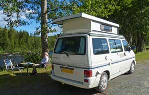 Northwards over the mountains into
Jämtland and the alpine valley of Åredalen: another bright, sunny
morning after a chill night, and we were away by 10-15am for our long drive
northwards into the province of Jämtland (see Map 4 top right for details
of route). Given the mountainous
topography, this entailed an initial long return loop eastwards along Route 64
through deserted pine forests before turning north over high ground on Route
315. The sun was bright lighting forests and lakes, traffic was light, and a
remarkable absence of speed cameras enabled us to make good progress. Route 315
through alpine farming countryside brought us to Vemdalen, a charming village
with wooden church. Just beyond here the road crossed from Härjedalen
into Jämtland,
and gained Northwards over the mountains into
Jämtland and the alpine valley of Åredalen: another bright, sunny
morning after a chill night, and we were away by 10-15am for our long drive
northwards into the province of Jämtland (see Map 4 top right for details
of route). Given the mountainous
topography, this entailed an initial long return loop eastwards along Route 64
through deserted pine forests before turning north over high ground on Route
315. The sun was bright lighting forests and lakes, traffic was light, and a
remarkable absence of speed cameras enabled us to make good progress. Route 315
through alpine farming countryside brought us to Vemdalen, a charming village
with wooden church. Just beyond here the road crossed from Härjedalen
into Jämtland,
and gained
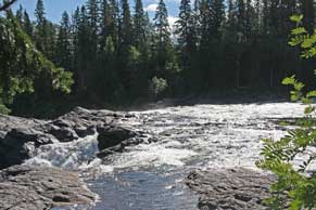 height steeply over higher ground, passing through soulless ski
resorts to reach the high point of these wooded hills. At the junction with Route 316, we turned off down to Klövsjö, another delightful alpine village and
ski centre. Beyond here more height gain over pine-covered hills before finally
descending to the junction at Åsarna to re-join the E45, the great S~N highway of
Inlandsvägan. 11kms north, we turned off onto Route 321 around the
pastoral western shore of the pervasively spreading lake of Storsjön (see Map 5
top right for details of route). This quiet
but poorly surfaced rural road passed through a series of delightful villages,
the fertile alluvial Storsjön soil providing good farming with all the pastures
cut for hay and bales of silage stacked at each farm as cattle feed for the long
winter. We eventually reached the junction with E14, the main trans-Sweden
highway from Sundsvall on the Bothnian coast across to Trondheim in Norway,
passing through the ski resort of Åre. We turned westwards on E14 along the broad and lushly green farming valley of Åredalen, and in 33kms reached
Ristafallet Camping which was to be our base in the valley. height steeply over higher ground, passing through soulless ski
resorts to reach the high point of these wooded hills. At the junction with Route 316, we turned off down to Klövsjö, another delightful alpine village and
ski centre. Beyond here more height gain over pine-covered hills before finally
descending to the junction at Åsarna to re-join the E45, the great S~N highway of
Inlandsvägan. 11kms north, we turned off onto Route 321 around the
pastoral western shore of the pervasively spreading lake of Storsjön (see Map 5
top right for details of route). This quiet
but poorly surfaced rural road passed through a series of delightful villages,
the fertile alluvial Storsjön soil providing good farming with all the pastures
cut for hay and bales of silage stacked at each farm as cattle feed for the long
winter. We eventually reached the junction with E14, the main trans-Sweden
highway from Sundsvall on the Bothnian coast across to Trondheim in Norway,
passing through the ski resort of Åre. We turned westwards on E14 along the broad and lushly green farming valley of Åredalen, and in 33kms reached
Ristafallet Camping which was to be our base in the valley.
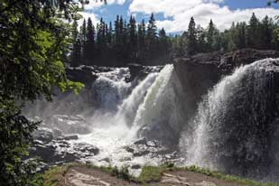 A welcoming return to Ristafallet Camping: before booking in at the campsite, we drove along to Åre
to shop for weekend provisions at the ICA supermarket by the station. Railway
passengers and shoppers mingled amid supermarket trolleys on the station
platform where an Östersund~Stockholm-bound train waited to depart. The
supermarket, poorly stocked and over-expensive, was more geared to the pushy Norwegian
cross-border shoppers. Åre is nothing but an unattractive winter ski resort with
the modern ski accommodation crowded up the foot of Åreskutan's formidable
massif which towers over the town, the forested lower slopes segmented by
ski runs. Along the shore of Åresjön lake to Duved, the old village with A welcoming return to Ristafallet Camping: before booking in at the campsite, we drove along to Åre
to shop for weekend provisions at the ICA supermarket by the station. Railway
passengers and shoppers mingled amid supermarket trolleys on the station
platform where an Östersund~Stockholm-bound train waited to depart. The
supermarket, poorly stocked and over-expensive, was more geared to the pushy Norwegian
cross-border shoppers. Åre is nothing but an unattractive winter ski resort with
the modern ski accommodation crowded up the foot of Åreskutan's formidable
massif which towers over the town, the forested lower slopes segmented by
ski runs. Along the shore of Åresjön lake to Duved, the old village with
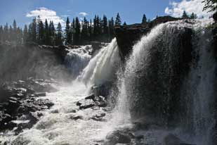 its
alpine farms stretching up the hillside is now almost overwhelmed by the modern
skiing industry. We returned eastwards along the valley, passing streams of
Norwegian holiday traffic heading back towards the border. At Ristafallet
Camping we were again welcomed warmly by the young owners Mathilde and Jan Vos,
who recalled our previous stay there in 2013 when we had rated Ristafallet as
without doubt Sweden's best campsite. This wonderfully hospitable campsite is
located on the banks of the Indalsälven river
which runs the length of the Åredalen valley, and here the fast-flowing white-water
rapids torrent curves around the hillock where the
campsite stands, dropping 14m over the 50m wide spectacular Ristafallet waterfalls
from which the campsite takes its name (see above left). In response to our earlier phone call,
Jan had reserved a space for us down by the river bank, and we quickly settled
into the grassy riverside terrace, the air filled with the roar of the Indalsälven
torrent rushing past (see above right). We sat with an early evening beer, looking across to the
spruce and birch forests covering the fell-side on its
alpine farms stretching up the hillside is now almost overwhelmed by the modern
skiing industry. We returned eastwards along the valley, passing streams of
Norwegian holiday traffic heading back towards the border. At Ristafallet
Camping we were again welcomed warmly by the young owners Mathilde and Jan Vos,
who recalled our previous stay there in 2013 when we had rated Ristafallet as
without doubt Sweden's best campsite. This wonderfully hospitable campsite is
located on the banks of the Indalsälven river
which runs the length of the Åredalen valley, and here the fast-flowing white-water
rapids torrent curves around the hillock where the
campsite stands, dropping 14m over the 50m wide spectacular Ristafallet waterfalls
from which the campsite takes its name (see above left). In response to our earlier phone call,
Jan had reserved a space for us down by the river bank, and we quickly settled
into the grassy riverside terrace, the air filled with the roar of the Indalsälven
torrent rushing past (see above right). We sat with an early evening beer, looking across to the
spruce and birch forests covering the fell-side on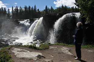 the opposite bank all lit by
the late sun, mesmerised by the river torrent's roar. The campsite's central
area was packed with camping-cars, all with their satellite dishes raised; what
sort of sub-intelligence would prefer TV to watching nature's display at
its very best; to sit eating supper looking out over Ristafallet's ever-changing
rapids and the sunlit forests beyond, to the constant accompaniment of the
rapids' roar, was surely all that anyone could ask for. It was a magical
evening, and so good to be back at Ristafallet Camping. We were looking forward
to our day in camp tomorrow, and were lulled to sleep later that evening by the background
soporific sound of the passing rapids. the opposite bank all lit by
the late sun, mesmerised by the river torrent's roar. The campsite's central
area was packed with camping-cars, all with their satellite dishes raised; what
sort of sub-intelligence would prefer TV to watching nature's display at
its very best; to sit eating supper looking out over Ristafallet's ever-changing
rapids and the sunlit forests beyond, to the constant accompaniment of the
rapids' roar, was surely all that anyone could ask for. It was a magical
evening, and so good to be back at Ristafallet Camping. We were looking forward
to our day in camp tomorrow, and were lulled to sleep later that evening by the background
soporific sound of the passing rapids.
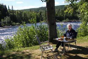 A day in camp by Ristafallet
waterfalls: on lifting the blinds the following morning, we were
greeted by the sunlit sight of Ristafallet rapids; one word summed it all up -
wow! The early cloud was just beginning to break, and while the sun was at the
right angle fully to illuminate the falls, we rushed down to Ristafallet for our
first batch of photos this year. The sun sparkled on the cascading streams of
water crashing over the brink, the full width of the falls cleaved in the centre
by a huge projecting rock (see left and right)
(Photo 35 - Ristafallet waterfalls). The falling water produced wafting clouds of spray
which drifted over the cascades taking endless variety of forms, all lit by the
morning sun
(Photo
36 - Ristafallet waterfalls); it was such a magnificent and awe-inspiring spectacle. Back up at
George, we sat for a late breakfast in dappled shade at our river bank terrace,
alongside the Indalsälven rapids A day in camp by Ristafallet
waterfalls: on lifting the blinds the following morning, we were
greeted by the sunlit sight of Ristafallet rapids; one word summed it all up -
wow! The early cloud was just beginning to break, and while the sun was at the
right angle fully to illuminate the falls, we rushed down to Ristafallet for our
first batch of photos this year. The sun sparkled on the cascading streams of
water crashing over the brink, the full width of the falls cleaved in the centre
by a huge projecting rock (see left and right)
(Photo 35 - Ristafallet waterfalls). The falling water produced wafting clouds of spray
which drifted over the cascades taking endless variety of forms, all lit by the
morning sun
(Photo
36 - Ristafallet waterfalls); it was such a magnificent and awe-inspiring spectacle. Back up at
George, we sat for a late breakfast in dappled shade at our river bank terrace,
alongside the Indalsälven rapids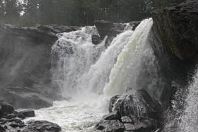 with their background roar which made conversation
difficult (Photo 37 - Breakfast at Ristafallet)
(see left). We enjoyed a thoroughly relaxing and productive day amid the
wonderful natural surroundings of Ristafallet Camping, with the ever-present
roar of the Indalsälven rapids. Late afternoon we wandered down to the river
bank again, with the falls now in shadow giving them a different mood slant. A
change in the weather overnight brought a heavily overcast sky and drizzly rain
the following morning; the river rapids looked sullenly grey with misty rain
cloud hovering over the spruce-covered fells on the far bank. We walked down for
a final set of photos with the falls now having a monochrome mood in this morning's
dull light (see right). It is always the sign of a good campsite when it is difficult to
tear yourself away, but having settled up our 2 days' rent and wished Mathilde
and Jan continuing success, we headed back along the valley. Ristafallet Camping
will always figure on our select list of Very Special Places. with their background roar which made conversation
difficult (Photo 37 - Breakfast at Ristafallet)
(see left). We enjoyed a thoroughly relaxing and productive day amid the
wonderful natural surroundings of Ristafallet Camping, with the ever-present
roar of the Indalsälven rapids. Late afternoon we wandered down to the river
bank again, with the falls now in shadow giving them a different mood slant. A
change in the weather overnight brought a heavily overcast sky and drizzly rain
the following morning; the river rapids looked sullenly grey with misty rain
cloud hovering over the spruce-covered fells on the far bank. We walked down for
a final set of photos with the falls now having a monochrome mood in this morning's
dull light (see right). It is always the sign of a good campsite when it is difficult to
tear yourself away, but having settled up our 2 days' rent and wished Mathilde
and Jan continuing success, we headed back along the valley. Ristafallet Camping
will always figure on our select list of Very Special Places.
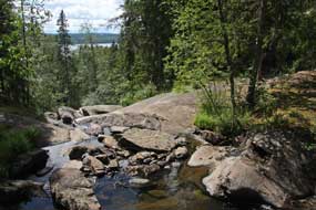 The Palaeolithic rock-engravings at Glösa:
at Mörsil we turned off over the forested hills down to the farming hamlet of
Alsen and along the north shore of Alsensjön lake for a return visit to
the Glösa Palaeolithic rock-engravings (Hällristningar in
Swedish) (see Map 5 top right for details of route). From the parking area, a 200m path led to the Glösa petroglyphs. The
Bohuslän rock-engravings seen earlier in the trip dating from around 1000 BC
were created by settled pastoralists who supplemented farming with hunting, and
the themes of these late Bronze Age rock-engravings reflected this settled
life-style. The Glösa petroglyphs however are more than twice that age, created
an estimated 5000 years ago by Palaeolithic nomadic hunter-gathers who lived by
trapping migrating elks which roamed the forests. The panel of Glösa
rock-engravings were carved on a large, flat slab beside a stream which The Palaeolithic rock-engravings at Glösa:
at Mörsil we turned off over the forested hills down to the farming hamlet of
Alsen and along the north shore of Alsensjön lake for a return visit to
the Glösa Palaeolithic rock-engravings (Hällristningar in
Swedish) (see Map 5 top right for details of route). From the parking area, a 200m path led to the Glösa petroglyphs. The
Bohuslän rock-engravings seen earlier in the trip dating from around 1000 BC
were created by settled pastoralists who supplemented farming with hunting, and
the themes of these late Bronze Age rock-engravings reflected this settled
life-style. The Glösa petroglyphs however are more than twice that age, created
an estimated 5000 years ago by Palaeolithic nomadic hunter-gathers who lived by
trapping migrating elks which roamed the forests. The panel of Glösa
rock-engravings were carved on a large, flat slab beside a stream which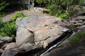 tumbles
steeply down the hillside in a pine wooded grove (see left and right)
(Photo
38 - Glösa rock-engravings pine wooded grove). The setting is as mysterious
now as it was between 4,000~3,500 BC when these Palaeolithic folk gathered
regularly at what was for them a sacred site, to carve ritual representations of
the prey they hunted and on which their livelihood depended. As well as meat,
elks provided hides for clothing and shelter-covering, horns for making axes,
picks and ornaments, and bones for scrapers, chisels, arrow- and spear-heads,
needles and tool handles. The Ice Age glaciers had retreated some 10,000 years
ago and the first humans had settled in what is now Jämtland around 8,000 years
ago. These nomadic peoples lived close to small lakes and rivers, hunting,
fishing and gathering berries, roots and nuts. Their most important prey were
elks which they killed by digging trapping-pits along tumbles
steeply down the hillside in a pine wooded grove (see left and right)
(Photo
38 - Glösa rock-engravings pine wooded grove). The setting is as mysterious
now as it was between 4,000~3,500 BC when these Palaeolithic folk gathered
regularly at what was for them a sacred site, to carve ritual representations of
the prey they hunted and on which their livelihood depended. As well as meat,
elks provided hides for clothing and shelter-covering, horns for making axes,
picks and ornaments, and bones for scrapers, chisels, arrow- and spear-heads,
needles and tool handles. The Ice Age glaciers had retreated some 10,000 years
ago and the first humans had settled in what is now Jämtland around 8,000 years
ago. These nomadic peoples lived close to small lakes and rivers, hunting,
fishing and gathering berries, roots and nuts. Their most important prey were
elks which they killed by digging trapping-pits along
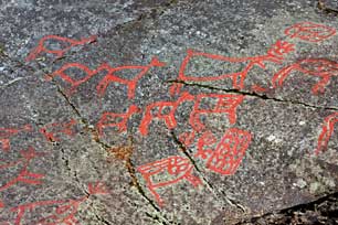 the elks' migration
routes. The Glösa site shows a total of 45 elks engraved by chiselling onto the
rock panel. There are also grid patterns which may represent branches laid over
trapping-pits. The meaning of the elk engravings cannot be fully interpreted but
is presumably of ritualistic significance in ensuring success in the hunt for
elks on which these peoples' subsistence and lifestyle depended. Most of the
elks face the same way, perhaps representing the animals' summer~winter
migrations when trapping took place
(Photo 39 - Glösa rock-engravings of migrating elks)
(see left). The engravings would have had religious
significance for their creators as a major source of subsistence. Some of the
elks have lines or organs the elks' migration
routes. The Glösa site shows a total of 45 elks engraved by chiselling onto the
rock panel. There are also grid patterns which may represent branches laid over
trapping-pits. The meaning of the elk engravings cannot be fully interpreted but
is presumably of ritualistic significance in ensuring success in the hunt for
elks on which these peoples' subsistence and lifestyle depended. Most of the
elks face the same way, perhaps representing the animals' summer~winter
migrations when trapping took place
(Photo 39 - Glösa rock-engravings of migrating elks)
(see left). The engravings would have had religious
significance for their creators as a major source of subsistence. Some of the
elks have lines or organs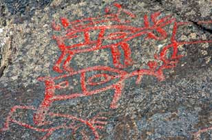 engraved within their bodies, perhaps representing the
heart or uterus symbolising life and fertility (see right) (Photo
40 - elk rock-engravings with symbolic heart and uterus). engraved within their bodies, perhaps representing the
heart or uterus symbolising life and fertility (see right) (Photo
40 - elk rock-engravings with symbolic heart and uterus).
A wooden viewing platform looked down across
the stream to the flat rock slabs which bore the engravings. As we stood there,
the sun was just breaking through casting an even light onto the panel of
engravings which were infilled with red paint to make them more visible to
modern eyes. We took our photos, both detailed close-ups of individual carvings
showing the animals' antlers, beard and internal organs, and of the overall
setting in the pine-grove with the stream trickling down past the rock panel.
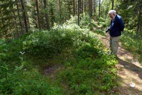 Back at the parking area, we followed another
path into the pine woods to find traces of surviving elk hunting-pits dating
from the Viking period. Elk had been hunted in the region from the early Stone
Age when hunter-gatherers had created the rock-engravings, right up to the 19th
century when entrapping was banned by law. Along the high crest-line of an
esker in the dense forest, we found the shallow remains of trapping-pits (fängstgropar
in Swedish) (see left), as well as beautiful patches of Twin Flowers lit by the afternoon
sunshine (Photo
41 - Twin Flowers). Back at the parking area, we followed another
path into the pine woods to find traces of surviving elk hunting-pits dating
from the Viking period. Elk had been hunted in the region from the early Stone
Age when hunter-gatherers had created the rock-engravings, right up to the 19th
century when entrapping was banned by law. Along the high crest-line of an
esker in the dense forest, we found the shallow remains of trapping-pits (fängstgropar
in Swedish) (see left), as well as beautiful patches of Twin Flowers lit by the afternoon
sunshine (Photo
41 - Twin Flowers).
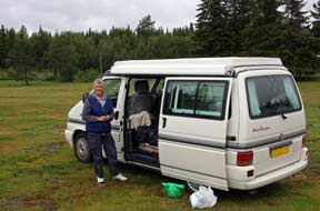 Lillholmsjö Camping: after our
stop for provisions in Krokom,
the weather closed in; it was now gloomily wet as we drove north-westerly on
Route 340 through the largely unpopulated forested hinterlands of the Norwegian
border region to find tonight's campsite Lillholmsjö Camping (see Map 6 top
right for details of route). This was indeed a
lonely road with just a little local traffic and the occasional timber truck.
From higher points along the road, empty forested terrain stretched away to
gloomily distant horizons with nothing but an empty sea of pines. After some
50kms, we reached the small village of Lillholmsjö with the campsite at a road
junction-corner; in poor light on such a gloomily wet afternoon, it looked
something of a bleak and cheerless place with a open camping area surrounded by
huts, but it was open and almost deserted. We eventually tracked down the
reception in a guest-house across the road; here the owner welcomed us with
formal politeness, Lillholmsjö Camping: after our
stop for provisions in Krokom,
the weather closed in; it was now gloomily wet as we drove north-westerly on
Route 340 through the largely unpopulated forested hinterlands of the Norwegian
border region to find tonight's campsite Lillholmsjö Camping (see Map 6 top
right for details of route). This was indeed a
lonely road with just a little local traffic and the occasional timber truck.
From higher points along the road, empty forested terrain stretched away to
gloomily distant horizons with nothing but an empty sea of pines. After some
50kms, we reached the small village of Lillholmsjö with the campsite at a road
junction-corner; in poor light on such a gloomily wet afternoon, it looked
something of a bleak and cheerless place with a open camping area surrounded by
huts, but it was open and almost deserted. We eventually tracked down the
reception in a guest-house across the road; here the owner welcomed us with
formal politeness,
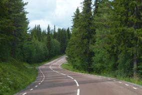 saying he had not seen a visitor from England in a long time.
It was a quaintly old-fashioned, no-frills campsite-cum-guest-house (even the weather forecast displayed on a notice board was 5 days out of date!) on a quiet
back-road from the Norwegian border, but the price of 185kr was very reasonable;
it would suit us well for a night's stop-over and we settled in (see right). The
service-house looked well-equipped and clean, with no extra charge for the
washing machine, and Sheila immediately put on our next load of laundry. How we
should dry it however was another matter: the sky became blacker and blacker
with distant rumbles of thunder getting closer. Lightning flashed across the sky
as a violent storm erupted overhead and heavy rain lashed down; it was a
miserably wet, gloomy evening. saying he had not seen a visitor from England in a long time.
It was a quaintly old-fashioned, no-frills campsite-cum-guest-house (even the weather forecast displayed on a notice board was 5 days out of date!) on a quiet
back-road from the Norwegian border, but the price of 185kr was very reasonable;
it would suit us well for a night's stop-over and we settled in (see right). The
service-house looked well-equipped and clean, with no extra charge for the
washing machine, and Sheila immediately put on our next load of laundry. How we
should dry it however was another matter: the sky became blacker and blacker
with distant rumbles of thunder getting closer. Lightning flashed across the sky
as a violent storm erupted overhead and heavy rain lashed down; it was a
miserably wet, gloomy evening.
The forested Norwegian borderlands:
it rained all night and only when we were packing to depart later in the morning
was the sky beginning to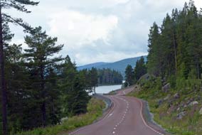 brighten. Our original plan had been to turn northwards
at Lillholmsjö and head directly to Hammerdal on Route 344. Last evening however
we had discovered a leaflet about the partly restored WW2 Klintaberg defensive
position near to Valsjöbyn close to the Norwegian border, built in 1943~44 to
protect against German invasion. Although 60kms off our route, and even though
Klintaberg may prove to be rather low key like the equivalent site at Alanäs
seen in 2013 on the way to Gäddede, the forested terrain along Route 340 out to
the border looked worth exploring (see above left) (see Map 6 top right for
details of route). We set off alongside a series of elongated SE~NW aligned lakes, which reflected the post-Ice Age topography created by
retreating glaciers. The terrain was densely forested with a scattering of small
villages whose names ending in -vik suggested long-standing settlements founded on bays in the lakes: Stångviken,
Häggsjövik, Norrvik, and Rötviken. We pulled into a well-appointed and
maintained picnic area overlooking Häggsjön lake (a lady from the local village
was cleaning the WCs) and amid the vegetation we found the first of this year's
Lingonberries just beginning to ripen (see below left). At the next village of Rötviken, we
passed a small, grassy campsite down at the lake shore and looking out across
Hotagen Lake to distant forested hills. This was a truly magnificent location
and, although not seemingly on our route today, we noted the campsite for future
reference, and continued towards the border. brighten. Our original plan had been to turn northwards
at Lillholmsjö and head directly to Hammerdal on Route 344. Last evening however
we had discovered a leaflet about the partly restored WW2 Klintaberg defensive
position near to Valsjöbyn close to the Norwegian border, built in 1943~44 to
protect against German invasion. Although 60kms off our route, and even though
Klintaberg may prove to be rather low key like the equivalent site at Alanäs
seen in 2013 on the way to Gäddede, the forested terrain along Route 340 out to
the border looked worth exploring (see above left) (see Map 6 top right for
details of route). We set off alongside a series of elongated SE~NW aligned lakes, which reflected the post-Ice Age topography created by
retreating glaciers. The terrain was densely forested with a scattering of small
villages whose names ending in -vik suggested long-standing settlements founded on bays in the lakes: Stångviken,
Häggsjövik, Norrvik, and Rötviken. We pulled into a well-appointed and
maintained picnic area overlooking Häggsjön lake (a lady from the local village
was cleaning the WCs) and amid the vegetation we found the first of this year's
Lingonberries just beginning to ripen (see below left). At the next village of Rötviken, we
passed a small, grassy campsite down at the lake shore and looking out across
Hotagen Lake to distant forested hills. This was a truly magnificent location
and, although not seemingly on our route today, we noted the campsite for future
reference, and continued towards the border.
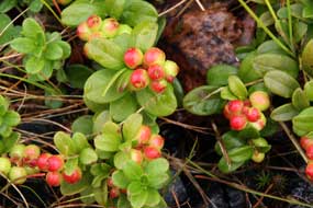 Klintaberg WW2 defensive position against
German invasion of Sweden: the water course connecting Lakes Hotagen
and Häggsjön ran shallowly over white-water rapids, with fishermen stood casting
their lines in the river. Just before the village of Valsjöbyn, we reached the
WW2 defensive position of Klintaberg, an elaborate network of underground
bunkers dug into the steep, forested hillside overlooking Valsjön lake. It may
have began life in 1940as a hastily built Dad's Army road-block as at Alanäs,
with little more than felled trees and antiquated field guns to halt the might
of the Wehrmacht in the event of a German invasion from occupied Norway. But
between 1943~44, the site was developed into what seemed a more Klintaberg WW2 defensive position against
German invasion of Sweden: the water course connecting Lakes Hotagen
and Häggsjön ran shallowly over white-water rapids, with fishermen stood casting
their lines in the river. Just before the village of Valsjöbyn, we reached the
WW2 defensive position of Klintaberg, an elaborate network of underground
bunkers dug into the steep, forested hillside overlooking Valsjön lake. It may
have began life in 1940as a hastily built Dad's Army road-block as at Alanäs,
with little more than felled trees and antiquated field guns to halt the might
of the Wehrmacht in the event of a German invasion from occupied Norway. But
between 1943~44, the site was developed into what seemed a more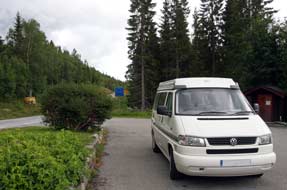 sophisticated
command and control centre. Was German invasion of Sweden a likelihood in
mid-1940? In hindsight, probably not: the risk of Allied invasion of Norway had been foiled at Narvik, and countered by the Atlantic Wall fortifications stretching
the whole
length of the Norwegian coast right up to the Arctic. Hitler was preoccupied
with the rapid occupation of the Low Countries and France, and had bigger fish
to fry with planning for Operation Barbarossa, the invasion of USSR in June
1941, to be diverted by a costly invasion of Sweden. And in any case, there were
plenty of pro-Nazi right wing sympathisers in the Swedish political, military
and business establishment to back the German cause in securing an interrupted
supply of Swedish iron ore. And by June 1944 the tide of the war had turned:
Stalingrad had resulted in the Red Army pushing westwards, and D-Day meant the
Allies were advancing eastwards. Germany's days were numbered, so perhaps
fortifications like Klintaberg were an unnecessary precaution for the Swedes. sophisticated
command and control centre. Was German invasion of Sweden a likelihood in
mid-1940? In hindsight, probably not: the risk of Allied invasion of Norway had been foiled at Narvik, and countered by the Atlantic Wall fortifications stretching
the whole
length of the Norwegian coast right up to the Arctic. Hitler was preoccupied
with the rapid occupation of the Low Countries and France, and had bigger fish
to fry with planning for Operation Barbarossa, the invasion of USSR in June
1941, to be diverted by a costly invasion of Sweden. And in any case, there were
plenty of pro-Nazi right wing sympathisers in the Swedish political, military
and business establishment to back the German cause in securing an interrupted
supply of Swedish iron ore. And by June 1944 the tide of the war had turned:
Stalingrad had resulted in the Red Army pushing westwards, and D-Day meant the
Allies were advancing eastwards. Germany's days were numbered, so perhaps
fortifications like Klintaberg were an unnecessary precaution for the Swedes.
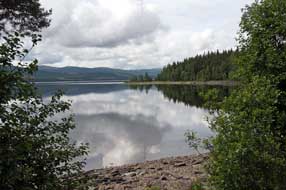 The Norwegian border: we walked up
the trackway to Klintaberg's conserved defensive position, but the place was
deserted. Guided tours of he complex were held on some days of the week, but not
today. We took a cursory look, but Twin Flowers flourishing among the forest
floor Lingonberry were of far greater interest than semi-derelict gun
emplacements and dingy underground bunkers. We left it at that, and continued
through the attractive settlement of Valsjöbyn up to the Norwegian border (see
above right). On
this quiet back road amid forested hills, the border spanned Rengen Lake, with a
picnic area set directly on the border-line overlooking The Norwegian border: we walked up
the trackway to Klintaberg's conserved defensive position, but the place was
deserted. Guided tours of he complex were held on some days of the week, but not
today. We took a cursory look, but Twin Flowers flourishing among the forest
floor Lingonberry were of far greater interest than semi-derelict gun
emplacements and dingy underground bunkers. We left it at that, and continued
through the attractive settlement of Valsjöbyn up to the Norwegian border (see
above right). On
this quiet back road amid forested hills, the border spanned Rengen Lake, with a
picnic area set directly on the border-line overlooking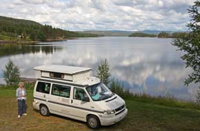 the lake (see left) (Photo
42 - Swedish~Norwegian border spanning Lake Rengen). Here we got
into conversation with a Swedish couple from Norrköping, who seemed not a jot
impressed by our knowledgeable description (from our 2013 visit) of their once
textile manufacturing hometown as Sweden's Manchester. They recommended
driving on through Norway to reach Gäddede rather than returning via Strömsund. They continued on their way, and we sat and
considered this suggestion over our munch sandwiches. It was very tempting
to take this shorter, more direct route, but this would mean missing a stay at Hammerdal Camping. A half-way alternative however was to stay tonight at the
attractive little lakeside village campsite at Rötviken, then drive on to
Hammerdal from there. After photos at the border (see above right), we returned along Route 340,
and in the first village of Valsjöbyn found a well-stocked village shop for
tonight's supper provisions; Vir har allt (We sell everything) said the
cheery shopkeeper, and he did!
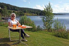 Rötviken Camping: back along to Rötviken,
we turned down to the lake-side just below the village, to be greeted at the
little campsite by the rather dour owner; the price was an all-inclusive 185kr,
and we pitched on the grassy terrace just above the lake. It was a glorious
position looking directly out across Hotagen Lake to distant forested hills from
the bay where Rötviken was set and from which it takes its name
(Photo
43 - Rötviken Camping) (see above right). The sun was
bright but much cloud still lingered, producing a dramatic sky reflected in the
still waters of the lake. But as early evening drew on, distant rumbles of
thunder and ominously threatening thunder clouds gathering across the lake
warned of an approaching storm. The storm clouds visibly gathered and moved in
our direction bringing 15 Rötviken Camping: back along to Rötviken,
we turned down to the lake-side just below the village, to be greeted at the
little campsite by the rather dour owner; the price was an all-inclusive 185kr,
and we pitched on the grassy terrace just above the lake. It was a glorious
position looking directly out across Hotagen Lake to distant forested hills from
the bay where Rötviken was set and from which it takes its name
(Photo
43 - Rötviken Camping) (see above right). The sun was
bright but much cloud still lingered, producing a dramatic sky reflected in the
still waters of the lake. But as early evening drew on, distant rumbles of
thunder and ominously threatening thunder clouds gathering across the lake
warned of an approaching storm. The storm clouds visibly gathered and moved in
our direction bringing 15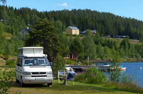 minutes of horrendously pouring, stair-rod rain, which
stopped as quickly as it had started but left the ground waterlogged around
where we were camped. Fortunately the gravelly lake-side soil soon drained, and
during the evening we sat looking out across the lake with its gloomily
impressive cloud-scape. The following morning, the sky partly cleared and a
warm, bright sun lit our lake-side camping spot. We were able to sit out for
breakfast, enjoying the warm sunshine and breeze blowing across the lake, with
that wonderful view and cloud mottled sky above the distant hills along
the horizon (see left and right) (Photo
44 - Breakfast at Rötviken Camping). Rötviken Camping was a
serendipitous gem of a find; this had been
another happy stay at this straightforward and wonderfully sited, peaceful
little campsite. minutes of horrendously pouring, stair-rod rain, which
stopped as quickly as it had started but left the ground waterlogged around
where we were camped. Fortunately the gravelly lake-side soil soon drained, and
during the evening we sat looking out across the lake with its gloomily
impressive cloud-scape. The following morning, the sky partly cleared and a
warm, bright sun lit our lake-side camping spot. We were able to sit out for
breakfast, enjoying the warm sunshine and breeze blowing across the lake, with
that wonderful view and cloud mottled sky above the distant hills along
the horizon (see left and right) (Photo
44 - Breakfast at Rötviken Camping). Rötviken Camping was a
serendipitous gem of a find; this had been
another happy stay at this straightforward and wonderfully sited, peaceful
little campsite.
Route 45 Camping at Hammerdal:
returning along Route 340, we paused at Häggsjövik to examine a memorial set on
a road-side hillock overlooking the lake. This seemed to recall the 18th century
founder of the
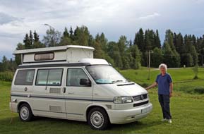 settlement and his descendents and recorded that the road was
only built in 1931. Back through the forests along the length of lakes to Lillholmsjö,
we turned off onto Route 344 for the further 60km drive through Föllinge across country to Hammerdal
(see Map 6 top right for details of route). This was an equally pleasant drive along the forested shores of lakes,
and as we approached Hammerdal, we crossed the line of the Inlandsbanan railway.
At the work-a-day village of Hammerdal, we finally joined the E45 Inlandsvägan,
and replenished our supply of provisions at the well-stocked ICA
supermarket. Just south of the village, we turned off along a side-lane to Route 45 Camping where we had first stayed in 2013 (Log of our 2013 stay at Route 45 Camping, Hammerdal).
We were expecting to meet again the young ex-pat Dutch couple, Niek and Tess who
had kept the campsite in 2013, but were surprised to be greeted at reception by
an English voice. We were sorry to learn that Niek and Tess had returned to the
Netherlands last year, and that an English couple had now taken over Route 45
Camping, moving to Hammerdal with their small children who now attended the local
school. The welcome was still as friendly as ever, and we wished them well with
this brave venture. We settled in at our regular spot down by the river as heavy
cloud gathered and rain began again (see left). It remained miserably wet all evening, with
mist swirling around the river; these were perfect conditions for the midges
which swarmed into the camper every time the slider was opened, needing the Bagon on to clear them. settlement and his descendents and recorded that the road was
only built in 1931. Back through the forests along the length of lakes to Lillholmsjö,
we turned off onto Route 344 for the further 60km drive through Föllinge across country to Hammerdal
(see Map 6 top right for details of route). This was an equally pleasant drive along the forested shores of lakes,
and as we approached Hammerdal, we crossed the line of the Inlandsbanan railway.
At the work-a-day village of Hammerdal, we finally joined the E45 Inlandsvägan,
and replenished our supply of provisions at the well-stocked ICA
supermarket. Just south of the village, we turned off along a side-lane to Route 45 Camping where we had first stayed in 2013 (Log of our 2013 stay at Route 45 Camping, Hammerdal).
We were expecting to meet again the young ex-pat Dutch couple, Niek and Tess who
had kept the campsite in 2013, but were surprised to be greeted at reception by
an English voice. We were sorry to learn that Niek and Tess had returned to the
Netherlands last year, and that an English couple had now taken over Route 45
Camping, moving to Hammerdal with their small children who now attended the local
school. The welcome was still as friendly as ever, and we wished them well with
this brave venture. We settled in at our regular spot down by the river as heavy
cloud gathered and rain began again (see left). It remained miserably wet all evening, with
mist swirling around the river; these were perfect conditions for the midges
which swarmed into the camper every time the slider was opened, needing the Bagon on to clear them.
Next week we move on further northwards to drive the
circuit of the Vildmarksvägen (Wilderness Way) over the bleakly remote
Stenenjokk Plateau and cross into Swedish Lapland, on the way seeing the
spectacular Hällingsåfallet waterfalls and canyon. We shall continue north into
the province of Västerbottens, out along the Blå Vägen into the high fells of
Tärnaby, before crossing the mountains into Norway to Mo i Rana. We shall cross
the Arctic Circle on high plateau of Saltfjell, then return along Sweden's
Silver Way, crossing the Arctic Circle a second time south to Arjeplog and
Arvidsjaur. More to come in the next episode.
Next edition
to be published quite soon
|
Sheila and Paul |
Published: 22 October 2016 |
|

 CAMPING
IN SWEDEN 2016 - Karlstad, Nora and
Pershyttan, Bergslagen, Lake Siljan,
Fulufjället National Park, Idredalen, Funnäsdalen,
Ristafallet in Åredalen, and Hammerdal:
 Around Lake Vänern to Karlstad:
rejoining E45, we made steady progress northwards along the western shore of
Lake Vänern with a pause for provisions re-stocking at a new out-of-town ICA
hypermarket on the outskirts of Säffle. E45 merged with E18 coming in from Oslo,
becoming motorway standard, before the E45 branched off northwards as the Inlandsvägan; we continued eastwards towards Karlstad and turned off into the
city. Our last visit in 2013 had been on a Sunday afternoon when street parking
was plentiful; today however on a busy weekday with the city crowded with traffic,
it was well nigh impossible to park. We eventually found space in a paying car
park and bought a couple of hours parking for our brief re-visit to the
provincial capital of Värmland (see
 bridge still bears the weight of city buses crossing.
Back through the city streets on the southern side, we crossed the canal which
links the Klarälven into Lake Vänern, and called in at Karlstad's neo-Classical
Domkyrka, built in the mid-18th century and seriously damaged in the disastrous
1865 fire which destroyed most of the town.
 at home. Having failed to gain entry on our
last visit, we tried again. 20kr gained us access to an unimpressive one room
museum with no English translations; the fact that 95% of its American visitors would
speak no Swedish was lost on the lady at reception who spoke no English, and
with no one available who could tell us more of the emigration database, we
might as well have saved our kroner. And that was Karlstad, but at least it had
been a pleasant stroll in the afternoon sunshine.
  (of
Nobel Prizes fame) made his fortune manufacturing arms and explosives. Turning
off here for the final 50kms of today's drive, Route 243 meandered its winding
way through the southern Bergslagen forests and former mining and iron working
villages like Gyttorp towards our destination, the small town of Nora. Reaching
Nora's outskirts, we threaded a way around the town's narrow streets past the
archetypal wooden houses, out to the campsite. We had happy memories from our
2013 stay at Trängbo Camping, a municipal-owned site with good value prices and
run by a welcoming and helpful lady. This year a shock awaited us: in the last
year, the campsite had been taken over by a large commercial concern, Sweden
Resorts, with prices to match, now increased to 270kr/night. The glossy
information brochure told us nothing except the list of do's and don'ts, all
common sense but doubtless necessary for the holiday-making folks who were now
prepared to pay such unheard of prices to frequent the place with their monster
caravans. Protestations about unjustifiable price increases were casually
brushed aside by the inanely grinning girl at reception with a
take-it-or-leave-it attitude; she further compounded the place's lost image by
being unable/unwilling to provide us each with a key to the facilities hut. The
place did at least now have wi-fi, but at that price you should be able to take
that for granted these days.
 We had no choice but to acquiesce tonight (see
above right), but
rather than stay for a second night as planned, we spent the first hour
researching an alternative site nearby for tomorrow after our visit to Nora and Pershyttan.
 Re-visit to the iron mining valley of Pershyttan: as well as serving as the town's TIC, the magnificent
1909 station building
(
 Pershyttan, with its iron mines and communal
charcoal-fired blast furnace smelter, was typical of the small scale iron
producing villages across the Bergslagen region (see
 wooden rods
called a beam-drive (see below right); on our 2013 visit, both the water-wheel and beam drive had
been operating, but today this rickety-looking structure stood silent under the
birch trees, the only noise being from a lad strimming the grass under the drive
linkages.
 Nearby the tower of Pershyttan's smelting house and blast furnace rose
above the trees
(
 and
the owner greeted us in Germanically officious manner, listing all her
regulations about how and where we should camp. Too travel-weary to take any
notice of this, we pitched how and where we wanted. Apparently she had kept
the campsite since 2001, and the care-worn facilities suggested they had not
received a lick of paint since long
 before then. The published price of 230kr
made no mention of an additional 2 x 10kr coins for showers; a total of 250kr
was far too much for such a unexceptional site, and we responded to her unwelcoming manner
by telling her so! With rain now pouring making the attractive forested surroundings
gloomily dark, we settled in to make the best of it and enjoy our evening after
today's happy re-visit to Nora and Pershyttan (see above left).
 delicious!
(see above left)
 much evidence of heavy engineering industry. The same was true of
the next town on our route, Ludvika, where we passed several heavy electrical engineering plants. Bergslagen's industrial heritage was still alive and thriving
in towns like Grängesberg and Ludvika. Continuing northwards on Route 50 with
pouring rain still obscuring the forested terrain, frequent speed cameras
further compounded trying driving conditions. Reaching the outskirts of the
steel-making town of Borlänge, our route on E16 took a western bypass so we saw
nothing of the huge SSAB steel producing plant which is the town's largest
employer. Just beyond Borlänge, E16 branched off signposted for Oslo; we
continued north on Route 70 towards Leksand, crossing the wide Österdalälven
river which flows south-easterly from the highlands of Idre, through Lake Siljan
and eventually exits into the Bothnian Gulf south of Gävle. Reaching Leksand, we
turned off through the village to take a minor lane through charmingly rustic
Dalarna villages to Tällberg. From Tällberg hill we got our first glimpse of
Lake Siljan, and turned off in the village down to the lake-side and Tällberg
Camping which was to be our base for the couple of days at Siljan.
 hemmed in between monster
camping-cars, we selected a spot higher up in what seemed a quiet corner (see
above left). Little
did we know that the nearby static caravans with awnings the size of a circus
big top were filled with holiday-makers whose noise and behaviour showed a total
indifference towards
 neighbouring campers. By now
rain had started again; we quickly pitched and pulled out the awning as rain
obscured the lake. When the rain eased, we used the wi-fi at reception to check
the forecast which showed Sunday as the better day for our Siljan tour, with a
likely wet day in camp tomorrow. The evening remained dull and gloomy with
little chance of Tällberg's renowned sunset across the lake tonight.
 parish church
(
 the flooded
meteorite-impact crater that had created Lake Siljan. Some 377 millions years ago, a
3km wide meteorite had struck the earth causing Europe's largest impact
crater 40km wide. This area of the earth's surface crust at that time consisted
of deep layers of sedimentary rock overlaying more substantial granite bed-rock.
The cataclysmic explosion resulting from the impact vaporised the meteorite's
material and pulverised the sedimentary layer at the point of impact, throwing up
disruptive clouds of debris, and forcing outwards the buckled strata to form a
ring around the impact site. Over aeons the underlying granite at the point of
impact has been lifted by pressure from within the earth's crust to form a low
dome of hills. The ring of disturbed sedimentary strata was subsequently eroded
by ice ages to form trenches which were flooded by glacial melt waters creating
the currently evident ring of lakes, Siljan, Orsa and other smaller lakes,
clearly visible from satellite photos around the uplifted dome of hills. We had
hoped to see the views looking out over the Siljan Ring from the look-out tower,
but to our disappointment, the tower was closed for repairs.
 the hamlet of Gesunda with its attractive Falun-Red painted wooden cottages. Here we turned
off over to Sollerön island for a glance at the campsite there. The sight of
massed ranks of caravans and camping-cars, packed in like sardines in a tin and
looking like a council estate on wheels, was more than enough to convince us
that this was not a place we should choose to camp; we readily drove on into Sollerön village. The apple trees in cottage gardens which lined the lane had
all been in blossom on our last visit in May 2013; today in early July, the
fruits were beginning to form.
 afield.
These late Viking period farming folk cremated their dead and buried the ashes
under burial mounds close to their homesteads, and modern archaeology has
revealed the remains of grave-goods from 950~1050 AD scattered across the
pastures of present day farms around Bengtsarvet. A jewel of a nature trail
threads a peaceful 3km circular walk from the Homestead Museum across the
fields, passing the Viking graves and back around lanes past modern-day farms
and cottages. Far away from the hoards of tourists that flock in droves to
the Siljan area like overflowing pollutant, this remote corner of Sollerön is a
haven of peace, still a farming area as it had been during the mid~late Iron
Age. Wearing waterproofs as a precaution against further rain, we set off to walk
the circuit of Viking graves (see above right), taking the sketch map and commentary sheet from 2013. In May 2013, the nature trail was a treasure trove of spring wild
flowers, but today the summertime grasses were high. We passed the Viking grave
mounds which were almost indistinguishable from piles of boulders cleared from
the fields, and walked over to the site of St Laurentius' ancient chapel built
by an earlier pagan sacred well. With the sky now bright, we branched off onto a
longer path circuit, sloping down towards the pools of Agnmyr. From across the
distant pastureland an unseen lapwing repeatedly sang his happy pee-wit call.
The path passed the remains of a 18~19th century silver mine cut into a rocky
escarpment; what had been hoped as a profitable source of silver turned out to
be poor quality
 galena ore. We emerged at a gravel lane and beyond a group of
cottages (see above left) turned back along a trackway past more grave-fields to the hamlet of Bengtsarvet.
From here it was a short walk back to the Homestead Museum, passing modern-day
wooden farmsteads which now stand on the site of Iron Age farms whose occupants had been buried in the neighbouring
fields (see above right).
 young Dalarna brothers, Nils and
Jannes Olssson, to make a few kroner for their family. The stumpy little brightly painted wooden horses caught on and now have become a symbol of Sweden.
The Swedes are potty about them and every home has a couple of Dala Horses on
its mantelpiece. Before beginning the drive down the eastern shore of the lake,
we turned off the main Route 70 into Nusnäs village to visit the workshops
where the cute little Dala Horses are produced by the current and more
commercially-minded generations of the Olsson family (
 varnish, again by machine. You could have them in a range of colours - red, white,
pink
or kitschy lilac-blue, all with their floral patterning, hand-carved and
hand-painted by machine and at astronomical prices (see above right).
 clustered around the large 18th century
church, a 'church town' of preserved 18~19th century wooden shacks once served
as stables for the horses of those attending church from outlying farms and
villages. In the bright afternoon sunshine, a brisk wind whipped up breakers on
the lake as we stood taking our photos of the 'church town' against the church
backdrop by the landing-stage where those attending church by church-boat had
moored (see left) (
 Northwards into the forested hills of NW Dalarna : a lovely sunny morning
for the start of 4th week, and we were able to sit outside for breakfast (
 we passed the village's Midsummer
Pole and the church-boat in its boat-house (see below right). By the time we reached Mora for a
provisions stock-up, the morning sun had disappeared behind heavy cloud; the forecast for
a dull afternoon looked to be right. Leaving Mora, we
headed north on Route 70 into the forests of NW Dalarna (see Map 3 top right for
details of route). Settlements were few
and far between and this NW corner of Dalarna had a feel of remote wilderness,
shrouded with vast swathes of uninhabited coniferous forest, so different from
the province's southern areas. There was a real feeling now of leaving behind
Southern and Central Sweden and making progress northwards; we hoped this would
also mean we were leaving behind crowded and expensive campsites and rowdy
holiday-makers. This was a region dominated by forestry and Route 70, the only
communications route through this remote part of the country, was rutted from
the frequent passage of logging trucks, many of which passed carrying cut timber
to the large gathering areas.
 second time we
had driven this route in poor weather, gaining height through the upper valley
of the great Österdalälven river which flows down from the northern mountains
through a series of elongated lakes dammed for HEP generation into Lake Siljan.
The empty terrain covered with dark pine and
 spruce forests stretching away to
murky horizons gave a real feeling of being back in comfortably familiar
northern Scandinavia. At one point we got a first glimpse of residual snow on
distant hilly slopes. The road was good with little traffic, and we steadily
gained height up onto the broad, empty plateau with the map showing spot heights
of over 500m. The rain eased and sky brightened as Route 70 crossed the
plateau-top to begin the long northern descent to the village of Särna where we
planned to camp tonight.
 Särna Camping ticked all the right boxes for a high rating.
With the sun now shining brightly, we pitched to give a lovely sheltered
position, enabling us to sit in the lee of George to enjoy the afternoon
sunshine looking out across the wide, placidly flowing river against a backdrop
of distant forested fells. Revelling in this glorious setting, we lit the first
barbecue of the trip and enjoyed a memorable supper
 enhanced by the peace of the
evening and this magnificent view from above the river (see above right). Late evening, the sun
declined against a dramatic cloud-scape above the open vista of river and fell (
 Over at the Naturum, we confirmed details of the circular walk, and set out across the board-walk which spanned the lower mires of the Njupån valley. The
marshland surface was covered with Cloudberry leaves and some developing fruits (
 board-walk, we began the gradual fell-land ascent through
ancient spruce forest (
 By the time we reached the wooden shelter at the
head of the path, heavier rain was falling causing us to kit up with full
waterproofs. The first distant views of Njupeskär falls in its dark cleft
were grey and obscured by mist and poor light, and from this
high vantage point the air was filled with the sound of rushing water from the Njupån
torrent way down below in the trees. With rain dripping off overhanging tree
branches, we began the descent of the steep wooden step-way down the precipitous
forested fell-side to the level of the wooden bridge spanning the torrent
descending from Njupeskär. These waters have their source in the lakes high on
the 980m Fulufjälletplateau, and over aeons have eroded a tiered canyon-cleft
in the red sandstone
 escarpment of the plateau's precipitous western edge, down
which the waters drop 93m forming the Njupeskär cascades, Sweden's highest
waterfall (see right). But being north facing, Njupeskär's cliff-enclosed cleft remains
totally shaded throughout the year, other than a few days around Midsummer when
dawn sunlight relieves the canyon's dark gloom. In today's rain, the
canyon-cleft was totally obscured and the dizzying cascades of falling water and
spray scarcely visible in the misty gloom.
 drop of the
falls. High above, the sun flared out at the uppermost gap of the cleft, but
ahead the cliff-enclosed canyon was misty blackness and the lower falls scarcely visible (
 the rock-fall board-walk, bright sun lit the magnificent view over pines and
spruces towards distant northward fells (
 flourishing patches of
Cloudberry with their white male flowers, returning to the parking area to begin
the 40km drive back to the main Route 70 and north to Idre.
 needed the Bagon diffuser to clear them from the
camper.
 mountain.
Although the sun was bright, the chill northern breeze would blow keenly on the
high open shoulder of Städjan, and today we had kitted up fully with our
northern clime clothing layers. Crossing the board-walk over the boggy ground at
the foot of the path, we began the lower slope up through the spruce forest.
From the start, the path was rough with tree roots and boulders and soon became
stonier and steeper. We had enjoyed a superb day's climb to Städjan's 1131m
summit in 2013 (see
 relative shelter of the
forested approach path out onto the broad, open fell-land of the mountain's
shoulder, the full force of the chill northern wind blew into our faces. At
least today, with all this brisk air movement even down on the lower path, there
would be no midges to bother us, and we donned cagoules, neck-muffs and hats
against the wind-chill. Out here on the open shoulder, the predominant ground
cover was spikey-leaved Crowberry, dotted with dwarf birch and low willow scrub,
with the occasional patch of Bearberry full of green, unripe fruits. We recalled
from 2013 the shoulder having masses of purple-flowered Mountain Heath, but that
had been 5 weeks earlier in the season. All that remained this year was the
ruddy-brown seed-cases of the Mountain Heath plants.

 which
merges with the Sörälven at Idre as the 2 source rivers of the Österdalälven. A
short distance north, what had lower been a placidly flowing river narrowed into
white-water rapids, cascading into a rocky channel. From the pine and birch-lined
rocky river bank, the river made a spectacular picture sparkling in the morning
sunshine
(
 warned that the ongoing Route 311 was narrow,
winding and in poor condition, and he was right: the next 40kms as far as Tännäs
was the roughest piece of road travelled on throughout Sweden. We bumped and
jolted along, dodging the pot-holes, and gained height up to Högvålen signed as
Sveriges högst belågna by (Sweden's highest village). The bumpy road
continued across the high, forested plateau
 with a sweeping vista of distant
fells some streaked with residual snow gracing the northern horizon. This lonely
road continued over high fells, passing occasional remote settlements, and
eventually dropping down to the ski-resort village of Tännäs; here we joined
Route 84, the main cross-country road running through Funäsdalen and Tänndalen
and on into Norway.
 ski runs. But on arrival today another heart-sink-moment awaited: seemingly
endless caravans and camping-cars lined up in conformist row upon row like not-so-little white
boxes (all made out of ticky-tacky and all looking just the same, as Pete
Seeger sang in 1963), filling the lower terraces of what had been a peacefully
empty campsite when we last stayed here in early June 2013. Fortunately we
found empty space on a higher terrace and settled in (see right), with a chill northerly wind
blowing. As evening drew on, the holiday-making hoards all hoisted their
satellite dishes and retired into their white boxes to watch their soap operas,
while we prepared our barbecue supper
(
 the highest point of
Route 84 at Högsta Hållan, the start point for Funäsdalen Guld Tur 11 to the Livsäterån
ravine high in the fells. It was here at the start of the walk that in 2013 we
had seen Siberian Jays in the birch woods (
 post
before our eyes and making no
attempt to avoid us as we moved closer;
we hoped for a repeat sighting today. The lowest section of the walk's start was
intrinsically wet and boggy from springtime snow-melts; although drier today later in the season, we picked a way carefully up the lower slopes, and
immediately began seeing interesting flora: an area of Heath Spotted Orchids soon had us down on hands and knees photographing these lovely specimens
(
 walks. During the afternoon, we passed several other walkers who greeted
us with a cheery Hej, hej. We followed the path through an avenue of
birch trees and at the far end crossed a stream on steeping stones, which in
2013 had been covered by a large area of residual snow. Here in this more
sheltered spot we found more floral gems: a few Mountain Heath plants still in
flower (see above left), Bilberry bushes also still with their deep pink flowers and a patch of
cheery Yellow Wood Violets. Leaving the birch grove, the path led out onto a
wide expanse of open fell-land with distant views in today's clear light to the
2 rounded peaks of Skarven to the north-west, and eastwards towards the
settlement of Funäsdalen nestling alongside its lake under craggy Funäsdalsberget.
The far horizon away to the north-east was graced with the crinkly ridge-line of Anåfjället. We were grateful for the reassuring guidance of way-marker posts
indicating the now indistinct line of the path across the open, treeless
moorland where in places the peat was moist and soft. We continued for some
distance across the fell-land plateau, finally dropping down into the low ravine
of the Livsäterån stream which sloped eastwards towards Funäsdalsjön.
 This was the outer limit of today's walk, but
the floral treasures were not over yet. On the very wet slopes of the ravine
bank, we found beautiful specimens of Bog Rosemary still adorned with its
elegant pink globular flowers
(
 Northwards over the mountains into
Jämtland and the alpine valley of Åredalen: another bright, sunny
morning after a chill night, and we were away by 10-15am for our long drive
northwards into the province of Jämtland (see Map 4 top right for details
of route). Given the mountainous
topography, this entailed an initial long return loop eastwards along Route 64
through deserted pine forests before turning north over high ground on Route
315. The sun was bright lighting forests and lakes, traffic was light, and a
remarkable absence of speed cameras enabled us to make good progress. Route 315
through alpine farming countryside brought us to Vemdalen, a charming village
with wooden church. Just beyond here the road crossed from Härjedalen
into Jämtland,
and gained
 height steeply over higher ground, passing through soulless ski
resorts to reach the high point of these wooded hills. At the junction with Route 316, we turned off down to Klövsjö, another delightful alpine village and
ski centre. Beyond here more height gain over pine-covered hills before finally
descending to the junction at Åsarna to re-join the E45, the great S~N highway of
Inlandsvägan. 11kms north, we turned off onto Route 321 around the
pastoral western shore of the pervasively spreading lake of Storsjön (see Map 5
top right for details of route). This quiet
but poorly surfaced rural road passed through a series of delightful villages,
the fertile alluvial Storsjön soil providing good farming with all the pastures
cut for hay and bales of silage stacked at each farm as cattle feed for the long
winter. We eventually reached the junction with E14, the main trans-Sweden
highway from Sundsvall on the Bothnian coast across to Trondheim in Norway,
passing through the ski resort of Åre. We turned westwards on E14 along the broad and lushly green farming valley of Åredalen, and in 33kms reached
Ristafallet Camping which was to be our base in the valley.
 A welcoming return to Ristafallet Camping: before booking in at the campsite, we drove along to Åre
to shop for weekend provisions at the ICA supermarket by the station. Railway
passengers and shoppers mingled amid supermarket trolleys on the station
platform where an Östersund~Stockholm-bound train waited to depart. The
supermarket, poorly stocked and over-expensive, was more geared to the pushy Norwegian
cross-border shoppers. Åre is nothing but an unattractive winter ski resort with
the modern ski accommodation crowded up the foot of Åreskutan's formidable
massif which towers over the town, the forested lower slopes segmented by
ski runs. Along the shore of Åresjön lake to Duved, the old village with
 its
alpine farms stretching up the hillside is now almost overwhelmed by the modern
skiing industry. We returned eastwards along the valley, passing streams of
Norwegian holiday traffic heading back towards the border. At Ristafallet
Camping we were again welcomed warmly by the young owners Mathilde and Jan Vos,
who recalled our previous stay there in 2013 when we had rated Ristafallet as
without doubt Sweden's best campsite. This wonderfully hospitable campsite is
located on the banks of the Indalsälven river
which runs the length of the Åredalen valley, and here the fast-flowing white-water
rapids torrent curves around the hillock where the
campsite stands, dropping 14m over the 50m wide spectacular Ristafallet waterfalls
from which the campsite takes its name (see above left). In response to our earlier phone call,
Jan had reserved a space for us down by the river bank, and we quickly settled
into the grassy riverside terrace, the air filled with the roar of the Indalsälven
torrent rushing past (see above right). We sat with an early evening beer, looking across to the
spruce and birch forests covering the fell-side on
 the opposite bank all lit by
the late sun, mesmerised by the river torrent's roar. The campsite's central
area was packed with camping-cars, all with their satellite dishes raised; what
sort of sub-intelligence would prefer TV to watching nature's display at
its very best; to sit eating supper looking out over Ristafallet's ever-changing
rapids and the sunlit forests beyond, to the constant accompaniment of the
rapids' roar, was surely all that anyone could ask for. It was a magical
evening, and so good to be back at Ristafallet Camping. We were looking forward
to our day in camp tomorrow, and were lulled to sleep later that evening by the background
soporific sound of the passing rapids.
 A day in camp by Ristafallet
waterfalls: on lifting the blinds the following morning, we were
greeted by the sunlit sight of Ristafallet rapids; one word summed it all up -
wow! The early cloud was just beginning to break, and while the sun was at the
right angle fully to illuminate the falls, we rushed down to Ristafallet for our
first batch of photos this year. The sun sparkled on the cascading streams of
water crashing over the brink, the full width of the falls cleaved in the centre
by a huge projecting rock (see left and right)
(
 with their background roar which made conversation
difficult (
 The Palaeolithic rock-engravings at Glösa:
at Mörsil we turned off over the forested hills down to the farming hamlet of
Alsen and along the north shore of Alsensjön lake for a return visit to
the Glösa Palaeolithic rock-engravings (Hällristningar in
Swedish) (see Map 5 top right for details of route). From the parking area, a 200m path led to the Glösa petroglyphs. The
Bohuslän rock-engravings seen earlier in the trip dating from around 1000 BC
were created by settled pastoralists who supplemented farming with hunting, and
the themes of these late Bronze Age rock-engravings reflected this settled
life-style. The Glösa petroglyphs however are more than twice that age, created
an estimated 5000 years ago by Palaeolithic nomadic hunter-gathers who lived by
trapping migrating elks which roamed the forests. The panel of Glösa
rock-engravings were carved on a large, flat slab beside a stream which
 tumbles
steeply down the hillside in a pine wooded grove (see left and right)
(
 the elks' migration
routes. The Glösa site shows a total of 45 elks engraved by chiselling onto the
rock panel. There are also grid patterns which may represent branches laid over
trapping-pits. The meaning of the elk engravings cannot be fully interpreted but
is presumably of ritualistic significance in ensuring success in the hunt for
elks on which these peoples' subsistence and lifestyle depended. Most of the
elks face the same way, perhaps representing the animals' summer~winter
migrations when trapping took place
(
 engraved within their bodies, perhaps representing the
heart or uterus symbolising life and fertility (see right) (
 Back at the parking area, we followed another
path into the pine woods to find traces of surviving elk hunting-pits dating
from the Viking period. Elk had been hunted in the region from the early Stone
Age when hunter-gatherers had created the rock-engravings, right up to the 19th
century when entrapping was banned by law. Along the high crest-line of an
esker in the dense forest, we found the shallow remains of trapping-pits (fängstgropar
in Swedish) (see left), as well as beautiful patches of Twin Flowers lit by the afternoon
sunshine (
 Lillholmsjö Camping: after our
stop for provisions in Krokom,
the weather closed in; it was now gloomily wet as we drove north-westerly on
Route 340 through the largely unpopulated forested hinterlands of the Norwegian
border region to find tonight's campsite Lillholmsjö Camping (see Map 6 top
right for details of route). This was indeed a
lonely road with just a little local traffic and the occasional timber truck.
From higher points along the road, empty forested terrain stretched away to
gloomily distant horizons with nothing but an empty sea of pines. After some
50kms, we reached the small village of Lillholmsjö with the campsite at a road
junction-corner; in poor light on such a gloomily wet afternoon, it looked
something of a bleak and cheerless place with a open camping area surrounded by
huts, but it was open and almost deserted. We eventually tracked down the
reception in a guest-house across the road; here the owner welcomed us with
formal politeness,
 saying he had not seen a visitor from England in a long time.
It was a quaintly old-fashioned, no-frills campsite-cum-guest-house (even the weather forecast displayed on a notice board was 5 days out of date!) on a quiet
back-road from the Norwegian border, but the price of 185kr was very reasonable;
it would suit us well for a night's stop-over and we settled in (see right). The
service-house looked well-equipped and clean, with no extra charge for the
washing machine, and Sheila immediately put on our next load of laundry. How we
should dry it however was another matter: the sky became blacker and blacker
with distant rumbles of thunder getting closer. Lightning flashed across the sky
as a violent storm erupted overhead and heavy rain lashed down; it was a
miserably wet, gloomy evening.
 brighten. Our original plan had been to turn northwards
at Lillholmsjö and head directly to Hammerdal on Route 344. Last evening however
we had discovered a leaflet about the partly restored WW2 Klintaberg defensive
position near to Valsjöbyn close to the Norwegian border, built in 1943~44 to
protect against German invasion. Although 60kms off our route, and even though
Klintaberg may prove to be rather low key like the equivalent site at Alanäs
seen in 2013 on the way to Gäddede, the forested terrain along Route 340 out to
the border looked worth exploring (see above left) (see Map 6 top right for
details of route). We set off alongside a series of elongated SE~NW aligned lakes, which reflected the post-Ice Age topography created by
retreating glaciers. The terrain was densely forested with a scattering of small
villages whose names ending in -vik suggested long-standing settlements founded on bays in the lakes: Stångviken,
Häggsjövik, Norrvik, and Rötviken. We pulled into a well-appointed and
maintained picnic area overlooking Häggsjön lake (a lady from the local village
was cleaning the WCs) and amid the vegetation we found the first of this year's
Lingonberries just beginning to ripen (see below left). At the next village of Rötviken, we
passed a small, grassy campsite down at the lake shore and looking out across
Hotagen Lake to distant forested hills. This was a truly magnificent location
and, although not seemingly on our route today, we noted the campsite for future
reference, and continued towards the border.
 Klintaberg WW2 defensive position against
German invasion of Sweden: the water course connecting Lakes Hotagen
and Häggsjön ran shallowly over white-water rapids, with fishermen stood casting
their lines in the river. Just before the village of Valsjöbyn, we reached the
WW2 defensive position of Klintaberg, an elaborate network of underground
bunkers dug into the steep, forested hillside overlooking Valsjön lake. It may
have began life in 1940as a hastily built Dad's Army road-block as at Alanäs,
with little more than felled trees and antiquated field guns to halt the might
of the Wehrmacht in the event of a German invasion from occupied Norway. But
between 1943~44, the site was developed into what seemed a more
 sophisticated
command and control centre. Was German invasion of Sweden a likelihood in
mid-1940? In hindsight, probably not: the risk of Allied invasion of Norway had been foiled at Narvik, and countered by the Atlantic Wall fortifications stretching
the whole
length of the Norwegian coast right up to the Arctic. Hitler was preoccupied
with the rapid occupation of the Low Countries and France, and had bigger fish
to fry with planning for Operation Barbarossa, the invasion of USSR in June
1941, to be diverted by a costly invasion of Sweden. And in any case, there were
plenty of pro-Nazi right wing sympathisers in the Swedish political, military
and business establishment to back the German cause in securing an interrupted
supply of Swedish iron ore. And by June 1944 the tide of the war had turned:
Stalingrad had resulted in the Red Army pushing westwards, and D-Day meant the
Allies were advancing eastwards. Germany's days were numbered, so perhaps
fortifications like Klintaberg were an unnecessary precaution for the Swedes.
 The Norwegian border: we walked up
the trackway to Klintaberg's conserved defensive position, but the place was
deserted. Guided tours of he complex were held on some days of the week, but not
today. We took a cursory look, but Twin Flowers flourishing among the forest
floor Lingonberry were of far greater interest than semi-derelict gun
emplacements and dingy underground bunkers. We left it at that, and continued
through the attractive settlement of Valsjöbyn up to the Norwegian border (see
above right). On
this quiet back road amid forested hills, the border spanned Rengen Lake, with a
picnic area set directly on the border-line overlooking
 the lake (see left) (
 Rötviken Camping: back along to Rötviken,
we turned down to the lake-side just below the village, to be greeted at the
little campsite by the rather dour owner; the price was an all-inclusive 185kr,
and we pitched on the grassy terrace just above the lake. It was a glorious
position looking directly out across Hotagen Lake to distant forested hills from
the bay where Rötviken was set and from which it takes its name
(
 minutes of horrendously pouring, stair-rod rain, which
stopped as quickly as it had started but left the ground waterlogged around
where we were camped. Fortunately the gravelly lake-side soil soon drained, and
during the evening we sat looking out across the lake with its gloomily
impressive cloud-scape. The following morning, the sky partly cleared and a
warm, bright sun lit our lake-side camping spot. We were able to sit out for
breakfast, enjoying the warm sunshine and breeze blowing across the lake, with
that wonderful view and cloud mottled sky above the distant hills along
the horizon (see left and right) (
 settlement and his descendents and recorded that the road was
only built in 1931. Back through the forests along the length of lakes to Lillholmsjö,
we turned off onto Route 344 for the further 60km drive through Föllinge across country to Hammerdal
(see Map 6 top right for details of route). This was an equally pleasant drive along the forested shores of lakes,
and as we approached Hammerdal, we crossed the line of the Inlandsbanan railway.
At the work-a-day village of Hammerdal, we finally joined the E45 Inlandsvägan,
and replenished our supply of provisions at the well-stocked ICA
supermarket. Just south of the village, we turned off along a side-lane to Route 45 Camping where we had first stayed in 2013 (