|
 CAMPING
IN SWEDEN 2016 - Gäddede, Vildmarksvägen
(Wilderness Way) into Swedish
Lapland, Fatmomakke Sámi church town, Vilhelmina and Dorotea,
Blå Vägen out to Tärnaby and Hemaven,
into Norway to Mo i Rana, across the Arctic
Circle over Saltfjell, re-cross into Sweden to Arjeplog, and Arvidsjaur: CAMPING
IN SWEDEN 2016 - Gäddede, Vildmarksvägen
(Wilderness Way) into Swedish
Lapland, Fatmomakke Sámi church town, Vilhelmina and Dorotea,
Blå Vägen out to Tärnaby and Hemaven,
into Norway to Mo i Rana, across the Arctic
Circle over Saltfjell, re-cross into Sweden to Arjeplog, and Arvidsjaur:
 North to Gäddede via the Vildmarksvägen (Wilderness Way):
leaving Route 45 Camping at Hammerdal, we set off on
the E45 for the 30km drive north to Strömsund. The road was good, through
pine-forested fell-land, and a road sign gave a distance of another 390kms to
Arvidsjaur on the Inlandsvägen; our less direct route however would be rather
further than this. Strömsund is a work-day-day, functional town, a service
centre for the surrounding forested rural hinterland, with supermarkets, banks
and filling stations and a lot of impatient traffic; it is certainly not a place
to hang around in longer than necessary, and having topped up with provisions
and diesel, we were glad to leave behind the dingy suburbs and head out on Route
342 towards distant Gäddede, the southern start of the Vildmarksvägen
(Wilderness Way) (click here for detailed map of route). North to Gäddede via the Vildmarksvägen (Wilderness Way):
leaving Route 45 Camping at Hammerdal, we set off on
the E45 for the 30km drive north to Strömsund. The road was good, through
pine-forested fell-land, and a road sign gave a distance of another 390kms to
Arvidsjaur on the Inlandsvägen; our less direct route however would be rather
further than this. Strömsund is a work-day-day, functional town, a service
centre for the surrounding forested rural hinterland, with supermarkets, banks
and filling stations and a lot of impatient traffic; it is certainly not a place
to hang around in longer than necessary, and having topped up with provisions
and diesel, we were glad to leave behind the dingy suburbs and head out on Route
342 towards distant Gäddede, the southern start of the Vildmarksvägen
(Wilderness Way) (click here for detailed map of route).
|
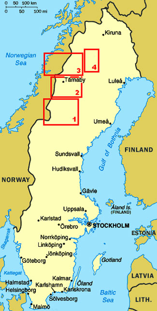
Click on the 4 highlighted areas of map
for
details of
North-West Sweden |
 |
 We
had been warned that this road was now stricken with road works, but to begin with Route 342 was newly laid asphalt.
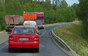
Inevitably however we soon reached the start of the road works, and followed
the pilot vehicle shepherding traffic through a section where new tarmac was
being laid (see above left). But far worse was to come: what had been a
reasonably surfaced road 3 years ago when we
last drove this route was now entirely stripped
of all its asphalt, leaving just a rutted, roughly gravelled unsurfaced road for
the next 20kms through the empty forests. On and on we juddered and bumped,
pausing for our lunch sandwiches at Alanäs opposite to Fläsjön lake. The
WW2 Dad's Army defensive position, on which Sweden had depended to counter
potential German invasion from occupied Norway, now stood silent and unseen up
on the hill-side. We
had been warned that this road was now stricken with road works, but to begin with Route 342 was newly laid asphalt.
Inevitably however we soon reached the start of the road works, and followed
the pilot vehicle shepherding traffic through a section where new tarmac was
being laid (see above left). But far worse was to come: what had been a
reasonably surfaced road 3 years ago when we
last drove this route was now entirely stripped
of all its asphalt, leaving just a rutted, roughly gravelled unsurfaced road for
the next 20kms through the empty forests. On and on we juddered and bumped,
pausing for our lunch sandwiches at Alanäs opposite to Fläsjön lake. The
WW2 Dad's Army defensive position, on which Sweden had depended to counter
potential German invasion from occupied Norway, now stood silent and unseen up
on the hill-side.
Our westward drive continued for another 10kms
with Route 342 scoured entirely of its surface down to bare rubble, until at
last we reached asphalt again and were able to pick up speed. With little
traffic and a bright afternoon sun, we made good progress for the remaining
90kms out to Gäddede, passing just the occasional fishing shack and a lone
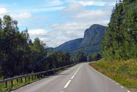
country store-cum-filling-station. Route 342 wound alongside Fågelsjön lake with
the prominent peak of Fågelberget towering overhead
 (see above left). A brisk
headwind raised white horses on the lake's ruffled surface, and endless forested
hills extended along the southern horizon lit by the afternoon sun. Somewhere
over there was our goal, the Hällingsåfallet waterfalls and canyon. The narrow
road wound around every bay of the lake, eventually leading to the outskirts of Gäddede,
and a couple of kms south of the village towards the Norwegian border, we turned
back 20 kms eastwards along an unsurfaced lane along the southern shore of Fågelsjön, and eventually
up a side-lane into the forest to the Hällingsåfallet falls parking
area. (see above left). A brisk
headwind raised white horses on the lake's ruffled surface, and endless forested
hills extended along the southern horizon lit by the afternoon sun. Somewhere
over there was our goal, the Hällingsåfallet waterfalls and canyon. The narrow
road wound around every bay of the lake, eventually leading to the outskirts of Gäddede,
and a couple of kms south of the village towards the Norwegian border, we turned
back 20 kms eastwards along an unsurfaced lane along the southern shore of Fågelsjön, and eventually
up a side-lane into the forest to the Hällingsåfallet falls parking
area.
Hällingsåfallet waterfalls and canyon:
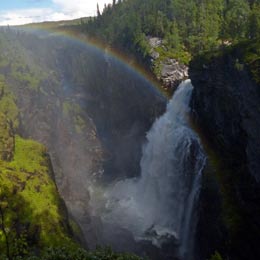
it was by now 4-00pm but the sun was still bright, and we hurried straight along
the approach path to the look-out point above the waterfalls. On the far side of
the canyon, the Hällingsåfallet falls surged from a cleft eroded in the cliff
face by the force of water
(see below right), dropping a sheer 42m into the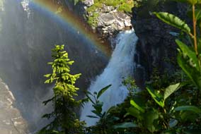 fearsomely black
cauldron of the canyon; clouds of drifting spray wafted overhead, soaking the
forested cliff-tops and catching the sunlight to form a rainbow which arched
high across the canyon's gulf. (Photo 1 - Hällingsåfallet waterfalls)
(see left).
This magnificent natural spectacle is without precedent in all our travels. The sun drifted into and out of rapidly passing clouds, causing the rainbow to
come and go. Late afternoon in mid-July, the sun created just a single rainbow
effect, unlike on our 2013 visit when the higher sun earlier in the day had cast
a double rainbow above the falls. We continued taking our photos from around the head of the canyon, looking out through the
trees down the 800m length of the canyon which had been formed by the erosive
power of melt-water following the last Ice Age, deepening a natural fissure in
the bed-rock (Photo
2 - Hällingsåfallet canyon). The sun
finally dipped below the trees, casting the falls
fully into shade; we had just made it here in time after our long
drive for
late
afternoon photos fearsomely black
cauldron of the canyon; clouds of drifting spray wafted overhead, soaking the
forested cliff-tops and catching the sunlight to form a rainbow which arched
high across the canyon's gulf. (Photo 1 - Hällingsåfallet waterfalls)
(see left).
This magnificent natural spectacle is without precedent in all our travels. The sun drifted into and out of rapidly passing clouds, causing the rainbow to
come and go. Late afternoon in mid-July, the sun created just a single rainbow
effect, unlike on our 2013 visit when the higher sun earlier in the day had cast
a double rainbow above the falls. We continued taking our photos from around the head of the canyon, looking out through the
trees down the 800m length of the canyon which had been formed by the erosive
power of melt-water following the last Ice Age, deepening a natural fissure in
the bed-rock (Photo
2 - Hällingsåfallet canyon). The sun
finally dipped below the trees, casting the falls
fully into shade; we had just made it here in time after our long
drive for
late
afternoon photos
 with sunlight to create the rainbow effect above the falls. with sunlight to create the rainbow effect above the falls.
A wild-camp at Hällingsåfallet
waterfalls:
returning up to the parking area, we assessed the wild-camping potential. The
camp-fire hearth had no cut timber for a birch wood barbecue this year, but
there were dry privvies and a flat space at the far end of the parking area.
We positioned George here with the slider facing into the forest and set up camp
(Photo
3 - Hällingsåfallet wild-camp)
(see
right). By now solid cloud had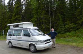 gathered;
despite the best of the afternoon's weather being gone, we set up our own
barbecue and sat up late into the evening enjoying the peacefulness of these
forested surroundings at this magnificent wild-camp spot. We woke to a
disappointingly overcast sky, and sat out the morning hoping that the sun would
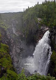
re-appear for more waterfalls photos. Down at the look-out point, the absence of
sun not only denied rainbow effect but gave the canyon a grey, gloomy air (see
left). The cloud persisted with no sign of breaking and no re-appearance of the
sun, and by 1-00pm, we could wait no longer. We broke camp and returned along
the dirt road to Gäddede. gathered;
despite the best of the afternoon's weather being gone, we set up our own
barbecue and sat up late into the evening enjoying the peacefulness of these
forested surroundings at this magnificent wild-camp spot. We woke to a
disappointingly overcast sky, and sat out the morning hoping that the sun would
re-appear for more waterfalls photos. Down at the look-out point, the absence of
sun not only denied rainbow effect but gave the canyon a grey, gloomy air (see
left). The cloud persisted with no sign of breaking and no re-appearance of the
sun, and by 1-00pm, we could wait no longer. We broke camp and returned along
the dirt road to Gäddede.
Vildmarksvägen from Gäddede
north to Ankarede: back in Gäddede, we shopped for provisions at the
ICA supermarket. Being so close to the border, the village in July was invaded
by Norwegians in their mega-buses and monster caravans, behaving in the
supermarket with the characteristic arrogance we had come to expect of southern
Norwegians. We used the wi-fi at Gäddede TIC to consult the ever reliable
Norwegian Meteorological Institute weather forecast
which unfortunately showed rain for the coming weekend when we should cross
Vildmarksvägen's highest point over the Stekenjokk Plateau into Swedish
Lapland. Leaving Gäddede, we turned northwards to begin the next leg of the
Wilderness Way (click here for detailed map of route). Gaining height
steadily alongside Storjorn Lake, we kept a careful eye open for Golden Eagles
soaring overhead which we had seen when driving this road in 2013; but none to
be seen this year. Passing
highland farms, the road gained
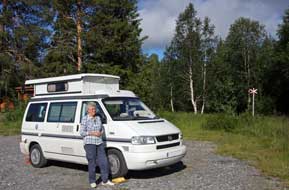 further height over a high watershed shoulder to
descend on the northern side towards Stora Blåsjön lake. Close to Sör Blåsjön, we
pulled in by the Brakkåfallet waterfalls where a profusion of wild orchids grew
alongside the shaly ravine (Photo
4 - Heath Spotted Orchid). further height over a high watershed shoulder to
descend on the northern side towards Stora Blåsjön lake. Close to Sör Blåsjön, we
pulled in by the Brakkåfallet waterfalls where a profusion of wild orchids grew
alongside the shaly ravine (Photo
4 - Heath Spotted Orchid).
 A
camp at the Sámi settlement of Ankarede:
continuing around the head of the lake, we reached the scattered settlement of
Stora Blåsjön with its tiny ICA-cum-filling station, and at the northern end of
the village, turned off onto the narrow side-lane which led to the traditional
Sámi seasonal gathering place of Ankarede. At the end of the lane, there was not
only the potential for camping in the parking area which served the huts and
Sámi kåtor (originally tepee-shaped nomadic dwellings) making up the settlement
of Ankarede, but even power supplies and a small service-house run by the
Ankarede Association both for the huts-settlement and camping area. The surface
was rough and gravelly and sloped to one side, but we pitched in the far corner
well away from the camping-cars already here (Photo
5 - Camp at Ankarede) (see left), and walked over to the hut-settlement. In 2013 we
were here around the time of the Midsummer gathering, but this year in mid-July
the place was deserted. Some of the kåtor seemed in a state of semi-dereliction,
and in this afternoon's poor light, the place had a sad air. Returning to the
parking/camping area, we set up camp and early evening, the sun finally broke
through for us to light the barbecue A
camp at the Sámi settlement of Ankarede:
continuing around the head of the lake, we reached the scattered settlement of
Stora Blåsjön with its tiny ICA-cum-filling station, and at the northern end of
the village, turned off onto the narrow side-lane which led to the traditional
Sámi seasonal gathering place of Ankarede. At the end of the lane, there was not
only the potential for camping in the parking area which served the huts and
Sámi kåtor (originally tepee-shaped nomadic dwellings) making up the settlement
of Ankarede, but even power supplies and a small service-house run by the
Ankarede Association both for the huts-settlement and camping area. The surface
was rough and gravelly and sloped to one side, but we pitched in the far corner
well away from the camping-cars already here (Photo
5 - Camp at Ankarede) (see left), and walked over to the hut-settlement. In 2013 we
were here around the time of the Midsummer gathering, but this year in mid-July
the place was deserted. Some of the kåtor seemed in a state of semi-dereliction,
and in this afternoon's poor light, the place had a sad air. Returning to the
parking/camping area, we set up camp and early evening, the sun finally broke
through for us to light the barbecue
 for supper. Before departing the following
morning, we walked over to Ankarede for photos in the bright sunshine. For centuries, nomadic Sámi reindeer herders
from the surrounding mountain grazing lands had traditionally gathered here at this spit of
land, the meeting-point of 2 rivers and 3 lakes, for festivals such as
Midsummer. The collection
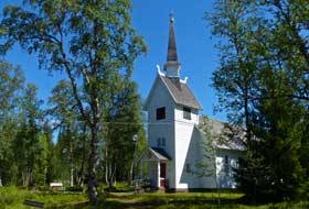
of Sámi kåtor and church-huts built originally by Swedish settlers still
survives, clustered around the white-painted wooden church which was built in
1895 (see above right). The kåtor and huts are still used as temporary accommodation for those
attending seasonal for supper. Before departing the following
morning, we walked over to Ankarede for photos in the bright sunshine. For centuries, nomadic Sámi reindeer herders
from the surrounding mountain grazing lands had traditionally gathered here at this spit of
land, the meeting-point of 2 rivers and 3 lakes, for festivals such as
Midsummer. The collection
of Sámi kåtor and church-huts built originally by Swedish settlers still
survives, clustered around the white-painted wooden church which was built in
1895 (see above right). The kåtor and huts are still used as temporary accommodation for those
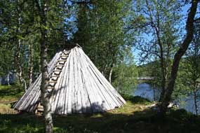
attending seasonal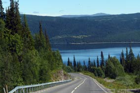 gatherings. The kåtor scattered along the river bank in the
birch groves had a peacefully mysterious air, and we wandered among them taking
our photos in the bright morning sunshine (Photo
6 - Sámi kåtor at Ankarede) (see left). gatherings. The kåtor scattered along the river bank in the
birch groves had a peacefully mysterious air, and we wandered among them taking
our photos in the bright morning sunshine (Photo
6 - Sámi kåtor at Ankarede) (see left).
Vildmarksvägen over the barren heights of Stekenjokk Plateau:
back along the lane to Stora Blåsjön, we re-joined the
Vildmarksvägen
and turned up over the high shoulder of birch-covered fell-side which
descended to cross the spectacular rapids draining from the Stekenjokk highlands
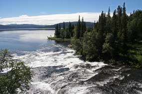
into Ankarvattnet lake (see right). Viewed
from the bridge, the foaming rapids sparkled in the morning sunshine (Photo
7 - Ankarvattnet rapids) (see below left), and on the road-side verge, tall
purple-blue floret-heads of Alpine Sow-thistle grew in profusion (Photo
8 - Alpine Sow-thistle). We now began Vildmarksvägen's long
ascent onto the Stekenjokk Plateau (click here for detailed map of route), and
 after a further 10kms reached
the turning to the limestone karst dolina of Bjurälven nature reserve, curiously
out of place in Sweden. A 3km dirt road led to
a parking area by an old fell-land farmstead, which marked the start of a
further 3km approach path for the dolina, where in classic karst limestone
conditions the stream appeared and disappeared. The overall walk, 12kms there
and back along the dolina, led almost to the Norwegian border in wild country;
there was no time to tackle that today, but we noted it for a future visit with
a wild-camp at the parking area. But cloud was gathering from the south; we
returned to the main
Vildmarksvägen
to continue the ascent onto the plateau after photographs of the rapids
dropping from higher fell-land (Photo
9 - Stekenjokk rapids). after a further 10kms reached
the turning to the limestone karst dolina of Bjurälven nature reserve, curiously
out of place in Sweden. A 3km dirt road led to
a parking area by an old fell-land farmstead, which marked the start of a
further 3km approach path for the dolina, where in classic karst limestone
conditions the stream appeared and disappeared. The overall walk, 12kms there
and back along the dolina, led almost to the Norwegian border in wild country;
there was no time to tackle that today, but we noted it for a future visit with
a wild-camp at the parking area. But cloud was gathering from the south; we
returned to the main
Vildmarksvägen
to continue the ascent onto the plateau after photographs of the rapids
dropping from higher fell-land (Photo
9 - Stekenjokk rapids).
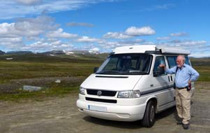
The road now gained further height, and having
already left behind the spruces at lower altitude, now passed through the upper
region of birches; as we ascended further, this gave way to low willow scrub and
finally to bare, empty fell-top. To the west, the sweeping line of mountains
forming the border with Norway still had large patches of residual snow. As the
road rounded onto the high, barren plateau-top, we kept a careful eye open for
herds of reindeer grazing the fells, but this year, 5 weeks later in the summer
than our 2013 crossing, there were none to be seen. What was more in evidence
were the numbers of ludicrously over-sized camping-cars befouling every lay-by.
Reaching the broad, open
 876m
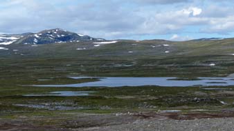
high plateau-top, the bare fell-scape stretched away into the distance with a
desolate beauty, enclosed to the west by snow-streaked mountains (see right) (Photo
10 - Stekenjokk Plateau). The low, shallow lake which nestles in the
plateau-top watershed and drains both north-easterly and southerly
(see left) was today a sordid, gravelly mess with trucks and diggers creating a
causeway barrier across the hollow. We moved on from the high-point before the
mass of cloud slowly advancing from the south could catch up. 876m
high plateau-top, the bare fell-scape stretched away into the distance with a
desolate beauty, enclosed to the west by snow-streaked mountains (see right) (Photo
10 - Stekenjokk Plateau). The low, shallow lake which nestles in the
plateau-top watershed and drains both north-easterly and southerly
(see left) was today a sordid, gravelly mess with trucks and diggers creating a
causeway barrier across the hollow. We moved on from the high-point before the
mass of cloud slowly advancing from the south could catch up.
The northward descent began quite suddenly,
soon dropping below the tree-line into birch trees.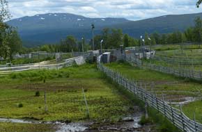 The road passed an area of
reindeer-herding pens (see right), and continued down to the settlement of Klimpfjäll. Along the valley
past shallow lake-land and a prominent red rock-pinnacle, we reached the
turning up to Fatmomakke, where 7kms of very dusty, corrugated dirt road led up
to the remote Sámi gathering area and church-town of Fatmomakke. The road passed an area of
reindeer-herding pens (see right), and continued down to the settlement of Klimpfjäll. Along the valley
past shallow lake-land and a prominent red rock-pinnacle, we reached the
turning up to Fatmomakke, where 7kms of very dusty, corrugated dirt road led up
to the remote Sámi gathering area and church-town of Fatmomakke.
The Sámi gathering area and church-town of
Fatmomakke:
set at the confluence of the 2 rivers draining the high fells of Marsfjället,
Fatmomakke had like Ankarede long been a traditional seasonal meeting place by
the Kultsjödalen lakeside for nomadic Sámi who migrated with their reindeer
herds between the high fell-land pastures in summer and the forests on the lower
slopes in winter.
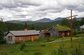 In the 17~18th centuries, conversion to Christianity, enforced by
zealous Lutheran missionaries, brought the legal duty for the Sámi regularly to
attend church, very inconvenient if you're a nomadic herdsman. Christian mission
work went hand in hand with the Swedish State's systematic efforts to colonise
the wild northern lands, bringing Swedish settlers who cleared farming lands in
remote forest areas that had once been the preserve of the Sámi. One way to
support both colonisation and missionary work was to build churches in the
inland mountainous areas, where both Sámi and settlers met for compulsory church
attendance and to pay their taxes. One such church was built at the Sámi
seasonal meeting place of Fatmomakke, and with the need to travel large
distances from grazing grounds for compulsory church attendance, the Sámi built In the 17~18th centuries, conversion to Christianity, enforced by
zealous Lutheran missionaries, brought the legal duty for the Sámi regularly to
attend church, very inconvenient if you're a nomadic herdsman. Christian mission
work went hand in hand with the Swedish State's systematic efforts to colonise
the wild northern lands, bringing Swedish settlers who cleared farming lands in
remote forest areas that had once been the preserve of the Sámi. One way to
support both colonisation and missionary work was to build churches in the
inland mountainous areas, where both Sámi and settlers met for compulsory church
attendance and to pay their taxes. One such church was built at the Sámi
seasonal meeting place of Fatmomakke, and with the need to travel large
distances from grazing grounds for compulsory church attendance, the Sámi built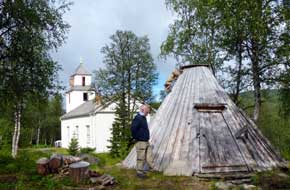 kåtor huts around Fatmomakke church as
overnight lodging when attending church. With increased State-sponsored
colonisation of the area, Swedish settlers also began to built lodging huts here
from the 1820s. The present church was built in 1884, and some 80 Sámi kåtor and
20 settlers' huts survive at Fatmomakke, still used for traditional gatherings
with descendents of both Sámi and Swedish settlers meeting here for church
festivals at Midsummer and September. These timings had originally coincided
with the summer and autumn migrations when the Sámi reindeer herders had moved
from summer mountain grazing grounds to lower forest grazing in winter.
Our camp and visit to Fatmomakke:
at the lane's end where a footbridge crossed the river to the Sámi
church-town, there are 2 very basic campsites shoe-horned into the river bank, Fatmomakke Fjälströms Camping and Fatmomakke Naturcamp: grubby, with limited
space, primitive facilities, over-crowded
 and
over-priced in high summer, there is little to choose between (or indeed to
commend) either of them, unless you want to fish the lake or overnight at
Fatmomakke. We found a space crammed in among caravans, but with no power,
facilities you would not choose to use, and at 80kr/night, this was nothing more
than an unsavoury but expensive wild-camp; after some hesitation, we booked in
at the café and settled George onto the riverbank. At Fatmomakke in July, the
fishermen, tourists, and therefore the kroner just keep coming! and
over-priced in high summer, there is little to choose between (or indeed to
commend) either of them, unless you want to fish the lake or overnight at
Fatmomakke. We found a space crammed in among caravans, but with no power,
facilities you would not choose to use, and at 80kr/night, this was nothing more
than an unsavoury but expensive wild-camp; after some hesitation, we booked in
at the café and settled George onto the riverbank. At Fatmomakke in July, the
fishermen, tourists, and therefore the kroner just keep coming!
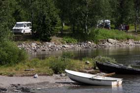 We
crossed the footbridge and walked along the lake-side trackway, past the
cemetery and tax-collector's hut, to the gathering area on the hillside where
the Midsummer pole still stood (see above left). The cloud of earlier had
thinned but still clung to the surrounding hills, as we climbed to the church
and wandered across the hillside among the Sámi kåtor and settlers' huts (Photo
11 - Fatmomakke church). One of the kåta was occupied
with a couple sitting outside, their fire smoke emerging from the kåta's apex (Photo
12 - Fatmomakke kåta). Back across to our unsavoury river-bank
camp (see right), we sat looking out across Kultsjön lake to the Fatmomakke
forested hillside, as a black-headed gull soared around vying for fish with the
fishermen out in their boats. After our night's camp at Fatmomakke, before
departing we walked back over to the church-town for a further hour's wandering
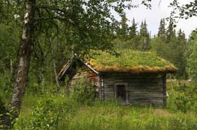
the pathways in bright morning sunshine among Fatmomakke's Sámi kåtor and settlers' huts (see above left) amid the
hillside birches and attractive summer wild flora (Photo
13 - Sámi kåta at Fatmomakke). Being a Sunday, Fatmomakke church bell
had rung for morning service, but there were surprisingly few other visitors and
we had the church-town virtually to ourselves. As we wandered
across We
crossed the footbridge and walked along the lake-side trackway, past the
cemetery and tax-collector's hut, to the gathering area on the hillside where
the Midsummer pole still stood (see above left). The cloud of earlier had
thinned but still clung to the surrounding hills, as we climbed to the church
and wandered across the hillside among the Sámi kåtor and settlers' huts (Photo
11 - Fatmomakke church). One of the kåta was occupied
with a couple sitting outside, their fire smoke emerging from the kåta's apex (Photo
12 - Fatmomakke kåta). Back across to our unsavoury river-bank
camp (see right), we sat looking out across Kultsjön lake to the Fatmomakke
forested hillside, as a black-headed gull soared around vying for fish with the
fishermen out in their boats. After our night's camp at Fatmomakke, before
departing we walked back over to the church-town for a further hour's wandering
the pathways in bright morning sunshine among Fatmomakke's Sámi kåtor and settlers' huts (see above left) amid the
hillside birches and attractive summer wild flora (Photo
13 - Sámi kåta at Fatmomakke). Being a Sunday, Fatmomakke church bell
had rung for morning service, but there were surprisingly few other visitors and
we had the church-town virtually to ourselves. As we wandered
across 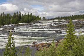 the hillside among the birches,
the soft sunlight gave the church-town a magical air the hillside among the birches,
the soft sunlight gave the church-town a magical air
Final section of
Vildmarksvägen to Vilhelmina: leaving Fatmomakke, we returned
down the dusty dirt-lane to
re-join Vildmarksvägen and turned south-eastwards along the shore of
Klimpviken lake (click here for detailed map of route). Crossing
the far end of the lake on an elegant bridge, the road continued along the
far shore of Kultsjön lake, passing a sign for 65ºN, to reach the more classy
village of Saxnäs. Beyond here the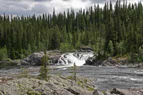 Kultsjöån river flows from its upper lake and
drops down a series of shale-terrace steps forming the spectacular 150m wide Trappstegsforsen rapids. The morning sun sparkled on the white water tumbling
down over the 500m length of the rapids (Photo
14 - Trappstegsforsen rapids). Our continued drive brought us past
further sets of rapids where the Kultsjöån river dropped over rocky passages between lakes
(see right) (Photo
15 - Kultsjöån rapids). The final 60kms of the drive passed alongside
the elongated Malgomaj lake, part of the Ångermanälven river basin on whose
banks we should camp later at Meselefors. But with little to see of the lake,
this was something of an anticlimactic last stage of the Vildmarksvägen
compared with its higher reaches. Kultsjöån river flows from its upper lake and
drops down a series of shale-terrace steps forming the spectacular 150m wide Trappstegsforsen rapids. The morning sun sparkled on the white water tumbling
down over the 500m length of the rapids (Photo
14 - Trappstegsforsen rapids). Our continued drive brought us past
further sets of rapids where the Kultsjöån river dropped over rocky passages between lakes
(see right) (Photo
15 - Kultsjöån rapids). The final 60kms of the drive passed alongside
the elongated Malgomaj lake, part of the Ångermanälven river basin on whose
banks we should camp later at Meselefors. But with little to see of the lake,
this was something of an anticlimactic last stage of the Vildmarksvägen
compared with its higher reaches.
A happy return to Doro Camping at Dorotea:
our plan had been to take our rest day at
Kolgården Camping just north of Vilhelmina. But on arriving there, it was clear
that its pleasant lake-side setting attracts hoards of holiday-making caravans
and camping-cars with all the de rigueur materialistic
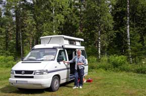 paraphernalia that has to
accompany them, certainly not the sort of company we should choose to share a
campsite with; it was clearly a total NO-NO in anything but May or September. Vilhelmina is a dreary sort of service centre town; it always seems an irony
that, along with Fredrika and Dorotea, the Lapland town of Vilhelmina is named
after Fredrika Dorotea Vilhelmina, Queen Consort of the inept Gustav IV Adolph,
who during his brief reign from 1792~1809 managed to lose one third of Sweden's
empire, including Finland to Tsarist Russia, and was consequently
deposed for his incompetence. Having shopped for provisions in Vilhelmina, we
headed south on E45 Inlandsvägen to the paraphernalia that has to
accompany them, certainly not the sort of company we should choose to share a
campsite with; it was clearly a total NO-NO in anything but May or September. Vilhelmina is a dreary sort of service centre town; it always seems an irony
that, along with Fredrika and Dorotea, the Lapland town of Vilhelmina is named
after Fredrika Dorotea Vilhelmina, Queen Consort of the inept Gustav IV Adolph,
who during his brief reign from 1792~1809 managed to lose one third of Sweden's
empire, including Finland to Tsarist Russia, and was consequently
deposed for his incompetence. Having shopped for provisions in Vilhelmina, we
headed south on E45 Inlandsvägen to the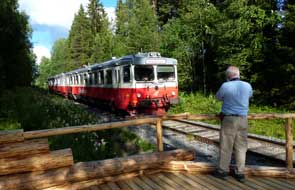 altogether more attractive little town
of Dorotea for a return stay at the welcoming Doro Camping. The road had
recently been re-surfaced, traffic was light, and with the road passing through
forested terrain parallel with the Inlandsbanan railway, this was a splendid
drive on a sunny Sunday afternoon. Crossing the Ångermanälven river at
Meselefors, we were reminded of its little riverside campsite which we had first
seen from the train on our 2013 Inlandsbanan ride; this would make an ideal stop
on our return north. Just south of Dorotea, we reached Doro Camping and received
the usual welcoming hospitality from the Dutch owners Louis and Tessa; the price
was a very reasonable all-inclusive 210kr, and we
found our usual pitch down in the far corner looking out into the neighbouring
forest where the Inlandsbanan train passes morning and evening (Photo
16 - Doro Camping) (see above left). altogether more attractive little town
of Dorotea for a return stay at the welcoming Doro Camping. The road had
recently been re-surfaced, traffic was light, and with the road passing through
forested terrain parallel with the Inlandsbanan railway, this was a splendid
drive on a sunny Sunday afternoon. Crossing the Ångermanälven river at
Meselefors, we were reminded of its little riverside campsite which we had first
seen from the train on our 2013 Inlandsbanan ride; this would make an ideal stop
on our return north. Just south of Dorotea, we reached Doro Camping and received
the usual welcoming hospitality from the Dutch owners Louis and Tessa; the price
was a very reasonable all-inclusive 210kr, and we
found our usual pitch down in the far corner looking out into the neighbouring
forest where the Inlandsbanan train passes morning and evening (Photo
16 - Doro Camping) (see above left).
 Doro Camping's station-halt on the
Inlandsbanan Railway: having set up camp, it was time to walk over to
watch the evening Inlandsbanan train pass through. We recalled the
straightforward set of wooden steps that constituted the 'platform' for Doro
Camping's little station-halt where we had clambered aboard the train in 2013 (See log of our 2013 Inlandsbanan ride).
Today the campsite owner had told us proudly that this had since been replaced
by a newer platform, and we found an altogether out-of-character, twee log
construction, far from the simple set of steps we had known! With evening sun
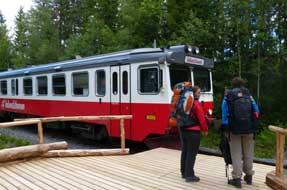
lighting the forest, the down train appeared in the distance, and 2 back-packers
alighted at Doro Camping halt. We took our photos as the Inlandsbanan red
railcar approached, and waved as the train drew out to continue its journey
south (see above right) (Photo
17 - Inlandsbanan approaching Doro Camping). Tonight after several
enjoyable days up in the fells, we were looking forward to our day in camp at
Doro Camping tomorrow. Doro Camping's station-halt on the
Inlandsbanan Railway: having set up camp, it was time to walk over to
watch the evening Inlandsbanan train pass through. We recalled the
straightforward set of wooden steps that constituted the 'platform' for Doro
Camping's little station-halt where we had clambered aboard the train in 2013 (See log of our 2013 Inlandsbanan ride).
Today the campsite owner had told us proudly that this had since been replaced
by a newer platform, and we found an altogether out-of-character, twee log
construction, far from the simple set of steps we had known! With evening sun
lighting the forest, the down train appeared in the distance, and 2 back-packers
alighted at Doro Camping halt. We took our photos as the Inlandsbanan red
railcar approached, and waved as the train drew out to continue its journey
south (see above right) (Photo
17 - Inlandsbanan approaching Doro Camping). Tonight after several
enjoyable days up in the fells, we were looking forward to our day in camp at
Doro Camping tomorrow.
The following morning we settled in for a day's
work with the benefit of Doro Camping's site-wide wi-fi signal. On checking the
BBC News however, we were horrified to learn that Teresa May had been nominated by the
Tory establishment as Prime Minister; 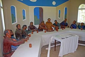 at a time when Britain needs the most clear
sighted, determined and inspirational political leadership, facing as we are an uncertain future outside
of the EU, we finish up with a third division player with a disastrous record of
failures as Home Secretary. The lunatics are now truly running the asylum! After
a restfully productive day, we again walked over to the platform-halt to watch
the evening Inlandsbanan, and chatted with the back-packers as they waited to
re-board the south-bound train after their 8 hour ride from Gällivare
yesterday
(see above left). at a time when Britain needs the most clear
sighted, determined and inspirational political leadership, facing as we are an uncertain future outside
of the EU, we finish up with a third division player with a disastrous record of
failures as Home Secretary. The lunatics are now truly running the asylum! After
a restfully productive day, we again walked over to the platform-halt to watch
the evening Inlandsbanan, and chatted with the back-packers as they waited to
re-board the south-bound train after their 8 hour ride from Gällivare
yesterday
(see above left).
The Last Supper sculpture group at Dorotea
graveyard chapel: back into Dorotea, and before heading north again, we
drove up to the parish church to see an unusual
piece of artwork in the graveyard chapel. This life-sized sculpture group of the
Last Supper had originally been created by the Norwegian Bjørn Martinius; born
in Oslo in 1908, he escaped to Sweden as a political refugee in 1942 where he
worked in Stockholm until his death in 1968. The representation of the Last
Supper which fills the graveyard chapel at Dorotea, sculpted in coloured
alabaster, is considered Martinius' greatest work, though how it came to finish
up in Dorotea's graveyard chapel is unknown. It was again an eerily uncanny
sensation on opening the chapel door: 3 trestle-tables filled the small room
with 13 life-like figures sitting at supper and gesturing to the central
Christ-figure
(see right)
(Photo
18 - Last Supper sculpture group).
Almost apologising as intruders into a private function we took our photos, and
quietly withdrew leaving the group to their meal, and went down into the town to
buy our food at the ICA supermarket.
 Another excellent campsite, Meselefors Camping:
leaving Dorotea on the E45 Inlandsvägen, a 20 minutes northward drive
brought us to the turn-off into Meselefors Camping, just before the bridge
crossing the wide Ångermanälven river, whose source is up in the Lapland fells
and which is crossed Another excellent campsite, Meselefors Camping:
leaving Dorotea on the E45 Inlandsvägen, a 20 minutes northward drive
brought us to the turn-off into Meselefors Camping, just before the bridge
crossing the wide Ångermanälven river, whose source is up in the Lapland fells
and which is crossed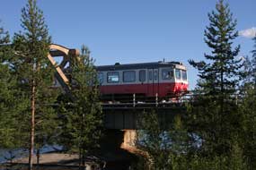 again by the High Coast Bridge close to where the river
flows into the Bothnian Gulf. We were greeted at reception with a friendly welcome
from the quietly reserved campsite owner; the charge was an excellent value
195kr including site-wide wi-fi. And the setting was simply stunning. The
camping area was set on the banks of the Ångermanälven, looking out directly
across the wide, placid river just at the point where the Inlandsbanan crossed
on its girder-bridge. We selected a pitch over at the far corner just above the
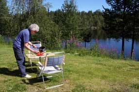
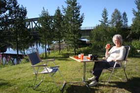
river and right opposite the railway bridge, and lunched on the riverbank (see
left) (Photo
19 - Meselefors Camping). The sun was shining brightly in a
clear sky, but little did we realise that later in the afternoon the sun would
sweep around behind high pine trees casting our corner into deep shade while the
rest of the site still enjoyed the afternoon sunshine! The Inlandsbanan timetable showed that the
afternoon south-bound train, which had left Gällivare at 7-50 this morning,
would pass across the Meselefors river bridge 526kms later at 17-31. We
positioned ourselves for photographs and waited, but instead of slowing as expected
to allow passengers to view the river crossing, the train rattled across at
speed; but we got our photos
(Photo
20 - Inlandsbanan crossing Ångermanälven at Meselefors) (see right). again by the High Coast Bridge close to where the river
flows into the Bothnian Gulf. We were greeted at reception with a friendly welcome
from the quietly reserved campsite owner; the charge was an excellent value
195kr including site-wide wi-fi. And the setting was simply stunning. The
camping area was set on the banks of the Ångermanälven, looking out directly
across the wide, placid river just at the point where the Inlandsbanan crossed
on its girder-bridge. We selected a pitch over at the far corner just above the
river and right opposite the railway bridge, and lunched on the riverbank (see
left) (Photo
19 - Meselefors Camping). The sun was shining brightly in a
clear sky, but little did we realise that later in the afternoon the sun would
sweep around behind high pine trees casting our corner into deep shade while the
rest of the site still enjoyed the afternoon sunshine! The Inlandsbanan timetable showed that the
afternoon south-bound train, which had left Gällivare at 7-50 this morning,
would pass across the Meselefors river bridge 526kms later at 17-31. We
positioned ourselves for photographs and waited, but instead of slowing as expected
to allow passengers to view the river crossing, the train rattled across at
speed; but we got our photos
(Photo
20 - Inlandsbanan crossing Ångermanälven at Meselefors) (see right).
 We woke to full sun
again, with the glassy still river reflecting the railway bridge just below
us
(Photo
21 - River reflections), and a fellow camper fishing in the river
(Photo
22 - A perfect morning for fishing). Wagtails hopped around on the
grass as we breakfasted on the riverbank revelling in We woke to full sun
again, with the glassy still river reflecting the railway bridge just below
us
(Photo
21 - River reflections), and a fellow camper fishing in the river
(Photo
22 - A perfect morning for fishing). Wagtails hopped around on the
grass as we breakfasted on the riverbank revelling in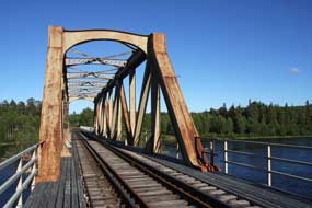 the glorious sunshine and
peaceful setting; it was a truly
idyllic morning (Photo
23 - Breakfast on the riverbank) (see left). Paul went exploring along
the railway line from Meselefors Camping's station-halt, and ventured across the
girder-bridge (see right) for photos looking back across the camping area (Photo
24 - Meselefors Camping) in good time before the morning up-train was
due. It had been a thoroughly enjoyable
stay at Meselefors Camping which, with its excellent value price, wonderful
river-side setting and view of the Inlandsbanan river-crossing, will certainly be one of the trip's most memorable
campsites. the glorious sunshine and
peaceful setting; it was a truly
idyllic morning (Photo
23 - Breakfast on the riverbank) (see left). Paul went exploring along
the railway line from Meselefors Camping's station-halt, and ventured across the
girder-bridge (see right) for photos looking back across the camping area (Photo
24 - Meselefors Camping) in good time before the morning up-train was
due. It had been a thoroughly enjoyable
stay at Meselefors Camping which, with its excellent value price, wonderful
river-side setting and view of the Inlandsbanan river-crossing, will certainly be one of the trip's most memorable
campsites.
The Blå Vägen (Blue Road) from Storuman to Tärnaby:
as we set off to cross the Ångermanälven road bridge, the river's still waters
gave a perfect reflection of the blue sky and fluffy cloud-scape. With traffic
light on E45 Inlandsvägen, we headed north back through Vilhelmina
towards Storuman. A bright sun lit the endless birch forests, making this a
glorious drive. At Storuman, E45 merged for a short distance with E12 Blå Vägen (Blue
Road) coming in from Umeå on the Bothnian coast. At the northern end of the
little town, E45 branched off north-eastwards, and we continued north-westwards
on E12 Blå Vägen
 (Blue Road)
to begin the drive up the Umeälven valley towards Tärnaby
(click here for detailed map of route). This morning, the sun shone in an almost
clear blue sky, lighting the forests, lakes and distant high fells. The road ran initially alongside Storuman lake, truly the Big Lake of its name, (Blue Road)
to begin the drive up the Umeälven valley towards Tärnaby
(click here for detailed map of route). This morning, the sun shone in an almost
clear blue sky, lighting the forests, lakes and distant high fells. The road ran initially alongside Storuman lake, truly the Big Lake of its name,
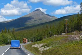 part of the Umeälven river system, regulated by a series of HEP dams along the length of its
upper valley. We continued along the picturesque Umeälven valley with its
endless vista of lakes and forests, and skyline of increasingly high fells
and distant snow-flecked mountains, all lit by the sun. This truly was a
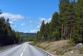
glorious drive with the clear sky enlivening the Blue Road's panoramic landscape
(see left) (Photo
25 - Blå Vägen). Approaching Tärnaby, the surrounding
lines of mountains and distinctive peaks became even more impressive (see right), but
increasing cloud was now gathering. Before continuing for our re-visit to the Hemavan Alpine Botanic Gardens, we turned off to Tärnaby Camping to reserve a
pitch for later, then continued along the valley to the Tärna Fjällpark at
Hemavan. part of the Umeälven river system, regulated by a series of HEP dams along the length of its
upper valley. We continued along the picturesque Umeälven valley with its
endless vista of lakes and forests, and skyline of increasingly high fells
and distant snow-flecked mountains, all lit by the sun. This truly was a
glorious drive with the clear sky enlivening the Blue Road's panoramic landscape
(see left) (Photo
25 - Blå Vägen). Approaching Tärnaby, the surrounding
lines of mountains and distinctive peaks became even more impressive (see right), but
increasing cloud was now gathering. Before continuing for our re-visit to the Hemavan Alpine Botanic Gardens, we turned off to Tärnaby Camping to reserve a
pitch for later, then continued along the valley to the Tärna Fjällpark at
Hemavan.
Hemavan Alpine Botanic
Gardens: Sweden's highest botanical gardens were established in 1989
by Dr Olof Rune an academic botanist from Umeå University, and are sited on a
high ridge-slope looking out across the valley at the southern start-point of
the 400km Kungsleden (King's Way) long distance foot path
(See
Hemavan Alpine Botanic Gardens web site). The gardens aim to provide access to a
 diversity of local mountain flora and protected plant species in a natural
habitat. 400m of pathway has been laid out in a loop around the ridge with the
flora arranged in separate raised timber-sided beds, the shaded northern side
giving a habitat for cold-dependent alpine species and the sunnier southern side for valley
plants. We began our bed by bed examination of the specimens, identified by
excellent labelling with both the common Swedish names but more importantly the
internationally diversity of local mountain flora and protected plant species in a natural
habitat. 400m of pathway has been laid out in a loop around the ridge with the
flora arranged in separate raised timber-sided beds, the shaded northern side
giving a habitat for cold-dependent alpine species and the sunnier southern side for valley
plants. We began our bed by bed examination of the specimens, identified by
excellent labelling with both the common Swedish names but more importantly the
internationally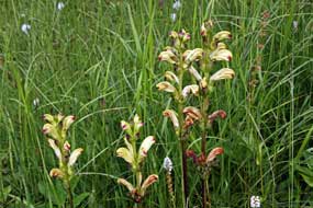 recognised Latin binomial names. The gardens' showpiece is the Brudkulla Orchid, a new species discovered in 1960 by Olof Rune growing wild
near Tängvattnet. It was at that time thought to be a variety of Black Vanilla
Orchid, but subsequent DNA analysis showed it to be a previously unknown
distinct species, occurring by hybridisation between Black Vanilla and
Fragrant Orchids; it was given the binomial Gymnadenia Runei, after its
discoverer and founder of the Alpine Gardens Olof Rune. This endemic Lapland
species only grows naturally at a few locations around Tärnaby and Hemavan, and
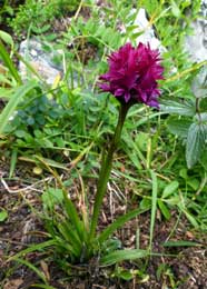
is thought to be very young, less than a 1,000 years old. Along with the many other species
of alpine flora in the Hemavan Gardens, we spent time particularly photographing the demurely
modest
little Brudkulla Orchid (Photo
26 - Brudkulla Orchid), maroon in
colour with a pom-pom head of florets (see left). The wet, marshy hillside above the laid-out beds was left in its wild state,
with many orchids growing naturally on the slope, but in mid-July the mire
was so overgrown that most were lost among the summer vegetation. But on the
lower slopes, we found a number of beautiful plants of Moor-king, known also as
King Charles Sceptre (Pedicularis sceptrum-carolinum), some still in bud
(Photo
27 - Moor-king). What a rewarding afternoon at the excellent Hemavan
Alpine Botanic Gardens. recognised Latin binomial names. The gardens' showpiece is the Brudkulla Orchid, a new species discovered in 1960 by Olof Rune growing wild
near Tängvattnet. It was at that time thought to be a variety of Black Vanilla
Orchid, but subsequent DNA analysis showed it to be a previously unknown
distinct species, occurring by hybridisation between Black Vanilla and
Fragrant Orchids; it was given the binomial Gymnadenia Runei, after its
discoverer and founder of the Alpine Gardens Olof Rune. This endemic Lapland
species only grows naturally at a few locations around Tärnaby and Hemavan, and
is thought to be very young, less than a 1,000 years old. Along with the many other species
of alpine flora in the Hemavan Gardens, we spent time particularly photographing the demurely
modest
little Brudkulla Orchid (Photo
26 - Brudkulla Orchid), maroon in
colour with a pom-pom head of florets (see left). The wet, marshy hillside above the laid-out beds was left in its wild state,
with many orchids growing naturally on the slope, but in mid-July the mire
was so overgrown that most were lost among the summer vegetation. But on the
lower slopes, we found a number of beautiful plants of Moor-king, known also as
King Charles Sceptre (Pedicularis sceptrum-carolinum), some still in bud
(Photo
27 - Moor-king). What a rewarding afternoon at the excellent Hemavan
Alpine Botanic Gardens. Tärnaby
Camping: we were greeted with a smiling welcome by the
long-standing owners at Tärnaby Camping, which is set on the banks of the
Tärnaforsen rapids, a fast-flowing narrow stretch of the Umeälven river
connecting Lakes Stor-Laisan and Gäutan under the shadow of Laxfjället hill.
This year however not only had the price increased to 240kr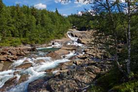 (including coins for
showers), the place was inevitably crowded in July; worse however, the facilities also were
run-down and grubby, and the wooden steps which (including coins for
showers), the place was inevitably crowded in July; worse however, the facilities also were
run-down and grubby, and the wooden steps which
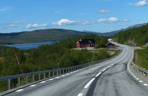 were in a broken state 3 years
ago were still unrepaired. Compared with the excellent value at Meselefors,
Tärnaby had a dreary air even in bright sunshine, and the supposed wi-fi failed
to connect. It was such a pity that prices had risen and standards declined;
it is doubtful we shall ever return. were in a broken state 3 years
ago were still unrepaired. Compared with the excellent value at Meselefors,
Tärnaby had a dreary air even in bright sunshine, and the supposed wi-fi failed
to connect. It was such a pity that prices had risen and standards declined;
it is doubtful we shall ever return.
Over the mountains into Norway:
an unbelievably hot morning with clear sky and blazing sun; it was hard to
believe that tomorrow we should cross the Polar Circle. We headed westwards
again through Tärnaby and Hemavan to begin
today's long drive over the mountains and down to the Norwegian coast at Mo i
Rana (click here for detailed map of route). The E12 road
connecting Sweden and Norway over the Tärnaby fells was only completed in 1939.
Before that, travellers had to cross Lake Över Uman by boat in summer, (in
winter the route was by horse-drawn sleigh across the frozen waters) to the inn
(fjellstue) at Umbukta before descending to Mo i Rana. Our first stop this morning was a couple of kms
beyond Hemavan, where the Systerbäcken torrent cascades in a series of rapids
from the high valleys on Norra Storfjället; even in midsummer with relatively
little water, it was an impressive sight (see above right) (Photo
28 - Systerbäcken torrent). But in Spring, with torrents of melt-water descending from
the Norra Storfjället glaciers, this would then be a terrifyingly spectacular
spectacle.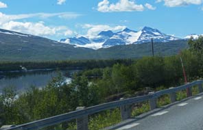
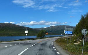 Beyond
Klippen village, the upper Umeälven river used to descend from its head-waters
at Över Uman lake via a long series of rapids down through the forested upper
valley. But in the early 1990s, Vattenfall, the state Hydro-power generating
company, built the Klippen power station. The underground HEP generating plant
at Klippen is fed by a 7.5km long head-race from its intake on the Över Uman
storage reservoir dam, leaving the river's natural course virtually dry. This
lengthy head-race achieves a fall of 65m by the time it reaches the generating
station, and the out-flow water is led from the power station back into the
river via a 3.5km long tail-race which flows out downstream of Klippen village.
Following the natural course of the now much reduced Umeälven river, the Blå Vägen
gained height gradually through endless spruce-covered high fells eventually
reaching Lake Över Uman just beyond the village of Umfors (see above left). The
road crossed the high plateau-lands almost at the tree-line, the horizon on all
sides marked by rounded-topped spruce-covered fells. Beyond the lake-narrowing
at Strimasund, the road wound around the shore of a further lake, and away to
the west snow-covered mountains graced the horizon (see above right) with the
shapely peaks of Okstindan (1,824m) standing clear above the rest. The
settlement of Kåtaviken just before the border had during WW2 been the site of a
radio station linking the Norwegian Resistance with London, and an escape route
from German occupied Norway. Beyond
Klippen village, the upper Umeälven river used to descend from its head-waters
at Över Uman lake via a long series of rapids down through the forested upper
valley. But in the early 1990s, Vattenfall, the state Hydro-power generating
company, built the Klippen power station. The underground HEP generating plant
at Klippen is fed by a 7.5km long head-race from its intake on the Över Uman
storage reservoir dam, leaving the river's natural course virtually dry. This
lengthy head-race achieves a fall of 65m by the time it reaches the generating
station, and the out-flow water is led from the power station back into the
river via a 3.5km long tail-race which flows out downstream of Klippen village.
Following the natural course of the now much reduced Umeälven river, the Blå Vägen
gained height gradually through endless spruce-covered high fells eventually
reaching Lake Över Uman just beyond the village of Umfors (see above left). The
road crossed the high plateau-lands almost at the tree-line, the horizon on all
sides marked by rounded-topped spruce-covered fells. Beyond the lake-narrowing
at Strimasund, the road wound around the shore of a further lake, and away to
the west snow-covered mountains graced the horizon (see above right) with the
shapely peaks of Okstindan (1,824m) standing clear above the rest. The
settlement of Kåtaviken just before the border had during WW2 been the site of a
radio station linking the Norwegian Resistance with London, and an escape route
from German occupied Norway.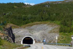
 Across
the border and E12 down to Mo i Rana: we reached the border at the 800m high
watershed (click here for detailed map of route)
(see above left)
and pulled in briefly at a lake-side picnic area. Across the border, E12
followed the lakeshore for some 5kms now well above the tree-line to reach
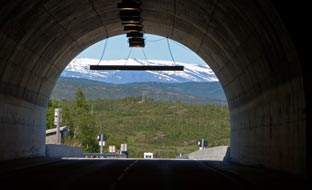
the entrance to the 3.7km long Umskard Tunnel (see left), which since its
opening in 2006 now takes the road through the mountain rather than over Umskardet. The tunnel now bypasses the old route which had always been a
problemsome section of the E12 highway, often closed in winter because of snow,
ice or bad weather. Emerging from the tunnel back into harsh daylight (see
right), the road began the long, gradual descent for the remaining 25 kms to Mo i
Rana, dropping down into a densely spruce-forested defile. Ahead the snows of
the vast Svartisan Glacier could be seen in the far distance. E12 wound around
through the forests, each bend opening up further spectacular views of distant
snow-covered mountains to the west. There was much height to be lost in a
short distance to reach Mo i Rana at the head of Ranfjord, but traffic was light
so that George could coast steadily down the winding descent (see below left).
Dropping down and down, we finally reached the valley, suddenly entering the
outskirts of Mo, and pulled into a Coop hypermarket for our Norwegian
provisions. We had come armed with a shopping list of Norwegian foodstuffs (like
frozen salmon fillets, tins of King Oscar sardines, and Macks beers), but
Norwegian food prices never cease to amaze! Across
the border and E12 down to Mo i Rana: we reached the border at the 800m high
watershed (click here for detailed map of route)
(see above left)
and pulled in briefly at a lake-side picnic area. Across the border, E12
followed the lakeshore for some 5kms now well above the tree-line to reach
the entrance to the 3.7km long Umskard Tunnel (see left), which since its
opening in 2006 now takes the road through the mountain rather than over Umskardet. The tunnel now bypasses the old route which had always been a
problemsome section of the E12 highway, often closed in winter because of snow,
ice or bad weather. Emerging from the tunnel back into harsh daylight (see
right), the road began the long, gradual descent for the remaining 25 kms to Mo i
Rana, dropping down into a densely spruce-forested defile. Ahead the snows of
the vast Svartisan Glacier could be seen in the far distance. E12 wound around
through the forests, each bend opening up further spectacular views of distant
snow-covered mountains to the west. There was much height to be lost in a
short distance to reach Mo i Rana at the head of Ranfjord, but traffic was light
so that George could coast steadily down the winding descent (see below left).
Dropping down and down, we finally reached the valley, suddenly entering the
outskirts of Mo, and pulled into a Coop hypermarket for our Norwegian
provisions. We had come armed with a shopping list of Norwegian foodstuffs (like
frozen salmon fillets, tins of King Oscar sardines, and Macks beers), but
Norwegian food prices never cease to amaze!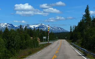
 A re-visit to Mo i Rana:
a short distance further and we reached the junction with Norway's main
northern highway, the E6 which drops down around Mo i Rana by the rapids below
the town's now closed steel works. Turning south on E6, we rounded the bypass
down towards the fjord and turned off into the town to a shopping centre which
houses the Tourist Information Centre (See log of our 2014 visit to Mo i Rana).
Just inside the mall we found an ATM for Norwegian cash. The girls in the TIC
were charmingly helpful: they confirmed that our planned campsite further north,
Elvmøthei Fjellgård was still open, and told us of new industries in Mo
providing much needed employment to replace the closed steelworks, including
Norway's state debt collecting agency and National Library both of which had
relocated to Mo from the south. A re-visit to Mo i Rana:
a short distance further and we reached the junction with Norway's main
northern highway, the E6 which drops down around Mo i Rana by the rapids below
the town's now closed steel works. Turning south on E6, we rounded the bypass
down towards the fjord and turned off into the town to a shopping centre which
houses the Tourist Information Centre (See log of our 2014 visit to Mo i Rana).
Just inside the mall we found an ATM for Norwegian cash. The girls in the TIC
were charmingly helpful: they confirmed that our planned campsite further north,
Elvmøthei Fjellgård was still open, and told us of new industries in Mo
providing much needed employment to replace the closed steelworks, including
Norway's state debt collecting agency and National Library both of which had
relocated to Mo from the south.
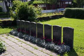
We parked up at the church and in the
churchyard paid our respects at the British war graves of 7 Scots Guards and 1 Royal Artillery
gunner killed 17~20 May 1940 trying to delay the northward advance of the
invading Germans (see above right). Lacking heavy artillery or air support, the
small British contingent stood little chance. Nearby a 1945 memorial topped by a
Communist red star lists in Cyrillic script the names of
Russian POWs worked to death so far from home as slave labour building the
Arctic road and railway north from Mo 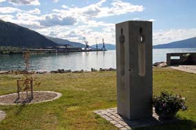 (Photo
29 - British War Graves). We walked down the steps of leafy Jarnbanegata (Railway Street) in the afternoon
sunshine (see left)
(Photo
30 - Jarnbanegata Mo i Rana). Down at the railway station, we crossed
the underpass out past wooden cottages to the viewpoint looking out across Ranfjord to the distant dockyard cranes
(Photo
31 - Mo i Rana dockyard cranes), and the memorial to the local girl
murdered along with 70 other teenagers at Utøya in July 2011 by the lunatic Anders Breivik (see
right). We greatly admired Mo-i-Rana as a surprisingly pleasant town, coping
admirably to revive itself after the closure of its steelworks major employer. (Photo
29 - British War Graves). We walked down the steps of leafy Jarnbanegata (Railway Street) in the afternoon
sunshine (see left)
(Photo
30 - Jarnbanegata Mo i Rana). Down at the railway station, we crossed
the underpass out past wooden cottages to the viewpoint looking out across Ranfjord to the distant dockyard cranes
(Photo
31 - Mo i Rana dockyard cranes), and the memorial to the local girl
murdered along with 70 other teenagers at Utøya in July 2011 by the lunatic Anders Breivik (see
right). We greatly admired Mo-i-Rana as a surprisingly pleasant town, coping
admirably to revive itself after the closure of its steelworks major employer.
North on E6 to camp at Elvmøthei Fjellgård:
we resumed our northward drive for the final 60kms on the E6 to find
tonight's campsite at Elvmøthei Fjellgård. Back around the
bypass to the E6/E12 junction, where E12 continued out to the coast at Nesna, we
turned north on E6 following the wide Ranelva river along Dunderlandsdalen (click here for detailed map of route)
into mountainous terrain. Almost immediately we encountered major road works
where E6 was being re-engineered; fortunately the works did not obstruct the
existing narrow road. We also passed through a set of Autopass toll cameras;
this year we had no
 Autopass
account as we had done on our 2014 Norwegian trip, so they'll just have to send
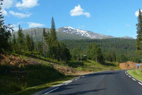
us a bill! (which they did 3 months later). Following the railway line, E6 wound an upward course into a
spectacularly forested valley, enclosed by high mountains on all sides (see
left). Sometimes the valley opened out into wider alpine farming meadows (see
right), other times it wound through narrow defiles. Traffic was light so
we could take a steady pace on the narrow winding road along the forested upper
valley, and just beyond the settlement of Krokstranda, where the road began the Autopass
account as we had done on our 2014 Norwegian trip, so they'll just have to send
us a bill! (which they did 3 months later). Following the railway line, E6 wound an upward course into a
spectacularly forested valley, enclosed by high mountains on all sides (see
left). Sometimes the valley opened out into wider alpine farming meadows (see
right), other times it wound through narrow defiles. Traffic was light so
we could take a steady pace on the narrow winding road along the forested upper
valley, and just beyond the settlement of Krokstranda, where the road began the 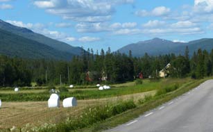 climb up onto Saltfjell, we reached the turning into the mountain farm of Elvmøthei Fjellgård.
We recalled from our May 2014 stay how the Spring melts from the heights of
Saltfjell turned the wide river into a wild torrent where the farm driveway
crossed on a narrow bridge. Today in mid-July, it was little more than an
insignificant trickle on a stony river bed
(Photo
33 - Partially dry water course); such a seasonal contrast. Round at
the small camping area, we pitched alongside the pine plantation with the vista
of mountains behind us. The sun was still astonishingly hot considering we
were only 15kms south of the Arctic Circle; we sat out late into a warm evening
after our barbecue supper, gazing up at pink reflections of the setting sun
glowing on the snow-fringed mountains. The following morning the sun was up early in a
clear sky, burning off the blotchy cloud over Saltfjell. The mountainous
environment of Elvmøthei Fjellgård was as magnificent as ever, and from our
breakfast table we could glance up to the snow-topped mountain ridge, climb up onto Saltfjell, we reached the turning into the mountain farm of Elvmøthei Fjellgård.
We recalled from our May 2014 stay how the Spring melts from the heights of
Saltfjell turned the wide river into a wild torrent where the farm driveway
crossed on a narrow bridge. Today in mid-July, it was little more than an
insignificant trickle on a stony river bed
(Photo
33 - Partially dry water course); such a seasonal contrast. Round at
the small camping area, we pitched alongside the pine plantation with the vista
of mountains behind us. The sun was still astonishingly hot considering we
were only 15kms south of the Arctic Circle; we sat out late into a warm evening
after our barbecue supper, gazing up at pink reflections of the setting sun
glowing on the snow-fringed mountains. The following morning the sun was up early in a
clear sky, burning off the blotchy cloud over Saltfjell. The mountainous
environment of Elvmøthei Fjellgård was as magnificent as ever, and from our
breakfast table we could glance up to the snow-topped mountain ridge,
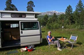 the
air tinged by the scent of the pines (see
below left) (Photo
33 - Elvmøthei Fjellgård). the
air tinged by the scent of the pines (see
below left) (Photo
33 - Elvmøthei Fjellgård).
Crossing the Arctic Circle on Saltfjell:
turning north on E6, we gradually gained height on the ascent to Saltfjell
plateau. Dark, shapely pines gave way to lush birch forest, then to thinner
birches some showing blackening from Autumnal Moth defoliation, and finally to birch scrub as we
reached the bom stasjon at the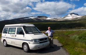 start of the bare plateau top. When last
we were up here in May 2014, the Saltfjell plateau was an almost continuous
snowfield, such an extraordinary vista (See log of our 2014 crossing of Saltfjell).
Today in contrast, the only snow visible was on the ridge-line of peaks enclosing the western side of the plateau, which
was itself an entirely bare and barren wilderness apart from the tarmac ribbon
of the E6 and the Nordlands-banen railway line. We paused for yet another
'Crossing the Line' photo (Photo
34 - Crossing the Arctic Circle on Saltfjell) (see right),
our 5th northward crossing of the Arctic Circle, well away from the tourist hoards who pack the Arctic Circle Centre gift shop
where the ephemeral souvenirs get tackier every year. A short distance
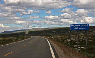
further north, we paused at the highest point (Høyeste Punkt) of Saltfjell
plateau 592m above sea level (see below left), and at the bridge over the
railway stretching across the fell (Photo
35 - Saltfjell railway line). Earlier by the Arctic Circle Centre, we had paid
our respects start of the bare plateau top. When last
we were up here in May 2014, the Saltfjell plateau was an almost continuous
snowfield, such an extraordinary vista (See log of our 2014 crossing of Saltfjell).
Today in contrast, the only snow visible was on the ridge-line of peaks enclosing the western side of the plateau, which
was itself an entirely bare and barren wilderness apart from the tarmac ribbon
of the E6 and the Nordlands-banen railway line. We paused for yet another
'Crossing the Line' photo (Photo
34 - Crossing the Arctic Circle on Saltfjell) (see right),
our 5th northward crossing of the Arctic Circle, well away from the tourist hoards who pack the Arctic Circle Centre gift shop
where the ephemeral souvenirs get tackier every year. A short distance
further north, we paused at the highest point (Høyeste Punkt) of Saltfjell
plateau 592m above sea level (see below left), and at the bridge over the
railway stretching across the fell (Photo
35 - Saltfjell railway line). Earlier by the Arctic Circle Centre, we had paid
our respects
 at the
memorials to so many Yugoslav and Soviet POW slave labourers whose lives the
railway had cost during its construction from 1942~45. Looking along the length
of the railway line, the dreary vista today
stretching into the distance across the barren plateau was of bare, grey-green
tundra with low-lying marshy areas; this was in stark contrast with the snowy
wastes seen on our last crossing of Saltfjell in May 2014. at the
memorials to so many Yugoslav and Soviet POW slave labourers whose lives the
railway had cost during its construction from 1942~45. Looking along the length
of the railway line, the dreary vista today
stretching into the distance across the barren plateau was of bare, grey-green
tundra with low-lying marshy areas; this was in stark contrast with the snowy
wastes seen on our last crossing of Saltfjell in May 2014.
Return to Sweden over mountainous terrain :
on the far side of the plateau we began the
descent into Lønsdalen, dropping down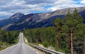 from
the bare fell top below the tree-line with the start of low birches. The now
narrow road wound around, losing height rapidly following the white-water rapids
of the Lønselva torrent tumbling in its rocky gorge (Photo
36 - Lønselva torrent). The birches became denser as we lost height and
reached the first of the dark pines, and the views down into lush-green
Saltdalen were magnificent against a backdrop of spectacularly rocky mountains
lining the valley spread out below. Dropping down rapidly into this dramatic
valley, E6 reached the junction with Route 77, and we turned off from E6 here
following the signpost towards the Swedish border for Arjeplog and Skellefteå
far away on the Bothnian coast (click here for detailed map of route).
We expected to continue losing height down into Junkerdalen, but in fact the
narrow road climbed dramatically, shelving steeply upward around the face of the
mountain lining the steep-sided valley. Tentatively George edged upwards, with
the road climbing
severely from
the bare fell top below the tree-line with the start of low birches. The now
narrow road wound around, losing height rapidly following the white-water rapids
of the Lønselva torrent tumbling in its rocky gorge (Photo
36 - Lønselva torrent). The birches became denser as we lost height and
reached the first of the dark pines, and the views down into lush-green
Saltdalen were magnificent against a backdrop of spectacularly rocky mountains
lining the valley spread out below. Dropping down rapidly into this dramatic
valley, E6 reached the junction with Route 77, and we turned off from E6 here
following the signpost towards the Swedish border for Arjeplog and Skellefteå
far away on the Bothnian coast (click here for detailed map of route).
We expected to continue losing height down into Junkerdalen, but in fact the
narrow road climbed dramatically, shelving steeply upward around the face of the
mountain lining the steep-sided valley. Tentatively George edged upwards, with
the road climbing
severely
 around the side of the deep valley to its head. Thankfully this led
into a high, flat alpine farming valley which gained height steadily to the head of Junkerdalen towards the Swedish border. These were indeed staggeringly severe
mountains on the Norwegian side of the border. Looking back along the valley,
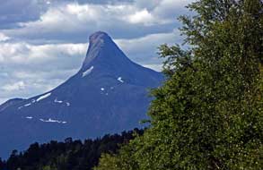
one isolated and magnificently shaped peak resembling the Matterhorn stood out
from the overall mountainous vista along the western skyline (see left). The
road climbed steeply for the remaining 5kms up to the border, cut into the rock
face on the left and looking out southwards across a barren mountainous
wasteland. Over the brow onto a plateau, we reached the border toll station;
this was one of the few border-crossings in Scandinavia with formalised toll
lanes, totally deserted here. As at the Abisko border-crossing in the far north,
we faced a sudden and abrupt topographical change beyond the line of the border:
we had just driven up a starkly narrow alpine valley enclosed on all sides by
fearsomely severe rocky mountains on the Norwegian side of the border; now
suddenly on the Swedish side, softer, greener terrain sloped away with distant
vistas of gently rolling fells and lakes, with smoothly rounded hills and not a
harsh peak in sight. We began a gradual descent on a relaxed, gentle gradient,
scarcely aware of the downhill slope. This was such a marked topographical
contrast with the severely mountainous ascent on the Norwegian side of the
border. around the side of the deep valley to its head. Thankfully this led
into a high, flat alpine farming valley which gained height steadily to the head of Junkerdalen towards the Swedish border. These were indeed staggeringly severe
mountains on the Norwegian side of the border. Looking back along the valley,
one isolated and magnificently shaped peak resembling the Matterhorn stood out
from the overall mountainous vista along the western skyline (see left). The
road climbed steeply for the remaining 5kms up to the border, cut into the rock
face on the left and looking out southwards across a barren mountainous
wasteland. Over the brow onto a plateau, we reached the border toll station;
this was one of the few border-crossings in Scandinavia with formalised toll
lanes, totally deserted here. As at the Abisko border-crossing in the far north,
we faced a sudden and abrupt topographical change beyond the line of the border:
we had just driven up a starkly narrow alpine valley enclosed on all sides by
fearsomely severe rocky mountains on the Norwegian side of the border; now
suddenly on the Swedish side, softer, greener terrain sloped away with distant
vistas of gently rolling fells and lakes, with smoothly rounded hills and not a
harsh peak in sight. We began a gradual descent on a relaxed, gentle gradient,
scarcely aware of the downhill slope. This was such a marked topographical
contrast with the severely mountainous ascent on the Norwegian side of the
border.
Back south across the Arctic Circle:
at a steady pace, we continued down the gentle grade, passing through no
settlements, and glancing around the distant horizon of soft, green fells and
rolling hills; this was an utterly deserted fell-scape in all directions.
Traffic was light with just the occasional Norwegian caravan lumbering slowly
towards the border. Water levels in the lakes we passed were dramatically low,
with much of the land around lake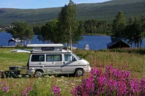 margins now exposed. The road, now designated
Route 95 in Sweden, ran on mile and after mile heading south-easterly along the
shore of an elongated lake to reach again the line of the Arctic Circle. Having
crossed the Circle northwards over Saltfjell earlier, we had now
with the return to Sweden travelled southward again to re-cross the Polar Circle
here on Route 95 (click here for detailed map of route).
This was a rather anticlimactic crossing point compared with the heights of Saltfjell,
with here just one tour-bus and a few aimless tourists milling around. Camping
Polcirkeln was located nearby right on the line of the eponymous Arctic Circle.
We had considered staying here, but one glance was enough to show this was not
for us: a huge and soulless winter skiing hut-encampment, spread along the
lake-shore looking forlorn and utterly uninviting. We drove on, after our second
crossing today (southwards this time) of the Arctic Circle. The lengthy,
elongated lake ended at its southern end at a vast rock-fill dam, with very
little water filtering down through the lower, now dry, channel into the next
lake of the chain, Hornavan, Sweden's deepest lake which stretches away
south-eastwards for 60kms as far as Arjeplog; these are the source waters of the
410km long Skellefteälven river, which we should cross later near to Skellefteå
and the river's outflow into the Bothnian Gulf.
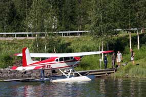 Welcoming and
magnificently sited Kyrkans
Fjällgård Camping: a short distance further, we reached the small settlement of Jäkkvik
and just beyond Kyrkans Fjällgård Camping. This was a farmstead conference-confirmation
camp centre, run by the Lutheran Church and also open for general camping. The
small camping area was set on a grassy terrace in a beautiful location
overlooking an inlet of Lake Hornavan (see above right) (Photo
37 - Kyrkans Fjällgård Camping). With the sun still fearsomely hot and
flies bothersome, we settled in, pulling out the awning for shade. The affably
chatty warden called round on his return and told us more about the centre, life
in the valley, and the Kungsleden long-distance path which passes through Jäkkvik
around the halfway mark of the trail's 440km length over wilderness terrain from Abisko in the north ending at Hemavan by the Alpine Botanical Gardens Welcoming and
magnificently sited Kyrkans
Fjällgård Camping: a short distance further, we reached the small settlement of Jäkkvik
and just beyond Kyrkans Fjällgård Camping. This was a farmstead conference-confirmation
camp centre, run by the Lutheran Church and also open for general camping. The
small camping area was set on a grassy terrace in a beautiful location
overlooking an inlet of Lake Hornavan (see above right) (Photo
37 - Kyrkans Fjällgård Camping). With the sun still fearsomely hot and
flies bothersome, we settled in, pulling out the awning for shade. The affably
chatty warden called round on his return and told us more about the centre, life
in the valley, and the Kungsleden long-distance path which passes through Jäkkvik
around the halfway mark of the trail's 440km length over wilderness terrain from Abisko in the north ending at Hemavan by the Alpine Botanical Gardens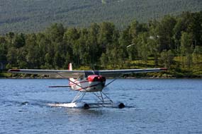 where we
had been 2 days ago. Kyrkans
Fjällgård makes on ideal staging camp for those walking the Kungsleden, and
early evening several back-packers pitched their tents nearby, far more
congenial neighbours than the usual holiday-makers. With the evening sun still
hot we cooked our supper,
looking forward to our day in camp tomorrow at such a pleasant and welcoming
spot. where we
had been 2 days ago. Kyrkans
Fjällgård makes on ideal staging camp for those walking the Kungsleden, and
early evening several back-packers pitched their tents nearby, far more
congenial neighbours than the usual holiday-makers. With the evening sun still
hot we cooked our supper,
looking forward to our day in camp tomorrow at such a pleasant and welcoming
spot.
The sun indeed was up early for another scorching
morning, and as we sat outside in the shade of George for breakfast, a small
float-plane circled low around the hills to land on the lake and taxi over to a
landing-stage below where we were camped (Photo
38 - Float-plane at Lake Hornavan) (see above left). It seemed to be picking up passengers
to ferry them out into the fells, and took off again in a spectacular cloud of
spray across the lake (see right). During the morning the back-packers departed, leaving us
to enjoy the peaceful setting, looking up from our work to look out across the
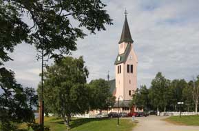 lake.
At lunch time we walked along to Jäkkvik's well-stocked village shop for bread and
milk, and were able to use Norwegian currency; along the
valley, Swedish and Norwegian banknotes seemed interchangeable. Later in the
day, as the sun declined and evening brought cooler air, we sat outside for our
supper after a thoroughly enjoyable and relaxing day in camp at this lovely
spot. lake.
At lunch time we walked along to Jäkkvik's well-stocked village shop for bread and
milk, and were able to use Norwegian currency; along the
valley, Swedish and Norwegian banknotes seemed interchangeable. Later in the
day, as the sun declined and evening brought cooler air, we sat outside for our
supper after a thoroughly enjoyable and relaxing day in camp at this lovely
spot.
A re-visit to Arjeplog: today we should move on to the next stage of
the trip, to Arjeplog and re-join the E45 Inlandsvägen at Arvidsjaur.
After our truly memorable stay at Kyrkans Fjällgård, we settled up our rent
(very reasonable at 220kr/night and such a magnificent location) using the
residue of our Norwegian kroner. Leaving Jäkkvik south-eastwards towards
Arjeplog on Route 95 (click here for detailed map of route),
the road passed the prominent ridge-end of the Pieljekaise National park. Route
95 ran along the length of Hornavan but some distance from the lake so we had
little visual impression of its size. Approaching the watery jigsaw of lakes
around Arjeplog, the road passed along the causeway on which the town is set. We
pulled in by the church (see left) to see the row of church-huts
(Photo
39 - Arjeplog church-huts) and to shop for provisions at the nearby ICA
supermarket.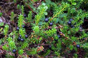
Vaukaströmmen nature walk: we recalled from our 2013 visit to Arjeplog
the beautiful lagoon of lakes and islands linked by board-walks close to the
town, but were not sure of its location. At the TIC, our attempt to describe the
nature walk brought an instant smile of recognition, and a freeby map showing
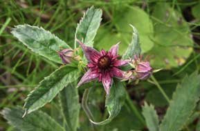 details of the Vaukaströmmen board-walk nature-trail. Just south of the town we
set out along the approach path for the magnificently constructed 2km long
board-walk path which links the forested islands through shallow lakeland. On a
Sunday morning, this was a popular leisure route for local strollers, joggers,
fishermen, and for us. We followed the board-walk at a leisurely pace, revelling
in the wonderful wild flora covering the forest floor and marshland. In the
height of a dry summer, water-levels were much lower than our last visit, making
the boulder fields and marshland remarkably dry. The presence of Labrador Tea
was immediately obvious from its heavy, medicinal turpentine smell especially
when the leaves were brushed. The flowers were well past but the prominent
seed-heads were evident. There was a lush ground cover of Bilberry, the
darker-leafed Bog Bilberry now laden with ripe berries, and Crowberry with shiny
black berries (see right). We were able to clamber down from the board-walk onto the
crunchy-dry marshland surface for close-up photos. Further along we found
specimens of maroon star-shaped flowers of Marsh Cinquefoil (see left). Then we reached the
beds of Cloudberry, initially just the distinctive leaves, then a few details of the Vaukaströmmen board-walk nature-trail. Just south of the town we
set out along the approach path for the magnificently constructed 2km long
board-walk path which links the forested islands through shallow lakeland. On a
Sunday morning, this was a popular leisure route for local strollers, joggers,
fishermen, and for us. We followed the board-walk at a leisurely pace, revelling
in the wonderful wild flora covering the forest floor and marshland. In the
height of a dry summer, water-levels were much lower than our last visit, making
the boulder fields and marshland remarkably dry. The presence of Labrador Tea
was immediately obvious from its heavy, medicinal turpentine smell especially
when the leaves were brushed. The flowers were well past but the prominent
seed-heads were evident. There was a lush ground cover of Bilberry, the
darker-leafed Bog Bilberry now laden with ripe berries, and Crowberry with shiny
black berries (see right). We were able to clamber down from the board-walk onto the
crunchy-dry marshland surface for close-up photos. Further along we found
specimens of maroon star-shaped flowers of Marsh Cinquefoil (see left). Then we reached the
beds of Cloudberry, initially just the distinctive leaves, then a few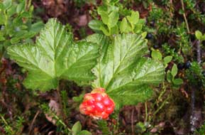 with large,
ripe orange fruits which we photographed (Photo
40 - Cloudberry ripe fruit) (see right) then picked to eat; the berries
had a waxy, mealy texture almost like ready-made cloudberry jam, with large,
hard seeds among the sticky pulp. We followed the board-walk around, passing
barbecue-huts and fishing places, to where the route turned across bridged
smaller islands. After a couple of hours of thoroughly enjoyable walking around
this remarkable lakeland/marshland board-walk, we turned back to the parking
area to resume our drive for the 90kms to Arvidsjaur. with large,
ripe orange fruits which we photographed (Photo
40 - Cloudberry ripe fruit) (see right) then picked to eat; the berries
had a waxy, mealy texture almost like ready-made cloudberry jam, with large,
hard seeds among the sticky pulp. We followed the board-walk around, passing
barbecue-huts and fishing places, to where the route turned across bridged
smaller islands. After a couple of hours of thoroughly enjoyable walking around
this remarkable lakeland/marshland board-walk, we turned back to the parking
area to resume our drive for the 90kms to Arvidsjaur.
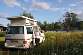 Nostalgic
pause at Sjöstjärnan Camping: we continued south-easterly on Route 95, the still
bright sun lighting the forests which stretched away into the distance to
horizons of spruce-covered rolling hills
(click here for detailed map of route). Nearer at hand, the sandy heath-land
forests had very much the look of Finland. Traffic was light and we kept up a
good pace, at one point having to brake sharply to avoid 3 reindeer which
trotted
casually across the road. Some 20kms from Arvidsjaur, we paused at the
dirt-track turning around to Långträskholmen, the peninsula in Långträsket lake
and site of the now closed Sjöstjärnan Camping which we had found by chance in
2013; we had enjoyed such wonderful hospitality from the affable owner Beatrice Karlsson at the campsite's lovely setting
(see left) that we had rated Sjöstjärnan as joint Best Swedish
Campsite along with Ristafallet Camping (See log of our 2013 stay at Sjöstjärnan Camping);
we had earlier this year exchanged emails with Beatrice and now wish her well with
her plans to re-open this lovely campsite
in 2017. Nostalgic
pause at Sjöstjärnan Camping: we continued south-easterly on Route 95, the still
bright sun lighting the forests which stretched away into the distance to
horizons of spruce-covered rolling hills
(click here for detailed map of route). Nearer at hand, the sandy heath-land
forests had very much the look of Finland. Traffic was light and we kept up a
good pace, at one point having to brake sharply to avoid 3 reindeer which
trotted
casually across the road. Some 20kms from Arvidsjaur, we paused at the
dirt-track turning around to Långträskholmen, the peninsula in Långträsket lake
and site of the now closed Sjöstjärnan Camping which we had found by chance in
2013; we had enjoyed such wonderful hospitality from the affable owner Beatrice Karlsson at the campsite's lovely setting
(see left) that we had rated Sjöstjärnan as joint Best Swedish
Campsite along with Ristafallet Camping (See log of our 2013 stay at Sjöstjärnan Camping);
we had earlier this year exchanged emails with Beatrice and now wish her well with
her plans to re-open this lovely campsite
in 2017.
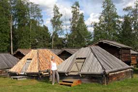 Lappstaden
church-town at Arvisdjaur: reaching the junction with the E45 Inlandsvägen,
we drove into Arvidsjaur, another drab service-centre town with little reason to
stop other than for provisions or fuel. Arvidsjaur's one redeeming feature is
the Lappstaden church-town, a preserved collection of over 80 Sámi kåtor and
Swedish settler church huts. In the 18~19th centuries, church attendance laws
imposed a compulsory level of church time which was difficult for the nomadic
Sámi to fulfil. With distances in these wild Northern lands long and travel only
possible by boat or by sledge in winter, the Sámi built their kåtor and the
settlers their huts as overnight stay for church services attendance at Arvidsjaur church. The Lappstaden collection of huts was gathered at its present
location in the early 19th century and preserved thanks to the efforts of a
local Sámi school teacher, Karin Stenberg. The 80 or so huts are still owned by
the Sámi and used for the annual feast of Storstämming on the last weekend of
August. Today this now peaceful collection of the pyramidal-shaped kåtor and
settler huts is set like a deserted time-warp incongruously amid modern
apartment blocks on the outskirts of Arvidsjaur (Photo
41 - Lappstaden church-town), and we stopped for a brief
re-visit in the afternoon sunshine. Lappstaden
church-town at Arvisdjaur: reaching the junction with the E45 Inlandsvägen,
we drove into Arvidsjaur, another drab service-centre town with little reason to
stop other than for provisions or fuel. Arvidsjaur's one redeeming feature is
the Lappstaden church-town, a preserved collection of over 80 Sámi kåtor and
Swedish settler church huts. In the 18~19th centuries, church attendance laws
imposed a compulsory level of church time which was difficult for the nomadic
Sámi to fulfil. With distances in these wild Northern lands long and travel only
possible by boat or by sledge in winter, the Sámi built their kåtor and the
settlers their huts as overnight stay for church services attendance at Arvidsjaur church. The Lappstaden collection of huts was gathered at its present
location in the early 19th century and preserved thanks to the efforts of a
local Sámi school teacher, Karin Stenberg. The 80 or so huts are still owned by
the Sámi and used for the annual feast of Storstämming on the last weekend of
August. Today this now peaceful collection of the pyramidal-shaped kåtor and
settler huts is set like a deserted time-warp incongruously amid modern
apartment blocks on the outskirts of Arvidsjaur (Photo
41 - Lappstaden church-town), and we stopped for a brief
re-visit in the afternoon sunshine.
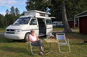 North to Moskosel Camping:
re-joining Inlandsvägen, we headed north for the
final 40kms of today's long drive up to the small settlement of Moskosel and
tonight's campsite. In the late afternoon sun, the endless spruce forests
stretching away to the northward horizon shimmered a misty green. We never cease
to enjoy the northern lands, and later read of a telling statistic: Arjeplog municipality has a population density of
0.2 inhabitants/km2, Norrbotten Sweden's northernmost province has 2.6 persons/km2,
Sweden as a whole 23.7
persons/km2, and North to Moskosel Camping:
re-joining Inlandsvägen, we headed north for the
final 40kms of today's long drive up to the small settlement of Moskosel and
tonight's campsite. In the late afternoon sun, the endless spruce forests
stretching away to the northward horizon shimmered a misty green. We never cease
to enjoy the northern lands, and later read of a telling statistic: Arjeplog municipality has a population density of
0.2 inhabitants/km2, Norrbotten Sweden's northernmost province has 2.6 persons/km2,
Sweden as a whole 23.7
persons/km2, and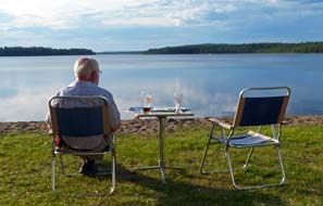 the EU 117 persons/km2.
We knew where we preferred to be! Just beyond Moskosel, we pulled into the little campsite, set beside a placid lake. The
owner, Naimy Olofsson, had kept the campsite for 30 years; he was now quite
elderly and spoke little English, but welcomed us in a taciturn manner. The charge
was 185kr/night including coins for showers, reasonable for a straightforward
little campsite, which clearly did a good trade from fishermen and passing
travellers along Inlandsvägen. There was one lake-side pitch remaining
and we settled in; weary after a long day, we were glad to collapse with beers,
and gaze out across the still waters of the lake (see above left) (Photo
42 - Moskosel Camping). We were fortunate in having like-minded
tent-camping Swedish neighbours who, like us conversed in quiet tones to avoid
disturbing others on a still and balmy evening; such neighbourly consideration
on campsites is becoming a rare event these days. The barbecue was lit to cook supper by the
lakeside (Photo
43 - Lakeside barbecue), and we sat late into the evening
with Moon Tigers on the table to deter the mossies (see right). the EU 117 persons/km2.
We knew where we preferred to be! Just beyond Moskosel, we pulled into the little campsite, set beside a placid lake. The
owner, Naimy Olofsson, had kept the campsite for 30 years; he was now quite
elderly and spoke little English, but welcomed us in a taciturn manner. The charge
was 185kr/night including coins for showers, reasonable for a straightforward
little campsite, which clearly did a good trade from fishermen and passing
travellers along Inlandsvägen. There was one lake-side pitch remaining
and we settled in; weary after a long day, we were glad to collapse with beers,
and gaze out across the still waters of the lake (see above left) (Photo
42 - Moskosel Camping). We were fortunate in having like-minded
tent-camping Swedish neighbours who, like us conversed in quiet tones to avoid
disturbing others on a still and balmy evening; such neighbourly consideration
on campsites is becoming a rare event these days. The barbecue was lit to cook supper by the
lakeside (Photo
43 - Lakeside barbecue), and we sat late into the evening
with Moon Tigers on the table to deter the mossies (see right).
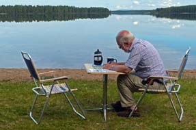 The
air was still balmy the following morning, and we sat outside again for
breakfast with broken cloud reflected on the placid lake's glassy surface (see
left). Today was certainly not a morning for rushing to be away, and it was 11-30am
by the time we departed, to drive back through the village to find the
Inlandsbanan Rallar (Navvies') Museum at the tiny station-halt. To our surprise,
the morning south-bound train was still waiting at the platform for the
passengers' coffee stop at the The
air was still balmy the following morning, and we sat outside again for
breakfast with broken cloud reflected on the placid lake's glassy surface (see
left). Today was certainly not a morning for rushing to be away, and it was 11-30am
by the time we departed, to drive back through the village to find the
Inlandsbanan Rallar (Navvies') Museum at the tiny station-halt. To our surprise,
the morning south-bound train was still waiting at the platform for the
passengers' coffee stop at the
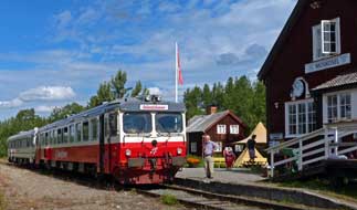 museum-café.
We took our photos in the morning sunlight of the railcars standing at Moskosel
station (see right) (Photo
44 - Moskosel station) before continuing our northward journey. museum-café.
We took our photos in the morning sunlight of the railcars standing at Moskosel
station (see right) (Photo
44 - Moskosel station) before continuing our northward journey.
Next week we move on, to cross the Arctic Circle for a
third time this trip northwards to Jokkmokk. After a diversion out into the
wilderness mountains at Kvikkjokk, we shall see the the Harsprånget gorge, now
laid bare with the Luleälven rapids dry below Harsprånget dam, re-visit the old
hydro-electric generating station at Porjus, and the crash site of WW2 Lancaster
Easy Elsie out in the marshland forests. Beyond Gällivare, we shall
investigate progress with Kiruna's relocation of the town to escape iron mining
subsidence, and reach the trip's mid-point at Karesuando, Sweden's northernmost
village. We shall travel along the Tornedalen valley, parallel with the NE
border of Finland to stay again at Pajala, location of Michael Niemi's novel
Popular Music from Vittula, and finally leave the Arctic in the lower
Kalixälevn valley near Överkalix. The next episode will conclude at Älvsbyn and
a re-visit to the spectacular Storforsen rapids on the Piteälven river. Lots
more still to come with our 2016 tour of Sweden.
Next edition
to be published quite soon
|
Sheila and Paul |
Published: 7 November 2016 |
|
 CAMPING
IN SWEDEN 2016 - Gäddede, Vildmarksvägen
(Wilderness Way) into Swedish
Lapland, Fatmomakke Sámi church town, Vilhelmina and Dorotea,
Blå Vägen out to Tärnaby and Hemaven,
into Norway to Mo i Rana, across the Arctic
Circle over Saltfjell, re-cross into Sweden to Arjeplog, and Arvidsjaur:
 North to Gäddede via the Vildmarksvägen (Wilderness Way):
leaving Route 45 Camping at Hammerdal, we set off on
the E45 for the 30km drive north to Strömsund. The road was good, through
pine-forested fell-land, and a road sign gave a distance of another 390kms to
Arvidsjaur on the Inlandsvägen; our less direct route however would be rather
further than this. Strömsund is a work-day-day, functional town, a service
centre for the surrounding forested rural hinterland, with supermarkets, banks
and filling stations and a lot of impatient traffic; it is certainly not a place
to hang around in longer than necessary, and having topped up with provisions
and diesel, we were glad to leave behind the dingy suburbs and head out on Route
342 towards distant Gäddede, the southern start of the Vildmarksvägen
(Wilderness Way) (
 We
had been warned that this road was now stricken with road works, but to begin with Route 342 was newly laid asphalt.
Inevitably however we soon reached the start of the road works, and followed
the pilot vehicle shepherding traffic through a section where new tarmac was
being laid (see above left). But far worse was to come: what had been a
reasonably surfaced road 3 years ago when we
last drove this route was now entirely stripped
of all its asphalt, leaving just a rutted, roughly gravelled unsurfaced road for
the next 20kms through the empty forests. On and on we juddered and bumped,
pausing for our lunch sandwiches at Alanäs opposite to Fläsjön lake. The
WW2 Dad's Army defensive position, on which Sweden had depended to counter
potential German invasion from occupied Norway, now stood silent and unseen up
on the hill-side.
 (see above left). A brisk
headwind raised white horses on the lake's ruffled surface, and endless forested
hills extended along the southern horizon lit by the afternoon sun. Somewhere
over there was our goal, the Hällingsåfallet waterfalls and canyon. The narrow
road wound around every bay of the lake, eventually leading to the outskirts of Gäddede,
and a couple of kms south of the village towards the Norwegian border, we turned
back 20 kms eastwards along an unsurfaced lane along the southern shore of Fågelsjön, and eventually
up a side-lane into the forest to the Hällingsåfallet falls parking
area.
 fearsomely black
cauldron of the canyon; clouds of drifting spray wafted overhead, soaking the
forested cliff-tops and catching the sunlight to form a rainbow which arched
high across the canyon's gulf. (
 with sunlight to create the rainbow effect above the falls.
 gathered;
despite the best of the afternoon's weather being gone, we set up our own
barbecue and sat up late into the evening enjoying the peacefulness of these
forested surroundings at this magnificent wild-camp spot. We woke to a
disappointingly overcast sky, and sat out the morning hoping that the sun would
re-appear for more waterfalls photos. Down at the look-out point, the absence of
sun not only denied rainbow effect but gave the canyon a grey, gloomy air (see
left). The cloud persisted with no sign of breaking and no re-appearance of the
sun, and by 1-00pm, we could wait no longer. We broke camp and returned along
the dirt road to Gäddede.
 further height over a high watershed shoulder to
descend on the northern side towards Stora Blåsjön lake. Close to Sör Blåsjön, we
pulled in by the Brakkåfallet waterfalls where a profusion of wild orchids grew
alongside the shaly ravine (
 A
camp at the Sámi settlement of Ankarede:
continuing around the head of the lake, we reached the scattered settlement of
Stora Blåsjön with its tiny ICA-cum-filling station, and at the northern end of
the village, turned off onto the narrow side-lane which led to the traditional
Sámi seasonal gathering place of Ankarede. At the end of the lane, there was not
only the potential for camping in the parking area which served the huts and
Sámi kåtor (originally tepee-shaped nomadic dwellings) making up the settlement
of Ankarede, but even power supplies and a small service-house run by the
Ankarede Association both for the huts-settlement and camping area. The surface
was rough and gravelly and sloped to one side, but we pitched in the far corner
well away from the camping-cars already here (
A
camp at the Sámi settlement of Ankarede:
continuing around the head of the lake, we reached the scattered settlement of
Stora Blåsjön with its tiny ICA-cum-filling station, and at the northern end of
the village, turned off onto the narrow side-lane which led to the traditional
Sámi seasonal gathering place of Ankarede. At the end of the lane, there was not
only the potential for camping in the parking area which served the huts and
Sámi kåtor (originally tepee-shaped nomadic dwellings) making up the settlement
of Ankarede, but even power supplies and a small service-house run by the
Ankarede Association both for the huts-settlement and camping area. The surface
was rough and gravelly and sloped to one side, but we pitched in the far corner
well away from the camping-cars already here ( for supper. Before departing the following
morning, we walked over to Ankarede for photos in the bright sunshine. For centuries, nomadic Sámi reindeer herders
from the surrounding mountain grazing lands had traditionally gathered here at this spit of
land, the meeting-point of 2 rivers and 3 lakes, for festivals such as
Midsummer. The collection
of Sámi kåtor and church-huts built originally by Swedish settlers still
survives, clustered around the white-painted wooden church which was built in
1895 (see above right). The kåtor and huts are still used as temporary accommodation for those
attending seasonal
 gatherings. The kåtor scattered along the river bank in the
birch groves had a peacefully mysterious air, and we wandered among them taking
our photos in the bright morning sunshine (
 after a further 10kms reached
the turning to the limestone karst dolina of Bjurälven nature reserve, curiously
out of place in Sweden. A 3km dirt road led to
a parking area by an old fell-land farmstead, which marked the start of a
further 3km approach path for the dolina, where in classic karst limestone
conditions the stream appeared and disappeared. The overall walk, 12kms there
and back along the dolina, led almost to the Norwegian border in wild country;
there was no time to tackle that today, but we noted it for a future visit with
a wild-camp at the parking area. But cloud was gathering from the south; we
returned to the main
Vildmarksvägen
to continue the ascent onto the plateau after photographs of the rapids
dropping from higher fell-land (
 876m
high plateau-top, the bare fell-scape stretched away into the distance with a
desolate beauty, enclosed to the west by snow-streaked mountains (see right) (
 The road passed an area of
reindeer-herding pens (see right), and continued down to the settlement of Klimpfjäll. Along the valley
past shallow lake-land and a prominent red rock-pinnacle, we reached the
turning up to Fatmomakke, where 7kms of very dusty, corrugated dirt road led up
to the remote Sámi gathering area and church-town of Fatmomakke.
 In the 17~18th centuries, conversion to Christianity, enforced by
zealous Lutheran missionaries, brought the legal duty for the Sámi regularly to
attend church, very inconvenient if you're a nomadic herdsman. Christian mission
work went hand in hand with the Swedish State's systematic efforts to colonise
the wild northern lands, bringing Swedish settlers who cleared farming lands in
remote forest areas that had once been the preserve of the Sámi. One way to
support both colonisation and missionary work was to build churches in the
inland mountainous areas, where both Sámi and settlers met for compulsory church
attendance and to pay their taxes. One such church was built at the Sámi
seasonal meeting place of Fatmomakke, and with the need to travel large
distances from grazing grounds for compulsory church attendance, the Sámi built
 kåtor huts around Fatmomakke church as
overnight lodging when attending church. With increased State-sponsored
colonisation of the area, Swedish settlers also began to built lodging huts here
from the 1820s. The present church was built in 1884, and some 80 Sámi kåtor and
20 settlers' huts survive at Fatmomakke, still used for traditional gatherings
with descendents of both Sámi and Swedish settlers meeting here for church
festivals at Midsummer and September. These timings had originally coincided
with the summer and autumn migrations when the Sámi reindeer herders had moved
from summer mountain grazing grounds to lower forest grazing in winter.
 and
over-priced in high summer, there is little to choose between (or indeed to
commend) either of them, unless you want to fish the lake or overnight at
Fatmomakke. We found a space crammed in among caravans, but with no power,
facilities you would not choose to use, and at 80kr/night, this was nothing more
than an unsavoury but expensive wild-camp; after some hesitation, we booked in
at the café and settled George onto the riverbank. At Fatmomakke in July, the
fishermen, tourists, and therefore the kroner just keep coming!
 We
crossed the footbridge and walked along the lake-side trackway, past the
cemetery and tax-collector's hut, to the gathering area on the hillside where
the Midsummer pole still stood (see above left). The cloud of earlier had
thinned but still clung to the surrounding hills, as we climbed to the church
and wandered across the hillside among the Sámi kåtor and settlers' huts (
 the hillside among the birches,
the soft sunlight gave the church-town a magical air
 Kultsjöån river flows from its upper lake and
drops down a series of shale-terrace steps forming the spectacular 150m wide Trappstegsforsen rapids. The morning sun sparkled on the white water tumbling
down over the 500m length of the rapids (
 paraphernalia that has to
accompany them, certainly not the sort of company we should choose to share a
campsite with; it was clearly a total NO-NO in anything but May or September. Vilhelmina is a dreary sort of service centre town; it always seems an irony
that, along with Fredrika and Dorotea, the Lapland town of Vilhelmina is named
after Fredrika Dorotea Vilhelmina, Queen Consort of the inept Gustav IV Adolph,
who during his brief reign from 1792~1809 managed to lose one third of Sweden's
empire, including Finland to Tsarist Russia, and was consequently
deposed for his incompetence. Having shopped for provisions in Vilhelmina, we
headed south on E45 Inlandsvägen to the
 altogether more attractive little town
of Dorotea for a return stay at the welcoming Doro Camping. The road had
recently been re-surfaced, traffic was light, and with the road passing through
forested terrain parallel with the Inlandsbanan railway, this was a splendid
drive on a sunny Sunday afternoon. Crossing the Ångermanälven river at
Meselefors, we were reminded of its little riverside campsite which we had first
seen from the train on our 2013 Inlandsbanan ride; this would make an ideal stop
on our return north. Just south of Dorotea, we reached Doro Camping and received
the usual welcoming hospitality from the Dutch owners Louis and Tessa; the price
was a very reasonable all-inclusive 210kr, and we
found our usual pitch down in the far corner looking out into the neighbouring
forest where the Inlandsbanan train passes morning and evening (
 Doro Camping's station-halt on the
Inlandsbanan Railway: having set up camp, it was time to walk over to
watch the evening Inlandsbanan train pass through. We recalled the
straightforward set of wooden steps that constituted the 'platform' for Doro
Camping's little station-halt where we had clambered aboard the train in 2013 (
 at a time when Britain needs the most clear
sighted, determined and inspirational political leadership, facing as we are an uncertain future outside
of the EU, we finish up with a third division player with a disastrous record of
failures as Home Secretary. The lunatics are now truly running the asylum! After
a restfully productive day, we again walked over to the platform-halt to watch
the evening Inlandsbanan, and chatted with the back-packers as they waited to
re-board the south-bound train after their 8 hour ride from Gällivare
yesterday
(see above left).
 Another excellent campsite, Meselefors Camping:
leaving Dorotea on the E45 Inlandsvägen, a 20 minutes northward drive
brought us to the turn-off into Meselefors Camping, just before the bridge
crossing the wide Ångermanälven river, whose source is up in the Lapland fells
and which is crossed
 again by the High Coast Bridge close to where the river
flows into the Bothnian Gulf. We were greeted at reception with a friendly welcome
from the quietly reserved campsite owner; the charge was an excellent value
195kr including site-wide wi-fi. And the setting was simply stunning. The
camping area was set on the banks of the Ångermanälven, looking out directly
across the wide, placid river just at the point where the Inlandsbanan crossed
on its girder-bridge. We selected a pitch over at the far corner just above the
river and right opposite the railway bridge, and lunched on the riverbank (see
left) (
 We woke to full sun
again, with the glassy still river reflecting the railway bridge just below
us
(
 the glorious sunshine and
peaceful setting; it was a truly
idyllic morning (
 (Blue Road)
to begin the drive up the Umeälven valley towards Tärnaby
(
 part of the Umeälven river system, regulated by a series of HEP dams along the length of its
upper valley. We continued along the picturesque Umeälven valley with its
endless vista of lakes and forests, and skyline of increasingly high fells
and distant snow-flecked mountains, all lit by the sun. This truly was a
glorious drive with the clear sky enlivening the Blue Road's panoramic landscape
(see left) (
 diversity of local mountain flora and protected plant species in a natural
habitat. 400m of pathway has been laid out in a loop around the ridge with the
flora arranged in separate raised timber-sided beds, the shaded northern side
giving a habitat for cold-dependent alpine species and the sunnier southern side for valley
plants. We began our bed by bed examination of the specimens, identified by
excellent labelling with both the common Swedish names but more importantly the
internationally
 recognised Latin binomial names. The gardens' showpiece is the Brudkulla Orchid, a new species discovered in 1960 by Olof Rune growing wild
near Tängvattnet. It was at that time thought to be a variety of Black Vanilla
Orchid, but subsequent DNA analysis showed it to be a previously unknown
distinct species, occurring by hybridisation between Black Vanilla and
Fragrant Orchids; it was given the binomial Gymnadenia Runei, after its
discoverer and founder of the Alpine Gardens Olof Rune. This endemic Lapland
species only grows naturally at a few locations around Tärnaby and Hemavan, and
is thought to be very young, less than a 1,000 years old. Along with the many other species
of alpine flora in the Hemavan Gardens, we spent time particularly photographing the demurely
modest
little Brudkulla Orchid (
 (including coins for
showers), the place was inevitably crowded in July; worse however, the facilities also were
run-down and grubby, and the wooden steps which
 were in a broken state 3 years
ago were still unrepaired. Compared with the excellent value at Meselefors,
Tärnaby had a dreary air even in bright sunshine, and the supposed wi-fi failed
to connect. It was such a pity that prices had risen and standards declined;
it is doubtful we shall ever return.
 Beyond
Klippen village, the upper Umeälven river used to descend from its head-waters
at Över Uman lake via a long series of rapids down through the forested upper
valley. But in the early 1990s, Vattenfall, the state Hydro-power generating
company, built the Klippen power station. The underground HEP generating plant
at Klippen is fed by a 7.5km long head-race from its intake on the Över Uman
storage reservoir dam, leaving the river's natural course virtually dry. This
lengthy head-race achieves a fall of 65m by the time it reaches the generating
station, and the out-flow water is led from the power station back into the
river via a 3.5km long tail-race which flows out downstream of Klippen village.
Following the natural course of the now much reduced Umeälven river, the Blå Vägen
gained height gradually through endless spruce-covered high fells eventually
reaching Lake Över Uman just beyond the village of Umfors (see above left). The
road crossed the high plateau-lands almost at the tree-line, the horizon on all
sides marked by rounded-topped spruce-covered fells. Beyond the lake-narrowing
at Strimasund, the road wound around the shore of a further lake, and away to
the west snow-covered mountains graced the horizon (see above right) with the
shapely peaks of Okstindan (1,824m) standing clear above the rest. The
settlement of Kåtaviken just before the border had during WW2 been the site of a
radio station linking the Norwegian Resistance with London, and an escape route
from German occupied Norway.
 Across
the border and E12 down to Mo i Rana: we reached the border at the 800m high
watershed (
 A re-visit to Mo i Rana:
a short distance further and we reached the junction with Norway's main
northern highway, the E6 which drops down around Mo i Rana by the rapids below
the town's now closed steel works. Turning south on E6, we rounded the bypass
down towards the fjord and turned off into the town to a shopping centre which
houses the Tourist Information Centre (
 (
( Autopass
account as we had done on our 2014 Norwegian trip, so they'll just have to send
us a bill! (which they did 3 months later). Following the railway line, E6 wound an upward course into a
spectacularly forested valley, enclosed by high mountains on all sides (see
left). Sometimes the valley opened out into wider alpine farming meadows (see
right), other times it wound through narrow defiles. Traffic was light so
we could take a steady pace on the narrow winding road along the forested upper
valley, and just beyond the settlement of Krokstranda, where the road began the
  climb up onto Saltfjell, we reached the turning into the mountain farm of Elvmøthei Fjellgård.
We recalled from our May 2014 stay how the Spring melts from the heights of
Saltfjell turned the wide river into a wild torrent where the farm driveway
crossed on a narrow bridge. Today in mid-July, it was little more than an
insignificant trickle on a stony river bed
(
 the
air tinged by the scent of the pines (see
below left) (
 start of the bare plateau top. When last
we were up here in May 2014, the Saltfjell plateau was an almost continuous
snowfield, such an extraordinary vista (
 at the
memorials to so many Yugoslav and Soviet POW slave labourers whose lives the
railway had cost during its construction from 1942~45. Looking along the length
of the railway line, the dreary vista today
stretching into the distance across the barren plateau was of bare, grey-green
tundra with low-lying marshy areas; this was in stark contrast with the snowy
wastes seen on our last crossing of Saltfjell in May 2014.
 from
the bare fell top below the tree-line with the start of low birches. The now
narrow road wound around, losing height rapidly following the white-water rapids
of the Lønselva torrent tumbling in its rocky gorge (
 around the side of the deep valley to its head. Thankfully this led
into a high, flat alpine farming valley which gained height steadily to the head of Junkerdalen towards the Swedish border. These were indeed staggeringly severe
mountains on the Norwegian side of the border. Looking back along the valley,
one isolated and magnificently shaped peak resembling the Matterhorn stood out
from the overall mountainous vista along the western skyline (see left). The
road climbed steeply for the remaining 5kms up to the border, cut into the rock
face on the left and looking out southwards across a barren mountainous
wasteland. Over the brow onto a plateau, we reached the border toll station;
this was one of the few border-crossings in Scandinavia with formalised toll
lanes, totally deserted here. As at the Abisko border-crossing in the far north,
we faced a sudden and abrupt topographical change beyond the line of the border:
we had just driven up a starkly narrow alpine valley enclosed on all sides by
fearsomely severe rocky mountains on the Norwegian side of the border; now
suddenly on the Swedish side, softer, greener terrain sloped away with distant
vistas of gently rolling fells and lakes, with smoothly rounded hills and not a
harsh peak in sight. We began a gradual descent on a relaxed, gentle gradient,
scarcely aware of the downhill slope. This was such a marked topographical
contrast with the severely mountainous ascent on the Norwegian side of the
border.
  margins now exposed. The road, now designated
Route 95 in Sweden, ran on mile and after mile heading south-easterly along the
shore of an elongated lake to reach again the line of the Arctic Circle. Having
crossed the Circle northwards over Saltfjell earlier, we had now
with the return to Sweden travelled southward again to re-cross the Polar Circle
here on Route 95 (
 Welcoming and
magnificently sited Kyrkans
Fjällgård Camping: a short distance further, we reached the small settlement of Jäkkvik
and just beyond Kyrkans Fjällgård Camping. This was a farmstead conference-confirmation
camp centre, run by the Lutheran Church and also open for general camping. The
small camping area was set on a grassy terrace in a beautiful location
overlooking an inlet of Lake Hornavan (see above right) (
 where we
had been 2 days ago. Kyrkans
Fjällgård makes on ideal staging camp for those walking the Kungsleden, and
early evening several back-packers pitched their tents nearby, far more
congenial neighbours than the usual holiday-makers. With the evening sun still
hot we cooked our supper,
looking forward to our day in camp tomorrow at such a pleasant and welcoming
spot.
  lake.
At lunch time we walked along to Jäkkvik's well-stocked village shop for bread and
milk, and were able to use Norwegian currency; along the
valley, Swedish and Norwegian banknotes seemed interchangeable. Later in the
day, as the sun declined and evening brought cooler air, we sat outside for our
supper after a thoroughly enjoyable and relaxing day in camp at this lovely
spot.
 details of the Vaukaströmmen board-walk nature-trail. Just south of the town we
set out along the approach path for the magnificently constructed 2km long
board-walk path which links the forested islands through shallow lakeland. On a
Sunday morning, this was a popular leisure route for local strollers, joggers,
fishermen, and for us. We followed the board-walk at a leisurely pace, revelling
in the wonderful wild flora covering the forest floor and marshland. In the
height of a dry summer, water-levels were much lower than our last visit, making
the boulder fields and marshland remarkably dry. The presence of Labrador Tea
was immediately obvious from its heavy, medicinal turpentine smell especially
when the leaves were brushed. The flowers were well past but the prominent
seed-heads were evident. There was a lush ground cover of Bilberry, the
darker-leafed Bog Bilberry now laden with ripe berries, and Crowberry with shiny
black berries (see right). We were able to clamber down from the board-walk onto the
crunchy-dry marshland surface for close-up photos. Further along we found
specimens of maroon star-shaped flowers of Marsh Cinquefoil (see left). Then we reached the
beds of Cloudberry, initially just the distinctive leaves, then a few
 with large,
ripe orange fruits which we photographed (
 Nostalgic
pause at Sjöstjärnan Camping: we continued south-easterly on Route 95, the still
bright sun lighting the forests which stretched away into the distance to
horizons of spruce-covered rolling hills
(
 Lappstaden
church-town at Arvisdjaur: reaching the junction with the E45 Inlandsvägen,
we drove into Arvidsjaur, another drab service-centre town with little reason to
stop other than for provisions or fuel. Arvidsjaur's one redeeming feature is
the Lappstaden church-town, a preserved collection of over 80 Sámi kåtor and
Swedish settler church huts. In the 18~19th centuries, church attendance laws
imposed a compulsory level of church time which was difficult for the nomadic
Sámi to fulfil. With distances in these wild Northern lands long and travel only
possible by boat or by sledge in winter, the Sámi built their kåtor and the
settlers their huts as overnight stay for church services attendance at Arvidsjaur church. The Lappstaden collection of huts was gathered at its present
location in the early 19th century and preserved thanks to the efforts of a
local Sámi school teacher, Karin Stenberg. The 80 or so huts are still owned by
the Sámi and used for the annual feast of Storstämming on the last weekend of
August. Today this now peaceful collection of the pyramidal-shaped kåtor and
settler huts is set like a deserted time-warp incongruously amid modern
apartment blocks on the outskirts of Arvidsjaur (
 North to Moskosel Camping:
re-joining Inlandsvägen, we headed north for the
final 40kms of today's long drive up to the small settlement of Moskosel and
tonight's campsite. In the late afternoon sun, the endless spruce forests
stretching away to the northward horizon shimmered a misty green. We never cease
to enjoy the northern lands, and later read of a telling statistic: Arjeplog municipality has a population density of
0.2 inhabitants/km2, Norrbotten Sweden's northernmost province has 2.6 persons/km2,
Sweden as a whole 23.7
persons/km2, and
 the EU 117 persons/km2.
We knew where we preferred to be! Just beyond Moskosel, we pulled into the little campsite, set beside a placid lake. The
owner, Naimy Olofsson, had kept the campsite for 30 years; he was now quite
elderly and spoke little English, but welcomed us in a taciturn manner. The charge
was 185kr/night including coins for showers, reasonable for a straightforward
little campsite, which clearly did a good trade from fishermen and passing
travellers along Inlandsvägen. There was one lake-side pitch remaining
and we settled in; weary after a long day, we were glad to collapse with beers,
and gaze out across the still waters of the lake (see above left) (
 The
air was still balmy the following morning, and we sat outside again for
breakfast with broken cloud reflected on the placid lake's glassy surface (see
left). Today was certainly not a morning for rushing to be away, and it was 11-30am
by the time we departed, to drive back through the village to find the
Inlandsbanan Rallar (Navvies') Museum at the tiny station-halt. To our surprise,
the morning south-bound train was still waiting at the platform for the
passengers' coffee stop at the
 museum-café.
We took our photos in the morning sunlight of the railcars standing at Moskosel
station (see right) (