|
 CAMPING
IN SWEDEN 2016 - Falun
Copper Mine, Färnebofjärden National Park, Sala
Silver Mine, Ängelsberg Bruk, Anundshög Burial
Grounds, Ramsund Sigurd Engraving, Eskilstuna, Göta Canal at Motala, Vadstena,
Eksjö wooden
town,
Småland, and South-East Coast at Oskarshamn: CAMPING
IN SWEDEN 2016 - Falun
Copper Mine, Färnebofjärden National Park, Sala
Silver Mine, Ängelsberg Bruk, Anundshög Burial
Grounds, Ramsund Sigurd Engraving, Eskilstuna, Göta Canal at Motala, Vadstena,
Eksjö wooden
town,
Småland, and South-East Coast at Oskarshamn:
A night's camp at Dalstuga, in a remote
corner of North Dalarna:
we headed west from Hudiksvall on Route 84, passing Delsbo and the Dellen Lakes,
out to Ljusdal where the railway sidings were
 full of loaded timber wagons (click here for detailed map of route).
Through the town, we turned south onto Route 83 alongside the Ljusnan river,
recalling our travelling this road on a Sunday afternoon in 2013 amid
Stockholm-bound speeding traffic returning from a weekend in the mountains.
Today progress through southern Hälsingland down to Bollnäs was obstructed by
slow-moving local traffic and frequent speed cameras. Bollnäs seemed a grubby
little industrial town with nothing to detain us other than a provisions stop at
the ICA Kvantum; the inevitable Roma beggars obstructing the doorway was a
feature of virtually every other supermarket throughout Sweden these days. Route
50 took us southwest-wards towards Falun passing the insignificant town of Alfta,
We had expected this to be a busier road, but in fact it turned out the highlight of
today's journey with virtually no traffic, passing lakes and attractive villages
before rising over high ground with endless forests stretching away to distant
southward horizons. full of loaded timber wagons (click here for detailed map of route).
Through the town, we turned south onto Route 83 alongside the Ljusnan river,
recalling our travelling this road on a Sunday afternoon in 2013 amid
Stockholm-bound speeding traffic returning from a weekend in the mountains.
Today progress through southern Hälsingland down to Bollnäs was obstructed by
slow-moving local traffic and frequent speed cameras. Bollnäs seemed a grubby
little industrial town with nothing to detain us other than a provisions stop at
the ICA Kvantum; the inevitable Roma beggars obstructing the doorway was a
feature of virtually every other supermarket throughout Sweden these days. Route
50 took us southwest-wards towards Falun passing the insignificant town of Alfta,
We had expected this to be a busier road, but in fact it turned out the highlight of
today's journey with virtually no traffic, passing lakes and attractive villages
before rising over high ground with endless forests stretching away to distant
southward horizons.
|
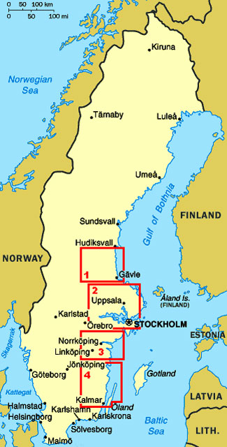
Click on 4 highlighted areas of
map
for details of
South-East Sweden |
 |
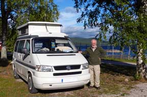 The road finally dropped down to the southern
tip of the extensively spreading Amungen Lake, crossing into the County of Northern Dalarna to reach a road junctions at Lamborn. Here we turned off onto Route 889,
a minor road running all the way cross-country to Rättvik on the SE corner of
Lake Siljan which we had passed through on our northward journey some 7 weeks
earlier. In 10kms at Bingsjö, a picture post-card of a village with little
wooden church, attractive Falun-Red painted cottages and traditional
gärdesgård slatted fencing, we turned off again for the final 5kms of
unsurfaced single-track lane leading to the tiny hamlet of Dalstuga spread
around the southern shore of Amungen Lake. The road finally dropped down to the southern
tip of the extensively spreading Amungen Lake, crossing into the County of Northern Dalarna to reach a road junctions at Lamborn. Here we turned off onto Route 889,
a minor road running all the way cross-country to Rättvik on the SE corner of
Lake Siljan which we had passed through on our northward journey some 7 weeks
earlier. In 10kms at Bingsjö, a picture post-card of a village with little
wooden church, attractive Falun-Red painted cottages and traditional
gärdesgård slatted fencing, we turned off again for the final 5kms of
unsurfaced single-track lane leading to the tiny hamlet of Dalstuga spread
around the southern shore of Amungen Lake.
Dalstuga Camping: we had identified what appeared to be a
straightforward little community-run camping at Dalstuga in an attractive
setting overlooking the lake, a remote Dalarna retreat as staging camp on our
journey south. Reaching the village, we threaded a way uncertainly around Dalstuga's
network of lanes, eventually reaching the lakeside leisure area (fritids-ömråde);
but the large, open grassy space overlooking the lake with its 2 midsummer poles
was now totally filled with static caravans; there was scarcely any space left
for visitors to camp. In summer time with all these
 caravans occupied, the place
would be insufferable bedlam, but thankfully with the holiday season now over,
it was peacefully deserted. We investigated an open area down by the lake-shore
and found power supplies; there were no functioning facilities, but here was a
perfect lakeside camping spot sheltered by birch trees. Despite the bright sun,
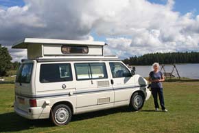
a chill wind was blowing across the lake whipping up white horses as we settled in (Photo 1 - Dalstuga Camping)
(see above left).
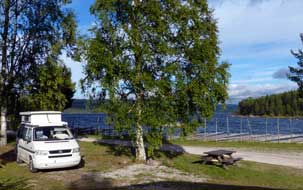
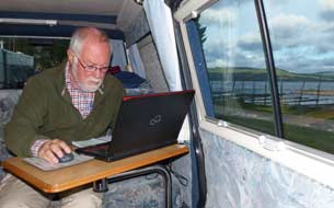
The late afternoon grew dull and heavily overcast, but out of the wind and with power for heating, we were snug inside George looking out
across the lake (see left). Today we had driven a further 200kms south to a remote corner
of Dalarna; Hudiksvall seemed a long way distant in time and space. That evening we
enjoyed a
supper of Carina's home-made meat-balls, and afterwards texted our thanks for
their open-hearted hospitality, vowing never again to touch supermarket
köttbullar again!. caravans occupied, the place
would be insufferable bedlam, but thankfully with the holiday season now over,
it was peacefully deserted. We investigated an open area down by the lake-shore
and found power supplies; there were no functioning facilities, but here was a
perfect lakeside camping spot sheltered by birch trees. Despite the bright sun,
a chill wind was blowing across the lake whipping up white horses as we settled in (Photo 1 - Dalstuga Camping)
(see above left).
The late afternoon grew dull and heavily overcast, but out of the wind and with power for heating, we were snug inside George looking out
across the lake (see left). Today we had driven a further 200kms south to a remote corner
of Dalarna; Hudiksvall seemed a long way distant in time and space. That evening we
enjoyed a
supper of Carina's home-made meat-balls, and afterwards texted our thanks for
their open-hearted hospitality, vowing never again to touch supermarket
köttbullar again!.
 Falun Copper Mine: we woke to
continuing heavily overcast sky with misty drizzle obscuring the lake; it was as
well we had taken our photos in this lovely lakeside setting in yesterday
afternoon's sunshine. As we packed to leave, pouring rain began, and Dalstuga's
lanes seemed even more of a maze on a gloomy morning. Back along to Bingsjö, we
re-joined Route 50 and turned south through the dreary forested landscape for
the 60kms to Falun to park at the Copper Mine, now a World Heritage tourist site
(see Log of our 2013 visit to Falun Copper Mine).
About the only worthwhile feature of the glitzy Visitor Centre were the loos. If
you were hoping to learn something here about the story of copper mining at Falun and
its historical Falun Copper Mine: we woke to
continuing heavily overcast sky with misty drizzle obscuring the lake; it was as
well we had taken our photos in this lovely lakeside setting in yesterday
afternoon's sunshine. As we packed to leave, pouring rain began, and Dalstuga's
lanes seemed even more of a maze on a gloomy morning. Back along to Bingsjö, we
re-joined Route 50 and turned south through the dreary forested landscape for
the 60kms to Falun to park at the Copper Mine, now a World Heritage tourist site
(see Log of our 2013 visit to Falun Copper Mine).
About the only worthwhile feature of the glitzy Visitor Centre were the loos. If
you were hoping to learn something here about the story of copper mining at Falun and
its historical
 contribution to Sweden's economy, you would be disappointed; in a
place devoted to profits, extracting £21 per person from the millions who visit the mine each year, the displays were extravagant but superficial and trivially
lacking in detail. On our 2013 visit, we had been duped into paying to go on the
underground mine visit, but the guide's so-called commentary was blandly vacuous
and non-informative; pressured by the tight schedule of lucrative hourly guided
tours, she was immune to information-seeking questions but doubtless had little
knowledge to impart anyway. Most of the party simply looked bored; a few like us
ignored the non-guide and peered around for ourselves trying to gain an
impression in the gloom of how dreadful working conditions would have been in
the mine's galleries. After such a World Heritage non-experience, this year we confined our re-visit to walking the 2km
trackway around the surface rim of the Great Pit of Falun Copper Gruva (Mine).
With the rain now easing but light still gloomy, we set off past the palatial
18th century mine headquarters building which now houses the
mining museum, across the look-out point which gives a full panorama view
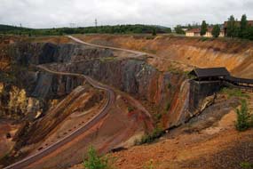
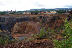
looking down into the 100m deep and 400m wide chasm of the Great Pit
(Photo
2 - Falun Copper Mine). There was even a glimmer of sun to lighten
the multitude of browns and orange of the pit's rock and debris (see above
right). contribution to Sweden's economy, you would be disappointed; in a
place devoted to profits, extracting £21 per person from the millions who visit the mine each year, the displays were extravagant but superficial and trivially
lacking in detail. On our 2013 visit, we had been duped into paying to go on the
underground mine visit, but the guide's so-called commentary was blandly vacuous
and non-informative; pressured by the tight schedule of lucrative hourly guided
tours, she was immune to information-seeking questions but doubtless had little
knowledge to impart anyway. Most of the party simply looked bored; a few like us
ignored the non-guide and peered around for ourselves trying to gain an
impression in the gloom of how dreadful working conditions would have been in
the mine's galleries. After such a World Heritage non-experience, this year we confined our re-visit to walking the 2km
trackway around the surface rim of the Great Pit of Falun Copper Gruva (Mine).
With the rain now easing but light still gloomy, we set off past the palatial
18th century mine headquarters building which now houses the
mining museum, across the look-out point which gives a full panorama view
looking down into the 100m deep and 400m wide chasm of the Great Pit
(Photo
2 - Falun Copper Mine). There was even a glimmer of sun to lighten
the multitude of browns and orange of the pit's rock and debris (see above
right).
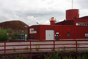 The
copper ore spoil heaps still yield a profitable inheritance: Falun is the centre
of production for Falu Rödfärg, the red-brown preservative paint used
universally on Sweden's wooden buildings giving them their distinctive colour.
The waste rock with its mix of metallic minerals, principally red-ochre iron The
copper ore spoil heaps still yield a profitable inheritance: Falun is the centre
of production for Falu Rödfärg, the red-brown preservative paint used
universally on Sweden's wooden buildings giving them their distinctive colour.
The waste rock with its mix of metallic minerals, principally red-ochre iron
 oxide, is ground and roasted as the base material for the wood preservative and
the Falu Rödfärg works stand next to the former copper mine's deep pit (see
right). After a brief look at the huge preserved water wheels which once powered
pumps and hoists as mine shafts were driver deeper, we set off around the Pit's
surface perimeter trackway, passing the tangled chaos of rocks and timber debris
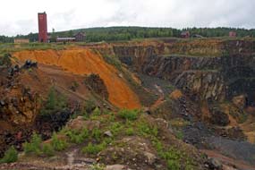
from the catastrophic 1687 cave-in. Ahead, the 40m tall red brick 1970s tower of
the Creutz Shaft winding gear, that had reached the 400m deep levels of the 20th
century working mine, rose on the hillside (see above left). Around on the
southern side amid the multi-coloured spoil heaps, viewing ports in the
chain-link fencing enabled clear views in the gloom looking across the chasm of
the Great Pit (Photo 3 - Falun copper Mine Great Pit)
(see left). As we completed the circuit around to the western side of the perimeter fence, where a road-way spiralled down into the depths of the
pit, rain began again with the light even gloomier. Looking across to the wooden
access stairway on the northern side of the pit, yet another group of tourists
could be seen descending into the mine; those of them who had any hopes of
learning anything about the mine's history and workings would be as disappointed
as we had been in 2013. oxide, is ground and roasted as the base material for the wood preservative and
the Falu Rödfärg works stand next to the former copper mine's deep pit (see
right). After a brief look at the huge preserved water wheels which once powered
pumps and hoists as mine shafts were driver deeper, we set off around the Pit's
surface perimeter trackway, passing the tangled chaos of rocks and timber debris
from the catastrophic 1687 cave-in. Ahead, the 40m tall red brick 1970s tower of
the Creutz Shaft winding gear, that had reached the 400m deep levels of the 20th
century working mine, rose on the hillside (see above left). Around on the
southern side amid the multi-coloured spoil heaps, viewing ports in the
chain-link fencing enabled clear views in the gloom looking across the chasm of
the Great Pit (Photo 3 - Falun copper Mine Great Pit)
(see left). As we completed the circuit around to the western side of the perimeter fence, where a road-way spiralled down into the depths of the
pit, rain began again with the light even gloomier. Looking across to the wooden
access stairway on the northern side of the pit, yet another group of tourists
could be seen descending into the mine; those of them who had any hopes of
learning anything about the mine's history and workings would be as disappointed
as we had been in 2013.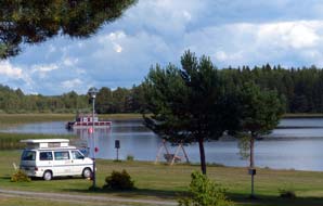
Färnebofjärdens
Camping in Färnebofjärden National Park: we
crossed the town to find Falun's ICA Maxi for a provisions stock-up; Friday
afternoon was not the time for this, with the maze-like supermarket crowded with
locals on a similar mission for weekend shopping. Leaving Falun
 eastwards on
Route E16 (click here for detailed map of route),
we turned off at Hofors onto cross-country minor roads to Färnebofjärdens Camping in Färnebofjärden
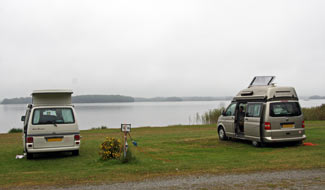
National Park. This wonderfully peaceful campsite, set on the shores of the Färnebofjärden
lake system, is kept by a Swiss couple who, as on our 2013 stay, gave us a warm welcome. We
pitched down at the lower area by the shores of the lake through which the lower Dalälven river
sluggishly meanders (Photo 4 - Färnebofjärdens Camping)
(see right).
Färnebofjärdens Camping, with its grassy camping area sloping down to the
lake-side, was a perfect setting for a day in camp tomorrow. The Dalälven is an opportunistic river: flowing down from the highlands
of Idre and Särne, where we had camped earlier in the trip, it fills the
meteorite crater forming Lake Siljan and pre-Ice Age once flowed south into Lake
Mälaren near to the modern city of Stockholm. Since the time when this course was blocked by
post-glacial moraine, the river now ambles slowly filling every depression in Färnebofjärden
National Park, making its way casually out into the Bothnian Gulf south of Gävle. eastwards on
Route E16 (click here for detailed map of route),
we turned off at Hofors onto cross-country minor roads to Färnebofjärdens Camping in Färnebofjärden
National Park. This wonderfully peaceful campsite, set on the shores of the Färnebofjärden
lake system, is kept by a Swiss couple who, as on our 2013 stay, gave us a warm welcome. We
pitched down at the lower area by the shores of the lake through which the lower Dalälven river
sluggishly meanders (Photo 4 - Färnebofjärdens Camping)
(see right).
Färnebofjärdens Camping, with its grassy camping area sloping down to the
lake-side, was a perfect setting for a day in camp tomorrow. The Dalälven is an opportunistic river: flowing down from the highlands
of Idre and Särne, where we had camped earlier in the trip, it fills the
meteorite crater forming Lake Siljan and pre-Ice Age once flowed south into Lake
Mälaren near to the modern city of Stockholm. Since the time when this course was blocked by
post-glacial moraine, the river now ambles slowly filling every depression in Färnebofjärden
National Park, making its way casually out into the Bothnian Gulf south of Gävle.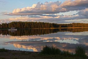
We were joined at the lake-shore camping area by another English
couple (see left), Jeff and Amanda Gafford from Chipping Norton, driving not just an
Autosleeper VW T5 Trident but, by one of life's curious coincidences, also purchased from Frank Williams at
Cotswold Motorhomes where we had
originally purchased our Autosleeper VW T4 Trooper and where we continue to enjoy excellent,
personalised service. That evening the setting sun produced a spectacular cloud
display across the lake (Photo 5 - Sunset cloud-scape)
(see right), adding further to the glory of the lakeland setting.
 Gysinge Bruk:
the following morning, with damp mist hanging dismally over the Färnebofjärden
lake-land landscape, we drove along to Gysinge Bruk,
a former estate iron foundry
dating from the 17th century. As at Ängelsberg Bruk the coincidental
presence of the 3 components necessary for iron smelting -
local supply of iron ore, fast-running water to power blast-furnace
air-pumps,
and plentiful timber for charcoal production - meant that the ironworks had
prospered. Clearly this had brought much wealth to the estate owners who had
lavished it on grandiose buildings, now housing among other features the Färnebofjärden
Visitor Centre. Here we learned more about the wildlife and topography of the
National Park and the Nedre Dalälven valley. The Öster-
and Väster-Dalälven rivers merge just south of Lake Siljan, then flow in a lazy,
ambling way through the watery Färnebofjärden meadows, fenland, and string of lakes interconnected
by rapids which once drove the water-wheels powering the furnace pumps of Gysinge
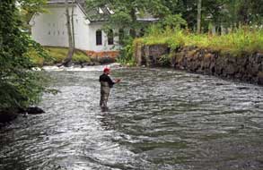
iron-works. The broad passage of Dalälven rapids still flows past the remains
of Gysinge Bruk's 19th century iron works water-wheel house (see left) (Photo
6 - Dalälven rapids at Gysinge Bruk). Gysinge Bruk:
the following morning, with damp mist hanging dismally over the Färnebofjärden
lake-land landscape, we drove along to Gysinge Bruk,
a former estate iron foundry
dating from the 17th century. As at Ängelsberg Bruk the coincidental
presence of the 3 components necessary for iron smelting -
local supply of iron ore, fast-running water to power blast-furnace
air-pumps,
and plentiful timber for charcoal production - meant that the ironworks had
prospered. Clearly this had brought much wealth to the estate owners who had
lavished it on grandiose buildings, now housing among other features the Färnebofjärden
Visitor Centre. Here we learned more about the wildlife and topography of the
National Park and the Nedre Dalälven valley. The Öster-
and Väster-Dalälven rivers merge just south of Lake Siljan, then flow in a lazy,
ambling way through the watery Färnebofjärden meadows, fenland, and string of lakes interconnected
by rapids which once drove the water-wheels powering the furnace pumps of Gysinge
iron-works. The broad passage of Dalälven rapids still flows past the remains
of Gysinge Bruk's 19th century iron works water-wheel house (see left) (Photo
6 - Dalälven rapids at Gysinge Bruk).
A comically inhospitably reception at
Sala Vandrarhem/Camping:
Route 56 was a well-engineered road through lovely forest lands of
what the Swedish botanist Carl von
Linné called the Limes Norrlandicus (Northlands boundary),
with typical north~south borderlands mixed ground
cover of both Bilberries and Lily of the Valley, but also with plentiful speed
cameras and aggressive driving standards to match as we approached the Stockholm
region (click here for detailed map of route).
Just before the road junction village of Heby, the forests ended with abrupt
suddenness and the terrain opened out to very southern farmland with ripening
cereal crops as far as the eye could see; we had truly reached Middle Sweden.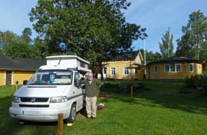 We turned westwards reaching the outskirts of Sala, and in the centre found an
ICA Kvantum with a post-office kiosk to top-up the credit on our Telia Swedish
SIM card. Amply clad Roma beggars inevitably obstructed the supermarket doorway;
such mafia organised human exploitation in the form of systematic begging is a source of
concern and irritation to even the
most liberal-minded Swedes; in a country whose citizens pay some of the highest taxation across Europe,
better regulation is accordingly expected in a law-abiding society.
 We had happy memories from our last visit to
Sala in 2013 when we had stayed at Sala Vandrarhem (hostel), with a small camping
area in the gardens behind the house. This year, a sign of the times, it was the
battered caravans of Bulgarian migrant workers that occupied the camping area.
With some reservations, we settled into a sunny corner, but on going to book in
at the hostel, we were greeted by a sour-faced, unsmiling woman: had we chosen a
place, she demanded, followed by an insistent 'You can't stop there; it isn't a
place!', pointing at George. We had apparently made the unforgivable error of
allowing half a wheel to overlap the pitch boundary. Her rule book-bound manner
became more and more obdurate and offensive, as we tried initially politely but
increasingly irritably to remonstrate. But rules were rules, and she was going
to stick by them. Her Fawlty Towers John
Cleese performance of how to
offend paying guests became so laughingly comical that irritation turned to
entertainment; ignoring her churlish behaviour (clearly not a happy bunny!), we
moved the offending wheel (and the rest of George) and settled in (Photo
7 - Sala Camping). But in her boorish zeal so clumsily to enforce her rules, she had omitted to provide keys for the facilities building.
Again we were faced with yet more unresponsive indifference: so comically
unhelpful was the femme comique's manner that even her young We had happy memories from our last visit to
Sala in 2013 when we had stayed at Sala Vandrarhem (hostel), with a small camping
area in the gardens behind the house. This year, a sign of the times, it was the
battered caravans of Bulgarian migrant workers that occupied the camping area.
With some reservations, we settled into a sunny corner, but on going to book in
at the hostel, we were greeted by a sour-faced, unsmiling woman: had we chosen a
place, she demanded, followed by an insistent 'You can't stop there; it isn't a
place!', pointing at George. We had apparently made the unforgivable error of
allowing half a wheel to overlap the pitch boundary. Her rule book-bound manner
became more and more obdurate and offensive, as we tried initially politely but
increasingly irritably to remonstrate. But rules were rules, and she was going
to stick by them. Her Fawlty Towers John
Cleese performance of how to
offend paying guests became so laughingly comical that irritation turned to
entertainment; ignoring her churlish behaviour (clearly not a happy bunny!), we
moved the offending wheel (and the rest of George) and settled in (Photo
7 - Sala Camping). But in her boorish zeal so clumsily to enforce her rules, she had omitted to provide keys for the facilities building.
Again we were faced with yet more unresponsive indifference: so comically
unhelpful was the femme comique's manner that even her young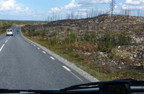 assistant
rolled his eyes in empathetic disbelief. We were still enjoying the
entertainment value of such ironically laughable inhospitality as we cooked and
eat our home made curry supper later in the evening. How long this sad soul's
employment will last is a matter of speculation! By 9-00 that evening, it was
fully dark; the combination the year moving on and our moving south was having
its impact. assistant
rolled his eyes in empathetic disbelief. We were still enjoying the
entertainment value of such ironically laughable inhospitality as we cooked and
eat our home made curry supper later in the evening. How long this sad soul's
employment will last is a matter of speculation! By 9-00 that evening, it was
fully dark; the combination the year moving on and our moving south was having
its impact.
Ängelsberg Bruk:
a low mist hung clammily over the campsite this morning, but the forecast was
good for our planned day at Ängelsberg Bruk, another of
Sweden's 19th century conserved rural ironworks. Leaving our pitch reserved, we set off westwards on Route 256 (click here for detailed map of route).
The road again showed the natural transition zone in this part of Middle Sweden
with farmland of golden-ripe wheat, some already harvested, alternating with
wilder areas of pine and spruce forest littered with glacial boulders, all
interspersed with chocolate-box villages such as Västerfärnebo. Some 40kms west,
as we turned off onto a minor road towards Ängelsberg Bruk,
the road passed through an extensive area of blasted heath severely ravaged by
forest fire: all the surviving birches were charred along with all traces of
ground vegetation, and remains of pine had been cut and stacked as piles of
blackened trunks. This was the first time we had ever seen the blackened remains
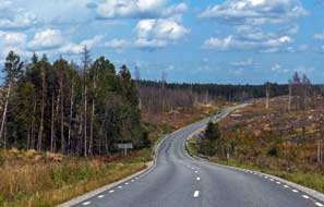
of forest fire damage in Scandinavia. We later learned from the cleaning lady at Sala hostel that the devastation had been caused by a major forest fire 2 years
ago. The fire had been started by sparks caused by a forestry machine striking a
rock; the wind had whipped up the flames which quickly spread out of control,
devastating a huge area including 25 homes, 10 of which were totally destroyed.
It was Sweden's worst ever forest fire disaster, and the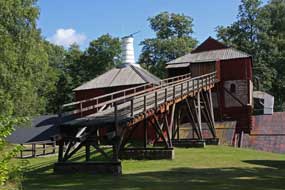 damage was still
evident 2 years later as we passed through the area (see right and above left). damage was still
evident 2 years later as we passed through the area (see right and above left).
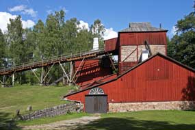
 As at Moviken and Gysinge, iron smelting had
been developed here at Ängelsberg Bruk on a nobleman's
estate during the 17~19th centuries, with improving technologies for ore
crushing and roasting and blast furnace and forge design to produce pig- and
wrought iron. But with the late 19th
century introduction of industrial scale
coal-fired Bessemer steel production, small scale charcoal-fired rural smelters
such as Ängelsberg could not compete and became uneconomical, and the Ängelsberg
Bruk was fired for the last time in 1919. The earth and timber insulated blast
furnace with its high furnace stack,
equipped with water-wheel driven heated air
blower, ore-crusher and ore roasting kiln, have
been conserved set amid the
landscaped estate as
a UNESCO World Heritage site. Today the now trimly manicured lawns and neat
chocolate-box, red-painted wooden buildings are a peaceful setting; what would
this scene have looked like at the height of its industrial production? We took
our photos from the outside of the blast furnace and ore-roasting oven in the
bright sunlight (see above left) (Photo
8 - Ängelsberg Bruk blast furnace).
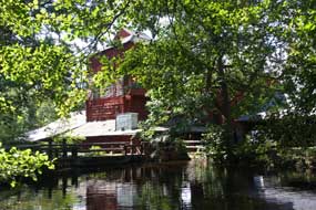
Out of season, the buildings were all locked up, but we were able to peer in at
the huge water-wheel (see left) which had powered blowers and hoists (Photo
9 - Ängelsberg Bruk iron ore hoist) (see right). At
Ängelsberg village, the earliest
crude oil distillation to produce lamp oil on an industrial scale had taken
place on Oljeön Island in Lake Amänningen in the late 19th century. As at Moviken and Gysinge, iron smelting had
been developed here at Ängelsberg Bruk on a nobleman's
estate during the 17~19th centuries, with improving technologies for ore
crushing and roasting and blast furnace and forge design to produce pig- and
wrought iron. But with the late 19th
century introduction of industrial scale
coal-fired Bessemer steel production, small scale charcoal-fired rural smelters
such as Ängelsberg could not compete and became uneconomical, and the Ängelsberg
Bruk was fired for the last time in 1919. The earth and timber insulated blast
furnace with its high furnace stack,
equipped with water-wheel driven heated air
blower, ore-crusher and ore roasting kiln, have
been conserved set amid the
landscaped estate as
a UNESCO World Heritage site. Today the now trimly manicured lawns and neat
chocolate-box, red-painted wooden buildings are a peaceful setting; what would
this scene have looked like at the height of its industrial production? We took
our photos from the outside of the blast furnace and ore-roasting oven in the
bright sunlight (see above left) (Photo
8 - Ängelsberg Bruk blast furnace).
Out of season, the buildings were all locked up, but we were able to peer in at
the huge water-wheel (see left) which had powered blowers and hoists (Photo
9 - Ängelsberg Bruk iron ore hoist) (see right). At
Ängelsberg village, the earliest
crude oil distillation to produce lamp oil on an industrial scale had taken
place on Oljeön Island in Lake Amänningen in the late 19th century.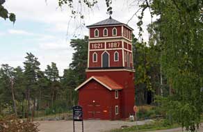
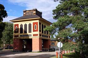 A
brief re-visit to Sala Silver Mine:
while we were over in the Ängelsberg area, it seemed worthwhile to investigate the two
mining and steel-working towns of Norberg and Fagersta. The map showed extensive
mine workings around both towns, but when we reached Norberg, this was just a modern and
insignificant place with nothing to be seen of the mines. We continued on the
busy Route 68 down to Fagersta which was an equally unimpressive town with some
modern industry but no trace of mining. Taking a back lane to Ängelsberg, we returned to Sala,
for a brief re-visit to Sala Silver Mine; see Log of our 2013 visit to Sala Silver Mine
for details of Sala's historical contribution to Sweden's economy. At this late
stage in the summer season, mine visits were limited and the place almost
deserted. At the small museum, we obtained a site plan identifying the various
features of the silver mines surface area, and set off to walk the footpath past
the Jack mine-shaft winding gear tower (see right), and around among the spoils
heaps and caved-in pit of earlier open-cast workings. This led us
past the site of the former
mining village, long-abandoned when the new town of Sala was established, and back to the impressive
winding-gear head-stocks tower of the mine's main Queen Christina shaft (Photo
10 - Sala Silver Mine Queen Christina shaft) (see above left). Before leaving Sala Silver
Mine, we paused at the early 19th century rotunda winding-gear tower and steam
engine A
brief re-visit to Sala Silver Mine:
while we were over in the Ängelsberg area, it seemed worthwhile to investigate the two
mining and steel-working towns of Norberg and Fagersta. The map showed extensive
mine workings around both towns, but when we reached Norberg, this was just a modern and
insignificant place with nothing to be seen of the mines. We continued on the
busy Route 68 down to Fagersta which was an equally unimpressive town with some
modern industry but no trace of mining. Taking a back lane to Ängelsberg, we returned to Sala,
for a brief re-visit to Sala Silver Mine; see Log of our 2013 visit to Sala Silver Mine
for details of Sala's historical contribution to Sweden's economy. At this late
stage in the summer season, mine visits were limited and the place almost
deserted. At the small museum, we obtained a site plan identifying the various
features of the silver mines surface area, and set off to walk the footpath past
the Jack mine-shaft winding gear tower (see right), and around among the spoils
heaps and caved-in pit of earlier open-cast workings. This led us
past the site of the former
mining village, long-abandoned when the new town of Sala was established, and back to the impressive
winding-gear head-stocks tower of the mine's main Queen Christina shaft (Photo
10 - Sala Silver Mine Queen Christina shaft) (see above left). Before leaving Sala Silver
Mine, we paused at the early 19th century rotunda winding-gear tower and steam
engine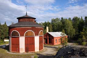 house of the Carl IX shaft, the deepest of the mine's workings at 318m.
The buildings were all locked but we clambered up onto the spoil heaps for
photographs (Photo
11 - Sala Silver Mine Carl IX shaft) (see right). house of the Carl IX shaft, the deepest of the mine's workings at 318m.
The buildings were all locked but we clambered up onto the spoil heaps for
photographs (Photo
11 - Sala Silver Mine Carl IX shaft) (see right).
 South
to Badelunda and the Anundshög Iron Age Burial Grounds:
a clear, warm night and this morning the sky was still clear with promise of a
fine day for our re-visit to Anundshög Iron Age Burial Grounds. Today we should
move considerably further south and camp tonight south of Lake Mälaren. Despite
the boss-lady's less than charming manner,
Sala Vandrarhem/Camping was still inherently a good place to camp, and we had
enjoyed our 3 day stay. We headed south from Sala on Route 256 (click here for detailed map of route)
across flat farming countryside with arable crops golden-ripe ready for
harvesting. This was a good road, alternating single/dual carriageway and light
traffic enabling us to make rapid progress towards Västerås. 6kms before the
city, we turned off onto back lanes towards Badelunda church. South
to Badelunda and the Anundshög Iron Age Burial Grounds:
a clear, warm night and this morning the sky was still clear with promise of a
fine day for our re-visit to Anundshög Iron Age Burial Grounds. Today we should
move considerably further south and camp tonight south of Lake Mälaren. Despite
the boss-lady's less than charming manner,
Sala Vandrarhem/Camping was still inherently a good place to camp, and we had
enjoyed our 3 day stay. We headed south from Sala on Route 256 (click here for detailed map of route)
across flat farming countryside with arable crops golden-ripe ready for
harvesting. This was a good road, alternating single/dual carriageway and light
traffic enabling us to make rapid progress towards Västerås. 6kms before the
city, we turned off onto back lanes towards Badelunda church.
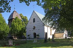
Badelunda church: Christianity came late to the tribes who farmed
these lands, who only converted around 1250 AD. The earliest parts of Badelunda
church were built in the
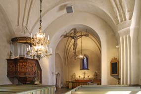 13th century, and during the Medieval period the
parish's wealth enabled the church to be extended further (see above left). The
older parts of the church were built of granite, later of brick, and since the
Reformation both the exterior and interior have been rendered, covering wall
paintings, some of which have survived in a side chapel. The church's other
feature of note is the beautiful wooden pulpit carved with figures of apostles
in the 1650s by Israel Snickare (the Carpenter) from Västerås (Photo
12 - Badelunda church) (see right). After a visit to Badelunda church, we continued along
the lane to the Anundshög Iron Age Burial Grounds where, beyond a brook and overhanging oak trees, earlier traces
of the pagan chieftains who ruled the lands along the Badelunda
ridge came into view, with stone ship-settings and burial mounds lit by the
morning sun. 13th century, and during the Medieval period the
parish's wealth enabled the church to be extended further (see above left). The
older parts of the church were built of granite, later of brick, and since the
Reformation both the exterior and interior have been rendered, covering wall
paintings, some of which have survived in a side chapel. The church's other
feature of note is the beautiful wooden pulpit carved with figures of apostles
in the 1650s by Israel Snickare (the Carpenter) from Västerås (Photo
12 - Badelunda church) (see right). After a visit to Badelunda church, we continued along
the lane to the Anundshög Iron Age Burial Grounds where, beyond a brook and overhanging oak trees, earlier traces
of the pagan chieftains who ruled the lands along the Badelunda
ridge came into view, with stone ship-settings and burial mounds lit by the
morning sun.
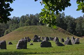 Anundshög Iron Age Burial Grounds: as early as 1,500 BC, Bronze Age
pastoralists were settling and farming around Anundshög along the Badelunda ridge which,
in those times before the land rose, stretched along the
shores of a bay, the furthest inland point of a fjord from the Baltic Sea.
As the land rose, further moraine rich fertile land emerged below
the ridge cultivated by these prehistoric agricultural peoples. Trade routes and
water courses met around the Badelunda ridge, and both archaeological finds and
the surviving grave-fields show that an important power centre ruled by powerful
clan chieftains developed here at Anundshög during the early Iron Age between
500~1050 AD. Around 500 visible graves survive, with an unknown number still
undiscovered, of varying forms - burial mounds, stone ship-settings and standing
stones. The largest is the great burial tumulus at Anundshög, Sweden's largest
at 9m high and 64m in diameter, created around the 10th Anundshög Iron Age Burial Grounds: as early as 1,500 BC, Bronze Age
pastoralists were settling and farming around Anundshög along the Badelunda ridge which,
in those times before the land rose, stretched along the
shores of a bay, the furthest inland point of a fjord from the Baltic Sea.
As the land rose, further moraine rich fertile land emerged below
the ridge cultivated by these prehistoric agricultural peoples. Trade routes and
water courses met around the Badelunda ridge, and both archaeological finds and
the surviving grave-fields show that an important power centre ruled by powerful
clan chieftains developed here at Anundshög during the early Iron Age between
500~1050 AD. Around 500 visible graves survive, with an unknown number still
undiscovered, of varying forms - burial mounds, stone ship-settings and standing
stones. The largest is the great burial tumulus at Anundshög, Sweden's largest
at 9m high and 64m in diameter, created around the 10th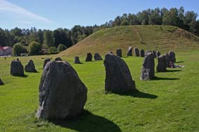 century AD. Many of the
mounds were plundered in antiquity and the Anundshög tumulus has never been
excavated. Built on a foundation of clay on which the dead were cremated along
with grave goods, the remains were covered with stones and turf to raise the
mound. The scale of the Anundshög tumulus and the numbers involved in its
construction indicate this was a mighty chieftain who controlled large tracts of
land. Around the mound were 5 large ship-settings, another form of burial
monument associated with pagan ritual. Again the scale suggests this was a
sacred cult centre. Nearby a large and ornate rune stone was raised with a line
of standing stones marking a roadway leading to a forded river crossing, century AD. Many of the
mounds were plundered in antiquity and the Anundshög tumulus has never been
excavated. Built on a foundation of clay on which the dead were cremated along
with grave goods, the remains were covered with stones and turf to raise the
mound. The scale of the Anundshög tumulus and the numbers involved in its
construction indicate this was a mighty chieftain who controlled large tracts of
land. Around the mound were 5 large ship-settings, another form of burial
monument associated with pagan ritual. Again the scale suggests this was a
sacred cult centre. Nearby a large and ornate rune stone was raised with a line
of standing stones marking a roadway leading to a forded river crossing,
 further
indicators that he who controlled communications routes and river-crossings with Anundshög at the hub was indeed a powerful chieftain. The names of these rulers
and their power centre are unknown, but the burial site is now referred to by
its later Medieval name of Anundshög, the burial mound of Anund the chieftain's
legendary name. By Medieval times and the conversion to Christianity, the pagan
ship-settings were overturned and the rune stone torn down in an attempt to
obliterate the pagan past. A more settled agricultural society developed at
Anundshög and the former chieftain's territories divided up, with the sacred
burial site becoming a meeting place for the local Thing, the district
court which met to resolve disputes. Badelunda church was built in the 13th
century, its scale again indicating that this was still an affluent farming
community. further
indicators that he who controlled communications routes and river-crossings with Anundshög at the hub was indeed a powerful chieftain. The names of these rulers
and their power centre are unknown, but the burial site is now referred to by
its later Medieval name of Anundshög, the burial mound of Anund the chieftain's
legendary name. By Medieval times and the conversion to Christianity, the pagan
ship-settings were overturned and the rune stone torn down in an attempt to
obliterate the pagan past. A more settled agricultural society developed at
Anundshög and the former chieftain's territories divided up, with the sacred
burial site becoming a meeting place for the local Thing, the district
court which met to resolve disputes. Badelunda church was built in the 13th
century, its scale again indicating that this was still an affluent farming
community.
We parked at the café, we
set off to explore the
Anundshög burial mounds site. It was a lovely bright
sunny morning with good light for photographing these remarkable 1,500 year old remains from
under the oak trees bordering the site, looking along the length of the
ship-settings towards the great tumulus (Photo
13 - Anundshög burial mounds) (see above left). Clearly the burial site's
now almost parklands setting was a popular picnic spot for local school
children with the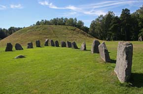 youngsters running around the standing stones and clambering
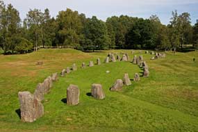
over Anund's burial mound. The main tumulus was huge and surrounded by 4 of the original 5 ship-settings now fully restored. The 2 largest, over 50m in length with stones
1m high, stood end to end leading to the tumulus with several other burial
mounds nearby. We walked among the stones of the ship-settings taking our photos
(see right) (Photo
14 - Anundshög stone ship-setting), and followed the line of
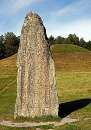
standing stones which marked the Iron Age highway of 'royal road' leading from
the forded brook along to a 2.5m high monolithic rune stone, erected in the late 10th century by a wealthy
clan leader to mark out his establishment of the road and control of local
communications routes; in translation the runic
inscription reads: Folkvid raised these stones in memory of his son Heden,
brother of Anund; Vred carved the runes. youngsters running around the standing stones and clambering
over Anund's burial mound. The main tumulus was huge and surrounded by 4 of the original 5 ship-settings now fully restored. The 2 largest, over 50m in length with stones
1m high, stood end to end leading to the tumulus with several other burial
mounds nearby. We walked among the stones of the ship-settings taking our photos
(see right) (Photo
14 - Anundshög stone ship-setting), and followed the line of
standing stones which marked the Iron Age highway of 'royal road' leading from
the forded brook along to a 2.5m high monolithic rune stone, erected in the late 10th century by a wealthy
clan leader to mark out his establishment of the road and control of local
communications routes; in translation the runic
inscription reads: Folkvid raised these stones in memory of his son Heden,
brother of Anund; Vred carved the runes.
 Clearly this was a powerful lord
who set up this imposing monument to tell the world for all time of his son, his
road, and himself. Vred was a skilful rune carver and produced an elegant
pictorial design of unknown significance around which the runic dedication is
inscribed. We photographed this imposing monument against the backdrop of the
great tumulus (see above left) (Photo
15 - Folkvid's rune stone). Clearly this was a powerful lord
who set up this imposing monument to tell the world for all time of his son, his
road, and himself. Vred was a skilful rune carver and produced an elegant
pictorial design of unknown significance around which the runic dedication is
inscribed. We photographed this imposing monument against the backdrop of the
great tumulus (see above left) (Photo
15 - Folkvid's rune stone).
Since our 2013 visit, a wooden walkway had been
built on the hidden back side of the burial mound to prevent further erosion on
the outer faces as people inevitably climbed the tumulus. The top of the Anundshög
burial mound gave a bird's eye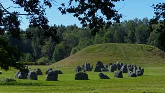 overview across the outline of the two end-on-end ship-settings (see left) (Photo
16 - Anundshög ship-settings) and of this magnificent ensemble of Iron Age burial
monuments, so beautifully restored in this parkland setting at Anundshög. The topography of Anundshög, the archaeological
finds of a Bronze Age landing-stage at the edge of the fjord-inlet which once
extended to the foot of the Badelunda ridge, now arable land following
land-rise, the burial mounds and memorials of Iron Age chieftains, and finally
Badelunda church built and extended during Christianised Medieval times, taken
together displayed a remarkable continuum of 3,500 years of human settlement here
at Anundshög, all set out before our eyes. And in today's bright sunshine, it
presented a memorable historic time-line picture (see right).
 Further prehistoric monuments along
Badelunda ridge: we drove
around the southern side of the site looking out across now flat arable farmland
where once an inlet from the sea would have lapped the shore-line of the bay
farmed by the original settlers. The modern road now cut through the line of the
Badelunda ridge, and we walked up through the delightful woodland of the ridge
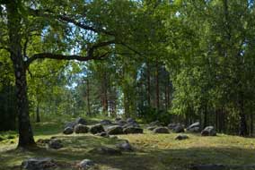
among a series of smaller burial mounds. The woodlands showed the classic
north~south mix of pines and birches along with oak and alder, with Lily of the
Valley covering the woodland floor, the leaves now turning autumnal yellow and
with their orange berries (Photo
17 - Autumnal Lily of Valley) (see left); it is one of nature's bizarre quirks that a
plant bearing such attractively delicate and sweet-smelling flowers in
spring can produce such fatally poisonous berries in autumn. Around in the
quaint little hamlet of Tibble, the ridge contained another historical relic, a
Medieval maze just visible by its raised lines on the woodland floor. Beyond
affluent looking stable blocks, the lane led round to the Grytahögen burial
mound standing rather neglected at the edge of a housing estate in the outer
suburbs of Västerås. Further prehistoric monuments along
Badelunda ridge: we drove
around the southern side of the site looking out across now flat arable farmland
where once an inlet from the sea would have lapped the shore-line of the bay
farmed by the original settlers. The modern road now cut through the line of the
Badelunda ridge, and we walked up through the delightful woodland of the ridge
among a series of smaller burial mounds. The woodlands showed the classic
north~south mix of pines and birches along with oak and alder, with Lily of the
Valley covering the woodland floor, the leaves now turning autumnal yellow and
with their orange berries (Photo
17 - Autumnal Lily of Valley) (see left); it is one of nature's bizarre quirks that a
plant bearing such attractively delicate and sweet-smelling flowers in
spring can produce such fatally poisonous berries in autumn. Around in the
quaint little hamlet of Tibble, the ridge contained another historical relic, a
Medieval maze just visible by its raised lines on the woodland floor. Beyond
affluent looking stable blocks, the lane led round to the Grytahögen burial
mound standing rather neglected at the edge of a housing estate in the outer
suburbs of Västerås.
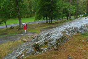 Aggressive driving standards around Västerås: having spent such a
peaceful time exploring the historical setting of the Anundshög burial
grounds, we now had to turn our attention to more mundane matters, and we turned
into the huge car park of an out-of-town commercial park to shop for provisions
at an ICA Maxi. Driving standards around Västerås were some of the most viciously
aggressive of any Swedish cities we had experienced, an indication of city
affluence and the fact that we were now within an hour's drive of the capital.
We joined E18 motorway westwards in speeding afternoon traffic seeing signs of
the ABB heavy engineering works as we drove past Västerås (click here for detailed map of route). Road works lane
closures at one intersection slowed the impatiently jostling urban traffic, but
we
were soon moving again, and past the city reached open countryside. The bright
sun was now fearsomely hot and glaring, adding further to stressful driving
conditions in heavy, speeding traffic. Thankful to turn off the motorway, we
joined Route 56 southwards to cross the narrows of Lake Mälaren at Kviksund, and
just beyond turned east again on E20 motorway to Eskilstuna, passing a large
Volvo assembly plant. Just north of Eskilstuna, we turned off again crossing
flat agricultural countryside towards the southern shore of Mälaren. Aggressive driving standards around Västerås: having spent such a
peaceful time exploring the historical setting of the Anundshög burial
grounds, we now had to turn our attention to more mundane matters, and we turned
into the huge car park of an out-of-town commercial park to shop for provisions
at an ICA Maxi. Driving standards around Västerås were some of the most viciously
aggressive of any Swedish cities we had experienced, an indication of city
affluence and the fact that we were now within an hour's drive of the capital.
We joined E18 motorway westwards in speeding afternoon traffic seeing signs of
the ABB heavy engineering works as we drove past Västerås (click here for detailed map of route). Road works lane
closures at one intersection slowed the impatiently jostling urban traffic, but
we
were soon moving again, and past the city reached open countryside. The bright
sun was now fearsomely hot and glaring, adding further to stressful driving
conditions in heavy, speeding traffic. Thankful to turn off the motorway, we
joined Route 56 southwards to cross the narrows of Lake Mälaren at Kviksund, and
just beyond turned east again on E20 motorway to Eskilstuna, passing a large
Volvo assembly plant. Just north of Eskilstuna, we turned off again crossing
flat agricultural countryside towards the southern shore of Mälaren.
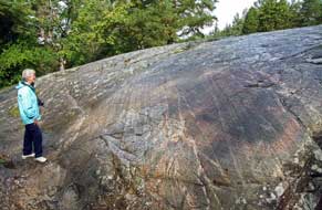 The Ramsund Sigurd legend
rock-engraving:
the sun was still wearyingly glaring as we reached the insignificant little
turning down to the site of the Ramsund Sigurd legend rock-engraving. Our eyes
were still blinded by the afternoon sun's dazzling glare as we were suddenly
pitched into the contrasting darkness of the mysterious little wooded
grove that seemed to act as almost a portal between the brash, busy,
traffic-ridden 21st century world outside and the 11th century AD world of the
powerful Lady Sigriðr who commissioned the rock panel pictorial engraving
showing the legend of Sigurd Fafnesbane in celebratory dedication to her late
husband Sigrøðr and the bridge she had caused to be built across the river here at Ramsund.
Having crossed what is now just a brook on a modern narrow bridge into a tree-lined clearing to a
parking place, there above in the woodland on a large bed-rock panel was the 5m long, 2m high Sigurd engraving (see above right). Carved around 1,030 AD, the engraving takes the form of a commemorative
runic inscription shaped within a curving ribbon forming a dragon's body and
enclosing a panel of pictorial engraving illustrating the central story of the
legend of Sigurd (Sigfried) (Photo
18 - Ramsund Sigurd legend rock-engraving). The legend of the heroic dragon-slayer, of golden
treasure and a cursed ring occurs from time immemorial across Europe: the
hero's adventures figure in the English epic Beowulf, in the Icelandic Edda
Sagas of Snorri Sturluson and the Germanic Nibelungenlied epic saga borrowed by Wagner in
the Ring Cycle operas; it was also heavily plagiarised by JRR Tolkien in the Hobbit
and The Ramsund Sigurd legend
rock-engraving:
the sun was still wearyingly glaring as we reached the insignificant little
turning down to the site of the Ramsund Sigurd legend rock-engraving. Our eyes
were still blinded by the afternoon sun's dazzling glare as we were suddenly
pitched into the contrasting darkness of the mysterious little wooded
grove that seemed to act as almost a portal between the brash, busy,
traffic-ridden 21st century world outside and the 11th century AD world of the
powerful Lady Sigriðr who commissioned the rock panel pictorial engraving
showing the legend of Sigurd Fafnesbane in celebratory dedication to her late
husband Sigrøðr and the bridge she had caused to be built across the river here at Ramsund.
Having crossed what is now just a brook on a modern narrow bridge into a tree-lined clearing to a
parking place, there above in the woodland on a large bed-rock panel was the 5m long, 2m high Sigurd engraving (see above right). Carved around 1,030 AD, the engraving takes the form of a commemorative
runic inscription shaped within a curving ribbon forming a dragon's body and
enclosing a panel of pictorial engraving illustrating the central story of the
legend of Sigurd (Sigfried) (Photo
18 - Ramsund Sigurd legend rock-engraving). The legend of the heroic dragon-slayer, of golden
treasure and a cursed ring occurs from time immemorial across Europe: the
hero's adventures figure in the English epic Beowulf, in the Icelandic Edda
Sagas of Snorri Sturluson and the Germanic Nibelungenlied epic saga borrowed by Wagner in
the Ring Cycle operas; it was also heavily plagiarised by JRR Tolkien in the Hobbit
and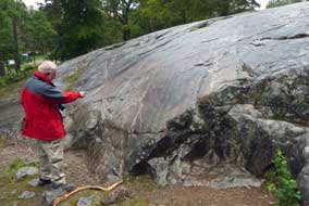 Lord of the Rings. Lord of the Rings.
The tortuous legend of Sigurd
Fafnesbane (Siegfried the Dragon-Slayer) goes like this: once upon a time, an
ancient magician named Rodmar had 3 sons, each with remarkable powers. The first
son Otr was able to take on the shape of an otter when fishing for salmon; one
of the Norse gods Loki happened to be passing and threw a rock at the otter
killing it. Rodmar the father was mightily angered by this and demanded that the
god make recompense for killing his son by filling the otter skin with golden
treasure as atonement. To find due treasure, Loki used his net to catch the
dwarf Andvari who had taken the shape of a pike swimming in the rapids. The
dwarf purchased his freedom with all the gold he possessed except for one gold
ring; when Loki ripped the ring from his finger, the dwarf placed a curse upon
all who came into contact with the treasure. Once Rodmar received the gold as
payment for Otr's killing, the curse brought greed upon him, causing him to
resent sharing the treasure with his other 2 surviving sons Fafnir and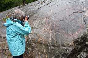 Regin. Fafnir
became so enraged that he killed his father to get his hands on all the gold,
and taking on the form of a snake-like dragon, he went to brood at a place
called Gnitaheden curled up on his pile of gold. The curse of the ring
continued: Regin, the third son and a skilful blacksmith, wanted his share of the patrimony and
planned to seize the treasure by trickery. He shared his plans with Sigurd whom
he had earlier adopted as his step-son, forging him a razor-sharp sword called
Gram. Urged on by Regin, Sigurd dug a trapping-pit near to where Fafnir in the
form of a dragon had slithered down to a lake to drink. Fafnir falls into the
trap and Sigurd stabs him to death with his sword Gram, so gaining the honorific
of Fafnesbane (Slayer of Fafnir). Sigurd cuts up the dragon, but in roasting its
heart on an open fire he burns his hand. Sucking his finger to soothe the burn,
he tastes the dragon's blood and instantly acquires the power to understand the
prophetic songs of birds sitting in a nearby tree; they warn Sigurd of Regin's
evil plans to kill him and seize the treasure for himself. The birds advise
Sigurd to strike first and to kill Regin. Sigurd cuts off Regin's head to escape
his future evil thoughts; he returns to Fafnir's lair and loads all the
treasure onto his faithful horse Grani, a direct descendent of Odin's horse
Sleipnir. The legend continues with the misfortunes which the treasure later
brings to Sigurd and his ill-fated family. Regin. Fafnir
became so enraged that he killed his father to get his hands on all the gold,
and taking on the form of a snake-like dragon, he went to brood at a place
called Gnitaheden curled up on his pile of gold. The curse of the ring
continued: Regin, the third son and a skilful blacksmith, wanted his share of the patrimony and
planned to seize the treasure by trickery. He shared his plans with Sigurd whom
he had earlier adopted as his step-son, forging him a razor-sharp sword called
Gram. Urged on by Regin, Sigurd dug a trapping-pit near to where Fafnir in the
form of a dragon had slithered down to a lake to drink. Fafnir falls into the
trap and Sigurd stabs him to death with his sword Gram, so gaining the honorific
of Fafnesbane (Slayer of Fafnir). Sigurd cuts up the dragon, but in roasting its
heart on an open fire he burns his hand. Sucking his finger to soothe the burn,
he tastes the dragon's blood and instantly acquires the power to understand the
prophetic songs of birds sitting in a nearby tree; they warn Sigurd of Regin's
evil plans to kill him and seize the treasure for himself. The birds advise
Sigurd to strike first and to kill Regin. Sigurd cuts off Regin's head to escape
his future evil thoughts; he returns to Fafnir's lair and loads all the
treasure onto his faithful horse Grani, a direct descendent of Odin's horse
Sleipnir. The legend continues with the misfortunes which the treasure later
brings to Sigurd and his ill-fated family.
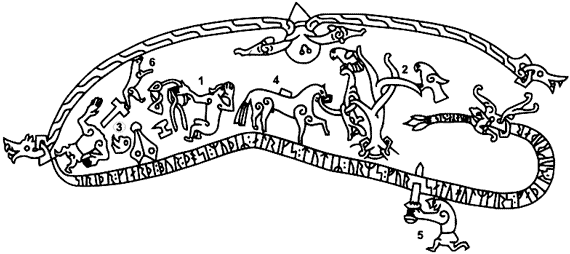 So
how come the ancient legend of Sigurd Fafnesbane was reproduced in the 11th
century AD as pictograms surrounded by a commemorative runic inscription carved into the coils
of the dragon's body? The runes on the Ramsund engraving translate
as: Sigriðr, mother of Alríkr and daughter of Ormr, built this bridge in
memory of the soul of Holmgeirr, father of her husband Sigrøðr Perhaps
it was the similarity of names between the aristocratic Sigriðr and her late husband
Sigroðr that caused the choice of the Sigurd legend pictograms, in order to glorify
the family's status by association with the legendary hero Sigurd. We know from
other dedicatory rune stones that it was not uncommon at this time for aristocratic families to enhance their prestige by building public works such as roads or
bridges to honour deceased relatives. This was the time of transition from the
old pagan religion to the new Christianity which sought to secure standing in
the local community by sponsoring such public works in exchange for indulgences,
forgiveness of sins as guarantee of passage to heaven. Just below the Ramsund rock panel,
remains of a stone roadway and abutments of the bridge which had once spanned the river, and which the inscription celebrated, were still visible. In the 11th century, water levels of the river
were some 12 feet higher than the insignificant brook of today. So
how come the ancient legend of Sigurd Fafnesbane was reproduced in the 11th
century AD as pictograms surrounded by a commemorative runic inscription carved into the coils
of the dragon's body? The runes on the Ramsund engraving translate
as: Sigriðr, mother of Alríkr and daughter of Ormr, built this bridge in
memory of the soul of Holmgeirr, father of her husband Sigrøðr Perhaps
it was the similarity of names between the aristocratic Sigriðr and her late husband
Sigroðr that caused the choice of the Sigurd legend pictograms, in order to glorify
the family's status by association with the legendary hero Sigurd. We know from
other dedicatory rune stones that it was not uncommon at this time for aristocratic families to enhance their prestige by building public works such as roads or
bridges to honour deceased relatives. This was the time of transition from the
old pagan religion to the new Christianity which sought to secure standing in
the local community by sponsoring such public works in exchange for indulgences,
forgiveness of sins as guarantee of passage to heaven. Just below the Ramsund rock panel,
remains of a stone roadway and abutments of the bridge which had once spanned the river, and which the inscription celebrated, were still visible. In the 11th century, water levels of the river
were some 12 feet higher than the insignificant brook of today.
The Ramsund inscription and
pictogram is reproduced above right: Sigurd is pictured sitting by the fire roasting
the dragon Fafnir's heart (1) which drips with blood; his horse Grani loaded with the
cursedly fateful treasure (4) is shown tethered to a tree on which stand the birds (2) whose
prophetic song warning of Regin's treachery Sigurd now understands having sucked
his burnt finger and tasted the dragon's magic blood; Regin's body (3) whom
Sigurd has just killed lies with his severed head among his blacksmith's tools
(bellows, anvil, hammer and pincers) (Photo
18 - Sigurd legend pictogram - 1) above all this stands Otr, the first
brother whose death at the hands of the god Loki had started all the woes (6);
and below, Sigurd is shown stabbing Fafnir, Regin's dragon-brother, with his
sword Gran (5) which penetrates the dragon's coil on which Sigriðr's dedicatory
runic inscription is carved in honour of the bridge she has built
(Photo
20 - Sigurd legend pictogram - 2).
We pulled into the parking area and walked up to the engraving. With sunlight filtering down through the trees,
the woodland setting added a
mystical aura to this remarkably preserved monument. We spent an hour examining
closely both the pictogram and the lines of runic inscription contained within
the Dragon coils. Knowing the translation enabled us to interpret at least the
runes forming the names of Sigriðr and her husband Sigrøðr. This wonderful
inscription, celebrating Sigriðr's donation of her bridge, and enhancing her
family's standing in her community by association with the Sigurd
legend, remains a timeless monument. It has stood amid the oaks of this
beautiful woodland grove at Ramsund overlooking the brook, by the remains of the bridge it
commemorated, for more than 1,000 years; long may it survive, despite the
careless way in which modern families indifferently allow their children to
scramble all over it.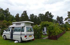
Sundbyholms Camping:
we had selected tonight's campsite, Sundbyholms Camping, because it was literally just around the corner from the Ramsund rock engraving, but knew
nothing of it other than that it was close to beaches on the southern shore of Lake Mälaren; for this reason, and because of its proximity to
Stockholm, it would in the height of summer attract the holiday-making 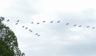 hoards. We drove past an enormous lake-side parking area, hoping the campsite
would not be similarly overrun in late August. First impressions were not
encouraging: a large site ranged over a number of areas and seemingly filled
totally with statics except a small, flat grassy area for visitors. The
reception was locked but a phone call brought the owner's daughter who greeted
us with a friendly, welcoming smile which immediately dispelled our misgivings.
For the site's location close to Mälaren, the price was reasonable at 230kr
including good site-wide wi-fi and first class facilities. We selected
a pitch alongside one of the empty statics, and with the evening sun still
shining brightly, settled in (see left). The following morning, with the
sky overcast and air chill, a flock of geese flew over (see right). Contrary to
expectations, Sundbyholms Camping had served us well as a useful staging camp in
this region of Central Sweden, but on the strict proviso of early or late season
only; in the main body of summer, it would be overwhelmed with holiday-makers
judging by the lavishly materialistic bad taste of the surrounding statics. hoards. We drove past an enormous lake-side parking area, hoping the campsite
would not be similarly overrun in late August. First impressions were not
encouraging: a large site ranged over a number of areas and seemingly filled
totally with statics except a small, flat grassy area for visitors. The
reception was locked but a phone call brought the owner's daughter who greeted
us with a friendly, welcoming smile which immediately dispelled our misgivings.
For the site's location close to Mälaren, the price was reasonable at 230kr
including good site-wide wi-fi and first class facilities. We selected
a pitch alongside one of the empty statics, and with the evening sun still
shining brightly, settled in (see left). The following morning, with the
sky overcast and air chill, a flock of geese flew over (see right). Contrary to
expectations, Sundbyholms Camping had served us well as a useful staging camp in
this region of Central Sweden, but on the strict proviso of early or late season
only; in the main body of summer, it would be overwhelmed with holiday-makers
judging by the lavishly materialistic bad taste of the surrounding statics.
Long journey south to Motala and the Göta
Canal: on the southern side of Eskilstuna, we picked up
Route 214, a narrow winding road, to begin today's 200kms drive south to Motala
(click here for detailed map of route).
At the eastern end of Lake Hjälmaren, we passed under what appeared to be the
high concrete pylons of a former aerial cable-way spanning the road. The map
showed this to stretch for almost 100kms northwards across the extensive body of
water to the distant town of Köping where it seemed to link with a spur of
railway line; there was no indication of
 what its origins were or whether this
had once been a mining region. Route 214 passed along the southern shore of Lake Hjälmaren, the broad spread of water extending westwards to Örebro whose castle
had once guarded the Swedish realm against Danish incursion. We now joined Route
52, a much busier road heading towards Örebro, and just beyond the small town of
Kumla turned off onto the E20 motorway SW-wards for one junction before turning
off again onto Route 50. We now encountered road works, major excavations to
remove huge areas of rock to widen this stretch what its origins were or whether this
had once been a mining region. Route 214 passed along the southern shore of Lake Hjälmaren, the broad spread of water extending westwards to Örebro whose castle
had once guarded the Swedish realm against Danish incursion. We now joined Route
52, a much busier road heading towards Örebro, and just beyond the small town of
Kumla turned off onto the E20 motorway SW-wards for one junction before turning
off again onto Route 50. We now encountered road works, major excavations to
remove huge areas of rock to widen this stretch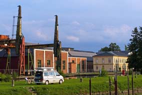 of road, but fortunately not
impeding the busy flow of traffic. The greater hazards were slow-moving caravans
and heavy trucks and the aggressive driving standards and tail-gating of car
drivers trying to overtake on the narrow, winding road. Beyond the road works,
improved road led down to the innermost north-eastern corner of the inland sea
of Lake Vättern and for a short distance the road ran along its shore-line. But
then more serious re-surfacing work began which brought the busy traffic to a
complete standstill with a 4km tail-back. We were clearly now travelling through
mining country, passing signs to Zinkgruvan (literally meaning Zinc Mine),
a massive area of deep underground mining operations extracting zinc, copper and
lead. The weather had been grey and gloomy for most of today's drive, but as we
approached Motala the sky was beginning to clear. of road, but fortunately not
impeding the busy flow of traffic. The greater hazards were slow-moving caravans
and heavy trucks and the aggressive driving standards and tail-gating of car
drivers trying to overtake on the narrow, winding road. Beyond the road works,
improved road led down to the innermost north-eastern corner of the inland sea
of Lake Vättern and for a short distance the road ran along its shore-line. But
then more serious re-surfacing work began which brought the busy traffic to a
complete standstill with a 4km tail-back. We were clearly now travelling through
mining country, passing signs to Zinkgruvan (literally meaning Zinc Mine),
a massive area of deep underground mining operations extracting zinc, copper and
lead. The weather had been grey and gloomy for most of today's drive, but as we
approached Motala the sky was beginning to clear.
Hospitable Mallbodens Camping Aire, wonderfully located on the banks of the Göta Canal at
Motala:
crossing the high-arching bridge where the Göta Canal and natural river of
Motala Ström flowed into Lake Vättern, we turned off into the southern outskirts
of the canal port of Motala. Motala had developed around the Canal, designed as
a new town by the canal builder Baltzar von Platen with a fan-shaped array of
streets so that residents
 could look down onto the Canal. Just along from the
marina, we hurried past Motala Södra Hamn Ställplats (Camping Aire), inevitably
filled to the brim with camping-cars lined up in sordid rows like sardines in a
tin (certainly not the overcrowded environment nor company for us!). Through the little town
we headed towards our preferred camping option of Mallbodens Café/Hostel which had a canal-side camping aire. Mallbodens possessed
a unique advantage which its web site emphasised: its access route was protected
by a 2.9m limited height railway bridge, serving as a major deterrent to the
scourge of massed camping-cars incursion. We followed the narrow
streets winding down towards the Canal, and there ahead was the seemingly
formidable obstacle of the low clearance bridge. But of course at 2.1m height,
George sailed under without difficulty, and down Järnvägsgatan could look down onto the Canal. Just along from the
marina, we hurried past Motala Södra Hamn Ställplats (Camping Aire), inevitably
filled to the brim with camping-cars lined up in sordid rows like sardines in a
tin (certainly not the overcrowded environment nor company for us!). Through the little town
we headed towards our preferred camping option of Mallbodens Café/Hostel which had a canal-side camping aire. Mallbodens possessed
a unique advantage which its web site emphasised: its access route was protected
by a 2.9m limited height railway bridge, serving as a major deterrent to the
scourge of massed camping-cars incursion. We followed the narrow
streets winding down towards the Canal, and there ahead was the seemingly
formidable obstacle of the low clearance bridge. But of course at 2.1m height,
George sailed under without difficulty, and down Järnvägsgatan
 (Railway Street),
we turned along the narrow unsurfaced lane by the canal-side leading to Mallbodens Café/Hostel. At the café, we received a warmly welcoming and helpful
greeting from the owners Ann and Isak, and the reasonable price of 200kr
included wi-fi internet extending across to the canal-side camping area, WC/showers (no kitchen/wash-up) for campers, and entry
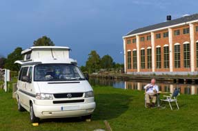
to the canal historical exhibitions just along the embankment. The delightful
camping area with just 3 pitches was sandwiched along the wide, grassy canal
embankment between the canal-side and former dry-dock where canal boats were
once repaired (see above left)
(Photo
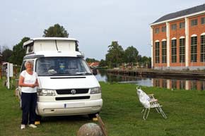
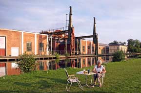
21 - Mallbodens Camping on banks of Göta Canal). The embankment on the opposite side of the canal was dominated by
the industrial complex of the former Canal Workshops (Motala Verkstad), now
restored as a museum, with its huge gantry crane that in its working days raised
and lowered boats from the canal (see above left) (Photo
22 - Motala Verkstad). It was a charmingly unique setting (see above
right). And (Railway Street),
we turned along the narrow unsurfaced lane by the canal-side leading to Mallbodens Café/Hostel. At the café, we received a warmly welcoming and helpful
greeting from the owners Ann and Isak, and the reasonable price of 200kr
included wi-fi internet extending across to the canal-side camping area, WC/showers (no kitchen/wash-up) for campers, and entry
to the canal historical exhibitions just along the embankment. The delightful
camping area with just 3 pitches was sandwiched along the wide, grassy canal
embankment between the canal-side and former dry-dock where canal boats were
once repaired (see above left)
(Photo
21 - Mallbodens Camping on banks of Göta Canal). The embankment on the opposite side of the canal was dominated by
the industrial complex of the former Canal Workshops (Motala Verkstad), now
restored as a museum, with its huge gantry crane that in its working days raised
and lowered boats from the canal (see above left) (Photo
22 - Motala Verkstad). It was a charmingly unique setting (see above
right). And
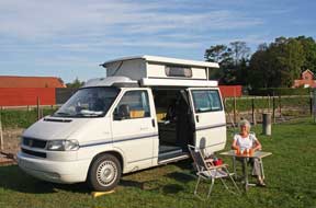
 best of all, not a
camping-car in sight, all deterred by the barrier of 2.9m limited height bridge! We
brought George round, carefully positioning ourselves on the embankment, and sat
out by the canal with the afternoon sun casting a golden light over this
remarkable of camp spots on the banks of the Göta Canal (see above left). The evening grew dusky
and darkness fell quickly; you just had take care walking along the embankment
to the facilities to avoid falling into the canal or dry dock! best of all, not a
camping-car in sight, all deterred by the barrier of 2.9m limited height bridge! We
brought George round, carefully positioning ourselves on the embankment, and sat
out by the canal with the afternoon sun casting a golden light over this
remarkable of camp spots on the banks of the Göta Canal (see above left). The evening grew dusky
and darkness fell quickly; you just had take care walking along the embankment
to the facilities to avoid falling into the canal or dry dock!
Exploring the locks of the central Göta Canal: the sun was up early
in a clear sky; it was going to be a very hot day. We breakfasted outside on the
canal bank (Photo
23 - Breakfast by Göta Canal) (see above right) as a group of yachts passed by along the canal (Photo
24 - Yachts on Göta Canal) (see left and right). It was a glorious morning in such a unique setting
on our canal-side pitch in the sunshine. Before setting out today for our
exploration of the locks of the central Göta Canal, we took the opportunity to
visit the historical exhibitions, set out in 2 old wooden warehouses just along
from Mallbodens Café, describing the Canal's construction and those responsible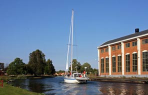 for its design. On a sunny morning, the Canal Workshops which von Platen had
founded to supply equipment for his canal were reflected in the still waters (Photo
25- Motala Workshops).
Construction of the Göta
(pronounced Yerta) Canal was one of Sweden's greatest civil engineering
projects (Click
here for map of the Göta Canal), 190kms in length across the southern width of the country, connecting the Baltic
near Stockholm with Göteborg on the North Sea, via Lakes Vättern and Vänern, the Trollhätten Canal and Göta River. The Canal was constructed between 1810~32
and designed by Baltzar von Platen; much of the technical
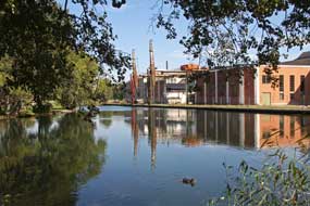 expertise and
equipment came from Britain, and the canal building company received consultancy
advice from the English civil engineer and canal builder Thomas Telford. Some
60,000 conscripted troops were involved in construction of the 87 kms of canal
which was cut by hand using primitive metal covered wooden spades to create
the navigable channel linking the series of natural lakes. A total of 58
sets of locks were built to overcome the height difference between sea level and the
canal's highest point of 91.8m at Lake Viken. Prior to the turn of the 19th
century, canal construction used the wet-digging technique following as far as
possible natural water courses and building dams to excavate and enlarge them.
With a larger workforce for such a major project however, the construction of
the Göta Canal used the newer dry-digging technology, following
the terrain's natural contour profile, and grouping locks into flights to raise
or lower the line of the canal. The Canal was officially opened on 26 September
1832 by King Carl XIV Johan, continuing expertise and
equipment came from Britain, and the canal building company received consultancy
advice from the English civil engineer and canal builder Thomas Telford. Some
60,000 conscripted troops were involved in construction of the 87 kms of canal
which was cut by hand using primitive metal covered wooden spades to create
the navigable channel linking the series of natural lakes. A total of 58
sets of locks were built to overcome the height difference between sea level and the
canal's highest point of 91.8m at Lake Viken. Prior to the turn of the 19th
century, canal construction used the wet-digging technique following as far as
possible natural water courses and building dams to excavate and enlarge them.
With a larger workforce for such a major project however, the construction of
the Göta Canal used the newer dry-digging technology, following
the terrain's natural contour profile, and grouping locks into flights to raise
or lower the line of the canal. The Canal was officially opened on 26 September
1832 by King Carl XIV Johan, continuing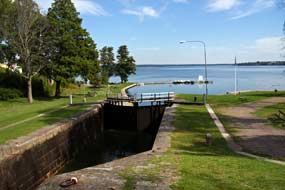 in use throughout the 19th century for
the transport of both export goods and
passengers, and today is still in regular use for pleasure boats. But von Platen
did not live to see the canal he had conceived; he died in 1829 just 3 years
before the canal's completion and is buried in the family grave at Motala on the
banks of his Canal. in use throughout the 19th century for
the transport of both export goods and
passengers, and today is still in regular use for pleasure boats. But von Platen
did not live to see the canal he had conceived; he died in 1829 just 3 years
before the canal's completion and is buried in the family grave at Motala on the
banks of his Canal.
We drove along the canal-side lane for our day of
exploration of the central Göta Canal and its locks (Click
here for map of the central Göta Canal locks), beginning at the flight of 5 locks at Borenshult which raise the canal 15m from the level of
Lake Boren. This was a beautifully peaceful setting on
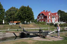 a sunny morning standing
by the top lock by the former lock-keeper's cottage (now a private house but
still bearing the name Borenshult) (Photo
26 - Borenshult locks) and gazing down the flight of locks to
the canal basin at the western end of Lake Boren (see right). We continued along
northern shore of Lake Boren and turned off the busy Route 34 into the little
canal port-town of Borensberg (pronouncede Bou-rens-ber-ye). The
ställplats (camping-aire) at Borensberg, recalled from our 2013 visit as a
peaceful setting by the canal basin, was today a hideous sight contaminated with
a log-jam of camping-cars (sign of the times), certainly not the environment nor company
we should choose to camp in. Across by the lifting bridge, the single
regulating-lock set against the backdrop of the classic canal-side Borensberg
Hotel was a scene of pure tranquillity (see left) (Photo
27 - Borensberg lock). Borensberg is the only remaining hand-operated
lock on the entire canal; with only a height difference of 0.2m, the lock's
purpose is purely to regulate Lake Boren's variable
water levels. a sunny morning standing
by the top lock by the former lock-keeper's cottage (now a private house but
still bearing the name Borenshult) (Photo
26 - Borenshult locks) and gazing down the flight of locks to
the canal basin at the western end of Lake Boren (see right). We continued along
northern shore of Lake Boren and turned off the busy Route 34 into the little
canal port-town of Borensberg (pronouncede Bou-rens-ber-ye). The
ställplats (camping-aire) at Borensberg, recalled from our 2013 visit as a
peaceful setting by the canal basin, was today a hideous sight contaminated with
a log-jam of camping-cars (sign of the times), certainly not the environment nor company
we should choose to camp in. Across by the lifting bridge, the single
regulating-lock set against the backdrop of the classic canal-side Borensberg
Hotel was a scene of pure tranquillity (see left) (Photo
27 - Borensberg lock). Borensberg is the only remaining hand-operated
lock on the entire canal; with only a height difference of 0.2m, the lock's
purpose is purely to regulate Lake Boren's variable
water levels.
We drove on to where Route 34 is bridged by an
aqueduct carrying the canal over the modern road (see below left). Pulling into the
well-appointed picnic area, we walked along and up to the towpath alongside the
canal across the aqueduct
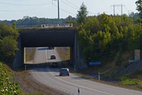 (see right). Standing on the aqueduct towpath
above the road, there was little sense of anything but the continuum of the
canal (Photo
28 - Göta Canal Aqueduct). Along this stretch, the natural water course of the Motala Ström followed
a parallel route to the canal, flowing through the sluggishly shallow Norrbysjön
Lake (Göta Canal map).
The canal builders, using the new dry-digging method, had rejected this as what
might have seemed an obvious course for the canal, but which with the river's
varying water levels, would have meant constant dredging work to keep the canal
open. (see right). Standing on the aqueduct towpath
above the road, there was little sense of anything but the continuum of the
canal (Photo
28 - Göta Canal Aqueduct). Along this stretch, the natural water course of the Motala Ström followed
a parallel route to the canal, flowing through the sluggishly shallow Norrbysjön
Lake (Göta Canal map).
The canal builders, using the new dry-digging method, had rejected this as what
might have seemed an obvious course for the canal, but which with the river's
varying water levels, would have meant constant dredging work to keep the canal
open.
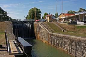 We drove on towards Berg, but on the approach to
Linköping, Friday afternoon traffic on Route 34 was fast and furious; we were
glad to turn off at the lifting-bridge above the Bergs Slussar (Berg Locks). The
complex of eleven locks at Berg is one of the most impressive structures along the entire Göta
Canal, raising the canal a staggering 29.1m (over 95 feet) from the level of Lake Roxen
to the on-going canal
(See plan of Berg Locks). From the canal's
exit at Lake Roxen, the Karl Johans flight of 7 interconnected
locks raises the canal 18.8m up to the canal basin at Berg; this is followed
by the double We drove on towards Berg, but on the approach to
Linköping, Friday afternoon traffic on Route 34 was fast and furious; we were
glad to turn off at the lifting-bridge above the Bergs Slussar (Berg Locks). The
complex of eleven locks at Berg is one of the most impressive structures along the entire Göta
Canal, raising the canal a staggering 29.1m (over 95 feet) from the level of Lake Roxen
to the on-going canal
(See plan of Berg Locks). From the canal's
exit at Lake Roxen, the Karl Johans flight of 7 interconnected
locks raises the canal 18.8m up to the canal basin at Berg; this is followed
by the double
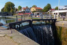 Oscars Locks, named after Crown Prince Oscar (later
King Oscar I) who with his father King Karl XIV Johan laid the foundation stone
for the locks in 1815. The double Oscar lock raises the canal another 4.8m, and
is followed immediately by the double Berg locks raising the canal a further
5.5m for its ongoing passage under the lifting road-bridge towards Borensberg.
From the parking area we walked up towards the top pair of Berg Locks (Photo
29 - Berg Locks) (see right). The large boats which operate
tourist cruises along the canal were moored at the canal basin, an illuminated sign announced that, with the
canal's imminent
seasonal closure, there was only one daily opening of the locks each way now. As a
result, such was the build up of head water in the canal upstream, a significant
overflow of water cascaded over the closed lock-gates (see left) (Photo 30 - Overflow at Berg Locks). Oscars Locks, named after Crown Prince Oscar (later
King Oscar I) who with his father King Karl XIV Johan laid the foundation stone
for the locks in 1815. The double Oscar lock raises the canal another 4.8m, and
is followed immediately by the double Berg locks raising the canal a further
5.5m for its ongoing passage under the lifting road-bridge towards Borensberg.
From the parking area we walked up towards the top pair of Berg Locks (Photo
29 - Berg Locks) (see right). The large boats which operate
tourist cruises along the canal were moored at the canal basin, an illuminated sign announced that, with the
canal's imminent
seasonal closure, there was only one daily opening of the locks each way now. As a
result, such was the build up of head water in the canal upstream, a significant
overflow of water cascaded over the closed lock-gates (see left) (Photo 30 - Overflow at Berg Locks).
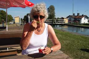 In
today's hot sunshine, we sat at the café-terrace alongside Berg Locks for a
salt-lakrits (liquorice) ice cream (see right) before ambling slowly downhill
for the view looking downstream from the lower of the Berg pair of locks (see
below left). Further along, looking down towards the middle pair of Oscar Locks
and canal basin, and the length of the Carl Johan flight of seven lock towards
the distant Lake Roxen, presented a panoramic view of this magnificent
feat of engineering In
today's hot sunshine, we sat at the café-terrace alongside Berg Locks for a
salt-lakrits (liquorice) ice cream (see right) before ambling slowly downhill
for the view looking downstream from the lower of the Berg pair of locks (see
below left). Further along, looking down towards the middle pair of Oscar Locks
and canal basin, and the length of the Carl Johan flight of seven lock towards
the distant Lake Roxen, presented a panoramic view of this magnificent
feat of engineering
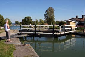 (see
below right) (Photo
31- Oscar and Carl Johan Locks). A wooden board-walk led around the
length of the huge canal basin. In the busy days of commercial canal traffic,
the basin would have been full of cargo boats waiting to make the passage up or down
the sets of locks; today the marina was empty. With the Canal due to close for
the season shortly, there was no sign of even leisure craft passing through the
locks to enliven the scene. Standing at the top of the Carl Johan flight of
seven locks emphasised the steepness of the 18.8m height gain achieved leading
up from the canal's exit basin from Lake Roxen at the bottom of the flight (see
below left) (Photo
32 - Carl Johan flight of locks). We walked slowly down alongside the flight
of locks, and both at the lower canal-side and the beach at Lake Roxen, crowds
of local youngsters lay sun-bathing in the hot sunshine. Across the bottom lock
foot-bridge, we plodded back up the steep slope peering into each of the locks
as we passed; what a brilliantly simple yet effective device a canal lock is,
enabling water to flow uphill! (see
below right) (Photo
31- Oscar and Carl Johan Locks). A wooden board-walk led around the
length of the huge canal basin. In the busy days of commercial canal traffic,
the basin would have been full of cargo boats waiting to make the passage up or down
the sets of locks; today the marina was empty. With the Canal due to close for
the season shortly, there was no sign of even leisure craft passing through the
locks to enliven the scene. Standing at the top of the Carl Johan flight of
seven locks emphasised the steepness of the 18.8m height gain achieved leading
up from the canal's exit basin from Lake Roxen at the bottom of the flight (see
below left) (Photo
32 - Carl Johan flight of locks). We walked slowly down alongside the flight
of locks, and both at the lower canal-side and the beach at Lake Roxen, crowds
of local youngsters lay sun-bathing in the hot sunshine. Across the bottom lock
foot-bridge, we plodded back up the steep slope peering into each of the locks
as we passed; what a brilliantly simple yet effective device a canal lock is,
enabling water to flow uphill!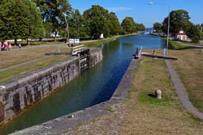
Amid Friday afternoon commuter traffic from Linköping,
we returned around Route 34 under the aqueduct, past Borensberg and back to
Motala for a final night at our canal-side pitch at Mallbodens Café/Camping.
After our day along the locks of the central Göta Canal, we set off to walk the
2km towpath into Motala to find the grave of Baltzar von Platen, the canal builder. It cannot be said
to be 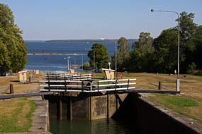 the
most of featuresome of walks, nor is Motala the most exciting of towns, but
just before Motala we did find the von Platen family grave set on the canal
embankment overlooking the canal he had designed and built (see below right). It
was an even more wearisome walk back along the towpath to our camp, and we sat
with beers looking out along the canal as one of large pleasure boats steamed
past. We had enjoyed an unprecedentedly rewarding day, exploring the engineering
marvels of von Platen's Göta Canal with its locks and aqueduct. Tomorrow it
would be time to move on south to the historical town of Vadstena. the
most of featuresome of walks, nor is Motala the most exciting of towns, but
just before Motala we did find the von Platen family grave set on the canal
embankment overlooking the canal he had designed and built (see below right). It
was an even more wearisome walk back along the towpath to our camp, and we sat
with beers looking out along the canal as one of large pleasure boats steamed
past. We had enjoyed an unprecedentedly rewarding day, exploring the engineering
marvels of von Platen's Göta Canal with its locks and aqueduct. Tomorrow it
would be time to move on south to the historical town of Vadstena.
South to Vadstena:
the following morning, after a provisions re-stock at the Motala ICA supermarket
(just off Metallvägen and Mineralvägen in the engineering town's northern
outskirts), we rejoined Route 50 crossing the high-arching bridge which looked
out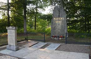 to where the Göta Canal and Motala Ström flowed into Lake Vättern
(click here for detailed map of route).
A short distance south, we turned off around the lake-shore into Vadstena. Set on the NE shore of the vast
Lake Vättern, the small town of 7,600 inhabitants had from medieval times been a
royal seat and important monastic centre. In 1545 Gustav Vasa had built
Vadstena's moated castle as part of his defensive ring of fortresses protecting
the Swedish heartlands from Danish incursion. 200 years earlier in 1346, King
Magnus Eriksson had donated Bjälbo Manor for use as a convent founded by Birgitta Birgersdotter, Sweden's most celebrated saint, to become Vadstena
Abbey.
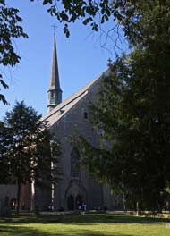
A re-visit to Vadstena Abbey-church:
Birgitta (1303~73) came from a noble Östergötland family and was certainly made
of sternly determined stuff: married at 13, she bore 8 children and became
lady-in-waiting to King Magnus Eriksson and his Queen Blanche of Namur. Such was
her forceful personality, she persuaded her royal sponsors to bequeath Bjälbo
Manor to found a nunnery to fulfil one of her many revelations. But according to
Catholic rules of the day, she needed to obtain papal authorisation for this,
and in 1349 she duly set off across Europe for Rome. Unfortunately no one had
told her that the pope was in Avignon, and not even Birgitta's forceful charm
could persuade him to return. She hung around in Rome, enjoying more visions
during the next 20 years, waiting for papal approval for her convent. Pope Urban
V eventually gave his blessing to the scheme in 1370, but Birgitta died in Rome
in 1373. Her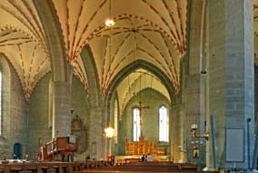 convent was duly established alongside the abbey-church in Vadstena
by her daughter Katarina who continued her mother's ecclesiastical work;
Birgitta was canonised for her efforts in 1391 to become Sweden's first female
saint; her daughter was also canonised as the founding abbess of Vadstena
nunnery. Not even Birgitta's reputation however could resist the forcefulness
of the mid-16th century Reformation, but since many of the nuns came from
powerful families, Vadstena convent was the last in the country to be closed in
1595. The abbey-church continued as Vadstena's parish church and a new convent
was founded in the late 20th century. convent was duly established alongside the abbey-church in Vadstena
by her daughter Katarina who continued her mother's ecclesiastical work;
Birgitta was canonised for her efforts in 1391 to become Sweden's first female
saint; her daughter was also canonised as the founding abbess of Vadstena
nunnery. Not even Birgitta's reputation however could resist the forcefulness
of the mid-16th century Reformation, but since many of the nuns came from
powerful families, Vadstena convent was the last in the country to be closed in
1595. The abbey-church continued as Vadstena's parish church and a new convent
was founded in the late 20th century.
Having found parking by the old centre, we walked
along through the former convent gardens to the Klosterkyrkan Abbey-church which
Birgitta had specified should be 'of plain construction, humble and strong'.
Viewed from under the trees in the gardens, the Abbey which was consecrated in
1430 certainly met her criteria, looking sombre and sturdy (Photo
33 - Vadstena Abbey-church) (see above left).
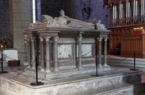 The abbey-church with its
beautiful medieval architecture has over the centuries been embellished with a
celebrated collection of medieval artwork and tombs. The most spectacular
feature was the decorated Gothic vaulting (see right), and the west end was
dominated by the ornate sarcophagus of Gustav Vasa's mentally retarded son
Duke Magnus who had lived at Vadstena Slott. The tomb was guarded by chubby,
glum-faced cherubs, the likeness of Magnus lying atop with its life-like hands
raised in prayer (see left). A wooden The abbey-church with its
beautiful medieval architecture has over the centuries been embellished with a
celebrated collection of medieval artwork and tombs. The most spectacular
feature was the decorated Gothic vaulting (see right), and the west end was
dominated by the ornate sarcophagus of Gustav Vasa's mentally retarded son
Duke Magnus who had lived at Vadstena Slott. The tomb was guarded by chubby,
glum-faced cherubs, the likeness of Magnus lying atop with its life-like hands
raised in prayer (see left). A wooden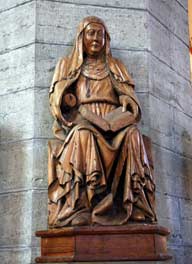 statuette of Birgitta of
1425 portrayed the saint ecstatically enjoying one of her visions (see right).
All of the statuettes around the church had their hands deliberately sawn off
possibly by Protestant vandalism after the Reformation. Along the abbey's
northern wall, the Door of Grace and Honour had received novice nuns into the
convent and released them on their deaths. In a place of honour to the side of
the main altar stood the reliquary containing the remains of Birgitta and her
daughter Katarina who built the Abbey after her mother's death.
The gilded high altar triptych carved in 1520 and displaying the assumption of Mary and scenes from the
crucifixion was lit by sun filtering in through the church's windows. A lower chancel, lined with confessional niches where the nuns
told all, was backed with another carved triptych of 1460 portraying the
saintly Birgitta dictating her revelations to bands of attentive nuns, while
below representations of purgatory showed the woebegone damned seemingly
disappearing into the mouth of a hippopotamus (Photo
34 - Saint Birgitta triptych).
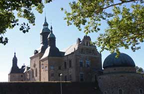 The
old town of Vadstena and its Castle: in bright afternoon
sunshine, but with brisk westerly wind whipping up white horses on Lake Vättern,
we followed the shore-side path around past the excavated remains of the
medieval nunnery to the parkland by Vadstena Slott (Castle) whose moat now
serves as the town's lake-side marina. The massive fortress had been
enlarged and converted into a Renaissance palace by Vasa's deranged sons,
notably the infamous Johan III who had poisoned his brother, Vasa's successor,
Eric XIV in the internecine wars which brought the dynasty to an inglorious end
in the early 17th century. We entered the castle's starkly vast inner courtyard and re-crossed the drawbridge around to the southern side of the castle
to walk over to the old town (see left) (Photo
35 - Vadstena castle). At the delightful cobbled Stortorget in Vadstena
old town (see below The
old town of Vadstena and its Castle: in bright afternoon
sunshine, but with brisk westerly wind whipping up white horses on Lake Vättern,
we followed the shore-side path around past the excavated remains of the
medieval nunnery to the parkland by Vadstena Slott (Castle) whose moat now
serves as the town's lake-side marina. The massive fortress had been
enlarged and converted into a Renaissance palace by Vasa's deranged sons,
notably the infamous Johan III who had poisoned his brother, Vasa's successor,
Eric XIV in the internecine wars which brought the dynasty to an inglorious end
in the early 17th century. We entered the castle's starkly vast inner courtyard and re-crossed the drawbridge around to the southern side of the castle
to walk over to the old town (see left) (Photo
35 - Vadstena castle). At the delightful cobbled Stortorget in Vadstena
old town (see below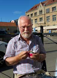 left), we stopped opposite the town hall to enjoy what must be one of Sweden's
tastiest salt-lakrits (liquorice) ice creams at Halvars Glass founded in 1936
(see below right).
The 9th century Rök Runestone
and the language of runes: extricating
ourselves from Vadstena's narrow streets, we headed south through delightful but
uncharacteristically flat farming countryside, past the eastern shore of Tåkern
Lake to the village of Väderstad
(click here for detailed map of route).
Here we turned westwards to
find the isolated church of Rök and the 9th century Rök Runestone.
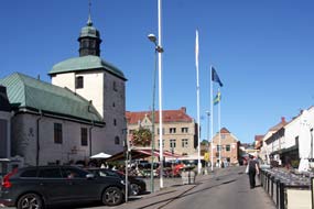 The
runic alphabet developed from the 6~7th centuries AD to express the language of the
northern Germanic peoples, as Norse travellers came into contact with the Roman
Empire and witnessed the art of writing. Runic script probably evolved from
Byzantine Greek (cf the similarities of many of the characters), the oldest
runic alphabet consisting of 24 different symbols. A later script evolved in the
8th century with an alphabet of 16 characters, one variant of which, 'twig
runes', was used on the Rök Runestone. The runic alphabet spread across northern
Europe, and it became common by the 9th century to erect runic inscriptions as
memorials to the dead. After the introduction of Christianity in the 10~11th
centuries, runestones were often decorated with ornate crosses. The
runic alphabet developed from the 6~7th centuries AD to express the language of the
northern Germanic peoples, as Norse travellers came into contact with the Roman
Empire and witnessed the art of writing. Runic script probably evolved from
Byzantine Greek (cf the similarities of many of the characters), the oldest
runic alphabet consisting of 24 different symbols. A later script evolved in the
8th century with an alphabet of 16 characters, one variant of which, 'twig
runes', was used on the Rök Runestone. The runic alphabet spread across northern
Europe, and it became common by the 9th century to erect runic inscriptions as
memorials to the dead. After the introduction of Christianity in the 10~11th
centuries, runestones were often decorated with ornate crosses.
The huge runestone at Rök was
raised in the early 9th century by a local Viking period chieftain Varin in
memory of his dead son Vämod, and features the longest known runic inscription
of over 700 characters covering front, back and sides of the 2.5m high engraved
stone. The stone was discovered in the 19th century built into the 12th century
church wall; it was common practice to use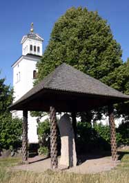 pagan rune stones as building
material. A few parts of the inscription are damaged but most remains legible.
It is unique in that the exquisitely carved runic memorial inscription contains
literary references to unknown pieces of Norse mythology, historic references to
Theodoric the Great, king of the Ostrogoths and briefly ruler of the residual
Western Roman Empire, as well as having some arcanely encrypted sections. The
inscription is therefore considered the first written piece of Swedish literature, and
in translation reads: pagan rune stones as building
material. A few parts of the inscription are damaged but most remains legible.
It is unique in that the exquisitely carved runic memorial inscription contains
literary references to unknown pieces of Norse mythology, historic references to
Theodoric the Great, king of the Ostrogoths and briefly ruler of the residual
Western Roman Empire, as well as having some arcanely encrypted sections. The
inscription is therefore considered the first written piece of Swedish literature, and
in translation reads:
In memory of
Vämod stand these runes, and Varin wrote them,
the father in memory of his dead son
I tell the young men the tale of the two war booties which 12 times were taken
from various men
This I tell second, about him who 9 generations ago lost his life with the Reidgoths, and
died with them because of his offences
<continuing in verse>
Theodoric the Bold
Chief of sea warriors
Ruled over the shores of the Hreiðsea,
Now sits armed
On his Gothic horse,
His shield strapped,
Prince of the Mærings
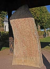 The inscription continues with obscure references
to unknown kings and their relatives in Själland, and invokes the Norse Aesir
god Thor. The inscription continues with obscure references
to unknown kings and their relatives in Själland, and invokes the Norse Aesir
god Thor.
Our visit to Rök Runestone: reaching the small museum, we
walked over to the huge runestone set up under its roofed covering close to Rök
church out among farm fields where harvesting of the ripe cereal crops was taking
place (see below right) (Photo
36 - Rök Runestone). Displays at the museum gave background details and
interpretation of the stone and its runic inscription. Although runic experts
can translate the inscription, there is still controversy over its
interpretation: Reidgoths is a poetic name for the Ostro-Goths; Hreiðsea is
presumably the Mediterranean where the Ostro-Goths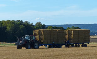 ruled, and the Mærings were
Theodoric's clan. The Scandinavian Vikings travelled far into Europe, coming
into contact with the Christianised Roman world, and would have heard tales of
Theodoric and his infamous Ostro-Goths who ruled from Ravenna in the 6th century
AD; a statue of
Theodoric found in Aachen sitting with shield and lance on his horse was well
known, hence the reference in the inscription. Theodoric died in 526 AD around 9
generations before the 9th century Rök Runestone inscription; the Church
considered him a cruel, barbarous tyrant hence the reference to dying for his
offences. Perhaps the references were intended to signify the powerful
connections of Varin's family as local chieftains. The stone's scale clearly
indicate that Varin was indeed a powerful Viking lord: the monument stood at the
place where Rök church would be built 3 centuries later, the village taking its
name from the stone, Rök literally meaning a stone in Old Norse. It was set up
at a prominent crossroads so that no passer-by could avoid seeing it and
marvelling at the powerful connection of Varin and his family. Walking over to
the church with the rune stone standing alongside (see left), this great 1,200 year old
monument with its intriguingly obscure literary and mythological references
still had the power to thrill, just as Varin had intended. ruled, and the Mærings were
Theodoric's clan. The Scandinavian Vikings travelled far into Europe, coming
into contact with the Christianised Roman world, and would have heard tales of
Theodoric and his infamous Ostro-Goths who ruled from Ravenna in the 6th century
AD; a statue of
Theodoric found in Aachen sitting with shield and lance on his horse was well
known, hence the reference in the inscription. Theodoric died in 526 AD around 9
generations before the 9th century Rök Runestone inscription; the Church
considered him a cruel, barbarous tyrant hence the reference to dying for his
offences. Perhaps the references were intended to signify the powerful
connections of Varin's family as local chieftains. The stone's scale clearly
indicate that Varin was indeed a powerful Viking lord: the monument stood at the
place where Rök church would be built 3 centuries later, the village taking its
name from the stone, Rök literally meaning a stone in Old Norse. It was set up
at a prominent crossroads so that no passer-by could avoid seeing it and
marvelling at the powerful connection of Varin and his family. Walking over to
the church with the rune stone standing alongside (see left), this great 1,200 year old
monument with its intriguingly obscure literary and mythological references
still had the power to thrill, just as Varin had intended.
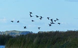 Wild
camp by Lake Tåkern: a
short distance from Rök, we approached the
Glänås Nature Reserve along a single-track lane on the southern shore of Lake Tåken with its
bird observation tower overlooking the lake. Lake Tåken is a 44km2
hollow in an otherwise flat landscape, just 0.8m deep and Wild
camp by Lake Tåkern: a
short distance from Rök, we approached the
Glänås Nature Reserve along a single-track lane on the southern shore of Lake Tåken with its
bird observation tower overlooking the lake. Lake Tåken is a 44km2
hollow in an otherwise flat landscape, just 0.8m deep and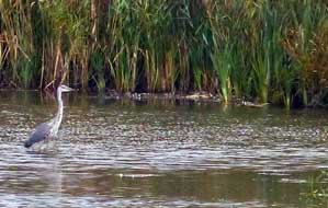 surrounded by Northern
Europe's largest area of reed beds. The nutrient-rich shallow waters, extensive
reed beds, lake-shore meadows and water-logged shore-side woods
attract substantial numbers and species of bird-life. The bird observation tower
gave a panoramic view over the lake and close inshore among the reeds large
numbers of Greylag geese were wading in the shallows and flying around in flocks
(see left). We spent a peaceful half hour watching and photographing the birds
including a couple of Grey Herons fishing among the reed beds (see right). By now, after our fulsome day, it was almost
7-00pm; the Nature Reserve's parking area in secluded woodland close by the
lake-shore made the perfect place for a night's wild camp. surrounded by Northern
Europe's largest area of reed beds. The nutrient-rich shallow waters, extensive
reed beds, lake-shore meadows and water-logged shore-side woods
attract substantial numbers and species of bird-life. The bird observation tower
gave a panoramic view over the lake and close inshore among the reeds large
numbers of Greylag geese were wading in the shallows and flying around in flocks
(see left). We spent a peaceful half hour watching and photographing the birds
including a couple of Grey Herons fishing among the reed beds (see right). By now, after our fulsome day, it was almost
7-00pm; the Nature Reserve's parking area in secluded woodland close by the
lake-shore made the perfect place for a night's wild camp.
South to the old wooden town of Eksjö: the following morning,
we continued our southward drive (click here for detailed map of route)
on Route 32 to Boxholm, a very passé-looking engineering town, through
Jönökoping Country past Tranås, running parallel with the main railway line. The
road had 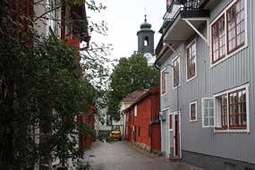 been newly upgraded since we had last driven this way in 2013,
enabling us to make good progress south into Småland. We turned off into the historical
wooden town of Eksjö and parked without difficulty close to the old town with
its wooden houses. been newly upgraded since we had last driven this way in 2013,
enabling us to make good progress south into Småland. We turned off into the historical
wooden town of Eksjö and parked without difficulty close to the old town with
its wooden houses.
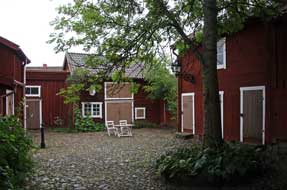 In
2003 Eksjö celebrated its 600th anniversary, having
been granted its town charter in 1403 by King Eric of Pomerania. The town has
suffered its share of disasters over the centuries: razed by Danish invaders in
1568, royal patronage from King Johann III enabled rebuilding, but disaster
struck again in 1856 when fire destroyed the southern part of Eksjö. Fortunately
the area of 17th century wooden houses to the north of Stortorget was saved both
from the fire and from wanton urban vandalism of the 1960s, and has been
conserved as a wooden town heritage area, the modern town expanding around and
beyond it. The town also has a long-standing military connection with the Royal
Smalandia Hussars who were garrisoned here during the 18~19th centuries, and a
unit of the Swedish armed forces still has its base in the northern
outskirts. In
2003 Eksjö celebrated its 600th anniversary, having
been granted its town charter in 1403 by King Eric of Pomerania. The town has
suffered its share of disasters over the centuries: razed by Danish invaders in
1568, royal patronage from King Johann III enabled rebuilding, but disaster
struck again in 1856 when fire destroyed the southern part of Eksjö. Fortunately
the area of 17th century wooden houses to the north of Stortorget was saved both
from the fire and from wanton urban vandalism of the 1960s, and has been
conserved as a wooden town heritage area, the modern town expanding around and
beyond it. The town also has a long-standing military connection with the Royal
Smalandia Hussars who were garrisoned here during the 18~19th centuries, and a
unit of the Swedish armed forces still has its base in the northern
outskirts.
The Eksjö Town Festival had clearly been taking
place during the fine weather of the last couple of days, but today major demolition work was in
full swing with youngsters busily
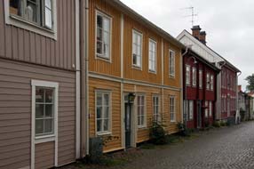 at work clearing up and dismantling all the stage-works and marquees that had filled the
surrounding streets for the festival's musical events. This morning the
weather had turned dull and overcast, and just as we parked in readiness for our
visit to Eksjö, the rain started. And did it pour! We were forced to shelter in George, eating our lunch sandwiches and waiting for a pause
in the rain. We have often recorded our more memorable lunch spots, but this was
truly the least salubrious: sat in a grubby back street car park in pouring rain,
watching a tanker- at work clearing up and dismantling all the stage-works and marquees that had filled the
surrounding streets for the festival's musical events. This morning the
weather had turned dull and overcast, and just as we parked in readiness for our
visit to Eksjö, the rain started. And did it pour! We were forced to shelter in George, eating our lunch sandwiches and waiting for a pause
in the rain. We have often recorded our more memorable lunch spots, but this was
truly the least salubrious: sat in a grubby back street car park in pouring rain,
watching a tanker-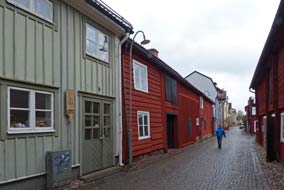 lorry very fetidly at work nearby
emptying mobile WCs, and a fork-lift truck
hoisting the emptied WCs to carry them away; we just hoped they were not
occupied at the time! When the rain eventually eased, we took a stroll in the
gloomy weather conditions around the cobbled streets of Eksjö's old town with
its conserved wooden houses and charactersome flower-filled courtyards
(Photo
37 - Eksjö wooden town). We began
in the main Stortorget where the grand equestrian statue of a Smalandian Hussar
was surrounded by the debris and semi-demolished pavilions of the town festival.
Youngsters in drenched plastic capes hustled around with sections of stage-works
and fencing, and fork-lift tractors carried away dismantled remains. We ambled
around the old street taking a few photos despite the gloomy light. Some of the
old wooden cottages were painted with Falu Rödfarg, the larger wooden town houses dressed
in pastel shades. Eksjö was a charming place, perhaps not on a par with Nora its Bergslagen fellow wooden town (Trästäder),
but today we had certainly not seen Eksjö at its best. Despite the chaos of
post-festival dismantling and miserable weather however, for us this was all
preferable to arriving here amid the throbbing noise and hubbub of a pop music
festival! lorry very fetidly at work nearby
emptying mobile WCs, and a fork-lift truck
hoisting the emptied WCs to carry them away; we just hoped they were not
occupied at the time! When the rain eventually eased, we took a stroll in the
gloomy weather conditions around the cobbled streets of Eksjö's old town with
its conserved wooden houses and charactersome flower-filled courtyards
(Photo
37 - Eksjö wooden town). We began
in the main Stortorget where the grand equestrian statue of a Smalandian Hussar
was surrounded by the debris and semi-demolished pavilions of the town festival.
Youngsters in drenched plastic capes hustled around with sections of stage-works
and fencing, and fork-lift tractors carried away dismantled remains. We ambled
around the old street taking a few photos despite the gloomy light. Some of the
old wooden cottages were painted with Falu Rödfarg, the larger wooden town houses dressed
in pastel shades. Eksjö was a charming place, perhaps not on a par with Nora its Bergslagen fellow wooden town (Trästäder),
but today we had certainly not seen Eksjö at its best. Despite the chaos of
post-festival dismantling and miserable weather however, for us this was all
preferable to arriving here amid the throbbing noise and hubbub of a pop music
festival!
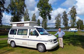 Movänta
Camping on the shores of Lake Försjön:
with the rain now pouring more heavily than ever, we drove 8kms eastwards from Eksjö to find Movänta
Camping. Arriving at reception, we were greeted with a locked door, which was
eventually opened by a young lad who declared they did not open until 4-00pm; we
responded to such inhospitality with a curt "OK, then we're not here to book-in
and pay!", and drove down into the camping area to find the pitch we had used at
our 2013 stay under the pines on the shores of Lake Försjön (see left) (Photo
38 - Movänta Camping). A this late stage of the season, the site was deserted which suited us well; we
re-filled with fresh water and pitched when the rain eased. This was thoroughly
wretched weather, but we had a good flat, well-drained pitch and peaceful setting for our
day in camp here tomorrow. It was still overcast the following morning, but over
a late breakfast, the sky began to clear and sun break through. We did some
washing and rigged a drying line between the tall pines, but the weather
gradually declined; cloud gathered and a sudden squally shower caused us to
abandon the attempt to dry the washing. Darkness fell even earlier, and with a
chill wind blowing, it was a miserably cold evening. Movänta
Camping on the shores of Lake Försjön:
with the rain now pouring more heavily than ever, we drove 8kms eastwards from Eksjö to find Movänta
Camping. Arriving at reception, we were greeted with a locked door, which was
eventually opened by a young lad who declared they did not open until 4-00pm; we
responded to such inhospitality with a curt "OK, then we're not here to book-in
and pay!", and drove down into the camping area to find the pitch we had used at
our 2013 stay under the pines on the shores of Lake Försjön (see left) (Photo
38 - Movänta Camping). A this late stage of the season, the site was deserted which suited us well; we
re-filled with fresh water and pitched when the rain eased. This was thoroughly
wretched weather, but we had a good flat, well-drained pitch and peaceful setting for our
day in camp here tomorrow. It was still overcast the following morning, but over
a late breakfast, the sky began to clear and sun break through. We did some
washing and rigged a drying line between the tall pines, but the weather
gradually declined; cloud gathered and a sudden squally shower caused us to
abandon the attempt to dry the washing. Darkness fell even earlier, and with a
chill wind blowing, it was a miserably cold evening.
A drive through the forests of Småland to Sweden's south-east coast: with brighter weather the following morning,
we set off for today's drive through the forests of Småland down to Sweden's
south-east coast (click here for detailed map of route).
Traffic on the main eastward Route 40 was
surprisingly light and, in bright morning sunshine, this was a relaxing drive
through delightful pine forests. The number of timber trucks and a large timber
processing yard we passed suggested that southern Småland was very much logging country.
Reaching the small town of Mariannelund, we turned off SE-wards on Route 129 to
Hultsfred, still passing through pine wooded countryside, so attractive in
morning sunshine. Rather than taking the obvious main roads down to the coast at Oskarshamn, we followed back-roads through woodland and farming countryside, a
delightfully peaceful and winding rural route, eventually emerging at Dödehult
on Route 47 8kms from Oskarshamn. Every country has its memorably unmemorable
non-entity of a town, and Sweden has Oskarshamn. Without reservation,
Oskarshamn takes the prize as Sweden's most inconsequential place: its only
raison d'être is as a ferry port where ferries depart for the Baltic island of
Götland; it also has the dubious claim to fame as the location of the
largest of Sweden's 3 nuclear power plants. We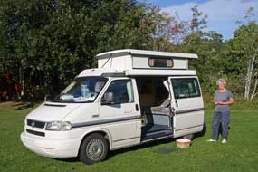 did pay to park but failed to find
anything good to say about Oskarshamn, other than a large ICA hypermarket in the
suburbs and the E22 bypass as a fast means of getting away! did pay to park but failed to find
anything good to say about Oskarshamn, other than a large ICA hypermarket in the
suburbs and the E22 bypass as a fast means of getting away!
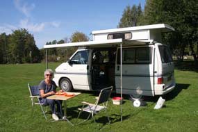 Kaffetorpets Camping on the Oknö coastal peninsula: we thankfully joined the E22 highway, hurrying
away from Oskarshamn south towards
the small port of
Möntsterås. Möntsterås has a well-equipped ställplats
(camping aire) by the attractive little harbour, but by 4-00pm brigades of
camping-cars were already gathering; parking in tightly packed rows on a
confined tarmaced quay-side is certainly not our idea of camping, and we turned off onto a side lane alongside a coastal creek down the 6kms length
of the Oknö peninsula. Along the lane just outside Möntsterås, we hurried past
an enormous First Camp, not having the requisite sized bank account to afford
the luxurious 'attractions' of such a place, nor indeed the wish to camp amid
1000s of other tightly packed caravans and their unsavoury occupants. Leaving
behind yet more holiday homes, we continued down the peninsula, finally reaching
an unsurfaced lane to the tip, ending at the gates of
Kaffetorpets Camping.
We had earlier telephoned to confirm they were open, and the owners had responded to
our enquiry in
welcoming tones, giving us the gate key-code since they were not on site out of
season; it sounded promising.
The barrier
led into the open, grassy camping area, totally deserted other than a handful of
empty statics at the far end. There was no view of the sea from here, but at end
August with all the holiday-makers long gone and not a camping-car in sight, it
was wonderfully peaceful; this would suit us well for a rest day here tomorrow,
and we gladly Kaffetorpets Camping on the Oknö coastal peninsula: we thankfully joined the E22 highway, hurrying
away from Oskarshamn south towards
the small port of
Möntsterås. Möntsterås has a well-equipped ställplats
(camping aire) by the attractive little harbour, but by 4-00pm brigades of
camping-cars were already gathering; parking in tightly packed rows on a
confined tarmaced quay-side is certainly not our idea of camping, and we turned off onto a side lane alongside a coastal creek down the 6kms length
of the Oknö peninsula. Along the lane just outside Möntsterås, we hurried past
an enormous First Camp, not having the requisite sized bank account to afford
the luxurious 'attractions' of such a place, nor indeed the wish to camp amid
1000s of other tightly packed caravans and their unsavoury occupants. Leaving
behind yet more holiday homes, we continued down the peninsula, finally reaching
an unsurfaced lane to the tip, ending at the gates of
Kaffetorpets Camping.
We had earlier telephoned to confirm they were open, and the owners had responded to
our enquiry in
welcoming tones, giving us the gate key-code since they were not on site out of
season; it sounded promising.
The barrier
led into the open, grassy camping area, totally deserted other than a handful of
empty statics at the far end. There was no view of the sea from here, but at end
August with all the holiday-makers long gone and not a camping-car in sight, it
was wonderfully peaceful; this would suit us well for a rest day here tomorrow,
and we gladly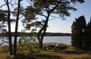 selected a sunny pitch and settled in (see above right). The sun set behind tall
trees and dusk fell quickly tonight; this region on the coast of
Southern Sweden felt a million miles away from the Sweden of the north we love
so well. selected a sunny pitch and settled in (see above right). The sun set behind tall
trees and dusk fell quickly tonight; this region on the coast of
Southern Sweden felt a million miles away from the Sweden of the north we love
so well.
It was another bright sunny morning for our rest day here
at Kaffetorpets Camping, with wagtails hopping around on the grass; by the time
the sun had cleared the trees, it was warm enough to sit outside for breakfast
(see above left) (Photo
39 - Breakfast at Kaffetorpets Camping). Sheila walked around the campsite picking blackberries and photographing the Red Squirrels scampering
around in the pines
(Photo
40 - Red Squirrel). Around noon, Mrs Anna
Aronsson the campsite owner arrived as arranged to collect our payment, and we
learned from her more about the campsite and its surroundings.
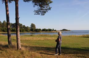 The land at the seaward end of the wooded Oknö coastal peninsula
was owned by Möntsterås Commune, and had previously been leased to the First Camp company who
had neglected the site so that the lease was terminated. The Aronsson family, Lars and Anna,
who were themselves experienced campers, had
taken over the campsite in June 2015. This had meant hasty preparations to open the neglected site in time for the 2015 summer season. They had
clearly done a good job since the facilities, although straightforward, were
perfectly functional and spotlessly clean. The family lived on the site in their
caravan during the peak season, and now ran the site with the deliberate policy
of maintaining a straightforward camping environment, with none of the expensive
distractions of First Camp; in other words, all that any discerning campers
would want of The land at the seaward end of the wooded Oknö coastal peninsula
was owned by Möntsterås Commune, and had previously been leased to the First Camp company who
had neglected the site so that the lease was terminated. The Aronsson family, Lars and Anna,
who were themselves experienced campers, had
taken over the campsite in June 2015. This had meant hasty preparations to open the neglected site in time for the 2015 summer season. They had
clearly done a good job since the facilities, although straightforward, were
perfectly functional and spotlessly clean. The family lived on the site in their
caravan during the peak season, and now ran the site with the deliberate policy
of maintaining a straightforward camping environment, with none of the expensive
distractions of First Camp; in other words, all that any discerning campers
would want of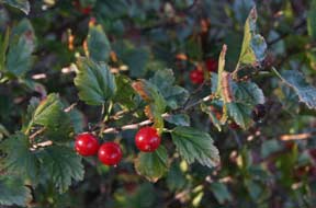 a campsite, and at the reasonable price of 220kr/night. They
stressed aiming to give their guests the chance to enjoy the peacefulness of
the lovely natural surroundings while respecting the presence of others, and had
adopted the motto Den lilla Campingen längst ut på Oknö
(The little campsite at the end of Oknö). We were full of admiration for
all they had achieved and the lovely straightforward environment they had
successfully maintained; we wish the Aronsson family well and share their
values.
Late in the afternoon, we explored the network of
paths around the coastal tip of the Oknö peninsula, discovering that the campsite
extended further with several other more secluded grassy areas bordering on the
coastal pinewoods. Paths through this delightful woodland led out among the reed
beds fringing the sea (see above right and left); with the western sun shimmering across
the shallow waters, it was a truly delightful setting (see above left). We
followed the coastal strip around the tip of the peninsula finding bushes laden
with juniper berries and wild red currents. Today, towards the tail
end of the trip, we had enjoyed a thoroughly relaxing day in this lovely
peaceful setting at Kaffetorpets.
Coming next:
during the final 2 weeks of this trip, we shall visit the famous glassworks of
Småland near to Nybro, then cross to spend a week on the Baltic island of Öland.
On our return to the mainland, we shall visit the historic town of Kalmar with
its magnificent castle, and spend the final few days travelling around the
southern coastline of Sweden, through Skåne calling at Kristianstad, Åhus,
Kivik, Ystad (of Wallander fame), Sweden's southernmost point at Smygehamn,
and Trelleborg with its reconstructed Viking fort. We shall conclude at the
bird-watching sand-spit of Falsterbo at the furthest SW point near Malmö, before
re-crossing the Öresund Bridge to begin the long journey home. But all of that is for our next edition, to be
published shortly.
Next edition
to be published quite soon
|
Sheila and Paul |
Published: 11 January 2017 |
|

 CAMPING
IN SWEDEN 2016 - Falun
Copper Mine, Färnebofjärden National Park, Sala
Silver Mine, Ängelsberg Bruk, Anundshög Burial
Grounds, Ramsund Sigurd Engraving, Eskilstuna, Göta Canal at Motala, Vadstena,
Eksjö wooden
town,
Småland, and South-East Coast at Oskarshamn:
 full of loaded timber wagons (
 The road finally dropped down to the southern
tip of the extensively spreading Amungen Lake, crossing into the County of Northern Dalarna to reach a road junctions at Lamborn. Here we turned off onto Route 889,
a minor road running all the way cross-country to Rättvik on the SE corner of
Lake Siljan which we had passed through on our northward journey some 7 weeks
earlier. In 10kms at Bingsjö, a picture post-card of a village with little
wooden church, attractive Falun-Red painted cottages and traditional
gärdesgård slatted fencing, we turned off again for the final 5kms of
unsurfaced single-track lane leading to the tiny hamlet of Dalstuga spread
around the southern shore of Amungen Lake.
 caravans occupied, the place
would be insufferable bedlam, but thankfully with the holiday season now over,
it was peacefully deserted. We investigated an open area down by the lake-shore
and found power supplies; there were no functioning facilities, but here was a
perfect lakeside camping spot sheltered by birch trees. Despite the bright sun,
a chill wind was blowing across the lake whipping up white horses as we settled in (
 Falun Copper Mine: we woke to
continuing heavily overcast sky with misty drizzle obscuring the lake; it was as
well we had taken our photos in this lovely lakeside setting in yesterday
afternoon's sunshine. As we packed to leave, pouring rain began, and Dalstuga's
lanes seemed even more of a maze on a gloomy morning. Back along to Bingsjö, we
re-joined Route 50 and turned south through the dreary forested landscape for
the 60kms to Falun to park at the Copper Mine, now a World Heritage tourist site
(see
  contribution to Sweden's economy, you would be disappointed; in a
place devoted to profits, extracting £21 per person from the millions who visit the mine each year, the displays were extravagant but superficial and trivially
lacking in detail. On our 2013 visit, we had been duped into paying to go on the
underground mine visit, but the guide's so-called commentary was blandly vacuous
and non-informative; pressured by the tight schedule of lucrative hourly guided
tours, she was immune to information-seeking questions but doubtless had little
knowledge to impart anyway. Most of the party simply looked bored; a few like us
ignored the non-guide and peered around for ourselves trying to gain an
impression in the gloom of how dreadful working conditions would have been in
the mine's galleries. After such a World Heritage non-experience, this year we confined our re-visit to walking the 2km
trackway around the surface rim of the Great Pit of Falun Copper Gruva (Mine).
With the rain now easing but light still gloomy, we set off past the palatial
18th century mine headquarters building which now houses the
mining museum, across the look-out point which gives a full panorama view
looking down into the 100m deep and 400m wide chasm of the Great Pit
(
 The
copper ore spoil heaps still yield a profitable inheritance: Falun is the centre
of production for Falu Rödfärg, the red-brown preservative paint used
universally on Sweden's wooden buildings giving them their distinctive colour.
The waste rock with its mix of metallic minerals, principally red-ochre iron
The
copper ore spoil heaps still yield a profitable inheritance: Falun is the centre
of production for Falu Rödfärg, the red-brown preservative paint used
universally on Sweden's wooden buildings giving them their distinctive colour.
The waste rock with its mix of metallic minerals, principally red-ochre iron
 oxide, is ground and roasted as the base material for the wood preservative and
the Falu Rödfärg works stand next to the former copper mine's deep pit (see
right). After a brief look at the huge preserved water wheels which once powered
pumps and hoists as mine shafts were driver deeper, we set off around the Pit's
surface perimeter trackway, passing the tangled chaos of rocks and timber debris
from the catastrophic 1687 cave-in. Ahead, the 40m tall red brick 1970s tower of
the Creutz Shaft winding gear, that had reached the 400m deep levels of the 20th
century working mine, rose on the hillside (see above left). Around on the
southern side amid the multi-coloured spoil heaps, viewing ports in the
chain-link fencing enabled clear views in the gloom looking across the chasm of
the Great Pit (
 eastwards on
Route E16 (
 Gysinge Bruk:
the following morning, with damp mist hanging dismally over the Färnebofjärden
lake-land landscape, we drove along to Gysinge Bruk,
a former estate iron foundry
dating from the 17th century. As at Ängelsberg Bruk the coincidental
presence of the 3 components necessary for iron smelting -
local supply of iron ore, fast-running water to power blast-furnace
air-pumps,
and plentiful timber for charcoal production - meant that the ironworks had
prospered. Clearly this had brought much wealth to the estate owners who had
lavished it on grandiose buildings, now housing among other features the Färnebofjärden
Visitor Centre. Here we learned more about the wildlife and topography of the
National Park and the Nedre Dalälven valley. The Öster-
and Väster-Dalälven rivers merge just south of Lake Siljan, then flow in a lazy,
ambling way through the watery Färnebofjärden meadows, fenland, and string of lakes interconnected
by rapids which once drove the water-wheels powering the furnace pumps of Gysinge
iron-works. The broad passage of Dalälven rapids still flows past the remains
of Gysinge Bruk's 19th century iron works water-wheel house (see left) (
 We turned westwards reaching the outskirts of Sala, and in the centre found an
ICA Kvantum with a post-office kiosk to top-up the credit on our Telia Swedish
SIM card. Amply clad Roma beggars inevitably obstructed the supermarket doorway;
such mafia organised human exploitation in the form of systematic begging is a source of
concern and irritation to even the
most liberal-minded Swedes; in a country whose citizens pay some of the highest taxation across Europe,
better regulation is accordingly expected in a law-abiding society.
 We had happy memories from our last visit to
Sala in 2013 when we had stayed at Sala Vandrarhem (hostel), with a small camping
area in the gardens behind the house. This year, a sign of the times, it was the
battered caravans of Bulgarian migrant workers that occupied the camping area.
With some reservations, we settled into a sunny corner, but on going to book in
at the hostel, we were greeted by a sour-faced, unsmiling woman: had we chosen a
place, she demanded, followed by an insistent 'You can't stop there; it isn't a
place!', pointing at George. We had apparently made the unforgivable error of
allowing half a wheel to overlap the pitch boundary. Her rule book-bound manner
became more and more obdurate and offensive, as we tried initially politely but
increasingly irritably to remonstrate. But rules were rules, and she was going
to stick by them. Her Fawlty Towers John
Cleese performance of how to
offend paying guests became so laughingly comical that irritation turned to
entertainment; ignoring her churlish behaviour (clearly not a happy bunny!), we
moved the offending wheel (and the rest of George) and settled in (
 assistant
rolled his eyes in empathetic disbelief. We were still enjoying the
entertainment value of such ironically laughable inhospitality as we cooked and
eat our home made curry supper later in the evening. How long this sad soul's
employment will last is a matter of speculation! By 9-00 that evening, it was
fully dark; the combination the year moving on and our moving south was having
its impact.

 damage was still
evident 2 years later as we passed through the area (see right and above left).
 As at Moviken and Gysinge, iron smelting had
been developed here at Ängelsberg Bruk on a nobleman's
estate during the 17~19th centuries, with improving technologies for ore
crushing and roasting and blast furnace and forge design to produce pig- and
wrought iron. But with the late 19th
century introduction of industrial scale
coal-fired Bessemer steel production, small scale charcoal-fired rural smelters
such as Ängelsberg could not compete and became uneconomical, and the Ängelsberg
Bruk was fired for the last time in 1919. The earth and timber insulated blast
furnace with its high furnace stack,
equipped with water-wheel driven heated air
blower, ore-crusher and ore roasting kiln, have
been conserved set amid the
landscaped estate as
a UNESCO World Heritage site. Today the now trimly manicured lawns and neat
chocolate-box, red-painted wooden buildings are a peaceful setting; what would
this scene have looked like at the height of its industrial production? We took
our photos from the outside of the blast furnace and ore-roasting oven in the
bright sunlight (see above left) (
 A
brief re-visit to Sala Silver Mine:
while we were over in the Ängelsberg area, it seemed worthwhile to investigate the two
mining and steel-working towns of Norberg and Fagersta. The map showed extensive
mine workings around both towns, but when we reached Norberg, this was just a modern and
insignificant place with nothing to be seen of the mines. We continued on the
busy Route 68 down to Fagersta which was an equally unimpressive town with some
modern industry but no trace of mining. Taking a back lane to Ängelsberg, we returned to Sala,
for a brief re-visit to Sala Silver Mine; see
  house of the Carl IX shaft, the deepest of the mine's workings at 318m.
The buildings were all locked but we clambered up onto the spoil heaps for
photographs (
 South
to Badelunda and the Anundshög Iron Age Burial Grounds:
a clear, warm night and this morning the sky was still clear with promise of a
fine day for our re-visit to Anundshög Iron Age Burial Grounds. Today we should
move considerably further south and camp tonight south of Lake Mälaren. Despite
the boss-lady's less than charming manner,
Sala Vandrarhem/Camping was still inherently a good place to camp, and we had
enjoyed our 3 day stay. We headed south from Sala on Route 256 (
 13th century, and during the Medieval period the
parish's wealth enabled the church to be extended further (see above left). The
older parts of the church were built of granite, later of brick, and since the
Reformation both the exterior and interior have been rendered, covering wall
paintings, some of which have survived in a side chapel. The church's other
feature of note is the beautiful wooden pulpit carved with figures of apostles
in the 1650s by Israel Snickare (the Carpenter) from Västerås (
 Anundshög Iron Age Burial Grounds: as early as 1,500 BC, Bronze Age
pastoralists were settling and farming around Anundshög along the Badelunda ridge which,
in those times before the land rose, stretched along the
shores of a bay, the furthest inland point of a fjord from the Baltic Sea.
As the land rose, further moraine rich fertile land emerged below
the ridge cultivated by these prehistoric agricultural peoples. Trade routes and
water courses met around the Badelunda ridge, and both archaeological finds and
the surviving grave-fields show that an important power centre ruled by powerful
clan chieftains developed here at Anundshög during the early Iron Age between
500~1050 AD. Around 500 visible graves survive, with an unknown number still
undiscovered, of varying forms - burial mounds, stone ship-settings and standing
stones. The largest is the great burial tumulus at Anundshög, Sweden's largest
at 9m high and 64m in diameter, created around the 10th
 century AD. Many of the
mounds were plundered in antiquity and the Anundshög tumulus has never been
excavated. Built on a foundation of clay on which the dead were cremated along
with grave goods, the remains were covered with stones and turf to raise the
mound. The scale of the Anundshög tumulus and the numbers involved in its
construction indicate this was a mighty chieftain who controlled large tracts of
land. Around the mound were 5 large ship-settings, another form of burial
monument associated with pagan ritual. Again the scale suggests this was a
sacred cult centre. Nearby a large and ornate rune stone was raised with a line
of standing stones marking a roadway leading to a forded river crossing,
 further
indicators that he who controlled communications routes and river-crossings with Anundshög at the hub was indeed a powerful chieftain. The names of these rulers
and their power centre are unknown, but the burial site is now referred to by
its later Medieval name of Anundshög, the burial mound of Anund the chieftain's
legendary name. By Medieval times and the conversion to Christianity, the pagan
ship-settings were overturned and the rune stone torn down in an attempt to
obliterate the pagan past. A more settled agricultural society developed at
Anundshög and the former chieftain's territories divided up, with the sacred
burial site becoming a meeting place for the local Thing, the district
court which met to resolve disputes. Badelunda church was built in the 13th
century, its scale again indicating that this was still an affluent farming
community.
 youngsters running around the standing stones and clambering
over Anund's burial mound. The main tumulus was huge and surrounded by 4 of the original 5 ship-settings now fully restored. The 2 largest, over 50m in length with stones
1m high, stood end to end leading to the tumulus with several other burial
mounds nearby. We walked among the stones of the ship-settings taking our photos
(see right) (
 Clearly this was a powerful lord
who set up this imposing monument to tell the world for all time of his son, his
road, and himself. Vred was a skilful rune carver and produced an elegant
pictorial design of unknown significance around which the runic dedication is
inscribed. We photographed this imposing monument against the backdrop of the
great tumulus (see above left) (
 overview across the outline of the two end-on-end ship-settings (see left) (
 Further prehistoric monuments along
Badelunda ridge: we drove
around the southern side of the site looking out across now flat arable farmland
where once an inlet from the sea would have lapped the shore-line of the bay
farmed by the original settlers. The modern road now cut through the line of the
Badelunda ridge, and we walked up through the delightful woodland of the ridge
among a series of smaller burial mounds. The woodlands showed the classic
north~south mix of pines and birches along with oak and alder, with Lily of the
Valley covering the woodland floor, the leaves now turning autumnal yellow and
with their orange berries (
 Aggressive driving standards around Västerås: having spent such a
peaceful time exploring the historical setting of the Anundshög burial
grounds, we now had to turn our attention to more mundane matters, and we turned
into the huge car park of an out-of-town commercial park to shop for provisions
at an ICA Maxi. Driving standards around Västerås were some of the most viciously
aggressive of any Swedish cities we had experienced, an indication of city
affluence and the fact that we were now within an hour's drive of the capital.
We joined E18 motorway westwards in speeding afternoon traffic seeing signs of
the ABB heavy engineering works as we drove past Västerås (
 The Ramsund Sigurd legend
rock-engraving:
the sun was still wearyingly glaring as we reached the insignificant little
turning down to the site of the Ramsund Sigurd legend rock-engraving. Our eyes
were still blinded by the afternoon sun's dazzling glare as we were suddenly
pitched into the contrasting darkness of the mysterious little wooded
grove that seemed to act as almost a portal between the brash, busy,
traffic-ridden 21st century world outside and the 11th century AD world of the
powerful Lady Sigriðr who commissioned the rock panel pictorial engraving
showing the legend of Sigurd Fafnesbane in celebratory dedication to her late
husband Sigrøðr and the bridge she had caused to be built across the river here at Ramsund.
Having crossed what is now just a brook on a modern narrow bridge into a tree-lined clearing to a
parking place, there above in the woodland on a large bed-rock panel was the 5m long, 2m high Sigurd engraving (see above right). Carved around 1,030 AD, the engraving takes the form of a commemorative
runic inscription shaped within a curving ribbon forming a dragon's body and
enclosing a panel of pictorial engraving illustrating the central story of the
legend of Sigurd (Sigfried) (
 Lord of the Rings.
 Regin. Fafnir
became so enraged that he killed his father to get his hands on all the gold,
and taking on the form of a snake-like dragon, he went to brood at a place
called Gnitaheden curled up on his pile of gold. The curse of the ring
continued: Regin, the third son and a skilful blacksmith, wanted his share of the patrimony and
planned to seize the treasure by trickery. He shared his plans with Sigurd whom
he had earlier adopted as his step-son, forging him a razor-sharp sword called
Gram. Urged on by Regin, Sigurd dug a trapping-pit near to where Fafnir in the
form of a dragon had slithered down to a lake to drink. Fafnir falls into the
trap and Sigurd stabs him to death with his sword Gram, so gaining the honorific
of Fafnesbane (Slayer of Fafnir). Sigurd cuts up the dragon, but in roasting its
heart on an open fire he burns his hand. Sucking his finger to soothe the burn,
he tastes the dragon's blood and instantly acquires the power to understand the
prophetic songs of birds sitting in a nearby tree; they warn Sigurd of Regin's
evil plans to kill him and seize the treasure for himself. The birds advise
Sigurd to strike first and to kill Regin. Sigurd cuts off Regin's head to escape
his future evil thoughts; he returns to Fafnir's lair and loads all the
treasure onto his faithful horse Grani, a direct descendent of Odin's horse
Sleipnir. The legend continues with the misfortunes which the treasure later
brings to Sigurd and his ill-fated family.
 So
how come the ancient legend of Sigurd Fafnesbane was reproduced in the 11th
century AD as pictograms surrounded by a commemorative runic inscription carved into the coils
of the dragon's body? The runes on the Ramsund engraving translate
as: Sigriðr, mother of Alríkr and daughter of Ormr, built this bridge in
memory of the soul of Holmgeirr, father of her husband Sigrøðr Perhaps
it was the similarity of names between the aristocratic Sigriðr and her late husband
Sigroðr that caused the choice of the Sigurd legend pictograms, in order to glorify
the family's status by association with the legendary hero Sigurd. We know from
other dedicatory rune stones that it was not uncommon at this time for aristocratic families to enhance their prestige by building public works such as roads or
bridges to honour deceased relatives. This was the time of transition from the
old pagan religion to the new Christianity which sought to secure standing in
the local community by sponsoring such public works in exchange for indulgences,
forgiveness of sins as guarantee of passage to heaven. Just below the Ramsund rock panel,
remains of a stone roadway and abutments of the bridge which had once spanned the river, and which the inscription celebrated, were still visible. In the 11th century, water levels of the river
were some 12 feet higher than the insignificant brook of today.
 hoards. We drove past an enormous lake-side parking area, hoping the campsite
would not be similarly overrun in late August. First impressions were not
encouraging: a large site ranged over a number of areas and seemingly filled
totally with statics except a small, flat grassy area for visitors. The
reception was locked but a phone call brought the owner's daughter who greeted
us with a friendly, welcoming smile which immediately dispelled our misgivings.
For the site's location close to Mälaren, the price was reasonable at 230kr
including good site-wide wi-fi and first class facilities. We selected
a pitch alongside one of the empty statics, and with the evening sun still
shining brightly, settled in (see left). The following morning, with the
sky overcast and air chill, a flock of geese flew over (see right). Contrary to
expectations, Sundbyholms Camping had served us well as a useful staging camp in
this region of Central Sweden, but on the strict proviso of early or late season
only; in the main body of summer, it would be overwhelmed with holiday-makers
judging by the lavishly materialistic bad taste of the surrounding statics.
 what its origins were or whether this
had once been a mining region. Route 214 passed along the southern shore of Lake Hjälmaren, the broad spread of water extending westwards to Örebro whose castle
had once guarded the Swedish realm against Danish incursion. We now joined Route
52, a much busier road heading towards Örebro, and just beyond the small town of
Kumla turned off onto the E20 motorway SW-wards for one junction before turning
off again onto Route 50. We now encountered road works, major excavations to
remove huge areas of rock to widen this stretch
 of road, but fortunately not
impeding the busy flow of traffic. The greater hazards were slow-moving caravans
and heavy trucks and the aggressive driving standards and tail-gating of car
drivers trying to overtake on the narrow, winding road. Beyond the road works,
improved road led down to the innermost north-eastern corner of the inland sea
of Lake Vättern and for a short distance the road ran along its shore-line. But
then more serious re-surfacing work began which brought the busy traffic to a
complete standstill with a 4km tail-back. We were clearly now travelling through
mining country, passing signs to Zinkgruvan (literally meaning Zinc Mine),
a massive area of deep underground mining operations extracting zinc, copper and
lead. The weather had been grey and gloomy for most of today's drive, but as we
approached Motala the sky was beginning to clear.
 could look down onto the Canal. Just along from the
marina, we hurried past Motala Södra Hamn Ställplats (Camping Aire), inevitably
filled to the brim with camping-cars lined up in sordid rows like sardines in a
tin (certainly not the overcrowded environment nor company for us!). Through the little town
we headed towards our preferred camping option of Mallbodens Café/Hostel which had a canal-side camping aire. Mallbodens possessed
a unique advantage which its web site emphasised: its access route was protected
by a 2.9m limited height railway bridge, serving as a major deterrent to the
scourge of massed camping-cars incursion. We followed the narrow
streets winding down towards the Canal, and there ahead was the seemingly
formidable obstacle of the low clearance bridge. But of course at 2.1m height,
George sailed under without difficulty, and down Järnvägsgatan
 (Railway Street),
we turned along the narrow unsurfaced lane by the canal-side leading to Mallbodens Café/Hostel. At the café, we received a warmly welcoming and helpful
greeting from the owners Ann and Isak, and the reasonable price of 200kr
included wi-fi internet extending across to the canal-side camping area, WC/showers (no kitchen/wash-up) for campers, and entry
to the canal historical exhibitions just along the embankment. The delightful
camping area with just 3 pitches was sandwiched along the wide, grassy canal
embankment between the canal-side and former dry-dock where canal boats were
once repaired (see above left)
(
 best of all, not a
camping-car in sight, all deterred by the barrier of 2.9m limited height bridge! We
brought George round, carefully positioning ourselves on the embankment, and sat
out by the canal with the afternoon sun casting a golden light over this
remarkable of camp spots on the banks of the Göta Canal (see above left). The evening grew dusky
and darkness fell quickly; you just had take care walking along the embankment
to the facilities to avoid falling into the canal or dry dock!
 for its design. On a sunny morning, the Canal Workshops which von Platen had
founded to supply equipment for his canal were reflected in the still waters (
 expertise and
equipment came from Britain, and the canal building company received consultancy
advice from the English civil engineer and canal builder Thomas Telford. Some
60,000 conscripted troops were involved in construction of the 87 kms of canal
which was cut by hand using primitive metal covered wooden spades to create
the navigable channel linking the series of natural lakes. A total of 58
sets of locks were built to overcome the height difference between sea level and the
canal's highest point of 91.8m at Lake Viken. Prior to the turn of the 19th
century, canal construction used the wet-digging technique following as far as
possible natural water courses and building dams to excavate and enlarge them.
With a larger workforce for such a major project however, the construction of
the Göta Canal used the newer dry-digging technology, following
the terrain's natural contour profile, and grouping locks into flights to raise
or lower the line of the canal. The Canal was officially opened on 26 September
1832 by King Carl XIV Johan, continuing
 in use throughout the 19th century for
the transport of both export goods and
passengers, and today is still in regular use for pleasure boats. But von Platen
did not live to see the canal he had conceived; he died in 1829 just 3 years
before the canal's completion and is buried in the family grave at Motala on the
banks of his Canal.
 a sunny morning standing
by the top lock by the former lock-keeper's cottage (now a private house but
still bearing the name Borenshult) (
 (see right). Standing on the aqueduct towpath
above the road, there was little sense of anything but the continuum of the
canal (
 We drove on towards Berg, but on the approach to
Linköping, Friday afternoon traffic on Route 34 was fast and furious; we were
glad to turn off at the lifting-bridge above the Bergs Slussar (Berg Locks). The
complex of eleven locks at Berg is one of the most impressive structures along the entire Göta
Canal, raising the canal a staggering 29.1m (over 95 feet) from the level of Lake Roxen
to the on-going canal
(
 Oscars Locks, named after Crown Prince Oscar (later
King Oscar I) who with his father King Karl XIV Johan laid the foundation stone
for the locks in 1815. The double Oscar lock raises the canal another 4.8m, and
is followed immediately by the double Berg locks raising the canal a further
5.5m for its ongoing passage under the lifting road-bridge towards Borensberg.
From the parking area we walked up towards the top pair of Berg Locks (
 In
today's hot sunshine, we sat at the café-terrace alongside Berg Locks for a
salt-lakrits (liquorice) ice cream (see right) before ambling slowly downhill
for the view looking downstream from the lower of the Berg pair of locks (see
below left). Further along, looking down towards the middle pair of Oscar Locks
and canal basin, and the length of the Carl Johan flight of seven lock towards
the distant Lake Roxen, presented a panoramic view of this magnificent
feat of engineering
 (see
below right) (
 the
most of featuresome of walks, nor is Motala the most exciting of towns, but
just before Motala we did find the von Platen family grave set on the canal
embankment overlooking the canal he had designed and built (see below right). It
was an even more wearisome walk back along the towpath to our camp, and we sat
with beers looking out along the canal as one of large pleasure boats steamed
past. We had enjoyed an unprecedentedly rewarding day, exploring the engineering
marvels of von Platen's Göta Canal with its locks and aqueduct. Tomorrow it
would be time to move on south to the historical town of Vadstena.
 to where the Göta Canal and Motala Ström flowed into Lake Vättern
(
 convent was duly established alongside the abbey-church in Vadstena
by her daughter Katarina who continued her mother's ecclesiastical work;
Birgitta was canonised for her efforts in 1391 to become Sweden's first female
saint; her daughter was also canonised as the founding abbess of Vadstena
nunnery. Not even Birgitta's reputation however could resist the forcefulness
of the mid-16th century Reformation, but since many of the nuns came from
powerful families, Vadstena convent was the last in the country to be closed in
1595. The abbey-church continued as Vadstena's parish church and a new convent
was founded in the late 20th century.
 The abbey-church with its
beautiful medieval architecture has over the centuries been embellished with a
celebrated collection of medieval artwork and tombs. The most spectacular
feature was the decorated Gothic vaulting (see right), and the west end was
dominated by the ornate sarcophagus of Gustav Vasa's mentally retarded son
Duke Magnus who had lived at Vadstena Slott. The tomb was guarded by chubby,
glum-faced cherubs, the likeness of Magnus lying atop with its life-like hands
raised in prayer (see left). A wooden
 statuette of Birgitta of
1425 portrayed the saint ecstatically enjoying one of her visions (see right).
All of the statuettes around the church had their hands deliberately sawn off
possibly by Protestant vandalism after the Reformation. Along the abbey's
northern wall, the Door of Grace and Honour had received novice nuns into the
convent and released them on their deaths. In a place of honour to the side of
the main altar stood the reliquary containing the remains of Birgitta and her
daughter Katarina who built the Abbey after her mother's death.
The gilded high altar triptych carved in 1520 and displaying the assumption of Mary and scenes from the
crucifixion was lit by sun filtering in through the church's windows. A lower chancel, lined with confessional niches where the nuns
told all, was backed with another carved triptych of 1460 portraying the
saintly Birgitta dictating her revelations to bands of attentive nuns, while
below representations of purgatory showed the woebegone damned seemingly
disappearing into the mouth of a hippopotamus (
 The
old town of Vadstena and its Castle: in bright afternoon
sunshine, but with brisk westerly wind whipping up white horses on Lake Vättern,
we followed the shore-side path around past the excavated remains of the
medieval nunnery to the parkland by Vadstena Slott (Castle) whose moat now
serves as the town's lake-side marina. The massive fortress had been
enlarged and converted into a Renaissance palace by Vasa's deranged sons,
notably the infamous Johan III who had poisoned his brother, Vasa's successor,
Eric XIV in the internecine wars which brought the dynasty to an inglorious end
in the early 17th century. We entered the castle's starkly vast inner courtyard and re-crossed the drawbridge around to the southern side of the castle
to walk over to the old town (see left) (
 left), we stopped opposite the town hall to enjoy what must be one of Sweden's
tastiest salt-lakrits (liquorice) ice creams at Halvars Glass founded in 1936
(see below right).
 The
runic alphabet developed from the 6~7th centuries AD to express the language of the
northern Germanic peoples, as Norse travellers came into contact with the Roman
Empire and witnessed the art of writing. Runic script probably evolved from
Byzantine Greek (cf the similarities of many of the characters), the oldest
runic alphabet consisting of 24 different symbols. A later script evolved in the
8th century with an alphabet of 16 characters, one variant of which, 'twig
runes', was used on the Rök Runestone. The runic alphabet spread across northern
Europe, and it became common by the 9th century to erect runic inscriptions as
memorials to the dead. After the introduction of Christianity in the 10~11th
centuries, runestones were often decorated with ornate crosses.
 pagan rune stones as building
material. A few parts of the inscription are damaged but most remains legible.
It is unique in that the exquisitely carved runic memorial inscription contains
literary references to unknown pieces of Norse mythology, historic references to
Theodoric the Great, king of the Ostrogoths and briefly ruler of the residual
Western Roman Empire, as well as having some arcanely encrypted sections. The
inscription is therefore considered the first written piece of Swedish literature, and
in translation reads:
 The inscription continues with obscure references
to unknown kings and their relatives in Själland, and invokes the Norse Aesir
god Thor.
 ruled, and the Mærings were
Theodoric's clan. The Scandinavian Vikings travelled far into Europe, coming
into contact with the Christianised Roman world, and would have heard tales of
Theodoric and his infamous Ostro-Goths who ruled from Ravenna in the 6th century
AD; a statue of
Theodoric found in Aachen sitting with shield and lance on his horse was well
known, hence the reference in the inscription. Theodoric died in 526 AD around 9
generations before the 9th century Rök Runestone inscription; the Church
considered him a cruel, barbarous tyrant hence the reference to dying for his
offences. Perhaps the references were intended to signify the powerful
connections of Varin's family as local chieftains. The stone's scale clearly
indicate that Varin was indeed a powerful Viking lord: the monument stood at the
place where Rök church would be built 3 centuries later, the village taking its
name from the stone, Rök literally meaning a stone in Old Norse. It was set up
at a prominent crossroads so that no passer-by could avoid seeing it and
marvelling at the powerful connection of Varin and his family. Walking over to
the church with the rune stone standing alongside (see left), this great 1,200 year old
monument with its intriguingly obscure literary and mythological references
still had the power to thrill, just as Varin had intended.
 Wild
camp by Lake Tåkern: a
short distance from Rök, we approached the
Glänås Nature Reserve along a single-track lane on the southern shore of Lake Tåken with its
bird observation tower overlooking the lake. Lake Tåken is a 44km2
hollow in an otherwise flat landscape, just 0.8m deep and
 surrounded by Northern
Europe's largest area of reed beds. The nutrient-rich shallow waters, extensive
reed beds, lake-shore meadows and water-logged shore-side woods
attract substantial numbers and species of bird-life. The bird observation tower
gave a panoramic view over the lake and close inshore among the reeds large
numbers of Greylag geese were wading in the shallows and flying around in flocks
(see left). We spent a peaceful half hour watching and photographing the birds
including a couple of Grey Herons fishing among the reed beds (see right). By now, after our fulsome day, it was almost
7-00pm; the Nature Reserve's parking area in secluded woodland close by the
lake-shore made the perfect place for a night's wild camp.
  been newly upgraded since we had last driven this way in 2013,
enabling us to make good progress south into Småland. We turned off into the historical
wooden town of Eksjö and parked without difficulty close to the old town with
its wooden houses.
 In
2003 Eksjö celebrated its 600th anniversary, having
been granted its town charter in 1403 by King Eric of Pomerania. The town has
suffered its share of disasters over the centuries: razed by Danish invaders in
1568, royal patronage from King Johann III enabled rebuilding, but disaster
struck again in 1856 when fire destroyed the southern part of Eksjö. Fortunately
the area of 17th century wooden houses to the north of Stortorget was saved both
from the fire and from wanton urban vandalism of the 1960s, and has been
conserved as a wooden town heritage area, the modern town expanding around and
beyond it. The town also has a long-standing military connection with the Royal
Smalandia Hussars who were garrisoned here during the 18~19th centuries, and a
unit of the Swedish armed forces still has its base in the northern
outskirts.
 at work clearing up and dismantling all the stage-works and marquees that had filled the
surrounding streets for the festival's musical events. This morning the
weather had turned dull and overcast, and just as we parked in readiness for our
visit to Eksjö, the rain started. And did it pour! We were forced to shelter in George, eating our lunch sandwiches and waiting for a pause
in the rain. We have often recorded our more memorable lunch spots, but this was
truly the least salubrious: sat in a grubby back street car park in pouring rain,
watching a tanker-
 lorry very fetidly at work nearby
emptying mobile WCs, and a fork-lift truck
hoisting the emptied WCs to carry them away; we just hoped they were not
occupied at the time! When the rain eventually eased, we took a stroll in the
gloomy weather conditions around the cobbled streets of Eksjö's old town with
its conserved wooden houses and charactersome flower-filled courtyards
(
 Movänta
Camping on the shores of Lake Försjön:
with the rain now pouring more heavily than ever, we drove 8kms eastwards from Eksjö to find Movänta
Camping. Arriving at reception, we were greeted with a locked door, which was
eventually opened by a young lad who declared they did not open until 4-00pm; we
responded to such inhospitality with a curt "OK, then we're not here to book-in
and pay!", and drove down into the camping area to find the pitch we had used at
our 2013 stay under the pines on the shores of Lake Försjön (see left) (
 did pay to park but failed to find
anything good to say about Oskarshamn, other than a large ICA hypermarket in the
suburbs and the E22 bypass as a fast means of getting away!
 Kaffetorpets Camping on the Oknö coastal peninsula: we thankfully joined the E22 highway, hurrying
away from Oskarshamn south towards
the small port of
Möntsterås. Möntsterås has a well-equipped ställplats
(camping aire) by the attractive little harbour, but by 4-00pm brigades of
camping-cars were already gathering; parking in tightly packed rows on a
confined tarmaced quay-side is certainly not our idea of camping, and we turned off onto a side lane alongside a coastal creek down the 6kms length
of the Oknö peninsula. Along the lane just outside Möntsterås, we hurried past
an enormous First Camp, not having the requisite sized bank account to afford
the luxurious 'attractions' of such a place, nor indeed the wish to camp amid
1000s of other tightly packed caravans and their unsavoury occupants. Leaving
behind yet more holiday homes, we continued down the peninsula, finally reaching
an unsurfaced lane to the tip, ending at the gates of
Kaffetorpets Camping.
We had earlier telephoned to confirm they were open, and the owners had responded to
our enquiry in
welcoming tones, giving us the gate key-code since they were not on site out of
season; it sounded promising.
The barrier
led into the open, grassy camping area, totally deserted other than a handful of
empty statics at the far end. There was no view of the sea from here, but at end
August with all the holiday-makers long gone and not a camping-car in sight, it
was wonderfully peaceful; this would suit us well for a rest day here tomorrow,
and we gladly
 selected a sunny pitch and settled in (see above right). The sun set behind tall
trees and dusk fell quickly tonight; this region on the coast of
Southern Sweden felt a million miles away from the Sweden of the north we love
so well.
 The land at the seaward end of the wooded Oknö coastal peninsula
was owned by Möntsterås Commune, and had previously been leased to the First Camp company who
had neglected the site so that the lease was terminated. The Aronsson family, Lars and Anna,
who were themselves experienced campers, had
taken over the campsite in June 2015. This had meant hasty preparations to open the neglected site in time for the 2015 summer season. They had
clearly done a good job since the facilities, although straightforward, were
perfectly functional and spotlessly clean. The family lived on the site in their
caravan during the peak season, and now ran the site with the deliberate policy
of maintaining a straightforward camping environment, with none of the expensive
distractions of First Camp; in other words, all that any discerning campers
would want of
 a campsite, and at the reasonable price of 220kr/night. They
stressed aiming to give their guests the chance to enjoy the peacefulness of
the lovely natural surroundings while respecting the presence of others, and had
adopted the motto Den lilla Campingen längst ut på Oknö
(The little campsite at the end of Oknö). We were full of admiration for
all they had achieved and the lovely straightforward environment they had
successfully maintained; we wish the Aronsson family well and share their
values.