 CAMPING IN DENMARK 2019 -
Jutland: CAMPING IN DENMARK 2019 -
Jutland:
 Good to be on the Road again,
thanks to Autosleepers: as the Harwich overnight ferry for Hook of Holland drew away from the quay, we
took our customary seats by the ferry's lounge bow windows, savouring the moment
for the launch of our
belated 2019 trip to Denmark. This long-awaited moment brought to an end a
long, frustrating early summer of waiting for repairs to the raising roof of our
beloved VW camper, George, damaged back in April just before the start date for
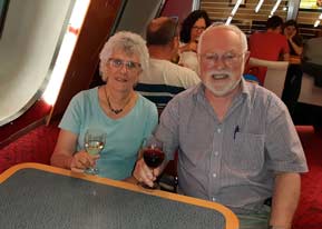
our originally planned trip to Scandinavia. We therefore raised our glasses to
toast our thanks (see left) to Alan Curry, Customer Services Manager at Autosleepers
and his Service Engineer Paul Oliver. Autosleepers not only no
longer produce the solid-sided, raising-roof VW Trooper but regrettably also no
longer convert VW campers at all; components therefore for repair to
George's damaged roof were no longer available. Despite this however, these two
valued friends at Autosleepers managed, against all the odds and with supreme
ingenuity, skill and craftsmanship, to find the means of sourcing or fabricating the
necessary parts, achieving a remarkable repair to George's raising roof.
Our VW Trooper has been the whole basis for the
travelling
life style we have enjoyed during the many years of our retirement; its unique
solid-sided raising roof design has enabled us to camp in some extreme and
sub-zero weather conditions during our travels, and for that reason it is for us
irreplaceable. The excellent work carried out by Alan and Paul at Autosleepers
in carrying out such difficult repairs has therefore restored our ability to
continue our travels across Europe, and for that we are truly grateful to them.
Thank you. Good to be on the Road again,
thanks to Autosleepers: as the Harwich overnight ferry for Hook of Holland drew away from the quay, we
took our customary seats by the ferry's lounge bow windows, savouring the moment
for the launch of our
belated 2019 trip to Denmark. This long-awaited moment brought to an end a
long, frustrating early summer of waiting for repairs to the raising roof of our
beloved VW camper, George, damaged back in April just before the start date for
our originally planned trip to Scandinavia. We therefore raised our glasses to
toast our thanks (see left) to Alan Curry, Customer Services Manager at Autosleepers
and his Service Engineer Paul Oliver. Autosleepers not only no
longer produce the solid-sided, raising-roof VW Trooper but regrettably also no
longer convert VW campers at all; components therefore for repair to
George's damaged roof were no longer available. Despite this however, these two
valued friends at Autosleepers managed, against all the odds and with supreme
ingenuity, skill and craftsmanship, to find the means of sourcing or fabricating the
necessary parts, achieving a remarkable repair to George's raising roof.
Our VW Trooper has been the whole basis for the
travelling
life style we have enjoyed during the many years of our retirement; its unique
solid-sided raising roof design has enabled us to camp in some extreme and
sub-zero weather conditions during our travels, and for that reason it is for us
irreplaceable. The excellent work carried out by Alan and Paul at Autosleepers
in carrying out such difficult repairs has therefore restored our ability to
continue our travels across Europe, and for that we are truly grateful to them.
Thank you.
|
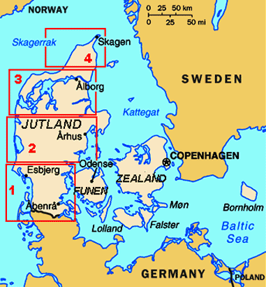
Click on 4 highlighted areas
for details of Jutland |
 |
 See
Campingplatz BUM near Borgdorf in
Schleswig-Holstein:
a long day's drive of 370 miles across Holland and Germany, with many autobahn hold-ups due to congested
traffic and road works, brought us with further delays past the landscape of
dockyard and container cranes at Hamburg, and under the Elbe Tunnel, for the final
100kms on the A7 into Schleswig-Holstein. 5kms around the lanes from A7 Junction
11 we finally reached See Campingplatz
BUM near Borgdorf. Since our last stay here in 2017, the lake-side camping See
Campingplatz BUM near Borgdorf in
Schleswig-Holstein:
a long day's drive of 370 miles across Holland and Germany, with many autobahn hold-ups due to congested
traffic and road works, brought us with further delays past the landscape of
dockyard and container cranes at Hamburg, and under the Elbe Tunnel, for the final
100kms on the A7 into Schleswig-Holstein. 5kms around the lanes from A7 Junction
11 we finally reached See Campingplatz
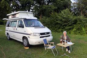
BUM near Borgdorf. Since our last stay here in 2017, the lake-side camping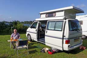 area
had been further enlarged and terraced with additional power supplies. Weary
after today's long drive, we sat in the late afternoon sunshine, enjoying
crisply fresh German beers (see left) (Photo
1 - See Campingplatz BUM), revelling in being able once more to
enjoy George's companionship. We woke to a bright morning and
breakfasted outside at the lake's edge in lovely warm sunshine to enjoy a
relaxed morning in camp (see right). The family that kept See Campingplatz BUM
were friendly and hospitably welcoming, and the charge was a very reasonable
€18.50. It was an altogether good site rated by as +5, so convenient to the
autobahn as a staging camp on the way up to Jutland. area
had been further enlarged and terraced with additional power supplies. Weary
after today's long drive, we sat in the late afternoon sunshine, enjoying
crisply fresh German beers (see left) (Photo
1 - See Campingplatz BUM), revelling in being able once more to
enjoy George's companionship. We woke to a bright morning and
breakfasted outside at the lake's edge in lovely warm sunshine to enjoy a
relaxed morning in camp (see right). The family that kept See Campingplatz BUM
were friendly and hospitably welcoming, and the charge was a very reasonable
€18.50. It was an altogether good site rated by as +5, so convenient to the
autobahn as a staging camp on the way up to Jutland.
Crossing into Denmark near Tønder in SW
Jutland:
re-joining A7 northwards, we shortly crossed over the impressively wide Kiel
Canal which cuts through the Schleswig-Holstein peninsula connecting the North
sea and Baltic Sea. At the northernmost German city of Flensburg, we turned off
the motorway and followed back lanes to cross into Denmark on the south-western
side of Jutland (click
here for detailed map of route). Observing the relaxed Danish speed
limit of 80kph (50mph) for trunk roads, we drove into the nearby town of Tønder
to shop for provisions, getting our first experience of the Danish high cost of
living.
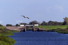 The Wadden Sea and Vidå Sluice at the
Forward Coastal Dyke: from Tønder,
country lanes
through flat coastal farming countryside led to the village of Højer, where we
continued out towards the Wadden Sea coast across polders (reclaimed former
marshland) and the Højer Dyke, following
the Vidå River to where it now enters the Wadden Sea through the Vidå
Sluice at the massively impressive Forward
Coastal Dyke. The Wadden Sea and Vidå Sluice at the
Forward Coastal Dyke: from Tønder,
country lanes
through flat coastal farming countryside led to the village of Højer, where we
continued out towards the Wadden Sea coast across polders (reclaimed former
marshland) and the Højer Dyke, following
the Vidå River to where it now enters the Wadden Sea through the Vidå
Sluice at the massively impressive Forward
Coastal Dyke.
 The Wadden Sea, stretching around the coasts of
Holland, North Germany and SW Jutland, is extremely tidal, with a tidal
difference of up to 2m between high and low tides every 25 hours. The reclaimed
polders of the fertile Tønder coastal marshlands had always been settled and
cultivated, but farms and buildings had to be raised on mounds and land
protected by dykes, from the constant hazard of flooding by sea-water during
storm tides, and by river water during winter~spring high flow periods. In 1861
the Højer Dyke was built protecting the then line of the Wadden Sea coast and
the outflow of the Vidå River controlled by Højer Sluice. With more intensive
exploitation and settlement of the Tønder reclaimed marshlands during the 20th
century, the threat of flooding of the coastal area, most of which lies at sea
level, became more critical. A severe storm tide in January 1976, which
threatened to overspill the existing coastal Højer Dyke, led to a Danish
parliamentary decision to construct a new 8m high forward coastal dyke to
protect settlements and agricultural land in the Tønder area. The Forward
Coastal Dyke was constructed between 1979~81, 1.4kms west and seaward of, and
parallel with, the old Højer Dyke, creating an extended new coastline. The Vidå
is the third largest river in Denmark, The Wadden Sea, stretching around the coasts of
Holland, North Germany and SW Jutland, is extremely tidal, with a tidal
difference of up to 2m between high and low tides every 25 hours. The reclaimed
polders of the fertile Tønder coastal marshlands had always been settled and
cultivated, but farms and buildings had to be raised on mounds and land
protected by dykes, from the constant hazard of flooding by sea-water during
storm tides, and by river water during winter~spring high flow periods. In 1861
the Højer Dyke was built protecting the then line of the Wadden Sea coast and
the outflow of the Vidå River controlled by Højer Sluice. With more intensive
exploitation and settlement of the Tønder reclaimed marshlands during the 20th
century, the threat of flooding of the coastal area, most of which lies at sea
level, became more critical. A severe storm tide in January 1976, which
threatened to overspill the existing coastal Højer Dyke, led to a Danish
parliamentary decision to construct a new 8m high forward coastal dyke to
protect settlements and agricultural land in the Tønder area. The Forward
Coastal Dyke was constructed between 1979~81, 1.4kms west and seaward of, and
parallel with, the old Højer Dyke, creating an extended new coastline. The Vidå
is the third largest river in Denmark,
 draining a 1,400km2 catchment
with its source on a glacial ridge near Aabenraa in SE Jutland. During the 19th
century, the river regularly flooded the low-lying Tønder marshlands during winter high
flow periods, leaving dry only dykes and buildings on mounds. During the 1920s,
the lower Vidå was canalised with protective embankments and water pumped from
marshes into the river. Prior to construction of the Forward Coastal Dyke in
1981, the Vidå River flowed into the Wadden Sea through Højer Sluice. It is now
controlled at its extended outflow at Vidå Sluice in the Forward Coastal Dyke.
The sluice consists of 3 chambers with a total width of 20m. Facing the sea on
the outward side are 3 pairs of automatic sluice gates, with 3 pairs of storm
shields on the inland side of the sluice facing up-river. Water levels are
monitored on both marine and inland sides, in order to forecast storm tide
warnings. During prolonged high tides in the Wadden Sea, the draining a 1,400km2 catchment
with its source on a glacial ridge near Aabenraa in SE Jutland. During the 19th
century, the river regularly flooded the low-lying Tønder marshlands during winter high
flow periods, leaving dry only dykes and buildings on mounds. During the 1920s,
the lower Vidå was canalised with protective embankments and water pumped from
marshes into the river. Prior to construction of the Forward Coastal Dyke in
1981, the Vidå River flowed into the Wadden Sea through Højer Sluice. It is now
controlled at its extended outflow at Vidå Sluice in the Forward Coastal Dyke.
The sluice consists of 3 chambers with a total width of 20m. Facing the sea on
the outward side are 3 pairs of automatic sluice gates, with 3 pairs of storm
shields on the inland side of the sluice facing up-river. Water levels are
monitored on both marine and inland sides, in order to forecast storm tide
warnings. During prolonged high tides in the Wadden Sea, the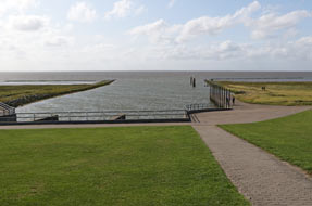 sluice gates are
kept shut. Accumulating water in the Vidå River then overflows into the
Margrethe Kog polder and reservoir on the inner side of the Forward Coastal
Dyke. On the outer seaward side of the Forward Coastal Dyke, a number of
sedimentation pans were created to promote the formation of new fore-shore and
enhance dyke safety. sluice gates are
kept shut. Accumulating water in the Vidå River then overflows into the
Margrethe Kog polder and reservoir on the inner side of the Forward Coastal
Dyke. On the outer seaward side of the Forward Coastal Dyke, a number of
sedimentation pans were created to promote the formation of new fore-shore and
enhance dyke safety.
We followed the lane out from Højer village
across the polders grazing lands towards the old Højer Dyke. The road rose and
dog-legged over the dyke towards Højer Sluice which formerly controlled the
River Vidå's outflow into the Wadden Sea (see above left). The lane continued alongside
the now
canalised lower course of the Vidå for 2kms,and in the distance we could see the
control tower of the 1982 Vidå Sluice. Towards the end of the lower Vidå, the
river forked into the area of reservoir into which the river now overspills when
prolonged high tides make necessary the sluice gates' closure. Extending
leftwards beyond the river's lower course, the Margrethe Kog polder stood
landward of the line of the new Forward Coastal Dyke and the saltwater lake. At
lane's end, we parked by the small restaurant and Vidå exhibition house, and
 walked over to explore the sluice, climbing up onto the apex of the Forward
Coastal Dyke which stretched away into the distance north and south along the
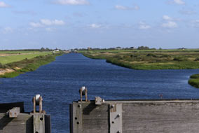
new outer coastline. From here we could look inland up the lower length of the
river and across the Margrethe Kog polder and overflow reservoir to its right
(see above right).
We were surprised at the shallow angle of the dyke's outer seaward face which
sloped gently down to the shore-line and the fore-shore sedimentation pans (see
above left).
Older dykes were built with more upright faces on both sides, which were
battered by the full force of tides on the outer seaward face. Modern dykes
such as the Forward Coastal Dyke are now constructed with more gently sloping
outer face towards the sea; this forces storm surge waves to release their energy
slowly instead of hitting the dyke wall with full force. Many of the older dykes
have now been modified with more gently sloping outer faces. walked over to explore the sluice, climbing up onto the apex of the Forward
Coastal Dyke which stretched away into the distance north and south along the
new outer coastline. From here we could look inland up the lower length of the
river and across the Margrethe Kog polder and overflow reservoir to its right
(see above right).
We were surprised at the shallow angle of the dyke's outer seaward face which
sloped gently down to the shore-line and the fore-shore sedimentation pans (see
above left).
Older dykes were built with more upright faces on both sides, which were
battered by the full force of tides on the outer seaward face. Modern dykes
such as the Forward Coastal Dyke are now constructed with more gently sloping
outer face towards the sea; this forces storm surge waves to release their energy
slowly instead of hitting the dyke wall with full force. Many of the older dykes
have now been modified with more gently sloping outer faces.
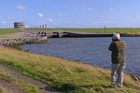
From the sluice control tower at the dyke apex,
we walked down the gently sloping outer face to stand above the sluice's seaward
storm gates (see above right), beyond which the Vidå River flowed out into the Wadden Sea. We
walked down alongside the outflow over the mudflats for photos looking back
towards the sluice and gently sloping dyke
(see left) (Photo 2 - Outflow of Vidå River into Wadden Sea). Back over the high dyke, we found
the Vidå exhibition which gave more information on Wadden Sea tides, storm
surges when powerful westerly gales force water several metres over its normal
level inland into the river's mouth, and bird- and wild-life of the Wadden Sea
coast.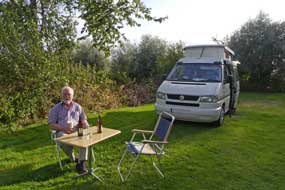
Rudbøl Camping on the line of the
Danish~German border:
by now its was 5-00pm and we drove back around the lanes to Højer village turning south on a lane which ran along the crest of the Gammel Højer Dige (Old
Højer Dyke) alongside the Vidå River which meandered through the reclaimed
polders farmland where sheep and cattle grazed. In 3kms we reached Rudbøl village,
and in the heart of the village found tonight's campsite, Rudbøl
Camping. We were greeted in friendly and welcoming manner by the lady owner who
showed us round; the charge of 210kr seemed high for a modest campsite, but this
was markedly cheaper than most of the larger and over-luxurious Danish
holiday-camps which we should try to avoid. The site was large with many statics in the central area
unoccupied mid-week, but with plenty of spaces further over. Having
 filled
George's fresh water, we settled into a deserted open area where we had total
privacy and access to power, and relaxed with beers in the evening sunshine
(see right) (Photo 3 - Rudbøl Camping). The
sun set behind a line of poplars and the evening grew cool. Today had been a
shorter and more relaxing day, but we had learned much about life on the Wadden
Sea coast of SW Jutland and the measures taken to protect against storm tides.
And tonight we were camped at what must be Jutland's southernmost village,
exactly on the line of the Danish~German border formed by the Vidå River, drawn
in 1920 with the post-WW1 partition of South Jutland and Schleswig-Holstein. filled
George's fresh water, we settled into a deserted open area where we had total
privacy and access to power, and relaxed with beers in the evening sunshine
(see right) (Photo 3 - Rudbøl Camping). The
sun set behind a line of poplars and the evening grew cool. Today had been a
shorter and more relaxing day, but we had learned much about life on the Wadden
Sea coast of SW Jutland and the measures taken to protect against storm tides.
And tonight we were camped at what must be Jutland's southernmost village,
exactly on the line of the Danish~German border formed by the Vidå River, drawn
in 1920 with the post-WW1 partition of South Jutland and Schleswig-Holstein.
 The Danish~German border:
after much rain in the night, which successfully tested George's newly repaired
roof, we woke to a much cooler weather and heavily overcast sky and spent a
relaxed morning sitting out the frequent heavy showers. Before leaving Rudbøl,
we drove through the village to the line of the Danish~German open border and
crossed the Vidå bridge at the point where the river swells out into another
flood lake. Having crossing the border into the neighbouring German village of
Rosenkranz simply for the sake of it, we turned back into Denmark by a surviving
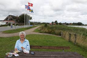
border barrier and sat at a lake-side picnic table for our lunch sandwiches by
the combined flags of the Nordic countries which proudly signified the border
(see left)
(Photo 4 - Danish~German border). The Danish~German border:
after much rain in the night, which successfully tested George's newly repaired
roof, we woke to a much cooler weather and heavily overcast sky and spent a
relaxed morning sitting out the frequent heavy showers. Before leaving Rudbøl,
we drove through the village to the line of the Danish~German open border and
crossed the Vidå bridge at the point where the river swells out into another
flood lake. Having crossing the border into the neighbouring German village of
Rosenkranz simply for the sake of it, we turned back into Denmark by a surviving
border barrier and sat at a lake-side picnic table for our lunch sandwiches by
the combined flags of the Nordic countries which proudly signified the border
(see left)
(Photo 4 - Danish~German border).
 Crossing the tidal causeway to the Wadden Sea island of Mandø:
we returned along the crest of the old Højer Dyke across agricultural polders
countryside riddled with drainage channels, and through Højer village we
continued north on Route 419 following the Wadden Sea coastline with the German
holiday island of Sylt and Danish island of Rømø lining the western horizon (click
here for detailed map of route). With the sun bright, a brisk westerly
wind from off the Wadden Sea created an impressive cloudscape. Into Skærbæk, we
shopped for 2 nights' provisions for our time on the offshore Wadden Sea island
of Mandø, which is connected to the Danish mainland by a 6kms long low gravel
causeway and only accessible twice daily at low tide. Continuing north on the
main Route 11, we turned off to the twee, des-res village of Vester Vedstad, and
the UNESCO World Heritage Wadden Sea Centre. We had earlier tried twice to
telephone to confirm our tide tables information for safe early evening
low tide crossing times to Mandø, but inevitably got no reply. From our past
experience of such Crossing the tidal causeway to the Wadden Sea island of Mandø:
we returned along the crest of the old Højer Dyke across agricultural polders
countryside riddled with drainage channels, and through Højer village we
continued north on Route 419 following the Wadden Sea coastline with the German
holiday island of Sylt and Danish island of Rømø lining the western horizon (click
here for detailed map of route). With the sun bright, a brisk westerly
wind from off the Wadden Sea created an impressive cloudscape. Into Skærbæk, we
shopped for 2 nights' provisions for our time on the offshore Wadden Sea island
of Mandø, which is connected to the Danish mainland by a 6kms long low gravel
causeway and only accessible twice daily at low tide. Continuing north on the
main Route 11, we turned off to the twee, des-res village of Vester Vedstad, and
the UNESCO World Heritage Wadden Sea Centre. We had earlier tried twice to
telephone to confirm our tide tables information for safe early evening
low tide crossing times to Mandø, but inevitably got no reply. From our past
experience of such places, UNESCO status is symbolic of the ultimate in negative attributes: high
on pretentious glitziness and entry cost, low on value as a source of
substantive detailed information, and the Wadden Sea Centre was no exception!
With zero expectations, we enquired with the girl at reception about earliest
safe crossing times to Mandø this evening with low tide presently set at 8-20pm.
As expected, she was utterly unhelpful and evasive - no tide
tables, no information, no help, nothing to justify the place's costly and
pretentious status! Instead we phoned the shop-cum-campsite on Mandø and were
assured that we could cross safely up to 2 hours before and after low tide time.
All the tractor-buses, which at great expense
convey tourists across the mud flats for day trips to Mandø, returned, and at
6-00pm we set off around the lane to the coastal dyke to begin the crossing of
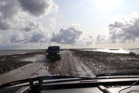
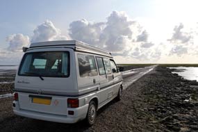
Mandø causeway, the Låningsvej (see right). The brisk westerly wind kept the showers at bay,
and driving into a magnificently dramatic Big Sky cloudscape (see above left
and right) (Photo
5 - Crossing Mandø causeway),
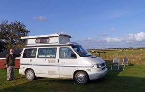 we crossed the
6kms of wet, muddy gravel causeway. 5kms over, the lane became tarmac again,
rising over the higher, grass-covered salt-marshes to reach Mandø island and its
farming village. Here we located the small campsite and settled into a quiet
corner, looking out across the pastureland towards the island's eastern side (Photo
6 - Mandø Camping). we crossed the
6kms of wet, muddy gravel causeway. 5kms over, the lane became tarmac again,
rising over the higher, grass-covered salt-marshes to reach Mandø island and its
farming village. Here we located the small campsite and settled into a quiet
corner, looking out across the pastureland towards the island's eastern side (Photo
6 - Mandø Camping).
Mandø island: Mandø is one of the
northernmost of the line of glacially deposited islands, sandbanks and mud-flats
lying along the length of the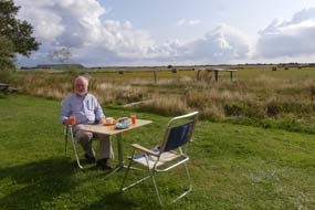 North Friesian coastline stretching from Holland,
North Germany to SW Jutland, which separate the shallow Wadden Sea from the
North Sea beyond the continental shelf. This chain of islands forms the remains
of a pre-Ice Age coastline before sea levels rose creating the Wadden Sea. Mandø
covers an area of just over 7 square kms. Extensive mud-flats and tidal marshes
surround the island, providing breeding grounds for multitudes of sea birds and
Common and Grey Seals. There are currently 60 permanent residents on Mandø and
the islanders have traditionally made a living from fishing and farming;
nowadays tourism provides a secondary source of earnings. An earth dyke was
constructed around the island's perimeter set back from the shore-line, to
protect the cultivable land from storm tides for cereal crops and for sheep and
cattle grazing. North Friesian coastline stretching from Holland,
North Germany to SW Jutland, which separate the shallow Wadden Sea from the
North Sea beyond the continental shelf. This chain of islands forms the remains
of a pre-Ice Age coastline before sea levels rose creating the Wadden Sea. Mandø
covers an area of just over 7 square kms. Extensive mud-flats and tidal marshes
surround the island, providing breeding grounds for multitudes of sea birds and
Common and Grey Seals. There are currently 60 permanent residents on Mandø and
the islanders have traditionally made a living from fishing and farming;
nowadays tourism provides a secondary source of earnings. An earth dyke was
constructed around the island's perimeter set back from the shore-line, to
protect the cultivable land from storm tides for cereal crops and for sheep and
cattle grazing.
 An afternoon's walking around Mandø's
western coastline: we woke to a bright sunny morning and breakfast outside (Photo
7 - Breakfast at Mandø Camping) (see right), spending a relaxing and peaceful morning in camp enjoying the
sunshine and solitude. We packed a day sac and set off for an afternoon of
walking around Mandø's western coastline. Just around the corner from the
campsite by the village's central 'square', where the tractor buses deposited today's bevies of tourists, we found the little Brugsen shop and settled up our
2 day's campsite rent, thanking the lady for her help with An afternoon's walking around Mandø's
western coastline: we woke to a bright sunny morning and breakfast outside (Photo
7 - Breakfast at Mandø Camping) (see right), spending a relaxing and peaceful morning in camp enjoying the
sunshine and solitude. We packed a day sac and set off for an afternoon of
walking around Mandø's western coastline. Just around the corner from the
campsite by the village's central 'square', where the tractor buses deposited today's bevies of tourists, we found the little Brugsen shop and settled up our
2 day's campsite rent, thanking the lady for her help with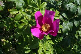 causeway low tide
crossing times. Strandvej led out over the western line of dunes and down to the
island's western shoreline where the Stormflodssøjlen column indicated record
heights of storm flood tides over the years since the disastrous tide of 1691. causeway low tide
crossing times. Strandvej led out over the western line of dunes and down to the
island's western shoreline where the Stormflodssøjlen column indicated record
heights of storm flood tides over the years since the disastrous tide of 1691.
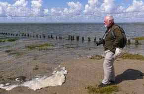
With a crisp westerly wind blowing and bright
afternoon sun sparkling on the Wadden Sea across the sandbanks, we walked down
to the water's edge for photographs along the shoreline (see left) (Photo
8 - Mandø's western shoreline). A track around the western foreshore led
just below the line of dunes, northwards parallel with the coast. Here massed
thickets of wild roses (Rosa rugosa) (see right) (Photo
9 - Wild Roses - Rosa rugosa), so characteristic of Denmark,
blossomed along the foreshore, covered with huge rose-hips and their dusky pink
and white flowers mostly over but still enough of them to fill the air with
their familiar scent. We ambled along the beautiful foreshore pausing
frequently to photograph the flora, which included
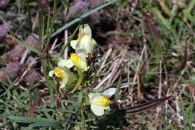 Toadflax
(see below left), Yellow Rattle, Slender Centuary, and Restharrow. The path curved around under the line of dunes,
gaining a little height to join the roadway that ran around in the lee of the
NW section of the massive dyke which encircles the island, protecting the
village and farmland from tidal storm floods. This entire centrally enclosed
area of the island is criss-crossed by a cleverly constructed network of
drainage dikes which all feed into a main dike running transversely E~W across
the island's centre to outflow through a sluice on the east coast. Toadflax
(see below left), Yellow Rattle, Slender Centuary, and Restharrow. The path curved around under the line of dunes,
gaining a little height to join the roadway that ran around in the lee of the
NW section of the massive dyke which encircles the island, protecting the
village and farmland from tidal storm floods. This entire centrally enclosed
area of the island is criss-crossed by a cleverly constructed network of
drainage dikes which all feed into a main dike running transversely E~W across
the island's centre to outflow through a sluice on the east coast.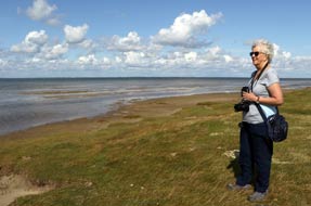
Once we had passed from the open west-facing
foreshore out of the wind into the lee of the huge dyke, the afternoon sun felt
warm. We followed the roadway northwards past a long, linear flood reservoir
either side of the island's central drainage dike. Grazing sheep stared down on
us from the crest of the dyke. The roadway curved round past ponds where many
birds gathered to reach the island's northern point. Here a side-track ran down
from the dyke towards the northern shore-line at Skelbankerampe. At the water's
edge we could look out over sand flats where at low tide colonies of seals bask
and oyster beds form on the mud banks (see right). Back up to the dyke, we returned through
sheep pastures on the more gently sloping outer seaward face, and along the
dykes crest high above the roadway. Dropping down the dyke's steep inner face,
we returned along Klitvej to the village, as the last of today's tourists were
departing in the tractor-bus. Today's 7kms walk had been thoroughly rewarding,
giving us a fuller understanding of Mandø's topography and the flood protection
and drainage that over time had made farming life on the island possible.
A change of weather for our return to the
mainland: more cloud gathered late evening foreshadowing the change of wind direction to south which
would bring tomorrow's forecast rain. The following morning duly brought heavily
overcast sky and cooler, wind-driven persistent drizzle; it was going to be a
thoroughly unpleasant day for our return to the mainland. We had been very
fortunate in having such a fine day and clear light for yesterday's shore-line
walk. We needed to be away by 10-30am latest for a safe crossing of the causeway
with low tide being at 9-30. From Mandø By (village) we headed across the
farmland to cross the northern peripheral dyke and began the return crossing of
the gravel causeway, passing a tractor-bus ferrying out the first of today's
tourists for a wretchedly wet day on Mandø.
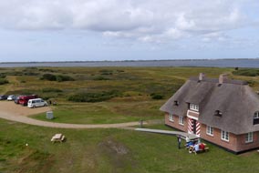 Tipperne Bird Reserve at Ringkøbing Fjord:
back across at the mainland, we headed north on Rte 11 with the attractive view
of Ribe's ancient medieval church towering over this former Viking port-town (click
here for detailed map of route). Rte 11 crossed the Esbjerg~Kolding
motorway and continued north to Varde where we re-stocked with provisions at a
Kvickly supermarket in the centre of town. As we turned off onto Rte 181 through
Nørre Nebel, the sky darkened dramatically and the forecast pouring rain began.
Our plan this afternoon had been to explore the bird-watching potential of the
Tipperne Peninsula Bird Reserve which extended into the southern part of Ringkøbing Fjord,
but in this driving rain and poor visibility, the chances of seeing much seemed
limited. We had been told that the gate into the Tipperne limited access
conservation reserve was only open from 9-30am to 3-30pm; despite the adverse
weather, we had an hour today for an exploratory foray. The lane leading to the
Tipperne conservation area gate soon became unsurfaced, and driving along the
2kms of gravelled approach lane, we disturbed a number of birds from the
surrounding moorland long grass: Snipe (recognised from having seen so many 2
years ago in Iceland), Grey Heron and Curlew. In pouring rain and poor light we
reached lane's end at the bird observation tower, but in such weather it simply was not worth a
purposeless soaking attempting to climb the tower today; we should have to return in the
morning in better weather. Tipperne Bird Reserve at Ringkøbing Fjord:
back across at the mainland, we headed north on Rte 11 with the attractive view
of Ribe's ancient medieval church towering over this former Viking port-town (click
here for detailed map of route). Rte 11 crossed the Esbjerg~Kolding
motorway and continued north to Varde where we re-stocked with provisions at a
Kvickly supermarket in the centre of town. As we turned off onto Rte 181 through
Nørre Nebel, the sky darkened dramatically and the forecast pouring rain began.
Our plan this afternoon had been to explore the bird-watching potential of the
Tipperne Peninsula Bird Reserve which extended into the southern part of Ringkøbing Fjord,
but in this driving rain and poor visibility, the chances of seeing much seemed
limited. We had been told that the gate into the Tipperne limited access
conservation reserve was only open from 9-30am to 3-30pm; despite the adverse
weather, we had an hour today for an exploratory foray. The lane leading to the
Tipperne conservation area gate soon became unsurfaced, and driving along the
2kms of gravelled approach lane, we disturbed a number of birds from the
surrounding moorland long grass: Snipe (recognised from having seen so many 2
years ago in Iceland), Grey Heron and Curlew. In pouring rain and poor light we
reached lane's end at the bird observation tower, but in such weather it simply was not worth a
purposeless soaking attempting to climb the tower today; we should have to return in the
morning in better weather.
Bork Havn
Camping on southern shore of Ringkøbing Fjord: back
along the lanes, we turned off to find tonight's planned campsite, Bork Havn
Camping on the southern shore of Ringkøbing Fjord, which we had first used in 2007
and again on our return from Norway in September 2014. As always, the
long-standing owners greeted us with a warm and friendly welcome. The site
was well priced at 195kr (plus extra for showers) with clean, modern facilities
and well-equipped kitchen, and was divided by hedges into a number of bays mostly now
filled by statics. In peak summer time, Bork Havn
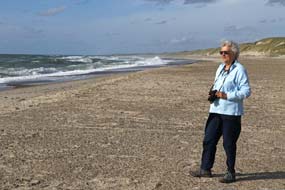 would be insufferably noisy,
but most of the statics were empty at this late stage in the year; even so the
noise of TVs in caravan awnings was an irritating intrusion. would be insufferably noisy,
but most of the statics were empty at this late stage in the year; even so the
noise of TVs in caravan awnings was an irritating intrusion.
A day of bird-watching around Ringkøbing Fjord:
the sky was clearing with a bright sun when we departed the following morning
for our day of bird-watching around Ringkøbing Fjord (click
here for detailed map of route). We returned firstly to Tipperne, and at the peninsula tip, climbed the bird observation tower to scan
the fjord and reed beds through binoculars (see above right). On a sunny day, there was less
bird-life in the approach meadows than in yesterday's rain, but Oyster Catchers
were feeding on the shore-side turf and in the distance a flock of geese could
be seen, with swans on the fjord. Swallows flitted around the Tipperne Reserve
building, nesting under the thatched eaves. Before leaving Tipperne, we diverted
down to another observation tower overlooking the Fugletårn. This was a
wonderfully peaceful place, and an ideal secluded spot for a wild camp. From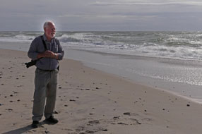 the
tower overlooking the lake shallows and reed-beds, we recorded seeing a Grey
Heron, several Greenshanks, a Curlew, and two unidentified birds of prey soaring
over the meadows where reeds cut for thatching had been stacked. the
tower overlooking the lake shallows and reed-beds, we recorded seeing a Grey
Heron, several Greenshanks, a Curlew, and two unidentified birds of prey soaring
over the meadows where reeds cut for thatching had been stacked.
We drove around to Lønborg from where a road
ran north, crossing the Skjern Å (River) which here at its outflow into Ringkøbing Fjord
spreads into many channels and lagoons. We pulled into a parking area where a
raised hide looked over one of the lagoons and reed-beds. Many Mute Swans glided
around the lagoon with their wing feathers raised, flocks of Lapwings flew over
or stood on the turf banks in their characteristic manner all facing the same
direction. Through binoculars, their head-crests were clearly visible. In
amongst the Lapwings were a few Golden Plovers, a Yellowhammer pecked on the
ground just below the hide, and a Heron stood among the reeds. Again Swallows
flitted around the hide, even swooping inside through open windows and perching
on rafters where a nest still contained young birds. We crossed the bridges
towards Skjern and turned off around lanes to Pumping Station Nord which had
once pumped water from the then drained
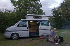 meadows into the Skjern Å. The roof-top
viewing platform gave views over the meadows and river, but there was no
bird-life to be seen here. meadows into the Skjern Å. The roof-top
viewing platform gave views over the meadows and river, but there was no
bird-life to be seen here.
We followed the fjord-side road
northwards, passing though attractive villages around to Ringkøbing at the head
of the fjord. Bypassing the town, we continued north and turned off beyond Vest
Stadil Fjord to find hides shown on a map-leaflet we had from our 2007 Danish
trip. From a parking area, a path led across the meadows to a hide overlooking
another small lake. A pair of Marsh Harriers soared over the meadows, and from
the hide we could see a number of Cormorants standing on islets in the
lake, and Terns flitting over and dipping in the lake. To the distant
westwards, the line of coastal dunes were visible along the West Jutland coast whose deposition over time had trapped the enclosed inland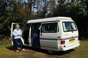 lagoons which now
form Ringkøbing and Nissum Fjords. Out to the main Route 181 coast road behind
these dunes at Husby Klit, we clambered up over the dunes where sweetly scented wild roses
flourished, and down to the deserted West Jutland beaches which stretched away
mile after mile north and south backed by the line of dunes (see above
left). The light was
perfect for photographs from high on the dunes (Photo
10 - Husby Klit dunes) and down by the water's edge,
where wind driven surf crashed onto the shore (see above right). lagoons which now
form Ringkøbing and Nissum Fjords. Out to the main Route 181 coast road behind
these dunes at Husby Klit, we clambered up over the dunes where sweetly scented wild roses
flourished, and down to the deserted West Jutland beaches which stretched away
mile after mile north and south backed by the line of dunes (see above
left). The light was
perfect for photographs from high on the dunes (Photo
10 - Husby Klit dunes) and down by the water's edge,
where wind driven surf crashed onto the shore (see above right).
Ringkøbing Camping:
back south on Rte 181 passing farms whose cattle grazed the fjord meadows, we turned off
at Søndervig to Ringkøbing to shop for provisions at the Brugsen
supermarket, and 2kms east beyond the town in woodland, we reached Ringkøbing
Camping. It was a large site with a range of pitches scattered among the
woodlands, and not unduly crowded. After a long day, we quickly settled in and
the barbecue was lit for supper in spite of threatening rain (see above left). In fact it poured all
night, and was still raining the following morning, giving George's new roof a
thorough testing. The campsite facilities were good, with two blocks of modern,
clean WC/showers and kitchenette/wash-ups. By the time we were ready to leave,
the sky was at last beginning to clear and sun breaking through (see right).
 Thyborøn ferry across mouth of Limfjord to Agger: we headed north
on Route 181 (click
here for detailed map of route) following the line of the West Jutland
coast, along the sandbar
whose narrow strip of high dunes stretching for miles down the coast separates
the North Sea from the inland Thyborøn ferry across mouth of Limfjord to Agger: we headed north
on Route 181 (click
here for detailed map of route) following the line of the West Jutland
coast, along the sandbar
whose narrow strip of high dunes stretching for miles down the coast separates
the North Sea from the inland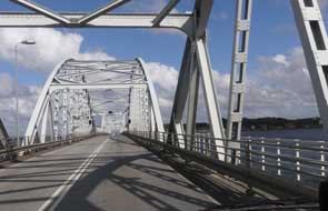 Nissum Fjord.
The road passed through Thorsminde village
and its harbour which have developed around the sluice which
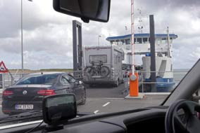
now controls the Nissum Fjord's outflow. With time now pressing, and just an hour to reach Thyborøn in
time for the 3-00pm ferry across to Agger on the far side of the Limfjord
outflow, we drove at pace for the remaining section of peninsula up to Thyborøn.
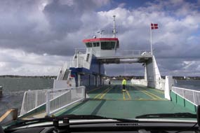
We reached the ferry dock with just 10 minutes to spare, and joined other
vehicles waiting to board for the 10 minute crossing (see left); the brisk
westerly wind raised white horses in the choppy waters of the mouth of Limfjord.
Ashore on the far bank, we drove north up the length of the desolate Agger Tange
sand spit, and turned west by Agger village's little harbour on Nissum
Bredning. At Vestervig church, Route 527 led north towards Thisted to reach Route 26
at Sundby; we turned SW-wards, crossing the huge girder bridge over Vilsund
Sound onto the large island of Mors (Photo
11 - Vilsund Sound bridge) (see right). Route 26 was a confusing road, busy with
traffic, and alternating stretches of 90kph highway with sudden poorly indicated
shorter stretches of 80kph speed limit, and one of only two speed cameras we
encountered in the whole of Denmark. Nissum Fjord.
The road passed through Thorsminde village
and its harbour which have developed around the sluice which
now controls the Nissum Fjord's outflow. With time now pressing, and just an hour to reach Thyborøn in
time for the 3-00pm ferry across to Agger on the far side of the Limfjord
outflow, we drove at pace for the remaining section of peninsula up to Thyborøn.
We reached the ferry dock with just 10 minutes to spare, and joined other
vehicles waiting to board for the 10 minute crossing (see left); the brisk
westerly wind raised white horses in the choppy waters of the mouth of Limfjord.
Ashore on the far bank, we drove north up the length of the desolate Agger Tange
sand spit, and turned west by Agger village's little harbour on Nissum
Bredning. At Vestervig church, Route 527 led north towards Thisted to reach Route 26
at Sundby; we turned SW-wards, crossing the huge girder bridge over Vilsund
Sound onto the large island of Mors (Photo
11 - Vilsund Sound bridge) (see right). Route 26 was a confusing road, busy with
traffic, and alternating stretches of 90kph highway with sudden poorly indicated
shorter stretches of 80kph speed limit, and one of only two speed cameras we
encountered in the whole of Denmark.
 Island of Fur in Limfjord:
the entire span of Jutland's northern region is in fact an island separated by Limfjord, a body of water
which stretches from the west coast at Agger to the east coast beyond Aalborg. Across the width of Mors, a wider bridge
spanned the Salting Sound, with Island of Fur in Limfjord:
the entire span of Jutland's northern region is in fact an island separated by Limfjord, a body of water
which stretches from the west coast at Agger to the east coast beyond Aalborg. Across the width of Mors, a wider bridge
spanned the Salting Sound, with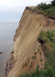 Limfjord's ubiquitously pervasive spread
stretching away to the north like an inland sea (click
here for detailed map of route). Back onto the NW Jutland
'mainland', we turned off across the Selling peninsula, winding a way on back
lanes to reach the dock at Brandon for the 5 minute ferry crossing over the
narrow channel to the Limfjord island of Fur
(Photo
12 - Fur Island ferry) (see left). We wound a way around the island's
lanes over to the north coast, ending at Fur Camping. The grassy camping areas were tiered up the
steep hill-side, but we managed
to find a pitch that was not unduly sloping or vulnerable to noise from
holiday-making Danes in the many statics. The place had changed drastically from
the straightforward and untamed wooded campsite recalled from our 2007 visit to
Fur; it was then called Råkilde Camping, with a charactersome back-woodsman
owner. In contrast however, it was now very much a Danish holiday-camp, extended in terraces up the
hillside, with a different atmosphere, different clientele, and very different
owners as we were shortly to discover. Limfjord's ubiquitously pervasive spread
stretching away to the north like an inland sea (click
here for detailed map of route). Back onto the NW Jutland
'mainland', we turned off across the Selling peninsula, winding a way on back
lanes to reach the dock at Brandon for the 5 minute ferry crossing over the
narrow channel to the Limfjord island of Fur
(Photo
12 - Fur Island ferry) (see left). We wound a way around the island's
lanes over to the north coast, ending at Fur Camping. The grassy camping areas were tiered up the
steep hill-side, but we managed
to find a pitch that was not unduly sloping or vulnerable to noise from
holiday-making Danes in the many statics. The place had changed drastically from
the straightforward and untamed wooded campsite recalled from our 2007 visit to
Fur; it was then called Råkilde Camping, with a charactersome back-woodsman
owner. In contrast however, it was now very much a Danish holiday-camp, extended in terraces up the
hillside, with a different atmosphere, different clientele, and very different
owners as we were shortly to discover.
Offensively ill-mannered owners at Fur
Camping - a place to be avoided: our plan had been to stay
a second night at Fur Camping, and to undertake the coastal walk around northern
Fur's moler cliffs. But when Paul went over for his shower at 10-30am, he
discovered that the
 WC/showers were closed for cleaning until 11-30, peak demand
time. Not prepared to waste time like this, he persuaded the cleaner to let him
use one of the showers, but Sheila was unable to get her shower. We packed our
kit for today's walk, but before leaving, went over to reception to raise the
issue of closing WC/showers to paying guests at peak times to suit management
convenience. Both the owner and his wife now turned insultingly rude, and
demanded we leave immediately for presuming to question the way they ran their
campsite. The more we remonstrated, the more offensive they became, obdurately
insisting we leave immediately, with no payment required for last night. In over
40 years of camping, this was the most grotesquely ill-mannered behaviour we had
ever encountered from campsite owners; not prepared to accept such uncouth
attitudes towards paying guests who kept them in WC/showers were closed for cleaning until 11-30, peak demand
time. Not prepared to waste time like this, he persuaded the cleaner to let him
use one of the showers, but Sheila was unable to get her shower. We packed our
kit for today's walk, but before leaving, went over to reception to raise the
issue of closing WC/showers to paying guests at peak times to suit management
convenience. Both the owner and his wife now turned insultingly rude, and
demanded we leave immediately for presuming to question the way they ran their
campsite. The more we remonstrated, the more offensive they became, obdurately
insisting we leave immediately, with no payment required for last night. In over
40 years of camping, this was the most grotesquely ill-mannered behaviour we had
ever encountered from campsite owners; not prepared to accept such uncouth
attitudes towards paying guests who kept them in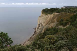 business, we did indeed depart, vowing to
ensure that the world knew of their intemperate lack of any grace or civility.
We urge all other campers to avoid Fur Camping like the plague, so that such
ill-mannered people learn to their cost the commercial consequences of treating
customers in such insulting terms. business, we did indeed depart, vowing to
ensure that the world knew of their intemperate lack of any grace or civility.
We urge all other campers to avoid Fur Camping like the plague, so that such
ill-mannered people learn to their cost the commercial consequences of treating
customers in such insulting terms.
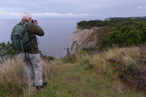
Fur moler cliffs: we drove around to the parking area at the Fur
northern cliff-top for the start of today's walk around the moler cliffs, and
here found an ideal spot for a wild camp tonight: the parking area was labelled
on the Fur tourist map-leaflet as a Primitiv Overnatningplads. Assured by
this, we set off for our cliff-top walk.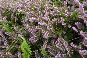
The cliffs of Mors and Fur, islands set in
Limfjord, show a unique geological feature, being composed of moler-clay, a
sedimentary rock laid down some 50 million years ago in a shallow sub-tropical
sea which then covered Denmark. It is formed of a mixture of fine clay particles
and Diatomaceous Earth (kieselgur), the fossilised siliceous remains of
diatoms, hard-shelled single cell creatures. Here on the northern cliffs of
Fur, the moler-clay is interspersed with strata of grey volcanic ash deposited
during the clay's formation. The seas in which the sediments were formed were
rich in plant and animal life, and the deposits of moler-clay now reveal a
wealth of fossilised remains. The moler-clay was quarried extensively during the
20th century, and used for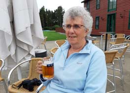 thermal insulation and industrial absorbency
applications, including the manufacture of cat litter; Nobel made dynamite by
absorbing nitro-glycerine in diatomite. The remains of former moler-clay
extraction quarries still exist in the northern hills of Fur just inland from
the cliffs, and the strata of moler-clay interspersed with grey volcanic ash,
thrust up and contorted into vertical planes, are exposed on the high cliff
faces of northern Fur where we planned to walk today. thermal insulation and industrial absorbency
applications, including the manufacture of cat litter; Nobel made dynamite by
absorbing nitro-glycerine in diatomite. The remains of former moler-clay
extraction quarries still exist in the northern hills of Fur just inland from
the cliffs, and the strata of moler-clay interspersed with grey volcanic ash,
thrust up and contorted into vertical planes, are exposed on the high cliff
faces of northern Fur where we planned to walk today.
From the parking area, we followed the clearly
marked cliff-top path which rose and dipped through woodland, with occasional
views over the cliff-edge.
 Inland from here, but unseen among the dense
woodland, were the remains of Fur's former moler-clay quarry pits. The cliffs
gained in height, finally emerging clear of the trees at the highest point of
the cliff-line; here at Knudeklinterne, the most impressive view of the
cliff-face became visible, revealing the alternating strata of creamy-coloured
moler-clay and grey volcanic ash (see above right)
(Photo
13 - Fur moler cliffs). Huge gashes in the upper part of the
cliff-face suggested that these had been quarried out. Beyond here, the
cliff-top path was ablaze with purple Heather (see above left) and Sea Buckthorn bushes laden
with orange berries. The height of the cliffs gradually reduced as we approached
and rounded the NW tip of the island, dropping down towards sea level at
Lille Knudshoved. Along the shore line, past dense thickets of sweetly-scented
wild roses, we turned inland to Fur Brewery where we Inland from here, but unseen among the dense
woodland, were the remains of Fur's former moler-clay quarry pits. The cliffs
gained in height, finally emerging clear of the trees at the highest point of
the cliff-line; here at Knudeklinterne, the most impressive view of the
cliff-face became visible, revealing the alternating strata of creamy-coloured
moler-clay and grey volcanic ash (see above right)
(Photo
13 - Fur moler cliffs). Huge gashes in the upper part of the
cliff-face suggested that these had been quarried out. Beyond here, the
cliff-top path was ablaze with purple Heather (see above left) and Sea Buckthorn bushes laden
with orange berries. The height of the cliffs gradually reduced as we approached
and rounded the NW tip of the island, dropping down towards sea level at
Lille Knudshoved. Along the shore line, past dense thickets of sweetly-scented
wild roses, we turned inland to Fur Brewery where we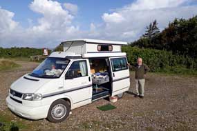 paused for glasses of the
micro-brewery's beers (see above right). A path led through the former moler-clay
quarry pits up through the woods to our start-point on the low cliff-top where
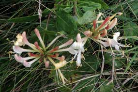
wild Honeysuckle flourished (see left)
(Photo
14 - Wild Honeysuckle) paused for glasses of the
micro-brewery's beers (see above right). A path led through the former moler-clay
quarry pits up through the woods to our start-point on the low cliff-top where
wild Honeysuckle flourished (see left)
(Photo
14 - Wild Honeysuckle)
Wild camp at Fur moler-cliffs:
back at the cliff-top parking area just behind the shingle beach, we set up camp
just in time as the forecast rain began in earnest. With the heavily overcast
sky, dusk seemed to fall earlier on such a gloomy evening. We were undisturbed
at our peaceful wild camp
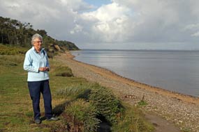 spot, and woke to a bright, sunny morning interspersed
with downpour showers brought in by the brisk SW wind. Before leaving, we walked
down to the beach for photos looking along the line of Northern Fur's moler
cliffs and out across the inland sea of Limfjord (see left). This had been a magnificent
spot to camp (see right) (Photo
15 - Fur wild camp). spot, and woke to a bright, sunny morning interspersed
with downpour showers brought in by the brisk SW wind. Before leaving, we walked
down to the beach for photos looking along the line of Northern Fur's moler
cliffs and out across the inland sea of Limfjord (see left). This had been a magnificent
spot to camp (see right) (Photo
15 - Fur wild camp).
A return visit to Nørre Vorupør on the North-West Jutland coast:
with the squally showers continuing, we crossed back from Fur on the ferry to Brandon on the Selling peninsula
through a network of lanes and small villages to rejoin the main Route 26 over
the wooded, hilly island of Mors (click
here for detailed map of route). Re-crossing the Vilsund girder-bridge,
we turned off northwards alongside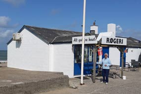 Thisted Bredning into the town of Thisted to
shop for provisions at the Brugsen supermarket. From here we headed west on
Route 539 through the Thy heath-land across to Nørre Vorupør on the NW Jutland
coast, to buy smoked fish
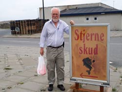
and the best fish-cakes ever tasted at our favourite fish smoke-house (røgeri),
with its sign promoting Alt Godt fra Havet (Everything Good from the Sea) (Photo
16 - Nørre Vorupør Røgeri) (see right).
Klitmøller and Nørre Vorupør are
two of several Jutland fishing villages without a harbour, where boats are still
dragged up and launched
from the beach, and we had to make a nostalgic re-visit to Nørre Vorupør
beach to photograph (yet again) the fishing boats drawn up on the sands (see Thisted Bredning into the town of Thisted to
shop for provisions at the Brugsen supermarket. From here we headed west on
Route 539 through the Thy heath-land across to Nørre Vorupør on the NW Jutland
coast, to buy smoked fish
and the best fish-cakes ever tasted at our favourite fish smoke-house (røgeri),
with its sign promoting Alt Godt fra Havet (Everything Good from the Sea) (Photo
16 - Nørre Vorupør Røgeri) (see right).
Klitmøller and Nørre Vorupør are
two of several Jutland fishing villages without a harbour, where boats are still
dragged up and launched
from the beach, and we had to make a nostalgic re-visit to Nørre Vorupør
beach to photograph (yet again) the fishing boats drawn up on the sands (see
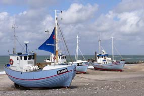 below left) (Photo
17 - Fishing boats at Nørre Vorupør beach).
Even on a sunny day, the
enclosed bay receives the
full force of the brisk westerly winds
which blow constantly
on
this magnificent coast-line, driving
huge breakers pounding towards the beach, and attracting
kite-surfers who hurtle across the bay
taking advantage of the wind and surf. below left) (Photo
17 - Fishing boats at Nørre Vorupør beach).
Even on a sunny day, the
enclosed bay receives the
full force of the brisk westerly winds
which blow constantly
on
this magnificent coast-line, driving
huge breakers pounding towards the beach, and attracting
kite-surfers who hurtle across the bay
taking advantage of the wind and surf.
A day in camp at Krohavens Camping at Stenbjerg:
just down the coast road from Nørre Vorupør, we turned off to Stenbjerg to find
Krohavens Camping, tucked away behind Stenbjerg Kro hotel-restaurant. We had first
discovered this homely site on our return from Norway in 2014, and had stayed
there again on our way to and from Hirtshals for the crossing to Faroes and
Iceland in 2017. Concerned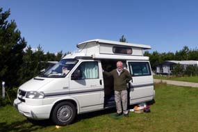 now that the place we had such fond
recollections of might have changed, we turned into the campsite. Opening hours at reception late in the
season were limited, and a notice advised us to select our pitch and book in
later; round at the camping area, all was thankfully as we remembered, other
than the inevitable increase in statics. The large, flat grassy pitches were
enclosed by hedges of sweetly-scented wild roses, and with the brisk SW wind
still blowing from across the open heath-land to the rear, we tucked George into
the shelter of the hedge at our usual place
(Photo
18 - Krohavens Camping at Stenbjerg) (see right); it was good to be back. The stiff
wind off the sea continued all evening bringing in heavy cloud and a lot of
overnight rain. now that the place we had such fond
recollections of might have changed, we turned into the campsite. Opening hours at reception late in the
season were limited, and a notice advised us to select our pitch and book in
later; round at the camping area, all was thankfully as we remembered, other
than the inevitable increase in statics. The large, flat grassy pitches were
enclosed by hedges of sweetly-scented wild roses, and with the brisk SW wind
still blowing from across the open heath-land to the rear, we tucked George into
the shelter of the hedge at our usual place
(Photo
18 - Krohavens Camping at Stenbjerg) (see right); it was good to be back. The stiff
wind off the sea continued all evening bringing in heavy cloud and a lot of
overnight rain.
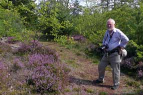 When reception opened the following morning at
8-00am, we went up to pay with the pleasantly welcoming owner Henny Mortensen: prices had remained
constant at 155kr (plus 5kr coins for showers) for as long as
we could recall, making Krohavens Camping surely one of the best value and
pleasantly located campsites in the whole of Denmark. The facilities were first
class with well-equipped kitchen/wash-up and cosy common room (newly fitted out
in 2017 and still as good as ever), homely, modern and spotlessly clean
WC/showers, and to top it all one of the few Danish campsites with full,
site-wide wifi; Krohavens was a first site rate campsite and worthily rated by
us at +5, a Danish favourite. Today the sun shone and we spent a much-needed and
productive day in camp in such a pleasant and peaceful setting at Stenbjerg. When reception opened the following morning at
8-00am, we went up to pay with the pleasantly welcoming owner Henny Mortensen: prices had remained
constant at 155kr (plus 5kr coins for showers) for as long as
we could recall, making Krohavens Camping surely one of the best value and
pleasantly located campsites in the whole of Denmark. The facilities were first
class with well-equipped kitchen/wash-up and cosy common room (newly fitted out
in 2017 and still as good as ever), homely, modern and spotlessly clean
WC/showers, and to top it all one of the few Danish campsites with full,
site-wide wifi; Krohavens was a first site rate campsite and worthily rated by
us at +5, a Danish favourite. Today the sun shone and we spent a much-needed and
productive day in camp in such a pleasant and peaceful setting at Stenbjerg.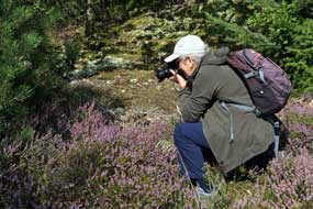
A day's walking in Thy National Park:
we woke to a heavily overcast morning with cool breeze, but the forecast was for a sunny day for our planned day's walking in the Thy
(pronounced as in French Tu) National Park dune heath-land.
The coastal area of NW Jutland such as the Stenbjerg Klitplantage (dune
plantation), where we should walk today, is largely seafloor uplift created
during the post-glacial land rise. It is therefore mostly sandy with the terrain
ranging from flat heath-land to extensive areas of dunes. The coastal cliffs of
the ancient pre-land uplift sea are still visible but now 6kms inland. Eastward
of this line, the soil changes from sand to clay and gravel on chalk, with
completely different vegetation, with the tree species and their growth giving
clear evidence of more fertile growing conditions. When coastal settlements in
Thy such as Stenbjerg began to develop from the end of the 17th
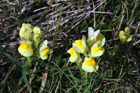 century, the
drifting sands of the coastal strip covered fields, making it impossible to
cultivate the soil, and farming was driven eastward inland. Those who did not
own land managed to settle in the coastal area of drifting sands, and eked out a
survival living from fishing and whatever could be cultivated on the poor soil.
In the early 19th century, as part of the constant battle against drifting sand,
local people began planting trees in the otherwise treeless landscape of the
coastal strip dunes. From the late 19th through 20th centuries, the sand drift
along the coastal belt was gradually consolidated by rolling out a plantation
carpet of Mountain Pines across the landscape. Gradually, as the plantations of
trees provided shelter from winds and frost, other species such as Spruce, Scots
Pine and deciduous trees (mainly Oak) could be introduced. century, the
drifting sands of the coastal strip covered fields, making it impossible to
cultivate the soil, and farming was driven eastward inland. Those who did not
own land managed to settle in the coastal area of drifting sands, and eked out a
survival living from fishing and whatever could be cultivated on the poor soil.
In the early 19th century, as part of the constant battle against drifting sand,
local people began planting trees in the otherwise treeless landscape of the
coastal strip dunes. From the late 19th through 20th centuries, the sand drift
along the coastal belt was gradually consolidated by rolling out a plantation
carpet of Mountain Pines across the landscape. Gradually, as the plantations of
trees provided shelter from winds and frost, other species such as Spruce, Scots
Pine and deciduous trees (mainly Oak) could be introduced.
The large areas of sandy heath-land are a
characteristic feature of Thy National Park, with distinctive flora and fauna
adapted to this habitat of sandy dunes, heath-land, heather and bog. Typical
plants are Ling, Crowberry, Bog-bilberry, Cranberry and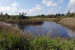 Sundew. Today many of
the sandy dune areas need regular management to avoid overgrowth of
vegetation, with clearance of Mountain Pine and other non-native species which
invade from the older plantations. In the outer dune seaward areas, another
man-made problem has been the invasion of thickets of the wild Rugosa
Rose. In the 1950s this hardy species, introduced from its native eastern Asia, was planted as hedges around holiday
houses, and has now invasively spread so uncontrollably to surrounding natural
areas of dune habitat that it threatens the original dune character and unique
natural flora. While we associate the sweetly-scented wild Rugosa Rose thickets
with coastal areas of Denmark, it has now become necessary to carry out large
scale cutting back to control this extensively invasive spread. Sundew. Today many of
the sandy dune areas need regular management to avoid overgrowth of
vegetation, with clearance of Mountain Pine and other non-native species which
invade from the older plantations. In the outer dune seaward areas, another
man-made problem has been the invasion of thickets of the wild Rugosa
Rose. In the 1950s this hardy species, introduced from its native eastern Asia, was planted as hedges around holiday
houses, and has now invasively spread so uncontrollably to surrounding natural
areas of dune habitat that it threatens the original dune character and unique
natural flora. While we associate the sweetly-scented wild Rugosa Rose thickets
with coastal areas of Denmark, it has now become necessary to carry out large
scale cutting back to control this extensively invasive spread.
 Our
day in Stenbjerg Klitplantage, Thy National Park: from the parking area just off the Route
181 Kystvej (coast road), we set off on the circular Bislet Trail through the
heather-covered sandy heath of Stenbjerg Klitplantage (dune plantation). This
forested sandy dune heath included areas of plantation which illustrated the
progression of plantation periods throughout the 20th century, and so included a
number of Pine and Spruce species and later plantation of broad-leafed species,
mainly Oak. We had walked this circuit through the dune heath woodland on
previous visits in late September, but being slightly earlier this year in
mid-August, the Ling was in full bloom, carpeting the sandy ground with
purple
(see above left and right) (Photo
19 - Heather in full bloom). It also showed how the planted trees so rapidly spread, with many low
Pine and Oak young seedlings among the ground cover of scrub vegetation. On a
sunny afternoon, this was a truly delightful walk through the sandy heath
landscape that illustrated the history of taming and managing the Thy coastal
dunes. A Our
day in Stenbjerg Klitplantage, Thy National Park: from the parking area just off the Route
181 Kystvej (coast road), we set off on the circular Bislet Trail through the
heather-covered sandy heath of Stenbjerg Klitplantage (dune plantation). This
forested sandy dune heath included areas of plantation which illustrated the
progression of plantation periods throughout the 20th century, and so included a
number of Pine and Spruce species and later plantation of broad-leafed species,
mainly Oak. We had walked this circuit through the dune heath woodland on
previous visits in late September, but being slightly earlier this year in
mid-August, the Ling was in full bloom, carpeting the sandy ground with
purple
(see above left and right) (Photo
19 - Heather in full bloom). It also showed how the planted trees so rapidly spread, with many low
Pine and Oak young seedlings among the ground cover of scrub vegetation. On a
sunny afternoon, this was a truly delightful walk through the sandy heath
landscape that illustrated the history of taming and managing the Thy coastal
dunes. A
 side-path climbed to the top of a particularly high dune, giving
extensive views over the tree-tops of older planted tall Pines. The dry,
nutrient-deficient sandy slopes of the dune hill supported the growth of
flourishing patches of Reindeer lichen (Cladonia rangiformis), previously
seen by us growing in the Arctic. Butterflies (Peacock, Painted Lady and Red
Admiral) flitted around us as we continued
around the circuit, revelling in this sunny wonderland carpeted with scented
heather and bright yellow Toadflax (see above left), following the path to the reed-beds of Bislet lake
(see above right) where the flora
changed to that characteristic of wetter areas. side-path climbed to the top of a particularly high dune, giving
extensive views over the tree-tops of older planted tall Pines. The dry,
nutrient-deficient sandy slopes of the dune hill supported the growth of
flourishing patches of Reindeer lichen (Cladonia rangiformis), previously
seen by us growing in the Arctic. Butterflies (Peacock, Painted Lady and Red
Admiral) flitted around us as we continued
around the circuit, revelling in this sunny wonderland carpeted with scented
heather and bright yellow Toadflax (see above left), following the path to the reed-beds of Bislet lake
(see above right) where the flora
changed to that characteristic of wetter areas.
We drove around to Route 571 Stenbjergvej to
the parking area for the circular Løvbakke and Embak walking routes, again
through 20th century plantation forests of the Stenbjerg Klitplantage sandy dune
heath-land. Although similar to the first walk, this terrain was more densely
planted, an obvious
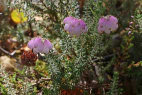
 plantation with less variety of flora and wetter ground. But
among the Ling here, Cross-leaved Heath (Erica tetralix) grew (see above
left) with its delicate pale-lilac
lantern-shaped flowers closely resembling those of Bearberry (another Ericaceae species). plantation with less variety of flora and wetter ground. But
among the Ling here, Cross-leaved Heath (Erica tetralix) grew (see above
left) with its delicate pale-lilac
lantern-shaped flowers closely resembling those of Bearberry (another Ericaceae species).
We drove back to the coast at Stenbjerg
Landingsplads where on a sunny September afternoon in 2017 we had sat to enjoy
lakrids (liquorice) ice cream from the National Park information hut. But
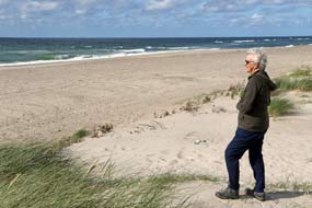
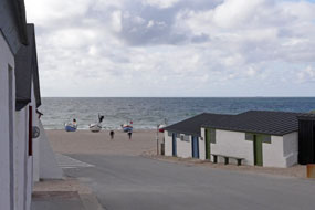
disappointment: this year the kiosk had closed at 4-00pm. Instead we walked down
to the deserted beach, where once fishing boats had been dragged up onto the sands
(see above right)
(Photo
20 - Stenbjerg Landingsplads). The
conserved fishing huts at Stenbjerg landing place alongside the Stenbjerg
life-boat station were built by Thy fishermen around 1900 to provide cover for
storing and maintaining nets and tackle. This was the time
when the advent of motorised vessels made possible the transition to fishing by
nets replacing line-fishing. Commercial fishing by larger boats ended at Stenbjerg
Landingsplads in 1972, but the
huts were restored and conserved and are still used by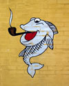 anglers. Today had been a
truly enjoyable day of walking in the Stenbjerg dune plantations; tomorrow we
continue our Jutland journey, around the northern shore of Limfjord for a return
stay at Løgstør. anglers. Today had been a
truly enjoyable day of walking in the Stenbjerg dune plantations; tomorrow we
continue our Jutland journey, around the northern shore of Limfjord for a return
stay at Løgstør.
North to the fishing port of Hanstholm:
on a heavily overcast morning with a cool wind as always blowing from the SW, we began today's drive
northwards up the Route 181 Kystvej (coast road) towards Hanstholm (click
here for detailed map of route). This led
initially through the tree-covered Tvorup Klintplantage (dune plantation) of
mature Pine and Spruce, the oldest plantations in Thy dating from the
 late
19th century, bordering the sea to the west and extending eastwards to the
inland agricultural land. The road then reached the broad areas of sandy dune
heath-land (klit hede in Danish), bare of trees and covered with rough
grass in contrast with the klit plantage's covering of Pine, Spruce and
Oak through which we had walked yesterday. The dune heath-land is mown and
burned to keep it free from unwanted trees. We continued through the Hanstholm dune heath-lands to turn off into the major fishing port of Hanstholm. Ironically the town's
main tourist attraction today are the WW2 fortifications and gigantic gun-emplacements
built by the German occupiers in 1941 as part of the Atlantic Wall. High German
wages tempted Danish workers to participate alongside Soviet POW slave-labour
in the construction of this huge complex. Hanstholm's civilian population however suffered a cruel fate with homes and
livelihood destroyed by evacuation to hastily-built camps, late
19th century, bordering the sea to the west and extending eastwards to the
inland agricultural land. The road then reached the broad areas of sandy dune
heath-land (klit hede in Danish), bare of trees and covered with rough
grass in contrast with the klit plantage's covering of Pine, Spruce and
Oak through which we had walked yesterday. The dune heath-land is mown and
burned to keep it free from unwanted trees. We continued through the Hanstholm dune heath-lands to turn off into the major fishing port of Hanstholm. Ironically the town's
main tourist attraction today are the WW2 fortifications and gigantic gun-emplacements
built by the German occupiers in 1941 as part of the Atlantic Wall. High German
wages tempted Danish workers to participate alongside Soviet POW slave-labour
in the construction of this huge complex. Hanstholm's civilian population however suffered a cruel fate with homes and
livelihood destroyed by evacuation to hastily-built camps,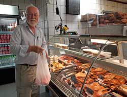 enforced by the collaborationist Danish government in compliance with German
demands. We saw from our 2007 visit that the WW2 museum presents a curiously
ambivalent message about the fortress and the shameful role of the Danish
authorities; the bunkers remain what they have always been, an ugly and evil
intrusion into an otherwise peaceful landscape. Hanstholm was totally destroyed during the German
retreat in 1945, making necessary complete post-war rebuilding of the town.
Our reason for today's return visit was to buy more
smoked fish from the røgeri (fish smoke-house) down by the port, known to
us as the Happy Smoking Cod from the emblem on its sign (see above
right). Along past the industrial port and all the fisheries support industries,
we turned off to find the røgeri again. The familiar sign still stood at
the corner; how we originally found the place in 2007 now escapes our
recollection. Today the place was full of visiting Danes lunching here, and we
bought a further supper of warm-smoked salmon fillets and smoked cod roe (see
right and above left).
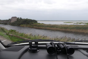 Bird watching at Vejlerne Wetlands: leaving Hanstholm
on Route 29 (click
here for detailed map of route), we headed SE towards Limfjord to join
the main Route 11 from Thisted. Along the northern shore of one of Limfjord's
islets, Spoonbills could be seen feeding in the shallow waters with the
characteristic side-to-side sweeping movement of their spoon-bill. Reaching the
hide at the Vejlerne Bird Reserve, we pulled in; looking out over the wetlands
(see left) , swallows flitted around and a large flock of starlings swarmed
across the meadows. Over at the hide, first impressions were of little bird-life
being about, but by patiently scanning around with binoculars, we were able to
see a numbers of birds: Mallards swam around the ponds immediately in front of
the hide, constantly up-ending to dabble; Dunlins pecked in the shallows further
out; over on a distant bank beyond the water, a line of Cormorants stood with
wings outstretched, and Lapwings fed among them; in the far distant meadows,
Great White Egrets and a flock of Greylag Geese were visible; a Sea Eagle
soared over stalking and bothering the geese which flew off. Bird watching at Vejlerne Wetlands: leaving Hanstholm
on Route 29 (click
here for detailed map of route), we headed SE towards Limfjord to join
the main Route 11 from Thisted. Along the northern shore of one of Limfjord's
islets, Spoonbills could be seen feeding in the shallow waters with the
characteristic side-to-side sweeping movement of their spoon-bill. Reaching the
hide at the Vejlerne Bird Reserve, we pulled in; looking out over the wetlands
(see left) , swallows flitted around and a large flock of starlings swarmed
across the meadows. Over at the hide, first impressions were of little bird-life
being about, but by patiently scanning around with binoculars, we were able to
see a numbers of birds: Mallards swam around the ponds immediately in front of
the hide, constantly up-ending to dabble; Dunlins pecked in the shallows further
out; over on a distant bank beyond the water, a line of Cormorants stood with
wings outstretched, and Lapwings fed among them; in the far distant meadows,
Great White Egrets and a flock of Greylag Geese were visible; a Sea Eagle
soared over stalking and bothering the geese which flew off.
We were joined in the hide by a couple of
Danish bird watchers who told us of another hide 6kms along a side lane from the
main road, and we drove around to find it. A footpath led along a wind-break
line of trees through meadows and fields of barley for
650m to reach the Kraptårnet bird-tower hide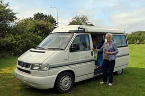 which overlooked the Bygholm
meadows and eastern side of Vejlerne Wetlands. By now rain was beginning and in
the overcast conditions and poor light, the distant view was misty. Through the
hide's in-built powerful binoculars, a huge flock almost 30 Cranes was visible
standing in line in the distant meadows. In the very far distance, only just
visible even through the hide's powerful binoculars, 3 Great White Egrets (in
Danish Sølv Hegre - Silver Heron) and a flock of Greylag Geese could be
seen, and an Osprey (in Danish Fiske Ørn - Fish Eagle) perched on a
fence post. By now visibility conditions were miserable, and in drizzly rain, we
returned to the parking area. This serendipitous meeting with the Danish couple
had enabled us to identify far more bird-life at Vejlerne than ever before.
Løgstør Camping:
in driving rain we now set course around the lanes through farming countryside
to the Limfjord port-town of Løgstør. Our plan had been to call in on the way
for a return visit to the Viking ring-fort at Aggersborg, but in pouring rain
this was pointless today; we should have to postpone the visit for better
weather in the morning before continuing north. We crossed the girder-bridge
over the Aggersund narrows, and shopped
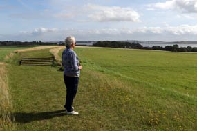 for provisions at the Brugsen
supermarket in Løgstør. Then out to Løgstør Camping to be welcomed again with
his quietly reserved hospitality by the owner Ole Vang and his wife Hanne, who
had just taken over the campsite when we stayed here on return from Norway in
September 2014. There were even more statics than on our last stay in 2017 on
return from Iceland, most of then thankfully deserted mid-week; even so the few
that were occupied still managed to produce irritating noise of TVs playing
over-loudly from dawn to dusk in caravan awnings. We selected a pitch as far
away as possible in the farthest corner and settled in (see above right) for a
gloomily wet evening. Facilities at Løgstør Camping were slightly old-fashioned
but perfectly functional, and the price remained unchanged at a very reasonable
(for Danish campsites!) 185kr. for provisions at the Brugsen
supermarket in Løgstør. Then out to Løgstør Camping to be welcomed again with
his quietly reserved hospitality by the owner Ole Vang and his wife Hanne, who
had just taken over the campsite when we stayed here on return from Norway in
September 2014. There were even more statics than on our last stay in 2017 on
return from Iceland, most of then thankfully deserted mid-week; even so the few
that were occupied still managed to produce irritating noise of TVs playing
over-loudly from dawn to dusk in caravan awnings. We selected a pitch as far
away as possible in the farthest corner and settled in (see above right) for a
gloomily wet evening. Facilities at Løgstør Camping were slightly old-fashioned
but perfectly functional, and the price remained unchanged at a very reasonable
(for Danish campsites!) 185kr.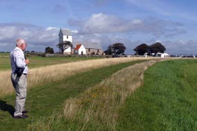
Viking ring-fort at Aggersborg:
the following morning's weather was brighter, and we re-crossed the Limfjord
narrows to return to Aggersborg. Here on the hillside over-looking Limfjord stand the scant remains of the Viking ring-fortress of Aggersborg
(see above left). All
that survives of this monumental construction are the restored low circular
earthworks which once enclosed the fortress, now peaceful farmland. In its
original construction, the ring-fort's 4m high turf rampart walls were
timber-clad on the outer base, topped with an oak palisade, and surrounded by
dry moat, as we had seen in the partially reconstructed
Viking ring-fort at Trelleborg in Swedish Skåne. The fortress spread
across the hill-top slope,
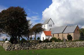 enclosed by the ramparts 240m in diameter, was
divided into 4 quadrants by internal roads connecting the fort's 4 gates at the cardinal quarters,
and was once occupied by 48 long-houses which were thought to have accommodated a
garrison of some 5,000 troops. Aggersborg was the largest of Denmark's 6
ring-forts built around 980 AD by King Harold Bluetooth or his son Sweyn
Forkbeard. The fortress' key strategic position guarded one of the key crossings
of Limfjord at Aggersund for the Hærvejen (army road) land route
north~south; even more importantly, with Limfjord then
open to the sea at both ends, it commanded both sea routes into the North Sea
west to England and the Kattegat north to Norway. With no archaeological
evidence yet available, it is a matter of speculation as to whether the
Aggersborg enclosed by the ramparts 240m in diameter, was
divided into 4 quadrants by internal roads connecting the fort's 4 gates at the cardinal quarters,
and was once occupied by 48 long-houses which were thought to have accommodated a
garrison of some 5,000 troops. Aggersborg was the largest of Denmark's 6
ring-forts built around 980 AD by King Harold Bluetooth or his son Sweyn
Forkbeard. The fortress' key strategic position guarded one of the key crossings
of Limfjord at Aggersund for the Hærvejen (army road) land route
north~south; even more importantly, with Limfjord then
open to the sea at both ends, it commanded both sea routes into the North Sea
west to England and the Kattegat north to Norway. With no archaeological
evidence yet available, it is a matter of speculation as to whether the
Aggersborg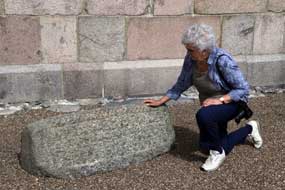 ring-fort's main function was as a stronghold to control trade
routes or, more likely, to reinforce Harold Bluetooth's control over rival chieftains in the
then newly unified kingdom. Another tempting interpretation of Aggersborg's purpose
was as a garrison/training ground in readiness for Sweyn Forkbeard's forthcoming
expeditions to England in the first decade of the 11th century which led to
Viking domination of England. ring-fort's main function was as a stronghold to control trade
routes or, more likely, to reinforce Harold Bluetooth's control over rival chieftains in the
then newly unified kingdom. Another tempting interpretation of Aggersborg's purpose
was as a garrison/training ground in readiness for Sweyn Forkbeard's forthcoming
expeditions to England in the first decade of the 11th century which led to
Viking domination of England.
We parked and walked over to
stand again atop the earth rampart, looking out across the fortress' central
enclosed area towards the distant Limfjord (see above right) (Photo
21 - Aggersborg Viking ring-fort).
Having taken our photos of the surviving fortress earthworks, we walked back
uphill to re-visit
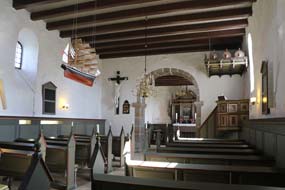 the starkly beautiful 12th century Aggersborg Church which
stood protectively behind us at the hill-top. Standing here at this peaceful
spot by Aggersborg Church, looking out across the ring-fort remains
down towards Limfjord, as always gave the same feeling of awe that this
sacred place had served its local settlement for 900 years (see above left). Preparations were in hand for
a Viking festival that was taking place this weekend, and we had learned from one of
the participants of a Viking era hogback stone grave-marker which had been
excavated at Aggersborg Church. In the neatly maintained graveyard, we found the
hogback standing along with other ancient gravestones by the church
porch (see above right) (Photo
22 - Aggersborg hogback grave-marker). This form of stone grave-marker
is found mainly in the once Viking
controlled area of the starkly beautiful 12th century Aggersborg Church which
stood protectively behind us at the hill-top. Standing here at this peaceful
spot by Aggersborg Church, looking out across the ring-fort remains
down towards Limfjord, as always gave the same feeling of awe that this
sacred place had served its local settlement for 900 years (see above left). Preparations were in hand for
a Viking festival that was taking place this weekend, and we had learned from one of
the participants of a Viking era hogback stone grave-marker which had been
excavated at Aggersborg Church. In the neatly maintained graveyard, we found the
hogback standing along with other ancient gravestones by the church
porch (see above right) (Photo
22 - Aggersborg hogback grave-marker). This form of stone grave-marker
is found mainly in the once Viking
controlled area of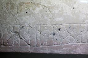 northern England and southern Scotland. Hogbacks were
carved Anglo-Scandinavian sculpted stones dating from the 10~12th centuries, and
take the form of recumbent monuments with outwardly curved sides and upwardly
curved ridged roof decorated with carved shingles, modelled on a Viking
long-house, implying a representation of a stylised house for the dead. The ends
of the hogback are often gripped by carved, squatting bears. They are
thought to have originated among Viking settlers who occupied northern England,
but are not generally found in the Viking homelands of Denmark, Sweden and
Norway. The presence therefore of the hogback grave-marker found here at Aggersborg Church
suggests the ring-fort's maritime links with England. We took our photos inside
the church (see above left), including the runic graffiti, carved in the plasterwork of
the church wall (see right) perhaps by bored 12th century parishioners during northern England and southern Scotland. Hogbacks were
carved Anglo-Scandinavian sculpted stones dating from the 10~12th centuries, and
take the form of recumbent monuments with outwardly curved sides and upwardly
curved ridged roof decorated with carved shingles, modelled on a Viking
long-house, implying a representation of a stylised house for the dead. The ends
of the hogback are often gripped by carved, squatting bears. They are
thought to have originated among Viking settlers who occupied northern England,
but are not generally found in the Viking homelands of Denmark, Sweden and
Norway. The presence therefore of the hogback grave-marker found here at Aggersborg Church
suggests the ring-fort's maritime links with England. We took our photos inside
the church (see above left), including the runic graffiti, carved in the plasterwork of
the church wall (see right) perhaps by bored 12th century parishioners during
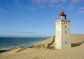 lengthy sermons. lengthy sermons.
North
up Jummerbugt coast to Rudbjerg Knude lighthouse: it was time now to resume our northward journey towards
Skagen, and we headed eastwards on minor roads to join the main Route 11 (click
here for detailed map of route), turning north onto Route 55 at Aabybro.
Reaching Løkken, we turned off across farming countryside to the Jummerbugt
coast to the parking area at Rudbjerg Knude lighthouse. The lighthouse had been
built on the 60m high cliff-tops at Rudbjerg Knude in 1899, originally 200m from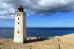 the cliff edge atop a further 30m depth of sand dunes. From the start however, a
combination of drifting, wind-blown sand and wind~tidal erosion of the soft,
sandy coast caused problems. Eventually the migrating dunes became so high as to
block access to the lighthouse and make its light invisible from the sea, and
the lighthouse closed in 1968. The sand-engulfed lighthouse became nothing more
than a tourist attraction, but the drifting dunes and rising sand threatened
totally to overwhelm its tower. Our photo taken on our 2007 visit shows just the
top three storeys' windows still standing clear of the rising sand (see left for
2007 photo).
During the intervening years, the lighthouse area was cleared of sand as the
dunes drifted northwards, again giving access to the tower which then stood in a
hollow surrounded by high dunes (see right for 2017 photo). An internal staircase was constructed allowing
access to the top platform, and in 2017 we were able to
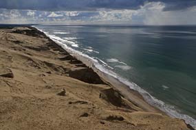 climb
to the tower's top for views over the dunes and along
the fragile coastline (see left) (Photo
23 - Rudbjerg Knude eroded coastline). But since then, coastal erosion has threatened to cause the tower to
fall into the sea; a structure that 100 years ago stood 200m from the cliff-edge
is now in danger of crashing over the cliff through erosion of the soft sandy coast. As a result, the Danish government has invested in moving the tower 80m
back from the cliff-edge. climb
to the tower's top for views over the dunes and along
the fragile coastline (see left) (Photo
23 - Rudbjerg Knude eroded coastline). But since then, coastal erosion has threatened to cause the tower to
fall into the sea; a structure that 100 years ago stood 200m from the cliff-edge
is now in danger of crashing over the cliff through erosion of the soft sandy coast. As a result, the Danish government has invested in moving the tower 80m
back from the cliff-edge.
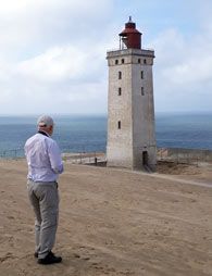 When
we arrived today at Rudbjerg Knude, we found that the foundations of the once
sand-engulfed lighthouse had been further cleared in readiness for the entire
structure to be hoisted onto a railed trolley construction, and dragged
wholesale back 80m from the threatening cliff-edge; this should be completed by
October 2019. As we walked up through the dunes for comparative 2019 photos (see
right) (Photo
24 - Rudbjerg Knude lighthouse), we witnessed dune migration at
first hand even on a still day with little
wind, with the sand swirling around as we clambered up onto the steep dunes. When
we arrived today at Rudbjerg Knude, we found that the foundations of the once
sand-engulfed lighthouse had been further cleared in readiness for the entire
structure to be hoisted onto a railed trolley construction, and dragged
wholesale back 80m from the threatening cliff-edge; this should be completed by
October 2019. As we walked up through the dunes for comparative 2019 photos (see
right) (Photo
24 - Rudbjerg Knude lighthouse), we witnessed dune migration at
first hand even on a still day with little
wind, with the sand swirling around as we clambered up onto the steep dunes.
Mårup cliff-top church and Lønstrup cliffs: we continued north along lanes to re-visit the
former site of Mårup Church. When we first came here in 2007,
the tiny medieval church was perched in isolation at the cliff's edge (see left for 2007 photo),
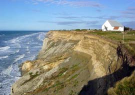 the fishing village
it had served long since washed into the sea 60m below. When we returned in
2017, we found that in the intervening 10 years, this little church had been
demolished to prevent coastal erosion causing it to crash into the sea below.
Today just the gravestones sadly remain, along with a large memorial anchor from
a British frigate sunk here in 1808, to
mark the site of the former church and village of Mårup (Photo
25- Site of Mårup cliff-top village and church. The
view along the coast beyond where the church had once stood showed how fragile
the line of sandy cliffs was and how
vulnerable to coastal erosion. Along at Lønstrup, once also a
fishing village but now given over entirely to tourism, we clambered up through
the holiday homes and Sea Buckthorn bushes laden with ripe orange berries (see
below left) (Photo
26 - Sea Buckthorn), for the view along the line of cliffs (Photo
27 - Lønstrup cliffs). the fishing village
it had served long since washed into the sea 60m below. When we returned in
2017, we found that in the intervening 10 years, this little church had been
demolished to prevent coastal erosion causing it to crash into the sea below.
Today just the gravestones sadly remain, along with a large memorial anchor from
a British frigate sunk here in 1808, to
mark the site of the former church and village of Mårup (Photo
25- Site of Mårup cliff-top village and church. The
view along the coast beyond where the church had once stood showed how fragile
the line of sandy cliffs was and how
vulnerable to coastal erosion. Along at Lønstrup, once also a
fishing village but now given over entirely to tourism, we clambered up through
the holiday homes and Sea Buckthorn bushes laden with ripe orange berries (see
below left) (Photo
26 - Sea Buckthorn), for the view along the line of cliffs (Photo
27 - Lønstrup cliffs).
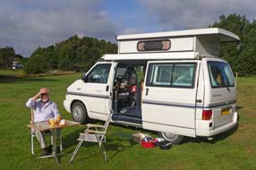 North towards Skagen and an excellent
farm-campsite at Ålbæk B & B farm-camping: but by now it was almost 4-00pm and we still had
1½ hours drive to reach Jutland's northernmost tip at Skagen this evening. We
were also uncertain about where we should camp this weekend with all the known
campsites at Skagen being ghastly, unattractive holiday-camps, over-priced and
over-crowded; we faced this prospect with dread after enjoying mostly peaceful
solitude so far this trip. Before setting off, we therefore North towards Skagen and an excellent
farm-campsite at Ålbæk B & B farm-camping: but by now it was almost 4-00pm and we still had
1½ hours drive to reach Jutland's northernmost tip at Skagen this evening. We
were also uncertain about where we should camp this weekend with all the known
campsites at Skagen being ghastly, unattractive holiday-camps, over-priced and
over-crowded; we faced this prospect with dread after enjoying mostly peaceful
solitude so far this trip. Before setting off, we therefore 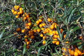 took stock and
identified a couple of possible stellplads within 25kms of Skagen.
Returning along the lanes past Skallerup church, we turned north on Route 55
towards Hirtshals (click
here for detailed map of route). Through the port-town past the Norway
ferries and Smyril Line terminals, used by us in 2014 and 2017, we joined Route
597 eastwards across the breadth of this northern projection of Jutland.
Approaching the junction with Route 40 up to Skagen, we passed the first of our stellplads
options 2kms from Ålbæk; this looked fine but before settling on this, we went
into the village to investigate the second option at Ålbæk Havn. This also
looked acceptable, but the Ålbæk B & B farm-campsite seemed preferable,
and we returned there to receive a lovely welcome from the owner Lotte Thau at
Gårdbo Farm. The price was a remarkable value 125kr including power, and after a
long drive we gladly settled into the small peaceful paddock to the rear of the
farm-house. This was a beautiful setting took stock and
identified a couple of possible stellplads within 25kms of Skagen.
Returning along the lanes past Skallerup church, we turned north on Route 55
towards Hirtshals (click
here for detailed map of route). Through the port-town past the Norway
ferries and Smyril Line terminals, used by us in 2014 and 2017, we joined Route
597 eastwards across the breadth of this northern projection of Jutland.
Approaching the junction with Route 40 up to Skagen, we passed the first of our stellplads
options 2kms from Ålbæk; this looked fine but before settling on this, we went
into the village to investigate the second option at Ålbæk Havn. This also
looked acceptable, but the Ålbæk B & B farm-campsite seemed preferable,
and we returned there to receive a lovely welcome from the owner Lotte Thau at
Gårdbo Farm. The price was a remarkable value 125kr including power, and after a
long drive we gladly settled into the small peaceful paddock to the rear of the
farm-house. This was a beautiful setting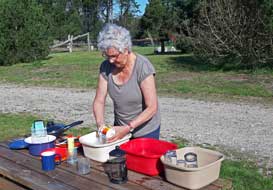 alongside
pine woods, which we had to ourselves. Ålbæk B & B farm-campsite was a real
+5 jewel of a chance find, warmly hospitable, excellent value, beautifully
sited, with first class facilities, and most importantly a wonderfully peaceful
place to camp. It was just 25kms from Skagen: we could drive up to Grenen and
return here to camp tomorrow evening. The following morning was bright and sunny,
and we breakfasted outside
(Photo
28 - Ålbæk B & B farm-camping) (see above right), with just the distant
passing traffic to disturb the rural peace of the farm setting. The showers were
homely and refreshing, some of the best of the trip with everything thought
of, and although there was no kitchen/wash-up, hot water from the
hand-basin enabled us to wash up outside on a picnic table (see right).
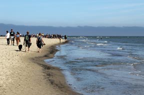
Northernmost tip of Jutland where Skagerrak
and Kattegat opposing tides meet at Grenen:
we set off through the heath-land and dune plantations to drive into Skagen
where a bypass road led around the town to Grenen at the northernmost tip of
Jutland.
Skagen (pronounced Skeyen)
is Denmark's most northerly region, and despite its apparent remoteness, is a
popular holiday destination during summer months. The entire peninsula of
Skagen, extensive heath-covered dunes and woodland planted in the 19th century
in an attempt to stabilise the shifting sands, culminates in a sandbar
gracefully curving out to the point where two seas meet, the Skagerrak on the
North Sea side and the Kattegat on the Baltic; this is Grenen, Denmark's most
northerly tip. Even on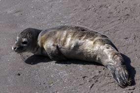 a sunny windless day, the powerful currents as the 2
opposing tides converge produce a compelling spectacle of upward surging
fountains of spray. On our last visit in early October 2007, we had the setting
to ourselves, but on a sunny late August weekend, there were bound still to be a
number of holiday-makers; there was no chance of our enjoying in peace the
natural spectacle of opposing tides converging, as we had done last year at the
similar sandspit setting of Cape Kolka in Northern Latvia on the far side of the
Baltic. a sunny windless day, the powerful currents as the 2
opposing tides converge produce a compelling spectacle of upward surging
fountains of spray. On our last visit in early October 2007, we had the setting
to ourselves, but on a sunny late August weekend, there were bound still to be a
number of holiday-makers; there was no chance of our enjoying in peace the
natural spectacle of opposing tides converging, as we had done last year at the
similar sandspit setting of Cape Kolka in Northern Latvia on the far side of the
Baltic.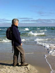
Reaching the enormous car parks at Grenen,
already full with holiday-makers, we set off for the 1.5km walk over the dunes
and along the Kattegat side of the cape, passing ugly wartime German concrete
bunkers, and the equally unseemly sight of holiday-making hordes; the numbers
thinned as we walked further out around the curving sandspit. Standing here on this narrowing
strip of wet sand at Denmark's northern tip, we could gaze out at a 270° sweep of horizon filled with
shipping; along the misty Kattegat, we counted 16 large container ships, showing
what busy shipping channels to and from the Baltic the Øresund and Store Bælt
are. Almost at the tip of the sandspit, 2 seal pups lay by the water's edge,
seeming in a distressed state, particularly with holiday-makers crowding around.
But an information panel assured that mother seals habitually leave their pups
to bask on the sunny shore-line while they are out hunting fish (see right) (Photo
29 - Seal pup basking on shore-line).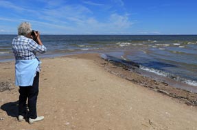
At
the tip of the sandy cape, even on a still, sunny day with little wind, the
tidal currents from each side brought a convergence of the opposing tides.
What would it be like in a
fiercesome winter storm? Even from a distance, this fascinating spectacle
was visible stretching way out into the sea showing how the sand bar extended
far out from the shore. Unlike our photo taken here in October 2007 (see left)
and our experience last year at Cape Kolka in Latvia (see right), today we had
to share the spectacle of converging tides meeting at Grenen
(Photo
30 - Grenen converging tides) (see below left) with the intrusive
presence of holiday-makers. The sun had been clear and bright so far today,
bringing the clear light of this northern coastline that had attracted a group
of trendy middle class painters who during the early 20th century had
transported their easels from the comfortable living of København to set up a
similarly comfortable living here; their naturalistic works depict the harsh
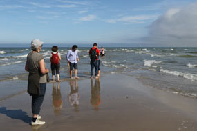 living and working conditions of impoverished Skagen fishermen. As we drove away
from Grenen, Skagen's notoriously fickle sea mist was beginning to drift in,
obscuring the lighthouse tower.
Skagen Klitplantage and the sand-engulfed
church (Den Tilsande Kirke): south of Skagen town, we turned off into Skagen Klitplantage (dune plantation)
to find the surviving tower of Den Tilsande Kirke, the sand-engulfed church. The
church of St Lawrence dating from the early 15th century had been built among
the Skagen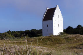 dunes on flat land between 2 of the rural parish's fishing villages.
But from the 16th century, the church increasingly was threatened by the
migrating dunes blown by the vicious storms that sweep across Skagen. By the late
18th century, those attending services had to take shovels to clear access to
their church amidst the drifting sand. By the early 19th century, the 5m high
nave was buried under the sand and the church abandoned, leaving just the gabled
tower which was painted white as a marker for passing shipping in the
nearby Kattegat. Such was the power and intensity of Skagen's drifting sand
dunes. We parked at the end of the forest road leading through the mainly spruce
plantation and walked out through the heath-covered dunes to where the church's
gabled tower still stands incongruously isolated among the dunes (see right)
(Photo 31 - Sand-engulfed church). dunes on flat land between 2 of the rural parish's fishing villages.
But from the 16th century, the church increasingly was threatened by the
migrating dunes blown by the vicious storms that sweep across Skagen. By the late
18th century, those attending services had to take shovels to clear access to
their church amidst the drifting sand. By the early 19th century, the 5m high
nave was buried under the sand and the church abandoned, leaving just the gabled
tower which was painted white as a marker for passing shipping in the
nearby Kattegat. Such was the power and intensity of Skagen's drifting sand
dunes. We parked at the end of the forest road leading through the mainly spruce
plantation and walked out through the heath-covered dunes to where the church's
gabled tower still stands incongruously isolated among the dunes (see right)
(Photo 31 - Sand-engulfed church).
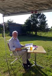 We returned for a second night at Ålbæk B
& B farm-campsite, and inland away
from the coast the sun was still bright and warm enough to sit out in the
shade of the awning (see left). We returned for a second night at Ålbæk B
& B farm-campsite, and inland away
from the coast the sun was still bright and warm enough to sit out in the
shade of the awning (see left).
Råbjerg Mile drifting sand dunes: sea mist covered the countryside
when we woke, but by 8-00am a hot sun was beginning to burn this off; it was
going to be another bright scorcher of a day for our exploration of the huge
open area of drifting sand dunes at Råbjerg Mile. Råbjerg Mile is
Denmark's largest expanse of drifting dunes, left in their natural unplanted
state; while the majority of dunes were
stabilised by planting with lyme grass or conifers, Råbjerg Mile was left to allow future generations to
understand the problem of migratory sand dune drift. The bare, undulating dunes
up to 40m high and covering an area of some 2 km2 were formed
on the west coast of Skagen during the 16th century great sand drift, and are
gradually moving north-eastwards across the peninsula. The destructive force of
this 4 million cubic metres of loose sand, driven by the predominant westerly
wind is now advancing at a rate of 18m per year, engulfing farmland and forest
(see right for map of Råbjerg Mile).
Returning north on Route 40, we turned off just beyond Bunken Klitplantage forest along to the parking
area at the northern foot of this mass of migrating dunes. We threaded a way
through the low scrub and ling edging the dunes and clambered up onto the start
of the bare dunes of Råbjerg Mile (see below left) (Photo
32- Start of Råbjerg Mile). This
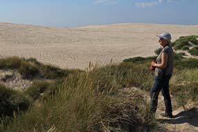 sloping
barren wasteland of sand was an unnerving, mesmerising sight, with the
undulating dune hills stretching away into the distance to the west and south,
with tongues of wind-blown sand visibly moving forwards over the nearby
heath-land. As we began advancing up onto the dune hills, it was hard going trying to make headway across the
loose sand, just like plodding a way across snow fields. Naturally there could be no marked regular paths, just the fleeting
footmarks of other walkers which would soon be covered by wind-blown sand
(see right)
(Photo
33 - Featureless desert-scape of Råbjerg Mile). In such a sloping
barren wasteland of sand was an unnerving, mesmerising sight, with the
undulating dune hills stretching away into the distance to the west and south,
with tongues of wind-blown sand visibly moving forwards over the nearby
heath-land. As we began advancing up onto the dune hills, it was hard going trying to make headway across the
loose sand, just like plodding a way across snow fields. Naturally there could be no marked regular paths, just the fleeting
footmarks of other walkers which would soon be covered by wind-blown sand
(see right)
(Photo
33 - Featureless desert-scape of Råbjerg Mile). In such a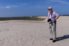 featureless bare sandy desert-scape, you
quickly lost your bearings and sense of direction, as we headed on a southerly
compass course for about 1km across the undulating
open dunes, heading towards a high-point to the south. On some slopes the sand
was so loose that you sank in, on others the loose sand had blown off leaving a
surprisingly compacted hard crust. Advancing across the open, bare sand-scape of
the dunes, the hot sun reflected off the fine white sand, again just like on
snow, had been scorching. As we approached the high-point target, the gradient
up onto its summit was much steeper, but we followed footstep routes up its side
to emerge onto the open dunes at the point where advancing tongues of sand were encroaching onto forest to the SE (Photo
34 - Advancing tongues of sand) (see left). What an featureless bare sandy desert-scape, you
quickly lost your bearings and sense of direction, as we headed on a southerly
compass course for about 1km across the undulating
open dunes, heading towards a high-point to the south. On some slopes the sand
was so loose that you sank in, on others the loose sand had blown off leaving a
surprisingly compacted hard crust. Advancing across the open, bare sand-scape of
the dunes, the hot sun reflected off the fine white sand, again just like on
snow, had been scorching. As we approached the high-point target, the gradient
up onto its summit was much steeper, but we followed footstep routes up its side
to emerge onto the open dunes at the point where advancing tongues of sand were encroaching onto forest to the SE (Photo
34 - Advancing tongues of sand) (see left). What an
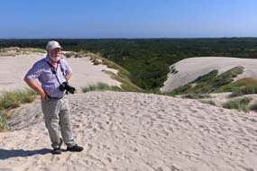 unbelievable sand-scape
vista, stretching away in all directions. unbelievable sand-scape
vista, stretching away in all directions.
Sandmilen migrating dune approaching the Kattegat:
6kms north up the main Route 40 (click
here for detailed map of route), we reached the parking area for this
afternoon's walk out across the stabilised, forested Skagen Klitplantage leading
to the
sandy heath dunes of Sandmilen edging the eastern coast-line of Skagen
overlooking the Kattegat. Whereas the Råbjerg Mile migrating dunes have advanced
only partway on their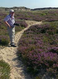 west~east transit of the Skagen peninsula, the Sandmilen
drifting dunes have over the centuries now reached the final stage of this
migratory advance driven by the prevailing westerly winds at a rate of 15m per
year across the entire width of the peninsula towards the east coast; had the
dunes not been stabilised by lyme grass and ling from its bare natural state, Sandmilen dunes would within 50 years be blown entirely into the Kattegat.
We set off through the gate across the railway
line into the Pine and Spruce plantations of Skagen Klitplantage. These had been
planted during the early 20th century in an attempt to stem the advancing
migratory dunes' advance which had already destroyed farms and settlements and
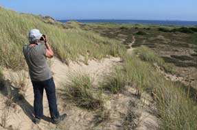 engulfed the Church of St Lawrence leaving just the tower standing clear of the
dunes. The forest floor was ablaze with purple heather, and in the
now hot, clear sun, the trees gave welcome shade. At the eastern edge of the forest, we
emerged from the trees to a more open vista of heath-covered dunes stretching
away north and south. A clearly marked path traced a way eastwards, undulating
through both dunes and open heath-land towards the Kattegat coast (see left) (Photo
35 - Sandmilen dune heath-land). We followed this across the heath-land which was
now stabilised with lyme grass and vivid purple patches of heather (see right). Despite the dry conditions, we also passed patches of Bog Myrtle which gave off
its pungent aroma when the leaves were rubbed. The path undulated through dune
slacks (hollows), some of which were bone dry with loose sand (see below left), others
clearly moist where vegetation grew in the hollows. As we moved closer towards
the coast, unseen at first behind and eastward of lines of dunes, the distant
sound of ships' diesel engines could be heard on engulfed the Church of St Lawrence leaving just the tower standing clear of the
dunes. The forest floor was ablaze with purple heather, and in the
now hot, clear sun, the trees gave welcome shade. At the eastern edge of the forest, we
emerged from the trees to a more open vista of heath-covered dunes stretching
away north and south. A clearly marked path traced a way eastwards, undulating
through both dunes and open heath-land towards the Kattegat coast (see left) (Photo
35 - Sandmilen dune heath-land). We followed this across the heath-land which was
now stabilised with lyme grass and vivid purple patches of heather (see right). Despite the dry conditions, we also passed patches of Bog Myrtle which gave off
its pungent aroma when the leaves were rubbed. The path undulated through dune
slacks (hollows), some of which were bone dry with loose sand (see below left), others
clearly moist where vegetation grew in the hollows. As we moved closer towards
the coast, unseen at first behind and eastward of lines of dunes, the distant
sound of ships' diesel engines could be heard on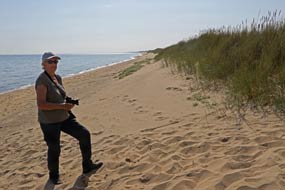 today's SE breeze blowing from
the Kattegat. We clambered
over successive lines of dunes, the path from each then dropping into a
further dune hollow, to mount the next line of dunes, and still tantalisingly
not reaching the coast. At last, as we broached the last set of dunes, the sound
of surf could be heard, and over the top there was the deserted beach stretching
away for miles in both directions (Photo
36 - Kattegat deserted beach). In today's almost windless, sunny
conditions, the
Kattegat surf lapped gently onto the shore. Out in the Kattegat, we counted at
least 15
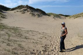 large freighter ships in these busy waters (Photo
37 - Freighters lining Kattegat horizon), and in the misty distance tall
buildings of Sweden's coast around Göteborg were just visible. Having taken our
photos on this magnificent deserted beach (see right), we retraced our steps
back across Sandmilen dune heath-land and through the Skagen Klitplantage forest
belt to the parking area. large freighter ships in these busy waters (Photo
37 - Freighters lining Kattegat horizon), and in the misty distance tall
buildings of Sweden's coast around Göteborg were just visible. Having taken our
photos on this magnificent deserted beach (see right), we retraced our steps
back across Sandmilen dune heath-land and through the Skagen Klitplantage forest
belt to the parking area.
Tolne Camping among Skagen beech wood hills:
having enjoyed 2 excellent days at Jutland's northernmost tip at Skagen, it was
time now to begin our return drive, initially to camp 25kms further south at
Tolne Camping in the beech wood covered hills of the peninsula's central area.
Minor roads brought us across farming countryside, eventually finding
the
campsite tucked away in more hilly terrain close to Tolne village (click
here for detailed map of route). We were welcomed by the helpful,
English-speaking owner who told us more about these attractive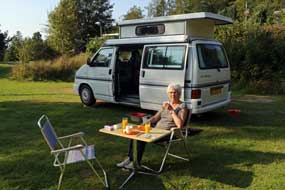 beech wood
covered hills. The campsite was a little more expensive at 215kr (including
coins for showers), but the place's most attractive feature was the setting, with
camping areas scattered among secluded corners of the rolling, beech wood
covered hills. Inevitably this meant sloping ground, but we found a quiet grove
among the beech woods, open to evening and morning sun, and managed to level
George. Again we had the perfect peace of having this corner to ourselves, and
settled in to relax with beers and light the barbecue for supper in the warm
evening sunshine after a satisfying day of walking among the Skagen dunes (Photo
38 - Barbecue supper at Tolne Camping). The following morning was warm
and sunny, and again we were able to breakfast outside (see right); Tolne Camping
was a good find and had served us well.
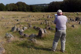 Iron Age~Viking period settlement and burial ground of Lindholm Høje:
leaving Tolne village, we shopped for supplies in the nearby small town of
Sindal, then continued south towards Aalborg at the Limfjord eastern crossing.
Rather than take the motorway, we followed a series of minor roads through
farming countryside and small villages (click
here for detailed map of route); harvesting was now well underway with
tractors pulling fully laden grain carts. Finally joining the motorway near Hjallerup, in the distance we could see the waters of distant Limfjord, last seen
at the Aggersund crossing. Around the northern side of the city, we turned off
to visit Aalborg's most noteworthy but little visited feature, the site of the
Iron Age~Viking period settlement and burial ground of Lindholm Høje. The first
farming settlement grew up here at Lindholm Iron Age~Viking period settlement and burial ground of Lindholm Høje:
leaving Tolne village, we shopped for supplies in the nearby small town of
Sindal, then continued south towards Aalborg at the Limfjord eastern crossing.
Rather than take the motorway, we followed a series of minor roads through
farming countryside and small villages (click
here for detailed map of route); harvesting was now well underway with
tractors pulling fully laden grain carts. Finally joining the motorway near Hjallerup, in the distance we could see the waters of distant Limfjord, last seen
at the Aggersund crossing. Around the northern side of the city, we turned off
to visit Aalborg's most noteworthy but little visited feature, the site of the
Iron Age~Viking period settlement and burial ground of Lindholm Høje. The first
farming settlement grew up here at Lindholm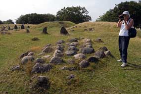 Høje on the south-facing slope of
the higher ground above Limfjord in early 5th century AD close to the fjord's
important eastern crossing point. Limfjord then divided the northern part of
Jutland from coast to coast, edged with swamps on either side; it was only
possible to make a crossing where the fjord narrowed, inland at Aggersund and
here in the east where the later city of Aalborg would develop. Important
north~south land communication routes developed at these two fjord
crossing-points. The settlement at Lindholm Høje was occupied and the land
farmed from the Nordic Iron Age for over 600 years until the 11th century AD
Viking Age. Høje on the south-facing slope of
the higher ground above Limfjord in early 5th century AD close to the fjord's
important eastern crossing point. Limfjord then divided the northern part of
Jutland from coast to coast, edged with swamps on either side; it was only
possible to make a crossing where the fjord narrowed, inland at Aggersund and
here in the east where the later city of Aalborg would develop. Important
north~south land communication routes developed at these two fjord
crossing-points. The settlement at Lindholm Høje was occupied and the land
farmed from the Nordic Iron Age for over 600 years until the 11th century AD
Viking Age.
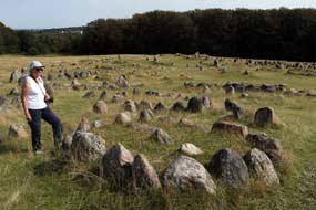 From ancient times, the area had been covered
by a deep layer of shifting sand which drifted constantly on these wind-swept
heights, a problem worsened by extensive de-forestation for timber as the
settlement at Lindholm Høje developed. The site was finally abandoned around
1050 AD and the site covered with westward drifting sand, which helped to
protect and conserve the remains of the site for discovery and archaeological
excavation in the 20th century. Some of the grave-marker stones in the burial
grounds had been removed and broken up for road construction in the 19th
century, but major archaeological investigation of the site began in the 1950s.
This revealed some 600 of the known 700 graves at Lindholm Høje, along with
remains of the settlement there. Because of its location on both land and From ancient times, the area had been covered
by a deep layer of shifting sand which drifted constantly on these wind-swept
heights, a problem worsened by extensive de-forestation for timber as the
settlement at Lindholm Høje developed. The site was finally abandoned around
1050 AD and the site covered with westward drifting sand, which helped to
protect and conserve the remains of the site for discovery and archaeological
excavation in the 20th century. Some of the grave-marker stones in the burial
grounds had been removed and broken up for road construction in the 19th
century, but major archaeological investigation of the site began in the 1950s.
This revealed some 600 of the known 700 graves at Lindholm Høje, along with
remains of the settlement there. Because of its location on both land and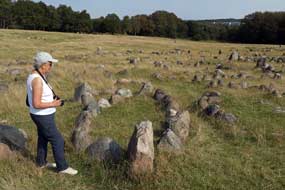 maritime trade and transportation routes, the settlement was clearly a
significant centre for trade as well as farming, judging from the glassware,
jewellery and Arab coins unearthed at Lindholm Høje.
The burial grounds associated with the
settlement were in use from around 400~1050 AD, with the oldest graves from the
early Iron Age at the northern top of the slope, and the younger Viking Age
graves at the southern lower part of the slope (see above left). Some of the early graves were
inhumation internments, their mounds unmarked, but the majority of later burials
were cremations which became the norm during Viking times. These graves were
marked with the placement of stones around the funeral pyre,
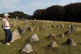 in an oval or round arrangement for women,
and in a triangular or ship-setting arrangement for men, an indication of the
importance of water-borne transportation during the Viking Age. The shape and
size of the grave-marker outline indicated the deceased's status. Although not
as large as the great ship-settings we had previously seen in Sweden such as Blomsholm,
Anundshög and Ales
Stones, Lindholm Høje constitutes the largest assemblage of well-preserved
ship-settings, with larger prow and stern stones and smaller stones representing
the ship's outline. in an oval or round arrangement for women,
and in a triangular or ship-setting arrangement for men, an indication of the
importance of water-borne transportation during the Viking Age. The shape and
size of the grave-marker outline indicated the deceased's status. Although not
as large as the great ship-settings we had previously seen in Sweden such as Blomsholm,
Anundshög and Ales
Stones, Lindholm Høje constitutes the largest assemblage of well-preserved
ship-settings, with larger prow and stern stones and smaller stones representing
the ship's outline.
Our arrival at the Lindholm Høje parking area
was greeted by the bizarre sound of gunfire from the nearby military shooting
range. The museum, which we had visited in 2007, whose displays gave an
impressive picture of life in Viking times,
detailing Viking society, life-style, farming and seafaring, and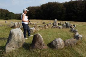 burial
traditions, was unfortunately closed on
Mondays. Instead we walked up to the northern, higher side of the site. From
here, by the older Iron Age grave-markers, we could look down over the slope
which was covered with the almost 700 sets of grave-marker stone arrangements
scattered across the hillside, with the younger Viking Age burials lower down on
the southern side towards the modern city of Aalborg whose high-rise buildings
were visible through the trees
(Photo
39 - Lindholm Høje burial ground). We walked slowly around the site, examining the
stone-settings arrangements, giving particular photographic attention to the
wonderfully preserved ship-settings (see above left and right)
(Photo
40 - Ship-setting grave-marker). Over to one side of the site, remains of
the Lindholm Høje village were visible, the post-holes of houses marked by
modern stone indications. In the light of a sunny afternoon, this was a truly
memorable experience, with just a handful of selectively discerning visitors to
this little visited but highly significant historical site. burial
traditions, was unfortunately closed on
Mondays. Instead we walked up to the northern, higher side of the site. From
here, by the older Iron Age grave-markers, we could look down over the slope
which was covered with the almost 700 sets of grave-marker stone arrangements
scattered across the hillside, with the younger Viking Age burials lower down on
the southern side towards the modern city of Aalborg whose high-rise buildings
were visible through the trees
(Photo
39 - Lindholm Høje burial ground). We walked slowly around the site, examining the
stone-settings arrangements, giving particular photographic attention to the
wonderfully preserved ship-settings (see above left and right)
(Photo
40 - Ship-setting grave-marker). Over to one side of the site, remains of
the Lindholm Høje village were visible, the post-holes of houses marked by
modern stone indications. In the light of a sunny afternoon, this was a truly
memorable experience, with just a handful of selectively discerning visitors to
this little visited but highly significant historical site.
Bramslev Bakker Camping overlooking Mariager Fjord,
a real disappointment: we now had the
challenge of negotiating our way around Aalborg's eastern suburbs and urban
motorway, through the Limfjord tunnel (the modern way of crossing the Limfjord
narrows!), and escape the Aalborg conurbation to the east (click
here for detailed map of route). We joined the E45 southwards in busy
late-afternoon rush-hour traffic, and soon were passing under the Limfjord
tunnel. Several junctions on the southern side, we turned off onto Route 595 and
shortly joined Route 507 for what should have been a straightforward run south.
But not only was traffic aggressively busy but we faced
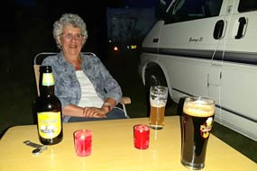 congestion
hold-up at bridge repairs and temporary traffic lights. Reaching the fjord-side
small town of Hadsund at the mouth of the elongated Mariager Fjord, we swung
westwards onto Route 541. At the small village of Valsgård, we turned off onto a
lane leading down to tonight's campsite on the northern bank overlooking
Mariager Fjord, Bramslev Bakker Camping. This small campsite's web site said all the
right things: a good value price at 158kr/night, peaceful fjord-side rural setting, with an
owner who expressed values that we could readily identify with. He greeted us in
a charmingly welcoming and hospitable manner; all seemed ideal for our planned
rest day here. But walking around to the camping area - horrors! - a geriatrics-ville
with sardine-packed rows of statics, line upon line of them with all the
materialistic paraphernalia that accompanies such folk, and scarcely any spaces
free for visitors. This was an utterly alien camping environment, totally
dissonant from all the impressions we had formed and the values expressed by the
owner; it looked as if he had become a victim of his own success. congestion
hold-up at bridge repairs and temporary traffic lights. Reaching the fjord-side
small town of Hadsund at the mouth of the elongated Mariager Fjord, we swung
westwards onto Route 541. At the small village of Valsgård, we turned off onto a
lane leading down to tonight's campsite on the northern bank overlooking
Mariager Fjord, Bramslev Bakker Camping. This small campsite's web site said all the
right things: a good value price at 158kr/night, peaceful fjord-side rural setting, with an
owner who expressed values that we could readily identify with. He greeted us in
a charmingly welcoming and hospitable manner; all seemed ideal for our planned
rest day here. But walking around to the camping area - horrors! - a geriatrics-ville
with sardine-packed rows of statics, line upon line of them with all the
materialistic paraphernalia that accompanies such folk, and scarcely any spaces
free for visitors. This was an utterly alien camping environment, totally
dissonant from all the impressions we had formed and the values expressed by the
owner; it looked as if he had become a victim of his own success.
With severe doubts about whether we were doing the
right thing, but with no other acceptable options available, we eventually (and
reluctantly) settled on a pitch at the end of a row, desperately trying to
insulate ourselves from the surrounding acres of statics, most of which
fortunately were empty. When the owner came round later on his bike to ask if
all was well, our grimly changed demeanours duly expressed our distaste for the
place's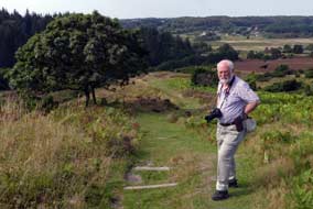 overcrowded nature, totally out of keeping with all we had been given to
expect, and utterly alien to all our values for straightforward outdoor life.
After supper the warm evening became dusky, and as darkness fell, we sat with
our beers under the awning with candles twinkling on the table (see above left).
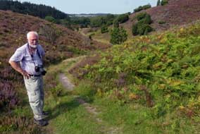 Walking in heath-land hills of Rebild Bakker:
the following morning, we returned north on Route 180 for a day's walking in the
heath-land hills of Rebild Bakker (Hills) National Park (click
here for detailed map of route). Through the extensive Spruce forests of
Rold Skov, we turned off into the heather-covered hills and dales of Rebild
Bakker. At the Rebil Porten information Centre, the impressively knowledgeable
and helpful guide provided us with the English language Rebild Bakker
information leaflet and map; it was exactly what we needed, detailed with
walking routes. Speaking in fluent Americanese from exchange-visits to Chicago (Rebild
has strong links to Danish-US emigrant organisations), she supplied us with
informed advice on a 6kms circular walking route which took in the main features
of Rebild Bakker heath-land hills, returning along a valley edging the Rold Skov
forests. From the parking area, we took a path which immediately began climbing
up through coppiced beech woods to the National Park's highest point of Sønderkol (102m). From the shady beech woods covering the summit plateau and out
onto open heath-land at the hill's highest point, we stood to reconcile the map
with the magnificent outlook over surrounding hills, ridges and intervening
valleys, bordered on the southern side by the darker, gloomy pine woods of Rold
Skov (Photo
41 - Rebild Bakker heath-land hills) (see above right). Walking in heath-land hills of Rebild Bakker:
the following morning, we returned north on Route 180 for a day's walking in the
heath-land hills of Rebild Bakker (Hills) National Park (click
here for detailed map of route). Through the extensive Spruce forests of
Rold Skov, we turned off into the heather-covered hills and dales of Rebild
Bakker. At the Rebil Porten information Centre, the impressively knowledgeable
and helpful guide provided us with the English language Rebild Bakker
information leaflet and map; it was exactly what we needed, detailed with
walking routes. Speaking in fluent Americanese from exchange-visits to Chicago (Rebild
has strong links to Danish-US emigrant organisations), she supplied us with
informed advice on a 6kms circular walking route which took in the main features
of Rebild Bakker heath-land hills, returning along a valley edging the Rold Skov
forests. From the parking area, we took a path which immediately began climbing
up through coppiced beech woods to the National Park's highest point of Sønderkol (102m). From the shady beech woods covering the summit plateau and out
onto open heath-land at the hill's highest point, we stood to reconcile the map
with the magnificent outlook over surrounding hills, ridges and intervening
valleys, bordered on the southern side by the darker, gloomy pine woods of Rold
Skov (Photo
41 - Rebild Bakker heath-land hills) (see above right).
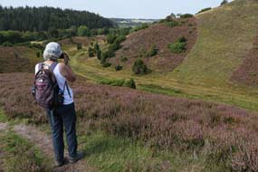 Rebild Bakker are actually not hills in the true
sense at all: Rebild is located on a chalk-limestone plateau 60m above the
present watercourse of Lindenborg River. When the Ice Age ended 12,000 years
ago, melt-water eroded this limestone plateau, forming the grooved gulleys and
valleys seen today between the residual terraces of moraine and sand 'hills' set
on the chalk base rock. The Rebild area was settled early as the sandy soil was
easy to Rebild Bakker are actually not hills in the true
sense at all: Rebild is located on a chalk-limestone plateau 60m above the
present watercourse of Lindenborg River. When the Ice Age ended 12,000 years
ago, melt-water eroded this limestone plateau, forming the grooved gulleys and
valleys seen today between the residual terraces of moraine and sand 'hills' set
on the chalk base rock. The Rebild area was settled early as the sandy soil was
easy to
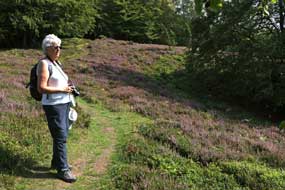 cultivate with primitive tools. This sandy soil was however quickly
depleted, and heather and bracken took over turning the hills into moorland. The
steep moorland slopes of Rebild were used as common grazing land for cattle,
sheep and horses. In 1912 a group of Danish-American emigrant descendents raised
donations to buy the Rebild area, and donated it to the Danish government on
condition it remained in its natural state with access open to all, and that
Danish-Americans be allowed to celebrate the 4 July holiday there. The Rebild
Bakker heath-land hills area is covered with Heather, Crowberry, Bilberry and
Lingonberry, with Beech and Aspen forming the natural woodland. This area of
Denmark marks the European northern limit of Beech, and if left, the Beech and
Aspen would gradually spread over the whole of Rebild Bakker. In order to
prevent this shrouding of the landscape, growth of the trees in the most
characteristic gorges and valleys is controlled, leaving them as open moorland
covered with heather. cultivate with primitive tools. This sandy soil was however quickly
depleted, and heather and bracken took over turning the hills into moorland. The
steep moorland slopes of Rebild were used as common grazing land for cattle,
sheep and horses. In 1912 a group of Danish-American emigrant descendents raised
donations to buy the Rebild area, and donated it to the Danish government on
condition it remained in its natural state with access open to all, and that
Danish-Americans be allowed to celebrate the 4 July holiday there. The Rebild
Bakker heath-land hills area is covered with Heather, Crowberry, Bilberry and
Lingonberry, with Beech and Aspen forming the natural woodland. This area of
Denmark marks the European northern limit of Beech, and if left, the Beech and
Aspen would gradually spread over the whole of Rebild Bakker. In order to
prevent this shrouding of the landscape, growth of the trees in the most
characteristic gorges and valleys is controlled, leaving them as open moorland
covered with heather.
From the vantage point of Sønderkol's high point
with its glorious outlook over the full extent of Rebild Bakker, we descended
the steep crest of the western slope into the valley of Kovads Bæk (so many
topographical terms in Danish are evidently cognate with their Viking-derived
equivalents in English eg bæk = beck). From here we rounded the valley between
hilly walls covered with purple heather (see above left) to begin up the slope of Rebild Bakker's
southern ridge (see above right) (Photo
42 - Heather-covered Rebild Bakker ridges and valleys). The path gained height steadily up the broad moorland ridge, and
towards the top entered the welcome shade of beech woods which covered the higher area of the hill (see above left). Many of the beech trees showed the multi-stemmed
coppiced appearance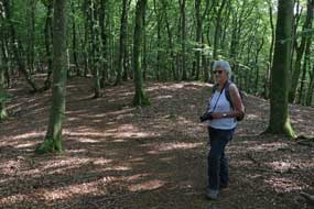 characteristic of the deciduous woodland of the older areas
of Rold Skov, resulting from being repeatedly browsed by grazing animals or
chopped for timber. The path, way-marked by white-painted indicators characteristic of the deciduous woodland of the older areas
of Rold Skov, resulting from being repeatedly browsed by grazing animals or
chopped for timber. The path, way-marked by white-painted indicators
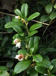 on trees,
gained further height, meandered through the woodland for some 800m, eventually
emerging at a highpoint overlooking the linear valley of Stendalen way below (Photo
43 - Rebild Bakker highpoint);
edged on the far side by gloomily dense pine forests of the modern planted Rold
Skov, this valley would form our return route. The path re-entered the beech
woods, turning every-which-way to reach a paths junction to descend along a
woodland fence down to the end of Stendalen at the route's outermost point. on trees,
gained further height, meandered through the woodland for some 800m, eventually
emerging at a highpoint overlooking the linear valley of Stendalen way below (Photo
43 - Rebild Bakker highpoint);
edged on the far side by gloomily dense pine forests of the modern planted Rold
Skov, this valley would form our return route. The path re-entered the beech
woods, turning every-which-way to reach a paths junction to descend along a
woodland fence down to the end of Stendalen at the route's outermost point.
A long return trek led along a trackway on this
boundary line between the hilly, open moorland heath of Rebild Bakker on one
side and the contrasting dark, uninvitingly gloomy pine forests of Rold Skov on
the other side. Up above us at the top of the heather-covered moorland slope, we
could see the beech wood hill top and look-out point where we had stood 30
minutes earlier. Thankful to have chosen to walk today on the open moorland
hills of Rebild Bakker rather than to have followed paths in the Rold Skov
forests, we made our way back along the forest edge, and turned back to our
earlier way point at the foot of the Sønderkol slope. Our continuing return
path, rising up the length of a valley under the down slopes of Kejserbakke
ridge was something of an anticlimax: gaining height up the gravel
trackway under the hot afternoon sun was a tedious grind. The path eventually
emerged at our earlier start point at the foot of Sønderkol's eastern slope to
return to the car park. Today's 6kms circular walk had enabled us to sample the
best of Rebild Bakker's unique moorland topography, with its classic Nordic
flora of Ling, Bilberry, Crowberry and even some Lingonberry with a few late
flowers (see left).
The town of Hobro
and the value of the European Health Insurance Card:
we returned south to the small town of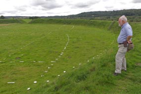 Hobro at the inner head of Mariager Fjord
to shop for provisions, before returning to Bramslev Bakker Camping for a final night.
Again we sat up late under the awning with candles twinkling on the table, but
storm clouds were gathering, prefacing tonight's forecast rain and
electrical storms. With lightening flashes and distant rumbles of thunder, the
first heavy rain began as we turned in, lasting well into the early hours. We
spent our planned day in camp at Bramslev Bakker Camping, which with most of the
statics empty was quieter than feared. The following day we drove back into
Hobro to find a pharmacy for antibiotics to deal with an infection. As expected,
this required a doctor's prescription, and with little difficulty we found a
health centre. Within an hour we had arranged an appointment for consultation
and secured a prescription, all without charge on the strength of our precious
European Health Insurance Card; the unscrupulous buffoon presently masquerading as
British
Prime Minister (elected not by public ballot, but by a cabal of the Tory
establishment) is doing his damndest to deprive the British public of this
asset which is invaluable for European travellers, along with all the other
benefits of EU membership. Hobro at the inner head of Mariager Fjord
to shop for provisions, before returning to Bramslev Bakker Camping for a final night.
Again we sat up late under the awning with candles twinkling on the table, but
storm clouds were gathering, prefacing tonight's forecast rain and
electrical storms. With lightening flashes and distant rumbles of thunder, the
first heavy rain began as we turned in, lasting well into the early hours. We
spent our planned day in camp at Bramslev Bakker Camping, which with most of the
statics empty was quieter than feared. The following day we drove back into
Hobro to find a pharmacy for antibiotics to deal with an infection. As expected,
this required a doctor's prescription, and with little difficulty we found a
health centre. Within an hour we had arranged an appointment for consultation
and secured a prescription, all without charge on the strength of our precious
European Health Insurance Card; the unscrupulous buffoon presently masquerading as
British
Prime Minister (elected not by public ballot, but by a cabal of the Tory
establishment) is doing his damndest to deprive the British public of this
asset which is invaluable for European travellers, along with all the other
benefits of EU membership.
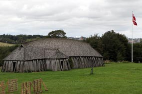 Viking ring-fort at Fyrkat:
from Hobro, we set course for the Viking Age ring-fort of Fyrkat, just outside
the town. Built by Harald Bluetooth, and dated by dendrological analysis of
timbers from the site to 980 AD, Fyrkat guarded the main south~north military
communication route through the newly united kingdom of Denmark. It was also
located at the inner reaches of Mariager Fjord close to the modern town of Hobro
which would have given maritime access. The fort was constructed on a narrow
strip of land protected on 3 sides by marshy land. Fyrkat was similar in design
to the other Viking ring-forts but smaller than Aggersborg and Trelleborg: the
interior diameter was 120m, divided into 4 quadrants by internal roads
connecting the fort's 4 gates at the Viking ring-fort at Fyrkat:
from Hobro, we set course for the Viking Age ring-fort of Fyrkat, just outside
the town. Built by Harald Bluetooth, and dated by dendrological analysis of
timbers from the site to 980 AD, Fyrkat guarded the main south~north military
communication route through the newly united kingdom of Denmark. It was also
located at the inner reaches of Mariager Fjord close to the modern town of Hobro
which would have given maritime access. The fort was constructed on a narrow
strip of land protected on 3 sides by marshy land. Fyrkat was similar in design
to the other Viking ring-forts but smaller than Aggersborg and Trelleborg: the
interior diameter was 120m, divided into 4 quadrants by internal roads
connecting the fort's 4 gates at the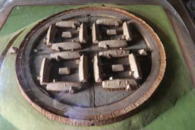 cardinal quarters; each of the quarters had 4 long-house barracks arranged in
a square which housed the garrison (see right for model of Fyrkat ring-fort). The
outer earthworks rampart was reinforced with an outer oakwood cladding, and
topped with timber palisade. Despite this enormous construction effort, the fort remained in use for no more than a decade.
We drove past the modern, tourist-oriented
Fyrkat Viking Centre and continued to the lane's end where the ring-fort's surviving
ramparts were visible across a field. Walking up the hill past a 1990s
reconstruction of a Viking long-house with its oakwood buttressed planking walls
and shingled roof (Photo
44 - Reconstructed Viking Age long-house) (see above left), we climbed
up onto the fort's earth rampart crest to examine the inner area (Photo
45 - Fyrkat ring-fort earth ramparts) (see above right). Outlines of the long-house barracks in each of
the 4 quadrants were notionally represented by white-painted stones indicating
the longhouses' outward curving walls. When we were here in 2007, the area was
totally overgrown and grazed by cattle. It had in the intervening years been
cleared, and was now clearly on the tourist trail: a group of American tourists
were being fed drivel by their guide as their tour-bus waited in the car park to
whisk them off to the next 'attraction'.
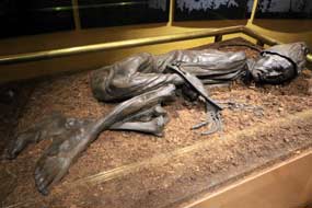 Tollund Man
bog body at Silkeborg Museum:
Route 579 took us westward from Hobro to Møldrup to join Route 13 trunk-road to
Viborg; around Viborg ring-road, Route 13 continued south towards Silkeborg (click
here for detailed map of route), passing through an
extensive area of conifer plantations which took over from farming countryside;
the dark, densely packed pines seemed so alien in this central part of Jutland.
We had first visited Silkeborg in 2007, and again on our drive south through
Jutland on return from Iceland in 2017. Our reason for coming to this otherwise
unremarkable town was to visit the
conserved remains of Tollund Man at Silkeborg Museum. Tollund Man
bog body at Silkeborg Museum:
Route 579 took us westward from Hobro to Møldrup to join Route 13 trunk-road to
Viborg; around Viborg ring-road, Route 13 continued south towards Silkeborg (click
here for detailed map of route), passing through an
extensive area of conifer plantations which took over from farming countryside;
the dark, densely packed pines seemed so alien in this central part of Jutland.
We had first visited Silkeborg in 2007, and again on our drive south through
Jutland on return from Iceland in 2017. Our reason for coming to this otherwise
unremarkable town was to visit the
conserved remains of Tollund Man at Silkeborg Museum.
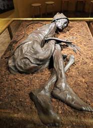 Tollund Man is a naturally preserved Iron Age bog body discovered in 1950
by peat diggers in the Bjældskovdal peat
bog at Tollund village near to Silkeborg. The excavated body, so well preserved
that it was at first believed to be a murder victim, was taken to København for
medical and forensic examination. The body was that of a 30~40 year old
male; it was discovered crouched in a foetal
position, slightly shrunken with arms and hands almost skeletonised (see left and
right) (Photo
46 - Tollund Man Iron Age bog body). But the feet and one finger along with the head and face had been preserved
completely intact by the cold, acidic peaty water of the bog, tanning the skin waxy black. The eyes and mouth were closed,
the hair and stubble on his chin stained ruddy brown by the bog water, and the facial expression peaceful and solemn as if sleeping
(see below left) (Photo
47 - Tollund Man's facial expression). His age at death was determined by dental
examination. The body was naked apart from a
leather belt and sheep skin cap on his head. A braided leather halter noose was
tied around his neck which had left a visible furrow in the skin (Photo
48 - Cause of death by garroting) (see below right). Tollund Man is a naturally preserved Iron Age bog body discovered in 1950
by peat diggers in the Bjældskovdal peat
bog at Tollund village near to Silkeborg. The excavated body, so well preserved
that it was at first believed to be a murder victim, was taken to København for
medical and forensic examination. The body was that of a 30~40 year old
male; it was discovered crouched in a foetal
position, slightly shrunken with arms and hands almost skeletonised (see left and
right) (Photo
46 - Tollund Man Iron Age bog body). But the feet and one finger along with the head and face had been preserved
completely intact by the cold, acidic peaty water of the bog, tanning the skin waxy black. The eyes and mouth were closed,
the hair and stubble on his chin stained ruddy brown by the bog water, and the facial expression peaceful and solemn as if sleeping
(see below left) (Photo
47 - Tollund Man's facial expression). His age at death was determined by dental
examination. The body was naked apart from a
leather belt and sheep skin cap on his head. A braided leather halter noose was
tied around his neck which had left a visible furrow in the skin (Photo
48 - Cause of death by garroting) (see below right).
 Forensic
examination confirmed that Tollund Man's cause of death was hanging or more
likely garroting with the leather loop, since x-rays showed the cervical
vertebrae had not been broken. The brain and internal organs were
well-preserved, and examination of the stomach contents showed that he had eaten
a last meal of gruel of seeds and grain. After death, the eyes and mouth had
been
closed, and the body carefully laid in a sleeping position in the bog. This
careful handling suggests that Tollund Man was the victim of ritual sacrifice to
appease the deities associated with the marshland; for early~mid Iron Age
peoples, bogs were mystical places, the source of their peat fuel and bog iron
ore. The last meal of grains suggests late winter as the likely time of
sacrifice, when meat was unavailable and the bog water still very cold to
preserve the body. Perhaps the human sacrifice was by way of appeal to the
deities for a return of spring warmth and re-growth of crops. Techniques of body
conservation were less developed in the 1950s: the head was severed from the
body and preserved intact, but the body was left untreated and became desiccated. What is now displayed at Silkeborg Museum is the original
conserved head attached to a reconstruction of the body as it was originally
found. Recent Forensic
examination confirmed that Tollund Man's cause of death was hanging or more
likely garroting with the leather loop, since x-rays showed the cervical
vertebrae had not been broken. The brain and internal organs were
well-preserved, and examination of the stomach contents showed that he had eaten
a last meal of gruel of seeds and grain. After death, the eyes and mouth had
been
closed, and the body carefully laid in a sleeping position in the bog. This
careful handling suggests that Tollund Man was the victim of ritual sacrifice to
appease the deities associated with the marshland; for early~mid Iron Age
peoples, bogs were mystical places, the source of their peat fuel and bog iron
ore. The last meal of grains suggests late winter as the likely time of
sacrifice, when meat was unavailable and the bog water still very cold to
preserve the body. Perhaps the human sacrifice was by way of appeal to the
deities for a return of spring warmth and re-growth of crops. Techniques of body
conservation were less developed in the 1950s: the head was severed from the
body and preserved intact, but the body was left untreated and became desiccated. What is now displayed at Silkeborg Museum is the original
conserved head attached to a reconstruction of the body as it was originally
found. Recent examination of bone samples from rib and femur using modern
radio-carbon
dating techniques have made possible a more precise dating of Tollund Man's
death, within a 21 year period between 405~384 BC in the Early Celtic Iron Age. examination of bone samples from rib and femur using modern
radio-carbon
dating techniques have made possible a more precise dating of Tollund Man's
death, within a 21 year period between 405~384 BC in the Early Celtic Iron Age.
Tollund Man and other local archaeological finds
from Iron Age sites are given pride of place at Silkeborg Museum, displayed in a
separate wing together with the less well preserved remains of another bog body Iron Age
 ritual sacrifice victim, that of Elling Woman, found in the same peat bog in 1938. She was of similar age around 30, and had been garroted
with a leather cord before being laid in the bog, wrapped in a sheepskin cape.
Little of the body survives except for the head which shows her elaborately
plaited hair, stained red by the bog water (see left). In the gallery beyond, Tollund Man
is displayed. If this reads like an autopsy report, that's exactly how it felt, gazing with ghoulish
fascination at a 2,400 year old body. This was not the stuff for the squeamish:
the flesh was shrunken, but his finger and feet remarkably preserved with nails, and features
and chin stubble clearly discernible. We were able to spend
uninterrupted time photographing the body from every angle, with close-ups of
the head and face. Despite his gruesome ordeal and the manner in which he met his death, Tollund Man had a certain timeless serenity with his seemingly peaceful looking gaze. We now
knew far more about him, the circumstances of his death and the discovery of
his body than we did on our first visit in 2007; in a macabre sense, it was like
meeting up with an old friend after a 10 year interval.
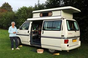
Tørring Camping:
we continued south on Route 13 (click
here for detailed map of route) through further Pine and Spruce
plantations, at last reaching the turning to Tørring. Through the village we
reached tonight's campsite Tørring Camping, a small site on the banks of the
Gudenå River which still attracted canoeists. The place had been renovated over
winter 2018~19 with a new facilities building, from the rather time-expired,
waterlogged site we had used in September 2017. It was still owned and operated
by a voluntary association, and we were welcomed hospitably by the new wardens
Betina and Flemming Johansen. We selected a secluded pitch and settled in,
concerned about the state of the low-lying ground which, even in a dry
summer, still tended to be wet (see right). There was also much noise both from passing
traffic and from large groups who congregated in the open central area. But it
was good value at 154kr/night and very handy for the historical site at Jelling
which we planned to visit tomorrow.
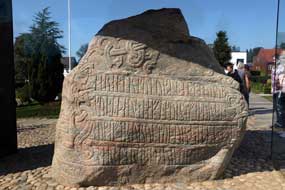 Jelling Church and Rune Stones erected by Harald Bluetooth and Gorm the Old:
the following morning, we set off for the 12 kms drive over to Jelling, a place
of historical and spiritual
significance for the Danes, and parked by
the
Kongernes Jelling Museum.
Jelling had clearly been a
site of ceremonial or ritual importance stretching back into the seeds of time.
In order to enhance his prestige and status by association with Jelling's
religious significance, it was here that Gorm the Old, son of the semi-legendary
Viking king Harthacnut, chose to establish his royal enclosure as a centre of
power, having gained sufficient control and suzerainty over rival clan
chieftains to style himself King of Denmark. He ruled from 936~958 AD with his
wife Thyra, founding the dynasty from which the present Danish royal family
claims descent. Jelling Church and Rune Stones erected by Harald Bluetooth and Gorm the Old:
the following morning, we set off for the 12 kms drive over to Jelling, a place
of historical and spiritual
significance for the Danes, and parked by
the
Kongernes Jelling Museum.
Jelling had clearly been a
site of ceremonial or ritual importance stretching back into the seeds of time.
In order to enhance his prestige and status by association with Jelling's
religious significance, it was here that Gorm the Old, son of the semi-legendary
Viking king Harthacnut, chose to establish his royal enclosure as a centre of
power, having gained sufficient control and suzerainty over rival clan
chieftains to style himself King of Denmark. He ruled from 936~958 AD with his
wife Thyra, founding the dynasty from which the present Danish royal family
claims descent.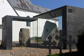
Gorm's eldest son Knut Danaast was killed in a
Viking raid on Dublin in 940 AD, and on Gorm's death in 958, his second son
Harald Bluetooth became king, ruling until 987 AD. It is uncertain where Harald
was buried, but he is commemorated at Roskilde Cathedral where he is said to
have built the first church and named Roskilde capital of the new Kingdom of
Denmark. Harald also chose to base his royal stronghold at Jelling to
consolidate his hold on power over rival chieftains in a country that was still
unstable. It was here that Harald established a memorial to his father Gorm and
his mother Thyra in the form of a monumental rune stone proclaiming and
celebrating not just the memorial to his parents, but also a propaganda
statement of his own achievement in unifying the Danes and converting them
Christianity. This style of self-acclamation was an innovation for rune stones,
which had normally been set up at prominent places as memorials to the life and
works of others, usually close relatives. Harald's
huge three-sided rune stone
contains 4 lines of runic inscription on
the main face which translates as:
King Harold ordered this
monument to be set up in memory
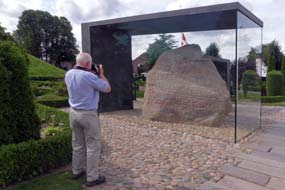 of Gorm his father and Thyra his mother. It was
this Harold who won all Denmark and Norway, and made the Danes Christian (see
above left)
(Photo
49 - Harald Bluetooth's Jelling rune stone).
The second face contains an ornamental animal design encoiled by a snake, and
the third face contains the first Scandinavian pictorial representation of the
crucified Christ. The rune stone still stands by
the church which Harald founded
at Jelling, and is today revered as Denmark's baptismal certificate marking Harald's unification of the kingdom as a Christianised
state. His father Gorm, a
powerful and pagan Viking chieftain, had been buried in a large funerary mound
at Jelling in the Norse Æsir tradition; the mound has been dated by
dendrological analysis of timber from its burial chamber to 958 AD,
the date of Gorm's
death. But as part of the symbolic political statement of converting the
Danish tribes to Christianity, Harald had built a church at Jelling on the site
of his royal hall as a mausoleum for his father's Christian re-burial
there. The original church would have been a wooden stave church, but the
successor stone church, built around 1100 AD, still stands, with Harald's rune
stone of Gorm his father and Thyra his mother. It was
this Harold who won all Denmark and Norway, and made the Danes Christian (see
above left)
(Photo
49 - Harald Bluetooth's Jelling rune stone).
The second face contains an ornamental animal design encoiled by a snake, and
the third face contains the first Scandinavian pictorial representation of the
crucified Christ. The rune stone still stands by
the church which Harald founded
at Jelling, and is today revered as Denmark's baptismal certificate marking Harald's unification of the kingdom as a Christianised
state. His father Gorm, a
powerful and pagan Viking chieftain, had been buried in a large funerary mound
at Jelling in the Norse Æsir tradition; the mound has been dated by
dendrological analysis of timber from its burial chamber to 958 AD,
the date of Gorm's
death. But as part of the symbolic political statement of converting the
Danish tribes to Christianity, Harald had built a church at Jelling on the site
of his royal hall as a mausoleum for his father's Christian re-burial
there. The original church would have been a wooden stave church, but the
successor stone church, built around 1100 AD, still stands, with Harald's rune
stone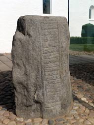 nearby; alongside stands a smaller rune stone erected by Gorm in memory of
his wife with the runic inscription: Gorm made this monument in memory of
Thyra his wife, Denmark's adornment
(Photo
50 - Jelling rune stones) (see right). This is the oldest reference to the
name Denmark (see right). Gorm's original burial mound is matched by a similarly sized mound
on the southern side of the church which contains no burial. This whole complex
at Jelling, including the outline of a monumental ship setting together with
timber traces of Harald's royal stronghold enclosure walls, taken together
symbolises the significance of Denmark's transition from Viking pagan tribal
society to royal-led Christianised statehood. Even more admirable was the
dignified solemnity with which the Danes chose to celebrate the Year 2000
Millennium: Jelling church was renovated and the founding ruler Gorm's remains
were re-interred in the church nave which his son Harold Bluetooth, the first
Christianised Danish nearby; alongside stands a smaller rune stone erected by Gorm in memory of
his wife with the runic inscription: Gorm made this monument in memory of
Thyra his wife, Denmark's adornment
(Photo
50 - Jelling rune stones) (see right). This is the oldest reference to the
name Denmark (see right). Gorm's original burial mound is matched by a similarly sized mound
on the southern side of the church which contains no burial. This whole complex
at Jelling, including the outline of a monumental ship setting together with
timber traces of Harald's royal stronghold enclosure walls, taken together
symbolises the significance of Denmark's transition from Viking pagan tribal
society to royal-led Christianised statehood. Even more admirable was the
dignified solemnity with which the Danes chose to celebrate the Year 2000
Millennium: Jelling church was renovated and the founding ruler Gorm's remains
were re-interred in the church nave which his son Harold Bluetooth, the first
Christianised Danish
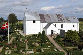 monarch, had built at the time of the first Millennium. monarch, had built at the time of the first Millennium.
On our first visit to Jelling in 2007, the two
magnificent rune stones had stood by the church out in the open with just
a dexion-built covering. When we returned in 2017, they had been encased in
glass both to protect them from further weathering and from the modern scourge of vandalism. Today we walked over again to spend
time re-examining these timeless 1000 year old runic monuments (see above left). We climbed the
southern burial mound for its view overlooking the church (see left) (Photo
51 - 12th century Jelling Church)
and the northern
mound, presumed to be Gorm's original pagan funerary monument raised by Harald
before his re-burial in the newly founded church. Beyond this the line of the
palisade wall of Harald's royal stronghold stretched away to the north with the
notional markings out of the original large scale ship setting. Across at Jelling
church, it was such a joy to stand again in this stately, straightforward and
dignified place, with its powerful historic associations and personal
recollections for us. The Museum at Jelling, a branch of the Danish National
Museum, is free-entry, and a roof-top viewing area gives a panoramic overview of
the entire Jelling site centred on the church, rune stones and the two burial
mounds (see below left and right), and the notionally marked out original ship setting and outline of Harald's stronghold enclosure walls stretching away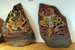 to each side. If you go to Jelling Museum, make a point also of asking to see the set of modern
reproductions of the rune stones, now tucked away in a conference room; these
are coloured in a way the originals are thought to have been, and therefore to each side. If you go to Jelling Museum, make a point also of asking to see the set of modern
reproductions of the rune stones, now tucked away in a conference room; these
are coloured in a way the originals are thought to have been, and therefore
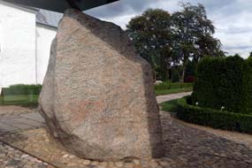 show far more detail of both the runic inscriptions and the two
pictorial designs, particularly the crucified Christ figure (Photo
52 - Jelling rune stone reproduction) (see right). Contrast this with the original stones
that
are now so badly eroded as to make such detail of the engravings almost impossible to discern
(see left). show far more detail of both the runic inscriptions and the two
pictorial designs, particularly the crucified Christ figure (Photo
52 - Jelling rune stone reproduction) (see right). Contrast this with the original stones
that
are now so badly eroded as to make such detail of the engravings almost impossible to discern
(see left).
On our 2017 visit, we had been fortunate enough to
meet with one of the site archaeologists, and were able to discuss with him the
forms of the runic characters, the normal conventions of runic memorial
inscriptions, and the unique character of Harald's stone in the form of a
political statement of power and self-proclamation of his own res gestae.
He had shown us a model which gave a much clearer impression of the whole site's
complexities,
showing the church and burial mounds surrounded by the monumental ship setting
which pre-dated the burial
mounds and perhaps was a surviving remnant of Jelling's past ritual
significance; part of the ship setting had been built over by the empty southern
mound which was assumed to be contemporary with the north mound, dated to 958 AD
from the timber lining of its burial chamber. The surviving excavated stones of
the ship setting had been reburied and were now notionally indicated by white
stone slabs. At its northern apex, a post hole indicated an original huge wooden
monument. The entire complex had been enclosed by a rhomboid-shaped palisade,
part of whose timbers survived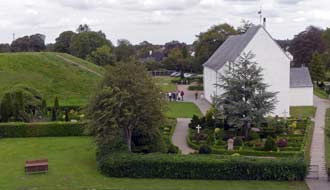 enabling dating to Harald's time, and therefore
assumed to be Harald's royal stronghold at Jelling. The scale of mathematical
precision of the enclosure, whose cross-lines coincided with the mound centre,
was believed to indicate a statement of power for the new royal court.
We were
also able to discuss enabling dating to Harald's time, and therefore
assumed to be Harald's royal stronghold at Jelling. The scale of mathematical
precision of the enclosure, whose cross-lines coincided with the mound centre,
was believed to indicate a statement of power for the new royal court.
We were
also able to discuss
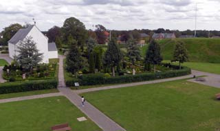 the realpolitik of Harald's much vaunted conversion
to Christianity, intended in practice to annul the external threat of invasion
from continental Europe by Otto, leader of the Holy Roman Empire. As a pagan
Harald was fair game for Otto to attack, but as a fellow Christian ruler he was
protected as one of the club! This enabled Harald to concentrate on his
vulnerability from within his own still unstable realm, where rival rebellious
chieftains were the real threat to his power, led by his own outlawed son Sweyn
Forkbeard who finally overthrew Harald. This was the principle raison d'être
of the ring-forts built by Harald at strategic points around his kingdom, to
contain the rebellious rival chieftains. Harald's real achievement was in
enabling the process of Danish unification, giving rise to the Viking Danish
state under Sweyn and then Knut to become mainstream European leaders,
establishing a northern empire of England and Scandinavia. Our visits to Jelling
had prompted much learning about this critical stage of Viking development with
Sweyn and Knut as Harald's successors, which touched upon English history
between Harald's death in 985 AD and the Norman conquest in 1066. the realpolitik of Harald's much vaunted conversion
to Christianity, intended in practice to annul the external threat of invasion
from continental Europe by Otto, leader of the Holy Roman Empire. As a pagan
Harald was fair game for Otto to attack, but as a fellow Christian ruler he was
protected as one of the club! This enabled Harald to concentrate on his
vulnerability from within his own still unstable realm, where rival rebellious
chieftains were the real threat to his power, led by his own outlawed son Sweyn
Forkbeard who finally overthrew Harald. This was the principle raison d'être
of the ring-forts built by Harald at strategic points around his kingdom, to
contain the rebellious rival chieftains. Harald's real achievement was in
enabling the process of Danish unification, giving rise to the Viking Danish
state under Sweyn and then Knut to become mainstream European leaders,
establishing a northern empire of England and Scandinavia. Our visits to Jelling
had prompted much learning about this critical stage of Viking development with
Sweyn and Knut as Harald's successors, which touched upon English history
between Harald's death in 985 AD and the Norman conquest in 1066.
Crossing the
Lille Bælt Bridge to Funen and Zealand:
with a final farewell to Jelling, and after a final night at Tørring Camping, we
set off to cross the Lille Bælt Bridge to begin the second half of this year's
trip exploring the rural corners of the Danish islands of Funen and
Sjælland (Zealand). But
that's a story for the next edition which will follow shortly.
Second edition
from Denmark to be published quite soon
|
Sheila and Paul |
Published: 10 October 2019 |
|

 CAMPING IN DENMARK 2019 -
Jutland:
 Good to be on the Road again,
thanks to Autosleepers: as the Harwich overnight ferry for Hook of Holland drew away from the quay, we
took our customary seats by the ferry's lounge bow windows, savouring the moment
for the launch of our
belated 2019 trip to Denmark. This long-awaited moment brought to an end a
long, frustrating early summer of waiting for repairs to the raising roof of our
beloved VW camper, George, damaged back in April just before the start date for
our originally planned trip to Scandinavia. We therefore raised our glasses to
toast our thanks (see left) to Alan Curry, Customer Services Manager at Autosleepers
and his Service Engineer Paul Oliver. Autosleepers not only no
longer produce the solid-sided, raising-roof VW Trooper but regrettably also no
longer convert VW campers at all; components therefore for repair to
George's damaged roof were no longer available. Despite this however, these two
valued friends at Autosleepers managed, against all the odds and with supreme
ingenuity, skill and craftsmanship, to find the means of sourcing or fabricating the
necessary parts, achieving a remarkable repair to George's raising roof.
Our VW Trooper has been the whole basis for the
travelling
life style we have enjoyed during the many years of our retirement; its unique
solid-sided raising roof design has enabled us to camp in some extreme and
sub-zero weather conditions during our travels, and for that reason it is for us
irreplaceable. The excellent work carried out by Alan and Paul at Autosleepers
in carrying out such difficult repairs has therefore restored our ability to
continue our travels across Europe, and for that we are truly grateful to them.
Thank you.
 See
Campingplatz BUM near Borgdorf in
Schleswig-Holstein:
a long day's drive of 370 miles across Holland and Germany, with many autobahn hold-ups due to congested
traffic and road works, brought us with further delays past the landscape of
dockyard and container cranes at Hamburg, and under the Elbe Tunnel, for the final
100kms on the A7 into Schleswig-Holstein. 5kms around the lanes from A7 Junction
11 we finally reached See Campingplatz
BUM near Borgdorf. Since our last stay here in 2017, the lake-side camping
 area
had been further enlarged and terraced with additional power supplies. Weary
after today's long drive, we sat in the late afternoon sunshine, enjoying
crisply fresh German beers (see left) (
 The Wadden Sea and Vidå Sluice at the
Forward Coastal Dyke: from Tønder,
country lanes
through flat coastal farming countryside led to the village of Højer, where we
continued out towards the Wadden Sea coast across polders (reclaimed former
marshland) and the Højer Dyke, following
the Vidå River to where it now enters the Wadden Sea through the Vidå
Sluice at the massively impressive Forward
Coastal Dyke.
  The Wadden Sea, stretching around the coasts of
Holland, North Germany and SW Jutland, is extremely tidal, with a tidal
difference of up to 2m between high and low tides every 25 hours. The reclaimed
polders of the fertile Tønder coastal marshlands had always been settled and
cultivated, but farms and buildings had to be raised on mounds and land
protected by dykes, from the constant hazard of flooding by sea-water during
storm tides, and by river water during winter~spring high flow periods. In 1861
the Højer Dyke was built protecting the then line of the Wadden Sea coast and
the outflow of the Vidå River controlled by Højer Sluice. With more intensive
exploitation and settlement of the Tønder reclaimed marshlands during the 20th
century, the threat of flooding of the coastal area, most of which lies at sea
level, became more critical. A severe storm tide in January 1976, which
threatened to overspill the existing coastal Højer Dyke, led to a Danish
parliamentary decision to construct a new 8m high forward coastal dyke to
protect settlements and agricultural land in the Tønder area. The Forward
Coastal Dyke was constructed between 1979~81, 1.4kms west and seaward of, and
parallel with, the old Højer Dyke, creating an extended new coastline. The Vidå
is the third largest river in Denmark,
 draining a 1,400km2 catchment
with its source on a glacial ridge near Aabenraa in SE Jutland. During the 19th
century, the river regularly flooded the low-lying Tønder marshlands during winter high
flow periods, leaving dry only dykes and buildings on mounds. During the 1920s,
the lower Vidå was canalised with protective embankments and water pumped from
marshes into the river. Prior to construction of the Forward Coastal Dyke in
1981, the Vidå River flowed into the Wadden Sea through Højer Sluice. It is now
controlled at its extended outflow at Vidå Sluice in the Forward Coastal Dyke.
The sluice consists of 3 chambers with a total width of 20m. Facing the sea on
the outward side are 3 pairs of automatic sluice gates, with 3 pairs of storm
shields on the inland side of the sluice facing up-river. Water levels are
monitored on both marine and inland sides, in order to forecast storm tide
warnings. During prolonged high tides in the Wadden Sea, the
 sluice gates are
kept shut. Accumulating water in the Vidå River then overflows into the
Margrethe Kog polder and reservoir on the inner side of the Forward Coastal
Dyke. On the outer seaward side of the Forward Coastal Dyke, a number of
sedimentation pans were created to promote the formation of new fore-shore and
enhance dyke safety.
 walked over to explore the sluice, climbing up onto the apex of the Forward
Coastal Dyke which stretched away into the distance north and south along the
new outer coastline. From here we could look inland up the lower length of the
river and across the Margrethe Kog polder and overflow reservoir to its right
(see above right).
We were surprised at the shallow angle of the dyke's outer seaward face which
sloped gently down to the shore-line and the fore-shore sedimentation pans (see
above left).
Older dykes were built with more upright faces on both sides, which were
battered by the full force of tides on the outer seaward face. Modern dykes
such as the Forward Coastal Dyke are now constructed with more gently sloping
outer face towards the sea; this forces storm surge waves to release their energy
slowly instead of hitting the dyke wall with full force. Many of the older dykes
have now been modified with more gently sloping outer faces.
 filled
George's fresh water, we settled into a deserted open area where we had total
privacy and access to power, and relaxed with beers in the evening sunshine
(see right) (
 The Danish~German border:
after much rain in the night, which successfully tested George's newly repaired
roof, we woke to a much cooler weather and heavily overcast sky and spent a
relaxed morning sitting out the frequent heavy showers. Before leaving Rudbøl,
we drove through the village to the line of the Danish~German open border and
crossed the Vidå bridge at the point where the river swells out into another
flood lake. Having crossing the border into the neighbouring German village of
Rosenkranz simply for the sake of it, we turned back into Denmark by a surviving
border barrier and sat at a lake-side picnic table for our lunch sandwiches by
the combined flags of the Nordic countries which proudly signified the border
(see left)
(
 Crossing the tidal causeway to the Wadden Sea island of Mandø:
we returned along the crest of the old Højer Dyke across agricultural polders
countryside riddled with drainage channels, and through Højer village we
continued north on Route 419 following the Wadden Sea coastline with the German
holiday island of Sylt and Danish island of Rømø lining the western horizon (
 places, UNESCO status is symbolic of the ultimate in negative attributes: high
on pretentious glitziness and entry cost, low on value as a source of
substantive detailed information, and the Wadden Sea Centre was no exception!
With zero expectations, we enquired with the girl at reception about earliest
safe crossing times to Mandø this evening with low tide presently set at 8-20pm.
As expected, she was utterly unhelpful and evasive - no tide
tables, no information, no help, nothing to justify the place's costly and
pretentious status! Instead we phoned the shop-cum-campsite on Mandø and were
assured that we could cross safely up to 2 hours before and after low tide time.
 we crossed the
6kms of wet, muddy gravel causeway. 5kms over, the lane became tarmac again,
rising over the higher, grass-covered salt-marshes to reach Mandø island and its
farming village. Here we located the small campsite and settled into a quiet
corner, looking out across the pastureland towards the island's eastern side (
 North Friesian coastline stretching from Holland,
North Germany to SW Jutland, which separate the shallow Wadden Sea from the
North Sea beyond the continental shelf. This chain of islands forms the remains
of a pre-Ice Age coastline before sea levels rose creating the Wadden Sea. Mandø
covers an area of just over 7 square kms. Extensive mud-flats and tidal marshes
surround the island, providing breeding grounds for multitudes of sea birds and
Common and Grey Seals. There are currently 60 permanent residents on Mandø and
the islanders have traditionally made a living from fishing and farming;
nowadays tourism provides a secondary source of earnings. An earth dyke was
constructed around the island's perimeter set back from the shore-line, to
protect the cultivable land from storm tides for cereal crops and for sheep and
cattle grazing.
  An afternoon's walking around Mandø's
western coastline: we woke to a bright sunny morning and breakfast outside (
 causeway low tide
crossing times. Strandvej led out over the western line of dunes and down to the
island's western shoreline where the Stormflodssøjlen column indicated record
heights of storm flood tides over the years since the disastrous tide of 1691.
 Toadflax
(see below left), Yellow Rattle, Slender Centuary, and Restharrow. The path curved around under the line of dunes,
gaining a little height to join the roadway that ran around in the lee of the
NW section of the massive dyke which encircles the island, protecting the
village and farmland from tidal storm floods. This entire centrally enclosed
area of the island is criss-crossed by a cleverly constructed network of
drainage dikes which all feed into a main dike running transversely E~W across
the island's centre to outflow through a sluice on the east coast.
 Tipperne Bird Reserve at Ringkøbing Fjord:
back across at the mainland, we headed north on Rte 11 with the attractive view
of Ribe's ancient medieval church towering over this former Viking port-town (
 would be insufferably noisy,
but most of the statics were empty at this late stage in the year; even so the
noise of TVs in caravan awnings was an irritating intrusion.
  the
tower overlooking the lake shallows and reed-beds, we recorded seeing a Grey
Heron, several Greenshanks, a Curlew, and two unidentified birds of prey soaring
over the meadows where reeds cut for thatching had been stacked.
 meadows into the Skjern Å. The roof-top
viewing platform gave views over the meadows and river, but there was no
bird-life to be seen here.
 lagoons which now
form Ringkøbing and Nissum Fjords. Out to the main Route 181 coast road behind
these dunes at Husby Klit, we clambered up over the dunes where sweetly scented wild roses
flourished, and down to the deserted West Jutland beaches which stretched away
mile after mile north and south backed by the line of dunes (see above
left). The light was
perfect for photographs from high on the dunes (
 Thyborøn ferry across mouth of Limfjord to Agger: we headed north
on Route 181 (
 Nissum Fjord.
The road passed through Thorsminde village
and its harbour which have developed around the sluice which
now controls the Nissum Fjord's outflow. With time now pressing, and just an hour to reach Thyborøn in
time for the 3-00pm ferry across to Agger on the far side of the Limfjord
outflow, we drove at pace for the remaining section of peninsula up to Thyborøn.
We reached the ferry dock with just 10 minutes to spare, and joined other
vehicles waiting to board for the 10 minute crossing (see left); the brisk
westerly wind raised white horses in the choppy waters of the mouth of Limfjord.
Ashore on the far bank, we drove north up the length of the desolate Agger Tange
sand spit, and turned west by Agger village's little harbour on Nissum
Bredning. At Vestervig church, Route 527 led north towards Thisted to reach Route 26
at Sundby; we turned SW-wards, crossing the huge girder bridge over Vilsund
Sound onto the large island of Mors (
 Island of Fur in Limfjord:
the entire span of Jutland's northern region is in fact an island separated by Limfjord, a body of water
which stretches from the west coast at Agger to the east coast beyond Aalborg. Across the width of Mors, a wider bridge
spanned the Salting Sound, with
 Limfjord's ubiquitously pervasive spread
stretching away to the north like an inland sea (
 WC/showers were closed for cleaning until 11-30, peak demand
time. Not prepared to waste time like this, he persuaded the cleaner to let him
use one of the showers, but Sheila was unable to get her shower. We packed our
kit for today's walk, but before leaving, went over to reception to raise the
issue of closing WC/showers to paying guests at peak times to suit management
convenience. Both the owner and his wife now turned insultingly rude, and
demanded we leave immediately for presuming to question the way they ran their
campsite. The more we remonstrated, the more offensive they became, obdurately
insisting we leave immediately, with no payment required for last night. In over
40 years of camping, this was the most grotesquely ill-mannered behaviour we had
ever encountered from campsite owners; not prepared to accept such uncouth
attitudes towards paying guests who kept them in
 business, we did indeed depart, vowing to
ensure that the world knew of their intemperate lack of any grace or civility.
We urge all other campers to avoid Fur Camping like the plague, so that such
ill-mannered people learn to their cost the commercial consequences of treating
customers in such insulting terms.
 thermal insulation and industrial absorbency
applications, including the manufacture of cat litter; Nobel made dynamite by
absorbing nitro-glycerine in diatomite. The remains of former moler-clay
extraction quarries still exist in the northern hills of Fur just inland from
the cliffs, and the strata of moler-clay interspersed with grey volcanic ash,
thrust up and contorted into vertical planes, are exposed on the high cliff
faces of northern Fur where we planned to walk today.
  Inland from here, but unseen among the dense
woodland, were the remains of Fur's former moler-clay quarry pits. The cliffs
gained in height, finally emerging clear of the trees at the highest point of
the cliff-line; here at Knudeklinterne, the most impressive view of the
cliff-face became visible, revealing the alternating strata of creamy-coloured
moler-clay and grey volcanic ash (see above right)
(
 paused for glasses of the
micro-brewery's beers (see above right). A path led through the former moler-clay
quarry pits up through the woods to our start-point on the low cliff-top where
wild Honeysuckle flourished (see left)
(
 spot, and woke to a bright, sunny morning interspersed
with downpour showers brought in by the brisk SW wind. Before leaving, we walked
down to the beach for photos looking along the line of Northern Fur's moler
cliffs and out across the inland sea of Limfjord (see left). This had been a magnificent
spot to camp (see right) (
 Thisted Bredning into the town of Thisted to
shop for provisions at the Brugsen supermarket. From here we headed west on
Route 539 through the Thy heath-land across to Nørre Vorupør on the NW Jutland
coast, to buy smoked fish
and the best fish-cakes ever tasted at our favourite fish smoke-house (røgeri),
with its sign promoting Alt Godt fra Havet (Everything Good from the Sea) (
 below left) (
 now that the place we had such fond
recollections of might have changed, we turned into the campsite. Opening hours at reception late in the
season were limited, and a notice advised us to select our pitch and book in
later; round at the camping area, all was thankfully as we remembered, other
than the inevitable increase in statics. The large, flat grassy pitches were
enclosed by hedges of sweetly-scented wild roses, and with the brisk SW wind
still blowing from across the open heath-land to the rear, we tucked George into
the shelter of the hedge at our usual place
(
 When reception opened the following morning at
8-00am, we went up to pay with the pleasantly welcoming owner Henny Mortensen: prices had remained
constant at 155kr (plus 5kr coins for showers) for as long as
we could recall, making Krohavens Camping surely one of the best value and
pleasantly located campsites in the whole of Denmark. The facilities were first
class with well-equipped kitchen/wash-up and cosy common room (newly fitted out
in 2017 and still as good as ever), homely, modern and spotlessly clean
WC/showers, and to top it all one of the few Danish campsites with full,
site-wide wifi; Krohavens was a first site rate campsite and worthily rated by
us at +5, a Danish favourite. Today the sun shone and we spent a much-needed and
productive day in camp in such a pleasant and peaceful setting at Stenbjerg.
 century, the
drifting sands of the coastal strip covered fields, making it impossible to
cultivate the soil, and farming was driven eastward inland. Those who did not
own land managed to settle in the coastal area of drifting sands, and eked out a
survival living from fishing and whatever could be cultivated on the poor soil.
In the early 19th century, as part of the constant battle against drifting sand,
local people began planting trees in the otherwise treeless landscape of the
coastal strip dunes. From the late 19th through 20th centuries, the sand drift
along the coastal belt was gradually consolidated by rolling out a plantation
carpet of Mountain Pines across the landscape. Gradually, as the plantations of
trees provided shelter from winds and frost, other species such as Spruce, Scots
Pine and deciduous trees (mainly Oak) could be introduced.
 Sundew. Today many of
the sandy dune areas need regular management to avoid overgrowth of
vegetation, with clearance of Mountain Pine and other non-native species which
invade from the older plantations. In the outer dune seaward areas, another
man-made problem has been the invasion of thickets of the wild Rugosa
Rose. In the 1950s this hardy species, introduced from its native eastern Asia, was planted as hedges around holiday
houses, and has now invasively spread so uncontrollably to surrounding natural
areas of dune habitat that it threatens the original dune character and unique
natural flora. While we associate the sweetly-scented wild Rugosa Rose thickets
with coastal areas of Denmark, it has now become necessary to carry out large
scale cutting back to control this extensively invasive spread.
 Our
day in Stenbjerg Klitplantage, Thy National Park: from the parking area just off the Route
181 Kystvej (coast road), we set off on the circular Bislet Trail through the
heather-covered sandy heath of Stenbjerg Klitplantage (dune plantation). This
forested sandy dune heath included areas of plantation which illustrated the
progression of plantation periods throughout the 20th century, and so included a
number of Pine and Spruce species and later plantation of broad-leafed species,
mainly Oak. We had walked this circuit through the dune heath woodland on
previous visits in late September, but being slightly earlier this year in
mid-August, the Ling was in full bloom, carpeting the sandy ground with
purple
(see above left and right) (
 side-path climbed to the top of a particularly high dune, giving
extensive views over the tree-tops of older planted tall Pines. The dry,
nutrient-deficient sandy slopes of the dune hill supported the growth of
flourishing patches of Reindeer lichen (Cladonia rangiformis), previously
seen by us growing in the Arctic. Butterflies (Peacock, Painted Lady and Red
Admiral) flitted around us as we continued
around the circuit, revelling in this sunny wonderland carpeted with scented
heather and bright yellow Toadflax (see above left), following the path to the reed-beds of Bislet lake
(see above right) where the flora
changed to that characteristic of wetter areas.
 plantation with less variety of flora and wetter ground. But
among the Ling here, Cross-leaved Heath (Erica tetralix) grew (see above
left) with its delicate pale-lilac
lantern-shaped flowers closely resembling those of Bearberry (another Ericaceae species).
 anglers. Today had been a
truly enjoyable day of walking in the Stenbjerg dune plantations; tomorrow we
continue our Jutland journey, around the northern shore of Limfjord for a return
stay at Løgstør.
 late
19th century, bordering the sea to the west and extending eastwards to the
inland agricultural land. The road then reached the broad areas of sandy dune
heath-land (klit hede in Danish), bare of trees and covered with rough
grass in contrast with the klit plantage's covering of Pine, Spruce and
Oak through which we had walked yesterday. The dune heath-land is mown and
burned to keep it free from unwanted trees. We continued through the Hanstholm dune heath-lands to turn off into the major fishing port of Hanstholm. Ironically the town's
main tourist attraction today are the WW2 fortifications and gigantic gun-emplacements
built by the German occupiers in 1941 as part of the Atlantic Wall. High German
wages tempted Danish workers to participate alongside Soviet POW slave-labour
in the construction of this huge complex. Hanstholm's civilian population however suffered a cruel fate with homes and
livelihood destroyed by evacuation to hastily-built camps,
 enforced by the collaborationist Danish government in compliance with German
demands. We saw from our 2007 visit that the WW2 museum presents a curiously
ambivalent message about the fortress and the shameful role of the Danish
authorities; the bunkers remain what they have always been, an ugly and evil
intrusion into an otherwise peaceful landscape. Hanstholm was totally destroyed during the German
retreat in 1945, making necessary complete post-war rebuilding of the town.
 Bird watching at Vejlerne Wetlands: leaving Hanstholm
on Route 29 (
 which overlooked the Bygholm
meadows and eastern side of Vejlerne Wetlands. By now rain was beginning and in
the overcast conditions and poor light, the distant view was misty. Through the
hide's in-built powerful binoculars, a huge flock almost 30 Cranes was visible
standing in line in the distant meadows. In the very far distance, only just
visible even through the hide's powerful binoculars, 3 Great White Egrets (in
Danish Sølv Hegre - Silver Heron) and a flock of Greylag Geese could be
seen, and an Osprey (in Danish Fiske Ørn - Fish Eagle) perched on a
fence post. By now visibility conditions were miserable, and in drizzly rain, we
returned to the parking area. This serendipitous meeting with the Danish couple
had enabled us to identify far more bird-life at Vejlerne than ever before.
 for provisions at the Brugsen
supermarket in Løgstør. Then out to Løgstør Camping to be welcomed again with
his quietly reserved hospitality by the owner Ole Vang and his wife Hanne, who
had just taken over the campsite when we stayed here on return from Norway in
September 2014. There were even more statics than on our last stay in 2017 on
return from Iceland, most of then thankfully deserted mid-week; even so the few
that were occupied still managed to produce irritating noise of TVs playing
over-loudly from dawn to dusk in caravan awnings. We selected a pitch as far
away as possible in the farthest corner and settled in (see above right) for a
gloomily wet evening. Facilities at Løgstør Camping were slightly old-fashioned
but perfectly functional, and the price remained unchanged at a very reasonable
(for Danish campsites!) 185kr.
 enclosed by the ramparts 240m in diameter, was
divided into 4 quadrants by internal roads connecting the fort's 4 gates at the cardinal quarters,
and was once occupied by 48 long-houses which were thought to have accommodated a
garrison of some 5,000 troops. Aggersborg was the largest of Denmark's 6
ring-forts built around 980 AD by King Harold Bluetooth or his son Sweyn
Forkbeard. The fortress' key strategic position guarded one of the key crossings
of Limfjord at Aggersund for the Hærvejen (army road) land route
north~south; even more importantly, with Limfjord then
open to the sea at both ends, it commanded both sea routes into the North Sea
west to England and the Kattegat north to Norway. With no archaeological
evidence yet available, it is a matter of speculation as to whether the
Aggersborg
 ring-fort's main function was as a stronghold to control trade
routes or, more likely, to reinforce Harold Bluetooth's control over rival chieftains in the
then newly unified kingdom. Another tempting interpretation of Aggersborg's purpose
was as a garrison/training ground in readiness for Sweyn Forkbeard's forthcoming
expeditions to England in the first decade of the 11th century which led to
Viking domination of England.
 the starkly beautiful 12th century Aggersborg Church which
stood protectively behind us at the hill-top. Standing here at this peaceful
spot by Aggersborg Church, looking out across the ring-fort remains
down towards Limfjord, as always gave the same feeling of awe that this
sacred place had served its local settlement for 900 years (see above left). Preparations were in hand for
a Viking festival that was taking place this weekend, and we had learned from one of
the participants of a Viking era hogback stone grave-marker which had been
excavated at Aggersborg Church. In the neatly maintained graveyard, we found the
hogback standing along with other ancient gravestones by the church
porch (see above right) (
 northern England and southern Scotland. Hogbacks were
carved Anglo-Scandinavian sculpted stones dating from the 10~12th centuries, and
take the form of recumbent monuments with outwardly curved sides and upwardly
curved ridged roof decorated with carved shingles, modelled on a Viking
long-house, implying a representation of a stylised house for the dead. The ends
of the hogback are often gripped by carved, squatting bears. They are
thought to have originated among Viking settlers who occupied northern England,
but are not generally found in the Viking homelands of Denmark, Sweden and
Norway. The presence therefore of the hogback grave-marker found here at Aggersborg Church
suggests the ring-fort's maritime links with England. We took our photos inside
the church (see above left), including the runic graffiti, carved in the plasterwork of
the church wall (see right) perhaps by bored 12th century parishioners during
 lengthy sermons.
  the cliff edge atop a further 30m depth of sand dunes. From the start however, a
combination of drifting, wind-blown sand and wind~tidal erosion of the soft,
sandy coast caused problems. Eventually the migrating dunes became so high as to
block access to the lighthouse and make its light invisible from the sea, and
the lighthouse closed in 1968. The sand-engulfed lighthouse became nothing more
than a tourist attraction, but the drifting dunes and rising sand threatened
totally to overwhelm its tower. Our photo taken on our 2007 visit shows just the
top three storeys' windows still standing clear of the rising sand (see left for
2007 photo).
During the intervening years, the lighthouse area was cleared of sand as the
dunes drifted northwards, again giving access to the tower which then stood in a
hollow surrounded by high dunes (see right for 2017 photo). An internal staircase was constructed allowing
access to the top platform, and in 2017 we were able to
 climb
to the tower's top for views over the dunes and along
the fragile coastline (see left) (
 When
we arrived today at Rudbjerg Knude, we found that the foundations of the once
sand-engulfed lighthouse had been further cleared in readiness for the entire
structure to be hoisted onto a railed trolley construction, and dragged
wholesale back 80m from the threatening cliff-edge; this should be completed by
October 2019. As we walked up through the dunes for comparative 2019 photos (see
right) (
 the fishing village
it had served long since washed into the sea 60m below. When we returned in
2017, we found that in the intervening 10 years, this little church had been
demolished to prevent coastal erosion causing it to crash into the sea below.
Today just the gravestones sadly remain, along with a large memorial anchor from
a British frigate sunk here in 1808, to
mark the site of the former church and village of Mårup (
 North towards Skagen and an excellent
farm-campsite at Ålbæk B & B farm-camping: but by now it was almost 4-00pm and we still had
1½ hours drive to reach Jutland's northernmost tip at Skagen this evening. We
were also uncertain about where we should camp this weekend with all the known
campsites at Skagen being ghastly, unattractive holiday-camps, over-priced and
over-crowded; we faced this prospect with dread after enjoying mostly peaceful
solitude so far this trip. Before setting off, we therefore
  took stock and
identified a couple of possible stellplads within 25kms of Skagen.
Returning along the lanes past Skallerup church, we turned north on Route 55
towards Hirtshals (
 alongside
pine woods, which we had to ourselves. Ålbæk B & B farm-campsite was a real
+5 jewel of a chance find, warmly hospitable, excellent value, beautifully
sited, with first class facilities, and most importantly a wonderfully peaceful
place to camp. It was just 25kms from Skagen: we could drive up to Grenen and
return here to camp tomorrow evening. The following morning was bright and sunny,
and we breakfasted outside
(
 a sunny windless day, the powerful currents as the 2
opposing tides converge produce a compelling spectacle of upward surging
fountains of spray. On our last visit in early October 2007, we had the setting
to ourselves, but on a sunny late August weekend, there were bound still to be a
number of holiday-makers; there was no chance of our enjoying in peace the
natural spectacle of opposing tides converging, as we had done last year at the
similar sandspit setting of Cape Kolka in Northern Latvia on the far side of the
Baltic.

 living and working conditions of impoverished Skagen fishermen. As we drove away
from Grenen, Skagen's notoriously fickle sea mist was beginning to drift in,
obscuring the lighthouse tower.
 dunes on flat land between 2 of the rural parish's fishing villages.
But from the 16th century, the church increasingly was threatened by the
migrating dunes blown by the vicious storms that sweep across Skagen. By the late
18th century, those attending services had to take shovels to clear access to
their church amidst the drifting sand. By the early 19th century, the 5m high
nave was buried under the sand and the church abandoned, leaving just the gabled
tower which was painted white as a marker for passing shipping in the
nearby Kattegat. Such was the power and intensity of Skagen's drifting sand
dunes. We parked at the end of the forest road leading through the mainly spruce
plantation and walked out through the heath-covered dunes to where the church's
gabled tower still stands incongruously isolated among the dunes (see right)
(
 We returned for a second night at Ålbæk B
& B farm-campsite, and inland away
from the coast the sun was still bright and warm enough to sit out in the
shade of the awning (see left).
  is
Denmark's largest expanse of drifting dunes, left in their natural unplanted
state; while the majority of dunes were
stabilised by planting with lyme grass or conifers, Råbjerg Mile was left to allow future generations to
understand the problem of migratory sand dune drift. The bare, undulating dunes
up to 40m high and covering an area of some 2 km2 were formed
on the west coast of Skagen during the 16th century great sand drift, and are
gradually moving north-eastwards across the peninsula. The destructive force of
this 4 million cubic metres of loose sand, driven by the predominant westerly
wind is now advancing at a rate of 18m per year, engulfing farmland and forest
(see right for map of Råbjerg Mile).
 sloping
barren wasteland of sand was an unnerving, mesmerising sight, with the
undulating dune hills stretching away into the distance to the west and south,
with tongues of wind-blown sand visibly moving forwards over the nearby
heath-land. As we began advancing up onto the dune hills, it was hard going trying to make headway across the
loose sand, just like plodding a way across snow fields. Naturally there could be no marked regular paths, just the fleeting
footmarks of other walkers which would soon be covered by wind-blown sand
(see right)
(
 featureless bare sandy desert-scape, you
quickly lost your bearings and sense of direction, as we headed on a southerly
compass course for about 1km across the undulating
open dunes, heading towards a high-point to the south. On some slopes the sand
was so loose that you sank in, on others the loose sand had blown off leaving a
surprisingly compacted hard crust. Advancing across the open, bare sand-scape of
the dunes, the hot sun reflected off the fine white sand, again just like on
snow, had been scorching. As we approached the high-point target, the gradient
up onto its summit was much steeper, but we followed footstep routes up its side
to emerge onto the open dunes at the point where advancing tongues of sand were encroaching onto forest to the SE (
 unbelievable sand-scape
vista, stretching away in all directions.
  west~east transit of the Skagen peninsula, the Sandmilen
drifting dunes have over the centuries now reached the final stage of this
migratory advance driven by the prevailing westerly winds at a rate of 15m per
year across the entire width of the peninsula towards the east coast; had the
dunes not been stabilised by lyme grass and ling from its bare natural state, Sandmilen dunes would within 50 years be blown entirely into the Kattegat.
 engulfed the Church of St Lawrence leaving just the tower standing clear of the
dunes. The forest floor was ablaze with purple heather, and in the
now hot, clear sun, the trees gave welcome shade. At the eastern edge of the forest, we
emerged from the trees to a more open vista of heath-covered dunes stretching
away north and south. A clearly marked path traced a way eastwards, undulating
through both dunes and open heath-land towards the Kattegat coast (see left) (
 today's SE breeze blowing from
the Kattegat. We clambered
over successive lines of dunes, the path from each then dropping into a
further dune hollow, to mount the next line of dunes, and still tantalisingly
not reaching the coast. At last, as we broached the last set of dunes, the sound
of surf could be heard, and over the top there was the deserted beach stretching
away for miles in both directions (
 large freighter ships in these busy waters (
 beech wood
covered hills. The campsite was a little more expensive at 215kr (including
coins for showers), but the place's most attractive feature was the setting, with
camping areas scattered among secluded corners of the rolling, beech wood
covered hills. Inevitably this meant sloping ground, but we found a quiet grove
among the beech woods, open to evening and morning sun, and managed to level
George. Again we had the perfect peace of having this corner to ourselves, and
settled in to relax with beers and light the barbecue for supper in the warm
evening sunshine after a satisfying day of walking among the Skagen dunes (
 Iron Age~Viking period settlement and burial ground of Lindholm Høje:
leaving Tolne village, we shopped for supplies in the nearby small town of
Sindal, then continued south towards Aalborg at the Limfjord eastern crossing.
Rather than take the motorway, we followed a series of minor roads through
farming countryside and small villages (
 Høje on the south-facing slope of
the higher ground above Limfjord in early 5th century AD close to the fjord's
important eastern crossing point. Limfjord then divided the northern part of
Jutland from coast to coast, edged with swamps on either side; it was only
possible to make a crossing where the fjord narrowed, inland at Aggersund and
here in the east where the later city of Aalborg would develop. Important
north~south land communication routes developed at these two fjord
crossing-points. The settlement at Lindholm Høje was occupied and the land
farmed from the Nordic Iron Age for over 600 years until the 11th century AD
Viking Age.
 From ancient times, the area had been covered
by a deep layer of shifting sand which drifted constantly on these wind-swept
heights, a problem worsened by extensive de-forestation for timber as the
settlement at Lindholm Høje developed. The site was finally abandoned around
1050 AD and the site covered with westward drifting sand, which helped to
protect and conserve the remains of the site for discovery and archaeological
excavation in the 20th century. Some of the grave-marker stones in the burial
grounds had been removed and broken up for road construction in the 19th
century, but major archaeological investigation of the site began in the 1950s.
This revealed some 600 of the known 700 graves at Lindholm Høje, along with
remains of the settlement there. Because of its location on both land and
 maritime trade and transportation routes, the settlement was clearly a
significant centre for trade as well as farming, judging from the glassware,
jewellery and Arab coins unearthed at Lindholm Høje.
 in an oval or round arrangement for women,
and in a triangular or ship-setting arrangement for men, an indication of the
importance of water-borne transportation during the Viking Age. The shape and
size of the grave-marker outline indicated the deceased's status. Although not
as large as the great ship-settings we had previously seen in Sweden such as Blomsholm,
Anundshög and Ales
Stones, Lindholm Høje constitutes the largest assemblage of well-preserved
ship-settings, with larger prow and stern stones and smaller stones representing
the ship's outline.
 burial
traditions, was unfortunately closed on
Mondays. Instead we walked up to the northern, higher side of the site. From
here, by the older Iron Age grave-markers, we could look down over the slope
which was covered with the almost 700 sets of grave-marker stone arrangements
scattered across the hillside, with the younger Viking Age burials lower down on
the southern side towards the modern city of Aalborg whose high-rise buildings
were visible through the trees
(
 congestion
hold-up at bridge repairs and temporary traffic lights. Reaching the fjord-side
small town of Hadsund at the mouth of the elongated Mariager Fjord, we swung
westwards onto Route 541. At the small village of Valsgård, we turned off onto a
lane leading down to tonight's campsite on the northern bank overlooking
Mariager Fjord, Bramslev Bakker Camping. This small campsite's web site said all the
right things: a good value price at 158kr/night, peaceful fjord-side rural setting, with an
owner who expressed values that we could readily identify with. He greeted us in
a charmingly welcoming and hospitable manner; all seemed ideal for our planned
rest day here. But walking around to the camping area - horrors! - a geriatrics-ville
with sardine-packed rows of statics, line upon line of them with all the
materialistic paraphernalia that accompanies such folk, and scarcely any spaces
free for visitors. This was an utterly alien camping environment, totally
dissonant from all the impressions we had formed and the values expressed by the
owner; it looked as if he had become a victim of his own success.
 overcrowded nature, totally out of keeping with all we had been given to
expect, and utterly alien to all our values for straightforward outdoor life.
After supper the warm evening became dusky, and as darkness fell, we sat with
our beers under the awning with candles twinkling on the table (see above left).
 Walking in heath-land hills of Rebild Bakker:
the following morning, we returned north on Route 180 for a day's walking in the
heath-land hills of Rebild Bakker (Hills) National Park (
 Rebild Bakker are actually not hills in the true
sense at all: Rebild is located on a chalk-limestone plateau 60m above the
present watercourse of Lindenborg River. When the Ice Age ended 12,000 years
ago, melt-water eroded this limestone plateau, forming the grooved gulleys and
valleys seen today between the residual terraces of moraine and sand 'hills' set
on the chalk base rock. The Rebild area was settled early as the sandy soil was
easy to
 cultivate with primitive tools. This sandy soil was however quickly
depleted, and heather and bracken took over turning the hills into moorland. The
steep moorland slopes of Rebild were used as common grazing land for cattle,
sheep and horses. In 1912 a group of Danish-American emigrant descendents raised
donations to buy the Rebild area, and donated it to the Danish government on
condition it remained in its natural state with access open to all, and that
Danish-Americans be allowed to celebrate the 4 July holiday there. The Rebild
Bakker heath-land hills area is covered with Heather, Crowberry, Bilberry and
Lingonberry, with Beech and Aspen forming the natural woodland. This area of
Denmark marks the European northern limit of Beech, and if left, the Beech and
Aspen would gradually spread over the whole of Rebild Bakker. In order to
prevent this shrouding of the landscape, growth of the trees in the most
characteristic gorges and valleys is controlled, leaving them as open moorland
covered with heather.
 characteristic of the deciduous woodland of the older areas
of Rold Skov, resulting from being repeatedly browsed by grazing animals or
chopped for timber. The path, way-marked by white-painted indicators
 on trees,
gained further height, meandered through the woodland for some 800m, eventually
emerging at a highpoint overlooking the linear valley of Stendalen way below (
 Hobro at the inner head of Mariager Fjord
to shop for provisions, before returning to Bramslev Bakker Camping for a final night.
Again we sat up late under the awning with candles twinkling on the table, but
storm clouds were gathering, prefacing tonight's forecast rain and
electrical storms. With lightening flashes and distant rumbles of thunder, the
first heavy rain began as we turned in, lasting well into the early hours. We
spent our planned day in camp at Bramslev Bakker Camping, which with most of the
statics empty was quieter than feared. The following day we drove back into
Hobro to find a pharmacy for antibiotics to deal with an infection. As expected,
this required a doctor's prescription, and with little difficulty we found a
health centre. Within an hour we had arranged an appointment for consultation
and secured a prescription, all without charge on the strength of our precious
European Health Insurance Card; the unscrupulous buffoon presently masquerading as
British
Prime Minister (elected not by public ballot, but by a cabal of the Tory
establishment) is doing his damndest to deprive the British public of this
asset which is invaluable for European travellers, along with all the other
benefits of EU membership.
 Viking ring-fort at Fyrkat:
from Hobro, we set course for the Viking Age ring-fort of Fyrkat, just outside
the town. Built by Harald Bluetooth, and dated by dendrological analysis of
timbers from the site to 980 AD, Fyrkat guarded the main south~north military
communication route through the newly united kingdom of Denmark. It was also
located at the inner reaches of Mariager Fjord close to the modern town of Hobro
which would have given maritime access. The fort was constructed on a narrow
strip of land protected on 3 sides by marshy land. Fyrkat was similar in design
to the other Viking ring-forts but smaller than Aggersborg and Trelleborg: the
interior diameter was 120m, divided into 4 quadrants by internal roads
connecting the fort's 4 gates at the
 cardinal quarters; each of the quarters had 4 long-house barracks arranged in
a square which housed the garrison (see right for model of Fyrkat ring-fort). The
outer earthworks rampart was reinforced with an outer oakwood cladding, and
topped with timber palisade. Despite this enormous construction effort, the fort remained in use for no more than a decade.
 Tollund Man
bog body at Silkeborg Museum:
Route 579 took us westward from Hobro to Møldrup to join Route 13 trunk-road to
Viborg; around Viborg ring-road, Route 13 continued south towards Silkeborg (
 Tollund Man is a naturally preserved Iron Age bog body discovered in 1950
by peat diggers in the Bjældskovdal peat
bog at Tollund village near to Silkeborg. The excavated body, so well preserved
that it was at first believed to be a murder victim, was taken to København for
medical and forensic examination. The body was that of a 30~40 year old
male; it was discovered crouched in a foetal
position, slightly shrunken with arms and hands almost skeletonised (see left and
right) (
 Forensic
examination confirmed that Tollund Man's cause of death was hanging or more
likely garroting with the leather loop, since x-rays showed the cervical
vertebrae had not been broken. The brain and internal organs were
well-preserved, and examination of the stomach contents showed that he had eaten
a last meal of gruel of seeds and grain. After death, the eyes and mouth had
been
closed, and the body carefully laid in a sleeping position in the bog. This
careful handling suggests that Tollund Man was the victim of ritual sacrifice to
appease the deities associated with the marshland; for early~mid Iron Age
peoples, bogs were mystical places, the source of their peat fuel and bog iron
ore. The last meal of grains suggests late winter as the likely time of
sacrifice, when meat was unavailable and the bog water still very cold to
preserve the body. Perhaps the human sacrifice was by way of appeal to the
deities for a return of spring warmth and re-growth of crops. Techniques of body
conservation were less developed in the 1950s: the head was severed from the
body and preserved intact, but the body was left untreated and became desiccated. What is now displayed at Silkeborg Museum is the original
conserved head attached to a reconstruction of the body as it was originally
found. Recent
 examination of bone samples from rib and femur using modern
radio-carbon
dating techniques have made possible a more precise dating of Tollund Man's
death, within a 21 year period between 405~384 BC in the Early Celtic Iron Age.
 ritual sacrifice victim, that of Elling Woman, found in the same peat bog in 1938. She was of similar age around 30, and had been garroted
with a leather cord before being laid in the bog, wrapped in a sheepskin cape.
Little of the body survives except for the head which shows her elaborately
plaited hair, stained red by the bog water (see left). In the gallery beyond, Tollund Man
is displayed. If this reads like an autopsy report, that's exactly how it felt, gazing with ghoulish
fascination at a 2,400 year old body. This was not the stuff for the squeamish:
the flesh was shrunken, but his finger and feet remarkably preserved with nails, and features
and chin stubble clearly discernible. We were able to spend
uninterrupted time photographing the body from every angle, with close-ups of
the head and face. Despite his gruesome ordeal and the manner in which he met his death, Tollund Man had a certain timeless serenity with his seemingly peaceful looking gaze. We now
knew far more about him, the circumstances of his death and the discovery of
his body than we did on our first visit in 2007; in a macabre sense, it was like
meeting up with an old friend after a 10 year interval.
 Jelling Church and Rune Stones erected by Harald Bluetooth and Gorm the Old:
the following morning, we set off for the 12 kms drive over to Jelling, a place
of historical and spiritual
significance for the Danes, and parked by
the

 of Gorm his father and Thyra his mother. It was
this Harold who won all Denmark and Norway, and made the Danes Christian (see
above left)
(
 nearby; alongside stands a smaller rune stone erected by Gorm in memory of
his wife with the runic inscription: Gorm made this monument in memory of
Thyra his wife, Denmark's adornment
(
 monarch, had built at the time of the first Millennium.
 to each side. If you go to Jelling Museum, make a point also of asking to see the set of modern
reproductions of the rune stones, now tucked away in a conference room; these
are coloured in a way the originals are thought to have been, and therefore
 show far more detail of both the runic inscriptions and the two
pictorial designs, particularly the crucified Christ figure (
 enabling dating to Harald's time, and therefore
assumed to be Harald's royal stronghold at Jelling. The scale of mathematical
precision of the enclosure, whose cross-lines coincided with the mound centre,
was believed to indicate a statement of power for the new royal court.
We were
also able to discuss
 the realpolitik of Harald's much vaunted conversion
to Christianity, intended in practice to annul the external threat of invasion
from continental Europe by Otto, leader of the Holy Roman Empire. As a pagan
Harald was fair game for Otto to attack, but as a fellow Christian ruler he was
protected as one of the club! This enabled Harald to concentrate on his
vulnerability from within his own still unstable realm, where rival rebellious
chieftains were the real threat to his power, led by his own outlawed son Sweyn
Forkbeard who finally overthrew Harald. This was the principle raison d'être
of the ring-forts built by Harald at strategic points around his kingdom, to
contain the rebellious rival chieftains. Harald's real achievement was in
enabling the process of Danish unification, giving rise to the Viking Danish
state under Sweyn and then Knut to become mainstream European leaders,
establishing a northern empire of England and Scandinavia. Our visits to Jelling
had prompted much learning about this critical stage of Viking development with
Sweyn and Knut as Harald's successors, which touched upon English history
between Harald's death in 985 AD and the Norman conquest in 1066.
