|
 CAMPING
IN ICELAND 2017 - West Fjords: Ísafjarðardjúp, Ísafjörđur, Bolungarvík, Flateyri, Þingeyri, Dynjandi, Tálknafjörđur, Patreksfjörđur, Látrabjarg
Cliffs, Reykhólar: CAMPING
IN ICELAND 2017 - West Fjords: Ísafjarðardjúp, Ísafjörđur, Bolungarvík, Flateyri, Þingeyri, Dynjandi, Tálknafjörđur, Patreksfjörđur, Látrabjarg
Cliffs, Reykhólar:
NW from Hólmavík towards the West Fjords:
glad to be leaving Hólmavík Camping, we were up at 6-30am to drive over to the NI service station at the village
outskirts; George was given a hose-brushing to remove all the accumulated dirt road
slurry-mud from his wheel arches and lower bodywork, and we shopped for provisions at the
supermarket. We headed north-west from Hólmavík on Route 61 alongside the inner arm of Steingrimsfjörður to its head, where Route 645 branched off for Drangnes. Our
road continued ahead into Straðardalur, gaining height steadily up onto the
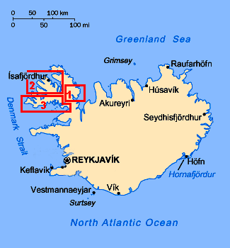
broad and bleakly grim plateau of Steingrimsfjarðarheiði (click on Map 1
right for details of route); this stony wilderness stretched away into the
distance in all directions. A long descent on the far side brought distant
vistas of the inner head of Ísafjarðardjúp, the fjord which slices deep into the
West Fjords mountainous landmass.
|
Click on 3 highlighted areas of
map
for details of Iceland's West Fjords |
 |
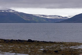 Ísafjarðardjúp: this long
arm of the Denmark Strait extends 75kms inland from its mouth at the
mountainous NW corner of Iceland at Bolungarvík, with 8 side-fjords cutting deep into
the southern coastline of Ísafjarðardjúp (click on Map 2
right for details). From this viewpoint on Steingrimsfjarðarheiði, remote, uninhabited and forbidding fjord-land stretched
away as far as the eye could
see. With just one small village, Súðávík where we should camp tonight, along
the 200kms length of lonely Route 61 winding along the southern,
much-indented shoreline, the northern side of Ísafjarðardjúp is lined with the
sheer, snow-capped mountainous coast of Langadalsströnd and Snæfjallaströnd (see
left);
these are cleaved by
the glacial lagoon of Kaldalón, which is fed by meltwaters from the Drangajökull glacier which caps the wilderness of Hornstrandir. Until the
mid-late 20th century, this northern coast was dotted with isolated farms eking
out a precarious subsistence living from sheep-farming and fishing. Today they
are all abandoned; life up here is unbelievably tough. Even the white fish have
left Ísafjarðardjúp in favour of the open North Atlantic, leaving the more
sheltered fjord to shrimps. Ísafjarðardjúp: this long
arm of the Denmark Strait extends 75kms inland from its mouth at the
mountainous NW corner of Iceland at Bolungarvík, with 8 side-fjords cutting deep into
the southern coastline of Ísafjarðardjúp (click on Map 2
right for details). From this viewpoint on Steingrimsfjarðarheiði, remote, uninhabited and forbidding fjord-land stretched
away as far as the eye could
see. With just one small village, Súðávík where we should camp tonight, along
the 200kms length of lonely Route 61 winding along the southern,
much-indented shoreline, the northern side of Ísafjarðardjúp is lined with the
sheer, snow-capped mountainous coast of Langadalsströnd and Snæfjallaströnd (see
left);
these are cleaved by
the glacial lagoon of Kaldalón, which is fed by meltwaters from the Drangajökull glacier which caps the wilderness of Hornstrandir. Until the
mid-late 20th century, this northern coast was dotted with isolated farms eking
out a precarious subsistence living from sheep-farming and fishing. Today they
are all abandoned; life up here is unbelievably tough. Even the white fish have
left Ísafjarðardjúp in favour of the open North Atlantic, leaving the more
sheltered fjord to shrimps.
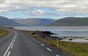 Route 61 around the southern shore of Ísafjarðardjúp: as we descended
from Steingrimsfjarðarheiði, just before reaching the innermost head of Ísafjarðardjúp,
the stony road leading up to the valley of Kaldalón below Hornstrandir's
Drangajökull Route 61 around the southern shore of Ísafjarðardjúp: as we descended
from Steingrimsfjarðarheiði, just before reaching the innermost head of Ísafjarðardjúp,
the stony road leading up to the valley of Kaldalón below Hornstrandir's
Drangajökull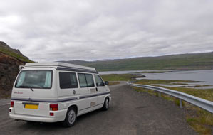 glacier branched off. Route 61 continued ahead to Ísafjarðardjúp's
shore (see right), and turned into the side-valley around the shores of
Ísafjörður, the
first of a series of 8 side-fjords cutting into Ísafjarðardjúp's southern coast
from the main fjord (see left). A long and lonely 25km drive along the side-fjord's eastern
shoreline brought us to the valley head; the surrounding mountains enclosing the
glacial valley seemed lower and less overwhelming than expected in the morning
sunshine. We passed frequent bird-life in the fjord-side shallows, but with nowhere to pull in, it was impossible to stop. Rounding
the valley head, we then had
the 25kms drive back along the western shore, bringing us along the narrow spit
of Reykjanes. We turned off here to pause at the hotel, a grim-looking concrete
bunker of a place which takes advantage of a local geothermal source to heat its
swimming pool. glacier branched off. Route 61 continued ahead to Ísafjarðardjúp's
shore (see right), and turned into the side-valley around the shores of
Ísafjörður, the
first of a series of 8 side-fjords cutting into Ísafjarðardjúp's southern coast
from the main fjord (see left). A long and lonely 25km drive along the side-fjord's eastern
shoreline brought us to the valley head; the surrounding mountains enclosing the
glacial valley seemed lower and less overwhelming than expected in the morning
sunshine. We passed frequent bird-life in the fjord-side shallows, but with nowhere to pull in, it was impossible to stop. Rounding
the valley head, we then had
the 25kms drive back along the western shore, bringing us along the narrow spit
of Reykjanes. We turned off here to pause at the hotel, a grim-looking concrete
bunker of a place which takes advantage of a local geothermal source to heat its
swimming pool.
The on-going Route 61 crossed the mouth of
the second and smaller side-fjord, Reykjarfjörður on a causeway
(click
here for detailed map of route), and climbed
steeply over the peninsula-finger of Vatnsfjarðarháls which tapers northwards to
its tip projecting into Ísafjarðardjúp main fjord. Route
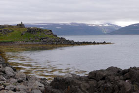 61 then crossed the
mouth of the larger Mjólfjörður, the third side-fjord, on a causeway-bridge,
saving a 40kms drive around its shoreline, before tracing a route around
the much-indented southern shore of Ísafjarðardjúp, each little bay and cove
with Eiders swimming in the shallows. In the distance 61 then crossed the
mouth of the larger Mjólfjörður, the third side-fjord, on a causeway-bridge,
saving a 40kms drive around its shoreline, before tracing a route around
the much-indented southern shore of Ísafjarðardjúp, each little bay and cove
with Eiders swimming in the shallows. In the distance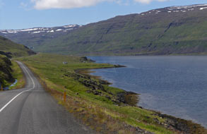 across the broad width of
the main fjord, the snowy mountains, sheer sea-cliffs and barren wastes of
the now uninhabited Hornstrandir peninsula, the northern extension of the West
Fjords region, stood out. Looking across from Route 61 to this wild northern coastline, the gaping mouth of Kaldalón could also be seen clearly,
backed by the white snowy mass of Drangajökull glacier. Hornstrandir is now one
of Europe's last remaining truly wilderness areas, with some of the most extreme
and inhospitable parts of Iceland. A number of farms had existed here until the
early 1950's, all long since abandoned, and since 1975 the 580 sq kms of tundra,
fjord coastline and alpine upland have been protected as Hornstrandir Nature
Reserve, with strict conservation rules to protect Iceland's only large mammal,
the Arctic Fox. But the delicate balance of Hornstrandir's wilderness natural
environment now faces further threat: the voraciously greedy mass tourism industry
now organises wild-life adventure tours into the region for gullible
tourists from developed countries seeking ever greater novelty on which to
expend their surplus wealth. Is there no part of the planet that is safe from
the ravages of the mass tourism industry? across the broad width of
the main fjord, the snowy mountains, sheer sea-cliffs and barren wastes of
the now uninhabited Hornstrandir peninsula, the northern extension of the West
Fjords region, stood out. Looking across from Route 61 to this wild northern coastline, the gaping mouth of Kaldalón could also be seen clearly,
backed by the white snowy mass of Drangajökull glacier. Hornstrandir is now one
of Europe's last remaining truly wilderness areas, with some of the most extreme
and inhospitable parts of Iceland. A number of farms had existed here until the
early 1950's, all long since abandoned, and since 1975 the 580 sq kms of tundra,
fjord coastline and alpine upland have been protected as Hornstrandir Nature
Reserve, with strict conservation rules to protect Iceland's only large mammal,
the Arctic Fox. But the delicate balance of Hornstrandir's wilderness natural
environment now faces further threat: the voraciously greedy mass tourism industry
now organises wild-life adventure tours into the region for gullible
tourists from developed countries seeking ever greater novelty on which to
expend their surplus wealth. Is there no part of the planet that is safe from
the ravages of the mass tourism industry?
 Route 61 wound around Ísafjarðardjúp's southern
shoreline (see above left), and turned into the fourth side-fjord, Skötufjörður
for the
15kms drive along its eastern shoreline (see above right). The road shelved high
above the fjord,
passing beneath towering mountainsides down which multiple water courses poured. We paused for lunch at the fjord's innermost head on a spit of land by an
abandoned Route 61 wound around Ísafjarðardjúp's southern
shoreline (see above left), and turned into the fourth side-fjord, Skötufjörður
for the
15kms drive along its eastern shoreline (see above right). The road shelved high
above the fjord,
passing beneath towering mountainsides down which multiple water courses poured. We paused for lunch at the fjord's innermost head on a spit of land by an
abandoned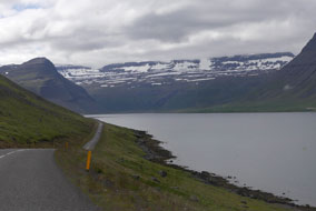 farm, before beginning the 15km return drive along the western side of Skötufjörður.
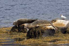
Towards the fjord's mouth, we paused at Hvítanes to watch a colony of Harbour
Seals basking on shore-side rocks. Up to 8 seals wallowed by the water's edge
basking in the sunshine just 200m away (Photo 1 - Basking Harbour Seal),
some swimming alongside in the fjord. We were able to take a series of good
telephoto photos of the seals, as Golden Plovers and Gulls pecked around beside
the basking seals (see left).
For our Harbour Seals Photo Gallery, click on Harbour Seals of
Hvítanes. farm, before beginning the 15km return drive along the western side of Skötufjörður.
Towards the fjord's mouth, we paused at Hvítanes to watch a colony of Harbour
Seals basking on shore-side rocks. Up to 8 seals wallowed by the water's edge
basking in the sunshine just 200m away (Photo 1 - Basking Harbour Seal),
some swimming alongside in the fjord. We were able to take a series of good
telephoto photos of the seals, as Golden Plovers and Gulls pecked around beside
the basking seals (see left).
For our Harbour Seals Photo Gallery, click on Harbour Seals of
Hvítanes.
Around the point of Hvítanes, Route 61 turned
into the fifth of the side-fjords, Hestfjörður, for the 20km drive along this
broodingly darker, more narrow fjord-valley to its head, culminating in a gloomy rounded
cirque, classic glacially formed topography
(click
here for detailed map of route). Back along Hestfjörður's
steep-sided western shore, the road mounted the narrow neck of the Hestur
peninsula which projected northwards out into Ísafjarðardjúr. The road continued along
the sheer-sided eastern face of Eyrarfjall, high above the fifth of the
side-fjords Seyðisfjörður, up to its narrowing northern tip where Route 61
turned sharply into the mouth of Áltafjörður, the seventh of Ísafjarðardjúp's
side fjords. The gloomy valley head was enclosed by high, snow-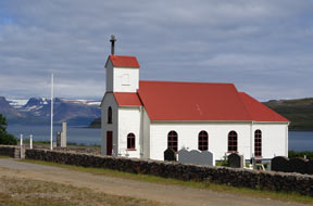 covered mountains
(see right), and the view across the width of this this watery gulf to the sculpted
mountainous massif on the far side was inspirationally spectacular; and there at
the foot of these shapely mountains, the two parts of the isolated village of Súðávík nestled at the fjord-side water's edge. covered mountains
(see right), and the view across the width of this this watery gulf to the sculpted
mountainous massif on the far side was inspirationally spectacular; and there at
the foot of these shapely mountains, the two parts of the isolated village of Súðávík nestled at the fjord-side water's edge.
 The village of Súðávík: in 1995
Súðávík was devastated by a series of avalanches falling from the mountain
face towering overhead. 14 villagers were killed in the tragedy, which prompted Icelandic
government funding for construction of avalanche protection bunds for
communities like Súðávík vulnerable to avalanches, as we had seen at Ólafsfjörður and Siglufjörður on Iceland's north
coast. The village of Súðávík with its 180 residents was re-built a little further south at a
less vulnerable point, and the 'old village' under the avalanche path is now
occupied only in summer; this includes Súðávík's campsite where we should camp
for the next 3 nights! The village of Súðávík: in 1995
Súðávík was devastated by a series of avalanches falling from the mountain
face towering overhead. 14 villagers were killed in the tragedy, which prompted Icelandic
government funding for construction of avalanche protection bunds for
communities like Súðávík vulnerable to avalanches, as we had seen at Ólafsfjörður and Siglufjörður on Iceland's north
coast. The village of Súðávík with its 180 residents was re-built a little further south at a
less vulnerable point, and the 'old village' under the avalanche path is now
occupied only in summer; this includes Súðávík's campsite where we should camp
for the next 3 nights!
We drove around the 30km length of Áltafjörður
to reach the southern 'new village' of Súðávík
(click
here for detailed map of route). The coastal strip which the 2
parts of the village occupy was wider than the map's contours had suggested, and Súðávík's
white painted wooden church stood by
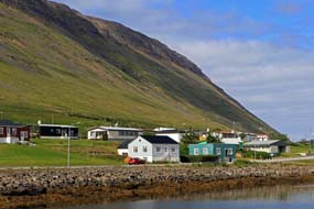 the fjord-side, against the
backdrop of Hornstrandir's distant snowy mountains on the far side of
Ísafjarðardjúp
(Photo
2 - Súðávík's fjord-side church) (see above left). The church had
originally stood at the now deserted farming settlement and herring station of Hesteyri in northern Hornstrandir;
it was dismantled when Hesteyri was
abandoned in 1952, and transported to Súðávík where several Hesteyri
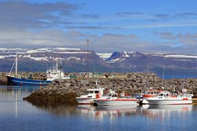
families had moved to start life afresh. We paused for photos at Súðávík 's
fishing harbour (see above right) (Photo 3 - Súðávík fishing harbour),
marvelling at the backdrop of snow-covered Hornstrandir mountains, then found the delightful little the fjord-side, against the
backdrop of Hornstrandir's distant snowy mountains on the far side of
Ísafjarðardjúp
(Photo
2 - Súðávík's fjord-side church) (see above left). The church had
originally stood at the now deserted farming settlement and herring station of Hesteyri in northern Hornstrandir;
it was dismantled when Hesteyri was
abandoned in 1952, and transported to Súðávík where several Hesteyri
families had moved to start life afresh. We paused for photos at Súðávík 's
fishing harbour (see above right) (Photo 3 - Súðávík fishing harbour),
marvelling at the backdrop of snow-covered Hornstrandir mountains, then found the delightful little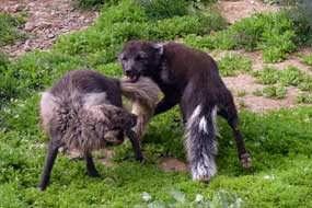 campsite on the hillside in
the northern 'summer village'. Looking up at the sheer walls of Súðárvíkurfjall's
mountain face towering above (see left) (Photo 4 -
Súðárvíkurfjall's mountain face), it was immediately evident why this was vulnerable
avalanche terrain; and we planned to camp directly at its foot! Fortunately
there was little trace of residual snow on the mountainous massif today. campsite on the hillside in
the northern 'summer village'. Looking up at the sheer walls of Súðárvíkurfjall's
mountain face towering above (see left) (Photo 4 -
Súðárvíkurfjall's mountain face), it was immediately evident why this was vulnerable
avalanche terrain; and we planned to camp directly at its foot! Fortunately
there was little trace of residual snow on the mountainous massif today.
Súðávík Arctic Fox Centre:
back along to the southern 'new village', we topped up George's diesel and
bought provisions at the village shop, before heading up to Súðávík's Arctic Fox Centre. This impressive
rescue centre aims to educate visitors about Iceland's largest native carnivore, conduct research into its living and breeding habits in the wilds of Hornstrandir,
and rescues and rears orphaned fox-cubs to release back into the wild
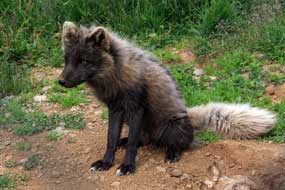
(Photo 5 - Arctic Fox) (see left and right).
The centre's film gave invaluable information about the Arctic Fox through the
seasons. There are 2 genetic colour morphs: one is pure white and the other
'blue', in fact a chocolate brown or grey-brown colour, better adapted to its
scavenging life along the seashores. The Arctic Fox
(Alopex lagopus) has inhabited Iceland since the last
Ice Age
 when they are thought to have reached here on ice floes from Greenland,
and became trapped as an isolated strain. In most of the country, Arctic Foxes are now regarded
by sheep farmers as vermin and shot to protect livestock, bringing the foxes to
the point of extinction. In deserted when they are thought to have reached here on ice floes from Greenland,
and became trapped as an isolated strain. In most of the country, Arctic Foxes are now regarded
by sheep farmers as vermin and shot to protect livestock, bringing the foxes to
the point of extinction. In deserted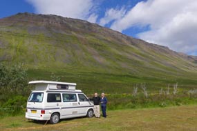 Hornstrandir however, they are protected by
law and are breeding again in the wilds as solitary animals, living off mice,
sea birds or carrion. Hornstrandir however, they are protected by
law and are breeding again in the wilds as solitary animals, living off mice,
sea birds or carrion.
Súðávík Camping: back along to the
campsite in the northern 'summer' half of Súðávík, we settled into the corner
space reserved earlier. The afternoon was still fine, but with a northern chill
in the air. This charming little campsite, set on a hillside terrace above the
fjord and fishing harbour, and in the looming shadow of Súðárvíkurfjall's
mountain wall towering overhead (see right), was arranged in 3 small, flat grassy camping
areas either side of the facilities hut: the first (with power supplies) which we
had entirely to ourselves was for campervans, the second was reserved for
trailer-tents (a curiosity not uncommon in Iceland), and the third, a secluded area
for tents. The facilities were limited but first class, brand new and spotlessly
clean, with 3 WCs, 2 showers, and wash-up sinks, all with piping hot water, but
no kitchen or wi-fi. But after the disgraceful absence of facilities,
overwhelming noise and shameful price at Hólmavík Camping, Súðávík Camping was
sheer heaven! The lady called round early evening to
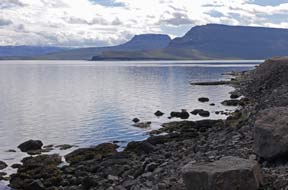 collect the rent of 550kr
each for seniors (a superb half-price reduction from the normal price of 1100kr)
plus 900kr for power, making a total of 2,000kr/night, by far the best value
campsite so far experienced in Iceland. And most importantly there was total peace and freedom from collect the rent of 550kr
each for seniors (a superb half-price reduction from the normal price of 1100kr)
plus 900kr for power, making a total of 2,000kr/night, by far the best value
campsite so far experienced in Iceland. And most importantly there was total peace and freedom from
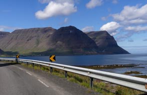 holiday-makers, with just the sound of the wind and birds
in this momentously memorable mountain and fjord-side setting (Photo 6 - Súðávík Camping). Súðávík was
self-evidently a +5 standard campsite. And in this lovely peaceful setting
looking out across the fjord, we slept the sleep of kings. holiday-makers, with just the sound of the wind and birds
in this momentously memorable mountain and fjord-side setting (Photo 6 - Súðávík Camping). Súðávík was
self-evidently a +5 standard campsite. And in this lovely peaceful setting
looking out across the fjord, we slept the sleep of kings.
The fishing port of Ísafjörður:
we woke to a lovely sunny morning, and having
luxuriated in lengthy hot showers after the absence of decent washing facilities
for the past few days, we set off northwards along the fjord. Beyond a 3km
stretch of rock-fall high risk hazard area, we paused just before the point of Arnarnes to admire the magnificent vista across the mouth of
Áltafjörður and the width of Ísafjarðardjúp to the distant mountains of Hornstrandir (see left). The views
across to the sheer cliffs of Snæfjallsheiði on the far side, and along the
misty length of this enormous fjord, all lit by the morning sun, were simply
sensational (Photo
7 - Arnarnes vista across Ísafjarðardjúp). Colonies of Eiders oo-oo-ed on the shore-side rocks by the water's
edge below us. Rounding the point of Arnarnes, the road passed through a 50m
long tunnel cut through the rocky headland, and turned along the eastern side of
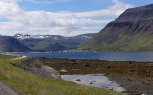 Skutulsfjörður, the 8th of Ísafjarðardjúp's side-fjords
(click
here for detailed map of route). On such a bright
morning, what magnificent views: directly across the mouth of Skutulsfjörður,
the bulky massifs of Eyrarjall, Búðarfjall and Hádegísfjall, all ending abruptly in
sheer cliff walls, dominated the northern vista (see above right);
we Skutulsfjörður, the 8th of Ísafjarðardjúp's side-fjords
(click
here for detailed map of route). On such a bright
morning, what magnificent views: directly across the mouth of Skutulsfjörður,
the bulky massifs of Eyrarjall, Búðarfjall and Hádegísfjall, all ending abruptly in
sheer cliff walls, dominated the northern vista (see above right);
we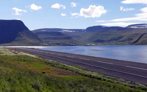 could
just make out the tiny
settlement of Hnífsdalur squatting in the valley mouth between these
overpowering mountains, and just beyond the tiny mouth of the tunnel through Hádegísfjall
which took Route 61 onwards from Ísafjörður to Bolungarvík.
Nearer at hand, Skutulsfjörður itself was enclosed on 3 sides by monumental
mountains, the details on their rock faces and sculpted corries highlighted by
the morning sun. And there in the distance nestled in the head of the side-fjord
was Ísafjörður, spread around its L-shaped sandspit in such a dramatic location,
surrounded on 3 sides by high mountains and on the 4th side by the dark waters
of the fjord (Photo
8 - Mountain-enclosed Ísafjörður) (see left). could
just make out the tiny
settlement of Hnífsdalur squatting in the valley mouth between these
overpowering mountains, and just beyond the tiny mouth of the tunnel through Hádegísfjall
which took Route 61 onwards from Ísafjörður to Bolungarvík.
Nearer at hand, Skutulsfjörður itself was enclosed on 3 sides by monumental
mountains, the details on their rock faces and sculpted corries highlighted by
the morning sun. And there in the distance nestled in the head of the side-fjord
was Ísafjörður, spread around its L-shaped sandspit in such a dramatic location,
surrounded on 3 sides by high mountains and on the 4th side by the dark waters
of the fjord (Photo
8 - Mountain-enclosed Ísafjörður) (see left).
Along the shore-line of Skutulsfjörður towards
its head, we approached Ísafjörður's tiny commercial airfield nestled on
re-claimed land alongside the fjord (see right). With such a seemingly short runway and
surrounded by high mountains, landing here must need extreme piloting skills,
banking tightly around, dropping down into the fjord, and skimming past the
sheer face of Kirkjubólsfjall on the runway approach (Photo
9 - Ísafjörður Airfield). The road swung tightly
around the head of
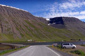 the fjord
under the towering cliffs and huge corrie on the flanks of Kirkjubólsfjall (see
left), passing the outlying settlements of Holtahverfi
and Skeiði and the turning onto the ongoing Route 60 towards the Vestfjarðagöng
Tunnel, and just beyond we pulled into a large Bonus supermarket for provisions. the fjord
under the towering cliffs and huge corrie on the flanks of Kirkjubólsfjall (see
left), passing the outlying settlements of Holtahverfi
and Skeiði and the turning onto the ongoing Route 60 towards the Vestfjarðagöng
Tunnel, and just beyond we pulled into a large Bonus supermarket for provisions.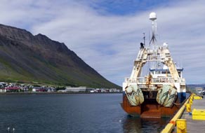 Continuing along the far fjord-side, we reached the main part of the town; by
the roundabout junction, we spotted Ísafjörður's parish church, an ugly
architectural monster of a structure looking more like an ochre-coloured folding
accordion, built amid controversy to replace an earlier wooden church which
burned down in 1987. We turned off onto the L-shaped peninsula of Eyri, where
the main part of Ísafjörður's old town and harbours are located. Just along
towards the town, we found a Netto supermarket for items unavailable at Bonus;
as we had learned at other Icelandic towns, Bonus was cheap and cheerful, Netto
a little more classy and better stocked! In the supermarket, we enquired after
barbecue charcoal, and were helped by a lad who turned out to be from Macedonia;
he had come to Ísafjörður originally to watch an ice-hockey match and had
stayed! Looking around, we could understand why as we parked along at the TIC in the heart of the old town by the harbour.
With a population of 2,800, Ísafjörður is the
largest town in the West Fjords and the region's administrative centre. Despite
the decline of fishing in the 1990's, fishing is still Ísafjörður's principal
industry with one of the largest fisheries in Iceland, which along with
fishing-support and marine engineering industries, together account for 30% of
 employment. A sign of the times, local and national government services account
for 40% of the town's employment, with tourism contributing employment. A sign of the times, local and national government services account
for 40% of the town's employment, with tourism contributing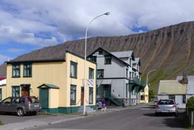 increasingly to the
local economy. But it's Ísafjörður's dramatic location that so astounds:
standing here by the quayside on this spit of land projecting into the fjord,
whichever way you looked apart from down the length of Skutulsfjörður, you were
left agape by the over-towering sheer walls of the mountains that surround and
enclose the town and port (see left and right), their faces scarred by crags and scree, with mighty
corries sculpted out of the high walls as if by a giant ice cream scoop (Photo
10 - Mountain face and sculpted corrie). During
the long, dark months of winter, it is a major struggle with the elements to
keep open the tiny airfield, which often provides the only means of contact with
the outside world. During the darkest months of December and January, the sheer
height of the enclosing mountains on 3 sides of the fjord prevents the low
winter sun from shining directly onto the town for several weeks; the sun's
re-appearance above the mountains at the end of January is a time for
celebration. Although the area was inhabited from the time of the Settlement, it
took several centuries for Eyri at Skutulsfjörður (as the settlement was then
known) to become established as a trading post and fish-salting station. Finally
in 1786, with the ending of the Danish Trade Monopoly, the town was granted its
municipal charter; 100 years later, Eyri received its city status, changing its
name to Ísafjörður, meaning Ice-Fjord named from the ice floes which once
drifted into Ísafjarðardjúp from the Denmark Strait. increasingly to the
local economy. But it's Ísafjörður's dramatic location that so astounds:
standing here by the quayside on this spit of land projecting into the fjord,
whichever way you looked apart from down the length of Skutulsfjörður, you were
left agape by the over-towering sheer walls of the mountains that surround and
enclose the town and port (see left and right), their faces scarred by crags and scree, with mighty
corries sculpted out of the high walls as if by a giant ice cream scoop (Photo
10 - Mountain face and sculpted corrie). During
the long, dark months of winter, it is a major struggle with the elements to
keep open the tiny airfield, which often provides the only means of contact with
the outside world. During the darkest months of December and January, the sheer
height of the enclosing mountains on 3 sides of the fjord prevents the low
winter sun from shining directly onto the town for several weeks; the sun's
re-appearance above the mountains at the end of January is a time for
celebration. Although the area was inhabited from the time of the Settlement, it
took several centuries for Eyri at Skutulsfjörður (as the settlement was then
known) to become established as a trading post and fish-salting station. Finally
in 1786, with the ending of the Danish Trade Monopoly, the town was granted its
municipal charter; 100 years later, Eyri received its city status, changing its
name to Ísafjörður, meaning Ice-Fjord named from the ice floes which once
drifted into Ísafjarðardjúp from the Denmark Strait.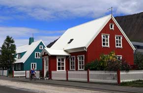
 Our day in Ísafjörður:
Ísafjörður felt a homely and thoroughly likable place, and we set off to wander
around the port and the labyrinth of back streets making up the old town spread
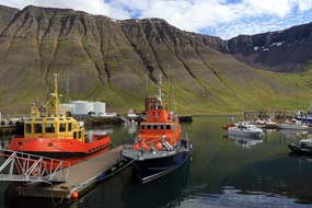
around Eyri. Every photo we took, whether of the fishing boats in the old and
new harbours, or of the brightly painted wooden houses in the quaintly rambling
streets of the old town, was set against a dramatic backdrop of mountain walls
and which towered over the town. You could understand why the people of
Ísafjörður
are so proud of their brave northern town: as we strolled around, we also shared
that feeling. Ísafjörður had an old-fashioned and unpretentious work-a-day
appeal which set it apart, an air of welcoming homeliness in a remote
wilderness. Our day in Ísafjörður:
Ísafjörður felt a homely and thoroughly likable place, and we set off to wander
around the port and the labyrinth of back streets making up the old town spread
around Eyri. Every photo we took, whether of the fishing boats in the old and
new harbours, or of the brightly painted wooden houses in the quaintly rambling
streets of the old town, was set against a dramatic backdrop of mountain walls
and which towered over the town. You could understand why the people of
Ísafjörður
are so proud of their brave northern town: as we strolled around, we also shared
that feeling. Ísafjörður had an old-fashioned and unpretentious work-a-day
appeal which set it apart, an air of welcoming homeliness in a remote
wilderness.
From the warehouses and marine engineering
workshops of the old harbour, we wandered among the former fishing shacks now
converted to cafés and fishing museum, and found the campsite at Suðurtangi; the
setting was starkly grim, and facilities ... well, to call them basic would be a
kindly overstatement; but the price told a story of greedy exploitation. The owner
who stood guard actually seemed to believe we should not find a better price
than the 4,000kr/night he was demanding, and failed to understand the mocking
irony of our dismissive response! 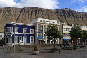 This was no place for us. But it was the vista
from the new port behind the fish-processing plant on the outer side of Eyri
that took top This was no place for us. But it was the vista
from the new port behind the fish-processing plant on the outer side of Eyri
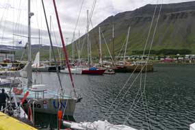
that took top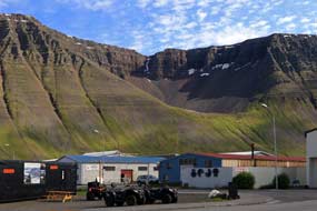 prize: the view looking across the fishing boats moored in the
harbour to the sheer wall of mountains rising beyond topped by a mightily
sculpted corrie simply epitomised Ísafjörður's outstanding location (see above right)
(Photo
11 - Ísafjörður fishing port); it was one of the most memorable
of our experiences in the whole of Iceland.
We continued our wanderings around the
grid of back-streets, past rambling wooden houses, some brightly painted, others
ramshackle, but all with trim picket fences (see above left); it was sheer delight. This led us to
small, laid-out town gardens, all freshly planted with flowers, and back along Aðalstræti to the town square
(see left) (Photo
12 - Ísafjörður's town square); we might have been in any attractive small
Icelandic town, but what set Ísafjörður apart was that, whenever we looked up
above the wooden buildings, the supreme mountainous backdrop reminded us that
this was special (see right) (Photo
13 - Ísafjörður's mountainous setting). It was an afternoon to remember and to savour.
A return to Súðávík Camping for a day in camp: we drove back around
the bay, pausing for more photos of Ísafjörður's dramatic mountainous setting
and the mountain-enclosed backdrop across the head of Skutulsfjörður (see
below left and right). Before
leaving Ísafjörður, we turned off along Tungudalur
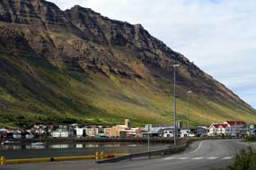 to investigate the campsite
there, knowing it also was ludicrously over-priced to investigate the campsite
there, knowing it also was ludicrously over-priced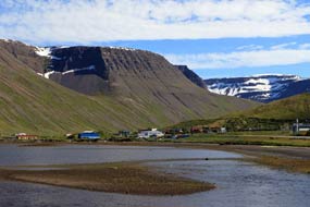 and likely to be overcrowded
with rowdy holiday-makers; but it was an Icelandic Camping Card site and we were
at risk of not using all 28 slots on our expensive card. It was a fine
location up the wooded valley below the attractive Bunárfoss waterfall, and not
as crowded as feared. But the peace and charm of Súðávík Camping was more
appealing, and we set off to return around the bay past the airfield, pausing
twice to photograph the setting of Ísafjörður township on its peninsula against
its mountainous backdrop and the mighty mountains and cliffs northwards towards Bolungarvík.
At the second stop, the Arctic Terns were particularly aggressive, swooping down
to attack our heads as we took our photos. and likely to be overcrowded
with rowdy holiday-makers; but it was an Icelandic Camping Card site and we were
at risk of not using all 28 slots on our expensive card. It was a fine
location up the wooded valley below the attractive Bunárfoss waterfall, and not
as crowded as feared. But the peace and charm of Súðávík Camping was more
appealing, and we set off to return around the bay past the airfield, pausing
twice to photograph the setting of Ísafjörður township on its peninsula against
its mountainous backdrop and the mighty mountains and cliffs northwards towards Bolungarvík.
At the second stop, the Arctic Terns were particularly aggressive, swooping down
to attack our heads as we took our photos.
Back at Súðávík Camping, the site was still
deserted and we settled back into our corner to relax in the bright early
evening sunshine after our splendid day in Ísafjörður (see left and right). The barbecue was lit for
supper of grilled pork and sausages, and as the sun set behind Súðárvíkurfjall's
mountain wall above us, the evening grew instantly chill. But even though the
sun had set on us in the mountain's shadow, its light still reflected on the
mountainside on the opposite side of Áltafjörður, casting shadows of the
mountain peaks above us; it was an eerie sensation. The forecast for tomorrow
was for rain, and since the peaceful environment, setting and price here at Súðávík
were so so favourable, we decided to bring 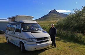 forward our planned rest day and stay
on for a day in camp and third night here. forward our planned rest day and stay
on for a day in camp and third night here. 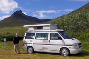
The following morning was overcast and by
mid-morning the rain had started. The few others camped here departed, leaving
us to enjoy our day in camp in peace. Without wi-fi, the only way to collect an
email from our daughter Lucy in Australia was to make sparing use of our phone's
mobile hot-spot feature. She was about to embark on a 10 day mountain-cycling
expedition of the Mawson Trail from Blinman in the Flinders Ranges on the remote
South Australian Outback to her home city of Adelaide, entailing 900kms on
unmade roads through wild country. We collected the email with schedule for this
astonishing undertaking, and exchanged further messages with her as she set off
with
Ben and minimally loaded bikes on the 8 hour outward journey by rural bus
to their ride's start point. The pouring rain continued all afternoon, with low
rain cloud obscuring the surrounding mountains and the view across the fjord.
Mid-evening, the lady warden came round for rent money, and we learned more from
her about the 1995 Súðávík avalanche tragedy: her home then had been the nearby
corner house, now a holiday home, and she had been forced to move to the 'new'
village; she had lost a friend among those killed in the disaster. There had
then been 300 residents in Súðávík, but the population had dwindled now to 180
as younger people moved away to Reykjavík and Akureyri in search of work.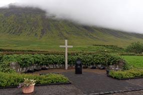
 Bolungarvíkurgöng Tunnel connecting Ísafjörður
to Bolungarvík: the following morning was still gloomily overcast with
low cloud still covering the
mountains behind us and across the fjord. On the
way out of the village, after our 3 happy days in Súðávík, we paused to pay
respects at the memorial to the 14 villagers, including 8 children, killed in
the January 1995 avalanche disaster (see left). Into Ísafjörður, with cloud still hovering
in strands along the walls of the surrounding mountains, we paused at the Polish
shop by Bonus supermarket for nostalgic polish foodstuffs (including Bigos mix,
borsch and urek soup), and Polish beers from the local Vinbuðin. From Sam the
Polish shop owner, we
learned that over 1,000 Poles live and work around the
West Fjords; he did not bat an eyelid when we greeted him with Dzień dobry! As well as being a welcoming
and homely town, Ísafjörður was also cosmopolitan: during our brief time here,
we had spoken with Thais, Poles and a Macedonian! Into town, we shopped for the
bulk of our provisions at Netto, then drove along to photograph the town's
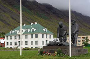
eccentric parish church (Photo
14 - Ísafjörður's modernistic parish church) and the Culture House, designed originally as the Ísafjörður's
hospital in 1925 in stately Modernist style by Icelandic State Architect Guðjón
Samúelsson, who also designed much of Reykjavík's public buildings and Akureyri
Cathedral. Alongside stood a statue of 2 of Ísafjörður's fishermen hauling in a
net-full of cod (see above right). Bolungarvíkurgöng Tunnel connecting Ísafjörður
to Bolungarvík: the following morning was still gloomily overcast with
low cloud still covering the
mountains behind us and across the fjord. On the
way out of the village, after our 3 happy days in Súðávík, we paused to pay
respects at the memorial to the 14 villagers, including 8 children, killed in
the January 1995 avalanche disaster (see left). Into Ísafjörður, with cloud still hovering
in strands along the walls of the surrounding mountains, we paused at the Polish
shop by Bonus supermarket for nostalgic polish foodstuffs (including Bigos mix,
borsch and urek soup), and Polish beers from the local Vinbuðin. From Sam the
Polish shop owner, we
learned that over 1,000 Poles live and work around the
West Fjords; he did not bat an eyelid when we greeted him with Dzień dobry! As well as being a welcoming
and homely town, Ísafjörður was also cosmopolitan: during our brief time here,
we had spoken with Thais, Poles and a Macedonian! Into town, we shopped for the
bulk of our provisions at Netto, then drove along to photograph the town's
eccentric parish church (Photo
14 - Ísafjörður's modernistic parish church) and the Culture House, designed originally as the Ísafjörður's
hospital in 1925 in stately Modernist style by Icelandic State Architect Guðjón
Samúelsson, who also designed much of Reykjavík's public buildings and Akureyri
Cathedral. Alongside stood a statue of 2 of Ísafjörður's fishermen hauling in a
net-full of cod (see above right).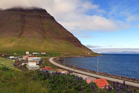
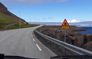 Finally leaving Ísafjörður today, we headed out
on Route 61 around the northern coast of Skutulsfjörður
(click
here for detailed map of route), under the towering
shadow of Eyrarfjall, and beyond the outlying village of Hnífsdalur, just before
the portal to Bolungarvíkurgöng Tunnel, we turned off onto the start of the old
pre-tunnel coast road to a viewpoint to eat our sandwich lunch. The ongoing
old road was now abandoned and clearly in a dangerous state, subject to
regular rock-falls from the unstable Óshlíð mountain face towering overhead. This was the reason for the 5.3 kms long tunnel's construction in 2010,
to provide a safer and more reliable connection between Ísafjörður and Bolungarvík,
and replace what had been one of Iceland's most dangerous, rock-fall prone roads around the coast
under Óshlíð. After photos from Hnífsdalur village of
the Búðarfjall massif with its huge cliffs tapering down to the sea (see left), and the tiny
concrete tube-portal of the tunnel-mouth at the mountain obstacle's foot, we
drove on to enter Bolungarvíkurgöng Tunnel (see right). Finally leaving Ísafjörður today, we headed out
on Route 61 around the northern coast of Skutulsfjörður
(click
here for detailed map of route), under the towering
shadow of Eyrarfjall, and beyond the outlying village of Hnífsdalur, just before
the portal to Bolungarvíkurgöng Tunnel, we turned off onto the start of the old
pre-tunnel coast road to a viewpoint to eat our sandwich lunch. The ongoing
old road was now abandoned and clearly in a dangerous state, subject to
regular rock-falls from the unstable Óshlíð mountain face towering overhead. This was the reason for the 5.3 kms long tunnel's construction in 2010,
to provide a safer and more reliable connection between Ísafjörður and Bolungarvík,
and replace what had been one of Iceland's most dangerous, rock-fall prone roads around the coast
under Óshlíð. After photos from Hnífsdalur village of
the Búðarfjall massif with its huge cliffs tapering down to the sea (see left), and the tiny
concrete tube-portal of the tunnel-mouth at the mountain obstacle's foot, we
drove on to enter Bolungarvíkurgöng Tunnel (see right).
Emerging into daylight at the tunnel's exit, we
turned off around the remaining northward stub of the old coastal road which led
to the Ósvör Maritime Museum, a group of reconstructed turf-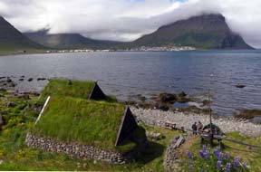 roofed fishing
shacks once used to house fishermen during winter; an oil-skin clad old salt was
showing visitors around. We parked here and walked on roofed fishing
shacks once used to house fishermen during winter; an oil-skin clad old salt was
showing visitors around. We parked here and walked on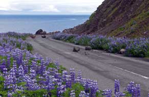 around the low cliffs,
photographing the imposing vista across the bay towards Bolungarvík and the
overshadowing majestically shapely bulk of Bolafjall (see left) (Photo
15 - Bolungarvík village from Óshlíð coast road). Beyond the squat
lighthouse, the residual tarmac road was increasingly littered with rock-fall
debris and huge boulders to the landward side (see right), and lined with Lupins on the
seaward side. At the point where the old road turned around the northern face of Óshlíð
towering menacingly overhead, a massive slice of mountainside must recently have
fallen away, the debris from the rock-fall blocking the way forward entirely. It
felt a very vulnerable place to hang around, and having taken photos of the
vista across Ísafjarðardjúp to the distant snow-capped mountains and cliffs of
Hornstrandir, we beat a hasty retreat. around the low cliffs,
photographing the imposing vista across the bay towards Bolungarvík and the
overshadowing majestically shapely bulk of Bolafjall (see left) (Photo
15 - Bolungarvík village from Óshlíð coast road). Beyond the squat
lighthouse, the residual tarmac road was increasingly littered with rock-fall
debris and huge boulders to the landward side (see right), and lined with Lupins on the
seaward side. At the point where the old road turned around the northern face of Óshlíð
towering menacingly overhead, a massive slice of mountainside must recently have
fallen away, the debris from the rock-fall blocking the way forward entirely. It
felt a very vulnerable place to hang around, and having taken photos of the
vista across Ísafjarðardjúp to the distant snow-capped mountains and cliffs of
Hornstrandir, we beat a hasty retreat.
The fishing port of Bolungarvík:
returning to the main Route 61 by the tunnel mouth, there ahead was the large
fishing port of Bolungarvík spread around the bay, also enclosed on 3 sides by
over-towering mountains. This work-a-day fishing village, with a population of
almost 1,000 residents, suffers from being set at one of Iceland's most isolated
and exposed locations at the mouth of Ísafjarðardjúp, facing the full force of
the Denmark Strait.
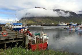 Hemmed in by high mountains, it is also vulnerable to
avalanches and, before the tunnel's construction, to being shut off by winter
weather and Hemmed in by high mountains, it is also vulnerable to
avalanches and, before the tunnel's construction, to being shut off by winter
weather and
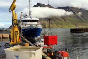 rock-falls. rock-falls.
We drove into Bolungarvík and found the campsite
behind the sports centre/swimming pool. But was this a campsite or a building
site? This rough patch of muddy grass was dominated by the noise and dust of
parked builders' trucks and concrete sanding from work on an extension to the
sports hall. Despite all this disturbance, we decided to stay, and found the
least poor of a poor lot of spaces to install George and walk into the village.
At the corner of Aðalstræti and Skólastígur, a small botanical gardens had been
laid out, the West Fjords Botanical Gardens, an initiative by the West Fjords
Natural History Unit; this included many Icelandic plants set out in ordered
beds and all admirably labelled. We crossed to their offices to congratulate them on
this lovely creation, strangely out of place in this isolated and functional
village. From here we ambled down to the fishing harbour (see left) (Photo
16 - Bolungarvík fishing harbour), and round past the
modern fish-processing factory we again photographed the smaller boats returning
with their catches to the quay. Crates full of fish were craned from the holds
onto the quay
(see right) (Photo
17 - Unloading today's catch), hoisted up deftly by fork-lift tractors, and their contents of
white fish tipped into larger crates. The
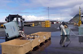 fork-lift operators skilfully stacked
the full crates for transportation in batches over to the fish-processing plant
(Photo
18 - Crating up unloaded fish) (see left and right),
and the little boats returned to sea. It was all a fascinating working routine,
and we spent a happy hour at the fishing quays taking fork-lift operators skilfully stacked
the full crates for transportation in batches over to the fish-processing plant
(Photo
18 - Crating up unloaded fish) (see left and right),
and the little boats returned to sea. It was all a fascinating working routine,
and we spent a happy hour at the fishing quays taking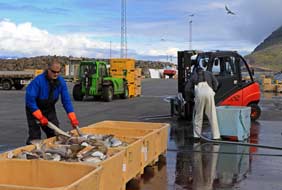 many photographs. many photographs.
Bolungarvík Camping: we walked
back up to the campsite to set up camp, assuming that, as it was now approaching
5-00pm, the building work would stop, bringing relief from the noise and filthy
dust of concrete sanding. But no ... these must have been Polish workers, who
continued all evening until gone 9-00pm until they were satisfied that the job
was completed. We had only chosen to stay at Bolungarvík because it was an
Icelandic Camping Card site to use slots on our card. But in addition to all the
noise and filth from the building site, the campsite was very limited: facilities were rudimentary and minimal, with antiquated
WCs, unusable wash hand-basins, paper towel and loo rolls left unfilled, no
kitchen or wi-fi of course, just cold water outdoor wash-up sinks, and with showers only in
the swimming pool at 400kr separate admission. Normal prices were 1,100kr each
(no seniors' reduction) plus 1,000 for power and 800kr if you could afford
swimming pool showers, an unforgivable cost for such low standards, along with
the building site noise and filth. We had to grin and bear it, but no one had
the nerve to come round for money, and
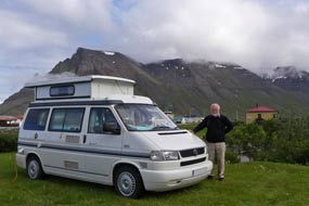 we were determined on no payment for such
a shameful place. The only good thing about Bolungarvík Camping was its outlook
and setting, alongside the Hólsá River where it tumbled down to the sea, and
looking directly up at the magnificent mountain walls enclosing the village,
with the sculpted corrie on the face of Hádegisfjall and the jagged walls of Óshlíð
under which we had stood earlier (see left). we were determined on no payment for such
a shameful place. The only good thing about Bolungarvík Camping was its outlook
and setting, alongside the Hólsá River where it tumbled down to the sea, and
looking directly up at the magnificent mountain walls enclosing the village,
with the sculpted corrie on the face of Hádegisfjall and the jagged walls of Óshlíð
under which we had stood earlier (see left).
 South from Ísafjörður through the Vestfjarðagöng Tunnel
to Suðureyri: with the sky heavily overcast, we returned from Bolungarvík the following morning to
drive back through Bolungarvíkurgöng Tunnel to Ísafjörður to top-up our
provisions at Netto (the last supermarket we should see for a number of days)
and for final photos across the bay of the mountain massif and corrie above town
and port. It had been a privilege to visit Ísafjörður (one of our favourite
places in Iceland), and we finally left now to turn off onto Route 60
(click
here for detailed map of route). The road
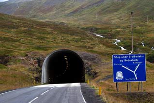
climbed steeply towards the concrete tube of the tunnel portal (see right), seemingly tiny
against the bulky massif of Botnsheiði. Vestfjarðagöng Tunnel, Y-shaped in plan,
was at the time of its construction in 1996 Iceland's longest tunnel
with a total
length of 9.1kms bored though the bulky massif of Breiðadalsheiði. It connects
Ísafjörður with Flateyri and
Þingeyri to the south, with a junction part-way through, where South from Ísafjörður through the Vestfjarðagöng Tunnel
to Suðureyri: with the sky heavily overcast, we returned from Bolungarvík the following morning to
drive back through Bolungarvíkurgöng Tunnel to Ísafjörður to top-up our
provisions at Netto (the last supermarket we should see for a number of days)
and for final photos across the bay of the mountain massif and corrie above town
and port. It had been a privilege to visit Ísafjörður (one of our favourite
places in Iceland), and we finally left now to turn off onto Route 60
(click
here for detailed map of route). The road
climbed steeply towards the concrete tube of the tunnel portal (see right), seemingly tiny
against the bulky massif of Botnsheiði. Vestfjarðagöng Tunnel, Y-shaped in plan,
was at the time of its construction in 1996 Iceland's longest tunnel
with a total
length of 9.1kms bored though the bulky massif of Breiðadalsheiði. It connects
Ísafjörður with Flateyri and
Þingeyri to the south, with a junction part-way through, where
 Route 65 branches off down to the
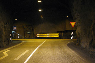
isolated fishing port of Suðureyri. The first section of the tunnel was normal
dual-lane and well-lit, but when we turned off at the junction part-way through
onto Route 65 to Suðureyri, the tunnel became single-lane with frequent passing
places (indicated by the M-sign for Mætast - Meeting place) (see left)
and priority
for returning traffic. We took it steadily but fortunately met no on-coming vehicles,
and emerged into gloomy daylight high above Botnsdalur to descend steeply
towards the head of the narrow Súgandafjörður (see below right). The upper valley was totally
deserted apart from one large farm whose home-pastures had been recently cut for
hay. The road shelved along the mountainside above the inner fjord for 10kms,
with not one dwelling other than a couple of abandoned farms the whole length of
the Route 65 branches off down to the
isolated fishing port of Suðureyri. The first section of the tunnel was normal
dual-lane and well-lit, but when we turned off at the junction part-way through
onto Route 65 to Suðureyri, the tunnel became single-lane with frequent passing
places (indicated by the M-sign for Mætast - Meeting place) (see left)
and priority
for returning traffic. We took it steadily but fortunately met no on-coming vehicles,
and emerged into gloomy daylight high above Botnsdalur to descend steeply
towards the head of the narrow Súgandafjörður (see below right). The upper valley was totally
deserted apart from one large farm whose home-pastures had been recently cut for
hay. The road shelved along the mountainside above the inner fjord for 10kms,
with not one dwelling other than a couple of abandoned farms the whole length of
the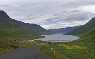 narrow fjord, until at last we reached the outskirts of the little fishing
harbour of Suðureyri. narrow fjord, until at last we reached the outskirts of the little fishing
harbour of Suðureyri.
The isolated village of Suðureyri:
the tiny fishing settlement of Suðureyri with its 270 residents, is set at
the mouth of the deep, narrow cleft of Súgandafjörður. The settlement founded in
the early 20th century grew rapidly with the mechanisation of the fishing
industry, but until the tunnel's completion, it was entirely isolated by the
forbidding massif of mountains. Suðureyri now has its own supply
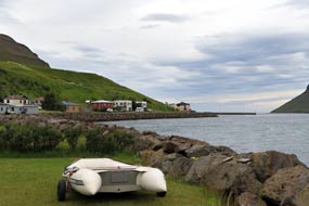 of geothermally
hot water from bore-holes above the village, used for heating homes, supplying
energy for the fish-processing plant, for fish-drying and heating the village's
outdoor swimming pool and hot tubs, one of the most popular in the West Fjords.
Fishing and fish-processing still dominate the village, but fishing has now been
turned to advantage to lure tourists out to this remote settlement, thanks to the tunnel
now accessible by road: you can, for a price, spend a day out in a
fishing boat, visit the fish-processing factory, sample fish dishes at the café,
and even feed the cod kept in the village lagoon. Every summer, sea anglers from
around Europe are attracted to Suðureyri. of geothermally
hot water from bore-holes above the village, used for heating homes, supplying
energy for the fish-processing plant, for fish-drying and heating the village's
outdoor swimming pool and hot tubs, one of the most popular in the West Fjords.
Fishing and fish-processing still dominate the village, but fishing has now been
turned to advantage to lure tourists out to this remote settlement, thanks to the tunnel
now accessible by road: you can, for a price, spend a day out in a
fishing boat, visit the fish-processing factory, sample fish dishes at the café,
and even feed the cod kept in the village lagoon. Every summer, sea anglers from
around Europe are attracted to Suðureyri.
The houses of the village are clustered along
its main street of Aðalgata. We followed this through and turned off to find
the campsite behind the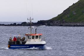 village shop; the fjord-side setting looking westwards
to the mouth of Súgandafjörður was really stunning (see left), but the campsite
was tents only and no power. Having eaten our sandwiches, we found the
café to enquire about visiting the fish-processing plant. The village was
certainly doing well from fish-tourism since the charge was now 5,000kr each,
almost £40! Þakka þér en nei takk (Thank you but no thank you)! Instead
we learned from the information panels outside the difference between long-line
fishing and hand-line fishing. For long-line fishing, the lines are cleaned and
prepared by a baiting team village shop; the fjord-side setting looking westwards
to the mouth of Súgandafjörður was really stunning (see left), but the campsite
was tents only and no power. Having eaten our sandwiches, we found the
café to enquire about visiting the fish-processing plant. The village was
certainly doing well from fish-tourism since the charge was now 5,000kr each,
almost £40! Þakka þér en nei takk (Thank you but no thank you)! Instead
we learned from the information panels outside the difference between long-line
fishing and hand-line fishing. For long-line fishing, the lines are cleaned and
prepared by a baiting team
 on land before sailing: fish-bait (either squid,
mackerel or herring, depending on what is being fished) is attached to up to 500
hooks along each line, before the lines are loaded into drums; a boat will
usually carry up to 20 such loaded drums, making a total of 10,000 baited hooks
per trip. When a boat reaches the fishing grounds, the lines are laid on the sea
bed for 2 hours, then hauled back on board loaded with fish to be unhooked and
crated up in the hold. Smaller boats equipped for
hand-line fishing have 5 or 6 wheels mounted at the boat's rail, each carrying a
line with 6~8 hooks baited with artificial lures. The motorised wheels
automatically cast the lines with their hooked lures, and reel in the catch from
just above the sea bed. The lines are hauled back aboard for the catch to be
removed from the hooks and crated. It was these loaded crates that we had
regularly seen being hoisted ashore onto the quay back at port. on land before sailing: fish-bait (either squid,
mackerel or herring, depending on what is being fished) is attached to up to 500
hooks along each line, before the lines are loaded into drums; a boat will
usually carry up to 20 such loaded drums, making a total of 10,000 baited hooks
per trip. When a boat reaches the fishing grounds, the lines are laid on the sea
bed for 2 hours, then hauled back on board loaded with fish to be unhooked and
crated up in the hold. Smaller boats equipped for
hand-line fishing have 5 or 6 wheels mounted at the boat's rail, each carrying a
line with 6~8 hooks baited with artificial lures. The motorised wheels
automatically cast the lines with their hooked lures, and reel in the catch from
just above the sea bed. The lines are hauled back aboard for the catch to be
removed from the hooks and crated. It was these loaded crates that we had
regularly seen being hoisted ashore onto the quay back at port.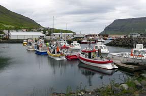
We drove through the village past the
fish-drying plant, and here reached the mole at the very mouth of the fjord
beyond the village. Today, although the sky was heavily overcast and rain
beginning, the sea was benignly calm. But the open mouth of Súgandafjörður faced
directly out over the Denmark Strait into the teeth of North Atlantic storms
which could blow from Greenland; today a lone fishing boat returned through the
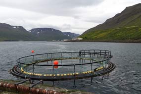
fjord mouth to Suðureyri port (see above right). Having taken our photos of fish farms
 by the
mole (see above left), we returned through the village for photos of the open-sided fish-drying
shed. Some fish are still dried in outdoor covered racks, but only over winter;
in summer flies would ruin the fish. At the nearer end of village by the
fish-processing factory, we paused for photos of the fishing boats moored in the
harbour (see right) (Photo
19 - Suðureyri fishing harbour). by the
mole (see above left), we returned through the village for photos of the open-sided fish-drying
shed. Some fish are still dried in outdoor covered racks, but only over winter;
in summer flies would ruin the fish. At the nearer end of village by the
fish-processing factory, we paused for photos of the fishing boats moored in the
harbour (see right) (Photo
19 - Suðureyri fishing harbour).
Back through Vestfjarðagöng Tunnel and
south to Flateyri:
with the sky now leadenly grey, we returned along the
length of the fjord and uphill to re-enter the tunnel-mouth, now having priority
in the single-lane tunnel
(click
here for detailed map of route). At the road junction in the centre of the tunnel (see
left), we turned south towards Flateyri,
the tunnel still single-lane, and emerged into pouring rain high above
Breiðdalur to descend to the junction with Route 64 and turn off to Flateyri.
Visibility was now poor and the surrounding mountains buried in rain cloud, as
we drove the 6kms along the fjord-side of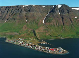 Önundarfjörður to reach the village.
In the outskirts of Flateyri, behind the NI filling station and directly beneath
the enormous bund of Flateyri's avalanche protection barrier, we found the
little campsite. But this was a poor affair, the most basic site yet in the West
Fjords, which despite its superb setting looking out over the village and fjord
and under the shadow of the avalanche protection bund, had only the most basic
of facilities: 2 WCs and outside wash-up sink, but no showers or hot water and
no electricity, not even lighting in the loos. But at least it was peaceful, and
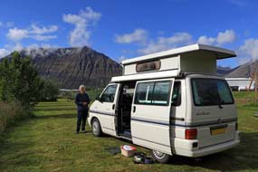
we found a spot away from the trailer-tent and camping-car here already, and
pitched behind a sheltering hedge with George's nose pointed into the wind and
rain driving down the fjord. Önundarfjörður to reach the village.
In the outskirts of Flateyri, behind the NI filling station and directly beneath
the enormous bund of Flateyri's avalanche protection barrier, we found the
little campsite. But this was a poor affair, the most basic site yet in the West
Fjords, which despite its superb setting looking out over the village and fjord
and under the shadow of the avalanche protection bund, had only the most basic
of facilities: 2 WCs and outside wash-up sink, but no showers or hot water and
no electricity, not even lighting in the loos. But at least it was peaceful, and
we found a spot away from the trailer-tent and camping-car here already, and
pitched behind a sheltering hedge with George's nose pointed into the wind and
rain driving down the fjord.
 Flateyri
Camping:
by now it was gone 4-00pm; it was too wet this afternoon to explore the village
and avalanche protection today, and we each did a couple of hours work before
cooking supper on this gloomily wet and chill evening. A local family called
round to collect rent money: 900kr each senior discount (normal price 1,100kr),
expensive for such a basic site with poor facilities, and we rated it at +1. We
did however chat with the family about the October 1995 avalanche which engulfed
part of Flateyri village killing 20 people and giving further inducement to the
Icelandic government to fund a construction programme of avalanche protection
walls which we had seen in several vulnerable villages. It was a grimly chill
night without power for heating, and we sat huddled in multi-layers for warmth. Flateyri
Camping:
by now it was gone 4-00pm; it was too wet this afternoon to explore the village
and avalanche protection today, and we each did a couple of hours work before
cooking supper on this gloomily wet and chill evening. A local family called
round to collect rent money: 900kr each senior discount (normal price 1,100kr),
expensive for such a basic site with poor facilities, and we rated it at +1. We
did however chat with the family about the October 1995 avalanche which engulfed
part of Flateyri village killing 20 people and giving further inducement to the
Icelandic government to fund a construction programme of avalanche protection
walls which we had seen in several vulnerable villages. It was a grimly chill
night without power for heating, and we sat huddled in multi-layers for warmth.
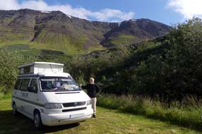 Flateyri and its avalanche protection bund:
a brighter morning (see left and right)
(Photo
20 - Flateyri Camping), and after breakfast we walked up through the tunnel in the
lower avalanche protection wall to a footpath up to a look-out point on the
20m high avalanche bunds. Their A-shaped layout was designed to deflect
snow-floods (snjóflóð in Icelandic) sideways into the fjord, away
from the mountainside towering above the
village below (see above right). A lower crossways wall connecting the two bottom ends of the
side-deflecting arms was intended to trap any excess of snow over-spilling the
side-bunds into a central
compound. From the look-out point, the vista was magnificent looking out over
the village built on a spit of land extending into the fjord Flateyri and its avalanche protection bund:
a brighter morning (see left and right)
(Photo
20 - Flateyri Camping), and after breakfast we walked up through the tunnel in the
lower avalanche protection wall to a footpath up to a look-out point on the
20m high avalanche bunds. Their A-shaped layout was designed to deflect
snow-floods (snjóflóð in Icelandic) sideways into the fjord, away
from the mountainside towering above the
village below (see above right). A lower crossways wall connecting the two bottom ends of the
side-deflecting arms was intended to trap any excess of snow over-spilling the
side-bunds into a central
compound. From the look-out point, the vista was magnificent looking out over
the village built on a spit of land extending into the fjord
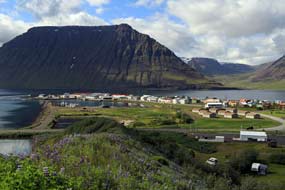 (Photo
21 - Flateyri village) (see left and below right), and down the length of
the silver-grey Önundarfjörður reflecting the morning sunlight, to the sharply
sculpted peaks surrounding the fjord-land along the far side. The view upwards
revealed the purposeful profile of the wedge-shaped triangular 20m high
avalanche protection bunds, with the apex high on the mountain slope above to
deflect falling snow-floods around the two sides, safely down into the fjord, so
protecting the village. It was such
a pity that it required the 1995 tragedy and loss of 20 lives to prompt governmental resourcing of bund construction for vulnerable communities. (Photo
21 - Flateyri village) (see left and below right), and down the length of
the silver-grey Önundarfjörður reflecting the morning sunlight, to the sharply
sculpted peaks surrounding the fjord-land along the far side. The view upwards
revealed the purposeful profile of the wedge-shaped triangular 20m high
avalanche protection bunds, with the apex high on the mountain slope above to
deflect falling snow-floods around the two sides, safely down into the fjord, so
protecting the village. It was such
a pity that it required the 1995 tragedy and loss of 20 lives to prompt governmental resourcing of bund construction for vulnerable communities.
We packed and drove down into Flateyri, pausing by
the church to pay our respects at the memorial to the 20 village residents
killed in the 1995 tragedy. The protective bunds spread up the mountainside
towering high above presented an ever-present but reassuring reminder of the
tragedy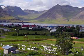 which buried part of the village under a million tones of snow killing
10% of residents, a calamity from which the community has never fully recovered.
The flat spit of land (eyri) projecting into Önundarfjörður on which Flateyri
now stands was first settled in the late 10th century by Önundar Vikingson, an illegitimate son of King
Harald Fairhair of Norway. The village later developed as a trading post from
1792, and formed the base for a whaling station in the 19th century. The fishing
industry prospered in Flateyri until recently but since the 2008 financial
crisis it is now in serious decline, with many of the population departing
leaving just 180 residents. Whereas which buried part of the village under a million tones of snow killing
10% of residents, a calamity from which the community has never fully recovered.
The flat spit of land (eyri) projecting into Önundarfjörður on which Flateyri
now stands was first settled in the late 10th century by Önundar Vikingson, an illegitimate son of King
Harald Fairhair of Norway. The village later developed as a trading post from
1792, and formed the base for a whaling station in the 19th century. The fishing
industry prospered in Flateyri until recently but since the 2008 financial
crisis it is now in serious decline, with many of the population departing
leaving just 180 residents. Whereas
 Suðureyri retained a thriving and purposeful
air with its fishing industry still vibrant and fishing-related tourism being
exploited to supplement the local economy, Flateyri in contrast had a
run-down air. There was still a small fish-processing plant along by the port,
but most of the buildings and houses had a sad feel. Even attempts to tap into
the burgeoning Icelandic tourist trade seemed rather half-hearted. The village's
highlight however was its second-hand bookshop (Bókabúðin), a quaint and
seemingly incongruous curiosity, founded in the early 20th century by the
great-grandfather of the current owner, where books are sold at 1,000kr per
kilogram. We drove around the village, pausing to photograph the fish-drying
shed and the few boats in the harbour, and that was about all that Flateyri had
to offer. There seemed little left to stop the inevitable population
decline as youngsters left to find work elsewhere, attracted by the bright
lights of Reykjavík and Akureyri. Suðureyri retained a thriving and purposeful
air with its fishing industry still vibrant and fishing-related tourism being
exploited to supplement the local economy, Flateyri in contrast had a
run-down air. There was still a small fish-processing plant along by the port,
but most of the buildings and houses had a sad feel. Even attempts to tap into
the burgeoning Icelandic tourist trade seemed rather half-hearted. The village's
highlight however was its second-hand bookshop (Bókabúðin), a quaint and
seemingly incongruous curiosity, founded in the early 20th century by the
great-grandfather of the current owner, where books are sold at 1,000kr per
kilogram. We drove around the village, pausing to photograph the fish-drying
shed and the few boats in the harbour, and that was about all that Flateyri had
to offer. There seemed little left to stop the inevitable population
decline as youngsters left to find work elsewhere, attracted by the bright
lights of Reykjavík and Akureyri.
The Skrúðor Fell Gardens at Núpur in Dýrafjörður:
back along Route 64 to rejoin Route 60, we turned south across the causeway
spit bridge over the inner head of Önundarfjörður (click
here for detailed map of route), and began the long, gruelling
climb up and over the pass of Gemlufallsheiði in gloomily overcast weather. Down the steeper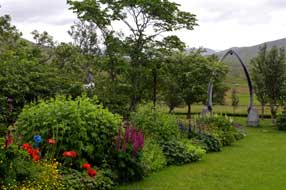 southern side of
the pass to the shores of Dýrafjörður (see above left), we turned off onto the tarmaced but
single-track with passing-places side-road, pausing by a sandy beach for our
sandwich lunch, with Oyster Catchers pecking on the sandy beach. Ahead the
shapely peak of Mýrafell rose by the fjord-side. 6kms along, we reached a
side-turn to the Skrúðor Gardens. This quite miraculous little walled garden, set amid
trees on the bleak and
 otherwise barren fell-side, was laid out originally in
1905 by Pastor Sigtryggur Guðlaugsson who had been appointed priest at the
nearby hamlet and boarding school of Núpur. He had been brought up at
Eyrafjörður in Northern Iceland where from a young age he had learned an
enthusiasm for vegetable growing and horticulture. When he settled at Núpur with his wife, he saw an opportunity to begin a garden on a plot of
fell-land, with the intention of teaching botany, horticulture and tree growing,
to show his pupils that with care and attention plants could be cultivated even
in these bleak Icelandic fell conditions, and to introduce vegetable growing as
part of a healthy diet. The walled garden was laid out and opened in 1909,
developing and thriving until 1980 when the school closed. The Skrúðor Garden
fell into neglect and decay, but in 1992 a group of volunteers began renovating the gardens. The Icelandic Ministry of Education, which still officially owned
the land, handed ownership and care of the resurrected gardens over to Ísafjarðarbær local authority who still maintain the garden as a memorial to its
founder. otherwise barren fell-side, was laid out originally in
1905 by Pastor Sigtryggur Guðlaugsson who had been appointed priest at the
nearby hamlet and boarding school of Núpur. He had been brought up at
Eyrafjörður in Northern Iceland where from a young age he had learned an
enthusiasm for vegetable growing and horticulture. When he settled at Núpur with his wife, he saw an opportunity to begin a garden on a plot of
fell-land, with the intention of teaching botany, horticulture and tree growing,
to show his pupils that with care and attention plants could be cultivated even
in these bleak Icelandic fell conditions, and to introduce vegetable growing as
part of a healthy diet. The walled garden was laid out and opened in 1909,
developing and thriving until 1980 when the school closed. The Skrúðor Garden
fell into neglect and decay, but in 1992 a group of volunteers began renovating the gardens. The Icelandic Ministry of Education, which still officially owned
the land, handed ownership and care of the resurrected gardens over to Ísafjarðarbær local authority who still maintain the garden as a memorial to its
founder.
Within its turfed walled enclosure, these
beautiful lawned gardens surrounded by the most un-Icelandic trees were filled
with almost English country cottage flowers, a floral oasis in the bleak
fell-scape and overshadowed by towering craggy peaks (see left and above right)
(Photo
22 - Skrúðor Fell Gardens). It truly was an amazingly
beautiful spectacle, a little known haven of peace. Quite stunned by its utterly
incongruous beauty, we strolled among the flower beds and read of the Garden's
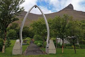
history in the little greenhouse. The only concession to its Icelandic fjordland
setting was the whale-bone arch at the entrance to the gardens.
Around Dýrafjörður to Þingeyri:
thinking this was the last we should see of
Núpur, we returned along the single-track lane to re-join Route 60. Across the
width of mountain-surrounded Dýrafjörður, we could see the sizeable village of Þingeyri
spread along the far shore, but to reach it, we had a 20kms drive around the
inner arm of the fjord. We were spared some 18kms of driving around the
innermost fjord head by Route 60 crossing partway along over a causeway-bridge,
to return along Dýrafjörður's southern shore-line. We were expecting there to be
more of Þingeyri judging by its apparent size, but it turned out to be as sleepy
and run-down as Flateyri. The harbour was almost empty of boats,
and apart from a filling station cum shop, TIC cum homemade knitwear shop and
bank, together with remains of the Settlement era Þing (Assembly) that gave the place its name,
that was about all. Things had not always been as
quiet in Þingeyri: with its sheltered position in Dýrafjörður, Þingeyri had been one of
the earliest trading stations in the West Fjords, and had developed as a
significant fishing port and mercantile centre, attracting numbers of foreign
vessels. But in 1602 the Danish Trade Monopoly brought all this to an end, with
Icelanders forced to trade only with Danish merchants. When the Monopoly ended
in late 18th century, Þingeyri again resumed its European commerce, attracting
many trading vessels to Dýrafjörður particularly French and German. In 1855, Þingeyri
was at the centre of a potential international turf-war: the French wanted to
establish a large fish factory at the port, provoking England to threaten war
with Denmark (who still ruled Iceland) if the Danes allowed the French to get a tow-hold in
the West Fjords; the
French backed down. Fishing is now in decline and Þingeyri's population is reduced to some 200 residents.
But at least there was a camping site which
accepted the Icelandic Camping Card, even if it had limited facilities and no
showers. We had been seeing obviously holiday-making cars loaded with bikes all
round Dýrafjörður, and on reaching the campsite at the far end of the village, we
found out the reason. The site was crammed full of tents and trailer-tents of
those taking part in a weekend mountain-biking and cross-country
running event. Horrors! We turned and left to take stock. One thing was clear:
we could not stay here, nor was it appealing to return for a further chill night
without power, heat or hot water and showers at Flateyri. First thought was to phone the
Korpudalur Hostel just off the Route 60/64 junction; their campsite was
expensive but gave a senior
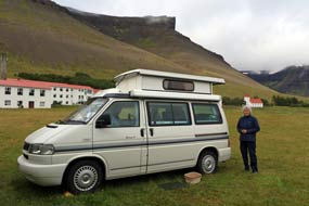 discount. We set off back around the fjord, but on
reaching the causeway crossing, another thought occurred: there was also Núpur Guest-house near Skrúðor Gardens which was much closer. We phoned, and
yes, not only did they offer camping with full facilities, but at an
all-inclusive charge of 2,000kr. No issue, and we set off to return there. discount. We set off back around the fjord, but on
reaching the causeway crossing, another thought occurred: there was also Núpur Guest-house near Skrúðor Gardens which was much closer. We phoned, and
yes, not only did they offer camping with full facilities, but at an
all-inclusive charge of 2,000kr. No issue, and we set off to return there.
Núpur Guest-House/Camping: Núpur
turned out to be a large and rather institutional-looking former boarding school
which, just like
Húsabakki near Dalvik
in Northern Iceland, now incongruously promoted itself as a guest-house, with a large
and rather bleak-looking flat, grassy field which served as a camping area. But
the youngsters at reception were welcoming, and showed us the facilities which
were seemingly scattered around the former school. It would certainly serve for
tonight; we settled in behind the shelter of a hedge, eventually finding a live
power connection, and brewed tea
(see left and below right) (Photo
23- Núpur Guest-House/Camping). Investigating the facilities further showed
that they were not only not as institutional as initially feared, but actually
quite homely with fully equipped kitchen (including a microwave), good showers
(phew!), and the staff would launder and dry a load of washing for just 500kr. And to
top it all, there was a slow but useable wi-fi signal reaching the camping area.
Out of potential disaster, we had emerged smelling of roses: we had found a
second Húsabakki worthy of +5 rating, and should stay a second night here to take a
much-needed rest day to catch up.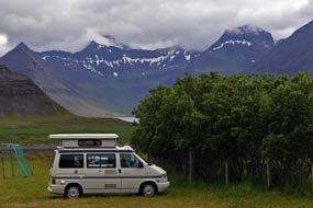
A day in camp at hospitable Núpur Guest-House/Camping:
we had the peaceful campsite to ourselves, but overnight the warmer SW wind had
shifted around to a cooler NW, bringing rain and heavily overcast skies, with a
forecast of more rain for Monday's crossing of the Dynjandi mountains on steep
hairpins and gravel roads; we were very tense about this. Over breakfast, we
received messages from our daughter Lucy in South Australia, telling us of a
near-disaster on her Mawson Trail mountain-biking expedition: she had ripped a
tyre, but they had managed by a supreme effort to get back to Hawker. There, by
the kindness of a stranger, they had borrowed a car from the café owner, driven
with the damaged bike to Quorn where they had arranged for a cycle shop to
undertake a repair, and returned for a second night at Hawker. They could absorb
this loss of a day in their schedule by using a planned rest day at Melrose. She
seemed remarkably sanguine about the entire stressful episode. What a remarkable
bonus modern electronic communications are, never to be taken for granted. We
exchanged further messages and, from their experience of Outback gravel roads,
they suggested lowering George's tyre pressures for the forthcoming dirt road
drive over the mountains. We spent the day catching up with practical matters,
including a batch of laundry, charging everything up while we had power, and
luxuriating in Núpur's first class showers. We had now completed the first half
of the trip, managing to eke out our first gas cylinder for 10 weeks, by careful
usage of the barbecue and campsite kitchens. Cooking supper this evening in Núpur's
well-equipped kitchen, we got into conversation with an Icelandic family from
Reykjavík; we thought no more of this at the time, saying goodnight and thinking this would
be the last we should see of them. Little did we know then that Serendipity had
other plans!
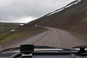 The gruelling drive over the mountains to Arnarfjörður:
the forecast for today's long and gruelling drive over the gravelled mountain roads to Arnarfjörður and Dynjandi was for heavy cloud cover and rain
(click
here for detailed map of route). Refreshed both
mentally and physically by our rest day at the fortuitously discovered Núpur
Guest-House/Camping, we set off to return along to re-join Route 60 around inner
Dýrafjörður into Þingeyri. A brisk wind kept the clouds moving but the fully
overcast sky brought drizzly showers. The little shop at Þingeyri's filling
station was fortunately well-stocked and we were able to secure essentials.
Before leaving Þingeyri, we had to see the turf mound which was said to be the
site by the village church of the ancient and eponymous Þing; this was mentioned in the Gísla Saga
which recounted the tale of the outlawed tragic hero Gísli Súrsson who was
forced to stay on the run for 13 years before being hunted down killed for the
revenge killing of his brother-in-law. We dallied by the Þing, perhaps as a
pretext for putting off tackling the coming mountain road. The gruelling drive over the mountains to Arnarfjörður:
the forecast for today's long and gruelling drive over the gravelled mountain roads to Arnarfjörður and Dynjandi was for heavy cloud cover and rain
(click
here for detailed map of route). Refreshed both
mentally and physically by our rest day at the fortuitously discovered Núpur
Guest-House/Camping, we set off to return along to re-join Route 60 around inner
Dýrafjörður into Þingeyri. A brisk wind kept the clouds moving but the fully
overcast sky brought drizzly showers. The little shop at Þingeyri's filling
station was fortunately well-stocked and we were able to secure essentials.
Before leaving Þingeyri, we had to see the turf mound which was said to be the
site by the village church of the ancient and eponymous Þing; this was mentioned in the Gísla Saga
which recounted the tale of the outlawed tragic hero Gísli Súrsson who was
forced to stay on the run for 13 years before being hunted down killed for the
revenge killing of his brother-in-law. We dallied by the Þing, perhaps as a
pretext for putting off tackling the coming mountain road.
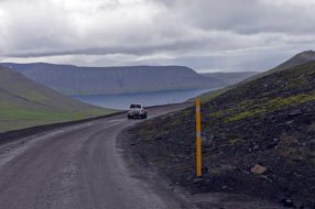 But the time had come, and from
Þingeyri we turned up onto the on-gong Route 60. The gravelled surface and steep gradient began immediately, and we
were following the service bus which regularly crosses this mountain pass over
to Arnarfjörður, both reassuring and unnerving since we were bound to be slowed
by the bus and needed all the revs that George could muster on the hairpins. The
road shelved directly uphill on a steep gradient high above Dýrafjörður,
rounding a bend at the top to drop unexpectedly into a long valley. Along the
length of this, the gravelled road surface was freshly scraped and reasonable,
but as the real climbing began, the road surface deteriorated markedly. Ahead we
could see the first of the tight bends and hairpins, with a fearful gradient.
George kept up his revs, tackling the first hairpin, fortunately not meeting
any of the tour-buses that clearly travel this route. But on the approach
to the second hairpin, the gradient was even more steep; after recent rain, the
gravelled surface was coated with slithery, muddy slurry, giving an insecure
feel of lack of adhesion. Fully loaded, George had at one point to drop down to
first gear to negotiate a broken down vehicle right at the apex of the bend. The
gradient up to the final bends to reach the Hrafnseyrarheiði watershed was even more grindingly
severe, and we were now But the time had come, and from
Þingeyri we turned up onto the on-gong Route 60. The gravelled surface and steep gradient began immediately, and we
were following the service bus which regularly crosses this mountain pass over
to Arnarfjörður, both reassuring and unnerving since we were bound to be slowed
by the bus and needed all the revs that George could muster on the hairpins. The
road shelved directly uphill on a steep gradient high above Dýrafjörður,
rounding a bend at the top to drop unexpectedly into a long valley. Along the
length of this, the gravelled road surface was freshly scraped and reasonable,
but as the real climbing began, the road surface deteriorated markedly. Ahead we
could see the first of the tight bends and hairpins, with a fearful gradient.
George kept up his revs, tackling the first hairpin, fortunately not meeting
any of the tour-buses that clearly travel this route. But on the approach
to the second hairpin, the gradient was even more steep; after recent rain, the
gravelled surface was coated with slithery, muddy slurry, giving an insecure
feel of lack of adhesion. Fully loaded, George had at one point to drop down to
first gear to negotiate a broken down vehicle right at the apex of the bend. The
gradient up to the final bends to reach the Hrafnseyrarheiði watershed was even more grindingly
severe, and we were now
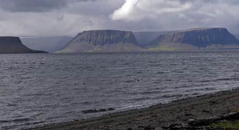 catching up with the bus (see above left). The narrow road seemed darkly
enclosed within a defile, shelved into the severely sloped and crumbly rock,
with fearful and unprotected drop on the outer side. On this relentless gradient
up to the crest of the pass, the narrow road seemed to cling precariously to a
vertical wall of dark, fragmented rock. Steadily and in second gear now, George
struggled up the unremitting gradient, and rounding the final curve, reached the
highpoint of the pass. The bus pulled over at the watershed, allowing us to
squeeze past, but there was nowhere for us to pull in. We were committed to beginning the descent, unable to pause for a breather and
to appreciate
this hugely dramatic terrain, surrounded by 700m high mountains. catching up with the bus (see above left). The narrow road seemed darkly
enclosed within a defile, shelved into the severely sloped and crumbly rock,
with fearful and unprotected drop on the outer side. On this relentless gradient
up to the crest of the pass, the narrow road seemed to cling precariously to a
vertical wall of dark, fragmented rock. Steadily and in second gear now, George
struggled up the unremitting gradient, and rounding the final curve, reached the
highpoint of the pass. The bus pulled over at the watershed, allowing us to
squeeze past, but there was nowhere for us to pull in. We were committed to beginning the descent, unable to pause for a breather and
to appreciate
this hugely dramatic terrain, surrounded by 700m high mountains.
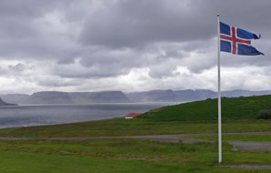 Way below in the misty distance, we could just see
the outline of Arnarfjörður as we rounded the first of the hairpins on this
dramatically steep down-slope (see above right). Visibility improved as we descended onto more
open, sweeping fell-side to reach the next tight hairpin, quickly followed by a
sharp curve leading into the third and final hairpin. Ahead the road descended
steeply in a direct line towards the Arnarfjörður valley floor. George coasted
steadily down the final stretch, and with much relief pulled into a lay-by at
the farming hamlet of Hrafnseyri on the shore of Arnarfjörður, for a breather
and for us to recover with our lunch sandwiches. We had made it over the
severest section of the pass, but the price was that George was filthy, caked
high on each side with the dirt road's muddy slurry. Way below in the misty distance, we could just see
the outline of Arnarfjörður as we rounded the first of the hairpins on this
dramatically steep down-slope (see above right). Visibility improved as we descended onto more
open, sweeping fell-side to reach the next tight hairpin, quickly followed by a
sharp curve leading into the third and final hairpin. Ahead the road descended
steeply in a direct line towards the Arnarfjörður valley floor. George coasted
steadily down the final stretch, and with much relief pulled into a lay-by at
the farming hamlet of Hrafnseyri on the shore of Arnarfjörður, for a breather
and for us to recover with our lunch sandwiches. We had made it over the
severest section of the pass, but the price was that George was filthy, caked
high on each side with the dirt road's muddy slurry.
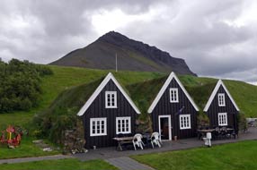 Hrafnseyri on northern shore of Arnarfjörður,
and the Jón Sigurðsson Museum:
Arnarfjörður is a huge fjord, 10kms wide at its mouth and cutting 30kms deep
into the interior, to fork at its innermost head into 6 finger-like sub-fjords
separated by high, sharply pointed mountainous projections. Directly across the
fjord's width from Hrafnseyri, shafts of sunlight picked out 2 particularly
shapely sculpted, flat-topped mountains, with the tiny settlement of Bíldudalur
nestling between them in this titanic fjord-scape (see above left). The little port at Bíldudalur
along with the farmstead at Hrafnseyri are the only settlements on the entire
coastline of Arnarfjörður. Hrafnseyri is named after one of Iceland's earliest
doctors from the period of Settlement, Hrafn Sveinbjarnarson who died here in
1213 having trained in Italy and returned home to practise. Hrafnseyri on northern shore of Arnarfjörður,
and the Jón Sigurðsson Museum:
Arnarfjörður is a huge fjord, 10kms wide at its mouth and cutting 30kms deep
into the interior, to fork at its innermost head into 6 finger-like sub-fjords
separated by high, sharply pointed mountainous projections. Directly across the
fjord's width from Hrafnseyri, shafts of sunlight picked out 2 particularly
shapely sculpted, flat-topped mountains, with the tiny settlement of Bíldudalur
nestling between them in this titanic fjord-scape (see above left). The little port at Bíldudalur
along with the farmstead at Hrafnseyri are the only settlements on the entire
coastline of Arnarfjörður. Hrafnseyri is named after one of Iceland's earliest
doctors from the period of Settlement, Hrafn Sveinbjarnarson who died here in
1213 having trained in Italy and returned home to practise.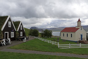
But the farmstead and church at Hrafnseyri (see
left and right)
(Photo
24 - Church at Hrafnseyri) is best known as the birthplace of Jón Sigurðsson (1811~79), the politician and leader of the 19th century
Icelandic Independence Movement, whose agitation and diplomacy secured Iceland a
degree of independence from Danish rule, after the Danes had almost bankrupted
the country during the period of Trade Monopoly. For Icelanders, Hrafnseyri has
become something of a national shrine, with the three gabled, turf-roofed
farmhouse and little red and white church, and the modern museum documenting in
rather over-romanticised terms Jón Sigurðsson's life and achievements.
 Born on 17 June 1811 (a day still celebrated as
Iceland's National Day) and son of the local pastor, Sigurðsson left home at
Hrafnseyri in 1833 to study at Copenhagen University. He clearly enjoyed the
city good life since he contracted syphilis and failed to complete his degree,
both facts conveniently air-brushed out of Icelandic tradition! Instead he
devoted his time to campaigning for the return of Iceland's medieval Saga
manuscripts kept by the Danes in Copenhagen. In 1841 he began his political
activities, campaigning for greater independence for Iceland, and in 1843 was
elected to the Icelandic Alþing, which regained its powers as a consultative
body in 1845 thanks to his agitation. He convincingly argued in his political
writings that since the Danish king had agreed to Born on 17 June 1811 (a day still celebrated as
Iceland's National Day) and son of the local pastor, Sigurðsson left home at
Hrafnseyri in 1833 to study at Copenhagen University. He clearly enjoyed the
city good life since he contracted syphilis and failed to complete his degree,
both facts conveniently air-brushed out of Icelandic tradition! Instead he
devoted his time to campaigning for the return of Iceland's medieval Saga
manuscripts kept by the Danes in Copenhagen. In 1841 he began his political
activities, campaigning for greater independence for Iceland, and in 1843 was
elected to the Icelandic Alþing, which regained its powers as a consultative
body in 1845 thanks to his agitation. He convincingly argued in his political
writings that since the Danish king had agreed to forego absolute powers in
1848, the decree of 1660 binding Icelanders to the absolute rule of the King of
Denmark was no longer justifiable, and that Iceland should therefore be given self-rule.
Further reforms followed as a result of his agitation, including the right to
free trade in 1854, finally removing remaining trade restrictions, a measure
which more than anything improved the quality of life for Icelanders, and
eventually 20 years later a favourable new Constitution for Iceland in 1871
which returned full legislative powers to the Alþing Icelandic parliament,
making the country self-governing at least in home affairs. Jón Sigurðsson died
in Copenhagen in 1879, not living to see Iceland become a sovereign state in
1918 and gain full independence as a republic in 1944 on the anniversary of his
birth. His body was returned to Reykjavík for a state funeral. forego absolute powers in
1848, the decree of 1660 binding Icelanders to the absolute rule of the King of
Denmark was no longer justifiable, and that Iceland should therefore be given self-rule.
Further reforms followed as a result of his agitation, including the right to
free trade in 1854, finally removing remaining trade restrictions, a measure
which more than anything improved the quality of life for Icelanders, and
eventually 20 years later a favourable new Constitution for Iceland in 1871
which returned full legislative powers to the Alþing Icelandic parliament,
making the country self-governing at least in home affairs. Jón Sigurðsson died
in Copenhagen in 1879, not living to see Iceland become a sovereign state in
1918 and gain full independence as a republic in 1944 on the anniversary of his
birth. His body was returned to Reykjavík for a state funeral.
We viewed the modern museum learning more about
Sigurðsson's life and works, and walked around the restored farmhouse, where
portraits of recent Icelandic presidents were displayed, along with a portrait
of Jón Sigurðsson (see left) and the painting of Sigurðsson and a
group of Alþing members meeting in 1851 with representatives of the Danish state which
helped pave the way to Icelandic home rule (see right). While we were exploring
the museum area, a Snipe landed briefly in the moorland grass immediately in
front of us; we had earlier in the trip regularly seen and heard these
charactersome waders
performing their buzzing aerial
courtship displays, but never been able to see one close up on the ground
(Photo
25 - Snipe).
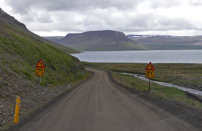 Dynjandi waterfalls:
Re-joining Route 60
(click
here for detailed map of route), Dynjandi waterfalls:
Re-joining Route 60
(click
here for detailed map of route),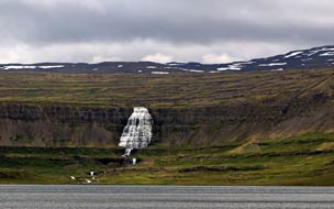 we continued eastwards along the desolate shore of
inner Arnarfjörður, the sky still gloomily overcast and the road still gravelled and severely
pot-holed (see left). 20kms further, the road rounded the head of Borgarfjörður, the
northernmost of Arnarfjörður's 6 forked inner recess head-fjords, passing the
small Mjólkárvirjun hydro-generating plant. As we drove from Hrafnseyri
along Arnarfjörður's northern shore-line, in the far distance the triangular
upper spread of Dynjandi's falls could be seen (see right). Now, as the dirt road rounded
the headland high above Dynjandisvogar (the second inner recess head-fjords),
the falls were even more evident (Photo
26 - Approaching Dynjandi waterfalls). But so also were the number of vehicles in the
parking area at the foot of the falls where we planned to wild camp tonight! we continued eastwards along the desolate shore of
inner Arnarfjörður, the sky still gloomily overcast and the road still gravelled and severely
pot-holed (see left). 20kms further, the road rounded the head of Borgarfjörður, the
northernmost of Arnarfjörður's 6 forked inner recess head-fjords, passing the
small Mjólkárvirjun hydro-generating plant. As we drove from Hrafnseyri
along Arnarfjörður's northern shore-line, in the far distance the triangular
upper spread of Dynjandi's falls could be seen (see right). Now, as the dirt road rounded
the headland high above Dynjandisvogar (the second inner recess head-fjords),
the falls were even more evident (Photo
26 - Approaching Dynjandi waterfalls). But so also were the number of vehicles in the
parking area at the foot of the falls where we planned to wild camp tonight!
Without doubt, Dynjandi is the most attractively
impressive of the West Fjords waterfalls. The main upper cascade, visible for
miles around, plunges over the high escarpment brim, falling in an elegant fan-tailed triangle
over a 100m drop, 30m wide at the top and spreading symmetrically to 60m
width at the base (Photo
27 - Dynjandi waterfalls). Looked at from a distance, the falling water spread
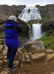 against
the backdrop of dark basalt resembles lacy curtains (see below right)
(Photo
28 - Main upper 'lacy curtains' cascade). Below the main upper
cascade, a series of 5 further smaller falls carry the waters of the Dynjandisá
torrent down the tiered basalt slope to the shore of the fjord. The rocks of the
West against
the backdrop of dark basalt resembles lacy curtains (see below right)
(Photo
28 - Main upper 'lacy curtains' cascade). Below the main upper
cascade, a series of 5 further smaller falls carry the waters of the Dynjandisá
torrent down the tiered basalt slope to the shore of the fjord. The rocks of the
West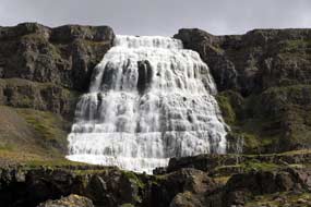 Fjords region are the oldest in Iceland, originating during a series of
volcanic eruptions during the Tertiary Period 14~16 million years ago.
Successive layers of basalt and lava slag have been deposited in this area, and
during the Ice Age which ended 10,000 years ago, the retreating glaciers gouged
out deep valleys and fjords in the landscape, leaving behind layers of rock of
differing degrees of harness. These eroded strata form the terraced waterfall of Dynjandi, where the river
torrent, which originates high on the Dynjandisheiði plateau,
plunges over the escarpment and cascades down into the head of Arnarfjörður. Fjords region are the oldest in Iceland, originating during a series of
volcanic eruptions during the Tertiary Period 14~16 million years ago.
Successive layers of basalt and lava slag have been deposited in this area, and
during the Ice Age which ended 10,000 years ago, the retreating glaciers gouged
out deep valleys and fjords in the landscape, leaving behind layers of rock of
differing degrees of harness. These eroded strata form the terraced waterfall of Dynjandi, where the river
torrent, which originates high on the Dynjandisheiði plateau,
plunges over the escarpment and cascades down into the head of Arnarfjörður.
Ignoring the swarms of tourists milling around, we
kitted up and followed the path upwards beside the cascading torrent, pausing
for photographs at the lower and middle series of falls
(Photo
29- Dynjandi waterfalls). The 4th set of falls, immediately
below the uppermost fantailed cascade, dropped impressively into a dark
cauldron, making a perfect foreground for the upper dominant lacy cascade (Photo
30 - Middle falls dropping into gully) (see left and right). As
usual, we suffered the gross ill-manners of tourists who with blithe
indifference wandered in front of our cameras. The wild flora growing alongside
the path was almost as impressive as the falls, with much Alpine Bistort (Bistorta
vivipara)
(Photo
31 - Alpine Bistort) and
several plants of Heath Spotted Orchid (Dactylorhiza maculata)
(Photo
32 - Heath Spotted Orchid), the first seen growing
wild in Iceland. We continued up the steep path to the lower brim of the upper cascade, standing in
the thundering spray to admire the perfect symmetry of these elegant 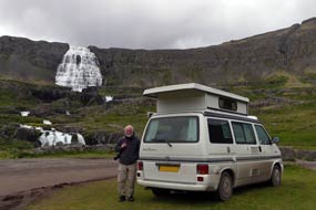 falls
(Photo
33 - Dynjandi upper cascade). falls
(Photo
33 - Dynjandi upper cascade).
A wild camp at Dynjandi waterfalls:
having enjoyed a couple of hours alongside the layered falls at Dynjandi, we
returned down to the parking area and found a flat spot to set up camp. Just in
time as a horrendous convoy of 8 Italian camping-cars swarmed in, disgorging
their rowdily babbling
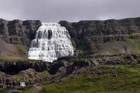 occupants; how can such folk make so much racket? We had
been told that the parking area was available as camping space with WCs and even
a cold water wash-up sink. But an official notice by the loos made it clear that
camping was now forbidden in Dynjandi Protected Area; how far did this
ambiguity stretch, and how firmly would wardens enforce the ban? We should find
out later. But even though there were no signs in the parking area forbidding
over-nighting, it was clear that abuse of Iceland's freedom to camp by excessive
numbers of tourist hire-campers had restricted the freedom; it was entirely
understandable that camping was being discouraged at Dynjandi. In the meantime,
we tried to remain as inconspicuous as possible, despite George's roof being up
showing an obvious intention to camp! But then, it seemed, so was this herd of
Italian camping-cars, and the car park remained crammed full of tourist
hire-cars. To our relief, all the Italians returned, having spent a cursory 10
minutes 'doing Dynjandi' and snapping their selfies by the lower falls, and one
by one moved out with as much hullabaloo as when they had arrived. So occupants; how can such folk make so much racket? We had
been told that the parking area was available as camping space with WCs and even
a cold water wash-up sink. But an official notice by the loos made it clear that
camping was now forbidden in Dynjandi Protected Area; how far did this
ambiguity stretch, and how firmly would wardens enforce the ban? We should find
out later. But even though there were no signs in the parking area forbidding
over-nighting, it was clear that abuse of Iceland's freedom to camp by excessive
numbers of tourist hire-campers had restricted the freedom; it was entirely
understandable that camping was being discouraged at Dynjandi. In the meantime,
we tried to remain as inconspicuous as possible, despite George's roof being up
showing an obvious intention to camp! But then, it seemed, so was this herd of
Italian camping-cars, and the car park remained crammed full of tourist
hire-cars. To our relief, all the Italians returned, having spent a cursory 10
minutes 'doing Dynjandi' and snapping their selfies by the lower falls, and one
by one moved out with as much hullabaloo as when they had arrived. So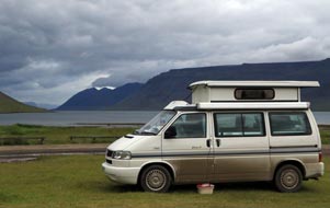 gradually
did all the hire-campers. We relaxed and, fearing at any moment a warden would
arrive to move us on, hesitantly cooked supper. As the evening wore on, all of
the tourist hire-cars disappeared, leaving us virtually alone to enjoy the
thundering Dynjandi Falls in peace (Dynjandi means Thundering One) (see
above right) and the view down the length of Arnarfjörður (see left)
(Photo
34 - Dynjandi wild camp).
Having taken evening photos against the backdrop of the falls with the parking
area now
empty
of tourist cars, we turned in, to be lulled to sleep by the
distant roar of Dynjandi's thunder, still not expecting to pass the night
unchallenged. gradually
did all the hire-campers. We relaxed and, fearing at any moment a warden would
arrive to move us on, hesitantly cooked supper. As the evening wore on, all of
the tourist hire-cars disappeared, leaving us virtually alone to enjoy the
thundering Dynjandi Falls in peace (Dynjandi means Thundering One) (see
above right) and the view down the length of Arnarfjörður (see left)
(Photo
34 - Dynjandi wild camp).
Having taken evening photos against the backdrop of the falls with the parking
area now
empty
of tourist cars, we turned in, to be lulled to sleep by the
distant roar of Dynjandi's thunder, still not expecting to pass the night
unchallenged.
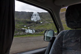 A
rough and filthy muddy drive over Dynjandisheiði plateau to Flókalundur:
we were not disturbed overnight, and what a view to wake to!. Although the
grey, overcast weather had denied us the view of Dynjandi Falls lit by evening
sun, the memory of waking to the sight and sound of thundering Dynjandi will
live with us for ever (see left). In fact we had not been entirely alone camping here:
there were at least 2 other small campers and even a back-packing couple in a
tent camped in the grassy space. We breakfasted and packed, but from an early
hour the tourist hordes were moving in; by the time we departed, the overnight
peace was long gone, the parking area was full again, and the approach path to
the falls swarming with tourists. A
rough and filthy muddy drive over Dynjandisheiði plateau to Flókalundur:
we were not disturbed overnight, and what a view to wake to!. Although the
grey, overcast weather had denied us the view of Dynjandi Falls lit by evening
sun, the memory of waking to the sight and sound of thundering Dynjandi will
live with us for ever (see left). In fact we had not been entirely alone camping here:
there were at least 2 other small campers and even a back-packing couple in a
tent camped in the grassy space. We breakfasted and packed, but from an early
hour the tourist hordes were moving in; by the time we departed, the overnight
peace was long gone, the parking area was full again, and the approach path to
the falls swarming with tourists.
The air was moist and drizzly rain was beginning by
the time we returned to Route 60 to begin the final stage over the mountains
with the climb up onto Dynjandisheiði plateau
(click
here for detailed map of route). The gravel road, already wet with
mud, climbed steeply up from fjord level weaving around bends to gain further
height, with a final tight hairpin followed by a straighter climb to bring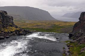 the
road up onto the bleak and cheerless plateau top. The road surface was a red,
muddy slurry with the rain, visibility was poor, but worst of all were the
pot-holes. This truly was the roughest 30kms of so-called road we had travelled
in the whole of Iceland, the surface rutted with constant pot-holes making
fearful impact on tyres and suspension. Yet still the silly young tourists in
hire cars drove at alarmingly irresponsible speeds, failing to slow in passing.
3kms along the plateau top, we paused where Route 60 crossed the Dynjandisá
river as it flowed from the plateau towards the head of the falls at the
upper escarpment edge (see right) (Photo
35 - Escarpment edge at head of Dynjndi falls). Route 60 continued, a narrow, filthy muddy, rutted and
pot-holed route in appalling condition, weaving every-which-way across the
cheerless, misty plateau-scape for another 25kms. At one point, there was a brief
misty distant view of the third of Arnarfjörður's inner finger of head-fjords,
Geirþjófsfjörður way down below. Although there were no further severe gradients to tackle, the
rough, rutted surface demanded constant care and attention on the narrow
road's slithery, slurried surface to avoid hitting the worst of the constant
pot-holes. It was a truly dreadful stretch of road, made worse by the
inconsiderate speed at which tourists in hire-cars passed with blithe
indifference to others. the
road up onto the bleak and cheerless plateau top. The road surface was a red,
muddy slurry with the rain, visibility was poor, but worst of all were the
pot-holes. This truly was the roughest 30kms of so-called road we had travelled
in the whole of Iceland, the surface rutted with constant pot-holes making
fearful impact on tyres and suspension. Yet still the silly young tourists in
hire cars drove at alarmingly irresponsible speeds, failing to slow in passing.
3kms along the plateau top, we paused where Route 60 crossed the Dynjandisá
river as it flowed from the plateau towards the head of the falls at the
upper escarpment edge (see right) (Photo
35 - Escarpment edge at head of Dynjndi falls). Route 60 continued, a narrow, filthy muddy, rutted and
pot-holed route in appalling condition, weaving every-which-way across the
cheerless, misty plateau-scape for another 25kms. At one point, there was a brief
misty distant view of the third of Arnarfjörður's inner finger of head-fjords,
Geirþjófsfjörður way down below. Although there were no further severe gradients to tackle, the
rough, rutted surface demanded constant care and attention on the narrow
road's slithery, slurried surface to avoid hitting the worst of the constant
pot-holes. It was a truly dreadful stretch of road, made worse by the
inconsiderate speed at which tourists in hire-cars passed with blithe
indifference to others.
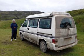 We reached the junction where Route 63 branched
off around the 3 other inner recess fjords to reach Bíldudalur on the southern
shore of Arnarfjörður. Beyond here Route 60 continued, as rough and pot-holed as
ever, finally beginning the steep descent towards the coast of Breiðafjörður at Flókalundur.
George bumped along the pot-holed road, counting off the kms to reach tarmac
again. Towards the bottom of the descent, stunted trees began again, and ahead
was the road junction with Route 62, and tarmac at last. We pulled into Flókalundur
Camping to pause for lunch sandwiches and to recover from the stressful
experience of driving this fearful, rutted road in such filthy, wet conditions.
And poor George was filthy, his sides and back chocolate-brown with mud from the
slurried road surface. The
Icelandic Roads Authority
web site gives invaluable information on the state of roads across the country,
wind and weather information, advice on driving conditions, and detailed maps
identifying tarmaced and unsurfaced roads (click
here for road surface map of West Fjords); we used this web site's maps
regularly as a planning aid to determine routes according to road surface condition. We reached the junction where Route 63 branched
off around the 3 other inner recess fjords to reach Bíldudalur on the southern
shore of Arnarfjörður. Beyond here Route 60 continued, as rough and pot-holed as
ever, finally beginning the steep descent towards the coast of Breiðafjörður at Flókalundur.
George bumped along the pot-holed road, counting off the kms to reach tarmac
again. Towards the bottom of the descent, stunted trees began again, and ahead
was the road junction with Route 62, and tarmac at last. We pulled into Flókalundur
Camping to pause for lunch sandwiches and to recover from the stressful
experience of driving this fearful, rutted road in such filthy, wet conditions.
And poor George was filthy, his sides and back chocolate-brown with mud from the
slurried road surface. The
Icelandic Roads Authority
web site gives invaluable information on the state of roads across the country,
wind and weather information, advice on driving conditions, and detailed maps
identifying tarmaced and unsurfaced roads (click
here for road surface map of West Fjords); we used this web site's maps
regularly as a planning aid to determine routes according to road surface condition.
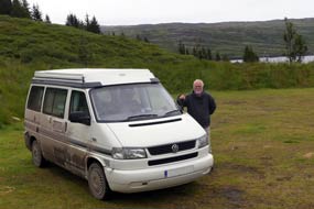 Flókalundur Camping at Breiðafjörður: Flókalundur
is named after an early settler Flóki (Raven) Vilgerðarson who had overwintered
by Vatnsfjörður at Barðaströnd around 868 AD, and named the land Ísland (Iceland) from the packs of sea-ice floating in
the fjord. The harsh winter weather had killed all his livestock, and in despair
he had returned to Norway. It is now nothing more than the road junction, a
hotel, filling station (we hoped they had a hose-brush to clean up George), and
the campsite where we planned to stay tonight. The campsite had
several large, flattish grassy camping areas tiered up the hill-side, but just a
few power supplies on each level. The price was unduly expensive for an
unexceptional site: 1,500kr/person plus 1000kr for Flókalundur Camping at Breiðafjörður: Flókalundur
is named after an early settler Flóki (Raven) Vilgerðarson who had overwintered
by Vatnsfjörður at Barðaströnd around 868 AD, and named the land Ísland (Iceland) from the packs of sea-ice floating in
the fjord. The harsh winter weather had killed all his livestock, and in despair
he had returned to Norway. It is now nothing more than the road junction, a
hotel, filling station (we hoped they had a hose-brush to clean up George), and
the campsite where we planned to stay tonight. The campsite had
several large, flattish grassy camping areas tiered up the hill-side, but just a
few power supplies on each level. The price was unduly expensive for an
unexceptional site: 1,500kr/person plus 1000kr for
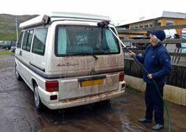 power, but it was an
Icelandic Camping Card site so at last we could use one of the slots on our
card. As we looked around to reserve a good pitch (see above left and right), a convoy of 7 holiday-making
Icelandic caravans arrived. We quickly selected a spot on the far corner of the
middle tier and secured one of the only 3 power sockets, reserving our
space. The caravans clustered in a tight-knit wagon-trail circle towards the
entrance where, far from us, they could make as much noise as they wanted!
Having secured our space, we took George down to the filling station and used
the hose-brush to clean off all the filthy mud accumulated over the 2 stages of
unsurfaced mountain roads driving over from Þingeyri (Photo
36 - Hose-brushing) (see left); George emerged white again
after his period in chocolate-brown! power, but it was an
Icelandic Camping Card site so at last we could use one of the slots on our
card. As we looked around to reserve a good pitch (see above left and right), a convoy of 7 holiday-making
Icelandic caravans arrived. We quickly selected a spot on the far corner of the
middle tier and secured one of the only 3 power sockets, reserving our
space. The caravans clustered in a tight-knit wagon-trail circle towards the
entrance where, far from us, they could make as much noise as they wanted!
Having secured our space, we took George down to the filling station and used
the hose-brush to clean off all the filthy mud accumulated over the 2 stages of
unsurfaced mountain roads driving over from Þingeyri (Photo
36 - Hose-brushing) (see left); George emerged white again
after his period in chocolate-brown!
The Vatnsdalsvatn Nature Reserve: we planned to spend the afternoon
walking the trail alongside Vatnsdalsvatn in the Vatnsfjörður Nature Reserve.
The lake was said to be a nesting ground for the Harlequin Duck, our last
opportunity to see this colourful bird, and for Red Throated and Northern
Divers. We got a copy of the map-leaflet from the Flókalundur Hotel, and drove
5kms eastward along the shore of Vatnsfjörður to its head. Parking by the spit
of land of harder rock now separating the inland lake of Vatnsdalsvatn from the
main fjord, left by the glacier which had carved out the side valley
of Vatnsdalur, we kitted up and set off on the path alongside the lake. But rain
was now beginning and there was not a sign of bird-life on the lake. In such
poor light as the rain worsened, this was pointless; we were getting a soaking
for no gain, and disappointedly we returned to George.
The inadequacies of Flókalundur Camping: back at Flókalundur
Camping, we settled in and brewed tea. It was a now wretchedly miserable afternoon,
and misty rain cloud obscured any view across Vatnsfjörður, a side-fjord off the
main Breiðafjörður. More campers and tents arrived, and by early evening we were
surrounded. The rain eased but down here at the coast, it was a warm, muggy
evening with many flies. The rent-collector came round and we paid by Camping
Card. We woke to another overcast and muggy morning. In the warm, misty weather,
the campsite was infested with as many midgy flies as Mývatn, and this morning we were
forced to use the Bagon again to deal with them swarming into the camper.
Sheila managed to get an early shower in the grubby cupboard which passed for a
shower-cubicle, a thoroughly un-refreshing experience, but by the time Paul went
over, all the hot water was gone. For such an expensive but otherwise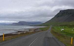 unexceptional campsite, Flókalundur's facilities were woefully inadequate. The
Hotel/Camping was clearly milking its position here on the Látrabjarg tourist
trail, and the tourists simply kept on coming in ever greater numbers! This was
one of the worst campsites so far, over-priced and under-provided with
facilities.
Along the Barðaströnd coastline and over to
Patreksfjörður: we set off westwards on Route 62
around the broad farming coastal strip and sandy shore-line of Breiðafjörður
(see right)
(click
here for detailed map of route).
The fjord was dotted with dozens of islands, and on the distant southern
skyline, the western cliffs of the Snæfellsnes peninsula were silhouetted. As we
rounded the Barðaströnd coastline, in the far distance the 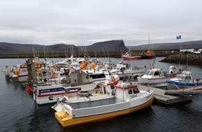 eastern end of the
extended line of cliffs making up the Látrabjarg peninsula became visible.
Beyond the sweeping bay of Hagavaðall, the road rounded further coastline before
turning inland to begin the long, steady climb up onto the Kleifaheiði plateau.
Across the broad watershed, the descent on the western side was steeper,
dropping via a pair of hairpins to the head of Ósafjörður inlet at the road
junction where Route 612 branched off towards Látrabjarg. Route 62 crossed the
inlet's head to continue along the northern coastline of Patreksfjörður with the
town that takes its name from the fjord visible in the distance. Approaching Patreksfjörður, we turned off into the town and found the small campsite
alongside the community centre. The camping area was quite small, but the
facilities in the community centre were first class, with homely and fully
equipped kitchen/common room and clean, modern WC/showers. Patreksfjörður
Camping's one downside was its high price of 1,500kr/person plus 1,250kr for
power, and not a Camping Card site when we had so many unused slots left on our
card. eastern end of the
extended line of cliffs making up the Látrabjarg peninsula became visible.
Beyond the sweeping bay of Hagavaðall, the road rounded further coastline before
turning inland to begin the long, steady climb up onto the Kleifaheiði plateau.
Across the broad watershed, the descent on the western side was steeper,
dropping via a pair of hairpins to the head of Ósafjörður inlet at the road
junction where Route 612 branched off towards Látrabjarg. Route 62 crossed the
inlet's head to continue along the northern coastline of Patreksfjörður with the
town that takes its name from the fjord visible in the distance. Approaching Patreksfjörður, we turned off into the town and found the small campsite
alongside the community centre. The camping area was quite small, but the
facilities in the community centre were first class, with homely and fully
equipped kitchen/common room and clean, modern WC/showers. Patreksfjörður
Camping's one downside was its high price of 1,500kr/person plus 1,250kr for
power, and not a Camping Card site when we had so many unused slots left on our
card.
Patreksfjörður is the largest town in the southern
part of the West Fjords, with a population of some 750 residents. It is named
after St Patrick of Ireland who had been the spiritual guide of Örlygur Hrappson,
the earliest settler in the area. The fishing and fish-processing industries
have always dominated the little port-town, now extending into fish farming in
the fjord. We drove around the main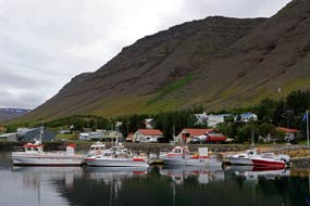 street of Aðalstræti and found 2
supermarkets; both were small but we
managed to stock up with 2 days' provisions, inevitably at seemingly enormous cost.
After photos of the harbour full of fishing boats (Photo
37 - Patreksfjörður fishing harbour) (see above left), we sat for our sandwiches
looking out over the harbour to the cliffs on the northern side of the Látrabjarg
peninsula across the fjord. street of Aðalstræti and found 2
supermarkets; both were small but we
managed to stock up with 2 days' provisions, inevitably at seemingly enormous cost.
After photos of the harbour full of fishing boats (Photo
37 - Patreksfjörður fishing harbour) (see above left), we sat for our sandwiches
looking out over the harbour to the cliffs on the northern side of the Látrabjarg
peninsula across the fjord.
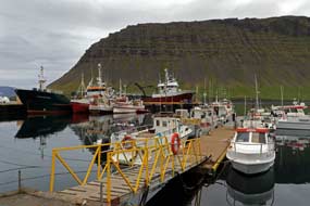 The isolated port-village of Bíldudalur on southern coast of Arnarfjörður:
leaving Patreksfjörður on Route 63
(click
here for detailed map of route), we began the long and increasingly steep
ascent of Miklidalur, rising to around 500m at the watershed, to descend on a
steeper gradient on the northern side, down into Höfðadalur and the head of
inner Tálknafjörður. As we coasted down towards the fjord, the small town of
Tálknafjörður came into view on the far side. Round the head of the fjord, the
road immediately began the long and grinding ascent of Gildalur, rounding a
sweeping hairpin and rising steeply to reach the 550m high watershed of
Hálfdánarfell, now hitting the cloud-base. Across the bleak, stony summit area,
the long and sweeping descent rounded a couple of hairpins, dropping steeply
towards the shore of Arnarfjörður. Ahead across the fjord, the prominent
cliff-end of Langanes point rose imperiously dominating the near skyline. Down
to the road junction with the Route 63 dirt road coming in from the
Dynjandi mountain road which we had driven 2 days ago, we turned into the tiny
isolated port-village of Bíldudalur (see left and above right) (Photo
38 - Port-village of Bíldudalur). The isolated port-village of Bíldudalur on southern coast of Arnarfjörður:
leaving Patreksfjörður on Route 63
(click
here for detailed map of route), we began the long and increasingly steep
ascent of Miklidalur, rising to around 500m at the watershed, to descend on a
steeper gradient on the northern side, down into Höfðadalur and the head of
inner Tálknafjörður. As we coasted down towards the fjord, the small town of
Tálknafjörður came into view on the far side. Round the head of the fjord, the
road immediately began the long and grinding ascent of Gildalur, rounding a
sweeping hairpin and rising steeply to reach the 550m high watershed of
Hálfdánarfell, now hitting the cloud-base. Across the bleak, stony summit area,
the long and sweeping descent rounded a couple of hairpins, dropping steeply
towards the shore of Arnarfjörður. Ahead across the fjord, the prominent
cliff-end of Langanes point rose imperiously dominating the near skyline. Down
to the road junction with the Route 63 dirt road coming in from the
Dynjandi mountain road which we had driven 2 days ago, we turned into the tiny
isolated port-village of Bíldudalur (see left and above right) (Photo
38 - Port-village of Bíldudalur).
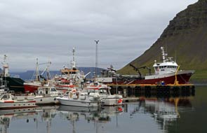 We found Bíldudalur Camping, set by the swimming
pool; the fjord-side setting was magnificent, but facilities were Spartan, just
2 WCs and no sign of anything else. Patreksfjörður had the facilities,
Bíldudalur had the setting, but both were expensive and not Camping Card
members. Tálknafjörður Camping accepted the Camping Card, but perhaps had
neither facilities nor setting; we should find out when we got there later. What
was particularly stunning about Bíldudalur village however was its panoramic
vista across the width of Arnarfjörður: in the murky, misty distance, not today
visible across the 10kms width of the huge fjord, was the Jón Sigurðsson Museum
at Hrafnseyri where we had been 2 days ago. We could however just make out in
the gloom the distant valley down which Route 60 descended after the hairy
drive over the mountain pass dirt road from Þingeyri. We found Bíldudalur Camping, set by the swimming
pool; the fjord-side setting was magnificent, but facilities were Spartan, just
2 WCs and no sign of anything else. Patreksfjörður had the facilities,
Bíldudalur had the setting, but both were expensive and not Camping Card
members. Tálknafjörður Camping accepted the Camping Card, but perhaps had
neither facilities nor setting; we should find out when we got there later. What
was particularly stunning about Bíldudalur village however was its panoramic
vista across the width of Arnarfjörður: in the murky, misty distance, not today
visible across the 10kms width of the huge fjord, was the Jón Sigurðsson Museum
at Hrafnseyri where we had been 2 days ago. We could however just make out in
the gloom the distant valley down which Route 60 descended after the hairy
drive over the mountain pass dirt road from Þingeyri.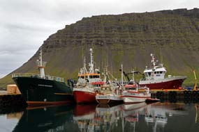
This thriving fishing port of Bíldudalur is the only
settlement on the whole of Arnarfjörður's shores, along with the farming hamlet of Hrafnseyri
on the north coast. It is really just a speck of a place with
only 200 residents, and judging by the boats moored in its harbour, fishing and
shrimping were still the main occupations (see right and left) along with a factory producing animal
feeds and fertiliser from seaweed. The village was dominated on 3 sides
by dark, brooding mountains, especially overshadowing on a gloomy afternoon. We
drove along to the harbour to photograph the boats, despite the poor light, and
walked around the village. At the far end, the road petered out to a trackway
which continued out towards the western tip of Arnarfjörður's peninsula, barren
mountainous terrain totally deserted save for the ruins of a few abandoned
farms.
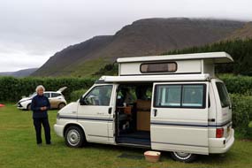 The sheltered port-village of Tálknafjörður and its campsite: back
over the Hálfdánarfell mountain pass
(click
here for detailed map of route), we turned off to the little fishing port
of Tálknafjörður which lies in an uncharacteristically benign fjord-land
setting, with gentle hills lining the broad coastal strip of the narrow,
sheltered fjord from which the village takes its name. Again fishing and
fish-processing are the mainstays of the local economy (see below left). At the far end of the
village by the swimming pool, we found the campsite. The unusually flat, grassy
coastal strip gave space for several camping areas sheltered by hedges, and in
the neighbouring swimming pool building, the facilities included WCs and a large
kitchen/common room/wash-up, with showers in the swimming pool at 330kr each
extra; the Camping Card was accepted, plus 1000kr for power. Not sure how busy
the campsite would get later, we selected and reserved a pitch, using the 12th
of the 28 slots on our Camping Card, then drove back along to the village to
photograph the boats in Tálknafjörður's harbour (see below left); we also bought good value packs
of salmon fillet from a self-service booth. Tálknafjörður Camping's green and
sheltered surroundings and reasonable facilities would make it a good base for
our rest day tomorrow (see right) (Photo
39 - Tálknafjörður Camping), before tackling the wilds of Látrabjarg at the weekend.
During the early evening, the campsite filled up with both tents and campers; it
was far from a peaceful spot. The sheltered port-village of Tálknafjörður and its campsite: back
over the Hálfdánarfell mountain pass
(click
here for detailed map of route), we turned off to the little fishing port
of Tálknafjörður which lies in an uncharacteristically benign fjord-land
setting, with gentle hills lining the broad coastal strip of the narrow,
sheltered fjord from which the village takes its name. Again fishing and
fish-processing are the mainstays of the local economy (see below left). At the far end of the
village by the swimming pool, we found the campsite. The unusually flat, grassy
coastal strip gave space for several camping areas sheltered by hedges, and in
the neighbouring swimming pool building, the facilities included WCs and a large
kitchen/common room/wash-up, with showers in the swimming pool at 330kr each
extra; the Camping Card was accepted, plus 1000kr for power. Not sure how busy
the campsite would get later, we selected and reserved a pitch, using the 12th
of the 28 slots on our Camping Card, then drove back along to the village to
photograph the boats in Tálknafjörður's harbour (see below left); we also bought good value packs
of salmon fillet from a self-service booth. Tálknafjörður Camping's green and
sheltered surroundings and reasonable facilities would make it a good base for
our rest day tomorrow (see right) (Photo
39 - Tálknafjörður Camping), before tackling the wilds of Látrabjarg at the weekend.
During the early evening, the campsite filled up with both tents and campers; it
was far from a peaceful spot.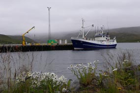
After some rain in the night, we woke to a gloomy,
drizzly morning with low, misty cloud clinging to the surrounding hills above
the fjord. Yesterday morning, Paul had observed that, despite
Iceland's weather, we had both surprisingly managed to avoid colds so far this trip; Sheila
obligingly began sneezing, so this morning it was double doses of Vitamin C to
combat colds! Immediately after breakfast, we managed to connect the laptop to
the Tálknafjörður swimming pool wi-fi for update news of Lucy's Mawson Trail
adventure. They had now passed the Goyder Line (which demarks rainfall, dividing cultivable land from the South Australian Outback), and had reached Jamestown and Burra copper mining country. We were able to download her current set of photos,
and marvelled at the challenging severity of the 900kms cycle ride through such
wild terrain. Our own trip this year had been so intensively busy and demanding,
that we had made little progress with web writing, but the first edition was
beginning to take shape, as we now reached the half-way point. Compared however
with all we had experienced in the intervening 10 weeks in Iceland, the
events of the first few days and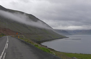 the journey out seemed a different universe! As
others left this morning, we moved George into a corner position by a sheltering
hedge, as the weather got gloomier with 100% cloud cover down to fjord level
enveloping the surrounding hills and the air moist. It was a thoroughly
miserable day, only fit to spend in camp. We expected the campsite to fill up
again this evening, but fewer arrived giving a more peaceful night. the journey out seemed a different universe! As
others left this morning, we moved George into a corner position by a sheltering
hedge, as the weather got gloomier with 100% cloud cover down to fjord level
enveloping the surrounding hills and the air moist. It was a thoroughly
miserable day, only fit to spend in camp. We expected the campsite to fill up
again this evening, but fewer arrived giving a more peaceful night.
A grim drive out along the Látrabjarg
peninsula:
the forecast for today's drive on dirt roads out along the desolate Látrabjarg
peninsula, and the weekend out at the bird cliffs, could not have been worse:
wet, wet, wet! George was going to be filthy again by the time we returned on Monday.
But here at sheltered Tálknafjörður, this morning the cloud was beginning to lift from the hills
along the fjord and it was not raining. Along at the village, we got more salmon
fillets from the booth, provisions at the little shop, and filled George's fresh
water at the car-cleaning point. Back around
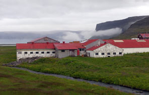 the inner head of the fjord
(click
here for detailed map of route), George
tackled the steep gradient over the high fells, and coasted down Miklidalur into Patreksfjörður
to complete our food shopping. Beginning the eastward drive along the shore of Patreksfjörður,
heavy gloomy cloud still clung to the fjord-sides, a portent of the weather to
come (see right). 12kms along the inner head of the fjord,
we turned off onto Route 612 around the northern shore of inner Ósafjörður. The
first 5kms were tarmaced as far as a farm and the beached wreck of a stranded
vessel. But beyond here, the tarmac ended and rutted pot-holed dirt road began,
continuing along the sandy shore-line and rounding headlands for some 10kms.
Across the mouth of the sand dune-filled valley of Sauðlauksdalur, the road
became narrower and rougher, rounding a series of rock-fall prone craggy
headlands on an airily exposed and unprotected shelf, where spurs of Vatnsdalsfjal projected northwards to the fjord coast. The rough, narrow and
pot-holed road was not as caked with mud as feared, but we were relieved to
shelve around the final spur-point to advance inland along the side of the wide,
sandy valley the inner head of the fjord
(click
here for detailed map of route), George
tackled the steep gradient over the high fells, and coasted down Miklidalur into Patreksfjörður
to complete our food shopping. Beginning the eastward drive along the shore of Patreksfjörður,
heavy gloomy cloud still clung to the fjord-sides, a portent of the weather to
come (see right). 12kms along the inner head of the fjord,
we turned off onto Route 612 around the northern shore of inner Ósafjörður. The
first 5kms were tarmaced as far as a farm and the beached wreck of a stranded
vessel. But beyond here, the tarmac ended and rutted pot-holed dirt road began,
continuing along the sandy shore-line and rounding headlands for some 10kms.
Across the mouth of the sand dune-filled valley of Sauðlauksdalur, the road
became narrower and rougher, rounding a series of rock-fall prone craggy
headlands on an airily exposed and unprotected shelf, where spurs of Vatnsdalsfjal projected northwards to the fjord coast. The rough, narrow and
pot-holed road was not as caked with mud as feared, but we were relieved to
shelve around the final spur-point to advance inland along the side of the wide,
sandy valley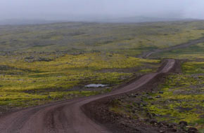 of Örlygshöfn to reach the farmstead and museum-cum-campsite
at Hnjótur (see left). of Örlygshöfn to reach the farmstead and museum-cum-campsite
at Hnjótur (see left).
Grateful for a break at this halfway point of the
difficult drive, we pulled in for our sandwich lunch, gazing at the bizarre sight
of the remains of a Douglas DC-3 US navy aircraft standing by the museum's
hangar. We should visit the museum on the return drive from Látrabjarg to learn
the full story of this strange collection at Hnjótur. Before leaving today, we
walked over to check out the campsite,
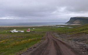 having exchanged pre-trip emails with the
owner Kristinn Thor Egilsson who had confirmed camping availability. He now
showed us around and told us something of the history of the Hnjótur museum and
its aircraft. But the approach to the supposed camping area was treacherously wet after all the rain; set on an exposed hillside, with ramshackle and
semi-built facilities, the campsite looked uncertain, and we left it for now to continue on
towards Látrabjarg. having exchanged pre-trip emails with the
owner Kristinn Thor Egilsson who had confirmed camping availability. He now
showed us around and told us something of the history of the Hnjótur museum and
its aircraft. But the approach to the supposed camping area was treacherously wet after all the rain; set on an exposed hillside, with ramshackle and
semi-built facilities, the campsite looked uncertain, and we left it for now to continue on
towards Látrabjarg.
Around the head of the valley, Route 612 branched
off to climb steeply high across the valley side. The road was now very rough,
rutted and pot-holed on a narrow shelf, eventually rounding onto the broader,
open fell-side of Hafnarfjall, to gain further height into cloud across the
watershed (see right). This was a bleak and desolately cheerless fell-scape, utterly
deserted apart from the rough, pot-holed narrow ribbon of muddy dirt road
stretching into the distance. This so-called road descended for a further 10kms,
eventually reaching the side-turning down to the Breiðavík Hotel and campsite.
Breiðavík Camping was very expensive at 2,200kr/person all-inclusive of showers,
wi-fi and washing machine, but it was the only viable camping option for the Látrabjarg
bird cliffs, especially in poor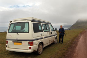 weather. At the hotel reception, we booked in
for one night and reserved our pitch since power supplies were limited. There
were basic WC/showers in a hut by the camping area, but facilities in the hotel
were of luxurious standard, including a fully equipped kitchen/wash-up. It may
have been expensive, but you got what you paid for including free cups of
tea/coffee. weather. At the hotel reception, we booked in
for one night and reserved our pitch since power supplies were limited. There
were basic WC/showers in a hut by the camping area, but facilities in the hotel
were of luxurious standard, including a fully equipped kitchen/wash-up. It may
have been expensive, but you got what you paid for including free cups of
tea/coffee.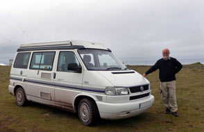
The Látrabjarg bird cliffs: the
weather forecast had changed back to wet for the weekend, so as it was only
2-30pm we decided to make an exploratory foray to the Látrabjarg cliffs. A
further 5kms on freshly scraped dirt road brought us across the final stretch of
fell-scape to descend to the peninsula's northern coast via 2 hairpins down to
the tiny holiday settlement of Látravík Bay (see above left)
(click
here for detailed map of route). Around the sandy bay, the road was
at its roughest and caked with filthy wet mud. We took it steadily past the
basic camping area, as tourist hire-cars sped by. On the far side of the bay,
the road shelved steeply and very uncertainly around a final headland, and
across the far side of the flat cliff-top area we reached the parking area close
to Bjartgtangar lighthouse. We had made it to Látrabjarg Cliffs, 64.5º west, and
(leaving aside the Azores) the westernmost point of Europe (see left and right) (Photo
40 - Látrabjarg Cliffs, Europe's westernmost point).
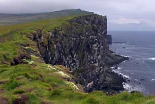 Inevitably there were many tourist cars parked
here, and we kitted up to explore the cliff-tops (see right and left) (Photo
41 - Látrabjarg cliffs). Just beyond the lighthouse, we
immediately began seeing Puffins perched sitting and standing preening
themselves on ledges just below the grassy cliff-edge. Safe from predators, the
14kms length of Látrabjarg cliffs is Iceland's largest bird breeding Inevitably there were many tourist cars parked
here, and we kitted up to explore the cliff-tops (see right and left) (Photo
41 - Látrabjarg cliffs). Just beyond the lighthouse, we
immediately began seeing Puffins perched sitting and standing preening
themselves on ledges just below the grassy cliff-edge. Safe from predators, the
14kms length of Látrabjarg cliffs is Iceland's largest bird breeding
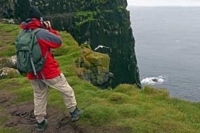 colony,
with millions of sea birds nesting on the cliffs' tiered basalt ledges,
coexisting in high-rise avian apartment blocks: among the scree and fallen
boulders at the foot of the 400m high cliffs, the world's largest single colony
of Razorbills nests. Fulmars nest on the grassy lower ledges, while the higher
ledges on the vertical cliff face are home to Kittiwakes and Guillemots (both
Common and Brünnich's). The Brünnich's Guillemot, with its distinctive white
streak extending back from the bill, breeds only in the North Atlantic around
Iceland, Greenland and Northern coast of Scandinavia, whereas the Common
Guillemot breeds as far south as the Spanish coast; for a comparison, see the
Nord University bird identification web site. Neither species build nests as such, but lay
their conical, roll-proof eggs on precarious rock ledges. Puffins occupy the
topmost 'apartments', nesting in burrows in the grassy cliff-top turf. colony,
with millions of sea birds nesting on the cliffs' tiered basalt ledges,
coexisting in high-rise avian apartment blocks: among the scree and fallen
boulders at the foot of the 400m high cliffs, the world's largest single colony
of Razorbills nests. Fulmars nest on the grassy lower ledges, while the higher
ledges on the vertical cliff face are home to Kittiwakes and Guillemots (both
Common and Brünnich's). The Brünnich's Guillemot, with its distinctive white
streak extending back from the bill, breeds only in the North Atlantic around
Iceland, Greenland and Northern coast of Scandinavia, whereas the Common
Guillemot breeds as far south as the Spanish coast; for a comparison, see the
Nord University bird identification web site. Neither species build nests as such, but lay
their conical, roll-proof eggs on precarious rock ledges. Puffins occupy the
topmost 'apartments', nesting in burrows in the grassy cliff-top turf.
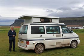 Atlantic Puffins (Fratercula arctica) are members of the Auk family and live for
25~30 years. After a winter-long separation at sea, the breeding pairs arrive in early April
to re-unite at their nesting burrows in the turf on Látrabjarg's
cliff-tops. Single eggs are laid in the burrow mid-May, and one of the adult Puffins remains incubating the egg in the burrow-nest while the
other adult flies out to sea fishing. The Puffin Atlantic Puffins (Fratercula arctica) are members of the Auk family and live for
25~30 years. After a winter-long separation at sea, the breeding pairs arrive in early April
to re-unite at their nesting burrows in the turf on Látrabjarg's
cliff-tops. Single eggs are laid in the burrow mid-May, and one of the adult Puffins remains incubating the egg in the burrow-nest while the
other adult flies out to sea fishing. The Puffin
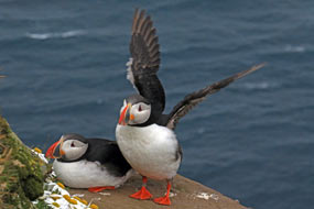 chicks (Pufflings) hatch at the turn of June~July. The adult birds bring back beakfuls of
sand eels garnered on their fishing trips, and can be seen standing by
their burrows early evening. The Puffins depart from Látrabjarg mid-August to over-winter at sea. We had not expected to find many Puffins at this
time of afternoon, assuming they would only return early evening from their day time
fishing at sea for sand eels. But in fact all along this stretch of cliff-top,
Puffins in ones and twos were standing or sitting on the ledges just over the
brink, or waddling rather clumsily along the cliff-top turf almost tripping over
their over-large webbed feet. They were literally just 2~3 metres distant from
us, showing complete indifference to our presence, or simply gazing with
apparent curiosity at these strange human creatures pointing cameras at them
(see left) (Photo
42 - Photographing puffins).
The cliff-top turf must have been the location of 1000s of Puffin burrows, now
no longer in use in late July since this year's young were by now almost ready
to depart in 3~4 weeks for the winter at sea. We spent a totally absorbing hour,
buffeted by the wind
on these exposed and precarious cliff-tops, taking many photos and videos of these charactersome little
Auks, as they stood or sat by their cliff-top burrows: chicks (Pufflings) hatch at the turn of June~July. The adult birds bring back beakfuls of
sand eels garnered on their fishing trips, and can be seen standing by
their burrows early evening. The Puffins depart from Látrabjarg mid-August to over-winter at sea. We had not expected to find many Puffins at this
time of afternoon, assuming they would only return early evening from their day time
fishing at sea for sand eels. But in fact all along this stretch of cliff-top,
Puffins in ones and twos were standing or sitting on the ledges just over the
brink, or waddling rather clumsily along the cliff-top turf almost tripping over
their over-large webbed feet. They were literally just 2~3 metres distant from
us, showing complete indifference to our presence, or simply gazing with
apparent curiosity at these strange human creatures pointing cameras at them
(see left) (Photo
42 - Photographing puffins).
The cliff-top turf must have been the location of 1000s of Puffin burrows, now
no longer in use in late July since this year's young were by now almost ready
to depart in 3~4 weeks for the winter at sea. We spent a totally absorbing hour,
buffeted by the wind
on these exposed and precarious cliff-tops, taking many photos and videos of these charactersome little
Auks, as they stood or sat by their cliff-top burrows:
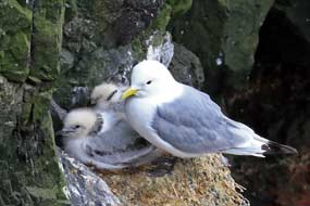 Up the muddy slope, we reached the higher bare
cliff-faces where 1000s of Kittiwakes were still nesting. We were able to
photograph them as they reared their now quite large but still fluffy chicks (Photo
43 - Kittiwake and chicks) (see below right).
Sharing the ledges with the Kittiwakes were Brünnich's Guillemots (Photo
44 - Brünnich's Guillemots and Kittiwake chicks). The noise of
the nesting birds and the stench of their guano on the ledges just below the
cliff-tops was overwhelming. We spent almost 3 hours along the cliff-tops,
enjoying the Up the muddy slope, we reached the higher bare
cliff-faces where 1000s of Kittiwakes were still nesting. We were able to
photograph them as they reared their now quite large but still fluffy chicks (Photo
43 - Kittiwake and chicks) (see below right).
Sharing the ledges with the Kittiwakes were Brünnich's Guillemots (Photo
44 - Brünnich's Guillemots and Kittiwake chicks). The noise of
the nesting birds and the stench of their guano on the ledges just below the
cliff-tops was overwhelming. We spent almost 3 hours along the cliff-tops,
enjoying the
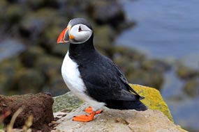 spectacle and taking our photos, particularly of the Puffins as we
edged warily along the cliff-tops, surprised at the ease with which we could
approach them (see left) (Photo
45 - Puffins at Látrabjarg). Back down to the parking area, we bumped back along the 12kms of
rough, muddy roadway to Breiðavík, and settled into our reserved place (see
above right) hoping,
weather and wind permitting, to spend a second day at Látrabjarg bird cliffs
tomorrow. spectacle and taking our photos, particularly of the Puffins as we
edged warily along the cliff-tops, surprised at the ease with which we could
approach them (see left) (Photo
45 - Puffins at Látrabjarg). Back down to the parking area, we bumped back along the 12kms of
rough, muddy roadway to Breiðavík, and settled into our reserved place (see
above right) hoping,
weather and wind permitting, to spend a second day at Látrabjarg bird cliffs
tomorrow.
Our Photo Gallery of the Puffins, Kittiwakes and
Guillemots of Látrabjarg Cliffs can be seen on:
Puffins of Látrabjarg Cliffs.
A second day at Látrabjarg bird cliffs:
we woke to the sound of wind-driven rain, and it continued raining all morning
with a brisk 10~12 m/s wind blowing from the SE. We packed and departed at noon,
with the rain at last beginning to ease. After 12 hours of continuous rain, the
dirt road across the fell-top was in a truly filthy state with liquid mud. Down
the hairpins and around Látravík Bay, and around the final headland, we parked
again by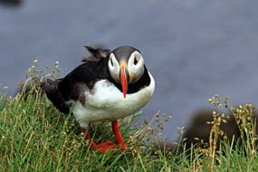 the lighthouse. George was now filthier than ever and covered with mud
spray. By now the rain had finally stopped, and the forecast showed a 4 hour
window without rain until 4-00pm. We just had time for our second visit to the
bird cliffs before the rain was forecast to start again, and we kitted up fully
with waterproofs, as much against the the lighthouse. George was now filthier than ever and covered with mud
spray. By now the rain had finally stopped, and the forecast showed a 4 hour
window without rain until 4-00pm. We just had time for our second visit to the
bird cliffs before the rain was forecast to start again, and we kitted up fully
with waterproofs, as much against the
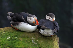 strong wind as against the
possibility of rain. Over at the cliff-top, it was now more evident than ever
just how strong the wind was: 10~12 m/s did not sound an excessively strong
wind, but on an exposed 400m cliff-top, we were just thankful that it was
blowing from the SE from the sea onto the land! strong wind as against the
possibility of rain. Over at the cliff-top, it was now more evident than ever
just how strong the wind was: 10~12 m/s did not sound an excessively strong
wind, but on an exposed 400m cliff-top, we were just thankful that it was
blowing from the SE from the sea onto the land!
Standing on the cliff-edge brink, it was difficult
to hold cameras steady as we were buffeted by the wind. There were fewer Puffins
about today, and some were generally hunkering down in the face of the wind (see
left) (Photo
46 - Látrabjarg Puffins sheltering from wind), others still standing on
the cliff edge in the face of the wind (see above right) (Photo
47 - Wind blown Puffin); perhaps the rest were taking
shelter in nooks and crannies out of view just over the cliff-edge. We spent
more time photographing the Puffins again, before heading up the slope to the edge of the higher cliff face where the Kittiwakes and Guillemots were nesting .
On the higher ledges, we could clearly see this year's chicks, now juvenile and
almost fully fledged but still fluffy. Part-way
down the cliff, a whole colony of Common Guillemots were perched, mainly facing
into the cliff for shelter from the wind. It was hard work struggling up
the muddy, tussocky cliff slope in the face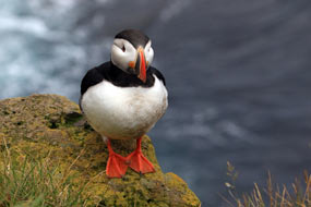 of the head wind, and up here in a
more exposed position it felt unsafe to stray too close to the cliff-edge
brink. Back down to lighthouse, we spent another hour taking photos and videos
of the Puffins as they stood in front of us at the cliff-edge (see right) of the head wind, and up here in a
more exposed position it felt unsafe to stray too close to the cliff-edge
brink. Back down to lighthouse, we spent another hour taking photos and videos
of the Puffins as they stood in front of us at the cliff-edge (see right)
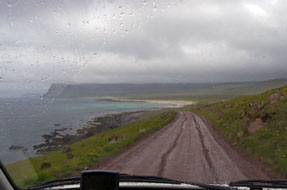 (Photo
48 - Puffin perched on Látrabjarg cliff edge). But it was by now
almost 3-30pm, and we had a long and challenging drive if we were to get back to Flókalundur
this evening. Returning to the parking area, we removed muddy boots and stowed
waterproofs, just in time as heavy rain started again. (Photo
48 - Puffin perched on Látrabjarg cliff edge). But it was by now
almost 3-30pm, and we had a long and challenging drive if we were to get back to Flókalundur
this evening. Returning to the parking area, we removed muddy boots and stowed
waterproofs, just in time as heavy rain started again.
Return to the extraordinary Hnjótur
Farmstead-Museum: finally leaving Látrabjarg cliffs in now pouring
rain on the muddy dirt track (see left), we began the
return drive
(click
here for detailed map of route); this was the furthest west we should travel this trip, so at just
after the half-way point of the trip, the journey home began here. Back across
past the turning to Breiðavík Bay (see below right), the fell-land plateau was now bleaker than ever in
driving rain, and the road wound a lonely way, endlessly across the dreary, wet
fell-scape until at last beginning the steep descent into the Örlygshöfn valley
(see below left) to reach the farmstead-museum at Hnjótur. The previous farmer at Hnjótur, Egill
Ólafsson had spent much of his life collecting anything and everything, amassing
an eclectic collection of both everyday and unusual objects reflecting the daily
life of farming and fishing; his extraordinary museum illustrated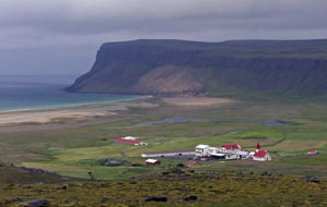 local and
national life in rural Iceland during the 20th century. His wide-ranging
collection was augmented during the British and US occupation of Iceland
during WW2 and the Cold War. In addition to tools, farming implements and
fishing equipment, his interest in aviation led to the acquisition of the
semi-dismantled remains of a
US Navy Douglas DC-3 aircraft from the Keflavík
Airbase and a Russian Antonov AN-2 biplane (see below right) with Aeroflot local and
national life in rural Iceland during the 20th century. His wide-ranging
collection was augmented during the British and US occupation of Iceland
during WW2 and the Cold War. In addition to tools, farming implements and
fishing equipment, his interest in aviation led to the acquisition of the
semi-dismantled remains of a
US Navy Douglas DC-3 aircraft from the Keflavík
Airbase and a Russian Antonov AN-2 biplane (see below right) with Aeroflot
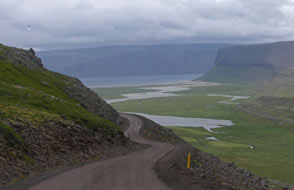 markings which landed nearby on some dubious
mission. The museum also shows a 1949 black and white film of the rescue by
local farmers of the stranded crew of the British trawler Dhoon from
Fleetwood which had run aground at the foot of the Látrabjarg cliffs during a
severe snowstorm in December 1947. The rescue teams from Hvallátur and Breiðavík
abseiled down the 300m cliffs using skills learned from egg gathering,
fired a line to the stricken trawler, hauled the surviving crew ashore by
breaches-buoy, and managed to lift them back up the cliff. This incredible
rescue gained national attention, and a documentary film was made the following
year with the farmers re-enacting the rescue. During the filming however another
British trawler, Sargon also ran aground nearby in
Patreksfjörður, and
the rescue mission was repeated to save its crew, providing coincidentally live
material for the filming. We chatted with a local lad from Hnjótur (who spoke
his English with a marked Scottish accent from time spent in Aberdeen) about the
Museum's history, and about Egill Ólafsson's life-long gathering. But time
was now pressing; we still had a long drive ahead and, after a quick look at the
2 aircraft, we resumed our journey. markings which landed nearby on some dubious
mission. The museum also shows a 1949 black and white film of the rescue by
local farmers of the stranded crew of the British trawler Dhoon from
Fleetwood which had run aground at the foot of the Látrabjarg cliffs during a
severe snowstorm in December 1947. The rescue teams from Hvallátur and Breiðavík
abseiled down the 300m cliffs using skills learned from egg gathering,
fired a line to the stricken trawler, hauled the surviving crew ashore by
breaches-buoy, and managed to lift them back up the cliff. This incredible
rescue gained national attention, and a documentary film was made the following
year with the farmers re-enacting the rescue. During the filming however another
British trawler, Sargon also ran aground nearby in
Patreksfjörður, and
the rescue mission was repeated to save its crew, providing coincidentally live
material for the filming. We chatted with a local lad from Hnjótur (who spoke
his English with a marked Scottish accent from time spent in Aberdeen) about the
Museum's history, and about Egill Ólafsson's life-long gathering. But time
was now pressing; we still had a long drive ahead and, after a quick look at the
2 aircraft, we resumed our journey.
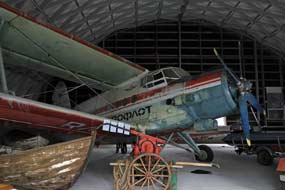 A wet return to Flókalundur Camping: the
stretch of narrow dirt road along the Örlygshöfn valley, and around the
unstable, rock-fall prone headlands were even worse than ever with constant deep
ruts; fortunately we met no on-coming cars. Across the heads of 2 further
valleys, and around further shaley headlands, the road dropped down to cross a
broader valley-mouth, still as muddy and rutted as ever. One further headland
brought us down to cross the sand-dune valley, past the old airstrip and along a
better fjord-side stretch finally to re-join the tarmac at a farming settlement.
The gusting wind was whipping up breakers on the grey, stormy fjord with
driving, misty rain filling the air. Picking up speed, we drove along this final
stretch to Ósafjörður and the junction with Route 62. In now pouring rain, we
now tackled the steep upward slope, rounding A wet return to Flókalundur Camping: the
stretch of narrow dirt road along the Örlygshöfn valley, and around the
unstable, rock-fall prone headlands were even worse than ever with constant deep
ruts; fortunately we met no on-coming cars. Across the heads of 2 further
valleys, and around further shaley headlands, the road dropped down to cross a
broader valley-mouth, still as muddy and rutted as ever. One further headland
brought us down to cross the sand-dune valley, past the old airstrip and along a
better fjord-side stretch finally to re-join the tarmac at a farming settlement.
The gusting wind was whipping up breakers on the grey, stormy fjord with
driving, misty rain filling the air. Picking up speed, we drove along this final
stretch to Ósafjörður and the junction with Route 62. In now pouring rain, we
now tackled the steep upward slope, rounding
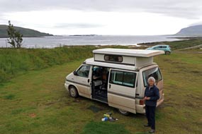 a couple of hairpins and continued
ever upward reaching dense cloud-base. The climbing continued, and with
visibility almost at zero, it was an uncomfortably eerie feeling advancing ever
upwards. The road was raised on an embankment, making the fells to the side
invisible against the cloud; all we could see was the semi-visible road ahead
advancing upwards. At last the gradient eased across the high Kleifaheiði
plateau, and we began the descent into Miklidalur, regaining some visibility as
the cloud thinned. Another equally long descent brought us at last down to the Barðaströnd
coast by a broad delta estuary, with the rain now pouring more than ever. We
hoped the driving rain would serve to wash some of the caked dirt road mud from
George's bodywork and wheels, as we picked up speed along the southern
coastline. Visibility was still poor with low rain clouds covering the craggy
basalt headlands; mist obscured the view across Breiðafjörður and the wind drove
breakers and spray onto the a couple of hairpins and continued
ever upward reaching dense cloud-base. The climbing continued, and with
visibility almost at zero, it was an uncomfortably eerie feeling advancing ever
upwards. The road was raised on an embankment, making the fells to the side
invisible against the cloud; all we could see was the semi-visible road ahead
advancing upwards. At last the gradient eased across the high Kleifaheiði
plateau, and we began the descent into Miklidalur, regaining some visibility as
the cloud thinned. Another equally long descent brought us at last down to the Barðaströnd
coast by a broad delta estuary, with the rain now pouring more than ever. We
hoped the driving rain would serve to wash some of the caked dirt road mud from
George's bodywork and wheels, as we picked up speed along the southern
coastline. Visibility was still poor with low rain clouds covering the craggy
basalt headlands; mist obscured the view across Breiðafjörður and the wind drove
breakers and spray onto the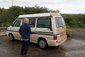 shore-line. shore-line.
With the pouring rain heavier than ever, we
continued around the Breiðafjörður coast, rounding a deep bay with forlornly wet
farms, past the Brjánslækur ferry terminal from where ferries crossed
Breiðafjörður,
along the shore of inner Vatnsfjörður, finally reaching the junction with Route
60 and Flókalundur Hotel. We booked into the campsite and drove uphill to find a
pitch (see above left). After 24 hours of rain, the campsite was sodden muddy, but we found an
empty space near where we had pitched on Tuesday, an apparent age ago in time
and space. It was by now 6-45pm and we were exhausted. But we had made it back
from Látrabjarg on that dreadful, muddy road and in the worst of weathers.
Tonight we should sleep the sleep of kings!
Long drive around the fjord-indented southern
coastline of the West Fjords: the rain had stopped the following
morning, although it was still very dull (see above left) for today's 120kms drive around the
fjord-indented southern coastline of the West Fjords
(click
here for detailed map of route). Before leaving Flókalundur,
we gave George another hose-brushing at the filling station to remove all the Látrabjarg
dirt road mud (see above right). The first section of road around rounding Vatnsfjörður
and the Hjarðarnes peninsula was newly engineered, tarmaced and wide, and we made good progress around the
craggy headland into the bay of Kjalkafjörður. Our map still showed the course
of the old gravelled road which passed around the inner head of the fjord. But a
new road now cut across part-way along on a causeway-bridge saving a few kms. We
continued around the pointed tip of shapely Litlanesfjall, and another new
stretch of road cut across the mouth of inner Mjóifjörður, saving further kms of
the old road's course into the innermost head of this side-fjord. As we sat
eating our sandwich-lunch at a lay-by, we got a message to say that Lucy and Ben
had reached home in Adelaide, having completed their 900kms, 9 day wild terrain
cycling expedition of the Mawson Trail, a startlingly impressive achievement. We
now crossed the head of Kerlingarfjörður; the impressively craggy mountainous
profile of the Skálmarnesmúlafjall triangular-shaped peninsula is still
connected to the mainland body (but only just) by a narrow tarbert-isthmus which
the road crosses to join the old section of road along the shore of
Vattarfjörður around its innermost head where dirt roads cut up into
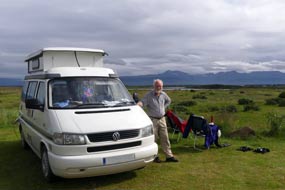 the valley
to abandoned farms. All along this coastline, the shallow fjords at low tide
presented a desolate scene of coastal mud-flats dotted with scattered rocks and
seaweed. the valley
to abandoned farms. All along this coastline, the shallow fjords at low tide
presented a desolate scene of coastal mud-flats dotted with scattered rocks and
seaweed.
Around the next craggy headland, the road followed
the shore-line around Skálmarfjörður, and on the far side of its head valley
it turned sharply uphill to cross the fell-land heights of Bæjarnesfjall
peninsula, descending equally steeply via a hairpin into the head of
Kollafjörður. Rounding the fjord's narrow head, we now had the long drive along
the whole length of Kollafjörður's eastern shore-line, shelving high above the
fjord as we approached its mouth onto the main Breiðafjörður. Reaching the tip
of the Skálanesfjall peninsula, the tarmac ended with the start of a 30kms
stretch of dirt road whose surface was as rough and rutted as some of the worst
we had driven at Látrabjarg. George advanced steadily around the coastal
strip of Gufufjörður. Again with low tide, the shallow fjord presented a dismal
vista of mud-flats scattered with rocks and seaweed. Around the valley-head, the
road climbed steeply to cross the high shoulder of Ódrjúgsháls, descending
via hairpins on the far side to the shore of Djúpifjörður. Rounding the
narrow valley-head, we could see the steaming waterfall of a geothermal source
on the hill-side. The rough, pot-holed dirt road now began a series of hairpins
to gain height steeply over the shoulder of the Hjallanáls peninsula. The rough
road made some of the most demanding driving of the trip, but this was
compounded by the reckless speeding of tourists in hire-cars trying to force a
way past. Beginning the steep descent via hairpins on the far side, the skyline
vista opening up ahead across the gulf of Þorskafjörður was monumental,
dominated by the twin peaks of Vaðalfjöll, an extinct volcano whose outer layers
have been eroded away leaving the two basalt plugs. But all our concentration
was focussed on the descent, dropping on a severe 15% gradient on the narrow,
pot-holed dirt road, shelving in tight curves down to fjord level. Ódrjúgsháls, descending
via hairpins on the far side to the shore of Djúpifjörður. Rounding the
narrow valley-head, we could see the steaming waterfall of a geothermal source
on the hill-side. The rough, pot-holed dirt road now began a series of hairpins
to gain height steeply over the shoulder of the Hjallanáls peninsula. The rough
road made some of the most demanding driving of the trip, but this was
compounded by the reckless speeding of tourists in hire-cars trying to force a
way past. Beginning the steep descent via hairpins on the far side, the skyline
vista opening up ahead across the gulf of Þorskafjörður was monumental,
dominated by the twin peaks of Vaðalfjöll, an extinct volcano whose outer layers
have been eroded away leaving the two basalt plugs. But all our concentration
was focussed on the descent, dropping on a severe 15% gradient on the narrow,
pot-holed dirt road, shelving in tight curves down to fjord level.
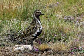 Grettislaug Camping on the Reykhólar peninsula:
Route 60 rounded the head of Þorskafjörður and, along the far shore-line, turned
inland to reach the Bjarkalundur Hotel. The campsite there was expensive, and
the presence of a host of caravans on the forecourt was an additional incentive
to move on. We turned off onto Route 607 for the 12kms drive down the Reykjanes
peninsula around the shore of Berufjörður to reach the scattered village of Reykhólar towards the southern tip.
Thankfully the little shop at the filling station was open for us to buy
essentials. We knew of 2 campsites at Reykhólar, one of which was
jam-packed full of Icelandic holiday-making caravans and trailer-tents.
Thankfully the other by the Grettislaug swimming pool was almost empty. Just a few tents occupied the flat, turfed camping area below the swimming pool, which
overlooked the moorland spreading out Grettislaug Camping on the Reykhólar peninsula:
Route 60 rounded the head of Þorskafjörður and, along the far shore-line, turned
inland to reach the Bjarkalundur Hotel. The campsite there was expensive, and
the presence of a host of caravans on the forecourt was an additional incentive
to move on. We turned off onto Route 607 for the 12kms drive down the Reykjanes
peninsula around the shore of Berufjörður to reach the scattered village of Reykhólar towards the southern tip.
Thankfully the little shop at the filling station was open for us to buy
essentials. We knew of 2 campsites at Reykhólar, one of which was
jam-packed full of Icelandic holiday-making caravans and trailer-tents.
Thankfully the other by the Grettislaug swimming pool was almost empty. Just a few tents occupied the flat, turfed camping area below the swimming pool, which
overlooked the moorland spreading out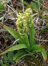 towards the peninsula tip. We
quickly secured a good pitch and settled in. Facilities were straightforward but
more than adequate with hot water, and showers available in the geothermally
heated swimming pool. towards the peninsula tip. We
quickly secured a good pitch and settled in. Facilities were straightforward but
more than adequate with hot water, and showers available in the geothermally
heated swimming pool.
It was by now 4-00pm and we settled in (Photo
49 - Reykhólar Camping) (see above left), spread out wet kit to dry in the sunshine and
brewed tea. Although not an unduly lengthy, today's drive had been demanding, crossing
high land on rough dirt roads, with the additional hazard common throughout
Iceland of youngsters in hire-cars driving at excessive speeds on the narrow
dirt roads. George's odometer today showed that we had now completed 2,000 miles of
driving in Iceland. In contrast with the dreadful weather of the last few days,
the air now here at Reykhólar was balmy warm and full of bird song, with a hazy
sun shining. We could relax at
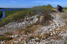 last. Looking south across the moorland, the
skyline vista showed the mountains and glacier of the Skarðsströnd peninsula,
and the distant misty outline of Snæfellsnes. This evening we managed to complete a
full 11 weeks of cooking suppers still using the first gas cylinder. last. Looking south across the moorland, the
skyline vista showed the mountains and glacier of the Skarðsströnd peninsula,
and the distant misty outline of Snæfellsnes. This evening we managed to complete a
full 11 weeks of cooking suppers still using the first gas cylinder.
A relaxing day in camp, and the birdlife,
wild flora and
geothermal springs of the Reykhólar peninsula: at last a fine day, and in the
balmy air of Reykhólar, we sat out for breakfast at a picnic table (Photo
50 - Breakfast at Reykhólar Camping) (see above right). This morning
we booted up and followed the network of paths out across the former meadows,
which had now reverted to rough moorland and marshes, to a bird hide on Lake Langavatn. The path was detailed as Route 44 in the
Rother
Walking Guide to Iceland, which had served us so well this trip. In hazy
sunlight, we crossed the wild moorland and found beautiful specimens of Northern Green Orchid (Photo
51 - Northern Green Orchid) (see above right). We were soon seeing
Whimbrel perching on mounds and soaring around (Photo
52 - Whimbrel), constantly singing their
distinctive call. A Golden Plover perched on the boulder (see above left) (Photo
53 - Golden Plover), joined by a smaller
Ringed Plover (Photo
54 - Ringed Plover). We were able to stand quite close for photographs of these
attractive and seemingly attention-seeking waders. Our Photo Gallery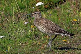 of Reykhólar's
bird-life can be seen on:
Whimbrels and Plovers of Reyhólar.
Following the wooden
peg-markers, we took an indistinct path through the marshes to reach a small
area of geothermal springs, where 80~100ºC water bubbled up from the
sinter-lined rock crevices (see above left) (Photo
55 - Reykhólar geothermal hot spring). We had seen the steam rising from the springs last
evening. Heat-loving vegetation grew in profusion in the marshy ground around
the springs, including purple Bugle plants, Grass of Parnassus and Marsh Cinquefoil. Finding a way with difficulty across the marshland, we reached the
hide. A fat mother Eider waddled and preened on the bank below the hide, while
further out in the lake, Red Throated Divers swam of Reykhólar's
bird-life can be seen on:
Whimbrels and Plovers of Reyhólar.
Following the wooden
peg-markers, we took an indistinct path through the marshes to reach a small
area of geothermal springs, where 80~100ºC water bubbled up from the
sinter-lined rock crevices (see above left) (Photo
55 - Reykhólar geothermal hot spring). We had seen the steam rising from the springs last
evening. Heat-loving vegetation grew in profusion in the marshy ground around
the springs, including purple Bugle plants, Grass of Parnassus and Marsh Cinquefoil. Finding a way with difficulty across the marshland, we reached the
hide. A fat mother Eider waddled and preened on the bank below the hide, while
further out in the lake, Red Throated Divers swam
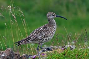 around making their
distinctive wailing calls.
After a late lunch at camp, we again walked out
across the wider area of rough meadows and marshland; Whimbrels constantly flew
around, perching on mounds and singing heartily, demanding to be photographed
(see left and right) (Photo
56 - Whimbrel). Further out we reached another larger geothermal spring, where
boiling water bubbled up from a sinter-lined pool and trickled downhill to the
lake amid clouds of steam. Mint plants flourished in the
warm, moist ground around the spring, but we could find no trace of the Small Adder's Tongue fern,
said to grow here and other geothermal areas of Iceland. around making their
distinctive wailing calls.
After a late lunch at camp, we again walked out
across the wider area of rough meadows and marshland; Whimbrels constantly flew
around, perching on mounds and singing heartily, demanding to be photographed
(see left and right) (Photo
56 - Whimbrel). Further out we reached another larger geothermal spring, where
boiling water bubbled up from a sinter-lined pool and trickled downhill to the
lake amid clouds of steam. Mint plants flourished in the
warm, moist ground around the spring, but we could find no trace of the Small Adder's Tongue fern,
said to grow here and other geothermal areas of Iceland.
Further out across the
marshes to a far corner of Langavatn, Phalaropes darted around in the shallows
and Divers swam further out in the lake. Back up at camp, we relaxed in the
bright afternoon sunshine with ice-cream from the swimming pool; today was the
very first time we had been able to be out without sweaters. Iceland's brief
summer had begun at last, and it was a gloriously warm, sunny afternoon and
evening as we cooked supper of delicious trout fillets brought from Tálknafjörður. Once the sun dipped however, lighting the craggy hills on the far
side of the fjord, the evening inevitably grew chill.
Next week, we shall continue south to explore the Snæfellsnes
peninsula, but
that's a story for the next edition. Join us again shortly.
Next edition
to be published in due course
|
Sheila and Paul |
Published: 6 May 2019 |
|

 CAMPING
IN ICELAND 2017 - West Fjords: Ísafjarðardjúp, Ísafjörđur, Bolungarvík, Flateyri, Þingeyri, Dynjandi, Tálknafjörđur, Patreksfjörđur, Látrabjarg
Cliffs, Reykhólar:
 Ísafjarðardjúp: this long
arm of the Denmark Strait extends 75kms inland from its mouth at the
mountainous NW corner of Iceland at Bolungarvík, with 8 side-fjords cutting deep into
the southern coastline of Ísafjarðardjúp (click on Map 2
right for details). From this viewpoint on Steingrimsfjarðarheiði, remote, uninhabited and forbidding fjord-land stretched
away as far as the eye could
see. With just one small village, Súðávík where we should camp tonight, along
the 200kms length of lonely Route 61 winding along the southern,
much-indented shoreline, the northern side of Ísafjarðardjúp is lined with the
sheer, snow-capped mountainous coast of Langadalsströnd and Snæfjallaströnd (see
left);
these are cleaved by
the glacial lagoon of Kaldalón, which is fed by meltwaters from the Drangajökull glacier which caps the wilderness of Hornstrandir. Until the
mid-late 20th century, this northern coast was dotted with isolated farms eking
out a precarious subsistence living from sheep-farming and fishing. Today they
are all abandoned; life up here is unbelievably tough. Even the white fish have
left Ísafjarðardjúp in favour of the open North Atlantic, leaving the more
sheltered fjord to shrimps.
 Route 61 around the southern shore of Ísafjarðardjúp: as we descended
from Steingrimsfjarðarheiði, just before reaching the innermost head of Ísafjarðardjúp,
the stony road leading up to the valley of Kaldalón below Hornstrandir's
Drangajökull
 glacier branched off. Route 61 continued ahead to Ísafjarðardjúp's
shore (see right), and turned into the side-valley around the shores of
Ísafjörður, the
first of a series of 8 side-fjords cutting into Ísafjarðardjúp's southern coast
from the main fjord (see left). A long and lonely 25km drive along the side-fjord's eastern
shoreline brought us to the valley head; the surrounding mountains enclosing the
glacial valley seemed lower and less overwhelming than expected in the morning
sunshine. We passed frequent bird-life in the fjord-side shallows, but with nowhere to pull in, it was impossible to stop. Rounding
the valley head, we then had
the 25kms drive back along the western shore, bringing us along the narrow spit
of Reykjanes. We turned off here to pause at the hotel, a grim-looking concrete
bunker of a place which takes advantage of a local geothermal source to heat its
swimming pool.
 61 then crossed the
mouth of the larger Mjólfjörður, the third side-fjord, on a causeway-bridge,
saving a 40kms drive around its shoreline, before tracing a route around
the much-indented southern shore of Ísafjarðardjúp, each little bay and cove
with Eiders swimming in the shallows. In the distance
 across the broad width of
the main fjord, the snowy mountains, sheer sea-cliffs and barren wastes of
the now uninhabited Hornstrandir peninsula, the northern extension of the West
Fjords region, stood out. Looking across from Route 61 to this wild northern coastline, the gaping mouth of Kaldalón could also be seen clearly,
backed by the white snowy mass of Drangajökull glacier. Hornstrandir is now one
of Europe's last remaining truly wilderness areas, with some of the most extreme
and inhospitable parts of Iceland. A number of farms had existed here until the
early 1950's, all long since abandoned, and since 1975 the 580 sq kms of tundra,
fjord coastline and alpine upland have been protected as Hornstrandir Nature
Reserve, with strict conservation rules to protect Iceland's only large mammal,
the Arctic Fox. But the delicate balance of Hornstrandir's wilderness natural
environment now faces further threat: the voraciously greedy mass tourism industry
now organises wild-life adventure tours into the region for gullible
tourists from developed countries seeking ever greater novelty on which to
expend their surplus wealth. Is there no part of the planet that is safe from
the ravages of the mass tourism industry?
 Route 61 wound around Ísafjarðardjúp's southern
shoreline (see above left), and turned into the fourth side-fjord, Skötufjörður
for the
15kms drive along its eastern shoreline (see above right). The road shelved high
above the fjord,
passing beneath towering mountainsides down which multiple water courses poured. We paused for lunch at the fjord's innermost head on a spit of land by an
abandoned
 farm, before beginning the 15km return drive along the western side of Skötufjörður.
Towards the fjord's mouth, we paused at Hvítanes to watch a colony of Harbour
Seals basking on shore-side rocks. Up to 8 seals wallowed by the water's edge
basking in the sunshine just 200m away (
 covered mountains
(see right), and the view across the width of this this watery gulf to the sculpted
mountainous massif on the far side was inspirationally spectacular; and there at
the foot of these shapely mountains, the two parts of the isolated village of Súðávík nestled at the fjord-side water's edge.
 The village of Súðávík: in 1995
Súðávík was devastated by a series of avalanches falling from the mountain
face towering overhead. 14 villagers were killed in the tragedy, which prompted Icelandic
government funding for construction of avalanche protection bunds for
communities like Súðávík vulnerable to avalanches, as we had seen at Ólafsfjörður and Siglufjörður on Iceland's north
coast. The village of Súðávík with its 180 residents was re-built a little further south at a
less vulnerable point, and the 'old village' under the avalanche path is now
occupied only in summer; this includes Súðávík's campsite where we should camp
for the next 3 nights!
  the fjord-side, against the
backdrop of Hornstrandir's distant snowy mountains on the far side of
Ísafjarðardjúp
(
 campsite on the hillside in
the northern 'summer village'. Looking up at the sheer walls of Súðárvíkurfjall's
mountain face towering above (see left) (
 when they are thought to have reached here on ice floes from Greenland,
and became trapped as an isolated strain. In most of the country, Arctic Foxes are now regarded
by sheep farmers as vermin and shot to protect livestock, bringing the foxes to
the point of extinction. In deserted
 Hornstrandir however, they are protected by
law and are breeding again in the wilds as solitary animals, living off mice,
sea birds or carrion.
 collect the rent of 550kr
each for seniors (a superb half-price reduction from the normal price of 1100kr)
plus 900kr for power, making a total of 2,000kr/night, by far the best value
campsite so far experienced in Iceland. And most importantly there was total peace and freedom from
 holiday-makers, with just the sound of the wind and birds
in this momentously memorable mountain and fjord-side setting (
 Skutulsfjörður, the 8th of Ísafjarðardjúp's side-fjords
(
 could
just make out the tiny
settlement of Hnífsdalur squatting in the valley mouth between these
overpowering mountains, and just beyond the tiny mouth of the tunnel through Hádegísfjall
which took Route 61 onwards from Ísafjörður to Bolungarvík.
Nearer at hand, Skutulsfjörður itself was enclosed on 3 sides by monumental
mountains, the details on their rock faces and sculpted corries highlighted by
the morning sun. And there in the distance nestled in the head of the side-fjord
was Ísafjörður, spread around its L-shaped sandspit in such a dramatic location,
surrounded on 3 sides by high mountains and on the 4th side by the dark waters
of the fjord (
 the fjord
under the towering cliffs and huge corrie on the flanks of Kirkjubólsfjall (see
left), passing the outlying settlements of Holtahverfi
and Skeiði and the turning onto the ongoing Route 60 towards the Vestfjarðagöng
Tunnel, and just beyond we pulled into a large Bonus supermarket for provisions.
 Continuing along the far fjord-side, we reached the main part of the town; by
the roundabout junction, we spotted Ísafjörður's parish church, an ugly
architectural monster of a structure looking more like an ochre-coloured folding
accordion, built amid controversy to replace an earlier wooden church which
burned down in 1987. We turned off onto the L-shaped peninsula of Eyri, where
the main part of Ísafjörður's old town and harbours are located. Just along
towards the town, we found a Netto supermarket for items unavailable at Bonus;
as we had learned at other Icelandic towns, Bonus was cheap and cheerful, Netto
a little more classy and better stocked! In the supermarket, we enquired after
barbecue charcoal, and were helped by a lad who turned out to be from Macedonia;
he had come to Ísafjörður originally to watch an ice-hockey match and had
stayed! Looking around, we could understand why as we parked along at the TIC in the heart of the old town by the harbour.
 employment. A sign of the times, local and national government services account
for 40% of the town's employment, with tourism contributing
 increasingly to the
local economy. But it's Ísafjörður's dramatic location that so astounds:
standing here by the quayside on this spit of land projecting into the fjord,
whichever way you looked apart from down the length of Skutulsfjörður, you were
left agape by the over-towering sheer walls of the mountains that surround and
enclose the town and port (see left and right), their faces scarred by crags and scree, with mighty
corries sculpted out of the high walls as if by a giant ice cream scoop (
 Our day in Ísafjörður:
Ísafjörður felt a homely and thoroughly likable place, and we set off to wander
around the port and the labyrinth of back streets making up the old town spread
around Eyri. Every photo we took, whether of the fishing boats in the old and
new harbours, or of the brightly painted wooden houses in the quaintly rambling
streets of the old town, was set against a dramatic backdrop of mountain walls
and which towered over the town. You could understand why the people of
Ísafjörður
are so proud of their brave northern town: as we strolled around, we also shared
that feeling. Ísafjörður had an old-fashioned and unpretentious work-a-day
appeal which set it apart, an air of welcoming homeliness in a remote
wilderness.
 This was no place for us. But it was the vista
from the new port behind the fish-processing plant on the outer side of Eyri
that took top
 prize: the view looking across the fishing boats moored in the
harbour to the sheer wall of mountains rising beyond topped by a mightily
sculpted corrie simply epitomised Ísafjörður's outstanding location (see above right)
(
 to investigate the campsite
there, knowing it also was ludicrously over-priced
 and likely to be overcrowded
with rowdy holiday-makers; but it was an Icelandic Camping Card site and we were
at risk of not using all 28 slots on our expensive card. It was a fine
location up the wooded valley below the attractive Bunárfoss waterfall, and not
as crowded as feared. But the peace and charm of Súðávík Camping was more
appealing, and we set off to return around the bay past the airfield, pausing
twice to photograph the setting of Ísafjörður township on its peninsula against
its mountainous backdrop and the mighty mountains and cliffs northwards towards Bolungarvík.
At the second stop, the Arctic Terns were particularly aggressive, swooping down
to attack our heads as we took our photos.
 forward our planned rest day and stay
on for a day in camp and third night here.

 Bolungarvíkurgöng Tunnel connecting Ísafjörður
to Bolungarvík: the following morning was still gloomily overcast with
low cloud still covering the
mountains behind us and across the fjord. On the
way out of the village, after our 3 happy days in Súðávík, we paused to pay
respects at the memorial to the 14 villagers, including 8 children, killed in
the January 1995 avalanche disaster (see left). Into Ísafjörður, with cloud still hovering
in strands along the walls of the surrounding mountains, we paused at the Polish
shop by Bonus supermarket for nostalgic polish foodstuffs (including Bigos mix,
borsch and urek soup), and Polish beers from the local Vinbuðin. From Sam the
Polish shop owner, we
learned that over 1,000 Poles live and work around the
West Fjords; he did not bat an eyelid when we greeted him with Dzień dobry! As well as being a welcoming
and homely town, Ísafjörður was also cosmopolitan: during our brief time here,
we had spoken with Thais, Poles and a Macedonian! Into town, we shopped for the
bulk of our provisions at Netto, then drove along to photograph the town's
eccentric parish church (
 Finally leaving Ísafjörður today, we headed out
on Route 61 around the northern coast of Skutulsfjörður
(
 roofed fishing
shacks once used to house fishermen during winter; an oil-skin clad old salt was
showing visitors around. We parked here and walked on
 around the low cliffs,
photographing the imposing vista across the bay towards Bolungarvík and the
overshadowing majestically shapely bulk of Bolafjall (see left) (
 Hemmed in by high mountains, it is also vulnerable to
avalanches and, before the tunnel's construction, to being shut off by winter
weather and
 rock-falls.
 fork-lift operators skilfully stacked
the full crates for transportation in batches over to the fish-processing plant
(
 many photographs.
 we were determined on no payment for such
a shameful place. The only good thing about Bolungarvík Camping was its outlook
and setting, alongside the Hólsá River where it tumbled down to the sea, and
looking directly up at the magnificent mountain walls enclosing the village,
with the sculpted corrie on the face of Hádegisfjall and the jagged walls of Óshlíð
under which we had stood earlier (see left).
 South from Ísafjörður through the Vestfjarðagöng Tunnel
to Suðureyri: with the sky heavily overcast, we returned from Bolungarvík the following morning to
drive back through Bolungarvíkurgöng Tunnel to Ísafjörður to top-up our
provisions at Netto (the last supermarket we should see for a number of days)
and for final photos across the bay of the mountain massif and corrie above town
and port. It had been a privilege to visit Ísafjörður (one of our favourite
places in Iceland), and we finally left now to turn off onto Route 60
(
 Route 65 branches off down to the
isolated fishing port of Suðureyri. The first section of the tunnel was normal
dual-lane and well-lit, but when we turned off at the junction part-way through
onto Route 65 to Suðureyri, the tunnel became single-lane with frequent passing
places (indicated by the M-sign for Mætast - Meeting place) (see left)
and priority
for returning traffic. We took it steadily but fortunately met no on-coming vehicles,
and emerged into gloomy daylight high above Botnsdalur to descend steeply
towards the head of the narrow Súgandafjörður (see below right). The upper valley was totally
deserted apart from one large farm whose home-pastures had been recently cut for
hay. The road shelved along the mountainside above the inner fjord for 10kms,
with not one dwelling other than a couple of abandoned farms the whole length of
the
 narrow fjord, until at last we reached the outskirts of the little fishing
harbour of Suðureyri.
 of geothermally
hot water from bore-holes above the village, used for heating homes, supplying
energy for the fish-processing plant, for fish-drying and heating the village's
outdoor swimming pool and hot tubs, one of the most popular in the West Fjords.
Fishing and fish-processing still dominate the village, but fishing has now been
turned to advantage to lure tourists out to this remote settlement, thanks to the tunnel
now accessible by road: you can, for a price, spend a day out in a
fishing boat, visit the fish-processing factory, sample fish dishes at the café,
and even feed the cod kept in the village lagoon. Every summer, sea anglers from
around Europe are attracted to Suðureyri.
 village shop; the fjord-side setting looking westwards
to the mouth of Súgandafjörður was really stunning (see left), but the campsite
was tents only and no power. Having eaten our sandwiches, we found the
café to enquire about visiting the fish-processing plant. The village was
certainly doing well from fish-tourism since the charge was now 5,000kr each,
almost £40! Þakka þér en nei takk (Thank you but no thank you)! Instead
we learned from the information panels outside the difference between long-line
fishing and hand-line fishing. For long-line fishing, the lines are cleaned and
prepared by a baiting team
 on land before sailing: fish-bait (either squid,
mackerel or herring, depending on what is being fished) is attached to up to 500
hooks along each line, before the lines are loaded into drums; a boat will
usually carry up to 20 such loaded drums, making a total of 10,000 baited hooks
per trip. When a boat reaches the fishing grounds, the lines are laid on the sea
bed for 2 hours, then hauled back on board loaded with fish to be unhooked and
crated up in the hold. Smaller boats equipped for
hand-line fishing have 5 or 6 wheels mounted at the boat's rail, each carrying a
line with 6~8 hooks baited with artificial lures. The motorised wheels
automatically cast the lines with their hooked lures, and reel in the catch from
just above the sea bed. The lines are hauled back aboard for the catch to be
removed from the hooks and crated. It was these loaded crates that we had
regularly seen being hoisted ashore onto the quay back at port.
 by the
mole (see above left), we returned through the village for photos of the open-sided fish-drying
shed. Some fish are still dried in outdoor covered racks, but only over winter;
in summer flies would ruin the fish. At the nearer end of village by the
fish-processing factory, we paused for photos of the fishing boats moored in the
harbour (see right) (
 Önundarfjörður to reach the village.
In the outskirts of Flateyri, behind the NI filling station and directly beneath
the enormous bund of Flateyri's avalanche protection barrier, we found the
little campsite. But this was a poor affair, the most basic site yet in the West
Fjords, which despite its superb setting looking out over the village and fjord
and under the shadow of the avalanche protection bund, had only the most basic
of facilities: 2 WCs and outside wash-up sink, but no showers or hot water and
no electricity, not even lighting in the loos. But at least it was peaceful, and
we found a spot away from the trailer-tent and camping-car here already, and
pitched behind a sheltering hedge with George's nose pointed into the wind and
rain driving down the fjord.
 Flateyri
Camping:
by now it was gone 4-00pm; it was too wet this afternoon to explore the village
and avalanche protection today, and we each did a couple of hours work before
cooking supper on this gloomily wet and chill evening. A local family called
round to collect rent money: 900kr each senior discount (normal price 1,100kr),
expensive for such a basic site with poor facilities, and we rated it at +1. We
did however chat with the family about the October 1995 avalanche which engulfed
part of Flateyri village killing 20 people and giving further inducement to the
Icelandic government to fund a construction programme of avalanche protection
walls which we had seen in several vulnerable villages. It was a grimly chill
night without power for heating, and we sat huddled in multi-layers for warmth.
 Flateyri and its avalanche protection bund:
a brighter morning (see left and right)
(
 (
( which buried part of the village under a million tones of snow killing
10% of residents, a calamity from which the community has never fully recovered.
The flat spit of land (eyri) projecting into Önundarfjörður on which Flateyri
now stands was first settled in the late 10th century by Önundar Vikingson, an illegitimate son of King
Harald Fairhair of Norway. The village later developed as a trading post from
1792, and formed the base for a whaling station in the 19th century. The fishing
industry prospered in Flateyri until recently but since the 2008 financial
crisis it is now in serious decline, with many of the population departing
leaving just 180 residents. Whereas
 Suðureyri retained a thriving and purposeful
air with its fishing industry still vibrant and fishing-related tourism being
exploited to supplement the local economy, Flateyri in contrast had a
run-down air. There was still a small fish-processing plant along by the port,
but most of the buildings and houses had a sad feel. Even attempts to tap into
the burgeoning Icelandic tourist trade seemed rather half-hearted. The village's
highlight however was its second-hand bookshop (Bókabúðin), a quaint and
seemingly incongruous curiosity, founded in the early 20th century by the
great-grandfather of the current owner, where books are sold at 1,000kr per
kilogram. We drove around the village, pausing to photograph the fish-drying
shed and the few boats in the harbour, and that was about all that Flateyri had
to offer. There seemed little left to stop the inevitable population
decline as youngsters left to find work elsewhere, attracted by the bright
lights of Reykjavík and Akureyri.
 southern side of
the pass to the shores of Dýrafjörður (see above left), we turned off onto the tarmaced but
single-track with passing-places side-road, pausing by a sandy beach for our
sandwich lunch, with Oyster Catchers pecking on the sandy beach. Ahead the
shapely peak of Mýrafell rose by the fjord-side. 6kms along, we reached a
side-turn to the Skrúðor Gardens. This quite miraculous little walled garden, set amid
trees on the bleak and
 otherwise barren fell-side, was laid out originally in
1905 by Pastor Sigtryggur Guðlaugsson who had been appointed priest at the
nearby hamlet and boarding school of Núpur. He had been brought up at
Eyrafjörður in Northern Iceland where from a young age he had learned an
enthusiasm for vegetable growing and horticulture. When he settled at Núpur with his wife, he saw an opportunity to begin a garden on a plot of
fell-land, with the intention of teaching botany, horticulture and tree growing,
to show his pupils that with care and attention plants could be cultivated even
in these bleak Icelandic fell conditions, and to introduce vegetable growing as
part of a healthy diet. The walled garden was laid out and opened in 1909,
developing and thriving until 1980 when the school closed. The Skrúðor Garden
fell into neglect and decay, but in 1992 a group of volunteers began renovating the gardens. The Icelandic Ministry of Education, which still officially owned
the land, handed ownership and care of the resurrected gardens over to Ísafjarðarbær local authority who still maintain the garden as a memorial to its
founder.
 discount. We set off back around the fjord, but on
reaching the causeway crossing, another thought occurred: there was also Núpur Guest-house near Skrúðor Gardens which was much closer. We phoned, and
yes, not only did they offer camping with full facilities, but at an
all-inclusive charge of 2,000kr. No issue, and we set off to return there.
 The gruelling drive over the mountains to Arnarfjörður:
the forecast for today's long and gruelling drive over the gravelled mountain roads to Arnarfjörður and Dynjandi was for heavy cloud cover and rain
(
 But the time had come, and from
Þingeyri we turned up onto the on-gong Route 60. The gravelled surface and steep gradient began immediately, and we
were following the service bus which regularly crosses this mountain pass over
to Arnarfjörður, both reassuring and unnerving since we were bound to be slowed
by the bus and needed all the revs that George could muster on the hairpins. The
road shelved directly uphill on a steep gradient high above Dýrafjörður,
rounding a bend at the top to drop unexpectedly into a long valley. Along the
length of this, the gravelled road surface was freshly scraped and reasonable,
but as the real climbing began, the road surface deteriorated markedly. Ahead we
could see the first of the tight bends and hairpins, with a fearful gradient.
George kept up his revs, tackling the first hairpin, fortunately not meeting
any of the tour-buses that clearly travel this route. But on the approach
to the second hairpin, the gradient was even more steep; after recent rain, the
gravelled surface was coated with slithery, muddy slurry, giving an insecure
feel of lack of adhesion. Fully loaded, George had at one point to drop down to
first gear to negotiate a broken down vehicle right at the apex of the bend. The
gradient up to the final bends to reach the Hrafnseyrarheiði watershed was even more grindingly
severe, and we were now
 catching up with the bus (see above left). The narrow road seemed darkly
enclosed within a defile, shelved into the severely sloped and crumbly rock,
with fearful and unprotected drop on the outer side. On this relentless gradient
up to the crest of the pass, the narrow road seemed to cling precariously to a
vertical wall of dark, fragmented rock. Steadily and in second gear now, George
struggled up the unremitting gradient, and rounding the final curve, reached the
highpoint of the pass. The bus pulled over at the watershed, allowing us to
squeeze past, but there was nowhere for us to pull in. We were committed to beginning the descent, unable to pause for a breather and
to appreciate
this hugely dramatic terrain, surrounded by 700m high mountains.
 Way below in the misty distance, we could just see
the outline of Arnarfjörður as we rounded the first of the hairpins on this
dramatically steep down-slope (see above right). Visibility improved as we descended onto more
open, sweeping fell-side to reach the next tight hairpin, quickly followed by a
sharp curve leading into the third and final hairpin. Ahead the road descended
steeply in a direct line towards the Arnarfjörður valley floor. George coasted
steadily down the final stretch, and with much relief pulled into a lay-by at
the farming hamlet of Hrafnseyri on the shore of Arnarfjörður, for a breather
and for us to recover with our lunch sandwiches. We had made it over the
severest section of the pass, but the price was that George was filthy, caked
high on each side with the dirt road's muddy slurry.
 Hrafnseyri on northern shore of Arnarfjörður,
and the Jón Sigurðsson Museum:
Arnarfjörður is a huge fjord, 10kms wide at its mouth and cutting 30kms deep
into the interior, to fork at its innermost head into 6 finger-like sub-fjords
separated by high, sharply pointed mountainous projections. Directly across the
fjord's width from Hrafnseyri, shafts of sunlight picked out 2 particularly
shapely sculpted, flat-topped mountains, with the tiny settlement of Bíldudalur
nestling between them in this titanic fjord-scape (see above left). The little port at Bíldudalur
along with the farmstead at Hrafnseyri are the only settlements on the entire
coastline of Arnarfjörður. Hrafnseyri is named after one of Iceland's earliest
doctors from the period of Settlement, Hrafn Sveinbjarnarson who died here in
1213 having trained in Italy and returned home to practise.
 Born on 17 June 1811 (a day still celebrated as
Iceland's National Day) and son of the local pastor, Sigurðsson left home at
Hrafnseyri in 1833 to study at Copenhagen University. He clearly enjoyed the
city good life since he contracted syphilis and failed to complete his degree,
both facts conveniently air-brushed out of Icelandic tradition! Instead he
devoted his time to campaigning for the return of Iceland's medieval Saga
manuscripts kept by the Danes in Copenhagen. In 1841 he began his political
activities, campaigning for greater independence for Iceland, and in 1843 was
elected to the Icelandic Alþing, which regained its powers as a consultative
body in 1845 thanks to his agitation. He convincingly argued in his political
writings that since the Danish king had agreed to
 forego absolute powers in
1848, the decree of 1660 binding Icelanders to the absolute rule of the King of
Denmark was no longer justifiable, and that Iceland should therefore be given self-rule.
Further reforms followed as a result of his agitation, including the right to
free trade in 1854, finally removing remaining trade restrictions, a measure
which more than anything improved the quality of life for Icelanders, and
eventually 20 years later a favourable new Constitution for Iceland in 1871
which returned full legislative powers to the Alþing Icelandic parliament,
making the country self-governing at least in home affairs. Jón Sigurðsson died
in Copenhagen in 1879, not living to see Iceland become a sovereign state in
1918 and gain full independence as a republic in 1944 on the anniversary of his
birth. His body was returned to Reykjavík for a state funeral.
 Dynjandi waterfalls:
Re-joining Route 60
(
 we continued eastwards along the desolate shore of
inner Arnarfjörður, the sky still gloomily overcast and the road still gravelled and severely
pot-holed (see left). 20kms further, the road rounded the head of Borgarfjörður, the
northernmost of Arnarfjörður's 6 forked inner recess head-fjords, passing the
small Mjólkárvirjun hydro-generating plant. As we drove from Hrafnseyri
along Arnarfjörður's northern shore-line, in the far distance the triangular
upper spread of Dynjandi's falls could be seen (see right). Now, as the dirt road rounded
the headland high above Dynjandisvogar (the second inner recess head-fjords),
the falls were even more evident (
 against
the backdrop of dark basalt resembles lacy curtains (see below right)
(
 Fjords region are the oldest in Iceland, originating during a series of
volcanic eruptions during the Tertiary Period 14~16 million years ago.
Successive layers of basalt and lava slag have been deposited in this area, and
during the Ice Age which ended 10,000 years ago, the retreating glaciers gouged
out deep valleys and fjords in the landscape, leaving behind layers of rock of
differing degrees of harness. These eroded strata form the terraced waterfall of Dynjandi, where the river
torrent, which originates high on the Dynjandisheiði plateau,
plunges over the escarpment and cascades down into the head of Arnarfjörður.
 falls
(
 occupants; how can such folk make so much racket? We had
been told that the parking area was available as camping space with WCs and even
a cold water wash-up sink. But an official notice by the loos made it clear that
camping was now forbidden in Dynjandi Protected Area; how far did this
ambiguity stretch, and how firmly would wardens enforce the ban? We should find
out later. But even though there were no signs in the parking area forbidding
over-nighting, it was clear that abuse of Iceland's freedom to camp by excessive
numbers of tourist hire-campers had restricted the freedom; it was entirely
understandable that camping was being discouraged at Dynjandi. In the meantime,
we tried to remain as inconspicuous as possible, despite George's roof being up
showing an obvious intention to camp! But then, it seemed, so was this herd of
Italian camping-cars, and the car park remained crammed full of tourist
hire-cars. To our relief, all the Italians returned, having spent a cursory 10
minutes 'doing Dynjandi' and snapping their selfies by the lower falls, and one
by one moved out with as much hullabaloo as when they had arrived. So
 gradually
did all the hire-campers. We relaxed and, fearing at any moment a warden would
arrive to move us on, hesitantly cooked supper. As the evening wore on, all of
the tourist hire-cars disappeared, leaving us virtually alone to enjoy the
thundering Dynjandi Falls in peace (Dynjandi means Thundering One) (see
above right) and the view down the length of Arnarfjörður (see left)
(
 A
rough and filthy muddy drive over Dynjandisheiði plateau to Flókalundur:
we were not disturbed overnight, and what a view to wake to!. Although the
grey, overcast weather had denied us the view of Dynjandi Falls lit by evening
sun, the memory of waking to the sight and sound of thundering Dynjandi will
live with us for ever (see left). In fact we had not been entirely alone camping here:
there were at least 2 other small campers and even a back-packing couple in a
tent camped in the grassy space. We breakfasted and packed, but from an early
hour the tourist hordes were moving in; by the time we departed, the overnight
peace was long gone, the parking area was full again, and the approach path to
the falls swarming with tourists.
 the
road up onto the bleak and cheerless plateau top. The road surface was a red,
muddy slurry with the rain, visibility was poor, but worst of all were the
pot-holes. This truly was the roughest 30kms of so-called road we had travelled
in the whole of Iceland, the surface rutted with constant pot-holes making
fearful impact on tyres and suspension. Yet still the silly young tourists in
hire cars drove at alarmingly irresponsible speeds, failing to slow in passing.
3kms along the plateau top, we paused where Route 60 crossed the Dynjandisá
river as it flowed from the plateau towards the head of the falls at the
upper escarpment edge (see right) (
 We reached the junction where Route 63 branched
off around the 3 other inner recess fjords to reach Bíldudalur on the southern
shore of Arnarfjörður. Beyond here Route 60 continued, as rough and pot-holed as
ever, finally beginning the steep descent towards the coast of Breiðafjörður at Flókalundur.
George bumped along the pot-holed road, counting off the kms to reach tarmac
again. Towards the bottom of the descent, stunted trees began again, and ahead
was the road junction with Route 62, and tarmac at last. We pulled into Flókalundur
Camping to pause for lunch sandwiches and to recover from the stressful
experience of driving this fearful, rutted road in such filthy, wet conditions.
And poor George was filthy, his sides and back chocolate-brown with mud from the
slurried road surface. The
 Flókalundur Camping at Breiðafjörður: Flókalundur
is named after an early settler Flóki (Raven) Vilgerðarson who had overwintered
by Vatnsfjörður at Barðaströnd around 868 AD, and named the land Ísland (Iceland) from the packs of sea-ice floating in
the fjord. The harsh winter weather had killed all his livestock, and in despair
he had returned to Norway. It is now nothing more than the road junction, a
hotel, filling station (we hoped they had a hose-brush to clean up George), and
the campsite where we planned to stay tonight. The campsite had
several large, flattish grassy camping areas tiered up the hill-side, but just a
few power supplies on each level. The price was unduly expensive for an
unexceptional site: 1,500kr/person plus 1000kr for
 power, but it was an
Icelandic Camping Card site so at last we could use one of the slots on our
card. As we looked around to reserve a good pitch (see above left and right), a convoy of 7 holiday-making
Icelandic caravans arrived. We quickly selected a spot on the far corner of the
middle tier and secured one of the only 3 power sockets, reserving our
space. The caravans clustered in a tight-knit wagon-trail circle towards the
entrance where, far from us, they could make as much noise as they wanted!
Having secured our space, we took George down to the filling station and used
the hose-brush to clean off all the filthy mud accumulated over the 2 stages of
unsurfaced mountain roads driving over from Þingeyri (
 unexceptional campsite, Flókalundur's facilities were woefully inadequate. The
Hotel/Camping was clearly milking its position here on the Látrabjarg tourist
trail, and the tourists simply kept on coming in ever greater numbers! This was
one of the worst campsites so far, over-priced and under-provided with
facilities.
 eastern end of the
extended line of cliffs making up the Látrabjarg peninsula became visible.
Beyond the sweeping bay of Hagavaðall, the road rounded further coastline before
turning inland to begin the long, steady climb up onto the Kleifaheiði plateau.
Across the broad watershed, the descent on the western side was steeper,
dropping via a pair of hairpins to the head of Ósafjörður inlet at the road
junction where Route 612 branched off towards Látrabjarg. Route 62 crossed the
inlet's head to continue along the northern coastline of Patreksfjörður with the
town that takes its name from the fjord visible in the distance. Approaching Patreksfjörður, we turned off into the town and found the small campsite
alongside the community centre. The camping area was quite small, but the
facilities in the community centre were first class, with homely and fully
equipped kitchen/common room and clean, modern WC/showers. Patreksfjörður
Camping's one downside was its high price of 1,500kr/person plus 1,250kr for
power, and not a Camping Card site when we had so many unused slots left on our
card.
 street of Aðalstræti and found 2
supermarkets; both were small but we
managed to stock up with 2 days' provisions, inevitably at seemingly enormous cost.
After photos of the harbour full of fishing boats (
 The isolated port-village of Bíldudalur on southern coast of Arnarfjörður:
leaving Patreksfjörður on Route 63
(
 We found Bíldudalur Camping, set by the swimming
pool; the fjord-side setting was magnificent, but facilities were Spartan, just
2 WCs and no sign of anything else. Patreksfjörður had the facilities,
Bíldudalur had the setting, but both were expensive and not Camping Card
members. Tálknafjörður Camping accepted the Camping Card, but perhaps had
neither facilities nor setting; we should find out when we got there later. What
was particularly stunning about Bíldudalur village however was its panoramic
vista across the width of Arnarfjörður: in the murky, misty distance, not today
visible across the 10kms width of the huge fjord, was the Jón Sigurðsson Museum
at Hrafnseyri where we had been 2 days ago. We could however just make out in
the gloom the distant valley down which Route 60 descended after the hairy
drive over the mountain pass dirt road from Þingeyri.
 The sheltered port-village of Tálknafjörður and its campsite: back
over the Hálfdánarfell mountain pass
(
 the journey out seemed a different universe! As
others left this morning, we moved George into a corner position by a sheltering
hedge, as the weather got gloomier with 100% cloud cover down to fjord level
enveloping the surrounding hills and the air moist. It was a thoroughly
miserable day, only fit to spend in camp. We expected the campsite to fill up
again this evening, but fewer arrived giving a more peaceful night.
 the inner head of the fjord
(
 of Örlygshöfn to reach the farmstead and museum-cum-campsite
at Hnjótur (see left).
 having exchanged pre-trip emails with the
owner Kristinn Thor Egilsson who had confirmed camping availability. He now
showed us around and told us something of the history of the Hnjótur museum and
its aircraft. But the approach to the supposed camping area was treacherously wet after all the rain; set on an exposed hillside, with ramshackle and
semi-built facilities, the campsite looked uncertain, and we left it for now to continue on
towards Látrabjarg.
 weather. At the hotel reception, we booked in
for one night and reserved our pitch since power supplies were limited. There
were basic WC/showers in a hut by the camping area, but facilities in the hotel
were of luxurious standard, including a fully equipped kitchen/wash-up. It may
have been expensive, but you got what you paid for including free cups of
tea/coffee.
 Inevitably there were many tourist cars parked
here, and we kitted up to explore the cliff-tops (see right and left) (
 colony,
with millions of sea birds nesting on the cliffs' tiered basalt ledges,
coexisting in high-rise avian apartment blocks: among the scree and fallen
boulders at the foot of the 400m high cliffs, the world's largest single colony
of Razorbills nests. Fulmars nest on the grassy lower ledges, while the higher
ledges on the vertical cliff face are home to Kittiwakes and Guillemots (both
Common and Brünnich's). The Brünnich's Guillemot, with its distinctive white
streak extending back from the bill, breeds only in the North Atlantic around
Iceland, Greenland and Northern coast of Scandinavia, whereas the Common
Guillemot breeds as far south as the Spanish coast; for a comparison, see the
 Atlantic Puffins (Fratercula arctica) are members of the Auk family and live for
25~30 years. After a winter-long separation at sea, the breeding pairs arrive in early April
to re-unite at their nesting burrows in the turf on Látrabjarg's
cliff-tops. Single eggs are laid in the burrow mid-May, and one of the adult Puffins remains incubating the egg in the burrow-nest while the
other adult flies out to sea fishing. The Puffin
 chicks (Pufflings) hatch at the turn of June~July. The adult birds bring back beakfuls of
sand eels garnered on their fishing trips, and can be seen standing by
their burrows early evening. The Puffins depart from Látrabjarg mid-August to over-winter at sea. We had not expected to find many Puffins at this
time of afternoon, assuming they would only return early evening from their day time
fishing at sea for sand eels. But in fact all along this stretch of cliff-top,
Puffins in ones and twos were standing or sitting on the ledges just over the
brink, or waddling rather clumsily along the cliff-top turf almost tripping over
their over-large webbed feet. They were literally just 2~3 metres distant from
us, showing complete indifference to our presence, or simply gazing with
apparent curiosity at these strange human creatures pointing cameras at them
(see left) (
 Up the muddy slope, we reached the higher bare
cliff-faces where 1000s of Kittiwakes were still nesting. We were able to
photograph them as they reared their now quite large but still fluffy chicks (
 spectacle and taking our photos, particularly of the Puffins as we
edged warily along the cliff-tops, surprised at the ease with which we could
approach them (see left) (
 the lighthouse. George was now filthier than ever and covered with mud
spray. By now the rain had finally stopped, and the forecast showed a 4 hour
window without rain until 4-00pm. We just had time for our second visit to the
bird cliffs before the rain was forecast to start again, and we kitted up fully
with waterproofs, as much against the
 strong wind as against the
possibility of rain. Over at the cliff-top, it was now more evident than ever
just how strong the wind was: 10~12 m/s did not sound an excessively strong
wind, but on an exposed 400m cliff-top, we were just thankful that it was
blowing from the SE from the sea onto the land!
 of the head wind, and up here in a
more exposed position it felt unsafe to stray too close to the cliff-edge
brink. Back down to lighthouse, we spent another hour taking photos and videos
of the Puffins as they stood in front of us at the cliff-edge (see right)
 (
( local and
national life in rural Iceland during the 20th century. His wide-ranging
collection was augmented during the British and US occupation of Iceland
during WW2 and the Cold War. In addition to tools, farming implements and
fishing equipment, his interest in aviation led to the acquisition of the
semi-dismantled remains of a
US Navy Douglas DC-3 aircraft from the Keflavík
Airbase and a Russian Antonov AN-2 biplane (see below right) with Aeroflot
 markings which landed nearby on some dubious
mission. The museum also shows a 1949 black and white film of the rescue by
local farmers of the stranded crew of the British trawler Dhoon from
Fleetwood which had run aground at the foot of the Látrabjarg cliffs during a
severe snowstorm in December 1947. The rescue teams from Hvallátur and Breiðavík
abseiled down the 300m cliffs using skills learned from egg gathering,
fired a line to the stricken trawler, hauled the surviving crew ashore by
breaches-buoy, and managed to lift them back up the cliff. This incredible
rescue gained national attention, and a documentary film was made the following
year with the farmers re-enacting the rescue. During the filming however another
British trawler, Sargon also ran aground nearby in
Patreksfjörður, and
the rescue mission was repeated to save its crew, providing coincidentally live
material for the filming. We chatted with a local lad from Hnjótur (who spoke
his English with a marked Scottish accent from time spent in Aberdeen) about the
Museum's history, and about Egill Ólafsson's life-long gathering. But time
was now pressing; we still had a long drive ahead and, after a quick look at the
2 aircraft, we resumed our journey.
 A wet return to Flókalundur Camping: the
stretch of narrow dirt road along the Örlygshöfn valley, and around the
unstable, rock-fall prone headlands were even worse than ever with constant deep
ruts; fortunately we met no on-coming cars. Across the heads of 2 further
valleys, and around further shaley headlands, the road dropped down to cross a
broader valley-mouth, still as muddy and rutted as ever. One further headland
brought us down to cross the sand-dune valley, past the old airstrip and along a
better fjord-side stretch finally to re-join the tarmac at a farming settlement.
The gusting wind was whipping up breakers on the grey, stormy fjord with
driving, misty rain filling the air. Picking up speed, we drove along this final
stretch to Ósafjörður and the junction with Route 62. In now pouring rain, we
now tackled the steep upward slope, rounding
 a couple of hairpins and continued
ever upward reaching dense cloud-base. The climbing continued, and with
visibility almost at zero, it was an uncomfortably eerie feeling advancing ever
upwards. The road was raised on an embankment, making the fells to the side
invisible against the cloud; all we could see was the semi-visible road ahead
advancing upwards. At last the gradient eased across the high Kleifaheiði
plateau, and we began the descent into Miklidalur, regaining some visibility as
the cloud thinned. Another equally long descent brought us at last down to the Barðaströnd
coast by a broad delta estuary, with the rain now pouring more than ever. We
hoped the driving rain would serve to wash some of the caked dirt road mud from
George's bodywork and wheels, as we picked up speed along the southern
coastline. Visibility was still poor with low rain clouds covering the craggy
basalt headlands; mist obscured the view across Breiðafjörður and the wind drove
breakers and spray onto the
 shore-line.
 the valley
to abandoned farms. All along this coastline, the shallow fjords at low tide
presented a desolate scene of coastal mud-flats dotted with scattered rocks and
seaweed.
 Ódrjúgsháls, descending
via hairpins on the far side to the shore of Djúpifjörður. Rounding the
narrow valley-head, we could see the steaming waterfall of a geothermal source
on the hill-side. The rough, pot-holed dirt road now began a series of hairpins
to gain height steeply over the shoulder of the Hjallanáls peninsula. The rough
road made some of the most demanding driving of the trip, but this was
compounded by the reckless speeding of tourists in hire-cars trying to force a
way past. Beginning the steep descent via hairpins on the far side, the skyline
vista opening up ahead across the gulf of Þorskafjörður was monumental,
dominated by the twin peaks of Vaðalfjöll, an extinct volcano whose outer layers
have been eroded away leaving the two basalt plugs. But all our concentration
was focussed on the descent, dropping on a severe 15% gradient on the narrow,
pot-holed dirt road, shelving in tight curves down to fjord level.
 Grettislaug Camping on the Reykhólar peninsula:
Route 60 rounded the head of Þorskafjörður and, along the far shore-line, turned
inland to reach the Bjarkalundur Hotel. The campsite there was expensive, and
the presence of a host of caravans on the forecourt was an additional incentive
to move on. We turned off onto Route 607 for the 12kms drive down the Reykjanes
peninsula around the shore of Berufjörður to reach the scattered village of Reykhólar towards the southern tip.
Thankfully the little shop at the filling station was open for us to buy
essentials. We knew of 2 campsites at Reykhólar, one of which was
jam-packed full of Icelandic holiday-making caravans and trailer-tents.
Thankfully the other by the Grettislaug swimming pool was almost empty. Just a few tents occupied the flat, turfed camping area below the swimming pool, which
overlooked the moorland spreading out
 towards the peninsula tip. We
quickly secured a good pitch and settled in. Facilities were straightforward but
more than adequate with hot water, and showers available in the geothermally
heated swimming pool.
 last. Looking south across the moorland, the
skyline vista showed the mountains and glacier of the Skarðsströnd peninsula,
and the distant misty outline of Snæfellsnes. This evening we managed to complete a
full 11 weeks of cooking suppers still using the first gas cylinder.
 of Reykhólar's
bird-life can be seen on:
 around making their
distinctive wailing calls.
After a late lunch at camp, we again walked out
across the wider area of rough meadows and marshland; Whimbrels constantly flew
around, perching on mounds and singing heartily, demanding to be photographed
(see left and right) (