|
 CAMPING
IN ICELAND 2017 - SnŠfellsnes Peninsula and West Iceland: EirÝksstair, Reykholt, Borgarfj÷rur, Eldborg Crater, Arnarstapi and Hellnar,
Hellissandur, Grundarfj÷rur, Stykkishˇlmur,
Borgarnes and Hvalfj÷rur: CAMPING
IN ICELAND 2017 - SnŠfellsnes Peninsula and West Iceland: EirÝksstair, Reykholt, Borgarfj÷rur, Eldborg Crater, Arnarstapi and Hellnar,
Hellissandur, Grundarfj÷rur, Stykkishˇlmur,
Borgarnes and Hvalfj÷rur:
 South from Reykhˇlar:
after our relaxing couple of days enjoying the warm weather and bird-life at
peaceful Reykhˇlar, we returned around the Reykjanes peninsula coastline to
re-join the main Route 60 at Bjarkarlundar. It was another beautiful morning:
the sky was clear with bright sunshine, the valleys looked green against the
misty, stark, craggy mountains, and the fjord reflected the blue sky. Farmers
had been taking full advantage of the few days of fine weather for hay-making,
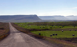
and fjord-side fields were dotted with plastic-covered hay bales (see left). South from Reykhˇlar:
after our relaxing couple of days enjoying the warm weather and bird-life at
peaceful Reykhˇlar, we returned around the Reykjanes peninsula coastline to
re-join the main Route 60 at Bjarkarlundar. It was another beautiful morning:
the sky was clear with bright sunshine, the valleys looked green against the
misty, stark, craggy mountains, and the fjord reflected the blue sky. Farmers
had been taking full advantage of the few days of fine weather for hay-making,
and fjord-side fields were dotted with plastic-covered hay bales (see left).
|
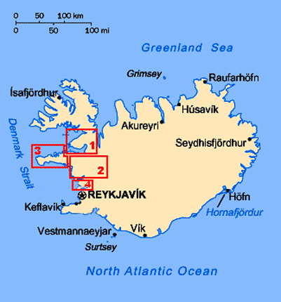
Click on the 4 highlighted areas of map
for
details of
SnŠfellsnes Peninsula |
 |
The White-Tailed Eagles Centre at Krˇksfjararnes:
there was little traffic as we drove around the coastal strip of Krˇksfj÷rur,
dropping down to the tiny settlement of Krˇksfjararnes (Click on Map 1 right). Just before the
village, the newly engineered Route 61 branched off along Gautsdalur towards
HolmavÝk, the route taken by all the Icelandic holiday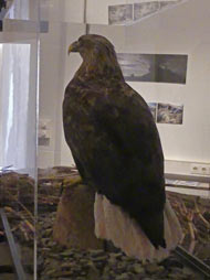 -making caravans from the
ReykjavÝk conurbation. We had seen reference to a White-Tailed Eagles
Centre in the Gamla KaupfÚlagsh˙si (Old Shop-house) at Krˇksfjararnes, but had
been unable to find any details. We turned off the main road into the scattered
village, found the old shop, and sure enough the sign in the window announced Arnarsetur Eagle Centre. The former village shop had closed, but had re-opened
as a community enterprise selling handicraft works, with locally made genuine
Icelandic sweaters (so much of the knitwear ubiquitously sold at enormous
expense to tourists are
far eastern imports). We were graciously welcomed, to be told that a local
person organised the displays and information panels about White-Tailed Eagles;
being now protected, these magnificent birds of prey are now nesting again in
ever greater numbers around Breiafj÷rur. -making caravans from the
ReykjavÝk conurbation. We had seen reference to a White-Tailed Eagles
Centre in the Gamla KaupfÚlagsh˙si (Old Shop-house) at Krˇksfjararnes, but had
been unable to find any details. We turned off the main road into the scattered
village, found the old shop, and sure enough the sign in the window announced Arnarsetur Eagle Centre. The former village shop had closed, but had re-opened
as a community enterprise selling handicraft works, with locally made genuine
Icelandic sweaters (so much of the knitwear ubiquitously sold at enormous
expense to tourists are
far eastern imports). We were graciously welcomed, to be told that a local
person organised the displays and information panels about White-Tailed Eagles;
being now protected, these magnificent birds of prey are now nesting again in
ever greater numbers around Breiafj÷rur.
We watched the video about White-Tailed Eagles; although only in Icelandic, we could follow the gist. With a wing span of
up to 2.5m, White-Tailed Eagles (known also as Sea Eagles) (see left) feed on both carrion
and hunt live prey, either fish or birds, mainly Eiders or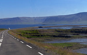 Fulmars; they are
non-migratory and pairs mate for life. This admirably unpretentious little
museum at Krˇksfjararnes, which charges only 250kr for admission, deserves
greater recognition. As we sat outside in the sunshine to eat our lunch
sandwiches after our visit. we chatted with the girl who had welcomed us; it
turned out she was German, who had come originally as a back-packing traveller,
and had stayed for the summer to work here at the handicraft shop. If you pass
this way en route to or from the West Fjords, make a point of stopping for
coffee and cakes at this worthy community venture. Fulmars; they are
non-migratory and pairs mate for life. This admirably unpretentious little
museum at Krˇksfjararnes, which charges only 250kr for admission, deserves
greater recognition. As we sat outside in the sunshine to eat our lunch
sandwiches after our visit. we chatted with the girl who had welcomed us; it
turned out she was German, who had come originally as a back-packing traveller,
and had stayed for the summer to work here at the handicraft shop. If you pass
this way en route to or from the West Fjords, make a point of stopping for
coffee and cakes at this worthy community venture.
South to B˙ardalur for provisions re-stock:
Route 60 crossed the mouth of Gilsfj÷rur on a 4kms long causeway (see right) and, amid
stately hills, climbed steadily up into the depths of Hvolsdalur, gaining height
to cross the Hˇlknaheii watershed, for the long descent of SvÝnadalur down to
 the shores of Hvammsfj÷rur, the innermost corner of the vast Breiafj÷rur, to reach the
large village of B˙ardalur (click
here for detailed map of route). Along the main road, we found a Samkaup-Strax
supermarket and filling station, for us to stock up with provisions at very
expensive prices and to re-fill George with diesel. This place was clearly
exploiting the tourist traffic and holiday-makers who pass along this main road. the shores of Hvammsfj÷rur, the innermost corner of the vast Breiafj÷rur, to reach the
large village of B˙ardalur (click
here for detailed map of route). Along the main road, we found a Samkaup-Strax
supermarket and filling station, for us to stock up with provisions at very
expensive prices and to re-fill George with diesel. This place was clearly
exploiting the tourist traffic and holiday-makers who pass along this main road.
EirÝksstair in Haukadalur:
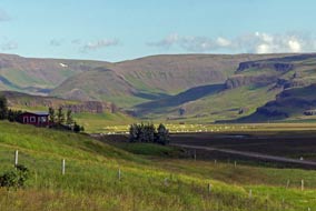
20kms south of B˙ardalur, we turned off into the broad, green farming valley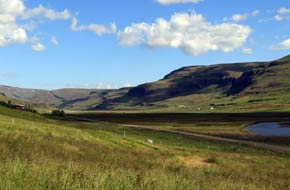 of
Haukadalur (see left and right), and 8 kms along the dale on a dusty dirt road we reached the site of
what has been interpreted from a tentative reference in one of the Sagas as EirÝksstair, the
farmstead of EirÝk the Red, father of Leifur EirÝksson. The Norse Viking, EirÝk
the Red (EirÝk Ůorvalsson 950~1003 AD) had, according to the Icelandic Book of
Settlements (the Landnßmabˇk), originally settled in Hornstrandir in the West
Fjords after his father had been exiled from his native Norway for murder. EirÝk
moved to Haukadalur after marrying into a land-owning family there. and built a farmstead which he named EirÝksstair. But, a violent and ill-tempered man,
he was exiled from Haukadalur after murdering several neighbours in a dispute.
He moved to SnŠfellsnes from where, after committing further acts of murder, he
was exiled again. With a shipload of comrades, he set sail westwards discovering
new lands where, of
Haukadalur (see left and right), and 8 kms along the dale on a dusty dirt road we reached the site of
what has been interpreted from a tentative reference in one of the Sagas as EirÝksstair, the
farmstead of EirÝk the Red, father of Leifur EirÝksson. The Norse Viking, EirÝk
the Red (EirÝk Ůorvalsson 950~1003 AD) had, according to the Icelandic Book of
Settlements (the Landnßmabˇk), originally settled in Hornstrandir in the West
Fjords after his father had been exiled from his native Norway for murder. EirÝk
moved to Haukadalur after marrying into a land-owning family there. and built a farmstead which he named EirÝksstair. But, a violent and ill-tempered man,
he was exiled from Haukadalur after murdering several neighbours in a dispute.
He moved to SnŠfellsnes from where, after committing further acts of murder, he
was exiled again. With a shipload of comrades, he set sail westwards discovering
new lands where,
 according to the Saga of the Greenlanders, he settled naming
the country Greenland to entice other settlers to follow. His son Leifur
EirÝksson, who had been born at EirÝksstair
around 980 AD and moved with his father to Greenland, set out also to sail
further westwards, discovering new lands in 1000 AD thought to be along the
Labrador coast of North America, which he named Markland (Forest Land). Sailing on, he reached more fertile lands
where wild vines are said by the Sagas to have grown; he accordingly named the
land Vinland. Leifur
EirÝksson attempted to establish a colony there, but this lasted for no
more than a generation. Among his fellow settlers in the New World were Ůorfinnur Karlsefni and GurÝur Ůorbjarnardˇttir, who according to the Saga of the Greenlanders, he settled naming
the country Greenland to entice other settlers to follow. His son Leifur
EirÝksson, who had been born at EirÝksstair
around 980 AD and moved with his father to Greenland, set out also to sail
further westwards, discovering new lands in 1000 AD thought to be along the
Labrador coast of North America, which he named Markland (Forest Land). Sailing on, he reached more fertile lands
where wild vines are said by the Sagas to have grown; he accordingly named the
land Vinland. Leifur
EirÝksson attempted to establish a colony there, but this lasted for no
more than a generation. Among his fellow settlers in the New World were Ůorfinnur Karlsefni and GurÝur Ůorbjarnardˇttir, who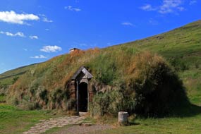 after the Vinland settlement's failure returned to Iceland in
the early years of the 11th century and settled at GlaumbŠr (See
log of our visit to GlaumbŠr); their infant
son Snorri Ůorfinnson was born at Vinland in 1003 AD becoming the first European born in
America, 500 years before Columbus re-discovered the continent. The unknown
location of Vinland remains a subject of speculation and controversy. after the Vinland settlement's failure returned to Iceland in
the early years of the 11th century and settled at GlaumbŠr (See
log of our visit to GlaumbŠr); their infant
son Snorri Ůorfinnson was born at Vinland in 1003 AD becoming the first European born in
America, 500 years before Columbus re-discovered the continent. The unknown
location of Vinland remains a subject of speculation and controversy.
Excavations at Haukadalur in the late 1990s
revealed a Viking era longhouse (skßli), and although there is no direct
evidence to link the site to EirÝk the Red, the place has been named EirÝksstair.
And the tourism industry rubbed its itchy hands with glee as the tourists
flocked in. We drove along the valley on the dusty dirt road past Haukadalsvatn
to reach the EirÝksstair parking area, large enough to accommodate a whole
fleet of tour buses. Up a hill-side path, past the over-stylised, twee statue of EirÝk
the Red standing at the prow of his long ship,
 we found the site of the
archaeological excavation. The view looking along the broad, fertile valley was
even more striking; you could understand why sea-born settlers had chosen this
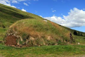
dale for their farmsteads. A modern replica of the turf-roofed long-house had
been constructed nearby (see above left and right) (Photo 1 - EirÝksstair reconstruction),
attended
by unconvincingly costumed modern-day 'Vikings',
one of whom had we had seen in the supermarket at B˙ardalur! This was clearly
little more than an over-priced tourist attraction and of little interest to us;
the unpretentious farmstead at GlaumbŠr (GlaumbŠr turf-walled farmstead museum)
was far more educative than the over-hyped imitation at EirÝksstair
with little evidence to support we found the site of the
archaeological excavation. The view looking along the broad, fertile valley was
even more striking; you could understand why sea-born settlers had chosen this
dale for their farmsteads. A modern replica of the turf-roofed long-house had
been constructed nearby (see above left and right) (Photo 1 - EirÝksstair reconstruction),
attended
by unconvincingly costumed modern-day 'Vikings',
one of whom had we had seen in the supermarket at B˙ardalur! This was clearly
little more than an over-priced tourist attraction and of little interest to us;
the unpretentious farmstead at GlaumbŠr (GlaumbŠr turf-walled farmstead museum)
was far more educative than the over-hyped imitation at EirÝksstair
with little evidence to support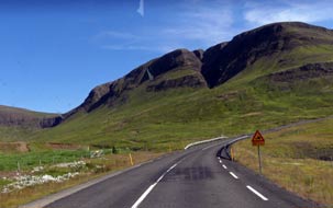 its tourist-focussed claim to links with EirÝk
the Red and Leifur EirÝksson. its tourist-focussed claim to links with EirÝk
the Red and Leifur EirÝksson.
South to re-join Route 1 Ring road: back along the valley, we continued south on Route 60 ,
with speeding Icelandic holiday-making traffic now increasing, and turned off at
one of the valley dairy farms, Erpsstair, to sample its renowned home-made
ice-cream (see left). Route 60 now climbed lustily over a high pass, amid
spectacular mountain terrain (see right) (click
here for detailed map of route), to descend the long, steep southern side passing
an impressive gorge carved out by the river torrent dropping from the
watershed. This long descent brought us down regrettably to re-join Route 1 Ring
Road, which we had left 3 weeks ago at Bru. ReykjavÝk-bound traffic now became
horribly oppressive, with equally stressful driving standards. It was thoroughly
unpleasant, and will from now only get worse as we approach the capital. As we
turned south onto the Ring Road, the nature of the terrain changed suddenly from
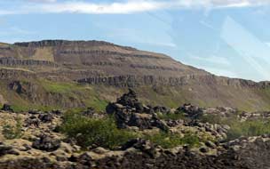
green, rolling hills to the volcanic lava fields of Grßbrˇkarhraun (see below left), with an evident
ash-cone by the road side. 10 kms further and the lava field
ended equally suddenly as we approached the turn-off onto Route 50.
 A
miserably crowded and noisy stay at the dreadful Varmaland Camping:
crossing the salmon-rich wide River Norurß, we turned off to find tonight's campsite at Varmaland, a huge geothermal swimming pool with attached so-called 'campsite'.
Being relatively close to ReykjavÝk, this was A
miserably crowded and noisy stay at the dreadful Varmaland Camping:
crossing the salmon-rich wide River Norurß, we turned off to find tonight's campsite at Varmaland, a huge geothermal swimming pool with attached so-called 'campsite'.
Being relatively close to ReykjavÝk, this was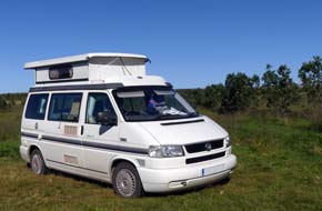 bound to attract holiday-making
crowds from the conurbation. We had little expectations of the place, but it was
even worse than we could have conceived: it was nothing more than an enormous
rough field alongside the swimming pool complex, crammed full of caravans and
luxury trailer-tents, the sort of fun-loving, materialistically-minded, rowdy
folk we should normally run a million miles to escape from, except that for
tonight there was no such escape. This was the only place to camp in the
vicinity, and we just about managed to find a reasonably quiet spot in the far
corner looking out across farmland to a distant horizon of volcanic mountains
(see right).
With heavy hearts we settled in. There was of course no power supplies in this
corner and the distant facilities were limited to WC and a geothermally heated
wash-up sink. Even so, with a captive audience of such massed holiday-makers,
prices were appallingly expensive, but at least the Camping Card was accepted.
But there would be little peace, despite having tent campers as near neighbours.
On a fine, sunny evening we cooked a barbecue supper, and tonight we had just
turned in and got off to sleep when we were wakened by noisy late arrivals
thoughtlessly slamming car doors, until our robust protests caused them to move.
The following morning was hot
 and sunny and we sat out for breakfast behind
George, out of view of the rowdy hordes. We managed to get a limited wash at the
basic facilities, and were glad to get away from this hideous place and the even
more hideous holiday-makers. and sunny and we sat out for breakfast behind
George, out of view of the rowdy hordes. We managed to get a limited wash at the
basic facilities, and were glad to get away from this hideous place and the even
more hideous holiday-makers.
 Deildartunguhver
geothermal source in Borgarfj÷rur: on a
beautifully sunny morning, driving inland across the rolling fertile farmlands
of lower Borgarfj÷rur (click
here for detailed map of route), we could see several steaming geothermal sources dotted across the landscape, and turned off
to Deildartunguhver, Europe's most prolific hot spring. This enormous geothermal
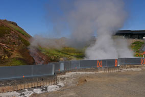
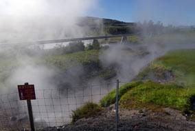
source pumps out 180 litres/second of boiling water (see left), which is conveyed by
insulated pipeline to heat the houses of Akranes 64kms distant and Borgarnes 34kms. We parked by the source but there was now little to see other than the
building works covering the spring outpourings together with the huge clouds of
steam billowing above the splashing boiling water and the start of the pipeline
(Photo 2 - Deildartunguhver geothermal pipeline)
(see right).
The geothermal source is also used to heat nearby market garden green houses growing
vegetables, and we
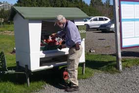
bought a bag of locally grown geothermal tomatoes from a stall (see below left). Deildartunguhver
geothermal source in Borgarfj÷rur: on a
beautifully sunny morning, driving inland across the rolling fertile farmlands
of lower Borgarfj÷rur (click
here for detailed map of route), we could see several steaming geothermal sources dotted across the landscape, and turned off
to Deildartunguhver, Europe's most prolific hot spring. This enormous geothermal
source pumps out 180 litres/second of boiling water (see left), which is conveyed by
insulated pipeline to heat the houses of Akranes 64kms distant and Borgarnes 34kms. We parked by the source but there was now little to see other than the
building works covering the spring outpourings together with the huge clouds of
steam billowing above the splashing boiling water and the start of the pipeline
(Photo 2 - Deildartunguhver geothermal pipeline)
(see right).
The geothermal source is also used to heat nearby market garden green houses growing
vegetables, and we
bought a bag of locally grown geothermal tomatoes from a stall (see below left).
 Reykholt, the farmstead of Snorri Sturluson: 5kms along Route 518 we reached Reykholt, site of
the farmstead estate of Iceland's renowned medieval clan-chieftain (goar),
politician and poet, Snorri Sturluson (1179~1241). Born into the wealthy
land-owning Sturlung family, one of the powerful clans whose feuding wracked
medieval Iceland, Snorri was educated at the cultural centre of Oddi in Reykholt, the farmstead of Snorri Sturluson: 5kms along Route 518 we reached Reykholt, site of
the farmstead estate of Iceland's renowned medieval clan-chieftain (goar),
politician and poet, Snorri Sturluson (1179~1241). Born into the wealthy
land-owning Sturlung family, one of the powerful clans whose feuding wracked
medieval Iceland, Snorri was educated at the cultural centre of Oddi in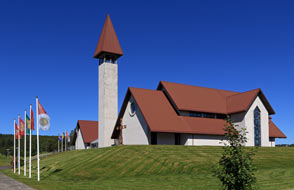 Southern
Iceland; he married into a wealthy land-owning family at Borg ß Mřrum near
Borgarnes so acquiring wealth and property. He later settled at the church centre
of Reykholt in Borgarfj÷rur, building up the estate, consolidating his grip
on power and wealth, and becoming goar (chieftain) of the Sturlung clan
and in 1215 Lawspeaker of the Al■ing, the Assembly of the Icelandic
Commonwealth. While at Reykholt, Snorri composed his famous Saga works, the
Prose Edda an account of Norse Mythology, Egil's Saga a history of the Viking
Skald court-poet Egil Skallagrimsson, and the Heimskringla a history of the
Kings of Norway. His position of power brought him into contact with King Hßkon
of Norway whose vassal Snorri became. In 1218 he travelled to the Cathedral city
of Nidaros (Trondheim) and the Norwegian court of the teenage King Hßkon at
Bergen, also forming a friendship with Jarl (Earl) Sk˙li, Hßkon's co-regent and
rival for the throne of Norway. Medieval power politics were however a changing
game: Hßkon was playing off the Icelandic clan chieftains against one another to
enhance his hold on power and extend his realm to Iceland. As Lawspeaker, Snorri
fell foul of this and was suborned by King Hßkon to persuade the Southern
Iceland; he married into a wealthy land-owning family at Borg ß Mřrum near
Borgarnes so acquiring wealth and property. He later settled at the church centre
of Reykholt in Borgarfj÷rur, building up the estate, consolidating his grip
on power and wealth, and becoming goar (chieftain) of the Sturlung clan
and in 1215 Lawspeaker of the Al■ing, the Assembly of the Icelandic
Commonwealth. While at Reykholt, Snorri composed his famous Saga works, the
Prose Edda an account of Norse Mythology, Egil's Saga a history of the Viking
Skald court-poet Egil Skallagrimsson, and the Heimskringla a history of the
Kings of Norway. His position of power brought him into contact with King Hßkon
of Norway whose vassal Snorri became. In 1218 he travelled to the Cathedral city
of Nidaros (Trondheim) and the Norwegian court of the teenage King Hßkon at
Bergen, also forming a friendship with Jarl (Earl) Sk˙li, Hßkon's co-regent and
rival for the throne of Norway. Medieval power politics were however a changing
game: Hßkon was playing off the Icelandic clan chieftains against one another to
enhance his hold on power and extend his realm to Iceland. As Lawspeaker, Snorri
fell foul of this and was suborned by King Hßkon to persuade the
 Al■ing to
accept Norwegian suzerainty. On his return to Iceland in 1220, he resumed his
duties as Lawspeaker of the Al■ing, but his support for Norway's cause brought
opposition from the other chieftains; the rise to power of Snorri's opponents
resulted in several years of violent clan feuding. By 1237 Snorri was forced to
seek refuge in Norway and he returned to Hßkon's court. But the power rivalry
there between the King and Jarl Sk˙li had erupted Al■ing to
accept Norwegian suzerainty. On his return to Iceland in 1220, he resumed his
duties as Lawspeaker of the Al■ing, but his support for Norway's cause brought
opposition from the other chieftains; the rise to power of Snorri's opponents
resulted in several years of violent clan feuding. By 1237 Snorri was forced to
seek refuge in Norway and he returned to Hßkon's court. But the power rivalry
there between the King and Jarl Sk˙li had erupted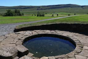 into open civil war; because
of Snorri's support for Sk˙li in his unsuccessful bid for royal power, Hßkon
forbade Snorri to leave Norway; Snorri disobeyed this command and sailed back to
Iceland in 1239. Hßkon charged one of Snorri's rival clan chieftains, Gissur
Ůorvalsson, to bring him back dead or alive. Gissur led a band of 70 armed men
to Reykholt, and Snorri was hacked to death in 1241. Hßkon continued suborning
the clan chieftains of Iceland, and in 1262, the Al■ing finally ratified union with
Norway; royal authority was instituted in Iceland, so bringing to an end the Commonwealth
which had ruled Iceland since 980 AD and the Settlement. into open civil war; because
of Snorri's support for Sk˙li in his unsuccessful bid for royal power, Hßkon
forbade Snorri to leave Norway; Snorri disobeyed this command and sailed back to
Iceland in 1239. Hßkon charged one of Snorri's rival clan chieftains, Gissur
Ůorvalsson, to bring him back dead or alive. Gissur led a band of 70 armed men
to Reykholt, and Snorri was hacked to death in 1241. Hßkon continued suborning
the clan chieftains of Iceland, and in 1262, the Al■ing finally ratified union with
Norway; royal authority was instituted in Iceland, so bringing to an end the Commonwealth
which had ruled Iceland since 980 AD and the Settlement.
Set in the broad, open farming valley of
Reykholtsdalur, Reykholt is now a quiet and unassuming cultural centre of
medieval Icelandic studies, the Snorrastofa, with a modern church and exhibition
on the life and works of Snorri Sturluson. We had expected it also to attract
hordes of visitors, but were amazed to find it quiet with just a few cars in the
parking area. Uncertain how superficial or informative the Snorrastofa
exhibition would be, we paid our seniors' admission of 1,000kr and viewed the
presentations. In fact they gave a well-documented account, with full English
translations, not only of Snorri's life, rise to power and his extensive
literary output, but also of power politics in medieval Norway and Iceland, and
the feuding of the Icelandic clan goar which led ultimately to the end
of the Commonwealth and absorption into the Norwegian realm. The weather was now
unbelievably hot with temperature around 23║C. We walked around the landscaped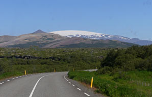 estate and found the pool fed by a hot spring, the Snorralaug, where Snorri is
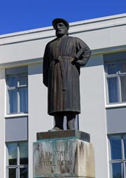
said to have bathed; a modern statue appeared to show him wearing
 his dressing
gown, perhaps just having got out of the Snorralaug (see above left). And nearby was the entrance to the tunnel leading to his
farm where he was murdered by Gissur's assassins. his dressing
gown, perhaps just having got out of the Snorralaug (see above left). And nearby was the entrance to the tunnel leading to his
farm where he was murdered by Gissur's assassins.
The Hraunfossar and Barnafoss Waterfalls on
the glacial HvÝtß River:
we continued eastwards on Route 518 (click
here for detailed map of route) with the road rising over higher pasture
land to drop down into the neighbouring upper valley of the glacial HvÝtß River
whose sources rise in the Langj÷kull Glacier. Inland the distant view was dominated by high mountains and the
massive ice-fields of Langj÷kull (see right). 5 kms deeper into the Borgarfj÷rur valley past
several farms, we pulled into a lay-by to visit the waterfalls on the
fast-flowing HvÝtß River. But so also, it seemed, had half of the million tourists
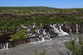
who swarm to Iceland each summer! Viewing platforms gave direct vista over the Hraunfossar
(meaning literally Lava Waterfalls), a series of cascades almost 1 km in
length, where surface water and melt-water draining from Langj÷kull percolate
down through the Hallmundarhraun lava field to emerge from under the leading
edge of the deep surface layer of lava, tumbling down in cascades over the
moss-covered series of bed-rock steps into the passing HvÝtß River (see above
left) (Photo 3 - Hraunfossar cascading from under lava field). The bright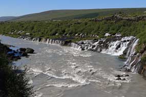 turquoise cascades pouring
 out from under the lava contrasted in colour with the
murky grey glacial silt-laden river. The Hallmundarhraun resulted from a
volcanic eruption under the NW edge of Langj÷kull around 930 AD, the time of the
first recorded Settlement of Iceland, which flowed westwards along
valleys to form a massive lava field covering an area of some 242 square kms
bordering on the HvÝtß River. The Hraunfossar made a unique sight with the long
lateral series of cascades pouring from under the base of the depth of lava
which overlays the lower strata of harder, more impervious bed-rock bordering the river's far bank (Photo 4 - Hraunfossar). out from under the lava contrasted in colour with the
murky grey glacial silt-laden river. The Hallmundarhraun resulted from a
volcanic eruption under the NW edge of Langj÷kull around 930 AD, the time of the
first recorded Settlement of Iceland, which flowed westwards along
valleys to form a massive lava field covering an area of some 242 square kms
bordering on the HvÝtß River. The Hraunfossar made a unique sight with the long
lateral series of cascades pouring from under the base of the depth of lava
which overlays the lower strata of harder, more impervious bed-rock bordering the river's far bank (Photo 4 - Hraunfossar).
Paths led along to another set of falls on the
river's main course, where the fast-flowing, silt-laden glacial river has carved
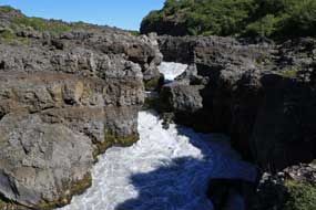
out a deep, winding canyon in the lava (see below right). Barnafoss (meaning Children's Falls)
takes its name from 2 children from a nearby farm who drowned here while
crossing a natural rock-bridge above the falls. Barnafoss drops into the winding
lava canyon in a series of falls (see left) (Photo 5 - Barnafoss Falls) where the power of the water has cut
rock-bridge arches under which the surging torrent now flows in the base of the
falls. A platform gave perfect views upstream along the length of the canyon of
grey-black
lava to the falls (Photo
6 - Barnafoss), and a footbridge spanning the river gorge crossed onto the
lava field on the far side for further downstream views along the silt-grey HvÝtß and the
length of Hraunfossar cascading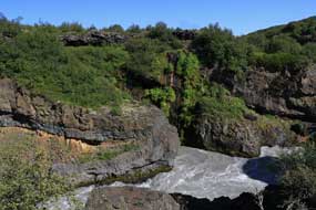 from from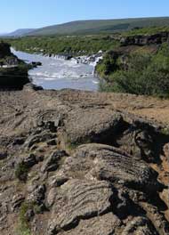 under the lava field
(see above right) (Photo
7 - Downstream view of Hraunfossar). Clambering up onto
the lava gave an astonishing vista of the full extent of the Hallmundarhraun
lava field stretching away into the distance, covered with Woolly Hair Moss and birch
scrub. The bright sunlight lit beautiful patches of Pahoe-hoe basaltic lava flow,
picking out the pronounced detailed patterning of the lava's smooth, undulating, ropy
surface texture (Photo
8 - Pahoe-hoe lava-flow) (see left). Pahoe-hoe lava-flows are associated
with low-effusion rate eruptions; the low flow-velocity of Pahoe-hoe lava's advance means that the skin
formed by air-cooling is not disrupted during flow and can therefore maintain its smooth,
unbroken, well-insulating surface. This contrasts with the other major type of
basaltic lava-flow, given the Hawaiian name of A'a. A'a lava-flows are
characterised by their rough, knobbly surface composed of
fragments of clinker-rubble, formed as
pasty lava is pulled apart by shearing and twisting during A'a lava's
rapid advance, as distinct from Pahoe-hoe
lava-flow's smooth, ropy surface texture (Photo
9 - Ropy textured Pahoe-hoe). The basaltic chemical composition of
the 2 types of lava (Pahoe-hoe and A'a) is the same; the difference in their
physical form reflects different lava-flow dynamics (see below right). under the lava field
(see above right) (Photo
7 - Downstream view of Hraunfossar). Clambering up onto
the lava gave an astonishing vista of the full extent of the Hallmundarhraun
lava field stretching away into the distance, covered with Woolly Hair Moss and birch
scrub. The bright sunlight lit beautiful patches of Pahoe-hoe basaltic lava flow,
picking out the pronounced detailed patterning of the lava's smooth, undulating, ropy
surface texture (Photo
8 - Pahoe-hoe lava-flow) (see left). Pahoe-hoe lava-flows are associated
with low-effusion rate eruptions; the low flow-velocity of Pahoe-hoe lava's advance means that the skin
formed by air-cooling is not disrupted during flow and can therefore maintain its smooth,
unbroken, well-insulating surface. This contrasts with the other major type of
basaltic lava-flow, given the Hawaiian name of A'a. A'a lava-flows are
characterised by their rough, knobbly surface composed of
fragments of clinker-rubble, formed as
pasty lava is pulled apart by shearing and twisting during A'a lava's
rapid advance, as distinct from Pahoe-hoe
lava-flow's smooth, ropy surface texture (Photo
9 - Ropy textured Pahoe-hoe). The basaltic chemical composition of
the 2 types of lava (Pahoe-hoe and A'a) is the same; the difference in their
physical form reflects different lava-flow dynamics (see below right).
A wild camp in Upper Borgarfj÷rur:
we still needed to find somewhere acceptable to camp tonight; it was out of the
question to consider returning to Varmaland to camp. We therefore continued
further into Upper Borgarfj÷rur valley to investigate potential wild camp spots
(click
here for detailed map of route), documented for us by fellow travellers
Kathy and Rick Howe from California (read the Howes'
excellent 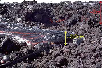 Travelin' Tortuga Icelandic travelogues on their web site
Icelandic Sagas
and
Land of the Sideways Sun).
A couple of kms eastwards beyond Barnafoss, a rough gravelly area of lava was
just about accessible from the road but was also very open and exposed. We
therefore continued for a further 5kms to H˙safell Camping, but this was both
obscenely expensive and even more overcrowded with Icelandic holiday-makers than
Varmaland; even its web site publicity photographs were enough to repel! We Travelin' Tortuga Icelandic travelogues on their web site
Icelandic Sagas
and
Land of the Sideways Sun).
A couple of kms eastwards beyond Barnafoss, a rough gravelly area of lava was
just about accessible from the road but was also very open and exposed. We
therefore continued for a further 5kms to H˙safell Camping, but this was both
obscenely expensive and even more overcrowded with Icelandic holiday-makers than
Varmaland; even its web site publicity photographs were enough to repel! We
 moved on, still with no where identified to camp tonight. Our guide books
suggested Fljˇtstunga Farm offered camping, located in remote wild country 6kms
beyond the end of the tarmaced Route 518, on a single-track dirt road across the
Hallmundarhraun lava field on the far side of the upper HvÝtß River. The remote
VÝgelmir lava cave and Surtshellir lava tube were both on Fljˇtstunga Farm's
property, and the farm organised tours of the caves. We set off, and just beyond
H˙safell where Route 518 passed through an area of birch scrub, we chanced upon a
lay-by, sheltered from the road by birch woodland; here was a potential wild
camp spot if all else failed. Just beyond, we reached the road junction where
the tarmac ended and Route 550 mountain road branched off southwards across the
remote interior towards Thingvellir. moved on, still with no where identified to camp tonight. Our guide books
suggested Fljˇtstunga Farm offered camping, located in remote wild country 6kms
beyond the end of the tarmaced Route 518, on a single-track dirt road across the
Hallmundarhraun lava field on the far side of the upper HvÝtß River. The remote
VÝgelmir lava cave and Surtshellir lava tube were both on Fljˇtstunga Farm's
property, and the farm organised tours of the caves. We set off, and just beyond
H˙safell where Route 518 passed through an area of birch scrub, we chanced upon a
lay-by, sheltered from the road by birch woodland; here was a potential wild
camp spot if all else failed. Just beyond, we reached the road junction where
the tarmac ended and Route 550 mountain road branched off southwards across the
remote interior towards Thingvellir.
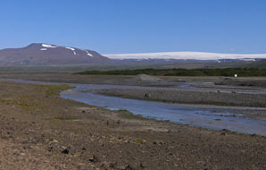
Route 518 continued ahead as a single-track dirt
road crossing the upper reaches of the grey silt-laden HvÝtß, which here flowed
in shallow, winding meanders across the lava wilderness of Geitlandshraun with
the imposing snow-white mountainous massif of Langj÷kull filling the eastern
horizon
(Photo
10 - HvÝtß River, Geitlandsrhaun lava field and Langj÷kull) (see above
left). Even in bright afternoon sunlight, it was a fearfully staggering vista.
The dirt road crossed the dusty lava wasteland, running alongside an
ochre-coloured scoria ridge (see left), and on the far side climbed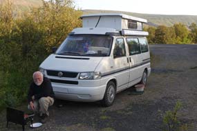
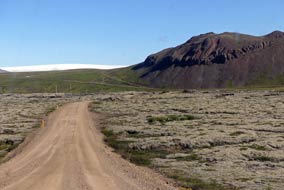 steeply to cross the
ridge; this descended even more steeply of the far side into a further desolate
valley filled with the moss-covered Hallmundarhraun lava field. The rough road
turned to cross a tributary of the HvÝtß, cutting across the lava field to reach
the turning to Fljˇtstunga Farm up on the hill-side. It was a remote and
isolated spot, but heart-sink: the camping symbol on Fljˇtstunga's sign was
crossed out. We tried unsuccessfully to phone, but the number was no longer in
use. We drove up, to be met by a security man who said we were 2 years too late;
the place had changed hands and no longer offered accommodation or camping! steeply to cross the
ridge; this descended even more steeply of the far side into a further desolate
valley filled with the moss-covered Hallmundarhraun lava field. The rough road
turned to cross a tributary of the HvÝtß, cutting across the lava field to reach
the turning to Fljˇtstunga Farm up on the hill-side. It was a remote and
isolated spot, but heart-sink: the camping symbol on Fljˇtstunga's sign was
crossed out. We tried unsuccessfully to phone, but the number was no longer in
use. We drove up, to be met by a security man who said we were 2 years too late;
the place had changed hands and no longer offered accommodation or camping!
Disappointed, we returned across the lava field
and over the ridge down to the bleak HvÝtß valley, pausing to photograph the
magnificent view looking up to Langj÷kull. Back to the junction with Route 550,
we returned along the tarmac lane and turned into the birch-wooded lay-by as our
wild camp spot for tonight. Largely hidden from the lane and the occasional
passing traffic, with plenty of cover from the dense birch woods, we set up camp
(see below left) (Photo
11 - Upper Borgarfj÷rur Wild camp) and lit the barbecue for supper (see right). Despite failing to find camping out at Fljˇtstunga, the drive out there had given opportunity to explore the wilds of
the upper HvÝtß valley with its views of Langj÷kull and the extensive reaches of
the Hallmundarhraun and Geitlandshraun lava fields. Despite fears of being disturbed by
late-arriving tourist cars pulling into the lay-by, we slept through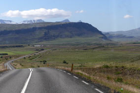
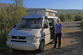 without
disturbance, and woke to a cloudier, cooler morning. without
disturbance, and woke to a cloudier, cooler morning.
The lower Borgarfj÷rur valley to Borgarnes:
as we returned down the valley, Hraunfossar and Barnafoss were already swarming
with tourists. Beyond Reykholt, we turned off on the more southerly Route 53
across broad open farming country of the lower HvÝtß and its meandering
tributary, the GrÝmsß, towards Borgarnes (click
here for detailed map of route). The southern aspect of the valley was
dominated by the shapely, craggy peaks of Hafnarfjall and Hrossatunga, outlying
crests of the Skarsheii range (see right). The road ran alongside these peaks to approach
the junction of the Ring Road (see below left). In busy traffic coming up from ReykjavÝk, we
crossed the 3kms wide bridge over the open mouth of Borgarfj÷rur, where the now
brisk NE wind was whipping up vicious looking turbulence. A modern commercial
centre now sprawled along the Ring Road at the outskirts of Borgarnes, with
filling stations, supermarkets, tourist-oriented consumer shops and banks. We
pulled in here and stocked up with 4 days' provisions and used the ATM for cash.
Having come this morning from the peaceful remoteness of the Upper HvÝtßdalur
valley down to this modern world materialism, it felt as if we had suddenly been
pitched into a different universe!
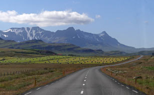 A blustery day in camp at Snorrastair:
thankful to be leaving all this behind, we headed north on the Ring Road in
heavy traffic, and even more thankfully turned off onto Route 54 towards SnŠfellsnes
(click
here for detailed map of route). In a A blustery day in camp at Snorrastair:
thankful to be leaving all this behind, we headed north on the Ring Road in
heavy traffic, and even more thankfully turned off onto Route 54 towards SnŠfellsnes
(click
here for detailed map of route). In a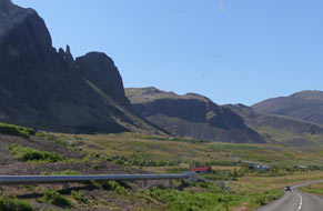 couple of kms, we reached the tiny
hamlet of Borg ß Mřrum, and paused at the tiny church by the historic farm where
the father of Egil Skallagrimsson, hero of Egil's Saga, had first settled and
which Snorri Sturluson later acquired by marriage. We continued across the rough
pasture land which was criss-crossed with basalt outcrops and distant volcanic
peaks, and beyond the ┴lftßrhraun lava field, eventually reached the turning to
Snorrastair Farm, the first of tonight's campsite options. 2 kms along the
farm's driveway, the little campsite looked empty and inviting. This was the
start-point for the walk across the Eldborgarhraun lava field to climb the scoria
cone of the Eldborg Crater. We had been undecided between the campsite at
Snorrastair Farm and our other option at the Eldborg Hotel a little further
north which was a Camping Card site. We phoned Eldborg for more information; the
person answering assured us it was not busy, but it was another of those sites
with showers at the neighbouring swimming pool charged extra at an expensive
700kr. The lady at the farmhouse confirmed the Snorrastair price was 2,500kr
all-inclusive of showers, kitchen and wi-fi. That decided it; we should stay
here at Snorrastair Farm. couple of kms, we reached the tiny
hamlet of Borg ß Mřrum, and paused at the tiny church by the historic farm where
the father of Egil Skallagrimsson, hero of Egil's Saga, had first settled and
which Snorri Sturluson later acquired by marriage. We continued across the rough
pasture land which was criss-crossed with basalt outcrops and distant volcanic
peaks, and beyond the ┴lftßrhraun lava field, eventually reached the turning to
Snorrastair Farm, the first of tonight's campsite options. 2 kms along the
farm's driveway, the little campsite looked empty and inviting. This was the
start-point for the walk across the Eldborgarhraun lava field to climb the scoria
cone of the Eldborg Crater. We had been undecided between the campsite at
Snorrastair Farm and our other option at the Eldborg Hotel a little further
north which was a Camping Card site. We phoned Eldborg for more information; the
person answering assured us it was not busy, but it was another of those sites
with showers at the neighbouring swimming pool charged extra at an expensive
700kr. The lady at the farmhouse confirmed the Snorrastair price was 2,500kr
all-inclusive of showers, kitchen and wi-fi. That decided it; we should stay
here at Snorrastair Farm.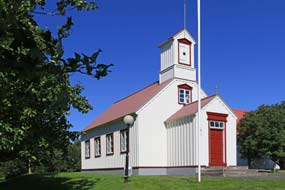
Even inland at H˙safell this morning, the wind
had increased, and
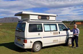 at Borgarnes it was whipping up a swell on the fjord; but out
here on the high, flat coastal plain exposed to the full force of winds blowing
straight off the North Atlantic, a 10 m/s gale was forcefully blowing from the
NE. There was absolutely no shelter or wind-break on the open, flat turfed
camping area, and the old barn converted for facilities served to give no
shelter from the gale blowing from the NE. With some difficulty struggling
against the force of the wind, we pitched with George faced into the gale (see
right) (Photo
12 - Snorrastair Farm-Camping), and
once inside out of the wind, the sun was warm. Quite remarkably,
we initially had the campsite almost to ourselves, but as we prepared supper, more
arrivals began, all clustering around us trying to shelter from the wind.
Clearly these inexperienced tourists in hire cars had no idea of checking wind
direction before trying to pitch their tents; they simply would not believe our
attempts to demonstrate that the wind direction was from the NE, and that trying
to huddle around the facilities barn would offer no shelter. Why not pitch your
tent in the lee of your car, we suggested. But no. Eventually giving up the
struggle against the force of the NE gale, they moved on! Late in the evening,
the sun declined to the NW, giving us chance for at Borgarnes it was whipping up a swell on the fjord; but out
here on the high, flat coastal plain exposed to the full force of winds blowing
straight off the North Atlantic, a 10 m/s gale was forcefully blowing from the
NE. There was absolutely no shelter or wind-break on the open, flat turfed
camping area, and the old barn converted for facilities served to give no
shelter from the gale blowing from the NE. With some difficulty struggling
against the force of the wind, we pitched with George faced into the gale (see
right) (Photo
12 - Snorrastair Farm-Camping), and
once inside out of the wind, the sun was warm. Quite remarkably,
we initially had the campsite almost to ourselves, but as we prepared supper, more
arrivals began, all clustering around us trying to shelter from the wind.
Clearly these inexperienced tourists in hire cars had no idea of checking wind
direction before trying to pitch their tents; they simply would not believe our
attempts to demonstrate that the wind direction was from the NE, and that trying
to huddle around the facilities barn would offer no shelter. Why not pitch your
tent in the lee of your car, we suggested. But no. Eventually giving up the
struggle against the force of the NE gale, they moved on! Late in the evening,
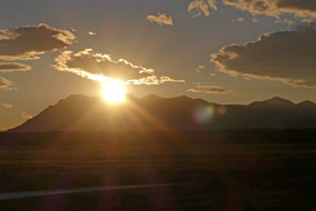
the sun declined to the NW, giving us chance for
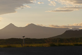 some glorious late sun
photographs against the silhouetted peaks of SnŠfellsnes
(Photo
13 - SnŠfellsnes sunset) (see below left and right). We battened down for a
rough night of blustery wind. some glorious late sun
photographs against the silhouetted peaks of SnŠfellsnes
(Photo
13 - SnŠfellsnes sunset) (see below left and right). We battened down for a
rough night of blustery wind.
 It was indeed a rough night, and this morning
dawned heavily overcast with a brisk NE wind still blowing at 10 m/s. The
forecast confirmed the decision to take a day in camp here today, and to climb
the Eldborg Carter tomorrow when the wind speed would be less. The weather
remained largely overcast all day and the gusting NE wind scarcely lessoned. Snorrastair had proved a good choice of campsite for a rest day, with its full
facilities, albeit straightforward, particularly the welcome relief of showers
which were becoming something of a rarity! The site-wide wi-fi was also a
welcome addition, and with its very reasonable all-inclusive price, Snorrastair
merited a +4 rating. It was indeed a rough night, and this morning
dawned heavily overcast with a brisk NE wind still blowing at 10 m/s. The
forecast confirmed the decision to take a day in camp here today, and to climb
the Eldborg Carter tomorrow when the wind speed would be less. The weather
remained largely overcast all day and the gusting NE wind scarcely lessoned. Snorrastair had proved a good choice of campsite for a rest day, with its full
facilities, albeit straightforward, particularly the welcome relief of showers
which were becoming something of a rarity! The site-wide wi-fi was also a
welcome addition, and with its very reasonable all-inclusive price, Snorrastair
merited a +4 rating.
The Eldborg scoria cone crater: the
gales continued all night, buffeting George, with no let up now forecast for
today's walk across Eldborgarhraun lava field and climb of the Eldborg (meaning
Fire Castle) scoria cone crater. The walk began on a clear path following
the Kaldß River past the home pastures of Snorrastair Farm, to reach the edge
of Eldborgarhraun lava field.
 This covers an area of some 32 square kms and had
spread from eruptions some 5,000~8,000 years ago from a short SW~NE fissure. The Eldborg scoria spatter cone, exceptionally symmetrical in shape, formed during
an eruption from a circular vent
along the fissure that had caused the lava field. Regular crater walls built up
around the vent in thin layers of lava, forming a narrow edge all around the
conical scoria crater, which now This covers an area of some 32 square kms and had
spread from eruptions some 5,000~8,000 years ago from a short SW~NE fissure. The Eldborg scoria spatter cone, exceptionally symmetrical in shape, formed during
an eruption from a circular vent
along the fissure that had caused the lava field. Regular crater walls built up
around the vent in thin layers of lava, forming a narrow edge all around the
conical scoria crater, which now stands 60m above the surrounding lava field,
slightly oval in shape, 200m in diameter and 50m deep inside. stands 60m above the surrounding lava field,
slightly oval in shape, 200m in diameter and 50m deep inside.
The path turned way from the river and threaded
a way through the dense and otherwise impenetrable birch scrub vegetation
which now covers the lava field, with a ground cover of Bilberry, Crowberry and
Bearberry. The birch scrub stood head height, meaning that the cone crater only
occasionally came into view as the path rose across higher areas of lava (see
left). The
path wound a way for some 3kms through this maze of impenetrable birch scrub,
reaching a mini-crater slightly apart from the older main Eldborg crater, and
built up of scoria clinker rubble. This was the site of a second and younger,
smaller and perhaps more explosive eruption resulting in A'a lava, the other
major type of basaltic lava-flow. There was now a clear view ahead of the main
Eldborg crater, the walls of which looked formidably vertical, rising 60m above
the surrounding birch scrub-covered lava. But we could make out a clear path
rising diagonally across the near walls, and figures standing on the crater rim
way above (see above left)
(Photo
14 - Eldborg Crater). The path now passed the mini-crater, and climbed steps cut into
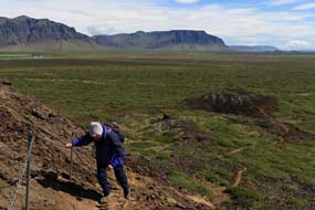 the
lava to cross a less distinct subsidiary crater where ropy patterned Pahoe-hoe
lava-flows were more evident (Photo
15 - Pahoe-hoe lava flow) (see above right). The wind was now blowing more strongly, at times
making it difficult to maintain balance. We had been well-sheltered crossing the
main lava field among the birch scrub. the
lava to cross a less distinct subsidiary crater where ropy patterned Pahoe-hoe
lava-flows were more evident (Photo
15 - Pahoe-hoe lava flow) (see above right). The wind was now blowing more strongly, at times
making it difficult to maintain balance. We had been well-sheltered crossing the
main lava field among the birch scrub.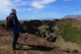
We now reached the foot of the main crater
wall. Steps cut into the lava helped to climb the lower part, then a safety
chain gave some security to haul up the much steeper higher sections. The
sharply angular projections of lava gave good footing, but the main path was
warm smooth by the 100s who daily scale this route up to the crater's rim (Photo
16 - Climbing Eldborg Crater) (see left). With
the aid of the safety chain, we scrambled a way up to emerge onto the crater
rim, no more than 2 m wide, to stand gazing down into the deep abyss of the
crater whose inner walls dropped sheer into its depths (Photo
17 - Crater rim) (see right). The jagged, brittle
summit wall around Eldborg's 200m diameter oval crater rim were now sealed off
as a safety measure, but the distant views across the crater's lava walls
looking over nearer mountains towards the
peak of SnŠfellsnes crowned by its glacier were simply magnificent (see below
left) (Photo
18 - SnŠfellsnes glacier). We stood now alone taking our photographs
across the gulf of the crater with its lava walls (see left)
Photo 19 - Eldborg Crater rim),
then
gingerly
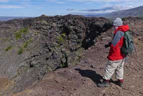 began the steep descent, thankful for the security of the safety chain.
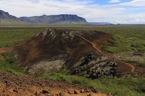
Edging our way down, we reached the foot of what had felt the near-vertical cone
wall, here able to stand to admire the view looking down over the subsidiary crater
below and the separate mini-crater set further over (see below right) (Photo
20 - Subsidiary craters). began the steep descent, thankful for the security of the safety chain.
Edging our way down, we reached the foot of what had felt the near-vertical cone
wall, here able to stand to admire the view looking down over the subsidiary crater
below and the separate mini-crater set further over (see below right) (Photo
20 - Subsidiary craters).
 Back across the side of the scoria subsidiary crater
down to a paths junction, we cut across on a side-path and up the slope of
scoria clinkers making up the smaller cone. This provided a vividly marked
contrast between the slow-moving Pahoe-hoe lava-flows that had accumulated
around the eruption and had built up to create Eldborg's cone; while here at the
separate and later mini-crater, the cone was formed of loose, small pieces of
rubble and airy, light pumice clinker, associated with classic A'a lava-flow. We climbed
the slope to the crater rim for the views looking back across the subsidiary crater to
the main Eldborg cone (Photo
21 - A'a lava) (see below right). Regaining the main path, we began the long return walk
through the birch scrub-covered Eldborgarhraun lava field (see below left), which at least gave
some shelter from the wind that had increased in intensity. Back at George, the
wind made it difficult to open the doors without risk of slamming. We settled up
with the farmer's wife and asked about the lava field; it was part of Snorrastair's
land, where the farm had bore holes for geothermal hot water, but the scrub-
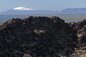 land
had no other use than for grazing sheep. land
had no other use than for grazing sheep.
The
expensive and mediocre Eldborg Hotel
Camping: after 2 nights at
the well-appointed and good value Snorrastair farm-camping, we now drove 25kms
north for a night at Eldborg Hotel Camping (click
here for detailed map of route). We knew this had no showers, (at
least we were not
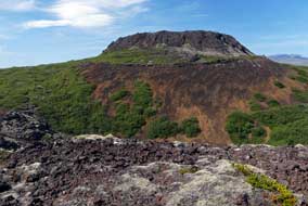 prepared to pay 700kr each for showers at their swimming
pool), its only advantage being that it accepted payment by Camping Card. The
now powerful headwind made driving around Route 54 unsteady, yet even so the
irresponsible young tourists in hire-cars still hassled from behind and sped past
dangerously in the face of oncoming traffic. We turned off along Eldborg's
driveway across the flat moorland, to reach the unsightly, ugly concrete bunker
of a hotel. The rough, grassy camping field alongside was thankfully almost
empty, and in the now really strong NE gale blowing over from the inland
mountains, the thick spruce and birch hedge across the middle of the field at
least provided an effective wind-break. A German couple in a camping-car filling
the middle space had no objection to our pitching alongside in the lee of the
only section of hedge within reach of the one and only power socket; with some
difficulty battling against the gale, we settled in (see below right). prepared to pay 700kr each for showers at their swimming
pool), its only advantage being that it accepted payment by Camping Card. The
now powerful headwind made driving around Route 54 unsteady, yet even so the
irresponsible young tourists in hire-cars still hassled from behind and sped past
dangerously in the face of oncoming traffic. We turned off along Eldborg's
driveway across the flat moorland, to reach the unsightly, ugly concrete bunker
of a hotel. The rough, grassy camping field alongside was thankfully almost
empty, and in the now really strong NE gale blowing over from the inland
mountains, the thick spruce and birch hedge across the middle of the field at
least provided an effective wind-break. A German couple in a camping-car filling
the middle space had no objection to our pitching alongside in the lee of the
only section of hedge within reach of the one and only power socket; with some
difficulty battling against the gale, we settled in (see below right).
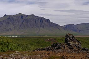 We walked over to the huge concrete bunker
masquerading as a hotel to book in, to be treated to an utterly indifferent and
unresponsive non-welcome from the girl at the hotel reception; if such a Why
should I bother to serve you? attitude represented the standard of service
expected of such a hotel, it spoke volumes about the place! We insisted on her
showing us the camping facilities, limited to 2 WCs and a hand basin in a dingy,
underground dungeon beneath the hotel, along with a wash-up sink and electric
ring We walked over to the huge concrete bunker
masquerading as a hotel to book in, to be treated to an utterly indifferent and
unresponsive non-welcome from the girl at the hotel reception; if such a Why
should I bother to serve you? attitude represented the standard of service
expected of such a hotel, it spoke volumes about the place! We insisted on her
showing us the camping facilities, limited to 2 WCs and a hand basin in a dingy,
underground dungeon beneath the hotel, along with a wash-up sink and electric
ring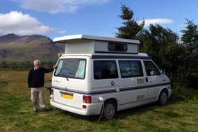 passing for a 'kitchen'. For all this substandard service and mediocre
facilities, they had the nerve to charge 1,200kr/person plus 1,000kr for
electricity (showers in their swimming pool were 700kr each extra). We paid by
Camping card. When it came later to writing up Eldborg Hotel's review, we tried
telephoning the hotel and received a similarly inhospitable, non-responsive
response! The place was given a generous -2 rating. passing for a 'kitchen'. For all this substandard service and mediocre
facilities, they had the nerve to charge 1,200kr/person plus 1,000kr for
electricity (showers in their swimming pool were 700kr each extra). We paid by
Camping card. When it came later to writing up Eldborg Hotel's review, we tried
telephoning the hotel and received a similarly inhospitable, non-responsive
response! The place was given a generous -2 rating.
The wind continued unabated, blowing violently
if you stepped beyond the shelter of the hedge; tucked in behind the wind-break,
George was snug as we cooked supper. The following morning, with the wind still
forecast as 7 m/s today, we decided to take a rest day here in spite of the
place's inadequacies, and review things tomorrow. The neighbouring camping-car
departed and we moved George fully into the shelter of the spruce hedge. This
morning we discovered that the campsite's basement WCs were in a disgustingly
filthy state. At reception we demanded to know from the hotel staff if this was
the normal
 standard offered in the hotel, and if not, why were campers
discriminated against. The girl hastily set to cleaning the loos, emptying bins
and re-filling paper towel and loo-roll holders. The gale continued to blow all
day, but the forecast showed a gradual reduction tomorrow and return to a more
gentle 3 m/s on Tuesday. standard offered in the hotel, and if not, why were campers
discriminated against. The girl hastily set to cleaning the loos, emptying bins
and re-filling paper towel and loo-roll holders. The gale continued to blow all
day, but the forecast showed a gradual reduction tomorrow and return to a more
gentle 3 m/s on Tuesday.
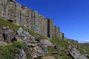
 Geruberg Basalt Columns: the following morning was bright,
and
as forecast the wind had reduced to 5 m/s. We returned to the main Route 54 and
almost opposite, a farm drive dirt track led inland sign-posted for Geruberg and
Rauamelur. The trackway led in a short distance to the Geruberg Basalt Columns, a
2kms long shattered escarpment of grey, 50m tall, hexagonal and square columns
with a skirt of broken blocks at the foot of the cliffs, the longest and most
perfect set of such basalt pillars in the country (see left). We stopped at a parking area
and climbed up the slope to the foot of the huge columns which towered overhead.
But the natural grandeur of this wonderful feat of nature was tarnished by the
silly antics of crowds of tourists swarming all over the cliffs and the skyline
above the pillars. For such folk, the only passing relevance of this
magnificent natural phenomenon was to form an incidental backdrop for their
'selfies'. But fortunately, true to form, the tourists' span of attention
typically was so brief that within moments, they had all rushed off in their
hire-cars to sully the next 'attraction', leaving us in Geruberg Basalt Columns: the following morning was bright,
and
as forecast the wind had reduced to 5 m/s. We returned to the main Route 54 and
almost opposite, a farm drive dirt track led inland sign-posted for Geruberg and
Rauamelur. The trackway led in a short distance to the Geruberg Basalt Columns, a
2kms long shattered escarpment of grey, 50m tall, hexagonal and square columns
with a skirt of broken blocks at the foot of the cliffs, the longest and most
perfect set of such basalt pillars in the country (see left). We stopped at a parking area
and climbed up the slope to the foot of the huge columns which towered overhead.
But the natural grandeur of this wonderful feat of nature was tarnished by the
silly antics of crowds of tourists swarming all over the cliffs and the skyline
above the pillars. For such folk, the only passing relevance of this
magnificent natural phenomenon was to form an incidental backdrop for their
'selfies'. But fortunately, true to form, the tourists' span of attention
typically was so brief that within moments, they had all rushed off in their
hire-cars to sully the next 'attraction', leaving us in
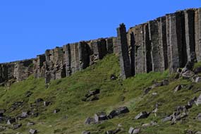
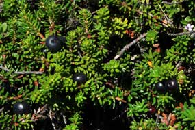
 peace to admire in wonder the Geruberg Basalt Columns. We stood amid the Bilberry and Crowberry
(see below right) at the foot of the parade of columns, admiring their majesty,
and contemplating their formation as the cooling basaltic lava cracked into
such regular patterns on such a scale. From this perspective, we took our photos
in the clear morning sunshine looking along the line of the columnar cliff
escarpment; some of the pillars were even leaning outwards, separated from the
walls of the cliffs
 (see above
right) (Photo
22 - Geruberg Basalt Columns). This
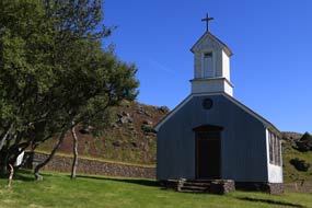
was nature at its most spectacular here at Geruberg. A further km along the
trackway, brought us to the abandoned farm of Ytri-Rauamelur, and its little
corrugated metal chapel standing on a slope surrounded by a hedge of birches
(see left).
From here we could look back along the Geruberg escarpment stretching away into
the distance.
The Harbour Seal colony at YtrÝ-Tunga beach: re-joining the main Route
54 (click
here for detailed map of route), we turned westwards across the green
coastal strip, passing modern working farms set against the backdrop of
elegantly sculpted corries of mighty Hafursfell towering above. The road swung
inland away from the coast but running parallel with the mountainous spine of
the SnŠfellsnes peninsula which was now dominated by the grey peaks of
Ljˇsufj÷ll. The now wide and remarkably flat, green coastal farming plain
stretched away to the distant coast and inland to the spine of mountains which
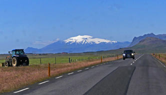 culminated in the
peak of SnŠfellsnes capped with its glacier (see left). At the Vegamˇt service station road junction, Route 56 branched off to Stykkishˇlmur on
the peninsula's north coast; Route 54 continued westwards turning back towards
the coast. Here we turned off down to YtrÝ-Tunga beach, but so regrettably had
the tourist hordes. Our reason for venturing off the main road down to this
beautiful stretch of wild beaches and golden sands surrounded by rounded
volcanic boulders, was to culminated in the
peak of SnŠfellsnes capped with its glacier (see left). At the Vegamˇt service station road junction, Route 56 branched off to Stykkishˇlmur on
the peninsula's north coast; Route 54 continued westwards turning back towards
the coast. Here we turned off down to YtrÝ-Tunga beach, but so regrettably had
the tourist hordes. Our reason for venturing off the main road down to this
beautiful stretch of wild beaches and golden sands surrounded by rounded
volcanic boulders, was to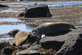 find the colony of Harbour Seals that bask on the
rocks along this coast-line. On such a bright, sunny day, we were not sure
whether the seals would be out of the water. But as we walked along the
magnificent beach, and scrambled over the rocks at the far end, sure enough
there were 2 pairs of Harbour Seals basking by the water's edge on flat rocks
(see right) (Photo
23 - Harbour Seals at YtrÝ Tunga).
Much smaller than Grey Seals, Harbour Seals are the most common seal species in
Icelandic waters, and can be recognised by their shorter, be-whiskered 'teddy
bear' snouts. They live on fish and are accomplished divers, feeding at depths
of 30~50m. They are sociable animals, gathering in groups to bask on the
shore-line. We positioned ourselves for photographs of the seals, as they lay
basking unconcernedly on the rocks no more than 5~10m from us (Photo
24 - Basking Harbour Seal); for our Seals Photo Gallery, click on
Harbour Seals of YtrÝ-Tunga.
But the peace of the setting was shattered by the arrival of a whole busload of tourists making an
unbelievable racket. Not surprisingly the find the colony of Harbour Seals that bask on the
rocks along this coast-line. On such a bright, sunny day, we were not sure
whether the seals would be out of the water. But as we walked along the
magnificent beach, and scrambled over the rocks at the far end, sure enough
there were 2 pairs of Harbour Seals basking by the water's edge on flat rocks
(see right) (Photo
23 - Harbour Seals at YtrÝ Tunga).
Much smaller than Grey Seals, Harbour Seals are the most common seal species in
Icelandic waters, and can be recognised by their shorter, be-whiskered 'teddy
bear' snouts. They live on fish and are accomplished divers, feeding at depths
of 30~50m. They are sociable animals, gathering in groups to bask on the
shore-line. We positioned ourselves for photographs of the seals, as they lay
basking unconcernedly on the rocks no more than 5~10m from us (Photo
24 - Basking Harbour Seal); for our Seals Photo Gallery, click on
Harbour Seals of YtrÝ-Tunga.
But the peace of the setting was shattered by the arrival of a whole busload of tourists making an
unbelievable racket. Not surprisingly the
 seals flopped over into the water and
swam off, their shiny black heads just visible in the water (Photo
25- Swimming seal). Why such folk come
here remains a mystery: they clearly have no interest in or appreciation of the
natural surroundings and wild-life, and with all their noise and disturbance,
they ruin whatever it is they do come to see. That regrettably is the story of
modern Iceland, whose unique natural beauty is progressively being destroyed by
the get-rich-quick greed of the mass tourism seals flopped over into the water and
swam off, their shiny black heads just visible in the water (Photo
25- Swimming seal). Why such folk come
here remains a mystery: they clearly have no interest in or appreciation of the
natural surroundings and wild-life, and with all their noise and disturbance,
they ruin whatever it is they do come to see. That regrettably is the story of
modern Iceland, whose unique natural beauty is progressively being destroyed by
the get-rich-quick greed of the mass tourism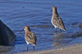 industry. industry.
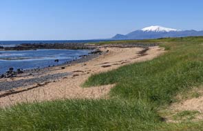
We walked slowly back over the rocks, to photograph the distant
snow-capped peak of SnŠfellsnes against the foreground of shore-side Marram
Grass
(see left) (Photo
26 - SnŠfellsnes peak from YtrÝ Tunga), as ignorant, ill-mannered tourists, too self-obsessed even to show any
awareness of others, wandered blithely in front of our cameras. Further along,
we stood quietly by a side beach photographing Dunlins (see right) (Photo
27 - Dunlin) and Ringed Plovers
busily pecking away at the water's edge, as tourists wandered indifferently past.
 B˙ir church and the B˙arhaun lava field: back to
the main road, we continued westwards in bright afternoon sunshine (click
here for detailed map of route). The road
over the flat, wide coastal strip ran alongside the wonderfully sculpted
mountainous escarpment of the SnŠfellsnes spine, with watercourses cascading
over the brim of cliffs and sunlight picking out all the details of the crags. A
further 20kms along around B˙avÝk Bay, we reached the point where the partly unsurfaced Route 54
branched off over a pass on the mountainous spine to ËlafsvÝk; just B˙ir church and the B˙arhaun lava field: back to
the main road, we continued westwards in bright afternoon sunshine (click
here for detailed map of route). The road
over the flat, wide coastal strip ran alongside the wonderfully sculpted
mountainous escarpment of the SnŠfellsnes spine, with watercourses cascading
over the brim of cliffs and sunlight picking out all the details of the crags. A
further 20kms along around B˙avÝk Bay, we reached the point where the partly unsurfaced Route 54
branched off over a pass on the mountainous spine to ËlafsvÝk; just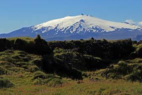 beyond a turning led down to the former fishing and trading hamlet of B˙ir. The
trading settlement was abandoned in the early 19th century, and all that remains now is
the tiny wooden church and nearby isolated inn-hotel, standing at the edge of the B˙ahraun lava field. B˙ir's
original name was Hraunh÷fn, meaning Lava-field Harbour.
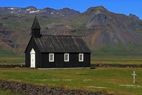
We turned off onto the single-track lane which led across the lava field,
past the hotel, and ended at the tiny, black-tarred wooden B˙ir church (see
left). The
present church is a reconstruction of the original 1703 church. More impressive
than the simple little church was the turf-topped lava-block wall surrounding
the graveyard. But again, the tourist hordes had got here before us, wandering
aimlessly around the church; they were even clambering pointlessly onto the
turf-topped wall. Having taken our photos of
 the church, we moved George back to
park near the hotel so that we could walk back along the lane to admire the lava
field, backed by the glorious view of the SnŠfellsnes peak and glacier (see
right) (Photo
28 - SnŠfellsnes above B˙ahraun), and B˙ir church
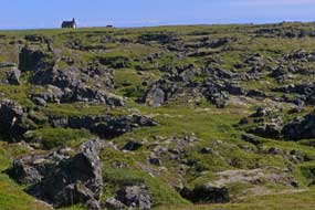
alongside the lava field (see below right). The B˙ahraun
lava field had flowed originally from the nearby B˙arklettur crater, and now forms a low area of wonderfully shaped
lava formations and fissures, all covered
with vegetation and moss (Photo
29 - B˙ahraun fissures) (see left). A little further back from the coast by a prominent
fissure (see below left), we found a small patch of the church, we moved George back to
park near the hotel so that we could walk back along the lane to admire the lava
field, backed by the glorious view of the SnŠfellsnes peak and glacier (see
right) (Photo
28 - SnŠfellsnes above B˙ahraun), and B˙ir church
alongside the lava field (see below right). The B˙ahraun
lava field had flowed originally from the nearby B˙arklettur crater, and now forms a low area of wonderfully shaped
lava formations and fissures, all covered
with vegetation and moss (Photo
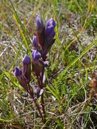
29 - B˙ahraun fissures) (see left). A little further back from the coast by a prominent
fissure (see below left), we found a small patch of
 Autumn Gentians
(Gentianella amarella) still
largely in bud
(Photo 30 -
Autumn Gentian)
(see below left). We also noted a flat area just off the road as a possible wild
camp spot with beautiful Grass of Parnassus growing in profusion among the lava
boulders (see below right). Autumn Gentians
(Gentianella amarella) still
largely in bud
(Photo 30 -
Autumn Gentian)
(see below left). We also noted a flat area just off the road as a possible wild
camp spot with beautiful Grass of Parnassus growing in profusion among the lava
boulders (see below right).
The outrageously over-priced and sub-minimally equipped Snjofell Travel
Service Camping at Arnarstapi:
Route 574 continued westwards, rounding a high shoulder of the SnŠfellsnes
mountainous spine, and ahead the fullest view so far of the SnŠfellsnes peak and
glacier opened up before us. All day on our westward drive along the
southern coastline of SnŠfellsnes, this view had dominated the distant sky-line.
The road continued around BreiavÝk Bay passing farms, and ahead the murky mass
of the gloomily shady subsidiary peak of Botnsfjall blotted out further views of
the glacier capping the main SnŠfellsnes massif. Parked cars just off the road
marked the start of the path up the mountainside of Botnsfjall to the fissure-gorge of Raufeldsgjß. But, weary
after a long day, and still uncertain about where we should camp tonight, we
left this for another day, and continued to the turning down to Arnarstapi. It may long ago have been a trading
post, but today Arnarstapi was clearly a holiday-village, with a mass of holiday homes
spread across the flat, green foreshore.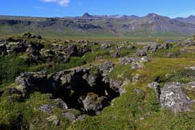
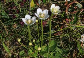 We had earlier phoned Snjofell Travel
Service guest-house-camping at Arnarstapi, as a potential campsite for tonight,
only to discover what an exploitative tourist rip-off this was. The woman
answering openly admitted that the only facilities were WCs and cold water; no
showers, no kitchen, and no hot water, and for this they were charging 3,000kr
plus 1,000 for power. But we had so far found no viable wild camp spot, and a
quick tour of the village showed that clearly there was no potential for wild
camping amid the holiday homes of Arnarstapi. Given therefore that we wanted to
walk the Arnarstapi~Hellnar cliff-top coastal path tomorrow, there was nothing
for it but to face the outrageously over-priced and sub-minimal facilities at Snjofell Travel
Service. We had earlier phoned Snjofell Travel
Service guest-house-camping at Arnarstapi, as a potential campsite for tonight,
only to discover what an exploitative tourist rip-off this was. The woman
answering openly admitted that the only facilities were WCs and cold water; no
showers, no kitchen, and no hot water, and for this they were charging 3,000kr
plus 1,000 for power. But we had so far found no viable wild camp spot, and a
quick tour of the village showed that clearly there was no potential for wild
camping amid the holiday homes of Arnarstapi. Given therefore that we wanted to
walk the Arnarstapi~Hellnar cliff-top coastal path tomorrow, there was nothing
for it but to face the outrageously over-priced and sub-minimal facilities at Snjofell Travel
Service.
Not prepared to pay the silly price for electricity, we positioned ourselves on the far side,
well away from all the Icelandic holiday-makers
and tourists in hired campers clustered around the facilities hut and one and
only power point, and pitched by the boundary hedge looking up to the
mountainous massif of Stapafell towering above us (see below left). We just had 2 nights' worth
of food left in the fridge, and after a hot day heating was not an issue.
Inspection of the facilities
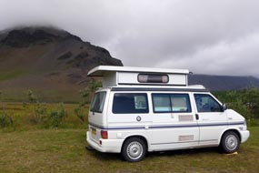 showed just how limited they were. A lad came round
after our barbecue supper to collect payment. We were all prepared to raise
vehement objections to the excessively high cost and minimal facilities, but in
fact the lad, a summer worker from Portugal, took the wind from our sails: he
came straight out showed just how limited they were. A lad came round
after our barbecue supper to collect payment. We were all prepared to raise
vehement objections to the excessively high cost and minimal facilities, but in
fact the lad, a summer worker from Portugal, took the wind from our sails: he
came straight out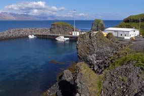 with a statement about the campsite owner's monopolistic
charges and complacency about providing adequate facilities with the
never-ending influx of tourists. He then surprised us further by volunteering to
charge us only 2,000kr as seniors and as if we were in a tent. So honour was
served and we duly paid 2,000kr for our night's stay. with a statement about the campsite owner's monopolistic
charges and complacency about providing adequate facilities with the
never-ending influx of tourists. He then surprised us further by volunteering to
charge us only 2,000kr as seniors and as if we were in a tent. So honour was
served and we duly paid 2,000kr for our night's stay.
The Arnarstapi~Hellnar cliff-top coastal path: a grey and mistily
moist start to the day, but gradually the sky brightened, even showing signs of
the cloud breaking. Down through the village, we parked by Arnarstapi's little
harbour which was surrounded by lava formations eroded by tidal action
(Photo
31 - Coastal lava formations). The
harbour walls themselves were constructed from blocks of black lava (see right) (Photo
32- Arnarstapi harbour). The sun was
now bright in an almost clear sky as we set out along the cliff-top path for the
7kms coastal walk along to Hellnar and back.
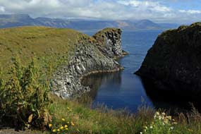 The path followed
all the indentations and clefts eroded into the basalt cliffs by the power of
waves (see left) (Photo
33 - Eroded cliffs), passing a small cliff-top pond where gulls splashed in the water. Inland,
the bulky pyramid of Stapafell towered above the village. Close to the cliff
edge, we could The path followed
all the indentations and clefts eroded into the basalt cliffs by the power of
waves (see left) (Photo
33 - Eroded cliffs), passing a small cliff-top pond where gulls splashed in the water. Inland,
the bulky pyramid of Stapafell towered above the village. Close to the cliff
edge, we could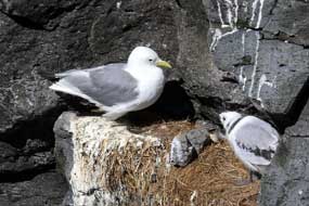 peer down at the many Kittiwakes nesting on ledges; this year's young birds were
by now almost fully grown (see right) (Photo
34 - Juvenile Kittiwakes). We followed the cliff-top path
around each of the indentations and clefts, passing a rocky, carved out sea
blow-hole; we could not see down into the hole's depths, but could hear the sea
water sloshing around in the bottom. Southerly gales create fountains of sea
water blowing up through these sea-holes. A clump of Scots Lovage grew on the
hole's rim. Cormorants perched on low rocks with typical wing-hanging pose (Photo
35 - Cormorant), while offshore a cluster of stumpy lava pillars provided nesting ledges
for more Kittiwakes (see below left and right). Looking ahead along the line of the cliffs, part of the Gatklettur rock-arch came into view, but it was not until we reached a diversion
from the main path to a cliff-top wooden look-out point that we could see the
full scale of this remarkable masterpiece of erosion
(Photo
36 - Gatklettur rock-arch). Closest to the shore, an
original rock-arch had collapsed leaving just a gap, then the slender main arch
spanned across with clear water beneath. Further out, wave action had carved a
smaller hole in the projecting spine of rock. What a spectacle, backed by the
array of stumpy rock pillars passed earlier, and the distant misty coast-line
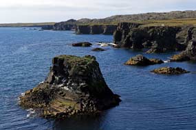 of
southern SnŠfellsnes stretching along the horizon (see below right). of
southern SnŠfellsnes stretching along the horizon (see below right).
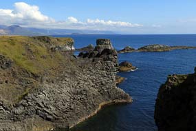 Clearly
the numbers of tourists treading the cliff-top path had caused serious problems
of erosion, and as a result the path had now been reinforced with hard rubber
mesh covered with gravel, a non-intrusive protective measure along the main body
of cliff-tops. Along this stretch, we found the first of the Gentians that
populate the Arnarstapi cliff-top turf: purple Field Gentians (Gentianella campestris)
(Photo
37 - Field Gentian) (see below right), and were soon sprawled
out on the close-cropped turf to photograph them. Continuing westwards,
another side-path led to a look-out point where in both directions a parade of
outward curving hexagonal vertical basalt columns graced the line of cliffs
(see below left) (Photo
38 - Basalt columns) along with a
huge sea cave to one side (see below right) (Photo
39 - Sea cave). A little further, a foot-bridge spanned a watercourse
running down to the cliff-edge and dropping into a cleft. Beyond this, a rocky
spine stretched out into the sea, again providing nesting ledges for Kittiwakes.
All along this coastline, the line of basalt cliffs was eroded into varying
rock formations of clefts and off-shore pillars, with Kittiwakes soaring above
the cliffs. Clearly
the numbers of tourists treading the cliff-top path had caused serious problems
of erosion, and as a result the path had now been reinforced with hard rubber
mesh covered with gravel, a non-intrusive protective measure along the main body
of cliff-tops. Along this stretch, we found the first of the Gentians that
populate the Arnarstapi cliff-top turf: purple Field Gentians (Gentianella campestris)
(Photo
37 - Field Gentian) (see below right), and were soon sprawled
out on the close-cropped turf to photograph them. Continuing westwards,
another side-path led to a look-out point where in both directions a parade of
outward curving hexagonal vertical basalt columns graced the line of cliffs
(see below left) (Photo
38 - Basalt columns) along with a
huge sea cave to one side (see below right) (Photo
39 - Sea cave). A little further, a foot-bridge spanned a watercourse
running down to the cliff-edge and dropping into a cleft. Beyond this, a rocky
spine stretched out into the sea, again providing nesting ledges for Kittiwakes.
All along this coastline, the line of basalt cliffs was eroded into varying
rock formations of clefts and off-shore pillars, with Kittiwakes soaring above
the cliffs.
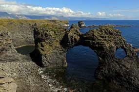 The path now reached a gate marking the end of the cliff-top turf meadowland,
and beyond this point the on-going path wound a tortuous way over The path now reached a gate marking the end of the cliff-top turf meadowland,
and beyond this point the on-going path wound a tortuous way over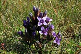 and through a rough lava field (see below left) (Photo
40 - Lava field) with even more fantastically shaped lava formations dropping
down at the cliff-edge (Photo
41 - Coastal lava formations) (see below right). The stony path climbed up through the lava field which
was overgrown with Woolly Hair Moss (Photo
42 - Hellnar lava field) (Racomitrium lanuginosum), winding a way past lava pillars and hollows,
eventually emerging on the far side in sight of the hamlet of Hellnar, once a
large fishing village but now reduced to a few tourist cafÚs. Hellnar had been
the birthplace of GurÝur Ůorbjarnardˇttir
who, with her husband Ůorfinnur Karlsefni, had been companions of Leifur
EirÝksson on the expedition which discovered the North American continent around
1000 AD; they had attempted to found a colony at Vinland, where GurÝur had
given birth to a son Snorri Ůorfinnson, the first European born in America who
later, after the Vinland settlement's failure, returned to Iceland and settled at GlaumbŠr.
A board-walk crossed the last of the lava field, dropping down to the remains of Hellnar's
little harbour and the large sea-cave of Bastofuhellir cut into the base of the basalt cliffs
(Photo
43 - Bastofuhellir sea-cave),
and once used by villagers as a bathing cave. Up the steep hillside, past all the
tourists gathered at one of Hellnar's cafÚs, we continued up the road past the
full car park trying to
 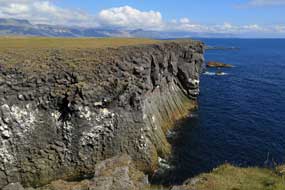 find the SnŠfellsnes National Park Information Centre. find the SnŠfellsnes National Park Information Centre.
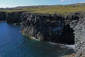 It was by now 2-45pm; we had spent 3 hours on
the outward walk with all the cliff-top photographic interest of basalt
formations and wild flora. Reaching another cafÚ, we learned that the
Information Centre had moved, so we returned downhill to begin the return walk.
Keeping up a good pace, we re-crossed the lava field passing swarms of tourists
wandering indifferently though this natural wonderland, and reached the gate
leading to the cliff-top meadowland for the return path along to Arnarstapi
harbour and its lava formations. It was by now 2-45pm; we had spent 3 hours on
the outward walk with all the cliff-top photographic interest of basalt
formations and wild flora. Reaching another cafÚ, we learned that the
Information Centre had moved, so we returned downhill to begin the return walk.
Keeping up a good pace, we re-crossed the lava field passing swarms of tourists
wandering indifferently though this natural wonderland, and reached the gate
leading to the cliff-top meadowland for the return path along to Arnarstapi
harbour and its lava formations.
Around the western tip of SnŠfellsnes:
not prepared to tolerate a second night at Snjofell Camping, we set off to
drive around the western tip of SnŠfellsnes peninsula to camp at Hellissandur on
the peninsula's northern coast (click
here for detailed map of route).
Although this would mean returning tomorrow for the planned visits around this
route, it was only 35kms and preferable to Snjofell. Beyond the road turning to Hellnar, as
Route 574 swung NW-wards around the far
SW tip of SnŠfellsnes, a bleak and barren lava-scape opened out before us.
To our right, the slopes of the 1,446m high SnŠfellsj÷kull peak extended upwards towards its
glacial snow-cap, and below the
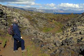 slopes, endless lava fields. Even on a bright
afternoon, this was a fearsomely bleak and desolate wilderness stretching away
as far as the eye could see, slopes, endless lava fields. Even on a bright
afternoon, this was a fearsomely bleak and desolate wilderness stretching away
as far as the eye could see,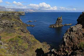 and dotted with clusters of outlying cone-craters.
Although covered with low vegetation, this entire landscape was barren
supporting no farming. The only thing to be seen were tourist cars gathered at
parking areas. The road continued northwards, swinging inland past the Sßxholl
Crater which we should visit tomorrow. Finally reaching the flatter north coast and the
shores of Breiafj÷rur, the road turned back eastwards along the coast, passing
the huge 412m high radio mast (one of Western Europe's tallest structures) of
Iceland's main 189kHz long wave transmitter which broadcasts the national
shipping forecast. and dotted with clusters of outlying cone-craters.
Although covered with low vegetation, this entire landscape was barren
supporting no farming. The only thing to be seen were tourist cars gathered at
parking areas. The road continued northwards, swinging inland past the Sßxholl
Crater which we should visit tomorrow. Finally reaching the flatter north coast and the
shores of Breiafj÷rur, the road turned back eastwards along the coast, passing
the huge 412m high radio mast (one of Western Europe's tallest structures) of
Iceland's main 189kHz long wave transmitter which broadcasts the national
shipping forecast.
Hellissandur Camping: reaching the large and scattered village of
Hellissandur, we found the municipal campsite in the western outskirts, a flat
grassy circuit tucked under the lava field. A cluster of mega-buses monopolised
one end, but we found a space by an electric point next to a friendly German
couple in a smaller camper (see below left)
(Photo
44 - Hellissandur Camping). Facilities were limited but at least there were
showers and wash-up sinks both with plenty of hot water. In that sense it was
good value at 1,100kr/person (750kr seniors' reduction) plus 500kr for
electricity, and they accepted Camping Cards. Inevitably therefore it was very
popular, and we reserved the pitch to drive over to the nearby
NI filling station and mini-market for essential
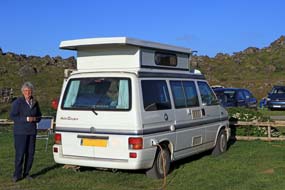 supplies. Back over at the
campsite, we settled in, both exhausted after such a rewarding day. The campsite
gradually filled to capacity tonight with supplies. Back over at the
campsite, we settled in, both exhausted after such a rewarding day. The campsite
gradually filled to capacity tonight with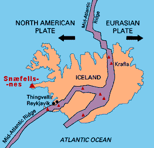 both Icelandic holiday-makers and
tourist hire-campers. Being so crowded, the site was inevitably noisy even
after 10-30 when we turned in.
SnŠfellsnes' geological history: the following morning was more
determinedly overcast with little sign of the cloud breaking. This morning we
enjoyed welcome showers after several days of poor campsites without showers.
Reserving our pitch, we set off on Route 574 to return around the western SnŠfellsnes
coast (click
here for detailed map of route), for today's series of visits to
geological features around the lava fields. Down to the SW corner of SnŠfellsnes,
we turned off to the SnŠfellsnes National Park Information Centre which we now
had discovered had relocated from Hellnar to the abandoned farm of Malßriff.
Here we learned more of the detailed geology of the SnŠfellsnes active volcanic
area, which lies considerably further west of Iceland's main zone of volcanism
located on a SW~NE line across the central part of the island along the tectonic
plates boundary of the Mid-Atlantic Ridge (see right). The central active
volcano of SnŠfellsnes and its subsidiary vents in the vicinity have erupted 20
times during the past 11,000 years, including 3 very powerful Plinian eruptions,
1,800, 4,000 and
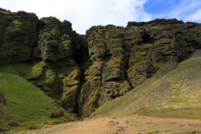 8,000 years ago. Plinian eruptions are the most violent of
explosive eruptions, ejecting huge columns of pulverised volcanic debris,
pumice, ash and volcanic gases high into the stratosphere, as happened
with Vesuvius in 79 AD and described in the letters of Pliny (hence the
eruption's name). In spite of there having been no eruptions in recent years, it
is still an active volcano beneath the SnŠfellsj÷kull glacial cap. 8,000 years ago. Plinian eruptions are the most violent of
explosive eruptions, ejecting huge columns of pulverised volcanic debris,
pumice, ash and volcanic gases high into the stratosphere, as happened
with Vesuvius in 79 AD and described in the letters of Pliny (hence the
eruption's name). In spite of there having been no eruptions in recent years, it
is still an active volcano beneath the SnŠfellsj÷kull glacial cap.
The SnŠfellsnes area's geology is very diverse with formations from almost every
era of Iceland's long history of volcanism: lava from the
Tertiary Period (3~16 million years ago) forms the underlying bed rock
layer, whose porous make-up prevents the accumulation of surface water; resting on this are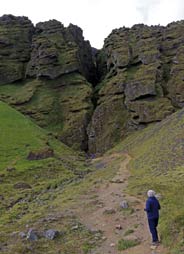 strata of rocks formed beneath glaciers during the
Ice Ages, and the surface layers are lava fields from the post-glacial period,
younger than 11,000 years old. SnŠfellsnes volcanic crater is best known as the
fictional setting for Jules Verne's adventure novel Journey to the Centre of
the Earth, in which the hero, German geologist Professor Lidenbrock from
Hamburg, descends into the crater of the dormant volcano under its glacier with
his nephew Axel and an Icelandic guide; after fantastic subterranean
adventures, they eventually emerge at the Mediterranean volcano of Stromboli. These
apparently barren lava fields covering such an extensive area of the peninsula's
western tip are state lands, since 2001 covered by the SnŠfellsnes National
Park. The only productive farming usage for the land is strata of rocks formed beneath glaciers during the
Ice Ages, and the surface layers are lava fields from the post-glacial period,
younger than 11,000 years old. SnŠfellsnes volcanic crater is best known as the
fictional setting for Jules Verne's adventure novel Journey to the Centre of
the Earth, in which the hero, German geologist Professor Lidenbrock from
Hamburg, descends into the crater of the dormant volcano under its glacier with
his nephew Axel and an Icelandic guide; after fantastic subterranean
adventures, they eventually emerge at the Mediterranean volcano of Stromboli. These
apparently barren lava fields covering such an extensive area of the peninsula's
western tip are state lands, since 2001 covered by the SnŠfellsnes National
Park. The only productive farming usage for the land is
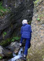 for sheep grazing,
although there are now few remaining farms. The lava fields once had a greater
covering of vegetation, but during the 19~20th centuries this was largely
stripped by over-grazing. for sheep grazing,
although there are now few remaining farms. The lava fields once had a greater
covering of vegetation, but during the 19~20th centuries this was largely
stripped by over-grazing.
The Raufeldsgjß fissure-gorge on Botnsfjall: we continued
SE-wards, around to the southern coast to turn off to the parking area for the Raufeldsgjß fissure-gorge.
The approach track led up the lower eastern slopes of Botnsfjall towards
the vertically scarred cliff-face, which was cleaved by a steep, narrow cleft
from the bottom of which a stream issued (Photo
45 - Raufeldsgjß fissure-gorge) (see above left and right). Today the stream was little more than
a trickle, but the scale of the lower gorge-cleft showed that, in spring time
spate, an impassable torrent would discharge from the base of the vertical
cliff-fissure. The track led up into the base of the gorge, from where it was
possible to scramble
up the rocks of the stream bed into the tightly enclosed lower chasm of the
claustrophobic fissure (see left) (Photo
46 - Raufeldsgjß fissure-gorge); this narrowed to 2m wide with imposing, moss-covered
cliff-walls looming several hundreds of metres high on both sides, and the
stream issuing from higher in the tight fissure. Balanced on the stream bed
rocks, in the fissure-cleft's confined space scarcely a shoulder's width between
the rock walls, and with some difficulty in the poor light, we tried to get
photographs which did justice to this remarkable feat of erosive nature (Photo
47 - Raufeldsgjß fissure-gorge).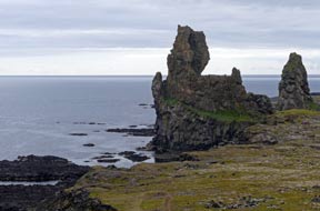
Lˇndrangar rock pillars and Dj˙palˇnssandur and
DritvÝk beaches: with the weather still gloomily overcast and light
poor, we returned around the south coast past Arnarstapi under the brooding shadow of
Stapafell, to cross the Hellnahraun lava field past the turning down to Hellnar.
A short distance further across the bleak Hßahraun lava field, we paused at a
parking area from where a footpath led up to a viewpoint overlooking the 2
massive Lˇndrangar lava rock-pillar formations standing 75m high atop the
cliff-edge
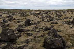 (Photo
48 - Lˇndrangar rock-pillars) (see right), one of them shaped in silhouette like a church, both remnants of a basalt
cinder cone.
The foreground cliffs provided nesting ledges for Kittiwakes.
Continuing around the coast, we turned off onto Route 672 across the magnificent BeruvÝkurhraun
lava field, with jagged, crusty outcrops poking up from the main body of surface
lava which was now covered with layers of flourishing layers of Woolly Hair Moss (Racomitrium
lanuginosum) (Photo
49 - BeruvÝkurhraun lava field) (see left). The road
ended at a parking area filled with tourist cars and tour buses. Paths passing
though larger, jagged outcrops of fantastically shaped lava formations, led
steeply down to Dj˙palˇnssandur and
DritvÝk beaches (Photo
50 - Jagged lava outcrops). Down at the grey, volcanic pebbly beach, the rusted, twisted
remains of the British trawler Epine from Grimsby, wrecked off this coast
in March 1948, lay scattered across the beach. Just 5 of the 19 crew were
rescued by local men managing to get a line aboard the stricken boat. The (Photo
48 - Lˇndrangar rock-pillars) (see right), one of them shaped in silhouette like a church, both remnants of a basalt
cinder cone.
The foreground cliffs provided nesting ledges for Kittiwakes.
Continuing around the coast, we turned off onto Route 672 across the magnificent BeruvÝkurhraun
lava field, with jagged, crusty outcrops poking up from the main body of surface
lava which was now covered with layers of flourishing layers of Woolly Hair Moss (Racomitrium
lanuginosum) (Photo
49 - BeruvÝkurhraun lava field) (see left). The road
ended at a parking area filled with tourist cars and tour buses. Paths passing
though larger, jagged outcrops of fantastically shaped lava formations, led
steeply down to Dj˙palˇnssandur and
DritvÝk beaches (Photo
50 - Jagged lava outcrops). Down at the grey, volcanic pebbly beach, the rusted, twisted
remains of the British trawler Epine from Grimsby, wrecked off this coast
in March 1948, lay scattered across the beach. Just 5 of the 19 crew were
rescued by local men managing to get a line aboard the stricken boat. The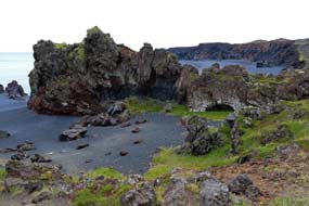 National Park map showed that all along this western coast of SnŠfellsnes, there
had been a history of wrecked trawlers, several of them British, the most recent
being the Svanborg in 2001. In such grey, overcast weather, the beach was
a gloomily eerie place, whose peace was disturbed by the racket created by moronic tourists milling around. We explored the grotesquely-shaped lava
formations which spilled down the beach right to the water's edge (see right) (Photo
51 - Dj˙palˇnssandur beach), and scrambled
back up to the path to the parking area.
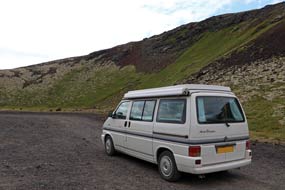 Hˇlarhˇlar Craters cluster and Sßxholl Crater:
continuing further north across the desolate lava wilderness, we turned off
again onto a dirt road leading
towards the Hˇlarhˇlar cluster of craters. 2 kms
along led us directly into the vast open amphitheatre of the Berudalur explosion
crater with views looking back at the SnŠfellsnes peak, its glacial cap now in
cloud (see below left) (Photo
52 - Berudalur explosion crater). Back to the main road, we turned off again to the jagged topped, Sßxholl
Crater, resulting from an explosive eruption some 3~4,000 years ago. The crater
cone was formed of pure scoria, light, airy pumice clinker and ash, with a metal
rung step-way curving around its side (see below right) leading up to the remains
of the 100m high crater rim This was certainly the easy way to the top; without this
step-way, it would have been an exhausting scramble causing much erosion of the Hˇlarhˇlar Craters cluster and Sßxholl Crater:
continuing further north across the desolate lava wilderness, we turned off
again onto a dirt road leading
towards the Hˇlarhˇlar cluster of craters. 2 kms
along led us directly into the vast open amphitheatre of the Berudalur explosion
crater with views looking back at the SnŠfellsnes peak, its glacial cap now in
cloud (see below left) (Photo
52 - Berudalur explosion crater). Back to the main road, we turned off again to the jagged topped, Sßxholl
Crater, resulting from an explosive eruption some 3~4,000 years ago. The crater
cone was formed of pure scoria, light, airy pumice clinker and ash, with a metal
rung step-way curving around its side (see below right) leading up to the remains
of the 100m high crater rim This was certainly the easy way to the top; without this
step-way, it would have been an exhausting scramble causing much erosion of the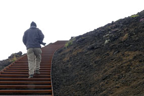 friable scoria. The jagged lava surround of the crater rim formed a more vivid
impression of this form of phreatic eruption crater (Photo
53 - Sßxholl Crater rim) (see below left) than others we had climbed such as Hverfjall at Mřvatn.
From its rim we had distant panoramic views across the Neshraun lava flow
extending down to the coast, across to the larger nearby crater of Stori-Sßxholl
Crater, and inland to the east, the main bulky body of SnŠfellsnes itself, its
glacial topping now covered by cloud.
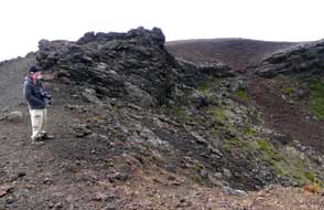
We continued around the main road to Hellissandur on the north coast, and
drove on to ËlafsvÝk to find the larger Kassim's supermarket for a provision
re-stock. While here we took an exploratory look at ËlafsvÝk Camping at the
eastern end of the village.
Back along the coast, we settled back into our reserved spot at Hellissandur
Camping. After such an overcast day, the sun amazingly broke through for a
bright evening, as the campsite filled up again.
SkarvÝk Beach and Ídverarnes Head at NW tip of SnŠfellsnes: the
following day, the campsite gradually emptied of the grossly materialistic
Icelandic mega-buses all towing their quad-bikes on trailers, leaving us to
spend a peaceful morning in camp and luxuriating in hot showers. We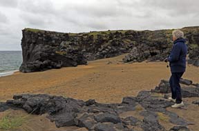 departed
early afternoon to return westwards and turn off on Route 579 (click
here for detailed map of route). The single-track lane continued
west, tarmaced for a couple of kms through ancient moss-covered lava fields as
far as SkarvÝk. Here dark grey basalt lava cliffs enclosed a small bay with
golden sand beach (see right) (Photo
54 - SkarvÝk Beach). We walked down to the beach to admire the cliffs; the
basaltic lava at its original solidification had fractured into regular shaped
blocks whose end surfaces showed on the cliff face (see below left). Today a gentle tide lapped against the foot of departed
early afternoon to return westwards and turn off on Route 579 (click
here for detailed map of route). The single-track lane continued
west, tarmaced for a couple of kms through ancient moss-covered lava fields as
far as SkarvÝk. Here dark grey basalt lava cliffs enclosed a small bay with
golden sand beach (see right) (Photo
54 - SkarvÝk Beach). We walked down to the beach to admire the cliffs; the
basaltic lava at its original solidification had fractured into regular shaped
blocks whose end surfaces showed on the cliff face (see below left). Today a gentle tide lapped against the foot of
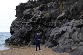 the basalt cliffs enclosing this sheltered cove, and for once we had this peaceful setting to
ourselves. Beyond here, a very rough, narrow and unsurfaced trackway continued
westwards, meandering through newer black lava fields. George bumped along
slowly and in 3 kms reached a T-junction: left headed for Sv÷rtuloft cliffs and
the tall lighthouse; we turned right for a further km to the rough track's end
at Ídverarnes Point with its squat orange lighthouse. This was the westernmost
tip of SnŠfellsnes peninsula at 24║ west (see below right) (Photo
55 - Ídverarnes Point), almost as far west as
Lßtrabjarg. It felt even more like the end of the
world, gazing out over the turf-covered lava, shore-side rocks and the calm
Atlantic, for any sign of Orcas (Killer Whales) which can be seen in these
waters. The cliffs on the distant northern side of Breiafj÷rur were just about
visible on the misty horizon, and closer at hand a lava-block-lined tunnel led
down into the ancient well of Fßlki. the basalt cliffs enclosing this sheltered cove, and for once we had this peaceful setting to
ourselves. Beyond here, a very rough, narrow and unsurfaced trackway continued
westwards, meandering through newer black lava fields. George bumped along
slowly and in 3 kms reached a T-junction: left headed for Sv÷rtuloft cliffs and
the tall lighthouse; we turned right for a further km to the rough track's end
at Ídverarnes Point with its squat orange lighthouse. This was the westernmost
tip of SnŠfellsnes peninsula at 24║ west (see below right) (Photo
55 - Ídverarnes Point), almost as far west as
Lßtrabjarg. It felt even more like the end of the
world, gazing out over the turf-covered lava, shore-side rocks and the calm
Atlantic, for any sign of Orcas (Killer Whales) which can be seen in these
waters. The cliffs on the distant northern side of Breiafj÷rur were just about
visible on the misty horizon, and closer at hand a lava-block-lined tunnel led
down into the ancient well of Fßlki.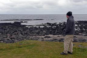
Rif fishing port and ËlafsvÝk Camping: having taken our photos at Ídverarnes, we
returned slowly along the rough track, glad to pick up tarmac again at SkarvÝk,
and drove eastwards through Hellissandur to the little fishing port of Rif.
Fishing boats equipped with cable drums for long-line fishing (Photo
56 - Long-line fishing boats) were moored around
the harbour quays (see left)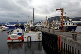 . We had previously learnt the difference
between long-line and hand-line fishing techniques at Suureyri (see our West Fjords travelogue). Juvenile Arctic Terns still learning to fly squatted in the
road by the port (see below right); they must perfect their flying skills quickly now since in a
month's time they will have to fly their trans-globe migration to Antarctica,
that is if they survive being hit by vehicle in the meantime. Leaving Rif,
we drove along the coast to the work-a-day fishing port of ËlafsvÝk and its
campsite, which at 6-00pm was still not too busy. We selected a pitch by one of
the few power-outlets in the second field (see below left). The site was clearly run by the same
municipality as Hellissandur with the same cheery man calling round evenings for
payment. The facilities were newer and well-designed for
Icelandic conditions with a covered area with picnic tables for tent campers,
spacious showers, plus a well-equipped kitchen. ËlafsvÝk campsite, like Hellissandur, merited a
+4 grading. Just above the campsite, a small HEP generating station was fed by a pipeline descending from the high mountains . We had previously learnt the difference
between long-line and hand-line fishing techniques at Suureyri (see our West Fjords travelogue). Juvenile Arctic Terns still learning to fly squatted in the
road by the port (see below right); they must perfect their flying skills quickly now since in a
month's time they will have to fly their trans-globe migration to Antarctica,
that is if they survive being hit by vehicle in the meantime. Leaving Rif,
we drove along the coast to the work-a-day fishing port of ËlafsvÝk and its
campsite, which at 6-00pm was still not too busy. We selected a pitch by one of
the few power-outlets in the second field (see below left). The site was clearly run by the same
municipality as Hellissandur with the same cheery man calling round evenings for
payment. The facilities were newer and well-designed for
Icelandic conditions with a covered area with picnic tables for tent campers,
spacious showers, plus a well-equipped kitchen. ËlafsvÝk campsite, like Hellissandur, merited a
+4 grading. Just above the campsite, a small HEP generating station was fed by a pipeline descending from the high mountains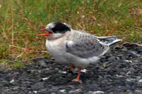 which enclosed
the site on 3 sides. The smell of fish from ËlafsvÝk fish-processing factory wafted over
from the town. By the time we had cooked supper, the evening grew very chill, and
the campsite filled to capacity as late-arriving tents and hire-campers swarmed
in, with much noise and lack of awareness for other campers. which enclosed
the site on 3 sides. The smell of fish from ËlafsvÝk fish-processing factory wafted over
from the town. By the time we had cooked supper, the evening grew very chill, and
the campsite filled to capacity as late-arriving tents and hire-campers swarmed
in, with much noise and lack of awareness for other campers.
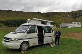 A day in camp at ËlafsvÝk Camping: with the Icelandic Labour Day
public holiday approaching, this morning we telephoned Stykkishˇlmur Camping
about the forthcoming holiday weekend. Being within easy driving distance of the
ReykjavÝk conurbation, it was inevitable that Stykkishˇlmur would be crowded
with rowdy Icelandic holiday makers, leaving us in a quandary as to where we
should camp this coming weekend. We decided in the meantime to take a day in
camp today here at ËlafsvÝk. The campsite emptied leaving us in peace for a
productive and restful day of mundane jobs catching up with writing. This
evening the campsite soon filled up again. A day in camp at ËlafsvÝk Camping: with the Icelandic Labour Day
public holiday approaching, this morning we telephoned Stykkishˇlmur Camping
about the forthcoming holiday weekend. Being within easy driving distance of the
ReykjavÝk conurbation, it was inevitable that Stykkishˇlmur would be crowded
with rowdy Icelandic holiday makers, leaving us in a quandary as to where we
should camp this coming weekend. We decided in the meantime to take a day in
camp today here at ËlafsvÝk. The campsite emptied leaving us in peace for a
productive and restful day of mundane jobs catching up with writing. This
evening the campsite soon filled up again.
Grundarfj÷rur fishing port on a gloomily grey
morning:
a grey and sullenly overcast morning, and we were up early to make an early start today.
Eastwards from ËlafsvÝk, Route 54 passed around GamlavÝk Bay and across the
mouth of VallnavÝk Bay (click
here for detailed map of route). Low, heavy cloud covered the SnŠfellsnes mountains
towering unseen in the murk above. Along the shore of LßtravÝk Bay, ahead we
could just about make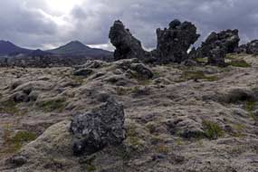 out the misty outline of the bulky, shapely Kirkjufell
which dominated the port of Grundarfj÷rur. Reaching Grundarfj÷rur, we turned
off to investigate the local campsite set by the town swimming pool. But this
was a very straightforward site, with basic facilities, and not really on our
route. The sky was now very gloomy, making what should in fine weather have been
the picture-postcard view of Kirkjufell across the fjord scarcely visible. What
however was entertaining was the sight of forlorn-looking tourists from the
cruise-ship anchored out in out the misty outline of the bulky, shapely Kirkjufell
which dominated the port of Grundarfj÷rur. Reaching Grundarfj÷rur, we turned
off to investigate the local campsite set by the town swimming pool. But this
was a very straightforward site, with basic facilities, and not really on our
route. The sky was now very gloomy, making what should in fine weather have been
the picture-postcard view of Kirkjufell across the fjord scarcely visible. What
however was entertaining was the sight of forlorn-looking tourists from the
cruise-ship anchored out in
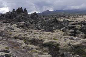 the bay, wandering aimlessly around the town, wet,
bedraggled and totally ill-equipped for Icelandic weather conditions, and
clearly puzzled at what they were doing here in this no-nonsense fishing port!
We drove down to the harbour, but all the boats were out; in such gloomy
weather, with low cloud obscuring the mountains enclosing the town, even we had
to admit that there was nothing for it but to drive on. the bay, wandering aimlessly around the town, wet,
bedraggled and totally ill-equipped for Icelandic weather conditions, and
clearly puzzled at what they were doing here in this no-nonsense fishing port!
We drove down to the harbour, but all the boats were out; in such gloomy
weather, with low cloud obscuring the mountains enclosing the town, even we had
to admit that there was nothing for it but to drive on.
The Berskjahraun lava field:
leaving Grundarfj÷rur, Route 54 passed across a mountainous shoulder of land
and the mouths of Kolgrafafj÷rur and Hraunsfj÷rur, and ahead the spiky
desolation of the Berskjahraun lava field extended across the plain between the
coast and mountainous interior. This area of viscous, spattered A'a lava flow
erupted from scoria craters on Bjarnarhafnarfjall some 4,000 years ago, and solidified into a lunar landscape
of jagged rock, now covered with Woolly Hair Moss (Racomitrium lanuginosum) (Photo
57 - Berskjahraun lava field) (see above left and right). The curious name
derives from Beserkers, sadistic warriors who fought like madmen and were hired
as mercenaries in Viking times. According to the Eyrbyggja Saga, which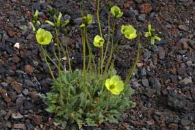 relates
tales of clan feuding in SnŠfellsnes, a late 10th century local farmer, Viga-Styr
from Hraun brought 2 berserker warriors from Sweden to defend his property and
work on his farm. But when one of them took a liking to Styr's daughter, he gave
the Beserkers the seemingly impossible task of clearing a way through the rough
lava field, as the condition for marrying his daughter. Unfortunately the
Beserkers succeeded in tearing a passageway through relates
tales of clan feuding in SnŠfellsnes, a late 10th century local farmer, Viga-Styr
from Hraun brought 2 berserker warriors from Sweden to defend his property and
work on his farm. But when one of them took a liking to Styr's daughter, he gave
the Beserkers the seemingly impossible task of clearing a way through the rough
lava field, as the condition for marrying his daughter. Unfortunately the
Beserkers succeeded in tearing a passageway through
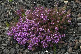 the lava. Styr killed them
both with the connivance of the Saga's leading character Snorri ١rgrÝmsson,
and married his daughter to Snorri. Today a rough trackway, the Beserkjagata,
can still be seen through the lava field, with 2 mounds said to be the Beserkers'
graves. We paused at the junction where an unsurfaced side lane led off to Bjarnarh÷fn at the coast, to admire and photograph the magnificent spectacle of
the lava field formations, and its fragile covering of Woolly Hair Moss, and
to collect specimens of the light, frothy A'a lava. And even on the
lava field's barren rubble, bright yellow Arctic Poppies (Photo
58 - Arctic Poppies) (see right) and patches of Arctic Thyme (see left) had managed to take
root. the lava. Styr killed them
both with the connivance of the Saga's leading character Snorri ١rgrÝmsson,
and married his daughter to Snorri. Today a rough trackway, the Beserkjagata,
can still be seen through the lava field, with 2 mounds said to be the Beserkers'
graves. We paused at the junction where an unsurfaced side lane led off to Bjarnarh÷fn at the coast, to admire and photograph the magnificent spectacle of
the lava field formations, and its fragile covering of Woolly Hair Moss, and
to collect specimens of the light, frothy A'a lava. And even on the
lava field's barren rubble, bright yellow Arctic Poppies (Photo
58 - Arctic Poppies) (see right) and patches of Arctic Thyme (see left) had managed to take
root.
Bjarnarh÷fn farm-museum and Hßkarl fermented
shark meat: the turning to
Bjarnarh÷fn led to the farm which houses the Bjarnarh÷fn Shark Museum, which
documents the production of Hßkarl, dried fermented meat cubes from the
Greenland Shark. In its raw state, the shark meat is laden with highly noxious
toxins. To render it semi-edible, the Vikings had buried the flesh in sand for 2
months which decomposed the meat, releasing the toxic urea and trimethylamine
oxide, and hung it to dry and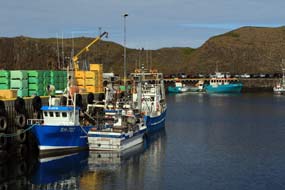 cure for another 4 months. But the resultant
so-called edible meat still reeks of ammonia, and is still a disgusting
gastronomic experience. Just because the Viking settlers in Iceland may have had
nothing better to eat than such evil-smelling, revoltingly nauseating stuff, it
has now became an Icelandic piece of tourist machismo to taste Hßkarl. And the
farm-museum at Bjarnarh÷fn dedicated to its cure for another 4 months. But the resultant
so-called edible meat still reeks of ammonia, and is still a disgusting
gastronomic experience. Just because the Viking settlers in Iceland may have had
nothing better to eat than such evil-smelling, revoltingly nauseating stuff, it
has now became an Icelandic piece of tourist machismo to taste Hßkarl. And the
farm-museum at Bjarnarh÷fn dedicated to its
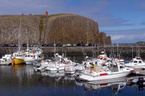 production has now become a
much-publicised stop-off for tour-buses, and obviously a profitable source of
tourist income. It all sounded even worse than Surstr÷mming, of similar origin,
and having tasted that in Sweden, we saw little point in repeating the
objectionable experience here with Hßkarl, let alone visiting an obvious tourist trap, and continued across the
magnificent Berskjahraun lava field. production has now become a
much-publicised stop-off for tour-buses, and obviously a profitable source of
tourist income. It all sounded even worse than Surstr÷mming, of similar origin,
and having tasted that in Sweden, we saw little point in repeating the
objectionable experience here with Hßkarl, let alone visiting an obvious tourist trap, and continued across the
magnificent Berskjahraun lava field.
Stykkishˇlmur fishing port:
Route 54 swung northwards up the length of the ١rsnes peninsula towards
Stykkishˇlmur. In passing we called in at Skj÷ldur Community Centre Camping, a
possible alternative to the municipal site at Stykkishˇlmur (which we knew would
be packed with holiday-makers over the holiday weekend); but this looked a poor
set up as well as being unduly expensive. By now, as we drove into the town of
Stykkishˇlmur, the overcast conditions of earlier had given way to bright and
sunny weather. We did a major, and very expensive provisions stock-up at the
Bonus supermarket, and drove down to park at the harbour. With a population of 1,100, Stykkishˇlmur is the
largest town in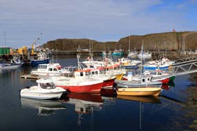 SnŠfellsnes. A place of early settlement, the town became an
important and wealthy trading centre and fishing port for Breiafj÷rur.
Nowadays, with its inheritance of attractive, brightly coloured wooden
harbour-side houses, its sheltered, warm climate, easy driving distance from the
ReykjavÝk conurbation, and ferry-link across Breiafj÷rur to Flatey and the
West Fjords, Stykkishˇlmur has become a SnŠfellsnes. A place of early settlement, the town became an
important and wealthy trading centre and fishing port for Breiafj÷rur.
Nowadays, with its inheritance of attractive, brightly coloured wooden
harbour-side houses, its sheltered, warm climate, easy driving distance from the
ReykjavÝk conurbation, and ferry-link across Breiafj÷rur to Flatey and the
West Fjords, Stykkishˇlmur has become a
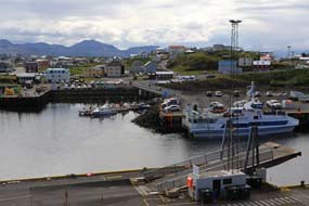 popular holiday resort and tourist destination. The town's harbour is now enclosed by a causeway built out to
connect to the large protective off-shore island of S˙gandisey. Having parked by
a harbour-side fish and chip stall, whose unconvincing smell wafted across the
quay, we ambled around the harbour photographing the fishing boats in the bright
sunshine (Photo
59 - Stykkishˇlmur fishing harbour) (see above right and left). The basalt walls of S˙gandisey enclosing the outer side of the harbour
were lined with weathered columns. Just by the ferry dock, where the Baldur
car-ferry crossed to Flatey and Bjarkalundur near to Flˇkalundur on the southern
coast of the West Fjords, steps led up onto the turf-covered top of the rocky
island with its squat lighthouse. From here, the view looking south across
Stykkishˇlmur harbour, its colourful wooden houses backed by the distant misty
mountains of the interior, was memorably photogenic (Photo
60 - Stykkishˇlmur and harbour) (see left and below right)) despite the gathering cloud. The outer side of the
little island looked out NW-wards across Breiafj÷rur's multitude of islets,
with the distant West Fjords coastline just visible on the skyline. popular holiday resort and tourist destination. The town's harbour is now enclosed by a causeway built out to
connect to the large protective off-shore island of S˙gandisey. Having parked by
a harbour-side fish and chip stall, whose unconvincing smell wafted across the
quay, we ambled around the harbour photographing the fishing boats in the bright
sunshine (Photo
59 - Stykkishˇlmur fishing harbour) (see above right and left). The basalt walls of S˙gandisey enclosing the outer side of the harbour
were lined with weathered columns. Just by the ferry dock, where the Baldur
car-ferry crossed to Flatey and Bjarkalundur near to Flˇkalundur on the southern
coast of the West Fjords, steps led up onto the turf-covered top of the rocky
island with its squat lighthouse. From here, the view looking south across
Stykkishˇlmur harbour, its colourful wooden houses backed by the distant misty
mountains of the interior, was memorably photogenic (Photo
60 - Stykkishˇlmur and harbour) (see left and below right)) despite the gathering cloud. The outer side of the
little island looked out NW-wards across Breiafj÷rur's multitude of islets,
with the distant West Fjords coastline just visible on the skyline.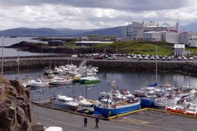
Back down to the harbour, we looked around the
attractive wooden houses of the old merchant town, most of which now were
converted to museums and restaurants geared to extracting kronas from the
tourists and holiday-makers who throng here. The museum that attracted us,
mainly for its
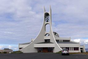 subject matter (but also for its free-entry!) was the Icelandic
Eider Centre (Ăarsetur ═slands). This showed a fascinating video on the farming
of Eider ducks, and the gathering and processing of their down for its
extraordinarily light, insulating properties. Samples of processed Eider down
and finished bed cover products were on display. We drove back through the town
up to Stykkishˇlmur's modernistic church (see left), set on a rocky hill overlooking Breiafj÷rur.
The church's interior was lit by 100s of suspended electric lights and dominated
by a modern painting of Madonna and child seemingly floating in space (see below
right). With nothing more
to detain us in tourist-oriented Stykkishˇlmur, it was time to depart to find a
campsite for tonight. subject matter (but also for its free-entry!) was the Icelandic
Eider Centre (Ăarsetur ═slands). This showed a fascinating video on the farming
of Eider ducks, and the gathering and processing of their down for its
extraordinarily light, insulating properties. Samples of processed Eider down
and finished bed cover products were on display. We drove back through the town
up to Stykkishˇlmur's modernistic church (see left), set on a rocky hill overlooking Breiafj÷rur.
The church's interior was lit by 100s of suspended electric lights and dominated
by a modern painting of Madonna and child seemingly floating in space (see below
right). With nothing more
to detain us in tourist-oriented Stykkishˇlmur, it was time to depart to find a
campsite for tonight.
A return to Snorrastair Farm-Camping: the 2 local campsites were
either over-crowded with holiday-making weekenders from ReykjavÝk with all their
noise and materialistic paraphernalia, or basic and over-priced. We examined the
map and took stock: it was only an hour's drive on Route 56 back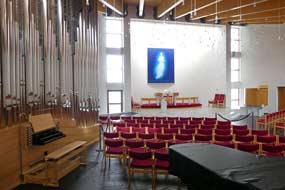 over the
peninsula spine to Snorrastair Farm-Camping, which was conveniently on our route back to Borgarnes. A quick
phone call confirmed that they were not overcrowded; their favourable response was
that for them the public holiday was just an ordinary working day. Back
along the ١rsnes peninsula (click
here for detailed map of route), with a passing glance at the much-promoted hill of over the
peninsula spine to Snorrastair Farm-Camping, which was conveniently on our route back to Borgarnes. A quick
phone call confirmed that they were not overcrowded; their favourable response was
that for them the public holiday was just an ordinary working day. Back
along the ١rsnes peninsula (click
here for detailed map of route), with a passing glance at the much-promoted hill of
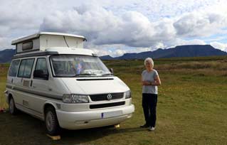 Helgafell, we returned around the end of the Berskjahraun lava field and turned
south onto Route 56. Gaining height over the SnŠfellsnes spine gave clear views
of how the viscous lava's spread was halted at a watercourse. Over the pass, we
descended to the junction with Route 54 and turned back eastwards, the way we
had come out to SnŠfellsnes a week ago across the broad coastal plain. Speeding
tourist traffic was bothersome, as in now gloomy light we passed the turnings
for Eldborg Hotel-Camping and Geruberg basalt cliffs, with the outline of the
Eldborg Crater standing clear above the lava fields. Turning off to Snorrastair
Farm, the campsite was virtually empty (see left and below right); we selected a pitch at the far end of
the camping field and walked over to the farm house to book in. As always, it
was good to return to a place where we had enjoyed a peaceful stay a week ago. Helgafell, we returned around the end of the Berskjahraun lava field and turned
south onto Route 56. Gaining height over the SnŠfellsnes spine gave clear views
of how the viscous lava's spread was halted at a watercourse. Over the pass, we
descended to the junction with Route 54 and turned back eastwards, the way we
had come out to SnŠfellsnes a week ago across the broad coastal plain. Speeding
tourist traffic was bothersome, as in now gloomy light we passed the turnings
for Eldborg Hotel-Camping and Geruberg basalt cliffs, with the outline of the
Eldborg Crater standing clear above the lava fields. Turning off to Snorrastair
Farm, the campsite was virtually empty (see left and below right); we selected a pitch at the far end of
the camping field and walked over to the farm house to book in. As always, it
was good to return to a place where we had enjoyed a peaceful stay a week ago.
War and Peace Museum documenting WW2 Allied
naval bases at Hvalfj÷rur:
the campsite remained quiet last evening with just a few tents, and this morning
we woke to a warm and sunny morning. The forecast showed days of heavy rain next
week, and given this pattern of weather, we revised our planned schedule: today
we should drive south to Hvalfj÷rur, and camp at Hafnarfj÷rur in the southern
outskirts of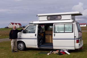 ReykjavÝk as our base for visiting the capital, to make full
use of the 2 days next week with albeit far from perfect weather on Monday and Wednesday.
It was noon by the time we finally left Snorrastair after another peaceful
stay. South across the bleak flatlands of Mřrar, we re-joined the Ring Road at
Borgarnes and again stopped at the Netto supermarket to re-stock with
provisions. Continuing south across the Borgafj÷rur causeway-bridge (click
here for detailed map of route), Route 1 rounded the shapely massif of
Hafnarfjall, and busy with traffic returning to the capital on a Sunday
afternoon, continued southwards across the rough coastal pastureland. Glad to
leave the aggressively speeding ReykjavÝk-bound traffic, we turned off onto the
more peaceful Route 47 for the 60kms detour around the long and
mountain-enclosed inlet of Hvalfj÷rur. The long and lonely road around Hvalfj÷rur
was once the main route from the capital to the north, until the opening in1998
of the 6kms long undersea toll-tunnel across the fjord-mouth at Akranes. Most
traffic now speeds northward from ReykjavÝk via the tunnel, preferring this
faster route's 1,000kr toll to the 60kms detour deep inland, leaving the Hvalfj÷rur
road more peaceful. ReykjavÝk as our base for visiting the capital, to make full
use of the 2 days next week with albeit far from perfect weather on Monday and Wednesday.
It was noon by the time we finally left Snorrastair after another peaceful
stay. South across the bleak flatlands of Mřrar, we re-joined the Ring Road at
Borgarnes and again stopped at the Netto supermarket to re-stock with
provisions. Continuing south across the Borgafj÷rur causeway-bridge (click
here for detailed map of route), Route 1 rounded the shapely massif of
Hafnarfjall, and busy with traffic returning to the capital on a Sunday
afternoon, continued southwards across the rough coastal pastureland. Glad to
leave the aggressively speeding ReykjavÝk-bound traffic, we turned off onto the
more peaceful Route 47 for the 60kms detour around the long and
mountain-enclosed inlet of Hvalfj÷rur. The long and lonely road around Hvalfj÷rur
was once the main route from the capital to the north, until the opening in1998
of the 6kms long undersea toll-tunnel across the fjord-mouth at Akranes. Most
traffic now speeds northward from ReykjavÝk via the tunnel, preferring this
faster route's 1,000kr toll to the 60kms detour deep inland, leaving the Hvalfj÷rur
road more peaceful.
Hvalfj÷rur (meaning Whale-fjord) was named
by early settlers after the number of whales that once lived in the fjord.
During the WW2 Allied occupation of Iceland however, the deep waters of the
sheltered fjord were used as a naval base by both the British and Americans, and
the
War and Peace Museum
part-way along Hvalfj÷rur's northern shore now documents the history of the
naval supply bases built along the shores of the fjord. We pulled in at the
museum, and the sight of the small campsite crowded with Icelandic
holiday-making weekenders made us glad to have changed our plans about staying
here. The small museum's entrance fee was expensive for the collection of
wartime artefacts and archive photographs relating to the Hvalfj÷rur naval
bases during the 1940~45 British and American occupation of Iceland. The Allies
constructed naval bases
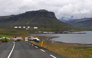 both deep at the fjord's head and towards its mouth,
with anchorages for warships and supply vessels. From the summer of 1941, Hvalfj÷rur
was used for 18 months as an assembly area for merchant vessels from both
Britain and USA gathering to sail in convoys north around Iceland through Arctic
waters past Nordkapp to Murmansk to supply USSR with war materials. This
continued until winter 1942 when the Arctic convoys sailed directly from
Scotland. Hvalfj÷rur continued as a naval base for warships protecting the
Atlantic convoys throughout the war. In winter 1940~41, the British battleship
HMS Hood was anchored at Hvalfj÷rur before joining HMS Prince of
Wales in the hunt for the German battleship Bismarck. Hood was
sunk with the loss of 1,421 sailors in the Denmark Strait between Iceland and
Greenland in the naval battle with Bismarck in May 1941, before
Bismarck herself was sunk by Royal Navy cruisers in the Atlantic. The naval
supply bases built by British and Americans continued in use throughout the war,
with a fuel depot at Misandur in the head of the fjord, and stores for supplies
and ammunition, and repair workshops including floating dock at HvammsvÝk and
HvÝtanes on the fjord's southern coast. The American oil depot at Misandur was
sold to the Icelandic government at the end of the war. both deep at the fjord's head and towards its mouth,
with anchorages for warships and supply vessels. From the summer of 1941, Hvalfj÷rur
was used for 18 months as an assembly area for merchant vessels from both
Britain and USA gathering to sail in convoys north around Iceland through Arctic
waters past Nordkapp to Murmansk to supply USSR with war materials. This
continued until winter 1942 when the Arctic convoys sailed directly from
Scotland. Hvalfj÷rur continued as a naval base for warships protecting the
Atlantic convoys throughout the war. In winter 1940~41, the British battleship
HMS Hood was anchored at Hvalfj÷rur before joining HMS Prince of
Wales in the hunt for the German battleship Bismarck. Hood was
sunk with the loss of 1,421 sailors in the Denmark Strait between Iceland and
Greenland in the naval battle with Bismarck in May 1941, before
Bismarck herself was sunk by Royal Navy cruisers in the Atlantic. The naval
supply bases built by British and Americans continued in use throughout the war,
with a fuel depot at Misandur in the head of the fjord, and stores for supplies
and ammunition, and repair workshops including floating dock at HvammsvÝk and
HvÝtanes on the fjord's southern coast. The American oil depot at Misandur was
sold to the Icelandic government at the end of the war.
Having viewed the museum's displays, we continued our journey around the inner
depths of Hvalfj÷rur (click
here for detailed map of route). Route 47 wound a way towards the fjord's inner head,
passing the site at Misandur of the wartime oil storage depot, now a modern oil
terminal (see above left). Around the lonely fjord head at Botnsdalur, where the Botnsß River
flowed in from the 200m high Glymur waterfalls, the road began the winding
return route along the southern shore, following every inlet. Normally a lonely
route, today on the holiday weekend, quite a number of ReykjavÝk-bound cars had
taken the longer route around Hvalfj÷rur. Route 47 passed the site of the
former naval stores and repairs depots, now occupied by holiday-homes, and
eventually reached the junction with Route 1 Ring Road at the southern mouth of
Akranes undersea tunnel. We joined the Ring Road, now very busy with returning
holiday traffic, to approach the outer suburb township of MosfellsbŠr, and the
start of the Greater ReykjavÝk conurbation.
Coming next: we shall now spend a couple
of days in Iceland's capital city ReykjavÝk, including a visit to the Al■ing,
Iceland's Parliament, and onwards to the Hengil geothermal area around
Hverageri, the volcanic plain of Ůingvellir astride the Mid Atlantic Ridge and
site of the medieval Al■ing Assembly, and Geysir spouting hot springs and
Gullfoss waterfalls, Iceland's south coast
at Eyrarbakki,
and Selfoss. But more of that in the next edition which will be published soon.
Next edition to
be published quite soon
|
Sheila and Paul |
Published: 2 June 2019 |
|

 CAMPING
IN ICELAND 2017 - SnŠfellsnes Peninsula and West Iceland: EirÝksstair, Reykholt, Borgarfj÷rur, Eldborg Crater, Arnarstapi and Hellnar,
Hellissandur, Grundarfj÷rur, Stykkishˇlmur,
Borgarnes and Hvalfj÷rur:
 South from Reykhˇlar:
after our relaxing couple of days enjoying the warm weather and bird-life at
peaceful Reykhˇlar, we returned around the Reykjanes peninsula coastline to
re-join the main Route 60 at Bjarkarlundar. It was another beautiful morning:
the sky was clear with bright sunshine, the valleys looked green against the
misty, stark, craggy mountains, and the fjord reflected the blue sky. Farmers
had been taking full advantage of the few days of fine weather for hay-making,
and fjord-side fields were dotted with plastic-covered hay bales (see left).
 -making caravans from the
ReykjavÝk conurbation. We had seen reference to a White-Tailed Eagles
Centre in the Gamla KaupfÚlagsh˙si (Old Shop-house) at Krˇksfjararnes, but had
been unable to find any details. We turned off the main road into the scattered
village, found the old shop, and sure enough the sign in the window announced Arnarsetur Eagle Centre. The former village shop had closed, but had re-opened
as a community enterprise selling handicraft works, with locally made genuine
Icelandic sweaters (so much of the knitwear ubiquitously sold at enormous
expense to tourists are
far eastern imports). We were graciously welcomed, to be told that a local
person organised the displays and information panels about White-Tailed Eagles;
being now protected, these magnificent birds of prey are now nesting again in
ever greater numbers around Breiafj÷rur.
 Fulmars; they are
non-migratory and pairs mate for life. This admirably unpretentious little
museum at Krˇksfjararnes, which charges only 250kr for admission, deserves
greater recognition. As we sat outside in the sunshine to eat our lunch
sandwiches after our visit. we chatted with the girl who had welcomed us; it
turned out she was German, who had come originally as a back-packing traveller,
and had stayed for the summer to work here at the handicraft shop. If you pass
this way en route to or from the West Fjords, make a point of stopping for
coffee and cakes at this worthy community venture.
  the shores of Hvammsfj÷rur, the innermost corner of the vast Breiafj÷rur, to reach the
large village of B˙ardalur (
 of
Haukadalur (see left and right), and 8 kms along the dale on a dusty dirt road we reached the site of
what has been interpreted from a tentative reference in one of the Sagas as EirÝksstair, the
farmstead of EirÝk the Red, father of Leifur EirÝksson. The Norse Viking, EirÝk
the Red (EirÝk Ůorvalsson 950~1003 AD) had, according to the Icelandic Book of
Settlements (the Landnßmabˇk), originally settled in Hornstrandir in the West
Fjords after his father had been exiled from his native Norway for murder. EirÝk
moved to Haukadalur after marrying into a land-owning family there. and built a farmstead which he named EirÝksstair. But, a violent and ill-tempered man,
he was exiled from Haukadalur after murdering several neighbours in a dispute.
He moved to SnŠfellsnes from where, after committing further acts of murder, he
was exiled again. With a shipload of comrades, he set sail westwards discovering
new lands where,
 according to the Saga of the Greenlanders, he settled naming
the country Greenland to entice other settlers to follow. His son Leifur
EirÝksson, who had been born at EirÝksstair
around 980 AD and moved with his father to Greenland, set out also to sail
further westwards, discovering new lands in 1000 AD thought to be along the
Labrador coast of North America, which he named Markland (Forest Land). Sailing on, he reached more fertile lands
where wild vines are said by the Sagas to have grown; he accordingly named the
land Vinland. Leifur
EirÝksson attempted to establish a colony there, but this lasted for no
more than a generation. Among his fellow settlers in the New World were
  after the Vinland settlement's failure returned to Iceland in
the early years of the 11th century and settled at GlaumbŠr (
 we found the site of the
archaeological excavation. The view looking along the broad, fertile valley was
even more striking; you could understand why sea-born settlers had chosen this
dale for their farmsteads. A modern replica of the turf-roofed long-house had
been constructed nearby (see above left and right) (
 its tourist-focussed claim to links with EirÝk
the Red and Leifur EirÝksson.
 A
miserably crowded and noisy stay at the dreadful Varmaland Camping:
crossing the salmon-rich wide River Norurß, we turned off to find tonight's campsite at Varmaland, a huge geothermal swimming pool with attached so-called 'campsite'.
Being relatively close to ReykjavÝk, this was
 bound to attract holiday-making
crowds from the conurbation. We had little expectations of the place, but it was
even worse than we could have conceived: it was nothing more than an enormous
rough field alongside the swimming pool complex, crammed full of caravans and
luxury trailer-tents, the sort of fun-loving, materialistically-minded, rowdy
folk we should normally run a million miles to escape from, except that for
tonight there was no such escape. This was the only place to camp in the
vicinity, and we just about managed to find a reasonably quiet spot in the far
corner looking out across farmland to a distant horizon of volcanic mountains
(see right).
With heavy hearts we settled in. There was of course no power supplies in this
corner and the distant facilities were limited to WC and a geothermally heated
wash-up sink. Even so, with a captive audience of such massed holiday-makers,
prices were appallingly expensive, but at least the Camping Card was accepted.
But there would be little peace, despite having tent campers as near neighbours.
On a fine, sunny evening we cooked a barbecue supper, and tonight we had just
turned in and got off to sleep when we were wakened by noisy late arrivals
thoughtlessly slamming car doors, until our robust protests caused them to move.
The following morning was hot
 and sunny and we sat out for breakfast behind
George, out of view of the rowdy hordes. We managed to get a limited wash at the
basic facilities, and were glad to get away from this hideous place and the even
more hideous holiday-makers.
 Deildartunguhver
geothermal source in Borgarfj÷rur: on a
beautifully sunny morning, driving inland across the rolling fertile farmlands
of lower Borgarfj÷rur (
 Reykholt, the farmstead of Snorri Sturluson: 5kms along Route 518 we reached Reykholt, site of
the farmstead estate of Iceland's renowned medieval clan-chieftain (goar),
politician and poet, Snorri Sturluson (1179~1241). Born into the wealthy
land-owning Sturlung family, one of the powerful clans whose feuding wracked
medieval Iceland, Snorri was educated at the cultural centre of Oddi in
 Southern
Iceland; he married into a wealthy land-owning family at Borg ß Mřrum near
Borgarnes so acquiring wealth and property. He later settled at the church centre
of Reykholt in Borgarfj÷rur, building up the estate, consolidating his grip
on power and wealth, and becoming goar (chieftain) of the Sturlung clan
and in 1215 Lawspeaker of the Al■ing, the Assembly of the Icelandic
Commonwealth. While at Reykholt, Snorri composed his famous Saga works, the
Prose Edda an account of Norse Mythology, Egil's Saga a history of the Viking
Skald court-poet Egil Skallagrimsson, and the Heimskringla a history of the
Kings of Norway. His position of power brought him into contact with King Hßkon
of Norway whose vassal Snorri became. In 1218 he travelled to the Cathedral city
of Nidaros (Trondheim) and the Norwegian court of the teenage King Hßkon at
Bergen, also forming a friendship with Jarl (Earl) Sk˙li, Hßkon's co-regent and
rival for the throne of Norway. Medieval power politics were however a changing
game: Hßkon was playing off the Icelandic clan chieftains against one another to
enhance his hold on power and extend his realm to Iceland. As Lawspeaker, Snorri
fell foul of this and was suborned by King Hßkon to persuade the
 Al■ing to
accept Norwegian suzerainty. On his return to Iceland in 1220, he resumed his
duties as Lawspeaker of the Al■ing, but his support for Norway's cause brought
opposition from the other chieftains; the rise to power of Snorri's opponents
resulted in several years of violent clan feuding. By 1237 Snorri was forced to
seek refuge in Norway and he returned to Hßkon's court. But the power rivalry
there between the King and Jarl Sk˙li had erupted
 into open civil war; because
of Snorri's support for Sk˙li in his unsuccessful bid for royal power, Hßkon
forbade Snorri to leave Norway; Snorri disobeyed this command and sailed back to
Iceland in 1239. Hßkon charged one of Snorri's rival clan chieftains, Gissur
Ůorvalsson, to bring him back dead or alive. Gissur led a band of 70 armed men
to Reykholt, and Snorri was hacked to death in 1241. Hßkon continued suborning
the clan chieftains of Iceland, and in 1262, the Al■ing finally ratified union with
Norway; royal authority was instituted in Iceland, so bringing to an end the Commonwealth
which had ruled Iceland since 980 AD and the Settlement.
 estate and found the pool fed by a hot spring, the Snorralaug, where Snorri is
said to have bathed; a modern statue appeared to show him wearing
 his dressing
gown, perhaps just having got out of the Snorralaug (see above left). And nearby was the entrance to the tunnel leading to his
farm where he was murdered by Gissur's assassins.
 turquoise cascades pouring
 out from under the lava contrasted in colour with the
murky grey glacial silt-laden river. The Hallmundarhraun resulted from a
volcanic eruption under the NW edge of Langj÷kull around 930 AD, the time of the
first recorded Settlement of Iceland, which flowed westwards along
valleys to form a massive lava field covering an area of some 242 square kms
bordering on the HvÝtß River. The Hraunfossar made a unique sight with the long
lateral series of cascades pouring from under the base of the depth of lava
which overlays the lower strata of harder, more impervious bed-rock bordering the river's far bank (
 from
from under the lava field
(see above right) (
 Travelin' Tortuga Icelandic travelogues on their web site
 moved on, still with no where identified to camp tonight. Our guide books
suggested Fljˇtstunga Farm offered camping, located in remote wild country 6kms
beyond the end of the tarmaced Route 518, on a single-track dirt road across the
Hallmundarhraun lava field on the far side of the upper HvÝtß River. The remote
VÝgelmir lava cave and Surtshellir lava tube were both on Fljˇtstunga Farm's
property, and the farm organised tours of the caves. We set off, and just beyond
H˙safell where Route 518 passed through an area of birch scrub, we chanced upon a
lay-by, sheltered from the road by birch woodland; here was a potential wild
camp spot if all else failed. Just beyond, we reached the road junction where
the tarmac ended and Route 550 mountain road branched off southwards across the
remote interior towards Thingvellir.
 steeply to cross the
ridge; this descended even more steeply of the far side into a further desolate
valley filled with the moss-covered Hallmundarhraun lava field. The rough road
turned to cross a tributary of the HvÝtß, cutting across the lava field to reach
the turning to Fljˇtstunga Farm up on the hill-side. It was a remote and
isolated spot, but heart-sink: the camping symbol on Fljˇtstunga's sign was
crossed out. We tried unsuccessfully to phone, but the number was no longer in
use. We drove up, to be met by a security man who said we were 2 years too late;
the place had changed hands and no longer offered accommodation or camping!
 without
disturbance, and woke to a cloudier, cooler morning.
 A blustery day in camp at Snorrastair:
thankful to be leaving all this behind, we headed north on the Ring Road in
heavy traffic, and even more thankfully turned off onto Route 54 towards SnŠfellsnes
(
 couple of kms, we reached the tiny
hamlet of Borg ß Mřrum, and paused at the tiny church by the historic farm where
the father of Egil Skallagrimsson, hero of Egil's Saga, had first settled and
which Snorri Sturluson later acquired by marriage. We continued across the rough
pasture land which was criss-crossed with basalt outcrops and distant volcanic
peaks, and beyond the ┴lftßrhraun lava field, eventually reached the turning to
Snorrastair Farm, the first of tonight's campsite options. 2 kms along the
farm's driveway, the little campsite looked empty and inviting. This was the
start-point for the walk across the Eldborgarhraun lava field to climb the scoria
cone of the Eldborg Crater. We had been undecided between the campsite at
Snorrastair Farm and our other option at the Eldborg Hotel a little further
north which was a Camping Card site. We phoned Eldborg for more information; the
person answering assured us it was not busy, but it was another of those sites
with showers at the neighbouring swimming pool charged extra at an expensive
700kr. The lady at the farmhouse confirmed the Snorrastair price was 2,500kr
all-inclusive of showers, kitchen and wi-fi. That decided it; we should stay
here at Snorrastair Farm.
 at Borgarnes it was whipping up a swell on the fjord; but out
here on the high, flat coastal plain exposed to the full force of winds blowing
straight off the North Atlantic, a 10 m/s gale was forcefully blowing from the
NE. There was absolutely no shelter or wind-break on the open, flat turfed
camping area, and the old barn converted for facilities served to give no
shelter from the gale blowing from the NE. With some difficulty struggling
against the force of the wind, we pitched with George faced into the gale (see
right) (
 some glorious late sun
photographs against the silhouetted peaks of SnŠfellsnes
(
 It was indeed a rough night, and this morning
dawned heavily overcast with a brisk NE wind still blowing at 10 m/s. The
forecast confirmed the decision to take a day in camp here today, and to climb
the Eldborg Carter tomorrow when the wind speed would be less. The weather
remained largely overcast all day and the gusting NE wind scarcely lessoned. Snorrastair had proved a good choice of campsite for a rest day, with its full
facilities, albeit straightforward, particularly the welcome relief of showers
which were becoming something of a rarity! The site-wide wi-fi was also a
welcome addition, and with its very reasonable all-inclusive price, Snorrastair
merited a +4 rating.
 This covers an area of some 32 square kms and had
spread from eruptions some 5,000~8,000 years ago from a short SW~NE fissure. The Eldborg scoria spatter cone, exceptionally symmetrical in shape, formed during
an eruption from a circular vent
along the fissure that had caused the lava field. Regular crater walls built up
around the vent in thin layers of lava, forming a narrow edge all around the
conical scoria crater, which now
 stands 60m above the surrounding lava field,
slightly oval in shape, 200m in diameter and 50m deep inside.
 the
lava to cross a less distinct subsidiary crater where ropy patterned Pahoe-hoe
lava-flows were more evident (
 began the steep descent, thankful for the security of the safety chain.
Edging our way down, we reached the foot of what had felt the near-vertical cone
wall, here able to stand to admire the view looking down over the subsidiary crater
below and the separate mini-crater set further over (see below right) (
 Back across the side of the scoria subsidiary crater
down to a paths junction, we cut across on a side-path and up the slope of
scoria clinkers making up the smaller cone. This provided a vividly marked
contrast between the slow-moving Pahoe-hoe lava-flows that had accumulated
around the eruption and had built up to create Eldborg's cone; while here at the
separate and later mini-crater, the cone was formed of loose, small pieces of
rubble and airy, light pumice clinker, associated with classic A'a lava-flow. We climbed
the slope to the crater rim for the views looking back across the subsidiary crater to
the main Eldborg cone (
 land
had no other use than for grazing sheep.
 prepared to pay 700kr each for showers at their swimming
pool), its only advantage being that it accepted payment by Camping Card. The
now powerful headwind made driving around Route 54 unsteady, yet even so the
irresponsible young tourists in hire-cars still hassled from behind and sped past
dangerously in the face of oncoming traffic. We turned off along Eldborg's
driveway across the flat moorland, to reach the unsightly, ugly concrete bunker
of a hotel. The rough, grassy camping field alongside was thankfully almost
empty, and in the now really strong NE gale blowing over from the inland
mountains, the thick spruce and birch hedge across the middle of the field at
least provided an effective wind-break. A German couple in a camping-car filling
the middle space had no objection to our pitching alongside in the lee of the
only section of hedge within reach of the one and only power socket; with some
difficulty battling against the gale, we settled in (see below right).
 We walked over to the huge concrete bunker
masquerading as a hotel to book in, to be treated to an utterly indifferent and
unresponsive non-welcome from the girl at the hotel reception; if such a Why
should I bother to serve you? attitude represented the standard of service
expected of such a hotel, it spoke volumes about the place! We insisted on her
showing us the camping facilities, limited to 2 WCs and a hand basin in a dingy,
underground dungeon beneath the hotel, along with a wash-up sink and electric
ring
 passing for a 'kitchen'. For all this substandard service and mediocre
facilities, they had the nerve to charge 1,200kr/person plus 1,000kr for
electricity (showers in their swimming pool were 700kr each extra). We paid by
Camping card. When it came later to writing up Eldborg Hotel's review, we tried
telephoning the hotel and received a similarly inhospitable, non-responsive
response! The place was given a generous -2 rating.
 standard offered in the hotel, and if not, why were campers
discriminated against. The girl hastily set to cleaning the loos, emptying bins
and re-filling paper towel and loo-roll holders. The gale continued to blow all
day, but the forecast showed a gradual reduction tomorrow and return to a more
gentle 3 m/s on Tuesday.
 Geruberg Basalt Columns: the following morning was bright,
and
as forecast the wind had reduced to 5 m/s. We returned to the main Route 54 and
almost opposite, a farm drive dirt track led inland sign-posted for Geruberg and
Rauamelur. The trackway led in a short distance to the Geruberg Basalt Columns, a
2kms long shattered escarpment of grey, 50m tall, hexagonal and square columns
with a skirt of broken blocks at the foot of the cliffs, the longest and most
perfect set of such basalt pillars in the country (see left). We stopped at a parking area
and climbed up the slope to the foot of the huge columns which towered overhead.
But the natural grandeur of this wonderful feat of nature was tarnished by the
silly antics of crowds of tourists swarming all over the cliffs and the skyline
above the pillars. For such folk, the only passing relevance of this
magnificent natural phenomenon was to form an incidental backdrop for their
'selfies'. But fortunately, true to form, the tourists' span of attention
typically was so brief that within moments, they had all rushed off in their
hire-cars to sully the next 'attraction', leaving us in
 peace to admire in wonder the Geruberg Basalt Columns. We stood amid the Bilberry and Crowberry
(see below right) at the foot of the parade of columns, admiring their majesty,
and contemplating their formation as the cooling basaltic lava cracked into
such regular patterns on such a scale. From this perspective, we took our photos
in the clear morning sunshine looking along the line of the columnar cliff
escarpment; some of the pillars were even leaning outwards, separated from the
walls of the cliffs
 (see above
right) (
 culminated in the
peak of SnŠfellsnes capped with its glacier (see left). At the Vegamˇt service station road junction, Route 56 branched off to Stykkishˇlmur on
the peninsula's north coast; Route 54 continued westwards turning back towards
the coast. Here we turned off down to YtrÝ-Tunga beach, but so regrettably had
the tourist hordes. Our reason for venturing off the main road down to this
beautiful stretch of wild beaches and golden sands surrounded by rounded
volcanic boulders, was to
 find the colony of Harbour Seals that bask on the
rocks along this coast-line. On such a bright, sunny day, we were not sure
whether the seals would be out of the water. But as we walked along the
magnificent beach, and scrambled over the rocks at the far end, sure enough
there were 2 pairs of Harbour Seals basking by the water's edge on flat rocks
(see right) (
 seals flopped over into the water and
swam off, their shiny black heads just visible in the water (
 industry.
 B˙ir church and the B˙arhaun lava field: back to
the main road, we continued westwards in bright afternoon sunshine (
 beyond a turning led down to the former fishing and trading hamlet of B˙ir. The
trading settlement was abandoned in the early 19th century, and all that remains now is
the tiny wooden church and nearby isolated inn-hotel, standing at the edge of the B˙ahraun lava field. B˙ir's
original name was Hraunh÷fn, meaning Lava-field Harbour.
 the church, we moved George back to
park near the hotel so that we could walk back along the lane to admire the lava
field, backed by the glorious view of the SnŠfellsnes peak and glacier (see
right) (
 Autumn Gentians
(Gentianella amarella) still
largely in bud
(
 We had earlier phoned Snjofell Travel
Service guest-house-camping at Arnarstapi, as a potential campsite for tonight,
only to discover what an exploitative tourist rip-off this was. The woman
answering openly admitted that the only facilities were WCs and cold water; no
showers, no kitchen, and no hot water, and for this they were charging 3,000kr
plus 1,000 for power. But we had so far found no viable wild camp spot, and a
quick tour of the village showed that clearly there was no potential for wild
camping amid the holiday homes of Arnarstapi. Given therefore that we wanted to
walk the Arnarstapi~Hellnar cliff-top coastal path tomorrow, there was nothing
for it but to face the outrageously over-priced and sub-minimal facilities at Snjofell Travel
Service.
 showed just how limited they were. A lad came round
after our barbecue supper to collect payment. We were all prepared to raise
vehement objections to the excessively high cost and minimal facilities, but in
fact the lad, a summer worker from Portugal, took the wind from our sails: he
came straight out
 with a statement about the campsite owner's monopolistic
charges and complacency about providing adequate facilities with the
never-ending influx of tourists. He then surprised us further by volunteering to
charge us only 2,000kr as seniors and as if we were in a tent. So honour was
served and we duly paid 2,000kr for our night's stay.
 The path followed
all the indentations and clefts eroded into the basalt cliffs by the power of
waves (see left) (
 peer down at the many Kittiwakes nesting on ledges; this year's young birds were
by now almost fully grown (see right) (
 of
southern SnŠfellsnes stretching along the horizon (see below right).
 Clearly
the numbers of tourists treading the cliff-top path had caused serious problems
of erosion, and as a result the path had now been reinforced with hard rubber
mesh covered with gravel, a non-intrusive protective measure along the main body
of cliff-tops. Along this stretch, we found the first of the Gentians that
populate the Arnarstapi cliff-top turf: purple Field Gentians (Gentianella campestris)
(
 The path now reached a gate marking the end of the cliff-top turf meadowland,
and beyond this point the on-going path wound a tortuous way over
 and through a rough lava field (see below left) (
 find the SnŠfellsnes National Park Information Centre.
 It was by now 2-45pm; we had spent 3 hours on
the outward walk with all the cliff-top photographic interest of basalt
formations and wild flora. Reaching another cafÚ, we learned that the
Information Centre had moved, so we returned downhill to begin the return walk.
Keeping up a good pace, we re-crossed the lava field passing swarms of tourists
wandering indifferently though this natural wonderland, and reached the gate
leading to the cliff-top meadowland for the return path along to Arnarstapi
harbour and its lava formations.
 slopes, endless lava fields. Even on a bright
afternoon, this was a fearsomely bleak and desolate wilderness stretching away
as far as the eye could see,
 and dotted with clusters of outlying cone-craters.
Although covered with low vegetation, this entire landscape was barren
supporting no farming. The only thing to be seen were tourist cars gathered at
parking areas. The road continued northwards, swinging inland past the Sßxholl
Crater which we should visit tomorrow. Finally reaching the flatter north coast and the
shores of Breiafj÷rur, the road turned back eastwards along the coast, passing
the huge 412m high radio mast (one of Western Europe's tallest structures) of
Iceland's main 189kHz long wave transmitter which broadcasts the national
shipping forecast.
 supplies. Back over at the
campsite, we settled in, both exhausted after such a rewarding day. The campsite
gradually filled to capacity tonight with
 both Icelandic holiday-makers and
tourist hire-campers. Being so crowded, the site was inevitably noisy even
after 10-30 when we turned in.
 8,000 years ago. Plinian eruptions are the most violent of
explosive eruptions, ejecting huge columns of pulverised volcanic debris,
pumice, ash and volcanic gases high into the stratosphere, as happened
with Vesuvius in 79 AD and described in the letters of Pliny (hence the
eruption's name). In spite of there having been no eruptions in recent years, it
is still an active volcano beneath the SnŠfellsj÷kull glacial cap.
 strata of rocks formed beneath glaciers during the
Ice Ages, and the surface layers are lava fields from the post-glacial period,
younger than 11,000 years old. SnŠfellsnes volcanic crater is best known as the
fictional setting for Jules Verne's adventure novel Journey to the Centre of
the Earth, in which the hero, German geologist Professor Lidenbrock from
Hamburg, descends into the crater of the dormant volcano under its glacier with
his nephew Axel and an Icelandic guide; after fantastic subterranean
adventures, they eventually emerge at the Mediterranean volcano of Stromboli. These
apparently barren lava fields covering such an extensive area of the peninsula's
western tip are state lands, since 2001 covered by the SnŠfellsnes National
Park. The only productive farming usage for the land is
 for sheep grazing,
although there are now few remaining farms. The lava fields once had a greater
covering of vegetation, but during the 19~20th centuries this was largely
stripped by over-grazing.
 (
( National Park map showed that all along this western coast of SnŠfellsnes, there
had been a history of wrecked trawlers, several of them British, the most recent
being the Svanborg in 2001. In such grey, overcast weather, the beach was
a gloomily eerie place, whose peace was disturbed by the racket created by moronic tourists milling around. We explored the grotesquely-shaped lava
formations which spilled down the beach right to the water's edge (see right) (
 Hˇlarhˇlar Craters cluster and Sßxholl Crater:
continuing further north across the desolate lava wilderness, we turned off
again onto a dirt road leading
towards the Hˇlarhˇlar cluster of craters. 2 kms
along led us directly into the vast open amphitheatre of the Berudalur explosion
crater with views looking back at the SnŠfellsnes peak, its glacial cap now in
cloud (see below left) (
 friable scoria. The jagged lava surround of the crater rim formed a more vivid
impression of this form of phreatic eruption crater (
 departed
early afternoon to return westwards and turn off on Route 579 (
 the basalt cliffs enclosing this sheltered cove, and for once we had this peaceful setting to
ourselves. Beyond here, a very rough, narrow and unsurfaced trackway continued
westwards, meandering through newer black lava fields. George bumped along
slowly and in 3 kms reached a T-junction: left headed for Sv÷rtuloft cliffs and
the tall lighthouse; we turned right for a further km to the rough track's end
at Ídverarnes Point with its squat orange lighthouse. This was the westernmost
tip of SnŠfellsnes peninsula at 24║ west (see below right) (
 . We had previously learnt the difference
between long-line and hand-line fishing techniques at Suureyri (
 which enclosed
the site on 3 sides. The smell of fish from ËlafsvÝk fish-processing factory wafted over
from the town. By the time we had cooked supper, the evening grew very chill, and
the campsite filled to capacity as late-arriving tents and hire-campers swarmed
in, with much noise and lack of awareness for other campers.
 A day in camp at ËlafsvÝk Camping: with the Icelandic Labour Day
public holiday approaching, this morning we telephoned Stykkishˇlmur Camping
about the forthcoming holiday weekend. Being within easy driving distance of the
ReykjavÝk conurbation, it was inevitable that Stykkishˇlmur would be crowded
with rowdy Icelandic holiday makers, leaving us in a quandary as to where we
should camp this coming weekend. We decided in the meantime to take a day in
camp today here at ËlafsvÝk. The campsite emptied leaving us in peace for a
productive and restful day of mundane jobs catching up with writing. This
evening the campsite soon filled up again.
  out the misty outline of the bulky, shapely Kirkjufell
which dominated the port of Grundarfj÷rur. Reaching Grundarfj÷rur, we turned
off to investigate the local campsite set by the town swimming pool. But this
was a very straightforward site, with basic facilities, and not really on our
route. The sky was now very gloomy, making what should in fine weather have been
the picture-postcard view of Kirkjufell across the fjord scarcely visible. What
however was entertaining was the sight of forlorn-looking tourists from the
cruise-ship anchored out in
 the bay, wandering aimlessly around the town, wet,
bedraggled and totally ill-equipped for Icelandic weather conditions, and
clearly puzzled at what they were doing here in this no-nonsense fishing port!
We drove down to the harbour, but all the boats were out; in such gloomy
weather, with low cloud obscuring the mountains enclosing the town, even we had
to admit that there was nothing for it but to drive on.
 relates
tales of clan feuding in SnŠfellsnes, a late 10th century local farmer, Viga-Styr
from Hraun brought 2 berserker warriors from Sweden to defend his property and
work on his farm. But when one of them took a liking to Styr's daughter, he gave
the Beserkers the seemingly impossible task of clearing a way through the rough
lava field, as the condition for marrying his daughter. Unfortunately the
Beserkers succeeded in tearing a passageway through
 the lava. Styr killed them
both with the connivance of the Saga's leading character Snorri ١rgrÝmsson,
and married his daughter to Snorri. Today a rough trackway, the Beserkjagata,
can still be seen through the lava field, with 2 mounds said to be the Beserkers'
graves. We paused at the junction where an unsurfaced side lane led off to Bjarnarh÷fn at the coast, to admire and photograph the magnificent spectacle of
the lava field formations, and its fragile covering of Woolly Hair Moss, and
to collect specimens of the light, frothy A'a lava. And even on the
lava field's barren rubble, bright yellow Arctic Poppies (
 cure for another 4 months. But the resultant
so-called edible meat still reeks of ammonia, and is still a disgusting
gastronomic experience. Just because the Viking settlers in Iceland may have had
nothing better to eat than such evil-smelling, revoltingly nauseating stuff, it
has now became an Icelandic piece of tourist machismo to taste Hßkarl. And the
farm-museum at Bjarnarh÷fn dedicated to its
 production has now become a
much-publicised stop-off for tour-buses, and obviously a profitable source of
tourist income. It all sounded even worse than Surstr÷mming, of similar origin,
and having tasted that in Sweden, we saw little point in repeating the
objectionable experience here with Hßkarl, let alone visiting an obvious tourist trap, and continued across the
magnificent Berskjahraun lava field.
 SnŠfellsnes. A place of early settlement, the town became an
important and wealthy trading centre and fishing port for Breiafj÷rur.
Nowadays, with its inheritance of attractive, brightly coloured wooden
harbour-side houses, its sheltered, warm climate, easy driving distance from the
ReykjavÝk conurbation, and ferry-link across Breiafj÷rur to Flatey and the
West Fjords, Stykkishˇlmur has become a
 popular holiday resort and tourist destination. The town's harbour is now enclosed by a causeway built out to
connect to the large protective off-shore island of S˙gandisey. Having parked by
a harbour-side fish and chip stall, whose unconvincing smell wafted across the
quay, we ambled around the harbour photographing the fishing boats in the bright
sunshine (
 subject matter (but also for its free-entry!) was the Icelandic
Eider Centre (Ăarsetur ═slands). This showed a fascinating video on the farming
of Eider ducks, and the gathering and processing of their down for its
extraordinarily light, insulating properties. Samples of processed Eider down
and finished bed cover products were on display. We drove back through the town
up to Stykkishˇlmur's modernistic church (see left), set on a rocky hill overlooking Breiafj÷rur.
The church's interior was lit by 100s of suspended electric lights and dominated
by a modern painting of Madonna and child seemingly floating in space (see below
right). With nothing more
to detain us in tourist-oriented Stykkishˇlmur, it was time to depart to find a
campsite for tonight.
 over the
peninsula spine to Snorrastair Farm-Camping, which was conveniently on our route back to Borgarnes. A quick
phone call confirmed that they were not overcrowded; their favourable response was
that for them the public holiday was just an ordinary working day. Back
along the ١rsnes peninsula (
 Helgafell, we returned around the end of the Berskjahraun lava field and turned
south onto Route 56. Gaining height over the SnŠfellsnes spine gave clear views
of how the viscous lava's spread was halted at a watercourse. Over the pass, we
descended to the junction with Route 54 and turned back eastwards, the way we
had come out to SnŠfellsnes a week ago across the broad coastal plain. Speeding
tourist traffic was bothersome, as in now gloomy light we passed the turnings
for Eldborg Hotel-Camping and Geruberg basalt cliffs, with the outline of the
Eldborg Crater standing clear above the lava fields. Turning off to Snorrastair
Farm, the campsite was virtually empty (see left and below right); we selected a pitch at the far end of
the camping field and walked over to the farm house to book in. As always, it
was good to return to a place where we had enjoyed a peaceful stay a week ago.
 ReykjavÝk as our base for visiting the capital, to make full
use of the 2 days next week with albeit far from perfect weather on Monday and Wednesday.
It was noon by the time we finally left Snorrastair after another peaceful
stay. South across the bleak flatlands of Mřrar, we re-joined the Ring Road at
Borgarnes and again stopped at the Netto supermarket to re-stock with
provisions. Continuing south across the Borgafj÷rur causeway-bridge (
 both deep at the fjord's head and towards its mouth,
with anchorages for warships and supply vessels. From the summer of 1941, Hvalfj÷rur
was used for 18 months as an assembly area for merchant vessels from both
Britain and USA gathering to sail in convoys north around Iceland through Arctic
waters past Nordkapp to Murmansk to supply USSR with war materials. This
continued until winter 1942 when the Arctic convoys sailed directly from
Scotland. Hvalfj÷rur continued as a naval base for warships protecting the
Atlantic convoys throughout the war. In winter 1940~41, the British battleship
HMS Hood was anchored at Hvalfj÷rur before joining HMS Prince of
Wales in the hunt for the German battleship Bismarck. Hood was
sunk with the loss of 1,421 sailors in the Denmark Strait between Iceland and
Greenland in the naval battle with Bismarck in May 1941, before
Bismarck herself was sunk by Royal Navy cruisers in the Atlantic. The naval
supply bases built by British and Americans continued in use throughout the war,
with a fuel depot at Misandur in the head of the fjord, and stores for supplies
and ammunition, and repair workshops including floating dock at HvammsvÝk and
HvÝtanes on the fjord's southern coast. The American oil depot at Misandur was
sold to the Icelandic government at the end of the war.