|
 CAMPING IN
SWEDEN 2016 - across the Arctic
Circle to Jokkmokk, Kvikkjokk, WW2 Lancaster Easy Elsie
crash site, Porjus and Lulea River HEP dams, iron ore town of Kiruna, Sweden's northernmost village Karesuando,
border with Finland along Tornedalen valley, Pajala, re-cross Arctic Circle south
at Överkalix, Älvsbyn, Piteälven valley and Storforsen rapids: CAMPING IN
SWEDEN 2016 - across the Arctic
Circle to Jokkmokk, Kvikkjokk, WW2 Lancaster Easy Elsie
crash site, Porjus and Lulea River HEP dams, iron ore town of Kiruna, Sweden's northernmost village Karesuando,
border with Finland along Tornedalen valley, Pajala, re-cross Arctic Circle south
at Överkalix, Älvsbyn, Piteälven valley and Storforsen rapids:
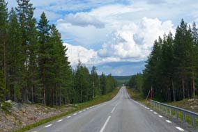 North across the Arctic Circle (again):
after leaving Moskosel northwards, E45 Inlandsvägen crossed the wide, fast-flowing Piteälven river, a
white-water torrent even in the dry season; we did not stop today since we
should see the Piteälven later in the trip at Storforsen rapids. The road
meandered generally northwards through magnificent spruce forested terrain, with
even more spectacular distant views to northern fell-land hills (click here for detailed map of route). The sheer scale
of this forested fell-scape offset the apparent monotony of the endless sea of
trees (see left). The Inlandsbanan railway had strayed away from the road, its route
determined by the practical difficulties of overcoming natural obstacles of
marshland and rivers, but re-crossed the E45 at the villages of Kåbdalis and
Tarrajaur. North across the Arctic Circle (again):
after leaving Moskosel northwards, E45 Inlandsvägen crossed the wide, fast-flowing Piteälven river, a
white-water torrent even in the dry season; we did not stop today since we
should see the Piteälven later in the trip at Storforsen rapids. The road
meandered generally northwards through magnificent spruce forested terrain, with
even more spectacular distant views to northern fell-land hills (click here for detailed map of route). The sheer scale
of this forested fell-scape offset the apparent monotony of the endless sea of
trees (see left). The Inlandsbanan railway had strayed away from the road, its route
determined by the practical difficulties of overcoming natural obstacles of
marshland and rivers, but re-crossed the E45 at the villages of Kåbdalis and
Tarrajaur.
|
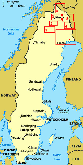
Click on 7 highlighted areas of
map
for details of Arctic Sweden |
 |
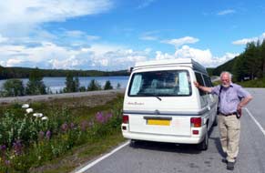 Some
6kms south of Jokkmokk, we pulled into the lay-by which marked the notional line
of 66º-33' N, the Arctic Circle (Polcirceln in Swedish, Napapiiri
in Finnish)
(Photo 1 -
Crossing Arctic Circle),
our second northward crossing of the Line this trip (see left). An information
panel described how the earth's angle of tilt causes the Arctic Circle's
movement. Defined as the southernmost latitude in the Northern Hemisphere at
which the Midnight Sun can be seen on the night of the Summer Solstice, the
Arctic Circle moves north and southwards across an area of 180 kms over a period
of 40,000 years; it will reach its northernmost position in the year 12,000,
returning to its current position in AD 22,000 and reaching its southernmost
line in 32,000 and continuing to cycle north and south thereafter if you care to
hang around to witness this curious phenomenon. After a pause for lunch
sandwiches and photos, we continued into Jokkmokk. Some
6kms south of Jokkmokk, we pulled into the lay-by which marked the notional line
of 66º-33' N, the Arctic Circle (Polcirceln in Swedish, Napapiiri
in Finnish)
(Photo 1 -
Crossing Arctic Circle),
our second northward crossing of the Line this trip (see left). An information
panel described how the earth's angle of tilt causes the Arctic Circle's
movement. Defined as the southernmost latitude in the Northern Hemisphere at
which the Midnight Sun can be seen on the night of the Summer Solstice, the
Arctic Circle moves north and southwards across an area of 180 kms over a period
of 40,000 years; it will reach its northernmost position in the year 12,000,
returning to its current position in AD 22,000 and reaching its southernmost
line in 32,000 and continuing to cycle north and south thereafter if you care to
hang around to witness this curious phenomenon. After a pause for lunch
sandwiches and photos, we continued into Jokkmokk.
Jokkmokk Fjällträdgård Botanic Gardens:
Jokkmokk takes its name in the Sámi language from its position on a bend in the
Luleälven river. The surrounding municipality through which the river runs
covers an area the size of Wales but with a population of just 3,000. On his
expedition through Lapland in 1732, Carl von Linné, the Swedish botanist,
likened it to an earthly paradise were it
 not
for the midges. Along Jokkmokk's main street of Storgatan, we turned down to
the Botanic Gardens which display the wild flora of Norbotten province's fells
and mountains. Set along sheltered embankments each side of a brook which
tumbles from a small lake, the gardens are divided into sections representing
the different types of terrain, with the flora of each growing in semi-wild
conditions. We began at the high fell-land plants which had to survive winter snows:
they were an exact reproduction of the berry plants we had seen yesterday:
Lingonberry, Bilberry, Bog Bilberry, Crowberry and Cloudberry. None of course
were in flower at this time of year, and the berries had not yet formed. The
next section was devoted to plants of the Taiga coniferous forest belt, and
included the 3 types of lichen which in winter the reindeer forage for under snow
covering (see left). When we had last visited the Botanic Gardens, we had been impressed
with their content and layout, but this year being later in the season, plants
were past not
for the midges. Along Jokkmokk's main street of Storgatan, we turned down to
the Botanic Gardens which display the wild flora of Norbotten province's fells
and mountains. Set along sheltered embankments each side of a brook which
tumbles from a small lake, the gardens are divided into sections representing
the different types of terrain, with the flora of each growing in semi-wild
conditions. We began at the high fell-land plants which had to survive winter snows:
they were an exact reproduction of the berry plants we had seen yesterday:
Lingonberry, Bilberry, Bog Bilberry, Crowberry and Cloudberry. None of course
were in flower at this time of year, and the berries had not yet formed. The
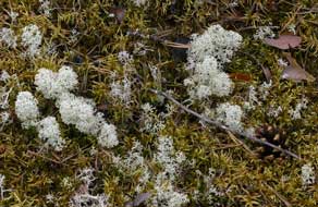
next section was devoted to plants of the Taiga coniferous forest belt, and
included the 3 types of lichen which in winter the reindeer forage for under snow
covering (see left). When we had last visited the Botanic Gardens, we had been impressed
with their content and layout, but this year being later in the season, plants
were past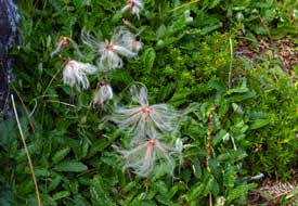 flowering and the beds devoted to meadow birch forests and cold
springs were totally overgrown. Parts on the rocky slopes across the brook were
in process of reconstruction, but fortunately the higher south-facing slopes of
Lingonberries remained intact and were covered with ripening berries (Photo 2 - Ripening Lingonberries).
The upper sections with mountain heath-land plants seemed better cared for and
well labelled with both common names and Latin binomials, which enabled our
identification of White Arctic Mountain Heather (Cassiope tetragona),
previously unknown to us and resembling club moss with tiny white flowers now
past. There were masses of Mountain Avens, the flowers also now past but with
wispy seed heads (see right), and beautiful specimens of Northern Wolfsbane (Photo
3 - Northern Wolfsbane) This year had been a rather disappointing visit,
partly due to the late time of the season but also the rather neglected state of
parts of the Gardens. flowering and the beds devoted to meadow birch forests and cold
springs were totally overgrown. Parts on the rocky slopes across the brook were
in process of reconstruction, but fortunately the higher south-facing slopes of
Lingonberries remained intact and were covered with ripening berries (Photo 2 - Ripening Lingonberries).
The upper sections with mountain heath-land plants seemed better cared for and
well labelled with both common names and Latin binomials, which enabled our
identification of White Arctic Mountain Heather (Cassiope tetragona),
previously unknown to us and resembling club moss with tiny white flowers now
past. There were masses of Mountain Avens, the flowers also now past but with
wispy seed heads (see right), and beautiful specimens of Northern Wolfsbane (Photo
3 - Northern Wolfsbane) This year had been a rather disappointing visit,
partly due to the late time of the season but also the rather neglected state of
parts of the Gardens.
 Skabram
Camping at Jokkmokk and frustrating weather change:
we camped that night at Skabram Camping, a small and hospitable site just west
of Jokkmokk kept by an ex-pat Dutch couple; it is clustered around the yard of a
cheese farm whose products are on sale at reception, with chickens clucking
around the camping area. The campsite at this time of year filled up with mainly
Dutch and German holiday-makers, but our pitch was carefully chosen to give us a
secluded corner to avoid the inevitable noise. The sun remained bright for our
barbecue supper, and we sat out late into the evening with Moon Tigers burning
on the table to deter mossies, looking out into a clearing in the surrounding
pine forest towards the setting sun (see below right). Skabram
Camping at Jokkmokk and frustrating weather change:
we camped that night at Skabram Camping, a small and hospitable site just west
of Jokkmokk kept by an ex-pat Dutch couple; it is clustered around the yard of a
cheese farm whose products are on sale at reception, with chickens clucking
around the camping area. The campsite at this time of year filled up with mainly
Dutch and German holiday-makers, but our pitch was carefully chosen to give us a
secluded corner to avoid the inevitable noise. The sun remained bright for our
barbecue supper, and we sat out late into the evening with Moon Tigers burning
on the table to deter mossies, looking out into a clearing in the surrounding
pine forest towards the setting sun (see below right).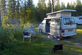
After overnight rain, the following day the sky
was heavily overcast; it looked as if the forecast change in the weather had
begun. A morning in camp ended with an hour-long thunderstorm with constantly
rumbling thunder and pouring rain, delaying our afternoon in Jokkmokk. Shopping
for provisions in the town's poorly stocked ICA and Coop-Konsum was a depressing
experience; it needed both supermarkets to secure 3 day's stock of supplies.
Round to the Tourist Information in another downpour, the bright and fluent
Americanese-speaking young lass reassured us on the state of the road out to
Kvikkjokk, but on checking the weather using their wi-fi internet, the forecast
for the week ahead showed a depressingly gloomy period of rain covering the
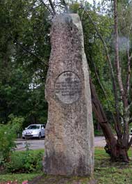
north as far as Karesuando. Down at Jokkmokk railway station, we found the
monument to the royal opening in 1937 of the final stretch of the Inlandsbanan
up to Gällivare (see left), but with the rain still pouring there was nothing
for it but to return to camp at Skabram after a frustrating afternoon of weather. The cloud just about
managed to break to give a wanly hazy evening sun which declined into a gap in
the pine trees. This looked like being the last chance of a barbecue for a while
with the worsening weather
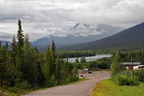 The road's-end settlement of Kvikkjokk in the mountainous interior:
before continuing north, our plan was to make a foray out to Kvikkjokk, an
isolated settlement 120kms into the interior towards the mountainous Sarek
National Park. Encouraging advice from the TIC and a neighbouring German The road's-end settlement of Kvikkjokk in the mountainous interior:
before continuing north, our plan was to make a foray out to Kvikkjokk, an
isolated settlement 120kms into the interior towards the mountainous Sarek
National Park. Encouraging advice from the TIC and a neighbouring German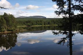 camper
was that the lane leading out to Kvikkjokk, although in poor state, was asphalt
all the way, with a small campsite at Årrenjarke 17kms from road's-end at Kvikkjokk;
this was a staging point on the Kungsleden long distance wilderness
trekking route part-way between Jäkkvik where we had camped last week and Abisko
in the north. With drizzly rain falling, we finally headed north from Jokkmokk,
and just across the Akkats dam, turned off onto Route 805, the minor road which
followed the scattered course of the Lille Luleälven water system network (click here for detailed map of route)
out to its end at remote Kvikkjokk. The
rain was by now increasing, sky sullenly grey, and the distant mountains lost in
low, misty rain cloud. Although tarmaced, the road was bumpy and uneven,
meandering every-which-way westwards through deserted forests and passing only
the occasional Sámi farmstead, and one lone and bedraggled reindeer. The entire
length of the valley was a network of lakes which formed the Lille Luleälven
water system, with intervening marshland, forests and extensive boulder-fields,
an uninhabited landscape virtually unchanged since the retreat of the Ice Age
glaciers, and looking even more desolate in such dreary weather. It was text
book post-glacial terrain, if only we could have seen it in the misty, murky
rain. With the bumpy, broken road surface, the 120km drive our to Kvikkjokk took us almost 2 hours, mile after endless, misty mile alongside lakes
and
marshes, through forests and boulder-fields. camper
was that the lane leading out to Kvikkjokk, although in poor state, was asphalt
all the way, with a small campsite at Årrenjarke 17kms from road's-end at Kvikkjokk;
this was a staging point on the Kungsleden long distance wilderness
trekking route part-way between Jäkkvik where we had camped last week and Abisko
in the north. With drizzly rain falling, we finally headed north from Jokkmokk,
and just across the Akkats dam, turned off onto Route 805, the minor road which
followed the scattered course of the Lille Luleälven water system network (click here for detailed map of route)
out to its end at remote Kvikkjokk. The
rain was by now increasing, sky sullenly grey, and the distant mountains lost in
low, misty rain cloud. Although tarmaced, the road was bumpy and uneven,
meandering every-which-way westwards through deserted forests and passing only
the occasional Sámi farmstead, and one lone and bedraggled reindeer. The entire
length of the valley was a network of lakes which formed the Lille Luleälven
water system, with intervening marshland, forests and extensive boulder-fields,
an uninhabited landscape virtually unchanged since the retreat of the Ice Age
glaciers, and looking even more desolate in such dreary weather. It was text
book post-glacial terrain, if only we could have seen it in the misty, murky
rain. With the bumpy, broken road surface, the 120km drive our to Kvikkjokk took us almost 2 hours, mile after endless, misty mile alongside lakes
and
marshes, through forests and boulder-fields.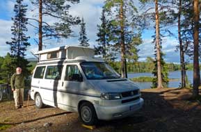
A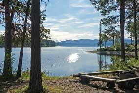 fter some 80kms the road surface improved, and
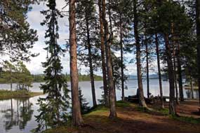
we were able to make better progress eventually to reach the hut settlement and camping of Årrenjarke, tucked in a forested bay at the innermost large lake of Saggat. We
investigated the tiny campsite which was nestled on a hillock-peninsula by an
inlet looking south-eastwards along the entire length of the lake. Despite the
still gloomy weather, the rain had now virtually stopped, and we reserved the
prime pitch on the crest of the hillock at this magnificent setting with its
outlook along the length of the lake and view of the distinctive ridge-end peak
of Kasssavare (957m) with its sheer-sided summit cliffs reflected in the lake's
still waters (see above right)
(Photo
4 - Reflections in Saggat lake). The
main valley road crossed a high shoulder of forested land to run along a
well-engineered shelf immediately above the Saggat lake's waterline and along to
the outskirts of Kvikkjokk. Other than the settlement being at road's-end and a
staging point on the Kungsleden long-distance wilderness path, we had no idea
what to expect of Kvikkjokk. On entering the settlement, a faded sign pointed
down towards the lake, ending at a rough parking area, with a superb distant
view of another distinctive sheer-sided peak, Tarrekaize (1824m) (see above
left)
(Photo
5 - Approaching Kvikkjokk). A little further and we reached the Kvikkjokk Turist-service
building, closed and semi-derelict, with a notice on the locked door Stängd
till nästa Fredag (Closed till next Friday); fter some 80kms the road surface improved, and
we were able to make better progress eventually to reach the hut settlement and camping of Årrenjarke, tucked in a forested bay at the innermost large lake of Saggat. We
investigated the tiny campsite which was nestled on a hillock-peninsula by an
inlet looking south-eastwards along the entire length of the lake. Despite the
still gloomy weather, the rain had now virtually stopped, and we reserved the
prime pitch on the crest of the hillock at this magnificent setting with its
outlook along the length of the lake and view of the distinctive ridge-end peak
of Kasssavare (957m) with its sheer-sided summit cliffs reflected in the lake's
still waters (see above right)
(Photo
4 - Reflections in Saggat lake). The
main valley road crossed a high shoulder of forested land to run along a
well-engineered shelf immediately above the Saggat lake's waterline and along to
the outskirts of Kvikkjokk. Other than the settlement being at road's-end and a
staging point on the Kungsleden long-distance wilderness path, we had no idea
what to expect of Kvikkjokk. On entering the settlement, a faded sign pointed
down towards the lake, ending at a rough parking area, with a superb distant
view of another distinctive sheer-sided peak, Tarrekaize (1824m) (see above
left)
(Photo
5 - Approaching Kvikkjokk). A little further and we reached the Kvikkjokk Turist-service
building, closed and semi-derelict, with a notice on the locked door Stängd
till nästa Fredag (Closed till next Friday);
 this seemed to summarize Kvikkjokk. Despite its isolation, a regular bus service still served the
village, and several back-packers were waiting at the bus stop by the church.
Lanes led up to a rough camping area and the Kvikkjokk Mountain Station hostel,
both serving Kungsleden back-packers. this seemed to summarize Kvikkjokk. Despite its isolation, a regular bus service still served the
village, and several back-packers were waiting at the bus stop by the church.
Lanes led up to a rough camping area and the Kvikkjokk Mountain Station hostel,
both serving Kungsleden back-packers.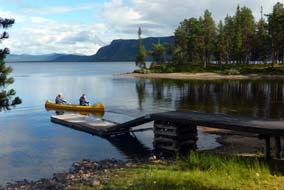 The scattering of houses around the small
shingled wooden church seemed partially occupied, but it would be a tough
existence up here in the depths of winter. The car park literally at road's-end
was quite full, presumably belonging to walkers out in these remote fells. Two
major rivers flowed down from the westward desolate high mountains of Sarek
National Park, the Kamajokk and Tarraätno, merging to form a delta as they
flowed into Saggat lake, the source of the Lille Luleälven chain of lakes which
finally flowed into the Stora Luleälven at Vuollerin. But for all its isolated
setting, Kvikkjokk was something of a bleak and cheerless place, and its tourist
service doubtless would remain stängd for many a nästa Fredag to
come. Unless you were walking the Kungsleden and making a staging camp here, Kvikkjokk had little in itself to commend it other than its isolated setting
amid such glorious mountainous solitude. The scattering of houses around the small
shingled wooden church seemed partially occupied, but it would be a tough
existence up here in the depths of winter. The car park literally at road's-end
was quite full, presumably belonging to walkers out in these remote fells. Two
major rivers flowed down from the westward desolate high mountains of Sarek
National Park, the Kamajokk and Tarraätno, merging to form a delta as they
flowed into Saggat lake, the source of the Lille Luleälven chain of lakes which
finally flowed into the Stora Luleälven at Vuollerin. But for all its isolated
setting, Kvikkjokk was something of a bleak and cheerless place, and its tourist
service doubtless would remain stängd for many a nästa Fredag to
come. Unless you were walking the Kungsleden and making a staging camp here, Kvikkjokk had little in itself to commend it other than its isolated setting
amid such glorious mountainous solitude.
Årrenjarke Fjällby-Camping near to Kvikkjokk: the weather
increasingly brightened as we drove back alongside Saggat lake; after this
morning's gloomy rain and solid, misty cloud, the forecast for brighter weather
and even for clear sun later in the afternoon scarcely seemed credible. But in
fact the cloud was now breaking and sun beginning to shine through. Back at Årrenjarke
Fjällby-Camping, we called in at reception to book in; as
 expected, the price
for camping was as expensive as the setting was attractive: 265kr, when at other
northern campsites we had been used to expected, the price
for camping was as expensive as the setting was attractive: 265kr, when at other
northern campsites we had been used to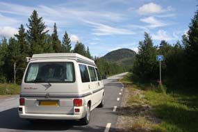 paying 200kr at most. Our questioning
such expensive prices was greeted with just a take-it-or-leave-it shrug. We
acquiesced, and with some difficulty level-pitched George on the sloping, rocky,
tree-root ridden ridge crest, and settled in (Photo
6 - Årrenjarke Fjällby-Camping), with Lingonberries growing in profusion around our pitch
(see above left). By now the sun had fully broken through with a clear sun
shining down through the pines, exactly as forecast. This was as gloriously
located and peaceful a camping spot as you could ask for, looking down the length of Saggat
lake from the pine-covered hillock (see above left); we sat revelling in the
magnificent setting with mountains and trees reflected in the
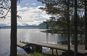
lake. We woke the following morning to a cloud-dappled sky, all
reflected and sparking amid the pine woods in the lake's still waters (see left) (Photo
7 - Morning sun sparkling in Saggat lake).
The beautiful morning light reinforced the magnificence of our camp spot
setting (see above left and right). Although expensive, Årrenjarke Fjällby-Camping would
probably be one of the trip's most memorable camping locations; it had been
worth the long drive out to this isolated spot. paying 200kr at most. Our questioning
such expensive prices was greeted with just a take-it-or-leave-it shrug. We
acquiesced, and with some difficulty level-pitched George on the sloping, rocky,
tree-root ridden ridge crest, and settled in (Photo
6 - Årrenjarke Fjällby-Camping), with Lingonberries growing in profusion around our pitch
(see above left). By now the sun had fully broken through with a clear sun
shining down through the pines, exactly as forecast. This was as gloriously
located and peaceful a camping spot as you could ask for, looking down the length of Saggat
lake from the pine-covered hillock (see above left); we sat revelling in the
magnificent setting with mountains and trees reflected in the
lake. We woke the following morning to a cloud-dappled sky, all
reflected and sparking amid the pine woods in the lake's still waters (see left) (Photo
7 - Morning sun sparkling in Saggat lake).
The beautiful morning light reinforced the magnificence of our camp spot
setting (see above left and right). Although expensive, Årrenjarke Fjällby-Camping would
probably be one of the trip's most memorable camping locations; it had been
worth the long drive out to this isolated spot.
 Return along Lille Luleälven valley to Inlandsvägen:
we set off on the 90km return drive on the single-track lane along the Lille Luleälven
valley. Despite the rough road surface, the morning sun and clear blue sky made
this drive a sheer delight compared with the gloomily wet drive out yesterday. The sun lit the road-side spruces and forest-covered hills, and the series of
lakes reflected the clear sky and blotchy cloud-scape (see right) (Photo
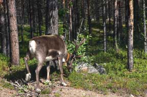
8 - Lille Luleälven cloud-scape). We passed a lone buck
reindeer grazing in the road-side forest, with the indignity of a collar and
bell (Photo
9 - Grazing reindeer) (see left). It was a glorious drive, taking 1½ hours to reach
the E45 Inlandsvägen. Return along Lille Luleälven valley to Inlandsvägen:
we set off on the 90km return drive on the single-track lane along the Lille Luleälven
valley. Despite the rough road surface, the morning sun and clear blue sky made
this drive a sheer delight compared with the gloomily wet drive out yesterday. The sun lit the road-side spruces and forest-covered hills, and the series of
lakes reflected the clear sky and blotchy cloud-scape (see right) (Photo
8 - Lille Luleälven cloud-scape). We passed a lone buck
reindeer grazing in the road-side forest, with the indignity of a collar and
bell (Photo
9 - Grazing reindeer) (see left). It was a glorious drive, taking 1½ hours to reach
the E45 Inlandsvägen.
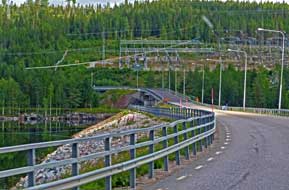 We now expected a rapid run for the 35kms up to Porjus (click here for detailed map of route),
but on approaching the Ligga dam (see right), serious road-works began. Dropping down the
steeply winding approach to cross the dam, entire sections of road were totally
stripped of tarmac, leaving just rough, gravelled surface. Crossing the Ligga
dam, the down-stream view into the bed of the Stora Luleälven showed the lower
rocky gorge to be entirely dry and barren, the river's natural course below the
reservoir diverted into the underground Ligga generating station for
hydro-electric power (HEP) production, with the
tail-race emerging several kms downstream. Across the dam, the E45 Inlandsvägen
began the climb towards Harsprånget, the long haul today made more
difficult by intermittent sections of road being entirely stripped of asphalt.
This continued for the next 20kms, and we bumped along the rough, gravelled
unsurfaced road all the way up to Porjus. For the country's main northern
highway to be left for several months in this state by the National Road Agency
with no remedial surfacing work taking place was an utter disgrace which
certainly would not be tolerated in the south of Sweden. We now expected a rapid run for the 35kms up to Porjus (click here for detailed map of route),
but on approaching the Ligga dam (see right), serious road-works began. Dropping down the
steeply winding approach to cross the dam, entire sections of road were totally
stripped of tarmac, leaving just rough, gravelled surface. Crossing the Ligga
dam, the down-stream view into the bed of the Stora Luleälven showed the lower
rocky gorge to be entirely dry and barren, the river's natural course below the
reservoir diverted into the underground Ligga generating station for
hydro-electric power (HEP) production, with the
tail-race emerging several kms downstream. Across the dam, the E45 Inlandsvägen
began the climb towards Harsprånget, the long haul today made more
difficult by intermittent sections of road being entirely stripped of asphalt.
This continued for the next 20kms, and we bumped along the rough, gravelled
unsurfaced road all the way up to Porjus. For the country's main northern
highway to be left for several months in this state by the National Road Agency
with no remedial surfacing work taking place was an utter disgrace which
certainly would not be tolerated in the south of Sweden.
 Crash-site of WW2 RAF Lancaster bomber Easy Elsie:
thankful to regain normally tarmaced road on reaching Porjus Old PowerStation,
we turned off across the Porjus New Dam onto Route 819 (click here for detailed map of route). The narrow single-track
lane wound past the dam's rock-fill foundations leading to the Sámi hamlet of Ålloluokta, and 7kms along the Crash-site of WW2 RAF Lancaster bomber Easy Elsie:
thankful to regain normally tarmaced road on reaching Porjus Old PowerStation,
we turned off across the Porjus New Dam onto Route 819 (click here for detailed map of route). The narrow single-track
lane wound past the dam's rock-fill foundations leading to the Sámi hamlet of Ålloluokta, and 7kms along the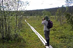 shores of Lake Stora Lulevatten we reached the
parking area at the start of the board-walk out to the marsh-land crash site
of the WW2 RAF Lancaster Easy Elsie. RAF Lancaster FC-E was assigned to
617 Squadron in August 1944 and re-christened Easy Elsie by
its crew. On its first operational mission against the German battleship
Tirpitz at the northern Norwegian anchorage at Kåfjord, Lancaster Easy
Elsie had been damaged by flak but repaired and made airworthy again.
Tirpitz was moved south to Kvaløya in Tromsø Fjord, and was attacked again
on 29 October 1944 by Lancasters of 617 and 9 Squadrons including Easy Elsie,
each stripped of armaments, modified with extra fuel tanks and carrying one 6
ton Tallboy bomb. During the attack, Easy Elsie was severely damaged by
flak: the right outer engine was lost, she was losing fuel and hydraulic fluid,
and the radio was hit. Further damaged by flak knocking out the left
inner
engine and losing more fuel, and with bomb doors unable to be raised through
loss of hydraulics, the resultant drag made the aircraft difficult to fly. With
2 engines lost and losing fuel, there was no way the Australian pilot, Flying
Officer David Carey could get the Lancaster back to Scotland. He and the
navigator Pilot Officer Alex McKie decided to try to get over to neutral Sweden.
With maximum power on the 2 remaining engines, Carey managed to gain sufficient
height to clear the Norwegian mountains and turned the severely damaged
Lancaster south into Sweden. Between the cloud, all they could see was empty
wilderness and forest, but with fuel almost exhausted they saw a boggy clearing
in the forest near to Porjus. The crew jettisoned all weapons, ammunition and
equipment to lighten the aircraft and took up crash-landing positions for Carey
to put the aircraft down in an open space. The undercarriage cut into bog and
the shores of Lake Stora Lulevatten we reached the
parking area at the start of the board-walk out to the marsh-land crash site
of the WW2 RAF Lancaster Easy Elsie. RAF Lancaster FC-E was assigned to
617 Squadron in August 1944 and re-christened Easy Elsie by
its crew. On its first operational mission against the German battleship
Tirpitz at the northern Norwegian anchorage at Kåfjord, Lancaster Easy
Elsie had been damaged by flak but repaired and made airworthy again.
Tirpitz was moved south to Kvaløya in Tromsø Fjord, and was attacked again
on 29 October 1944 by Lancasters of 617 and 9 Squadrons including Easy Elsie,
each stripped of armaments, modified with extra fuel tanks and carrying one 6
ton Tallboy bomb. During the attack, Easy Elsie was severely damaged by
flak: the right outer engine was lost, she was losing fuel and hydraulic fluid,
and the radio was hit. Further damaged by flak knocking out the left
inner
engine and losing more fuel, and with bomb doors unable to be raised through
loss of hydraulics, the resultant drag made the aircraft difficult to fly. With
2 engines lost and losing fuel, there was no way the Australian pilot, Flying
Officer David Carey could get the Lancaster back to Scotland. He and the
navigator Pilot Officer Alex McKie decided to try to get over to neutral Sweden.
With maximum power on the 2 remaining engines, Carey managed to gain sufficient
height to clear the Norwegian mountains and turned the severely damaged
Lancaster south into Sweden. Between the cloud, all they could see was empty
wilderness and forest, but with fuel almost exhausted they saw a boggy clearing
in the forest near to Porjus. The crew jettisoned all weapons, ammunition and
equipment to lighten the aircraft and took up crash-landing positions for Carey
to put the aircraft down in an open space. The undercarriage cut into bog and
the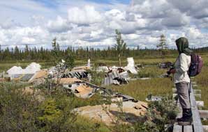 plane shuddered to a halt standing on its nose and falling back into the
bog. It was 11-50am. The pilot injured his knee on the instrument panel with the
impact of crash-landing, but the rest of the crew was unhurt. They destroyed all
maps and operational orders, tried to set fire to the wreckage, and carried
Carey into the nearby forest. Swedish soldiers who had seen the Lancaster's
crash-landing, found the crew who were taken to Stockholm for interrogation and
later repatriated to England in November 1944. Tirpitz was finally sunk
in Tromsø Fjord in November 1944 by a further 617 and 9 Squadron Lancaster
attack, Operation Catechism. plane shuddered to a halt standing on its nose and falling back into the
bog. It was 11-50am. The pilot injured his knee on the instrument panel with the
impact of crash-landing, but the rest of the crew was unhurt. They destroyed all
maps and operational orders, tried to set fire to the wreckage, and carried
Carey into the nearby forest. Swedish soldiers who had seen the Lancaster's
crash-landing, found the crew who were taken to Stockholm for interrogation and
later repatriated to England in November 1944. Tirpitz was finally sunk
in Tromsø Fjord in November 1944 by a further 617 and 9 Squadron Lancaster
attack, Operation Catechism.
 We had first visited the crash site
on our 2013 Sweden trip; see our log for the full history of Easy Elsie's last
mission and crash-landing in marshland near Porjus. We had first visited the crash site
on our 2013 Sweden trip; see our log for the full history of Easy Elsie's last
mission and crash-landing in marshland near Porjus.
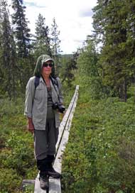
Kitting up in expectation of midges, we again
set out to walk the 2 kms along the forest board-walk to the marsh-land
clearing to pay our respects at the aircraft remains (Photo
10 - Board-walk to crash-site). We feared that, in the 3
years since our first visit, the board-walk might be suffering for lack of
maintenance, but it was as sturdy as ever thanks to the efforts of the Porjus
Archive Committee; and at the driest time of a dry year,
the surrounding marshland was firm apart from the very wet areas of bog around
the aircraft remains. The 2 kms route out through the spruce forest was itself a
delightful prelude, with the forest floor covered with the usual northern berry
plants (Photo
11 - Ripe Cloudberry) and Labrador Tea (see above left). This lovely walk, meandering through the
forest of tall candle-spruces, brought us out to the edge of a boggy clearing.
The topography of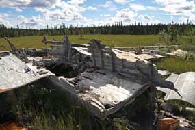 this generally forest covered region showed the skill and good
judgement on Carey and McKie's part in locating the clearing amid almost continuous forest, and managing to 'pancake' the severely damaged
aircraft in the boggy ground with no serious injuries or death to the crew. It
was one brilliant piece of flying and navigation. And over in the centre of the
clearing, we could see ahead the this generally forest covered region showed the skill and good
judgement on Carey and McKie's part in locating the clearing amid almost continuous forest, and managing to 'pancake' the severely damaged
aircraft in the boggy ground with no serious injuries or death to the crew. It
was one brilliant piece of flying and navigation. And over in the centre of the
clearing, we could see ahead the
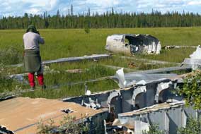 Lancaster's remains lying forlornly where she
had crash-landed 72 years ago (see above right) (Photo
12 - Forest clearing crash-site). We moved forward
along the board-walk to the centre of the clearing and the remains of the
crashed aircraft (see above left and right). Lancaster's remains lying forlornly where she
had crash-landed 72 years ago (see above right) (Photo
12 - Forest clearing crash-site). We moved forward
along the board-walk to the centre of the clearing and the remains of the
crashed aircraft (see above left and right).
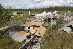
First impressions were that the wreckage was
more scattered and randomly heaped, and in a more dilapidated state than in
2013. Certainly the rear fuselage was toppled over onto its side and the
tail-plane and fins less orderly placed. But it was more likely that, with the
passage of time, decay and dereliction had further taken its toll, together with souvenir hunters removing further portions of the aircraft's remains.
The sun just about managed to shine for us to take our photos from the
board-walk surrounding the wreckage, which still lay in the soggy marsh-land
that had saved it from total destruction
on crash-landing 72 years ago (see left) (Photo
13 - Remains of Lancaster Easy Elsie). With no
functioning undercarriage due to total loss of hydraulics from flak damage, it
was Flying Officer Carey's skill in putting the badly damaged aircraft down in this bog
that had saved the crew's lives. We walked around the crashed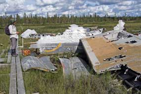 Lancaster trying to
identify its decayed components. There was little remaining of the cockpit and
forward section of the fuselage which were badly damaged when the
crew had attempted to destroy the plane after the crash-landing (see above
right). Part of a yellow RAF
roundel was recognisable on one section of the fuselage (see right) (Photo
14 - Fuselage with RAF roundel), and the surviving wings
and other sections showed flak damage. It was a poignantly moving moment again
to pay our respects to the skill and courage of Easy
Elsie's flying crew at the site of the crash-landing (Photo
15 - Easy Elsie crash site). We do however make this plea to
others who may visit the Lancaster's remains, which have survived here at the
marshland crash-site for 72 years: please do NOT remove further fragments as
souvenirs or further disturb the aircraft; leave the remains of the Lancaster in
peace out of respect for her crew. See our
Crashed RAF Lancaster Photo Gallery. Lancaster trying to
identify its decayed components. There was little remaining of the cockpit and
forward section of the fuselage which were badly damaged when the
crew had attempted to destroy the plane after the crash-landing (see above
right). Part of a yellow RAF
roundel was recognisable on one section of the fuselage (see right) (Photo
14 - Fuselage with RAF roundel), and the surviving wings
and other sections showed flak damage. It was a poignantly moving moment again
to pay our respects to the skill and courage of Easy
Elsie's flying crew at the site of the crash-landing (Photo
15 - Easy Elsie crash site). We do however make this plea to
others who may visit the Lancaster's remains, which have survived here at the
marshland crash-site for 72 years: please do NOT remove further fragments as
souvenirs or further disturb the aircraft; leave the remains of the Lancaster in
peace out of respect for her crew. See our
Crashed RAF Lancaster Photo Gallery.
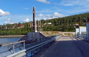 Wild-camp at
the abandoned village of Harsprånget:
we returned across the Porjus dam to Porjus (click here for detailed map of route)
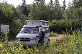
(see left), and shopped for provisions at the local village ICA stores
before tackling the return drive down the scoured, surface-less E45 to wild-camp
at the site of the now abandoned village of Harsprånget. This had originally
been built in 1946 to provide accommodation for building workers close to the construction site of the new Harsprånget
dam and power plant. Sweden's 20th century programme of hydro-electric power production
had begun in 1910 at Olidan on the Gotä River rapids near Trollhätten (See log of our visit to Olidan HEP plant).
This was followed by the pioneering construction 5 years later of the Wild-camp at
the abandoned village of Harsprånget:
we returned across the Porjus dam to Porjus (click here for detailed map of route)
(see left), and shopped for provisions at the local village ICA stores
before tackling the return drive down the scoured, surface-less E45 to wild-camp
at the site of the now abandoned village of Harsprånget. This had originally
been built in 1946 to provide accommodation for building workers close to the construction site of the new Harsprånget
dam and power plant. Sweden's 20th century programme of hydro-electric power production
had begun in 1910 at Olidan on the Gotä River rapids near Trollhätten (See log of our visit to Olidan HEP plant).
This was followed by the pioneering construction 5 years later of the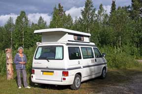 dam and
underground generating plant at Porjus, primarily to supply power for electric
traction on the Malmbanan railway transporting iron ore from the mines at
Gällivare and Kiruna down to the ports of Narvik and Luleå. Plans were drawn up
in 1919 to follow this with an even bigger dam and HEP
generating station further downstream on the steeply falling Luleälven river at Harsprånget.
But with post-WW1 depression and decreased demand for electricity, construction
of the Harsprånget dam was postponed. Work finally began in 1946 of what would
be Sweden's largest rock-fill dam and hydro-electric generating plant at Harsprånget,
with a power production capacity of 977Mw. Because of Harsprånget dam's isolated
location in the then remote Lapland wilderness, a new village was built nearby
for construction workers and their families. At its height, the village housed
over 2,000 residents, a well-established community with shops,
 leisure
facilities, hospital and school. The dam and generating plant at Harsprånget
were commissioned in 1952,and production capacity increased with additional
power plants during the 1970s. The nearby village of Harsprånget remained
occupied until 1985, when the last occupants moved away and the wooden
houses were transported elsewhere. leisure
facilities, hospital and school. The dam and generating plant at Harsprånget
were commissioned in 1952,and production capacity increased with additional
power plants during the 1970s. The nearby village of Harsprånget remained
occupied until 1985, when the last occupants moved away and the wooden
houses were transported elsewhere.
From the E45, we turned up the gravel lane that
led to the site of the long abandoned village of Harsprånget. Nature had
reclaimed the former settlement's site, and a tangle of wilderness vegetation
and birch trees had reasserted itself where once there had been streets and
houses. The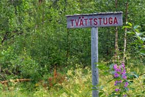 Porjus Archive Association keep alive the village's memory,
preserving the approach lane of Storgatan (Main Street), with a few of
the street name boards still in place (see right). An information panel gave an outline map
showing the extent of the former village's streets, but beyond Torget these were
all now totally overgrown with an impenetrable re-growth of trees and
vegetation. With midges swarming around our heads, we set up camp by the former
village's square of Torget (see above right) (Photo
16 - Harsprånget wild-camp), and later that
evening cooked an appropriate Swedish supper of köttbular (meatballs) and
lingonberry sauce. Porjus Archive Association keep alive the village's memory,
preserving the approach lane of Storgatan (Main Street), with a few of
the street name boards still in place (see right). An information panel gave an outline map
showing the extent of the former village's streets, but beyond Torget these were
all now totally overgrown with an impenetrable re-growth of trees and
vegetation. With midges swarming around our heads, we set up camp by the former
village's square of Torget (see above right) (Photo
16 - Harsprånget wild-camp), and later that
evening cooked an appropriate Swedish supper of köttbular (meatballs) and
lingonberry sauce.
We woke to a bright morning for breakfast
looking out onto the overgrown Torget of Harsprånget (see above left). Earlier we had walked
along the remaining length of Storgatan where the forest was increasingly
re-claiming the land. Harsprånget abandoned village had been a hugely memorable
if eerily
 uncanny camping spot among the thickets of this ghost village, and
the only disturbance during the night was the sound of an animal munching among
the vegetation! For a brief overnight and morning, our presence had
brought life back to what had once been a lively community, but now nature was
once more re-asserting its hold over the site. uncanny camping spot among the thickets of this ghost village, and
the only disturbance during the night was the sound of an animal munching among
the vegetation! For a brief overnight and morning, our presence had
brought life back to what had once been a lively community, but now nature was
once more re-asserting its hold over the site.
 Harsprånget rock-fill dam and dry gorge:
back down the lane, we now faced the dreadful state of the E45. The State
Highways Authority had stripped the entire asphalt surface from a 20km section
of the road at the beginning of summer, and local people travelling between Porjus and Jokkmokk had been forced to endure the damaging impact on their
vehicles for all this time; it was not expected to be re-surfaced for another
couple of months. For a major European highway, and the principal route up
through Northern Sweden, to be left in such a disgraceful condition for 5 months
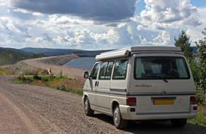
was nothing short of scandalous. We returned downhill with the road's steep
gradient showing how much the Luleälven river must drop in the 10kms distance
from the Porjus dam outflow. Rounding a bend, there was the massive curvature of
the Harsprånget rock-fill dam winding across the head of the gorge (see left) (Photo
17 - Harsprånget rock-fill dam). We bumped our way a further km down the
steep slope past the Harsprånget HEP generating station (kraftverk in
Swedish) to the parking area signposted for the memorial to the 10 men
killed during the Harsprånget dam's construction, and the look-out point viewing
platform overlooking what once would have been the torrent of Harsprånget
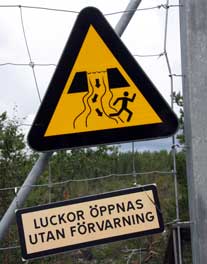
waterfalls. A gate through the fence displayed a menacing sign with the warning:
Dam gates may open without prior warning, and an image showing the dam
sluices open and water flooding down the normally dry gorge in pursuit of a
figure Harsprånget rock-fill dam and dry gorge:
back down the lane, we now faced the dreadful state of the E45. The State
Highways Authority had stripped the entire asphalt surface from a 20km section
of the road at the beginning of summer, and local people travelling between Porjus and Jokkmokk had been forced to endure the damaging impact on their
vehicles for all this time; it was not expected to be re-surfaced for another
couple of months. For a major European highway, and the principal route up
through Northern Sweden, to be left in such a disgraceful condition for 5 months
was nothing short of scandalous. We returned downhill with the road's steep
gradient showing how much the Luleälven river must drop in the 10kms distance
from the Porjus dam outflow. Rounding a bend, there was the massive curvature of
the Harsprånget rock-fill dam winding across the head of the gorge (see left) (Photo
17 - Harsprånget rock-fill dam). We bumped our way a further km down the
steep slope past the Harsprånget HEP generating station (kraftverk in
Swedish) to the parking area signposted for the memorial to the 10 men
killed during the Harsprånget dam's construction, and the look-out point viewing
platform overlooking what once would have been the torrent of Harsprånget
waterfalls. A gate through the fence displayed a menacing sign with the warning:
Dam gates may open without prior warning, and an image showing the dam
sluices open and water flooding down the normally dry gorge in pursuit of a
figure
 fleeing in terror! (see right) We followed the sturdy board-walk which enabled a safe
descent down over the smoothly eroded granite slabs into the steep and in places
almost sheer rocky slope of the ravine (Photo
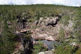
18 - Harsprånget Gorge board-walk). The Harsprånget gorge is now almost
totally dry (see left): the dam's construction across the head of the gorge now
holds back the waters of the Luleälven river which once cascaded in raging
torrents, particularly after Spring melts, down the steep length of the canyon
creating what was then the Harsprånget-fallet. fleeing in terror! (see right) We followed the sturdy board-walk which enabled a safe
descent down over the smoothly eroded granite slabs into the steep and in places
almost sheer rocky slope of the ravine (Photo
18 - Harsprånget Gorge board-walk). The Harsprånget gorge is now almost
totally dry (see left): the dam's construction across the head of the gorge now
holds back the waters of the Luleälven river which once cascaded in raging
torrents, particularly after Spring melts, down the steep length of the canyon
creating what was then the Harsprånget-fallet.
We edged down with the sun illuminating the
length of the upper gorge. Vattenfall's construction of the Harsprånget dam may
have closed off the rapids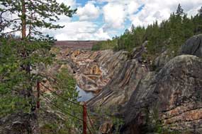 and falls which once glorified this magnificent
gorge, but depriving the world of that spectacle had opened up another equally
impressive sight: the precipitous rocky sides of the now dry gorge, lit by the morning
sun, glowed in multiple shades of ruddy-brown. From the wooden viewing-platform
high above the sheer drop of the canyon, the view up the gorge was
staggeringly beautiful with its rock walls glowing in the sunlight; and the
rock-fill dam, which from 1952 has held back the natural flow of the once
mighty Luleälven torrent, reared high above across the distant head of the
gorge, now revealing these magnificent rock walls
(Photo
19 - Harsprånget Gorge rock walls) (see right). We clambered up the
rocks at the look-out point marvelling at the bare rocky spectacle of this
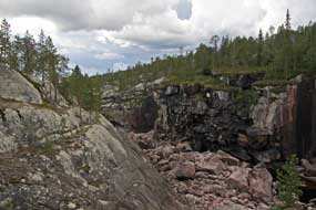
magnificent canyon now revealed before us in all its glory thanks to the Harsprånget dam. Looking downstream from
the view-point, the walls of the totally dry canyon bed rose precipitously on
the far side (see below left). But the sun had now disappeared behind gathering storm
clouds, and we hurried back up the board-walk before the inevitable downpour
hit. and falls which once glorified this magnificent
gorge, but depriving the world of that spectacle had opened up another equally
impressive sight: the precipitous rocky sides of the now dry gorge, lit by the morning
sun, glowed in multiple shades of ruddy-brown. From the wooden viewing-platform
high above the sheer drop of the canyon, the view up the gorge was
staggeringly beautiful with its rock walls glowing in the sunlight; and the
rock-fill dam, which from 1952 has held back the natural flow of the once
mighty Luleälven torrent, reared high above across the distant head of the
gorge, now revealing these magnificent rock walls
(Photo
19 - Harsprånget Gorge rock walls) (see right). We clambered up the
rocks at the look-out point marvelling at the bare rocky spectacle of this
magnificent canyon now revealed before us in all its glory thanks to the Harsprånget dam. Looking downstream from
the view-point, the walls of the totally dry canyon bed rose precipitously on
the far side (see below left). But the sun had now disappeared behind gathering storm
clouds, and we hurried back up the board-walk before the inevitable downpour
hit.
 The environmental impact of hydro-power:
the sight of the now dry Harsprånget brought home the controversial issue
of the impact of supposedly environmentally friendly hydro-electric power.
Vattenfall's web site naturally makes much of hydro-electric power as a
totally renewable energy source with minimal environmental impact and zero
pollution. Opponents however point out the vast changes that the damming of
natural water courses causes, and the impact on both flora and fauna: salmon can
no longer follow their powerful instinct to migrate upstream to spawn, and part
of the cost of hydro-power is the necessary annual fish re-stocking of rivers.
The enlargement of lakes caused by damming has damaging impact on grazing lands
and makes reindeer migrating routes more difficult. We had ourselves witnessed
the contrast in topographical impact of the now totally controlled Umeälven river
compared with the natural state of the unexploited Vindelälven valley. Of the
major rivers of Northern Sweden, only 4 now remain in their natural state
unexploited by HEP, the Torne, Kalix, Pite and Vindel Rivers. Here at
Harsprånget, we could see the issue in stark terms before our very eyes: before
the dam's construction, this would have been a wild torrent flowing down the
falls of the narrow canyon and subject to the natural seasonal variations in
water flow from the wild spring melt-water floods to the ice-bound white-out of
winter; the very name Harsprånget meaning 'hare's run' was derived from the
sharp turns in the rapids, similar to a hare fleeing. Now however the gorge was
entirely dry, and high above us at the head of the canyon we could see the stark
desert-like stone field of the rock-fill dam's embankment. Having said that
however, with the canyon now dry and deprived of water by the dam, the stark
natural beauty of its varied multi-coloured rock walls were revealed in their
full glory. Modern society demands ever-increasing supplies of electricity, and
compared with the pollutant impact and short-term finiteness of expendable
fossil fuels or long-term inheritance of nuclear waste, the impact of
hydro-power seemed minimalist. Clearly there is no such thing as a free light
switch and the price to pay for hydro-power, in terrain where this is feasible,
seems the least damaging compared with alternative sources of energy. The environmental impact of hydro-power:
the sight of the now dry Harsprånget brought home the controversial issue
of the impact of supposedly environmentally friendly hydro-electric power.
Vattenfall's web site naturally makes much of hydro-electric power as a
totally renewable energy source with minimal environmental impact and zero
pollution. Opponents however point out the vast changes that the damming of
natural water courses causes, and the impact on both flora and fauna: salmon can
no longer follow their powerful instinct to migrate upstream to spawn, and part
of the cost of hydro-power is the necessary annual fish re-stocking of rivers.
The enlargement of lakes caused by damming has damaging impact on grazing lands
and makes reindeer migrating routes more difficult. We had ourselves witnessed
the contrast in topographical impact of the now totally controlled Umeälven river
compared with the natural state of the unexploited Vindelälven valley. Of the
major rivers of Northern Sweden, only 4 now remain in their natural state
unexploited by HEP, the Torne, Kalix, Pite and Vindel Rivers. Here at
Harsprånget, we could see the issue in stark terms before our very eyes: before
the dam's construction, this would have been a wild torrent flowing down the
falls of the narrow canyon and subject to the natural seasonal variations in
water flow from the wild spring melt-water floods to the ice-bound white-out of
winter; the very name Harsprånget meaning 'hare's run' was derived from the
sharp turns in the rapids, similar to a hare fleeing. Now however the gorge was
entirely dry, and high above us at the head of the canyon we could see the stark
desert-like stone field of the rock-fill dam's embankment. Having said that
however, with the canyon now dry and deprived of water by the dam, the stark
natural beauty of its varied multi-coloured rock walls were revealed in their
full glory. Modern society demands ever-increasing supplies of electricity, and
compared with the pollutant impact and short-term finiteness of expendable
fossil fuels or long-term inheritance of nuclear waste, the impact of
hydro-power seemed minimalist. Clearly there is no such thing as a free light
switch and the price to pay for hydro-power, in terrain where this is feasible,
seems the least damaging compared with alternative sources of energy.
 The Luleälven dams and hydro-electric
generating plants:
we bumped our way back up the 10kms of unsurfaced E45 to the huge complex of
the Porjus dam and hydro-electric generating station at Porjus village, and
turned off to the Gamle Kraftverk (Old Power Station). The power generating and
distribution company Vattenfall is still a state-owned
enterprise although now partly deregulated to compete for business across the
EU. It now manages all of Sweden's power industry, hydro, nuclear and
wind-power, with stakes in power generation in Germany, Poland and Holland. 46%
of Sweden's electrical supply is generated by HEP, 44% by its 3 nuclear power
stations, and just 1% by wind power. The 15 HEP stations on the Luleälven, which
drops 1000m from its source in the Norwegian mountains down its 450km length to
the Bothnian Gulf at Luleä, supply 15% of the country's power. The Luleälven's
15 dams are now of the rock-fill type construction, which rely on
steady filtering of water through the semi-permeable core and broadly spread
compacted rock to control the reservoir's water volume. All 15 of the Luleälven
generating stations (kraft verks) are now remotely controlled from a
central control station at Vuollerim part-way down the river. The Luleälven dams and hydro-electric
generating plants:
we bumped our way back up the 10kms of unsurfaced E45 to the huge complex of
the Porjus dam and hydro-electric generating station at Porjus village, and
turned off to the Gamle Kraftverk (Old Power Station). The power generating and
distribution company Vattenfall is still a state-owned
enterprise although now partly deregulated to compete for business across the
EU. It now manages all of Sweden's power industry, hydro, nuclear and
wind-power, with stakes in power generation in Germany, Poland and Holland. 46%
of Sweden's electrical supply is generated by HEP, 44% by its 3 nuclear power
stations, and just 1% by wind power. The 15 HEP stations on the Luleälven, which
drops 1000m from its source in the Norwegian mountains down its 450km length to
the Bothnian Gulf at Luleä, supply 15% of the country's power. The Luleälven's
15 dams are now of the rock-fill type construction, which rely on
steady filtering of water through the semi-permeable core and broadly spread
compacted rock to control the reservoir's water volume. All 15 of the Luleälven
generating stations (kraft verks) are now remotely controlled from a
central control station at Vuollerim part-way down the river.
 The first dam at Porjus, built between 1910~15,
was a vast construction undertaking in remote wilderness terrain through the
darkness and freezing temperatures of the Arctic winter. The original Porjus generating station was constructed 60m underground, blasted out of
the bedrock to achieve the necessary head-drop of water from the nearby dam. The
tail-race ran in an underground tunnel over 1km downstream for the out-flow of
used water back into the river. The imposing red-brick neo-Gothic switchgear building,
visible at ground level above the underground generating hall, was designed in
monumental style by Erik Josephson (1864~1929), a leading The first dam at Porjus, built between 1910~15,
was a vast construction undertaking in remote wilderness terrain through the
darkness and freezing temperatures of the Arctic winter. The original Porjus generating station was constructed 60m underground, blasted out of
the bedrock to achieve the necessary head-drop of water from the nearby dam. The
tail-race ran in an underground tunnel over 1km downstream for the out-flow of
used water back into the river. The imposing red-brick neo-Gothic switchgear building,
visible at ground level above the underground generating hall, was designed in
monumental style by Erik Josephson (1864~1929), a leading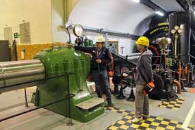 Swedish architect of
public buildings, who had also been responsible for the fortress-like design of Olidan power station. Being a public undertaking, Vattenfall's predecessor
company, Kungliga Vattenfallsstyrelsen (Royal State Power Board),
intended the monumental Porjus Power Station to reflect its royal standing. No
expense was spared in the design, which was not only extravagant in scale but
also incorporated imposing art nouveau decorative features such as shapely
windows, grandiose main doors, belfry-like tower with golden royal crown, and in
the control room, grand light fittings and marble-faced control panel. King
Gustav V was due to perform the opening in 1915, but WW1 made his monarchic
venture to the Arctic too dangerous, and the dam's inauguration was performed by
telephone from Stockholm. The old Porjus dam and power station continued in
operation until 1975 when the original solid-core dam was replaced by the
present rock-fill dam with its new underground kraft verk. The
imposing Neo-Gothic building of the now redundant former power station has been
retained as a heritage site, and during the summer months Vattenfall offer
free-of-charge hourly guided tours of the original station and its underground
generating hall. Swedish architect of
public buildings, who had also been responsible for the fortress-like design of Olidan power station. Being a public undertaking, Vattenfall's predecessor
company, Kungliga Vattenfallsstyrelsen (Royal State Power Board),
intended the monumental Porjus Power Station to reflect its royal standing. No
expense was spared in the design, which was not only extravagant in scale but
also incorporated imposing art nouveau decorative features such as shapely
windows, grandiose main doors, belfry-like tower with golden royal crown, and in
the control room, grand light fittings and marble-faced control panel. King
Gustav V was due to perform the opening in 1915, but WW1 made his monarchic
venture to the Arctic too dangerous, and the dam's inauguration was performed by
telephone from Stockholm. The old Porjus dam and power station continued in
operation until 1975 when the original solid-core dam was replaced by the
present rock-fill dam with its new underground kraft verk. The
imposing Neo-Gothic building of the now redundant former power station has been
retained as a heritage site, and during the summer months Vattenfall offer
free-of-charge hourly guided tours of the original station and its underground
generating hall.
 Our visit to the Porjus Old Power Station:
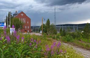
black storm clouds filled the sky as we reached the Porjus Old Power Station
(see above right) (Photo
20 - Porjus Old Power Station),
and it was unnerving looking out across the towering complex of switchgear,
transformers and distribution network with lightning flashing overhead and
thunder rumbling around the surrounding fells. In pouring rain we heaved open
the building's grandiose door in time for the
1-30pm tour, to be faced with depressing news: because of the thunderstorm and
risk of power failure affecting the lift and lighting in the underground
generating hall, the visit would be restricted to a brief commentary in the
station's control room. Showing our extreme disappointment and frustration, we
tried every form of persuasion: the storm was visibly passing, we were Our visit to the Porjus Old Power Station:
black storm clouds filled the sky as we reached the Porjus Old Power Station
(see above right) (Photo
20 - Porjus Old Power Station),
and it was unnerving looking out across the towering complex of switchgear,
transformers and distribution network with lightning flashing overhead and
thunder rumbling around the surrounding fells. In pouring rain we heaved open
the building's grandiose door in time for the
1-30pm tour, to be faced with depressing news: because of the thunderstorm and
risk of power failure affecting the lift and lighting in the underground
generating hall, the visit would be restricted to a brief commentary in the
station's control room. Showing our extreme disappointment and frustration, we
tried every form of persuasion: the storm was visibly passing, we were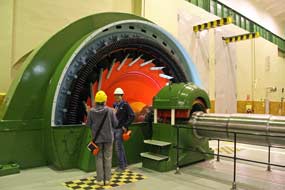 happy to
use the stairs, let us speak to someone with more senior authority. But the
young guide would not succumb; safety rules must prevail. So while we waited for
the next tour in an hour, when the storm certainly would be past, we viewed the
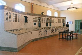
grandiose control room (see above left). Here was a total irony: Vattenfall,
which is responsible for electricity generation covering the whole of Sweden
and parts of wider Europe, could not even guarentee lighting for its own power
station! At 2-30pm with the weather now clear, we returned with renewed
determination; another of the guides, having checked the lighting after the
thunderstorm fiasco, declared all was well and issued us with hard-hats for the
tour. We emerged from the lift into the vast and beautifully tiled underground
machine hall, and spent the next hour examining the turbines, generators and
control equipment, in detailed discussion about their working with the guide, Eino. The
Vattenfall displays were first class, with key parts of the original turbines
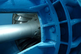
and generators opened up to reveal their working components. An artificial
opening gave a clear view inside the normally enclosed inner turbine chamber (see
above left), showing the pressured water
entry conduit which dropped 60m from the reservoir supply way above down onto
the turbine blades, and the shaft rotated by water pressure on the
turbine. Below this, the waste water conduit, now blocked off, would in
operation have dropped down to the underground tail-race; see
diagram of HEP power station working. Maintenance staff would have had to
crawl into this chamber via a small entry port, and hang above the chasm of the
exit conduit to repair cavitation damage to turbine blades. happy to
use the stairs, let us speak to someone with more senior authority. But the
young guide would not succumb; safety rules must prevail. So while we waited for
the next tour in an hour, when the storm certainly would be past, we viewed the
grandiose control room (see above left). Here was a total irony: Vattenfall,
which is responsible for electricity generation covering the whole of Sweden
and parts of wider Europe, could not even guarentee lighting for its own power
station! At 2-30pm with the weather now clear, we returned with renewed
determination; another of the guides, having checked the lighting after the
thunderstorm fiasco, declared all was well and issued us with hard-hats for the
tour. We emerged from the lift into the vast and beautifully tiled underground
machine hall, and spent the next hour examining the turbines, generators and
control equipment, in detailed discussion about their working with the guide, Eino. The
Vattenfall displays were first class, with key parts of the original turbines
and generators opened up to reveal their working components. An artificial
opening gave a clear view inside the normally enclosed inner turbine chamber (see
above left), showing the pressured water
entry conduit which dropped 60m from the reservoir supply way above down onto
the turbine blades, and the shaft rotated by water pressure on the
turbine. Below this, the waste water conduit, now blocked off, would in
operation have dropped down to the underground tail-race; see
diagram of HEP power station working. Maintenance staff would have had to
crawl into this chamber via a small entry port, and hang above the chasm of the
exit conduit to repair cavitation damage to turbine blades.
 Eino showed us the enormous steel drive shaft which
connected turbine to generator on the far side of the hall via
self-regulating apparatus which maintained rotation at the optimum rate of 2,500
rpm for generation of 50hz AC current (Photo
21 - Underground generating hall) (see above right). This governing
device operated hydraulic pistons which automatically adjusted the turbine
blades angle to maintain consistent revolutions of the drive shaft. The drive
shaft itself was a hugely impressive piece of equipment with massive
roller-bearings at key points along its length, and at the far end further bearings connected it to the 4m high
generator, which was partially exposed to show its workings (Photo
22 - Porjus generator) (see above right). Driven by the turbine, the
inner disk of electro-magnetic armatures rotated within the outer ring of
stator-coils to generate
AC electricity. Eino very competently and in fluent English explained the
turbine and generator's workings. We discussed how the technology of both
turbines and generators had improved in generating capacity: when all 9
turbine~generator sets of the original 1915 Porjus plant were operating,
together they produced a maximum of 145Mw of electricity; in contrast,
just one of the 2 new generation generators of the 1970s New Porjus Station can
produce 240Mw. We were also shown the new Powerformer generators, set up in
experimental form in place of the original units 8 and 9 at Porjus and installed
operationally at Parsi HEP Station further down the Luleälven. They generate high
voltage current supplied directly to the distribution grid without the losses
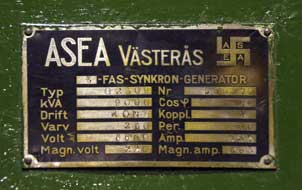
incurred by step-up transformers. One item of historic interest was the logo of Allmänna
Svenska Elektriska A-B (now ABB) electrical engineering company from Västerås
which had supplied the Porjus generators. The company's original logo had
incorporated the ancient Indo-European swastika symbol; this was changed in 1933
for political correctness reasons, but a plaque with a sole example of the
original logo survives Eino showed us the enormous steel drive shaft which
connected turbine to generator on the far side of the hall via
self-regulating apparatus which maintained rotation at the optimum rate of 2,500
rpm for generation of 50hz AC current (Photo
21 - Underground generating hall) (see above right). This governing
device operated hydraulic pistons which automatically adjusted the turbine
blades angle to maintain consistent revolutions of the drive shaft. The drive
shaft itself was a hugely impressive piece of equipment with massive
roller-bearings at key points along its length, and at the far end further bearings connected it to the 4m high
generator, which was partially exposed to show its workings (Photo
22 - Porjus generator) (see above right). Driven by the turbine, the
inner disk of electro-magnetic armatures rotated within the outer ring of
stator-coils to generate
AC electricity. Eino very competently and in fluent English explained the
turbine and generator's workings. We discussed how the technology of both
turbines and generators had improved in generating capacity: when all 9
turbine~generator sets of the original 1915 Porjus plant were operating,
together they produced a maximum of 145Mw of electricity; in contrast,
just one of the 2 new generation generators of the 1970s New Porjus Station can
produce 240Mw. We were also shown the new Powerformer generators, set up in
experimental form in place of the original units 8 and 9 at Porjus and installed
operationally at Parsi HEP Station further down the Luleälven. They generate high
voltage current supplied directly to the distribution grid without the losses
incurred by step-up transformers. One item of historic interest was the logo of Allmänna
Svenska Elektriska A-B (now ABB) electrical engineering company from Västerås
which had supplied the Porjus generators. The company's original logo had
incorporated the ancient Indo-European swastika symbol; this was changed in 1933
for political correctness reasons, but a plaque with a sole example of the
original logo survives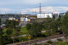 on a piece of machinery at Porjus (see
above left). There
was noticeable contrast in standards of finish between the original wing of the
machine hall and the later extension: with royal status, the original company
had lavished funding on the scale and finish of the tiled generator hall; in
contrast, 1940s austerity meant reduced standards with plainer floor tiles and
even exposed bed-rock showing through on the walls. on a piece of machinery at Porjus (see
above left). There
was noticeable contrast in standards of finish between the original wing of the
machine hall and the later extension: with royal status, the original company
had lavished funding on the scale and finish of the tiled generator hall; in
contrast, 1940s austerity meant reduced standards with plainer floor tiles and
even exposed bed-rock showing through on the walls.
After the initial set-back from the storm, we had been most
fortunate in achieving the Porjus Power Station visit with Eino as our guide:
his knowledge, competence and fluent English contributed much to our
understanding of the workings of HEP generation. His family lived in Porjus and
his father was an electrical engineer at the New Porjus Power Station; we
assumed Eino was also an engineer, but in fact he was due to go up to Skellefteå
University to read computer science. Through our web site we extend our profuse
gratitude for his thoroughly educative commentary and wish him well in his
future studies and career.
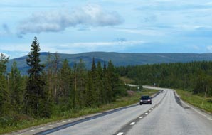 North on E45 Inlandsvägen to Gällivare:
the storm clouds and rain had passed and sky brightening by the time we emerged
from the Porjus underground generating hall to resume our northward journey. The
final section of the Inlandsbanan railway curved away towards the Porjus new dam
just beyond the Old Power Station (see above right)
(Photo
23 - Porjus dam and New Power Station), following the line of the original trackway
built in 1912 to supply materials for the old Porjus dam and deliver machine
parts for the generator house. Part of this original narrow gauge siding
trackway still survived outside the Old Power Station, running alongside the
standard gauge Inlandsbanan, and disappearing through lofty doors into the
switchgear house. Earlier we had seen huge gantry cranes North on E45 Inlandsvägen to Gällivare:
the storm clouds and rain had passed and sky brightening by the time we emerged
from the Porjus underground generating hall to resume our northward journey. The
final section of the Inlandsbanan railway curved away towards the Porjus new dam
just beyond the Old Power Station (see above right)
(Photo
23 - Porjus dam and New Power Station), following the line of the original trackway
built in 1912 to supply materials for the old Porjus dam and deliver machine
parts for the generator house. Part of this original narrow gauge siding
trackway still survived outside the Old Power Station, running alongside the
standard gauge Inlandsbanan, and disappearing through lofty doors into the
switchgear house. Earlier we had seen huge gantry cranes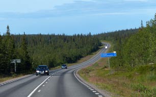 which had off-loaded
machine parts from railway wagons inside the station and lowered them for
assembly down in the underground turbine~generator hall. We passed through
Porjus village, now a community of 400 residents from its origins as a
settlement for construction workers on the 1910 old dam and power station; the
Stockholm government had assigned 100 immigrants to live here in a former
barracks hut. The E45 turned north-west heading towards Gällivare (click here for detailed map of route) with the
magnificent spruce forested rolling fell-scape lit by now bright afternoon sun
against a blue sky; higher rounded hills covered with spruce forests graced the
northern horizon. which had off-loaded
machine parts from railway wagons inside the station and lowered them for
assembly down in the underground turbine~generator hall. We passed through
Porjus village, now a community of 400 residents from its origins as a
settlement for construction workers on the 1910 old dam and power station; the
Stockholm government had assigned 100 immigrants to live here in a former
barracks hut. The E45 turned north-west heading towards Gällivare (click here for detailed map of route) with the
magnificent spruce forested rolling fell-scape lit by now bright afternoon sun
against a blue sky; higher rounded hills covered with spruce forests graced the
northern horizon.
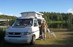 Wild-camp on banks of Kalixälven river at
Lappeasuando: crossing the river at Gällivare, we drove past the
modern apartment blocks of the lower town to find the ICA Kvantum hypermarket.
Ahead we could see the Malmberget iron mines scarring the hillside; we recalled
our underground visit to the Malmberget mines in 2013 (See log of our 2013 visit to Malmberget iron mines)
and this raised the question of how far the residents of Gällivare had
progressed with relocation of the original settlement which was now so
threatened with mining subsidence. The Gällivare ICA Kvantum was a large and
well-stocked stores, built on reclaimed industrial land in the newer part of town Wild-camp on banks of Kalixälven river at
Lappeasuando: crossing the river at Gällivare, we drove past the
modern apartment blocks of the lower town to find the ICA Kvantum hypermarket.
Ahead we could see the Malmberget iron mines scarring the hillside; we recalled
our underground visit to the Malmberget mines in 2013 (See log of our 2013 visit to Malmberget iron mines)
and this raised the question of how far the residents of Gällivare had
progressed with relocation of the original settlement which was now so
threatened with mining subsidence. The Gällivare ICA Kvantum was a large and
well-stocked stores, built on reclaimed industrial land in the newer part of town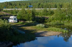 , and we stocked up with 2 days' provisions. Leaving Gällivare, E45 merged
with E10 coming up from Luleå and headed north across increasingly hilly,
forested fell-land (see above right). After some 40kms we reached the Kalixälven
river-crossing at Lappeasuando, the tiny settlement which spans the 2
municipalities of Gällivare and Kiruna, divided by the river. Here the former
1930s elegantly arched bridge, which replaced a former ferry crossing the Kalixälven,
still stands alongside the more functional modern bridge carrying the E45 across
the wide river. Alongside, a large picnic area stood by a café; we pulled in,
and below the tarmaced car park, found a lower grassy area screened by
trees and directly overlooking the river and old bridge. Here was the perfect
wild-camp spot, and we tucked George into a sheltered corner by the river by the
old bridge (see left)
(Photo
24 - Kalixälven wild-camp). , and we stocked up with 2 days' provisions. Leaving Gällivare, E45 merged
with E10 coming up from Luleå and headed north across increasingly hilly,
forested fell-land (see above right). After some 40kms we reached the Kalixälven
river-crossing at Lappeasuando, the tiny settlement which spans the 2
municipalities of Gällivare and Kiruna, divided by the river. Here the former
1930s elegantly arched bridge, which replaced a former ferry crossing the Kalixälven,
still stands alongside the more functional modern bridge carrying the E45 across
the wide river. Alongside, a large picnic area stood by a café; we pulled in,
and below the tarmaced car park, found a lower grassy area screened by
trees and directly overlooking the river and old bridge. Here was the perfect
wild-camp spot, and we tucked George into a sheltered corner by the river by the
old bridge (see left)
(Photo
24 - Kalixälven wild-camp).
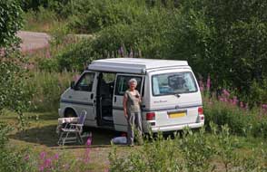 The
afternoon sun was bright, and the old bridge gave a perfect view of our
peaceful riverside camping spot (see left and above right). In contrast the
stark parking area was crammed full of camping-cars lined up in rows; thankfully
we were well sheltered from these hoards. Exploration showed not only that the
café also had a small campsite, but the parking area was equipped with
water-supplied WCs; it was indeed not only a beautifully located wild-camp spot
but well equipped, and later the sun declined across the Kalixälven to give
magnificent reflections in the wide river's still waters
(Photo
25- Kalixälven reflections) (see right). The
afternoon sun was bright, and the old bridge gave a perfect view of our
peaceful riverside camping spot (see left and above right). In contrast the
stark parking area was crammed full of camping-cars lined up in rows; thankfully
we were well sheltered from these hoards. Exploration showed not only that the
café also had a small campsite, but the parking area was equipped with
water-supplied WCs; it was indeed not only a beautifully located wild-camp spot
but well equipped, and later the sun declined across the Kalixälven to give
magnificent reflections in the wide river's still waters
(Photo
25- Kalixälven reflections) (see right).
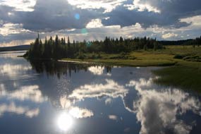 Yet more neglect of northern
principal roads:
the following morning we continued north on E45 to the road junction at Svappavaara, where the
Inlandsvägen turned north towards its ultimate northerly
destination at Karesuando on the Finnish border. We turned NW on E10 towards Kiruna
(click
here for detailed map of route). The open-cast iron mines at Svappavaara
seemed more widespread than ever as LKAB, the state-owned mining company takes
over more of the Sámi reindeer grazing lands. But at least, we thought, two years
on from when we last passed this way, when we had crawled along for more than
20kms of rough, unsurfaced road with the tarmac totally stripped away, by now
all the road-widening works should have been completed with an entirely new,
re-engineered highway. For the first 5kms this was so, but then the dreaded road
works signs loomed. The next 15kms had been widened but were still in process of
being re-tarmaced. Worse still however, where the road crossed drainage culverts
every 500m, the surface was still stripped, meaning slowing to cross these rough
30m sections. This appallingly slow progress with reinstating a major highway
simply would not be tolerated in the south of Sweden particularly around
Stockholm; but up here in the north, seemly anything goes. This was not simply
northern prejudice feeling the victim of public services neglect compared with
the south; Yet more neglect of northern
principal roads:
the following morning we continued north on E45 to the road junction at Svappavaara, where the
Inlandsvägen turned north towards its ultimate northerly
destination at Karesuando on the Finnish border. We turned NW on E10 towards Kiruna
(click
here for detailed map of route). The open-cast iron mines at Svappavaara
seemed more widespread than ever as LKAB, the state-owned mining company takes
over more of the Sámi reindeer grazing lands. But at least, we thought, two years
on from when we last passed this way, when we had crawled along for more than
20kms of rough, unsurfaced road with the tarmac totally stripped away, by now
all the road-widening works should have been completed with an entirely new,
re-engineered highway. For the first 5kms this was so, but then the dreaded road
works signs loomed. The next 15kms had been widened but were still in process of
being re-tarmaced. Worse still however, where the road crossed drainage culverts
every 500m, the surface was still stripped, meaning slowing to cross these rough
30m sections. This appallingly slow progress with reinstating a major highway
simply would not be tolerated in the south of Sweden particularly around
Stockholm; but up here in the north, seemly anything goes. This was not simply
northern prejudice feeling the victim of public services neglect compared with
the south;
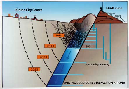 we had experienced direct evidence of such neglect twice now. LKAB's
mining, which is taking over more and more land in Norrland,
raises untold revenues for the State, yet the north of the country enjoys
second rate public services compared with the south. we had experienced direct evidence of such neglect twice now. LKAB's
mining, which is taking over more and more land in Norrland,
raises untold revenues for the State, yet the north of the country enjoys
second rate public services compared with the south.
 The iron mining town of Kiruna, threatened by
mining subsidence: we had visited Kiruna in both 2013 and 2014, when
we had learned much about the town's economic reliance on iron ore mining,
undertaken by the State-mining company LKAB, which takes its name,
Luossovaara-Kiirunavaara Aktiebolag, from the Kiruna's 2 hills of Luossovaara
and Kiirunavaara where open-cast iron ore mining at Kiruna first began in 1898
(see right). Mining is progressively undermining the city centre, making
necessary its relocation due to the impact of mining subsidence. Our main reason for returning to Kiruna
this year was to see how much tangible progress had been made in the last 2
years with the town's relocation. In 2004 LKAB's Managing Director had submitted
an arrogantly brief letter to Kiruna Municipal Authority, which we had seen
displayed in Kiruna City Hall. The gist of the letter was: We are going on
mining deeper; you'd better move your town. LKAB's deep mining method called sub-level
caving leaves cavities in the bed-rock when the ore is extracted. When these
cavities collapse re-filling the surrounding bed-rock, over time this results in
subsidence at the surface (see
log of 2013 visit to Kiruna). Because the ore body, into which LKAB are deep mining,
slopes down at a 60º angle beneath the city, the area of subsidence is moving
ever closer towards Kiruna centre at the rate of 40m a year (see diagram left). This
damaging impact on the city's environment has already reached close to the E10
and the present City Hall. The speed of approach of the area of surface
deformation depends on the rate of LKAB's deep mining, at present at the 1,365m
level. Levels and progress of deformation are being monitored by ground
measuring instruments, giving forecasts of future rate of subsidence on which
the Municipality is basing its relocation plans. Forecasts however predict that
33% of Kiruna's 20,000 residents must be re-housed; within the zone of surface
deformation, there are 3,200 homes, several hotels, the entire city centre
commercial The iron mining town of Kiruna, threatened by
mining subsidence: we had visited Kiruna in both 2013 and 2014, when
we had learned much about the town's economic reliance on iron ore mining,
undertaken by the State-mining company LKAB, which takes its name,
Luossovaara-Kiirunavaara Aktiebolag, from the Kiruna's 2 hills of Luossovaara
and Kiirunavaara where open-cast iron ore mining at Kiruna first began in 1898
(see right). Mining is progressively undermining the city centre, making
necessary its relocation due to the impact of mining subsidence. Our main reason for returning to Kiruna
this year was to see how much tangible progress had been made in the last 2
years with the town's relocation. In 2004 LKAB's Managing Director had submitted
an arrogantly brief letter to Kiruna Municipal Authority, which we had seen
displayed in Kiruna City Hall. The gist of the letter was: We are going on
mining deeper; you'd better move your town. LKAB's deep mining method called sub-level
caving leaves cavities in the bed-rock when the ore is extracted. When these
cavities collapse re-filling the surrounding bed-rock, over time this results in
subsidence at the surface (see
log of 2013 visit to Kiruna). Because the ore body, into which LKAB are deep mining,
slopes down at a 60º angle beneath the city, the area of subsidence is moving
ever closer towards Kiruna centre at the rate of 40m a year (see diagram left). This
damaging impact on the city's environment has already reached close to the E10
and the present City Hall. The speed of approach of the area of surface
deformation depends on the rate of LKAB's deep mining, at present at the 1,365m
level. Levels and progress of deformation are being monitored by ground
measuring instruments, giving forecasts of future rate of subsidence on which
the Municipality is basing its relocation plans. Forecasts however predict that
33% of Kiruna's 20,000 residents must be re-housed; within the zone of surface
deformation, there are 3,200 homes, several hotels, the entire city centre
commercial
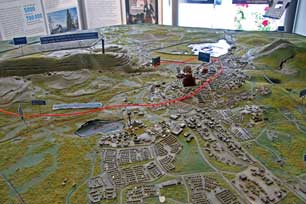 district,
and the majority of public institutions including City Hall, secondary and
elementary schools, hospital, library, parish church and public baths. This all
affects 1,000 jobs and over 6,000 people. district,
and the majority of public institutions including City Hall, secondary and
elementary schools, hospital, library, parish church and public baths. This all
affects 1,000 jobs and over 6,000 people.
Our 2016 re-visit to Kiruna: turning off E10 into Kiruna, we passed the
construction site for the new city centre, but the only visible progress was a
large rotunda-shaped building in the early stages of construction. The rest of
the area was still untouched former industrial land. Was this all the progress
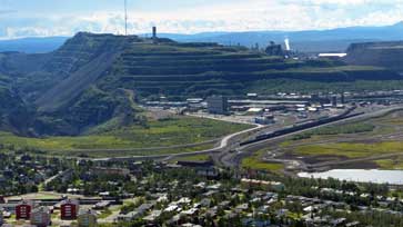 that
the last 2 years had produced, and were the discussions, consultation and glitzy
plans still the only thing happening in Kiruna? One thing was certain however:
LKAB was still driving the underground mining into the ore body ever deeper and
deeper, lining the State's coffers accordingly, and of course further
undermining the city centre with ever threatening subsidence. We continued ahead
into the city, passing the mammoth gash of the original
open-cast mine scarred across Kiirunavaara hill. There was the City Hall just
beyond the corner of Gruvavägen (Mine Street), and the attractive wooden houses
of the original 1910 township. All still looked the same; nothing had yet fallen
into the mine! On a Saturday afternoon, we parked without difficulty in the
central square; in the community centre LKAB's model illustrating the potential
impact of mining subsidence was still there (See left), but today no one from
LKAB's PR department was present to answer our questions. There was nothing new to be learned here. that
the last 2 years had produced, and were the discussions, consultation and glitzy
plans still the only thing happening in Kiruna? One thing was certain however:
LKAB was still driving the underground mining into the ore body ever deeper and
deeper, lining the State's coffers accordingly, and of course further
undermining the city centre with ever threatening subsidence. We continued ahead
into the city, passing the mammoth gash of the original
open-cast mine scarred across Kiirunavaara hill. There was the City Hall just
beyond the corner of Gruvavägen (Mine Street), and the attractive wooden houses
of the original 1910 township. All still looked the same; nothing had yet fallen
into the mine! On a Saturday afternoon, we parked without difficulty in the
central square; in the community centre LKAB's model illustrating the potential
impact of mining subsidence was still there (See left), but today no one from
LKAB's PR department was present to answer our questions. There was nothing new to be learned here.
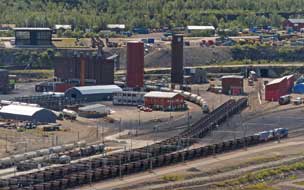 We drove through Kiruna's western suburbs to the
lane which circled up around the western side of Luossovaara hill. Leaving
George towards the top of the steep gravelled trackway, we walked up the final
section to the ski station at the summit, past the gashes of the original
open-cast mines which still scar the eastern face of the hill. Our reason for
struggling up to this high view-point was for the panoramic vista over the
township spread out below with the overwhelming presence of LKAB modern mining
operations, at least We drove through Kiruna's western suburbs to the
lane which circled up around the western side of Luossovaara hill. Leaving
George towards the top of the steep gravelled trackway, we walked up the final
section to the ski station at the summit, past the gashes of the original
open-cast mines which still scar the eastern face of the hill. Our reason for
struggling up to this high view-point was for the panoramic vista over the
township spread out below with the overwhelming presence of LKAB modern mining
operations, at least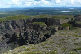 that which can be seen on the surface. Here dominating the
landscape was the original reason for Kiruna's foundation as a town, its current
source of wealth and employment, and soon its potential cause of destruction and
need for relocation (see above right)
(Photo
26 - LKAB iron ore mine). In the hazy afternoon
sunshine we took our photos looking over the town and mine. Lines of empty
hopper wagons awaiting re-filling with processed iron ore pellets for rail
shipment down to Narvik stood in the sidings
(see left) (Photo
27 - Sidings of hopper wagons); it seemed that LKAB had in the last 2
years re-routed the railway line safely away from the area of subsidence to the
far side of the lake, and the new relocated Kiruna railway station had now
opened. But all else remained the same, with the evident line of surface
deformation creeping ever closer towards the city centre. that which can be seen on the surface. Here dominating the
landscape was the original reason for Kiruna's foundation as a town, its current
source of wealth and employment, and soon its potential cause of destruction and
need for relocation (see above right)
(Photo
26 - LKAB iron ore mine). In the hazy afternoon
sunshine we took our photos looking over the town and mine. Lines of empty
hopper wagons awaiting re-filling with processed iron ore pellets for rail
shipment down to Narvik stood in the sidings
(see left) (Photo
27 - Sidings of hopper wagons); it seemed that LKAB had in the last 2
years re-routed the railway line safely away from the area of subsidence to the
far side of the lake, and the new relocated Kiruna railway station had now
opened. But all else remained the same, with the evident line of surface
deformation creeping ever closer towards the city centre.
From the summit area we peered over the fencing
into the gash of the former open-cast mine which spread across the eastern face
of Luossovaara hill (see right), and returned down to George to sit at a
barbecue hearth to eat our sandwiches. From this viewpoint high on the western
side of Luossovaara hill, we had a 270º continuous panorama of empty wilderness;
not even a trace of roads or any human presence, just empty fell-scape and the
distant sweep of horizon looking out towards Abisko with the line of snow-capped
Norwegian mountains
(Photo
28 - Fell-scape panorama); so close to the industrial landscape of
Kiruna's mines on the far side of the hill, but here an outlook of empty and
uncontaminated natural beauty. This was another of the trip's most memorable
lunch spots.
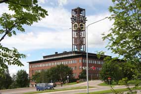 Back
down the hill into the town, we parked by the City Hall for photographs
(Photo
29 - Kiruna City Hall) (see left); who knows, next time we come to
Kiruna, this inelegant cuboid building with its skeletal bell-tower may have
been demolished and the city bureaucrats relocated, or will it have collapsed
into the mine! As we stood examining the city relocation displays in the City
Hall's lofty inner hall (see below right), a
Municipal official joined us, opening with an unfortunate question: what did we
think about what had been achieved with the city's relocation? Summoning utmost
tact, the gist of our response was: well, not very much! You've had since 2004
and, from our 3 visits since 2013, all that seems to have happened is much
discussion and paper plans, but precious little by way of tangible action, (well
she did ask!) and the hole in the ground Back
down the hill into the town, we parked by the City Hall for photographs
(Photo
29 - Kiruna City Hall) (see left); who knows, next time we come to
Kiruna, this inelegant cuboid building with its skeletal bell-tower may have
been demolished and the city bureaucrats relocated, or will it have collapsed
into the mine! As we stood examining the city relocation displays in the City
Hall's lofty inner hall (see below right), a
Municipal official joined us, opening with an unfortunate question: what did we
think about what had been achieved with the city's relocation? Summoning utmost
tact, the gist of our response was: well, not very much! You've had since 2004
and, from our 3 visits since 2013, all that seems to have happened is much
discussion and paper plans, but precious little by way of tangible action, (well
she did ask!) and the hole in the ground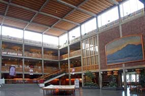 goes on getting bigger by the year. In
fact, without her trying to push some indefensible local authority party line,
we had a helpful and informative discussion with her about what was happening at Kiruna. The decision
had been taken for the new city centre as the town's focus to
move to a now agreed site 3kms eastwards along Malmvägen, and the rotunda
building we had seen in construction was the new City Hall called Kristallen. In
discussion about public attitudes towards the necessity for relocation, she
added that, while there was general acceptance, public concerns now focussed on
2 issues which she summarised as money and outlook: LKAB were now committed to
contributing huge sums of money as compensation for city infrastructure, and to
fund new housing over the next 3 years to replace that in the threatened areas.
While this suited property owners, those who rented houses, largely from LKAB at
currently reasonable rents, faced a doubling of rental prices for new replacement
housing. This issue remained unresolved. The other major concern was over visual
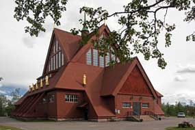 outlook:
those parts of the town affected by subsidence currently enjoyed a
westward vista towards open fell-land, which we had seen from Luossovaara;
eastward relocation however would deprive residents of that magnificent open
fell and mountainous outlook. Another issue was that, due to cost restrictions, Kiruna's attractive original wooden houses, part of its key heritage, would be
demolished and not relocated; a proposal had been put forward for the owners to
relocate the demolished wooden houses at their own expense. This issue
also remained unresolved. outlook:
those parts of the town affected by subsidence currently enjoyed a
westward vista towards open fell-land, which we had seen from Luossovaara;
eastward relocation however would deprive residents of that magnificent open
fell and mountainous outlook. Another issue was that, due to cost restrictions, Kiruna's attractive original wooden houses, part of its key heritage, would be
demolished and not relocated; a proposal had been put forward for the owners to
relocate the demolished wooden houses at their own expense. This issue
also remained unresolved.
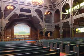 In spite of all of this, the fact remained that,
were it not for LKAB's mining, Kiruna would not exist as a township; its entire
economic future depend totally on LKAB as the city's main employer along with
mining support industries. Unemployment in Kiruna, with its population of 20,000
is just 2%. This prompted us to raise the issue of immigration and its impact
on Kiruna. The Swedish government had forcibly assigned immigrants to northern
townships to house, and Kiruna had accepted 1,000. Some had even been allocated
to the empty skiing hotels up in the Arctic wilderness at Riksgränsen during the
summer season! Despite this having been a thoroughly informative discussion from
which we had learnt much, we were still however left with the feeling that the
pace of progress with Kiruna's relocation was failing to match the rate at which
LKAB's ever deeper and deeper mining was hastening the growth of subsidence.
Time will tell. In spite of all of this, the fact remained that,
were it not for LKAB's mining, Kiruna would not exist as a township; its entire
economic future depend totally on LKAB as the city's main employer along with
mining support industries. Unemployment in Kiruna, with its population of 20,000
is just 2%. This prompted us to raise the issue of immigration and its impact
on Kiruna. The Swedish government had forcibly assigned immigrants to northern
townships to house, and Kiruna had accepted 1,000. Some had even been allocated
to the empty skiing hotels up in the Arctic wilderness at Riksgränsen during the
summer season! Despite this having been a thoroughly informative discussion from
which we had learnt much, we were still however left with the feeling that the
pace of progress with Kiruna's relocation was failing to match the rate at which
LKAB's ever deeper and deeper mining was hastening the growth of subsidence.
Time will tell.
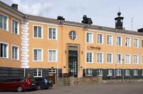 Before leaving Kiruna, we re-visited 2 of its
other features. Just up Gruvavägen, the town's wooden church (also due for
relocation) had itself been a gift from LKAB and its the all-powerful managing
director Hjalmar Lundbohm, regarded as Kiruna's founding father
(Photo
30- Kiruna's wooden church) (see above left). The church was
open, but the interior with its elaborate wooden structure was almost too dark
for photos (see right). Further up into the town, but still within the
threatened zone of deformation, we paused at the Swedish Sámi Parliament, the
Sámetinget (Photo
31 - Swedish Sámi Parliament) (see left). Before leaving Kiruna, we re-visited 2 of its
other features. Just up Gruvavägen, the town's wooden church (also due for
relocation) had itself been a gift from LKAB and its the all-powerful managing
director Hjalmar Lundbohm, regarded as Kiruna's founding father
(Photo
30- Kiruna's wooden church) (see above left). The church was
open, but the interior with its elaborate wooden structure was almost too dark
for photos (see right). Further up into the town, but still within the
threatened zone of deformation, we paused at the Swedish Sámi Parliament, the
Sámetinget (Photo
31 - Swedish Sámi Parliament) (see left).
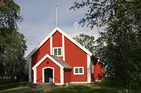
Jukkasjärvi wooden church:
at 4-30pm we finally left Kiruna today. Our discussion at City Hall was partly
reassuring about the city's relocation, but with typical local authority
handling, it seemed a frustratingly slow process; what should we find if we ever
return? Back out along E10, we turned off across the wide Torneälven river to
Jukkasjärvi to find Sweden's oldest wooden church from 1608 (see right). A wedding was about
to take place, but as the guests assembled we just managed to gain entry for
photos of the organ screen with Sámi drum symbol intertwined with Christian
cross and modernistic altar paintings showing Laestadius denying sustaining
liquor to the Sámis
(Photo
32 - Jukkasjärvi wooden church).
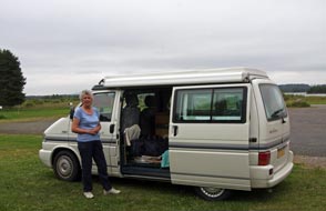 Trollsparvens
Camping at Vittangi: we returned along the E10 for the 40kms to
Svappavaara, braving the 3 hazards of this road: everlasting road works, slowly
lumbering Norwegian camping-cars, and an equally tedious procession of speed
cameras. Here we turned off northwards onto the E45 Inlandsvägen again,
across the flat, forested lands of the Torneälven valley to Vittangi on the
southern side of the river. The village has given its name to Vittangi Syndrome,
congenital analgesia or the inability to feel pain, because of a cluster of
cases of this rare condition reported in 2006 at Vittangi. On the far side of
the wide river-crossing, we found tonight's campsite, Trollsparvens Camping on
the banks of the Torneälven, a place we Trollsparvens
Camping at Vittangi: we returned along the E10 for the 40kms to
Svappavaara, braving the 3 hazards of this road: everlasting road works, slowly
lumbering Norwegian camping-cars, and an equally tedious procession of speed
cameras. Here we turned off northwards onto the E45 Inlandsvägen again,
across the flat, forested lands of the Torneälven valley to Vittangi on the
southern side of the river. The village has given its name to Vittangi Syndrome,
congenital analgesia or the inability to feel pain, because of a cluster of
cases of this rare condition reported in 2006 at Vittangi. On the far side of
the wide river-crossing, we found tonight's campsite, Trollsparvens Camping on
the banks of the Torneälven, a place we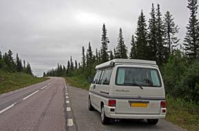 had passed twice before. An earlier
phone call had brought no response, and on arrival the reception hut was locked.
But as we stood there an Estonian migrant worker staying at one of the huts came
over, saying he was looking after the place while the owner was in Luleå. The
camping area was deserted and we settled in, but here on the banks of the Torneälven
the midges were horrendous, some of the worst of the trip. After the mountainous
landscapes of the last few days, the flat fells of the Torneälven valley seemed
tediously monotonous, particularly in the now dull light (see left). The charge
was reasonable at 180kr/night and facilities basic, but after 2
nights of wild-camping, it was a relief to soak in a hot shower. had passed twice before. An earlier
phone call had brought no response, and on arrival the reception hut was locked.
But as we stood there an Estonian migrant worker staying at one of the huts came
over, saying he was looking after the place while the owner was in Luleå. The
camping area was deserted and we settled in, but here on the banks of the Torneälven
the midges were horrendous, some of the worst of the trip. After the mountainous
landscapes of the last few days, the flat fells of the Torneälven valley seemed
tediously monotonous, particularly in the now dull light (see left). The charge
was reasonable at 180kr/night and facilities basic, but after 2
nights of wild-camping, it was a relief to soak in a hot shower.
Final stretch of E45 Inlandsvägen to Karesuando: after a
relaxing morning, it was noon before we were away, to drive the final 100kms of
E45 Inlandsvägen, the road we had followed much of the way from Göteborg
in the south, to Karesuando, Sweden's northernmost village on the
border with NW Finland (click here for detailed map of route).
When we had driven this section of Inlandsvägen south in 2014, it had
been a glorious day with bright sun picking out all the details of the
candle-spruces lining the road and enlivening the fell-scape. Today in total
contrast, the dull, flat light rendered the trees and fells and equally dull and
lifeless grey-green monotone (see right). We continued northwards through the
Sámi settlements of
 Nedre and Övre Soppero, which spanned the Lainioälven, one
of Sweden's finest fishing rivers and a tributary of the Torneälven. At present
rate we should reach Karesuando early afternoon, but a thought now occurred:
having secured our pitch at Sandlövs Camping, why not cross the border-bridge
into Finland, and drive up to Kilpisjärvi this afternoon for a nostalgic
re-visit and shop for shop for Finnish items from the K-Market there? So that
was decided on, and we hastened on to Karesuando. As we drove northwards, the
flat, empty fell-scape gave way to distant, higher and Nedre and Övre Soppero, which spanned the Lainioälven, one
of Sweden's finest fishing rivers and a tributary of the Torneälven. At present
rate we should reach Karesuando early afternoon, but a thought now occurred:
having secured our pitch at Sandlövs Camping, why not cross the border-bridge
into Finland, and drive up to Kilpisjärvi this afternoon for a nostalgic
re-visit and shop for shop for Finnish items from the K-Market there? So that
was decided on, and we hastened on to Karesuando. As we drove northwards, the
flat, empty fell-scape gave way to distant, higher and more rounded hills, but
misty and featureless in the gloomy light. more rounded hills, but
misty and featureless in the gloomy light.
A brief re-visit to
Kilpisjärvi in NW Finland: we reached
the outskirts of Karesuando at 2-00pm and through the village past the familiar
shops and reindeer meat-hall, turned off into Sandlövs Camping, where we had
stayed many times before. Having reserved our place opposite the bridge and
church, we crossed the bridge to Kaaresuvanto on the Finnish bank and turned
NW-wards onto Route 21 to cross the Lätäseno which drains the empty fells of
Finland's north-western arm of territory, and headed for Kilpisjärvi (click here for detailed map of route).
Today the gloriously empty fell-scape and boulder-fields of the Könkämaälven
valley were a boundless and featureless grey monotone in this dull light, such a
pity without sunlight to enliven all the details of this magnificent empty
wilderness landscape (see above left). Despite the less than even road surface,
we made good progress, passing frequent camping-cars and caravans lumbering
their way back to Norway. The distinctive feature of this lovely road are the
long, straight stretches which undulate across the landscape, disappearing into
the horizon-bound distance (see above right). Following the river and line of
lakes which marks the Finnish~Swedish border, and passing through the occasional
 Sámi
settlement, we moved NW-wards towards Kilpisjärvi, road signs ticking off the
kms. The higher fells grew closer, and eventually we gained height towards the
watershed with the first views of Kilpisjärvi lake filling the upper
valley. In the now even gloomier light, the distant mountains of Norway were
almost invisible in dark rain cloud, and as we passed along the shore of
Kilpisjärvi lake, Saana (Finland's highest fell) and the lower Malla Fell were half-lost in a
heavy covering of cloud. Passing the National Park centre, we finally reached
the central area of Kilpisjärvi, with the K-Market and filling station as its Sámi
settlement, we moved NW-wards towards Kilpisjärvi, road signs ticking off the
kms. The higher fells grew closer, and eventually we gained height towards the
watershed with the first views of Kilpisjärvi lake filling the upper
valley. In the now even gloomier light, the distant mountains of Norway were
almost invisible in dark rain cloud, and as we passed along the shore of
Kilpisjärvi lake, Saana (Finland's highest fell) and the lower Malla Fell were half-lost in a
heavy covering of cloud. Passing the National Park centre, we finally reached
the central area of Kilpisjärvi, with the K-Market and filling station as its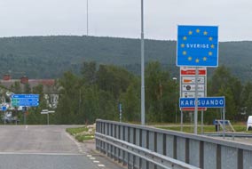 focus, and by now the dark, gloomy cloud had turned to driving rain. The car
park was full of Norwegian cross-border shoppers, but at least the supermarket
was open. Inside we shopped for favourite Finnish items, and to our relief found
a whole shelf full of the Laitilan Finnish beer which we had driven 100km from Karesuando to buy! We loaded our trolley and the €s bill tolled upwards; but no
matter, we had secured our Laitilan. With a grateful kiitos paljon
to the fluently English-speaking girl on the till, we loaded our supplies into
George, and in winter-cold wind and rain, drove along to Kilpisjärvi Retkeilykeskus for a brief nostalgic re-visit. Across the lake, where last year
we had crossed to the Treriksröset monument marking the fell-land meeting of the 3 borders, today the
fells and distant mountainous skyline were totally lost in gloomy rain cloud. We
turned and headed back the way we had driven along the shore of Kilpisjärvi lake
in poor light and driving rain. From the head of the pass, the long, straight
road stretched away for seemingly many kms into the murky distance, with the
fell-scape and lakes a featureless, grey blur (see above left). It took over an
hour to drive the 100km back to Kaaresuvanto on the Finnish side of the
border-bridge, and as we returned south-eastwards the sky became brighter.
George had a fill of cheaper Finnish diesel before we re-crossed the river
into Ruotsi, as the Finns call Sweden (see right).
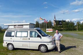 Sandlövs Camping at Karesuando: Sandlövs
Camping was still almost deserted as we settled George into his place looking
across to Laestadius' church. The Finnish beer we had driven a wearying 200kms
for this afternoon tasted even better than usual! It had also been a wonderfully
nostalgic Sandlövs Camping at Karesuando: Sandlövs
Camping was still almost deserted as we settled George into his place looking
across to Laestadius' church. The Finnish beer we had driven a wearying 200kms
for this afternoon tasted even better than usual! It had also been a wonderfully
nostalgic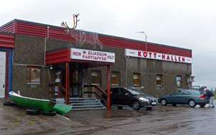 foray into NW Finland despite the regrettable weather conditions. The
inevitable Norwegian caravans drifted in along with a ludicrously monstrous
mega-bus, less an intrusion than a source of much ridicule and contempt for such
gross materialism on wheels. Karesuando and Sandlövs Camping in particular will always
be one of our Very Special Places, and it was wonderful to be back despite the
misty cloud and rain which persisted all evening. Karesuando at the northern
limit of Sweden represented the trip's half-way point, having driven almost
3,500 miles since crossing the Öresund; tomorrow we should begin the long
homeward
drive along the Finnish borderlands of the Tornedalen valley to Pajala, and the forecast was awful for chill Arctic rain. The forecast was right and we woke
to miserably chill temperatures and wind-driven rain. It was no fun this morning
washing up at the outdoor sink, wearing waterproofs against the chill rain. It
was simply too wet this morning for photos of this lovely straightforward
campsite, and we recalled the pleasant sun
when we stayed here last year from Finland
(Photo
33 - Sandlövs Camping at Karesuando) (see left). With farewells to Sandlövs
for another year, we drove into the village for our shopping. In pouring rain,
our first stop was Eliasson Kötthallen (Meat-hall) for frozen packs of reindeer
and elk meat (see right), then the minimarkets for general foodstuffs. foray into NW Finland despite the regrettable weather conditions. The
inevitable Norwegian caravans drifted in along with a ludicrously monstrous
mega-bus, less an intrusion than a source of much ridicule and contempt for such
gross materialism on wheels. Karesuando and Sandlövs Camping in particular will always
be one of our Very Special Places, and it was wonderful to be back despite the
misty cloud and rain which persisted all evening. Karesuando at the northern
limit of Sweden represented the trip's half-way point, having driven almost
3,500 miles since crossing the Öresund; tomorrow we should begin the long
homeward
drive along the Finnish borderlands of the Tornedalen valley to Pajala, and the forecast was awful for chill Arctic rain. The forecast was right and we woke
to miserably chill temperatures and wind-driven rain. It was no fun this morning
washing up at the outdoor sink, wearing waterproofs against the chill rain. It
was simply too wet this morning for photos of this lovely straightforward
campsite, and we recalled the pleasant sun
when we stayed here last year from Finland
(Photo
33 - Sandlövs Camping at Karesuando) (see left). With farewells to Sandlövs
for another year, we drove into the village for our shopping. In pouring rain,
our first stop was Eliasson Kötthallen (Meat-hall) for frozen packs of reindeer
and elk meat (see right), then the minimarkets for general foodstuffs.
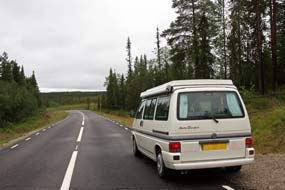 A wet drive along the Tornedalen valley Finnish
borderlands to Pajala:
finally leaving Karesuando with the rain still pouring on a very gloomy morning,
we turned south-eastwards just before the border-bridge onto the lonely Route 99
for the 180km drive down Tornedalen. On a sunny day, this would have been a
supremely beautiful road, with a bright sun picking out the detail of pines and
spruces, occasional glimpses of the Torneälven, and the distant forested hills
of Finland across the river-border. Today however, in such filthy wet weather,
the forests had a sad and drearily grey air (see left), and we bumped along the poorly
surfaced road, splashing through puddles and scarcely seeing any other vehicles.
This was indeed a very lonely road (click here for detailed map of route).
The road ran parallel with the Muonionjoki border-river
(Photo
34 - Muonionjoki border-river), passing the occasional Sámi settlement.
Finally we reached the larger village of Muodoslompolo where we had discovered a
small campsite set right on the river-border and run by the Tornedalen-Finnish
Malmström family for 30 years. We ventured off the main road and 6 kms along a
single-track lane at the tiny border village of Muonionalusta, set on a
river-island formed between the main Muonionjoki and a tributary, we finally
reached Rajamaa Camping. Although it was off our route today, this was certainly
worthwhile for a future stay either from Northern Finland or A wet drive along the Tornedalen valley Finnish
borderlands to Pajala:
finally leaving Karesuando with the rain still pouring on a very gloomy morning,
we turned south-eastwards just before the border-bridge onto the lonely Route 99
for the 180km drive down Tornedalen. On a sunny day, this would have been a
supremely beautiful road, with a bright sun picking out the detail of pines and
spruces, occasional glimpses of the Torneälven, and the distant forested hills
of Finland across the river-border. Today however, in such filthy wet weather,
the forests had a sad and drearily grey air (see left), and we bumped along the poorly
surfaced road, splashing through puddles and scarcely seeing any other vehicles.
This was indeed a very lonely road (click here for detailed map of route).
The road ran parallel with the Muonionjoki border-river
(Photo
34 - Muonionjoki border-river), passing the occasional Sámi settlement.
Finally we reached the larger village of Muodoslompolo where we had discovered a
small campsite set right on the river-border and run by the Tornedalen-Finnish
Malmström family for 30 years. We ventured off the main road and 6 kms along a
single-track lane at the tiny border village of Muonionalusta, set on a
river-island formed between the main Muonionjoki and a tributary, we finally
reached Rajamaa Camping. Although it was off our route today, this was certainly
worthwhile for a future stay either from Northern Finland or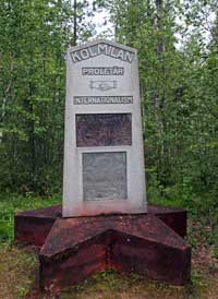 Swedish Lapland,
particularly since Route 404 crossed the river to Muonio close to the Pallas-Yllästunturi
National Park. We continued south on Route 99 which turned inland through
sandy-heath forests rich with reindeer lichen before returning to the river at
the tiny settlement of Parkajoki. All the settlements along this stretch had
Finnish-sounding names, ending in -joki and -järvi. Swedish Lapland,
particularly since Route 404 crossed the river to Muonio close to the Pallas-Yllästunturi
National Park. We continued south on Route 99 which turned inland through
sandy-heath forests rich with reindeer lichen before returning to the river at
the tiny settlement of Parkajoki. All the settlements along this stretch had
Finnish-sounding names, ending in -joki and -järvi.
The Kaalama memorial: a short
distance further near the village of Kaalama, we reached the memorial to a 1942 wartime
atrocity which we had first discovered when passing this way on our 2013 trip. Set in
a forest clearing a short distance from the road, the monument, headed Kolmin
Proletär Internationalism and mounted on a communist red-star plinth,
incorporated a pictorial plaque showing helmeted soldiers executing
kneeling figures (see right). The lengthily worded inscription included
the date of 22 December 1942, but we had been unable to discover from any source
more details about the commemorated massacre. Careful analysis and translation
of the monument's semi legible Swedish inscription has now thrown some light on
the incident: the monument was erected in 1978 by the Pajala branch of the VPK,
formerly the Swedish Communist Party; in 1942 a group of Finnish communist guerrilla fighters, referred to as Forest Guards because of their
hideout in the forests,
had been pursued across the border by Finnish military; their alleged crime was
their 'anti fascist' resistance to what the text calls the 'fascist onslaught', in other words a
continuation of the bitter left- and right-wing enmity that still existed in
Finland from the time of the 1918~20 Civil War, even after the 1939~40 Winter
War had brought a degree of national unity. The guerrillas had been sheltered by
left-wing sympathisers from nearby Swedish villages, but some had been
shot by Swedish military and police (the massacre portrayed on the pictorial plaque), others
were imprisoned or deported back to internment camps in Finland. We now had a
clearer understanding of the background to this now forgotten memorial
half-buried in the forest, which recalled one brutal episode involving left-wing
guerrillas and the White-dominated Finnish military along the porous Tornedalen
border, in the long history of
internecine political extreme violence in Finland during the first half of the
20th century.
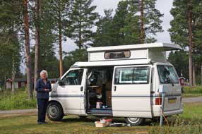 Pajala Camping and the village of Pajala: Route 99 now moved away
from the river (click here for detailed map of route), with apparently a clear run past the Struve geodetic memorial at Jupukka, but then we had to face yet more road works and a 10 kms stretch of
totally stripped, unsurfaced gravel or newly asphalted road, lasting until the
river crossing to join Route 395 coming in from Vittangi down to Pajala. Through
Pajala, we finally reached the campsite down on the banks of the wide Torneälven
river. When we had stayed here in 2013, prices were a reasonable 210kr/night; 3
years on, they risen to 260kr, a very unreasonable 25% increase price.
Reluctantly we booked in, and settled into the forested corner
(Photo
35 - Pajala Camping), preferring the
company of Bilberries Pajala Camping and the village of Pajala: Route 99 now moved away
from the river (click here for detailed map of route), with apparently a clear run past the Struve geodetic memorial at Jupukka, but then we had to face yet more road works and a 10 kms stretch of
totally stripped, unsurfaced gravel or newly asphalted road, lasting until the
river crossing to join Route 395 coming in from Vittangi down to Pajala. Through
Pajala, we finally reached the campsite down on the banks of the wide Torneälven
river. When we had stayed here in 2013, prices were a reasonable 210kr/night; 3
years on, they risen to 260kr, a very unreasonable 25% increase price.
Reluctantly we booked in, and settled into the forested corner
(Photo
35 - Pajala Camping), preferring the
company of Bilberries 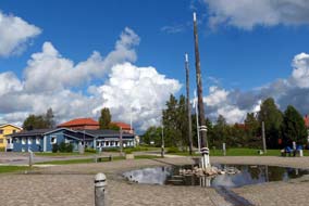 and Lingonberries on the river bank to all the caravans and camping-cars corralled into the tarmaced area by reception. Today had been a
depressingly chill, wet and cheerless day for our drive along the Tornedalen
valley, but we hoped for better weather for our day in camp tomorrow at Pajala.
A warmer morning brought even a hint of hazy sun, but by early afternoon the
rain returned; even so we managed to pick breakfast bilberries from the forest
floor near our pitch, and that evening we cooked a Lapland supper of reindeer
and lingonberry stew. But the rain began again, and for the first time this
trip, the sky was really dusky; the year was moving on and we tomorrow we should
cross the Arctic Circle south. and Lingonberries on the river bank to all the caravans and camping-cars corralled into the tarmaced area by reception. Today had been a
depressingly chill, wet and cheerless day for our drive along the Tornedalen
valley, but we hoped for better weather for our day in camp tomorrow at Pajala.
A warmer morning brought even a hint of hazy sun, but by early afternoon the
rain returned; even so we managed to pick breakfast bilberries from the forest
floor near our pitch, and that evening we cooked a Lapland supper of reindeer
and lingonberry stew. But the rain began again, and for the first time this
trip, the sky was really dusky; the year was moving on and we tomorrow we should
cross the Arctic Circle south.
Crossing the Arctic Circle
south near to Överkalix:
before leaving Pajala, we called in at the village centre to shop at the Coop-Konsum
and re-visit the Pajala Sun Square, claimed as the world's largest sun dial
fully 38m in diameter and filling the village's central square. The Midnight
Sun's 24 hours'
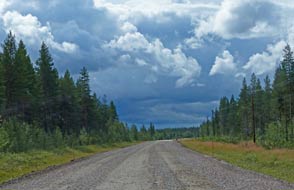 light casts the shadow of the tall gnomon, angled like the
Earth's axis, against the 360° cicle of hour posts. And this morning, the sun
actually obligingly shone enabling us to check the sun dial's accuracy (Photo
36 - Pajala sun dial) (see right). Route 392 took us across the lonely
and deserted wilderness terrain between the Torneälven and Kalixälven valleys (click here for detailed map of route),
but 30km south from Pajala we reached Korpilombolo and yet another 20kms of road
entirely stripped of asphalt which the owner of Pajala Camping had light casts the shadow of the tall gnomon, angled like the
Earth's axis, against the 360° cicle of hour posts. And this morning, the sun
actually obligingly shone enabling us to check the sun dial's accuracy (Photo
36 - Pajala sun dial) (see right). Route 392 took us across the lonely
and deserted wilderness terrain between the Torneälven and Kalixälven valleys (click here for detailed map of route),
but 30km south from Pajala we reached Korpilombolo and yet another 20kms of road
entirely stripped of asphalt which the owner of Pajala Camping had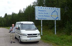 warned us of. We passed no reindeer this year along this road, but this was
scarcely surprising; these gentle creatures have more sense than to try walking
along such rough gravelled, unsurfaced road which we had to travel. As we
journeyed on, the hugely dramatic cloud-scape filling the southern sky emphasised the
emptiness of this lonely fell-land and forest (see left); we made the most of
it, since we should shortly be leaving the Arctic, and exchanging wild country
for forests maintained for timber cutting. Driving on, we reached the road junction at the Kalixälven
valley, and as we turned south the terrain became more pastoral with farms
spread along the banks of the wide river. A short distance further an we reached
the line of the Arctic Circle, our 4th crossing this year (see right) (Photo
37 - Crossing Arctic Circle south).
South to Älvsbyn:
by the time we reached the junction with
Route 98 and near to Överkalix
to
join Route E10 coming in from Gällivare,
the lower Kalixälven valley was continuous farmland (click here for detailed map of route),
reinforcing the feeling we had now left the Arctic. We followed this faster road alongside the lakes of the lower Kalixälven valley
to turn off at the junction with Route 356 at Marjärv. This road wound its way
through forested lands, with the parallel Haparanda railway line following an
even more winding course. But these were not now the wild forests of the Arctic,
but clearly maintained for timber. The sky had darkened and rain was falling as
we reached the unremarkable garrison town of Boden, to cross the Luleälven
again, here flowing far more gently in its lower valley than when we had last
seen this mighty river much abused for HEP production up at Porjus and Harsprånget.
The final stage of today's journey on Route 356 was through more open terrain
with distant views over forested hills, bringing us finally down to join Route
94 along the lower Piteälven valley and across the river to Älvsbyn.
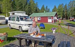 Selholmens Camping at Älvsbyn:
after shopping for provisions at the well-stocked ICA supermarket in the centre
of Älvsbyn, we booked in at Selholmens Camping, a small local campsite
pleasantly terraced up the banks of the Piteälven
river. The campsite is owned by Älvsbyn municipality and managed by a local
sports association. On our last stay in July 2013, the site was popular with
Swedish holiday-makers from the coastal cities, and today we had telephoned to be
assured of a place. On arrival, we were surprised to find the site almost empty,
the only occupants being the Selholmens Camping at Älvsbyn:
after shopping for provisions at the well-stocked ICA supermarket in the centre
of Älvsbyn, we booked in at Selholmens Camping, a small local campsite
pleasantly terraced up the banks of the Piteälven
river. The campsite is owned by Älvsbyn municipality and managed by a local
sports association. On our last stay in July 2013, the site was popular with
Swedish holiday-makers from the coastal cities, and today we had telephoned to be
assured of a place. On arrival, we were surprised to find the site almost empty,
the only occupants being the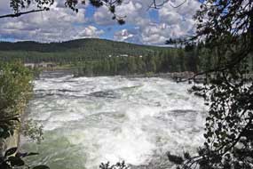 clusters of caravans used by migrant railway civil engineering
workers. We settled on the upper terrace to enjoy the peace of the early evening
overlooking the river. The following morning we woke to mist drifting along the river
valley, which soon lifted to give a clear sky and bright sun; it was a truly
beautiful early autumn morning (see left) (Photo
38 - Selholmens Camping at Älvsbyn). To begin with we were able to sit
out at a picnic table to enjoy a peaceful breakfast. But the railway navvies
returned from their night shift; their undue noise and offensive behaviour put
paid to the peaceful morning. This may be a ready source of income for
municipal campsites to host migrant workers (an increasing feature seen a
elsewhere), but the noise and unacceptable behaviour of such folk will certainly deter
regular visitors; we
made it abundantly clear to the warden that we were not prepared to tolerate
such disturbance. It remains for campsite owners to choose their priorities
between a quick buck or lasting business. clusters of caravans used by migrant railway civil engineering
workers. We settled on the upper terrace to enjoy the peace of the early evening
overlooking the river. The following morning we woke to mist drifting along the river
valley, which soon lifted to give a clear sky and bright sun; it was a truly
beautiful early autumn morning (see left) (Photo
38 - Selholmens Camping at Älvsbyn). To begin with we were able to sit
out at a picnic table to enjoy a peaceful breakfast. But the railway navvies
returned from their night shift; their undue noise and offensive behaviour put
paid to the peaceful morning. This may be a ready source of income for
municipal campsites to host migrant workers (an increasing feature seen a
elsewhere), but the noise and unacceptable behaviour of such folk will certainly deter
regular visitors; we
made it abundantly clear to the warden that we were not prepared to tolerate
such disturbance. It remains for campsite owners to choose their priorities
between a quick buck or lasting business.
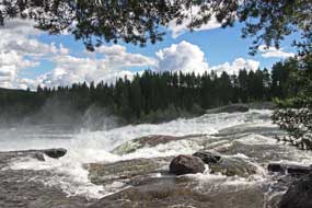 Storforsen rapids on the Piteälven river: the forecast suggested that
the fine weather would not last through the afternoon, and we therefore set off
early to ensure clear sun for our re-visit to Storforsen rapids. Before
departing, we reserved a pitch lower down away from the noise and loutish behaviour of the railway workers. Route 274 followed the Piteälven for 30kms
westwards along the farming Storforsen rapids on the Piteälven river: the forecast suggested that
the fine weather would not last through the afternoon, and we therefore set off
early to ensure clear sun for our re-visit to Storforsen rapids. Before
departing, we reserved a pitch lower down away from the noise and loutish behaviour of the railway workers. Route 274 followed the Piteälven for 30kms
westwards along the farming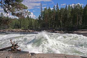 valley
(click here for detailed map of route) to the lake where the river turns through a
sharp 90º after descending the steep rapids of Storforsen, to continue its more
gentle course along the lower valley. A side lane ended at the large car park,
almost full of tourist cars even mid-week. valley
(click here for detailed map of route) to the lake where the river turns through a
sharp 90º after descending the steep rapids of Storforsen, to continue its more
gentle course along the lower valley. A side lane ended at the large car park,
almost full of tourist cars even mid-week.
The Piteälven along with Torneälven, Kalixälven
and Vindelälven are Sweden's 4 remaining rivers whose natural environment is
protected by law from intrusive exploitation for hydro-electric generation. The
natural flow of water in the Piteälven varies enormously between seasons,
highest during Spring melts reaching 1000m3/second, and lowest in
mid-winter when the flow rate is as low as 24m3. The rapids at
Storforsen (meaning Great Rapids) are the largest natural white-water rapids in
the Nordic countries and among Europe's largest with a total drop of 82m over
their 5km course at the point where the river over aeons has gouged out a
channel in the hard granite
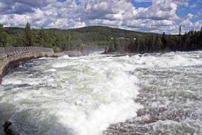 bed rock. Along the final and most spectacular 600m,
the rapids drop some 50m before the river resumes its normally placid onward
flow. The Piteälven was used for timber-floating from 1858 until 1982, and in
sections of rapids such as Storforsen, the river's course was straightened and
deepened by blocking off its side channels with box-booms to allow logs to be
floated down-river to sawmills. bed rock. Along the final and most spectacular 600m,
the rapids drop some 50m before the river resumes its normally placid onward
flow. The Piteälven was used for timber-floating from 1858 until 1982, and in
sections of rapids such as Storforsen, the river's course was straightened and
deepened by blocking off its side channels with box-booms to allow logs to be
floated down-river to sawmills.
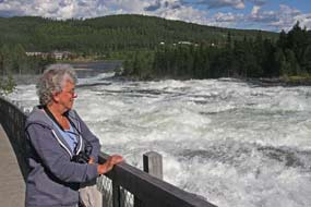 We threaded a way across to the now semi-dry rocks
of the Döda Fallet (Dead Falls) area, where the river was diverted from its
natural, wide-spreading course to be channelled into a deeper float-way at the
time of log-floating. The flat rocks now serve as a sunbathing terrace for
tourists, though how such folk can lie there apparently indifferent to the
thunderous roar of the rapids hurtling past nearby remains one of life's
mysteries! The nature reserve includes sturdy wooden walk-ways immediately
alongside this final 800m section of the falls enabling bird's eye viewing of this spectacular natural phenomenon. The sun drifted in and out of
increasing cloud, and we stood at the walk-way's top viewing platform, looking
directly across to the point at which the mighty river tumbled over the brink of
the rapids, surging and boiling in foaming fury down its white-water passage
with the sun lighting the rapids' sparkling waters (Photo
39 - Storforsen Rapids). We followed the board-walk down,
and even in a dry year mid-summer when the river's flow was supposedly at its
lowest, the churning waters of the rapids was still mesmerising, the patterns of
water for ever changing and throwing up clouds of spray. Part-way down the rapids, and across
an We threaded a way across to the now semi-dry rocks
of the Döda Fallet (Dead Falls) area, where the river was diverted from its
natural, wide-spreading course to be channelled into a deeper float-way at the
time of log-floating. The flat rocks now serve as a sunbathing terrace for
tourists, though how such folk can lie there apparently indifferent to the
thunderous roar of the rapids hurtling past nearby remains one of life's
mysteries! The nature reserve includes sturdy wooden walk-ways immediately
alongside this final 800m section of the falls enabling bird's eye viewing of this spectacular natural phenomenon. The sun drifted in and out of
increasing cloud, and we stood at the walk-way's top viewing platform, looking
directly across to the point at which the mighty river tumbled over the brink of
the rapids, surging and boiling in foaming fury down its white-water passage
with the sun lighting the rapids' sparkling waters (Photo
39 - Storforsen Rapids). We followed the board-walk down,
and even in a dry year mid-summer when the river's flow was supposedly at its
lowest, the churning waters of the rapids was still mesmerising, the patterns of
water for ever changing and throwing up clouds of spray. Part-way down the rapids, and across
an
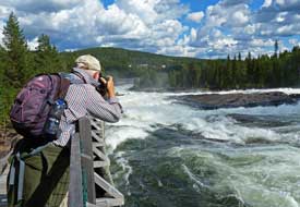 intervening area of rocky pathway under trees between sections of board-walk, the river's
surging passage hurtled over one of the bed-rock thresholds more resistant to erosion, creating a series of spectacular falls (Photo
40 - Lower Storforsen). The board -walk, running the length of the
rapids (see above left), can easily be taken for granted, but is in itself a remarkable work of
construction which gives intervening area of rocky pathway under trees between sections of board-walk, the river's
surging passage hurtled over one of the bed-rock thresholds more resistant to erosion, creating a series of spectacular falls (Photo
40 - Lower Storforsen). The board -walk, running the length of the
rapids (see above left), can easily be taken for granted, but is in itself a remarkable work of
construction which gives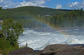 such an intimate view immediately above and alongside
the rapids (Photo
41 - View from Storforsen board-walk) (see right). Pounded by the rapids'
turbulence, especially in Spring, the structure must need constant maintenance. such an intimate view immediately above and alongside
the rapids (Photo
41 - View from Storforsen board-walk) (see right). Pounded by the rapids'
turbulence, especially in Spring, the structure must need constant maintenance.
We followed the board-walk down to the lower area
where below the rapids the river turns to resume a more placid course along the
lower valley. Here among the riverside vegetation we found Stone Bramble berries
in fruit (Photo
42 - Stoneberry ripe fruits). Back up the board-walk, the
sun's angle had now moved round so that its light just caught the clouds of
spray welling up from where the rapids thundered over the rocky thresholds, to
create a rainbow effect (Photo
43 - Rainbow over Storforsen). Looking down the length of the
rapids from the top viewing platform, we were rewarded with spectacular
lighting, the afternoon sun's light again catching the spray to produce further
rainbow effect (Photo
44 - Storforsen rainbow). After such a memorable afternoon at Storforsen
with its admirable board-walk giving such close views of the rapids, we returned
along the Piteälven for a final night's camp at Älvsbyn.
Coming soon: we shall now continue our southward journey
following a series of zigzags routes inland and out to the east coast along the
valleys of Sweden's major rivers, the Skellefteälven, Vindelälven, Ångermanälven
and Indalsälven: firstly inland to Arvidsjaur, then back to the Bothnian coast at Skellefteå, on the way visiting
the restored section of the former Linbanan mining cable-way that once
transported ore to coastal smelters. We then travel down the lower Vindelälven
river valley before looping inland again and finishing back at the coast at Örnsköldsvik, for
at day out on Trysunda, one of the High Coast off-shore Baltic islands. Inland
again, we shall visit the spectacular Döda Fallet dry falls created by a
disastrous accident
in the late 18th century on the Indalsävlen river. We shall visit the town of
Sundsvall before moving on to Hudiksvall to stay for a couple of days with an
old friend and her family. But
that's a story for the next episode, coming soon.
Next edition
to be published shortly
|
Sheila and Paul |
Published: 26 November 2016 |
|

 CAMPING IN
SWEDEN 2016 - across the Arctic
Circle to Jokkmokk, Kvikkjokk, WW2 Lancaster Easy Elsie
crash site, Porjus and Lulea River HEP dams, iron ore town of Kiruna, Sweden's northernmost village Karesuando,
border with Finland along Tornedalen valley, Pajala, re-cross Arctic Circle south
at Överkalix, Älvsbyn, Piteälven valley and Storforsen rapids:
 North across the Arctic Circle (again):
after leaving Moskosel northwards, E45 Inlandsvägen crossed the wide, fast-flowing Piteälven river, a
white-water torrent even in the dry season; we did not stop today since we
should see the Piteälven later in the trip at Storforsen rapids. The road
meandered generally northwards through magnificent spruce forested terrain, with
even more spectacular distant views to northern fell-land hills (
 Some
6kms south of Jokkmokk, we pulled into the lay-by which marked the notional line
of 66º-33' N, the Arctic Circle (Polcirceln in Swedish, Napapiiri
in Finnish)
(
 not
for the midges. Along Jokkmokk's main street of Storgatan, we turned down to
the Botanic Gardens which display the wild flora of Norbotten province's fells
and mountains. Set along sheltered embankments each side of a brook which
tumbles from a small lake, the gardens are divided into sections representing
the different types of terrain, with the flora of each growing in semi-wild
conditions. We began at the high fell-land plants which had to survive winter snows:
they were an exact reproduction of the berry plants we had seen yesterday:
Lingonberry, Bilberry, Bog Bilberry, Crowberry and Cloudberry. None of course
were in flower at this time of year, and the berries had not yet formed. The
next section was devoted to plants of the Taiga coniferous forest belt, and
included the 3 types of lichen which in winter the reindeer forage for under snow
covering (see left). When we had last visited the Botanic Gardens, we had been impressed
with their content and layout, but this year being later in the season, plants
were past
 flowering and the beds devoted to meadow birch forests and cold
springs were totally overgrown. Parts on the rocky slopes across the brook were
in process of reconstruction, but fortunately the higher south-facing slopes of
Lingonberries remained intact and were covered with ripening berries (
 Skabram
Camping at Jokkmokk and frustrating weather change:
we camped that night at Skabram Camping, a small and hospitable site just west
of Jokkmokk kept by an ex-pat Dutch couple; it is clustered around the yard of a
cheese farm whose products are on sale at reception, with chickens clucking
around the camping area. The campsite at this time of year filled up with mainly
Dutch and German holiday-makers, but our pitch was carefully chosen to give us a
secluded corner to avoid the inevitable noise. The sun remained bright for our
barbecue supper, and we sat out late into the evening with Moon Tigers burning
on the table to deter mossies, looking out into a clearing in the surrounding
pine forest towards the setting sun (see below right).
 The road's-end settlement of Kvikkjokk in the mountainous interior:
before continuing north, our plan was to make a foray out to Kvikkjokk, an
isolated settlement 120kms into the interior towards the mountainous Sarek
National Park. Encouraging advice from the TIC and a neighbouring German
 camper
was that the lane leading out to Kvikkjokk, although in poor state, was asphalt
all the way, with a small campsite at Årrenjarke 17kms from road's-end at Kvikkjokk;
this was a staging point on the Kungsleden long distance wilderness
trekking route part-way between Jäkkvik where we had camped last week and Abisko
in the north. With drizzly rain falling, we finally headed north from Jokkmokk,
and just across the Akkats dam, turned off onto Route 805, the minor road which
followed the scattered course of the Lille Luleälven water system network (
 fter some 80kms the road surface improved, and
we were able to make better progress eventually to reach the hut settlement and camping of Årrenjarke, tucked in a forested bay at the innermost large lake of Saggat. We
investigated the tiny campsite which was nestled on a hillock-peninsula by an
inlet looking south-eastwards along the entire length of the lake. Despite the
still gloomy weather, the rain had now virtually stopped, and we reserved the
prime pitch on the crest of the hillock at this magnificent setting with its
outlook along the length of the lake and view of the distinctive ridge-end peak
of Kasssavare (957m) with its sheer-sided summit cliffs reflected in the lake's
still waters (see above right)
(
 this seemed to summarize Kvikkjokk. Despite its isolation, a regular bus service still served the
village, and several back-packers were waiting at the bus stop by the church.
Lanes led up to a rough camping area and the Kvikkjokk Mountain Station hostel,
both serving Kungsleden back-packers.
 The scattering of houses around the small
shingled wooden church seemed partially occupied, but it would be a tough
existence up here in the depths of winter. The car park literally at road's-end
was quite full, presumably belonging to walkers out in these remote fells. Two
major rivers flowed down from the westward desolate high mountains of Sarek
National Park, the Kamajokk and Tarraätno, merging to form a delta as they
flowed into Saggat lake, the source of the Lille Luleälven chain of lakes which
finally flowed into the Stora Luleälven at Vuollerin. But for all its isolated
setting, Kvikkjokk was something of a bleak and cheerless place, and its tourist
service doubtless would remain stängd for many a nästa Fredag to
come. Unless you were walking the Kungsleden and making a staging camp here, Kvikkjokk had little in itself to commend it other than its isolated setting
amid such glorious mountainous solitude.
 expected, the price
for camping was as expensive as the setting was attractive: 265kr, when at other
northern campsites we had been used to
 paying 200kr at most. Our questioning
such expensive prices was greeted with just a take-it-or-leave-it shrug. We
acquiesced, and with some difficulty level-pitched George on the sloping, rocky,
tree-root ridden ridge crest, and settled in (
 Return along Lille Luleälven valley to Inlandsvägen:
we set off on the 90km return drive on the single-track lane along the Lille Luleälven
valley. Despite the rough road surface, the morning sun and clear blue sky made
this drive a sheer delight compared with the gloomily wet drive out yesterday. The sun lit the road-side spruces and forest-covered hills, and the series of
lakes reflected the clear sky and blotchy cloud-scape (see right) (
 We now expected a rapid run for the 35kms up to Porjus (
 Crash-site of WW2 RAF Lancaster bomber Easy Elsie:
thankful to regain normally tarmaced road on reaching Porjus Old PowerStation,
we turned off across the Porjus New Dam onto Route 819 (
 shores of Lake Stora Lulevatten we reached the
parking area at the start of the board-walk out to the marsh-land crash site
of the WW2 RAF Lancaster Easy Elsie. RAF Lancaster FC-E was assigned to
617 Squadron in August 1944 and re-christened Easy Elsie by
its crew. On its first operational mission against the German battleship
Tirpitz at the northern Norwegian anchorage at Kåfjord, Lancaster Easy
Elsie had been damaged by flak but repaired and made airworthy again.
Tirpitz was moved south to Kvaløya in Tromsø Fjord, and was attacked again
on 29 October 1944 by Lancasters of 617 and 9 Squadrons including Easy Elsie,
each stripped of armaments, modified with extra fuel tanks and carrying one 6
ton Tallboy bomb. During the attack, Easy Elsie was severely damaged by
flak: the right outer engine was lost, she was losing fuel and hydraulic fluid,
and the radio was hit. Further damaged by flak knocking out the left
inner
engine and losing more fuel, and with bomb doors unable to be raised through
loss of hydraulics, the resultant drag made the aircraft difficult to fly. With
2 engines lost and losing fuel, there was no way the Australian pilot, Flying
Officer David Carey could get the Lancaster back to Scotland. He and the
navigator Pilot Officer Alex McKie decided to try to get over to neutral Sweden.
With maximum power on the 2 remaining engines, Carey managed to gain sufficient
height to clear the Norwegian mountains and turned the severely damaged
Lancaster south into Sweden. Between the cloud, all they could see was empty
wilderness and forest, but with fuel almost exhausted they saw a boggy clearing
in the forest near to Porjus. The crew jettisoned all weapons, ammunition and
equipment to lighten the aircraft and took up crash-landing positions for Carey
to put the aircraft down in an open space. The undercarriage cut into bog and
the
 plane shuddered to a halt standing on its nose and falling back into the
bog. It was 11-50am. The pilot injured his knee on the instrument panel with the
impact of crash-landing, but the rest of the crew was unhurt. They destroyed all
maps and operational orders, tried to set fire to the wreckage, and carried
Carey into the nearby forest. Swedish soldiers who had seen the Lancaster's
crash-landing, found the crew who were taken to Stockholm for interrogation and
later repatriated to England in November 1944. Tirpitz was finally sunk
in Tromsø Fjord in November 1944 by a further 617 and 9 Squadron Lancaster
attack, Operation Catechism.
  We had first visited the crash site
on our 2013 Sweden trip; see our log for the full history of
  this generally forest covered region showed the skill and good
judgement on Carey and McKie's part in locating the clearing amid almost continuous forest, and managing to 'pancake' the severely damaged
aircraft in the boggy ground with no serious injuries or death to the crew. It
was one brilliant piece of flying and navigation. And over in the centre of the
clearing, we could see ahead the
 Lancaster's remains lying forlornly where she
had crash-landed 72 years ago (see above right) (
 Lancaster trying to
identify its decayed components. There was little remaining of the cockpit and
forward section of the fuselage which were badly damaged when the
crew had attempted to destroy the plane after the crash-landing (see above
right). Part of a yellow RAF
roundel was recognisable on one section of the fuselage (see right) (
 Wild-camp at
the abandoned village of Harsprånget:
we returned across the Porjus dam to Porjus (
 dam and
underground generating plant at Porjus, primarily to supply power for electric
traction on the Malmbanan railway transporting iron ore from the mines at
Gällivare and Kiruna down to the ports of Narvik and Luleå. Plans were drawn up
in 1919 to follow this with an even bigger dam and HEP
generating station further downstream on the steeply falling Luleälven river at Harsprånget.
But with post-WW1 depression and decreased demand for electricity, construction
of the Harsprånget dam was postponed. Work finally began in 1946 of what would
be Sweden's largest rock-fill dam and hydro-electric generating plant at Harsprånget,
with a power production capacity of 977Mw. Because of Harsprånget dam's isolated
location in the then remote Lapland wilderness, a new village was built nearby
for construction workers and their families. At its height, the village housed
over 2,000 residents, a well-established community with shops,
 leisure
facilities, hospital and school. The dam and generating plant at Harsprånget
were commissioned in 1952,and production capacity increased with additional
power plants during the 1970s. The nearby village of Harsprånget remained
occupied until 1985, when the last occupants moved away and the wooden
houses were transported elsewhere.
 Porjus Archive Association keep alive the village's memory,
preserving the approach lane of Storgatan (Main Street), with a few of
the street name boards still in place (see right). An information panel gave an outline map
showing the extent of the former village's streets, but beyond Torget these were
all now totally overgrown with an impenetrable re-growth of trees and
vegetation. With midges swarming around our heads, we set up camp by the former
village's square of Torget (see above right) (
 uncanny camping spot among the thickets of this ghost village, and
the only disturbance during the night was the sound of an animal munching among
the vegetation! For a brief overnight and morning, our presence had
brought life back to what had once been a lively community, but now nature was
once more re-asserting its hold over the site.
 Harsprånget rock-fill dam and dry gorge:
back down the lane, we now faced the dreadful state of the E45. The State
Highways Authority had stripped the entire asphalt surface from a 20km section
of the road at the beginning of summer, and local people travelling between Porjus and Jokkmokk had been forced to endure the damaging impact on their
vehicles for all this time; it was not expected to be re-surfaced for another
couple of months. For a major European highway, and the principal route up
through Northern Sweden, to be left in such a disgraceful condition for 5 months
was nothing short of scandalous. We returned downhill with the road's steep
gradient showing how much the Luleälven river must drop in the 10kms distance
from the Porjus dam outflow. Rounding a bend, there was the massive curvature of
the Harsprånget rock-fill dam winding across the head of the gorge (see left) (
 fleeing in terror! (see right) We followed the sturdy board-walk which enabled a safe
descent down over the smoothly eroded granite slabs into the steep and in places
almost sheer rocky slope of the ravine (
 and falls which once glorified this magnificent
gorge, but depriving the world of that spectacle had opened up another equally
impressive sight: the precipitous rocky sides of the now dry gorge, lit by the morning
sun, glowed in multiple shades of ruddy-brown. From the wooden viewing-platform
high above the sheer drop of the canyon, the view up the gorge was
staggeringly beautiful with its rock walls glowing in the sunlight; and the
rock-fill dam, which from 1952 has held back the natural flow of the once
mighty Luleälven torrent, reared high above across the distant head of the
gorge, now revealing these magnificent rock walls
(
 The environmental impact of hydro-power:
the sight of the now dry Harsprånget brought home the controversial issue
of the impact of supposedly environmentally friendly hydro-electric power.
 The Luleälven dams and hydro-electric
generating plants:
we bumped our way back up the 10kms of unsurfaced E45 to the huge complex of
the Porjus dam and hydro-electric generating station at Porjus village, and
turned off to the Gamle Kraftverk (Old Power Station). The power generating and
distribution company Vattenfall is still a state-owned
enterprise although now partly deregulated to compete for business across the
EU. It now manages all of Sweden's power industry, hydro, nuclear and
wind-power, with stakes in power generation in Germany, Poland and Holland. 46%
of Sweden's electrical supply is generated by HEP, 44% by its 3 nuclear power
stations, and just 1% by wind power. The 15 HEP stations on the Luleälven, which
drops 1000m from its source in the Norwegian mountains down its 450km length to
the Bothnian Gulf at Luleä, supply 15% of the country's power. The Luleälven's
15 dams are now of the rock-fill type construction, which rely on
steady filtering of water through the semi-permeable core and broadly spread
compacted rock to control the reservoir's water volume. All 15 of the Luleälven
generating stations (kraft verks) are now remotely controlled from a
central control station at Vuollerim part-way down the river.
  The first dam at Porjus, built between 1910~15,
was a vast construction undertaking in remote wilderness terrain through the
darkness and freezing temperatures of the Arctic winter. The original Porjus generating station was constructed 60m underground, blasted out of
the bedrock to achieve the necessary head-drop of water from the nearby dam. The
tail-race ran in an underground tunnel over 1km downstream for the out-flow of
used water back into the river. The imposing red-brick neo-Gothic switchgear building,
visible at ground level above the underground generating hall, was designed in
monumental style by Erik Josephson (1864~1929), a leading
 Swedish architect of
public buildings, who had also been responsible for the fortress-like design of Olidan power station. Being a public undertaking, Vattenfall's predecessor
company, Kungliga Vattenfallsstyrelsen (Royal State Power Board),
intended the monumental Porjus Power Station to reflect its royal standing. No
expense was spared in the design, which was not only extravagant in scale but
also incorporated imposing art nouveau decorative features such as shapely
windows, grandiose main doors, belfry-like tower with golden royal crown, and in
the control room, grand light fittings and marble-faced control panel. King
Gustav V was due to perform the opening in 1915, but WW1 made his monarchic
venture to the Arctic too dangerous, and the dam's inauguration was performed by
telephone from Stockholm. The old Porjus dam and power station continued in
operation until 1975 when the original solid-core dam was replaced by the
present rock-fill dam with its new underground kraft verk. The
imposing Neo-Gothic building of the now redundant former power station has been
retained as a heritage site, and during the summer months Vattenfall offer
free-of-charge hourly guided tours of the original station and its underground
generating hall.
 Our visit to the Porjus Old Power Station:
black storm clouds filled the sky as we reached the Porjus Old Power Station
(see above right) (
 happy to
use the stairs, let us speak to someone with more senior authority. But the
young guide would not succumb; safety rules must prevail. So while we waited for
the next tour in an hour, when the storm certainly would be past, we viewed the
grandiose control room (see above left). Here was a total irony: Vattenfall,
which is responsible for electricity generation covering the whole of Sweden
and parts of wider Europe, could not even guarentee lighting for its own power
station! At 2-30pm with the weather now clear, we returned with renewed
determination; another of the guides, having checked the lighting after the
thunderstorm fiasco, declared all was well and issued us with hard-hats for the
tour. We emerged from the lift into the vast and beautifully tiled underground
machine hall, and spent the next hour examining the turbines, generators and
control equipment, in detailed discussion about their working with the guide, Eino. The
Vattenfall displays were first class, with key parts of the original turbines
and generators opened up to reveal their working components. An artificial
opening gave a clear view inside the normally enclosed inner turbine chamber (see
above left), showing the pressured water
entry conduit which dropped 60m from the reservoir supply way above down onto
the turbine blades, and the shaft rotated by water pressure on the
turbine. Below this, the waste water conduit, now blocked off, would in
operation have dropped down to the underground tail-race; see
 Eino showed us the enormous steel drive shaft which
connected turbine to generator on the far side of the hall via
self-regulating apparatus which maintained rotation at the optimum rate of 2,500
rpm for generation of 50hz AC current (
 on a piece of machinery at Porjus (see
above left). There
was noticeable contrast in standards of finish between the original wing of the
machine hall and the later extension: with royal status, the original company
had lavished funding on the scale and finish of the tiled generator hall; in
contrast, 1940s austerity meant reduced standards with plainer floor tiles and
even exposed bed-rock showing through on the walls.
 North on E45 Inlandsvägen to Gällivare:
the storm clouds and rain had passed and sky brightening by the time we emerged
from the Porjus underground generating hall to resume our northward journey. The
final section of the Inlandsbanan railway curved away towards the Porjus new dam
just beyond the Old Power Station (see above right)
(
 which had off-loaded
machine parts from railway wagons inside the station and lowered them for
assembly down in the underground turbine~generator hall. We passed through
Porjus village, now a community of 400 residents from its origins as a
settlement for construction workers on the 1910 old dam and power station; the
Stockholm government had assigned 100 immigrants to live here in a former
barracks hut. The E45 turned north-west heading towards Gällivare (
 Wild-camp on banks of Kalixälven river at
Lappeasuando: crossing the river at Gällivare, we drove past the
modern apartment blocks of the lower town to find the ICA Kvantum hypermarket.
Ahead we could see the Malmberget iron mines scarring the hillside; we recalled
our underground visit to the Malmberget mines in 2013 (
 , and we stocked up with 2 days' provisions. Leaving Gällivare, E45 merged
with E10 coming up from Luleå and headed north across increasingly hilly,
forested fell-land (see above right). After some 40kms we reached the Kalixälven
river-crossing at Lappeasuando, the tiny settlement which spans the 2
municipalities of Gällivare and Kiruna, divided by the river. Here the former
1930s elegantly arched bridge, which replaced a former ferry crossing the Kalixälven,
still stands alongside the more functional modern bridge carrying the E45 across
the wide river. Alongside, a large picnic area stood by a café; we pulled in,
and below the tarmaced car park, found a lower grassy area screened by
trees and directly overlooking the river and old bridge. Here was the perfect
wild-camp spot, and we tucked George into a sheltered corner by the river by the
old bridge (see left)
(
 The
afternoon sun was bright, and the old bridge gave a perfect view of our
peaceful riverside camping spot (see left and above right). In contrast the
stark parking area was crammed full of camping-cars lined up in rows; thankfully
we were well sheltered from these hoards. Exploration showed not only that the
café also had a small campsite, but the parking area was equipped with
water-supplied WCs; it was indeed not only a beautifully located wild-camp spot
but well equipped, and later the sun declined across the Kalixälven to give
magnificent reflections in the wide river's still waters
(
 Yet more neglect of northern
principal roads:
the following morning we continued north on E45 to the road junction at Svappavaara, where the
Inlandsvägen turned north towards its ultimate northerly
destination at Karesuando on the Finnish border. We turned NW on E10 towards Kiruna
(
 we had experienced direct evidence of such neglect twice now. LKAB's
mining, which is taking over more and more land in Norrland,
raises untold revenues for the State, yet the north of the country enjoys
second rate public services compared with the south.
 The iron mining town of Kiruna, threatened by
mining subsidence: we had visited Kiruna in both 2013 and 2014, when
we had learned much about the town's economic reliance on iron ore mining,
undertaken by the State-mining company LKAB, which takes its name,
Luossovaara-Kiirunavaara Aktiebolag, from the Kiruna's 2 hills of Luossovaara
and Kiirunavaara where open-cast iron ore mining at Kiruna first began in 1898
(see right). Mining is progressively undermining the city centre, making
necessary its relocation due to the impact of mining subsidence. Our main reason for returning to Kiruna
this year was to see how much tangible progress had been made in the last 2
years with the town's relocation. In 2004 LKAB's Managing Director had submitted
an arrogantly brief letter to Kiruna Municipal Authority, which we had seen
displayed in Kiruna City Hall. The gist of the letter was: We are going on
mining deeper; you'd better move your town. LKAB's deep mining method called sub-level
caving leaves cavities in the bed-rock when the ore is extracted. When these
cavities collapse re-filling the surrounding bed-rock, over time this results in
subsidence at the surface (
 district,
and the majority of public institutions including City Hall, secondary and
elementary schools, hospital, library, parish church and public baths. This all
affects 1,000 jobs and over 6,000 people.
 that
the last 2 years had produced, and were the discussions, consultation and glitzy
plans still the only thing happening in Kiruna? One thing was certain however:
LKAB was still driving the underground mining into the ore body ever deeper and
deeper, lining the State's coffers accordingly, and of course further
undermining the city centre with ever threatening subsidence. We continued ahead
into the city, passing the mammoth gash of the original
open-cast mine scarred across Kiirunavaara hill. There was the City Hall just
beyond the corner of Gruvavägen (Mine Street), and the attractive wooden houses
of the original 1910 township. All still looked the same; nothing had yet fallen
into the mine! On a Saturday afternoon, we parked without difficulty in the
central square; in the community centre LKAB's model illustrating the potential
impact of mining subsidence was still there (See left), but today no one from
LKAB's PR department was present to answer our questions. There was nothing new to be learned here.
 We drove through Kiruna's western suburbs to the
lane which circled up around the western side of Luossovaara hill. Leaving
George towards the top of the steep gravelled trackway, we walked up the final
section to the ski station at the summit, past the gashes of the original
open-cast mines which still scar the eastern face of the hill. Our reason for
struggling up to this high view-point was for the panoramic vista over the
township spread out below with the overwhelming presence of LKAB modern mining
operations, at least
 that which can be seen on the surface. Here dominating the
landscape was the original reason for Kiruna's foundation as a town, its current
source of wealth and employment, and soon its potential cause of destruction and
need for relocation (see above right)
(
 Back
down the hill into the town, we parked by the City Hall for photographs
(
 goes on getting bigger by the year. In
fact, without her trying to push some indefensible local authority party line,
we had a helpful and informative discussion with her about what was happening at Kiruna. The decision
had been taken for the new city centre as the town's focus to
move to a now agreed site 3kms eastwards along Malmvägen, and the rotunda
building we had seen in construction was the new City Hall called Kristallen. In
discussion about public attitudes towards the necessity for relocation, she
added that, while there was general acceptance, public concerns now focussed on
2 issues which she summarised as money and outlook: LKAB were now committed to
contributing huge sums of money as compensation for city infrastructure, and to
fund new housing over the next 3 years to replace that in the threatened areas.
While this suited property owners, those who rented houses, largely from LKAB at
currently reasonable rents, faced a doubling of rental prices for new replacement
housing. This issue remained unresolved. The other major concern was over visual
 outlook:
those parts of the town affected by subsidence currently enjoyed a
westward vista towards open fell-land, which we had seen from Luossovaara;
eastward relocation however would deprive residents of that magnificent open
fell and mountainous outlook. Another issue was that, due to cost restrictions, Kiruna's attractive original wooden houses, part of its key heritage, would be
demolished and not relocated; a proposal had been put forward for the owners to
relocate the demolished wooden houses at their own expense. This issue
also remained unresolved.
 In spite of all of this, the fact remained that,
were it not for LKAB's mining, Kiruna would not exist as a township; its entire
economic future depend totally on LKAB as the city's main employer along with
mining support industries. Unemployment in Kiruna, with its population of 20,000
is just 2%. This prompted us to raise the issue of immigration and its impact
on Kiruna. The Swedish government had forcibly assigned immigrants to northern
townships to house, and Kiruna had accepted 1,000. Some had even been allocated
to the empty skiing hotels up in the Arctic wilderness at Riksgränsen during the
summer season! Despite this having been a thoroughly informative discussion from
which we had learnt much, we were still however left with the feeling that the
pace of progress with Kiruna's relocation was failing to match the rate at which
LKAB's ever deeper and deeper mining was hastening the growth of subsidence.
Time will tell.
 Before leaving Kiruna, we re-visited 2 of its
other features. Just up Gruvavägen, the town's wooden church (also due for
relocation) had itself been a gift from LKAB and its the all-powerful managing
director Hjalmar Lundbohm, regarded as Kiruna's founding father
(
 Trollsparvens
Camping at Vittangi: we returned along the E10 for the 40kms to
Svappavaara, braving the 3 hazards of this road: everlasting road works, slowly
lumbering Norwegian camping-cars, and an equally tedious procession of speed
cameras. Here we turned off northwards onto the E45 Inlandsvägen again,
across the flat, forested lands of the Torneälven valley to Vittangi on the
southern side of the river. The village has given its name to Vittangi Syndrome,
congenital analgesia or the inability to feel pain, because of a cluster of
cases of this rare condition reported in 2006 at Vittangi. On the far side of
the wide river-crossing, we found tonight's campsite, Trollsparvens Camping on
the banks of the Torneälven, a place we
 had passed twice before. An earlier
phone call had brought no response, and on arrival the reception hut was locked.
But as we stood there an Estonian migrant worker staying at one of the huts came
over, saying he was looking after the place while the owner was in Luleå. The
camping area was deserted and we settled in, but here on the banks of the Torneälven
the midges were horrendous, some of the worst of the trip. After the mountainous
landscapes of the last few days, the flat fells of the Torneälven valley seemed
tediously monotonous, particularly in the now dull light (see left). The charge
was reasonable at 180kr/night and facilities basic, but after 2
nights of wild-camping, it was a relief to soak in a hot shower.
  Nedre and Övre Soppero, which spanned the Lainioälven, one
of Sweden's finest fishing rivers and a tributary of the Torneälven. At present
rate we should reach Karesuando early afternoon, but a thought now occurred:
having secured our pitch at Sandlövs Camping, why not cross the border-bridge
into Finland, and drive up to Kilpisjärvi this afternoon for a nostalgic
re-visit and shop for shop for Finnish items from the K-Market there? So that
was decided on, and we hastened on to Karesuando. As we drove northwards, the
flat, empty fell-scape gave way to distant, higher and
 more rounded hills, but
misty and featureless in the gloomy light.
 Sámi
settlement, we moved NW-wards towards Kilpisjärvi, road signs ticking off the
kms. The higher fells grew closer, and eventually we gained height towards the
watershed with the first views of Kilpisjärvi lake filling the upper
valley. In the now even gloomier light, the distant mountains of Norway were
almost invisible in dark rain cloud, and as we passed along the shore of
Kilpisjärvi lake, Saana (Finland's highest fell) and the lower Malla Fell were half-lost in a
heavy covering of cloud. Passing the National Park centre, we finally reached
the central area of Kilpisjärvi, with the K-Market and filling station as its
 focus, and by now the dark, gloomy cloud had turned to driving rain. The car
park was full of Norwegian cross-border shoppers, but at least the supermarket
was open. Inside we shopped for favourite Finnish items, and to our relief found
a whole shelf full of the Laitilan Finnish beer which we had driven 100km from Karesuando to buy! We loaded our trolley and the €s bill tolled upwards; but no
matter, we had secured our Laitilan. With a grateful kiitos paljon
to the fluently English-speaking girl on the till, we loaded our supplies into
George, and in winter-cold wind and rain, drove along to Kilpisjärvi Retkeilykeskus for a brief nostalgic re-visit. Across the lake, where last year
we had crossed to the Treriksröset monument marking the fell-land meeting of the 3 borders, today the
fells and distant mountainous skyline were totally lost in gloomy rain cloud. We
turned and headed back the way we had driven along the shore of Kilpisjärvi lake
in poor light and driving rain. From the head of the pass, the long, straight
road stretched away for seemingly many kms into the murky distance, with the
fell-scape and lakes a featureless, grey blur (see above left). It took over an
hour to drive the 100km back to Kaaresuvanto on the Finnish side of the
border-bridge, and as we returned south-eastwards the sky became brighter.
George had a fill of cheaper Finnish diesel before we re-crossed the river
into Ruotsi, as the Finns call Sweden (see right).
 Sandlövs Camping at Karesuando: Sandlövs
Camping was still almost deserted as we settled George into his place looking
across to Laestadius' church. The Finnish beer we had driven a wearying 200kms
for this afternoon tasted even better than usual! It had also been a wonderfully
nostalgic
 foray into NW Finland despite the regrettable weather conditions. The
inevitable Norwegian caravans drifted in along with a ludicrously monstrous
mega-bus, less an intrusion than a source of much ridicule and contempt for such
gross materialism on wheels. Karesuando and Sandlövs Camping in particular will always
be one of our Very Special Places, and it was wonderful to be back despite the
misty cloud and rain which persisted all evening. Karesuando at the northern
limit of Sweden represented the trip's half-way point, having driven almost
3,500 miles since crossing the Öresund; tomorrow we should begin the long
homeward
drive along the Finnish borderlands of the Tornedalen valley to Pajala, and the forecast was awful for chill Arctic rain. The forecast was right and we woke
to miserably chill temperatures and wind-driven rain. It was no fun this morning
washing up at the outdoor sink, wearing waterproofs against the chill rain. It
was simply too wet this morning for photos of this lovely straightforward
campsite, and we recalled the pleasant sun
when we stayed here last year from Finland
(
 A wet drive along the Tornedalen valley Finnish
borderlands to Pajala:
finally leaving Karesuando with the rain still pouring on a very gloomy morning,
we turned south-eastwards just before the border-bridge onto the lonely Route 99
for the 180km drive down Tornedalen. On a sunny day, this would have been a
supremely beautiful road, with a bright sun picking out the detail of pines and
spruces, occasional glimpses of the Torneälven, and the distant forested hills
of Finland across the river-border. Today however, in such filthy wet weather,
the forests had a sad and drearily grey air (see left), and we bumped along the poorly
surfaced road, splashing through puddles and scarcely seeing any other vehicles.
This was indeed a very lonely road (
 Swedish Lapland,
particularly since Route 404 crossed the river to Muonio close to the Pallas-Yllästunturi
National Park. We continued south on Route 99 which turned inland through
sandy-heath forests rich with reindeer lichen before returning to the river at
the tiny settlement of Parkajoki. All the settlements along this stretch had
Finnish-sounding names, ending in -joki and -järvi.
 Pajala Camping and the village of Pajala: Route 99 now moved away
from the river (
 and Lingonberries on the river bank to all the caravans and camping-cars corralled into the tarmaced area by reception. Today had been a
depressingly chill, wet and cheerless day for our drive along the Tornedalen
valley, but we hoped for better weather for our day in camp tomorrow at Pajala.
A warmer morning brought even a hint of hazy sun, but by early afternoon the
rain returned; even so we managed to pick breakfast bilberries from the forest
floor near our pitch, and that evening we cooked a Lapland supper of reindeer
and lingonberry stew. But the rain began again, and for the first time this
trip, the sky was really dusky; the year was moving on and we tomorrow we should
cross the Arctic Circle south.
 light casts the shadow of the tall gnomon, angled like the
Earth's axis, against the 360° cicle of hour posts. And this morning, the sun
actually obligingly shone enabling us to check the sun dial's accuracy (
 warned us of. We passed no reindeer this year along this road, but this was
scarcely surprising; these gentle creatures have more sense than to try walking
along such rough gravelled, unsurfaced road which we had to travel. As we
journeyed on, the hugely dramatic cloud-scape filling the southern sky emphasised the
emptiness of this lonely fell-land and forest (see left); we made the most of
it, since we should shortly be leaving the Arctic, and exchanging wild country
for forests maintained for timber cutting. Driving on, we reached the road junction at the Kalixälven
valley, and as we turned south the terrain became more pastoral with farms
spread along the banks of the wide river. A short distance further an we reached
the line of the Arctic Circle, our 4th crossing this year (see right) (
 Selholmens Camping at Älvsbyn:
after shopping for provisions at the well-stocked ICA supermarket in the centre
of Älvsbyn, we booked in at Selholmens Camping, a small local campsite
pleasantly terraced up the banks of the Piteälven
river. The campsite is owned by Älvsbyn municipality and managed by a local
sports association. On our last stay in July 2013, the site was popular with
Swedish holiday-makers from the coastal cities, and today we had telephoned to be
assured of a place. On arrival, we were surprised to find the site almost empty,
the only occupants being the
 clusters of caravans used by migrant railway civil engineering
workers. We settled on the upper terrace to enjoy the peace of the early evening
overlooking the river. The following morning we woke to mist drifting along the river
valley, which soon lifted to give a clear sky and bright sun; it was a truly
beautiful early autumn morning (see left) (
 Storforsen rapids on the Piteälven river: the forecast suggested that
the fine weather would not last through the afternoon, and we therefore set off
early to ensure clear sun for our re-visit to Storforsen rapids. Before
departing, we reserved a pitch lower down away from the noise and loutish behaviour of the railway workers. Route 274 followed the Piteälven for 30kms
westwards along the farming
 valley
(
 bed rock. Along the final and most spectacular 600m,
the rapids drop some 50m before the river resumes its normally placid onward
flow. The Piteälven was used for timber-floating from 1858 until 1982, and in
sections of rapids such as Storforsen, the river's course was straightened and
deepened by blocking off its side channels with box-booms to allow logs to be
floated down-river to sawmills.
 We threaded a way across to the now semi-dry rocks
of the Döda Fallet (Dead Falls) area, where the river was diverted from its
natural, wide-spreading course to be channelled into a deeper float-way at the
time of log-floating. The flat rocks now serve as a sunbathing terrace for
tourists, though how such folk can lie there apparently indifferent to the
thunderous roar of the rapids hurtling past nearby remains one of life's
mysteries! The nature reserve includes sturdy wooden walk-ways immediately
alongside this final 800m section of the falls enabling bird's eye viewing of this spectacular natural phenomenon. The sun drifted in and out of
increasing cloud, and we stood at the walk-way's top viewing platform, looking
directly across to the point at which the mighty river tumbled over the brink of
the rapids, surging and boiling in foaming fury down its white-water passage
with the sun lighting the rapids' sparkling waters (
 intervening area of rocky pathway under trees between sections of board-walk, the river's
surging passage hurtled over one of the bed-rock thresholds more resistant to erosion, creating a series of spectacular falls (
 such an intimate view immediately above and alongside
the rapids (