|
 CAMPING
IN SWEDEN 2016 - Arvidsjaur, Norsjö Linbana mining cableway, Skellefteå, Vindelälven Valley,
Örnsköldsvik, Baltic island of Trysunda, Sollefteå, Indalsälven valley and Döda Fallet, Sundsvall, Hudiksvall: CAMPING
IN SWEDEN 2016 - Arvidsjaur, Norsjö Linbana mining cableway, Skellefteå, Vindelälven Valley,
Örnsköldsvik, Baltic island of Trysunda, Sollefteå, Indalsälven valley and Döda Fallet, Sundsvall, Hudiksvall:
Älvsbyn to Arvidsjaur: our final
morning at Selholmens Camping, and an early mist along the Piteälven valley soon
cleared from the river to give another bright, sunny morning. We were away early
for today's long drive, and headed westwards on Route 94 from Älvsbyn towards Arvidsjaur (click here for detailed map of route).
The lower valley was mainly farmland with fields of ripening barley, but as we
advanced the terrain became
 hillier covered with attractive forest, the morning
sun picking out details of the myriads of pine and spruce trees. We crossed the Vistån river, a tributary of the Piteälven, and the Byskeälven, and continued
through shallow lake-land to the road junction 3kms from Arvidsjaur. The town
sits astride a bewildering cross-roads of Route 95, the east~west Silver
Way which continues to Arjeplog and the Norwegian border (the route we had
taken earlier) and the north~south E45 Inlandsvägen. hillier covered with attractive forest, the morning
sun picking out details of the myriads of pine and spruce trees. We crossed the Vistån river, a tributary of the Piteälven, and the Byskeälven, and continued
through shallow lake-land to the road junction 3kms from Arvidsjaur. The town
sits astride a bewildering cross-roads of Route 95, the east~west Silver
Way which continues to Arjeplog and the Norwegian border (the route we had
taken earlier) and the north~south E45 Inlandsvägen.
|
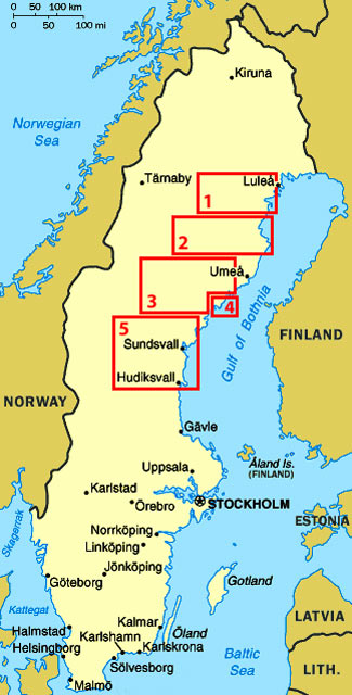
Click on the 5 highlighted areas of map
for
details of
North-East Sweden |
 |
Closed campsites disappointments but a serendipitous find: after a brief
provisions stop in Arvidsjaur, we re-joined Route 95 SE-wards (click here for detailed map of route)
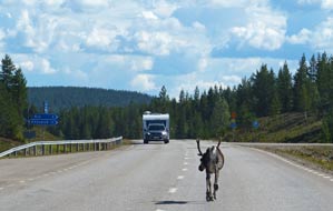
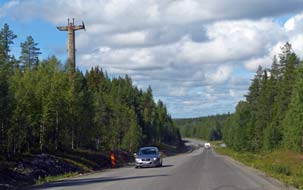
through attractive forests, passing a number of reindeer ambling along the main road
(see above left) (Photo 1 - Reindeer ambling along road).
The road ran parallel with a disused spur of railway line into Arvidsjaur which
branched off the main east coast line near to Jörn. We passed a number of
Norwegian caravans returning from the Bothnian coast, so perhaps with August,
the main holiday season was over; we hoped so! Villages shown on the map were
just isolated cottages or farmsteads, until we reached the surprisingly larger
settlement of Glommersträsk. Just east of Jörn, we reached the aptly named
village of Österjörn but found the lakeside campsite, where we had planned to
stay, effectively closed: Strabag, the road construction firm, had taken the
place over campsite, huts and all, for 3 months as temporary accommodation for
their gangs of road workers. This was the first disappointment, since the site
had a lovely outlook across the lake.
 We
continued south-easterly on Route 95 towards Boliden, where we knew of
another campsite, passing through attractively forested lake-land. But all that
changed when we reached Boliden, a sordid place totally dominated by mining
spoil heaps; the Boliden Mining Group operated a number of mines along the Skellefteälven valley, producing copper, zinc, and lead ores, and a smelting
plant down at the coast at Rönnskär beyond Skellefteå.
Driving through this singularly unattractive village, we eventually found
Sidtjärns Camping, which turned out to be an annexe to a grubby-looking hostel
used by mine workers, and closed; our second disappointment today! There was
nothing for it but to continue along the Skellefteälven valley on Route 370, and
hope to find somewhere to camp. Beyond the Boliden mines and the areas of
devastation left by extensive spoil heaps, we drove on along the forested valley
passing the residual concrete pylons of the 96 km aerial cableway which once
brought ore from the mines further up the valley (see left). Route 370 seemed a
surprisingly wide and well-surfaced road, but we soon understood why: it was now
used by convoys of huge mine trucks thundering along the once peaceful valley.
We crossed the Skellefteälven river, and just beyond near the hamlet of Rengård
found a neat looking stugby, a holiday chalet encampment, set alongside a
traditional, red-painted farmstead. The charming lady-owner was most welcoming:
not only was she happy for us to camp, but she would charge just 100kr. As
so often happens, the blessed St Serendipity had once more come to our rescue,
finding us the perfect solution for tonight's camp here at Ringvor i Rengård
after our 2 earlier disappointments. We
continued south-easterly on Route 95 towards Boliden, where we knew of
another campsite, passing through attractively forested lake-land. But all that
changed when we reached Boliden, a sordid place totally dominated by mining
spoil heaps; the Boliden Mining Group operated a number of mines along the Skellefteälven valley, producing copper, zinc, and lead ores, and a smelting
plant down at the coast at Rönnskär beyond Skellefteå.
Driving through this singularly unattractive village, we eventually found
Sidtjärns Camping, which turned out to be an annexe to a grubby-looking hostel
used by mine workers, and closed; our second disappointment today! There was
nothing for it but to continue along the Skellefteälven valley on Route 370, and
hope to find somewhere to camp. Beyond the Boliden mines and the areas of
devastation left by extensive spoil heaps, we drove on along the forested valley
passing the residual concrete pylons of the 96 km aerial cableway which once
brought ore from the mines further up the valley (see left). Route 370 seemed a
surprisingly wide and well-surfaced road, but we soon understood why: it was now
used by convoys of huge mine trucks thundering along the once peaceful valley.
We crossed the Skellefteälven river, and just beyond near the hamlet of Rengård
found a neat looking stugby, a holiday chalet encampment, set alongside a
traditional, red-painted farmstead. The charming lady-owner was most welcoming:
not only was she happy for us to camp, but she would charge just 100kr. As
so often happens, the blessed St Serendipity had once more come to our rescue,
finding us the perfect solution for tonight's camp here at Ringvor i Rengård
after our 2 earlier disappointments.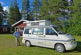 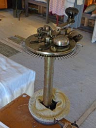
Ringvor i Rengård Stugby-Camping:
we gladly settled in beside one of the stugor (chalet-huts) and plugged
into a power socket in one of the barns. The lady's passion clearly was
traditional textile weaving: the barns were filled with an exhibition of woven textiles,
and cottage-industry antique looms, including a circular
knitting machine for hosiery making such as Sheila's grandmother had worked on
(see right). Not only was the hospitality so welcoming, but the setting was
delightful in the trimly
maintained gardens (see left), and the facilities homely, with a full strength
wi-fi signal. It was the perfect location for our day in camp tomorrow. The
following morning, we sat out for breakfast in bright sunshine, with wild
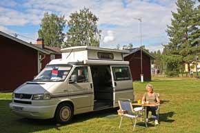
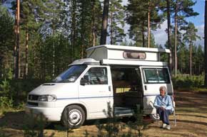
raspberries picked from bushes behind the stuga (Photo 2 - Breakfast at Ringvor i Rengård). Ringvor i Rengård Stugby-Camping
had proved to be a welcoming jewel of a serendipitous find and the lovely garden
setting beside the traditional family-homestead was perfect for our much-needed
rest-day; this would be one of the trip's most memorable stays. The only
downside were the mine trucks which thundered past at regular intervals and
now plagued the residents of the valley.
The Linbana mining cableway:
our plan for today was to explore the preserved 13.6km section of the Linbana
aerial cableway, built originally to transport ore from the Skellefteälven
valley mines down to the smelting works, a distance of 96kms. Before WW2, the
predecessor mining company of Boliden AB had transported ore from
 the copper,
zinc, lead and gold mines at Kristineberg in the Malå~Norsjö region by truck
down to Boliden. But in WW2 the Allied blockade of Scandinavia led to shortages
of both fuel and rubber for tyres, making road transportation of ore
increasingly expensive. A railway line was considered as an alternative means of
moving ore along the valley, but construction time and cost, and shortage of steel for rails led to a decision in 1941 to build a 96km aerial cableway linking
the mines along the valley to Boliden, because of its more economic construction
and materials requirements. In April 1942, a workforce of 1,500 the copper,
zinc, lead and gold mines at Kristineberg in the Malå~Norsjö region by truck
down to Boliden. But in WW2 the Allied blockade of Scandinavia led to shortages
of both fuel and rubber for tyres, making road transportation of ore
increasingly expensive. A railway line was considered as an alternative means of
moving ore along the valley, but construction time and cost, and shortage of steel for rails led to a decision in 1941 to build a 96km aerial cableway linking
the mines along the valley to Boliden, because of its more economic construction
and materials requirements. In April 1942, a workforce of 1,500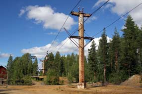 men was deployed
to clear a 40m wide corridor through the forests, construct access roads, and to
cast and assemble the reinforced concrete support pylons for the cableway. Along
the 96km length, 514 cableway support pylons were raised, 16 of these standing
in lakes, along with 10 driving stations and 25 intermediate tensioning
stations. The tallest of the pylons at the Skellefteälven river-crossing were
38m tall; pylon to pylon cable span ranged from 11m to 429m. The construction was
completed in 1 year and 5 days, 4½ months ahead of schedule, and the first ore
buckets, each conveying 1.4 tons, were transported down the 96kms of cableway
from Kristineberg mine to Boliden on 14 April 1943. men was deployed
to clear a 40m wide corridor through the forests, construct access roads, and to
cast and assemble the reinforced concrete support pylons for the cableway. Along
the 96km length, 514 cableway support pylons were raised, 16 of these standing
in lakes, along with 10 driving stations and 25 intermediate tensioning
stations. The tallest of the pylons at the Skellefteälven river-crossing were
38m tall; pylon to pylon cable span ranged from 11m to 429m. The construction was
completed in 1 year and 5 days, 4½ months ahead of schedule, and the first ore
buckets, each conveying 1.4 tons, were transported down the 96kms of cableway
from Kristineberg mine to Boliden on 14 April 1943.
During its 44 years of continuous operation
from 1943 until 1987, the cableway moved 12 million tons of copper, zinc, lead,
sulphur, and gold ore concentrates from the mines down the valley to smelters.
During this time, the cableway was periodically evaluated for its
cost-effectiveness compared with road transport, and technical improvements made
to maintain its favourable position. Finally however in 1986, the decision was
made to switch to road transport as heavy trucks became more economical; the
cableway was closed in 1987 and demolition began. At the time of decommissioning
however,
a society was formed at Norsjö, the Världens längsta linbana-föreningen
(World's longest cableway society), to preserve at least part of the cableway.
Section IV, 13.6km in length between Menträsk and
Örträsk
 with 73 support pylons, was preserved as a tourist attraction and re-equipped
with modern 4-seat gondola-cars to replace the ore buckets; operated by Linob i
Norsjö AB, the Linbana still with 73 support pylons, was preserved as a tourist attraction and re-equipped
with modern 4-seat gondola-cars to replace the ore buckets; operated by Linob i
Norsjö AB, the Linbana still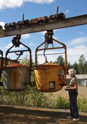 operates regularly during the summer months (see the Linbana web site
including a U-Tube video about the cableway's preservation). All the other
remaining mechanical installations of the original cableway, including
the cables and ore buckets, were demolished, but most of the concrete support
pylons were left standing along their path through the forests and across lakes
and can still be seen 70 years after their initial construction.
Our visit to the Örträsk Linbana station:
from Rengård, we drove 20 kms along Route 370 and turned off to the hamlet of
Örträsk (click here for detailed map of route), the southern terminus station of the preserved 13.6km section of
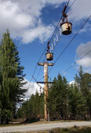
Linbana. Just before the settlement, several of the original concrete pylons
stood at the point where the cableway had crossed the road, still fitted
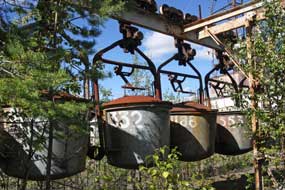
with their cables carrying several original ore buckets (Photo 3 - Linbana cableway with ore buckets at Örträsk)
(see above left). Continuing around to the Örträsk Linbana station, the first
thing we found was a straightforward, grassy camping aire, with showers and WCs at the Linbana café; here was our base for tonight. The
daily tourist 'flight' of the Linbana left Örträsk at 1-00pm for the 1 hour 45
minutes cableway travel up to Menträsk. We therefore had over an hour to explore
the surroundings of the defunct, open-cast copper mine and ore loading area
before the modern gondola-cars of the preserved Linbana emerged from the station
to
 begin their 'flight'. A small museum in a reconstructed mine head-stocks
building gave a history of the arduous work of the men who built the
cableway and the women who cooked for them. Nearby alongside the flooded pit of
the Örträsk open-cast copper mine, a section of the original cableway with its
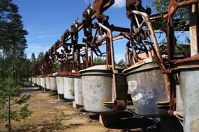
concrete pylons and ore buckets was preserved (see above right) (Photo 4 - Original mining cableway at Örträsk).
The former mine's ore-loading area stood alongside the Linbana's Örträsk
station; here in mining
days, loaded ore buckets were assembled on overhead rails for onward dispatch along the cableway begin their 'flight'. A small museum in a reconstructed mine head-stocks
building gave a history of the arduous work of the men who built the
cableway and the women who cooked for them. Nearby alongside the flooded pit of
the Örträsk open-cast copper mine, a section of the original cableway with its
concrete pylons and ore buckets was preserved (see above right) (Photo 4 - Original mining cableway at Örträsk).
The former mine's ore-loading area stood alongside the Linbana's Örträsk
station; here in mining
days, loaded ore buckets were assembled on overhead rails for onward dispatch along the cableway 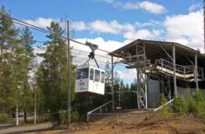 to the Boliden smelters (Photo 5 - Ore buckets awaiting cableway transportation),
and empty returning buckets awaited re-loading with ore (see above left and
right).
With each bucket carrying a 1.4 ton load of ore, the cableway's efficiency as a
continuously working means of down-valley transportation was evident. Alongside
this bucket assembly and ore-loading område (useful Swedish word meaning
area or zone), the remains of spoil heaps glowed bright orange in
the sunlight, showing that copper was being mined here at Örträsk. to the Boliden smelters (Photo 5 - Ore buckets awaiting cableway transportation),
and empty returning buckets awaited re-loading with ore (see above left and
right).
With each bucket carrying a 1.4 ton load of ore, the cableway's efficiency as a
continuously working means of down-valley transportation was evident. Alongside
this bucket assembly and ore-loading område (useful Swedish word meaning
area or zone), the remains of spoil heaps glowed bright orange in
the sunlight, showing that copper was being mined here at Örträsk.
Just before 1-00pm, the sound from within the
Linbana station of electric motors starting up to drive the cableway's
haul-cables indicated that the 'flight' was about to begin. One by one, the
gondola-cars emerged from the station-shed and drifted silently upwards, casting
an eerie shadow over our heads as they began their 13kms of travel above the
forests
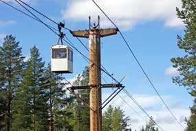 and lakes along the cableway route to Menträsk (Photo
6 - Linbana gondola-cars emerging from Örträsk) (see right). The
gondola-cars glided gracefully northwards along the cableway, one after the other
through the forest, silently disappearing into the distance taking the tourists
on their journey over forests and lakes towards Menträsk (see left) (Photo
7 - Linbana gondola-cars heading northward). and lakes along the cableway route to Menträsk (Photo
6 - Linbana gondola-cars emerging from Örträsk) (see right). The
gondola-cars glided gracefully northwards along the cableway, one after the other
through the forest, silently disappearing into the distance taking the tourists
on their journey over forests and lakes towards Menträsk (see left) (Photo
7 - Linbana gondola-cars heading northward).
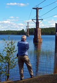 The Menträsk Linbana station: we now drove over to Menträsk to be there in time for when the Linbana's gondolas arrived along the cableway. From Örträsk village
we followed a narrow, unsurfaced single-track lane leading for 12kms through
beautiful forest land, and eventually emerging onto Route 365. 2kms
north, the road passed under the preserved cableway, and at Menträsk village we
turned off along a single-track lane to reach the Linbana northern station
set on a peninsula in Menträsk lake, the site of the original mining cableway's
drive station. As we pulled into the lakeside parking area to pick Bilberries
from the forest floor, we were faced with the remarkable sight of the Linbana's
concrete support-pylons spaced out across the length of the lake (Photo
8 - Linbana support-pylon in Menträsk lake) (see right). The Boliden
company had sunk a 260m deep mine under the lake here at Menträsk in 1945; but
such were the frequent incidents of lake water flooding that, with typical
commercial arrogance of mining companies, they even sought planning permission
to drain the entire Menträsk lake. Thankfully consent was refused, and the mine
closed in 1949. The modern preserved Linbana now uses part of mine buildings as
its restaurant alongside the cableway The Menträsk Linbana station: we now drove over to Menträsk to be there in time for when the Linbana's gondolas arrived along the cableway. From Örträsk village
we followed a narrow, unsurfaced single-track lane leading for 12kms through
beautiful forest land, and eventually emerging onto Route 365. 2kms
north, the road passed under the preserved cableway, and at Menträsk village we
turned off along a single-track lane to reach the Linbana northern station
set on a peninsula in Menträsk lake, the site of the original mining cableway's
drive station. As we pulled into the lakeside parking area to pick Bilberries
from the forest floor, we were faced with the remarkable sight of the Linbana's
concrete support-pylons spaced out across the length of the lake (Photo
8 - Linbana support-pylon in Menträsk lake) (see right). The Boliden
company had sunk a 260m deep mine under the lake here at Menträsk in 1945; but
such were the frequent incidents of lake water flooding that, with typical
commercial arrogance of mining companies, they even sought planning permission
to drain the entire Menträsk lake. Thankfully consent was refused, and the mine
closed in 1949. The modern preserved Linbana now uses part of mine buildings as
its restaurant alongside the cableway
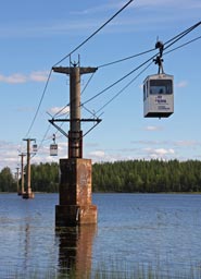 drive-station, now the Linbana northern
terminus. Beyond here, the now cable-less support-pylons of the abandoned
northward cableway route still survive, stretching across the lake into the
distance. drive-station, now the Linbana northern
terminus. Beyond here, the now cable-less support-pylons of the abandoned
northward cableway route still survive, stretching across the lake into the
distance.
Inside Menträsk station, above the noise of
electric motors and moving cables, the Linbana attendant
waited to receive the incoming gondolas which could now be seen in the distance
gliding along the cableway above the lake (see left) (Photo
9 - Gondolas over Menträsk lake). We stood at the arrival bay, watching as
the cable-cars moved slowly towards the station by the shore of the lake
(Photo
10 - Incoming gondolas approaching Menträsk). One by one, the incoming gondolas
reached the platform and were brought swaying to a halt for the bemused-looking
passengers to emerge (see below right) (Photo
11 - Gondolas docking). It cannot be said that, like Brian Hanrahan, we
had counted all the gondolas out at Örträsk and counted them in again here at Menträsk,
but after they had all docked, we certainly noted 13 cable-cars now parked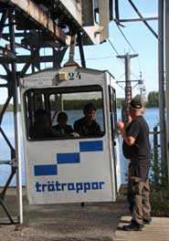 around the Menträsk
station shed, suspended from a rail. Today, with sunny weather, had certainly
been a satisfying day of learning: we were truly impressed by the efforts of
those who had constructed the original cableway; we were equally impressed by the determination of the Norsjö preservation society that continued to
keep section IV of the Linbana operating 70 years after its inauguration.
Camping aire at Örträsk Linbana station:
it was by now almost 3-15pm and we needed to find a shop open on a Sunday
afternoon for food essentials. Norsjö 30 minutes drive away was the nearest
town, and on reaching there we were surprised that it was larger than expected with
Coop Konsum and ICA supermarkets, both open until 8-00pm on Sundays. We did our
provisions shopping and returned along to Route 370 and Örträsk Linbana station
for the camping aire. The Linbana summer season finished tomorrow, meaning that
the facilities at the café would also close tomorrow after the final cable-car
'flight'. We selected a pitch over on the far side looking out to pine woods
(see left) (Photo
12 - Camping aire at Menträsk); the long, rough grass would certainly attract flies
and
midges but we settled in to brew tea after such an excellent day, and the
evening
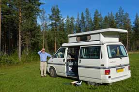 stayed fine for our barbecue. For a straightforward camping aire (no
power or kitchen/wash-up), Örträsk was excellent value at 60kr/night (pay at the
café or honesty box at the gate); the camping field's setting was pleasant
looking out westerly to setting sun over pine forests and the Linbana cable-way,
and the WC/shower facilities were first class, some of the best of the trip and
spotlessly clean, but only open during the Linbana's brief summer working. stayed fine for our barbecue. For a straightforward camping aire (no
power or kitchen/wash-up), Örträsk was excellent value at 60kr/night (pay at the
café or honesty box at the gate); the camping field's setting was pleasant
looking out westerly to setting sun over pine forests and the Linbana cable-way,
and the WC/shower facilities were first class, some of the best of the trip and
spotlessly clean, but only open during the Linbana's brief summer working.
A re-visit to Skellefteå church and
church-town: the weather turned overnight, and
we woke to heavily overcast sky, cool breeze and drizzly rain; the forecast
however was for brighter weather later down at the coast. Our plan for today
therefore was to drive down to the Bothnian coast at Skellefteå to re-visit the
church and church-town, then return up-valley to camp tonight at Rännuddens
Camping near Norsjö which we had recce-ed yesterday afternoon.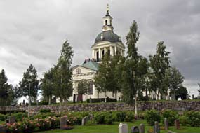
Back along the Skellefteälven valley on Route
370 (click here for detailed map of route),
we saw the surviving tall concrete pylons which had once carried the cable-way
across the river, and passing Boliden showed what a sordid blot on the forested
landscape the mines were. Reaching the western outskirts
of Skellefteå, we shopped for provisions at a well-stocked ICA Kvantum, then drove down to the domed neo-Classical parish church on the
banks of the Skellefteälven river. Skellefteå had been founded in the 15th
century by Swedish settlers at the mouth of the river, and a wealthy
 trading
colony developed here centred around the parish church.
The original 1324 wooden church was replaced by a larger stone structure in 1507, the
Gothic ogival arches of which can still be seen in the sacristy of the modern
neo-Classical church which was built in 1800 as the parish grew in size. As at Luleå, a church town (kyrkstad) developed at Bonnstan next to Skellefteå church
with a large collection of wooden huts where parishioners travelling from
far flung parts of the interior for compulsory church attendance could spend the
night after sitting through lengthy Lutheran sermons before returning to their
distant farms. trading
colony developed here centred around the parish church.
The original 1324 wooden church was replaced by a larger stone structure in 1507, the
Gothic ogival arches of which can still be seen in the sacristy of the modern
neo-Classical church which was built in 1800 as the parish grew in size. As at Luleå, a church town (kyrkstad) developed at Bonnstan next to Skellefteå church
with a large collection of wooden huts where parishioners travelling from
far flung parts of the interior for compulsory church attendance could spend the
night after sitting through lengthy Lutheran sermons before returning to their
distant farms.
Far from brightening, the weather was still
gloomily dull, and the sky heavily overcast threatening rain when we parked down by
the church. The huge shape of the cruciform neo-Classical parish church (Landskyrka),
its dome supported by columns, dominated the hillside
above the river in the modern town's western outskirts. Even on an overcast day,
the white-painted church stood out starkly against the grey sky
(Photo
13 - Skellefteå parish-church) (see above right). The church's chancel, redesigned in the
1960s, was lit by a beautiful, modern blue stained-glass east end rose-window,
inspired by a mill on the Baltic island of Öland, above the medieval
triptych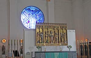 altarpiece (see
right). But the church's prime treasure was its collection of medieval carved
wooden artwork of saints and madonnas, now displayed in an ambulatory chapel
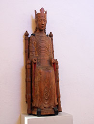
behind the altar. The pride of the collection was the Skellefteå Madonna
statuette, one of few surviving Romanesque images of the Virgin, carved
from walnut in Northern Germany in the 12th century (see left). The Child
was missing, as were the arms and hands on several of the statuettes, perhaps
deliberately removed to allow the carvings to be hidden in a wall cavity from
anti-Catholic vandalism after the Reformation conversion to puritanical
Lutheranism. altarpiece (see
right). But the church's prime treasure was its collection of medieval carved
wooden artwork of saints and madonnas, now displayed in an ambulatory chapel
behind the altar. The pride of the collection was the Skellefteå Madonna
statuette, one of few surviving Romanesque images of the Virgin, carved
from walnut in Northern Germany in the 12th century (see left). The Child
was missing, as were the arms and hands on several of the statuettes, perhaps
deliberately removed to allow the carvings to be hidden in a wall cavity from
anti-Catholic vandalism after the Reformation conversion to puritanical
Lutheranism.
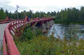 With
the sun still not yet broken through, we walked down the lane to where the
Lejonströmsbron wooden bridge dating from 1737 crossed the Skellefteälven (see
left)
(Photo
14 - 1737 Lejonströmsbron wooden bridge). One of the oldest and longest wooden bridges in
Sweden, it had been the site of a skirmish between Swedes and Russians in the
war of 1741 and still carries modern traffic across the river, albeit one-way
controlled by traffic-lights. With
the sun still not yet broken through, we walked down the lane to where the
Lejonströmsbron wooden bridge dating from 1737 crossed the Skellefteälven (see
left)
(Photo
14 - 1737 Lejonströmsbron wooden bridge). One of the oldest and longest wooden bridges in
Sweden, it had been the site of a skirmish between Swedes and Russians in the
war of 1741 and still carries modern traffic across the river, albeit one-way
controlled by traffic-lights.
Bonnstan church town (kyrkstad):
we followed the river-side pathway below the beautifully maintained graveyard
tiered up the hillside, this year bringing bags to collect the wild raspberries
which grew in profusion along the river bank. At the point where the path was
cantilevered out over the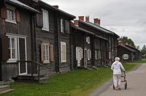 river on a wooden walk-way, steps led up into the heart of the Bonnstan church
town (kyrkstad). 392 of the log-constructed wooden cottages survive, clearly
still occupied though few residents were about today. We ambled along the
pathways among the huts, taking our photos in the still dull light (see right)
(Photo
15 - Bonnstan church town), before returning along to the
church where young gardeners were raking the graveyard gravel paths.
 Rännuddens
Camping near Norsjö, grubby, run-down and expensive: leaving Skellefteå,
we returned along the valley on Route 370, and turning off through Norsjö we
reached Rännuddens Camping. This place might once have been a pleasantly
straightforward little fishing camp, but things had changed drastically: an
inspection of the facilities showed them to be grubby, unsavoury and badly in
need of renovation; the campsite was largely deserted but the huts were fully
occupied, and paper notices at reception all in Polish suggested that the place
was now monopolised by Polish migrant workers; we were greeted in a surly and
off-hand manner, and the charge for such a run-down campsite was an
unrealistically expensive 250kr/night, probably inflated by bank interest on a
loan to buy the run-down site. But it was late, and too weary to find an
alternative tonight, we acquiesced and settled into the lake-side camping Rännuddens
Camping near Norsjö, grubby, run-down and expensive: leaving Skellefteå,
we returned along the valley on Route 370, and turning off through Norsjö we
reached Rännuddens Camping. This place might once have been a pleasantly
straightforward little fishing camp, but things had changed drastically: an
inspection of the facilities showed them to be grubby, unsavoury and badly in
need of renovation; the campsite was largely deserted but the huts were fully
occupied, and paper notices at reception all in Polish suggested that the place
was now monopolised by Polish migrant workers; we were greeted in a surly and
off-hand manner, and the charge for such a run-down campsite was an
unrealistically expensive 250kr/night, probably inflated by bank interest on a
loan to buy the run-down site. But it was late, and too weary to find an
alternative tonight, we acquiesced and settled into the lake-side camping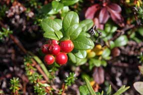 area
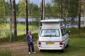
which was at least peaceful and in a lovely forested setting looking out across Norsjön lake
(see left)
(Photo
16 - Rännuddens Camping). The camping area
was however some 400m distant from the main facilities, the nearer ones were
even more disgustingly unsavoury, and the alleged wi-fi was of course totally
out of range. The following morning, a weak sun just about lifted the gloom of
the camping area for us to photograph the Lingonberries ripening on the forest floor (Photo
17 - Ripening Lingonberries) (see right), and our breakfast yogurt was
enriched by the lusciously tasty wild raspberries picked yesterday on the Skellefteälven
river bank. It was only the lovely forested, lake-side setting which saved this
now run-down and unduly expensive campsite from a negative rating. area
which was at least peaceful and in a lovely forested setting looking out across Norsjön lake
(see left)
(Photo
16 - Rännuddens Camping). The camping area
was however some 400m distant from the main facilities, the nearer ones were
even more disgustingly unsavoury, and the alleged wi-fi was of course totally
out of range. The following morning, a weak sun just about lifted the gloom of
the camping area for us to photograph the Lingonberries ripening on the forest floor (Photo
17 - Ripening Lingonberries) (see right), and our breakfast yogurt was
enriched by the lusciously tasty wild raspberries picked yesterday on the Skellefteälven
river bank. It was only the lovely forested, lake-side setting which saved this
now run-down and unduly expensive campsite from a negative rating.
The lower Vindelälven valley:
we set off from Norsjövallen and drove south-west on Route 365, passing lakes
and small villages, leading in 30kms to the junction with Route 363 to begin
today's journey along the lower Vindelälven valley (click here for detailed map of route).
At this stage, the morning was still bright, and we paused for lunch sandwiches
at a lay-by overlooking the wide river. We had last seen the Vindelälven, one of
Sweden's four rivers legally protected from Hydro-electric exploitation, when we
had driven along its upper valley to the Sámi mountain village of Ammanäs, and
camped on the banks of the middle river at Sorsele in 2013. Today we continued
south-easterly along the lower valley, where the river swelled out into an
elongated lake, but the road gave only fleeting glimpses of the Vindelälven.
The delightfully
charming Åmsele Camping: by
1-00pm we reached the attractive farming village of Åmsele and just by the
roadside found Åmsele Camping. Just before the village, we had passed what
appeared to be a now closed military base which we later learnt had been a
Swedish Air Force airfield.
Åmsele Camping's website promotes the campsite as a small, straightforward,
unpretentious and peaceful little place, operated by 3 local farming families
since 2011; they had taken over a former activities centre and hostel
and were now gradually upgrading the service and facilities. It all sounded
 very
much to our taste and worthy of support, and the price was just 160kr/night. We
had telephoned last evening and the lady had said for us to settle in when we
arrived and she would be round later. The small site sloped steeply down to a
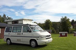
lake (see left), and quite bizarrely most of the flatter upper area with power
supplies was set among a crazy
golf course; a man mowing the grass showed us the facilities and said to camp
among the crazy golf features! very
much to our taste and worthy of support, and the price was just 160kr/night. We
had telephoned last evening and the lady had said for us to settle in when we
arrived and she would be round later. The small site sloped steeply down to a
lake (see left), and quite bizarrely most of the flatter upper area with power
supplies was set among a crazy
golf course; a man mowing the grass showed us the facilities and said to camp
among the crazy golf features!
Since it still was only 1-30pm we decided to
drive further down the valley to the main village of Vindeln, and while there
take a comparative look at Vindelns Camping. For the main road along the Vindelälven
valley, Route 363 was much in need of widening and re-surfacing, and remedial
road works were just beginning. The weather by now was utterly foul, with
pouring rain and low, misty rain cloud totally obscuring the forested hills
enclosing the river valley; it looked as if the rain would continue all
afternoon. Reaching the outskirts of Vindeln, we turned into the campsite which
was part of a larger hotel and leisure complex. In today's pouring rain, even
the best of places would not have looked attractive, but this was dark and
gloomy under riverside pines with an uninviting, rule-book air of over formality
and evidently locked facilities: the choice of pitches was water-logged grass or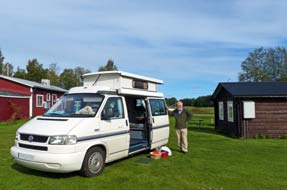 tarmaced parking area, with a couple of gravelled pitches overlooking the river.
At reception, we were greeted in an offensively officious manner: the cost was
250kr/night, plus 40kr extra for the riverside pitches; did we want to stay or
not? There was only one answer to such silly prices and surly inhospitality, and
we told him! In contrast, the simple charm and hospitable welcome at Åmsele
Camping beckoned us to return up valley, and within half hour we were pitched at Åmsele
next to hole 7 of the crazy golf course (see above left). By now the rain had eased, allowing us
to settle in without a soaking. The straightforward Åmsele Camping had a quaint
charm of its own, unpretentious, supremely good value at 160kr/night (there was
even a wi-fi internet network), and peaceful; other than an occasional timber
truck, little traffic passed along the main road through the village. We admired
the local farming families in re-creating the campsite, and their efforts
deserved support. The sky cleared this evening, but with a Scandinavian autumnal
chillness in the air; we even had the heater on this evening for warmth, and
along the road-sides today, the birches were showing distinct signs of autumn
gold.
After yesterday's rain, we woke to a sunny
morning, with the turf now drained and almost dry
(Photo
18 - Åmsele Camping) (see above right). After breakfast the lady arrived
on her bicycle for us to pay her, and she told us more of the campsite's
history. It had been set up in the 1980s as a canoeing and outdoor activities
centre with a government grant to promote tourism in the political aftermath of
the decision to protect the Vindelälven from HEP exploitation. We congratulated
her on the 3 families' initiative in taking over the centre on a voluntary/community
basis, giving our approval to their policy of promoting it as a straightforward,
low cost site, and the efforts that had gone into upgrading the facilities and
keeping them spotlessly clean. She
seemed quite taken aback by our praise. We had enjoyed a thoroughly enjoyable
and memorable stay.
A long, wet drive westwards to Fredrika and south to Örnsköldsvik:
we had a long drive today, taking a 280km dog-leg route inland to Fredrika, then southwards
back to the coast to Örnsköldsvik (pronounced Ern-sherlds-vik), and as we
set off down the lower Vindelälven valley, the cloud began
to gather again (click here for detailed map of route).
Beyond Vindeln, we turned off onto a minor road which followed the final stretch
of the Vindel-river through small villages; this was significant dairy farming
countryside, with cattle grazing in wet riverside meadows and bales of silage
stacked in readiness for the coming long winter. We finally reached the junction
with E12/Route 92 at Vännäsby close to the confluence of Vindelälven with
Umeälven, and turned westward for the 80km dog-leg inland to Fredrika as the
rain began again. E12 branched off north-westwards as the Blå Vägen to
Storuman and on to Tärnaby (the route we had followed earlier in the trip). Soon
after we crossed the wide lower Umeälven, the river we had last seen at Storuman,
and had followed its HEP-controlled upper course, almost to its source in the
mountains at the Norwegian border on our way over to Mo i Rana. Today we
continued ahead on Route 92, with rain increasing and the sky now heavily
overcast, passing through gloomy forested terrain to reach the small town of
Bjurholm. Road signs on Route 92 pointed to Dorotea almost 200kms westwards into
the interior.
 The road now began to gain height steadily onto
thinly forested high ground, totally deserted of any habitation or signs of
life, and in the dull, grey light and pouring rain, the solitude of these
desolate forests seemed even more intense. Beyond the high point, the road
continued towards Fredrika across plateau-land with little loss of height.
Alongside an elongated lake, we reached the next staging point on today's
journey at Fredrika. Along with the Lapland towns of Dorotea and Vilhelmina,
Fredrika is named after Fredrika Dorotea Vilhelmina, Queen Consort of the inept
Gustav IV Adolph, who during his brief reign from 1792~1809 managed to lose one
third of Sweden's empire, including Finland to Tsarist Russia, and was
consequently deposed for his incompetence. Route 92 continued westwards to Dorotea,
but we turned off southwards at this point onto the minor Route 352 (click here for detailed map of route).
Although tarmaced, this was a bumpy, lonely road passing over similarly high
forested terrain with just a few scattered villages. This was clearly timber
country and at one point a loaded timber truck pulled out from a forest road.
The deserted road took us onward through the forests for mile after mile towards
our goal of Örnsköldsvik on the Bothnian coast. Eventually reaching the
outskirts of the town, suddenly we were in busy traffic after the solitude of
the last hour's lonely drive. The rain had eased earlier but was now pouring
again as we parked at the busy ICA Kvantum supermarket for The road now began to gain height steadily onto
thinly forested high ground, totally deserted of any habitation or signs of
life, and in the dull, grey light and pouring rain, the solitude of these
desolate forests seemed even more intense. Beyond the high point, the road
continued towards Fredrika across plateau-land with little loss of height.
Alongside an elongated lake, we reached the next staging point on today's
journey at Fredrika. Along with the Lapland towns of Dorotea and Vilhelmina,
Fredrika is named after Fredrika Dorotea Vilhelmina, Queen Consort of the inept
Gustav IV Adolph, who during his brief reign from 1792~1809 managed to lose one
third of Sweden's empire, including Finland to Tsarist Russia, and was
consequently deposed for his incompetence. Route 92 continued westwards to Dorotea,
but we turned off southwards at this point onto the minor Route 352 (click here for detailed map of route).
Although tarmaced, this was a bumpy, lonely road passing over similarly high
forested terrain with just a few scattered villages. This was clearly timber
country and at one point a loaded timber truck pulled out from a forest road.
The deserted road took us onward through the forests for mile after mile towards
our goal of Örnsköldsvik on the Bothnian coast. Eventually reaching the
outskirts of the town, suddenly we were in busy traffic after the solitude of
the last hour's lonely drive. The rain had eased earlier but was now pouring
again as we parked at the busy ICA Kvantum supermarket for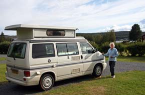 provisions. provisions.
Solbacken Lutheran retreat-centre and
Camping: through Örnsköldsvik in drenching, misty drizzle and late
afternoon traffic, and out past industrial estates in the town's eastern suburbs,
we followed the lane around the coast with little visibility and dense sea
mist clinging to headlands. After 10kms, we turned off onto a single-track lane
leading over a narrow bridge and around the shore-line of the small island of Dekarsön. Over a hill-top on the far side of the island, we reached Solbacken
Lutheran retreat-centre and peaceful campsite overlooking the Bothnian Gulf
coast. We had stayed here in late July 2013 and
nothing seemed to have changed; even the price remained at the good value
210kr/night,
 one of the very few places that had not increased its prices. The
staff at reception were still as pleasantly friendly and helpful as ever, and we settled in at one of the pitches
on the far side opposite the little wooden church (see above left), and pulled out the awning
against the still persistent rain. Solbacken's site-wide wi-fi enabled us to
check the forecast for tomorrow which promised better weather for our day
in camp. But tonight was a miserably chill and wet evening, and again we needed
the heater for warmth. By 10-pm it was quite dark; we had come a long way south
today. one of the very few places that had not increased its prices. The
staff at reception were still as pleasantly friendly and helpful as ever, and we settled in at one of the pitches
on the far side opposite the little wooden church (see above left), and pulled out the awning
against the still persistent rain. Solbacken's site-wide wi-fi enabled us to
check the forecast for tomorrow which promised better weather for our day
in camp. But tonight was a miserably chill and wet evening, and again we needed
the heater for warmth. By 10-pm it was quite dark; we had come a long way south
today.
After a chill night, we woke to thin cloud and
a brighter morning; autumn was approaching fast, but at least the midges were
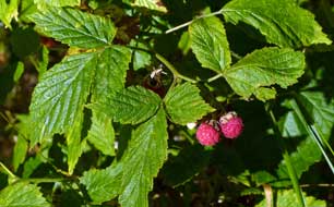
gone (where do the little brutes disappear to in autumn?). Wild raspberries
picked around the campsite made a perfect breakfast (see left). We were looking
forward to our day in camp, but only when a hazy sun finally broke through did
the temperature rise a little (Photo
19 - Solbacken Camping) (see above right). We took advantage of Solbacken's
free washing machine to catch up with laundry, and settled in for a restful and
productive day of writing. Early evening, the wanly golden sun declined across
an inlet of the sea, and the sky grew dusky even earlier.
 The off-shore High Coast island of Trysunda:
our plan for today was to take the ferry from the little port of
Köpmanholmen for a day out on the tiny off-shore High Coast island of Trysunda (click here for detailed map).
The forecast was for a fine day but with chill breeze, and the sun was up early in a
clear sky. Late last evening as we were turning in, the most monstrous caravan
had arrived with much noisy ado, and lit up in the darkness like the good ship
Queen Mary; The off-shore High Coast island of Trysunda:
our plan for today was to take the ferry from the little port of
Köpmanholmen for a day out on the tiny off-shore High Coast island of Trysunda (click here for detailed map).
The forecast was for a fine day but with chill breeze, and the sun was up early in a
clear sky. Late last evening as we were turning in, the most monstrous caravan
had arrived with much noisy ado, and lit up in the darkness like the good ship
Queen Mary;
 it was so overwhelmingly big that it seemed we were dreaming
it. But this morning, we could see it was no dream, rather the most obscene
display of ostentatious materialism imaginable! We were away early to drive back across Dekarsön
bridge, and in heavy traffic through the centre of Örnsköldsvik joined the
dreaded E4 east coast motorway. Some 15kms south, just before the start of long
hill down the High Coast, we were thankful to turn off at Bjästa, and 6kms along
the lane reached the tiny ferry-port of Köpmanholmen. Return ferry tickets for
Trysunda, at a very reasonable 120kr each, were bought at the kiosk, and we
waited by the quay. A number of other passengers were gathering, all with piles
of luggage for stays at holiday homes on Trysunda and the larger island of Ulvön.
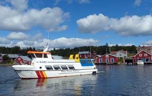
At 11-45am M/F Ranö drew into the quay, and we clambered aboard over
heaps of luggage, just managing to secure seats at the boat's open rear. Once clear of
Köpmanholmen harbour, M/F Ranö
sped across the outer channel
(Photo
20 - Leaving Köpmanholmen), passing smaller wooded islands, and pulled
into Trysunda's harbour sound (see above right). it was so overwhelmingly big that it seemed we were dreaming
it. But this morning, we could see it was no dream, rather the most obscene
display of ostentatious materialism imaginable! We were away early to drive back across Dekarsön
bridge, and in heavy traffic through the centre of Örnsköldsvik joined the
dreaded E4 east coast motorway. Some 15kms south, just before the start of long
hill down the High Coast, we were thankful to turn off at Bjästa, and 6kms along
the lane reached the tiny ferry-port of Köpmanholmen. Return ferry tickets for
Trysunda, at a very reasonable 120kr each, were bought at the kiosk, and we
waited by the quay. A number of other passengers were gathering, all with piles
of luggage for stays at holiday homes on Trysunda and the larger island of Ulvön.
At 11-45am M/F Ranö drew into the quay, and we clambered aboard over
heaps of luggage, just managing to secure seats at the boat's open rear. Once clear of
Köpmanholmen harbour, M/F Ranö
sped across the outer channel
(Photo
20 - Leaving Köpmanholmen), passing smaller wooded islands, and pulled
into Trysunda's harbour sound (see above right).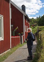
Trysunda was originally 3 islets separated by 3
straits (hence the name Try-sunda meaning 3 sounds). But the land-rise since the
last Ice Age caused 2 of the channels to silt up, merging the 3 former islets
into the one larger tricorne shaped larger island seen today (Map of Baltic Island of Trysunda).
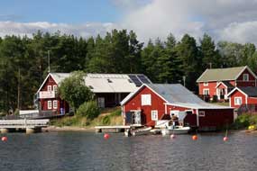
The one remaining sound leads into Trysunda's narrow, well-protected fishing harbour, its sides lined by red-painted wooden cottages and fishing sheds. Once
we were ashore at the jetty, the boat quickly pulled away to continue on to Ulvön,
leaving us looking across Trysunda sound to the sunlit houses and boat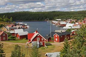 sheds on
the far side, familiar to us from our 2013 visit (Photo
21 - Trysunda quay-side cottages) (see above left). sheds on
the far side, familiar to us from our 2013 visit (Photo
21 - Trysunda quay-side cottages) (see above left).
A walk around Trysunda Island: a
narrow lane behind the quayside cottages and flower gardens (see right) led to
the inner apex of the narrow inlet, and steps took us up onto a rocky outcrop
with look-out
point atop with glorious view over the tiny fishing village of Trysunda with its red-painted houses spread around the harbour sound
(see left) (Photo
22 - Trysunda fishing village). Although there was more cloud than
expected this morning, a brisk breeze kept the clouds moving so that bright sun
lit all the cottages and little church. A path-way led through the forest along
what would have been Trysunda's second sound before
past-glacial land-uplift had unified the three once separate islands. Here we
found another old botanical friend, ripe-red Dwarf Cornel berries
(Photo
23 - Dwarf Cornel berries). The path emerged at the magnificent cove of
Storviken, where on our 2013 visit low cloud had covered the island and sea mist
swirled around the cove preventing our seeing across the width of the bay. Today
bright sun sparkled on the sea, lighting the boulder-field beach left behind
when tidal action washed away glacial moraine. Sunlight gave a clear view
across the full sweep of the bay with its bouldery beach and forest-backed
granite rocks surrounding the cove
(see below left) (Photo
24 - Storviken Bay). It was a truly glorious sight on such a fine day.
Around the far side of the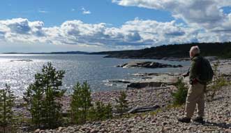 deserted bay's
wave-polished cobbles, way-marks identified the point at which
the continuing path left the beach to enter the forest. With final photos across
the sweep of the bay, deserted bay's
wave-polished cobbles, way-marks identified the point at which
the continuing path left the beach to enter the forest. With final photos across
the sweep of the bay,
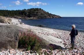 sunlight sparkling on the sea and above this a magnificent
cloud-scape (see right)
(Photo
25- Sun over Storviken beach), we entered the dark and equally glorious pine forest.
Lush patches of lichen, Crowberries, attractively black but with little taste,
and ripe Bilberries carpeted the forest floor, and our hands were soon stained
purple from picking the juicily ripe fruits. This lovely path meandered a way
over forest hillocks, and emerged at the glorious sweep of white sands
surrounding the forest-enclosed bay of Bjornviken on Trysunda's northern coast.
The almost deserted wild beach was lit by bright sun against a blue sea and
backdrop of dark forest. We crossed the white sands to pick up the continuing
path-way through the forest, leading in 500m to turnings down to the
characteristic coarse, gritty red sand beaches of Rödviken. We stood at the forest's
edge taking our photos along the sweep of the secluded bay against the forested
backdrop (Photo
26 - Rödviken beach). sunlight sparkling on the sea and above this a magnificent
cloud-scape (see right)
(Photo
25- Sun over Storviken beach), we entered the dark and equally glorious pine forest.
Lush patches of lichen, Crowberries, attractively black but with little taste,
and ripe Bilberries carpeted the forest floor, and our hands were soon stained
purple from picking the juicily ripe fruits. This lovely path meandered a way
over forest hillocks, and emerged at the glorious sweep of white sands
surrounding the forest-enclosed bay of Bjornviken on Trysunda's northern coast.
The almost deserted wild beach was lit by bright sun against a blue sea and
backdrop of dark forest. We crossed the white sands to pick up the continuing
path-way through the forest, leading in 500m to turnings down to the
characteristic coarse, gritty red sand beaches of Rödviken. We stood at the forest's
edge taking our photos along the sweep of the secluded bay against the forested
backdrop (Photo
26 - Rödviken beach).
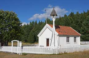
We continued along the forest path, past
Trysunda's forest-graveyard (Skogs-kyrkagård) back to the village, to
re-visit the little wooden chapel (see below left), built in 1654 by the
island's first residents, fishermen from Gävle who used it during the winter
months to store their nets. Although the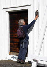 church was locked, a large key hung on a nail by the door (see below right).
Inside, the chapel walls were covered with straightforward rustic artwork (Photo
27 - Trysunda chapel)
 painted
in 1711, the year in which King Karl XII built a naval base at Trysunda; the
artist was probably a craftsman on one of the warships and like many of his
fellow sailors came from Finland. There was just time to walk along past
the harbour-side cottages and boat-houses to the darkly enclosed small rocky
beach at the island's northern tip, before returning round to the landing-stage
for the return ferry. We had expected the boat to be full of passengers
returning from Ulvön, but with the holiday season now finished there was plenty
of space on the boat. The day's sun was now past, and with a chill breeze
blowing, we were glad to settle into the warm ferry lounge. The moment the boat
swung out of Trysunda's sheltered sound into the open sea, it was clear that the
return crossing was not going to be smooth: the small boat crested waves churned
up by the wind and crashed down into subsequent troughs. We hunkered down for a
rough 40 minute crossing! painted
in 1711, the year in which King Karl XII built a naval base at Trysunda; the
artist was probably a craftsman on one of the warships and like many of his
fellow sailors came from Finland. There was just time to walk along past
the harbour-side cottages and boat-houses to the darkly enclosed small rocky
beach at the island's northern tip, before returning round to the landing-stage
for the return ferry. We had expected the boat to be full of passengers
returning from Ulvön, but with the holiday season now finished there was plenty
of space on the boat. The day's sun was now past, and with a chill breeze
blowing, we were glad to settle into the warm ferry lounge. The moment the boat
swung out of Trysunda's sheltered sound into the open sea, it was clear that the
return crossing was not going to be smooth: the small boat crested waves churned
up by the wind and crashed down into subsequent troughs. We hunkered down for a
rough 40 minute crossing!
Örverhörnäs Camping:
glad to be back ashore at Köpmanholmen, we shopped for provisions at Bjästa before
returning 10kms north up E4. Thankfully traffic was light, and just south of Örnsköldsvik
we turned off into the village of Örverhörnäs to find the campsite. We had
stayed here in 2013 when, during the holiday season, the small lake-side site
had been quite crowded; tonight we were surprised to find that, with holidays
over, it was almost deserted. We therefore had the choice of pitches and
selected one at the far end of the lake-shore looking across towards the distant
Själevad church and forested hills. When we booked in, the elderly owner was
delighted to hear that we had stayed before; perhaps you will come again, he
said. Although facilities were basic, even after 3 years this pleasant
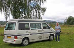 little
site was still a good value 190kr/night. By the time we turned in, it was
completely dark, and the forecast rain was beginning. The rain poured all night,
but by breakfast the cloud was thinning and sky beginning to brighten for
today's long drive inland. little
site was still a good value 190kr/night. By the time we turned in, it was
completely dark, and the forecast rain was beginning. The rain poured all night,
but by breakfast the cloud was thinning and sky beginning to brighten for
today's long drive inland.
A long drive over to the lower
Ångermanälven and Indalsälven valleys:
we set off from Örverhörnäs village, taking Route 335 for the first stage of
today's westward 231km journey (click here for detailed map of route).
Initially through farming countryside, the road then climbed over unpopulated
higher watershed ground (see below right), magnificently forested but sullied by 3 enormous
wind-farms; for the minimal amount of electricity generated, such wind-farms are
an indefensible intrusive eyesore on wild landscape. A long and winding descent
finally brought us down into the farming valley of the lower Ångermanälven
river, on whose banks we had earlier camped on at Meselefors north of Dorotea.
This brought us to the rather unattractive town of Sollefteå, to cross the Ångermanälven
just below the hydro-electric dam which spanned the river upstream of the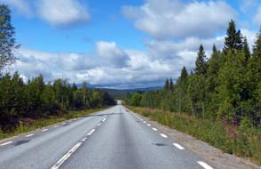 bridge. On the far side of the town, we pulled into an ICA Kvantum hypermarket
to shop for provisions. Leaving Sollefteå, Route 87, the road north-westwards to
Östersund (Route 90 had branched off northwards to Vilhelmina), was for the next
20kms a modern upgraded road alternating dual/single carriageway past the small
town of Långsele, crossing back from Västernorrland into Jämtland province to
reach the insignificant road junction town of Bisgården. Here we reached the
valley of the lower Indalsälven
river, and 6kms further we pulled into the parking area of our next milestone
point, the now dry waterfalls of Döda Fallet.
Sweden greatest environmental disaster,
creating the dry waterfalls of Döda Fallet (Dead Falls): before the last Ice Age,
the Indalsälven river flowed along its lower valley taking a course south
of a high mountain spur. As the ice retreated some 10,000 years ago, glacial
deposit caused the river to divert its course northwards, swelling out into the
25km long lake of Ragmundasjön. At its southern end, the huge discharge of
the Ragmundasjön head-waters dropped over a 35m (115 feet) high rocky threshold
barrier, forming the massive waterfalls and rapids of Storforsen which surged
down the lower gorge to re-join the Indalsälven river's former onward
course. In the mid~late 18th century, logging became a major industry in the
densely forested region of Jämtland, with the rivers used to float timber down
to coastal sawmills. The Storforsen falls and rapids were however a major
obstacle, smashing much of the timber and forcing the use of land transportation
(portaging) past the waterfalls from the southern end of Ragmundasjön lake down
to rejoin the Indalsälven below the falls and rapids.
 In 1793, the logging interests contracted with a
Sundsvall merchant, Magnus Huss, a man noted for ingenious solutions to
technical problems, to construct a canal to bypass the falls for log-floating.
Rather than use the costly and time-consuming process of digging a canal through
the moraine plateau, Huss opted to harness natural water force by damming part
of Lake Ragunda on the western side, and allow the overflow water to create a
path around the falls and rapids. Work started in 1794~95, but the
creation of the bypass channel was delayed by the works being sabotaged by
sceptical locals who stood to lose their livelihoods from log portaging if the
scheme succeeded. In early 1796 work on the canal was brought to a In 1793, the logging interests contracted with a
Sundsvall merchant, Magnus Huss, a man noted for ingenious solutions to
technical problems, to construct a canal to bypass the falls for log-floating.
Rather than use the costly and time-consuming process of digging a canal through
the moraine plateau, Huss opted to harness natural water force by damming part
of Lake Ragunda on the western side, and allow the overflow water to create a
path around the falls and rapids. Work started in 1794~95, but the
creation of the bypass channel was delayed by the works being sabotaged by
sceptical locals who stood to lose their livelihoods from log portaging if the
scheme succeeded. In early 1796 work on the canal was brought to a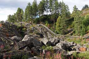 stop as
unconsolidated glacial-outwash sand and gravel from the esker kept running back
into the channel. Huss then tried a new method, damming a side-creek and allowing
released water to wash away a course; this process was repeated stage by stage
upstream towards Ragmundasjön. But the Spring flood of 1796 was unusually heavy:
lake water began to leak into Huss' excavations, and the porous ground could not
withstand the force of water which further eroded the esker. On the night of 6~7
June 1796, the whole hillside collapsed, and in just 4 hours the entire lake
drained, triggering a 15m high tsunami of flood-water which surged down the
valley, destroying homes, farms and livelihoods. As a result, the much deepened,
scoured-out channel re-created the natural river's pre-Ice Age northward course
by removing the moraine barrage. But overnight Ragmundasjön was totally drained,
leaving the former river bed and Storforsen waterfalls and rapids lower gorge
totally dry. By an irony, the Indalsälven new course bypassing the now dry falls
became navigable for log-floating, and the now drained former lake-bed became
farm land where the town of Hammarstrand was later built. Despite it being
Sweden's greatest environmental disaster, remarkably no one was killed, but Huss
was blamed and later found drowned lower down the river, believed to have been
lynched by those whose farms had been destroyed. stop as
unconsolidated glacial-outwash sand and gravel from the esker kept running back
into the channel. Huss then tried a new method, damming a side-creek and allowing
released water to wash away a course; this process was repeated stage by stage
upstream towards Ragmundasjön. But the Spring flood of 1796 was unusually heavy:
lake water began to leak into Huss' excavations, and the porous ground could not
withstand the force of water which further eroded the esker. On the night of 6~7
June 1796, the whole hillside collapsed, and in just 4 hours the entire lake
drained, triggering a 15m high tsunami of flood-water which surged down the
valley, destroying homes, farms and livelihoods. As a result, the much deepened,
scoured-out channel re-created the natural river's pre-Ice Age northward course
by removing the moraine barrage. But overnight Ragmundasjön was totally drained,
leaving the former river bed and Storforsen waterfalls and rapids lower gorge
totally dry. By an irony, the Indalsälven new course bypassing the now dry falls
became navigable for log-floating, and the now drained former lake-bed became
farm land where the town of Hammarstrand was later built. Despite it being
Sweden's greatest environmental disaster, remarkably no one was killed, but Huss
was blamed and later found drowned lower down the river, believed to have been
lynched by those whose farms had been destroyed.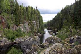
Our visit to the dry waterfalls of Döda Fallet:
from the parking area we walked down to the visitor centre, and secured a site
plan; the forested valley and huge board-walk around the area was spread out
below, but at this stage we had little concept of the topography and how the
disaster resulting in the dry falls had occurred (See map of Indalsälven valley and Döda Fallet).
The entire valley was now spread out below us, revealing the disastrous
consequences of Huss' misguided efforts to bypass the former falls: the now dry
boulder-strewn former river-bed
spread
from the former southern end of Ragmundasjön
lake down to the brink of the former falls; the dry former lake
bed, now farm land, stretched away 25kms north towards the modern town of Hammarstrand. Across on the far side of the now dry valley, a forested hill separated the Indalsälven's former course over the falls from the river's modern
(and pre-Ice Age) course over on the far side of the hill, just visible
beyond the southern tip of the ridge. The glacial moraine esker, which had once
formed a barrage diverting the river to swell out to form Ragunda Lake spilling
over Storforsen and which Huss' misguided efforts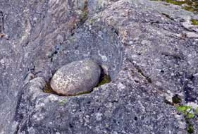 had washed away, must have
been sited at the northern end of this forested ridge. had washed away, must have
been sited at the northern end of this forested ridge.
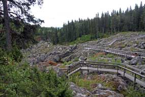
Döda Fallet is understandably a major tourist
attraction, and an impressive wooden board-walk (as at the Piteälven Storforsen) has
been constructed enabling visitors the unique experience of crossing and seeing
at close quarters the boulder-strewn now dry former lake- and river-bed, above
the top of the Dead Falls (Photo
28 - Döda Fallet board-walk) (see above left). We followed this board-walk round and
across the now dry former bed of the lake and river-rapids, an unbelievable
tangled mass of huge boulders and fissured bed-rock, showing all the
kettle-holes created by boulders being swirled around in the rapids current on
the river bed. Here was living geomorphology revealed before our eyes down in
this now dry river-bed. One cauldron-hole still housed the boulder whose
grinding action in the river current had eroded the hollow in which the
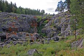 boulder
now nestled (see right). Ripe red Lingonberries now flourished among the rocky
debris of the dry former river-bed. The view down-stream showed the now almost
dry lower gorge below the rock-lip of what was once the Storforsen falls, with
just traces of stagnant water in the confines of the gorge (see above left). In the far distance,
we could just make out the Indalsälven river where its new course emerged from
the far side of the intervening hill. The board-walk crossed above the lip of
the dry falls where the cliff dropped 35m into the gorge below. The board-walk continued along the far
side of the gorge, among the huge boulders that were once eroded by the might of
the rapids' surging waters but now totally dry. This marvellous board-walk gave
intimate views of the former river bed's rocks now fully revealed. The sky had
clouded over making for poor photographic light, but the sun briefly emerged to
light this amazing rock-scape of the rapids' now dry bed and the distant view of
the rock-threshold over which the Storforsen falls had cascaded before 1796 (see
above right) (Photo
29 - Döda Fallet dry falls). The
board-walk crossed the lower end of the dry gorge, and a path returned along the
upper side under pines for a close view of the former Storforsen falls' rocky barrier
rising high above the stagnant pool at the cliff's foot (Photo 30 - Döda Fallet's now dry cliff)
(see left). We returned up the long
flights of wooden steps to the parking area, still marvelling at the stark
natural beauty of Döda Fallet and the dry rapids bed, now revealed at close
quarters by means of this wonderful boulder
now nestled (see right). Ripe red Lingonberries now flourished among the rocky
debris of the dry former river-bed. The view down-stream showed the now almost
dry lower gorge below the rock-lip of what was once the Storforsen falls, with
just traces of stagnant water in the confines of the gorge (see above left). In the far distance,
we could just make out the Indalsälven river where its new course emerged from
the far side of the intervening hill. The board-walk crossed above the lip of
the dry falls where the cliff dropped 35m into the gorge below. The board-walk continued along the far
side of the gorge, among the huge boulders that were once eroded by the might of
the rapids' surging waters but now totally dry. This marvellous board-walk gave
intimate views of the former river bed's rocks now fully revealed. The sky had
clouded over making for poor photographic light, but the sun briefly emerged to
light this amazing rock-scape of the rapids' now dry bed and the distant view of
the rock-threshold over which the Storforsen falls had cascaded before 1796 (see
above right) (Photo
29 - Döda Fallet dry falls). The
board-walk crossed the lower end of the dry gorge, and a path returned along the
upper side under pines for a close view of the former Storforsen falls' rocky barrier
rising high above the stagnant pool at the cliff's foot (Photo 30 - Döda Fallet's now dry cliff)
(see left). We returned up the long
flights of wooden steps to the parking area, still marvelling at the stark
natural beauty of Döda Fallet and the dry rapids bed, now revealed at close
quarters by means of this wonderful
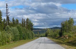 board-walk. The railway line to Östersund,
which runs along this section of the Indalsälven valley, curved around the rim
of the dry falls and lake-bed to cross the river a little further north towards
the modern village of Ragunda. board-walk. The railway line to Östersund,
which runs along this section of the Indalsälven valley, curved around the rim
of the dry falls and lake-bed to cross the river a little further north towards
the modern village of Ragunda.
Hammarstrand to Sandnäsets Camping:
we on drove northwards along the valley (click here for detailed map of route),
waving a greeting to the Indalsälven river, which earlier in the trip we had
camped alongside at one of its more active stretches at Ristafallet.
Reaching the unassuming little town of Hammarstrand, we crossed the wide river
just above the Hammarfallet dam and HEP generating station, to begin the next
stage of today's journey on Route 232 to Källarne. Beyond the village of Ragunda,
which had given its name to the huge lake through which the Indalsälven had once
flowed (and which Huss had succeeded in emptying!), the road rose over forested
high ground (see right) and descended to a farming valley to reach Källarne. From here Route
320 led through forested lake-land to tonight's campsite; weary after a long
day, we were thankful to reach Sandnäsets Camping. We knew nothing about the
place other than its lakeside location, but pulling into the driveway, it was
immediately clear it was a no-hoper! The small camping area stretching along the
lake-shore was filled with grubby statics, with virtually no space for visitors;
it was one of those places where folk
from the coastal towns go to spend weekends getting drunk on the pretext of
fishing, and we had chosen Saturday night to stay here! Most of the
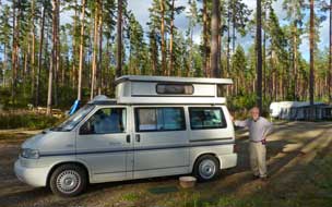 statics were
empty at this time of year, but the few folk here were making enough noise in
the bar or in caravan awnings to make up for it. We had no other options, and
reluctantly booked in at the bar-reception. statics were
empty at this time of year, but the few folk here were making enough noise in
the bar or in caravan awnings to make up for it. We had no other options, and
reluctantly booked in at the bar-reception.
We found a space in an open, gravelly area under
the high pines and settled in. Facilities were basic verging on primitive; it
was no place for the rest day planned for tomorrow, but at 180kr/night it would
have to serve for tonight. Sandnäsets Camping's woodland setting under high,
ancient pines alongside Holmsjön lake was its one saving grace (Photo
31- Sandnäsets Camping) (see left). The forest floor where we were
camped was simply a mass of the plumpest, juiciest Bilberries ever tasted (it
said something about the folk in the statics that there were so many Bilberries
left!), and despite the midges making a swarming last-ditch come-back, we went
out Bilberry picking for tomorrow's breakfast. As the evening grew dusky, there was an
outstanding sunset, which although hidden by the pine tree, lit the western sky
with a pervasive deep salmon-pink glow; this was reflected on the pine-covered
hills across the lake giving the late sky an eerie golden afterglow. And to cap
it all, a rain shower in the eastern sky, catching this reflected luminescence
of the setting sun, caused a spectacular vertical rainbow which lasted and
lasted, seeming to move gradually across the sky.
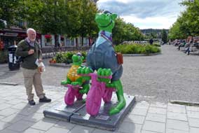 Dragon
hunting in Sundsvall: Route 320
from Sandnäsets ran along the shore of the elongated Holmsjön lake and a farming
valley to join Route 86 into Sundsvall (click here for detailed map of route). Founded in 1621, Sundsvall developed as
a wealthy trading port on the Bothnian coast particularly for timber export, but
in midsummer Dragon
hunting in Sundsvall: Route 320
from Sandnäsets ran along the shore of the elongated Holmsjön lake and a farming
valley to join Route 86 into Sundsvall (click here for detailed map of route). Founded in 1621, Sundsvall developed as
a wealthy trading port on the Bothnian coast particularly for timber export, but
in midsummer
 1888, sparks from a steam-boat started the worst ever fire which
destroyed the entire town with 9,000 houses burnt down. Such however was the town's wealth that within 10 years Sundsvall was rebuilt, constructed wholly
from stone by Stockholm's leading architects with wide streets and esplanades as
fire breaks, giving Sundsvall the sobriquet of Stenstaden (Stone City)
from the city centre's turn of 20th century grandiose urban architecture. Each
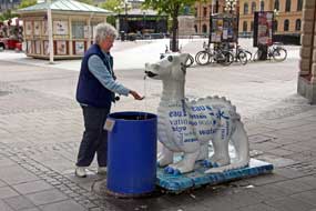
summer nowadays, Sundsvall celebrates its Dragon Parade with city centre street
corners decorated with colourful dragon statues, sponsored by local
organisations. The dragons' fiery breath recalls the disastrous Great Fire of
1888, and a competition is held to elect the most popular of the colourful
dragon statues, with residents and visitors voting for their favourite. We had
enjoyed such a fun afternoon in Sundsvall in 2013, ambling around this
delightful city in the summer sunshine among the dragon statues, that we had
chosen to re-visit Sundsvall on our way through today and again vote in the
city's fun dragon-competition. 1888, sparks from a steam-boat started the worst ever fire which
destroyed the entire town with 9,000 houses burnt down. Such however was the town's wealth that within 10 years Sundsvall was rebuilt, constructed wholly
from stone by Stockholm's leading architects with wide streets and esplanades as
fire breaks, giving Sundsvall the sobriquet of Stenstaden (Stone City)
from the city centre's turn of 20th century grandiose urban architecture. Each
summer nowadays, Sundsvall celebrates its Dragon Parade with city centre street
corners decorated with colourful dragon statues, sponsored by local
organisations. The dragons' fiery breath recalls the disastrous Great Fire of
1888, and a competition is held to elect the most popular of the colourful
dragon statues, with residents and visitors voting for their favourite. We had
enjoyed such a fun afternoon in Sundsvall in 2013, ambling around this
delightful city in the summer sunshine among the dragon statues, that we had
chosen to re-visit Sundsvall on our way through today and again vote in the
city's fun dragon-competition.
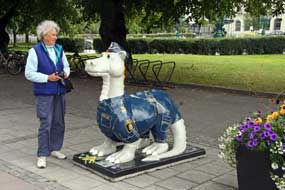 With Sunday morning traffic light, there was no
difficulty parking by the Kulturmagazinet, former 19th century stone-built
warehouses now tastefully converted to form the town's library and museum. As we
walked along Esplanaden, we soon encountered our first dragon statue, Lill
Trampa and With Sunday morning traffic light, there was no
difficulty parking by the Kulturmagazinet, former 19th century stone-built
warehouses now tastefully converted to form the town's library and museum. As we
walked along Esplanaden, we soon encountered our first dragon statue, Lill
Trampa and
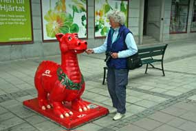 Hjulbert, sponsored by Sundsvall Cycling Club (see above right).
Along by the main square of Stortorget, there were dragons at every corner (Photo
32 - Sundsvall Dragon Parade). On the far side of the square Klara the
water-breathing dragon was sponsored by Mid-Sweden Water Company (see above
left), and Åke Slack Dragon sponsored by the Fire-Rescue Authority and saving a
baby dragon. But to our disappointment, the Rådhus (City-Hall) was
closed on a Sunday so we were unable vote in the dragon competition. Instead we
wandered along Storgatan and found Erica, the ICA Supermarket Dragon (see left),
Polis Konstabel Drake, the Police Authority dragon (see right), and several
other dragons standing at street corners. Along the other end of Storgatan,
dragons stood outside many of the department stores including Aluminator Dragon
sponsored by the Sundsvall Aluminium Smelter (see below left), and Smile the Dental
Dragon with his tooth brush, sponsored by a Sundsvall Dental Practice
(Photo
33 - Smile, the Dental Dragon). It had all been great fun again, but who
would we have voted for if the City-Hall had been open? Hjulbert, sponsored by Sundsvall Cycling Club (see above right).
Along by the main square of Stortorget, there were dragons at every corner (Photo
32 - Sundsvall Dragon Parade). On the far side of the square Klara the
water-breathing dragon was sponsored by Mid-Sweden Water Company (see above
left), and Åke Slack Dragon sponsored by the Fire-Rescue Authority and saving a
baby dragon. But to our disappointment, the Rådhus (City-Hall) was
closed on a Sunday so we were unable vote in the dragon competition. Instead we
wandered along Storgatan and found Erica, the ICA Supermarket Dragon (see left),
Polis Konstabel Drake, the Police Authority dragon (see right), and several
other dragons standing at street corners. Along the other end of Storgatan,
dragons stood outside many of the department stores including Aluminator Dragon
sponsored by the Sundsvall Aluminium Smelter (see below left), and Smile the Dental
Dragon with his tooth brush, sponsored by a Sundsvall Dental Practice
(Photo
33 - Smile, the Dental Dragon). It had all been great fun again, but who
would we have voted for if the City-Hall had been open?
A lonely road through the forests south to Delsbo:
we left Sundsvall for the first stage of this afternoon's drive (click here for detailed map of route),
westwards to Stöde on E14, the main trans-Sweden highway which runs over to
Trondheim in Norway, a road we had used earlier in the trip along Åredalen to
Ristafallet. E14 was an unpleasant road with heavy traffic returning eastwards
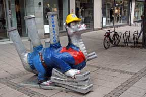 and frequent aggressive overtaking. Fortunately our
westward direction was only
bothered by speed and frequent aggressive overtaking. Fortunately our
westward direction was only
bothered by speed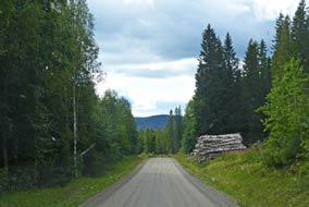 cameras. Reaching Stöde, we were glad to turn off onto the
more peaceful Route 305. The road initially was of reasonable standard, uneven
but at least tarmaced; but soon the asphalt unexpectedly ended and for the next
30kms the unsurfaced lane wound a meandering, pot-holed, single-track course through empty forested
hills (see right). Crossing from Västernorrland to Gävleborg county, the road
dropped down into a farming valley and passing through small, isolated villages,
the road was now tarmaced again and a little wider. As we moved further south
towards the western end of Norrdellen Lake, farms became bigger and more
affluent-looking. Our original plan had been to camp at Delsbo, but we had no
great hopes for the campsite there, and the map showed several campsites around
the shores of Norrdellen Lake. It could be that, being lakeside campsites close
to the Bothnian Coast, they would be full of statics and noise infested like Sandnäsets,
but reaching the village of Bjuråker, we investigated the first of these sites a
couple of kms along a side lane. cameras. Reaching Stöde, we were glad to turn off onto the
more peaceful Route 305. The road initially was of reasonable standard, uneven
but at least tarmaced; but soon the asphalt unexpectedly ended and for the next
30kms the unsurfaced lane wound a meandering, pot-holed, single-track course through empty forested
hills (see right). Crossing from Västernorrland to Gävleborg county, the road
dropped down into a farming valley and passing through small, isolated villages,
the road was now tarmaced again and a little wider. As we moved further south
towards the western end of Norrdellen Lake, farms became bigger and more
affluent-looking. Our original plan had been to camp at Delsbo, but we had no
great hopes for the campsite there, and the map showed several campsites around
the shores of Norrdellen Lake. It could be that, being lakeside campsites close
to the Bothnian Coast, they would be full of statics and noise infested like Sandnäsets,
but reaching the village of Bjuråker, we investigated the first of these sites a
couple of kms along a side lane.
Rävnäsets Camping near to Delsbo, a jewel of a find: Rävnäsets
Camping in fact turned out to be a very promising campsite, with few statics and
pitches on flat terraces spread up the pine forested hillside above the lake;
more importantly it was almost deserted, the facilities were clean with
well-equipped kitchen, and the cost was only 180kr/night. But the reception was
locked and the campsite's leaflet said the place closed tomorrow at the end of
its short summer season. This was
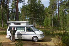 no good to us if it closed tomorrow since we
had a rest day scheduled before we met our friend in Hudiksvall on Tuesday.
Without much hope, we no good to us if it closed tomorrow since we
had a rest day scheduled before we met our friend in Hudiksvall on Tuesday.
Without much hope, we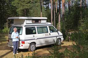 telephoned the number; the owner answered and in very
helpful tones assured us we could stay tomorrow. She would come out to book us
in after we had driven down to the supermarket in Delsbo 6kms away, a large
village with ICA supermarket, bank and filling station. While there we took a
look at its campsite; it had many chalet-huts, was full of camping cars and the
ground sloped steeply down to the lake. Our choice was clear: we should return
to the peaceful solitude of Rävnäsets Camping. telephoned the number; the owner answered and in very
helpful tones assured us we could stay tomorrow. She would come out to book us
in after we had driven down to the supermarket in Delsbo 6kms away, a large
village with ICA supermarket, bank and filling station. While there we took a
look at its campsite; it had many chalet-huts, was full of camping cars and the
ground sloped steeply down to the lake. Our choice was clear: we should return
to the peaceful solitude of Rävnäsets Camping.
When we arrived back at Rävnäsets, Irene the
lady-owner was
waiting and welcomed us in a thoroughly charming manner; you simply could not
ask for more pleasantly helpful hospitality. We selected one of the flat,
terraced pitches up in the forested camping area and settled in; this was a
delightful setting for our day in camp tomorrow, but probably only early or late
in the season when the place was deserted (Photo
34 - Rävnäsets Camping). The sun was bright the following morning in
this wonderfully peaceful forested hideaway, with just the sound of Green
Woodpeckers' laughing calls high in the pine trees. Rävnäsets Camping was indeed
a lovely chance find.
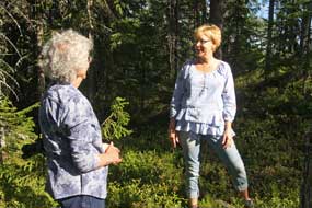 A hospitable welcome from old friends at
Hudiksvall: today we were
to go into the Bothnian coastal town of Hudiksvall to meet again with Carina, A hospitable welcome from old friends at
Hudiksvall: today we were
to go into the Bothnian coastal town of Hudiksvall to meet again with Carina,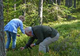 whom we had met by chance on
our 2013 visit to Hudiksvall and with whom we had kept in touch since;
hearing we were visiting Sweden again this year, she had invited to stay a
couple of days with her family. Leaving Rävnäsets, we drove a quiet back road alongside Sordellen Lake which
sparkled in the morning sunshine, to our arranged rendez-vous with Carina at the
harbour parking area in Hudiksvall. We firstly walked around to Möljen and the little
fisherman statue overlooking Hudiksvall's iconic boathouses and fishing harbour
(Photo
35 - Hudiksvall's fisherman statue), before driving up to her home in
the upper part of the town. That afternoon, Carina took us berry and mushroom
picking in the forests just to the north of Hudiksvall (see left and right);
clambering up the forest slopes picking Bilberries and Golden Chanterelles (see
below left),
Carina taught us which mushrooms were edible and which to avoid. Returning home,
we met Carina's husband Dan and their sons Hugo and Carl. Their lounge looked
out over the town of Hudiksvall, and prominently on the skyline St Jakob's
Church where we had first met Carina. That evening we all sat down to a family supper of
baked salmon and delicious sauces, and talked late into the evening about
current Swedish politics and the controversial issue of the Social Democrat
coalition government's maladroit attempts to manage the overwhelming numbers of
immigrants, the impact of which we had seen in every town and city around
Sweden; we were very impressed with Hugo's detailed knowledge and mature whom we had met by chance on
our 2013 visit to Hudiksvall and with whom we had kept in touch since;
hearing we were visiting Sweden again this year, she had invited to stay a
couple of days with her family. Leaving Rävnäsets, we drove a quiet back road alongside Sordellen Lake which
sparkled in the morning sunshine, to our arranged rendez-vous with Carina at the
harbour parking area in Hudiksvall. We firstly walked around to Möljen and the little
fisherman statue overlooking Hudiksvall's iconic boathouses and fishing harbour
(Photo
35 - Hudiksvall's fisherman statue), before driving up to her home in
the upper part of the town. That afternoon, Carina took us berry and mushroom
picking in the forests just to the north of Hudiksvall (see left and right);
clambering up the forest slopes picking Bilberries and Golden Chanterelles (see
below left),
Carina taught us which mushrooms were edible and which to avoid. Returning home,
we met Carina's husband Dan and their sons Hugo and Carl. Their lounge looked
out over the town of Hudiksvall, and prominently on the skyline St Jakob's
Church where we had first met Carina. That evening we all sat down to a family supper of
baked salmon and delicious sauces, and talked late into the evening about
current Swedish politics and the controversial issue of the Social Democrat
coalition government's maladroit attempts to manage the overwhelming numbers of
immigrants, the impact of which we had seen in every town and city around
Sweden; we were very impressed with Hugo's detailed knowledge and mature
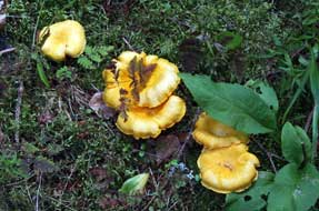 understanding of both Swedish politics and world current affairs. understanding of both Swedish politics and world current affairs.
A
day around Hudiksvall and Hälsingland with Carina and Dan:
the following day after a visit to
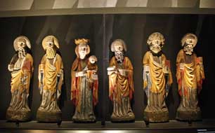 the magnificent 16th century wood-carved
ecclesiastical artwork of local craftsman Haaken Gulleson in Hudiksvall Museum
(see right), Carina and Dan took us on a tour of the Hälsingland rural
hinterland (click here for detailed map of route). Out through Delsbo and Bjuråker (where we had camped at the
weekend), we turned off around the northern shore of Norrdellen Lake to Avholm
where the rocky crest of a hill gave panoramic views over the Dellen Lakes to
the distant skyline of Hälsingland's renowned blue hills
(Photo
36 - Carina and Dan) (see below left). Further around the lake-shore, we
reached the hamlet of Moviken to visit the restored 19th century iron-smelting
works (bruk in Swedish), which had been developed by a country estate
landowner. The huge blast-furnace building was clearly constructed from bricks
of moulded slag, the waste product from iron smelting (see below right). Historically the three necessary components for iron working were in
plentiful supply in rural Hälsingland: iron ore, fast-running water to drive
air-pumps for blast-furnaces, and timber for charcoal production. Production of smelted iron had the magnificent 16th century wood-carved
ecclesiastical artwork of local craftsman Haaken Gulleson in Hudiksvall Museum
(see right), Carina and Dan took us on a tour of the Hälsingland rural
hinterland (click here for detailed map of route). Out through Delsbo and Bjuråker (where we had camped at the
weekend), we turned off around the northern shore of Norrdellen Lake to Avholm
where the rocky crest of a hill gave panoramic views over the Dellen Lakes to
the distant skyline of Hälsingland's renowned blue hills
(Photo
36 - Carina and Dan) (see below left). Further around the lake-shore, we
reached the hamlet of Moviken to visit the restored 19th century iron-smelting
works (bruk in Swedish), which had been developed by a country estate
landowner. The huge blast-furnace building was clearly constructed from bricks
of moulded slag, the waste product from iron smelting (see below right). Historically the three necessary components for iron working were in
plentiful supply in rural Hälsingland: iron ore, fast-running water to drive
air-pumps for blast-furnaces, and timber for charcoal production. Production of smelted iron had
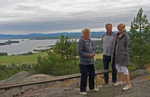 begun in 1797, but the quality
of local iron ore soon proved too low and ore was imported from Bergslagen,
shipped in bulk up the coast to Hudiksvall, towed in lighters across the two
Dellen Lakes, and off-loaded onto a light railway to the smelter at Moviken. Ovens
for bulk production of charcoal from timber cut in the local forests were built
in the 19th century on begun in 1797, but the quality
of local iron ore soon proved too low and ore was imported from Bergslagen,
shipped in bulk up the coast to Hudiksvall, towed in lighters across the two
Dellen Lakes, and off-loaded onto a light railway to the smelter at Moviken. Ovens
for bulk production of charcoal from timber cut in the local forests were built
in the 19th century on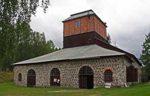 the lake-shore. Improved blast-furnaces were installed in
1903, and when iron production ceased in 1937 having remained a local estate
concern, the blast-furnace was conserved. the lake-shore. Improved blast-furnaces were installed in
1903, and when iron production ceased in 1937 having remained a local estate
concern, the blast-furnace was conserved.
The young guide gave us a tour of the bruk (see below left),
hesitantly apologising for her English, but in fact her knowledgeable
commentary was given in commendably competent English as she answered our many
questions about the blast furnace's working. Ore was manually crushed with
hammers and transported by water-driven hoist up to ore-roasting furnaces on the
bruk's first story to remove impurities prior to smelting. The roasted
ore was again crushed and tipped into mobile storage bins for hoisting up to the
second storey and graded by quality. Charcoal produced in the lake-side ovens
was also hoisted from storage, and tipped into the top of the blast furnace, in
layers with graded ore mixed with flux-lime. The blast-furnace operated
continuously, only being cooled for re-lining once yearly. Molten red-hot iron
was run out into moulds to solidify into pig-iron ingots (göts in
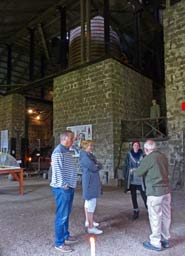 Swedish,
pronounced yerts). Down by the former dock area on the shore of Norrdellen Lake, one of the original charcoal ovens built of slag-bricks was
conserved (see below right). It took 41 days to burn and cool the huge quantity
of charcoal, which was consumed by the blast-furnace in a week; one of the
reasons for the bruk's eventual closure was deforestation of the
surrounding estate. Swedish,
pronounced yerts). Down by the former dock area on the shore of Norrdellen Lake, one of the original charcoal ovens built of slag-bricks was
conserved (see below right). It took 41 days to burn and cool the huge quantity
of charcoal, which was consumed by the blast-furnace in a week; one of the
reasons for the bruk's eventual closure was deforestation of the
surrounding estate.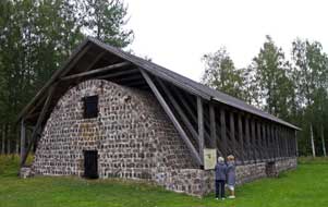
We drove up to the estate manor house at Strömbacka, and nearby the forge was
conserved where pig-iron ingots from the Moviken smelter were brought for
hammering into less brittle wrought iron. The nearby lake was dammed to provide
a head of water for water-turbines to power forge machinery and air pumps. The
forge was conserved, and we were able to see the enormous beam forge-hammers,
and a small museum described the forge's working processes and the social
conditions of estate workers. From Stömbacka, we took an unsurfaced back route
winding over remote high forested terrain, eventually leading back into
Hudiksvall.
Back at their home, Carina prepared a delicious
supper of pumpkin soup with vegetables from her garden, and again we sat up late
into the evening, learning much about life in Sweden. All day Paul had been
quizzing Carina on Swedish pronunciation; it was desperately deflating how
inadequate our attempts at correct pronunciation had been despite all our
efforts to learn. Before leaving the following morning, Carina wrote out her
family recipe for Köttbular (meatballs), and generously loaded us with gifts of a
pack of her home-made meatballs for our next supper, pots of her home-made jams,
and a container full of Bilberries. It had been so delightful to spend time
with her and Dan: we had learned much, enjoyed a thoroughly pleasant and relaxed
2 days, and had been welcomed with the most kindly and open-hearted hospitality;
we send them our greetings and our gratitude, and wish Carl and Hugo much
success in their studies.
Coming next: we shall now travel a long way
down through Central and Southern Sweden, visiting Falun and its copper mine,
Färnebofjärden National Park, Sala and its silver mine, the Anunshög prehistoric
burial grounds, Motala and the locks of the central Göta Canal, the historical
town of Vadstena, ending in Småland with its famous glassworks. But more of all
of that in the next edition which will be
published shortly.
Next edition
to be published quite soon
|
Sheila and Paul |
Published: 14 December 2016 |
|

 CAMPING
IN SWEDEN 2016 - Arvidsjaur, Norsjö Linbana mining cableway, Skellefteå, Vindelälven Valley,
Örnsköldsvik, Baltic island of Trysunda, Sollefteå, Indalsälven valley and Döda Fallet, Sundsvall, Hudiksvall:
 hillier covered with attractive forest, the morning
sun picking out details of the myriads of pine and spruce trees. We crossed the Vistån river, a tributary of the Piteälven, and the Byskeälven, and continued
through shallow lake-land to the road junction 3kms from Arvidsjaur. The town
sits astride a bewildering cross-roads of Route 95, the east~west Silver
Way which continues to Arjeplog and the Norwegian border (the route we had
taken earlier) and the north~south E45 Inlandsvägen.
 We
continued south-easterly on Route 95 towards Boliden, where we knew of
another campsite, passing through attractively forested lake-land. But all that
changed when we reached Boliden, a sordid place totally dominated by mining
spoil heaps; the Boliden Mining Group operated a number of mines along the Skellefteälven valley, producing copper, zinc, and lead ores, and a smelting
plant down at the coast at Rönnskär beyond Skellefteå.
Driving through this singularly unattractive village, we eventually found
Sidtjärns Camping, which turned out to be an annexe to a grubby-looking hostel
used by mine workers, and closed; our second disappointment today! There was
nothing for it but to continue along the Skellefteälven valley on Route 370, and
hope to find somewhere to camp. Beyond the Boliden mines and the areas of
devastation left by extensive spoil heaps, we drove on along the forested valley
passing the residual concrete pylons of the 96 km aerial cableway which once
brought ore from the mines further up the valley (see left). Route 370 seemed a
surprisingly wide and well-surfaced road, but we soon understood why: it was now
used by convoys of huge mine trucks thundering along the once peaceful valley.
We crossed the Skellefteälven river, and just beyond near the hamlet of Rengård
found a neat looking stugby, a holiday chalet encampment, set alongside a
traditional, red-painted farmstead. The charming lady-owner was most welcoming:
not only was she happy for us to camp, but she would charge just 100kr. As
so often happens, the blessed St Serendipity had once more come to our rescue,
finding us the perfect solution for tonight's camp here at Ringvor i Rengård
after our 2 earlier disappointments.
We
continued south-easterly on Route 95 towards Boliden, where we knew of
another campsite, passing through attractively forested lake-land. But all that
changed when we reached Boliden, a sordid place totally dominated by mining
spoil heaps; the Boliden Mining Group operated a number of mines along the Skellefteälven valley, producing copper, zinc, and lead ores, and a smelting
plant down at the coast at Rönnskär beyond Skellefteå.
Driving through this singularly unattractive village, we eventually found
Sidtjärns Camping, which turned out to be an annexe to a grubby-looking hostel
used by mine workers, and closed; our second disappointment today! There was
nothing for it but to continue along the Skellefteälven valley on Route 370, and
hope to find somewhere to camp. Beyond the Boliden mines and the areas of
devastation left by extensive spoil heaps, we drove on along the forested valley
passing the residual concrete pylons of the 96 km aerial cableway which once
brought ore from the mines further up the valley (see left). Route 370 seemed a
surprisingly wide and well-surfaced road, but we soon understood why: it was now
used by convoys of huge mine trucks thundering along the once peaceful valley.
We crossed the Skellefteälven river, and just beyond near the hamlet of Rengård
found a neat looking stugby, a holiday chalet encampment, set alongside a
traditional, red-painted farmstead. The charming lady-owner was most welcoming:
not only was she happy for us to camp, but she would charge just 100kr. As
so often happens, the blessed St Serendipity had once more come to our rescue,
finding us the perfect solution for tonight's camp here at Ringvor i Rengård
after our 2 earlier disappointments.

 the copper,
zinc, lead and gold mines at Kristineberg in the Malå~Norsjö region by truck
down to Boliden. But in WW2 the Allied blockade of Scandinavia led to shortages
of both fuel and rubber for tyres, making road transportation of ore
increasingly expensive. A railway line was considered as an alternative means of
moving ore along the valley, but construction time and cost, and shortage of steel for rails led to a decision in 1941 to build a 96km aerial cableway linking
the mines along the valley to Boliden, because of its more economic construction
and materials requirements. In April 1942, a workforce of 1,500
 men was deployed
to clear a 40m wide corridor through the forests, construct access roads, and to
cast and assemble the reinforced concrete support pylons for the cableway. Along
the 96km length, 514 cableway support pylons were raised, 16 of these standing
in lakes, along with 10 driving stations and 25 intermediate tensioning
stations. The tallest of the pylons at the Skellefteälven river-crossing were
38m tall; pylon to pylon cable span ranged from 11m to 429m. The construction was
completed in 1 year and 5 days, 4½ months ahead of schedule, and the first ore
buckets, each conveying 1.4 tons, were transported down the 96kms of cableway
from Kristineberg mine to Boliden on 14 April 1943.
 with 73 support pylons, was preserved as a tourist attraction and re-equipped
with modern 4-seat gondola-cars to replace the ore buckets; operated by Linob i
Norsjö AB, the Linbana still
 operates regularly during the summer months (
 begin their 'flight'. A small museum in a reconstructed mine head-stocks
building gave a history of the arduous work of the men who built the
cableway and the women who cooked for them. Nearby alongside the flooded pit of
the Örträsk open-cast copper mine, a section of the original cableway with its
concrete pylons and ore buckets was preserved (see above right) (
 to the Boliden smelters (
 and lakes along the cableway route to Menträsk (
 The Menträsk Linbana station: we now drove over to Menträsk to be there in time for when the Linbana's gondolas arrived along the cableway. From Örträsk village
we followed a narrow, unsurfaced single-track lane leading for 12kms through
beautiful forest land, and eventually emerging onto Route 365. 2kms
north, the road passed under the preserved cableway, and at Menträsk village we
turned off along a single-track lane to reach the Linbana northern station
set on a peninsula in Menträsk lake, the site of the original mining cableway's
drive station. As we pulled into the lakeside parking area to pick Bilberries
from the forest floor, we were faced with the remarkable sight of the Linbana's
concrete support-pylons spaced out across the length of the lake (
 drive-station, now the Linbana northern
terminus. Beyond here, the now cable-less support-pylons of the abandoned
northward cableway route still survive, stretching across the lake into the
distance.
 around the Menträsk
station shed, suspended from a rail. Today, with sunny weather, had certainly
been a satisfying day of learning: we were truly impressed by the efforts of
those who had constructed the original cableway; we were equally impressed by the determination of the Norsjö preservation society that continued to
keep section IV of the Linbana operating 70 years after its inauguration.
 stayed fine for our barbecue. For a straightforward camping aire (no
power or kitchen/wash-up), Örträsk was excellent value at 60kr/night (pay at the
café or honesty box at the gate); the camping field's setting was pleasant
looking out westerly to setting sun over pine forests and the Linbana cable-way,
and the WC/shower facilities were first class, some of the best of the trip and
spotlessly clean, but only open during the Linbana's brief summer working.
 trading
colony developed here centred around the parish church.
The original 1324 wooden church was replaced by a larger stone structure in 1507, the
Gothic ogival arches of which can still be seen in the sacristy of the modern
neo-Classical church which was built in 1800 as the parish grew in size. As at Luleå, a church town (kyrkstad) developed at Bonnstan next to Skellefteå church
with a large collection of wooden huts where parishioners travelling from
far flung parts of the interior for compulsory church attendance could spend the
night after sitting through lengthy Lutheran sermons before returning to their
distant farms.
 altarpiece (see
right). But the church's prime treasure was its collection of medieval carved
wooden artwork of saints and madonnas, now displayed in an ambulatory chapel
behind the altar. The pride of the collection was the Skellefteå Madonna
statuette, one of few surviving Romanesque images of the Virgin, carved
from walnut in Northern Germany in the 12th century (see left). The Child
was missing, as were the arms and hands on several of the statuettes, perhaps
deliberately removed to allow the carvings to be hidden in a wall cavity from
anti-Catholic vandalism after the Reformation conversion to puritanical
Lutheranism.
  With
the sun still not yet broken through, we walked down the lane to where the
Lejonströmsbron wooden bridge dating from 1737 crossed the Skellefteälven (see
left)
(
 river on a wooden walk-way, steps led up into the heart of the Bonnstan church
town (kyrkstad). 392 of the log-constructed wooden cottages survive, clearly
still occupied though few residents were about today. We ambled along the
pathways among the huts, taking our photos in the still dull light (see right)
(
 Rännuddens
Camping near Norsjö, grubby, run-down and expensive: leaving Skellefteå,
we returned along the valley on Route 370, and turning off through Norsjö we
reached Rännuddens Camping. This place might once have been a pleasantly
straightforward little fishing camp, but things had changed drastically: an
inspection of the facilities showed them to be grubby, unsavoury and badly in
need of renovation; the campsite was largely deserted but the huts were fully
occupied, and paper notices at reception all in Polish suggested that the place
was now monopolised by Polish migrant workers; we were greeted in a surly and
off-hand manner, and the charge for such a run-down campsite was an
unrealistically expensive 250kr/night, probably inflated by bank interest on a
loan to buy the run-down site. But it was late, and too weary to find an
alternative tonight, we acquiesced and settled into the lake-side camping
 area
which was at least peaceful and in a lovely forested setting looking out across Norsjön lake
(see left)
(
 very
much to our taste and worthy of support, and the price was just 160kr/night. We
had telephoned last evening and the lady had said for us to settle in when we
arrived and she would be round later. The small site sloped steeply down to a
lake (see left), and quite bizarrely most of the flatter upper area with power
supplies was set among a crazy
golf course; a man mowing the grass showed us the facilities and said to camp
among the crazy golf features!
  tarmaced parking area, with a couple of gravelled pitches overlooking the river.
At reception, we were greeted in an offensively officious manner: the cost was
250kr/night, plus 40kr extra for the riverside pitches; did we want to stay or
not? There was only one answer to such silly prices and surly inhospitality, and
we told him! In contrast, the simple charm and hospitable welcome at Åmsele
Camping beckoned us to return up valley, and within half hour we were pitched at Åmsele
next to hole 7 of the crazy golf course (see above left). By now the rain had eased, allowing us
to settle in without a soaking. The straightforward Åmsele Camping had a quaint
charm of its own, unpretentious, supremely good value at 160kr/night (there was
even a wi-fi internet network), and peaceful; other than an occasional timber
truck, little traffic passed along the main road through the village. We admired
the local farming families in re-creating the campsite, and their efforts
deserved support. The sky cleared this evening, but with a Scandinavian autumnal
chillness in the air; we even had the heater on this evening for warmth, and
along the road-sides today, the birches were showing distinct signs of autumn
gold.
 The road now began to gain height steadily onto
thinly forested high ground, totally deserted of any habitation or signs of
life, and in the dull, grey light and pouring rain, the solitude of these
desolate forests seemed even more intense. Beyond the high point, the road
continued towards Fredrika across plateau-land with little loss of height.
Alongside an elongated lake, we reached the next staging point on today's
journey at Fredrika. Along with the Lapland towns of Dorotea and Vilhelmina,
Fredrika is named after Fredrika Dorotea Vilhelmina, Queen Consort of the inept
Gustav IV Adolph, who during his brief reign from 1792~1809 managed to lose one
third of Sweden's empire, including Finland to Tsarist Russia, and was
consequently deposed for his incompetence. Route 92 continued westwards to Dorotea,
but we turned off southwards at this point onto the minor Route 352 (
 provisions.
 one of the very few places that had not increased its prices. The
staff at reception were still as pleasantly friendly and helpful as ever, and we settled in at one of the pitches
on the far side opposite the little wooden church (see above left), and pulled out the awning
against the still persistent rain. Solbacken's site-wide wi-fi enabled us to
check the forecast for tomorrow which promised better weather for our day
in camp. But tonight was a miserably chill and wet evening, and again we needed
the heater for warmth. By 10-pm it was quite dark; we had come a long way south
today.
 The off-shore High Coast island of Trysunda:
our plan for today was to take the ferry from the little port of
Köpmanholmen for a day out on the tiny off-shore High Coast island of Trysunda (
 it was so overwhelmingly big that it seemed we were dreaming
it. But this morning, we could see it was no dream, rather the most obscene
display of ostentatious materialism imaginable! We were away early to drive back across Dekarsön
bridge, and in heavy traffic through the centre of Örnsköldsvik joined the
dreaded E4 east coast motorway. Some 15kms south, just before the start of long
hill down the High Coast, we were thankful to turn off at Bjästa, and 6kms along
the lane reached the tiny ferry-port of Köpmanholmen. Return ferry tickets for
Trysunda, at a very reasonable 120kr each, were bought at the kiosk, and we
waited by the quay. A number of other passengers were gathering, all with piles
of luggage for stays at holiday homes on Trysunda and the larger island of Ulvön.
At 11-45am M/F Ranö drew into the quay, and we clambered aboard over
heaps of luggage, just managing to secure seats at the boat's open rear. Once clear of
Köpmanholmen harbour, M/F Ranö
sped across the outer channel
(
 sheds on
the far side, familiar to us from our 2013 visit (
 deserted bay's
wave-polished cobbles, way-marks identified the point at which
the continuing path left the beach to enter the forest. With final photos across
the sweep of the bay,
 sunlight sparkling on the sea and above this a magnificent
cloud-scape (see right)
(
 church was locked, a large key hung on a nail by the door (see below right).
Inside, the chapel walls were covered with straightforward rustic artwork (
 painted
in 1711, the year in which King Karl XII built a naval base at Trysunda; the
artist was probably a craftsman on one of the warships and like many of his
fellow sailors came from Finland. There was just time to walk along past
the harbour-side cottages and boat-houses to the darkly enclosed small rocky
beach at the island's northern tip, before returning round to the landing-stage
for the return ferry. We had expected the boat to be full of passengers
returning from Ulvön, but with the holiday season now finished there was plenty
of space on the boat. The day's sun was now past, and with a chill breeze
blowing, we were glad to settle into the warm ferry lounge. The moment the boat
swung out of Trysunda's sheltered sound into the open sea, it was clear that the
return crossing was not going to be smooth: the small boat crested waves churned
up by the wind and crashed down into subsequent troughs. We hunkered down for a
rough 40 minute crossing!
 little
site was still a good value 190kr/night. By the time we turned in, it was
completely dark, and the forecast rain was beginning. The rain poured all night,
but by breakfast the cloud was thinning and sky beginning to brighten for
today's long drive inland.
 bridge. On the far side of the town, we pulled into an ICA Kvantum hypermarket
to shop for provisions. Leaving Sollefteå, Route 87, the road north-westwards to
Östersund (Route 90 had branched off northwards to Vilhelmina), was for the next
20kms a modern upgraded road alternating dual/single carriageway past the small
town of Långsele, crossing back from Västernorrland into Jämtland province to
reach the insignificant road junction town of Bisgården. Here we reached the
valley of the lower Indalsälven
river, and 6kms further we pulled into the parking area of our next milestone
point, the now dry waterfalls of Döda Fallet.
 In 1793, the logging interests contracted with a
Sundsvall merchant, Magnus Huss, a man noted for ingenious solutions to
technical problems, to construct a canal to bypass the falls for log-floating.
Rather than use the costly and time-consuming process of digging a canal through
the moraine plateau, Huss opted to harness natural water force by damming part
of Lake Ragunda on the western side, and allow the overflow water to create a
path around the falls and rapids. Work started in 1794~95, but the
creation of the bypass channel was delayed by the works being sabotaged by
sceptical locals who stood to lose their livelihoods from log portaging if the
scheme succeeded. In early 1796 work on the canal was brought to a
 stop as
unconsolidated glacial-outwash sand and gravel from the esker kept running back
into the channel. Huss then tried a new method, damming a side-creek and allowing
released water to wash away a course; this process was repeated stage by stage
upstream towards Ragmundasjön. But the Spring flood of 1796 was unusually heavy:
lake water began to leak into Huss' excavations, and the porous ground could not
withstand the force of water which further eroded the esker. On the night of 6~7
June 1796, the whole hillside collapsed, and in just 4 hours the entire lake
drained, triggering a 15m high tsunami of flood-water which surged down the
valley, destroying homes, farms and livelihoods. As a result, the much deepened,
scoured-out channel re-created the natural river's pre-Ice Age northward course
by removing the moraine barrage. But overnight Ragmundasjön was totally drained,
leaving the former river bed and Storforsen waterfalls and rapids lower gorge
totally dry. By an irony, the Indalsälven new course bypassing the now dry falls
became navigable for log-floating, and the now drained former lake-bed became
farm land where the town of Hammarstrand was later built. Despite it being
Sweden's greatest environmental disaster, remarkably no one was killed, but Huss
was blamed and later found drowned lower down the river, believed to have been
lynched by those whose farms had been destroyed.
 had washed away, must have
been sited at the northern end of this forested ridge.
 boulder
now nestled (see right). Ripe red Lingonberries now flourished among the rocky
debris of the dry former river-bed. The view down-stream showed the now almost
dry lower gorge below the rock-lip of what was once the Storforsen falls, with
just traces of stagnant water in the confines of the gorge (see above left). In the far distance,
we could just make out the Indalsälven river where its new course emerged from
the far side of the intervening hill. The board-walk crossed above the lip of
the dry falls where the cliff dropped 35m into the gorge below. The board-walk continued along the far
side of the gorge, among the huge boulders that were once eroded by the might of
the rapids' surging waters but now totally dry. This marvellous board-walk gave
intimate views of the former river bed's rocks now fully revealed. The sky had
clouded over making for poor photographic light, but the sun briefly emerged to
light this amazing rock-scape of the rapids' now dry bed and the distant view of
the rock-threshold over which the Storforsen falls had cascaded before 1796 (see
above right) (
 board-walk. The railway line to Östersund,
which runs along this section of the Indalsälven valley, curved around the rim
of the dry falls and lake-bed to cross the river a little further north towards
the modern village of Ragunda.
 statics were
empty at this time of year, but the few folk here were making enough noise in
the bar or in caravan awnings to make up for it. We had no other options, and
reluctantly booked in at the bar-reception.
 Dragon
hunting in Sundsvall: Route 320
from Sandnäsets ran along the shore of the elongated Holmsjön lake and a farming
valley to join Route 86 into Sundsvall (
 1888, sparks from a steam-boat started the worst ever fire which
destroyed the entire town with 9,000 houses burnt down. Such however was the town's wealth that within 10 years Sundsvall was rebuilt, constructed wholly
from stone by Stockholm's leading architects with wide streets and esplanades as
fire breaks, giving Sundsvall the sobriquet of Stenstaden (Stone City)
from the city centre's turn of 20th century grandiose urban architecture. Each
summer nowadays, Sundsvall celebrates its Dragon Parade with city centre street
corners decorated with colourful dragon statues, sponsored by local
organisations. The dragons' fiery breath recalls the disastrous Great Fire of
1888, and a competition is held to elect the most popular of the colourful
dragon statues, with residents and visitors voting for their favourite. We had
enjoyed such a fun afternoon in Sundsvall in 2013, ambling around this
delightful city in the summer sunshine among the dragon statues, that we had
chosen to re-visit Sundsvall on our way through today and again vote in the
city's fun dragon-competition.
 With Sunday morning traffic light, there was no
difficulty parking by the Kulturmagazinet, former 19th century stone-built
warehouses now tastefully converted to form the town's library and museum. As we
walked along Esplanaden, we soon encountered our first dragon statue, Lill
Trampa and
 Hjulbert, sponsored by Sundsvall Cycling Club (see above right).
Along by the main square of Stortorget, there were dragons at every corner (
 and frequent aggressive overtaking. Fortunately our
westward direction was only
bothered by speed
 cameras. Reaching Stöde, we were glad to turn off onto the
more peaceful Route 305. The road initially was of reasonable standard, uneven
but at least tarmaced; but soon the asphalt unexpectedly ended and for the next
30kms the unsurfaced lane wound a meandering, pot-holed, single-track course through empty forested
hills (see right). Crossing from Västernorrland to Gävleborg county, the road
dropped down into a farming valley and passing through small, isolated villages,
the road was now tarmaced again and a little wider. As we moved further south
towards the western end of Norrdellen Lake, farms became bigger and more
affluent-looking. Our original plan had been to camp at Delsbo, but we had no
great hopes for the campsite there, and the map showed several campsites around
the shores of Norrdellen Lake. It could be that, being lakeside campsites close
to the Bothnian Coast, they would be full of statics and noise infested like Sandnäsets,
but reaching the village of Bjuråker, we investigated the first of these sites a
couple of kms along a side lane.
 no good to us if it closed tomorrow since we
had a rest day scheduled before we met our friend in Hudiksvall on Tuesday.
Without much hope, we
 telephoned the number; the owner answered and in very
helpful tones assured us we could stay tomorrow. She would come out to book us
in after we had driven down to the supermarket in Delsbo 6kms away, a large
village with ICA supermarket, bank and filling station. While there we took a
look at its campsite; it had many chalet-huts, was full of camping cars and the
ground sloped steeply down to the lake. Our choice was clear: we should return
to the peaceful solitude of Rävnäsets Camping.
 A hospitable welcome from old friends at
Hudiksvall: today we were
to go into the Bothnian coastal town of Hudiksvall to meet again with Carina,
 whom we had met by chance on
  understanding of both Swedish politics and world current affairs.
 the magnificent 16th century wood-carved
ecclesiastical artwork of local craftsman Haaken Gulleson in Hudiksvall Museum
(see right), Carina and Dan took us on a tour of the Hälsingland rural
hinterland (
 begun in 1797, but the quality
of local iron ore soon proved too low and ore was imported from Bergslagen,
shipped in bulk up the coast to Hudiksvall, towed in lighters across the two
Dellen Lakes, and off-loaded onto a light railway to the smelter at Moviken. Ovens
for bulk production of charcoal from timber cut in the local forests were built
in the 19th century on
 the lake-shore. Improved blast-furnaces were installed in
1903, and when iron production ceased in 1937 having remained a local estate
concern, the blast-furnace was conserved.
 Swedish,
pronounced yerts). Down by the former dock area on the shore of Norrdellen Lake, one of the original charcoal ovens built of slag-bricks was
conserved (see below right). It took 41 days to burn and cool the huge quantity
of charcoal, which was consumed by the blast-furnace in a week; one of the
reasons for the bruk's eventual closure was deforestation of the
surrounding estate.
