CAMPING
IN POLAND 2010 - Western Lithuania, NE Poland and borderlands with the Russian
Oblast of Kaliningrad:
Leaving the primeval puszcza forests of
Białowieźa, we faced a long drive north on minor roads along the Belarusian
borderlands. Our route passed through end-of-world villages, many with gilded
onion-domed Orthodox churches, and from close to one of the few border-crossings
into Belarus an unsurfaced lane led to Kruszyniany. Our reason for locating this
remote village was that it is still occupied by one of Poland's tiny ethnic
minorities, descendents of Tatar horsemen who settled here in the 17th century
on land granted by the Polish Crown in return for military service. In
1241, vast tribes of nomadic Mongols from Central Asia forged into a warrior
confederation by Genghis Khan, had swept into Eastern Europe; these ferocious bands of horsemen
had invaded Poland and Hungary, wreaking total havoc and
sacking cities, their unstoppable brutality passing into folklore legend. They
withdrew into Asia as quickly as they had invaded, settling in the Crimea which
later came under the control of the Duchy of Lithuania; the Tatar horsemen were
drafted into the armies of the Lithuanian empire which became dynastically
linked with Poland. Over the next centuries, the Tatars migrated westwards,
continuing to serve in the Polish armies, and were rewarded with grants of
land for their services to King Jan Sobieski in helping drive out the
Ottoman Turks. Their descendents with their distinctive Asiatic appearance and
Islamic religion still live at Kruszyniany.
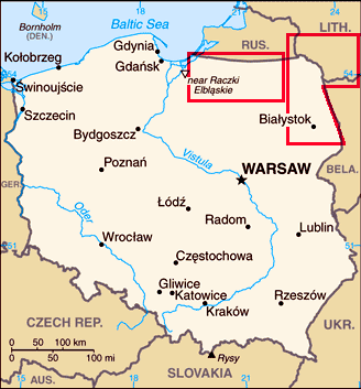
Click
on 2 map regions for details of West
Lithuania and North-east
Poland
We
paused on our journey to visit Kruszyniany village and see the 18th century
Tatar mosque which resembled a wooden church but topped not with an Orthodox
cross but an Islamic crescent. Removing our shoes in accordance with Muslim custom, we entered the prayer hall; normally female worshippers have to
remain secreted in a back room, but exception was made for visitors. We were
welcomed by a young Tatar, who when he discovered we were English, explained in
heavily-accented English that his brother now lived in Chesterfield; he gladly
showed us around the mosque, describing the history of the Tatar settlement in Eastern
Poland and explaining the Islamic traditions. Our travels have brought us into
contact with such a variety of fascinating quirks of history.
After a
further long drive, we camped that night at Augustów, a small town set alongside the Augustów Canal.
This 100km long waterway was constructed in the 19th century, linking natural lakes and rivers
to convey Polish timber to the Baltic ports and avoid the excessive tariffs
imposed by the then German-controlled East Prussia. Nowadays the waterway's
location amid beautiful forested terrain makes it a huge tourist and
water-sports attraction. From the little port of Żeluga Augustów, we took one of
the boat cruises through Lakes Necko, Białe and Studzieniczne and the
interlinking sections of canal. The magnificent silver and grey clouded sky lit
by bright sunlight made for glorious photographic potential, especially as the
boat navigated the passage through the locks (Śluza) at Przewięź (Photo 1 -
Navigating the Przewięź lock on the Augustów Canal). Pope John-Paul II made
the same boat trip in 1999 to the small lakeside sanctuary at Studzieniczne
which adds to the attraction for Polish visitors even today. The weather was
glorious and the lake and forest surroundings spectacular, making this excursion
on the Augustów Canal a relaxing interlude in our travels.
We
continued north to Suwałki along Route 8, the main highway serving the Baltic
Republics and therefore severely rutted by the constant streams of heavy trucks.
The small town of Suwałki was another edge-of-world place but led to the lakes
and forests of the small Wigry National Park. The PTTK campsite at the lakeside
village of
Stary Folwark was a sheer disgrace, but nearby at Tartak we were welcomed by Mrs
Zofia Tarasiewcz at her Agroturystyczne; the peaceful camping area set alongside
Lake Pietry was idyllically rustic (Photo 2 - Lake Pietry in Wigry National Park),
with water drawn from the electrically-pumped well (Photo 3 - rustic camping
at Agroturystyczne Tarasiewicz). Early morning mist cleared to give a
wonderfully sunny morning and we enjoyed a perfect day's walking around the
National Park's way-marked lakeland forested routes (Photo
4 - Forested lake-land walking in the Wigry National Park).
With the pines reflected in the dark waters of the small lakes, we saw tiny Sundew
insectivorous plants where boarded walk-ways crossed the sphagnum
moss and trees gnawed by beavers which build their lodges around the lakes'
edge.
Our plans were to make a 5 day exploratory
visit to western Lithuania as a prelude to next year's full trip to the Baltic
Republics, and just beyond the small market town of Sejny, a quiet road led to
the Ogrodniki border-crossing. The former border-control buildings of the now
open Schengen frontier seemed eerily quiet as we crossed into the Republic of
Lithuania (Lietuvos Respublika) (Photo 5 - Polish~Lithuanian border-crossing at Ogrodniki).
In overcast weather, the countryside seemed grey and dull as we drove
uncertainly towards the small town of Lazdijai. Stopping in the town to get a
feel of this new country, we spent our first Lithuanian lits to top-up our
provisions. It was 1 September and we had noticed smartly dressed school-age
youngsters many carrying posies of flowers; was there a connection between this
clearly being the first day of the new school year, and puzzling official signs
in the supermarket which prevented us buying our first Lithuanian beer. The only
way
to
find out was to enquire in the TIC. Speaking in impressively good English, the
girl in the TIC explained that nationally the start of the new school year was
celebrated as Students' Day on which the sale of alcohol was banned - but we
could buy beer tomorrow, she added reassuringly. We used our first word in
Lithuanian to say
thank you - Ačiū, pronounced as if sneezing; the courteous response was
prošom (you're welcome), but somehow 'Bless you' would have felt more
appropriate. After 10 weeks of becoming accustomed to Polish, never before had
we felt so linguistically isolated: although of ancient Indo-European origins,
Lithuanian and Latvian belong to a Baltic group of dialects quite distinct from
Slavic, and in our brief 5 day stay in the country, we should pick up little of
the language which seemed utterly incomprehensible.
Leaving Lazdijai, we continued through the
forests south of the town on well-surfaced roads to reach Druskininkai to stay
at the spa-town's campsite. Although generally modern and of western layout, the
few Lithuanian campsites we used this year were more expensive than their Polish
equivalents, typically around 60 lits/night (€15), but the restaurant at Camping
Druskininkai, where thankfully both English and Polish were spoken, gave us our
first taste of Švyturys Lithuanian beer. But the miserable rainy weather
persisted; if this was Lithuanian weather, we felt like returning to Poland.
At
Grūtas Park just beyond Druskininkai, Lithuanian millionaire entrepreneur
Viliumas Malinauskas has gathered a collection of Soviet era statues discarded from Lithuanian towns and cities after the 1990 downfall of communism. His
initiative has attracted criticism for insensitively exploiting Lithuanian
suffering under communism to create what is alleged a 'Soviet Disneyland' with
its gathering of statues and other communist memorabilia. There is no disputing
however that this grotesque display represents a curious profile of Lithuania's
albeit tragic history during the second half of the 20th century. All of the
huge statues are set up in hedged enclosures amid parkland, each with a
historical biography in Lithuanian, Russian and English. As we walked
around,
many were instantly recognisable - Marx, Engels, Stalin, with all sizes
and shapes of Lenins including the monumental statue which once dominated Lukiškių Square in Vilnius until unceremonially hauled down in 1991; the
grotesque statue still showed the cracks where the legs were hacked off by
demonstrators unable to detach it from its plinth (Photo 6 - Shaking
hands with Lenin at Grūtas Park of Soviet era statues).
There were statues of the evil-looking Feliks Dzerzhinsky, founder of the Cheka
in 1918, forerunner of the KGB, and many of Lithuanian communist and
revolutionary leaders. The museum was crammed with memorabilia of the communist
era showing the nature of this evil and repressive regime, portraits of Soviet
leaders and displays showing the farce of communist one-candidate elections.
Commercial exploitation or not, like it or not, there was no denying the
historic value of this unique collection which demonstrated the horrendously
destructive folly of communism; the statues which the regime had intended
to glorify these Heroes of the Revolution simply served to show it in its
most ludicrous light.
Visit the Grūtas Park web site
Early
September was clearly the time for picking wild mushrooms and on the drive to
Vilnius, we passed many stalls selling mushrooms gathered from the forests (see
right);
stewed with chopped chicken and onion, they were delicious.
Close to Vilnius, we
turned off the main road through industrial estates and beyond railway
marshalling yards, we eventually found the memorial site of the massacres
committed here deep in the forests between 1941~44 by the German occupiers and
their Lithuanian accomplices. In 1939, the Soviets had invaded Eastern Poland
which then had included Vilnius and in 1941 the Red Army began digging oil
storage pits in the forests. The work was left uncompleted when the Germans
invaded USSR in June 1941, occupying the Baltic States. SS Einsatzgruppen
squads immediately went to work,
supported by Lithuanian
collaborators, rounding up Vilnius' sizeable Jewish population into a ghetto.
This remote area deep in the forests so close to Vilnius provided the perfect
place of execution: Polish intelligentsia including priests, Jews and Soviet
POWs were force-marched out to Paneriai, shot and the bodies buried in the pits.
The systematic killing continued until 1944, with 100,000 shot at Paneriai -
70,000 Jews, 20,000 Poles and 20,000 Russian POWs. This was no sophisticated
killing process here: just march in the victims, kneel them by the pits and
shoot them usually by Lithuanian collaborators with a final shot in the head for
good measure by a German SS officer. As the Red Army approached in 1944, squads
of prisoners were organised to exhume bodies and burn them, burying the ashes
from the pits to hide the evidence of mass murder. Some of these burial squads
managed to escape and join the partisans to survive the war; their evidence gave
testimony of the German war crimes committed here.
The lane
ended at a lonely spot where we
found the Soviet era memorial plaques which record simply Here the Germans
shot 100,000 Soviet citizens; Soviet anti-Semitic policy made no mention of
Jewish victims, and the Soviet obelisk recalls simply The victims of fascist
terror. The small museum was closed on the day of our visit, but a path led
down into the forest to the pits where the mass murders had been committed. Set
in hollows, there was no telling how deep the original pits would have been, but
in the gloomy silent forest, this was an eerily awful place
(Photo 7 - Execution pits at site of Paneriai massacres). Even more sinister was the stone-lined pit with one of the original ladders used
by the corpse squads to exhume the remains of earlier victims for burning. This
was truly a chilling sight. We were glad to drive away from this dreadful place
which had left a searing mark on our recollections: the sheer animal brutality
of the creatures who committed these inhuman barbaric acts here at Paneriai
defies all civilised comprehension.
Vilnius
city traffic was to say the least challenging, but we eventually found our way
up to the City Campsite, guided by the TV Tower on the hilltop where in 1991, as
communist control crumbled under Lithuanian popular assertion of
re-independence, 12 civilians died under Soviet tanks with the Kremlin old
guard's ham-fisted attempt to crush the small republic's coup. The new Vilnius
City Camping was exactly what it appeared, a large car park by an exhibition
centre, but it was securely fenced, the portakabin facilities were fine, and
more importantly it was just a 15 minute bus ride (#11 or #16 trolley bus) to the city centre, with city
maps and bus tickets available from reception. It is also worth noting that,
whatever the guide books say, Lithuania like Latvia and Estonia is in the
Eastern European Time Zone, 2 hours ahead of UK time and 1 hour ahead of Poland, as we belatedly discovered.
The following day we caught the bus into Lithuania's capital city Vilnius, and
standing by the railway station we felt even more bemused than usual with
virtually no understanding of signs or street names. Finding our bearings, we
headed towards the Old Town, passing through the Gate of Dawn, the only
surviving gate-house through the city walls where in the 17th century monks from
the nearby St Theresa's church had built a chapel to house the most revered
of the city's many holy icons, the Madonna of the Gate of Dawn (Photo 8 -Gate of Dawn
leading into Vilnius Old Town and Madonna icon, Aušros vartų Marija).
This was clearly a place of pilgrimage for both Lithuanians and Poles where
visitors knelt in prayer before the silver-plated icon with its slender
fingers splayed in stylised gesture of grace; those passing through the gate
glanced up at the Madonna visible in the arched opening and crossed themselves. A
little further along the street of Aušros vartų, we reached the Church of the Holy
Spirit, one of the oldest Russian Orthodox churches in Lithuania; the incense
filled candle lit interior was dominated by the huge green iconostasis, and in
front the small altar-casket containing the remains of the church's 3 patron
martyrs (Photo 9 - Russian Orthodox Church of Holy Spirit, Vilnius).
These were said to be bishops executed by the pagan Grand Duke Algirdas in 1347 who
in a spirit of
repentance and political expediency, built the chapel here; it makes a good
yarn, and the 3 martyrs looked cosily comfortable tucked up in their purple
shrouds and carpet slippers.
From the city's Town Hall Square (Rotušės
aikštė) with its elegant town houses and street cafés (Photo 10 - Town Hall Square in Vilnius Old Town),
we walked around Vokiečių gatvė, once the heart of Vilnius' thriving pre-war
Jewish community; it's now an elegantly curving boulevard lined with trendy
street cafés, a far cry from its former embodiment. Vilnius' 70,000 Jewish
community was confined initially to 2 ghettoes by the Germans and progressively
rounded up and force-marched to the forests of Paneriai for extermination, aided
and abetted by their anti-Semitic Lithuanian collaborators. During the Soviet
era, the full extent of Jewish suffering in Vilnius was glossed over, with the
'Soviet people' presented as the victims of German terror. Only in the
post-independence 1990s were memorials put up to record the scale of the
Holocaust's impact on Lithuanian Jewry, in the heart of what was the Vilnius
ghetto in the aptly named Žydų gatvė (Jews' Street).
Along Universiteto gatvė, we reached the Presidential Palace (Photo 11 - Presidential Palace in Vilnius, official residence of Lithuania's Head of State),
a soberly plain Neoclassical building with its trio of flag poles bearing the
Lithuanian gold, green and red tricolour. Nearby stood the buildings of Vilnius
University centred around a cluster of quads. Founded in 1589 as a Jesuit
college, it was upgraded to full university status 10 years later. In the early 19th century, when Vilnius as part of Greater Poland withered under
Tsarist rule, it became a hot-bed of radical student nationalism, and was closed
in the wake of the failed 1830 insurrections. It remained closed until Polish
independence after WW1 when it again became one of Poland's leading academic
institutions. It became Lithuanianised after WW2 and managed to survive the
communist era to become the modern country's main centre of learning with over
14,000 students. The arcaded quad of the Grand Courtyard is dominated by the
icing-cake façade of St John's Church, an obscenely
outrageous Baroque
extravaganza which shows its Jesuit origins.
Just beyond, the broad expanse of Cathedral
Square is dominated by Vilnius Cathedral with its separate belfry which
resembles a Baroque lighthouse (Photo 12 - Vilnius Cathedral
in Cathedral Square). The church was
built originally by Grand Duke Jogaila after his conversion to Christianity in
1387 to replace an earlier pagan temple; the Lithuanians were Europe's longest
surviving pagan culture. As the symbolic heart of modern country's Catholicism,
the Cathedral was the natural focus of the mass rallies in the 1990 run-up to
declaration of independence from USSR, and in January 1991, the coffins of the
12 demonstrators killed by Soviet tanks at the TV Tower were laid out on the
flagstones of Cathedral Square draped in the Lithuanian tricolour at a memorial
service which united Lithuanians in defiance of the occupying Soviets.
Lithuania declared independence shortly after, the first Soviet republic to do
so. Just around the corner is the statue of another Lithuanian hero, Grand Duke
Gediminas the 13th century legendary founder of Vilnius.
Running west from Cathedral Square, the broad
boulevard of Gedimino Prospektas is Vilnius' main shopping and commercial
street; on the day of our visit, it was crowded with local people attending a
weekend festival, creating a real carnival atmosphere. We worked our way along
through the crowds to find the huge and forbiddingly grey Neoclassical
building at no 40 Gedimino Prospektas. Some buildings attract infamy: during WW2
it had been occupied by the Gestapo, and for the 40 years of communism it had
been the HQ of Lithuania's KGB, and the lower courses of the building's
stonework are now engraved with the names of KGB victims who had been
imprisoned, tortured or executed in the building's basement. Its rooms
structurally unchanged since the KGB occupants moved out, this grim building now
houses the Museum of Genocide Victims, opened in late 1992. Its displays deal
with the painful mid~late 20th century history of Lithuania: Soviet occupation
1939~41, German occupation 1941~44, and even more repressive Soviet occupation
1944~91, with loss of independence and brutal deportations and repression at
Soviet hands even more destructive of human life than under the Germans. Further
displays showed partisan resistance to Soviet rule, conditions in prisons and
labour camps and mass deportations. Particularly chilling was the basement where
the KGB cells and torture rooms had been preserved intact; but worst of all,
buried deep beneath the exercise yard were the execution chambers where 1000s of
KGB victims were disposed of. In this claustrophobic, confined underground
space, it was a thoroughly frightening experience just standing there. It was a
relief when closing time came and we rushed to get out of this evil place and
push open the heavy door to escape out into the street, return to the happy
sounds of people enjoying the festival in Gedimino Prospektas, and catch our bus
back out to the campsite. Just like the Runde Ecke Stasi Museum in Leipzig, this
is not a place for the faint hearted.
Museum of Genocide Victims web site
Early
mist obscuring the TV Tower on the hill above Vilnius City Camping quickly
cleared as we set off westwards towards Trakai to visit the castle there. On a
sunny early autumn Sunday morning, the lakeside village and castle were clearly
a popular outings for Vilnians. Along with Vilnius, Trakai was one of the
earliest military strongholds,
built by Grand Duke Gediminas when the Lithuanian tribes were unified in the
14th century into something resembling a state. The impregnable castle at Trakai
built on an island in the lake was the birthplace of Gediminas' grandson
Vytautas the Great under whom medieval Lithuania reached its apogee in the 15th
century. The medieval island castle 500m off-shore had fallen into ruins
and was rebuilt by the Lithuanians in 1962 as a iconic symbol of Lithuanian
national pride, much to the chagrin of Moscow and Khrushchev in particular. With
its brick-built walls, turrets and huge central keep, it certainly made an
attractive sight lit by the bright afternoon sunshine across the water as we
walked across the footbridge (Photo 13 - Grand Duke Vytautas' Castle at Trakai
lake).
Tonight's campsite, Harmonie Camping buried deep
in the pine forests near the remote village of Rūdiškės, had been recommended to
us by Barry and Margaret Williamson whose own epic world-wide travelling
exploits are described on their website
MagBaz Travels. Approached by a 3 km long unsurfaced lane, Harmonie Camping
is set in a clearing amid the pine forests; here we were greeted affably by the
Dutch ex-pat owner Mr Wim Brawns who reputedly was a professional footballer,
coach to the Lithuanian Olympic cycling team, and who regularly runs his guests
from the campsite to the station at Rūdiškės to catch the train into
Vilnius. His hard work over the years in turning a rough forest clearing into a
beautifully landscaped perfect green oasis of tranquillity clearly showed. It
truly merited the name Harmonie; the only sound was that of woodpeckers among
the pine trees. We gladly settled in for a day's break at what certainly merits
the accolade of Campsite of the Trip, and indeed one of the finest campsites we
have ever stayed at in many years of travelling (Photo 14 - Camping Harmonie in the pine forests of Lithuania).
On our final day in Lithuania, we drove westwards
through Marijampole to turn off at Kalvarija to the tiny village of Vištytis
which is set on the shore of a lake which marks the border with the Russian
Oblast of Kaliningrad. This enclave of former German East
Prussia was seized and
retained by the Soviets at the end of WW2 because of its strategic
position on the Baltic coast, and now forms
the westernmost part of the Russian
Federation, isolated with no land connection to the rest of Russia. Surrounded
as it is by EU member states, the Kaliningrad Oblast is a politically sensitive
area with only 3 border crossings and for some years after the fall of the
Soviet Union, Kaliningrad Oblast was one the most militarized areas of the Russian
Federation. Recent Russian proposals for visa-free travel between the EU and
Kaliningrad have so far been rejected by the EU. On arriving at Vištytis, we
walked down the lakeside lane which the map suggested led to the Russian border;
here a shock awaited us. At the anticipated border-post, the lane was totally
sealed not just by an electrified doubled row of barbed wire, but a solid 8 feet
high metal fence to prevent prying eyes peering across (Photo
15 - Sealed border between Lithuania and the Russian Oblast of Kaliningrad). What
was even worse were the several impoverished-looking cottages on the Lithuanian
side just 30 feet away from this barrier with its Cold War atmosphere. This was
for us a spooky experience standing alongside such an inhospitable sealed
border. We were to spend the next week moving along this largely sealed
frontier, a novel but intriguing experience for those used to the freedom of
open borders. That night we camped on the eastern shore of the lake and watched
a glorious sunset across towards the Russian side (Photo 16 - Sunset over Lake Vištytis and Russian enclave of Kaliningrad).
The
following morning, we re-crossed into Poland; as always in returning from an
'outreach' country, it felt like 'coming home', and at the open-border, we
changed our remaining Lithuanian lits into Polish złotys. Turning off northwards,
we passed
through farming villages where the school bus was dropping off the children, and
just beyond Wiżajny we reached the politico-geographical point where the borders
of the 3 countries, Poland, Lithuania and the Russian Oblast of Kaliningrad,
met. 100m from the road, a marble obelisk marked the junction of the 3 borders,
Trójstyk granic
(see left). A sign gave dire warnings about all the things you were forbidden to
do at the border, including photography, but even the border guard showed no
interest as we took our photos. The Polish~Russian border was separated by a fenced wide 'no man's land', but in the corner, a gap allowed us to step
through into the dense woodland on the Russian side (see right). The fencing
between Russian~Lithuanian territory was a fearsome tangle of barbed
wire; it was all curiously eerie, reflecting the sensitive relations between
Russia and the EU states. A short
distance further brought us to the village of Żytkiejmy, and we followed a lane which the map showed
leading to the Russian
border. Dogs barked and cattle lowed as if to say 'Don't go down there'. But we
did, and 400m along the lane was completely blocked by a red and white barrier
with the Polish Granica Państwa (national border) sign. This was without
question a 'No through road' with nothing but inhospitable forest on the Russian
side. Again we took our photos at this eerie spot where 2 alienated worlds
collided, and returned safely into Poland before we provoked a border incident (Photo 17 - Sealed Polish~Russian border at village of Żytkiejmy)
A few kms from the border, we turned off over
wooded hilly country to find another local curiosity near the hamlet of
Stańczyki, 2 massive railway viaducts dating from the early 20th century German
control of East Prussia. The viaducts, standing side by side and built of
reinforced concrete 200m long with five 36m high arches, each supported a single
railway line and spanned the wide Błędzianka valley. Stańczyki had been located
on the border of East Prussia and Poland, and in 1910 the Germans had
constructed a railway line to transport timber; a second viaduct was built later
to cope with increased rail traffic, but the lines fell into disuse before WW2.
The viaducts survive, but the railway lines have long gone along with East
Prussia. Today the twin viaducts still tower impressively above the valley and
you can clamber up to walk across the top of them (Photo 18 - Former Prussian railway viaducts at Stańczyki).
Further west, the Mazurian Lakes are one of
Poland's most popular tourist regions; sparsely populated and covered with dense
forests, the landscape was carved out by retreating glaciers in the last Ice Age
forming 1000s of lakes. Our reason was visiting the area was to see man-made
remains from more recent times. Just before WW1, the East Prussian Germans
began constricting the Mazurian Canal, to connect Lake Mamry via a series of
rivers and lakes to the Baltic coast at what was then Königsberg, now
Kaliningrad. 10 giants locks were planned to overcome the height difference of
111m along the canal's course. The project was never completed but 2 of the
unfinished massive concrete locks survive, one still showing the remains of the
Nazi eagle emblem, along with part of the canal remains. Nearby are the remains
of the Mauerwald complex of massive reinforced concrete bunkers, the command HQ
of the Wehrmacht's general staff in planning and executing the 1941
invasion of USSR hidden on the forests of the Mazurian lakes. The complex of
some 30 camouflaged bunkers with walls 7m thick had been abandoned as the Red
Army approached in January 1945 and taken intact.
8 kms from the former East Prussian town of
Rastenburg, now Polish Kętrzyn, we reached the Wolfsschanze (Wolf's Lair),
Hitler's WW2 military HQ where he skulked for over 3 years, conducting the
eastern front war until his final withdrawal in late 1944. The complex with its
own airfield and railway station occupied some 2.5 square miles surrounded by
security zones and guarded by huge numbers of security troops. The central
bunkers accommodated Hitler's entourage of cronies, Göring, Bormann, Himmler,
Speer, Ribbentrop and military leaders Keitel and Jodl. As the Red Army
approached, tons of explosives were used in an attempt to destroy the complex;
the 8m thick steel-reinforced concrete bunker walls though badly damaged
were left almost intact. The minefields surrounding the complex were so
extensive that it took until 1956 finally to clear them with some 55,000 mines
defused or detonated by Polish mine clearance troops. This sobering site now attracts
coach loads of German tourists who flock here to see where their erstwhile führer conducted the war which cost so many lives and so much suffering. Despite
the fact that the place reeked of evil, we like others
were drawn by salacious curiosity and followed the route around the site, peering
into the damaged bunkers; inevitably the monumental bunker occupied by Hitler
attracted most attention. The northern side was almost intact but the rear was in
total ruins from the 1944 attempts to destroy the complex, with broken slabs of
massive concrete and projecting steel reinforcing bars.
Further round, we found the bunker occupied by Göring where the force of the
explosions had lifted the 7m thick roof leaving a gap around the walls;
hesitantly we ventured inside the ruined bunkers by the light of our lamps (Photo
19 - The Wolf's Lair, Hitler's WW2 bunker-complex).
One
of the most poignant sites at the Wolf's Lair were the ruined remains of the
conference room where in July 1944 von Stauffenberg's briefcase bomb had come
within an ace of assassinating Hitler. From 1942, failures on the eastern front
and the appalling atrocities and genocide committed in occupied territories had
alienated aristocratic high ranking German army officers; as the war turned
against Germany, a plot was formed to assassinate Hitler and sue for peace with
the Allies. Von Stauffenberg had access to the Führer HQ and used the
opportunity of a military briefing with Hitler to place his briefcase bomb by
the leg of the conference table. Unfortunately another officer moved the
briefcase beyond the heavy table leg and although the explosion wrecked the
building killing others, Hitler was unwounded. Von Stauffenberg escaped by plane
to Berlin but the plot was doomed; in a viciously ruthless roundup, von Stauffenberg and 5,000 others were executed, in the process eliminating many who
might have been qualified to run the post-war German government. Had the plot
succeeded, the outcome of the war and European history might have been so
different: 5 million lives might have been spared, the devastation to Poland
avoided along with communist control of Eastern Europe. As it was, Hitler became
even more paranoid in his conduct of the failing eastern campaign and the war
ground on to its destructive conclusion with Stalin overrunning the whole of
Eastern Europe. A plaque at the ruins of the conference room destroyed by von Stauffenberg's bomb recalled the failed plot (Photo 20 - Site of von Stauffenberg's
bomb plot to assassinate Hitler).
After a long and tiring day, it would have made
sense to find somewhere nearby to camp, but some feeling made us want to put
distance between where we camped that night and this dreadful place. Almost
ashamed that we too had been drawn here, and sickened by the sense of evil
presence that still pervaded the place, we hastened away from the Wolf's Lair.
After a night's camp on the shores of Lake
Niegnocin, we continued westwards over rolling countryside to reach the village
of Święta Lipka, site of
Poland's most famous Baroque Marian shrine church.
Although an out-of-the-way place, at times of religious festivals it would be
thronged with pilgrims such is the Polish Catholic fervour even in a secular
age. The village name means 'Holy Lime Tree' derived from a medieval legend of a
statue of the Virgin carved from lime wood and associated with healing miracles. A
chapel built at this place was later replaced by the present Baroque church, its
ceilings covered with elaborate frescoes. But the church's piece de
resistance is its renowned Baroque organ, a massive and fantastically ornate
instrument which fills the entire upper west end, decked with 2 layers of blue
and gilded turrets and topped with figures of the saints. A recital is given
several times each day to demonstrate the organ's flamboyant performance.
The church filled with Polish tourists and after a brief introduction from a
priest, the performance began with a medley of
'popular-pieces-you-all-love-to-hear', but suddenly the mammoth instrument
came alive with all the gilded figures moving like a gigantic fairground organ:
bells jangled, little windmills turned, saints bowed and crossed themselves, and
trumpet-blowing cherubs sounded their saintly sonorous trumpets. It was a vivid
fusion of the artistic and outrageously comical. We watched with wonder at this
musical extravaganza; it was magnificently entertaining, but with all the
church's Catholic graven images it seemed wantonly irreligiously to us soberly
sullen protestants (Photo 21 - Baroque organ
at Święta Lipka Marian shrine church).
We
camped that night close to the former Prussian city of Olsztyn on a
heath-covered hilltop overlooking Lake Ukiel before moving on to the small
Baltic coastal port of Frombork. The mighty fortress walls of the town's
cathedral complex high on a hilltop reared up like a medieval castle. The little
port's chief claim to fame however is that Nicolaus Copernicus (Mikołaj Kopernik),
the medieval astronomer and arch-Renaissance-man, spent the latter 30 years of
his life as a canon of the Frombork Cathedral chapter. It was here that he
conducted the empirical research which led to the publication of his seminal
treatise de Revolutionibus Orbium Caelestium (On the Revolutions of the
Heavenly Spheres) which refuted the church-approved Ptolemaic assumption that
the sun revolved around the earth. Copernicus incurred papal displeasure with
his
heliocentric assertion that in fact the sun was the centre of the solar
system with the earth and other planets following circular orbits around it. The
work inevitably was banned by the Catholic church and was eagerly published by
Lutheran printers in Nuremberg in 1543, the year of Copernicus' death. The
Bishop's Palace at Frombork now houses a museum on the life and work of
Copernicus, displaying a selection of the polymath's writings including treatises
on surgery, anatomy, law and architecture and a 1566 edition of his astronomical
work (Photo 22 - 1566 edition of Copernicus' treatise de Revolutionibus Orbium Caelestium).
The terrace atop the Belfry Tower gave a magnificent panorama looking across the
town and Cathedral and our first view this trip of the Baltic Sea (Photo 23 - Frombork Cathedral and our first
view of distant Baltic coastline).
After having stood at several sealed sections of the border with Russia earlier
in the week, we wanted, while in this area, to drive out beyond Braniewo to see
one of the 3 border-crossings into the Russian Oblast of Kaliningrad. Just
beyond Gronowo, the last village in Poland along this stretch of road, the
frontier barriers appeared ahead. Russian registered cars sped past us as we
paused there to take a surreptitious photo, before turning back safely into
Poland (Photo 24 - Polish
border-crossing into the Russian Oblast of Kaliningrad at Gronowo).
This had been another fullsome two weeks of travelling,
taking us into the neighbouring Baltic state of Lithuania and along the
borderlands with the seemingly xenophobic Russian enclave of Kaliningrad. During
our last 2 weeks on Poland, we shall explore sand spits and dunes of the Baltic coastline and visit the
great port city of Gdansk where ship-yard workers' protests organised by Solidarity, the first independent trade union in
any of the former Eastern bloc countries, contributed to the downfall of
communism and emergence of the new democratic Poland in 1991. This will be a
fitting climax to what has been a challenging trip but one packed full of
learning and discovery.

 CAMPING
IN POLAND 2010 - Western Lithuania, NE Poland and borderlands with the Russian
Oblast of Kaliningrad:
CAMPING
IN POLAND 2010 - Western Lithuania, NE Poland and borderlands with the Russian
Oblast of Kaliningrad:
 We
paused on our journey to visit Kruszyniany village and see the 18th century
Tatar mosque which resembled a wooden church but topped not with an Orthodox
cross but an Islamic crescent. Removing our shoes in accordance with Muslim custom, we entered the prayer hall; normally female worshippers have to
remain secreted in a back room, but exception was made for visitors. We were
welcomed by a young Tatar, who when he discovered we were English, explained in
heavily-accented English that his brother now lived in Chesterfield; he gladly
showed us around the mosque, describing the history of the Tatar settlement in Eastern
Poland and explaining the Islamic traditions. Our travels have brought us into
contact with such a variety of fascinating quirks of history.
We
paused on our journey to visit Kruszyniany village and see the 18th century
Tatar mosque which resembled a wooden church but topped not with an Orthodox
cross but an Islamic crescent. Removing our shoes in accordance with Muslim custom, we entered the prayer hall; normally female worshippers have to
remain secreted in a back room, but exception was made for visitors. We were
welcomed by a young Tatar, who when he discovered we were English, explained in
heavily-accented English that his brother now lived in Chesterfield; he gladly
showed us around the mosque, describing the history of the Tatar settlement in Eastern
Poland and explaining the Islamic traditions. Our travels have brought us into
contact with such a variety of fascinating quirks of history. After a
further long drive, we camped that night at Augustów, a small town set alongside the Augustów Canal.
This 100km long waterway was constructed in the 19th century, linking natural lakes and rivers
to convey Polish timber to the Baltic ports and avoid the excessive tariffs
imposed by the then German-controlled East Prussia. Nowadays the waterway's
location amid beautiful forested terrain makes it a huge tourist and
water-sports
After a
further long drive, we camped that night at Augustów, a small town set alongside the Augustów Canal.
This 100km long waterway was constructed in the 19th century, linking natural lakes and rivers
to convey Polish timber to the Baltic ports and avoid the excessive tariffs
imposed by the then German-controlled East Prussia. Nowadays the waterway's
location amid beautiful forested terrain makes it a huge tourist and
water-sports attraction. From the little port of Żeluga Augustów, we took one of
the boat cruises through Lakes Necko, Białe and Studzieniczne and the
interlinking sections of canal. The magnificent silver and grey clouded sky lit
by bright sunlight made for glorious photographic potential, especially as the
boat navigated the passage through the locks (Śluza) at Przewięź (Photo 1 -
Navigating the Przewięź lock on the Augustów Canal). Pope John-Paul II made
the same boat trip in 1999 to the small lakeside sanctuary at Studzieniczne
which adds to the attraction for Polish visitors even today. The weather was
glorious and the lake and forest surroundings spectacular, making this excursion
on the Augustów Canal a relaxing interlude in our travels.
attraction. From the little port of Żeluga Augustów, we took one of
the boat cruises through Lakes Necko, Białe and Studzieniczne and the
interlinking sections of canal. The magnificent silver and grey clouded sky lit
by bright sunlight made for glorious photographic potential, especially as the
boat navigated the passage through the locks (Śluza) at Przewięź (Photo 1 -
Navigating the Przewięź lock on the Augustów Canal). Pope John-Paul II made
the same boat trip in 1999 to the small lakeside sanctuary at Studzieniczne
which adds to the attraction for Polish visitors even today. The weather was
glorious and the lake and forest surroundings spectacular, making this excursion
on the Augustów Canal a relaxing interlude in our travels. We
continued north to Suwałki along Route 8, the main highway serving the Baltic
Republics and therefore severely rutted by the constant streams of heavy trucks.
The small town of Suwałki was another edge-of-world place but led to the lakes
and forests of the small Wigry National Park. The PTTK campsite at the lakeside
village of
We
continued north to Suwałki along Route 8, the main highway serving the Baltic
Republics and therefore severely rutted by the constant streams of heavy trucks.
The small town of Suwałki was another edge-of-world place but led to the lakes
and forests of the small Wigry National Park. The PTTK campsite at the lakeside
village of Stary Folwark was a sheer disgrace, but nearby at Tartak we were welcomed by Mrs
Zofia Tarasiewcz at her Agroturystyczne; the peaceful camping area set alongside
Lake Pietry was idyllically rustic (Photo 2 - Lake Pietry in Wigry National Park),
with water drawn from the electrically-pumped well (Photo 3 - rustic camping
at Agroturystyczne Tarasiewicz). Early morning mist cleared to give a
wonderfully sunny morning and we enjoyed a perfect day's walking around the
National Park's way-marked lakeland forested routes (Photo
4 - Forested lake-land walking in the Wigry National Park).
With the pines reflected in the dark waters of the small lakes, we saw tiny Sundew
insectivorous plants where boarded walk-ways crossed the sphagnum
moss and trees gnawed by beavers which build their lodges around the lakes'
edge.
Stary Folwark was a sheer disgrace, but nearby at Tartak we were welcomed by Mrs
Zofia Tarasiewcz at her Agroturystyczne; the peaceful camping area set alongside
Lake Pietry was idyllically rustic (Photo 2 - Lake Pietry in Wigry National Park),
with water drawn from the electrically-pumped well (Photo 3 - rustic camping
at Agroturystyczne Tarasiewicz). Early morning mist cleared to give a
wonderfully sunny morning and we enjoyed a perfect day's walking around the
National Park's way-marked lakeland forested routes (Photo
4 - Forested lake-land walking in the Wigry National Park).
With the pines reflected in the dark waters of the small lakes, we saw tiny Sundew
insectivorous plants where boarded walk-ways crossed the sphagnum
moss and trees gnawed by beavers which build their lodges around the lakes'
edge. to
find out was to enquire in the TIC. Speaking in impressively good English, the
girl in the TIC explained that nationally the start of the new school year was
celebrated as Students' Day on which the sale of alcohol was banned - but we
could buy beer tomorrow, she added reassuringly. We used our first word in
Lithuanian to say
to
find out was to enquire in the TIC. Speaking in impressively good English, the
girl in the TIC explained that nationally the start of the new school year was
celebrated as Students' Day on which the sale of alcohol was banned - but we
could buy beer tomorrow, she added reassuringly. We used our first word in
Lithuanian to say thank you - Ačiū, pronounced as if sneezing; the courteous response was
prošom (you're welcome), but somehow 'Bless you' would have felt more
appropriate. After 10 weeks of becoming accustomed to Polish, never before had
we felt so linguistically isolated: although of ancient Indo-European origins,
Lithuanian and Latvian belong to a Baltic group of dialects quite distinct from
Slavic, and in our brief 5 day stay in the country, we should pick up little of
the language which seemed utterly incomprehensible.
thank you - Ačiū, pronounced as if sneezing; the courteous response was
prošom (you're welcome), but somehow 'Bless you' would have felt more
appropriate. After 10 weeks of becoming accustomed to Polish, never before had
we felt so linguistically isolated: although of ancient Indo-European origins,
Lithuanian and Latvian belong to a Baltic group of dialects quite distinct from
Slavic, and in our brief 5 day stay in the country, we should pick up little of
the language which seemed utterly incomprehensible.
 At
Grūtas Park just beyond Druskininkai, Lithuanian millionaire entrepreneur
Viliumas Malinauskas has gathered a collection of Soviet era statues discarded from Lithuanian towns and cities after the 1990 downfall of communism. His
initiative has attracted criticism for insensitively exploiting Lithuanian
suffering under communism to create what is alleged a 'Soviet Disneyland' with
its gathering of statues and other communist memorabilia. There is no disputing
however that this grotesque display represents a curious profile of Lithuania's
albeit tragic history during the second half of the 20th century. All of the
huge statues are set up in hedged enclosures amid parkland, each with a
historical biography in Lithuanian, Russian and English. As we walked
around,
At
Grūtas Park just beyond Druskininkai, Lithuanian millionaire entrepreneur
Viliumas Malinauskas has gathered a collection of Soviet era statues discarded from Lithuanian towns and cities after the 1990 downfall of communism. His
initiative has attracted criticism for insensitively exploiting Lithuanian
suffering under communism to create what is alleged a 'Soviet Disneyland' with
its gathering of statues and other communist memorabilia. There is no disputing
however that this grotesque display represents a curious profile of Lithuania's
albeit tragic history during the second half of the 20th century. All of the
huge statues are set up in hedged enclosures amid parkland, each with a
historical biography in Lithuanian, Russian and English. As we walked
around,
 many were instantly recognisable - Marx, Engels, Stalin, with all sizes
and shapes of Lenins including the monumental statue which once dominated Lukiškių Square in Vilnius until unceremonially hauled down in 1991; the
grotesque statue still showed the cracks where the legs were hacked off by
demonstrators unable to detach it from its plinth (Photo 6 - Shaking
hands with Lenin at Grūtas Park of Soviet era statues).
There were statues of the evil-looking Feliks Dzerzhinsky, founder of the Cheka
in 1918, forerunner of the KGB, and many of Lithuanian communist and
revolutionary leaders. The museum was crammed with memorabilia of the communist
era showing the nature of this evil and repressive regime, portraits of Soviet
leaders and displays showing the farce of communist one-candidate elections.
Commercial exploitation or not, like it or not, there was no denying the
historic value of this unique collection which demonstrated the horrendously
destructive folly of communism; the statues which the regime had intended
to glorify these Heroes of the Revolution simply served to show it in its
most ludicrous light.
many were instantly recognisable - Marx, Engels, Stalin, with all sizes
and shapes of Lenins including the monumental statue which once dominated Lukiškių Square in Vilnius until unceremonially hauled down in 1991; the
grotesque statue still showed the cracks where the legs were hacked off by
demonstrators unable to detach it from its plinth (Photo 6 - Shaking
hands with Lenin at Grūtas Park of Soviet era statues).
There were statues of the evil-looking Feliks Dzerzhinsky, founder of the Cheka
in 1918, forerunner of the KGB, and many of Lithuanian communist and
revolutionary leaders. The museum was crammed with memorabilia of the communist
era showing the nature of this evil and repressive regime, portraits of Soviet
leaders and displays showing the farce of communist one-candidate elections.
Commercial exploitation or not, like it or not, there was no denying the
historic value of this unique collection which demonstrated the horrendously
destructive folly of communism; the statues which the regime had intended
to glorify these Heroes of the Revolution simply served to show it in its
most ludicrous light.
 Early
September was clearly the time for picking wild mushrooms and on the drive to
Vilnius, we passed many stalls selling mushrooms gathered from the forests (see
right);
stewed with chopped chicken and onion, they were delicious.
Early
September was clearly the time for picking wild mushrooms and on the drive to
Vilnius, we passed many stalls selling mushrooms gathered from the forests (see
right);
stewed with chopped chicken and onion, they were delicious. supported by Lithuanian
collaborators, rounding up Vilnius' sizeable Jewish population into a ghetto.
This remote area deep in the forests so close to Vilnius provided the perfect
place of execution: Polish intelligentsia including priests, Jews and Soviet
POWs were force-marched out to Paneriai, shot and the bodies buried in the pits.
The systematic killing continued until 1944, with 100,000 shot at Paneriai -
70,000 Jews, 20,000 Poles and 20,000 Russian POWs. This was no sophisticated
killing process here: just march in the victims, kneel them by the pits and
shoot them usually by Lithuanian collaborators with a final shot in the head for
good measure by a German SS officer. As the Red Army approached in 1944, squads
of prisoners were organised to exhume bodies and burn them, burying the ashes
from the pits to hide the evidence of mass murder. Some of these burial squads
managed to escape and join the partisans to survive the war; their evidence gave
testimony of the German war crimes committed here.
supported by Lithuanian
collaborators, rounding up Vilnius' sizeable Jewish population into a ghetto.
This remote area deep in the forests so close to Vilnius provided the perfect
place of execution: Polish intelligentsia including priests, Jews and Soviet
POWs were force-marched out to Paneriai, shot and the bodies buried in the pits.
The systematic killing continued until 1944, with 100,000 shot at Paneriai -
70,000 Jews, 20,000 Poles and 20,000 Russian POWs. This was no sophisticated
killing process here: just march in the victims, kneel them by the pits and
shoot them usually by Lithuanian collaborators with a final shot in the head for
good measure by a German SS officer. As the Red Army approached in 1944, squads
of prisoners were organised to exhume bodies and burn them, burying the ashes
from the pits to hide the evidence of mass murder. Some of these burial squads
managed to escape and join the partisans to survive the war; their evidence gave
testimony of the German war crimes committed here. The lane
ended at a lonely spot where we
found the Soviet era memorial plaques which record simply Here the Germans
shot 100,000 Soviet citizens; Soviet anti-Semitic policy made no mention of
Jewish victims, and the Soviet obelisk recalls simply The victims of fascist
terror. The small museum was closed on the day of our visit, but a path led
down into the forest to the pits where the mass murders had been committed. Set
in hollows, there was no telling how deep the original pits would have been, but
in the gloomy silent forest, this was an eerily awful place
(Photo 7 - Execution pits at site of Paneriai massacres). Even more sinister was the stone-lined pit with one of the original ladders used
by the corpse squads to exhume the remains of earlier victims for burning. This
was truly a chilling sight. We were glad to drive away from this dreadful place
which had left a searing mark on our recollections: the sheer animal brutality
of the creatures who committed these inhuman barbaric acts here at Paneriai
defies all civilised comprehension.
The lane
ended at a lonely spot where we
found the Soviet era memorial plaques which record simply Here the Germans
shot 100,000 Soviet citizens; Soviet anti-Semitic policy made no mention of
Jewish victims, and the Soviet obelisk recalls simply The victims of fascist
terror. The small museum was closed on the day of our visit, but a path led
down into the forest to the pits where the mass murders had been committed. Set
in hollows, there was no telling how deep the original pits would have been, but
in the gloomy silent forest, this was an eerily awful place
(Photo 7 - Execution pits at site of Paneriai massacres). Even more sinister was the stone-lined pit with one of the original ladders used
by the corpse squads to exhume the remains of earlier victims for burning. This
was truly a chilling sight. We were glad to drive away from this dreadful place
which had left a searing mark on our recollections: the sheer animal brutality
of the creatures who committed these inhuman barbaric acts here at Paneriai
defies all civilised comprehension. Vilnius
city traffic was to say the least challenging, but we eventually found our way
up to the City Campsite, guided by the TV Tower on the hilltop where in 1991, as
communist control crumbled under Lithuanian popular assertion of
re-independence, 12 civilians died under Soviet tanks with the Kremlin old
guard's ham-fisted attempt to crush the small republic's coup. The new Vilnius
City Camping was exactly what it appeared, a large car park by an exhibition
centre, but it was securely fenced, the portakabin facilities were fine, and
more importantly it was just a 15 minute bus ride (#11 or #16 trolley bus) to the city centre, with city
maps and bus tickets available from reception. It is also worth noting that,
whatever the guide books say, Lithuania like Latvia and Estonia is in the
Eastern European Time Zone, 2 hours ahead of UK time and 1 hour ahead of Poland, as we belatedly discovered.
Vilnius
city traffic was to say the least challenging, but we eventually found our way
up to the City Campsite, guided by the TV Tower on the hilltop where in 1991, as
communist control crumbled under Lithuanian popular assertion of
re-independence, 12 civilians died under Soviet tanks with the Kremlin old
guard's ham-fisted attempt to crush the small republic's coup. The new Vilnius
City Camping was exactly what it appeared, a large car park by an exhibition
centre, but it was securely fenced, the portakabin facilities were fine, and
more importantly it was just a 15 minute bus ride (#11 or #16 trolley bus) to the city centre, with city
maps and bus tickets available from reception. It is also worth noting that,
whatever the guide books say, Lithuania like Latvia and Estonia is in the
Eastern European Time Zone, 2 hours ahead of UK time and 1 hour ahead of Poland, as we belatedly discovered.
 repentance and political expediency, built the chapel here; it makes a good
yarn, and the 3 martyrs looked cosily comfortable tucked up in their purple
shrouds and carpet slippers.
repentance and political expediency, built the chapel here; it makes a good
yarn, and the 3 martyrs looked cosily comfortable tucked up in their purple
shrouds and carpet slippers.
 outrageous Baroque
extravaganza which shows its Jesuit origins.
outrageous Baroque
extravaganza which shows its Jesuit origins. Running west from Cathedral Square, the broad
boulevard of Gedimino Prospektas is Vilnius' main shopping and commercial
street; on the day of our visit, it was crowded with local people attending a
weekend festival, creating a real carnival atmosphere. We worked our way along
through the crowds to find the huge and forbiddingly grey
Running west from Cathedral Square, the broad
boulevard of Gedimino Prospektas is Vilnius' main shopping and commercial
street; on the day of our visit, it was crowded with local people attending a
weekend festival, creating a real carnival atmosphere. We worked our way along
through the crowds to find the huge and forbiddingly grey Neoclassical
building at no 40 Gedimino Prospektas. Some buildings attract infamy: during WW2
it had been occupied by the Gestapo, and for the 40 years of communism it had
been the HQ of Lithuania's KGB, and the lower courses of the building's
stonework are now engraved with the names of KGB victims who had been
imprisoned, tortured or executed in the building's basement. Its rooms
structurally unchanged since the KGB occupants moved out, this grim building now
houses the Museum of Genocide Victims, opened in late 1992. Its displays deal
with the painful mid~late 20th century history of Lithuania: Soviet occupation
1939~41, German occupation 1941~44, and even more repressive Soviet occupation
1944~91, with loss of independence and brutal deportations and repression at
Soviet hands even more destructive of human life than under the Germans. Further
displays showed partisan resistance to Soviet rule, conditions in prisons and
labour camps and mass deportations. Particularly chilling was the basement where
the KGB cells and torture rooms had been preserved intact; but worst of all,
buried deep beneath the exercise yard were the execution chambers where 1000s of
KGB victims were disposed of. In this claustrophobic, confined underground
space, it was a thoroughly frightening experience just standing there. It was a
relief when closing time came and we rushed to get out of this evil place and
push open the heavy door to escape out into the street, return to the happy
sounds of people enjoying the festival in Gedimino Prospektas, and catch our bus
back out to the campsite. Just like the Runde Ecke Stasi Museum in Leipzig, this
is not a place for the faint hearted.
Neoclassical
building at no 40 Gedimino Prospektas. Some buildings attract infamy: during WW2
it had been occupied by the Gestapo, and for the 40 years of communism it had
been the HQ of Lithuania's KGB, and the lower courses of the building's
stonework are now engraved with the names of KGB victims who had been
imprisoned, tortured or executed in the building's basement. Its rooms
structurally unchanged since the KGB occupants moved out, this grim building now
houses the Museum of Genocide Victims, opened in late 1992. Its displays deal
with the painful mid~late 20th century history of Lithuania: Soviet occupation
1939~41, German occupation 1941~44, and even more repressive Soviet occupation
1944~91, with loss of independence and brutal deportations and repression at
Soviet hands even more destructive of human life than under the Germans. Further
displays showed partisan resistance to Soviet rule, conditions in prisons and
labour camps and mass deportations. Particularly chilling was the basement where
the KGB cells and torture rooms had been preserved intact; but worst of all,
buried deep beneath the exercise yard were the execution chambers where 1000s of
KGB victims were disposed of. In this claustrophobic, confined underground
space, it was a thoroughly frightening experience just standing there. It was a
relief when closing time came and we rushed to get out of this evil place and
push open the heavy door to escape out into the street, return to the happy
sounds of people enjoying the festival in Gedimino Prospektas, and catch our bus
back out to the campsite. Just like the Runde Ecke Stasi Museum in Leipzig, this
is not a place for the faint hearted.
 Early
mist obscuring the TV Tower on the hill above Vilnius City Camping quickly
cleared as we set off westwards towards Trakai to visit the castle there. On a
sunny early autumn Sunday morning, the lakeside village and castle were clearly
a popular outings for Vilnians. Along with Vilnius, Trakai was one of the
earliest military strongholds,
Early
mist obscuring the TV Tower on the hill above Vilnius City Camping quickly
cleared as we set off westwards towards Trakai to visit the castle there. On a
sunny early autumn Sunday morning, the lakeside village and castle were clearly
a popular outings for Vilnians. Along with Vilnius, Trakai was one of the
earliest military strongholds, built by Grand Duke Gediminas when the Lithuanian tribes were unified in the
14th century into something resembling a state. The impregnable castle at Trakai
built on an island in the lake was the birthplace of Gediminas' grandson
Vytautas the Great under whom medieval Lithuania reached its apogee in the 15th
century. The medieval island castle 500m off-shore had fallen into ruins
and was rebuilt by the Lithuanians in 1962 as a iconic symbol of Lithuanian
national pride, much to the chagrin of Moscow and Khrushchev in particular. With
its brick-built walls, turrets and huge central keep, it certainly made an
attractive sight lit by the bright afternoon sunshine across the water as we
walked across the footbridge (Photo 13 - Grand Duke Vytautas' Castle at Trakai
lake).
built by Grand Duke Gediminas when the Lithuanian tribes were unified in the
14th century into something resembling a state. The impregnable castle at Trakai
built on an island in the lake was the birthplace of Gediminas' grandson
Vytautas the Great under whom medieval Lithuania reached its apogee in the 15th
century. The medieval island castle 500m off-shore had fallen into ruins
and was rebuilt by the Lithuanians in 1962 as a iconic symbol of Lithuanian
national pride, much to the chagrin of Moscow and Khrushchev in particular. With
its brick-built walls, turrets and huge central keep, it certainly made an
attractive sight lit by the bright afternoon sunshine across the water as we
walked across the footbridge (Photo 13 - Grand Duke Vytautas' Castle at Trakai
lake). Tonight's campsite, Harmonie Camping buried deep
in the pine forests near the remote village of Rūdiškės, had been recommended to
us by Barry and Margaret Williamson whose own epic world-wide travelling
exploits are described on their website
Tonight's campsite, Harmonie Camping buried deep
in the pine forests near the remote village of Rūdiškės, had been recommended to
us by Barry and Margaret Williamson whose own epic world-wide travelling
exploits are described on their website  Prussia was seized and
retained by the Soviets at the end of WW2 because of its strategic
position on the Baltic coast, and now forms
the westernmost part of the Russian
Federation, isolated with no land connection to the rest of Russia. Surrounded
as it is by EU member states, the Kaliningrad Oblast is a politically sensitive
area with only 3 border crossings and for some years after the fall of the
Soviet Union, Kaliningrad Oblast was one the most militarized areas of the Russian
Federation. Recent Russian proposals for visa-free travel between the EU and
Kaliningrad have so far been rejected by the EU. On arriving at Vištytis, we
walked down the lakeside lane which the map suggested led to the Russian border;
here a shock awaited us. At the anticipated border-post, the lane was totally
sealed not just by an electrified doubled row of barbed wire, but a solid 8 feet
high metal fence to prevent prying eyes peering across (Photo
15 - Sealed border between Lithuania and the Russian Oblast of Kaliningrad). What
was even worse were the several impoverished-looking cottages on the Lithuanian
side just 30 feet away from this barrier with its Cold War atmosphere. This was
for us a spooky experience standing alongside such an inhospitable sealed
border. We were to spend the next week moving along this largely sealed
frontier, a novel but intriguing experience for those used to the freedom of
open borders. That night we camped on the eastern shore of the lake and watched
a glorious sunset across towards the Russian side (Photo 16 - Sunset over Lake Vištytis and Russian enclave of Kaliningrad).
Prussia was seized and
retained by the Soviets at the end of WW2 because of its strategic
position on the Baltic coast, and now forms
the westernmost part of the Russian
Federation, isolated with no land connection to the rest of Russia. Surrounded
as it is by EU member states, the Kaliningrad Oblast is a politically sensitive
area with only 3 border crossings and for some years after the fall of the
Soviet Union, Kaliningrad Oblast was one the most militarized areas of the Russian
Federation. Recent Russian proposals for visa-free travel between the EU and
Kaliningrad have so far been rejected by the EU. On arriving at Vištytis, we
walked down the lakeside lane which the map suggested led to the Russian border;
here a shock awaited us. At the anticipated border-post, the lane was totally
sealed not just by an electrified doubled row of barbed wire, but a solid 8 feet
high metal fence to prevent prying eyes peering across (Photo
15 - Sealed border between Lithuania and the Russian Oblast of Kaliningrad). What
was even worse were the several impoverished-looking cottages on the Lithuanian
side just 30 feet away from this barrier with its Cold War atmosphere. This was
for us a spooky experience standing alongside such an inhospitable sealed
border. We were to spend the next week moving along this largely sealed
frontier, a novel but intriguing experience for those used to the freedom of
open borders. That night we camped on the eastern shore of the lake and watched
a glorious sunset across towards the Russian side (Photo 16 - Sunset over Lake Vištytis and Russian enclave of Kaliningrad).
 The
following morning, we re-crossed into Poland; as always in returning from an
'outreach' country, it felt like 'coming home', and at the open-border, we
changed our remaining Lithuanian lits into Polish złotys. Turning off northwards,
we passed
through farming villages where the school bus was dropping off the children, and
just beyond Wiżajny we reached the politico-geographical point where the borders
of the 3 countries, Poland, Lithuania and the Russian Oblast of Kaliningrad,
met. 100m from the road, a marble obelisk marked the junction of the 3 borders,
Trójstyk granic
(see left). A sign gave dire warnings about all the things you were forbidden to
do at the border, including photography, but even the border guard showed no
interest as we took our photos. The Polish~Russian border was separated by a fenced wide 'no man's land', but in the corner, a gap allowed us to step
through into the dense woodland on the Russian side (see right). The fencing
between Russian~Lithuanian territory was a fearsome tangle of barbed
wire; it was all curiously eerie, reflecting the sensitive relations between
Russia and the EU states. A short
The
following morning, we re-crossed into Poland; as always in returning from an
'outreach' country, it felt like 'coming home', and at the open-border, we
changed our remaining Lithuanian lits into Polish złotys. Turning off northwards,
we passed
through farming villages where the school bus was dropping off the children, and
just beyond Wiżajny we reached the politico-geographical point where the borders
of the 3 countries, Poland, Lithuania and the Russian Oblast of Kaliningrad,
met. 100m from the road, a marble obelisk marked the junction of the 3 borders,
Trójstyk granic
(see left). A sign gave dire warnings about all the things you were forbidden to
do at the border, including photography, but even the border guard showed no
interest as we took our photos. The Polish~Russian border was separated by a fenced wide 'no man's land', but in the corner, a gap allowed us to step
through into the dense woodland on the Russian side (see right). The fencing
between Russian~Lithuanian territory was a fearsome tangle of barbed
wire; it was all curiously eerie, reflecting the sensitive relations between
Russia and the EU states. A short distance further brought us to the village of Żytkiejmy, and we followed a lane which the map showed
leading to the Russian
border. Dogs barked and cattle lowed as if to say 'Don't go down there'. But we
did, and 400m along the lane was completely blocked by a red and white barrier
with the Polish Granica Państwa (national border) sign. This was without
question a 'No through road' with nothing but inhospitable forest on the Russian
side. Again we took our photos at this eerie spot where 2 alienated worlds
collided, and returned safely into Poland before we provoked a border incident (Photo 17 - Sealed Polish~Russian border at village of Żytkiejmy)
distance further brought us to the village of Żytkiejmy, and we followed a lane which the map showed
leading to the Russian
border. Dogs barked and cattle lowed as if to say 'Don't go down there'. But we
did, and 400m along the lane was completely blocked by a red and white barrier
with the Polish Granica Państwa (national border) sign. This was without
question a 'No through road' with nothing but inhospitable forest on the Russian
side. Again we took our photos at this eerie spot where 2 alienated worlds
collided, and returned safely into Poland before we provoked a border incident (Photo 17 - Sealed Polish~Russian border at village of Żytkiejmy)


") 8 kms from the former East Prussian town of
Rastenburg, now Polish Kętrzyn, we reached the Wolfsschanze (Wolf's Lair),
Hitler's WW2 military HQ where he skulked for over 3 years, conducting the
eastern front war until his final withdrawal in late 1944. The complex with its
own airfield and railway station occupied some 2.5 square miles surrounded by
security zones and guarded by huge numbers of security troops. The central
bunkers accommodated Hitler's entourage of cronies, Göring, Bormann, Himmler,
Speer, Ribbentrop and military leaders
8 kms from the former East Prussian town of
Rastenburg, now Polish Kętrzyn, we reached the Wolfsschanze (Wolf's Lair),
Hitler's WW2 military HQ where he skulked for over 3 years, conducting the
eastern front war until his final withdrawal in late 1944. The complex with its
own airfield and railway station occupied some 2.5 square miles surrounded by
security zones and guarded by huge numbers of security troops. The central
bunkers accommodated Hitler's entourage of cronies, Göring, Bormann, Himmler,
Speer, Ribbentrop and military leaders Keitel and Jodl. As the Red Army
approached, tons of explosives were used in an attempt to destroy the complex;
the 8m thick steel-reinforced concrete bunker walls though badly damaged
were left almost intact. The minefields surrounding the complex were so
extensive that it took until 1956 finally to clear them with some 55,000 mines
defused or detonated by Polish mine clearance troops. This sobering site now attracts
coach loads of German tourists who flock here to see where their erstwhile führer conducted the war which cost so many lives and so much suffering. Despite
the fact that the place reeked of evil, we like others
were drawn by salacious curiosity and followed the route around the site, peering
into the damaged bunkers; inevitably the monumental bunker occupied by Hitler
attracted most attention. The northern side was almost intact but the rear was in
total ruins from the 1944 attempts to destroy the complex, with broken slabs of
massive concrete and projecting steel reinforcing bars.
Further round, we found the bunker occupied by Göring where the force of the
explosions had lifted the 7m thick roof leaving a gap around the walls;
hesitantly we ventured inside the ruined bunkers by the light of our lamps (Photo
19 - The Wolf's Lair, Hitler's WW2 bunker-complex).
Keitel and Jodl. As the Red Army
approached, tons of explosives were used in an attempt to destroy the complex;
the 8m thick steel-reinforced concrete bunker walls though badly damaged
were left almost intact. The minefields surrounding the complex were so
extensive that it took until 1956 finally to clear them with some 55,000 mines
defused or detonated by Polish mine clearance troops. This sobering site now attracts
coach loads of German tourists who flock here to see where their erstwhile führer conducted the war which cost so many lives and so much suffering. Despite
the fact that the place reeked of evil, we like others
were drawn by salacious curiosity and followed the route around the site, peering
into the damaged bunkers; inevitably the monumental bunker occupied by Hitler
attracted most attention. The northern side was almost intact but the rear was in
total ruins from the 1944 attempts to destroy the complex, with broken slabs of
massive concrete and projecting steel reinforcing bars.
Further round, we found the bunker occupied by Göring where the force of the
explosions had lifted the 7m thick roof leaving a gap around the walls;
hesitantly we ventured inside the ruined bunkers by the light of our lamps (Photo
19 - The Wolf's Lair, Hitler's WW2 bunker-complex). One
of the most poignant sites at the Wolf's Lair were the ruined remains of the
conference room where in July 1944 von Stauffenberg's briefcase bomb had come
within an ace of assassinating Hitler. From 1942, failures on the eastern front
and the appalling atrocities and genocide committed in occupied territories had
alienated aristocratic high ranking German army officers; as the war turned
against Germany, a plot was formed to assassinate Hitler and sue for peace with
the Allies. Von Stauffenberg had access to the Führer HQ and used the
opportunity of a military briefing with Hitler to place his briefcase bomb by
the leg of the conference table. Unfortunately another officer moved the
briefcase beyond the heavy table leg and although the explosion wrecked the
building killing others,
One
of the most poignant sites at the Wolf's Lair were the ruined remains of the
conference room where in July 1944 von Stauffenberg's briefcase bomb had come
within an ace of assassinating Hitler. From 1942, failures on the eastern front
and the appalling atrocities and genocide committed in occupied territories had
alienated aristocratic high ranking German army officers; as the war turned
against Germany, a plot was formed to assassinate Hitler and sue for peace with
the Allies. Von Stauffenberg had access to the Führer HQ and used the
opportunity of a military briefing with Hitler to place his briefcase bomb by
the leg of the conference table. Unfortunately another officer moved the
briefcase beyond the heavy table leg and although the explosion wrecked the
building killing others, Hitler was unwounded. Von Stauffenberg escaped by plane
to Berlin but the plot was doomed; in a viciously ruthless roundup, von Stauffenberg and 5,000 others were executed, in the process eliminating many who
might have been qualified to run the post-war German government. Had the plot
succeeded, the outcome of the war and European history might have been so
different: 5 million lives might have been spared, the devastation to Poland
avoided along with communist control of Eastern Europe. As it was, Hitler became
even more paranoid in his conduct of the failing eastern campaign and the war
ground on to its destructive conclusion with Stalin overrunning the whole of
Eastern Europe. A plaque at the ruins of the conference room destroyed by von Stauffenberg's bomb recalled the failed plot (Photo 20 - Site of von Stauffenberg's
bomb plot to assassinate Hitler).
Hitler was unwounded. Von Stauffenberg escaped by plane
to Berlin but the plot was doomed; in a viciously ruthless roundup, von Stauffenberg and 5,000 others were executed, in the process eliminating many who
might have been qualified to run the post-war German government. Had the plot
succeeded, the outcome of the war and European history might have been so
different: 5 million lives might have been spared, the devastation to Poland
avoided along with communist control of Eastern Europe. As it was, Hitler became
even more paranoid in his conduct of the failing eastern campaign and the war
ground on to its destructive conclusion with Stalin overrunning the whole of
Eastern Europe. A plaque at the ruins of the conference room destroyed by von Stauffenberg's bomb recalled the failed plot (Photo 20 - Site of von Stauffenberg's
bomb plot to assassinate Hitler). Poland's most famous Baroque Marian shrine church.
Although an out-of-the-way place, at times of religious festivals it would be
thronged with pilgrims such is the Polish Catholic fervour even in a secular
age. The village name means 'Holy Lime Tree' derived from a medieval legend of a
statue of the Virgin carved from lime wood and associated with healing miracles. A
chapel built at this place was later replaced by the present Baroque church, its
ceilings covered with elaborate frescoes. But the church's piece de
resistance is its renowned Baroque organ, a massive and fantastically ornate
instrument which fills the entire upper west end, decked with 2 layers of blue
and gilded turrets and topped with figures of the saints. A recital is given
several times each day to demonstrate the organ's flamboyant performance.
The church filled with Polish tourists and after a brief introduction from a
priest, the performance began with a medley of
'popular-pieces-you-all-love-to-hear', but suddenly the mammoth instrument
came alive with all the gilded figures moving like a gigantic fairground organ:
bells jangled, little windmills turned, saints bowed and crossed themselves, and
trumpet-blowing cherubs sounded their saintly sonorous trumpets. It was a vivid
fusion of the artistic and outrageously comical. We watched with wonder at this
musical extravaganza; it was magnificently entertaining, but with all the
church's Catholic graven images it seemed wantonly irreligiously to us soberly
sullen protestants (Photo 21 - Baroque organ
at Święta Lipka Marian shrine church).
Poland's most famous Baroque Marian shrine church.
Although an out-of-the-way place, at times of religious festivals it would be
thronged with pilgrims such is the Polish Catholic fervour even in a secular
age. The village name means 'Holy Lime Tree' derived from a medieval legend of a
statue of the Virgin carved from lime wood and associated with healing miracles. A
chapel built at this place was later replaced by the present Baroque church, its
ceilings covered with elaborate frescoes. But the church's piece de
resistance is its renowned Baroque organ, a massive and fantastically ornate
instrument which fills the entire upper west end, decked with 2 layers of blue
and gilded turrets and topped with figures of the saints. A recital is given
several times each day to demonstrate the organ's flamboyant performance.
The church filled with Polish tourists and after a brief introduction from a
priest, the performance began with a medley of
'popular-pieces-you-all-love-to-hear', but suddenly the mammoth instrument
came alive with all the gilded figures moving like a gigantic fairground organ:
bells jangled, little windmills turned, saints bowed and crossed themselves, and
trumpet-blowing cherubs sounded their saintly sonorous trumpets. It was a vivid
fusion of the artistic and outrageously comical. We watched with wonder at this
musical extravaganza; it was magnificently entertaining, but with all the
church's Catholic graven images it seemed wantonly irreligiously to us soberly
sullen protestants (Photo 21 - Baroque organ
at Święta Lipka Marian shrine church). We
camped that night close to the former Prussian city of Olsztyn on a
heath-covered hilltop overlooking Lake Ukiel before moving on to the small
Baltic coastal port of Frombork. The mighty fortress walls of the town's
cathedral complex high on a hilltop reared up like a medieval castle. The little
port's chief claim to fame however is that Nicolaus Copernicus (Mikołaj Kopernik),
the medieval astronomer and arch-Renaissance-man, spent the latter 30 years of
his life as a canon of the Frombork Cathedral chapter. It was here that he
conducted the empirical research which led to the publication of his seminal
treatise de Revolutionibus Orbium Caelestium (On the Revolutions of the
Heavenly Spheres) which refuted the church-approved Ptolemaic assumption that
the sun revolved around the earth. Copernicus incurred papal displeasure with
his
We
camped that night close to the former Prussian city of Olsztyn on a
heath-covered hilltop overlooking Lake Ukiel before moving on to the small
Baltic coastal port of Frombork. The mighty fortress walls of the town's
cathedral complex high on a hilltop reared up like a medieval castle. The little
port's chief claim to fame however is that Nicolaus Copernicus (Mikołaj Kopernik),
the medieval astronomer and arch-Renaissance-man, spent the latter 30 years of
his life as a canon of the Frombork Cathedral chapter. It was here that he
conducted the empirical research which led to the publication of his seminal
treatise de Revolutionibus Orbium Caelestium (On the Revolutions of the
Heavenly Spheres) which refuted the church-approved Ptolemaic assumption that
the sun revolved around the earth. Copernicus incurred papal displeasure with
his
, Renaissance polymath who advanced the theory of the heliocentric solar system") heliocentric assertion that in fact the sun was the centre of the solar
system with the earth and other planets following circular orbits around it. The
work inevitably was banned by the Catholic church and was eagerly published by
Lutheran printers in Nuremberg in 1543, the year of Copernicus' death. The
Bishop's Palace at Frombork now houses a museum on the life and work of
Copernicus, displaying a selection of the polymath's writings including treatises
on surgery, anatomy, law and architecture and a 1566 edition of his astronomical
work (Photo 22 - 1566 edition of Copernicus' treatise de Revolutionibus Orbium Caelestium).
The terrace atop the Belfry Tower gave a magnificent panorama looking across the
town and Cathedral and our first view this trip of the Baltic Sea (Photo 23 - Frombork Cathedral and our first
view of distant Baltic coastline).
After having stood at several sealed sections of the border with Russia earlier
in the week, we wanted, while in this area, to drive out beyond Braniewo to see
one of the 3 border-crossings into the Russian Oblast of Kaliningrad. Just
beyond Gronowo, the last village in Poland along this stretch of road, the
frontier barriers appeared ahead. Russian registered cars sped past us as we
paused there to take a surreptitious photo, before turning back safely into
Poland (Photo 24 - Polish
border-crossing into the Russian Oblast of Kaliningrad at Gronowo).
heliocentric assertion that in fact the sun was the centre of the solar
system with the earth and other planets following circular orbits around it. The
work inevitably was banned by the Catholic church and was eagerly published by
Lutheran printers in Nuremberg in 1543, the year of Copernicus' death. The
Bishop's Palace at Frombork now houses a museum on the life and work of
Copernicus, displaying a selection of the polymath's writings including treatises
on surgery, anatomy, law and architecture and a 1566 edition of his astronomical
work (Photo 22 - 1566 edition of Copernicus' treatise de Revolutionibus Orbium Caelestium).
The terrace atop the Belfry Tower gave a magnificent panorama looking across the
town and Cathedral and our first view this trip of the Baltic Sea (Photo 23 - Frombork Cathedral and our first
view of distant Baltic coastline).
After having stood at several sealed sections of the border with Russia earlier
in the week, we wanted, while in this area, to drive out beyond Braniewo to see
one of the 3 border-crossings into the Russian Oblast of Kaliningrad. Just
beyond Gronowo, the last village in Poland along this stretch of road, the
frontier barriers appeared ahead. Russian registered cars sped past us as we
paused there to take a surreptitious photo, before turning back safely into
Poland (Photo 24 - Polish
border-crossing into the Russian Oblast of Kaliningrad at Gronowo).
