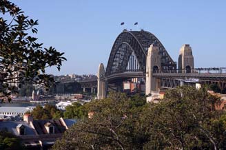
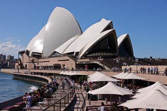
|
 BACK-PACKING
TRIP TO AUSTRALIA 2011 - Sydney and Blue Mountains, New South Wales: BACK-PACKING
TRIP TO AUSTRALIA 2011 - Sydney and Blue Mountains, New South Wales:
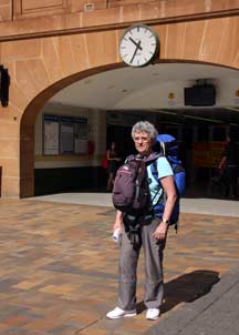 Overnight
flight from Hong Kong to Sydney: despite sleeping poorly on the first overnight flight, we both slept soundly on
the overnight Qantas flight to Sydney in our exhausted state after 2 late nights
and fulsome days in Hong Kong. We were woken at 6-00am (Sydney time) but in
reality 4-00am with the Hong Kong~Sydney time shift, meaning we got less than 5
hours' sleep. We were both therefore very blear-eyed. The meals on this leg of
the journey were less attractive and the service rather unsmiling and
perfunctory. As soon as we woke, we again switched on the real-time flight
progress monitors to follow our approach to Sydney, having followed the flight
last evening from Hong Kong over the Philippines and Borneo. Overnight
flight from Hong Kong to Sydney: despite sleeping poorly on the first overnight flight, we both slept soundly on
the overnight Qantas flight to Sydney in our exhausted state after 2 late nights
and fulsome days in Hong Kong. We were woken at 6-00am (Sydney time) but in
reality 4-00am with the Hong Kong~Sydney time shift, meaning we got less than 5
hours' sleep. We were both therefore very blear-eyed. The meals on this leg of
the journey were less attractive and the service rather unsmiling and
perfunctory. As soon as we woke, we again switched on the real-time flight
progress monitors to follow our approach to Sydney, having followed the flight
last evening from Hong Kong over the Philippines and Borneo.
|
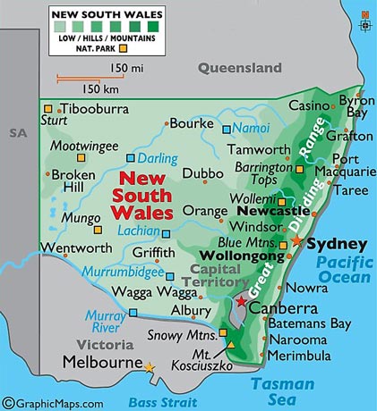
Map of New South Wales |
 |
As the plane drew close to Sydney, we got a
brief glimpse of the distinctive outline of Sydney Harbour Bridge. We had to
fill out Australian immigration cards, needing to record our address in
Australia, but without having our address book to hand we were unsure of our
daughters precise address in Adelaide. We also had to declare whether we had
criminal records, having believed that, in the post-colonial era, this was no longer a requirement for
entry into Australia! But in our semi-comatose, blear-eyed state, there was no
telling what we had declared. Paul was also convinced that one of our packs
still contained a biscuit left over from the previous flight, and we had to perjure
ourselves in declaring we were not importing foodstuffs, just hoping that
immigration control had no sniffer dogs.
 Arrival at Sydney Airport:
we landed at Sydney Airport and disembarked around
7‑45am (see above left), and having passed the lengthy queues for immigration,
then came the biscuit test. To our relief, the packs and day-sacs passed through
the x-ray scanner without betraying the concealed, illegally imported biscuit,
which even we have yet to discover. Perhaps it may
be festering away still in the hidden recesses of one the packs. Arrival at Sydney Airport:
we landed at Sydney Airport and disembarked around
7‑45am (see above left), and having passed the lengthy queues for immigration,
then came the biscuit test. To our relief, the packs and day-sacs passed through
the x-ray scanner without betraying the concealed, illegally imported biscuit,
which even we have yet to discover. Perhaps it may
be festering away still in the hidden recesses of one the packs.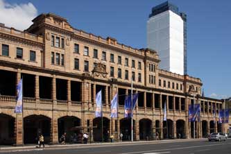
Following our daughter's instructions, our
first stop was the Vodafone stand to purchase a pay-as-you-go Australian SIM
card for the antique spare phone. Paul put on the bemused geriatric performance,
and the helpful young lad not only sorted out SIM card and registration, but also gave
us a lesson in how to use the phone, even installing both our daughters' numbers
in its memory. So we now had our Australian phone number and $30 worth of credit
on it. Totally bemused by exhaustion, we texted both daughters with our new
number.
The Big Hostel, our base in Sydney: having recovered a little with an airport coffee,
we donned packs and headed to the railway station for the train into Sydney
Central. This was both expensive ($15 each, and we could not use our UK bus pass
to prove senior status for reductions),
 and there were no vacant seats. This
meant standing with our packs in the lobby for the 20 minute journey; well below
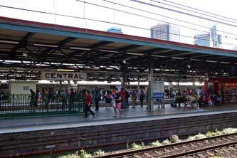
Hong Kong standards! But arriving at Central Station with its impressive façade
(see left and right), it was literally a 5
minute walk through a pleasant park over to the Big Hostel, the back-packing
hostel where we were booked for our stay in Sydney. We were hospitably and
helpfully received and although, as expected, our room was not yet ready, we
were able to leave our packs in a locked store until later. and there were no vacant seats. This
meant standing with our packs in the lobby for the 20 minute journey; well below
Hong Kong standards! But arriving at Central Station with its impressive façade
(see left and right), it was literally a 5
minute walk through a pleasant park over to the Big Hostel, the back-packing
hostel where we were booked for our stay in Sydney. We were hospitably and
helpfully received and although, as expected, our room was not yet ready, we
were able to leave our packs in a locked store until later.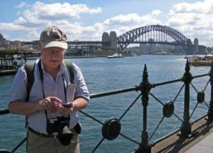
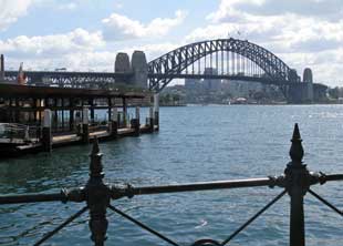
Our first sight of Sydney Harbour Bridge from Circular Quay: a free shuttle bus ran from outside the hostel down to Circular Quay, and we
crossed from where the bus dropped us to the waterfront for our first view of
Sydney's iconic Harbour Bridge (see left) (Photo 1 - First view of Sydney Harbour Bridge).
It was just after 11-00am and our Australian
adventure was truly underway; we texted our daughter Lucy in Adelaide with the
news using the new phone (see right), and took the first of many photos of the Bridge from
Circular Quay.
Classic views of the Bridge and Opera House
across Sydney Harbour: although it was only 11-30am, we paused for an
early snack lunch of bacon and egg cobs from a snack bar by the Manly Ferry
Terminal at Circular
 Quay, then continued through the Sunday morning crowds of
both tourists and local families enjoying a lovely sunny morning, around to Circular Quay
station. We had hoped to get up onto the platform for its higher level view of
the Bridge across the harbour, but this of course required a ticket to pass
through the barriers. Just beyond here, we paused around Circular Quay to listen
to a trio of highly unauthentic, over-decorated aboriginal buskers playing
didgeridoos and clapping sticks (Photo 2 - Aboriginal buskers); highly contrived but nevertheless entertaining.
Nearby a young girl Quay, then continued through the Sunday morning crowds of
both tourists and local families enjoying a lovely sunny morning, around to Circular Quay
station. We had hoped to get up onto the platform for its higher level view of
the Bridge across the harbour, but this of course required a ticket to pass
through the barriers. Just beyond here, we paused around Circular Quay to listen
to a trio of highly unauthentic, over-decorated aboriginal buskers playing
didgeridoos and clapping sticks (Photo 2 - Aboriginal buskers); highly contrived but nevertheless entertaining.
Nearby a young girl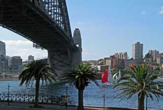 opera-singing busker was ignored by the crowds; we tried to
show our appreciation of her efforts. Full of excitement at the surroundings, we continued around to the former Overseas
Passenger Terminal Building (Photo
3 - Overseas Passenger Terminal), now an over-priced, over-pretentious restaurant,
set against the Bridge's backdrop. Here we chatted with two lads from San Francisco who asked us to take their
photos; Paul obliged with what he thought was an artistically composed picture, but
they wanted just a holiday snap together so the photo had to be re-taken! opera-singing busker was ignored by the crowds; we tried to
show our appreciation of her efforts. Full of excitement at the surroundings, we continued around to the former Overseas
Passenger Terminal Building (Photo
3 - Overseas Passenger Terminal), now an over-priced, over-pretentious restaurant,
set against the Bridge's backdrop. Here we chatted with two lads from San Francisco who asked us to take their
photos; Paul obliged with what he thought was an artistically composed picture, but
they wanted just a holiday snap together so the photo had to be re-taken!
Circular Quay, Campbell's Cove and Dawes
Point: from this point, the views of the Bridge
across Sydney Harbour demanded endless photos
(Photo
4 - Sydney's iconic Harbour Bridge); in fact today, there were predominantly two subjects for
photographs: the Bridge and Sydney Opera House
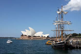
(Photo 5 - Sydney Opera House),
and between these two iconic Sydney
 landmarks, we must have taken during the day
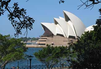
so many photos, from just about every angle and standpoint! We walked around Campbell's Cove to Dawes Point Park for yet more Bridge (Photo
6 - Dawes Point Park palms) and Opera House photos from under the
tropical palms (see left) (Photo
7 - Opera House through palms). A young Japanese tourist asked Sheila to
take his photo against the backdrop of the Bridge; he duly posed with thumbs up,
and Paul observed that there was a nice snap to send to his Mum and Dad! How sad
we thought for a young landmarks, we must have taken during the day
so many photos, from just about every angle and standpoint! We walked around Campbell's Cove to Dawes Point Park for yet more Bridge (Photo
6 - Dawes Point Park palms) and Opera House photos from under the
tropical palms (see left) (Photo
7 - Opera House through palms). A young Japanese tourist asked Sheila to
take his photo against the backdrop of the Bridge; he duly posed with thumbs up,
and Paul observed that there was a nice snap to send to his Mum and Dad! How sad
we thought for a young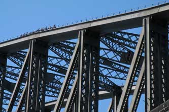 Japanese on holiday with no one to take his photo, and
how altruistic we felt! Under the mighty Bridge and over the brow of Dawes Point (Photo
8 - Under the Bridge) (see above right), and of course more Bridge photos, this
time in full afternoon sun on its western side (Photo
9 - Western Side of Bridge) rather than the shaded semi-silhouette from its
eastern face.
Our first taste of Australian beer in the
shadow of the Bridge: we trudged up Lower Fort Street passing a very
British style Victorian post box (Photo
10 - Victorian post box), and weariness provided the perfect pretext to pause for a beer at the terrace of the
appropriately named Harbour View pub. This had been well-used by the
Bridge-building crews in the 1920~30s, and Paul chatted with the Brazilian
barman about the beers. We enjoyed our first pint of Tooheys NSW bitter ale, a
thoroughly
 refreshing English-style top-fermented beer. We also enquired more
about the peculiar Aussie beer measures terminology: the normal 500ml large
measure is referred to as a schooner and the smaller 250ml measure a middy, at least in
NSW, but apparently is called a pot in the other States; here in this pub they also served imperial
pints. We sat on the outside terrace to enjoy our beer, looking up at the mighty
bridge structure and watching groups on the Bridge Walk high above us (see
above right). refreshing English-style top-fermented beer. We also enquired more
about the peculiar Aussie beer measures terminology: the normal 500ml large
measure is referred to as a schooner and the smaller 250ml measure a middy, at least in
NSW, but apparently is called a pot in the other States; here in this pub they also served imperial
pints. We sat on the outside terrace to enjoy our beer, looking up at the mighty
bridge structure and watching groups on the Bridge Walk high above us (see
above right).
 Exploring the Rocks area:
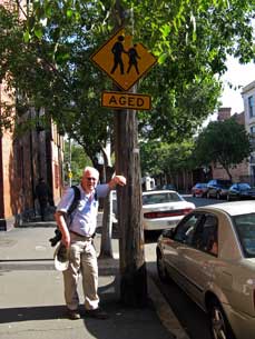
we continued along among the colonial style houses of the Rocks district, taking a pause by an 'Aged' road sign
(see left). Further along Lower Fort Street we
reached another pub set at a hill-side street corner, the Hero of Waterloo;
as one of the original colony's earliest pubs built in 1843 using sandstone blocks
excavated from the Argyle Cut, this needed to be investigated further. The description suggested a pseudy establishment,
but in fact inside it had a genuinely delightful atmosphere, with another good range of
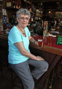
home-brewed English style beers, served of course in schooners and middies. We sat in the old wooden church pews
in the corner of the public bar drinking our
James Squires bitter (see right) (Photo
11 - Hero of Waterloo), 'entertained' by an obnoxious group of loud-mouthed
yuppies in their ill-fitting suits gathered here for a wedding. Rather more
cultured
entertainment was provided by an elderly jazz quartet playing at the far end of
the bar. Exploring the Rocks area:
we continued along among the colonial style houses of the Rocks district, taking a pause by an 'Aged' road sign
(see left). Further along Lower Fort Street we
reached another pub set at a hill-side street corner, the Hero of Waterloo;
as one of the original colony's earliest pubs built in 1843 using sandstone blocks
excavated from the Argyle Cut, this needed to be investigated further. The description suggested a pseudy establishment,
but in fact inside it had a genuinely delightful atmosphere, with another good range of
home-brewed English style beers, served of course in schooners and middies. We sat in the old wooden church pews
in the corner of the public bar drinking our
James Squires bitter (see right) (Photo
11 - Hero of Waterloo), 'entertained' by an obnoxious group of loud-mouthed
yuppies in their ill-fitting suits gathered here for a wedding. Rather more
cultured
entertainment was provided by an elderly jazz quartet playing at the far end of
the bar.
Views of the Bridge and Harbour from Observatory
Park: we continued along Windmill Street, past former
warehouses now converted to apartments, to reach the Millers Point district,
and here turned up Argyle Street past yet another 'Oldest Pub in Sydney', the Lord
Nelson. The road led steeply up to the wonderful hill-top open expanse of Observatory Park (Photo
12 - View from Observatory Park). From
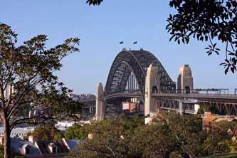
this viewpoint, glorious views looking out through the trees to the Bridge opened
up (Photo
13 - Bridge viewed through trees) (see below left), past the
Garrison Church and harbour-side houses of Millers Point below us
(Photo
14 - Bridge, Harbour and Garrison Church),
 across towards the
harbour and the Bridge with its approach road
(Photo
15 - Bridge and approach road), all lit by the golden afternoon sun. The
lighting among the tree branches, combined with the distant views of the Bridge
and Harbour, demanded further photos
(Photo
16 - Sunlit trees and Bridge), and we sat on the grass by the Observatory to pick out landmarks of this magnificent harbour vista (Photo
17 - Harbour Vista). In fact we later agreed that Observatory Park
offered one of the finest vantage points for photographing
the Bridge, framed by the park's Moreton Bay Fig Trees (Photo
18 - Moreton Bay Fig Trees). across towards the
harbour and the Bridge with its approach road
(Photo
15 - Bridge and approach road), all lit by the golden afternoon sun. The
lighting among the tree branches, combined with the distant views of the Bridge
and Harbour, demanded further photos
(Photo
16 - Sunlit trees and Bridge), and we sat on the grass by the Observatory to pick out landmarks of this magnificent harbour vista (Photo
17 - Harbour Vista). In fact we later agreed that Observatory Park
offered one of the finest vantage points for photographing
the Bridge, framed by the park's Moreton Bay Fig Trees (Photo
18 - Moreton Bay Fig Trees).
 Views from the Bridge
Lookout to Opera House and Central Business District: from the Bridge
Steps Passage we climbed to the level of Cumberland Street, amid the maze of
steps and passageways, up to the pedestrian walkway which ran alongside the
multi-lane highway busy with speeding traffic crossing the Bridge. The walkway continued
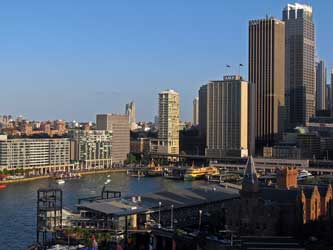
across towards the Bridge pillar, giving wonderful panoramic views out over the harbour to Circular Quay, with the
ring of modern tower-blocks making up Sydney's Central Business District (CBD)
(see right) (Photo
19 - Central Business District), and the
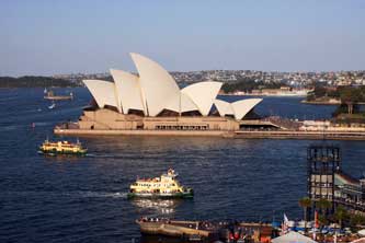
Opera House set on its peninsula extending from Circular Quay. Ferry boats criss-crossed the harbour in front
of the Opera House (see below left) (Photo
20 - Sydney Opera House), and again 1001 photos were taken looking out over this
magnificent view as we walked over to the Bridge's SE pillar. A Views from the Bridge
Lookout to Opera House and Central Business District: from the Bridge
Steps Passage we climbed to the level of Cumberland Street, amid the maze of
steps and passageways, up to the pedestrian walkway which ran alongside the
multi-lane highway busy with speeding traffic crossing the Bridge. The walkway continued
across towards the Bridge pillar, giving wonderful panoramic views out over the harbour to Circular Quay, with the
ring of modern tower-blocks making up Sydney's Central Business District (CBD)
(see right) (Photo
19 - Central Business District), and the
Opera House set on its peninsula extending from Circular Quay. Ferry boats criss-crossed the harbour in front
of the Opera House (see below left) (Photo
20 - Sydney Opera House), and again 1001 photos were taken looking out over this
magnificent view as we walked over to the Bridge's SE pillar. A
 commemorative plaque
set in the pillar's stonework recorded
that the Bridge was designed and built by the British engineering contractors
Dorman Long of Middlesbrough (based on their design of the 1928 Tyne Bridge in
Newcastle upon Tyne), and opened in 1932 (see below right). We were too late today to visit the
Bridge
Lookout Museum but should return tomorrow for that. Today we simply revelled in
the wonderful photographic opportunities of this viewpoint in the glorious late
afternoon lighting conditions. commemorative plaque
set in the pillar's stonework recorded
that the Bridge was designed and built by the British engineering contractors
Dorman Long of Middlesbrough (based on their design of the 1928 Tyne Bridge in
Newcastle upon Tyne), and opened in 1932 (see below right). We were too late today to visit the
Bridge
Lookout Museum but should return tomorrow for that. Today we simply revelled in
the wonderful photographic opportunities of this viewpoint in the glorious late
afternoon lighting conditions.
Supper at the Rocks, and after-dark Bridge
illuminations: returning
along the bridge walkway, the Argyle
Steps provided the perfect vantage point to photograph the Cut from above, with the golden evening sun gleaming
on the sandstone blocks and shining through the Bridge highway tunnel (Photo
21 - Bridge highway tunnel). We descended to Argyle Street for
an early evening supper at the Lord Nelson pub, and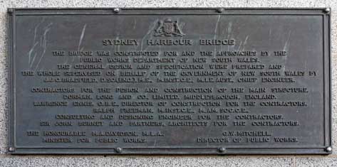 to watch rugby league
on the bar TV. From here we phoned our daughter Lucy in Adelaide with news of
our day's wanderings. By the time we came out of the pub at 7-45pm, it was pitch
dark as we walked down through the sandstone blocks of Argyle Cut back to
Circular Quay from where the evening ferries still crossed the harbour to Manly.
We stood by the railings to photograph the lights of the Bridge and North Shore
reflected in the waters of the harbour
(see left) to watch rugby league
on the bar TV. From here we phoned our daughter Lucy in Adelaide with news of
our day's wanderings. By the time we came out of the pub at 7-45pm, it was pitch
dark as we walked down through the sandstone blocks of Argyle Cut back to
Circular Quay from where the evening ferries still crossed the harbour to Manly.
We stood by the railings to photograph the lights of the Bridge and North Shore
reflected in the waters of the harbour
(see left)
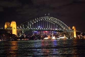 (Photo
22 - Bridge illuminations),
and the more subtly lit Opera House. We
had reckoned to catch the free shuttle bus back out to the Big Hostel, but this
service stopped running at 6-00pm; fortunately there was a taxi stand opposite for a taxi ride back to the hostel. (Photo
22 - Bridge illuminations),
and the more subtly lit Opera House. We
had reckoned to catch the free shuttle bus back out to the Big Hostel, but this
service stopped running at 6-00pm; fortunately there was a taxi stand opposite for a taxi ride back to the hostel.
Back at the Big Hostel, we booked in, collected
our packs, and opened up our room on the first floor; although basic, this was
more than adequate and clean. Initially we thought the bulb in the en suite
bathroom had blown, and the hostel staff readily responded; in fact we had
simply identified the wrong switch! We had achieved a remarkable amount during
today's initial explorations of Sydney's principal sights; although exhausted from our overnight flight
and fulsome first day, we sorted our kit and Paul wrote up today's 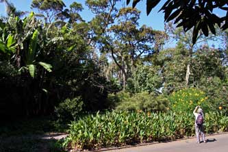 log
while Sheila read up in readiness for a second day in Sydney tomorrow. We turned in at 11-0pm in the
creaky bunk-bed and slept soundly after our memorable first day in Sydney. log
while Sheila read up in readiness for a second day in Sydney tomorrow. We turned in at 11-0pm in the
creaky bunk-bed and slept soundly after our memorable first day in Sydney.
Sydney Royal Botanic Gardens: the Big Hostel provided
facilities for making breakfast, and having
completed yesterday's log and showered, we went down to the kitchen/common-room area.
Cereals and toast were available, though dishes, plates and cutlery were rather
lacking. It
 reminded us of youth hostel days, and as to be expected,
some folk inevitably failed to wash up their crockery and cutlery. reminded us of youth hostel days, and as to be expected,
some folk inevitably failed to wash up their crockery and cutlery.
We were out by 9-45am to catch the free shuttle
bus down to the centre from opposite the hostel. Today we got off before Circular Quay and walked through to the
corner gate of the Sydney Royal Botanic Gardens. This large expanse of formally
laid-out gardens, planted with all kinds of Australian trees and shrubs was a sheer delight (see above right); signs set aside the usual public gardens prohibitions and
encouraged visitors to walk on the grass, smell the flowers, hug the trees
and picnic on the lawns. We followed the network of paths heading downhill
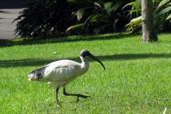
towards the waters of the Harbour; Australian White Ibis with their ungainly
long, curving beaks strutted about on the grass, indifferent to passing
visitors
(Photo
23 - Australian White Ibis) (see left). Exotic trees were silhouetted against a skyline of Sydney Central
Business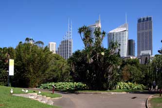 District's skyscraper office blocks
(Photo
24 - Tropical trees and CBD skyline), and at one point in the Royal
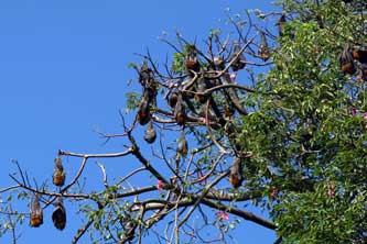
Botanic Gardens we passed a tree brim-full of huge Grey-Headed Flying-Foxes
making a shrilling cacophony (Photo
25- Grey-Headed Flying-Fox bats) (see below left). The Flying-Fox bats' main food source is the
protein-rich pollen produced by Eucalyptus flowers, and through feeding on
nectar and pollen, the bats are important District's skyscraper office blocks
(Photo
24 - Tropical trees and CBD skyline), and at one point in the Royal
Botanic Gardens we passed a tree brim-full of huge Grey-Headed Flying-Foxes
making a shrilling cacophony (Photo
25- Grey-Headed Flying-Fox bats) (see below left). The Flying-Fox bats' main food source is the
protein-rich pollen produced by Eucalyptus flowers, and through feeding on
nectar and pollen, the bats are important
 pollinators for the Eucalyptus forests
and woodlands of eastern and northern Australia. They are also a threatened
species as their natural habitat has increasingly been destroyed by development.
Prior to our 2011 visit, a colony of some 20,000 of the nocturnal Flying-Fox
bats had taken to roosting during the day in the trees of Sydney Botanic Gardens
in the heart of the city after overnight feeding. It was these bats that we now
saw filling the trees. But the following year in 2012, the Botanic Gardens
began a controversial policy of deterring the bats from roosting in the gardens
by playing loud recorded industrial noise, claiming that the Flying-Foxes were
causing defoliation damage to rare trees; as a result the bats moved on to roost
elsewhere! pollinators for the Eucalyptus forests
and woodlands of eastern and northern Australia. They are also a threatened
species as their natural habitat has increasingly been destroyed by development.
Prior to our 2011 visit, a colony of some 20,000 of the nocturnal Flying-Fox
bats had taken to roosting during the day in the trees of Sydney Botanic Gardens
in the heart of the city after overnight feeding. It was these bats that we now
saw filling the trees. But the following year in 2012, the Botanic Gardens
began a controversial policy of deterring the bats from roosting in the gardens
by playing loud recorded industrial noise, claiming that the Flying-Foxes were
causing defoliation damage to rare trees; as a result the bats moved on to roost
elsewhere!
 Mrs
Macquarie's Point: down at the Harbour water's edge, we took the path
which followed the harbour-side around
an inlet towards Mrs Macquarie's Point, named after the wife of Major-General Lachlan
Macquarie, Governor of the New South Wales penal colony from 1810 to 1821; she
had
made this peninsula projecting into the Harbour one of her regular haunts. The
glorious vista that opened up looking westwards back along the length of Mrs
Macquarie's Point: down at the Harbour water's edge, we took the path
which followed the harbour-side around
an inlet towards Mrs Macquarie's Point, named after the wife of Major-General Lachlan
Macquarie, Governor of the New South Wales penal colony from 1810 to 1821; she
had
made this peninsula projecting into the Harbour one of her regular haunts. The
glorious vista that opened up looking westwards back along the length of
 the
Harbour against the skyline of the CBD's tower blocks (Photo
26- CBD tower-blocks vista) further illustrated what
a magnificent natural haven Sydney Harbour was, fully protected from the open
Pacific within the harbour entrance at the Heads. This
was to be another day of a 1001 Bridge and Opera House photos, but this time
with the
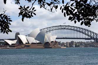
2 icons of Sydney figuring in the same view across the waters of the Harbour
from the eastern side (see right) (Photo
27- Harbour Bridge and Opera House).
This magnificent view was photographed from beneath every tree we passed to
create our trademark leafy framed image (Photo
28 - Westward view under harbour-side trees). We reached the tip of the peninsula
where the classic water-scape panorama presented itself to be photographed
(Photo
29 - Harbour water-scape panorama), with harbour lapping against
shore; and having responded to requests from several sets of Japanese tourists to take
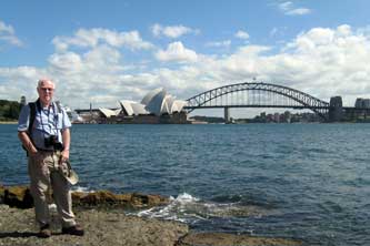
their photos, we photographed ourselves at this splendid spot (see left) (Photo
30 - Shared Harbour photo) against the
backdrop of Sydney's classic icons. the
Harbour against the skyline of the CBD's tower blocks (Photo
26- CBD tower-blocks vista) further illustrated what
a magnificent natural haven Sydney Harbour was, fully protected from the open
Pacific within the harbour entrance at the Heads. This
was to be another day of a 1001 Bridge and Opera House photos, but this time
with the
2 icons of Sydney figuring in the same view across the waters of the Harbour
from the eastern side (see right) (Photo
27- Harbour Bridge and Opera House).
This magnificent view was photographed from beneath every tree we passed to
create our trademark leafy framed image (Photo
28 - Westward view under harbour-side trees). We reached the tip of the peninsula
where the classic water-scape panorama presented itself to be photographed
(Photo
29 - Harbour water-scape panorama), with harbour lapping against
shore; and having responded to requests from several sets of Japanese tourists to take
their photos, we photographed ourselves at this splendid spot (see left) (Photo
30 - Shared Harbour photo) against the
backdrop of Sydney's classic icons.
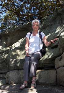 We clambered up onto the point of Mrs Macquarie's peninsula
for yet more photos, then walked over to the rocky headland where the demanding
Mrs Mac (She Who Must be Obeyed, even by the Governor himself) had required
colonial workmen to excise several rock-seats in the sandstone outcrops from
which she could view the scene which, almost two centuries later, would be
graced We clambered up onto the point of Mrs Macquarie's peninsula
for yet more photos, then walked over to the rocky headland where the demanding
Mrs Mac (She Who Must be Obeyed, even by the Governor himself) had required
colonial workmen to excise several rock-seats in the sandstone outcrops from
which she could view the scene which, almost two centuries later, would be
graced
 with Sydney's iconic Bridge and Opera House. The grandiloquent
inscription on the rock seat declared for all to see: with Sydney's iconic Bridge and Opera House. The grandiloquent
inscription on the rock seat declared for all to see:
Be it recorded that the Road
Round the inside of the Government Domain called Mrs Macquarie's Road
So named by the Governor on account of her having originally
Planned it measuring 3 miles and 377 yards
Was finally completed on the 13 day of June 1816
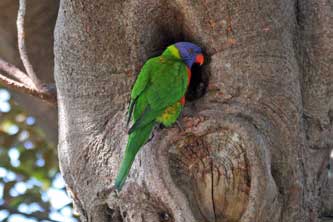
As we sat on Her Chair (see right), a pair of Rainbow Lorikeets
displayed themselves perched in the fig tree above us
(Photo
31 - Rainbow Lorikeets) (see left). These colourful, medium-sized
parrots are common along the eastern seaboard of Australia from Queensland
around to
South Australia. Just beyond Mrs Macquarie's Chair, we bought a snack-lunch of
tasteless hot dogs from Mrs Mac's snack bar as yet another Australian White Ibis
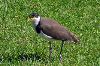
pranced by. In addition to the Ibises and Lorikeets, we also saw two other
distinctive Australian bird species around this area of the Botanic Gardens
alongside the harbour-side path: Masked Lapwings (see below left) and Noisy Miners
(see below right) pecking under
the trees.
 Opera House and Cadman's Cottage: back along
the said Road, which Mrs Mac had caused Opera House and Cadman's Cottage: back along
the said Road, which Mrs Mac had caused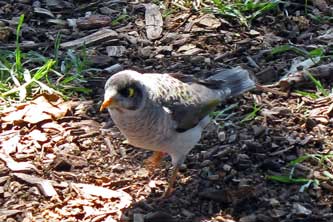 the colonial convict-workmen to
construct for her along the crest of the peninsula, we continued taking yet more
Bridge and Opera House photos as we went. Increasingly hassled by joggers who
had emerged from the tower-bock offices of Sydney's Central Business District (CBD)
to bother the tourists, we descended the Fleet Steps, named after the American
fleet which had made an imperialist tour of the Pacific in 1910, a tradition
followed less successfully by latter day American imperialists in SE Asia, and walked back
around the harbour-side path towards the Opera House, where office workers sat
sunning themselves or eating lunch (Photo
32- Lunch by Opera House). the colonial convict-workmen to
construct for her along the crest of the peninsula, we continued taking yet more
Bridge and Opera House photos as we went. Increasingly hassled by joggers who
had emerged from the tower-bock offices of Sydney's Central Business District (CBD)
to bother the tourists, we descended the Fleet Steps, named after the American
fleet which had made an imperialist tour of the Pacific in 1910, a tradition
followed less successfully by latter day American imperialists in SE Asia, and walked back
around the harbour-side path towards the Opera House, where office workers sat
sunning themselves or eating lunch (Photo
32- Lunch by Opera House).
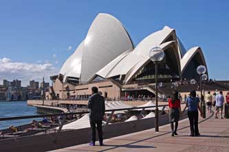
From this end view, the wedge-shaped segmented design of Sydney Opera House
took on the more familiar appearance, with the two tall 3-segment wings of the
Concert Hall and Opera Theatre rising progressively to the rear
(see below left) (Photo
33 - Opera House segmented design). We followed the crowds up
the steps of the broad podium (Photo
34 - Opera House stepped podium) to the Opera House's foyer entrance, and
examined at close quarters the surprisingly small diamond pattern of white tiles
covering the
segments
and reflecting the glaring
sunlight (see right)
 (Photo
35 - Diamond-patterned white tiles). We walked around the
distinctively-shaped building photographing it on all (Photo
35 - Diamond-patterned white tiles). We walked around the
distinctively-shaped building photographing it on all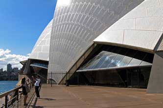 sides and the wonderful
vista out across the Harbour. From the Opera House podium there were also impressive views
looking back towards
Circular Quay and the skyscrapers of CBD rising behind
(Photo
36 - Central Business District). After the natural
beauty and comparative peacefulness of the Botanic Gardens and Mrs Macquarie's Point, this area around the Opera House was inevitably busy with tourists
crowding the pathways and cafés (Photo
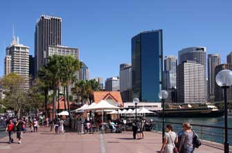
37 - Tourist crowds). From the Opera House, we followed the harbour-side
pathway under the palm trees and coffee stalls, busy in the bright sunshine, all
the way around to Circular Quay (Photo
38 - Palm trees and coffee stalls). By the quay-side we paused to watch another group of aboriginal
buskers explaining the workings of the didgeridoo and giving their performance
for the tourists. Since yesterday a monstrously
intrusive cruise-ship had moored alongside the Overseas Passenger Terminal,
blocking the views across the Harbour towards the Bridge (see below left). Just
a little further round from Circular Quay however, the Bridge in all its splendour came back into view lit by the
afternoon sun
(Photo
39 - Bridge from Circular Quay). Nearby we found
Cadman's Cottage (see below right), a small stone house built into the natural rock shelf at the
foot of the Rocks slope by what
would once have been the water's edge. This was
named after a former convict who had occupied the house as the early colony's
coxswain, having been sides and the wonderful
vista out across the Harbour. From the Opera House podium there were also impressive views
looking back towards
Circular Quay and the skyscrapers of CBD rising behind
(Photo
36 - Central Business District). After the natural
beauty and comparative peacefulness of the Botanic Gardens and Mrs Macquarie's Point, this area around the Opera House was inevitably busy with tourists
crowding the pathways and cafés (Photo
37 - Tourist crowds). From the Opera House, we followed the harbour-side
pathway under the palm trees and coffee stalls, busy in the bright sunshine, all
the way around to Circular Quay (Photo
38 - Palm trees and coffee stalls). By the quay-side we paused to watch another group of aboriginal
buskers explaining the workings of the didgeridoo and giving their performance
for the tourists. Since yesterday a monstrously
intrusive cruise-ship had moored alongside the Overseas Passenger Terminal,
blocking the views across the Harbour towards the Bridge (see below left). Just
a little further round from Circular Quay however, the Bridge in all its splendour came back into view lit by the
afternoon sun
(Photo
39 - Bridge from Circular Quay). Nearby we found
Cadman's Cottage (see below right), a small stone house built into the natural rock shelf at the
foot of the Rocks slope by what
would once have been the water's edge. This was
named after a former convict who had occupied the house as the early colony's
coxswain, having been
 convicted to transportation for life for stealing a horse
at Bewdley. The building now housed the office of the convicted to transportation for life for stealing a horse
at Bewdley. The building now housed the office of the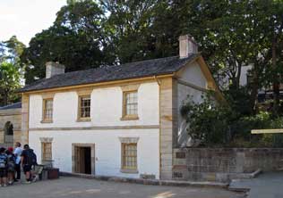 NSW National Parks
Service, and we enquired about information on walks around Manly. The helpful
warden produced leaflets and maps; she herself had emigrated from Surrey in 1979
(with or without a criminal record, we were too polite to enquire) and now lived
in Manly. NSW National Parks
Service, and we enquired about information on walks around Manly. The helpful
warden produced leaflets and maps; she herself had emigrated from Surrey in 1979
(with or without a criminal record, we were too polite to enquire) and now lived
in Manly.
Suez Canal and the Rocks: up Argyle Street,
we turned along past the shops in George Street to find the narrow passageway of
Suez Canal amid the Rocks area. When we eventually found it, this led up back
round to Argyle Street, and at the junction with Cumberland Street, we paused
for a drink at a corner pub, sitting on the roof terrace and trying our first
Victoria Bitter (VB). But in contrast with the blue skies and bright sun of
earlier, a sudden cool wind had blown up and dark clouds were gathering.
Harbour Bridge Museum and SE Pylon Lookout:
we made our way up the Argyle Cut steps again to walk along the
approach-pathway alongside the Harbour Bridge approach highway, to the Bridge
Pylon Lookout set in the SE pillar. This time we managed to get senior's
entrance tickets to the Museum.
Steps climbed up the inside of the tower
where
displays illustrated the Bridge's history
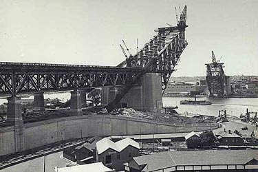 and details of its construction, which had taken 7
years from 1924 to its opening in 1932. The riveted steel construction was
explained together with photographs showing the final lowering into place of the 2 opposing archways;
these were
cantilevered out from each shore (see left) to lock into position in the centre
and create the now familiar 504m wide coat-hanger and details of its construction, which had taken 7
years from 1924 to its opening in 1932. The riveted steel construction was
explained together with photographs showing the final lowering into place of the 2 opposing archways;
these were
cantilevered out from each shore (see left) to lock into position in the centre
and create the now familiar 504m wide coat-hanger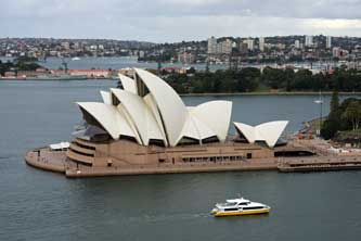 arch, its summit 134m above the
waters of the harbour. Abutments at the base of the pylons support the
loads from the arch and hold its span in place, but the four
granite-faced pylons themselves are purely aesthetic, serving no structural purpose. The pylons were
included to provide a frame for the arch panels and to give visual balance to
the bridge; they were not part of the original design, and were added only to
allay public concern about the bridge's structural integrity!
Emerging onto the pillar top's parapet, the Lookout atop the Bridge pylon gave stunning
panoramic views: eastwards out over the Opera House where ferries chugged back
and forth across the Harbour (see above right) (Photo
40 - Opera House from Pillar Lookout); continuing around over Circular Quay
ferry-dockings with the cruise ship still anchored alongside the Overseas
Passenger Terminal, all backed by the CBD tower-blocks; swinging further around
(Photo
41 - Circular Quay), the view opened out over the city with the
Bridge approach highway busy with late afternoon commuter traffic rushing across
Bridge towards the North Shore (Photo
42 - Commuter traffic over Bridge), and backed by the hill-top
Observatory Park where we had been standing yesterday; continuing further
westwards over the apartment blocks of Miller's Point, the view extended inland
along the river (Photo
43 - Miller's Point). But even more impressive was the
northward view from this high vantage point looking down across the river over
to the North Shore and the upper steelworks of the Bridge's coat-hanger arch
(Photo
44 - Bridge's coat-hanger arch),
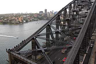 where groups of
bridge climbers scrambled up the walkways (Photo
45 - Bridge climbers)
(see
left). This really was the perfect vantage point for panoramic photographs of
Sydney (Photo
46 - Bridge Lookout Photos) (see right). The fine weather of earlier however
was now well and truly gone; heavy cloud had gathered, and misty rain drifted
along the Harbour obscuring the magnificent where groups of
bridge climbers scrambled up the walkways (Photo
45 - Bridge climbers)
(see
left). This really was the perfect vantage point for panoramic photographs of
Sydney (Photo
46 - Bridge Lookout Photos) (see right). The fine weather of earlier however
was now well and truly gone; heavy cloud had gathered, and misty rain drifted
along the Harbour obscuring the magnificent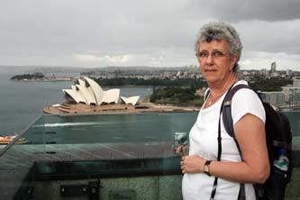 views. views.
Final night at Big Hostel, Sydney: despite the now gloomy weather, we took more photos, but it was by now approaching 5-00pm and Museum closing time.
We descended to the pathway at bridge level, with the sky now dark and road wet from the
earlier rain. Back up the hill to the Lord Nelson at Miller's Point for their pie night supper,
we enjoyed more of the pub's home-brewed beer. But outside the rain began again and
a lashing pour-down followed. By the time we left, the rain had eased, but weary from today's walking,
we took a taxi again. Back at the Big Hostel for our final night of this stay, we charged up all the electrical equipment and
transcribed our 2 days' photographs onto the laptop in readiness for tomorrow, making use of the hostel
wi-fi in the common room to collect emails. Part of today's log
was written before we turned in, very weary after a second fulsome day in
Sydney.
We had enjoyed two excellent initial days in central
Sydney, and the wonderful Australian autumn sunshine had enabled us to garner a
fine crop of photographs and videos. Tomorrow we should set off into the
interior of New South Wales by train to Katoomba for our 3 day foray into the Blue
Mountains of the Great Dividing Range (see map at head of page).
 By
train out to Katoomba in the Blue Mountains:
the alarm was set for 7-00am to allow time for yesterday's log to be completed,
but the hostel kitchen was chaotic this morning with crowds of youngsters
pushing and shoving to make breakfast. We showered and re-packed our kit, and
were ready to check-out and collect our $20 key deposit by just after 9-30am. By
train out to Katoomba in the Blue Mountains:
the alarm was set for 7-00am to allow time for yesterday's log to be completed,
but the hostel kitchen was chaotic this morning with crowds of youngsters
pushing and shoving to make breakfast. We showered and re-packed our kit, and
were ready to check-out and collect our $20 key deposit by just after 9-30am.
 Still weary from a solid week's non-stop travelling and city
exploration, we plodded back to Central Station with our full packs on a dull, damp
morning. One-way tickets to Katoomba were a reasonable $15 for both of us, but
no seniors' discount for non-residents. We found platform 10 and boarded the
10-09am train for the 2 hour rail service to Lithgow which passed through
Katoomba. The train was already crowded but we managed to get seats on the left
hand side for views as we approached the Blue Mountains. Not that this served
much purpose since the morning was still heavily overcast even in Sydney, and
became more murky as the train gained height into the Blue Mountains foothills.
The train passed through the outer suburbs of Sydney and the terrain became more
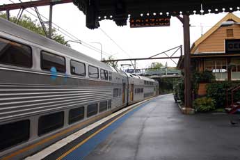
rural. As the train passed through a series of very English-named little towns, the sky became greyer and misty-murky; drizzly rain
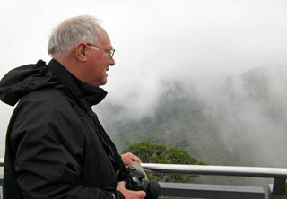
obscured the eucalyptus-covered hills by the time we neared Katoomba station (see above left and right). Sheila had prepared maps of the route from
Katoomba station to the Number 14 Hostel which she had booked for our 3 day stay, and we plodded downhill
in now misty drizzle, with low cloud Still weary from a solid week's non-stop travelling and city
exploration, we plodded back to Central Station with our full packs on a dull, damp
morning. One-way tickets to Katoomba were a reasonable $15 for both of us, but
no seniors' discount for non-residents. We found platform 10 and boarded the
10-09am train for the 2 hour rail service to Lithgow which passed through
Katoomba. The train was already crowded but we managed to get seats on the left
hand side for views as we approached the Blue Mountains. Not that this served
much purpose since the morning was still heavily overcast even in Sydney, and
became more murky as the train gained height into the Blue Mountains foothills.
The train passed through the outer suburbs of Sydney and the terrain became more
rural. As the train passed through a series of very English-named little towns, the sky became greyer and misty-murky; drizzly rain
obscured the eucalyptus-covered hills by the time we neared Katoomba station (see above left and right). Sheila had prepared maps of the route from
Katoomba station to the Number 14 Hostel which she had booked for our 3 day stay, and we plodded downhill
in now misty drizzle, with low cloud
 covering the town.
Although technically we had missed the earlier booking-in time of 11‑00am, the
lady-owner welcomed us, albeit in a rather unsmiling manner, and supplied us
with a tourist map of the Katoomba area, suggesting things we might do on a wet
afternoon. We were able to stow our packs in our room and sort out day-sacs. The
best use of time in today's miserable weather was to explore the town and get
our bearings. By the time we were ready to walk back up into the town, the misty rain had become
more determined. We therefore covering the town.
Although technically we had missed the earlier booking-in time of 11‑00am, the
lady-owner welcomed us, albeit in a rather unsmiling manner, and supplied us
with a tourist map of the Katoomba area, suggesting things we might do on a wet
afternoon. We were able to stow our packs in our room and sort out day-sacs. The
best use of time in today's miserable weather was to explore the town and get
our bearings. By the time we were ready to walk back up into the town, the misty rain had become
more determined. We therefore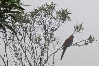 set off
in full waterproofs, with day-sacs
protected by their new rainproof covers. set off
in full waterproofs, with day-sacs
protected by their new rainproof covers.
Number 14 Hostel at Katoomba:
we got details of local bus services and another copy of the free-issue Katoomba map from the
tour-bus office, then found a milk-bar for a Big Breakfast lunch. By the time we
had eaten this, the rain had almost stopped, so we were able to stow our rain
gear, and walked across the road for a swift pint of Coopers Adelaide beer at
the prestigious Carrington Hotel's plebs' bar. Thus fed and watered, we walked
along Katoomba Street to get the lie of the land, sort out shops, find a
supermarket for supplies, and draw another $200 from an ATM.
It was by now gone 3-30pm, but we decided to walk along to Echo Point
overlooking the sheer escarpment cliff-face above the Jamison Valley. Even if
the weather denied us any views of the surrounding mountains today, at least we
could get more information from the National Park Information Office, and try to gain a
better understanding of the National Park's complex topography. Although not raining, the air was
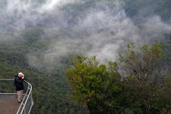 cool and a dense mist hovered along at the far end by Echo Point,
meaning we should probably see nothing of the Three Sisters rock formations. As we neared the
end of Katoomba Street, we were lured into conversation by a garrulous elderly
lady, who was stood in her front garden waiting to accost gullible English
passers-by to tell them her life story; she preferred English, she explained,
since they were more polite, ie didn't rush off half way through her
lengthy autobiographical treatise. We were this afternoon's victims, and she proceeded
to detain us with the full version of This-is-Her-Life. We did eventually escape, excusing ourselves with duly
characteristic English cool and a dense mist hovered along at the far end by Echo Point,
meaning we should probably see nothing of the Three Sisters rock formations. As we neared the
end of Katoomba Street, we were lured into conversation by a garrulous elderly
lady, who was stood in her front garden waiting to accost gullible English
passers-by to tell them her life story; she preferred English, she explained,
since they were more polite, ie didn't rush off half way through her
lengthy autobiographical treatise. We were this afternoon's victims, and she proceeded
to detain us with the full version of This-is-Her-Life. We did eventually escape, excusing ourselves with duly
characteristic English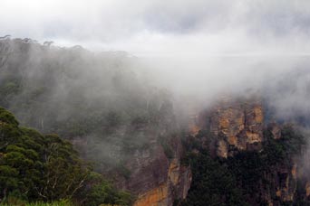 politeness, and rushed on towards Echo Point where the mist was even thicker. When we
eventually reached the Echo Point car park and Information Office, one of the
local buses had just drawn in, and we confirmed with the helpful driver that the
last bus back into town left at 5‑15pm. politeness, and rushed on towards Echo Point where the mist was even thicker. When we
eventually reached the Echo Point car park and Information Office, one of the
local buses had just drawn in, and we confirmed with the helpful driver that the
last bus back into town left at 5‑15pm.
First sighting of Three Sisters pinnacles in mist at Echo Point:
over at the National Park
Info Office, we monopolised the warden for a good 10 minutes as a queue formed
behind us, for as much information as we good garner (maps, guide leaflets, details of topography and wild life),
in readiness for our planned day of walking down in the National Park the day after
tomorrow. In spite of the unyieldingly opaque mist, we
walked over to the look-out point for the total non-view of the Three Sisters
rock pinnacles hidden by mist (see above left), and of the surrounding mountains and the tree-covered valley
floor 100s of feet below down the sheer rock cliffs of the escarpment (see above
left). We were desperate enough even to try photographing the mist-obscured
non-view, and walked down to the lower
 observation platform for a more intimate
view into the white-out gloom (see above right). We did however get a glimpse in the mist of another
brightly coloured parrot perched in the branches of a tree close by, later
identified as a Crimson Rosella (see above right). We waited for half hour and still the mist
remained resolutely opaque; so with the last bus due in 15 minutes we returned
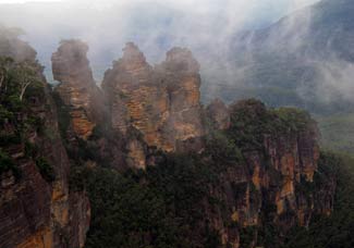
to the higher platform. It was just at this point of course that the mist suddenly begin to evaporate,
revealing the surrounding mountains, and magically the Three Sisters rocks pinnacles
standing clear of the escarpment wall (see left) (Photo
47 - Three Sisters pinnacles). Paul rushed back down to the lower platform
before the mist closed in again, and we both managed to get some partial photos
of the escarpment face. So
absorbed was Paul in his photography that we almost missed the last bus, with Sheila
desperately waving for him to rush back upwards. observation platform for a more intimate
view into the white-out gloom (see above right). We did however get a glimpse in the mist of another
brightly coloured parrot perched in the branches of a tree close by, later
identified as a Crimson Rosella (see above right). We waited for half hour and still the mist
remained resolutely opaque; so with the last bus due in 15 minutes we returned
to the higher platform. It was just at this point of course that the mist suddenly begin to evaporate,
revealing the surrounding mountains, and magically the Three Sisters rocks pinnacles
standing clear of the escarpment wall (see left) (Photo
47 - Three Sisters pinnacles). Paul rushed back down to the lower platform
before the mist closed in again, and we both managed to get some partial photos
of the escarpment face. So
absorbed was Paul in his photography that we almost missed the last bus, with Sheila
desperately waving for him to rush back upwards.
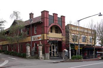 Carrington Arms, our local at Katoomba, and the Number 14 Hostel: winded we returned to the bus-stop just as the friendly driver returned. Thankfully we were dropped back in
the town right outside the Carrington Arms (see right). It was by now 5-30pm and almost dusky. In
the bar, we sat with schooners of James Squires Amber Ale, a tasty
English-style beer but served in the Australian fashion very chilled, with even
the glass taken from a refrigerated cabinet.
An elderly American couple came in and asked what beer we
were drinking, clearly folk of like values with ourselves. In conversation with
them, we learnt that they came from Boston and were on an organised tour of Sydney;
they also were visiting their daughter who now lived in Manly. In the pub's dim light,
we tried to sort out train timings for tomorrow's planned ride on the preserved Zig-Zag Railway. By
6-00pm it was fully dark on a dull, cool evening. We sat with our beers until
7-00pm, then walked across for supper at a small Thai restaurant just opposite. We had expected Katoomba to be a
busy and over-commercialised mountain
resort, and Echo Point to be heaving with coach tours, whereas in fact the town
was a quiet, old-fashioned place. The lady spoken to earlier had said the
residents were mainly retired people, and there was now no work other than
tourism to retain the youngsters. At Echo Point there had been just a few
car-born visitors. Perhaps this was because it was now autumn; the chill, dark,
drizzly-misty evening felt exactly like November in UK. We enjoyed a
tasty Thai curry supper, but even the restaurant was quite quiet without other
guests. After supper, in misty drizzle we walked back down to Number 14 Hostel to settle in. Our large en
suite room was charmingly furnished, and having spread our wet kit out to dry, Paul wrote
up today's rather limited log given the weather, while Sheila read up on Australian bird-life with its colourful array
of exotic species. The evening was cool with more rain, and both weary again, we
gladly settled in ready for a night's sleep. Carrington Arms, our local at Katoomba, and the Number 14 Hostel: winded we returned to the bus-stop just as the friendly driver returned. Thankfully we were dropped back in
the town right outside the Carrington Arms (see right). It was by now 5-30pm and almost dusky. In
the bar, we sat with schooners of James Squires Amber Ale, a tasty
English-style beer but served in the Australian fashion very chilled, with even
the glass taken from a refrigerated cabinet.
An elderly American couple came in and asked what beer we
were drinking, clearly folk of like values with ourselves. In conversation with
them, we learnt that they came from Boston and were on an organised tour of Sydney;
they also were visiting their daughter who now lived in Manly. In the pub's dim light,
we tried to sort out train timings for tomorrow's planned ride on the preserved Zig-Zag Railway. By
6-00pm it was fully dark on a dull, cool evening. We sat with our beers until
7-00pm, then walked across for supper at a small Thai restaurant just opposite. We had expected Katoomba to be a
busy and over-commercialised mountain
resort, and Echo Point to be heaving with coach tours, whereas in fact the town
was a quiet, old-fashioned place. The lady spoken to earlier had said the
residents were mainly retired people, and there was now no work other than
tourism to retain the youngsters. At Echo Point there had been just a few
car-born visitors. Perhaps this was because it was now autumn; the chill, dark,
drizzly-misty evening felt exactly like November in UK. We enjoyed a
tasty Thai curry supper, but even the restaurant was quite quiet without other
guests. After supper, in misty drizzle we walked back down to Number 14 Hostel to settle in. Our large en
suite room was charmingly furnished, and having spread our wet kit out to dry, Paul wrote
up today's rather limited log given the weather, while Sheila read up on Australian bird-life with its colourful array
of exotic species. The evening was cool with more rain, and both weary again, we
gladly settled in ready for a night's sleep.
A day on the Zig-Zag Heritage Railway in the western Blue Mountains:
the No 14 Hostel's kitchen was reasonably equipped, clean and less chaotically overcrowded than at Big Hostel in
Sydney. We were ready to leave by 9-30am wearing full rain gear, and walked back
up into town. A wet mist still hung over Katoomba, but although it had rained
heavily during the night, it was not actually raining this morning. The day-sac
rain-covers were certainly a valuable innovation, removing concern over day-sacs
and contents getting soaked in pouring rain and difficult to dry afterwards.
Our intention today was to catch the service train from Katoomba westwards towards Lithgow
in order to travel on the preserved
Zig-Zag Heritage Railway for what
was promoted as a steam day.
At this stage however, we simply could not envisage the topography of the
mountainous terrain which the peculiarly named Zig-Zag Railway had originally
been constructed to overcome. We also had little idea of the route the original
railway had followed, or its relationship with the modern main line to Lithgow.
 History
of the Zig-Zag Railway: built in the 1860s,
the Zig-Zag line had formed a significant feature in enabling the railway,
westward from Sydney into inland New South Wales, to
overcome the seemingly impassable physical barrier of the Blue Mountains as part
of the Great Dividing Range (see map of New South Wales at head of page). This impressive feat of civil engineering to
construct the railway over the mountains was achieved by John Whitton, Chief
Engineer of the NSW Government Railways. Despite the difficult terrain, the
westward railway from Sydney had reached Clarence high in the Blue Mountains by
the mid-1860s. But the next obstacle was for the line to negotiate the 600 feet
descent of the mountains' western escarpment into the Lithgow valley. Whitton's original proposal was to
achieve the railway's descent from the mountains to the
valley by means of a 2 miles tunnel, but this was beyond both the
resources of the Colonial Government and construction technology of the
day. History
of the Zig-Zag Railway: built in the 1860s,
the Zig-Zag line had formed a significant feature in enabling the railway,
westward from Sydney into inland New South Wales, to
overcome the seemingly impassable physical barrier of the Blue Mountains as part
of the Great Dividing Range (see map of New South Wales at head of page). This impressive feat of civil engineering to
construct the railway over the mountains was achieved by John Whitton, Chief
Engineer of the NSW Government Railways. Despite the difficult terrain, the
westward railway from Sydney had reached Clarence high in the Blue Mountains by
the mid-1860s. But the next obstacle was for the line to negotiate the 600 feet
descent of the mountains' western escarpment into the Lithgow valley. Whitton's original proposal was to
achieve the railway's descent from the mountains to the
valley by means of a 2 miles tunnel, but this was beyond both the
resources of the Colonial Government and construction technology of the
day.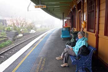 His alternative solution to overcome the otherwise insurmountable descent of the
Blue Mountains western escarpment was the Lithgow Great Zig-Zag. Whitton had
used the zig-zag railway formation with an impressive construction at the
Lapstone Zig-Zag built between 1863~65 to overcome the climb up the Blue Mountains eastern escarpment; the zig-zag concept had been
used on smaller scale minor lines in India, but this was the world's first
application on a main line railway. The construction of the Great Lithgow
Zig-Zag was
regarded as one of the engineering wonders of the Victorian age. It enabled
the railway to be driven westwards, linking Sydney over the Blue Mountains
dividing range, to transport farming produce from the prosperous lands of the NSW
western plains, and to exploit the coal
and iron ore deposits in the Lithgow Valley. By 1910 however, the railway had
become so successful and traffic so busy that the single line Zig-Zag ascent/descent of the
Blue Mountains western escarpment had become an inefficient bottle-neck. To
alleviate the rail congestion, the line was re-routed in 1910 by the cutting of a series of 10 tunnels
through the mountains to enable the railway to cross from Mount Victoria through
to Lithgow, the route of the current main line, obviating the need for the Zig-Zag route
over the mountains via Clarence. After that the now redundant Zig-Zag route, with its one long tunnel and 3 viaducts, was abandoned and fell
into dereliction for 65 years; the line was lifted and part of the track-bed
even tarmaced as a road. In 1975 however, a group of enthusiasts resurrected the
line from the former junction with the modern line down at Bottom Points up to
the now isolated Clarence station high in the mountains, to operate this route as a heritage railway,
using steam engines and diesel railcars preserved from Queensland Railways on a
3' 6" gauge.
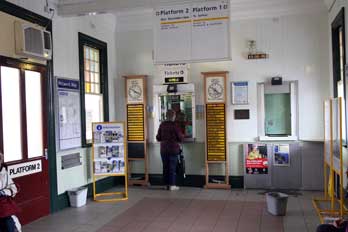
 Katoomba
railway station: at Katoomba station, we chatted with the friendly ticket lady,
complementing her on both the reasonable price and standard of service on the
Australian nationalised railways network compared with the over-priced and
degenerate state of Britain's semi-privatised railways. Our bus passes this time
produced the required response, and the seniors' reduced return fare from Katoomba to Zig-Zag was
just $16.20. These small country stations were charming, with a lovely nostalgic
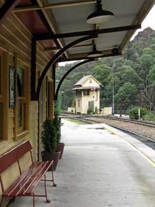
ticket-office-cum-waiting-room (see above left), flower beds planted along the platforms, and even a Station
Master's Office (see above right) (far more meaningful than Senior Customer Services Manager,
in the ludicrous modern parlance). Katoomba
railway station: at Katoomba station, we chatted with the friendly ticket lady,
complementing her on both the reasonable price and standard of service on the
Australian nationalised railways network compared with the over-priced and
degenerate state of Britain's semi-privatised railways. Our bus passes this time
produced the required response, and the seniors' reduced return fare from Katoomba to Zig-Zag was
just $16.20. These small country stations were charming, with a lovely nostalgic
ticket-office-cum-waiting-room (see above left), flower beds planted along the platforms, and even a Station
Master's Office (see above right) (far more meaningful than Senior Customer Services Manager,
in the ludicrous modern parlance).
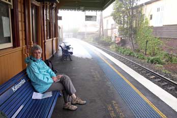
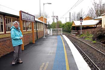 We waited for the 10-18am service train to Lithgow and Bathurst (see left and right)
(Photo
48 - Katoomba station), along with a group of elderly
evident 'train spotters' and a wino with his breakfast bottle of Scotch. We had been advised to sit in the last compartment of the modern
train and to alert the guard that we wanted to alight at the Zig-Zag platform,
though at this stage we still had no conception of what this entailed. The train drew
in, and as advised, we duly minded the gap between the train and Katoomba
station's sharply curving platform edge. As instructed, we notified the guard of
our wish to alight at Zig-Zag; she responded that we should recognise the
station as immediately following the succession of 10 tunnels. The ride was
smooth, but with distant views across the 1000s of Eucalyptus trees covering the
Blue Mountains obscured by mist. The small intervening stations, with their very
English-sounding names, were all as charming as
 Katoomba. But beyond Mount
Victoria and Bell, we had to concentrate on counting off the 10 tunnels as the train passed through, so that we were
ready to alight at Zig-Zag immediately beyond the final tunnel. Now we could see why we had to
sit in the last compartment: the tiny wooden platform-halt was less than one carriage
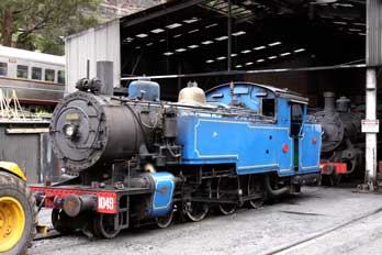
length! And there beside the modern line was the engine shed of the Zig-Zag Railway with lines of steam locomotives
(see left).
We had made it. Katoomba. But beyond Mount
Victoria and Bell, we had to concentrate on counting off the 10 tunnels as the train passed through, so that we were
ready to alight at Zig-Zag immediately beyond the final tunnel. Now we could see why we had to
sit in the last compartment: the tiny wooden platform-halt was less than one carriage
length! And there beside the modern line was the engine shed of the Zig-Zag Railway with lines of steam locomotives
(see left).
We had made it.
 Layout and operation of the Zig-Zag Railway, over the Blue Mountains western escarpment:
at this point however we could not see the Zig-Zag Railway's own bottom station,
but one of the train spotters pointed it out up the hill.
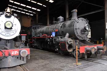
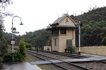
Having spent time photographing the steam
engines in the engine shed (see right), we walked up past
the signal box (see below left) to the platform and booking-office (see below
right and left); here we got the disappointing
news that the steam service was not operating today because of absence of a steam-qualified volunteer crew. Not only that, but the replacement
service operated by the preserved vintage railcar had broken down at the upper
terminus Clarence station. We were assured however that normal service was in
process of being restored; we should wait and the diesel train would be down
shortly.
While waiting, we took the opportunity to get to grips with a fuller understanding
the Zig-Zag Railway's
topography, the layout and former working of the line's peculiar
alignment, and its relationship with the successor modern line which had
replaced it on the alternative route between Bell and Lithgow via the 10
tunnels. The original Zig-Zag line over the mountains, constructed in
the 1860s, had operated from 1869 until 1910. In its day, the line had surmounted the obstacle of the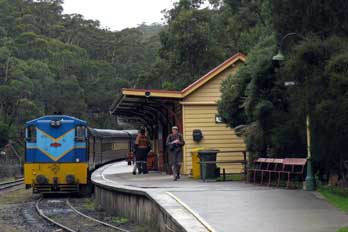 Blue Mountains
western escarpment by means of a sequence of two diagonally alternating 2kms-long inclines, zig-zagging at a 1:42 gradient on ledges hewn into
the rock face of the mountain side, literally in the form of
a letter Z: a train from Lithgow rose up the valley into what was then a
reversing-siding at Bottom
Points, forming the Bottom
Road of the zig-zag, on the site of what is now the Zig-Zag Railway's station-halt on the modern main line.
The engine ran round the train on a passing loop, and from the other end
pulled the train tender-first up the first incline (Middle Road of the
zig-zag) into a
reversing-siding at Top Points; there the engine again ran round the train, the
points were changed, and the train continued its journey up the second incline (Top
Road of the zig-zag), and on across the bush-covered plateau to Clarence, the highest
point of the line at 3,658 feet (1,115m) above sea Blue Mountains
western escarpment by means of a sequence of two diagonally alternating 2kms-long inclines, zig-zagging at a 1:42 gradient on ledges hewn into
the rock face of the mountain side, literally in the form of
a letter Z: a train from Lithgow rose up the valley into what was then a
reversing-siding at Bottom
Points, forming the Bottom
Road of the zig-zag, on the site of what is now the Zig-Zag Railway's station-halt on the modern main line.
The engine ran round the train on a passing loop, and from the other end
pulled the train tender-first up the first incline (Middle Road of the
zig-zag) into a
reversing-siding at Top Points; there the engine again ran round the train, the
points were changed, and the train continued its journey up the second incline (Top
Road of the zig-zag), and on across the bush-covered plateau to Clarence, the highest
point of the line at 3,658 feet (1,115m) above sea
 level (Map
1: 1869~1910 Lithgow Zig-Zag). From
there it descended to Bell and Mount Victoria and on eastwards towards Sydney.
Because of the steep 1:33 gradients on the line up to Clarence, trains were
double-headed with a banking engine in both directions from Bell and from
Lithgow, making Clarence a busy rail siding. As trains got longer and heavier,
the line descending eastward from Clarence was re-routed in 1897 via the Dargans
Creek Deviation, easing the gradient to 1:60 up from Newnes Junction to
Clarence. Even so, with further increases of rail traffic causing the single-line Zig-Zag route to become a bottleneck
(it took trains 3 hours to cross the Zig-Zag), the Ten level (Map
1: 1869~1910 Lithgow Zig-Zag). From
there it descended to Bell and Mount Victoria and on eastwards towards Sydney.
Because of the steep 1:33 gradients on the line up to Clarence, trains were
double-headed with a banking engine in both directions from Bell and from
Lithgow, making Clarence a busy rail siding. As trains got longer and heavier,
the line descending eastward from Clarence was re-routed in 1897 via the Dargans
Creek Deviation, easing the gradient to 1:60 up from Newnes Junction to
Clarence. Even so, with further increases of rail traffic causing the single-line Zig-Zag route to become a bottleneck
(it took trains 3 hours to cross the Zig-Zag), the Ten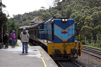 Tunnels Deviation was constructed
in 1910. This new line by-passed the 'over-the-mountain-top' Zig-Zag route entirely,
branching off before the lower incline from Bottom Points, passing through the
mountains by a more circuitous route via a 3 miles sequence of 10 tunnels, and re-joining the original route
where the Zig-Zag line had formerly descended from Clarence (Map
2: Zig-Zag and 10 Tunnels routes). The
Zig-Zag Railway Preservation Society has ambitious plans to extend the restored
railway eastwards from the present isolated upper terminus at Clarence down to Newnes
Junction, using the 1897 Dargans Creek Deviation, since the original 1869 track-bed
is now buried under the main road's tarmac. Future restoration of Newnes
Junction station would provide a better interchange with the Blue Mountains main
line service than the present Zig-Zag Bottom Points platform. Tunnels Deviation was constructed
in 1910. This new line by-passed the 'over-the-mountain-top' Zig-Zag route entirely,
branching off before the lower incline from Bottom Points, passing through the
mountains by a more circuitous route via a 3 miles sequence of 10 tunnels, and re-joining the original route
where the Zig-Zag line had formerly descended from Clarence (Map
2: Zig-Zag and 10 Tunnels routes). The
Zig-Zag Railway Preservation Society has ambitious plans to extend the restored
railway eastwards from the present isolated upper terminus at Clarence down to Newnes
Junction, using the 1897 Dargans Creek Deviation, since the original 1869 track-bed
is now buried under the main road's tarmac. Future restoration of Newnes
Junction station would provide a better interchange with the Blue Mountains main
line service than the present Zig-Zag Bottom Points platform.
Our ride on the restored Zig-Zag Railway up
from Bottom Points to Clarence:
we were now a little clearer on both the history, development, complex layout
and functioning of the original Zig-Zag route. After a wait, the diesel-hauled
relief train descended the Zig-Zag inclines to Bottom Points (see above right),
bringing its full load of passengers down from Clarence which had road access
from the parallel running Great West Highway. The now repaired 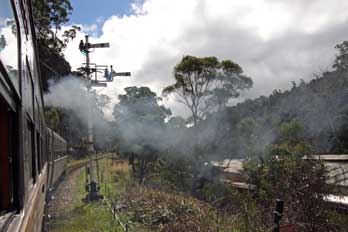 railcar followed it down into the lower siding;
almost
immediately, the railcar was ready to re-ascend the first incline of the Zig-Zags back up to Clarence (see
left). railcar followed it down into the lower siding;
almost
immediately, the railcar was ready to re-ascend the first incline of the Zig-Zags back up to Clarence (see
left).
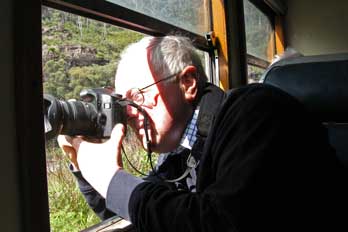 We managed to get seats at the rear of the
railcar and to open the windows for
photography (see right), particularly as the train advanced up the lower
incline, over the two viaducts on the upward approach to Top Points (Map
1: Zig-Zag Railway), with the rock-wall of the onward higher
section of upper incline line towering overhead (Photo
49 - Lower incline viaducts). Although the railcar had a driving cab at both
ends, meaning the driver had only to walk through for the change of direction at
the Top Points Zig-Zag, the train paused at the siding station for the guard to explain
the working principles of the Zig-Zags. He also pointed out the original short
length of siding
where an engine overran the buffers in 1901, stopping part-hanging over the
cliff. In the late-19th century, before trains were fitted with vacuum brakes,
train runaways on steep gradients such as the Zig-Zags were not unknown,
especially in bad weather or poor visibility. The new (and present) extended siding was cut to prevent future such
accidents, by allowing longer trains to occupy the siding before
ascending/descending the upper/lower zig-zag. The railcar now reversed We managed to get seats at the rear of the
railcar and to open the windows for
photography (see right), particularly as the train advanced up the lower
incline, over the two viaducts on the upward approach to Top Points (Map
1: Zig-Zag Railway), with the rock-wall of the onward higher
section of upper incline line towering overhead (Photo
49 - Lower incline viaducts). Although the railcar had a driving cab at both
ends, meaning the driver had only to walk through for the change of direction at
the Top Points Zig-Zag, the train paused at the siding station for the guard to explain
the working principles of the Zig-Zags. He also pointed out the original short
length of siding
where an engine overran the buffers in 1901, stopping part-hanging over the
cliff. In the late-19th century, before trains were fitted with vacuum brakes,
train runaways on steep gradients such as the Zig-Zags were not unknown,
especially in bad weather or poor visibility. The new (and present) extended siding was cut to prevent future such
accidents, by allowing longer trains to occupy the siding before
ascending/descending the upper/lower zig-zag. The railcar now reversed
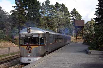 direction to move forward
past Top Points signal box, over the changed points at the siding's outer
end, and upwards
onto the second incline; the lower incline that we had just climbed could now
be seen sloping downwards
way below into the
tree-covered valley (Photo
50 - Upper incline high on Mountain face), showing the unbelievable height gain up the mountain
face. The
ex-Queensland Railways railcar direction to move forward
past Top Points signal box, over the changed points at the siding's outer
end, and upwards
onto the second incline; the lower incline that we had just climbed could now
be seen sloping downwards
way below into the
tree-covered valley (Photo
50 - Upper incline high on Mountain face), showing the unbelievable height gain up the mountain
face. The
ex-Queensland Railways railcar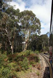 continued
up the slope, crossing
another magnificent
stone viaduct, and passing though forests of gum trees and the lengthy Clarence
Tunnel on the plateau top, before eventually pulling into Clarence station, the
upper terminus of the preserved railway (see left) (Photo
51 - Clarence upper terminus station). We sat here to eat a lunch of pies from
the station buffet, and to wait for the next return of the railcar at 3-00pm.
On the 3-00pm down train, the guard again gave a fulsome commentary, explaining
features of the terrain and the line. We
secured more photos from the train window, firstly among the gum trees which
covered the bush land of the upper mountain plateau
(Photo
52 - Gum tree-covered bush)
(see right). Just before the first viaduct, the train paused for
passengers to alight at a viewpoint (see below left) in order to photograph the magnificent view
looking down across the valley
(Photo
53 - View into Lithgow valley): the high rock-wall below the upper incline showed the
scale of colossal civil engineering task, blasting out and excavation on this
sheer slope to create the two inclines shelving across the precipitous face of the mountainside,
and switching back on themselves twice to reach the bottom of
the 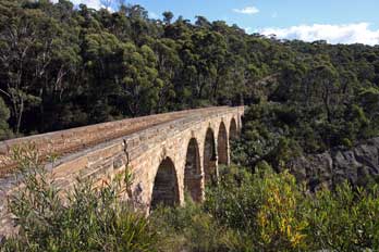 escarpment. From this viewpoint, we could look along the railway line of the
upper incline towards the first viaduct, down the rock-wall to the line of
the lower incline shelf sloping down from Top Points over Viaducts Two and Three, and way down 100s of feet into the
valley bottom forest the
electrified double main line continuing westward towards Lithgow, with Farmers
Creek below that in the very bottom of the valley (Photo
54 - Upper and lower Zig-Zags). Standing here at this rocky viewpoint on
the upper incline, we were almost directly above the point where Photo 49 was
taken earlier from the train as it climbed the lower incline approaching No 3
Viaduct. Re-boarding the train, we
now moved forward over the upper viaduct, and now from the train window
we could look down over the stone parapet and rock retaining-wall onto the line
sloping downwards over the lower incline escarpment. From this viewpoint, we could look along the railway line of the
upper incline towards the first viaduct, down the rock-wall to the line of
the lower incline shelf sloping down from Top Points over Viaducts Two and Three, and way down 100s of feet into the
valley bottom forest the
electrified double main line continuing westward towards Lithgow, with Farmers
Creek below that in the very bottom of the valley (Photo
54 - Upper and lower Zig-Zags). Standing here at this rocky viewpoint on
the upper incline, we were almost directly above the point where Photo 49 was
taken earlier from the train as it climbed the lower incline approaching No 3
Viaduct. Re-boarding the train, we
now moved forward over the upper viaduct, and now from the train window
we could look down over the stone parapet and rock retaining-wall onto the line
sloping downwards over the lower incline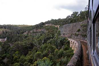 and its two viaducts (Photo
55 - Train crossing upper viaduct) as the train descended the upper incline
back into the extended
reversing-siding at Top Points. and its two viaducts (Photo
55 - Train crossing upper viaduct) as the train descended the upper incline
back into the extended
reversing-siding at Top Points.
The train paused at Top Points
station giving us chance to photograph both the railcar (Photo
56 - Top Points station) and the view looking
along the lower valley, with the upper incline viaduct still visible high
above its rocky retaining wall, the lower incline sloping steeply downwards into
its tunnel mouth, and
the Lithgow main line way down in the valley bottom (Photo
57 - Scale of mountain face).
This view upwards and downwards again
showed the monumental scale of the mountainous barrier that the Zig-Zag line was
designed to negotiate; it also emphasised
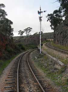 the enormous engineering challenge of
the railway's construction on the sheer mountain face. The signal changed and
the train moved forward over the points to start the final leg down the lower
incline (see above right). As the train crossed the points at the end of the siding,
the upper line that we had just descended rose visibly to the right, and the
lower zig-zag fell away on the downhill slope (see left) down to Bottom Points way down into the
valley below. Across the two viaducts and through the lower tunnel, the
train returned down to Bottom Points. the enormous engineering challenge of
the railway's construction on the sheer mountain face. The signal changed and
the train moved forward over the points to start the final leg down the lower
incline (see above right). As the train crossed the points at the end of the siding,
the upper line that we had just descended rose visibly to the right, and the
lower zig-zag fell away on the downhill slope (see left) down to Bottom Points way down into the
valley below. Across the two viaducts and through the lower tunnel, the
train returned down to Bottom Points.
A 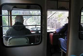 second ride up and down the preserved Zig-Zags: it was now 4-00pm, and with the over-running timetable due to the earlier
breakdown, we should have to catch a later service train back to Katoomba; we
therefore had time for a further tour of the engine-shed to view the collection of steam
locos. None of
the engines or rolling stock was native to the original Zig-Zag Railway, but
came from Queensland which still had the 3' 6" gauge; at the 1975 restoration,
the original standard gauge Zig-Zag line had therefore to be re-laid with the narrower gauge. In the yard at the back of the
shed, an oil-fired Beyer-Garratt 4-8-2+2-4-8 articulated
locomotive was stored in semi-derelict condition, looking quite incongruous in
this location (Photo
58 - Beyer-Garratt articulated locomotive). Ten of these engines had been
ordered in 1951 from Beyer-Peacock of Manchester and shipped out to Australia to
haul ore trains from the mines at Broken Hill to smelters at Port Pirie in South
Australia; when the engines were replaced by diesels, No 402 was
purchased by the Zig-Zag Railway in 1973 and still awaited restoration. Later in the trip
we should see a fully restored member of this heavy freight locomotive class at
Port Adelaide Railway Museum. We
assumed that would be the end of our visit and that we should have to pass the
1½ hour wait with a cup of tea at the Bottom Points station buffet. But the lady there was
about to close for the day, and instead offered us an extra ride up and down the
restored line before our return train to Katoomba. We therefore had further
opportunity
to take more photos on this spectacular line up to Clarence,
although the bright sun of earlier was now gone and the weather had turned
disappointingly dull with poor light. What a difference second ride up and down the preserved Zig-Zags: it was now 4-00pm, and with the over-running timetable due to the earlier
breakdown, we should have to catch a later service train back to Katoomba; we
therefore had time for a further tour of the engine-shed to view the collection of steam
locos. None of
the engines or rolling stock was native to the original Zig-Zag Railway, but
came from Queensland which still had the 3' 6" gauge; at the 1975 restoration,
the original standard gauge Zig-Zag line had therefore to be re-laid with the narrower gauge. In the yard at the back of the
shed, an oil-fired Beyer-Garratt 4-8-2+2-4-8 articulated
locomotive was stored in semi-derelict condition, looking quite incongruous in
this location (Photo
58 - Beyer-Garratt articulated locomotive). Ten of these engines had been
ordered in 1951 from Beyer-Peacock of Manchester and shipped out to Australia to
haul ore trains from the mines at Broken Hill to smelters at Port Pirie in South
Australia; when the engines were replaced by diesels, No 402 was
purchased by the Zig-Zag Railway in 1973 and still awaited restoration. Later in the trip
we should see a fully restored member of this heavy freight locomotive class at
Port Adelaide Railway Museum. We
assumed that would be the end of our visit and that we should have to pass the
1½ hour wait with a cup of tea at the Bottom Points station buffet. But the lady there was
about to close for the day, and instead offered us an extra ride up and down the
restored line before our return train to Katoomba. We therefore had further
opportunity
to take more photos on this spectacular line up to Clarence,
although the bright sun of earlier was now gone and the weather had turned
disappointingly dull with poor light. What a difference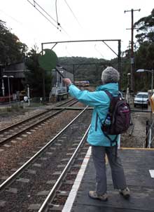 it would have made had the late
afternoon sun been shining, and such a pity we had been denied the sight and
smell of steam operation on the challenging slopes of the Zig-Zag it would have made had the late
afternoon sun been shining, and such a pity we had been denied the sight and
smell of steam operation on the challenging slopes of the Zig-Zag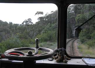 Railway. On the
downward run with the towering rock-wall of the higher incline rising on the
upper side, we had the railcar to ourselves, and on the final section down
from Top Points, the driver invited us to sit in the driving compartment for
bonus photos of the forward view from the cab (see above right).
Despite the now gloomy light, we took our photos as the railcar travelled down
over the viaducts (Photo
59 - View from railcar driver's cab) and into the darkness of the lower tunnel
(see right). Back
down at Bottom station we said farewell to the crew, and crossed back to the tiny wooden platform-halt to await the main
line train back to Katoomba. It was here that we discovered it was necessary to
indicate for the main line train to stop at the Zig-Zag platform by waving a large
lollipop-baton as the main line train
approached (see left) (Photo
60 - Requesting train to stop). Railway. On the
downward run with the towering rock-wall of the higher incline rising on the
upper side, we had the railcar to ourselves, and on the final section down
from Top Points, the driver invited us to sit in the driving compartment for
bonus photos of the forward view from the cab (see above right).
Despite the now gloomy light, we took our photos as the railcar travelled down
over the viaducts (Photo
59 - View from railcar driver's cab) and into the darkness of the lower tunnel
(see right). Back
down at Bottom station we said farewell to the crew, and crossed back to the tiny wooden platform-halt to await the main
line train back to Katoomba. It was here that we discovered it was necessary to
indicate for the main line train to stop at the Zig-Zag platform by waving a large
lollipop-baton as the main line train
approached (see left) (Photo
60 - Requesting train to stop).
Return to Katoomba:
the smoothly running, comfortable main line train hummed along to Katoomba,
and it was fully dark by the time we arrived back at 6-30pm. Today had been so
rewarding, learning at first hand about the history and
working of the early railways in NSW's mountain terrain, and first stop this
evening was the Carrington for schooners of Amber. When we left the pub, the air was very cool tonight,
with a damp mist down again. We walked along the main street, failing to find the
Indian restaurant we had seen yesterday. Instead we found another Thai restaurant which offered a 10% discount with the local tourist card.
The town was totally deserted and restaurants closing as if
mid-winter with the eerie mist. Katoomba certainly did not fit our fears
of it being a busy and over-commercialised resort, at least not on a chill
April-autumn evening. Back to the hostel up and down the steep, hilly streets,
we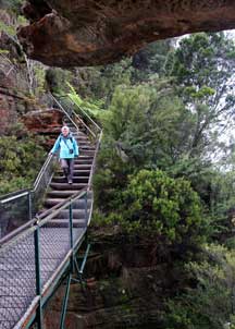 sorted kit from today and read up in readiness for tomorrow's walking in the
Blue Mountains National Park. sorted kit from today and read up in readiness for tomorrow's walking in the
Blue Mountains National Park.
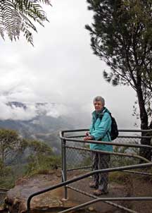 A day in Blue Mountains National Park: we were away by 9-20am for
our day's walking in the Blue Mountains National Park, and although the mist was
still down, the weather was at least not wet this morning. Our plan for today was
to catch the bus which ran from Katoomba along to Echo point, and to make the descent of
the Jamison Valley's sheer northern escarpment cliff-face via the Giant
Steps below the Three Sisters rock pinnacles; we should then walk westwards along
through the rainforest down in the valley bottom via the Dardanelles Pass Path
and Federal Pass Path, and re-ascend the escarpment via the Furber Steps (Map of
Jamison Valley escarpment). A day in Blue Mountains National Park: we were away by 9-20am for
our day's walking in the Blue Mountains National Park, and although the mist was
still down, the weather was at least not wet this morning. Our plan for today was
to catch the bus which ran from Katoomba along to Echo point, and to make the descent of
the Jamison Valley's sheer northern escarpment cliff-face via the Giant
Steps below the Three Sisters rock pinnacles; we should then walk westwards along
through the rainforest down in the valley bottom via the Dardanelles Pass Path
and Federal Pass Path, and re-ascend the escarpment via the Furber Steps (Map of
Jamison Valley escarpment).
Giant Stairway descent of Jamison Valley northern escarpment cliff-face:
the bus arrived and the driver again was helpful, giving us advice on the
walking route for today, an optimistic weather report, and details of return
buses. At the Echo Point National Park Info Centre, the smilingly helpful warden
gave us more reassuring details of the rock steps descent of the cliff-face. A pathway led around to
the look-out at the top of the steps. The mist was just beginning to break, opening
up limited views across the valley in the notoriously omnipresent Blue Mountains autumn mist. Hesitantly we began the descent.
The rock steps seemed alarmingly steep, wet and worn, less than 3 feet wide, but
reassuringly enclosed between a handrail on the outer side and the sheer
rock-face of the cliff on the inner side. There was therefore little sense of
undue exposure, simply the alarmingly severe steepness of the escarpment cliff. The
descent continued in zig-zagging sections, so that we advanced one section at a
time down the sheer cliff-face alongside and below the Three Sisters. Some
sections were winding and partially eroded rock-steps, others very steep steel
step-ways lined on both sides with hand rails. Hesitantly we worked our way down
to the bottom of the first section (see above right); here a
fragile-looking footbridge spanned the airy gap between the look-out on the
vertical cliff-face across to a rock platform cut into the sedimentary rock
strata of the innermost of the Three Sisters pinnacles
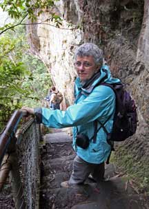 (Photo
61 - Three Sisters footbridge); uncertainly we edged across the footbridge to stand on the rock
platform beneath the overhang of the closest rock pinnacle (see above left).
The cloud and mist were
just beginning to break, magically opening up further distant views across the
Jamison Valley. (Photo
61 - Three Sisters footbridge); uncertainly we edged across the footbridge to stand on the rock
platform beneath the overhang of the closest rock pinnacle (see above left).
The cloud and mist were
just beginning to break, magically opening up further distant views across the
Jamison Valley.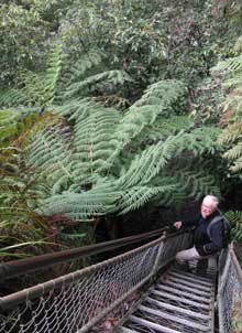
Nerving ourselves, we set off again on the
steepest section of the severe descent (see right), and continued section by section down the
eroded stone steps and steep step-ways (see left); the descent route seemed to zig-zag
every-which-way on the seemingly vertical cliff face (Map of Giant Steps descent).
From the sea of forest way down below us, the air was filled with the constant
trilling, warbling, shrieking background sound of exotic birds down in the
rainforest. Occasionally white cockatoos flew around, tiny in the distance way below
us. As we descended further, the bird-song grew louder, but all our attention
was firmly riveted on the demandingly steep descent. Down, down, and ever down
again the twisting, turning descent continued. We paused frequently both to take
photos and to allow more active walkers to pass. Once we were accustomed to the
severe downward gradients, the descent became less nerve-wracking, even on the
almost vertical steel step-ways (Photo
62 - Descending steel step-ways), and we
were better able to appreciate the thrillingly magnificent descent of the
northern escarpment cliff-face and the vista across the
rainforest-covered Jamison Valley (Photo
63 - Forest-covered valley). As we descended further, the
misty cloud broke more to
produce blue sky gaps and emerging sun. Moving with slow and deliberate steps, and
with frequent halts (Photo
64 - Descent of Giant Steps), it took over an hour to complete the descent
into the increasingly dense rainforests (see below right). The
vegetation on the vertical cliff-face gradually changed from heath to open
forest as we descended lower and the cliff-side below the Three Sisters offered
more protection from the wind to plant species managing to get a toe-hold on the vertical
rock-face. Suddenly the gradient eased and as we entered the forest, the transverse Dardanelles Pass path
became
visible still
way down below us in the
valley bottom. We stepped down from the last steps onto the valley transverse path (see
left),
relieved to being on flattish ground again after the near-vertical gradients of the
eroded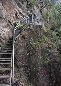 rock and steel steps descent.
Although unnerving and difficult fully to appreciate at time of actual descent
(easier in retrospect!), there was no denying that the Giant Steps were in fact an
admirable piece of construction, giving unparalleled
vistas over the valley and intimate views of the sheer rock face of the cliff. The route
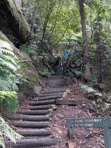 was pioneered
by Ranger McKay of Katoomba: starting in 1911 from valley bottom, he
and his crew carved out over 900 steps in the 1,000 feet high sheer rock face, bridging gaps
and linking buttresses with steel ladders; the route was completed in 1932
and opened to visitors, allowing descent from Echo Point to valley floor as a
lasting tribute to these early pioneers. was pioneered
by Ranger McKay of Katoomba: starting in 1911 from valley bottom, he
and his crew carved out over 900 steps in the 1,000 feet high sheer rock face, bridging gaps
and linking buttresses with steel ladders; the route was completed in 1932
and opened to visitors, allowing descent from Echo Point to valley floor as a
lasting tribute to these early pioneers.
We had expected to descend to a flat valley
bottom into the rainforest, but in fact the hillside continued downwards at a
more shallow angle, covered with dense rainforest, for a considerable distance
down further into the Jamison Valley. The air was filled with the loud noise of
bird-life; although no birds were visible in the dense forest, Sheila took
videos, panning around this exotic forest-scape and recording the bird-sounds.
Darnanelles Pass Path through rainforest: we set
off westwards along the transverse Dardanelles Pass Path, with the route rising
and falling through the rainforest. The path advanced along a shelf across the downward-sloping forest floor (see
below left) which
fell away below us way down into the lower Jamison Valley (Map of rainforest path).
We stopped
frequently to photograph the exotic trees: huge Tree-Ferns
(Photo
65 - Rainforest Tree Ferns) (see below right), and orange and white
bare trunks of Eucalyptus, their
stringy bark peeling off and hanging in shreds
or lying in heaps on the ground below the trees. It was all so thrilling viewing
such exotic trees,
to the accompaniment of the constant background shrieking and warbling calls of unseen forest bird-life.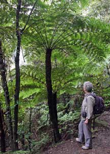
We paused to eat our lunch cobs just after joining
the Federal Pass Path, revelling in the atmosphere of the dense rainforest
vegetation. Moving forward, we found a flowering shrub of Lambertia formosa, commonly known as
Mountain Devil
(Photo
66 - Mountain Devil flowers) 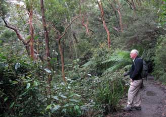 (from its horn-shaped fruits), with its spectacular red tubular,
spiny flower-heads; this was another flower producing profuse amounts of nectar and
pollinated by honeyeaters. We also saw a Banksia shrub with its yellow 'bottle-brush'
flower heads. Here was botanising with a difference (see below right). We continued for some 2 kms through the dense forest, the bird
sounds now lessening as we reached the still running lower downfalls of the Katoomba Cascades which we could hear from a distance as we approached. We also
passed a Turpentine Tree (Syncarpia glomulifera), another tree of the
Eucalyptus family, growing up to 60m in height and native to Queensland
and NSW; its crushed leaves have a taste and smell reminiscent of turpentine.
The distant view back towards the Three Sisters was magnificent lit by the morning sun. (from its horn-shaped fruits), with its spectacular red tubular,
spiny flower-heads; this was another flower producing profuse amounts of nectar and
pollinated by honeyeaters. We also saw a Banksia shrub with its yellow 'bottle-brush'
flower heads. Here was botanising with a difference (see below right). We continued for some 2 kms through the dense forest, the bird
sounds now lessening as we reached the still running lower downfalls of the Katoomba Cascades which we could hear from a distance as we approached. We also
passed a Turpentine Tree (Syncarpia glomulifera), another tree of the
Eucalyptus family, growing up to 60m in height and native to Queensland
and NSW; its crushed leaves have a taste and smell reminiscent of turpentine.
The distant view back towards the Three Sisters was magnificent lit by the morning sun.
Tourist hordes brought down by funiculars to pollute the
rainforest:
so far we had enjoyed almost complete solitude on our passage through the
rainforest, meeting only the occasional other walkers;
but increasing numbers were gathering around the crossing of the waterfalls. Some 250m beyond this however, we passed
through gates into the so-called Scenic World, a sordid and
exploitational Disney Land area set amid the natural rainforest, with 2 funicular
railways up the
escarpment and the horrifically intrusive Scenic Skyway cable-car
spanning the cliffs above the Upper Katoomba Falls. At first as we entered this area, the crowds of tourists who had descended effortlessly by funicular did not
seem unduly intrusive. But our attention was entirely focussed on the magnificent spectacle
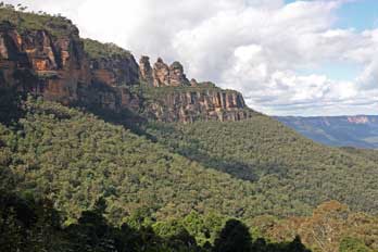 of the Three Sisters away to the east, the craggy
cliff-line of the Katoomba escarpment towering overhead
(see left) (Photo
67 - Three Sisters), and the multi-green colours of the forest floor
which filled the entire valley, all dominated by the
stunning of the Three Sisters away to the east, the craggy
cliff-line of the Katoomba escarpment towering overhead
(see left) (Photo
67 - Three Sisters), and the multi-green colours of the forest floor
which filled the entire valley, all dominated by the
stunning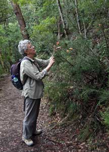 profile of Mount Solitary away to the south. And by now the cloud had
broken fully to give blue sky, with bright sunshine illuminating the Three
Sisters and cliff-faces. The funicular however brought down increasing
multitudes of unrestrained, rowdy tourists; we therefore advanced further
through the area of trivial 'attractions' put there to entertain the tourists,
as if the unbelievable beauty of the natural landscape were not enough in itself to hold the attention of these vacuously simple-minded folk.
We continued round to the start of the
rainforest board-walk which looped off the main path. Treacherously slippery in
the moist rainforest atmosphere, the wooden board-walk felled the tourists,
ill-shod in their city shoes, who
rowdily disturbed the peace of the forest; why do they come down here to pollute
the forest, so
indifferent to these majestic natural surroundings? Scattered among the densely
wooded rainforest were specimens of stately tall Mountain Blue Gum Trees (Eucalyptus
deanei), a species of Eucalyptus endemic to New South Wales and growing up
to 65m tall, with
smooth, pale bark. Thick, convoluted woody Liana vines enveloped trees and hung from branches (see below
left).
We had been told that Superb Lyre Birds could sometimes be seen scratching around on the rainforest floor,
but with all the brouhaha and disturbance created by
the wretched tourists, this
seemed
 unlikely
today. We enquired about the Lyre Birds with a maintenance man,
who dutifully (but unconvincingly) tried to persuade us about the owners of
Scenic World and their supposed efforts to conserve the rainforests. We were
neither persuaded nor
impressed; they were still making a fortune out of the funiculars and Skyway
which daily brought 1000s of tourists effortlessly down, totally indifferent to
the natural wonders, to disrupt the peace of the forest and to disturb
the wildlife. The rowdiness of the Japanese tourists in particular was so
offensively intrusive, and
totally ruled out any chance of sighting of the Lyre Bird. unlikely
today. We enquired about the Lyre Birds with a maintenance man,
who dutifully (but unconvincingly) tried to persuade us about the owners of
Scenic World and their supposed efforts to conserve the rainforests. We were
neither persuaded nor
impressed; they were still making a fortune out of the funiculars and Skyway
which daily brought 1000s of tourists effortlessly down, totally indifferent to
the natural wonders, to disrupt the peace of the forest and to disturb
the wildlife. The rowdiness of the Japanese tourists in particular was so
offensively intrusive, and
totally ruled out any chance of sighting of the Lyre Bird.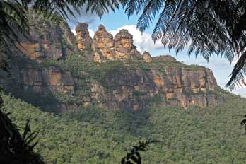
Re-ascent of escarpment via Furber Steps:
returning to the main path-way, we fought
our way back through the tourist hordes who blocked the way, rowdily
photographing one another by the pseudo-coalmine attractions. These were
intended to inform visitors about the late 19th century coal and shale mines
which were worked here below Katoomba, and whose tramways were the predecessors
of today's tourist funiculars; (not of course that the tourists had any interest
in being so informed!). Our attention was focussed on the distant profile of the Three Sisters,
framed by the overhanging giant Tree Ferns (see right). All of this intrusively disturbing presence of rowdy tourists made us determined not to
use the funicular for our re-ascent, but to return to the
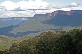 Furber Steps as our
means of re-ascending the escarpment. Once we had left behind the
immediate surroundings of Scenic World, peace and solitude thankfully were restored. We
returned to the foot of the Furber Steps and eat our choc-bars before beginning
the re-ascent. At least on the lower sections, the Furber Steps gradient looked
less severe than on our descent via the Giant Steps. Steadily we set off
upwards, section by section, still hoping to see a Superb Lyre Bird
on the forested slopes of the cliff. Generally the steps were less severe and
less exposed, and we gained height steadily without undue effort. The vista
across the panorama of the forest-covered Jamison Furber Steps as our
means of re-ascending the escarpment. Once we had left behind the
immediate surroundings of Scenic World, peace and solitude thankfully were restored. We
returned to the foot of the Furber Steps and eat our choc-bars before beginning
the re-ascent. At least on the lower sections, the Furber Steps gradient looked
less severe than on our descent via the Giant Steps. Steadily we set off
upwards, section by section, still hoping to see a Superb Lyre Bird
on the forested slopes of the cliff. Generally the steps were less severe and
less exposed, and we gained height steadily without undue effort. The vista
across the panorama of the forest-covered Jamison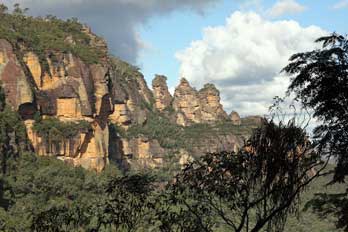 Valley, backed by Mount
Solitary forming the southern valley rim, was simply magnificent (see left). But
what was even more extraordinary was the increasingly clear line of sight
towards the Three Sisters, and we took a series of photos as we advanced little
by little up the cliff. From this angle, the footbridge connecting the
cliff face onto the rock platform on the innermost of the Three Sisters
pinnacles that we had crossed this morning, was clearly visible (Photo
68 - Three Sisters pinnacles) (see right).
Apart from 2 or 3 steeper sections with some
steel steps, the ascent presented no problems. Three quarters of the way up, a
side path diversion shelved around to a lookout 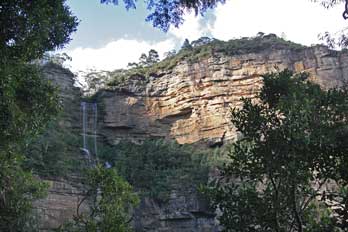 giving spectacular views of the Katoomba Falls
(Photo
69 - Katoomba Falls) which dropped over the rim of the cliff-line way above (see
left), falling the entire 1,000 feet height of the escarpment. On the shelved
sections of the climb, the path passed under magnificent rocky overhangs where strata
of sedimented clay had been eroded below the over-topping residual sandstone (Photo
70 - Eroded cliff overhang) (see below right).
Through the fringe of trees at this lookout (see below left), Mount Solitary stood like a
sentinel on the southern flank of the forest-covered Jamison Valley. Returning to the main path, we advanced up
the giving spectacular views of the Katoomba Falls
(Photo
69 - Katoomba Falls) which dropped over the rim of the cliff-line way above (see
left), falling the entire 1,000 feet height of the escarpment. On the shelved
sections of the climb, the path passed under magnificent rocky overhangs where strata
of sedimented clay had been eroded below the over-topping residual sandstone (Photo
70 - Eroded cliff overhang) (see below right).
Through the fringe of trees at this lookout (see below left), Mount Solitary stood like a
sentinel on the southern flank of the forest-covered Jamison Valley. Returning to the main path, we advanced up
the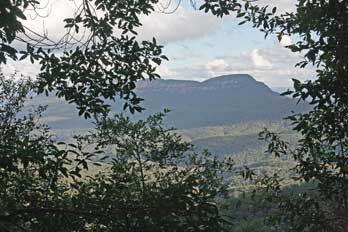 final steps to reach the transverse Prince Henry path which would lead
around the upper cliff-tops back to Echo Point for the bus back into town. But the
signposts ran out, and the pathways became confusingly uncertain. We eventually
emerged onto the cliff-top road at a car park near the Katoomba camping site. A pair
of Parakeets
had chosen this spot to roost in a tree. There was no time now to attempt to walk around
to Echo Point; we should miss the last bus which left at 5-15pm. Fortunately,
although there was no bus stop in sight, we managed to flag down a bus, by coincidence with the same helpful driver as earlier; this circled back to Echo Point and dropped us back
in Katoomba outside the Carrington. We had truly earned our schooners of Amber
tonight. final steps to reach the transverse Prince Henry path which would lead
around the upper cliff-tops back to Echo Point for the bus back into town. But the
signposts ran out, and the pathways became confusingly uncertain. We eventually
emerged onto the cliff-top road at a car park near the Katoomba camping site. A pair
of Parakeets
had chosen this spot to roost in a tree. There was no time now to attempt to walk around
to Echo Point; we should miss the last bus which left at 5-15pm. Fortunately,
although there was no bus stop in sight, we managed to flag down a bus, by coincidence with the same helpful driver as earlier; this circled back to Echo Point and dropped us back
in Katoomba outside the Carrington. We had truly earned our schooners of Amber
tonight.
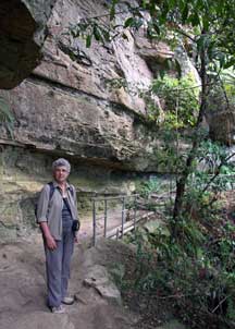 Final
evening at Katoomba:
in the pub, again we got into conversation with a local
Aussie, and talked cricket, and employment in country towns such a Katoomba, and
contributed with answers to the pub quiz which was just starting. The air was
cold tonight as we walked around to the Greek Cypriot restaurant opposite the
station for our supper. The owner hussled us to place our order, as we chatted
with an elderly Aussie couple whom we had met in the Thai restaurant last
evening. This initial inhospitable non-welcome should have been sufficient to
alert that this was not the place for Final
evening at Katoomba:
in the pub, again we got into conversation with a local
Aussie, and talked cricket, and employment in country towns such a Katoomba, and
contributed with answers to the pub quiz which was just starting. The air was
cold tonight as we walked around to the Greek Cypriot restaurant opposite the
station for our supper. The owner hussled us to place our order, as we chatted
with an elderly Aussie couple whom we had met in the Thai restaurant last
evening. This initial inhospitable non-welcome should have been sufficient to
alert that this was not the place for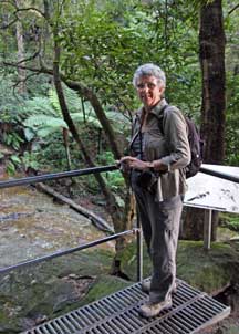 us; as should the horrendous prices when
we gaped at the menu. But we were unguardedly tempted by the allure of Greek food,
and failed to react to these obvious red-flag warnings;
common sense said we ought to have walked out at that point. But instead we
ordered 3 dishes: merides, keftedes and souvlaki and a Greek salad. What
arrived were micro-portions of not particularly noteworthy quality; and the bill
for this unimpressively limited supper was equally breathtaking! Furious with
ourselves for being so deluded, and not walking out in the first place, we
returned to the Carrington still hungry, to complete our supper with another
beer and a large bag of crisps since the pub had stopped serving chips at
9-00pm! On a chillingly cold evening, we returned for
our final night at No 14 Hostel, after such a
wonderfully memorable day's walking amid the Jamison Valley rainforests. Tomorrow we should return by train to Sydney. us; as should the horrendous prices when
we gaped at the menu. But we were unguardedly tempted by the allure of Greek food,
and failed to react to these obvious red-flag warnings;
common sense said we ought to have walked out at that point. But instead we
ordered 3 dishes: merides, keftedes and souvlaki and a Greek salad. What
arrived were micro-portions of not particularly noteworthy quality; and the bill
for this unimpressively limited supper was equally breathtaking! Furious with
ourselves for being so deluded, and not walking out in the first place, we
returned to the Carrington still hungry, to complete our supper with another
beer and a large bag of crisps since the pub had stopped serving chips at
9-00pm! On a chillingly cold evening, we returned for
our final night at No 14 Hostel, after such a
wonderfully memorable day's walking amid the Jamison Valley rainforests. Tomorrow we should return by train to Sydney.
Return by train to Sydney:
another 7-00am start to the day in order to write up yesterday's
log which had been started last night. No 14 Hostel had been an good choice: a
peaceful environment, good facilities, and a helpful and hospitable welcome from the owner. We re-packed our kit
(Photo
71 - No 14 Hostel), and set off with full packs for the exhausting walk back
uphill to Katoomba station.
At the station, we bought our return tickets from the
same friendly ticket lady. The 11-20 train from Sydney drew in, terminating at Katoomba; we managed to
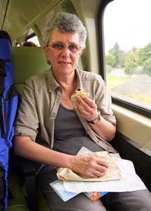 get seats with good views for the return
journey (see below left), as the train passed through all the delightful little country stations on the way
into Sydney. The train drew into Sydney at 13-20 and, donning our packs, we made
our way out of the now familiar Central Station and plodded through the park
(where White Ibises scavenged the bins for scraps) across to the Big Hostel. The
warden welcomed us back; our room, this time on the top floor was ready so we
were able to stow our kit and pack light day sacs ready for an afternoon in the
Central Business District of Sydney. After a wait at the bus stop across the
road, we caught the free bus down into the city. After the peaceful air of Katoomba, the noise of Sydney traffic resounded
deafeningly in our ears. get seats with good views for the return
journey (see below left), as the train passed through all the delightful little country stations on the way
into Sydney. The train drew into Sydney at 13-20 and, donning our packs, we made
our way out of the now familiar Central Station and plodded through the park
(where White Ibises scavenged the bins for scraps) across to the Big Hostel. The
warden welcomed us back; our room, this time on the top floor was ready so we
were able to stow our kit and pack light day sacs ready for an afternoon in the
Central Business District of Sydney. After a wait at the bus stop across the
road, we caught the free bus down into the city. After the peaceful air of Katoomba, the noise of Sydney traffic resounded
deafeningly in our ears.
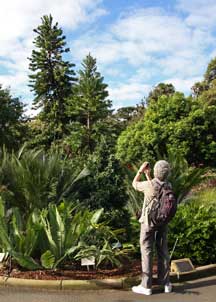 Wollemi Pine at Sydney Botanic Gardens: our plan for this afternoon was to revisit the Botanical
Gardens, then to walk through the central city to visit key buildings of the CBD.
Busy city traffic slowed the bus to a crawl down Elizabeth Street, but we
got off at the stop before Circular Quay and walked through to the
corner of the Botanic Gardens, the site where the NSW colony's first convict settlers grew
vegetables. In the central area of the gardens, we found
the cultivated specimen of the Wollemi Pine (Wollemia nobilis) (see right)
(Photo
72 - Wollemi Pine), a species of coniferous tree surviving from
the Cretaceous Period. The tree was previously known only from fossil records and thought to be long
extinct, until discovered in 1994 by a bush-walker in an isolated, temperate
rainforest wilderness area of the Wollemi National Park in north-west New South Wales, in
narrow, steep-sided sandstone gorges. Wollemi Pines are classified as a
critically endangered species, and legally protected in Australia with less than
100 specimens surviving in the wild. They were saved from damage in the
2019~2020 bush fires by the prompt action of National Park and Rural Fire
Service fire fighters. They grow to 25~40m tall in the wild, with
long, flat evergreen leaves and distinctive dark brown knobbly bark. After their
discovery, they were successfully cloned and grown at Sydney Botanic Gardens;
a small cultivated population of the trees has now been established and a recovery plan
drawn up to ensure that the species remains viable. Close to the cultivated
specimen in the Botanic Gardens, huge Grey-Headed Flying-Fox bats roosted in the trees (see below left Wollemi Pine at Sydney Botanic Gardens: our plan for this afternoon was to revisit the Botanical
Gardens, then to walk through the central city to visit key buildings of the CBD.
Busy city traffic slowed the bus to a crawl down Elizabeth Street, but we
got off at the stop before Circular Quay and walked through to the
corner of the Botanic Gardens, the site where the NSW colony's first convict settlers grew
vegetables. In the central area of the gardens, we found
the cultivated specimen of the Wollemi Pine (Wollemia nobilis) (see right)
(Photo
72 - Wollemi Pine), a species of coniferous tree surviving from
the Cretaceous Period. The tree was previously known only from fossil records and thought to be long
extinct, until discovered in 1994 by a bush-walker in an isolated, temperate
rainforest wilderness area of the Wollemi National Park in north-west New South Wales, in
narrow, steep-sided sandstone gorges. Wollemi Pines are classified as a
critically endangered species, and legally protected in Australia with less than
100 specimens surviving in the wild. They were saved from damage in the
2019~2020 bush fires by the prompt action of National Park and Rural Fire
Service fire fighters. They grow to 25~40m tall in the wild, with
long, flat evergreen leaves and distinctive dark brown knobbly bark. After their
discovery, they were successfully cloned and grown at Sydney Botanic Gardens;
a small cultivated population of the trees has now been established and a recovery plan
drawn up to ensure that the species remains viable. Close to the cultivated
specimen in the Botanic Gardens, huge Grey-Headed Flying-Fox bats roosted in the trees (see below left
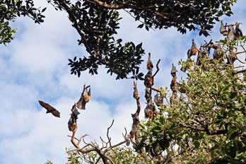 and right) and soared around with their 2 feet wide wing span
(Photo
73 - Grey-Headed Flying-Fox). and right) and soared around with their 2 feet wide wing span
(Photo
73 - Grey-Headed Flying-Fox).
New South Wales State Library: we spent a while
photographing both the Wollemi Pine and the bats, before returning to the corner of
Macquarie Street, and crossing to the State Library of NSW with its imposing
neo-classical façade. The reason for our brief visit was to see the
reproduction of Dutch explorer Abel Tasman's 1644 first mapping of the continent
of Australia, set into a floor mosaic just inside the foyer (Photo
74 - Taman's first mapping of Australia); the original copy of the map is held in the Library's historic
collection. The map depicted an outline of Australia but with details of the east
coast missing and the northern
Cape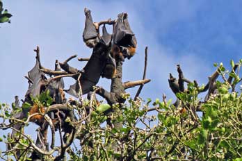 York extremity joined to Papua-New Guinea.
Outside the State Library stood a statue of the British explorer and
cartographer Matthew Flinders who led the second expedition to circumnavigate
Australia in 1802~3. York extremity joined to Papua-New Guinea.
Outside the State Library stood a statue of the British explorer and
cartographer Matthew Flinders who led the second expedition to circumnavigate
Australia in 1802~3.
New South Wales State Parliament:
just along Macquarie Street, we reached the NSW State Parliament
which historically was housed in one of the wings of the original Sydney hospital. The NSW convict colony was
settled in 1788, and by 1824 a small Legislative Council was established to
assist the Governor in the colony's administration. By 1829 the Council began
meeting in the hospital and became the centre of New South Wales's democratic
government.
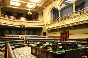 Unsure of whether we could visit the NSW State Parliament, we
hesitantly approached the security guards. They enthusiastically almost
press-ganged us into the building, and after passing us through security, they directed us across to the main building. Here we were similarly welcomed by the
receptionist, who explained to us something of the NSW democratic process and
workings of their bi-cameral State Parliament. The Lower House, the Legislative
Assembly, has 93 members, elected every 4 years by proportional representation.
The Upper House, the Legislative Council, has 42 members, and is similarly voted
for
by the electorate. Bills pass from the Lower to the Upper House and, if passed,
are approved Unsure of whether we could visit the NSW State Parliament, we
hesitantly approached the security guards. They enthusiastically almost
press-ganged us into the building, and after passing us through security, they directed us across to the main building. Here we were similarly welcomed by the
receptionist, who explained to us something of the NSW democratic process and
workings of their bi-cameral State Parliament. The Lower House, the Legislative
Assembly, has 93 members, elected every 4 years by proportional representation.
The Upper House, the Legislative Council, has 42 members, and is similarly voted
for
by the electorate. Bills pass from the Lower to the Upper House and, if passed,
are approved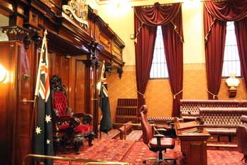 by the Governor. The Canberra Federal Government controls national
affairs such as foreign policy and defence, while the States have devolved powers
over state finances, health, education and transportation. by the Governor. The Canberra Federal Government controls national
affairs such as foreign policy and defence, while the States have devolved powers
over state finances, health, education and transportation.
We were shown the Chamber of the Lower House,
the Legislative Assembly (see left) (Photo
75 - Legislative Assembly) and encouraged to
walk around, even to sit in the Speaker's chair, and to take whatever photos we
wished. The Chamber was laid out like Westminster, with green leather benches
and government and opposition sides. The recent 4-yearly general election had
resulted in a
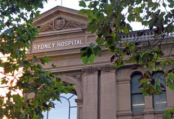 change of government from Labour to Conservative. We were
similarly shown the Upper House, the Legislative Council (see right)
(Photo
76 - Legislative Council) modelled on the Westminster Lords with red
leather
benches, and again were free to take photos. A range
of leaflets was
available explaining the NSW democratic processes, and we were able to question
the attendant in comparing the British and Australian systems of devolved
government. As
we finished the visit, the attendant presented us with a huge and weightily
bound hard-back glossy history of the NSW State Parliament; how we should manage
to carry home this souvenir of our visit in our already heavy packs remained to be seen! change of government from Labour to Conservative. We were
similarly shown the Upper House, the Legislative Council (see right)
(Photo
76 - Legislative Council) modelled on the Westminster Lords with red
leather
benches, and again were free to take photos. A range
of leaflets was
available explaining the NSW democratic processes, and we were able to question
the attendant in comparing the British and Australian systems of devolved
government. As
we finished the visit, the attendant presented us with a huge and weightily
bound hard-back glossy history of the NSW State Parliament; how we should manage
to carry home this souvenir of our visit in our already heavy packs remained to be seen!
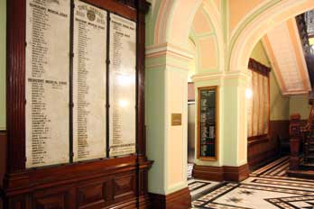 Family connections with Sydney Hospital:
further along Macquarie Street, now busy with Friday afternoon
traffic, we reached Sydney Hospital (see left) where Sheila had a distant family connection.
Her late Great-Uncle Jack had emigrated to Australia in the 1920s and had settled at
Manly (see later below); his daughter Kathleen, Sheila's second cousin, had trained and worked as a
nurse at Sydney Hospital in the late 1930s. The hospital, originally founded by Governor
Macquarie and his wife in 1816 and funded by profits from the lucrative rum
trade, was modelled on a typical English county infirmary. We crossed over to the hospital, and up the
steps found the lobby to the Board Room with medical staff name boards (see
right), exactly as at English hospitals like the Radcliffe Infirmary in Oxford. Outside, a
pathway led through to a quad with a fountain, the old ward blocks now
overshadowed by Family connections with Sydney Hospital:
further along Macquarie Street, now busy with Friday afternoon
traffic, we reached Sydney Hospital (see left) where Sheila had a distant family connection.
Her late Great-Uncle Jack had emigrated to Australia in the 1920s and had settled at
Manly (see later below); his daughter Kathleen, Sheila's second cousin, had trained and worked as a
nurse at Sydney Hospital in the late 1930s. The hospital, originally founded by Governor
Macquarie and his wife in 1816 and funded by profits from the lucrative rum
trade, was modelled on a typical English county infirmary. We crossed over to the hospital, and up the
steps found the lobby to the Board Room with medical staff name boards (see
right), exactly as at English hospitals like the Radcliffe Infirmary in Oxford. Outside, a
pathway led through to a quad with a fountain, the old ward blocks now
overshadowed by
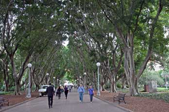 neighbouring office tower-blocks (Photo
77 - Sydney Hospital),
and the Nightingale Building; this must have been the School of Nursing where Kathleen
had trained. A small plaque on a plinth near the fountain was dedicated to the
memory of nurses who had trained at Sydney Hospital during the early 20th
century, which had included Sheila's second cousin Kathleen, a moving moment in our
travels. neighbouring office tower-blocks (Photo
77 - Sydney Hospital),
and the Nightingale Building; this must have been the School of Nursing where Kathleen
had trained. A small plaque on a plinth near the fountain was dedicated to the
memory of nurses who had trained at Sydney Hospital during the early 20th
century, which had included Sheila's second cousin Kathleen, a moving moment in our
travels.
Sydney Anzac Memorial and Queen Victoria
Building: we walked on through Hyde Park gardens
which were busy in the growing dusk of a late Friday afternoon (see
above left), and crossed to the gardens surrounding the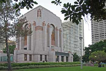 huge Art Deco Anzac Memorial
(see right). In the failing light, we walked down busy Druitt Street but it was too dark to see the
detail of the ornate Town Hall. But across the busy street, we entered the shopping
mall of the restored Queen Victoria Building. Built as a market hall in 1898 in
Romanesque Revival style on the scale of a cathedral with huge central dome and
stained glass windows,
it was named the Queen Victoria Market Building to commemorate her Diamond
Jubilee. The structure was restored in 1986 to create a modern shopping mall. But this
was certainly not the usual kind of shopping centre to be seen in most cities:
the restored Queen Victoria Building
tastefully preserved all the architectural features, monumental scale and interior
design of the original grandiose building (Photo
78 - Queen Victoria Building)
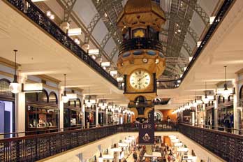 (see
below left), with beautiful tiled floors, magnificent staircases and galleries,
antique lifts, arched windows and wonderful vaulted partially-glazed ceiling. It truly was an architectural masterpiece
(Photo
79 - Tasteful interior design) (see below right and left), and quite understandably there were almost as many people photographing the building's restored interior as shopping. (see
below left), with beautiful tiled floors, magnificent staircases and galleries,
antique lifts, arched windows and wonderful vaulted partially-glazed ceiling. It truly was an architectural masterpiece
(Photo
79 - Tasteful interior design) (see below right and left), and quite understandably there were almost as many people photographing the building's restored interior as shopping.
Pub supper up at the Rocks and return to Big Hostel:
weary from walking, we took stock on supper options for this
evening, finally deciding to
catch a bus up to the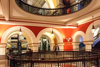 Rocks for drinks and supper at the Hero of Waterloo.
George Street, the main shopping drag, was busy with commuters, shoppers and
tourists. Our first thought was to catch a bus down at Circular Quay, but it
soon became clear that bus services from outside the Queen Victoria Building went directly up to Millers Point
passing the Hero of Waterloo. A #433 bus came along and the very helpful
driver confirmed the route; we were able to get off right opposite the pub
which, contrary to expectations, was far from busy despite being Friday evening.
We sat in the corner with our beers and ordered supper. Later in the evening, a
duo of guitar and fiddle set up to play Irish style music, all very
entertaining. Rocks for drinks and supper at the Hero of Waterloo.
George Street, the main shopping drag, was busy with commuters, shoppers and
tourists. Our first thought was to catch a bus down at Circular Quay, but it
soon became clear that bus services from outside the Queen Victoria Building went directly up to Millers Point
passing the Hero of Waterloo. A #433 bus came along and the very helpful
driver confirmed the route; we were able to get off right opposite the pub
which, contrary to expectations, was far from busy despite being Friday evening.
We sat in the corner with our beers and ordered supper. Later in the evening, a
duo of guitar and fiddle set up to play Irish style music, all very
entertaining.
 But we had to leave to catch the return bus. At first it
seemed from the timetable that we had missed the last service from Millers Point
which finished at 8-00pm; we should have to walk down to Circular Quay. But
unexpectedly a #433 came along just as we were setting off to walk. It was the
same driver as earlier, and in response to our question as to whether he went to
Central Station, he replied with good humour "If you insist!" We did, and were
dropped off alongside the station, just 5 minutes' walk from the Big Hostel.
Although weary, we wrote up some of today's log and read up for tomorrow. What a
successfully action-packed half-day we had enjoyed in Sydney: we had again seen
and learned so much, and again But we had to leave to catch the return bus. At first it
seemed from the timetable that we had missed the last service from Millers Point
which finished at 8-00pm; we should have to walk down to Circular Quay. But
unexpectedly a #433 came along just as we were setting off to walk. It was the
same driver as earlier, and in response to our question as to whether he went to
Central Station, he replied with good humour "If you insist!" We did, and were
dropped off alongside the station, just 5 minutes' walk from the Big Hostel.
Although weary, we wrote up some of today's log and read up for tomorrow. What a
successfully action-packed half-day we had enjoyed in Sydney: we had again seen
and learned so much, and again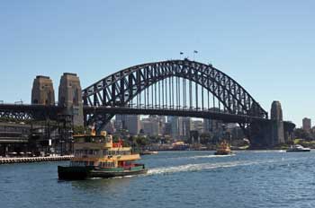 experienced the open and hospitable Aussie
manner, with many memorable encounters. Tomorrow we should cross Sydney Harbour
ferry to Manly, but tonight peaceful Katoomba, from where we had returned only
this lunchtime, seemed a million miles away. experienced the open and hospitable Aussie
manner, with many memorable encounters. Tomorrow we should cross Sydney Harbour
ferry to Manly, but tonight peaceful Katoomba, from where we had returned only
this lunchtime, seemed a million miles away.
Ferry across Sydney Harbour to Manly:
we were away early to catch the bus down to Circular Quay for our
day over at Manly on the north shore by the Harbour entrance from the Pacific
Ocean (Map of Sydney).
Despite being autumn, the
morning was warm and sunny with a clear sky, and we walked
through to landing stage number 3 for the ferry over to Manly. Ferries constantly chugged to
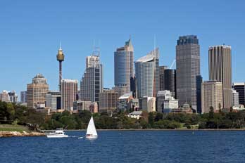 and
from the quays. The Manly ferry drew in and we boarded to
stand up in the bows for best views across the harbour. As the ferry drew away
from the quay, further views opened up of the Bridge across the sparkling water
(see above right) and Opera House
(Photo
80 - Opera House), this time from end-on against the backdrop of
the CBD. It was a truly glorious morning. The ferry crossed the harbour
at a fair speed, passing the water-side path we had walked last week out to Mrs
Macquarie's Chair (see left). The panorama around the inlet gave a clear
impression of what a wonderful naturally sheltered and extensive anchorage
Sydney Harbour was (see right), and a further view of Bridge and Opera House
opened up looking down the length of the Harbour from the ferry and
from the quays. The Manly ferry drew in and we boarded to
stand up in the bows for best views across the harbour. As the ferry drew away
from the quay, further views opened up of the Bridge across the sparkling water
(see above right) and Opera House
(Photo
80 - Opera House), this time from end-on against the backdrop of
the CBD. It was a truly glorious morning. The ferry crossed the harbour
at a fair speed, passing the water-side path we had walked last week out to Mrs
Macquarie's Chair (see left). The panorama around the inlet gave a clear
impression of what a wonderful naturally sheltered and extensive anchorage
Sydney Harbour was (see right), and a further view of Bridge and Opera House
opened up looking down the length of the Harbour from the ferry 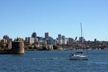 (Photo
81 - Harbour panorama). (Photo
81 - Harbour panorama).
As the ferry advanced eastwards along the
length of the Harbour, we could see from the ferry bows the narrow width of
the Harbour inlet entrance between the North and South Heads, giving protection from
the open Pacific Ocean (see below left). The ferry drew close to Manly with its
sheltered harbour-side beach in a small pine-fringed cove alongside the ferry
anchorage (see below right). Stepping
ashore
at the busy ferry terminal (Photo
82 - Manly ferry terminal), first stop was the Tourist Information Centre
for brochures, maps and information about buses down to North Head. Manly seemed
to have the pleasantly old-fashioned atmosphere of a family-day-out seaside resort,
with beach, surfing and aquarium. For a weekend
and sunny Saturday, the town was not unduly crowded. a family-day-out seaside resort,
with beach, surfing and aquarium. For a weekend
and sunny Saturday, the town was not unduly crowded.
One of our reasons for visiting Manly was in search of a
further aspect of Sheila's family connection: Manly had been the home of her
Great-Uncle Jack and his family. Great-Uncle Jack Hardy, was Sheila's Grandmother's elder
brother; like many enterprising young men of the post-WW1 generation, he had emigrated initially
to Canada with his wife Lottie. Their only daughter Kathleen, Sheila's Mother's
cousin, was born in September 1920. The family subsequently moved to Australia
in the late 1920s and set up home in Manly at 39 Wentworth
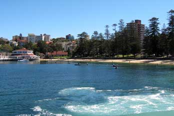 Street. Kathleen
trained as a nurse at Sydney Hospital during the late 1930s, and met her future
husband, who was serving during WW2 as an officer with the American forces in
Australia; they married in 1946 at St Matthew's Church Manly. In 1947
Kathleen joined her husband in USA and they lived in West Virginia with their
son who was born around 1948~9. After miscarrying their second child in November
1950, Kathleen
was given a blood transfusion, which in those days was
unscreened; soon after she became seriously ill, and tragically died in March
1951 aged 31. Sheila's genealogical researches revealed that the cause of death
was recorded on the death certificate as Homologous Serum Jaundice (ie
Hepatitis B), most likely Street. Kathleen
trained as a nurse at Sydney Hospital during the late 1930s, and met her future
husband, who was serving during WW2 as an officer with the American forces in
Australia; they married in 1946 at St Matthew's Church Manly. In 1947
Kathleen joined her husband in USA and they lived in West Virginia with their
son who was born around 1948~9. After miscarrying their second child in November
1950, Kathleen
was given a blood transfusion, which in those days was
unscreened; soon after she became seriously ill, and tragically died in March
1951 aged 31. Sheila's genealogical researches revealed that the cause of death
was recorded on the death certificate as Homologous Serum Jaundice (ie
Hepatitis B), most likely
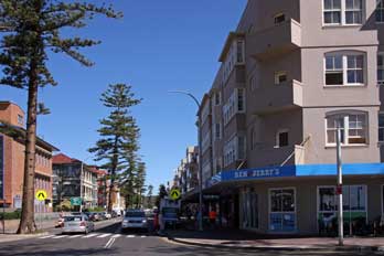 caused by transfusion of infected blood. Great-Uncle Jack died in 1961, and his death was
registered at Gosford north of Sydney; Auntie Lottie died in 1963, and her death
was registered at Lithgow. caused by transfusion of infected blood. Great-Uncle Jack died in 1961, and his death was
registered at Gosford north of Sydney; Auntie Lottie died in 1963, and her death
was registered at Lithgow.
We walked up into the town and soon identified Wentworth
Street which linked the harbour and ferry terminal through to the beach on the
Pacific coast. We found the likely area where number 39 might once have been,
but of course, the Wentworth Street of 2011 was a series of modern apartments
and shops; the site of number 39 seemed now to be occupied by a fish and chip
café (see left). This seemed a most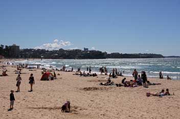 fitting
place to buy our lunch, and we took our fish and chips across to
the beach at South Steyne Prom to eat at the picnic tables there (see below
left), surrounded by
predatory Silver Gulls. Ever the champions of the
underdog, we rewarded a one-legged gull with a chip, which caused mayhem with
the rest of the squawking flock. Considering the lovely Saturday
afternoon weather, the sea-front was not as crowded as might be expected; looking out over Manly beach and surf of the
Pacific coast, the sun was strong and bright but breeze brisk and cool
(Photo
84 - Manly beach).
The fish and chips were delicious and made an
appropriate Manly lunch, against the backdrop of the block of shops and
apartments now occupying the site fitting
place to buy our lunch, and we took our fish and chips across to
the beach at South Steyne Prom to eat at the picnic tables there (see below
left), surrounded by
predatory Silver Gulls. Ever the champions of the
underdog, we rewarded a one-legged gull with a chip, which caused mayhem with
the rest of the squawking flock. Considering the lovely Saturday
afternoon weather, the sea-front was not as crowded as might be expected; looking out over Manly beach and surf of the
Pacific coast, the sun was strong and bright but breeze brisk and cool
(Photo
84 - Manly beach).
The fish and chips were delicious and made an
appropriate Manly lunch, against the backdrop of the block of shops and
apartments now occupying the site
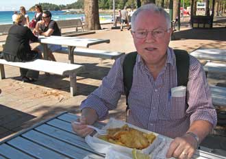 in Wentworth Street, where Sheila's Uncle
Jack had once lived (Photo
85 - Fish and chips beach lunch). After lunch we walked back down the Corso, the main street
across the peninsula between Manly harbour and Pacific Ocean, past St Matthew's Church
(see right) where Uncle Jack's daughter Kathleen was married in April 1946. in Wentworth Street, where Sheila's Uncle
Jack had once lived (Photo
85 - Fish and chips beach lunch). After lunch we walked back down the Corso, the main street
across the peninsula between Manly harbour and Pacific Ocean, past St Matthew's Church
(see right) where Uncle Jack's daughter Kathleen was married in April 1946.
Footpath around North Head:
on investigating buses back at the harbour, we learned that the
supposed free buses out to the former Quarantine Station at North Head were in
fact few and far between. Further enquiry at
the TIC about buses this time produced a more
helpfully optimistic report: the #135 service from Stand J in fact ran right out to North
Head, exactly where we wanted to go. An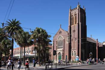 outward bus was due at 13‑38, and a
return was scheduled for 15‑50, giving us two hours to walk the footpath out to
the Head; these times were perfect. The bus drew in, and although the driver was not as helpful as
most we had encountered, he did drop us exactly where required, some 6kms from
the town, right at the start of the Sydney Harbour National Park circular
footpath around the headland of North Head.
We eventually found the start of the footpath which ran through
impenetrable bush-scrub
 covering the headland. The path out led to Fairfax
lookout-point which gave magnificent views around the full panorama of the
natural inlet of Sydney Harbour: we could look across the seemingly narrow gap,
between where we were stood here on the cliff-top at North Head, and South Head just opposite
across the sound at the Harbour entrance from the open Pacific out to the east.
This again showed clearly the protected nature of Sydney's natural harbour. We could follow
the full length of this wonderful natural sound with all its bays and inlets,
around into the far western distance where the tower-blocks of Sydney city came into view
(see left) (Photo
86 - View from North Head)
with just a glimpse of the Bridge. Sailing boats and speed boats filled the
harbour, with the more determinedly functional covering the headland. The path out led to Fairfax
lookout-point which gave magnificent views around the full panorama of the
natural inlet of Sydney Harbour: we could look across the seemingly narrow gap,
between where we were stood here on the cliff-top at North Head, and South Head just opposite
across the sound at the Harbour entrance from the open Pacific out to the east.
This again showed clearly the protected nature of Sydney's natural harbour. We could follow
the full length of this wonderful natural sound with all its bays and inlets,
around into the far western distance where the tower-blocks of Sydney city came into view
(see left) (Photo
86 - View from North Head)
with just a glimpse of the Bridge. Sailing boats and speed boats filled the
harbour, with the more determinedly functional Manly ferries ploughing their way
diagonally across the water. Out in the Pacific, an Australian Navy corvette
patrolled off-shore. From this cliff-top vantage point at North Head, we stood
gazing out across the harbour taking many photographs both of the views over
Sydney Harbour and of the cliff-top flora. These included Heath-leaved Banksia (Banksia
ericifolia) with its yellow-orange 'bottle-brush' shaped flower-heads, Fuschia
Heath (Epacris longiflora) with its distinctive tubular flowers pink at the base and tipped
with white, and an unidentified decorative
shrub with bright red elaborate
flowers (Photo
87 - North Head shrubs) (see left). Given the magnificent Manly ferries ploughing their way
diagonally across the water. Out in the Pacific, an Australian Navy corvette
patrolled off-shore. From this cliff-top vantage point at North Head, we stood
gazing out across the harbour taking many photographs both of the views over
Sydney Harbour and of the cliff-top flora. These included Heath-leaved Banksia (Banksia
ericifolia) with its yellow-orange 'bottle-brush' shaped flower-heads, Fuschia
Heath (Epacris longiflora) with its distinctive tubular flowers pink at the base and tipped
with white, and an unidentified decorative
shrub with bright red elaborate
flowers (Photo
87 - North Head shrubs) (see left). Given the magnificent
 setting and views, it was
understandable that the North Head paths were a popular area for cyclists with
many out enjoying the autumn sunshine. setting and views, it was
understandable that the North Head paths were a popular area for cyclists with
many out enjoying the autumn sunshine.
From the high cliffs above North Head, we completed the
circuit of footpath through the maquis-like scrubland, back around to the car
park where the bus had dropped us earlier, to sit on the grass looking out over the
harbour as we waited for the return bus
into Manly (see below right). There was time to walk a second time along Wentworth Street for further photos of
the modern shops and apartments now occupying the site of number 39.
And with late afternoon shadows lengthening but the sun still shining brightly, we could not resist
going down across the white sands of Manly
beach for photos of a ritual paddle in the surf of the Pacific Ocean (Photo
88 - Paddling in Pacific). brightly, we could not resist
going down across the white sands of Manly
beach for photos of a ritual paddle in the surf of the Pacific Ocean (Photo
88 - Paddling in Pacific).
Return to Sydney for another Rocks pub supper: it was
time now to head back to the pier for the return ferry. We again managed to get positions up in the prow, anticipating sunset
photos over the Harbour Bridge as the ferry crossed the Harbour on the return to the city
(see left). We were not
disappointed: the timing of sunset could not
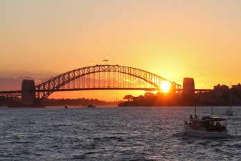 have been more perfect, and the
golden orb of the sun declined slowly to set with a ruddy glow behind the silhouetted bridge just as the ferry drew closer to Circular Quay
(Photo
89 - Sunset over Harbour Bridge). The after-glow lingered behind the
Bridge edging the clouds with a golden frill (see below left). have been more perfect, and the
golden orb of the sun declined slowly to set with a ruddy glow behind the silhouetted bridge just as the ferry drew closer to Circular Quay
(Photo
89 - Sunset over Harbour Bridge). The after-glow lingered behind the
Bridge edging the clouds with a golden frill (see below left).
Ashore from the ferry,
we decided to return to the Hero of Waterloo up at the Rocks for a light supper.
It was a short walk up Argyle
Street, under the Bridge highway, past the Garrison Church and down Lower Fort
Street, and
we were settled with our schooners of Amber by 6‑30pm. This week the elderly jazz quartet were just
finishing, before this evening's threateningly loud guitar duo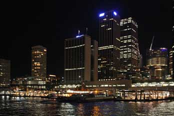 began
their session. The #431/433 buses to Central Station, which
seemingly ran on Friday evenings when the timetable said they shouldn't,
positively did not run on Saturdays at all. We therefore returned on foot down
Argyle Street, through hordes of young Japanese
tourists to Circular Quay for night-time photos of the illuminated Opera House
(Photo
90 - Opera House after dark) with the lights of Circular Quay and the Central Business District tower blocks beyond
(see right). began
their session. The #431/433 buses to Central Station, which
seemingly ran on Friday evenings when the timetable said they shouldn't,
positively did not run on Saturdays at all. We therefore returned on foot down
Argyle Street, through hordes of young Japanese
tourists to Circular Quay for night-time photos of the illuminated Opera House
(Photo
90 - Opera House after dark) with the lights of Circular Quay and the Central Business District tower blocks beyond
(see right).
We 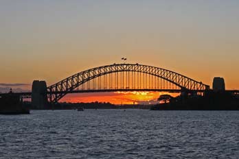 caught a bus from Circular Quay along
George Street and were back at the Big Hostel by 9-30pm. Big Hostel had proved
to be a good choice, excellently located for public transport, especially being
so close to Central Station with our packs. Back at the hostel, despite our
weariness after another long day, Paul wrote up today's log while Sheila read up on the area
in the southern suburbs of the city around Bondi and Coogee Beaches for
tomorrow. The area's coastal walking potential had been recommended, but from
the map it seemed very built up and not particularly
attractive. We should find out tomorrow when we investigate the
world-renowned surfing beach at Bondi in Sydney's SW suburbs. caught a bus from Circular Quay along
George Street and were back at the Big Hostel by 9-30pm. Big Hostel had proved
to be a good choice, excellently located for public transport, especially being
so close to Central Station with our packs. Back at the hostel, despite our
weariness after another long day, Paul wrote up today's log while Sheila read up on the area
in the southern suburbs of the city around Bondi and Coogee Beaches for
tomorrow. The area's coastal walking potential had been recommended, but from
the map it seemed very built up and not particularly
attractive. We should find out tomorrow when we investigate the
world-renowned surfing beach at Bondi in Sydney's SW suburbs.
 Public transport to Bondi Beach:
day sacs were packed and we were away by 9-30am for today's venture by public
transport out to Bondi Beach. To save time, we caught a regular bus as close as
we could to Circular Quay given today's road closures due to a city Triathlon event, the poster for which we had seen yesterday. As we approached the city,
the bus passed crowds of runners apparently going in opposite directions;
perhaps Aussie rules were different! Our bus turned off before Circular Quay and
we walked the final couple of blocks. At the kiosk, we bought tickets for the
bus to Bondi Beach, which seemed unaffected by
the Triathlon road closures. The 10-20 bus arrived and we boarded for the hour's
journey. But Public transport to Bondi Beach:
day sacs were packed and we were away by 9-30am for today's venture by public
transport out to Bondi Beach. To save time, we caught a regular bus as close as
we could to Circular Quay given today's road closures due to a city Triathlon event, the poster for which we had seen yesterday. As we approached the city,
the bus passed crowds of runners apparently going in opposite directions;
perhaps Aussie rules were different! Our bus turned off before Circular Quay and
we walked the final couple of blocks. At the kiosk, we bought tickets for the
bus to Bondi Beach, which seemed unaffected by
the Triathlon road closures. The 10-20 bus arrived and we boarded for the hour's
journey. But
 by the time the bus reached Elizabeth Street, we hit the traffic
grid-lock, presumably caused by road closures. For the next hour, the
bus moved forward just 100m; we were getting nowhere, and neither were any of
the other solid masses of city traffic. The grid-lock stretched away into the
distance as far as the eye could see; solid lines of cars and buses all totally
immobile. At this rate we should spend the day sat here unmoving. The driver
suggested getting off and catching the Metro train from Martin Place underground
station which we had just passed, for 3 stops out to Bondi Junction, and then
catch the bus out to the beach. The Metro station was deserted: perhaps the
entire population of Sydney was trapped in by the time the bus reached Elizabeth Street, we hit the traffic
grid-lock, presumably caused by road closures. For the next hour, the
bus moved forward just 100m; we were getting nowhere, and neither were any of
the other solid masses of city traffic. The grid-lock stretched away into the
distance as far as the eye could see; solid lines of cars and buses all totally
immobile. At this rate we should spend the day sat here unmoving. The driver
suggested getting off and catching the Metro train from Martin Place underground
station which we had just passed, for 3 stops out to Bondi Junction, and then
catch the bus out to the beach. The Metro station was deserted: perhaps the
entire population of Sydney was trapped in their cars in the unmoving grid-lock
in the streets above. The ticket lady said we could use our bus tickets on the
Metro, but the automated gates thought differently and refused us passage. An
inspector also insisted NO, but still allowed us through, and we caught the next
train. 10 minutes later we reached Bondi Junction, but would all the buses still
be trapped in the city grid-lock? We joined the queue for the Bondi Beach bus,
and to our relief a bus came along in a few minutes. The bus wound through the
suburbs and 10 minutes later emerged at a vista of the sweeping cove of a silver
sand beach backed by the town. It was just after 12-00 noon, and we had managed
to extricate ourselves from the city grid-lock to reach our objective, Bondi
Beach. their cars in the unmoving grid-lock
in the streets above. The ticket lady said we could use our bus tickets on the
Metro, but the automated gates thought differently and refused us passage. An
inspector also insisted NO, but still allowed us through, and we caught the next
train. 10 minutes later we reached Bondi Junction, but would all the buses still
be trapped in the city grid-lock? We joined the queue for the Bondi Beach bus,
and to our relief a bus came along in a few minutes. The bus wound through the
suburbs and 10 minutes later emerged at a vista of the sweeping cove of a silver
sand beach backed by the town. It was just after 12-00 noon, and we had managed
to extricate ourselves from the city grid-lock to reach our objective, Bondi
Beach.
Coastal path from Bondi to Coogee Beach: to our amazement,
despite being a sunny Sunday, Bondi beach filling the circular bay was
surprisingly quiet, and not swarming with all the crowds we had expected. Even
more surprisingly however, the surf seemed disappointingly calm, not at all as spectacular as Bondi Beach's
reputation as the surfing capital of the universe implied (Photo
91 - Bondi Beach) (see above right and left). The only surfers in
evidence was a small group of learners. We took our photos looking out over the
beach, then bought a take-away burger lunch from a café across the road, eating them sat on a bench overlooking
the beach. Having cleaned up from the sticky mess of our burger lunch, we set
off to walk south around the coastal path heading down towards Coogee. This had
been recommended, but we had some reservations due to the distance and
its passing through largely built-up areas. But from the high point of
Mackenzies Point, a spectacular panoramic view opened up, looking back north
around the sweep of Bondi Bay (see above right). The air was warm and heavy with none of the
expected breeze off the sea, and an uncertain sky. The path continued above weathered
sandstone rocks and outcrops, around past Tamarara Point to the deep bay of Tamarara Cove road, eating them sat on a bench overlooking
the beach. Having cleaned up from the sticky mess of our burger lunch, we set
off to walk south around the coastal path heading down towards Coogee. This had
been recommended, but we had some reservations due to the distance and
its passing through largely built-up areas. But from the high point of
Mackenzies Point, a spectacular panoramic view opened up, looking back north
around the sweep of Bondi Bay (see above right). The air was warm and heavy with none of the
expected breeze off the sea, and an uncertain sky. The path continued above weathered
sandstone rocks and outcrops, around past Tamarara Point to the deep bay of Tamarara Cove
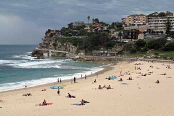 (Photo
92 - Tamarara Cove) (see above left), a beautiful small strand again remarkably quiet with families sunbathing or playing ball on the beach, and just a few surfers at
the nearer end. The whole atmosphere was one of an old-fashioned
seaside town, with none of the attractions which might sully the peace of
the place. (Photo
92 - Tamarara Cove) (see above left), a beautiful small strand again remarkably quiet with families sunbathing or playing ball on the beach, and just a few surfers at
the nearer end. The whole atmosphere was one of an old-fashioned
seaside town, with none of the attractions which might sully the peace of
the place.
We continued around the headland leading to Bronte Beach (Photo
93 - Bronte Beach) (see left and above right),
again quiet and unsullied with an old-fashioned air, and even a miniature
railway pulled by an Australian diesel engine for children's rides. There was
none of the expected over-commercialisation and brashness to spoil the 1960s air
of a charming little seaside spot. At Bronte, we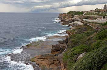 passed a bus stop with
timetable for buses back to both Bondi Junction and Circular Quay. This was
clearly the halfway point of the total walk to Coogee, and the 2.5kms distance
had taken less than 1.5 hours. We decided to press on and complete the walk as
far as Coogee and catch the bus back from there. Rising up from the bay, the
road cut through a sandstone headland with the path now turning back to the
coast on a wooden platform walk-way above the natural rocks (Photo
94 - Coastal path) (see right). This soon reached
the cliff-top Waverley Cemetery which covered a huge area, with the path-way
curving around passed a bus stop with
timetable for buses back to both Bondi Junction and Circular Quay. This was
clearly the halfway point of the total walk to Coogee, and the 2.5kms distance
had taken less than 1.5 hours. We decided to press on and complete the walk as
far as Coogee and catch the bus back from there. Rising up from the bay, the
road cut through a sandstone headland with the path now turning back to the
coast on a wooden platform walk-way above the natural rocks (Photo
94 - Coastal path) (see right). This soon reached
the cliff-top Waverley Cemetery which covered a huge area, with the path-way
curving around
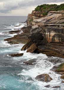 the seaward side. At the far end, the
coastal path picked a way around the cliff-top giving increasingly spectacular
views both of the surf pounding the foot of the cliffs and of the ominously
threatening sky out over the sea (Photo
95 - Surf and sky) (see left). The
afternoon, which had begun bright at Bondi, had gradually become more overcast,
and off-shore in the distance out into the Pacific Ocean we could see an evident
squally storm heading northwards towards us. It was just possible the squall
would pass us by as we rounded the headland of Shark Point, but Coogee ahead was
clearly becoming enveloped in misty rain. A chill wind suddenly blew up,
indicating that contrary to expectations the rain storm was about to hit us. We
had completed around 4 kms of the 5 kms distance to Coogee; but to continue
would inevitably mean a soaking, since we had only brought light weight
cagoules. We quickly donned these and took shelter back at a bus stop. A bus was
approaching, and with the storm now the seaward side. At the far end, the
coastal path picked a way around the cliff-top giving increasingly spectacular
views both of the surf pounding the foot of the cliffs and of the ominously
threatening sky out over the sea (Photo
95 - Surf and sky) (see left). The
afternoon, which had begun bright at Bondi, had gradually become more overcast,
and off-shore in the distance out into the Pacific Ocean we could see an evident
squally storm heading northwards towards us. It was just possible the squall
would pass us by as we rounded the headland of Shark Point, but Coogee ahead was
clearly becoming enveloped in misty rain. A chill wind suddenly blew up,
indicating that contrary to expectations the rain storm was about to hit us. We
had completed around 4 kms of the 5 kms distance to Coogee; but to continue
would inevitably mean a soaking, since we had only brought light weight
cagoules. We quickly donned these and took shelter back at a bus stop. A bus was
approaching, and with the storm now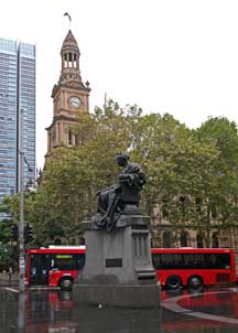 blowing driving rain from the seaward
direction and the route ahead looking totally urbanised and enveloped in misty
greyness, we decided to cut our losses and catch the bus back to Bondi Junction.
We had covered the more interesting part of the walk along the open, rural
sections of the cliff-top coastal path, passing through delightful little
seaside resorts. blowing driving rain from the seaward
direction and the route ahead looking totally urbanised and enveloped in misty
greyness, we decided to cut our losses and catch the bus back to Bondi Junction.
We had covered the more interesting part of the walk along the open, rural
sections of the cliff-top coastal path, passing through delightful little
seaside resorts.
Afternoon tea at Queen Victoria Building back in Sydney:
with the rain now coming on fast, we reached Bondi
Junction to catch the underground train back to the city. Hoping the grid-lock
and rain-storm would now have passed, we continued to Town Hall Station. When we
emerged from the subway however, the rain was still lashing down. With just our
lightweight cags, it was going to be impossible this afternoon to walk over to
Darling Harbour as planned. Instead we crossed under the subway to the shelter
of the Queen Victoria Building, and took afternoon tea amid the gloriously
restored Art Deco splendour of the QVB galleries and tiled arcades (Photo
96 - Afternoon tea at QVB) (see below left). Before
entering the shopping mall, we had stood under the shelter of the entrance
canopy to photograph the bronze statue of a seated Queen Victoria (see right) which the
Irish had generously donated in 1947
 from Dublin; they had clearly been glad to
see the back of this symbolic figure of English imperialism. Even in the pouring
rain and poor light, the statue looked more at home here in downtown Sydney
against the backdrop of the Town Hall. from Dublin; they had clearly been glad to
see the back of this symbolic figure of English imperialism. Even in the pouring
rain and poor light, the statue looked more at home here in downtown Sydney
against the backdrop of the Town Hall.
Sydney traffic and Monorail in pouring rain:
inside the QVB at the foot of the grand central staircase, we
learned from the concierge more of the building's history and its restoration;
we were also told about the animated clock which, at the chiming of the hour,
would present its display of British monarchs. In the meantime, we walked
through to the northern exit onto Market Street where the rain was lashing even
harder. Towering above us between the office blocks, the GPO telephone tower
loomed like an infernal monster above the city. Shoppers scuttled by clutching
umbrellas in the pouring rain, and reflected headlights of city traffic gleaming on
wet streets (Photo
97 - Wet streets) (see below right) made for some urban photography with
a difference. Sydney's monorail, which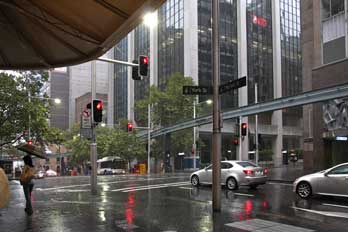 circles between Darling Harbour and the City, passed by high above
the traffic in Market Street (see below left) (Photo
98 - Sydney Monorail), adding further interest to our photographs. circles between Darling Harbour and the City, passed by high above
the traffic in Market Street (see below left) (Photo
98 - Sydney Monorail), adding further interest to our photographs.
Queen Victoria Building animated clock: just before
5-00pm, we climbed to level 2 of the QVB opposite the world's largest hanging
clock (Photo
99 - QVB Hanging clock), to witness its animated display of English monarchs as the clock chimed
the hour. To the accompaniment of Jeremiah Clarke's Trumpet Voluntary, animated
tableaux of the Viking King Cnut, Saxon King Harold's defeat by William the Norman
Conqueror at Hastings, King John signing Magna Carta at Runnymede in the
presence of the rebellious barons, Henry VIII surrounded by his six
animated wives, Elizabeth knighting Raleigh on the deck of his ship, and Charles I being beheaded
after the Civil War, all
appeared before us within the illuminated interior of the clock's upper turret (Photo
100 - Animated regal display) (see below right).
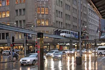 Supper at Sydney's Chinatown, and final night at Big Hostel:
with the rain now just about beginning to ease, we decided
to catch the Metro back to Central Station, return to our hostel to drop off
kit, and pick up more rain gear for the evening; we should then decide where to
go for supper. By the time we emerged from Central Station, the rain storm had
passed, for us to walk back to the Big Hostel. Having taken a break, we set off
again to nearby China Town. Big Hostel was indeed ideally located for us: it was
only a couple of blocks across to George Street with China Town just beyond. The
hostel
 receptionist had suggested a pub on the corner of George Street: Paddy Maguires pub was brash and loud, but served James Squire's Amber among its
vast range of beers, and we sat for a schooner or 3 before walking over to China Town to
find restaurants recommended by Lonely Planet. Dixon Street, the main
pedestrianised centre of China Town, was over-commercialised with girls enticing
the tourists into restaurants; it was all very tawdry and lurid, but all the
same entertaining. Unable to locate the recommended Super Bowl restaurant,
across in Thomas Street we found Lonely Planet's other choice, Emperor's Garden
BBQ and Noodles, an altogether less brash establishment with roasted chickens
hanging in the windows. The owner welcomed us and we ordered a vast supper from
the tempting menu to celebrate our final evening in Sydney: Won Ton soup and
edible pan-fried soft-shelled crabs, a bowl of delicious egg and ginger rice,
king prawns, and egg and chicken in a BBQ sauce, all washed down with Jasmine
tea. Both the soup and crabs were unbelievably delicious, and the main meal
courses were hugely generous. Sheila nobly used chop sticks, but Paul was hungry and
tucked in with spoon and fork. It was a truly magnificent feast, but there was
no means we could finish it all. The owner chatted as he passed our table: he
was from Hong Kong and had kept restaurants in Amsterdam, London, and now
in Sydney. We felt guiltily greedy in ordering such a large meal and then being
unable to finish it, and of course the bill came to a tidy sum! But we had
enjoyed it enormously, and it was a suitably memorable conclusion to such a
successful week in and around Sydney. Sydney, like Hong Kong, felt perfectly
safe, walking back late in the evening, even in a less obviously tourist area
such as this. The rain had by now stopped, and back at the hostel we settled in
for our final night at the Big Hostel. receptionist had suggested a pub on the corner of George Street: Paddy Maguires pub was brash and loud, but served James Squire's Amber among its
vast range of beers, and we sat for a schooner or 3 before walking over to China Town to
find restaurants recommended by Lonely Planet. Dixon Street, the main
pedestrianised centre of China Town, was over-commercialised with girls enticing
the tourists into restaurants; it was all very tawdry and lurid, but all the
same entertaining. Unable to locate the recommended Super Bowl restaurant,
across in Thomas Street we found Lonely Planet's other choice, Emperor's Garden
BBQ and Noodles, an altogether less brash establishment with roasted chickens
hanging in the windows. The owner welcomed us and we ordered a vast supper from
the tempting menu to celebrate our final evening in Sydney: Won Ton soup and
edible pan-fried soft-shelled crabs, a bowl of delicious egg and ginger rice,
king prawns, and egg and chicken in a BBQ sauce, all washed down with Jasmine
tea. Both the soup and crabs were unbelievably delicious, and the main meal
courses were hugely generous. Sheila nobly used chop sticks, but Paul was hungry and
tucked in with spoon and fork. It was a truly magnificent feast, but there was
no means we could finish it all. The owner chatted as he passed our table: he
was from Hong Kong and had kept restaurants in Amsterdam, London, and now
in Sydney. We felt guiltily greedy in ordering such a large meal and then being
unable to finish it, and of course the bill came to a tidy sum! But we had
enjoyed it enormously, and it was a suitably memorable conclusion to such a
successful week in and around Sydney. Sydney, like Hong Kong, felt perfectly
safe, walking back late in the evening, even in a less obviously tourist area
such as this. The rain had by now stopped, and back at the hostel we settled in
for our final night at the Big Hostel.
In the next episode, we move on to Adelaide to explore the South
Australian capital city and surrounding area; join us again shortly for the next stage of our
antipodean adventures.
Next edition
from Adelaide, South Australia to be published quite soon
|
Sheila and Paul |
Published: 21 January 2021 |
|

 BACK-PACKING
TRIP TO AUSTRALIA 2011 - Sydney and Blue Mountains, New South Wales:
 Overnight
flight from Hong Kong to Sydney: despite sleeping poorly on the first overnight flight, we both slept soundly on
the overnight Qantas flight to Sydney in our exhausted state after 2 late nights
and fulsome days in Hong Kong. We were woken at 6-00am (Sydney time) but in
reality 4-00am with the Hong Kong~Sydney time shift, meaning we got less than 5
hours' sleep. We were both therefore very blear-eyed. The meals on this leg of
the journey were less attractive and the service rather unsmiling and
perfunctory. As soon as we woke, we again switched on the real-time flight
progress monitors to follow our approach to Sydney, having followed the flight
last evening from Hong Kong over the Philippines and Borneo.
 Arrival at Sydney Airport:
we landed at Sydney Airport and disembarked around
7‑45am (see above left), and having passed the lengthy queues for immigration,
then came the biscuit test. To our relief, the packs and day-sacs passed through
the x-ray scanner without betraying the concealed, illegally imported biscuit,
which even we have yet to discover. Perhaps it may
be festering away still in the hidden recesses of one the packs.
 and there were no vacant seats. This
meant standing with our packs in the lobby for the 20 minute journey; well below
Hong Kong standards! But arriving at Central Station with its impressive façade
(see left and right), it was literally a 5
minute walk through a pleasant park over to the Big Hostel, the back-packing
hostel where we were booked for our stay in Sydney. We were hospitably and
helpfully received and although, as expected, our room was not yet ready, we
were able to leave our packs in a locked store until later.
 Quay, then continued through the Sunday morning crowds of
both tourists and local families enjoying a lovely sunny morning, around to Circular Quay
station. We had hoped to get up onto the platform for its higher level view of
the Bridge across the harbour, but this of course required a ticket to pass
through the barriers. Just beyond here, we paused around Circular Quay to listen
to a trio of highly unauthentic, over-decorated aboriginal buskers playing
didgeridoos and clapping sticks (
 opera-singing busker was ignored by the crowds; we tried to
show our appreciation of her efforts. Full of excitement at the surroundings, we continued around to the former Overseas
Passenger Terminal Building (
 landmarks, we must have taken during the day
so many photos, from just about every angle and standpoint! We walked around Campbell's Cove to Dawes Point Park for yet more Bridge (
 Japanese on holiday with no one to take his photo, and
how altruistic we felt! Under the mighty Bridge and over the brow of Dawes Point (
 refreshing English-style top-fermented beer. We also enquired more
about the peculiar Aussie beer measures terminology: the normal 500ml large
measure is referred to as a schooner and the smaller 250ml measure a middy, at least in
NSW, but apparently is called a pot in the other States; here in this pub they also served imperial
pints. We sat on the outside terrace to enjoy our beer, looking up at the mighty
bridge structure and watching groups on the Bridge Walk high above us (see
above right).
 Exploring the Rocks area:
we continued along among the colonial style houses of the Rocks district, taking a pause by an 'Aged' road sign
(see left). Further along Lower Fort Street we
reached another pub set at a hill-side street corner, the Hero of Waterloo;
as one of the original colony's earliest pubs built in 1843 using sandstone blocks
excavated from the Argyle Cut, this needed to be investigated further. The description suggested a pseudy establishment,
but in fact inside it had a genuinely delightful atmosphere, with another good range of
home-brewed English style beers, served of course in schooners and middies. We sat in the old wooden church pews
in the corner of the public bar drinking our
James Squires bitter (see right) (
 across towards the
harbour and the Bridge with its approach road
(
 Views from the Bridge
Lookout to Opera House and Central Business District: from the Bridge
Steps Passage we climbed to the level of Cumberland Street, amid the maze of
steps and passageways, up to the pedestrian walkway which ran alongside the
multi-lane highway busy with speeding traffic crossing the Bridge. The walkway continued
across towards the Bridge pillar, giving wonderful panoramic views out over the harbour to Circular Quay, with the
ring of modern tower-blocks making up Sydney's Central Business District (CBD)
(see right) (
 commemorative plaque
set in the pillar's stonework recorded
that the Bridge was designed and built by the British engineering contractors
Dorman Long of Middlesbrough (based on their design of the 1928 Tyne Bridge in
Newcastle upon Tyne), and opened in 1932 (see below right). We were too late today to visit the
Bridge
Lookout Museum but should return tomorrow for that. Today we simply revelled in
the wonderful photographic opportunities of this viewpoint in the glorious late
afternoon lighting conditions.
 to watch rugby league
on the bar TV. From here we phoned our daughter Lucy in Adelaide with news of
our day's wanderings. By the time we came out of the pub at 7-45pm, it was pitch
dark as we walked down through the sandstone blocks of Argyle Cut back to
Circular Quay from where the evening ferries still crossed the harbour to Manly.
We stood by the railings to photograph the lights of the Bridge and North Shore
reflected in the waters of the harbour
(see left)
 (
( log
while Sheila read up in readiness for a second day in Sydney tomorrow. We turned in at 11-0pm in the
creaky bunk-bed and slept soundly after our memorable first day in Sydney.
 reminded us of youth hostel days, and as to be expected,
some folk inevitably failed to wash up their crockery and cutlery.
 District's skyscraper office blocks
(
 pollinators for the Eucalyptus forests
and woodlands of eastern and northern Australia. They are also a threatened
species as their natural habitat has increasingly been destroyed by development.
Prior to our 2011 visit, a colony of some 20,000 of the nocturnal Flying-Fox
bats had taken to roosting during the day in the trees of Sydney Botanic Gardens
in the heart of the city after overnight feeding. It was these bats that we now
saw filling the trees. But the following year in 2012, the Botanic Gardens
began a controversial policy of deterring the bats from roosting in the gardens
by playing loud recorded industrial noise, claiming that the Flying-Foxes were
causing defoliation damage to rare trees; as a result the bats moved on to roost
elsewhere!
 Mrs
Macquarie's Point: down at the Harbour water's edge, we took the path
which followed the harbour-side around
an inlet towards Mrs Macquarie's Point, named after the wife of Major-General Lachlan
Macquarie, Governor of the New South Wales penal colony from 1810 to 1821; she
had
made this peninsula projecting into the Harbour one of her regular haunts. The
glorious vista that opened up looking westwards back along the length of
 the
Harbour against the skyline of the CBD's tower blocks (
 We clambered up onto the point of Mrs Macquarie's peninsula
for yet more photos, then walked over to the rocky headland where the demanding
Mrs Mac (She Who Must be Obeyed, even by the Governor himself) had required
colonial workmen to excise several rock-seats in the sandstone outcrops from
which she could view the scene which, almost two centuries later, would be
graced
 with Sydney's iconic Bridge and Opera House. The grandiloquent
inscription on the rock seat declared for all to see:
 Opera House and Cadman's Cottage: back along
the said Road, which Mrs Mac had caused
 the colonial convict-workmen to
construct for her along the crest of the peninsula, we continued taking yet more
Bridge and Opera House photos as we went. Increasingly hassled by joggers who
had emerged from the tower-bock offices of Sydney's Central Business District (CBD)
to bother the tourists, we descended the Fleet Steps, named after the American
fleet which had made an imperialist tour of the Pacific in 1910, a tradition
followed less successfully by latter day American imperialists in SE Asia, and walked back
around the harbour-side path towards the Opera House, where office workers sat
sunning themselves or eating lunch (
 (
( sides and the wonderful
vista out across the Harbour. From the Opera House podium there were also impressive views
looking back towards
Circular Quay and the skyscrapers of CBD rising behind
(
 convicted to transportation for life for stealing a horse
at Bewdley. The building now housed the office of the
 NSW National Parks
Service, and we enquired about information on walks around Manly. The helpful
warden produced leaflets and maps; she herself had emigrated from Surrey in 1979
(with or without a criminal record, we were too polite to enquire) and now lived
in Manly.
 and details of its construction, which had taken 7
years from 1924 to its opening in 1932. The riveted steel construction was
explained together with photographs showing the final lowering into place of the 2 opposing archways;
these were
cantilevered out from each shore (see left) to lock into position in the centre
and create the now familiar 504m wide coat-hanger
 arch, its summit 134m above the
waters of the harbour. Abutments at the base of the pylons support the
loads from the arch and hold its span in place, but the four
granite-faced pylons themselves are purely aesthetic, serving no structural purpose. The pylons were
included to provide a frame for the arch panels and to give visual balance to
the bridge; they were not part of the original design, and were added only to
allay public concern about the bridge's structural integrity!
 where groups of
bridge climbers scrambled up the walkways (
 views.
 By
train out to Katoomba in the Blue Mountains:
the alarm was set for 7-00am to allow time for yesterday's log to be completed,
but the hostel kitchen was chaotic this morning with crowds of youngsters
pushing and shoving to make breakfast. We showered and re-packed our kit, and
were ready to check-out and collect our $20 key deposit by just after 9-30am.
 Still weary from a solid week's non-stop travelling and city
exploration, we plodded back to Central Station with our full packs on a dull, damp
morning. One-way tickets to Katoomba were a reasonable $15 for both of us, but
no seniors' discount for non-residents. We found platform 10 and boarded the
10-09am train for the 2 hour rail service to Lithgow which passed through
Katoomba. The train was already crowded but we managed to get seats on the left
hand side for views as we approached the Blue Mountains. Not that this served
much purpose since the morning was still heavily overcast even in Sydney, and
became more murky as the train gained height into the Blue Mountains foothills.
The train passed through the outer suburbs of Sydney and the terrain became more
rural. As the train passed through a series of very English-named little towns, the sky became greyer and misty-murky; drizzly rain
obscured the eucalyptus-covered hills by the time we neared Katoomba station (see above left and right). Sheila had prepared maps of the route from
Katoomba station to the Number 14 Hostel which she had booked for our 3 day stay, and we plodded downhill
in now misty drizzle, with low cloud
 covering the town.
Although technically we had missed the earlier booking-in time of 11‑00am, the
lady-owner welcomed us, albeit in a rather unsmiling manner, and supplied us
with a tourist map of the Katoomba area, suggesting things we might do on a wet
afternoon. We were able to stow our packs in our room and sort out day-sacs. The
best use of time in today's miserable weather was to explore the town and get
our bearings. By the time we were ready to walk back up into the town, the misty rain had become
more determined. We therefore
 set off
in full waterproofs, with day-sacs
protected by their new rainproof covers.
 cool and a dense mist hovered along at the far end by Echo Point,
meaning we should probably see nothing of the Three Sisters rock formations. As we neared the
end of Katoomba Street, we were lured into conversation by a garrulous elderly
lady, who was stood in her front garden waiting to accost gullible English
passers-by to tell them her life story; she preferred English, she explained,
since they were more polite, ie didn't rush off half way through her
lengthy autobiographical treatise. We were this afternoon's victims, and she proceeded
to detain us with the full version of This-is-Her-Life. We did eventually escape, excusing ourselves with duly
characteristic English
 politeness, and rushed on towards Echo Point where the mist was even thicker. When we
eventually reached the Echo Point car park and Information Office, one of the
local buses had just drawn in, and we confirmed with the helpful driver that the
last bus back into town left at 5‑15pm.
 observation platform for a more intimate
view into the white-out gloom (see above right). We did however get a glimpse in the mist of another
brightly coloured parrot perched in the branches of a tree close by, later
identified as a Crimson Rosella (see above right). We waited for half hour and still the mist
remained resolutely opaque; so with the last bus due in 15 minutes we returned
to the higher platform. It was just at this point of course that the mist suddenly begin to evaporate,
revealing the surrounding mountains, and magically the Three Sisters rocks pinnacles
standing clear of the escarpment wall (see left) (
 Carrington Arms, our local at Katoomba, and the Number 14 Hostel: winded we returned to the bus-stop just as the friendly driver returned. Thankfully we were dropped back in
the town right outside the Carrington Arms (see right). It was by now 5-30pm and almost dusky. In
the bar, we sat with schooners of James Squires Amber Ale, a tasty
English-style beer but served in the Australian fashion very chilled, with even
the glass taken from a refrigerated cabinet.
An elderly American couple came in and asked what beer we
were drinking, clearly folk of like values with ourselves. In conversation with
them, we learnt that they came from Boston and were on an organised tour of Sydney;
they also were visiting their daughter who now lived in Manly. In the pub's dim light,
we tried to sort out train timings for tomorrow's planned ride on the preserved Zig-Zag Railway. By
6-00pm it was fully dark on a dull, cool evening. We sat with our beers until
7-00pm, then walked across for supper at a small Thai restaurant just opposite. We had expected Katoomba to be a
busy and over-commercialised mountain
resort, and Echo Point to be heaving with coach tours, whereas in fact the town
was a quiet, old-fashioned place. The lady spoken to earlier had said the
residents were mainly retired people, and there was now no work other than
tourism to retain the youngsters. At Echo Point there had been just a few
car-born visitors. Perhaps this was because it was now autumn; the chill, dark,
drizzly-misty evening felt exactly like November in UK. We enjoyed a
tasty Thai curry supper, but even the restaurant was quite quiet without other
guests. After supper, in misty drizzle we walked back down to Number 14 Hostel to settle in. Our large en
suite room was charmingly furnished, and having spread our wet kit out to dry, Paul wrote
up today's rather limited log given the weather, while Sheila read up on Australian bird-life with its colourful array
of exotic species. The evening was cool with more rain, and both weary again, we
gladly settled in ready for a night's sleep.
 History
of the Zig-Zag Railway: built in the 1860s,
the Zig-Zag line had formed a significant feature in enabling the railway,
westward from Sydney into inland New South Wales, to
overcome the seemingly impassable physical barrier of the Blue Mountains as part
of the Great Dividing Range (see map of New South Wales at head of page). This impressive feat of civil engineering to
construct the railway over the mountains was achieved by John Whitton, Chief
Engineer of the NSW Government Railways. Despite the difficult terrain, the
westward railway from Sydney had reached Clarence high in the Blue Mountains by
the mid-1860s. But the next obstacle was for the line to negotiate the 600 feet
descent of the mountains' western escarpment into the Lithgow valley. Whitton's original proposal was to
achieve the railway's descent from the mountains to the
valley by means of a 2 miles tunnel, but this was beyond both the
resources of the Colonial Government and construction technology of the
day.
 His alternative solution to overcome the otherwise insurmountable descent of the
Blue Mountains western escarpment was the Lithgow Great Zig-Zag. Whitton had
used the zig-zag railway formation with an impressive construction at the
Lapstone Zig-Zag built between 1863~65 to overcome the climb up the Blue Mountains eastern escarpment; the zig-zag concept had been
used on smaller scale minor lines in India, but this was the world's first
application on a main line railway. The construction of the Great Lithgow
Zig-Zag was
regarded as one of the engineering wonders of the Victorian age. It enabled
the railway to be driven westwards, linking Sydney over the Blue Mountains
dividing range, to transport farming produce from the prosperous lands of the NSW
western plains, and to exploit the coal
and iron ore deposits in the Lithgow Valley. By 1910 however, the railway had
become so successful and traffic so busy that the single line Zig-Zag ascent/descent of the
Blue Mountains western escarpment had become an inefficient bottle-neck. To
alleviate the rail congestion, the line was re-routed in 1910 by the cutting of a series of 10 tunnels
through the mountains to enable the railway to cross from Mount Victoria through
to Lithgow, the route of the current main line, obviating the need for the Zig-Zag route
over the mountains via Clarence. After that the now redundant Zig-Zag route, with its one long tunnel and 3 viaducts, was abandoned and fell
into dereliction for 65 years; the line was lifted and part of the track-bed
even tarmaced as a road. In 1975 however, a group of enthusiasts resurrected the
line from the former junction with the modern line down at Bottom Points up to
the now isolated Clarence station high in the mountains, to operate this route as a heritage railway,
using steam engines and diesel railcars preserved from Queensland Railways on a
3' 6" gauge.
 Katoomba
railway station: at Katoomba station, we chatted with the friendly ticket lady,
complementing her on both the reasonable price and standard of service on the
Australian nationalised railways network compared with the over-priced and
degenerate state of Britain's semi-privatised railways. Our bus passes this time
produced the required response, and the seniors' reduced return fare from Katoomba to Zig-Zag was
just $16.20. These small country stations were charming, with a lovely nostalgic
ticket-office-cum-waiting-room (see above left), flower beds planted along the platforms, and even a Station
Master's Office (see above right) (far more meaningful than Senior Customer Services Manager,
in the ludicrous modern parlance).
 We waited for the 10-18am service train to Lithgow and Bathurst (see left and right)
(
 Katoomba. But beyond Mount
Victoria and Bell, we had to concentrate on counting off the 10 tunnels as the train passed through, so that we were
ready to alight at Zig-Zag immediately beyond the final tunnel. Now we could see why we had to
sit in the last compartment: the tiny wooden platform-halt was less than one carriage
length! And there beside the modern line was the engine shed of the Zig-Zag Railway with lines of steam locomotives
(see left).
We had made it.
 Layout and operation of the Zig-Zag Railway, over the Blue Mountains western escarpment:
at this point however we could not see the Zig-Zag Railway's own bottom station,
but one of the train spotters pointed it out up the hill.
Having spent time photographing the steam
engines in the engine shed (see right), we walked up past
the signal box (see below left) to the platform and booking-office (see below
right and left); here we got the disappointing
news that the steam service was not operating today because of absence of a steam-qualified volunteer crew. Not only that, but the replacement
service operated by the preserved vintage railcar had broken down at the upper
terminus Clarence station. We were assured however that normal service was in
process of being restored; we should wait and the diesel train would be down
shortly.
 Blue Mountains
western escarpment by means of a sequence of two diagonally alternating 2kms-long inclines, zig-zagging at a 1:42 gradient on ledges hewn into
the rock face of the mountain side, literally in the form of
a letter Z: a train from Lithgow rose up the valley into what was then a
reversing-siding at Bottom
Points, forming the Bottom
Road of the zig-zag, on the site of what is now the Zig-Zag Railway's station-halt on the modern main line.
The engine ran round the train on a passing loop, and from the other end
pulled the train tender-first up the first incline (Middle Road of the
zig-zag) into a
reversing-siding at Top Points; there the engine again ran round the train, the
points were changed, and the train continued its journey up the second incline (Top
Road of the zig-zag), and on across the bush-covered plateau to Clarence, the highest
point of the line at 3,658 feet (1,115m) above sea
 level (
 Tunnels Deviation was constructed
in 1910. This new line by-passed the 'over-the-mountain-top' Zig-Zag route entirely,
branching off before the lower incline from Bottom Points, passing through the
mountains by a more circuitous route via a 3 miles sequence of 10 tunnels, and re-joining the original route
where the Zig-Zag line had formerly descended from Clarence (
 railcar followed it down into the lower siding;
almost
immediately, the railcar was ready to re-ascend the first incline of the Zig-Zags back up to Clarence (see
left).
 We managed to get seats at the rear of the
railcar and to open the windows for
photography (see right), particularly as the train advanced up the lower
incline, over the two viaducts on the upward approach to Top Points (
 direction to move forward
past Top Points signal box, over the changed points at the siding's outer
end, and upwards
onto the second incline; the lower incline that we had just climbed could now
be seen sloping downwards
way below into the
tree-covered valley (
 continued
up the slope, crossing
another magnificent
stone viaduct, and passing though forests of gum trees and the lengthy Clarence
Tunnel on the plateau top, before eventually pulling into Clarence station, the
upper terminus of the preserved railway (see left) (
 escarpment. From this viewpoint, we could look along the railway line of the
upper incline towards the first viaduct, down the rock-wall to the line of
the lower incline shelf sloping down from Top Points over Viaducts Two and Three, and way down 100s of feet into the
valley bottom forest the
electrified double main line continuing westward towards Lithgow, with Farmers
Creek below that in the very bottom of the valley (
 and its two viaducts (
 the enormous engineering challenge of
the railway's construction on the sheer mountain face. The signal changed and
the train moved forward over the points to start the final leg down the lower
incline (see above right). As the train crossed the points at the end of the siding,
the upper line that we had just descended rose visibly to the right, and the
lower zig-zag fell away on the downhill slope (see left) down to Bottom Points way down into the
valley below. Across the two viaducts and through the lower tunnel, the
train returned down to Bottom Points.
 second ride up and down the preserved Zig-Zags: it was now 4-00pm, and with the over-running timetable due to the earlier
breakdown, we should have to catch a later service train back to Katoomba; we
therefore had time for a further tour of the engine-shed to view the collection of steam
locos. None of
the engines or rolling stock was native to the original Zig-Zag Railway, but
came from Queensland which still had the 3' 6" gauge; at the 1975 restoration,
the original standard gauge Zig-Zag line had therefore to be re-laid with the narrower gauge. In the yard at the back of the
shed, an oil-fired Beyer-Garratt 4-8-2+2-4-8 articulated
locomotive was stored in semi-derelict condition, looking quite incongruous in
this location (
 it would have made had the late
afternoon sun been shining, and such a pity we had been denied the sight and
smell of steam operation on the challenging slopes of the Zig-Zag
 Railway. On the
downward run with the towering rock-wall of the higher incline rising on the
upper side, we had the railcar to ourselves, and on the final section down
from Top Points, the driver invited us to sit in the driving compartment for
bonus photos of the forward view from the cab (see above right).
Despite the now gloomy light, we took our photos as the railcar travelled down
over the viaducts (
 sorted kit from today and read up in readiness for tomorrow's walking in the
Blue Mountains National Park.
 A day in Blue Mountains National Park: we were away by 9-20am for
our day's walking in the Blue Mountains National Park, and although the mist was
still down, the weather was at least not wet this morning. Our plan for today was
to catch the bus which ran from Katoomba along to Echo point, and to make the descent of
the Jamison Valley's sheer northern escarpment cliff-face via the Giant
Steps below the Three Sisters rock pinnacles; we should then walk westwards along
through the rainforest down in the valley bottom via the Dardanelles Pass Path
and Federal Pass Path, and re-ascend the escarpment via the Furber Steps (
 (
(
 rock and steel steps descent.
Although unnerving and difficult fully to appreciate at time of actual descent
(easier in retrospect!), there was no denying that the Giant Steps were in fact an
admirable piece of construction, giving unparalleled
vistas over the valley and intimate views of the sheer rock face of the cliff. The route
 was pioneered
by Ranger McKay of Katoomba: starting in 1911 from valley bottom, he
and his crew carved out over 900 steps in the 1,000 feet high sheer rock face, bridging gaps
and linking buttresses with steel ladders; the route was completed in 1932
and opened to visitors, allowing descent from Echo Point to valley floor as a
lasting tribute to these early pioneers.
 (from its horn-shaped fruits), with its spectacular red tubular,
spiny flower-heads; this was another flower producing profuse amounts of nectar and
pollinated by honeyeaters. We also saw a Banksia shrub with its yellow 'bottle-brush'
flower heads. Here was botanising with a difference (see below right). We continued for some 2 kms through the dense forest, the bird
sounds now lessening as we reached the still running lower downfalls of the Katoomba Cascades which we could hear from a distance as we approached. We also
passed a Turpentine Tree (Syncarpia glomulifera), another tree of the
Eucalyptus family, growing up to 60m in height and native to Queensland
and NSW; its crushed leaves have a taste and smell reminiscent of turpentine.
The distant view back towards the Three Sisters was magnificent lit by the morning sun.
 of the Three Sisters away to the east, the craggy
cliff-line of the Katoomba escarpment towering overhead
(see left) (
 profile of Mount Solitary away to the south. And by now the cloud had
broken fully to give blue sky, with bright sunshine illuminating the Three
Sisters and cliff-faces. The funicular however brought down increasing
multitudes of unrestrained, rowdy tourists; we therefore advanced further
through the area of trivial 'attractions' put there to entertain the tourists,
as if the unbelievable beauty of the natural landscape were not enough in itself to hold the attention of these vacuously simple-minded folk.
 unlikely
today. We enquired about the Lyre Birds with a maintenance man,
who dutifully (but unconvincingly) tried to persuade us about the owners of
Scenic World and their supposed efforts to conserve the rainforests. We were
neither persuaded nor
impressed; they were still making a fortune out of the funiculars and Skyway
which daily brought 1000s of tourists effortlessly down, totally indifferent to
the natural wonders, to disrupt the peace of the forest and to disturb
the wildlife. The rowdiness of the Japanese tourists in particular was so
offensively intrusive, and
totally ruled out any chance of sighting of the Lyre Bird.
 Furber Steps as our
means of re-ascending the escarpment. Once we had left behind the
immediate surroundings of Scenic World, peace and solitude thankfully were restored. We
returned to the foot of the Furber Steps and eat our choc-bars before beginning
the re-ascent. At least on the lower sections, the Furber Steps gradient looked
less severe than on our descent via the Giant Steps. Steadily we set off
upwards, section by section, still hoping to see a Superb Lyre Bird
on the forested slopes of the cliff. Generally the steps were less severe and
less exposed, and we gained height steadily without undue effort. The vista
across the panorama of the forest-covered Jamison
 Valley, backed by Mount
Solitary forming the southern valley rim, was simply magnificent (see left). But
what was even more extraordinary was the increasingly clear line of sight
towards the Three Sisters, and we took a series of photos as we advanced little
by little up the cliff. From this angle, the footbridge connecting the
cliff face onto the rock platform on the innermost of the Three Sisters
pinnacles that we had crossed this morning, was clearly visible (
 giving spectacular views of the Katoomba Falls
(
 final steps to reach the transverse Prince Henry path which would lead
around the upper cliff-tops back to Echo Point for the bus back into town. But the
signposts ran out, and the pathways became confusingly uncertain. We eventually
emerged onto the cliff-top road at a car park near the Katoomba camping site. A pair
of Parakeets
had chosen this spot to roost in a tree. There was no time now to attempt to walk around
to Echo Point; we should miss the last bus which left at 5-15pm. Fortunately,
although there was no bus stop in sight, we managed to flag down a bus, by coincidence with the same helpful driver as earlier; this circled back to Echo Point and dropped us back
in Katoomba outside the Carrington. We had truly earned our schooners of Amber
tonight.
 Final
evening at Katoomba:
in the pub, again we got into conversation with a local
Aussie, and talked cricket, and employment in country towns such a Katoomba, and
contributed with answers to the pub quiz which was just starting. The air was
cold tonight as we walked around to the Greek Cypriot restaurant opposite the
station for our supper. The owner hussled us to place our order, as we chatted
with an elderly Aussie couple whom we had met in the Thai restaurant last
evening. This initial inhospitable non-welcome should have been sufficient to
alert that this was not the place for
 us; as should the horrendous prices when
we gaped at the menu. But we were unguardedly tempted by the allure of Greek food,
and failed to react to these obvious red-flag warnings;
common sense said we ought to have walked out at that point. But instead we
ordered 3 dishes: merides, keftedes and souvlaki and a Greek salad. What
arrived were micro-portions of not particularly noteworthy quality; and the bill
for this unimpressively limited supper was equally breathtaking! Furious with
ourselves for being so deluded, and not walking out in the first place, we
returned to the Carrington still hungry, to complete our supper with another
beer and a large bag of crisps since the pub had stopped serving chips at
9-00pm! On a chillingly cold evening, we returned for
our final night at No 14 Hostel, after such a
wonderfully memorable day's walking amid the Jamison Valley rainforests. Tomorrow we should return by train to Sydney.
 get seats with good views for the return
journey (see below left), as the train passed through all the delightful little country stations on the way
into Sydney. The train drew into Sydney at 13-20 and, donning our packs, we made
our way out of the now familiar Central Station and plodded through the park
(where White Ibises scavenged the bins for scraps) across to the Big Hostel. The
warden welcomed us back; our room, this time on the top floor was ready so we
were able to stow our kit and pack light day sacs ready for an afternoon in the
Central Business District of Sydney. After a wait at the bus stop across the
road, we caught the free bus down into the city. After the peaceful air of Katoomba, the noise of Sydney traffic resounded
deafeningly in our ears.
 Wollemi Pine at Sydney Botanic Gardens: our plan for this afternoon was to revisit the Botanical
Gardens, then to walk through the central city to visit key buildings of the CBD.
Busy city traffic slowed the bus to a crawl down Elizabeth Street, but we
got off at the stop before Circular Quay and walked through to the
corner of the Botanic Gardens, the site where the NSW colony's first convict settlers grew
vegetables. In the central area of the gardens, we found
the cultivated specimen of the Wollemi Pine (Wollemia nobilis) (see right)
(
 and right) and soared around with their 2 feet wide wing span
(
 York extremity joined to Papua-New Guinea.
Outside the State Library stood a statue of the British explorer and
cartographer Matthew Flinders who led the second expedition to circumnavigate
Australia in 1802~3.
 Unsure of whether we could visit the NSW State Parliament, we
hesitantly approached the security guards. They enthusiastically almost
press-ganged us into the building, and after passing us through security, they directed us across to the main building. Here we were similarly welcomed by the
receptionist, who explained to us something of the NSW democratic process and
workings of their bi-cameral State Parliament. The Lower House, the Legislative
Assembly, has 93 members, elected every 4 years by proportional representation.
The Upper House, the Legislative Council, has 42 members, and is similarly voted
for
by the electorate. Bills pass from the Lower to the Upper House and, if passed,
are approved
 by the Governor. The Canberra Federal Government controls national
affairs such as foreign policy and defence, while the States have devolved powers
over state finances, health, education and transportation.
 change of government from Labour to Conservative. We were
similarly shown the Upper House, the Legislative Council (see right)
(
 Family connections with Sydney Hospital:
further along Macquarie Street, now busy with Friday afternoon
traffic, we reached Sydney Hospital (see left) where Sheila had a distant family connection.
Her late Great-Uncle Jack had emigrated to Australia in the 1920s and had settled at
Manly (see later below); his daughter Kathleen, Sheila's second cousin, had trained and worked as a
nurse at Sydney Hospital in the late 1930s. The hospital, originally founded by Governor
Macquarie and his wife in 1816 and funded by profits from the lucrative rum
trade, was modelled on a typical English county infirmary. We crossed over to the hospital, and up the
steps found the lobby to the Board Room with medical staff name boards (see
right), exactly as at English hospitals like the Radcliffe Infirmary in Oxford. Outside, a
pathway led through to a quad with a fountain, the old ward blocks now
overshadowed by
 neighbouring office tower-blocks (
 huge Art Deco Anzac Memorial
(see right). In the failing light, we walked down busy Druitt Street but it was too dark to see the
detail of the ornate Town Hall. But across the busy street, we entered the shopping
mall of the restored Queen Victoria Building. Built as a market hall in 1898 in
Romanesque Revival style on the scale of a cathedral with huge central dome and
stained glass windows,
it was named the Queen Victoria Market Building to commemorate her Diamond
Jubilee. The structure was restored in 1986 to create a modern shopping mall. But this
was certainly not the usual kind of shopping centre to be seen in most cities:
the restored Queen Victoria Building
tastefully preserved all the architectural features, monumental scale and interior
design of the original grandiose building (
 (see
below left), with beautiful tiled floors, magnificent staircases and galleries,
antique lifts, arched windows and wonderful vaulted partially-glazed ceiling. It truly was an architectural masterpiece
(
 Rocks for drinks and supper at the Hero of Waterloo.
George Street, the main shopping drag, was busy with commuters, shoppers and
tourists. Our first thought was to catch a bus down at Circular Quay, but it
soon became clear that bus services from outside the Queen Victoria Building went directly up to Millers Point
passing the Hero of Waterloo. A #433 bus came along and the very helpful
driver confirmed the route; we were able to get off right opposite the pub
which, contrary to expectations, was far from busy despite being Friday evening.
We sat in the corner with our beers and ordered supper. Later in the evening, a
duo of guitar and fiddle set up to play Irish style music, all very
entertaining.
 But we had to leave to catch the return bus. At first it
seemed from the timetable that we had missed the last service from Millers Point
which finished at 8-00pm; we should have to walk down to Circular Quay. But
unexpectedly a #433 came along just as we were setting off to walk. It was the
same driver as earlier, and in response to our question as to whether he went to
Central Station, he replied with good humour "If you insist!" We did, and were
dropped off alongside the station, just 5 minutes' walk from the Big Hostel.
Although weary, we wrote up some of today's log and read up for tomorrow. What a
successfully action-packed half-day we had enjoyed in Sydney: we had again seen
and learned so much, and again
 experienced the open and hospitable Aussie
manner, with many memorable encounters. Tomorrow we should cross Sydney Harbour
ferry to Manly, but tonight peaceful Katoomba, from where we had returned only
this lunchtime, seemed a million miles away.
 and
from the quays. The Manly ferry drew in and we boarded to
stand up in the bows for best views across the harbour. As the ferry drew away
from the quay, further views opened up of the Bridge across the sparkling water
(see above right) and Opera House
(
 (
( a family-day-out seaside resort,
with beach, surfing and aquarium. For a weekend
and sunny Saturday, the town was not unduly crowded.
  Street. Kathleen
trained as a nurse at Sydney Hospital during the late 1930s, and met her future
husband, who was serving during WW2 as an officer with the American forces in
Australia; they married in 1946 at St Matthew's Church Manly. In 1947
Kathleen joined her husband in USA and they lived in West Virginia with their
son who was born around 1948~9. After miscarrying their second child in November
1950, Kathleen
was given a blood transfusion, which in those days was
unscreened; soon after she became seriously ill, and tragically died in March
1951 aged 31. Sheila's genealogical researches revealed that the cause of death
was recorded on the death certificate as Homologous Serum Jaundice (ie
Hepatitis B), most likely
 caused by transfusion of infected blood. Great-Uncle Jack died in 1961, and his death was
registered at Gosford north of Sydney; Auntie Lottie died in 1963, and her death
was registered at Lithgow.
 fitting
place to buy our lunch, and we took our fish and chips across to
the beach at South Steyne Prom to eat at the picnic tables there (see below
left), surrounded by
predatory Silver Gulls. Ever the champions of the
underdog, we rewarded a one-legged gull with a chip, which caused mayhem with
the rest of the squawking flock. Considering the lovely Saturday
afternoon weather, the sea-front was not as crowded as might be expected; looking out over Manly beach and surf of the
Pacific coast, the sun was strong and bright but breeze brisk and cool
(
 in Wentworth Street, where Sheila's Uncle
Jack had once lived (
 outward bus was due at 13‑38, and a
return was scheduled for 15‑50, giving us two hours to walk the footpath out to
the Head; these times were perfect. The bus drew in, and although the driver was not as helpful as
most we had encountered, he did drop us exactly where required, some 6kms from
the town, right at the start of the Sydney Harbour National Park circular
footpath around the headland of North Head.
 covering the headland. The path out led to Fairfax
lookout-point which gave magnificent views around the full panorama of the
natural inlet of Sydney Harbour: we could look across the seemingly narrow gap,
between where we were stood here on the cliff-top at North Head, and South Head just opposite
across the sound at the Harbour entrance from the open Pacific out to the east.
This again showed clearly the protected nature of Sydney's natural harbour. We could follow
the full length of this wonderful natural sound with all its bays and inlets,
around into the far western distance where the tower-blocks of Sydney city came into view
(see left) (
 Manly ferries ploughing their way
diagonally across the water. Out in the Pacific, an Australian Navy corvette
patrolled off-shore. From this cliff-top vantage point at North Head, we stood
gazing out across the harbour taking many photographs both of the views over
Sydney Harbour and of the cliff-top flora. These included Heath-leaved Banksia (Banksia
ericifolia) with its yellow-orange 'bottle-brush' shaped flower-heads, Fuschia
Heath (Epacris longiflora) with its distinctive tubular flowers pink at the base and tipped
with white, and an unidentified decorative
shrub with bright red elaborate
flowers (
 setting and views, it was
understandable that the North Head paths were a popular area for cyclists with
many out enjoying the autumn sunshine.
  brightly, we could not resist
going down across the white sands of Manly
beach for photos of a ritual paddle in the surf of the Pacific Ocean (
 have been more perfect, and the
golden orb of the sun declined slowly to set with a ruddy glow behind the silhouetted bridge just as the ferry drew closer to Circular Quay
(
 began
their session. The #431/433 buses to Central Station, which
seemingly ran on Friday evenings when the timetable said they shouldn't,
positively did not run on Saturdays at all. We therefore returned on foot down
Argyle Street, through hordes of young Japanese
tourists to Circular Quay for night-time photos of the illuminated Opera House
(
 caught a bus from Circular Quay along
George Street and were back at the Big Hostel by 9-30pm. Big Hostel had proved
to be a good choice, excellently located for public transport, especially being
so close to Central Station with our packs. Back at the hostel, despite our
weariness after another long day, Paul wrote up today's log while Sheila read up on the area
in the southern suburbs of the city around Bondi and Coogee Beaches for
tomorrow. The area's coastal walking potential had been recommended, but from
the map it seemed very built up and not particularly
attractive. We should find out tomorrow when we investigate the
world-renowned surfing beach at Bondi in Sydney's SW suburbs.
 Public transport to Bondi Beach:
day sacs were packed and we were away by 9-30am for today's venture by public
transport out to Bondi Beach. To save time, we caught a regular bus as close as
we could to Circular Quay given today's road closures due to a city Triathlon event, the poster for which we had seen yesterday. As we approached the city,
the bus passed crowds of runners apparently going in opposite directions;
perhaps Aussie rules were different! Our bus turned off before Circular Quay and
we walked the final couple of blocks. At the kiosk, we bought tickets for the
bus to Bondi Beach, which seemed unaffected by
the Triathlon road closures. The 10-20 bus arrived and we boarded for the hour's
journey. But
 by the time the bus reached Elizabeth Street, we hit the traffic
grid-lock, presumably caused by road closures. For the next hour, the
bus moved forward just 100m; we were getting nowhere, and neither were any of
the other solid masses of city traffic. The grid-lock stretched away into the
distance as far as the eye could see; solid lines of cars and buses all totally
immobile. At this rate we should spend the day sat here unmoving. The driver
suggested getting off and catching the Metro train from Martin Place underground
station which we had just passed, for 3 stops out to Bondi Junction, and then
catch the bus out to the beach. The Metro station was deserted: perhaps the
entire population of Sydney was trapped in
 their cars in the unmoving grid-lock
in the streets above. The ticket lady said we could use our bus tickets on the
Metro, but the automated gates thought differently and refused us passage. An
inspector also insisted NO, but still allowed us through, and we caught the next
train. 10 minutes later we reached Bondi Junction, but would all the buses still
be trapped in the city grid-lock? We joined the queue for the Bondi Beach bus,
and to our relief a bus came along in a few minutes. The bus wound through the
suburbs and 10 minutes later emerged at a vista of the sweeping cove of a silver
sand beach backed by the town. It was just after 12-00 noon, and we had managed
to extricate ourselves from the city grid-lock to reach our objective, Bondi
Beach.
 road, eating them sat on a bench overlooking
the beach. Having cleaned up from the sticky mess of our burger lunch, we set
off to walk south around the coastal path heading down towards Coogee. This had
been recommended, but we had some reservations due to the distance and
its passing through largely built-up areas. But from the high point of
Mackenzies Point, a spectacular panoramic view opened up, looking back north
around the sweep of Bondi Bay (see above right). The air was warm and heavy with none of the
expected breeze off the sea, and an uncertain sky. The path continued above weathered
sandstone rocks and outcrops, around past Tamarara Point to the deep bay of Tamarara Cove
 (
( passed a bus stop with
timetable for buses back to both Bondi Junction and Circular Quay. This was
clearly the halfway point of the total walk to Coogee, and the 2.5kms distance
had taken less than 1.5 hours. We decided to press on and complete the walk as
far as Coogee and catch the bus back from there. Rising up from the bay, the
road cut through a sandstone headland with the path now turning back to the
coast on a wooden platform walk-way above the natural rocks (
 the seaward side. At the far end, the
coastal path picked a way around the cliff-top giving increasingly spectacular
views both of the surf pounding the foot of the cliffs and of the ominously
threatening sky out over the sea (
 blowing driving rain from the seaward
direction and the route ahead looking totally urbanised and enveloped in misty
greyness, we decided to cut our losses and catch the bus back to Bondi Junction.
We had covered the more interesting part of the walk along the open, rural
sections of the cliff-top coastal path, passing through delightful little
seaside resorts.
 from Dublin; they had clearly been glad to
see the back of this symbolic figure of English imperialism. Even in the pouring
rain and poor light, the statue looked more at home here in downtown Sydney
against the backdrop of the Town Hall.
 circles between Darling Harbour and the City, passed by high above
the traffic in Market Street (see below left) (
 Supper at Sydney's Chinatown, and final night at Big Hostel:
with the rain now just about beginning to ease, we decided
to catch the Metro back to Central Station, return to our hostel to drop off
kit, and pick up more rain gear for the evening; we should then decide where to
go for supper. By the time we emerged from Central Station, the rain storm had
passed, for us to walk back to the Big Hostel. Having taken a break, we set off
again to nearby China Town. Big Hostel was indeed ideally located for us: it was
only a couple of blocks across to George Street with China Town just beyond. The
hostel
 receptionist had suggested a pub on the corner of George Street: Paddy Maguires pub was brash and loud, but served James Squire's Amber among its
vast range of beers, and we sat for a schooner or 3 before walking over to China Town to
find restaurants recommended by Lonely Planet. Dixon Street, the main
pedestrianised centre of China Town, was over-commercialised with girls enticing
the tourists into restaurants; it was all very tawdry and lurid, but all the
same entertaining. Unable to locate the recommended Super Bowl restaurant,
across in Thomas Street we found Lonely Planet's other choice, Emperor's Garden
BBQ and Noodles, an altogether less brash establishment with roasted chickens
hanging in the windows. The owner welcomed us and we ordered a vast supper from
the tempting menu to celebrate our final evening in Sydney: Won Ton soup and
edible pan-fried soft-shelled crabs, a bowl of delicious egg and ginger rice,
king prawns, and egg and chicken in a BBQ sauce, all washed down with Jasmine
tea. Both the soup and crabs were unbelievably delicious, and the main meal
courses were hugely generous. Sheila nobly used chop sticks, but Paul was hungry and
tucked in with spoon and fork. It was a truly magnificent feast, but there was
no means we could finish it all. The owner chatted as he passed our table: he
was from Hong Kong and had kept restaurants in Amsterdam, London, and now
in Sydney. We felt guiltily greedy in ordering such a large meal and then being
unable to finish it, and of course the bill came to a tidy sum! But we had
enjoyed it enormously, and it was a suitably memorable conclusion to such a
successful week in and around Sydney. Sydney, like Hong Kong, felt perfectly
safe, walking back late in the evening, even in a less obviously tourist area
such as this. The rain had by now stopped, and back at the hostel we settled in
for our final night at the Big Hostel.