|
 BACK-PACKING
TRIP TO AUSTRALIA 2011 - South Australian outback, Flinders Ranges, Clare Valley: BACK-PACKING
TRIP TO AUSTRALIA 2011 - South Australian outback, Flinders Ranges, Clare Valley:
 Leaving Adelaide
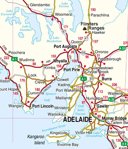
for our trip into South Australian outback: today we were to head north from Adelaide in a
hire-car for our 5 day trip with our daughter Lucy into the South
Australian outback and the Flinders Ranges (see
map right). We were away by 9-00am to drive
around the eastern side of the city and out onto the main road north. Leaving
the city behind, the broad dual-carriageway headed out into flat, rich farming
terrain; this clearly was the produce-growing region serving the city,
filled with market gardens. Traffic was reasonably light and we made good
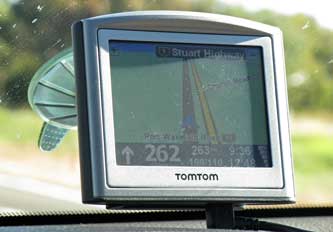
progress northwards; the sat-nav gave the instruction to go ahead for 262 kms,
and the display showed a single road leading ahead without any side branches
(see left). Leaving Adelaide
for our trip into South Australian outback: today we were to head north from Adelaide in a
hire-car for our 5 day trip with our daughter Lucy into the South
Australian outback and the Flinders Ranges (see
map right). We were away by 9-00am to drive
around the eastern side of the city and out onto the main road north. Leaving
the city behind, the broad dual-carriageway headed out into flat, rich farming
terrain; this clearly was the produce-growing region serving the city,
filled with market gardens. Traffic was reasonably light and we made good
progress northwards; the sat-nav gave the instruction to go ahead for 262 kms,
and the display showed a single road leading ahead without any side branches
(see left).
|
Map of South Australia |
 |
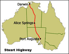 This
route was the southern start of the Stuart Highway which crosses Central
Australia from Port Augusta, eventually leading to Alice Springs and finally
Darwin on the north coast of the continent (see left). The only significant traffic were the frequent road-trains of
multiple heavy trucks (Photo 1: Road-trains).
The road ran parallel with the modern Ghan Railway which
carried long freight trains in both directions. After 2 hours' driving and good
progress northwards, we pulled into a truck-stop alongside the road and railway
for a pause, to enjoy a brunch of bacon-egg butty or toasted current bread. For us this was an instructive initial glimpse into Australian
rural life. On the drive up, we had passed through vegetable growing areas of
market gardens, broader, flat prairie lands of cattle and sheep grazing dotted
with farmsteads, and classic open bush-land with just low
vegetation. Occasional roads led off to the side, some tarmaced leading to
signposted towns named in very English manner, others simply dirt roads leading
to farming settlements. This
route was the southern start of the Stuart Highway which crosses Central
Australia from Port Augusta, eventually leading to Alice Springs and finally
Darwin on the north coast of the continent (see left). The only significant traffic were the frequent road-trains of
multiple heavy trucks (Photo 1: Road-trains).
The road ran parallel with the modern Ghan Railway which
carried long freight trains in both directions. After 2 hours' driving and good
progress northwards, we pulled into a truck-stop alongside the road and railway
for a pause, to enjoy a brunch of bacon-egg butty or toasted current bread. For us this was an instructive initial glimpse into Australian
rural life. On the drive up, we had passed through vegetable growing areas of
market gardens, broader, flat prairie lands of cattle and sheep grazing dotted
with farmsteads, and classic open bush-land with just low
vegetation. Occasional roads led off to the side, some tarmaced leading to
signposted towns named in very English manner, others simply dirt roads leading
to farming settlements.
 Port Germein's
Jetty, longest in the Southern Hemisphere:
setting off again following the railway, we
passed the insignificant industrial settlement of Port Pirie on the eastern
coast of the Spencer Gulf and dominated by a huge smelter plant. A short distance
further north, we pulled off the main road into Port Germein, set at the
narrowing northern head of the Spencer Gulf (see below right). 219kms north of Adelaide, Port Port Germein's
Jetty, longest in the Southern Hemisphere:
setting off again following the railway, we
passed the insignificant industrial settlement of Port Pirie on the eastern
coast of the Spencer Gulf and dominated by a huge smelter plant. A short distance
further north, we pulled off the main road into Port Germein, set at the
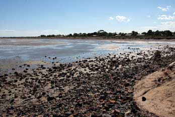
narrowing northern head of the Spencer Gulf (see below right). 219kms north of Adelaide, Port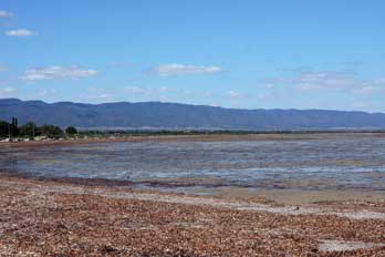 Germein with a current population of just 240 consisted of a single street of
cottages and post-office cum general stores, ending at the 1,532m long jetty which
extended out into the Gulf (Photo 2: Port Germein Jetty). Port Germein's raison d'être clearly had been as an
important transport hub and shipping point for cereals grown in the surrounding
districts of South Australia, following the opening in 1881 of what was once the longest
jetty in the southern hemisphere. Due to the shallow water along the coast, the
long jetty was necessary to allow anchorage for sailing ships to be loaded with grain from
the surrounding hinterland. Bagged wheat was brought in carts from local farms
on
the eastern side of the Southern Flinders Ranges, and in small boats from the west coast
of the Gulf. About 100,000 bags of wheat
each year were loaded into the holds of sailing freighters at the jetties of
South Australian ports like Port Pirie and Port Germaine for transport back to
Europe. We were to see one of these steel-hulled sailing ships, the Pommern, at
Mariehamn in the Åland Islands in 2012: this Glasgow-built merchantman had
operated Germein with a current population of just 240 consisted of a single street of
cottages and post-office cum general stores, ending at the 1,532m long jetty which
extended out into the Gulf (Photo 2: Port Germein Jetty). Port Germein's raison d'être clearly had been as an
important transport hub and shipping point for cereals grown in the surrounding
districts of South Australia, following the opening in 1881 of what was once the longest
jetty in the southern hemisphere. Due to the shallow water along the coast, the
long jetty was necessary to allow anchorage for sailing ships to be loaded with grain from
the surrounding hinterland. Bagged wheat was brought in carts from local farms
on
the eastern side of the Southern Flinders Ranges, and in small boats from the west coast
of the Gulf. About 100,000 bags of wheat
each year were loaded into the holds of sailing freighters at the jetties of
South Australian ports like Port Pirie and Port Germaine for transport back to
Europe. We were to see one of these steel-hulled sailing ships, the Pommern, at
Mariehamn in the Åland Islands in 2012: this Glasgow-built merchantman had
operated
 the grain route from South Australia, holding the record for completing
the Roaring Forties home-run around Cape Horn to England in 86 days loaded with
grain. Today we paused here at Port Germein's jetty, taking photos at the pier,
where the low tide left estuary mud along the shore-line shallows of Spencer
Gulf (Photo
3: Spencer Gulf) (see above left). the grain route from South Australia, holding the record for completing
the Roaring Forties home-run around Cape Horn to England in 86 days loaded with
grain. Today we paused here at Port Germein's jetty, taking photos at the pier,
where the low tide left estuary mud along the shore-line shallows of Spencer
Gulf (Photo
3: Spencer Gulf) (see above left).
 Australian Arid Lands Botanic Gardens at Port Augusta:
continuing north towards Port Augusta, the road ran along the sandy coastal plain of the
narrowing gulf, edged on the eastern side by the line of hills of the Southern
Flinders. We turned into the town of Port Augusta to find a supermarket for
provisions for Sunday's evening meal, to fill the hire car with fuel, and to get
cash from an ATM. Beyond the town, a short distance up the main Stuart Highway,
we located the
Australian Arid Lands Botanic Gardens.
The Australian Arid Lands Botanic Gardens were established in 1993 to research,
conserve and promote a wider appreciation of Australia’s arid zone flora.
Located on the shores of the Upper Spencer Gulf at Port Augusta, with
spectacular views of the Flinders Ranges, the Gardens are set out with 250
hectares of natural arid zone habitats; these are planted with collections of
Australian flora from those regions of the country with an average annual
rainfall of 300mm or less, the definition of arid lands (Australian average rainfall). Australian Arid Lands Botanic Gardens at Port Augusta:
continuing north towards Port Augusta, the road ran along the sandy coastal plain of the
narrowing gulf, edged on the eastern side by the line of hills of the Southern
Flinders. We turned into the town of Port Augusta to find a supermarket for
provisions for Sunday's evening meal, to fill the hire car with fuel, and to get
cash from an ATM. Beyond the town, a short distance up the main Stuart Highway,
we located the
Australian Arid Lands Botanic Gardens.
The Australian Arid Lands Botanic Gardens were established in 1993 to research,
conserve and promote a wider appreciation of Australia’s arid zone flora.
Located on the shores of the Upper Spencer Gulf at Port Augusta, with
spectacular views of the Flinders Ranges, the Gardens are set out with 250
hectares of natural arid zone habitats; these are planted with collections of
Australian flora from those regions of the country with an average annual
rainfall of 300mm or less, the definition of arid lands (Australian average rainfall).
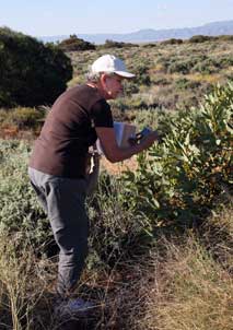
The Gardens covered a seemingly huge area of
semi-wild scrub-land, with naturally laid-out zones of wild shrubs from the
different regions of SA desert lands
(Photo
4: Arid Lands Botanic Gardens). With the aid of a
commentary-plan from the info-centre, we walked the loop-paths photographing many
of the fascinating specimens of native wild flora (see above left). But for botanic gardens, the
plantings were disappointingly labelled,
and therefore frustratingly difficult
to identify individual species. Having said that however, the desert setting in the warm afternoon
sunshine was hugely impressive (Photo
5: Desert setting),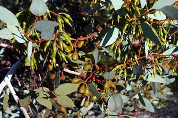 with an occasional gecko scuttling around in the
sand beneath bushes
(Photo
6: Gecko).
We did see further examples of South with an occasional gecko scuttling around in the
sand beneath bushes
(Photo
6: Gecko).
We did see further examples of South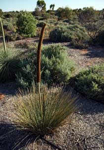 Australia's iconic flower, Sturt's Desert
Pea (Swainsona formosa) (Photo
7: Sturt's Desert Pea), this time growing in its natural conditions in dry, red desert
sand.
Typical plants of the arid Australian bush-land included needle-like Hakea
Bushes (Hakea leucoptera), and porcupine-clumps of Spinifex grass (Triodia
scariosa); the brittle tips of these plants' spiny leaves are rich in silica, and if
brushed against easily break off sticking in the skin with risk of infection. We
also found more distinctive arid desert flora: a Cactus Pea bush (Bossiaea walkeri) with
its flattened leaf-like grey-green stems and red pea-type flowers (Photo
8: Cactus Pea), isolated clumps of erect, narrow-leaved shrubs with tall flowering
heads, later identified as a Yakka, also known as Grass Trees (Xanthorrhoea sp) (Photo
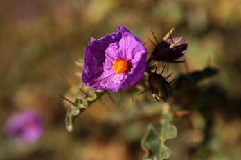
9: Grass Tree - Yakka); the Narrawa Burr (Solanum cinereum) with showy
purple flowers and crinkly leaves with viciously large spines along their
mid-vein (Photo
10: Narrawa Burr - Solanum cinereum) (see above right), and a specimen of
Harlequin Mistletoe (Lysiana exocarpi), a shrub endemic to Australia and
parasitic on Acacia and Eucalyptus, with distinctive red tubular flowers and protruding
stamens
(Photo
11: Harlequin Mistletoe). In spite of having seen many Eucalyptus trees so far in
our Australian travels, for the first time now we could examine close up
Eucalyptus flowers and fruit
(see left) (Photo
12: Eucalyptus flowers). We
had the opportunity to complete one of the circuits, particularly admiring the desert plant
life of the Flinders region. But time was moving on and the sun beginning to
lower; we still had another hour's drive north to reach Quorn before dusk, to
avoid risk of encountering kangaroos on the road. Australia's iconic flower, Sturt's Desert
Pea (Swainsona formosa) (Photo
7: Sturt's Desert Pea), this time growing in its natural conditions in dry, red desert
sand.
Typical plants of the arid Australian bush-land included needle-like Hakea
Bushes (Hakea leucoptera), and porcupine-clumps of Spinifex grass (Triodia
scariosa); the brittle tips of these plants' spiny leaves are rich in silica, and if
brushed against easily break off sticking in the skin with risk of infection. We
also found more distinctive arid desert flora: a Cactus Pea bush (Bossiaea walkeri) with
its flattened leaf-like grey-green stems and red pea-type flowers (Photo
8: Cactus Pea), isolated clumps of erect, narrow-leaved shrubs with tall flowering
heads, later identified as a Yakka, also known as Grass Trees (Xanthorrhoea sp) (Photo
9: Grass Tree - Yakka); the Narrawa Burr (Solanum cinereum) with showy
purple flowers and crinkly leaves with viciously large spines along their
mid-vein (Photo
10: Narrawa Burr - Solanum cinereum) (see above right), and a specimen of
Harlequin Mistletoe (Lysiana exocarpi), a shrub endemic to Australia and
parasitic on Acacia and Eucalyptus, with distinctive red tubular flowers and protruding
stamens
(Photo
11: Harlequin Mistletoe). In spite of having seen many Eucalyptus trees so far in
our Australian travels, for the first time now we could examine close up
Eucalyptus flowers and fruit
(see left) (Photo
12: Eucalyptus flowers). We
had the opportunity to complete one of the circuits, particularly admiring the desert plant
life of the Flinders region. But time was moving on and the sun beginning to
lower; we still had another hour's drive north to reach Quorn before dusk, to
avoid risk of encountering kangaroos on the road.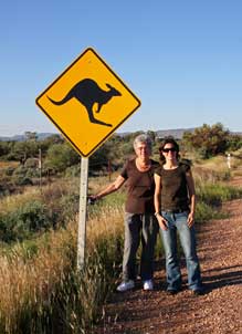
Over the Pichi Richi Pass to Quorn: returning to Port Augusta, the
sat-nav directed us onto the more minor road which followed the course of the
Pichi Richi Railway over a shoulder of the Flinders Hills. After a pause for an
Aussie souvenir photo by a road-side kangaroo warning sign (see left), we continued on the winding road
over the Pichi Richi Pass alongside the railway in the late afternoon sunlight.
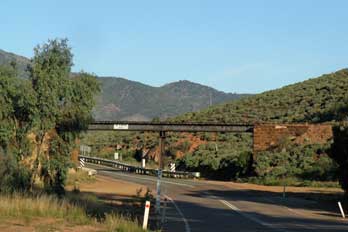 It was glorious bush-land terrain, covered with scrub and eucalyptus and lit by golden sunlight
(Photo
13: Pichi Richi Pass) (see right). By 5-00pm, we
reached the one-street outback town of Quorn to find tonight's accommodation, the
Austral pub-motel
(Photo
14: Austral pub, Quorn) just opposite the Pichi Richi Railway station. The
pub frontage and line of
the street was like something out of the Wild West, and we happily fell into the
bar to book in. Our motel room around the back was functionally adequate if
rather basic, and having stowed our kit, we returned to the bar to settle in for
schooners of Amber and Coopers after such a long and wearying drive and our
memorable afternoon in SA outback sunshine at the Arid Lands Botanic Gardens. And to round off the day, we enjoyed an excellent
supper of tender, juicy kangaroo steaks with an unusual range of Aussie
vegetables, a superbly memorable evening. Paul stayed on to watch Aussie Rules
Football on the bar TV with a last glass of Amber, and a Pom's tutorial session
from the landlady on the curious rules of AFL, before turning in himself.
Our day on the Pichi Richi Heritage Railway: we were up early to complete yesterday's log and to get breakfast over in the pub, in
order to be over at the station (see below left) for a good seat on the train. We had
booked
our tickets on-line for our ride on the preserved
Pichi Richi Heritage Railway,
but seats on the train were on a first-come-first-served basis, and a number of
folk were gathering early. The steam locomotive brought in the vintage wooden
coaches then returned to the depot; we
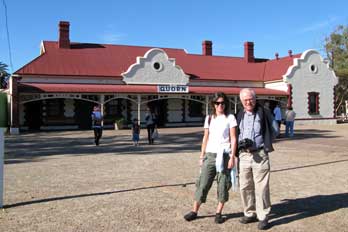 browsed the souvenir shop, waiting for
10-00am when we could board the train to reserve our seats. browsed the souvenir shop, waiting for
10-00am when we could board the train to reserve our seats.
History of the Ghan Railway: construction
had started in 1878 on the 3'6'' narrow gauge Port Augusta and Government Gums
(now known as Farina, north of the Flinders Ranges) Railway. Quorn, named after
the Leicestershire village, grew up as a small outback railhead town around the
railway which reached the town from Port Augusta in 1879. The line was extended
in 1891 to Oodnadatta, and to Alice Springs 1,241 km further
north into the interior in 1929, establishing a crucial rail link into Central Australia.
The Old Ghan, as the Great Northern Railway was
called (allegedly from the Asian camel drivers or Afghans who worked on the
line's construction), served all the outback towns on the journey northwards
into the interior to Alice Springs. The current elegant stone-and brick-built
Quorn station was completed in 1916. Quorn's hotels and pubs provided
accommodation for passengers as a staging halt on the days-long railway journey.
In 1917, Quorn became the rail travel crossroads in Australia, when the
east~west Trans-Australian Railway was completed across the Nullarbor Plain
linking Port Augusta to Kalgoorlie in Western Australia. This made Quorn
 an
important town, given that people an
important town, given that people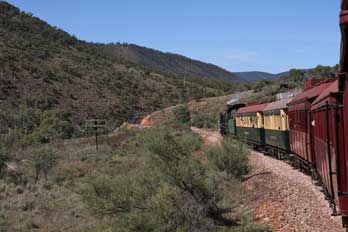 travelling by rail both east~west or
south~north in Australia would need to pass through Quorn. As a result, many
fine buildings were built as the town prospered and expanded. During WW2, Quorn
became an assembly area in the movement of troops and supplies to Darwin in
readiness to repel the threat of Japanese invasion following the 1941 bombing,
and for the transport of evacuees south. After the war, business in Quorn
declined, particularly after the new standard gauge Ghan west of the Flinders
was completed in 1956 (see map of Ghan Railway), and the Old Ghan narrow
gauge line closed in 1970. The Pichi Richi
Preservation Society re-opened the line in 1973 from Quorn southwards to Port Augusta over
the Pichi Richi Pass through Woolshed Flat, following the route of the original
3' 6” narrow gauge Old Ghan.
Our ride on the preserved Pichi Richi Railway: the Pichi Richi
Railway now operates weekend steam-hauled services on this southern section of
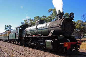
the Old Ghan route as far as Woolshed Flat and back. The engine pulling
this morning's train, 4-8-2 locomotive number W933, was built by Beyer-Peacock
of Manchester in 1951, initially for the Western Australian State Railway (see
above right). We
secured seats in the end-carriage and managed to open the windows for photography
(Photo
15: Railway photography). At
10‑30am the train pulled out, gaining height gradually on the
1:60 gradient up to Summit at an
 elevation of elevation of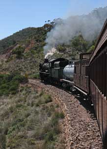 406m (see above left), and over the Pichi Richi
Pass (344m)
(Photo
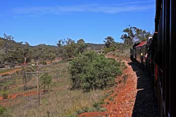
16: Pichi Richi Pass). The outback scenery was magnificent, with the line passing through
grazing country bounded by the scrub-covered, red-brown rocky hills of the Flinders Range
(Photo
17: Flinders Hills). We
all took a number of photos from the train windows, both of the terrain and of the engine
down the curving length of the train amid the Flinders outback hills (see above
right) (Photo
18: Curving length of train). Over the Summit, the line descended
via tight curves through more wooded terrain with beautifully shaped,
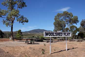
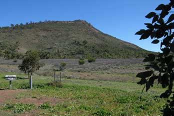
silver-coloured Eucalyptus, down into the siding at Woolshed Flat for a 40
minute break (see left); while other passengers took refreshments, we
photographed the engine as it ran around the train, and examined the wildlife. The ground around Woolshed
Flat was covered with tiny snails and wild gourds, and before re-boarding the train,
we had to inspect one another's boots and carefully pick off the sharp, prickly
fruiting burs. On the return journey, again many photos were taken around the
curving length of the train, with the engine now working hard up the steep grade
of the pass (Photo
19: Working hard up grade) (see right). On the return ride we saw more of the
Grass-trees (Xanthorrhoea), first seen yesterday at the Arid Lands Botanic Gardens,
growing across the open hill-side (Photo
20: Yakkas - Xanthorrhoea); fellow
passengers called these Yakkas, or more colloquially Blackboys from their tall
flowering heads sprouting from the mop of grass-leaves which were said to resemble
Aboriginals carrying spears. Back at Quorn, souvenir photos were taken of the steam locomotive to recall our ride on this preserved section of the Old Ghan Railway
(Photo
21: 4-8-2 locomotive W933). 406m (see above left), and over the Pichi Richi
Pass (344m)
(Photo
16: Pichi Richi Pass). The outback scenery was magnificent, with the line passing through
grazing country bounded by the scrub-covered, red-brown rocky hills of the Flinders Range
(Photo
17: Flinders Hills). We
all took a number of photos from the train windows, both of the terrain and of the engine
down the curving length of the train amid the Flinders outback hills (see above
right) (Photo
18: Curving length of train). Over the Summit, the line descended
via tight curves through more wooded terrain with beautifully shaped,
silver-coloured Eucalyptus, down into the siding at Woolshed Flat for a 40
minute break (see left); while other passengers took refreshments, we
photographed the engine as it ran around the train, and examined the wildlife. The ground around Woolshed
Flat was covered with tiny snails and wild gourds, and before re-boarding the train,
we had to inspect one another's boots and carefully pick off the sharp, prickly
fruiting burs. On the return journey, again many photos were taken around the
curving length of the train, with the engine now working hard up the steep grade
of the pass (Photo
19: Working hard up grade) (see right). On the return ride we saw more of the
Grass-trees (Xanthorrhoea), first seen yesterday at the Arid Lands Botanic Gardens,
growing across the open hill-side (Photo
20: Yakkas - Xanthorrhoea); fellow
passengers called these Yakkas, or more colloquially Blackboys from their tall
flowering heads sprouting from the mop of grass-leaves which were said to resemble
Aboriginals carrying spears. Back at Quorn, souvenir photos were taken of the steam locomotive to recall our ride on this preserved section of the Old Ghan Railway
(Photo
21: 4-8-2 locomotive W933).
 Collecting the hire-car, we set off
northwards on this afternoon's venture to drive outback dirt roads heading
towards tonight's goal of Hawker. Collecting the hire-car, we set off
northwards on this afternoon's venture to drive outback dirt roads heading
towards tonight's goal of Hawker.
Into the SA outback at Dutchman's Stern and Warren Gorge:
crossing the railway and turning north from Quorn onto back-roads, the gravel surface was good.
We
headed
inland through groves of gum trees to turn off again onto a narrow side-lane detour
leading to the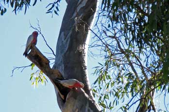 conservation area of The Dutchman's Stern; this was named by the British
navigator Matthew Flinders after a prominent 820m high bluff shaped like the
stern of an 18th century Dutch sailing ship (see left) (Photo
22 - Dutchman's Stern). Time however was pressing, and
further exploration was limited to photos from the viewpoint.
Returning to the principal dirt road, we continued
northwards along Arden Vale. Groves of gum trees lined the road, with the creeks
totally dry at this time of year. At Warren Gorge we turned off again for a
short distance to a small wild camping area in a grove of old, gnarled gum
trees (Photo
23 - Warren Gorge Gum trees), an astonishingly beautiful spot with jagged, bright orange rock
formations giving a stunning contrast with the clear blue sky and dark Cypress
Pines, and pink and grey Galah cockatoos squawking in the branches off
Eucalyptus trees (see right). conservation area of The Dutchman's Stern; this was named by the British
navigator Matthew Flinders after a prominent 820m high bluff shaped like the
stern of an 18th century Dutch sailing ship (see left) (Photo
22 - Dutchman's Stern). Time however was pressing, and
further exploration was limited to photos from the viewpoint.
Returning to the principal dirt road, we continued
northwards along Arden Vale. Groves of gum trees lined the road, with the creeks
totally dry at this time of year. At Warren Gorge we turned off again for a
short distance to a small wild camping area in a grove of old, gnarled gum
trees (Photo
23 - Warren Gorge Gum trees), an astonishingly beautiful spot with jagged, bright orange rock
formations giving a stunning contrast with the clear blue sky and dark Cypress
Pines, and pink and grey Galah cockatoos squawking in the branches off
Eucalyptus trees (see right).
 Willochra
Plain and Goyder's Line: continuing north, the gum trees were left
behind as we passed into the wide, open terrain of Willochra Plain, the name Willochra being derived from an Aboriginal word meaning Flooded creek where wild
bushes grow; the plain is crossed by the large but ephemeral, gum tree-lined Willochra Creek. Much of the plain is semi-arid and drought-affected, lying
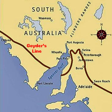
north well beyond Goyder's Line, which since 1865 has Willochra
Plain and Goyder's Line: continuing north, the gum trees were left
behind as we passed into the wide, open terrain of Willochra Plain, the name Willochra being derived from an Aboriginal word meaning Flooded creek where wild
bushes grow; the plain is crossed by the large but ephemeral, gum tree-lined Willochra Creek. Much of the plain is semi-arid and drought-affected, lying
north well beyond Goyder's Line, which since 1865 has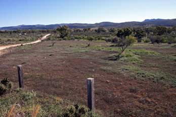 demarcated the limits of
South Australian lands suitable for arable agricultural settlement, and land
only suitable for pastoralism. In 1865 George Goyder, then SA Surveyor-General,
was commissioned to map the boundary between those areas of the new colony that
benefitted from sufficient annual rainfall to support arable farming
particularly for wheat growing, and those
subject to drought. North of Goyder's Line, annual rainfall is less than 10
inches, too low to support crop-growing, the land being only suitable for
stock grazing (see map left). In spite of Goyder's invaluable work, successive
colonial governments of the 1870s and 1880s surveyed and released former livestock
grazing pastoral land
for leasing for crop farming. But many such settlements inevitably failed because of the
arid nature of the drought-prone land, and now tragically stand long-abandoned. The Willochra Plain terrain stretched away to
open horizons in all directions, a frighteningly eerie, empty place, the land
covered with low Mallee scrub. This was cattle and sheep grazing country on
a huge scale, crossed by a network of dry creeks. But the scattered ruins of
forlornly abandoned farms and homesteads told the sad story of failed 19th
century attempts to settle and to farm these arid, inhospitable plains. demarcated the limits of
South Australian lands suitable for arable agricultural settlement, and land
only suitable for pastoralism. In 1865 George Goyder, then SA Surveyor-General,
was commissioned to map the boundary between those areas of the new colony that
benefitted from sufficient annual rainfall to support arable farming
particularly for wheat growing, and those
subject to drought. North of Goyder's Line, annual rainfall is less than 10
inches, too low to support crop-growing, the land being only suitable for
stock grazing (see map left). In spite of Goyder's invaluable work, successive
colonial governments of the 1870s and 1880s surveyed and released former livestock
grazing pastoral land
for leasing for crop farming. But many such settlements inevitably failed because of the
arid nature of the drought-prone land, and now tragically stand long-abandoned. The Willochra Plain terrain stretched away to
open horizons in all directions, a frighteningly eerie, empty place, the land
covered with low Mallee scrub. This was cattle and sheep grazing country on
a huge scale, crossed by a network of dry creeks. But the scattered ruins of
forlornly abandoned farms and homesteads told the sad story of failed 19th
century attempts to settle and to farm these arid, inhospitable plains.
 Abandoned settlement of Kanyaka: after
driving some miles across these grazing lands of Willochra Plain (see above
right) (Photo
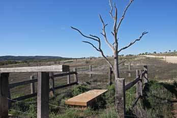
24: Willochra Plain), we paused at Proby's Grave. Hugh Proby was a Scottish aristocrat who had led the founding of the ill-fated
pastoral farming settlement at Kanyaka in Willochra Plain in 1850; he was
drowned in the swollen Willochra Abandoned settlement of Kanyaka: after
driving some miles across these grazing lands of Willochra Plain (see above
right) (Photo
24: Willochra Plain), we paused at Proby's Grave. Hugh Proby was a Scottish aristocrat who had led the founding of the ill-fated
pastoral farming settlement at Kanyaka in Willochra Plain in 1850; he was
drowned in the swollen Willochra
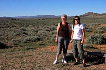 Creek in 1852 aged 24 during violent rain
storms while trying to recover stampeded cattle. His brother and sister had
shipped out a huge granite slab from Scotland to be engraved with his memorial which now stood here
(see right) (Photo
25: Proby's Grave). Looking around at the arid, scrub-covered endless plains, it seemed
inconceivable to attempt even to rear cattle here let alone to grow wheat. Some distance further, we
reached the junction of Simmonston. It had been proposed to build another
outback town here on what was envisaged as the route of the Ghan Railway
advancing northward from Quorn. Plots of land were sold to prospective settlers
and building began in 1880. But an alternative route east of the Flinders was selected
for the railway; the town of Simmonston died before it was even begun, and the
lonely remains stood here amid the scrub and desolate red earth of Willochra Plains as testimony to the unfortunate
settlers (Photo
26: Site of Simmonston) (see left). Rejoining the main tarmaced road to Hawker, we
continued north crossing a number of now totally dry creeks. We paused at the
aboriginal water hole of Kanyaka amid a rocky grove of gum trees; legend has Creek in 1852 aged 24 during violent rain
storms while trying to recover stampeded cattle. His brother and sister had
shipped out a huge granite slab from Scotland to be engraved with his memorial which now stood here
(see right) (Photo
25: Proby's Grave). Looking around at the arid, scrub-covered endless plains, it seemed
inconceivable to attempt even to rear cattle here let alone to grow wheat. Some distance further, we
reached the junction of Simmonston. It had been proposed to build another
outback town here on what was envisaged as the route of the Ghan Railway
advancing northward from Quorn. Plots of land were sold to prospective settlers
and building began in 1880. But an alternative route east of the Flinders was selected
for the railway; the town of Simmonston died before it was even begun, and the
lonely remains stood here amid the scrub and desolate red earth of Willochra Plains as testimony to the unfortunate
settlers (Photo
26: Site of Simmonston) (see left). Rejoining the main tarmaced road to Hawker, we
continued north crossing a number of now totally dry creeks. We paused at the
aboriginal water hole of Kanyaka amid a rocky grove of gum trees; legend has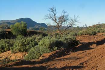 it that dying
aborigines were laid to rest in the shadow of the great rock overlooking the
water hole. As we walked over to the waterhole, the outback flies were
horrendous. Nearby were the ruined remains of Proby's failed farming settlement
of Kanyaka (Photo
27: Waterhole and settlement of Kanyaka), named after the
waterhole. We wondered what had happened to this and so many it that dying
aborigines were laid to rest in the shadow of the great rock overlooking the
water hole. As we walked over to the waterhole, the outback flies were
horrendous. Nearby were the ruined remains of Proby's failed farming settlement
of Kanyaka (Photo
27: Waterhole and settlement of Kanyaka), named after the
waterhole. We wondered what had happened to this and so many
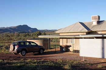 of the other
failed settlements we had passed during that afternoon. of the other
failed settlements we had passed during that afternoon.
Wonoka sheep station, our accommodation for the Flinders Ranges:
passing Hawker, we turned off further north onto a
dirt road (see right) leading for 7 kms into the bush to the farmstead and sheep station of
Wonoka where we had rented the former sheep-shearer's cottage for the
next two nights. Eventually after a long drive through the scrub-covered
bush-land grazing
grounds, we reached the isolated farmstead, to be greeted by the farmer, Peter
McInnis; we learned that his family had settled the lands in the mid-19th century, originating
from Ireland and the Isle of Mull. He now kept 2,000 head of sheep, all Merinos
with their tough wool, on the 20,000 hectares of land of this lonely
sheep–station. We
settled in to the straightforward former sheep-shearer's cottage, and stood
gazing around in awe at the spectacular views to the surrounding Flinders Hills,
now lit by the last golden light of the setting sun as it disappeared below the
line of hills (see above left) (Photo
28: Wonoka sheep station). We have stayed in some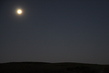 impressively memorable locations during
our travels, but none as isolated and grandiose as this. Today we had at last sampled the real outback
of Australia, and very weary after such a long and eventful day, we cooked
supper of stir-fry with pasta and barbecued corn cobs. With the impressively memorable locations during
our travels, but none as isolated and grandiose as this. Today we had at last sampled the real outback
of Australia, and very weary after such a long and eventful day, we cooked
supper of stir-fry with pasta and barbecued corn cobs. With the
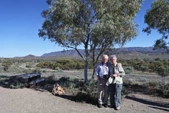 salmon-pink
sunset after-glow now silhouetting trees along the horizon (Photo
29: Sunset after-glow), darkness
fell remarkably quickly at
6-00pm, and as night came on, the sky was lit by a
full moon (see right), with the Southern Cross clearly visible. It was such a peacefully
still evening, disturbed only by the bothersome outback flies and bugs attracted
to the cottage lights; we were thankful for the fly-screens on the doors. salmon-pink
sunset after-glow now silhouetting trees along the horizon (Photo
29: Sunset after-glow), darkness
fell remarkably quickly at
6-00pm, and as night came on, the sky was lit by a
full moon (see right), with the Southern Cross clearly visible. It was such a peacefully
still evening, disturbed only by the bothersome outback flies and bugs attracted
to the cottage lights; we were thankful for the fly-screens on the doors.
North to the Flinders Ranges:
the alarm was set early, just in time to see the morning sun breasting the eastern
hill-side, and flooding the cottage with bright sunshine. We sat out for a hasty
breakfast in these magnificent surroundings
(Photo
30: Breakfast at Wonoka), and were away by
9‑00am, to drive back down the sheep-station dirt track to the main road into
Hawker. The sky was pure blue and the early sun hot; it was a truly beautiful
morning. Hawker, as the cross-roads town of
this northern part of the Flinders Ranges 350 kms north of Adelaide, was just a
small place with 490 population. It also had a number of camping-caravan sites,
a small general stores, bank-ATM, and a couple of filling stations; and that was
about it, other than a Restaurant-Gallery at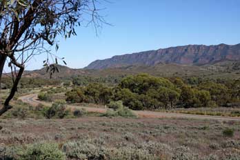 the Old Ghan railway station which
looked (and surely was) ultra-pseudy and even more ultra-expensive. Having
satisfied ourselves that the general stores had reasonable stocks for supper,
and stayed open until 5-00pm, we pressed on northwards to Wilpena. the Old Ghan railway station which
looked (and surely was) ultra-pseudy and even more ultra-expensive. Having
satisfied ourselves that the general stores had reasonable stocks for supper,
and stayed open until 5-00pm, we pressed on northwards to Wilpena.
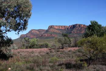 As we drove north from Hawker, the open outback
terrain looked forbiddingly attractive in the morning sunshine, backed by the
red sandstone ridges of the Flinders. We paused at the Rawnsley Bluff look-out
with its magnificent views across the outback grazing lands to the
whaleback ridges of the Elder Range (Photo
31: Elder Range) (see above left and right). This was a well-made road and we made good
speed northwards to pull into the Arkaba Hill look-out, again with
wonderful views across to the red sandstone mountains which enclose the southern
bounds of Wilpena Pound lit by the morning sun (see left) (Photo
32: Wilpena Pound southern outer face). Our plan for today was to climb
to one of the lookout points on the rim of Wilpena Pound, but at this stage, it
was difficult to envisage the exact topography of the Pound and its relationship
with the rest of the Northern Flinders; we needed maps. As we drove north from Hawker, the open outback
terrain looked forbiddingly attractive in the morning sunshine, backed by the
red sandstone ridges of the Flinders. We paused at the Rawnsley Bluff look-out
with its magnificent views across the outback grazing lands to the
whaleback ridges of the Elder Range (Photo
31: Elder Range) (see above left and right). This was a well-made road and we made good
speed northwards to pull into the Arkaba Hill look-out, again with
wonderful views across to the red sandstone mountains which enclose the southern
bounds of Wilpena Pound lit by the morning sun (see left) (Photo
32: Wilpena Pound southern outer face). Our plan for today was to climb
to one of the lookout points on the rim of Wilpena Pound, but at this stage, it
was difficult to envisage the exact topography of the Pound and its relationship
with the rest of the Northern Flinders; we needed maps.
Topography and history of farming at Wilpena Pound: Wilpena Pound is a natural oval, bowl-shaped
amphitheatre of sedimentary rock, 17 km long and 8 km wide, in the heart of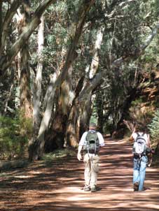 the
Southern Flinders Range mountains; its huge cattle-pound appearance gave the
geographical feature its name
(Map of Wilpena Pound).
The flat plain enclosed within the basin is covered with scrub and trees, and totally surrounded by jagged
hills which form the amphitheatre rim. This valley surrounded by its rim of
mountains was formed 600 million years ago during the
Southern Flinders Range mountains; its huge cattle-pound appearance gave the
geographical feature its name
(Map of Wilpena Pound).
The flat plain enclosed within the basin is covered with scrub and trees, and totally surrounded by jagged
hills which form the amphitheatre rim. This valley surrounded by its rim of
mountains was formed 600 million years ago during
 the Palaeozoic Era by faster
erosion of the valley floor soft bed-rock, compared with the harder sandstone
rocks which form the enclosing cliffs of the Pound. The wall of mountains almost
completely encircles the gently-sloping interior of the Pound, with the only
breaks being the gorge of Wilpena Gap on the eastern side of the range, and the
other leading through the narrow, rocky Edeowie Gorge on the western side; most
of the Pound's inner area drains into Wilpena Creek which exits through Wilpena
Gap. The highest peak in the Pound, also the highest of the Flinders Ranges, is
St Mary Peak (1,171m) on the north-eastern side. the Palaeozoic Era by faster
erosion of the valley floor soft bed-rock, compared with the harder sandstone
rocks which form the enclosing cliffs of the Pound. The wall of mountains almost
completely encircles the gently-sloping interior of the Pound, with the only
breaks being the gorge of Wilpena Gap on the eastern side of the range, and the
other leading through the narrow, rocky Edeowie Gorge on the western side; most
of the Pound's inner area drains into Wilpena Creek which exits through Wilpena
Gap. The highest peak in the Pound, also the highest of the Flinders Ranges, is
St Mary Peak (1,171m) on the north-eastern side.
For 1000s of years, the Adnyamathanha
aboriginals were the only inhabitants of Wilpena Pound; they called the Pound
Ikara, meaning meeting/initiation place. Although the first European to sight
the distant peaks of the Pound was Edward Eyre on his first 1839 expedition to
explore the vicinity of Lake Torrens, Eyre did not actually visit or investigate
these ranges and so had no idea of their geographical formation. Matthew Flinder's botanist Robert Brown had climbed one of the highest peaks of the
southern Flinders in March 1802, but Wilpena would have been beyond his view just over the
horizon. William and John Browne were the first to discover Wilpena Pound in
1850, and realising its prospects for pastoralism, applied to lease the land.
The Browne brothers won the claim for Wilpena, and Henry Strong Price ran the
40,000-hectare Wilpena Station for them, purchasing Wilpena from the Brownes in
1861. Initially, being such a well-protected and isolated natural enclosure, the
Pound was seen as an ideal stock compound used for grazing horses. By 1863 the Wilpena
Estate consisted of well over 200,000 hectares of grazing land, but was almost
ruined by the drought of that decade.
The Pound was leased to the Hill family from
Hawker in 1901. They worked determinedly to clear the valley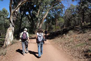 for wheat growing,
something never before attempted so far north. Goyder's Line had proved accurate
with regard to agricultural expansion during the great drought of the 1880s, and Wilpena is some 140 kilometres (87 mi) north of the Line. But being in the
shadow of some of the highest mountains of the Flinders, rainfall in the Pound
is a little higher. After the immense labour of constructing a road through for wheat growing,
something never before attempted so far north. Goyder's Line had proved accurate
with regard to agricultural expansion during the great drought of the 1880s, and Wilpena is some 140 kilometres (87 mi) north of the Line. But being in the
shadow of some of the highest mountains of the Flinders, rainfall in the Pound
is a little higher. After the immense labour of constructing a road through
 the
torturous Wilpena Gap, the Hill family cleared open patches in the thick scrub
of the Pound's interior and built a small homestead, the remains of which can
still be seen today. They harvested their first wheat crop from the Pound in
1902 despite it being a drought year, and for several years they had moderate
success growing crops within the Pound. But in 1914 a major flood destroyed the
road that they had laboured so hard to construct up through the gorge. They
continued to keep horses and cattle in the Pound until the lease expired in 1921
when, defeated in their efforts, they sold their homestead to the government and
the land was abandoned. The Pound then became a forest reserve leased for
grazing, and in 1945 the tourist potential of the area was recognised when a
National Pleasure Resort was opened on the southern side of the creek just
outside the gorge. The Pound later became part of the Flinders Ranges National
Park. the
torturous Wilpena Gap, the Hill family cleared open patches in the thick scrub
of the Pound's interior and built a small homestead, the remains of which can
still be seen today. They harvested their first wheat crop from the Pound in
1902 despite it being a drought year, and for several years they had moderate
success growing crops within the Pound. But in 1914 a major flood destroyed the
road that they had laboured so hard to construct up through the gorge. They
continued to keep horses and cattle in the Pound until the lease expired in 1921
when, defeated in their efforts, they sold their homestead to the government and
the land was abandoned. The Pound then became a forest reserve leased for
grazing, and in 1945 the tourist potential of the area was recognised when a
National Pleasure Resort was opened on the southern side of the creek just
outside the gorge. The Pound later became part of the Flinders Ranges National
Park.
Wilpena Pound National Park Information
Centre for maps and routes: 40kms further north, we crossed the National
Park boundary and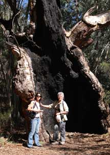 paused to pay our $7.50 entry fee. It was noticeable that once
into the protected area of the national park, where the natural vegetation had
been spared from grazing, small pine trees flourished along the road side. We
turned off to the Wilpena National Park Information Centre in search of maps,
details of
the Pound's topography, and for advice on half-day walks. The most suitable
round trip bushwalk, given our limited time, was the Wangara Lookout Walk: this
overall 8 km route would take us up Wilpena Creek via Sliding Rock Gorge, the
only natural access to penetrate the surrounding barrier of hills into the paused to pay our $7.50 entry fee. It was noticeable that once
into the protected area of the national park, where the natural vegetation had
been spared from grazing, small pine trees flourished along the road side. We
turned off to the Wilpena National Park Information Centre in search of maps,
details of
the Pound's topography, and for advice on half-day walks. The most suitable
round trip bushwalk, given our limited time, was the Wangara Lookout Walk: this
overall 8 km route would take us up Wilpena Creek via Sliding Rock Gorge, the
only natural access to penetrate the surrounding barrier of hills into the
 interior of Wilpena Pound, leading past the conserved remains of Hills'
Homestead. From there, a side route would take us up to the lower and upper Wangara Hill lookouts on the enclosing mountain rim of Wilpena Pound, offering
panoramic views into the entire geological feature (Map of Wilpena Pound). Having
now gained this greater understanding of Wilpena's topography, we thanked the
national park warden for her helpful advice, and went through to the small store
to stock up with food and water for the day. interior of Wilpena Pound, leading past the conserved remains of Hills'
Homestead. From there, a side route would take us up to the lower and upper Wangara Hill lookouts on the enclosing mountain rim of Wilpena Pound, offering
panoramic views into the entire geological feature (Map of Wilpena Pound). Having
now gained this greater understanding of Wilpena's topography, we thanked the
national park warden for her helpful advice, and went through to the small store
to stock up with food and water for the day.
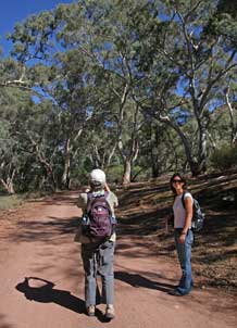
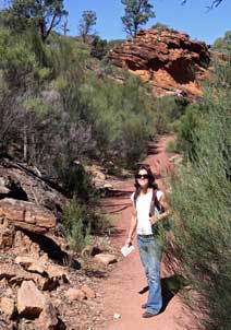
Sliding Rock Gorge alongside Wilpena Creek: fully kitted up for a day's bushwalk in the hot
Australian outback sun, and armed with local maps and compass, we set off
through the groves of gum trees up into Sliding Rock Gorge alongside Wilpena
Creek (see above right) (Photo
33: Wilpena Creek footpath). The path was well-formed and
way-marked, and despite the number of cars at the parking area, was not unduly
crowded (see above right) (Photo
34: Sliding Rock Gorge bush-trail). The sunlight and dappled shade were magnificent (Photo
35: Wilpena dappled shade),
and the fascinating variety of gnarled old gum trees provided endless opportunity for
photography (Photo
36: Gnarled Gum trees) (see above right). The path followed the course of Wilpena Creek,
the drainage course for water gathering in the natural bowl of the Pound. The
creek was mainly dry at this time of year, but in places residual pools of
semi-stagnant water remained in the bed of the gorge (Photo
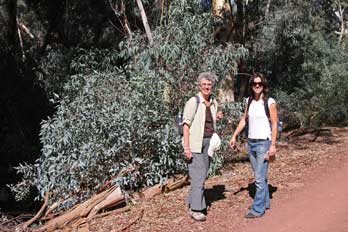
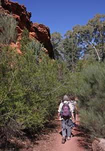
37: Semi-stagnant pools). We made frequent stops for photos amid the
groves of white-trunked Eucalyptus trees
 (Photo
38: Eucalyptus groves).
The sky remained
clear and sun bright, (Photo
38: Eucalyptus groves).
The sky remained
clear and sun bright,
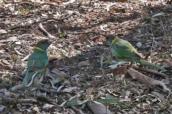
 and the air was filled with the
calls and squawks of typical Australian bird-life, with good sightings of brightly colourful Rainbow
Lorikeets (see above left); we also saw, both in the gorge and on the higher Wangara slopes, specimens of Dusty Miller (Spyridium
phlebophyllum), a
characteristic plant of the Flinders rocky ridges (Photo
39: Dusty Miller - Spyridium phlebophyllum). We took our time, totally
revelling in these remarkably classic Aussie bush-land surroundings and
red-sandstone topography. and the air was filled with the
calls and squawks of typical Australian bird-life, with good sightings of brightly colourful Rainbow
Lorikeets (see above left); we also saw, both in the gorge and on the higher Wangara slopes, specimens of Dusty Miller (Spyridium
phlebophyllum), a
characteristic plant of the Flinders rocky ridges (Photo
39: Dusty Miller - Spyridium phlebophyllum). We took our time, totally
revelling in these remarkably classic Aussie bush-land surroundings and
red-sandstone topography.
Wilpena Gorge leading to remains of Hills'
Homestead: with all 3 of us relishing these 2 hours of glorious
photographic opportunities, we eventually emerged from the gorge at the entrance
to the Pound, to reach the site of Hills' Farmstead (Map of Wilpena Pound). Here we sat on a log in the
shade to eat our lunch. The restored shell of the Hills' family homestead stood
in the middle of the clearing, and information panels told the heart-rending story of their
struggles to clear the land in the Pound's basin for growing wheat and for
cattle grazing, and to overcome the problems of draught, disease and death. The
family had struggled on into the 20th century, until finally defeated
by the gorge road's flood destruction,
they gave up their heroic struggle to farm this impossible terrain and abandoned
their homestead. Their homestead ruins now stand as a memorial, and wording of the plaque said it all: if only the walls could
talk.
Panorama of Wilpena Pound from Wangara Lookout:
from the site of the homestead, we followed the steep, way-marked track which
gained height rapidly up rock steps (see above right), winding a way up the natural
slabs of sloping strata (see below left), around the red-sandstone outcrops (see
above left) (Photo
40: Wangara path), and rising steeply through scrub bushes
to emerge high above the tree-line
of
gums
(Photo
41: Wangara tree-line). This led after a
stiff climb to the lower lookout, giving initial
views across the inner depths
of the Pound. Further
climbing led across steep sandstone
slabs to emerge 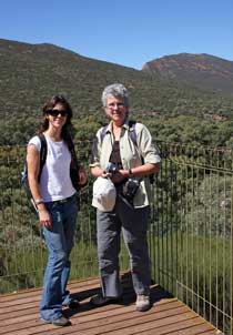 onto the Upper Wangara Lookout, and from here a complete panorama opened up of the entire length and breadth of Wilpena Pound surrounded by its
enclosing circle of craggy sandstone hills (Photo
42: Scrub-covered Wilpena Pound); this superb vantage point gave the
perfect impression of the Pound's onto the Upper Wangara Lookout, and from here a complete panorama opened up of the entire length and breadth of Wilpena Pound surrounded by its
enclosing circle of craggy sandstone hills (Photo
42: Scrub-covered Wilpena Pound); this superb vantage point gave the
perfect impression of the Pound's
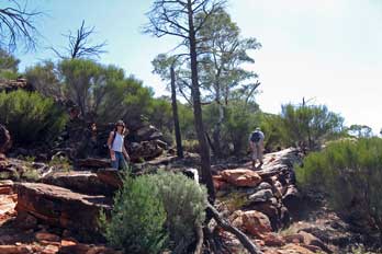 shape and structure. The original strata of
softer surface limestone within the Pound had over aeons been eroded away to
create this huge natural bowl, surrounded by the enclosing harder, more
resistant rim of sandstone (Photo
43: Wilpena panorama). The natural covering of bush, woodland and scrub across
the floor of the valley had reasserted itself over the last 100 years, after
having been partially cleared by the efforts of the Hill family to create wheat growing
areas and cattle grazing pastures (Photo
44: Scrub-covered Wilpena basin). But there were still clearer areas which we
interpreted as being more waterlogged where the trees were less inclined to grow. We
took our photos from this magnificent lookout position (see right) (Photo
45: Wilpena Pound), and began the descent of
the steep slabs, the sandstone giving good grip despite the gradient of the
slope (Photo
46: Descent from Wilpena rim). After a brief detour to a side rocky
outcrop for views to the NE, we continued the descent of the lower slopes back
down to the site of Hills' Homestead (see
below left); here we sat enjoying the shade among the trees for a
second lunch instalment of snack-bars and apple, and a refill of water bottles
from the rainwater storage tanks. shape and structure. The original strata of
softer surface limestone within the Pound had over aeons been eroded away to
create this huge natural bowl, surrounded by the enclosing harder, more
resistant rim of sandstone (Photo
43: Wilpena panorama). The natural covering of bush, woodland and scrub across
the floor of the valley had reasserted itself over the last 100 years, after
having been partially cleared by the efforts of the Hill family to create wheat growing
areas and cattle grazing pastures (Photo
44: Scrub-covered Wilpena basin). But there were still clearer areas which we
interpreted as being more waterlogged where the trees were less inclined to grow. We
took our photos from this magnificent lookout position (see right) (Photo
45: Wilpena Pound), and began the descent of
the steep slabs, the sandstone giving good grip despite the gradient of the
slope (Photo
46: Descent from Wilpena rim). After a brief detour to a side rocky
outcrop for views to the NE, we continued the descent of the lower slopes back
down to the site of Hills' Homestead (see
below left); here we sat enjoying the shade among the trees for a
second lunch instalment of snack-bars and apple, and a refill of water bottles
from the rainwater storage tanks.
With the sun still bright, we took a steady pace for the return walk back
down Wilpena Gorge. The gum trees took on a different appearance in the golden
light of afternoon, and yet more photos were taken. As we plodded down, we kept
a watchful eye for possible Koalas up in the tree branches, but unfortunately none were
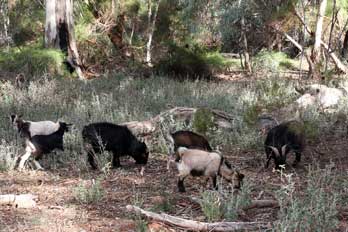
seen. We did however pass a small flock of wild goats grazing
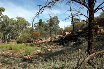 down in the creek
bed among the gum tree groves (see right), and completed the 8 kms circuit with the return to the car park by
the national park office. down in the creek
bed among the gum tree groves (see right), and completed the 8 kms circuit with the return to the car park by
the national park office.
 Return to Hawker:
setting off at 3-30pm, we returned to the main road and turned south, just
getting a brief sighting of a pair of grey Kangaroos bounding across the road
100m ahead and disappearing into the pines. Wispy cloud had gathered, dimming
the bright sunlight, and we feared that this duller light would encourage more
Kangaroos across the road. We therefore took the return drive at a steadier
pace. There were several sightings of Emus and we paused to photograph a flock
grazing on a hillock amid the scrub (Photo
47: Grazing Emus). But none were close enough for detailed
photos. After pausing at one final lookout for more photos of the distant Elder
Range across the intervening bush-land
(Photo
48: Elder Range) (see below left) all lit by the now brighter afternoon sun, we reached Hawker at 4-15pm, and
scoured the poorly stocked general store for supper materials and a much-needed pack of
beer. The storekeeper should certainly have been happier than his manner suggested,
given the prices he was charging! Return to Hawker:
setting off at 3-30pm, we returned to the main road and turned south, just
getting a brief sighting of a pair of grey Kangaroos bounding across the road
100m ahead and disappearing into the pines. Wispy cloud had gathered, dimming
the bright sunlight, and we feared that this duller light would encourage more
Kangaroos across the road. We therefore took the return drive at a steadier
pace. There were several sightings of Emus and we paused to photograph a flock
grazing on a hillock amid the scrub (Photo
47: Grazing Emus). But none were close enough for detailed
photos. After pausing at one final lookout for more photos of the distant Elder
Range across the intervening bush-land
(Photo
48: Elder Range) (see below left) all lit by the now brighter afternoon sun, we reached Hawker at 4-15pm, and
scoured the poorly stocked general store for supper materials and a much-needed pack of
beer. The storekeeper should certainly have been happier than his manner suggested,
given the prices he was charging!
 A second night in the peace of Wonoka sheep station:
rounding Wonoka Hill onto the main B83 road north, we turned
off onto the dirt track driveway to Wonoka Sheep Station (see below left)
through the seemingly barren
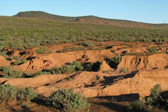 bush-land grazing. We paused briefly to photograph
a dried up creek bed (see below right) (Photo
49: Dried up creek bed), and as we stood on the dry, red mud-banks,
Galah cockatoos swooped overhead and a Willie Wagtail with his fan-shaped tail flitted
around the dry creek bed. Back at Wonoka cottage, we
stood awhile chatting with Mr McInnis the owner about the local features. The state of the
local bush-land we could see around us was more or less natural, despite seeming
to us so barren; the only change
he could recall was the increase in growth of the low Acacia scrub encouraged by
sheep grazing. On the distance horizon, the Elder Range which we had
photographed earlier stood out clearly. The sun was just dipping below the
western hillside although it was only just gone 5-00pm and, while there was
still daylight, we prepared supper of sweet potato, chopped peppers and mushrooms to add
to the left-overs of last night's stir-fry, and barbecued sausages bought at Hawker. After
such a wearying but wonderfully satisfying day, we hungrily tucked into this
hearty supper.
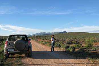 Darkness fell quickly by 6-00pm and the full moon rose swiftly above the
eastern skyline giving the sky a bright light. We sat in the kitchen
after
supper, Lucy reading a book on the history of the Flinders from the cottage Darkness fell quickly by 6-00pm and the full moon rose swiftly above the
eastern skyline giving the sky a bright light. We sat in the kitchen
after
supper, Lucy reading a book on the history of the Flinders from the cottage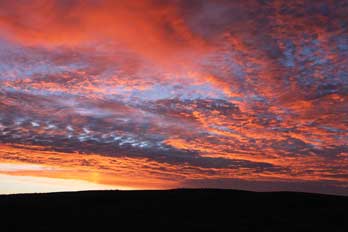 bookshelf, Sheila researching tomorrow's return route, and Paul writing today's log.
Today had given such a wonderfully fulfilling set of new experiences and
learning, and from the Wangara high-point, we had been rewarded with such a
magnificent panorama of the complete circular bowl of Wilpena Pound and its
surrounding craggy enclosing sandstone hills. Tomorrow we should begin the
return journey down the eastern side of the Flinders Range.
Early morning at Wonoka sheep station: the alarm was set early
for 6‑15am to allow time for log completion, showers, loading the vehicle and
breakfast, and an early start at 8-00am. We were jerked into early consciousness
by the compelling need to rush outside to photograph a flaringly pink dawn sky
which cast a salmon glow over this wonderful Wonoka landscape
(Photo
50: Flaringly pink dawn sky) (see right). It was a startlingly bright
morning at Wonoka's peaceful setting, and again flocks of pink and
grey Galah cockatoos soared over the farmstead this morning
(Photo
51: Galah cockatoos). Before leaving, we
added suitably
appreciative comments in the visitors' book, and as we were
loading the car, Mr McInnis came over.
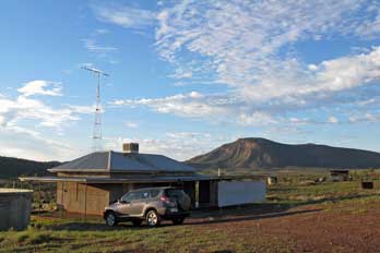 He told us that, what we had thought was
the smell of wild thyme, was simply the dewy grass drying in the morning
sunshine. He also described the creek we had stopped at last evening as more of
a storm water drainage; at times of heavy rain, the creek He told us that, what we had thought was
the smell of wild thyme, was simply the dewy grass drying in the morning
sunshine. He also described the creek we had stopped at last evening as more of
a storm water drainage; at times of heavy rain, the creek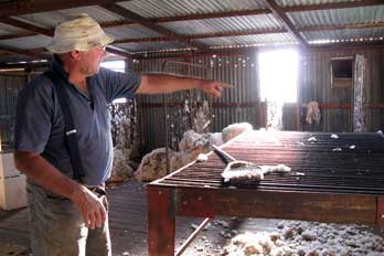 ran high and fast for
a couple of days, draining off the surface water, then drying up again to the
red sandy mud we had seen last evening. He also told us about Wonoka's water
gathering and storage arrangements: rain water was gathered into tanks for
drinking, and spring water pumped up from deep wells by the windmills we had
seen everywhere; this water was very brackish in taste from dissolved minerals
dating from aeons ago when SA was submerged. He gave us more details of his work
on the sheep station: his 2,000 sheep roamed freely over 20,000 hectares of
Wonoka's bush-land grazing; at shearing time they had to be rounded up by
driving around on his motorbike with his dogs. Although none of his sheep were
gathered in the shearing shed at present, he invited us over to see the recently
shorn Merino wool
(Photo
52: Sheep-shearing shed), and explained the routine of shearing and baling up the wool
for auctioning at Port Augusta market. Shearing at Wonoka was routinely carried
out once yearly in February, with contract shearing gangs coming in and paid by
the numbers of sheep shorn. Other stations sheared at different times of the
year to allow an evenly spread work schedule for the shearers. A sheep's wool
was shorn in one piece, and typically produced a 2 kg fleece. After sorting and
grading, (different grades of wool were sold at varying prices), the fleeces
were baled by machine into batches of ran high and fast for
a couple of days, draining off the surface water, then drying up again to the
red sandy mud we had seen last evening. He also told us about Wonoka's water
gathering and storage arrangements: rain water was gathered into tanks for
drinking, and spring water pumped up from deep wells by the windmills we had
seen everywhere; this water was very brackish in taste from dissolved minerals
dating from aeons ago when SA was submerged. He gave us more details of his work
on the sheep station: his 2,000 sheep roamed freely over 20,000 hectares of
Wonoka's bush-land grazing; at shearing time they had to be rounded up by
driving around on his motorbike with his dogs. Although none of his sheep were
gathered in the shearing shed at present, he invited us over to see the recently
shorn Merino wool
(Photo
52: Sheep-shearing shed), and explained the routine of shearing and baling up the wool
for auctioning at Port Augusta market. Shearing at Wonoka was routinely carried
out once yearly in February, with contract shearing gangs coming in and paid by
the numbers of sheep shorn. Other stations sheared at different times of the
year to allow an evenly spread work schedule for the shearers. A sheep's wool
was shorn in one piece, and typically produced a 2 kg fleece. After sorting and
grading, (different grades of wool were sold at varying prices), the fleeces
were baled by machine into batches of
 104 kgs, for contractors to transport to
market. 104 kgs, for contractors to transport to
market.
 We wished we had
time to stay longer at Wonoka and learn more about these fascinating new
experiences. He was an engaging and charmingly unassuming, taciturn man with a
delightful drawl; so interesting to listen to and to learn from. We had felt so
at home here at Wonoka; as Lucy so aptly put it, we should all leave part of
ourselves at Wonoka, and should take with us such rich memories, even from our
brief stay. We wished we had
time to stay longer at Wonoka and learn more about these fascinating new
experiences. He was an engaging and charmingly unassuming, taciturn man with a
delightful drawl; so interesting to listen to and to learn from. We had felt so
at home here at Wonoka; as Lucy so aptly put it, we should all leave part of
ourselves at Wonoka, and should take with us such rich memories, even from our
brief stay.
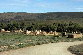
Kanyaka homestead ruins memorial site:
we said our farewells to Peter and Cheryl, and
drove back down the Wonoka driveway to the main road. Passing Hawker, we
continued south on a hot, sunny morning, and paused again to explore more
thoroughly the ruins of the 1850~60s sheep station of Kanyaka, founded
originally by Hugh Proby, which we had seen briefly on the outward drive. After Proby's death in 1852, his sheep station leases were taken over and enlarged by
partners Alexander Grant and John Philips, who settled here at Kanyaka and built
the homestead, wool shed and surrounding
 dwellings during the 1850s. During
these years the Kanyaka sheep run had flourished, growing to over 360 square
miles in area, and despite the impact of drought, had at its peak shorn 60,000
head of sheep a year with up to 70 men and their families living at the
homestead. It also functioned as a staging point and post office on the road
north into the outback. But tragically the widespread and devastating droughts
of 1864~67 brought dwellings during the 1850s. During
these years the Kanyaka sheep run had flourished, growing to over 360 square
miles in area, and despite the impact of drought, had at its peak shorn 60,000
head of sheep a year with up to 70 men and their families living at the
homestead. It also functioned as a staging point and post office on the road
north into the outback. But tragically the widespread and devastating droughts
of 1864~67 brought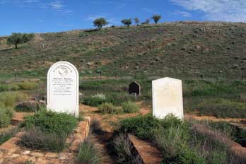 an end to the great pastoral settlements; Kanyaka was
eventually abandoned by Philips in 1888, and the surviving sheep driven to the
Coorong area south of Adelaide. an end to the great pastoral settlements; Kanyaka was
eventually abandoned by Philips in 1888, and the surviving sheep driven to the
Coorong area south of Adelaide.
We turned off the main road down to Kanyaka's homestead
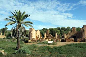
ruins (see above left), now preserved as a heritage site and memorial to those who had laboured,
suffered and striven to make a success of this pioneering settlement
(Photo
53: Kanyaka ruins) (see left). We walked
hesitantly across the bush-land to photograph the ruins, treading with
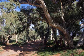
deliberate wariness in case of snakes lurking in the scrub. Down beyond the creek
lined with magnificent gum trees (see above right) (Photo
54: Gum tree lined dried creek), we walked around the
preserved ruins, amazed at how extensive the settlement had been at its height
(Photo
55: Impression of Kanyaka size), and stood sorrowfully to pay our respects at the settlement's
graveyard (Photo
56: Kanyaka graveyard) (see above right). Tragically the farmstead had not lasted long enough to fill the area
marked off as the settlement's
 graveyard before the cruel natural hardships of
this wilderness had finally brought its downfall. Sadly we wondered what had
happened to the survivors of Kanyaka, despite all the efforts they had made to
farm these inhospitable outback lands and hardships they
had endured. graveyard before the cruel natural hardships of
this wilderness had finally brought its downfall. Sadly we wondered what had
happened to the survivors of Kanyaka, despite all the efforts they had made to
farm these inhospitable outback lands and hardships they
had endured.
 Re-joining the main road, we set off again
southwards passing the point where we had joined this road from the outback
Willochra dirt track 2 days ago. Despite the speed at which traffic moved on
these dead straight main outback roads, every few kms signs warned of an
approaching floodway, the low-point dip where a creek water-course crossed the
road at times of rainfall. From a distance, the dry creek bed was visible lined
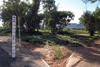
with gum trees. At the centre-point of each floodway, a
water depth post showed that, in times of heavy rain, a torrent of up to 2m
depth could surge across the road at this point (see left). We heard of
motorists being drowned through careless crossing at such floodways. A number of elaborate caravans pulled by 4WD
vehicles passed by heading north, perhaps reflecting the approaching Easter
holidays. The morning continued bright as we made good progress southwards, back
into Quorn to pass the railway station and Austral pub which we had left
seemingly weeks ago. Re-joining the main road, we set off again
southwards passing the point where we had joined this road from the outback
Willochra dirt track 2 days ago. Despite the speed at which traffic moved on
these dead straight main outback roads, every few kms signs warned of an
approaching floodway, the low-point dip where a creek water-course crossed the
road at times of rainfall. From a distance, the dry creek bed was visible lined
with gum trees. At the centre-point of each floodway, a
water depth post showed that, in times of heavy rain, a torrent of up to 2m
depth could surge across the road at this point (see left). We heard of
motorists being drowned through careless crossing at such floodways. A number of elaborate caravans pulled by 4WD
vehicles passed by heading north, perhaps reflecting the approaching Easter
holidays. The morning continued bright as we made good progress southwards, back
into Quorn to pass the railway station and Austral pub which we had left
seemingly weeks ago.
 The one-horse outback town of Wilmington: turning off by the
Austral pub, we started on the road across the broad, empty Willochra Plain,
the northern arid outback-lands now giving way to prairies of rough pastureland
or stubble from harvested crops. The lonely road extended away southwards,
totally straight and empty. By 11-00am, we reached Wilmington where we hoped to
buy food for today's lunch. A superficially attractive, one-street town where we
filled up with fuel at the one garage, it in fact proved to be a totally
one-horse town, and being Tuesday, the one horse was on its day off: the local
café was closed, and the poorly stocked general stores was unable or unwilling
to provide further provisions. Unsupplied, with other than pasties and sausage
rolls, we pressed on, and soon after, turned off up to the northern end of Mount
Remarkable National Park. The one-horse outback town of Wilmington: turning off by the
Austral pub, we started on the road across the broad, empty Willochra Plain,
the northern arid outback-lands now giving way to prairies of rough pastureland
or stubble from harvested crops. The lonely road extended away southwards,
totally straight and empty. By 11-00am, we reached Wilmington where we hoped to
buy food for today's lunch. A superficially attractive, one-street town where we
filled up with fuel at the one garage, it in fact proved to be a totally
one-horse town, and being Tuesday, the one horse was on its day off: the local
café was closed, and the poorly stocked general stores was unable or unwilling
to provide further provisions. Unsupplied, with other than pasties and sausage
rolls, we pressed on, and soon after, turned off up to the northern end of Mount
Remarkable National Park.
Alligator Gorge in Mount Remarkable National Park: the
single-track lane gained height steeply, undulating over 11kms of switchback road
across the higher flanks of Mount Remarkable through dense woodland, and ended
at a parking area perched on a spur
 (Map of Alligator Gorge).
Having paid our $8 national park entry fee, we kitted up and descended steep steps down into the rocky bed
of Alligator Gorge (Photo
57: Alligator Gorge) for the 2kms circular walk following the
dry creek bed along the cliff-lined floor of
the sandstone gorge. To our relief, there were no alligators in Alligator Gorge; the gorge
was named after a local shepherd called Ally. The gorge floor was thickly wooded
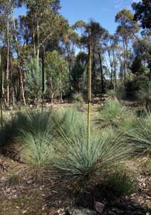
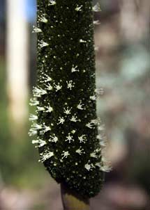
with gum trees and many more Yakka grass-trees (Xanthorrhoea) (Photo
58: Yakka - Xanthorrhoea) (see above right)
than we had seen further north; many of them had brown flowering heads dotted with tiny white
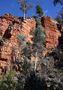
star flowers (see left). The stratified sandstone of the high gorge side-walls glowed a
vivid crimson-red in the golden afternoon sunlight (Photo
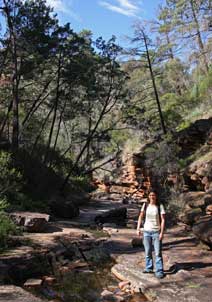
59: Sandstone gorge walls) (see right). The creek, which at times of
flood would have washed along the gorge-bed, was almost dry, and the faint track
alternated between banks of the creek and the stones of the creek-bed itself (Photo
60: Semi-dry stream bed) (see below left). To begin with, we turned right along the gorge floor
under the high sandstone side-cliffs, following the course of the creek which
rose up a lengthy series of flat slab terraces
(Photo
61: Eroded stream bed). In places, the sandstone of the gorge floor
showed traces of petrified sand with a ripple effect (Map of Alligator Gorge).
Having paid our $8 national park entry fee, we kitted up and descended steep steps down into the rocky bed
of Alligator Gorge (Photo
57: Alligator Gorge) for the 2kms circular walk following the
dry creek bed along the cliff-lined floor of
the sandstone gorge. To our relief, there were no alligators in Alligator Gorge; the gorge
was named after a local shepherd called Ally. The gorge floor was thickly wooded
with gum trees and many more Yakka grass-trees (Xanthorrhoea) (Photo
58: Yakka - Xanthorrhoea) (see above right)
than we had seen further north; many of them had brown flowering heads dotted with tiny white
star flowers (see left). The stratified sandstone of the high gorge side-walls glowed a
vivid crimson-red in the golden afternoon sunlight (Photo
59: Sandstone gorge walls) (see right). The creek, which at times of
flood would have washed along the gorge-bed, was almost dry, and the faint track
alternated between banks of the creek and the stones of the creek-bed itself (Photo
60: Semi-dry stream bed) (see below left). To begin with, we turned right along the gorge floor
under the high sandstone side-cliffs, following the course of the creek which
rose up a lengthy series of flat slab terraces
(Photo
61: Eroded stream bed). In places, the sandstone of the gorge floor
showed traces of petrified sand with a ripple effect
 from the bed of an ancient
sea, now preserved in stone. The gorge walls rose between 50 and 80 feet
above us, and at their foot in the bed of the wooded gorge, the stratified
sandstone blocks were eroded by the stream in times of spate
(Photo
62: Eroded gorge walls); it was a truly spectacular place. We followed the rocky-floored creek bed, rising up the creek
through the Yakka and gum trees until the path petered out amid dense scrub.
Returning down the rocky slab terraces of the gorge bed, we paused to sit on the slabs to eat our
lunch, revelling in the awesome silence of the gorge fissure. from the bed of an ancient
sea, now preserved in stone. The gorge walls rose between 50 and 80 feet
above us, and at their foot in the bed of the wooded gorge, the stratified
sandstone blocks were eroded by the stream in times of spate
(Photo
62: Eroded gorge walls); it was a truly spectacular place. We followed the rocky-floored creek bed, rising up the creek
through the Yakka and gum trees until the path petered out amid dense scrub.
Returning down the rocky slab terraces of the gorge bed, we paused to sit on the slabs to eat our
lunch, revelling in the awesome silence of the gorge fissure.
Setting off again, we returned to the start point in the bed of Alligator
Gorge at the foot of the steps, and turned left to follow the dry creek into the
now gloomy depths of a 100 feet deep canyon (Map of Alligator Gorge). This must have been formed
originally by a tectonic fissure in the sandstone which over aeons had been
deepened by erosion by the creek to create this now mighty canyon. In times of
heavy rain, the flooded creek would be impassable; but today, the rocky floor
was almost dry and we were able to pick our way over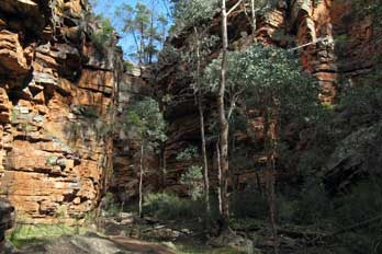 the boulders of the creek
bed (see right). Here we found a Cherry Ballart tree (Exocarpos cupressiformis) with
its unusual, edible red fruits or 'cherries', the swollen stem above the nut. Along this main course of the gorge, there were more folk about, and the
over-loud noise of human voices echoing within the gorge walls was an irritating intrusion into the imposing
silence of the canyon. The walls of the meandering canyon, now towering 100 feet
above us (Photo
63: Canyon walls) (see right and below left), narrowed as we wound our way along the
boulder-strewn gorge bed; here we reached a
spectacular narrowing gullet where the force of water at times of flood had
deposited huge pieces of tree debris, trapped against the twisted trunks of dead trees
(Photo
64: Tree debris), almost blocking the throat of the
gorge. The lower walls at the foot of the side-cliffs within the gullet were
hollowed out, undercut by storm water swirling like a maelstrom
below the high
canyon
walls, and eroding the sandstone side-walls into a rounded passageway
(Photo
65: Gorge narrows) (see below right).
Once through the gullet,
the side-walls of the gorge lowered and widened, and the pathway advanced along
a delightfully verdant section of woodland the boulders of the creek
bed (see right). Here we found a Cherry Ballart tree (Exocarpos cupressiformis) with
its unusual, edible red fruits or 'cherries', the swollen stem above the nut. Along this main course of the gorge, there were more folk about, and the
over-loud noise of human voices echoing within the gorge walls was an irritating intrusion into the imposing
silence of the canyon. The walls of the meandering canyon, now towering 100 feet
above us (Photo
63: Canyon walls) (see right and below left), narrowed as we wound our way along the
boulder-strewn gorge bed; here we reached a
spectacular narrowing gullet where the force of water at times of flood had
deposited huge pieces of tree debris, trapped against the twisted trunks of dead trees
(Photo
64: Tree debris), almost blocking the throat of the
gorge. The lower walls at the foot of the side-cliffs within the gullet were
hollowed out, undercut by storm water swirling like a maelstrom
below the high
canyon
walls, and eroding the sandstone side-walls into a rounded passageway
(Photo
65: Gorge narrows) (see below right).
Once through the gullet,
the side-walls of the gorge lowered and widened, and the pathway advanced along
a delightfully verdant section of woodland
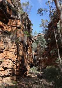 valley, before rising up the hillside to an
informal camping and picnic area at Blue Gum Flat high on the slopes above. A
narrow track descended steeply from here then rose steadily for a 30 minute
climb through woodland, returning us to the parking area. valley, before rising up the hillside to an
informal camping and picnic area at Blue Gum Flat high on the slopes above. A
narrow track descended steeply from here then rose steadily for a 30 minute
climb through woodland, returning us to the parking area.
We set off again back over the undulating single-track lane across the shoulder
of Mount Remarkable, passing a clearing where we spotted a small Grey
Kangaroo. We stopped and walked back, expecting him to have disappeared. But
almost oblivious to our presence, he stood hopping around with the peculiar
kangaroo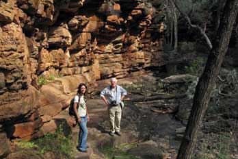 rocking gait (see below left) (Photo
66 - Grey Kangaroo),
until finally bouncing off into the woodland.
Although almost too distant for photographs, we had a clear sighting of our
first Kangaroo, a grey around 3 feet high and remarkably tolerant of human
presence. rocking gait (see below left) (Photo
66 - Grey Kangaroo),
until finally bouncing off into the woodland.
Although almost too distant for photographs, we had a clear sighting of our
first Kangaroo, a grey around 3 feet high and remarkably tolerant of human
presence.
The outback town of Melrose: we drove back down from Mount
Remarkable towards the main road,
and close by Wilmington cemetery, had the spectacular sight of a huge flock of White
Cockatoos swarming around gum trees and roosting in ranks along the
branches (see below right) (Photo
67 - White Cockatoos). Back at the main road, we turned south into the next small outback town of Melrose, which was set against the impressive outline of 950m high Mount
Remarkable. In origin an 1840s copper mining boom town, today Melrose was a
sleepy, twee place, the main street lined with over-restored buildings clearly
aimed at tourism. We paused for a 'nice cuppa tea' (complete with 'nice' tea
cups and tea-strainer) at an over-twee, 'nice old black-smithy tea room', and a
welcome sit under the shade
of the veranda in the hot afternoon sunshine. The
library van parked nearby was doing a lively trade with the elderly ladies of
the town.
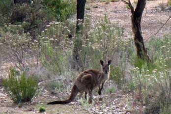 Clare Valley wine-growing area: setting off
again at 4-00pm, we continued south for the 130kms drive through a series of
little one-street country towns such as Laura, Gladstone, and Yacka, until
finally we reached tonight's goal, the wine-growing area of Clare Valley. As we Clare Valley wine-growing area: setting off
again at 4-00pm, we continued south for the 130kms drive through a series of
little one-street country towns such as Laura, Gladstone, and Yacka, until
finally we reached tonight's goal, the wine-growing area of Clare Valley. As we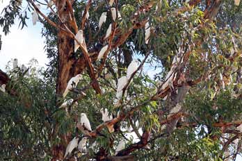 advanced south beyond the Willochra Plain and Melrose, the wide open prairie landscape
became much more familiarly agricultural with fenced pastureland and open arable
countryside with recently harvested crop stubble burnt off. As we approached
Clare however, the terrain changed again to rolling hills, and we passed the
first vines. We had during our time in Australia begun to get accustomed to the
inverted seasons, but suddenly it occurred to us to wonder: when in the southern
hemisphere was the grape vendange? Some of the vines were now down to bare
twigs, others were still in full leaf, and we assumed that March~April was the
time of the grape harvest here, as opposed to September~October in the northern
hemisphere that we had been accustomed to.
Clare Hotel/pub, our accommodation for Clare Valley:
Clare was a larger town, clearly the region's main centre, with evident
commercial industry supporting local viticulture. We rolled into town, and along
the main street found tonight's accommodation, the Clare Hotel, the middle of
the town's 3 pubs
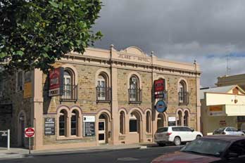 (see below left). As we entered, first impressions were of a rather seedy
sports bar with a side room stuffed full of flashing, whirring 'pokies' (fruit
machines), and as always the inevitable resident saddies. Our room was reasonable, but the
noisy urban environment seemed a million alien miles from the glorious outback
silence of Wonoka. We settled in and while
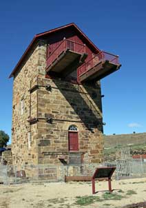 Paul worked on today's log with a pint of
Coopers in the bar, Sheila and Lucy went for an exploratory walk along Clare's
main street to reconnoitre food options. We in fact enjoyed a huge if expensive
supper of seafood platter or barramundi with sweet potatoes and spinach in the pub's dining room, and shared a bottle of the local
Clare Valley Jim Barrie Riesling. It had been another excellent day: we had enjoyed a thrilling
walk in Alligator Gorge on Mount Remarkable, seen our first Kangaroo, and
travelled a good distance south. But tonight our thoughts were still in the
memorable outback solitude and silence of Wonoka. Paul worked on today's log with a pint of
Coopers in the bar, Sheila and Lucy went for an exploratory walk along Clare's
main street to reconnoitre food options. We in fact enjoyed a huge if expensive
supper of seafood platter or barramundi with sweet potatoes and spinach in the pub's dining room, and shared a bottle of the local
Clare Valley Jim Barrie Riesling. It had been another excellent day: we had enjoyed a thrilling
walk in Alligator Gorge on Mount Remarkable, seen our first Kangaroo, and
travelled a good distance south. But tonight our thoughts were still in the
memorable outback solitude and silence of Wonoka.
South to the former copper mining town of Burra: it had rained
heavily during the night, and the noise of heavy trucks passing through the town
main street directly under our hotel room window was disturbing. After a minimal
breakfast of muesli bars and coffee, we were away by 8-30am to drive over to
visit the former copper mining town of Burra. The route passed over rolling hills of open arable land, running
alongside water pipelines and the now closed Adelaide~Burra railway line. We parked at
Burra at 9-00am outside the town's TIC in order to get some understanding as to
what we could see of the town's copper mining heritage (see right and below left), which in its day had
contributed much to support the early colony's ailing economy
(Copper mines remains at Burra).
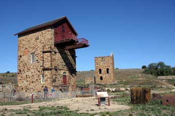 History of copper mining at Burra: the blue-green ore indicating
veins of copper was reputably discovered by a shepherd, William Streair, in 1845
alongside Burra Creek. Speculators moved in sensing the fortunes to made from
copper exploitation, and the first company-owned mining township in Australia, Kooringa rapidly developed to become the country's largest inland town by 1851.
Speculative investment in the mine was led by John Morphett, one of South Australia's pioneer
English colonists who made his fortune from mining speculation and other
commercial trading ventures, to become one of the colony's leading landowners
and
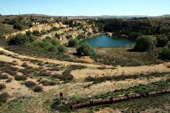 politicians, and 7 times state premier. The Burra Mine,
known also as the Monster Mine, was the largest metal producing mine in Australia by 1860, attracting 1000s of miners from Cornwall, South Wales and Scotland, at a
time when falling world prices were forcing the closure of formerly flourishing Cornish
mines. Employment prospects in SA also attracted carpenters, engineers, masons
and other trades. The Burra mine developed on company-owned land, and the
townships of Redruth, Aberdeen and Llwchwr grew up further north. The first
mines of the 1840~60s were deep shaft pits, and the mine
became a labyrinth of underground galleries. But as these veins became
exhausted, from 1870 open-cast working with lower cost mechanical extraction
took over (see right). All in all the mines at Burra produced around 50,000 tonnes of
copper between 1845 and 1877 when the SA Mining Association's operations ceased.
During its heyday, the Burra mines, along with the mines at
Kapunda (see below), have been credited with
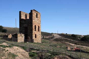 saving the economy of the
struggling new colony of South Australia, producing 89% of South Australia's and
5% of the world's copper. When the mine was exhausted and closed, Burra's
population shrank dramatically, and the townships' economy relied mainly on
agriculture. Today Burra continues as a centre for the surrounding farming
industry and for tourism, and is one of the best-preserved Victorian era towns in Australia. saving the economy of the
struggling new colony of South Australia, producing 89% of South Australia's and
5% of the world's copper. When the mine was exhausted and closed, Burra's
population shrank dramatically, and the townships' economy relied mainly on
agriculture. Today Burra continues as a centre for the surrounding farming
industry and for tourism, and is one of the best-preserved Victorian era towns in Australia.
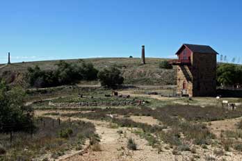 Arrival at Burra:
from the rapidly speaking elderly gent at the TIC, we learned of
the options available to help understand more of Burra's mining history and to see something of the
conserved remains: we could either spend $25 each on tickets for a guided tour
of every item of the town's local trivia, including the town hall, 2 churches, and Miss
Mable's cottage (flippantly re-labelled by us as Good Golly Miss Molly;
those under the age of 70 simply wouldn't understand!), or walk around
the site of the former mine and the 1870s huge, flooded open-cast mining pit and restored
engine-house museum for a $5 entry fee. It was a simple choice, and quite
naturally we chose the latter. Contrary to our expectations, the modern day Burra was a classic South Australian country town. Although relying
economically to a degree on tourism, this had not caused degeneration into a twee
museum-piece place. It was a largely functional town with an every-day feel,
albeit keeping its traditional air with admirably preserved stone-built, Arrival at Burra:
from the rapidly speaking elderly gent at the TIC, we learned of
the options available to help understand more of Burra's mining history and to see something of the
conserved remains: we could either spend $25 each on tickets for a guided tour
of every item of the town's local trivia, including the town hall, 2 churches, and Miss
Mable's cottage (flippantly re-labelled by us as Good Golly Miss Molly;
those under the age of 70 simply wouldn't understand!), or walk around
the site of the former mine and the 1870s huge, flooded open-cast mining pit and restored
engine-house museum for a $5 entry fee. It was a simple choice, and quite
naturally we chose the latter. Contrary to our expectations, the modern day Burra was a classic South Australian country town. Although relying
economically to a degree on tourism, this had not caused degeneration into a twee
museum-piece place. It was a largely functional town with an every-day feel,
albeit keeping its traditional air with admirably preserved stone-built,
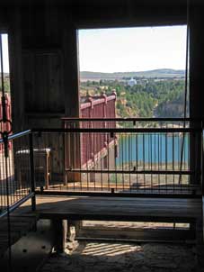 colonial
era shops and
cottages
(Photo
68: Colonial era building), and a hardware store where you could buy anything from a wrench to a
cement mixer. We sat at a very down-to-earth bakery-cum-coffee shop where, over
a late breakfast of meat pie and sauce, (or rock cakes with Earl Grey
tea for the more refined of us), we studied the material garnered from the TIC and drew up a
programme for our morning around Burra. colonial
era shops and
cottages
(Photo
68: Colonial era building), and a hardware store where you could buy anything from a wrench to a
cement mixer. We sat at a very down-to-earth bakery-cum-coffee shop where, over
a late breakfast of meat pie and sauce, (or rock cakes with Earl Grey
tea for the more refined of us), we studied the material garnered from the TIC and drew up a
programme for our morning around Burra.
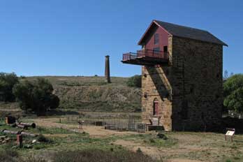 Our visit to the remains of Burra copper mines: guided by the TIC
Heritage Trail booklet, we followed a dirt track out to the site of Burra's former copper mining
activity, passing the town's corporation rubbish tip (about the one and only
local feature not detailed in the booklet!). Although not having paid the $25 fee for the Burra Passport
ticket, we managed somehow to gate-crash the mining powder magazine tour,
courtesy of a couple of gullible tourists who had parted with cash! The stone
building with its blast-proof containment wall, had a beautiful arched stone
roof. From here we drove around to the restored Morphett's Pumping Engine House
(Photo
69: Burra copper mine museum), where we paid our $4 seniors' reduction
for entry to the museum site (see above right). The attendant gave an
impressively instructive commentary on the working of the huge beam
pumping-engine, fed by its wood-fired Cornish boilers, which pumped aquifer
water from the 600 feet deep old workings. The 40 psi beam-engine and Cornish
boilers had been shipped out from England and operated by Cornish engineers. The
magnificent Morphett's Engine House, named after John Morphett the mine's principal director, had been restored in 1986 as
a 150 year SA jubilee project (see right) (Photo
70: Morphetts Engine House). The cantilevered third storey balconies,
where the beam had formerly been balanced, gave astonishing views over the huge
flooded pit of the 1870s open-cast workings
(Photo
71: Flooded open-cast mine) (see above left).
Information panels inside the restored pumping house gave fascinating details of the engine's working, and the
history of the Cornish miners at Burra mines. Our visit to the remains of Burra copper mines: guided by the TIC
Heritage Trail booklet, we followed a dirt track out to the site of Burra's former copper mining
activity, passing the town's corporation rubbish tip (about the one and only
local feature not detailed in the booklet!). Although not having paid the $25 fee for the Burra Passport
ticket, we managed somehow to gate-crash the mining powder magazine tour,
courtesy of a couple of gullible tourists who had parted with cash! The stone
building with its blast-proof containment wall, had a beautiful arched stone
roof. From here we drove around to the restored Morphett's Pumping Engine House
(Photo
69: Burra copper mine museum), where we paid our $4 seniors' reduction
for entry to the museum site (see above right). The attendant gave an
impressively instructive commentary on the working of the huge beam
pumping-engine, fed by its wood-fired Cornish boilers, which pumped aquifer
water from the 600 feet deep old workings. The 40 psi beam-engine and Cornish
boilers had been shipped out from England and operated by Cornish engineers. The
magnificent Morphett's Engine House, named after John Morphett the mine's principal director, had been restored in 1986 as
a 150 year SA jubilee project (see right) (Photo
70: Morphetts Engine House). The cantilevered third storey balconies,
where the beam had formerly been balanced, gave astonishing views over the huge
flooded pit of the 1870s open-cast workings
(Photo
71: Flooded open-cast mine) (see above left).
Information panels inside the restored pumping house gave fascinating details of the engine's working, and the
history of the Cornish miners at Burra mines.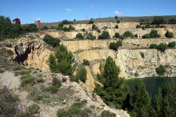
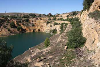 The mine workings had covered a huge area although there was little else remaining
to be seen now. We walked around the other areas of the mining site, seeing one of the
recovered Cornish boilers and the shaft where the pumping mechanism extracted
water from the pit (Photo
72: Mine pumping shaft). Further round we found the gravestone of Henry
Roach, one of the mine captains, and another pumping house building standing at
the edge of the flooded pit of the 1870s open-cast workings. The mid-19th
century deep mining had produced much richer ore than all the mechanically
excavated open-cast mining of the later period. The open-cast workings with its tiered
sides (see left) had left an extensive, turquoise-blue flooded pit (Photo
73: Flooded workings); we explored all round the excavated workings, clambering down the tiered chalky sides
(see right)
(Photo
74: Open-cast workings tiered sides), but could find no sign of spoil heaps of
waste from either the earlier deep mining or later open-cast mining. Around the
far side, we peered into an adit which was part of the extracting tunnel for
water pumped from the deep pit, and continued around to a lookout with
magnificent views over the flooded open-cast workings. The vegetation of the
former Burra mining area included Agave The mine workings had covered a huge area although there was little else remaining
to be seen now. We walked around the other areas of the mining site, seeing one of the
recovered Cornish boilers and the shaft where the pumping mechanism extracted
water from the pit (Photo
72: Mine pumping shaft). Further round we found the gravestone of Henry
Roach, one of the mine captains, and another pumping house building standing at
the edge of the flooded pit of the 1870s open-cast workings. The mid-19th
century deep mining had produced much richer ore than all the mechanically
excavated open-cast mining of the later period. The open-cast workings with its tiered
sides (see left) had left an extensive, turquoise-blue flooded pit (Photo
73: Flooded workings); we explored all round the excavated workings, clambering down the tiered chalky sides
(see right)
(Photo
74: Open-cast workings tiered sides), but could find no sign of spoil heaps of
waste from either the earlier deep mining or later open-cast mining. Around the
far side, we peered into an adit which was part of the extracting tunnel for
water pumped from the deep pit, and continued around to a lookout with
magnificent views over the flooded open-cast workings. The vegetation of the
former Burra mining area included Agave
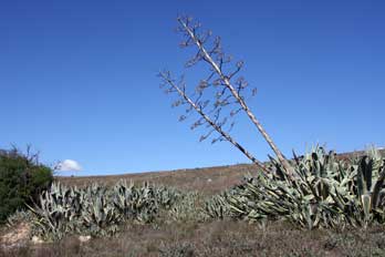 (Century
plant) (see below left) and Prickly Pear Cactus (Opuntia) (Photo
75 - Prickly Pear Cactus); both native to America, they were introduced to Australia in
the 19th
century where, although attractive, they have now become naturalised as widespread invasive weeds. (Century
plant) (see below left) and Prickly Pear Cactus (Opuntia) (Photo
75 - Prickly Pear Cactus); both native to America, they were introduced to Australia in
the 19th
century where, although attractive, they have now become naturalised as widespread invasive weeds.
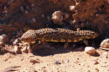 A brief visit to the town of Burra:
entry to the mining site had proved good value, giving us far more than we might
have expected on the mining history. We had partitioned our time today to give us the
morning to see Burra and to learn as much as we could about its copper mining
heritage, leaving this afternoon to sample some of the Clare Valley wine
producers. It was now 12;00 noon, and we returned to the town to see a little of Burra itself and to get a
swift pub lunch. On the drive back around the dirt track, Lucy abruptly
screeched to a halt. There in the road was a large lizard: a Shingleback, the
bulkiest of Australian blue-tongued skinks (Tiliqua rugosa), known also as a
Sleepy, a Pine Cone, Stumpey, or Two-headed Lizard, with a tail resembling its
head, part of its defence mechanism (Photo
76 - Shingleback Lizard) (see right); although disturbed by us, we were
able to photograph the lizard before it eventually scuttled off onto the scrub. A brief visit to the town of Burra:
entry to the mining site had proved good value, giving us far more than we might
have expected on the mining history. We had partitioned our time today to give us the
morning to see Burra and to learn as much as we could about its copper mining
heritage, leaving this afternoon to sample some of the Clare Valley wine
producers. It was now 12;00 noon, and we returned to the town to see a little of Burra itself and to get a
swift pub lunch. On the drive back around the dirt track, Lucy abruptly
screeched to a halt. There in the road was a large lizard: a Shingleback, the
bulkiest of Australian blue-tongued skinks (Tiliqua rugosa), known also as a
Sleepy, a Pine Cone, Stumpey, or Two-headed Lizard, with a tail resembling its
head, part of its defence mechanism (Photo
76 - Shingleback Lizard) (see right); although disturbed by us, we were
able to photograph the lizard before it eventually scuttled off onto the scrub.
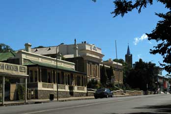 Driving back through the town, we rapidly ticked off the lesser attractions,
including the town hall (see left), and made our way around to
Burra's former railway
station. Despite the line's closure in 1998, the station building still stood
and a preservation society was attempting to restore it. The history of their
progress (or rather lack of it!) was recorded on a panel, showing little more
than 5 years' worth of committee meetings. It was a truly Driving back through the town, we rapidly ticked off the lesser attractions,
including the town hall (see left), and made our way around to
Burra's former railway
station. Despite the line's closure in 1998, the station building still stood
and a preservation society was attempting to restore it. The history of their
progress (or rather lack of it!) was recorded on a panel, showing little more
than 5 years' worth of committee meetings. It was a truly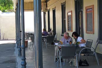 magnificent example of
an Australian country railway station, with a beautiful curved, corrugated iron
platform canopy (Photo
77 - Burra railway station). The tracks were still in situ despite badly rotted wooden sleepers, and
hopefully one day the preservation society might be able to restore steam
working to Burra. Such a lovely station deserved it. We paused for a pub lunch
at the rather sordid Burra Hotel, where the offensively surly
landlady was ironically re-christened Hail Mary Full of Grace. Over a
suitable Burra lunch of Cornish pasty on the pub's shady veranda (see right), we considered Lucy's suggested schedule for an afternoon of wine-tasting around some
of the producers of the Clare Valley. magnificent example of
an Australian country railway station, with a beautiful curved, corrugated iron
platform canopy (Photo
77 - Burra railway station). The tracks were still in situ despite badly rotted wooden sleepers, and
hopefully one day the preservation society might be able to restore steam
working to Burra. Such a lovely station deserved it. We paused for a pub lunch
at the rather sordid Burra Hotel, where the offensively surly
landlady was ironically re-christened Hail Mary Full of Grace. Over a
suitable Burra lunch of Cornish pasty on the pub's shady veranda (see right), we considered Lucy's suggested schedule for an afternoon of wine-tasting around some
of the producers of the Clare Valley.
Wine tasting and buying in Clare Valley:
driving back along Burra's classic country town main street, we headed back
towards Clare. This first part of the route ran along the Barrier Highway, an
inter-state road which crosses
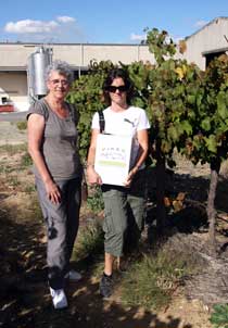 the Darling River and eventually extends all the
way to NSW and Sydney, passing Broken Hill, the former mining town just into
NSW, through Lithgow and past Katoomba. After our earlier trip into the NSW Blue
Mountains, we were now seeing this highway at its
South Australian end. Approaching Clare, we turned off onto an unsealed dirt road across the
rolling hills of broad agricultural countryside and the first vines. Not only
were the seasons reversed for grape harvesting in the southern hemisphere, but with
the sun taking a more northerly passage across the sky, it was the northern
slopes that were favoured for ripening the grapes rather than the south-facing
slopes the Darling River and eventually extends all the
way to NSW and Sydney, passing Broken Hill, the former mining town just into
NSW, through Lithgow and past Katoomba. After our earlier trip into the NSW Blue
Mountains, we were now seeing this highway at its
South Australian end. Approaching Clare, we turned off onto an unsealed dirt road across the
rolling hills of broad agricultural countryside and the first vines. Not only
were the seasons reversed for grape harvesting in the southern hemisphere, but with
the sun taking a more northerly passage across the sky, it was the northern
slopes that were favoured for ripening the grapes rather than the south-facing
slopes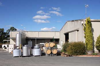 we were accustomed to in Europe. we were accustomed to in Europe.
Pikes Wines: we turned down Pike's Hill passing the autumnal
grapes, and pulled into
Pikes' Vineyard (see left and right). We were received hospitably at this medium sized
establishment, and considered their tasting list. Prices were generally more
expensive than we had previously experienced, and we confined our attention to
those wines around $20 for tasting. The man who served us introduced the wines and answered our questions about
assemblage and southern hemisphere viticultural techniques. Their 2010 Pikes' Traditionale Riesling
at $23/bottle was crisply dry; this was an archetypal
Clare Valley cépage. We next tasted their 2008 Pikes' Dogwalk, an attractive
blend of 75% Cabernet Sauvignon/25% Cabernet Franc: this was a richly
full-bodied wine at $18, with the distinctive bite of Cabernet Sauvignon. We
then tried what for us was a new grape, their 2009 Pikes' Luccio 100% Sangiovese,
a light bodied red with a luscious cherry taste; the Sangiovese was a grape
favoured in the wine growing region of Tuscany. All the wines had a prominent
bouquet which we fully appreciated. Having explained we were from England, the
man was quite understanding about our limited carrying capacity. We took a
bottle each of the Riesling and Sangiovese, and thanking the man for his hospitality, we took photos outside standing alongside
their vines framed by Eucalyptus as typically Australian (Photo
78: Pikes' Wines)
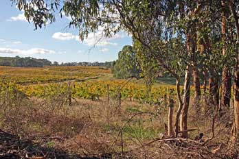 Paullets Wines: just
down the lane at Polish Hill River, a
region named after the Polish settlers of the mid-19th century, we pulled into
a smaller establishment, Paullets Wines: just
down the lane at Polish Hill River, a
region named after the Polish settlers of the mid-19th century, we pulled into
a smaller establishment,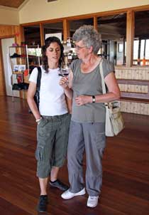 Paullets Wines, where again we received a hospitable
and informative welcome. Again their tasting notes were helpful. It made a
pleasant change to be able to converse readily in English without struggling for
wine terminology in French. The girl explained more about Australian vine-growing: it was not simply that in
the southern hemisphere, the vines were grown on north-facing slopes; that would
expose the vines to too harsh a sun, particularly in the afternoon. The NE~E
slopes were preferred for the gentler morning sun, and presence of water was a
more important consideration. Also the full canopy of leaf was encouraged to
grow down to shelter the grapes from direct harsh sun and for fuller
photosynthesis. We also asked about the threat of phylloxera: despite the
presence of the aphid threat in the Victoria and NSW wine-growing areas,
precautions had kept SA phylloxera-free so far. We tasted their 2010 Polish Hill River
Riesling, slightly sweeter than at Pikes' but certainly a refreshing wine, at
$20. Although not a wine we should take, the young lady suggested we try their
NV Trillians Sparkling Red, what she described as a 'Christmas morning wine'
(though she of course meant a southern hemisphere hot summer's Christmas
morning!); it was a smoothly luscious mousseaux, though not really to our taste.
We finally tasted their 2006 Stone Cutting Red Blend (84% Shiraz, 10% Cabernet
Sauvignon, 6% Merlot), an uncomplicated, ready drinking wine, with rich bouquet
and just enough bite to give it interest, at $16. This had been a lovely visit
to a welcoming winery (Photo
79: Paullets Wines) (see right), and we took one bottle of their Riesling and one of their
Red Blend.
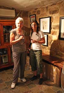 Jeanneret Wines: as we stood tasting at Paullets, another couple
came in. We could hear them speaking in French, and it turned out he was
half-American and she was from Brittany; we had noticed a Breton flag in their
vehicle. Down to the main Clare Valley road, we turned up a minor road on the
western side of the valley, where the countryside had almost the look of rolling
English parkland, except for the vines on Jeanneret Wines: as we stood tasting at Paullets, another couple
came in. We could hear them speaking in French, and it turned out he was
half-American and she was from Brittany; we had noticed a Breton flag in their
vehicle. Down to the main Clare Valley road, we turned up a minor road on the
western side of the valley, where the countryside had almost the look of rolling
English parkland, except for the vines on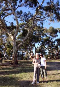 the hill-side and presence of gum trees. We again paused for further photos among the Clare Valley
vines (Photo
80: Clare Valley vines) (see above left), before taking another side turn to
reach the larger establishment of Skillogalee. One look at their inflated
prices was enough to alert us, but the snooty indifference of the woman serving
confirmed this place as a definite No-No. We turned and left! the hill-side and presence of gum trees. We again paused for further photos among the Clare Valley
vines (Photo
80: Clare Valley vines) (see above left), before taking another side turn to
reach the larger establishment of Skillogalee. One look at their inflated
prices was enough to alert us, but the snooty indifference of the woman serving
confirmed this place as a definite No-No. We turned and left!
Further along the narrowing lane however up through the vines, we found the
very antithesis:
Jeanneret Wines, a small and unassumingly straightforward producer, but
outstandingly hospitable and their web site says it all (see left) (Photo
81: Jeannerets Wines). We were welcomed by the very pleasant lady owner and
her cats, and tasted her 2010 Big Fat Girl Riesling, but this was too
sweet for our taste. She suggested we try her 2010 Watervale Riesling;
this was drier, but at $25 a bottle it was too expensive for us. We next tried
her 2006 Grace and Favour Grenache (70%) and Shiraz (30%) blend; this was
a luscious, full-bodied wine with a rich bouquet and bite, and we took 2 bottles
of this. She told us a little more about their small vineyard: most
of their grapes were home produced, but they brought in some from other selected
growers to give a wider variety.
Spring Gully Conservation Park: we drove on and turned up another
side lane leading to the Spring Gully Conservation Park, set on the crest of the
ridge of hills lining the western side of Clare Valley (see right). From a grove of ancient
gum trees at a lookout, extensive views gave a panoramic vista across the wide
western plains towards the coast (Photo
82: Spring Gully lookout), all lit by the golden light with the long
shadows of a late afternoon (Photo
83: Western plains). We peered up into the trees searching for
Koalas since it was by now
4‑15pm and the sun was dipping towards the horizon.
There were unfortunately no Koalas, but we did see 2 beautiful Galahs perching
in the high branches of the gum
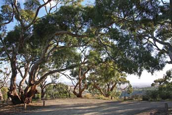 trees (Photo
84: Galah Cockatoos) (see below right). trees (Photo
84: Galah Cockatoos) (see below right).
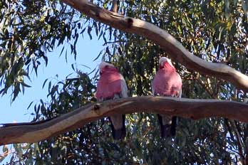 Eldredge Wines: along Spring Gully Road, we pulled into our
fourth producer this afternoon,
Eldredge Wines.
Here we were received by a delightful man, presumably Mr Eldredge himself, and
conversed with him, comparing European and southern hemisphere wine methods and
traditions. He had bought the land in the early 1990s, and had laid out the
vineyards himself, planting his new vines. This was an admirable achievement,
and clearly one which had entailed expensive bank loans until the wines were
producing any income. And when it came to tasting, his wines were indeed
excellent (Photo
85: Eldridge Wines). We first tasted his Semillon (60%) Sauvignon (40%) blend,
unexpectedly rather bland with the over-dominant Semillon and none of the
expected fruitiness of the Sauvignon. He next offered us a tasting of his
sparkling Riesling Cleanskin at $10; this was an interesting experience but not
a wine for serious drinking. We next tried his 2009 Sangiovese Rosé, pleasantly
strawberry tasting but slightly sweet wine which he assured us was due wholly to
the grape's fruitiness rather than any residual sugar; the must was fermented on
the skins for no more than an hour to obtain the required rosé colour and
flavour, the juice then cold fermented in stainless steel. He next offered us a
tasting of his 2006 Red Cleanskin blend. This Eldredge Wines: along Spring Gully Road, we pulled into our
fourth producer this afternoon,
Eldredge Wines.
Here we were received by a delightful man, presumably Mr Eldredge himself, and
conversed with him, comparing European and southern hemisphere wine methods and
traditions. He had bought the land in the early 1990s, and had laid out the
vineyards himself, planting his new vines. This was an admirable achievement,
and clearly one which had entailed expensive bank loans until the wines were
producing any income. And when it came to tasting, his wines were indeed
excellent (Photo
85: Eldridge Wines). We first tasted his Semillon (60%) Sauvignon (40%) blend,
unexpectedly rather bland with the over-dominant Semillon and none of the
expected fruitiness of the Sauvignon. He next offered us a tasting of his
sparkling Riesling Cleanskin at $10; this was an interesting experience but not
a wine for serious drinking. We next tried his 2009 Sangiovese Rosé, pleasantly
strawberry tasting but slightly sweet wine which he assured us was due wholly to
the grape's fruitiness rather than any residual sugar; the must was fermented on
the skins for no more than an hour to obtain the required rosé colour and
flavour, the juice then cold fermented in stainless steel. He next offered us a
tasting of his 2006 Red Cleanskin blend. This
 was a concept rather like the Alsace Edelzwicker, where the vintner used the last remnants of his grapes in an
undesignated blend to make a cheaper wine; in this case it was a 90% Cabernet
Sauvignon, 10% Shiraz blend, producing a full-bodied wine with a good edge, at
$10 which he offered to us at $8/bottle. We took a bottle each of the Sangiovese
Rosé and the Red Cleanskin blend. The term Cleanskin is used for Australian
wines whose bottle label does not indicate the wine or winemaker's name, only
the grape variety and year of bottling; these wines are sold at lower prices.
The designation, originally from the term for unbranded cattle, was introduced
for wines in the early 2000s as a way for wine producers to clear their surplus
wines. was a concept rather like the Alsace Edelzwicker, where the vintner used the last remnants of his grapes in an
undesignated blend to make a cheaper wine; in this case it was a 90% Cabernet
Sauvignon, 10% Shiraz blend, producing a full-bodied wine with a good edge, at
$10 which he offered to us at $8/bottle. We took a bottle each of the Sangiovese
Rosé and the Red Cleanskin blend. The term Cleanskin is used for Australian
wines whose bottle label does not indicate the wine or winemaker's name, only
the grape variety and year of bottling; these wines are sold at lower prices.
The designation, originally from the term for unbranded cattle, was introduced
for wines in the early 2000s as a way for wine producers to clear their surplus
wines.
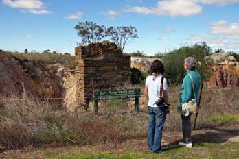 Return to Clare: this had been the most interesting of a wonderful afternoon
of visits, and we hugely admired Mr Eldredge's achievement in creating an
entirely new vineyard producing such quality wines. He wished us well in our
travels, and advised us to watch out for Kangaroos on the drive back to Clare in
the gathering dusk. We took the drive steadily along the dirt road, but
unfortunately (perhaps fortunately from a driving point of view!) there were no
more sightings of Kangaroos. Back into the town of Clare, we filled the car with
fuel and returned to the pub-hotel, to write up today's fulsome log down in the bar
with a pint of Coopers. At 7-30pm we walked along the main street for
supper at a Thai restaurant spotted last evening, and enjoyed
a very tasty Thai meal. This had been another splendid day of experiences and
learning; it would be strange returning the city tomorrow. Return to Clare: this had been the most interesting of a wonderful afternoon
of visits, and we hugely admired Mr Eldredge's achievement in creating an
entirely new vineyard producing such quality wines. He wished us well in our
travels, and advised us to watch out for Kangaroos on the drive back to Clare in
the gathering dusk. We took the drive steadily along the dirt road, but
unfortunately (perhaps fortunately from a driving point of view!) there were no
more sightings of Kangaroos. Back into the town of Clare, we filled the car with
fuel and returned to the pub-hotel, to write up today's fulsome log down in the bar
with a pint of Coopers. At 7-30pm we walked along the main street for
supper at a Thai restaurant spotted last evening, and enjoyed
a very tasty Thai meal. This had been another splendid day of experiences and
learning; it would be strange returning the city tomorrow.
 South to former copper mining town of Kapunda:
we were up early again to complete yesterday's log, and after packing our kit
and settling the hotel bill, we walked across Clare's main street for breakfast
at a café. We continued south down the length of the Clare Valley, passing a
number of producers. Vines lined both sides of the road, their residual canopies
of leaf now in autumn colours. Down the main road past attractive properties, we
passed through the small wine-growing town of Auburn, and turned off at Tarlee
to the former copper mining town of Kapunda. We drove into the quiet town and
parked in the main street for information from the TIC about the remains of the
Kapunda mining industry and local heritage trail. South to former copper mining town of Kapunda:
we were up early again to complete yesterday's log, and after packing our kit
and settling the hotel bill, we walked across Clare's main street for breakfast
at a café. We continued south down the length of the Clare Valley, passing a
number of producers. Vines lined both sides of the road, their residual canopies
of leaf now in autumn colours. Down the main road past attractive properties, we
passed through the small wine-growing town of Auburn, and turned off at Tarlee
to the former copper mining town of Kapunda. We drove into the quiet town and
parked in the main street for information from the TIC about the remains of the
Kapunda mining industry and local heritage trail.
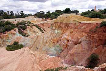 History of copper mining at Kapunda:
the first evidence of copper ore deposits
at Kapunda were discovered by chance by 2 local shepherds, Francis Dutton and
Charles Bagot in 1842. They purchased a parcel of land and began digging at the
surface lode in 1843, after promising assay results. The Kapunda high grade
copper ore was found as veins of quartz with various copper minerals, between
15cms to 1m in thickness. The first blue-green copper ore was raised from
surface deposits, and mining activity developed from there, again attracting
Cornish miners. The underground working became deeper and more difficult,
reaching the water-table in 1845, and initially water was extracted by
horse-turned whim-gin; this was replaced in 1847 by a Cornish steam-driven
pumping engine as the shafts were driven deeper and the volume of History of copper mining at Kapunda:
the first evidence of copper ore deposits
at Kapunda were discovered by chance by 2 local shepherds, Francis Dutton and
Charles Bagot in 1842. They purchased a parcel of land and began digging at the
surface lode in 1843, after promising assay results. The Kapunda high grade
copper ore was found as veins of quartz with various copper minerals, between
15cms to 1m in thickness. The first blue-green copper ore was raised from
surface deposits, and mining activity developed from there, again attracting
Cornish miners. The underground working became deeper and more difficult,
reaching the water-table in 1845, and initially water was extracted by
horse-turned whim-gin; this was replaced in 1847 by a Cornish steam-driven
pumping engine as the shafts were driven deeper and the volume of
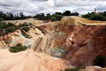 water to be
extracted increased. Initially ore was shipped from Port Adelaide to Swansea in
South Wales for smelting, but in 1849 the first smelter was installed at Kapunda
operated by Welsh smeltermen. By the mid-1850s, the town was a prosperous mining
centre contributing to the SA colony's economic recovery. As the richer
underground lodes were exhausted, open-cast extraction of lower grade ore
followed in the 1860s. The copper was recovered using the Henderson process by
hydrochloric acid treatment of the crushed ore and precipitation of the copper
onto scrap iron. The process became an economic failure with the low grade ore
containing insufficient copper; as world prices of copper fell in the late
1870s, the Kapunda mines closed in 1879. water to be
extracted increased. Initially ore was shipped from Port Adelaide to Swansea in
South Wales for smelting, but in 1849 the first smelter was installed at Kapunda
operated by Welsh smeltermen. By the mid-1850s, the town was a prosperous mining
centre contributing to the SA colony's economic recovery. As the richer
underground lodes were exhausted, open-cast extraction of lower grade ore
followed in the 1860s. The copper was recovered using the Henderson process by
hydrochloric acid treatment of the crushed ore and precipitation of the copper
onto scrap iron. The process became an economic failure with the low grade ore
containing insufficient copper; as world prices of copper fell in the late
1870s, the Kapunda mines closed in 1879.
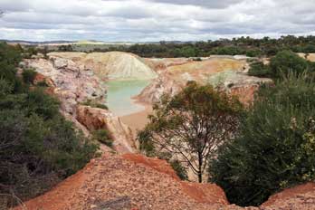 Our visit to the Kapunda copper mining remains:
although none of the Kapunda mine buildings
survived for restoration as at Burra, the site of the former mine with the
gouged out remains of its open-cast workings was still accessible, and we drove
around to investigate. Parking by a modern agricultural produce area of silos,
we followed the Mine Trail. Info panels gave frustratingly brief interpretation
of the remains, and from a hill, there was a full overview across all former the
open-cast workings (Photo
86: Kapunda copper mines). A Buhl pumping engine, manufactured by
Harvey and Co of Hayle in Cornwall, was installed in 1851, raising 340,000
gallons of water per day from the deep shaft mine and allowing mine working down to the 360 feet level;
it had continued working until the Our visit to the Kapunda copper mining remains:
although none of the Kapunda mine buildings
survived for restoration as at Burra, the site of the former mine with the
gouged out remains of its open-cast workings was still accessible, and we drove
around to investigate. Parking by a modern agricultural produce area of silos,
we followed the Mine Trail. Info panels gave frustratingly brief interpretation
of the remains, and from a hill, there was a full overview across all former the
open-cast workings (Photo
86: Kapunda copper mines). A Buhl pumping engine, manufactured by
Harvey and Co of Hayle in Cornwall, was installed in 1851, raising 340,000
gallons of water per day from the deep shaft mine and allowing mine working down to the 360 feet level;
it had continued working until the
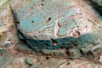 Kapunda mine's closure in 1878. All that survived
of the former engine-house today was a section of stone masonry (see above
right) (Photo
87: Pumping house remains) which had supported the
cylinder, and the nearby boiler chimney (Photo
88: Pumping engine chimney). We followed the pathway round, descending
into one of the open pits to find tiny traces of the green-blue copper-bearing
minerals (see left) (Photo
89: Copper-bearing minerals), malachite and azurite, with Lucy and Sheila
trying to figure out the chemistry of the copper compounds. The path led around
the rim of the deeper, later workings which showed the soft, chalky rock in
which the copper carbonate compounds were found, and which were evidently
visible today giving the pools of accumulated water and spoil heaps a turquoise
colouring (see above and below right) (Photo
90: Turquoise copper compounds). Harder intrusions of an
attractive maroon rock showed in the softer chalk. The trail wound around the partly flooded workings (Photo
91: Open-cast mine workings) (see above left and right), but it was impossible today to interpret
much of the detail of the former Kapunda mine's closure in 1878. All that survived
of the former engine-house today was a section of stone masonry (see above
right) (Photo
87: Pumping house remains) which had supported the
cylinder, and the nearby boiler chimney (Photo
88: Pumping engine chimney). We followed the pathway round, descending
into one of the open pits to find tiny traces of the green-blue copper-bearing
minerals (see left) (Photo
89: Copper-bearing minerals), malachite and azurite, with Lucy and Sheila
trying to figure out the chemistry of the copper compounds. The path led around
the rim of the deeper, later workings which showed the soft, chalky rock in
which the copper carbonate compounds were found, and which were evidently
visible today giving the pools of accumulated water and spoil heaps a turquoise
colouring (see above and below right) (Photo
90: Turquoise copper compounds). Harder intrusions of an
attractive maroon rock showed in the softer chalk. The trail wound around the partly flooded workings (Photo
91: Open-cast mine workings) (see above left and right), but it was impossible today to interpret
much of the detail of the former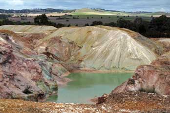 mining activity other than the surviving pits
and spoil heaps. The path led back round to the car park past the site of
the former smelting works and acid treatment plant, but nothing of these
remained. Despite the overcast sky today, we took a number of photos, and
returned to the town to follow the sign-posted Heritage Trail. mining activity other than the surviving pits
and spoil heaps. The path led back round to the car park past the site of
the former smelting works and acid treatment plant, but nothing of these
remained. Despite the overcast sky today, we took a number of photos, and
returned to the town to follow the sign-posted Heritage Trail.
The Kapunda Heritage Trail:
there was no disputing that Kapunda was doing its best to display its past to
visitors, but 'low key' would be the kindest description for the Heritage Trail.
We passed the former railway station, now a B&B, followed by the Cricket Oval,
duck pond, a closed
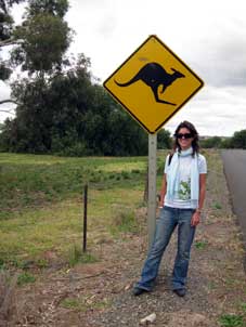 Catholic nunnery, several churches, and the Masonic Hall;
and that was about it! Local-Boy-Made-Good and Cattle King, Sir Sidney Kidman,
who sounded an utterly unsavoury, ruthlessly exploitational but paternalistic
19th century land owner, had contributed his former home as the town's high
school, but Kapunda's well-meaning attempts to show its history was all rather
... well, low key and un-inspirational; it was just an ordinary little town,
doing its bit to extract the tourists' dollars. Leaving the doubtless equally
low key museum, we sought lunch of meat pies at the local bakers. The 2 pubs in
the main street were simply too sordid to bother with, and we returned to the
vehicle for the 1½ hour, 80 kms drive back to Adelaide, pausing for further
photos by a kangaroo warning road sign
(see left) (Photo
92: Kangaroo warning sign). Catholic nunnery, several churches, and the Masonic Hall;
and that was about it! Local-Boy-Made-Good and Cattle King, Sir Sidney Kidman,
who sounded an utterly unsavoury, ruthlessly exploitational but paternalistic
19th century land owner, had contributed his former home as the town's high
school, but Kapunda's well-meaning attempts to show its history was all rather
... well, low key and un-inspirational; it was just an ordinary little town,
doing its bit to extract the tourists' dollars. Leaving the doubtless equally
low key museum, we sought lunch of meat pies at the local bakers. The 2 pubs in
the main street were simply too sordid to bother with, and we returned to the
vehicle for the 1½ hour, 80 kms drive back to Adelaide, pausing for further
photos by a kangaroo warning road sign
(see left) (Photo
92: Kangaroo warning sign).
Return to Adelaide:
joining the Sturt Highway, which links Adelaide to
Sydney and Canberra, a new stretch of bypass road around Gawler had the sat-nav
totally bewildered: its mapping appeared to show us driving across road-less
open country; the unfortunate device was stunned into stammering silence until
we re-joined the old road closer to the city. The sky now blackened and we drove
through a rain-storm in desperately heavy traffic on this multi-lane highway
through the outer suburbs. Paul's nervousness about next week's driving in road
conditions like this increased further. We passed around the north of Adelaide,
re-filled the vehicle with fuel, and drove back to Lucy's apartment to unload all
our kit.
Lucy took the vehicle to a car-wash to remove all
the smeared evidence of our trip to the Flinders and encaked insects on the
bonnet. In the meantime we unpacked our kit and transcribed the 1000s of photos
from memory cards. To our concern, the laptop's hard drive was
filling fast and we were only just halfway through the trip. Lucy returned home
and we walked around to the General Havelock for supper. The pub however
was packed, throbbing and flashing like a disco; this was certainly not a place
for a peaceful supper for three weary travellers newly returned from the
solitude of the outback, and we therefore found a more peaceful pub in Pulteney
Street for our supper. It seemed so strange to be back in an urbanised
environment again, but we felt so grateful to Lucy for planning and arranging
such a well thought-out and varied trip to the Flinders; it had given us the
opportunity for so many new experiences and so much learning in such a short
time.
Next time we are back in
Adelaide city for further
exploration, including a visit to the famous cricket ground of Adelaide Oval,
site of many a Test Match, and a visit to Cooper's Adelaide Brewery.
We also drive down to Encounter Bay on the south
coast to cross at dusk to Granite Island to see the colony of Little (or Fairy)
Penguins; we also visit the Barossa wine-growing area, and Cleland Wildlife Park in the Adelaide Hills to see the
wonderful collection of unique Australian fauna.
We are also in Adelaide on Anzac Day, 25 April,
the anniversary of the 1915 landings at Gallipoli by Australian and New Zealand
forces (ANZACs), traditionally commemorated throughout Australia to honour the
war dead in all conflicts since. We were privileged to share with South
Australians the moving
dawn service on Anzac Day 2011 at the
Adelaide war memorial. Join us again shortly for further reports and photos from
Australia 2011.
Next edition
from Adelaide South Australia to be published quite soon
|
Sheila and Paul |
Published: 14 March 2021 |
|

 with an occasional gecko scuttling around in the
sand beneath bushes
(Photo
6: Gecko).
We did see further examples of South
 Australia's iconic flower, Sturt's Desert
Pea (Swainsona formosa) (Photo
7: Sturt's Desert Pea), this time growing in its natural conditions in dry, red desert
sand.
Typical plants of the arid Australian bush-land included needle-like Hakea
Bushes (Hakea leucoptera), and porcupine-clumps of Spinifex grass (Triodia
scariosa); the brittle tips of these plants' spiny leaves are rich in silica, and if
brushed against easily break off sticking in the skin with risk of infection. We
also found more distinctive arid desert flora: a Cactus Pea bush (Bossiaea walkeri) with
its flattened leaf-like grey-green stems and red pea-type flowers (Photo
8: Cactus Pea), isolated clumps of erect, narrow-leaved shrubs with tall flowering
heads, later identified as a Yakka, also known as Grass Trees (Xanthorrhoea sp) (Photo
9: Grass Tree - Yakka); the Narrawa Burr (Solanum cinereum) with showy
purple flowers and crinkly leaves with viciously large spines along their
mid-vein (Photo
10: Narrawa Burr - Solanum cinereum) (see above right), and a specimen of
Harlequin Mistletoe (Lysiana exocarpi), a shrub endemic to Australia and
parasitic on Acacia and Eucalyptus, with distinctive red tubular flowers and protruding
stamens
(Photo
11: Harlequin Mistletoe). In spite of having seen many Eucalyptus trees so far in
our Australian travels, for the first time now we could examine close up
Eucalyptus flowers and fruit
(see left) (Photo
12: Eucalyptus flowers). We
had the opportunity to complete one of the circuits, particularly admiring the desert plant
life of the Flinders region. But time was moving on and the sun beginning to
lower; we still had another hour's drive north to reach Quorn before dusk, to
avoid risk of encountering kangaroos on the road.
 conservation area of The Dutchman's Stern; this was named by the British
navigator Matthew Flinders after a prominent 820m high bluff shaped like the
stern of an 18th century Dutch sailing ship (see left) (Photo
22 - Dutchman's Stern). Time however was pressing, and
further exploration was limited to photos from the viewpoint.
Returning to the principal dirt road, we continued
northwards along Arden Vale. Groves of gum trees lined the road, with the creeks
totally dry at this time of year. At Warren Gorge we turned off again for a
short distance to a small wild camping area in a grove of old, gnarled gum
trees (Photo
23 - Warren Gorge Gum trees), an astonishingly beautiful spot with jagged, bright orange rock
formations giving a stunning contrast with the clear blue sky and dark Cypress
Pines, and pink and grey Galah cockatoos squawking in the branches off
Eucalyptus trees (see right).
 He told us that, what we had thought was
the smell of wild thyme, was simply the dewy grass drying in the morning
sunshine. He also described the creek we had stopped at last evening as more of
a storm water drainage; at times of heavy rain, the creek
 ran high and fast for
a couple of days, draining off the surface water, then drying up again to the
red sandy mud we had seen last evening. He also told us about Wonoka's water
gathering and storage arrangements: rain water was gathered into tanks for
drinking, and spring water pumped up from deep wells by the windmills we had
seen everywhere; this water was very brackish in taste from dissolved minerals
dating from aeons ago when SA was submerged. He gave us more details of his work
on the sheep station: his 2,000 sheep roamed freely over 20,000 hectares of
Wonoka's bush-land grazing; at shearing time they had to be rounded up by
driving around on his motorbike with his dogs. Although none of his sheep were
gathered in the shearing shed at present, he invited us over to see the recently
shorn Merino wool
(Photo
52: Sheep-shearing shed), and explained the routine of shearing and baling up the wool
for auctioning at Port Augusta market. Shearing at Wonoka was routinely carried
out once yearly in February, with contract shearing gangs coming in and paid by
the numbers of sheep shorn. Other stations sheared at different times of the
year to allow an evenly spread work schedule for the shearers. A sheep's wool
was shorn in one piece, and typically produced a 2 kg fleece. After sorting and
grading, (different grades of wool were sold at varying prices), the fleeces
were baled by machine into batches of
 104 kgs, for contractors to transport to
market.
 graveyard before the cruel natural hardships of
this wilderness had finally brought its downfall. Sadly we wondered what had
happened to the survivors of Kanyaka, despite all the efforts they had made to
farm these inhospitable outback lands and hardships they
had endured.
 (Map of Alligator Gorge).
Having paid our $8 national park entry fee, we kitted up and descended steep steps down into the rocky bed
of Alligator Gorge (Photo
57: Alligator Gorge) for the 2kms circular walk following the
dry creek bed along the cliff-lined floor of
the sandstone gorge. To our relief, there were no alligators in Alligator Gorge; the gorge
was named after a local shepherd called Ally. The gorge floor was thickly wooded
with gum trees and many more Yakka grass-trees (Xanthorrhoea) (Photo
58: Yakka - Xanthorrhoea) (see above right)
than we had seen further north; many of them had brown flowering heads dotted with tiny white
star flowers (see left). The stratified sandstone of the high gorge side-walls glowed a
vivid crimson-red in the golden afternoon sunlight (Photo
59: Sandstone gorge walls) (see right). The creek, which at times of
flood would have washed along the gorge-bed, was almost dry, and the faint track
alternated between banks of the creek and the stones of the creek-bed itself (Photo
60: Semi-dry stream bed) (see below left). To begin with, we turned right along the gorge floor
under the high sandstone side-cliffs, following the course of the creek which
rose up a lengthy series of flat slab terraces
(Photo
61: Eroded stream bed). In places, the sandstone of the gorge floor
showed traces of petrified sand with a ripple effect
 from the bed of an ancient
sea, now preserved in stone. The gorge walls rose between 50 and 80 feet
above us, and at their foot in the bed of the wooded gorge, the stratified
sandstone blocks were eroded by the stream in times of spate
(Photo
62: Eroded gorge walls); it was a truly spectacular place. We followed the rocky-floored creek bed, rising up the creek
through the Yakka and gum trees until the path petered out amid dense scrub.
Returning down the rocky slab terraces of the gorge bed, we paused to sit on the slabs to eat our
lunch, revelling in the awesome silence of the gorge fissure.
 the boulders of the creek
bed (see right). Here we found a Cherry Ballart tree (Exocarpos cupressiformis) with
its unusual, edible red fruits or 'cherries', the swollen stem above the nut. Along this main course of the gorge, there were more folk about, and the
over-loud noise of human voices echoing within the gorge walls was an irritating intrusion into the imposing
silence of the canyon. The walls of the meandering canyon, now towering 100 feet
above us (Photo
63: Canyon walls) (see right and below left), narrowed as we wound our way along the
boulder-strewn gorge bed; here we reached a
spectacular narrowing gullet where the force of water at times of flood had
deposited huge pieces of tree debris, trapped against the twisted trunks of dead trees
(Photo
64: Tree debris), almost blocking the throat of the
gorge. The lower walls at the foot of the side-cliffs within the gullet were
hollowed out, undercut by storm water swirling like a maelstrom
below the high
canyon
walls, and eroding the sandstone side-walls into a rounded passageway
(Photo
65: Gorge narrows) (see below right).
Once through the gullet,
the side-walls of the gorge lowered and widened, and the pathway advanced along
a delightfully verdant section of woodland
 valley, before rising up the hillside to an
informal camping and picnic area at Blue Gum Flat high on the slopes above. A
narrow track descended steeply from here then rose steadily for a 30 minute
climb through woodland, returning us to the parking area.

 BACK-PACKING
TRIP TO AUSTRALIA 2011 - South Australian outback, Flinders Ranges, Clare Valley:
 Leaving Adelaide
for our trip into South Australian outback: today we were to head north from Adelaide in a
hire-car for our 5 day trip with our daughter Lucy into the South
Australian outback and the Flinders Ranges (see
map right). We were away by 9-00am to drive
around the eastern side of the city and out onto the main road north. Leaving
the city behind, the broad dual-carriageway headed out into flat, rich farming
terrain; this clearly was the produce-growing region serving the city,
filled with market gardens. Traffic was reasonably light and we made good
progress northwards; the sat-nav gave the instruction to go ahead for 262 kms,
and the display showed a single road leading ahead without any side branches
(see left).
 This
route was the southern start of the Stuart Highway which crosses Central
Australia from Port Augusta, eventually leading to Alice Springs and finally
Darwin on the north coast of the continent (see left). The only significant traffic were the frequent road-trains of
multiple heavy trucks (
 Port Germein's
Jetty, longest in the Southern Hemisphere:
setting off again following the railway, we
passed the insignificant industrial settlement of Port Pirie on the eastern
coast of the Spencer Gulf and dominated by a huge smelter plant. A short distance
further north, we pulled off the main road into Port Germein, set at the
narrowing northern head of the Spencer Gulf (see below right). 219kms north of Adelaide, Port
 Germein with a current population of just 240 consisted of a single street of
cottages and post-office cum general stores, ending at the 1,532m long jetty which
extended out into the Gulf (
 the grain route from South Australia, holding the record for completing
the Roaring Forties home-run around Cape Horn to England in 86 days loaded with
grain. Today we paused here at Port Germein's jetty, taking photos at the pier,
where the low tide left estuary mud along the shore-line shallows of Spencer
Gulf (
 Australian Arid Lands Botanic Gardens at Port Augusta:
continuing north towards Port Augusta, the road ran along the sandy coastal plain of the
narrowing gulf, edged on the eastern side by the line of hills of the Southern
Flinders. We turned into the town of Port Augusta to find a supermarket for
provisions for Sunday's evening meal, to fill the hire car with fuel, and to get
cash from an ATM. Beyond the town, a short distance up the main Stuart Highway,
we located the
 It was glorious bush-land terrain, covered with scrub and eucalyptus and lit by golden sunlight
(
 browsed the souvenir shop, waiting for
10-00am when we could board the train to reserve our seats.

 an
important town, given that people
 travelling by rail both east~west or
south~north in Australia would need to pass through Quorn. As a result, many
fine buildings were built as the town prospered and expanded. During WW2, Quorn
became an assembly area in the movement of troops and supplies to Darwin in
readiness to repel the threat of Japanese invasion following the 1941 bombing,
and for the transport of evacuees south. After the war, business in Quorn
declined, particularly after the new standard gauge Ghan west of the Flinders
was completed in 1956 (see
  elevation of
 406m (see above left), and over the Pichi Richi
Pass (344m)
(
 Collecting the hire-car, we set off
northwards on this afternoon's venture to drive outback dirt roads heading
towards tonight's goal of Hawker.
 Willochra
Plain and Goyder's Line: continuing north, the gum trees were left
behind as we passed into the wide, open terrain of Willochra Plain, the name Willochra being derived from an Aboriginal word meaning Flooded creek where wild
bushes grow; the plain is crossed by the large but ephemeral, gum tree-lined Willochra Creek. Much of the plain is semi-arid and drought-affected, lying
north well beyond Goyder's Line, which since 1865 has
 demarcated the limits of
South Australian lands suitable for arable agricultural settlement, and land
only suitable for pastoralism. In 1865 George Goyder, then SA Surveyor-General,
was commissioned to map the boundary between those areas of the new colony that
benefitted from sufficient annual rainfall to support arable farming
particularly for wheat growing, and those
subject to drought. North of Goyder's Line, annual rainfall is less than 10
inches, too low to support crop-growing, the land being only suitable for
stock grazing (see map left). In spite of Goyder's invaluable work, successive
colonial governments of the 1870s and 1880s surveyed and released former livestock
grazing pastoral land
for leasing for crop farming. But many such settlements inevitably failed because of the
arid nature of the drought-prone land, and now tragically stand long-abandoned. The Willochra Plain terrain stretched away to
open horizons in all directions, a frighteningly eerie, empty place, the land
covered with low Mallee scrub. This was cattle and sheep grazing country on
a huge scale, crossed by a network of dry creeks. But the scattered ruins of
forlornly abandoned farms and homesteads told the sad story of failed 19th
century attempts to settle and to farm these arid, inhospitable plains.
  Abandoned settlement of Kanyaka: after
driving some miles across these grazing lands of Willochra Plain (see above
right) (
 Creek in 1852 aged 24 during violent rain
storms while trying to recover stampeded cattle. His brother and sister had
shipped out a huge granite slab from Scotland to be engraved with his memorial which now stood here
(see right) (
 it that dying
aborigines were laid to rest in the shadow of the great rock overlooking the
water hole. As we walked over to the waterhole, the outback flies were
horrendous. Nearby were the ruined remains of Proby's failed farming settlement
of Kanyaka (
 of the other
failed settlements we had passed during that afternoon.
 impressively memorable locations during
our travels, but none as isolated and grandiose as this. Today we had at last sampled the real outback
of Australia, and very weary after such a long and eventful day, we cooked
supper of stir-fry with pasta and barbecued corn cobs. With the
 salmon-pink
sunset after-glow now silhouetting trees along the horizon (
 the Old Ghan railway station which
looked (and surely was) ultra-pseudy and even more ultra-expensive. Having
satisfied ourselves that the general stores had reasonable stocks for supper,
and stayed open until 5-00pm, we pressed on northwards to Wilpena.
 As we drove north from Hawker, the open outback
terrain looked forbiddingly attractive in the morning sunshine, backed by the
red sandstone ridges of the Flinders. We paused at the Rawnsley Bluff look-out
with its magnificent views across the outback grazing lands to the
whaleback ridges of the Elder Range (
 the
Southern Flinders Range mountains; its huge cattle-pound appearance gave the
geographical feature its name
(
 the Palaeozoic Era by faster
erosion of the valley floor soft bed-rock, compared with the harder sandstone
rocks which form the enclosing cliffs of the Pound. The wall of mountains almost
completely encircles the gently-sloping interior of the Pound, with the only
breaks being the gorge of Wilpena Gap on the eastern side of the range, and the
other leading through the narrow, rocky Edeowie Gorge on the western side; most
of the Pound's inner area drains into Wilpena Creek which exits through Wilpena
Gap. The highest peak in the Pound, also the highest of the Flinders Ranges, is
St Mary Peak (1,171m) on the north-eastern side.
 for wheat growing,
something never before attempted so far north. Goyder's Line had proved accurate
with regard to agricultural expansion during the great drought of the 1880s, and Wilpena is some 140 kilometres (87 mi) north of the Line. But being in the
shadow of some of the highest mountains of the Flinders, rainfall in the Pound
is a little higher. After the immense labour of constructing a road through
 the
torturous Wilpena Gap, the Hill family cleared open patches in the thick scrub
of the Pound's interior and built a small homestead, the remains of which can
still be seen today. They harvested their first wheat crop from the Pound in
1902 despite it being a drought year, and for several years they had moderate
success growing crops within the Pound. But in 1914 a major flood destroyed the
road that they had laboured so hard to construct up through the gorge. They
continued to keep horses and cattle in the Pound until the lease expired in 1921
when, defeated in their efforts, they sold their homestead to the government and
the land was abandoned. The Pound then became a forest reserve leased for
grazing, and in 1945 the tourist potential of the area was recognised when a
National Pleasure Resort was opened on the southern side of the creek just
outside the gorge. The Pound later became part of the Flinders Ranges National
Park.
the
torturous Wilpena Gap, the Hill family cleared open patches in the thick scrub
of the Pound's interior and built a small homestead, the remains of which can
still be seen today. They harvested their first wheat crop from the Pound in
1902 despite it being a drought year, and for several years they had moderate
success growing crops within the Pound. But in 1914 a major flood destroyed the
road that they had laboured so hard to construct up through the gorge. They
continued to keep horses and cattle in the Pound until the lease expired in 1921
when, defeated in their efforts, they sold their homestead to the government and
the land was abandoned. The Pound then became a forest reserve leased for
grazing, and in 1945 the tourist potential of the area was recognised when a
National Pleasure Resort was opened on the southern side of the creek just
outside the gorge. The Pound later became part of the Flinders Ranges National
Park. paused to pay our $7.50 entry fee. It was noticeable that once
into the protected area of the national park, where the natural vegetation had
been spared from grazing, small pine trees flourished along the road side. We
turned off to the Wilpena National Park Information Centre in search of maps,
details of
the Pound's topography, and for advice on half-day walks. The most suitable
round trip bushwalk, given our limited time, was the Wangara Lookout Walk: this
overall 8 km route would take us up Wilpena Creek via Sliding Rock Gorge, the
only natural access to penetrate the surrounding barrier of hills into the
 interior of Wilpena Pound, leading past the conserved remains of Hills'
Homestead. From there, a side route would take us up to the lower and upper Wangara Hill lookouts on the enclosing mountain rim of Wilpena Pound, offering
panoramic views into the entire geological feature (
 (
( and the air was filled with the
calls and squawks of typical Australian bird-life, with good sightings of brightly colourful Rainbow
Lorikeets (see above left); we also saw, both in the gorge and on the higher Wangara slopes, specimens of Dusty Miller (Spyridium
phlebophyllum), a
characteristic plant of the Flinders rocky ridges (
 onto the Upper Wangara Lookout, and from here a complete panorama opened up of the entire length and breadth of Wilpena Pound surrounded by its
enclosing circle of craggy sandstone hills (
 shape and structure. The original strata of
softer surface limestone within the Pound had over aeons been eroded away to
create this huge natural bowl, surrounded by the enclosing harder, more
resistant rim of sandstone (
 down in the creek
bed among the gum tree groves (see right), and completed the 8 kms circuit with the return to the car park by
the national park office.
 Return to Hawker:
setting off at 3-30pm, we returned to the main road and turned south, just
getting a brief sighting of a pair of grey Kangaroos bounding across the road
100m ahead and disappearing into the pines. Wispy cloud had gathered, dimming
the bright sunlight, and we feared that this duller light would encourage more
Kangaroos across the road. We therefore took the return drive at a steadier
pace. There were several sightings of Emus and we paused to photograph a flock
grazing on a hillock amid the scrub (
 A second night in the peace of Wonoka sheep station:
rounding Wonoka Hill onto the main B83 road north, we turned
off onto the dirt track driveway to Wonoka Sheep Station (see below left)
through the seemingly barren
 bush-land grazing. We paused briefly to photograph
a dried up creek bed (see below right) (
 Darkness fell quickly by 6-00pm and the full moon rose swiftly above the
eastern skyline giving the sky a bright light. We sat in the kitchen
after
supper, Lucy reading a book on the history of the Flinders from the cottage
 bookshelf, Sheila researching tomorrow's return route, and Paul writing today's log.
Today had given such a wonderfully fulfilling set of new experiences and
learning, and from the Wangara high-point, we had been rewarded with such a
magnificent panorama of the complete circular bowl of Wilpena Pound and its
surrounding craggy enclosing sandstone hills. Tomorrow we should begin the
return journey down the eastern side of the Flinders Range.
 We wished we had
time to stay longer at Wonoka and learn more about these fascinating new
experiences. He was an engaging and charmingly unassuming, taciturn man with a
delightful drawl; so interesting to listen to and to learn from. We had felt so
at home here at Wonoka; as Lucy so aptly put it, we should all leave part of
ourselves at Wonoka, and should take with us such rich memories, even from our
brief stay.
 dwellings during the 1850s. During
these years the Kanyaka sheep run had flourished, growing to over 360 square
miles in area, and despite the impact of drought, had at its peak shorn 60,000
head of sheep a year with up to 70 men and their families living at the
homestead. It also functioned as a staging point and post office on the road
north into the outback. But tragically the widespread and devastating droughts
of 1864~67 brought
 an end to the great pastoral settlements; Kanyaka was
eventually abandoned by Philips in 1888, and the surviving sheep driven to the
Coorong area south of Adelaide.
 Re-joining the main road, we set off again
southwards passing the point where we had joined this road from the outback
Willochra dirt track 2 days ago. Despite the speed at which traffic moved on
these dead straight main outback roads, every few kms signs warned of an
approaching floodway, the low-point dip where a creek water-course crossed the
road at times of rainfall. From a distance, the dry creek bed was visible lined
with gum trees. At the centre-point of each floodway, a
water depth post showed that, in times of heavy rain, a torrent of up to 2m
depth could surge across the road at this point (see left). We heard of
motorists being drowned through careless crossing at such floodways. A number of elaborate caravans pulled by 4WD
vehicles passed by heading north, perhaps reflecting the approaching Easter
holidays. The morning continued bright as we made good progress southwards, back
into Quorn to pass the railway station and Austral pub which we had left
seemingly weeks ago.
 The one-horse outback town of Wilmington: turning off by the
Austral pub, we started on the road across the broad, empty Willochra Plain,
the northern arid outback-lands now giving way to prairies of rough pastureland
or stubble from harvested crops. The lonely road extended away southwards,
totally straight and empty. By 11-00am, we reached Wilmington where we hoped to
buy food for today's lunch. A superficially attractive, one-street town where we
filled up with fuel at the one garage, it in fact proved to be a totally
one-horse town, and being Tuesday, the one horse was on its day off: the local
café was closed, and the poorly stocked general stores was unable or unwilling
to provide further provisions. Unsupplied, with other than pasties and sausage
rolls, we pressed on, and soon after, turned off up to the northern end of Mount
Remarkable National Park.
 rocking gait (see below left) (
 Clare Valley wine-growing area: setting off
again at 4-00pm, we continued south for the 130kms drive through a series of
little one-street country towns such as Laura, Gladstone, and Yacka, until
finally we reached tonight's goal, the wine-growing area of Clare Valley. As we
 advanced south beyond the Willochra Plain and Melrose, the wide open prairie landscape
became much more familiarly agricultural with fenced pastureland and open arable
countryside with recently harvested crop stubble burnt off. As we approached
Clare however, the terrain changed again to rolling hills, and we passed the
first vines. We had during our time in Australia begun to get accustomed to the
inverted seasons, but suddenly it occurred to us to wonder: when in the southern
hemisphere was the grape vendange? Some of the vines were now down to bare
twigs, others were still in full leaf, and we assumed that March~April was the
time of the grape harvest here, as opposed to September~October in the northern
hemisphere that we had been accustomed to.
 (see below left). As we entered, first impressions were of a rather seedy
sports bar with a side room stuffed full of flashing, whirring 'pokies' (fruit
machines), and as always the inevitable resident saddies. Our room was reasonable, but the
noisy urban environment seemed a million alien miles from the glorious outback
silence of Wonoka. We settled in and while
 Paul worked on today's log with a pint of
Coopers in the bar, Sheila and Lucy went for an exploratory walk along Clare's
main street to reconnoitre food options. We in fact enjoyed a huge if expensive
supper of seafood platter or barramundi with sweet potatoes and spinach in the pub's dining room, and shared a bottle of the local
Clare Valley Jim Barrie Riesling. It had been another excellent day: we had enjoyed a thrilling
walk in Alligator Gorge on Mount Remarkable, seen our first Kangaroo, and
travelled a good distance south. But tonight our thoughts were still in the
memorable outback solitude and silence of Wonoka.
 History of copper mining at Burra: the blue-green ore indicating
veins of copper was reputably discovered by a shepherd, William Streair, in 1845
alongside Burra Creek. Speculators moved in sensing the fortunes to made from
copper exploitation, and the first company-owned mining township in Australia, Kooringa rapidly developed to become the country's largest inland town by 1851.
Speculative investment in the mine was led by John Morphett, one of South Australia's pioneer
English colonists who made his fortune from mining speculation and other
commercial trading ventures, to become one of the colony's leading landowners
and
 politicians, and 7 times state premier. The Burra Mine,
known also as the Monster Mine, was the largest metal producing mine in Australia by 1860, attracting 1000s of miners from Cornwall, South Wales and Scotland, at a
time when falling world prices were forcing the closure of formerly flourishing Cornish
mines. Employment prospects in SA also attracted carpenters, engineers, masons
and other trades. The Burra mine developed on company-owned land, and the
townships of Redruth, Aberdeen and Llwchwr grew up further north. The first
mines of the 1840~60s were deep shaft pits, and the mine
became a labyrinth of underground galleries. But as these veins became
exhausted, from 1870 open-cast working with lower cost mechanical extraction
took over (see right). All in all the mines at Burra produced around 50,000 tonnes of
copper between 1845 and 1877 when the SA Mining Association's operations ceased.
During its heyday, the Burra mines, along with the mines at
Kapunda (see below), have been credited with
 saving the economy of the
struggling new colony of South Australia, producing 89% of South Australia's and
5% of the world's copper. When the mine was exhausted and closed, Burra's
population shrank dramatically, and the townships' economy relied mainly on
agriculture. Today Burra continues as a centre for the surrounding farming
industry and for tourism, and is one of the best-preserved Victorian era towns in Australia.
 Arrival at Burra:
from the rapidly speaking elderly gent at the TIC, we learned of
the options available to help understand more of Burra's mining history and to see something of the
conserved remains: we could either spend $25 each on tickets for a guided tour
of every item of the town's local trivia, including the town hall, 2 churches, and Miss
Mable's cottage (flippantly re-labelled by us as Good Golly Miss Molly;
those under the age of 70 simply wouldn't understand!), or walk around
the site of the former mine and the 1870s huge, flooded open-cast mining pit and restored
engine-house museum for a $5 entry fee. It was a simple choice, and quite
naturally we chose the latter. Contrary to our expectations, the modern day Burra was a classic South Australian country town. Although relying
economically to a degree on tourism, this had not caused degeneration into a twee
museum-piece place. It was a largely functional town with an every-day feel,
albeit keeping its traditional air with admirably preserved stone-built,
 colonial
era shops and
cottages
(
 Our visit to the remains of Burra copper mines: guided by the TIC
Heritage Trail booklet, we followed a dirt track out to the site of Burra's former copper mining
activity, passing the town's corporation rubbish tip (about the one and only
local feature not detailed in the booklet!). Although not having paid the $25 fee for the Burra Passport
ticket, we managed somehow to gate-crash the mining powder magazine tour,
courtesy of a couple of gullible tourists who had parted with cash! The stone
building with its blast-proof containment wall, had a beautiful arched stone
roof. From here we drove around to the restored Morphett's Pumping Engine House
(
 The mine workings had covered a huge area although there was little else remaining
to be seen now. We walked around the other areas of the mining site, seeing one of the
recovered Cornish boilers and the shaft where the pumping mechanism extracted
water from the pit (
 (Century
plant) (see below left) and Prickly Pear Cactus (Opuntia) (
 A brief visit to the town of Burra:
entry to the mining site had proved good value, giving us far more than we might
have expected on the mining history. We had partitioned our time today to give us the
morning to see Burra and to learn as much as we could about its copper mining
heritage, leaving this afternoon to sample some of the Clare Valley wine
producers. It was now 12;00 noon, and we returned to the town to see a little of Burra itself and to get a
swift pub lunch. On the drive back around the dirt track, Lucy abruptly
screeched to a halt. There in the road was a large lizard: a Shingleback, the
bulkiest of Australian blue-tongued skinks (Tiliqua rugosa), known also as a
Sleepy, a Pine Cone, Stumpey, or Two-headed Lizard, with a tail resembling its
head, part of its defence mechanism (
 Driving back through the town, we rapidly ticked off the lesser attractions,
including the town hall (see left), and made our way around to
Burra's former railway
station. Despite the line's closure in 1998, the station building still stood
and a preservation society was attempting to restore it. The history of their
progress (or rather lack of it!) was recorded on a panel, showing little more
than 5 years' worth of committee meetings. It was a truly
 magnificent example of
an Australian country railway station, with a beautiful curved, corrugated iron
platform canopy (
 the Darling River and eventually extends all the
way to NSW and Sydney, passing Broken Hill, the former mining town just into
NSW, through Lithgow and past Katoomba. After our earlier trip into the NSW Blue
Mountains, we were now seeing this highway at its
South Australian end. Approaching Clare, we turned off onto an unsealed dirt road across the
rolling hills of broad agricultural countryside and the first vines. Not only
were the seasons reversed for grape harvesting in the southern hemisphere, but with
the sun taking a more northerly passage across the sky, it was the northern
slopes that were favoured for ripening the grapes rather than the south-facing
slopes
 we were accustomed to in Europe.
  Paullets Wines: just
down the lane at Polish Hill River, a
region named after the Polish settlers of the mid-19th century, we pulled into
a smaller establishment,
 Jeanneret Wines: as we stood tasting at Paullets, another couple
came in. We could hear them speaking in French, and it turned out he was
half-American and she was from Brittany; we had noticed a Breton flag in their
vehicle. Down to the main Clare Valley road, we turned up a minor road on the
western side of the valley, where the countryside had almost the look of rolling
English parkland, except for the vines on
 the hill-side and presence of gum trees. We again paused for further photos among the Clare Valley
vines (
 trees (
 Eldredge Wines: along Spring Gully Road, we pulled into our
fourth producer this afternoon,
 was a concept rather like the Alsace Edelzwicker, where the vintner used the last remnants of his grapes in an
undesignated blend to make a cheaper wine; in this case it was a 90% Cabernet
Sauvignon, 10% Shiraz blend, producing a full-bodied wine with a good edge, at
$10 which he offered to us at $8/bottle. We took a bottle each of the Sangiovese
Rosé and the Red Cleanskin blend. The term Cleanskin is used for Australian
wines whose bottle label does not indicate the wine or winemaker's name, only
the grape variety and year of bottling; these wines are sold at lower prices.
The designation, originally from the term for unbranded cattle, was introduced
for wines in the early 2000s as a way for wine producers to clear their surplus
wines.
  Return to Clare: this had been the most interesting of a wonderful afternoon
of visits, and we hugely admired Mr Eldredge's achievement in creating an
entirely new vineyard producing such quality wines. He wished us well in our
travels, and advised us to watch out for Kangaroos on the drive back to Clare in
the gathering dusk. We took the drive steadily along the dirt road, but
unfortunately (perhaps fortunately from a driving point of view!) there were no
more sightings of Kangaroos. Back into the town of Clare, we filled the car with
fuel and returned to the pub-hotel, to write up today's fulsome log down in the bar
with a pint of Coopers. At 7-30pm we walked along the main street for
supper at a Thai restaurant spotted last evening, and enjoyed
a very tasty Thai meal. This had been another splendid day of experiences and
learning; it would be strange returning the city tomorrow.
 South to former copper mining town of Kapunda:
we were up early again to complete yesterday's log, and after packing our kit
and settling the hotel bill, we walked across Clare's main street for breakfast
at a café. We continued south down the length of the Clare Valley, passing a
number of producers. Vines lined both sides of the road, their residual canopies
of leaf now in autumn colours. Down the main road past attractive properties, we
passed through the small wine-growing town of Auburn, and turned off at Tarlee
to the former copper mining town of Kapunda. We drove into the quiet town and
parked in the main street for information from the TIC about the remains of the
Kapunda mining industry and local heritage trail.
 History of copper mining at Kapunda:
the first evidence of copper ore deposits
at Kapunda were discovered by chance by 2 local shepherds, Francis Dutton and
Charles Bagot in 1842. They purchased a parcel of land and began digging at the
surface lode in 1843, after promising assay results. The Kapunda high grade
copper ore was found as veins of quartz with various copper minerals, between
15cms to 1m in thickness. The first blue-green copper ore was raised from
surface deposits, and mining activity developed from there, again attracting
Cornish miners. The underground working became deeper and more difficult,
reaching the water-table in 1845, and initially water was extracted by
horse-turned whim-gin; this was replaced in 1847 by a Cornish steam-driven
pumping engine as the shafts were driven deeper and the volume of
 water to be
extracted increased. Initially ore was shipped from Port Adelaide to Swansea in
South Wales for smelting, but in 1849 the first smelter was installed at Kapunda
operated by Welsh smeltermen. By the mid-1850s, the town was a prosperous mining
centre contributing to the SA colony's economic recovery. As the richer
underground lodes were exhausted, open-cast extraction of lower grade ore
followed in the 1860s. The copper was recovered using the Henderson process by
hydrochloric acid treatment of the crushed ore and precipitation of the copper
onto scrap iron. The process became an economic failure with the low grade ore
containing insufficient copper; as world prices of copper fell in the late
1870s, the Kapunda mines closed in 1879.
 Our visit to the Kapunda copper mining remains:
although none of the Kapunda mine buildings
survived for restoration as at Burra, the site of the former mine with the
gouged out remains of its open-cast workings was still accessible, and we drove
around to investigate. Parking by a modern agricultural produce area of silos,
we followed the Mine Trail. Info panels gave frustratingly brief interpretation
of the remains, and from a hill, there was a full overview across all former the
open-cast workings (
 Kapunda mine's closure in 1878. All that survived
of the former engine-house today was a section of stone masonry (see above
right) (
 mining activity other than the surviving pits
and spoil heaps. The path led back round to the car park past the site of
the former smelting works and acid treatment plant, but nothing of these
remained. Despite the overcast sky today, we took a number of photos, and
returned to the town to follow the sign-posted Heritage Trail.
 Catholic nunnery, several churches, and the Masonic Hall;
and that was about it! Local-Boy-Made-Good and Cattle King, Sir Sidney Kidman,
who sounded an utterly unsavoury, ruthlessly exploitational but paternalistic
19th century land owner, had contributed his former home as the town's high
school, but Kapunda's well-meaning attempts to show its history was all rather
... well, low key and un-inspirational; it was just an ordinary little town,
doing its bit to extract the tourists' dollars. Leaving the doubtless equally
low key museum, we sought lunch of meat pies at the local bakers. The 2 pubs in
the main street were simply too sordid to bother with, and we returned to the
vehicle for the 1½ hour, 80 kms drive back to Adelaide, pausing for further
photos by a kangaroo warning road sign
(see left) (