|
 BACK-PACKING
TRIP TO AUSTRALIA 2011 - Camping on Kangaroo Island in hired campervan: BACK-PACKING
TRIP TO AUSTRALIA 2011 - Camping on Kangaroo Island in hired campervan:
Collecting the hire-camper and preparation for the Kangaroo Island trip:
the day before we set off for Kangaroo Island, we
went carefully through our regular pre-trip kit check-list in
preparation for collecting the hired camper, formulating a list of
questions about the camper's features, and what equipment the hire firm provided. It
quickly became clear how much in our own camper we now take for granted, and how much we
have attuned both vehicle and its equipment to our needs over our many years
of travelling. There was so much kit which, if not provided, we should miss. To save time tomorrow, we also drew
up a shopping list of provisions and consumables like washing up liquid.
That afternoon, Lucy drove us out
along Sir Donald Bradman Way towards Adelaide airport where the Britz camper hire
firm was based, while we noted carefully the route we should have to drive back;
she left us at the Britz offices to return home and prepare for her weekend at a
motor race meeting in Perth.
|
Click on highlighted
area of map
for
details of
Kangaroo Island |
 |
 In the Britz
office we completed the hire formalities, and went through our list of questions.
But when we were taken out to the vehicle, we discovered the vehicle provided
was an automatic transmission. The girl initially reacted with indifference to our request for the expected manual
vehicle, but we responded with equally determined assertiveness. After a wait, a
manual vehicle was prepared, this time a Toyota Hiace high-top camper as
expected (the automatic had been a retracting roof camper), and we carefully
checked through the fittings and equipment. It certainly seemed a well-appointed
vehicle, and we went through all our queries. Having
re-signed for the new vehicle, we prepared to drive back. The vehicle's
responsiveness greatly improved when Paul discovered how to release the
handbrake! And In the Britz
office we completed the hire formalities, and went through our list of questions.
But when we were taken out to the vehicle, we discovered the vehicle provided
was an automatic transmission. The girl initially reacted with indifference to our request for the expected manual
vehicle, but we responded with equally determined assertiveness. After a wait, a
manual vehicle was prepared, this time a Toyota Hiace high-top camper as
expected (the automatic had been a retracting roof camper), and we carefully
checked through the fittings and equipment. It certainly seemed a well-appointed
vehicle, and we went through all our queries. Having
re-signed for the new vehicle, we prepared to drive back. The vehicle's
responsiveness greatly improved when Paul discovered how to release the
handbrake! And thankful for the more familiar manual gear change, we emerged
into the traffic stream for our first experience of Aussie traffic. Closer into the
city, we pulled into a large Woolworth's supermarket to stock up a mammoth $150s
worth of provisions. Now we faced the evening rush-hour 5-00pm
traffic for the drive back and, to our relief, parked outside Lucy's apartment.
By now it was too dark to begin packing kit and supplies tonight, so these were
all piled in the hallway ready for the morning. thankful for the more familiar manual gear change, we emerged
into the traffic stream for our first experience of Aussie traffic. Closer into the
city, we pulled into a large Woolworth's supermarket to stock up a mammoth $150s
worth of provisions. Now we faced the evening rush-hour 5-00pm
traffic for the drive back and, to our relief, parked outside Lucy's apartment.
By now it was too dark to begin packing kit and supplies tonight, so these were
all piled in the hallway ready for the morning.
Setting off from Adelaide:
we were up at 6-00am to complete our packing ready for today's crossing to Kangaroo Island
(Photo 1 - Loading the camper).
Bruce (as the Britz camper inevitably became called) was loaded with all our kit
and supplies, and we were off just before 9-00am. The morning rush hour had
eased, so traffic through the city was quite light. We were soon around South
Terrace to turn off onto Anzac Highway and finally Main Road South. Although
still slightly tense, Paul soon became used to the Adelaide traffic conditions
and to driving Bruce; Sheila kept a close eye on the map, and double-checked
road junctions and speed limits.
Fleurieu Peninsula down to Cape Jervis: within a half hour we were clear of the city and heading out over the southern Adelaide Hills
past Noarlunga, initially following the same route as last week down to Victor Harbor.
Beyond the McClaren Vale junction, we drove on through broad farming
countryside; the road became single-carriageway but traffic was very light. As
we continued south into the Fleurieu Peninsula, the terrain became hilly and
bleakly wild, especially on an overcast morning. The road became very winding
especially passing the Myponga Reservoir, and Paul took it steadily. As we wound
through the wooded hills, an approaching driver flashed a warning; was this to
alert us to a problem which would cause us delays when we had already made such
good progress? Rounding a bend, we could see a police car's flashing lights
ahead; Paul
slowed and the police waved us on around a huge truck which had overturned and
was lying precariously at the roadside above a valley. Unnerved by this, we
dropped down into the large settlement of Yankalilla. continued south into the Fleurieu Peninsula, the terrain became hilly and
bleakly wild, especially on an overcast morning. The road became very winding
especially passing the Myponga Reservoir, and Paul took it steadily. As we wound
through the wooded hills, an approaching driver flashed a warning; was this to
alert us to a problem which would cause us delays when we had already made such
good progress? Rounding a bend, we could see a police car's flashing lights
ahead; Paul
slowed and the police waved us on around a huge truck which had overturned and
was lying precariously at the roadside above a valley. Unnerved by this, we
dropped down into the large settlement of Yankalilla.
 On from here, the road wound down to the coast
lined with Norfolk Island Pines; we paused at a headland look-out overlooking Yankalilla Bay (see above left). The road turned inland through bleak, open moorland,
passing small, remote farmsteads and turnings down to the coast. A final
straight stretch led down to the scattered settlement and ferry port of Cape
Jervis. Bruce's dash-mounted gear change had proved comfortable to use and his
2.4 litre engine lively, though the narrow winding road had given little chance
to stretch him. On from here, the road wound down to the coast
lined with Norfolk Island Pines; we paused at a headland look-out overlooking Yankalilla Bay (see above left). The road turned inland through bleak, open moorland,
passing small, remote farmsteads and turnings down to the coast. A final
straight stretch led down to the scattered settlement and ferry port of Cape
Jervis. Bruce's dash-mounted gear change had proved comfortable to use and his
2.4 litre engine lively, though the narrow winding road had given little chance
to stretch him.
Ferry from Cape Jervis across to Penneshaw on Kangaroo Island: on the 110 kms drive down, we had used about one
fifth of our full tank of petrol. As we approached the port, we passed a small
filling station; their normal lead-free was $1.51/litre, and since fuel on
Kangaroo Island (KI) would inevitably be more expensive, we decided to fill up
here. Down at the port, Bruce joined the queue of vehicles waiting at the ferry embarkation (he had probably been over here a
dozen times before so knew the ropes!); we went to the terminal to book in. Very
efficiently we were expected, and booked in without problem as to the height of
the vehicle. There was time before ferry sailing for photos at the port (see
above right). When boarding time came, Paul was able to drive Bruce aboard (we feared with his
height we should have to reverse on), and Sheila stood to photograph his
boarding (Photo 2 - Boarding ferry).
From the ferry upper deck we stood looking out over the port fuel on
Kangaroo Island (KI) would inevitably be more expensive, we decided to fill up
here. Down at the port, Bruce joined the queue of vehicles waiting at the ferry embarkation (he had probably been over here a
dozen times before so knew the ropes!); we went to the terminal to book in. Very
efficiently we were expected, and booked in without problem as to the height of
the vehicle. There was time before ferry sailing for photos at the port (see
above right). When boarding time came, Paul was able to drive Bruce aboard (we feared with his
height we should have to reverse on), and Sheila stood to photograph his
boarding (Photo 2 - Boarding ferry).
From the ferry upper deck we stood looking out over the port
 as the ferry
prepared to sail (Photo
3 - Cape Jervis). At 12-30 the ferry pulled away from the quay to begin the crossing
(see above right),
and we received a text from our daughter wishing us a good time on KI. The sound was
quite choppy and sky heavily overcast for the 45 minute crossing (see above
left). The 14km wide
straits separating Cape Jervis at the tip of the mainland Fleuieu Peninsula from
Kangaroo Island was named Backstairs Passage by Matthew Flinders during his 1802
expedition aboard HMS Investigator exploring and mapping the coast of
South Australia. as the ferry
prepared to sail (Photo
3 - Cape Jervis). At 12-30 the ferry pulled away from the quay to begin the crossing
(see above right),
and we received a text from our daughter wishing us a good time on KI. The sound was
quite choppy and sky heavily overcast for the 45 minute crossing (see above
left). The 14km wide
straits separating Cape Jervis at the tip of the mainland Fleuieu Peninsula from
Kangaroo Island was named Backstairs Passage by Matthew Flinders during his 1802
expedition aboard HMS Investigator exploring and mapping the coast of
South Australia.
Arrival at Penneshaw and KI Shores
Camping:
the crossing passed quickly and we were soon approaching the landing stage at
Penneshaw (see above left). Driving ashore (see above right), we passed the
queues of returning vehicles and turned left (as directed by the helpful Sealink
check-in girl at Cape Jervis) to find KI Shores Camping, where the Sealink ferry
booking included our first night's camping, just 300m from the ferry terminal. In this
late autumn season, the campsite was almost deserted, and we were given a hospitable
welcome by the warden who was expecting our arrival from
the ferry. She pointed out the facilities block and free gas barbecue,
told us a little of what Penneshaw had to offer, and we took time to select a
pitch. The site was well-shaded with gum and pine trees, and in spite of
the late season, helpful Sealink
check-in girl at Cape Jervis) to find KI Shores Camping, where the Sealink ferry
booking included our first night's camping, just 300m from the ferry terminal. In this
late autumn season, the campsite was almost deserted, and we were given a hospitable
welcome by the warden who was expecting our arrival from
the ferry. She pointed out the facilities block and free gas barbecue,
told us a little of what Penneshaw had to offer, and we took time to select a
pitch. The site was well-shaded with gum and pine trees, and in spite of
the late season,
 the air was filled with the sound of birdsong and scent of
eucalyptus. Bruce settled in and found a power supply (again he had probably
been here before, but tactfully kept quiet about that), and we brewed tea, desperately trying to remember where we had stowed
everything this morning. The picnic chairs borrowed from Lucy were brought out,
outside table clipped into place, and we enjoyed a few moments of relaxation
writing log and doing initial reading on KI, until drops of rain forced us
inside
(Photo
4 - Penneshaw Camping). Today was the dreaded day of yet another royal
wedding in UK, and we were so thankful to be here at this remote spot on KI, a million
miles away from all the sycophantic hullaballoo. the air was filled with the sound of birdsong and scent of
eucalyptus. Bruce settled in and found a power supply (again he had probably
been here before, but tactfully kept quiet about that), and we brewed tea, desperately trying to remember where we had stowed
everything this morning. The picnic chairs borrowed from Lucy were brought out,
outside table clipped into place, and we enjoyed a few moments of relaxation
writing log and doing initial reading on KI, until drops of rain forced us
inside
(Photo
4 - Penneshaw Camping). Today was the dreaded day of yet another royal
wedding in UK, and we were so thankful to be here at this remote spot on KI, a million
miles away from all the sycophantic hullaballoo.
Exploring Penneshaw: when the
shower passed, we packed day sacs and set off to get the lie of
the land around Penneshaw
(click
here for map of Kangaroo Island). We firstly walked across to the foreshore to
investigate the Little Penguin tours this evening (see left). We found the penguin spotting
walkway and visitor centre just across the road on the foreshore, and should
come over later after dark; the campsite warden growing on Penneshaw rocky shore-line") had suggested red transparent
cellophane for our torch in readiness for the tour. It was just a short distance
back down to the ferry terminal where vehicles were queuing for the next ferry over to the mainland. A shore-side pathway ran from a look-out above the orange
lichen-covered granite boulders onto which impressive surf crashed. Despite the
overcast and occasionally drizzly weather, we took yet more photos of waves
breaking over the shore-line rocks (see below left and right). The path led through a paradise garden of
cliff-top scrubland planted with all manner of interesting flora all demanding
to be photographed including Common Boobialla (Myoporum insulare) (see
right). The path emerged at the eastern, older end of Penneshaw
where the settlement's first houses had been built (see above left and right). had suggested red transparent
cellophane for our torch in readiness for the tour. It was just a short distance
back down to the ferry terminal where vehicles were queuing for the next ferry over to the mainland. A shore-side pathway ran from a look-out above the orange
lichen-covered granite boulders onto which impressive surf crashed. Despite the
overcast and occasionally drizzly weather, we took yet more photos of waves
breaking over the shore-line rocks (see below left and right). The path led through a paradise garden of
cliff-top scrubland planted with all manner of interesting flora all demanding
to be photographed including Common Boobialla (Myoporum insulare) (see
right). The path emerged at the eastern, older end of Penneshaw
where the settlement's first houses had been built (see above left and right).
Back along beyond the ferry terminal, we paused for
refreshments in
the bar of the Penneshaw Hotel, then walked down past the garage-cum-hardware
store and called in at
 the sizeable IGA supermarket for a few items of
additional provisions, surprisingly not as expensive as feared. We enquired with the
young lad at the till about red cellophane to cover our torch for
penguin-spotting; only in Penneshaw would he know exactly what we wanted. The
IGA could not oblige, but he directed us over to the post-office where they had
exactly the thing; again only in Penneshaw. the sizeable IGA supermarket for a few items of
additional provisions, surprisingly not as expensive as feared. We enquired with the
young lad at the till about red cellophane to cover our torch for
penguin-spotting; only in Penneshaw would he know exactly what we wanted. The
IGA could not oblige, but he directed us over to the post-office where they had
exactly the thing; again only in Penneshaw.
Frenchman's Rock at Hog Bay along Penneshaw coast-line:
having dropped off our shopping back at Bruce, we
walked down to the eastern seashore. A board-walk led through shore-side scrub
down to the beach, and we walked along the wet sand of the water's edge finding
lots of cuttlefish bones, as if dropped by passing budgies. The shoreline led
around to Frenchman's Rock. Captain Matthew Flinders had discovered Kangaroo
Island while charting the coast of South Australia in 1802; he had named the
island after the docile mobs of kangaroos he found on the island, and came
ashore here to gather supplies of kangaroo meat, fresh water and timber.
Flinders met the French explorer Nicolas Baudin at Encounter Bay and, despite
the English and French being at war, they exchanged information; Flinders told
Baudin about Kangaroo Island, and Baudin circumnavigated KI in 1803. He made a
landing here at Hog Bay in 1803 during his expedition on Le Geographe to map the
coast of New Holland (Australia); Penneshaw was originally known as Hog Bay from
the pigs released by Baudin. Baudin and his crew stayed for 3 weeks and during
that time, he mapped the island and collected many flora and fauna specimens.
Baudin left a legacy of French names around KI which he assigned to geographical
features, and which survive today: D'Estrecs Bay, Cape du Couedic, Vivonne Bay.
Members of his crew carved an inscription on a large rock here: Expedition de
decourverte par le commandant Baudin sur le Geographe 1803. A replica
inscribed stone stands on this spot, now called Frenchman's Rock, under a white
painted stone cupola; but in the gathering dusk, it was too dark for us to read. we walked along the wet sand of the water's edge finding
lots of cuttlefish bones, as if dropped by passing budgies. The shoreline led
around to Frenchman's Rock. Captain Matthew Flinders had discovered Kangaroo
Island while charting the coast of South Australia in 1802; he had named the
island after the docile mobs of kangaroos he found on the island, and came
ashore here to gather supplies of kangaroo meat, fresh water and timber.
Flinders met the French explorer Nicolas Baudin at Encounter Bay and, despite
the English and French being at war, they exchanged information; Flinders told
Baudin about Kangaroo Island, and Baudin circumnavigated KI in 1803. He made a
landing here at Hog Bay in 1803 during his expedition on Le Geographe to map the
coast of New Holland (Australia); Penneshaw was originally known as Hog Bay from
the pigs released by Baudin. Baudin and his crew stayed for 3 weeks and during
that time, he mapped the island and collected many flora and fauna specimens.
Baudin left a legacy of French names around KI which he assigned to geographical
features, and which survive today: D'Estrecs Bay, Cape du Couedic, Vivonne Bay.
Members of his crew carved an inscription on a large rock here: Expedition de
decourverte par le commandant Baudin sur le Geographe 1803. A replica
inscribed stone stands on this spot, now called Frenchman's Rock, under a white
painted stone cupola; but in the gathering dusk, it was too dark for us to read.
 Back along the coast road
past holiday homes with the lights of the distant village reflected in Penneshaw
Bay
(Photo 5 - Penneshaw after dark), we brought out our red-covered torch
and walked around the penguin viewing platform searching in vain for Little
Penguins. It was by now 6-30pm and pitch dark, but disappointingly there were no
penguins to be seen. Perhaps they came
ashore later, since the organised Back along the coast road
past holiday homes with the lights of the distant village reflected in Penneshaw
Bay
(Photo 5 - Penneshaw after dark), we brought out our red-covered torch
and walked around the penguin viewing platform searching in vain for Little
Penguins. It was by now 6-30pm and pitch dark, but disappointingly there were no
penguins to be seen. Perhaps they came
ashore later, since the organised penguin tours were at 7-30 and 8-30. Or
perhaps they were all in their burrows eating the fish they had caught today out at sea. penguin tours were at 7-30 and 8-30. Or
perhaps they were all in their burrows eating the fish they had caught today out at sea.
First night's camp at Penneshaw and barbecued supper: back
to Bruce, we also were too hungry to wait until after the 7-30 penguin tour, and began supper preparations. Paul investigated the campsite gas
barbecue but could not get it to work; he had to interrupt the warden and his
wife, who were avidly watching the royal wedding on TV, for instructions on
lighting the gas barbecue. Sheila meantime prepared the rest of the meal, while Paul
barbecued oregano-coated chicken kebabs; part way through cooking, the gas bottle ran out,
meaning interrupting the warden a second time to replace the cylinder. The
jovial man duly did this and returned to his royal wedding TV gala, leaving Paul
to complete barbecuing our supper chicken. We finally sat down at Bruce's cleverly fitting inside table to supper of
barbecued oregano chicken, sweet corn, avocado and tomato; it was a delicious
meal, accompanied by a bottle of Pike's Riesling bought last week in Clare
Valley and chilled in Bruce's efficient if noisy compression fridge which
rumbled away under the work-surface.
 After supper, Paul completed
log writing while Sheila returned to the shore for a further penguin hunt; this was still
unsuccessful, but she did see a small wallaby hopping around by the penguin
viewing area. We were both weary after a fulsome day, and having assembled the full-width
bed, we turned in for our first night
on KI in Bruce. We were thankfully indifferent to the royal wedding which was
taking place at that moment in UK and which, to our puzzlement, raised so much
obsequious enthusiasm among Australians. We preferred to rejoice in the peaceful solitude of
Kangaroo Island. After supper, Paul completed
log writing while Sheila returned to the shore for a further penguin hunt; this was still
unsuccessful, but she did see a small wallaby hopping around by the penguin
viewing area. We were both weary after a fulsome day, and having assembled the full-width
bed, we turned in for our first night
on KI in Bruce. We were thankfully indifferent to the royal wedding which was
taking place at that moment in UK and which, to our puzzlement, raised so much
obsequious enthusiasm among Australians. We preferred to rejoice in the peaceful solitude of
Kangaroo Island.
Leaving Penneshaw:
it rained quite a lot during the night, but we were snug in the sleeping bags
and, oblivious to the rumblings of Bruce's fridge, we slept soundly. It was
still heavily overcast and drizzly this morning; perhaps with the pessimistic
forecast, yesterday afternoon on our arrival would be the only time we should be
able to use the chairs and outside table. This morning, we were beginning to
establish a routine in Bruce, finding sensible places to store things, and even
more importantly remembering where we had stored them. Sheila discovered the
purpose of the extended mirror on Bruce's rear; angled downwards, it was
intended to avoid backing into obstacles while reversing. Bedding was stored up
in his high-top roof and we breakfasted inside because of drizzly rain.
Facilities at Penneshaw Camping were fine: the
freeby gas barbecue cooked a good supper last evening (when the empty cylinder
was replaced and the barbecue eventually lit), wash-ups were equipped with
piping hot water, as were the showers. Perhaps inevitably the first morning we
were slow getting away: the cable was wiped, coiled and stowed (we missed
George's cable-reel), the gas was turned off, and fresh water tank topped up
from a nearby stand-pipe. We had run the fridge at full blast all morning, since
it seemed unlikely we should have power for the next two nights. It was gone
11-00am by the time we were away. should be
able to use the chairs and outside table. This morning, we were beginning to
establish a routine in Bruce, finding sensible places to store things, and even
more importantly remembering where we had stored them. Sheila discovered the
purpose of the extended mirror on Bruce's rear; angled downwards, it was
intended to avoid backing into obstacles while reversing. Bedding was stored up
in his high-top roof and we breakfasted inside because of drizzly rain.
Facilities at Penneshaw Camping were fine: the
freeby gas barbecue cooked a good supper last evening (when the empty cylinder
was replaced and the barbecue eventually lit), wash-ups were equipped with
piping hot water, as were the showers. Perhaps inevitably the first morning we
were slow getting away: the cable was wiped, coiled and stowed (we missed
George's cable-reel), the gas was turned off, and fresh water tank topped up
from a nearby stand-pipe. We had run the fridge at full blast all morning, since
it seemed unlikely we should have power for the next two nights. It was gone
11-00am by the time we were away.
 First stop this morning was
the IGA supermarket for fresh bread and a few extra items for lunch, then we
drove up to the Penneshaw TIC. The girl there gave us useful practical guidance
on camping sites around the island, and urged care driving on the unsealed roads when wet due to
the slipperiness of surface slurry. We also played with the musical toy birds to
identify the call of the Kookaburra which, true to the bird's name, really was a laughing
sound! The TIC also
displayed the original of the Baudin rock inscription from First stop this morning was
the IGA supermarket for fresh bread and a few extra items for lunch, then we
drove up to the Penneshaw TIC. The girl there gave us useful practical guidance
on camping sites around the island, and urged care driving on the unsealed roads when wet due to
the slipperiness of surface slurry. We also played with the musical toy birds to
identify the call of the Kookaburra which, true to the bird's name, really was a laughing
sound! The TIC also
displayed the original of the Baudin rock inscription from Hog Bay. At last we
left Penneshaw on the main road west to begin in earnest our first Kangaroo
Island day, in pouring rain with gloomy, grey cloud. Hog Bay. At last we
left Penneshaw on the main road west to begin in earnest our first Kangaroo
Island day, in pouring rain with gloomy, grey cloud.
Pelican Lagoon and American River:
with rain now increasing, we turned off the
main road onto our first unsealed road (see above left), out to the tiny holiday-home settlement
of Sapphiretown, hoping to get sightings of pelicans around the Pelican Lagoon
Conservation Park
(click
here for map of Kangaroo Island). As soon as we turned onto the narrow unsealed road, we passed
warning signs for Kangaroos and Echidnas (see above right and left). The lane passed through dense mallee
scrub, but we saw no sign of wildlife. On the return leg, which the map
suggested ran alongside the lagoon, again there was no sign of pelicans (see
above right); in the
rain, we could scarcely see the lagoon! A Conservation Park van passed, and we
stopped to ask the best place for pelican sighting. The driver said there was
nowhere along this road we could approach the lagoon, and the best place was at
American River. The sky was now gloomier than ever
 and the rain pouring, as we
drove past Prospect Hill, a prominent high-point used by Flinders as a lookout
while mapping this coastline. The panoramic view from the hill was said to be
extensive, but today rain cloud hovered around the hill's summit; it was far too
wet to stop and climb the hill. A little further
along, we turned off to the small town and harbour of American River, and
stopped by the waterfront to eat our lunch sandwiches. The little town and the rain pouring, as we
drove past Prospect Hill, a prominent high-point used by Flinders as a lookout
while mapping this coastline. The panoramic view from the hill was said to be
extensive, but today rain cloud hovered around the hill's summit; it was far too
wet to stop and climb the hill. A little further
along, we turned off to the small town and harbour of American River, and
stopped by the waterfront to eat our lunch sandwiches. The little town was named
after American sealers and whalers who built a trading post here in 1804, having
learned from Baudin of KI's abundant seal colonies. American River was set on a
small peninsula which shelters the calm inner bay named Pelican Lagoon by
Flinders. The birds still gather here and, as we sat sheltering from the rain in
Bruce to eat our lunch sandwiches, pelicans could be seen everywhere: perched on
boat mooring pontoons (see above left and right) and on lamp posts, swimming in
flocks around the bay (see left) and soaring overhead (see right) (Photo
6 - Pelican at American River). They were clearly accustomed to
human presence and remained indifferent to being photographed. was named
after American sealers and whalers who built a trading post here in 1804, having
learned from Baudin of KI's abundant seal colonies. American River was set on a
small peninsula which shelters the calm inner bay named Pelican Lagoon by
Flinders. The birds still gather here and, as we sat sheltering from the rain in
Bruce to eat our lunch sandwiches, pelicans could be seen everywhere: perched on
boat mooring pontoons (see above left and right) and on lamp posts, swimming in
flocks around the bay (see left) and soaring overhead (see right) (Photo
6 - Pelican at American River). They were clearly accustomed to
human presence and remained indifferent to being photographed.
Clifford's Honey Farm: back along to the
main road, we continued west for 10 kms then turned off onto a corrugated,
rutted and slippery unsealed road through farmland and mallee scrub for a bumpy,
muddy 12 kms to reach Clifford's Honey Farm,
one of several KI honey producers keeping Ligurian bees (click
here for map of Kangaroo Island). In 1885, the SA
government declared Kangaroo Island a Ligurian bee sanctuary, and all other
strains of bee were excluded from the island. The island is now
 the world's
oldest bee sanctuary and home to the only pure strain of Ligurian Bee. First
introduced from near Bologna in Italy, Ligurian bees are renowned for being
placid and for producing fine honey. KI's isolation enabled the maintenance of
the pure breed of Ligurian bees, which elsewhere in the world have interbred
with other strains. This quarantining of KI from all other bee strains has
enabled a continuation of KI Ligurian bees' genetic purity. Due to their
isolation they have also remained free of the major bee diseases which infect
mainland bees. Kangaroo Island is too distant for mainland bees to fly there,
even with strong winds to propel them. To protect their genetic purity and
disease-free status, any bees, beekeeping equipment, honey, pollen, beeswax or
other hive products are restricted from entering KI. KI queen bees are now
exported to other parts of the world for interbreeding with more aggressive
strains of bee. We were able to
taste samples of the Clifford honeys and bought small jars of mallee and tea tree honey, both of which had particularly distinctive tastes. the world's
oldest bee sanctuary and home to the only pure strain of Ligurian Bee. First
introduced from near Bologna in Italy, Ligurian bees are renowned for being
placid and for producing fine honey. KI's isolation enabled the maintenance of
the pure breed of Ligurian bees, which elsewhere in the world have interbred
with other strains. This quarantining of KI from all other bee strains has
enabled a continuation of KI Ligurian bees' genetic purity. Due to their
isolation they have also remained free of the major bee diseases which infect
mainland bees. Kangaroo Island is too distant for mainland bees to fly there,
even with strong winds to propel them. To protect their genetic purity and
disease-free status, any bees, beekeeping equipment, honey, pollen, beeswax or
other hive products are restricted from entering KI. KI queen bees are now
exported to other parts of the world for interbreeding with more aggressive
strains of bee. We were able to
taste samples of the Clifford honeys and bought small jars of mallee and tea tree honey, both of which had particularly distinctive tastes.
Emu Ridge Eucalyptus Oil Distillery: back along the muddy, bumpy
unsealed road, we turned off to the Emu Ridge Eucalyptus Oil
Distillery. Eucalyptus oil had traditionally been distilled by boiling the foliage of the
indigenous Kangaroo Island Narrow Leaf Eucalyptus mallee, to produce an antiseptic
disinfectant oil for multiple uses,
ranging from treating cuts, burns, abrasions and stings, through to floor cleaning and stain removal. Emu Ridge had originally been a KI sheep station,
but when the price of wool fell in the 1990s, the owners Larry and Bev Turner
resurrected this uniquely SA industry of producing eucalyptus oil. The Emu Ridge
distillery is the only commercial operation of its kind now left in SA. Unsure
of what to expect (was it a distinctive and esoteric form of strong liquor?), we
went in to learn more. The lady explained the nature, production and
applications of this curious product, and showed us a video about the present
owners' diversification. Rather than pay to be shown around, we sampled the
products in the shop, tasting honey and
cleaning and stain removal. Emu Ridge had originally been a KI sheep station,
but when the price of wool fell in the 1990s, the owners Larry and Bev Turner
resurrected this uniquely SA industry of producing eucalyptus oil. The Emu Ridge
distillery is the only commercial operation of its kind now left in SA. Unsure
of what to expect (was it a distinctive and esoteric form of strong liquor?), we
went in to learn more. The lady explained the nature, production and
applications of this curious product, and showed us a video about the present
owners' diversification. Rather than pay to be shown around, we sampled the
products in the shop, tasting honey and
 eucalyptus throat sweets, and rubbing on
both eucalyptus oil and emu oil; how this latter was derived was not explained,
but it smelled rank! With a long and uncertain drive ahead, we continued our
journey. eucalyptus throat sweets, and rubbing on
both eucalyptus oil and emu oil; how this latter was derived was not explained,
but it smelled rank! With a long and uncertain drive ahead, we continued our
journey.
Emu Bay:
the rain was still pouring and the bumpy road was even more covered in slurry. Bruce's
bodywork was also covered with sandy mud sprayed up from the wet unsealed road.
A day of rain was rendering the normally dry farmland into quagmires, but more
worryingly it was forming lagoons on either side of the road. Not far along the
tarmac began again, much to Bruce's relief, and we made good progress northward
to re-join the main road heading towards the island's main town of Kingscote (click
here for map of Kangaroo Island),
site of the very first European colonial settlement in SA in July 1836 before
the foundation of Adelaide in 1837. Time was pressing and rather than continue
into the town, we debated whether to reverse our planned sequence of circuit
around Kangaroo Island and turn SW on the main tarmaced road in the hope of
better weather tomorrow. On balance however, we decided to stick with our
planned route, and turned off on the still tarmaced road out to Emu Bay. the hope of
better weather tomorrow. On balance however, we decided to stick with our
planned route, and turned off on the still tarmaced road out to Emu Bay.
We were
expecting this to be a wild bay with rocky cove and coastline. To our
disappointment however, it turned out to be a rather sanitised holiday-home
resort with seaweed-infested beach; we turned and re-traced our route to head
westward again on the North Coast Road. Within 550m of this turning, the tarmac
ran out again and the road continued ahead as a corrugated, unsealed lane, wet
with slippery slurry, winding on for almost 40 kms across high rolling farmland
and
 mallee scrubland. By now it was almost 4-00pm, and the day remained very
overcast with rain still pouring. In over an hour, we did not pass another
vehicle, and in the gloomy light these were just the conditions to encounter
kangaroos. At one point a large Grey Kangaroo classically hopped across the
road in the distance safely ahead of us (see above left ). Then some kms further, we slowed as a
group of 6 or 8 small Wallabies hopped around alongside the road, sheltering
among the mallee to our side. Bruce edged forward as
they hopped across in front of us. mallee scrubland. By now it was almost 4-00pm, and the day remained very
overcast with rain still pouring. In over an hour, we did not pass another
vehicle, and in the gloomy light these were just the conditions to encounter
kangaroos. At one point a large Grey Kangaroo classically hopped across the
road in the distance safely ahead of us (see above left ). Then some kms further, we slowed as a
group of 6 or 8 small Wallabies hopped around alongside the road, sheltering
among the mallee to our side. Bruce edged forward as
they hopped across in front of us.
Stokes Bay in overcast weather and poor
light: after what seemed
an age, bumping and slithering along the wet unsealed North Coast Road (click
here for map of Kangaroo Island), we approached Stokes
Bay, and in a roadside parking area 2 Grey Kangaroos stood. We paused to try
further photos but they sensed our presence and hopped away. Reaching Stokes
Bay, we found the camping area which inevitably looked utterly forlorn in the
pouring rain. We paid the $10 camping fee at the small café, and the lady gave us directions for reaching the nearby beach: beyond the car park,
she advised, look
out for a yellow 'Rip current' warning sign, and follow the path through the
rocks to the large, open beach. This sounded intriguing and the rain had now
eased although light still poor. So having parked Bruce,
who was now covered with muddy sand from driving along the slurry-caked unsealed
roads, we set off to investigate the hidden beach (see above right). We found the yellow sign and an arrow pointing through over-towering rocks
to 'Beach' (Photo
7 - Hidden passage-way). The tide was lapping the foot of the rocks (see
above left), and we clambered over
huge, rough craggy boulders to reach a sandy path. From a vantage point, we
could make out gulls perched on the rocks where waves crashed in towards the
shore. The path burrowed onwards, tunnelling though a labyrinth of huge boulders
and chock-stones (see above right), and squeezing through tight cracks, eventually to emerge
 suddenly at a vast and deserted expanse of white sand beach backed by craggy
cliffs (see above left). The tortuous footpath route we had followed seemed the only means of
access. Huge waves rolled in, breaking onto the deserted shore-line, and a salty
mist of sea-spray hung in the air (Photo
8 - Stokes Bay beach) (see left). Despite the poor light, this wonderful,
secluded, deserted white sand paradise demanded many photos. suddenly at a vast and deserted expanse of white sand beach backed by craggy
cliffs (see above left). The tortuous footpath route we had followed seemed the only means of
access. Huge waves rolled in, breaking onto the deserted shore-line, and a salty
mist of sea-spray hung in the air (Photo
8 - Stokes Bay beach) (see left). Despite the poor light, this wonderful,
secluded, deserted white sand paradise demanded many photos.
 A night at Stokes Bay Camping: in the hope of better weather tomorrow, we
planned to return to the secluded beach in the morning.
Meanwhile, we made our way back through the secret rocky passageway (like
something from a C S Lewis children's story), to the parking area. At the beach
café, we thanked the couple for sharing knowledge of this inaccessible beach,
and bought a couple of bottles of beer to celebrate our arrival at this
wonderfully remote location. We found a public gas-barbecue in a shelter by the car park but too
far away from the camping area to be of use to us tonight. In any case rain was
beginning again; we quickly set up Bruce into camping mode and settled in. One
other trailer-tent and a hire-camper shared the camping area on an autumn
evening. There were no power supplies and no showers, just rather smelly loos,
but it was a secure location to camp for the night. A night at Stokes Bay Camping: in the hope of better weather tomorrow, we
planned to return to the secluded beach in the morning.
Meanwhile, we made our way back through the secret rocky passageway (like
something from a C S Lewis children's story), to the parking area. At the beach
café, we thanked the couple for sharing knowledge of this inaccessible beach,
and bought a couple of bottles of beer to celebrate our arrival at this
wonderfully remote location. We found a public gas-barbecue in a shelter by the car park but too
far away from the camping area to be of use to us tonight. In any case rain was
beginning again; we quickly set up Bruce into camping mode and settled in. One
other trailer-tent and a hire-camper shared the camping area on an autumn
evening. There were no power supplies and no showers, just rather smelly loos,
but it was a secure location to camp for the night.
 It was by now almost 6-00pm and dusk was gathering. After a busy day, we sat and
relaxed for an hour with our beers, writing today's log and reading up more on KI
(see above right). Supper tonight, with rain again pouring on a thoroughly miserable evening,
was tasty fried sausages with sliced mushrooms, two more of the corn cobs, avocado and
tomato, followed by cheese and one of the Gala apples from the Adelaide Hills Baldasso orchards/winery. All of this was accompanied by a delicious
Shiraz-Grenache rosé from the St Hallet winery in Barossa, It was by now almost 6-00pm and dusk was gathering. After a busy day, we sat and
relaxed for an hour with our beers, writing today's log and reading up more on KI
(see above right). Supper tonight, with rain again pouring on a thoroughly miserable evening,
was tasty fried sausages with sliced mushrooms, two more of the corn cobs, avocado and
tomato, followed by cheese and one of the Gala apples from the Adelaide Hills Baldasso orchards/winery. All of this was accompanied by a delicious
Shiraz-Grenache rosé from the St Hallet winery in Barossa, with a dusky pink
colour and subtly plummy nose and taste. It was unsurprising that rosé wine was
not a popular seller, since Australians were clearly not noted for their
appreciation of the concept of subtlety. Outside the rain continued to pour; we
hoped that, if it rained all during the night, at least it would wash some of
the sandy mud from Bruce's bodywork. Our first full
day on KI had been disappointingly gloomy and wet, preventing our seeing much of KI's terrain, and only some of the wildlife (pelicans at American River, Grey
Kangaroos, and Wallabies at Stokes Bay). We had our first experience of the KI
unsealed roads which continuous rain had caked with slurry-mud. Of greater
concern however was how quickly flooded areas had formed across both moorland
and farming countryside. And the forecast did not sound promising for tomorrow. with a dusky pink
colour and subtly plummy nose and taste. It was unsurprising that rosé wine was
not a popular seller, since Australians were clearly not noted for their
appreciation of the concept of subtlety. Outside the rain continued to pour; we
hoped that, if it rained all during the night, at least it would wash some of
the sandy mud from Bruce's bodywork. Our first full
day on KI had been disappointingly gloomy and wet, preventing our seeing much of KI's terrain, and only some of the wildlife (pelicans at American River, Grey
Kangaroos, and Wallabies at Stokes Bay). We had our first experience of the KI
unsealed roads which continuous rain had caked with slurry-mud. Of greater
concern however was how quickly flooded areas had formed across both moorland
and farming countryside. And the forecast did not sound promising for tomorrow.
 A sunny morning at Stokes Bay Camping:
May Morning down-under, and we woke to a clearing sky with the sun just about
promising to appear above the trees out of the residue of yesterday's rain
cloud. At 7-00am when the alarm went off, we were still in the heavy shade of
gum and pine trees. It had been a chill and very wet night, but we had slept
snugly in the thick sleeping bags. Bruce's leisure battery seemed to be holding
up well without a hook-up and with only the driving A sunny morning at Stokes Bay Camping:
May Morning down-under, and we woke to a clearing sky with the sun just about
promising to appear above the trees out of the residue of yesterday's rain
cloud. At 7-00am when the alarm went off, we were still in the heavy shade of
gum and pine trees. It had been a chill and very wet night, but we had slept
snugly in the thick sleeping bags. Bruce's leisure battery seemed to be holding
up well without a hook-up and with only the driving for charging; his internal
lighting was good, and this morning we brewed tea using his whistling kettle.
The sky gradually cleared and a bright, warming sun rose above the trees; after
such an appallingly wet day yesterday, it was a beautiful morning. Wet
waterproofs
were spread out for drying, along with Paul's camera that had got
a soaking last evening and was again showing signs of intermittency;
but at least we now knew how to dry it thoroughly in the sun on the dashboard. The outside table and chairs were set up and
it was a joy to sit outside today for breakfast in such
glorious morning sunshine (see above left and right) (Photo
9 - Stokes Bay Camping). A Wicked camper (another of the hire
firms) had arrived at the
campsite last evening,
and this morning seeing close up its garish decoration and rundown appearance, we were
glad we had chosen to hire from Britz. Paul for charging; his internal
lighting was good, and this morning we brewed tea using his whistling kettle.
The sky gradually cleared and a bright, warming sun rose above the trees; after
such an appallingly wet day yesterday, it was a beautiful morning. Wet
waterproofs
were spread out for drying, along with Paul's camera that had got
a soaking last evening and was again showing signs of intermittency;
but at least we now knew how to dry it thoroughly in the sun on the dashboard. The outside table and chairs were set up and
it was a joy to sit outside today for breakfast in such
glorious morning sunshine (see above left and right) (Photo
9 - Stokes Bay Camping). A Wicked camper (another of the hire
firms) had arrived at the
campsite last evening,
and this morning seeing close up its garish decoration and rundown appearance, we were
glad we had chosen to hire from Britz. Paul
 gave Bruce a wiping over to remove the worst of yesterday's
accumulated sandy grime. This dried in the warm morning sunshine, and we were able
to brush off most of the mud. By the time we were ready to depart, Bruce was
looking reasonably respectable again. gave Bruce a wiping over to remove the worst of yesterday's
accumulated sandy grime. This dried in the warm morning sunshine, and we were able
to brush off most of the mud. By the time we were ready to depart, Bruce was
looking reasonably respectable again.
Ideal photographic lighting conditions at
Stokes Bay beach:
having packed kit, we moved Bruce around to the beach car park, as the surf
rolled into the bay catching the morning sunlight (see above left). Down at the beach, the surf this morning lapped around the start-point of the pathway to the
otherwise inaccessible beach (Photo
10 - Surf lapping onto beach) (see above right)
and breakers crashed onto rocks in showers of spray (see left)
(Photo
11 - Breakers on shore-side rocks). The passageway to the inaccessible
beach through the boulders, which yesterday afternoon in gloomy weather had
seemed so forbidding, was on a fine morning far more thrilling. Clambering
through the labyrinth, we emerged at the far end into the gloriously deserted
surroundings of Stokes Bay
Beach
(Photo
12 - Secret passageway through boulders). In the bright morning sunlight
with the light sparkling on the sea-scape, this was photographic heaven. At the
western end of the beach, ocean waves broke over rocks jutting out from
the
shore-line, while in the lee of the
rocks the still,
beach, the surf this morning lapped around the start-point of the pathway to the
otherwise inaccessible beach (Photo
10 - Surf lapping onto beach) (see above right)
and breakers crashed onto rocks in showers of spray (see left)
(Photo
11 - Breakers on shore-side rocks). The passageway to the inaccessible
beach through the boulders, which yesterday afternoon in gloomy weather had
seemed so forbidding, was on a fine morning far more thrilling. Clambering
through the labyrinth, we emerged at the far end into the gloriously deserted
surroundings of Stokes Bay
Beach
(Photo
12 - Secret passageway through boulders). In the bright morning sunlight
with the light sparkling on the sea-scape, this was photographic heaven. At the
western end of the beach, ocean waves broke over rocks jutting out from
the
shore-line, while in the lee of the
rocks the still,
 shallow waters lapped the white sand beach (Photo
13 - Breakers rolling in). The sun sparkled on the
sea as a succession of breakers rolled in, with also just enough cloud to give a
dramatic sky for our photos (Photo
14 - Dramatic cloud-scape) (see right). At one point, a light cloud veil
partially obscured the direct sun giving monochrome
lighting conditions for front-lit photographs of the wind-driven surf rolling in
across the bay and the sunlight sparkling like diamonds on the water
(Photo
15 - Sun sparkling on surf). We spent a
happy half hour taking full advantage of these glorious lighting conditions and
dramatic sea- and cloud-scape (see left) (Photo
16 - Monochrome lighting); between us, we shot off what promised to be some
of the most effective photographs of the trip. But time was now
pressing, and reluctantly we shallow waters lapped the white sand beach (Photo
13 - Breakers rolling in). The sun sparkled on the
sea as a succession of breakers rolled in, with also just enough cloud to give a
dramatic sky for our photos (Photo
14 - Dramatic cloud-scape) (see right). At one point, a light cloud veil
partially obscured the direct sun giving monochrome
lighting conditions for front-lit photographs of the wind-driven surf rolling in
across the bay and the sunlight sparkling like diamonds on the water
(Photo
15 - Sun sparkling on surf). We spent a
happy half hour taking full advantage of these glorious lighting conditions and
dramatic sea- and cloud-scape (see left) (Photo
16 - Monochrome lighting); between us, we shot off what promised to be some
of the most effective photographs of the trip. But time was now
pressing, and reluctantly we threaded our way back through the boulder passageway
between the rocks to the beach area below the campsite; there we re-joined Bruce
to begin today's drive westwards. threaded our way back through the boulder passageway
between the rocks to the beach area below the campsite; there we re-joined Bruce
to begin today's drive westwards.
Westwards along KI north coast:
the unsurfaced road westwards over high land from Stokes Bay (click
here for map of Kangaroo Island) rose across open grazing land lined with gum trees and Yakkas
/ Grasstrees (Xanthorrhoea) lit by the morning sun
(see right)
(Photo
17 - Gum trees and Yakkas). In Australia
Xanthorrhoea were once colloquially called Blackboys, from the tall, spikey flowering head projecting up from the mop of grass-leaf
said to resemble in
silhouette an aboriginal holding a spear. In South Australia they are also
commonly known as Yakkas from the local Kaurna
 aboriginal language.
The road was lined with gum trees and young Xanthorrhoea whose grass head
rosettes fanned out like fibre optic lamps. The red sandy unsealed road had dried remarkably quickly from yesterday's rain, and the
surface along this stretch was reasonably smooth. We were therefore able to make
good progress, stopping frequently to photograph the glorious scenery. From
under shady arching gum trees we could look out over open hilly farming countryside (Photo
18 - Hilly farming countryside), or pause
by picturesque pools surrounded by broken trees (see left) (Photo
19 - Pools surrounded by trees). Without the
slippery slurry, the driving was so much more relaxing, and there was so much to
see along this stretch of road. aboriginal language.
The road was lined with gum trees and young Xanthorrhoea whose grass head
rosettes fanned out like fibre optic lamps. The red sandy unsealed road had dried remarkably quickly from yesterday's rain, and the
surface along this stretch was reasonably smooth. We were therefore able to make
good progress, stopping frequently to photograph the glorious scenery. From
under shady arching gum trees we could look out over open hilly farming countryside (Photo
18 - Hilly farming countryside), or pause
by picturesque pools surrounded by broken trees (see left) (Photo
19 - Pools surrounded by trees). Without the
slippery slurry, the driving was so much more relaxing, and there was so much to
see along this stretch of road. Farming on Kangaroo Island was however clearly
an economic nightmare: we passed so many properties and areas of land for sale. Farming on Kangaroo Island was however clearly
an economic nightmare: we passed so many properties and areas of land for sale.
Snelling Beach: the lane descended steeply to Snelling Beach where we pulled into the small car park-cum-camping
area. A board-walk led down through flourishing shore-side vegetation to a
glorious broad expanse of totally deserted strand (see right) (Photo
20 - Snelling Beach) with magnificent surf rolling in. This was another
truly outstanding setting, and again we spent another fulfilling half hour
photographing the sweeping breakers rolling in succession from the open ocean (Photo
21 - Ocean breakers) (see
below
left). Looking out over the surf, you could observe the water of the open sea
bulge upwards as a fresh line of waves formed, and the breakers
 came thundering
shore-wards, surging across the beach (Photo
22 - Breakers surging onto beach). As the surf broke across the
beach, the sunlight gave a magical
sparkle to the water, with the cloud-scape adding a dramatic backdrop to such
magnificent photographic opportunity (Photo
23 - Dramatic cloud-scape). We clambered over rocks around the western
extremity of the beach for more blue sky, silver sand and foaming
waves shots
(Photo
24 - Blue sky and foaming waves). So mesmerising was this
magnificent surf that we could easily have devoted the entire day here, recording on
photograph the came thundering
shore-wards, surging across the beach (Photo
22 - Breakers surging onto beach). As the surf broke across the
beach, the sunlight gave a magical
sparkle to the water, with the cloud-scape adding a dramatic backdrop to such
magnificent photographic opportunity (Photo
23 - Dramatic cloud-scape). We clambered over rocks around the western
extremity of the beach for more blue sky, silver sand and foaming
waves shots
(Photo
24 - Blue sky and foaming waves). So mesmerising was this
magnificent surf that we could easily have devoted the entire day here, recording on
photograph the sparkling surf against the backdrop of sensational cloud-scape at
this peaceful beach (Photo
25 - peaceful beach). But it was now gone 12-30pm;
again with regrets it was time to move on, and we walked back to the parking
area from the deserted
white sands and surf of Snelling Beach (Photo
26- White sands and surf). sparkling surf against the backdrop of sensational cloud-scape at
this peaceful beach (Photo
25 - peaceful beach). But it was now gone 12-30pm;
again with regrets it was time to move on, and we walked back to the parking
area from the deserted
white sands and surf of Snelling Beach (Photo
26- White sands and surf).
Western River Cove: leaving Snelling Beach car park, the unsealed road rose steeply, curving around the side of
beautifully moulded hills which enclosed green valleys carved by creeks (Photo
27- Road curving up from Snelling Beach). The fertile-looking grazing
land was lined with groves of gum trees and clumps of the characteristic Yakkas (Photo
28 - Road lined with Yakkas). We stopped several times on the steep
hill for photographs of the
 trees. But the view which really dominated was that
looking back towards Snelling Beach, which from this high hillside vantage point presented a
perfect panorama of curving beaches, fringed with foaming surf and backed by folded green hills and farmsteads (see right) (Photo
29 - Snelling Beach nestled in valley). trees. But the view which really dominated was that
looking back towards Snelling Beach, which from this high hillside vantage point presented a
perfect panorama of curving beaches, fringed with foaming surf and backed by folded green hills and farmsteads (see right) (Photo
29 - Snelling Beach nestled in valley).
The North Coast Road gained further height back to the plateau level, and 8 kms
further we
reached the junction of a side–lane down to Western River Cove. A sign warned of
a narrow, steep and winding lane, forbidding caravans and campers longer than
5m. Tentatively and more slowly, we turned into the gum tree-lined side lane which soon became
single-track (Photo
30 - Single-track unsealed lane) (see left). This really was fertile grazing country, very verdant looking. The
road surface was smooth, but still moist from yesterday's rain. Hesitantly we
moved ahead, and shortly further passed another Britz high-top camper
(presumably one of Bruce's cousins) coming up from Western River Cove;
fortunately we passed on a wider section of road. This gave us more confidence;
if he could make it, so could we, and we edged forward, still slowly but with more assurety. The road began its descent towards the coast, passing a large herd of grazing
cattle. We could see now the cove way down below, but there was still much
height to be lost. The road steepened even further, but still the surface was
smooth and firm giving no cause for concern. The single-track and campers longer than
5m. Tentatively and more slowly, we turned into the gum tree-lined side lane which soon became
single-track (Photo
30 - Single-track unsealed lane) (see left). This really was fertile grazing country, very verdant looking. The
road surface was smooth, but still moist from yesterday's rain. Hesitantly we
moved ahead, and shortly further passed another Britz high-top camper
(presumably one of Bruce's cousins) coming up from Western River Cove;
fortunately we passed on a wider section of road. This gave us more confidence;
if he could make it, so could we, and we edged forward, still slowly but with more assurety. The road began its descent towards the coast, passing a large herd of grazing
cattle. We could see now the cove way down below, but there was still much
height to be lost. The road steepened even further, but still the surface was
smooth and firm giving no cause for concern. The single-track
 lane was narrow
and edges broken, but there was no undue sense of exposure on the outer side. We
soon dropped down to the junction at the bottom, where the surprisingly wide
Western River flowed down to the coast. lane was narrow
and edges broken, but there was no undue sense of exposure on the outer side. We
soon dropped down to the junction at the bottom, where the surprisingly wide
Western River flowed down to the coast.
We turned along the river and pulled up at the camping-area-cum-car park, which from its
higher position looked down to the cove; here the Western River flowed into the
sea between rocky headlands. The camping place was in a beautiful position, and
it would have been an easy decision to stay here for tonight. We sat in Bruce to
eat our lunch sandwiches, looking down towards where a small footbridge crossed
the creek close by its outflow (Photo
31 - Western River creek footbridge); a lone fisherman stood on the bridge with rod and line. Leaving Bruce
here, we walked down and crossed the rickety bridge (Photo
32- Footbridge over creek) to follow footprints leading
along the sandy bank of the creek towards its outflow into the sea (see above
right) (Photo
33 - Sandy footpath along creek). Footprints in the sand under the water suggested that the creek was still running high
after yesterday's rain. Where the creek waters flowed into the sea at its
outflow, the incoming sandy salt tide from the sea poured in to meet gently
flowing freshwater from the landward creek; it was a mysterious meeting point of
merging waters. Up over the sand-bar, we stood on the broad sea-shore which was
confined between two high enclosing headlands. The surging tide roared as high
waves rolled in from the open ocean
towards the shore-line with the brisk wind
whipping spray from the wave-tops (see above down towards where a small footbridge crossed
the creek close by its outflow (Photo
31 - Western River creek footbridge); a lone fisherman stood on the bridge with rod and line. Leaving Bruce
here, we walked down and crossed the rickety bridge (Photo
32- Footbridge over creek) to follow footprints leading
along the sandy bank of the creek towards its outflow into the sea (see above
right) (Photo
33 - Sandy footpath along creek). Footprints in the sand under the water suggested that the creek was still running high
after yesterday's rain. Where the creek waters flowed into the sea at its
outflow, the incoming sandy salt tide from the sea poured in to meet gently
flowing freshwater from the landward creek; it was a mysterious meeting point of
merging waters. Up over the sand-bar, we stood on the broad sea-shore which was
confined between two high enclosing headlands. The surging tide roared as high
waves rolled in from the open ocean
towards the shore-line with the brisk wind
whipping spray from the wave-tops (see above
 left) (Photo
34 - Wind whipped surf spray). The
wind kept
clouds scudding over and driving surf against the shore-side rocks under the
dark cliffs at the far end of the beach (see right) (Photo
35 - Wind driven clouds and surf). We stood taking photos, the only other
person on the beach being the lone fisherman seen earlier at the bridge. The
glorious sound of crashing waves, the spectacular light sparkling on the water,
the dramatically over-arching sky-scape, and the solemn solitude of this
stunning setting, all combined to impress themselves on our senses (Photo
36 - Crashing surf and dramatic cloud-scape); it was a
memorable moment and demanded yet more photographs. left) (Photo
34 - Wind whipped surf spray). The
wind kept
clouds scudding over and driving surf against the shore-side rocks under the
dark cliffs at the far end of the beach (see right) (Photo
35 - Wind driven clouds and surf). We stood taking photos, the only other
person on the beach being the lone fisherman seen earlier at the bridge. The
glorious sound of crashing waves, the spectacular light sparkling on the water,
the dramatically over-arching sky-scape, and the solemn solitude of this
stunning setting, all combined to impress themselves on our senses (Photo
36 - Crashing surf and dramatic cloud-scape); it was a
memorable moment and demanded yet more photographs.
 North Coast Road to Cape Borda:
as we started back along the creek, another couple arrived; they also were in a hired Britz
camper (perhaps another of Bruce's cousins), and had driven down the western side of the
cove; they assured us that although steep, the unsealed road was secure. We
exchanged experiences of Britz campers: they had not been supplied with tea mugs
by the hire firm, and along the way had acquired a mouse passenger. We
empathised from our 2007 experience in Denmark; perhaps they should recommend to Britz to include a mousetrap in their standard equipment provision, as George
now carries. From the creek-side junction, we took the western exit road which
passed by an isolated farm before rising steeply uphill on the far side of
Western River Cove. On a steady gradient, the unsealed road gained height back up onto the high
plateau (see right) (Photo
37 - Single-track unsealed road). Pausing by the roadside for photos amid North Coast Road to Cape Borda:
as we started back along the creek, another couple arrived; they also were in a hired Britz
camper (perhaps another of Bruce's cousins), and had driven down the western side of the
cove; they assured us that although steep, the unsealed road was secure. We
exchanged experiences of Britz campers: they had not been supplied with tea mugs
by the hire firm, and along the way had acquired a mouse passenger. We
empathised from our 2007 experience in Denmark; perhaps they should recommend to Britz to include a mousetrap in their standard equipment provision, as George
now carries. From the creek-side junction, we took the western exit road which
passed by an isolated farm before rising steeply uphill on the far side of
Western River Cove. On a steady gradient, the unsealed road gained height back up onto the high
plateau (see right) (Photo
37 - Single-track unsealed road). Pausing by the roadside for photos amid
 the
surrounding Yakkas (see above left), we could look back down to the cove
way down below us. 8 kms onwards across the remote farmland and scrub, we
re-joined what seemed like the 'main road', ie the North Coast Road. The better
surface of this enabled us to make faster headway (click
here for map of Kangaroo Island), and after a further 8 kms,
we re-joined the Playford Highway and the luxury of tarmac. the
surrounding Yakkas (see above left), we could look back down to the cove
way down below us. 8 kms onwards across the remote farmland and scrub, we
re-joined what seemed like the 'main road', ie the North Coast Road. The better
surface of this enabled us to make faster headway (click
here for map of Kangaroo Island), and after a further 8 kms,
we re-joined the Playford Highway and the luxury of tarmac.
Playford Highway westward to Cape Borda: turning westwards, Bruce relished the relief to his tyres and suspension, and enjoyed
the opportunity of 70 kph driving for a brief spell along to where the tarmaced
road turned south
becoming the West End Highway. Ahead our road towards the western extremity of KI
became unsealed again We now had 30 kms of unsurfaced road along to the
lighthouse at Cape Borda and, from the advice received at the Penneshaw TIC,
we feared that
this would be an endless corrugated, bumpy and slow road. To our surprise, the
initial 25 kms were well smoothed and we made good headway at 40 kph. But then
the corrugations began in earnest and, in danger of shaking Bruce into his
component parts, we bumped and slithered along in second gear at 20 kph for the
final 5 kms. The corrugations along this last section of the road leading to
Cape Borda were excruciatingly bumpy. At last we passed the sign for Harvey's
Return, where tonight's planned camping area was, along with the
lighthouse-keepers' Cemetery. It was however another 3 kms of bone-shaking
corrugations before we finally pulled into the car park by the lighthouse; we
were thankful to be still all in one piece. that
this would be an endless corrugated, bumpy and slow road. To our surprise, the
initial 25 kms were well smoothed and we made good headway at 40 kph. But then
the corrugations began in earnest and, in danger of shaking Bruce into his
component parts, we bumped and slithered along in second gear at 20 kph for the
final 5 kms. The corrugations along this last section of the road leading to
Cape Borda were excruciatingly bumpy. At last we passed the sign for Harvey's
Return, where tonight's planned camping area was, along with the
lighthouse-keepers' Cemetery. It was however another 3 kms of bone-shaking
corrugations before we finally pulled into the car park by the lighthouse; we
were thankful to be still all in one piece.
Cape Borda was another of the
geographical features named by Nicolas Baudin during his 1803 mapping expedition
to KI (See map of Cape Borda).
The name commemorated the 18th century French mariner,
engineer and mathematician Jean-Charles de Borda (1733~99) who, among his many achievements,
devised the standard metre as basis of the metric system. We walked over towards the stumpy, square lighthouse
(Photo
38 - Cape Borda lighthouse) (see left and right) set on an open-topped
hillock amid limestone outcrops some distance from the western cliff-edge. A sign by a nearby hut said there were
tours of the lighthouse at 3-15 and 4-00pm, and it was
 now 3-00pm. In anticipation, we
walked up onto the hillock to photograph the lighthouse while we waited. We followed signs along a
rocky path through the eucalyptus scrub which covered the entire cliff-top, down
towards the cliff edge. Curiously eroded now 3-00pm. In anticipation, we
walked up onto the hillock to photograph the lighthouse while we waited. We followed signs along a
rocky path through the eucalyptus scrub which covered the entire cliff-top, down
towards the cliff edge. Curiously eroded limestone outcrops
were exposed along the cliff-top path, which were also visible under the dense covering of scrub
(see below right). The path ended at a look-out perched at the cliff edge above a sheer
100m drop down to a boiling
maelstrom of white, foaming sea, which surged around the rocky foot of the
Cape Borda cliffs (Photo
39 - Cape Borda cliffs). The line of cliffs extended away into the distance in both directions.
limestone outcrops
were exposed along the cliff-top path, which were also visible under the dense covering of scrub
(see below right). The path ended at a look-out perched at the cliff edge above a sheer
100m drop down to a boiling
maelstrom of white, foaming sea, which surged around the rocky foot of the
Cape Borda cliffs (Photo
39 - Cape Borda cliffs). The line of cliffs extended away into the distance in both directions.
Cape Borda lighthouse:
having explored the cliff-tops, we returned up the path through the scrub, taking photos of
eucalyptus fruits (Photo
40 - Eucalyptus fruit) (see left), colloquially called 'gum nuts'. As we reached the lighthouse, we heard voices:
the 4-00pm tour was just beginning, and the guide called over to us to join
them. The anticipated tour of the lighthouse was however a total anti-climax:
the guide, a local farmer, stood in the
ground-floor room of the square lighthouse and gave us his lengthy and bigoted
views of SA colonisation, but only the briefest history of the Cape Borda
lighthouse and the seas around KI. The lighthouse was built in this isolated
position at the westernmost tip of Kangaoo Island in 1858, to guide ships travelling
along the Roaring Forties trade route heading into the Investigator Strait
towards Port Adelaide. Investigator Strait, the sea passage separating the Yorke Peninsula on the SA
mainland from Kangaroo Island, was named by Matthew Flinders after his ship
HMS Investigator on his 1801~02 voyage of discovery. The Cape Borda
lighthouse is the third oldest remaining and only square stone lighthouse in South Australia.
Originally there was no road linking Cape Borda
to the rest of Kangaroo Island, and all supplies for the lighthouse had to be
hauled up from ships every three months via a steep cableway at the nearby cove
of Harvey's Return. The rest of the tour group dogmatically joined in bemoaning
the state of the Australian economy, and its over-dependence on Chinese trade in
Australian mineral resources. The guide dismissed our request Borda
to the rest of Kangaroo Island, and all supplies for the lighthouse had to be
hauled up from ships every three months via a steep cableway at the nearby cove
of Harvey's Return. The rest of the tour group dogmatically joined in bemoaning
the state of the Australian economy, and its over-dependence on Chinese trade in
Australian mineral resources. The guide dismissed our request
 to see the light
with a curt response of No, not possible, and that was it for the supposed
'lighthouse tour'. And to add insult to injury, he tried charging us $26 each
for the privilege; Paul equally curtly demanded a seniors' concession, and we paid $21
for what had been a disappointing visit. to see the light
with a curt response of No, not possible, and that was it for the supposed
'lighthouse tour'. And to add insult to injury, he tried charging us $26 each
for the privilege; Paul equally curtly demanded a seniors' concession, and we paid $21
for what had been a disappointing visit.
Harveys Return campsite in a grove of gum
trees: it was by
now 5-00pm and, with the sun dipping towards the horizon and casting long
shadows in the golden
light,
we bumped back along the corrugated dirt road to find the Harveys Return camping area
(see right). Just beyond the Lighthouse Keepers'
Cemetery, we turned into a narrow side-lane, and among a forest grove of gum trees and Yakkas
found the small, cleared space of the Harveys Return camping area. It was a
totally delightful and isolated spot and, best of all, we had it to ourselves.
 Having
settled Bruce in among the gum trees (see above left)
(Photo
41 - Harveys Return Camping), we set off following signs to walk down to the Harveys Return cliff-top.
We found the path leading from the clearing down to the Harveys
Return landing stage, where deliveries of
supplies for the isolated lighthouse had once been hauled up from ships below. The roadway
from Kingscote had only been constructed through the scrubland in 1929. The
rocky Having
settled Bruce in among the gum trees (see above left)
(Photo
41 - Harveys Return Camping), we set off following signs to walk down to the Harveys Return cliff-top.
We found the path leading from the clearing down to the Harveys
Return landing stage, where deliveries of
supplies for the isolated lighthouse had once been hauled up from ships below. The roadway
from Kingscote had only been constructed through the scrubland in 1929. The
rocky
 path led steeply down through the woods to the site of the winding gear
which had once hauled supplies up a railed cableway from the landing stage some
300 feet below. A very steep path led down to the shore far below us, but the
light was now failing, with the last golden light of the setting sun just
catching the wooded cliff-top opposite (see right). We returned up the path through the
forest, and just close to the camping area, we encountered the highlight of the
afternoon: Sheila spotted a pair of Echidnas grubbing around among the tree debris on
the forest floor by the path. As we approached, they both curled up into spiky
balls, digging themselves into hollows in the soft earth (see left) (Photo
42 - Echidna). We were able to get
close-up photographs, but only occasionally did they show their little elongated
snouts. This was a wonderfully opportunistic sighting of these rare monotreme egg-laying mammals; a real treasure of a find, and suitable
climax to a memorable day. path led steeply down through the woods to the site of the winding gear
which had once hauled supplies up a railed cableway from the landing stage some
300 feet below. A very steep path led down to the shore far below us, but the
light was now failing, with the last golden light of the setting sun just
catching the wooded cliff-top opposite (see right). We returned up the path through the
forest, and just close to the camping area, we encountered the highlight of the
afternoon: Sheila spotted a pair of Echidnas grubbing around among the tree debris on
the forest floor by the path. As we approached, they both curled up into spiky
balls, digging themselves into hollows in the soft earth (see left) (Photo
42 - Echidna). We were able to get
close-up photographs, but only occasionally did they show their little elongated
snouts. This was a wonderfully opportunistic sighting of these rare monotreme egg-laying mammals; a real treasure of a find, and suitable
climax to a memorable day.
 Back over at Bruce, we settled in as darkness fell. No other campers had arrived, and
we had this delightful forest grove all to ourselves. It was however too cool
this evening to sit outside, and we settled in to brew tea. Supper
tonight was delicious pork slices with chopped mushrooms and oregano, with
over-ripe avocado and corn cobs. This was accompanied by bottles of Paullets Riesling and Pike's Sangiovese. Our wine purchases in Clare Valley had
provided us with some real gems to drink during our camping trip to Kangaroo Island.
Today had been memorably extraordinary: the weather had been exceptional, and we
had been privileged to enjoy so many wonderful experiences Back over at Bruce, we settled in as darkness fell. No other campers had arrived, and
we had this delightful forest grove all to ourselves. It was however too cool
this evening to sit outside, and we settled in to brew tea. Supper
tonight was delicious pork slices with chopped mushrooms and oregano, with
over-ripe avocado and corn cobs. This was accompanied by bottles of Paullets Riesling and Pike's Sangiovese. Our wine purchases in Clare Valley had
provided us with some real gems to drink during our camping trip to Kangaroo Island.
Today had been memorably extraordinary: the weather had been exceptional, and we
had been privileged to enjoy so many wonderful experiences to treasure. Nightfall in our forest clearing
brought total and impenetrable darkness, and with the absence of any
light-pollution, the clearest of starry skies ever experienced. It was an
indescribably unbelievable sensation peering up through the canopy of Eucalyptus
branches, and seeing the black orbit of the heavens ablaze with a myriad of
bright stars. It was a phenomenal climax to an astonishingly wonderful day. to treasure. Nightfall in our forest clearing
brought total and impenetrable darkness, and with the absence of any
light-pollution, the clearest of starry skies ever experienced. It was an
indescribably unbelievable sensation peering up through the canopy of Eucalyptus
branches, and seeing the black orbit of the heavens ablaze with a myriad of
bright stars. It was a phenomenal climax to an astonishingly wonderful day.
Morning in camp at Harveys Return:
when we first woke,
the dawning sun silhouetted the trees of the campsite forest grove (see above
right) (Photo
43 - Dawning sun). But this initial promise of a fine day was very soon was enveloped in gathering
cloud; it looked as if today would not be as bright as yesterday.
Despite the air being
quite cool and misty-moisty, we eat breakfast outside (Photo
44 - Breakfast at Harveys Return) and wrote yesterday's log at a picnic table (Photo
45 - Log-writing), as
gradually the sky cleared from the west, re-raising hopes of another sunny day.
The morning sunlight lit the gum trees and Yakkas (Photo
46 - Gum trees and Yakkas), emphasising what a glorious spot
Harveys Return truly was. We really could not have asked for a finer camping spot, which must rank among the most memorable camping
experiences ever (see above left). By
the time we were ready to depart, the sky was clear blue, but still with hints
of
cloud. Although we saw no Kangaroos in the early dawn this morning,
the air was filled with bird song echoing around the woods. Most fascinating was
the mellifluous warbling sound which curiously seemed to come from the
Australian Magpies (see right); this sweetest of sounds from such an ungainly-looking bird
seemed utterly incongruous.
could not have asked for a finer camping spot, which must rank among the most memorable camping
experiences ever (see above left). By
the time we were ready to depart, the sky was clear blue, but still with hints
of
cloud. Although we saw no Kangaroos in the early dawn this morning,
the air was filled with bird song echoing around the woods. Most fascinating was
the mellifluous warbling sound which curiously seemed to come from the
Australian Magpies (see right); this sweetest of sounds from such an ungainly-looking bird
seemed utterly incongruous.
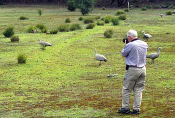 South-west
to Flinders Chase National Park:
setting off at 10-30am, we began the return drive along the dreaded dirt road
corrugations (click
here for map of Kangaroo Island). It took 15 minutes to advance slowly along the worst part, then on
reaching the section already scraped, we were able to maintain a steady 40 kph,
reaching the tarmac within 25 minutes. During the drive, we saw two large, black
and buff-coloured, eagle-shaped birds of prey, and a flock of Pied Currawongs
flying over. The two days of driving on unsealed roads had not only caked Bruce
with a layer of sandy mud and dust, it had also burned three quarters of our
full tank of fuel; we badly needed a fill-up. Once onto the tarmaced surface of
the West End Highway, it immediately became clear why the unsealed roads
consumed so much fuel: you had to keep your foot on the throttle constantly to
maintain momentum. Once onto smooth South-west
to Flinders Chase National Park:
setting off at 10-30am, we began the return drive along the dreaded dirt road
corrugations (click
here for map of Kangaroo Island). It took 15 minutes to advance slowly along the worst part, then on
reaching the section already scraped, we were able to maintain a steady 40 kph,
reaching the tarmac within 25 minutes. During the drive, we saw two large, black
and buff-coloured, eagle-shaped birds of prey, and a flock of Pied Currawongs
flying over. The two days of driving on unsealed roads had not only caked Bruce
with a layer of sandy mud and dust, it had also burned three quarters of our
full tank of fuel; we badly needed a fill-up. Once onto the tarmaced surface of
the West End Highway, it immediately became clear why the unsealed roads
consumed so much fuel: you had to keep your foot on the throttle constantly to
maintain momentum. Once onto smooth tarmac, you realised how much you tended to
coast. From our map, Sheila located a petrol station at the exclusive private resort of KI
Wilderness Retreat, and we pulled in. There was a fuel pump, but unleaded fuel was a
horrifying $1.85/litre, 34 cents/litre more expensive than we had paid at Cape
Jervis, and 50 cents more expensive than Adelaide prices! They literally had us
over a barrel, and with ill-gracious gratitude we handed over our $50 for a
fill-up to get us back to Penneshaw. tarmac, you realised how much you tended to
coast. From our map, Sheila located a petrol station at the exclusive private resort of KI
Wilderness Retreat, and we pulled in. There was a fuel pump, but unleaded fuel was a
horrifying $1.85/litre, 34 cents/litre more expensive than we had paid at Cape
Jervis, and 50 cents more expensive than Adelaide prices! They literally had us
over a barrel, and with ill-gracious gratitude we handed over our $50 for a
fill-up to get us back to Penneshaw.
Just west from here, we headed for the Flinders Chase National Park Visitor Centre. During the
drive over, the sky had darkened; it looked as if the best we could hope for
today would be showery weather. Just before the National Park Visitor Centre, we
passed a flock of Cape Barren Geese grazing in a paddock by the
 roadside (Photo
47 - Cape Barren Geese) (see above left). As we
stopped to photograph them, we were drenched by a sudden downpour. These bulky
Cape Barren Geese with uniformly grey plumage are now firmly established at the Rocky River area of Flinders
Chase, migrating here seasonally for nesting and rearing of young during winter.
The females emitted a pig-like grunting sound (hence the alternative name of Pig
Geese), and the males seemed aggressive, attacking other geese. Like most
geese they were singularly unattractive! roadside (Photo
47 - Cape Barren Geese) (see above left). As we
stopped to photograph them, we were drenched by a sudden downpour. These bulky
Cape Barren Geese with uniformly grey plumage are now firmly established at the Rocky River area of Flinders
Chase, migrating here seasonally for nesting and rearing of young during winter.
The females emitted a pig-like grunting sound (hence the alternative name of Pig
Geese), and the males seemed aggressive, attacking other geese. Like most
geese they were singularly unattractive!
South to Cape du Couedic:
we stopped at the Visitor Centre to pay our $9 each National Park entry fee, and to
make enquires about local walks. Our original plan had been to camp at the
Western KI Caravan Park just along the South Coast Road; this would have been
expensive but did have the advantage of power supplies for charging cameras.
The National Park Visitor Centre however also had a straightforward camping area
nearby, Rocky River Campground; although not having any power, it seemed more
reasonably priced and we should return here to camp later.
We turned off onto the narrow, winding, but at least
tarmaced lane leading down to Cape du Couedic (click
here for map of Kangaroo Island). The road wound
through endless mallee scrub
bushland (Photo
48 - Mallee scrub bushland) (see right above), dotted with classic 'black boy' Yakkas
(see left), and from a look-out high on Bunker Hill, the
extent of damage caused by the 2007 bush fire was still evident. The lane undulated across the
Flinders Chase scrub-covered terrain
(see right) ending by the
lighthouse at Cape du Couedic. The heavy cloud of earlier had now cleared and
sun broken through, giving a lovely soft light for photography. We had
ambitious (perhaps over-ambitious) plans for today: the obvious visits were to
Admirals Arch here at Cape du Couedic to see the seals, and the nearby
geological curiosity of Remarkable Rocks; we also hoped to follow (click
here for map of Kangaroo Island). The road wound
through endless mallee scrub
bushland (Photo
48 - Mallee scrub bushland) (see right above), dotted with classic 'black boy' Yakkas
(see left), and from a look-out high on Bunker Hill, the
extent of damage caused by the 2007 bush fire was still evident. The lane undulated across the
Flinders Chase scrub-covered terrain
(see right) ending by the
lighthouse at Cape du Couedic. The heavy cloud of earlier had now cleared and
sun broken through, giving a lovely soft light for photography. We had
ambitious (perhaps over-ambitious) plans for today: the obvious visits were to
Admirals Arch here at Cape du Couedic to see the seals, and the nearby
geological curiosity of Remarkable Rocks; we also hoped to follow
 the
Platypus Water-holes Walk from the National Park Visitor Centre, and to visit the Hanson
Bay Wildlife Sanctuary to see Koalas in the wild. With the weather now looking
promising down here at the coast with clearing blue sky and bright sun, our
first priority would be the cliff walk here at Cape du Couedic down to Admirals
Arch, to see the New Zealand Fur Seals. the
Platypus Water-holes Walk from the National Park Visitor Centre, and to visit the Hanson
Bay Wildlife Sanctuary to see Koalas in the wild. With the weather now looking
promising down here at the coast with clearing blue sky and bright sun, our
first priority would be the cliff walk here at Cape du Couedic down to Admirals
Arch, to see the New Zealand Fur Seals.
Cape du
Couedic:
parking by the lighthouse, we walked down towards the cape (click
here for map of Kangaroo Island) which had been named by Nicolas Baudin
during his 1803 expedition in memory
of Charles Louis du Couëdic, the Seigneur de Kergoualer (1740~80), a French
naval officer. To conserve the cliff-top paths and flora from
 erosion by the 1000s of visitors
who tread these paths, a broad board-walk had been constructed, zigzagging down
to the cliff-tops overlooking the narrow channel of sea which surged between the
SW tip of Kangaroo Island and the tiny Casuarina Islets 500m offshore. The
islets were named by Baudin after one of the expedition's ships the
Casuarina. Never before had we witnessed such ferociously surging seas (see
left) (Photo
49 - Surging sea): huge
breakers swelled in mid-channel and rolled in towards the craggy coastline of
both KI and the offshore islets, crashing into a foaming maelstrom along the
rocks (see right)
(Photo
50 - Foaming surf). Today generally the sea was calm; there was no stormy wind, and the erosion by the 1000s of visitors
who tread these paths, a broad board-walk had been constructed, zigzagging down
to the cliff-tops overlooking the narrow channel of sea which surged between the
SW tip of Kangaroo Island and the tiny Casuarina Islets 500m offshore. The
islets were named by Baudin after one of the expedition's ships the
Casuarina. Never before had we witnessed such ferociously surging seas (see
left) (Photo
49 - Surging sea): huge
breakers swelled in mid-channel and rolled in towards the craggy coastline of
both KI and the offshore islets, crashing into a foaming maelstrom along the
rocks (see right)
(Photo
50 - Foaming surf). Today generally the sea was calm; there was no stormy wind, and the
 sun
was bright. But even in these placid conditions, the sea running through this
narrow channel was both fearsome and fascinating. sun
was bright. But even in these placid conditions, the sea running through this
narrow channel was both fearsome and fascinating.
As we walked down the board-walk towards the cliff-tops, closer views of the rocky shore-line
pounded by the foaming sea opened up before us. Set against a dramatic sky-scape
and lit by bright sun
(Photo
51 - Casuarina islets), the surging sea generated endless potential for
photography. To the NW the seemingly endless coastline, with its flat, shelving
rocks sloping down to the seething waterline, was wreathed in spray from the
surf which crashed onto the shore
(Photo
52 - NW from Cape Couedic) (see left). Looking
across the narrow straights which separated the KI southern shoreline from the larger and
closer of the Casuarina Islets, enormous waves broke with towering showers of
spray; below us along the rocky shore of Cape du Couedic, endless series of
seething waves rose in a foaming mass to crash onto the rocks also with showers
of spray
(Photo
53 - Surf spray). It was all totally exhilarating, but at the same time hellishly
terrifying. Any vessel which unwittingly strayed anywhere near this dreadful
channel would inevitably and inescapably be dashed onto the rocks of either KI
or the offshore islets. Mesmerised by the dreadful foaming sea, we took endless
photos from Cape Couedic looking along the NW coast, and out towards the offshore islets
with the
foreshore of Kangaroo Island's SW tip of below us. the KI southern shoreline from the larger and
closer of the Casuarina Islets, enormous waves broke with towering showers of
spray; below us along the rocky shore of Cape du Couedic, endless series of
seething waves rose in a foaming mass to crash onto the rocks also with showers
of spray
(Photo
53 - Surf spray). It was all totally exhilarating, but at the same time hellishly
terrifying. Any vessel which unwittingly strayed anywhere near this dreadful
channel would inevitably and inescapably be dashed onto the rocks of either KI
or the offshore islets. Mesmerised by the dreadful foaming sea, we took endless
photos from Cape Couedic looking along the NW coast, and out towards the offshore islets
with the
foreshore of Kangaroo Island's SW tip of below us.

Admirals Arch and the New Zealand Fur Seals:
from the cliff-top, the board-walk continued down steps around the corner of the
cliffs, giving yet more intimately closer overview of the incoming surging
waves, before they crashed in foaming spray onto the rocks immediately below us. But all of this was just a foretaste; the best was yet to come.
We had already seen distant views of seals basking on the shore-side rocks (Photo
54 - seals basking on rocks) (see above right). But now as we rounded
the corner of the cliffs on the board-walk steps, there down below us, basking
in the sunshine on the wave-splashed flat rocks, were dozens of New Zealand Fur
Seals (Photo
55 - New Zealand Fur Seal) (see left).
Others were frolicking in a rock pool atop the flat rocks, seeming to take delight in the
constant showering wash-over as crashing waves splashed around them. It was all
totally surrealistic. sunshine on the wave-splashed flat rocks, were dozens of New Zealand Fur
Seals (Photo
55 - New Zealand Fur Seal) (see left).
Others were frolicking in a rock pool atop the flat rocks, seeming to take delight in the
constant showering wash-over as crashing waves splashed around them. It was all
totally surrealistic.
But the thrills were still not yet over.
Rounding a further corner, and descending the board-walk steps to a
viewing
platform, there ahead was the over-hanging Admirals Arch, carved by wind and
wave erosion, a natural rock-bridge arching over flat slabs onto which waves
from the far side of the straits crashed
 (see
right) (Photo
56 - Admirals Arch). Along the distant coast-line away
to the north-west, the cliffs were masked by spray raised from surf crashing
onto shore-side rocks. And down on the slabs beneath the arch's overhang, yet
more seals lay basking, playfully sparring with each other or
swimming in the foaming shallows. And to complete the picture, the air under the
confined space of the cavern created by the huge overhanging natural arch was
rank with the foul, fetid smell presumably of seal excrement. The underside of
the over-arching rock-bridge was lined with huge rocky accretions of stalactites
(Photo
57 - Stalactite accretions). The deafening sound
of waves crashing beyond the arch, and the sight of seals basking and seeming
almost to pose for visitors' cameras, all
combined to distract from any awareness of the fetid atmosphere. (see
right) (Photo
56 - Admirals Arch). Along the distant coast-line away
to the north-west, the cliffs were masked by spray raised from surf crashing
onto shore-side rocks. And down on the slabs beneath the arch's overhang, yet
more seals lay basking, playfully sparring with each other or
swimming in the foaming shallows. And to complete the picture, the air under the
confined space of the cavern created by the huge overhanging natural arch was
rank with the foul, fetid smell presumably of seal excrement. The underside of
the over-arching rock-bridge was lined with huge rocky accretions of stalactites
(Photo
57 - Stalactite accretions). The deafening sound
of waves crashing beyond the arch, and the sight of seals basking and seeming
almost to pose for visitors' cameras, all
combined to distract from any awareness of the fetid atmosphere.
 growing on Cape du Couedic cliff-tops") We had spent 1½ hours down here at the Cape, photographing surf and seals, and simply
revelling in the glorious surroundings of this natural wonderland; by now
however it was almost 2-00pm. We re-traced the route back up the steps and
board-walk to Bruce to eat our lunch sandwiches. The sun was still bright and
warm, and after lunch we returned down to the Admirals Arch viewing platform for
a second spell of watching the seals basking on the rocks or cavorting in the
rock-pools. On the way down, we photographed the characteristic KI cliff-top
flowering shrub of Kangaroo Island Round-leaved Correa (Correa backhouseana)
(see right) (Photo
58 - Round-leaved Correa).
But time was now pressing; we had decided to postpone the Koala Walk at Hanson
Bay Wildlife Sanctuary until tomorrow morning, but if we were to fit in the rest
of our programme, we should have to move on. We had spent 1½ hours down here at the Cape, photographing surf and seals, and simply
revelling in the glorious surroundings of this natural wonderland; by now
however it was almost 2-00pm. We re-traced the route back up the steps and
board-walk to Bruce to eat our lunch sandwiches. The sun was still bright and
warm, and after lunch we returned down to the Admirals Arch viewing platform for
a second spell of watching the seals basking on the rocks or cavorting in the
rock-pools. On the way down, we photographed the characteristic KI cliff-top
flowering shrub of Kangaroo Island Round-leaved Correa (Correa backhouseana)
(see right) (Photo
58 - Round-leaved Correa).
But time was now pressing; we had decided to postpone the Koala Walk at Hanson
Bay Wildlife Sanctuary until tomorrow morning, but if we were to fit in the rest
of our programme, we should have to move on.
 Cape du Couedic lighthouse:
returning to Bruce, we drove up for photographs of the Cape du Couedic lighthouse
(see above left) (Photo
59 - Cape du Couedic lighthouse), built in 1909 after
the loss of several merchantmen in the treacherous seas around the cape. Just up
the lane, a side road branched off eastwards following the line of the coast. In
the distance around the cliff-tops on the far side of a deep bay, this prominent
outcrop of rocks was visible crowning a headland Cape du Couedic lighthouse:
returning to Bruce, we drove up for photographs of the Cape du Couedic lighthouse
(see above left) (Photo
59 - Cape du Couedic lighthouse), built in 1909 after
the loss of several merchantmen in the treacherous seas around the cape. Just up
the lane, a side road branched off eastwards following the line of the coast. In
the distance around the cliff-tops on the far side of a deep bay, this prominent
outcrop of rocks was visible crowning a headland overlooking the coast and
glowing golden in the afternoon sunlight. We paused at a
look-out to photograph the magnificent sweep of beach far below us at the foot
of high cliffs, with white foam of waves washing ashore, and above this the
prominence of Remarkable Rocks (see left). overlooking the coast and
glowing golden in the afternoon sunlight. We paused at a
look-out to photograph the magnificent sweep of beach far below us at the foot
of high cliffs, with white foam of waves washing ashore, and above this the
prominence of Remarkable Rocks (see left).
Geological phenomenon of Remarkable Rocks:
at the lane's end, we parked and walked along another conservational board-walk towards the
golden rocky dome crowned with enormous granite boulders which were eroded into curious
shapes (Photo
60 - Domed prominence of Remarkable Rocks). Information panels explained the geological formation of this volcanic
intrusion of granite, with the original sedimentary surface rocks eroded away
over aeons to leave the exposed dome-shaped granite outcrop. The huge surface
layer of granite fragmented over time and was weathered and sculpted into the
separate mammoth blocks seen today (Photo
61 - Remarkable Rocks eroded granite blocks) (see below left). At the end of the board-walk, we clambered
up onto the domed outcrop, the crystalline granite surface giving secure
foot-hold in dry weather; in wet weather it would have been treacherously
slippery. It was possible to scramble around and between
 the massive boulders,
in order to photograph their
fantastically eroded shapes (Photo
62 - Eroded granite), some of which resembled Henry Moore sculptures
(see right). With
their golden lichen coating, the rocks glowed in the afternoon sunlight, and to
the NW along the cliff-line clouds of spray rose from the beach seen earlier
from the look-out point. the massive boulders,
in order to photograph their
fantastically eroded shapes (Photo
62 - Eroded granite), some of which resembled Henry Moore sculptures
(see right). With
their golden lichen coating, the rocks glowed in the afternoon sunlight, and to
the NW along the cliff-line clouds of spray rose from the beach seen earlier
from the look-out point.
Flinders Chase Rocky River Camping: it was by now
gone 4-00pm, and we still had hopes of tackling the Platypus Walk this afternoon
before dusk.
As we drove back along the lane to the road leading in 15 kms to the Flinders
Chase National Park Visitor Centre (click
here for map of Kangaroo Island), we saw two more Echidnas: one stayed on gravel by
the roadside, but the other
Echidna shuffled purposefully across the road in front of us and disappeared
into the mallee scrub (see below right). They moved slowly
giving us time to stop, and we now took extra care in case any larger and
faster-moving creatures such as Wallabies or Kangaroos emerged from the scrub to
hop in front of us.
Back at the Flinders Chase Visitor Centre, we inspected the
Rocky River campsite:
facilities seemed fine with WCs, modern wash-ups, showers with hot water, fresh water supplies, and
barbecues, but remote from the camping area. We went down to the Visitor Centre
to check that the water was fit for drinking, and bought bottles of beer for
later. But it was by now 5-00pm; the sun was beginning to set, and it would be
dark in an hour. There was no time left this afternoon for the Platypus Walk,
and we were both tired. The campsite was virtually deserted at this time of
year, and we settled Bruce into one of the pitches. We had hoped that the
original charge of water would last out, but on trying to fill the kettle, it
was clear that the fresh water tank was almost empty. We had therefore to pack
away again in order to drive Bruce around to the facilities block for a refill. But at
least this did not entail collapsing his roof as with George. Back to our pitch, we finally were able to
settle in fully, and cracked a beer. But at
least this did not entail collapsing his roof as with George. Back to our pitch, we finally were able to
settle in fully, and cracked a beer.
Supper tonight was sliced kangaroo steak fried and simmered in its own gravy with
chopped mushroom, another delicious supper
in Bruce, with a bottle of Eldridge Sangiovese Rosé from Clare Valley. Darkness
fell remarkably quickly, and by soon after 6-00pm it was pitch black. The
evening became overcast and with rain showers. The sky cleared later
to give some stars, but not as startlingly bright as last night. At one point on opening the slider, we could see the outline of a small animal. At first
we thought it was a Wallaby, but shining the torch showed it to be a Brushtail
Possum, a large, furry and cuddly-looking, nocturnal, semi-arboreal marsupial
with pink ears and large round eyes; indifferent to the light, he wandered off
into the scrub.
A wet morning at Rocky River, Flinders Chase National Park:
when we first woke at 7-00am, the sky seemed heavily overcast; we feared another miserable day after
last night's rain. In fact by the time we emerged, the morning sun was just
breaking through the overnight cloud and the sky clearing, and by breakfast the
sun was shining brightly. The air however was autumnally chill. We had eaten our
way through our food stocks, and should have to shop later at Penneshaw for
tonight's supper and tomorrow's breakfast. Rocky River Campground was well laid
out with tarmac driveways, but the separate gravel pitches in each enclosure were
surrounded by natural scrub (see left). This morning the air was again filled with the
sound of bird song, particularly the melodious fluty warbling of the Australian
Magpie (Cracticus tibicen, appropriately from the Latin for
flute-player), one of Australia's most vociferous songbirds with a
remarkably mellifluous repertoire of calls, compared with the harsh squawk of
unrelated British Magpies. particularly the melodious fluty warbling of the Australian
Magpie (Cracticus tibicen, appropriately from the Latin for
flute-player), one of Australia's most vociferous songbirds with a
remarkably mellifluous repertoire of calls, compared with the harsh squawk of
unrelated British Magpies.
The clear sky of earlier did not last: by the time we were packed to leave, serious cloud had
gathered. As we parked by the Visitor Centre to pack day sacs for the Platypus
Water-holes Walk, a thoroughly soaking drizzle was pouring. We kitted up fully
with waterproofs, and while
 waiting at the Visitor Centre for the rain to ease,
we sampled the pelts of fauna found in the National Park: the skins of a Goanna,
a Kangaroo, Tammar Wallaby, and the spiny quills of an Echidna. The rain eased
showing no signs of stopping, but we set off on the 4.5 kms circular walk. waiting at the Visitor Centre for the rain to ease,
we sampled the pelts of fauna found in the National Park: the skins of a Goanna,
a Kangaroo, Tammar Wallaby, and the spiny quills of an Echidna. The rain eased
showing no signs of stopping, but we set off on the 4.5 kms circular walk.
Platypus Water-holes Walk, Flinders Chase:
from the rear of the Visitor Centre, the path led to an information shelter with panels about
wildlife to be seen at Flinders Chase (See map of Platypus Water-holes Walk). From here the route crossed the open
turf-land of Black Swamp. The close-cropped turf was covered with the droppings
of Kangaroos and the Cape Barren Geese which were grazing in flocks around us
(see above right).
Shortly after growing at Black Swamp, Rocky River") the start, we passed a Tammar Wallaby grazing near to the path
(see left) (Photo
63 - Tammar Wallaby). He
was clearly aware of our presence, but tolerated our approaching closely for
photographs. Finally he had enough and hopped away. The
Cape Barren Geese continued grazing, letting out the occasional grunting as we
passed. Beyond the open turf-land, the path meandered through a more densely
wooded area of gum trees and Yakkas (see right). There was still much remaining damage from
a recent bush-fire, but the vegetation was re-asserting itself among charred
stumps of fire-damaged trees. The drizzle continued as we walked on through the
bush; this was a truly delightful path, even in poor weather. the start, we passed a Tammar Wallaby grazing near to the path
(see left) (Photo
63 - Tammar Wallaby). He
was clearly aware of our presence, but tolerated our approaching closely for
photographs. Finally he had enough and hopped away. The
Cape Barren Geese continued grazing, letting out the occasional grunting as we
passed. Beyond the open turf-land, the path meandered through a more densely
wooded area of gum trees and Yakkas (see right). There was still much remaining damage from
a recent bush-fire, but the vegetation was re-asserting itself among charred
stumps of fire-damaged trees. The drizzle continued as we walked on through the
bush; this was a truly delightful path, even in poor weather.
 After 2 kms, we reached Black Swamp and the junction of the
Platypus Water-holes circular walk around the swampy
area of the Rocky River. Information panels warned visitors to keep as quiet as
possible and to move slowly; but even then the chances of seeing the rare
Platypus were minimal, as the warden at the Visitor Centre had advised
yesterday. The pathway advanced through denser scrubland leading to a viewing
platform looking over the swampy river (see left) (Photo
64 - Platypus Water-holes Walk, Rocky River). Rain was falling more heavily now with
raindrops splashing from overhanging vegetation into the river. Eagerly we
scoured the muddy river banks where a number of possible burrow-holes were
visible, but the only disturbance of the water was not from a After 2 kms, we reached Black Swamp and the junction of the
Platypus Water-holes circular walk around the swampy
area of the Rocky River. Information panels warned visitors to keep as quiet as
possible and to move slowly; but even then the chances of seeing the rare
Platypus were minimal, as the warden at the Visitor Centre had advised
yesterday. The pathway advanced through denser scrubland leading to a viewing
platform looking over the swampy river (see left) (Photo
64 - Platypus Water-holes Walk, Rocky River). Rain was falling more heavily now with
raindrops splashing from overhanging vegetation into the river. Eagerly we
scoured the muddy river banks where a number of possible burrow-holes were
visible, but the only disturbance of the water was not from a Platypus but
falling rain drops. We stood silently and patiently watching for any signs of
life, but Platypus were there none. Continuing around the circuit, hoping the
continuing dripping rain would encourage Platypus to emerge from their burrows,
we crossed the river on a footbridge. But despite our peering expectantly at the
muddy banks, there were still no Platypus sightings. Further around, the path
again crossed the river at a delightful spot, despite the dull light and
dripping drizzle. Last chance, but regrettably still no Platypus. Platypus but
falling rain drops. We stood silently and patiently watching for any signs of
life, but Platypus were there none. Continuing around the circuit, hoping the
continuing dripping rain would encourage Platypus to emerge from their burrows,
we crossed the river on a footbridge. But despite our peering expectantly at the
muddy banks, there were still no Platypus sightings. Further around, the path
again crossed the river at a delightful spot, despite the dull light and
dripping drizzle. Last chance, but regrettably still no Platypus.
On the return leg through the forest, we watched a tiny, beautiful bird flitting around and
settling on a branch, giving us a clear view: an appropriately
 named Australian
Scarlet Robin (Petroica boodang),
black bodied with white wing-bars and white head patch, and a magnificently
prominent vermilion shirt. Back at the circuit's start point, we turned back
along the meandering path through the forest; here new generations of vegetation
growth flourished amid the burnt stems and stumps from recent bush-fires.
As we emerged onto the more open heath-land, two Kangaroos were grazing in the
distance. We edged across towards them as quietly as possible, and getting good photos as we came closer. They tolerated
our presence and our clicking cameras for a while, then decided enough was named Australian
Scarlet Robin (Petroica boodang),
black bodied with white wing-bars and white head patch, and a magnificently
prominent vermilion shirt. Back at the circuit's start point, we turned back
along the meandering path through the forest; here new generations of vegetation
growth flourished amid the burnt stems and stumps from recent bush-fires.
As we emerged onto the more open heath-land, two Kangaroos were grazing in the
distance. We edged across towards them as quietly as possible, and getting good photos as we came closer. They tolerated
our presence and our clicking cameras for a while, then decided enough was enough; they bounded off towards cover (see above right) (Photo
65 - Bounding Kangaroo). But we had managed to get good photos of
their peculiar bounding gait. All around us, Cape Barren Geese grazed and
grunted, seemingly indifferent to our presence. Among the trees at Black Swamp,
we found specimens of Kangaroo Apple with its garishly purple flowers (see
left) and its yellow fruit.
enough; they bounded off towards cover (see above right) (Photo
65 - Bounding Kangaroo). But we had managed to get good photos of
their peculiar bounding gait. All around us, Cape Barren Geese grazed and
grunted, seemingly indifferent to our presence. Among the trees at Black Swamp,
we found specimens of Kangaroo Apple with its garishly purple flowers (see
left) and its yellow fruit.
A short distance further we spotted another Tammar Wallaby contentedly grazing among
small, bushy tufts of vegetation (see right) (Photo
66 - Tammar Wallaby). Again we were able to creep up
close to him for photos before he hopped away. Yesterday we had seen several
Echidnas and knew what to look out for. Suddenly we spotted what evidently
seemed an Echidna
 with its light buff spiny quills standing out clearly. But as
we approached, it became less certain: there were a number of small, tufted
clumps of grassy plant bases, and closer examination showed that what in our
enthusiasm had appeared to be an Echidna turned out to be purely vegetable
matter! Wading through yet more geese, we returned to the information shelter at
the start of the path, and walked back to Bruce. Although not having been
rewarded with platypus sightings, it had been a worthwhile walk enabling us to
capture a number of close-up wild-life photos. And
despite the thinning cloud, the rain now started again as we prepared to leave
Flinders Chase. with its light buff spiny quills standing out clearly. But as
we approached, it became less certain: there were a number of small, tufted
clumps of grassy plant bases, and closer examination showed that what in our
enthusiasm had appeared to be an Echidna turned out to be purely vegetable
matter! Wading through yet more geese, we returned to the information shelter at
the start of the path, and walked back to Bruce. Although not having been
rewarded with platypus sightings, it had been a worthwhile walk enabling us to
capture a number of close-up wild-life photos. And
despite the thinning cloud, the rain now started again as we prepared to leave
Flinders Chase.
 Koala Walk at Hanson Bay Wildlife Sanctuary:
beyond the junction with West End Highway (click
here for map of Kangaroo Island), we passed the Western KI Caravan Park and soon
after pulled into the Hanson Bay Wildlife Sanctuary. This huge area of protected mallee scrub
is privately owned, but just close to the entrance,
two avenues of tall gum trees are open to the public for a nominal entrance fee
of $2.50 to the Koala Walk. Koalas are
arboreal, herbivorous marsupials, related to Wombats; in the wild, they sleep nestled high in the forked branches
of Eucalyptus trees, or sit munching their leaves, getting through 2 kgs of
eucalyptus leaves per day which make up
most of their diet. Other wild-life such as Kangaroos, Wallabies and Echidnas, as well as a variety
of bird-life can be seen in the Koala Walk at Hanson Bay Wildlife Sanctuary:
beyond the junction with West End Highway (click
here for map of Kangaroo Island), we passed the Western KI Caravan Park and soon
after pulled into the Hanson Bay Wildlife Sanctuary. This huge area of protected mallee scrub
is privately owned, but just close to the entrance,
two avenues of tall gum trees are open to the public for a nominal entrance fee
of $2.50 to the Koala Walk. Koalas are
arboreal, herbivorous marsupials, related to Wombats; in the wild, they sleep nestled high in the forked branches
of Eucalyptus trees, or sit munching their leaves, getting through 2 kgs of
eucalyptus leaves per day which make up
most of their diet. Other wild-life such as Kangaroos, Wallabies and Echidnas, as well as a variety
of bird-life can be seen in the
 grassland near to the gum trees. grassland near to the gum trees.
We parked and walked over to the avenues of trees, leaving our $5 at the entrance hut. There
were few other folk about and the drizzle persisted. We spoke with a couple who were visiting from NSW and who gave us directions to where they
had seen Koalas sleeping in the tree branches; they pointed out a pair of
Koalas high in the tree-tops
(Photo
67 - Pair of Koalas). At that height however, it was impossible to make
out any details; all we could see was a pair furry bundles squatting on the
Eucalyptus branches. We wondered how they did not fall from the tree branches when asleep! Further along however by
a flag-marker, we spotted a Koala clearly visible just 10 feet above the ground.
He looked a very sturdy, stocky little creatures with sharp claws on his
little 'hands', a large black, leathery-looking nose, fluffy ears, and teddy
bear eyes, nestled in the fork of Eucalyptus branches (see above left) (Photo
68 - Koala nestled in Eucalyptus branches). Peering up at him, we took a number of photos, although Paul's camera
battery was now running low without mains power for charging these last 3 days.
We had seen conserved Koalas at Cleland Wildlife Park near to Adelaide, but this
was the first we had seen one reasonably close-up in the wild. The curious
creature resembled a stocky, little old man sitting with his arms resting on his
knees and his head nodding in sleep (see above right) branches when asleep! Further along however by
a flag-marker, we spotted a Koala clearly visible just 10 feet above the ground.
He looked a very sturdy, stocky little creatures with sharp claws on his
little 'hands', a large black, leathery-looking nose, fluffy ears, and teddy
bear eyes, nestled in the fork of Eucalyptus branches (see above left) (Photo
68 - Koala nestled in Eucalyptus branches). Peering up at him, we took a number of photos, although Paul's camera
battery was now running low without mains power for charging these last 3 days.
We had seen conserved Koalas at Cleland Wildlife Park near to Adelaide, but this
was the first we had seen one reasonably close-up in the wild. The curious
creature resembled a stocky, little old man sitting with his arms resting on his
knees and his head nodding in sleep (see above right)  (Photo
69 - Sleeping Koala); at one point Sheila even saw him yawn. He
remained completely indifferent to our attention and the clicking of our cameras
below his perch on the tree branch. We walked along the rest of the gum tree
avenue with our heads craned upwards, and further along, spotted two more Koalas
sat sleeping side by side; but being on a high branch, we could make out no detail. (Photo
69 - Sleeping Koala); at one point Sheila even saw him yawn. He
remained completely indifferent to our attention and the clicking of our cameras
below his perch on the tree branch. We walked along the rest of the gum tree
avenue with our heads craned upwards, and further along, spotted two more Koalas
sat sleeping side by side; but being on a high branch, we could make out no detail.
On the walk back, other wildlife attracted our attention: a flock of Galahs flitted around
the open space beyond the trees, close enough to be photographed as they pecked
around on the grass
(see above left). By the entrance, we had been able to approach
and photograph a Tammar Wallaby who was sheltering from the rain under a
eucalyptus bush (see above right) (Photo
70 - Tammar Wallaby). Another KI Grey Kangaroo was now grazing and hopping around the
open space, and we followed him along, going in close to get some of the best
Kanga-pics yet. We were able to photograph him closely as he reached up to
browse Eucalyptus leaves from the trees (Photo
71 - Grey Kangaroo browsing Eucalyptus). He sat
upright holding leaves in his little front paws to nibble, and moved forward
with that curious rocking gait using forearms and tail (Photo
72 - Kangaroo's rocking gait) (see below left). Then he would
launch himself into full flight, hopping and bounding away across the field like
the silhouette on the Qantas logo (see above left) (Photo
73 - Bounding Kangaroo). We followed him the length of the field as he paused again by a pile of straw.
He almost posed for us as we photographed him at very close range, as he picked up
'handfuls' of the rain under a
eucalyptus bush (see above right) (Photo
70 - Tammar Wallaby). Another KI Grey Kangaroo was now grazing and hopping around the
open space, and we followed him along, going in close to get some of the best
Kanga-pics yet. We were able to photograph him closely as he reached up to
browse Eucalyptus leaves from the trees (Photo
71 - Grey Kangaroo browsing Eucalyptus). He sat
upright holding leaves in his little front paws to nibble, and moved forward
with that curious rocking gait using forearms and tail (Photo
72 - Kangaroo's rocking gait) (see below left). Then he would
launch himself into full flight, hopping and bounding away across the field like
the silhouette on the Qantas logo (see above left) (Photo
73 - Bounding Kangaroo). We followed him the length of the field as he paused again by a pile of straw.
He almost posed for us as we photographed him at very close range, as he picked up
'handfuls' of
 straw to nibble (Photo
74 - Kangaroo nibbling straw). Again he hopped and bounded further and we
followed; he almost seemed as curious of us as we were of him, allowing us to
come within hands reach (Photo
75 - Kangaroo close up). If we had held out food, he would probably have taken
it from our hands. We walked along the second avenue,
but could find no further Koalas in the trees. But there hopping around among
logs we came close to other Kangaroos, and were able to photograph these
at close range (see right) (Photo
76 - Grey Kangaroo). But time was now pressing: it was 3-00pm, and we had a two hour drive to get back
to Penneshaw to shop for food and complete jobs while there was still daylight. We also had a
couple of other planned visits on the way. As we drove from the car park passing
another group of 4 Kangaroos standing grazing in the field, the rain started
again. straw to nibble (Photo
74 - Kangaroo nibbling straw). Again he hopped and bounded further and we
followed; he almost seemed as curious of us as we were of him, allowing us to
come within hands reach (Photo
75 - Kangaroo close up). If we had held out food, he would probably have taken
it from our hands. We walked along the second avenue,
but could find no further Koalas in the trees. But there hopping around among
logs we came close to other Kangaroos, and were able to photograph these
at close range (see right) (Photo
76 - Grey Kangaroo). But time was now pressing: it was 3-00pm, and we had a two hour drive to get back
to Penneshaw to shop for food and complete jobs while there was still daylight. We also had a
couple of other planned visits on the way. As we drove from the car park passing
another group of 4 Kangaroos standing grazing in the field, the rain started
again.
South Coast Road to Vivonne Bay:
we drove on for some 30 kms, making good progress along the fast, tarmaced South Coast
Road through the mallee scrub and gum trees (click
here for map of Kangaroo Island). Reaching Vivonne Bay, (also named
by the 1803 Baudin expedition after Catherine de Vivonne, Marquise de
Rambouillet, a 17th century member of the French nobility), we turned off along 3 kms of bumpy dirt road down to
the bay and jetty. In fine weather Vivonne Bay would have been a magnificent 5
kms wide span of golden sand beach, but today with heavily overcast sky and poor
light, and with our limited time, it scarcely seemed worth stopping. And we had
in fact seen more dramatic rocky coastlines and seascapes over the last 2 days
to photograph in much better lighting conditions. We therefore returned to the
main road and drove on eastwards, to pause briefly and investigate an area of
sand dunes labelled on the map as Little Sahara. But the approach dirt
lane was deeply rutted and pitted, and signs promoting quad bikes and
paint-balling also suggested sordid commercial exploitation; we left it and
continued our journey. beach, but today with heavily overcast sky and poor
light, and with our limited time, it scarcely seemed worth stopping. And we had
in fact seen more dramatic rocky coastlines and seascapes over the last 2 days
to photograph in much better lighting conditions. We therefore returned to the
main road and drove on eastwards, to pause briefly and investigate an area of
sand dunes labelled on the map as Little Sahara. But the approach dirt
lane was deeply rutted and pitted, and signs promoting quad bikes and
paint-balling also suggested sordid commercial exploitation; we left it and
continued our journey.
 Return to Penneshaw:
despite being wary of wild-life on the road in the gloomy light of a dull late
afternoon, we made good speed along the mainly straight South Coast Road,
passing the turning for Seal Bay. We cut through on a minor but tarmaced road
past an airstrip to reach the main road to American River and Penneshaw. Several
kms of good progress along a straight road brought us back to the point where
last Saturday we had turned off to the honey farm. As we passed the turning for
American River and rounded Pelican Lagoon and Prospect Hill, the sky was at last
beginning to brighten, and we completed the last few kms back to Penneshaw.
After a brisk drive along the South Coast Road down the length of the island, we
reached Penneshaw on target at 5-00pm. But as we drove into town, it seemed a
different world we were re-entering from the wild,
deserted mallee scrubland we had left earlier. Return to Penneshaw:
despite being wary of wild-life on the road in the gloomy light of a dull late
afternoon, we made good speed along the mainly straight South Coast Road,
passing the turning for Seal Bay. We cut through on a minor but tarmaced road
past an airstrip to reach the main road to American River and Penneshaw. Several
kms of good progress along a straight road brought us back to the point where
last Saturday we had turned off to the honey farm. As we passed the turning for
American River and rounded Pelican Lagoon and Prospect Hill, the sky was at last
beginning to brighten, and we completed the last few kms back to Penneshaw.
After a brisk drive along the South Coast Road down the length of the island, we
reached Penneshaw on target at 5-00pm. But as we drove into town, it seemed a
different world we were re-entering from the wild,
deserted mallee scrubland we had left earlier.
 Final night on Kangaroo Island at KI Shores Camping:
down into the town, we bought a couple of bottles of beer at the bottle shop,
and stopped at the IGA supermarket for supper and breakfast provisions. Round to
the campsite, we booked in now at just $27/night with power supply, with winter
season prices having begun at start of May; all camera batteries and phones
needed charging. Fortunately the same pitch used last weekend was free close to
the stand-pipe and, with the light failing fast, gave Bruce a good cleaning off. We finally hosed him down hoping
that in the light of morning we should not discover missed Final night on Kangaroo Island at KI Shores Camping:
down into the town, we bought a couple of bottles of beer at the bottle shop,
and stopped at the IGA supermarket for supper and breakfast provisions. Round to
the campsite, we booked in now at just $27/night with power supply, with winter
season prices having begun at start of May; all camera batteries and phones
needed charging. Fortunately the same pitch used last weekend was free close to
the stand-pipe and, with the light failing fast, gave Bruce a good cleaning off. We finally hosed him down hoping
that in the light of morning we should not discover missed
 streaks. We also
filled his fresh water tank ready for his return.
We settled into our pitch, connected Bruce's power,
and by 6-00pm it was pitch
dark with stars beginning to appear. Supper tonight required careful use of Bruce's limited capacity pans: chorizo sausage chopped to make meat-balls with
onion, peppers and mushrooms in tomato sauce with oregano served with spaghetti.
We settled in for our final night in Bruce, after another memorable day of KI
wild-life in spite of the disappointing weather. It was another chill and
miserable night. streaks. We also
filled his fresh water tank ready for his return.
We settled into our pitch, connected Bruce's power,
and by 6-00pm it was pitch
dark with stars beginning to appear. Supper tonight required careful use of Bruce's limited capacity pans: chorizo sausage chopped to make meat-balls with
onion, peppers and mushrooms in tomato sauce with oregano served with spaghetti.
We settled in for our final night in Bruce, after another memorable day of KI
wild-life in spite of the disappointing weather. It was another chill and
miserable night.
Final morning at Penneshaw:
the alarm was set for 6-40am to allow time for the log to be completed; we also had much
to do this morning to be down at the ferry port in time for the 10-30 sailing.
But at least now we had power for his electric kettle for our final morning brew
in Bruce. The early sky gave mixed promises for today's weather: dramatic cloudy
sky with a hint of sun at first light. We eat our last breakfast sat at Bruce's table
(see above right).
We systematically gathered together our belongings, and having washed up, we packed away Bruce's equipment. It had to be admitted that Britz had provided not
only an almost new vehicle, but also one practicably laid out and thoughtfully
equipped. Having checked off all the packing of Bruce's kit and separated off
our food and kit, we left Penneshaw Camping and
drove down to the ferry dock. right).
We systematically gathered together our belongings, and having washed up, we packed away Bruce's equipment. It had to be admitted that Britz had provided not
only an almost new vehicle, but also one practicably laid out and thoughtfully
equipped. Having checked off all the packing of Bruce's kit and separated off
our food and kit, we left Penneshaw Camping and
drove down to the ferry dock.
Re-crossing by ferry to Cape Jervis:
other vehicles were gathering for the 10-30 crossing, and Bruce parked in the queuing lane
while we checked in. Other cars seemed to be driving aboard the waiting ferry,
so we also edged forward down towards the ramp. A brusque voice called after us,
what did we think we were
 doing moving down before instructed? Paul was learning
Australian directness, and responded in like manner. Shortly after, another more
helpful crew member called us forward and directed us to back aboard (Photo
77 - Backing aboard ferry) (see above left). After 5
days driving experience in Bruce, this presented no problems, other than that we
were trapped at the very rear of the vehicle deck, and should therefore be one
of the last ashore at Cape Jervis when we were anxious to start the drive back
to Adelaide. But Bruce was settled into his allotted space and Paul went aloft to join
Sheila who had walked aboard. We were anxious about time since we had a drive of at
least 2 hours back to Adelaide; we then needed to unload our kit at Lucy's
apartment and return Bruce to Britz near the airport, all before closing
time at 3-30pm. It was going to be a tight schedule. doing moving down before instructed? Paul was learning
Australian directness, and responded in like manner. Shortly after, another more
helpful crew member called us forward and directed us to back aboard (Photo
77 - Backing aboard ferry) (see above left). After 5
days driving experience in Bruce, this presented no problems, other than that we
were trapped at the very rear of the vehicle deck, and should therefore be one
of the last ashore at Cape Jervis when we were anxious to start the drive back
to Adelaide. But Bruce was settled into his allotted space and Paul went aloft to join
Sheila who had walked aboard. We were anxious about time since we had a drive of at
least 2 hours back to Adelaide; we then needed to unload our kit at Lucy's
apartment and return Bruce to Britz near the airport, all before closing
time at 3-30pm. It was going to be a tight schedule.
The ferry pulled away from Penneshaw dock at 10-30am (see above right), and we took our farewell photos of Kangaroo Island as Penneshaw
and the coastline soon receded into the distance (Photo
78 - Ferry departing Kangaroo Island) (see left and right above). The weather was still uncertain with heavily overcast sky,
and a shower over KI produced a rainbow to enliven our photos.
During the crossing, we got into conversation with other passengers and with one
particularly chatty elderly gent from Murray Bridge who made regular crossings to KI.
The crossing of Backstairs Passage threatened to be delayed as the ferry made a sweeping detour to
allow a large container-ship to pass before us (see above left), but we resumed course
and made good headway across Backstairs Passage towards Cape Jervis. Heavy, squally
rain-clouds obscured the outline of the mainland ahead of us (see right), and
with 11-15 approaching, we eat an early sandwich lunch as the ferry docked at Cape Jervis
(see below left). chatty elderly gent from Murray Bridge who made regular crossings to KI.
The crossing of Backstairs Passage threatened to be delayed as the ferry made a sweeping detour to
allow a large container-ship to pass before us (see above left), but we resumed course
and made good headway across Backstairs Passage towards Cape Jervis. Heavy, squally
rain-clouds obscured the outline of the mainland ahead of us (see right), and
with 11-15 approaching, we eat an early sandwich lunch as the ferry docked at Cape Jervis
(see below left).
 Return from Cape Jervis up through Fleuieu Peninsula to Adelaide:
Paul hurried down to Bruce, anxious to begin the drive, waiting for other vehicles to
clear the ramp before he could drive ashore (Photo
79 - Cape Jervis). Picking up Sheila from the quayside, we joined the line of vehicles
heading up the road from the dock. Frustratingly slow drivers ahead of us
threatened to cause further delays; we managed to pass these, but the narrow,
winding road for the first 20 kms kept our speed down to 80kph. Paul kept an eye on
Bruce's fuel gauge since we were down to our last quarter, but even at the small
town of Yankalilla, we passed no filing stations. The weather continued showery,
potentially spraying road grime up onto Bruce's freshly cleaned bodywork. Return from Cape Jervis up through Fleuieu Peninsula to Adelaide:
Paul hurried down to Bruce, anxious to begin the drive, waiting for other vehicles to
clear the ramp before he could drive ashore (Photo
79 - Cape Jervis). Picking up Sheila from the quayside, we joined the line of vehicles
heading up the road from the dock. Frustratingly slow drivers ahead of us
threatened to cause further delays; we managed to pass these, but the narrow,
winding road for the first 20 kms kept our speed down to 80kph. Paul kept an eye on
Bruce's fuel gauge since we were down to our last quarter, but even at the small
town of Yankalilla, we passed no filing stations. The weather continued showery,
potentially spraying road grime up onto Bruce's freshly cleaned bodywork.
Once beyond the hills we were able to pick up speed, and regular overtaking lanes enabled us
to get past slower trucks. Within an hour we reached Nuarlunga, and soon after
pulled into a petrol station to fill Bruce with fuel at $1.35/litre, exactly 50
cents cheaper than we had to pay on KI. Traffic was very heavy on the duel
carriageway, a total culture shock after KI's peaceful roads. Once beyond the
Expressway however, traffic thinned and we were able to make better headway,
dropping steeply downhill towards the outskirts of the city. It seemed to take
longer than ever driving through the Adelaide suburbs, with all the interchange
traffic lights causing more frustrating delays. After a tense navigational
error, we regained our route along Anzac Highway and turned into South Terrace,
finally parking outside our daughter's apartment at 1-30pm, having
achieved the drive in exactly 2 hours. however, traffic thinned and we were able to make better headway,
dropping steeply downhill towards the outskirts of the city. It seemed to take
longer than ever driving through the Adelaide suburbs, with all the interchange
traffic lights causing more frustrating delays. After a tense navigational
error, we regained our route along Anzac Highway and turned into South Terrace,
finally parking outside our daughter's apartment at 1-30pm, having
achieved the drive in exactly 2 hours.
Farewell to Bruce:
all our kit was quickly unloaded and Bruce's lockers double-checked. Just to be sure we incurred
no penalties on returning the camper, Paul gave him another quick wipe over to remove any
residual grime, and at 1-55 we set off for the airport. Traffic was now lighter
early afternoon, and we pulled into Britz's forecourt at 2-25, well within a
safe time margin before their closing time. We had made it, but it had
been a tense drive up from Cape Jervis. We said our
farewells and thanks to Bruce who had been such an admirably amenable
travelling companion (Photo
80 - Farewll to Bruce) (see right), and returned his keys to the same sour-faced
girl who went out to inspect him. Returning satisfied (we should hope so after
two cleanings!), she reimbursed our credit card with the full deposit. At the bus
stop immediately outside, we caught one of the regular buses from Glenelg into
the city and got off right outside the Metro Information Centre for
details of public transport routes for our next days of travelling around the
environs of Adelaide.
Despite the mixed weather, our 5 days on KI had been an extraordinarily memorable venture:
Bruce had been a loyal and long-suffering travelling companion especially on the
KI dirt
roads, the camping had been second to none, and to top it all we had witnessed a
wealth of KI wild-life. It truly had been a worthwhile trip, with many
recollections and photographs to savour.
Our concluding travels around Adelaide:
during our concluding week in and around Adelaide, we caught the local train out
to Port Adelaide to explore the conserved remains of the former dockland area
and the modern container Outer Port. Port Adelaide now is home to two first
class museums, the National Railway Museum and Maritime Museum Museum where we
learned much about the development of railways in South Australia and the part
played by the port in the arrival of immigrants. We enjoyed an excellent day of
wine tasting in the vineyards of McLaren Vale, and at Goolwa learned about the
importance of river trade between NSW and South Australia along the Murray
River. We also visited the spectacular mouth of the Murray River where it
discharges into the Southern Ocean. Our final day in South Australia was spent
exploring the St Kilda mangrove swamps, but all of this will be detailed in the
next edition.
Next edition
to be published quite soon
|
Sheila and Paul |
Published: 20 June 2021 |
|


